PT 13549 and Cinnamon Mountain – 13,336

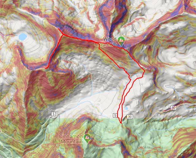
RT Length: 4.06 miles

Elevation Gain: 1419’

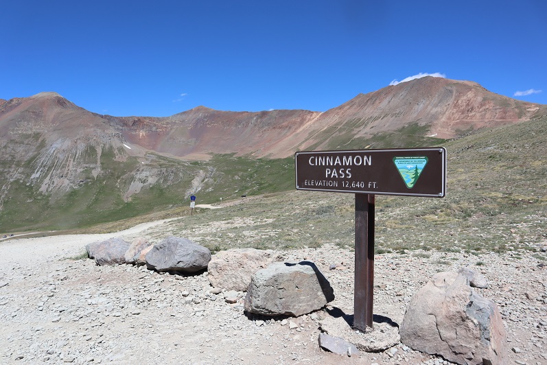
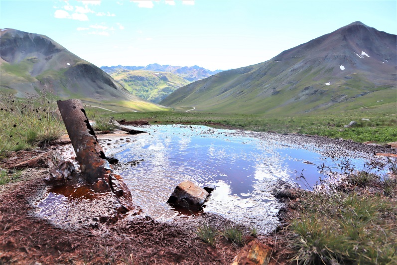
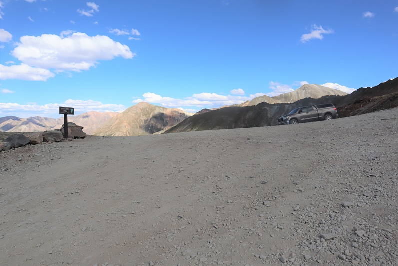
I’d forgotten what an intense drive Cinnamon Pass was… or at least, I didn’t remember it being this bad.  I drove a stock Tacoma to the pass, and while it handled famously, I probably asked it to do more than it wanted to do.  Luckily, at this time of the year, I was the only one there, and I didn’t see anyone else on the road the entire day. I parked at the pass and was on my way.

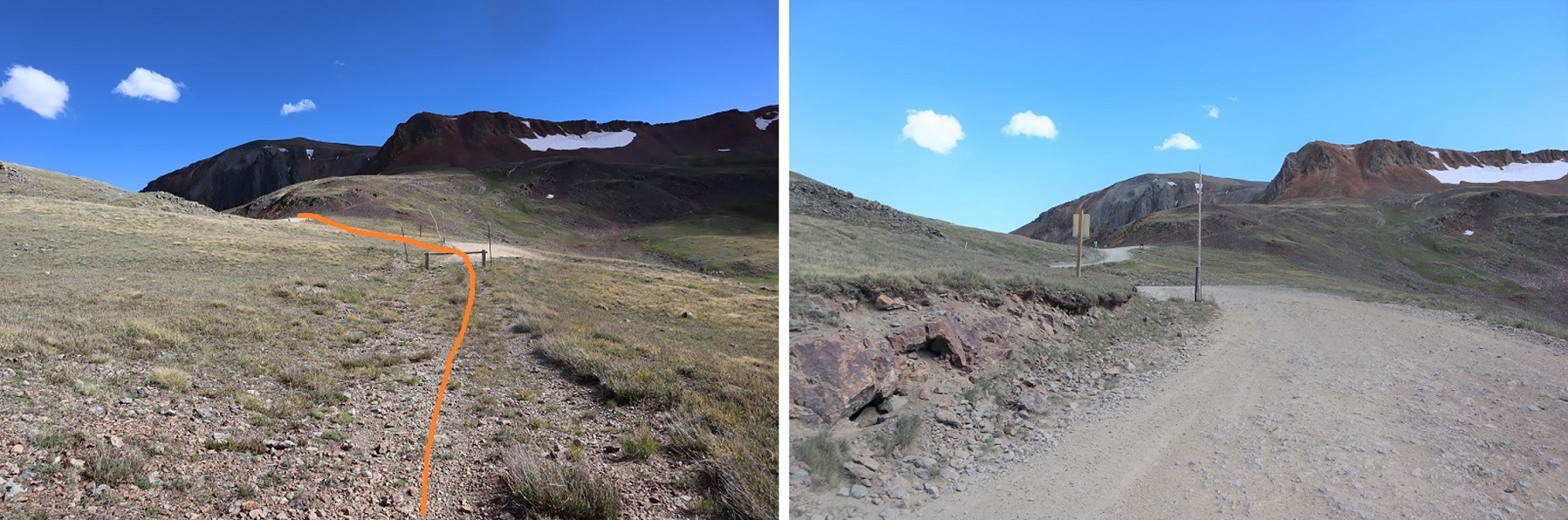
There is a trail here that goes all the way up to the saddle.  I started by following it south

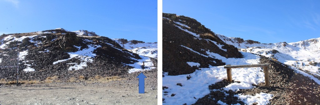
It had snowed in the last week or so, and even though there weren’t any footprints on the trail besides a few game tracks here and there, the path was obvious to the ridge

Also, all the little snow there was, was on the trail.  I sunk up to my thighs post-holing.

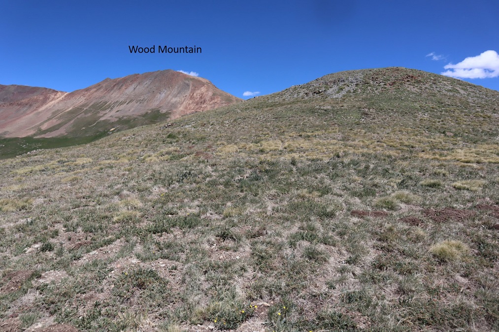
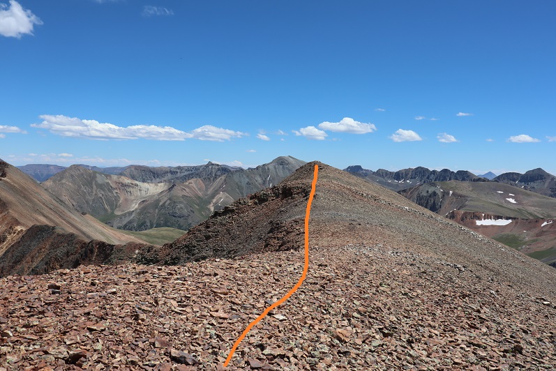
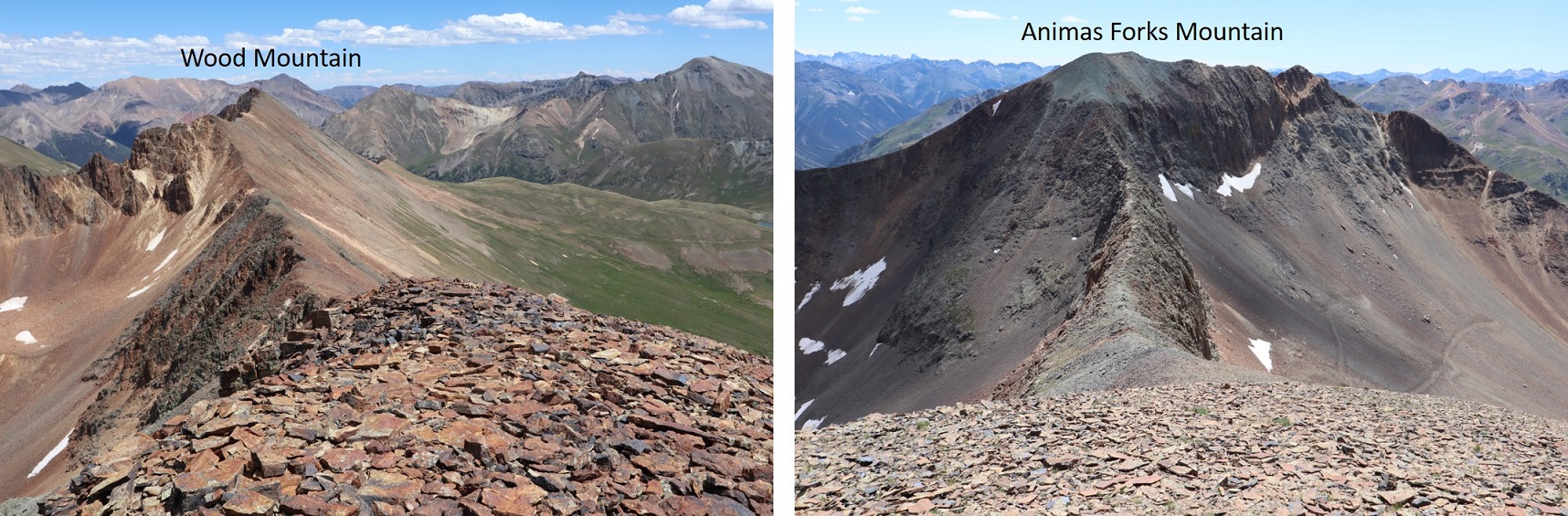
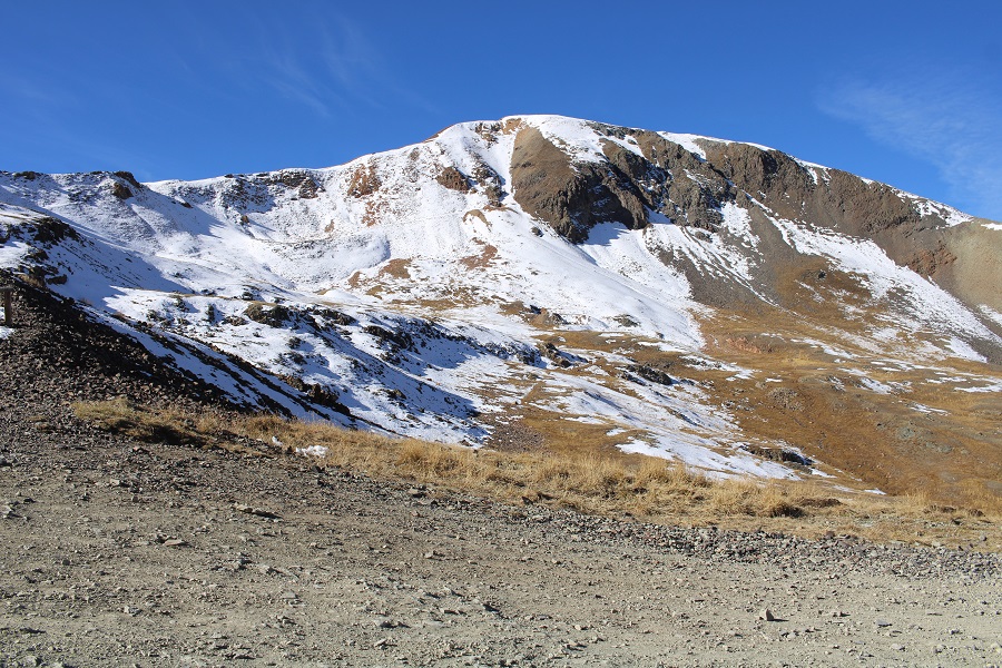
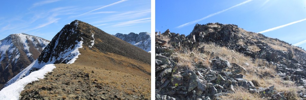
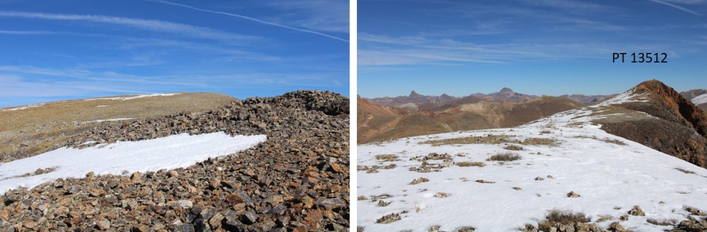
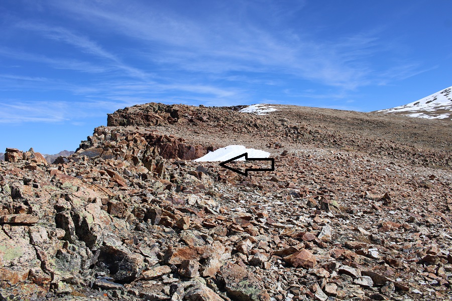
Once on the ridge, I could clearly see PT 13512, my first objective

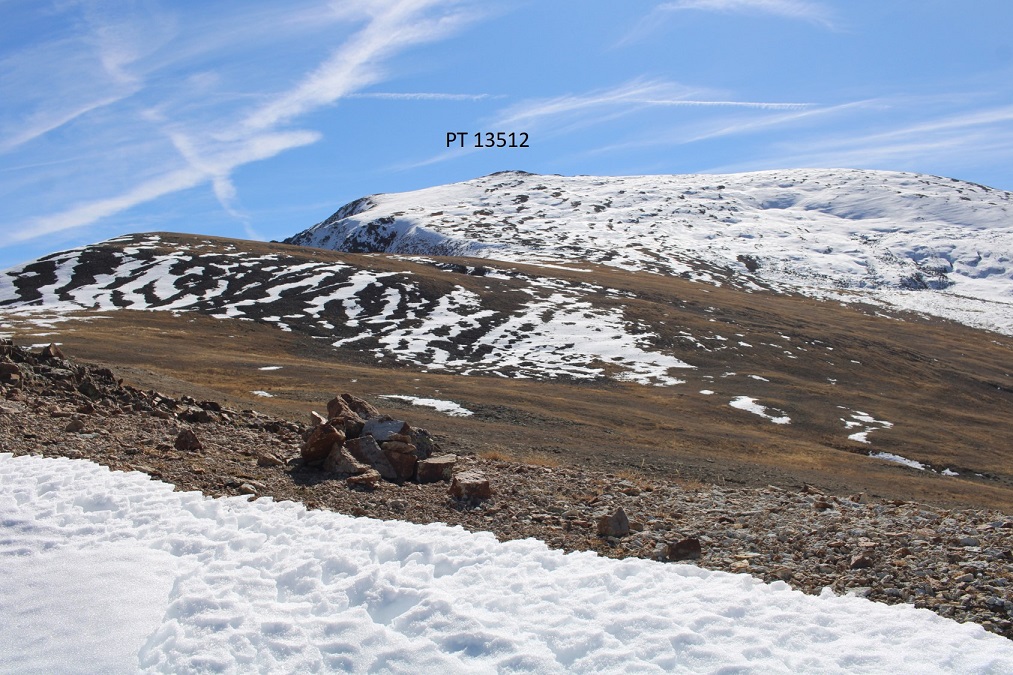
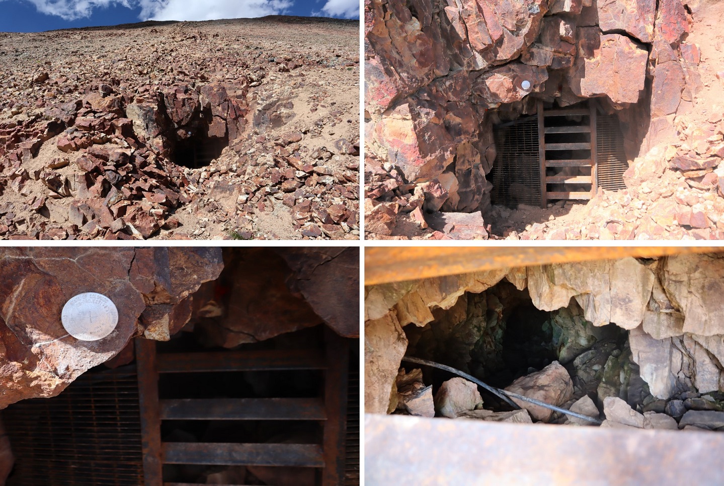
This was very straightforward.  I just headed southeast.  Side note:  If you’re a rock hound, there are a ton of really cool rocks on this hike, complete with white, black, yellow, and orange crystals that shine in the sun.

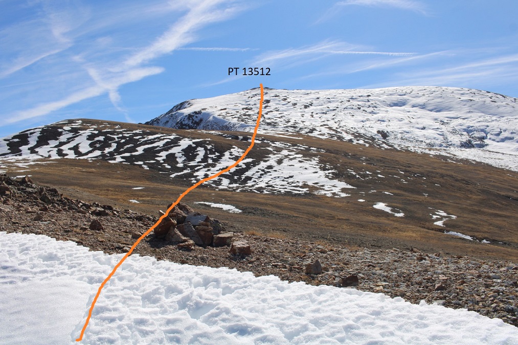
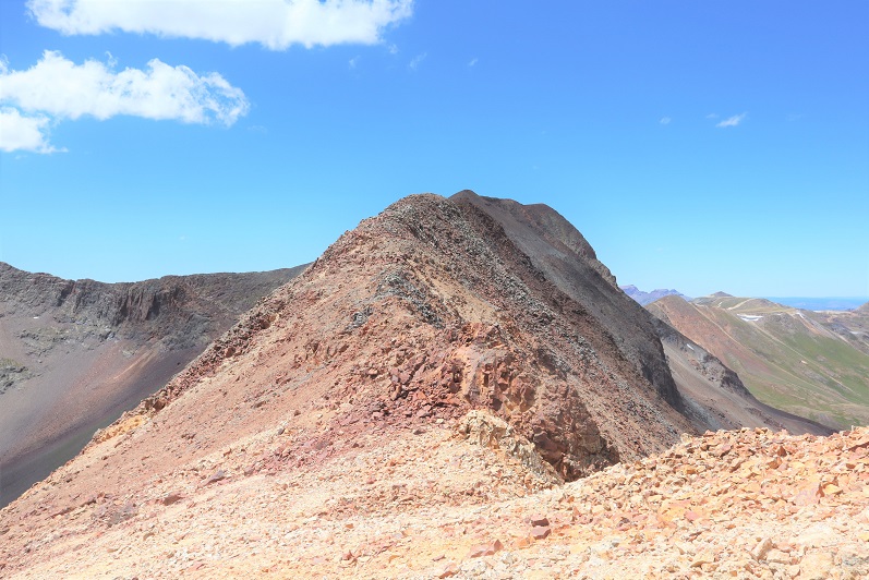
The ‘summit’ was obvious

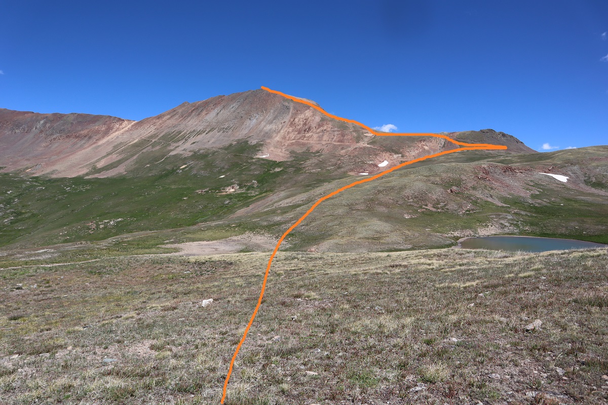
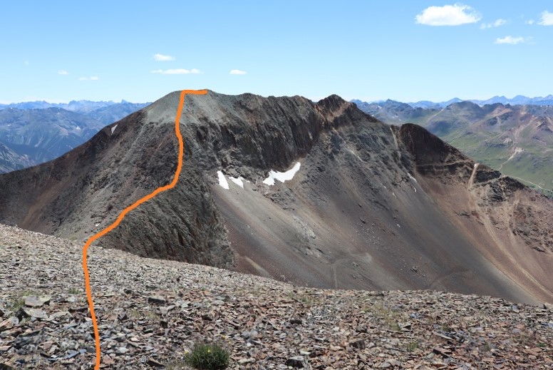
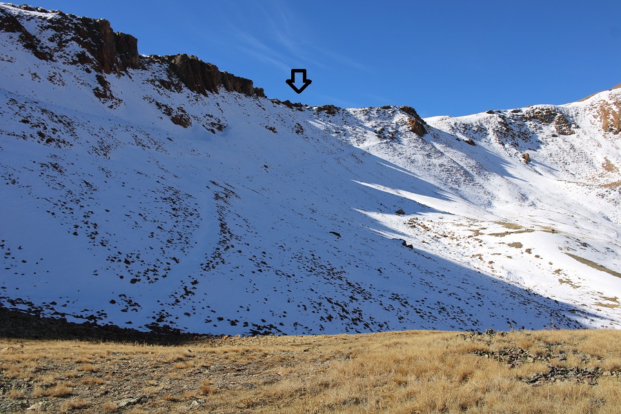
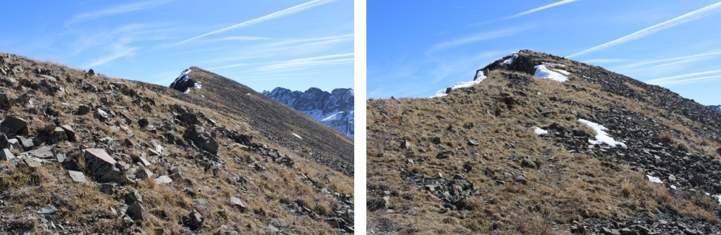
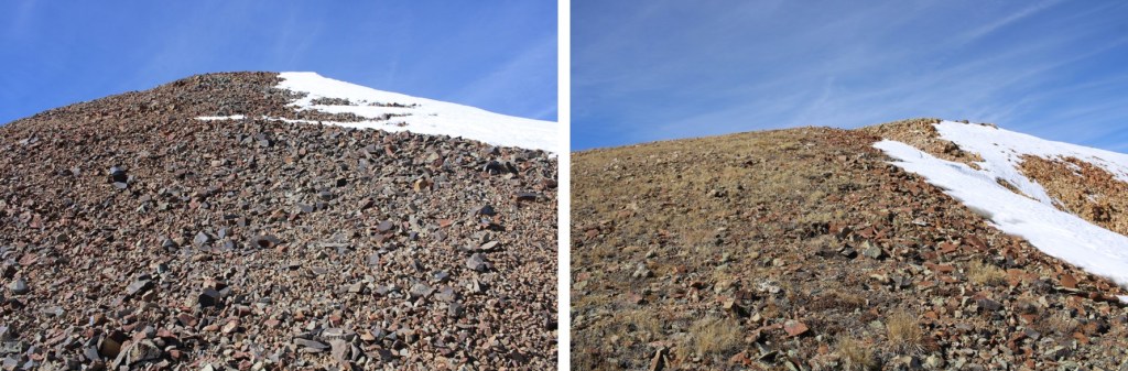
However, this wasn’t an actual ranked summit.  I was headed towards PT 13549, to the south

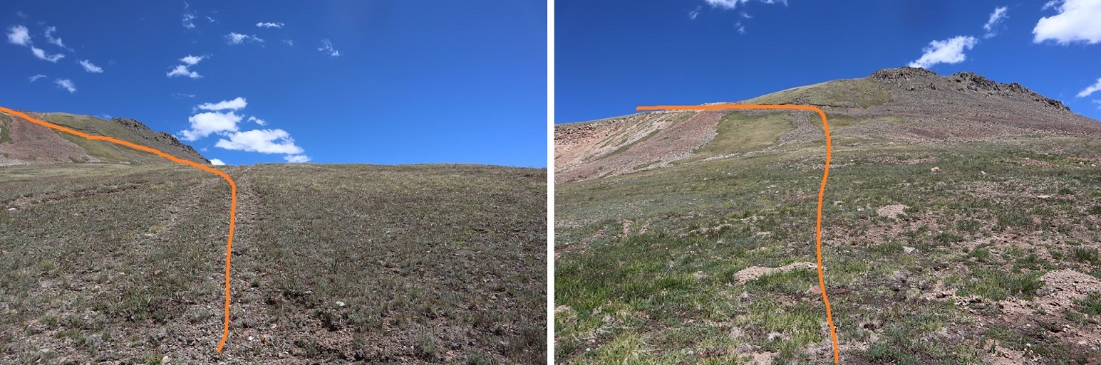
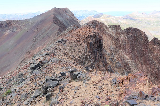
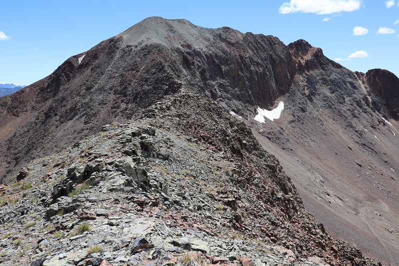
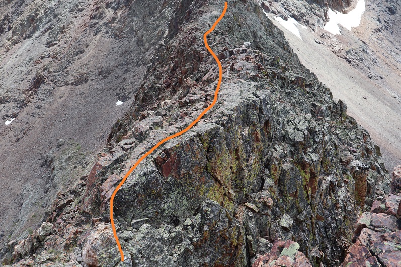
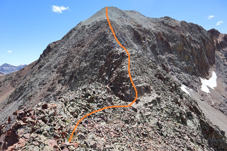
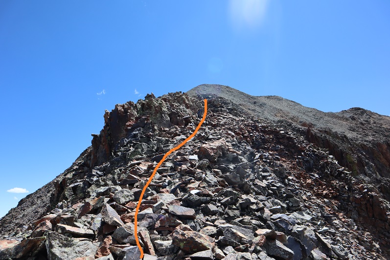
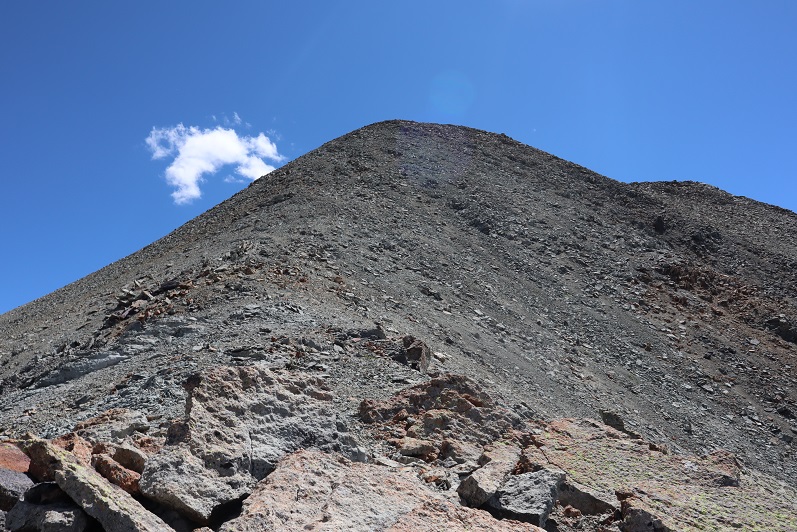
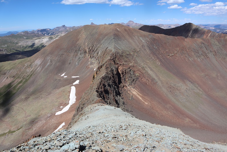
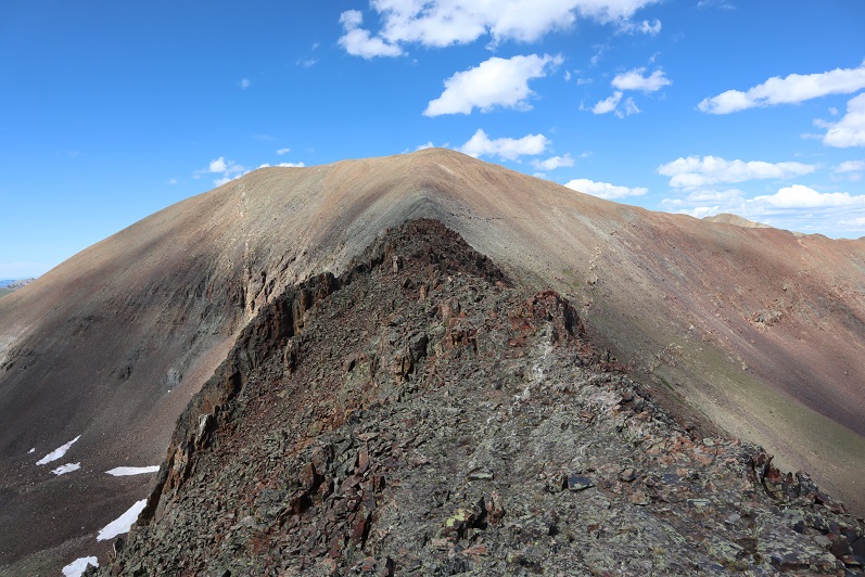
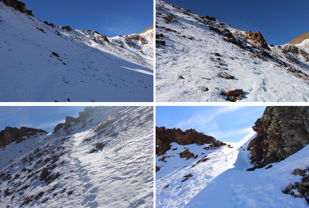
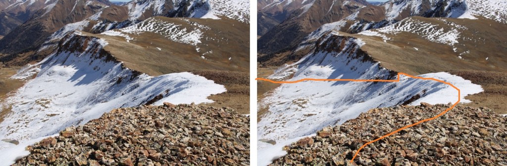
To get there, I followed the class 2 ridge as it curved southwest, and then southeast towards the summit.  Here are some pictures of the ridge.

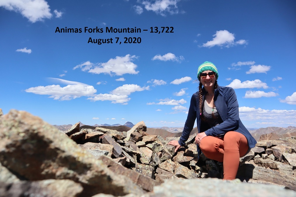
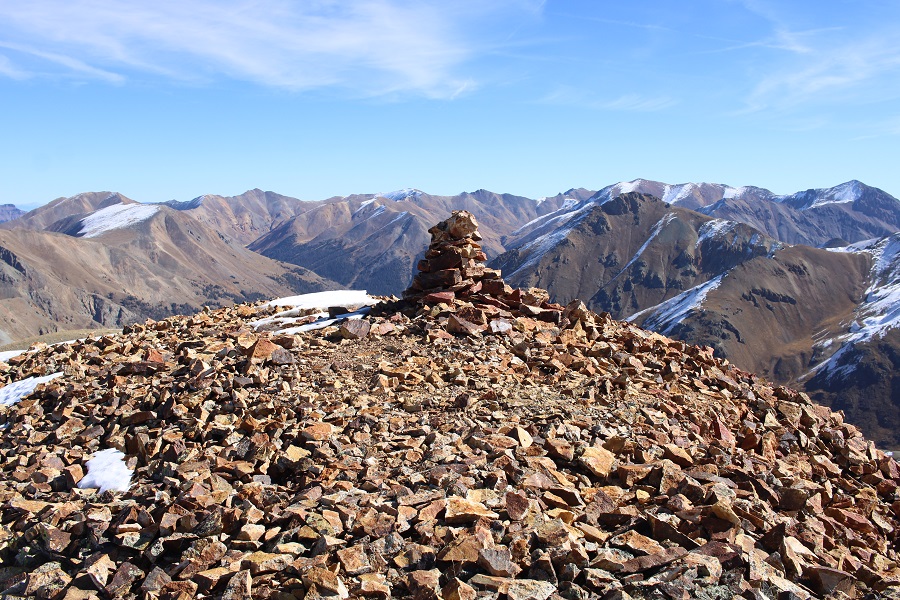
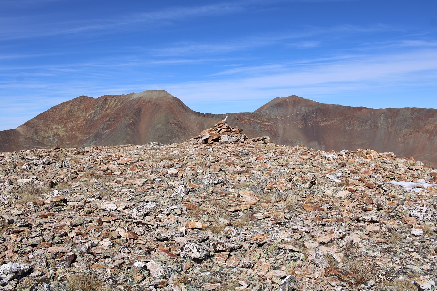
I summited PT 13549 at 11:30am
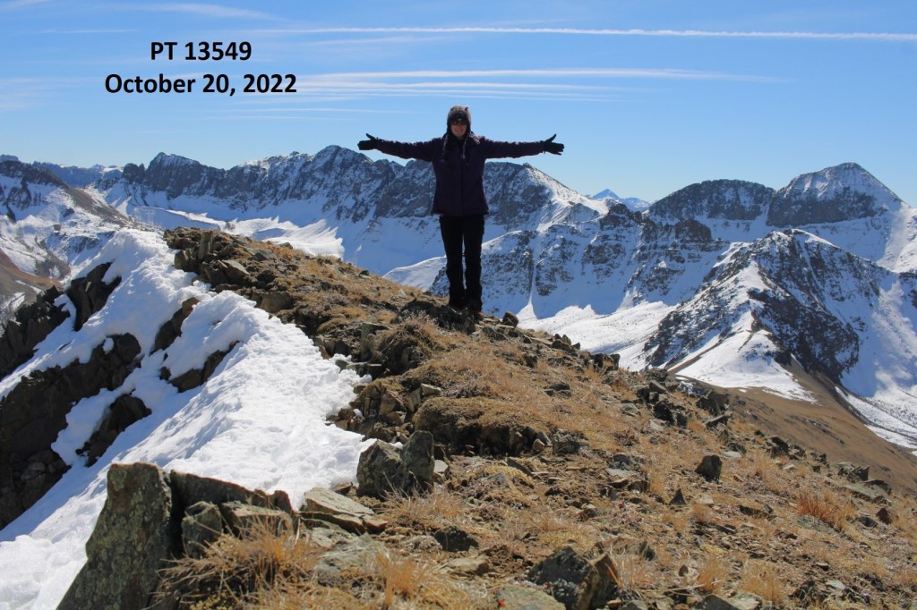
PT 13549:

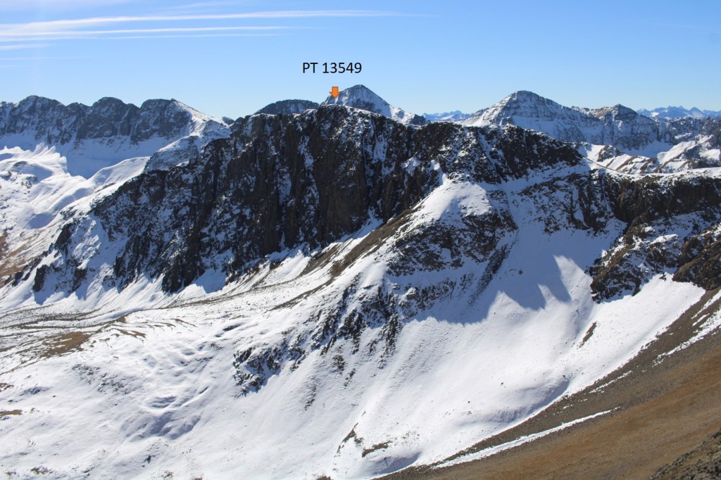
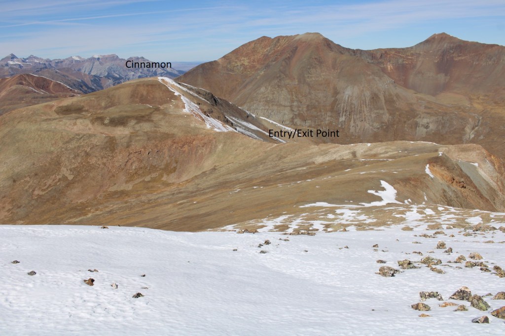
After taking in the views, I followed the ridge back to PT 13512

Once back at 13512, I turned left, and headed northeast over to Cinnamon Mountain.  This was once again a class 2 hike

I summited Cinnamon Mountain at 12:30pm

Cinnamon Mountain:

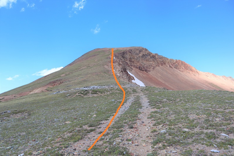
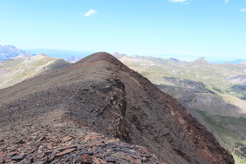
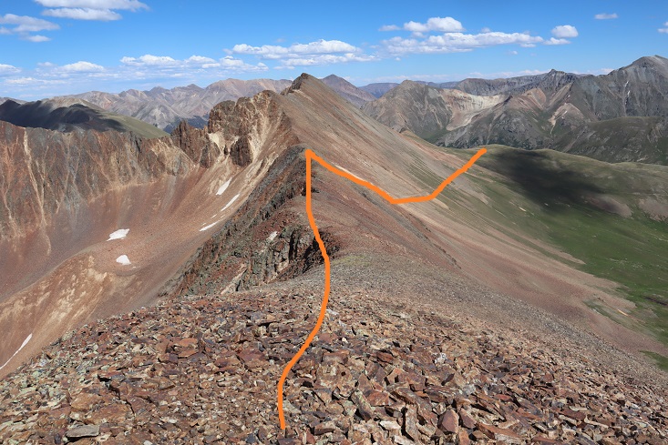
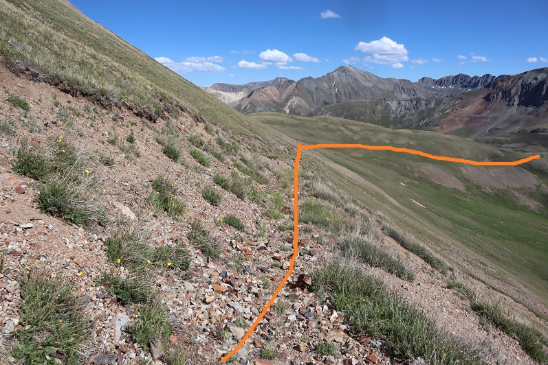
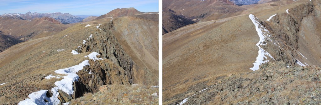
When I looked east, the route back to Cinnamon Pass was obvious

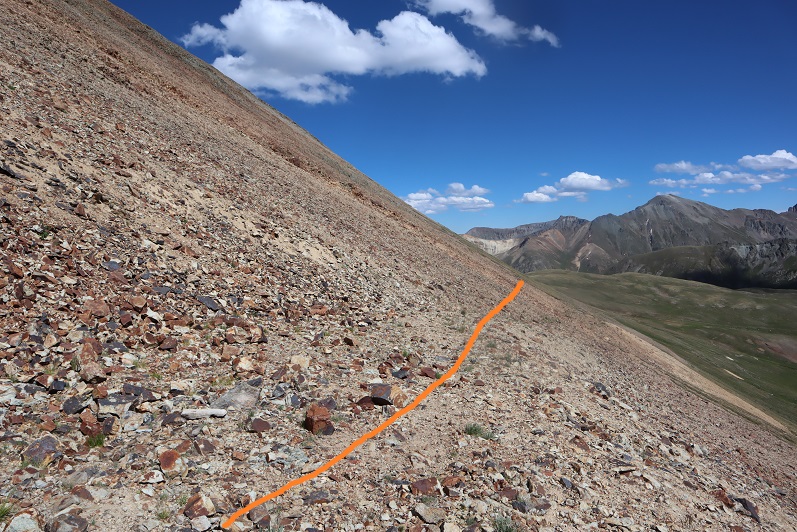
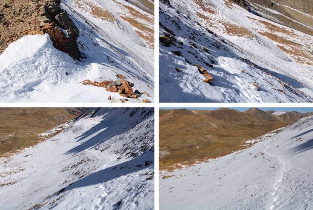
Here are some pictures down the ridge

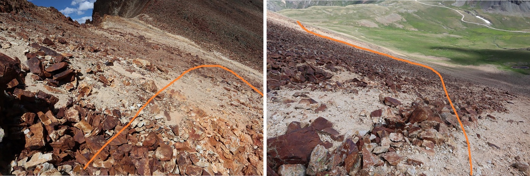
And then from the ridge back to the trailhead

I made it back to my truck at 1pm, making this a 4.06 mile hike with of 1419’ of elevation gain in 2.5 hours.  And now, to drive back down from Cinnamon Pass. 

On to the next trailhead!

Wood Mountain – 13,682, UR 13,715 & Animas Forks Mountain – 13,740

1

RT Length: 6.53 miles

Elevation Gain: 2270’

After hiking Every Mountain and Cooper Creek Peak I still had some energy left, so I decided to drive up to Cinnamon Pass and get in a few more peaks today.  There were a bunch of OHVs in the parking area when I arrived.  Mine was the only truck/non OHV there.

2

I gathered my gear and started out at 12:30pm.  I began by heading north towards Wood Mountain

3

Here’s an overall view of the route

4

As I was hiking I came across a faint road and followed it up to the ridge

5

The road ended at what used to be a structure.  From there I just hiked up the side of the mountain

6

I summited Wood Mountain at 1:15pm, and while I was a little slow/tired from my hike earlier today, I couldn’t believe how easy this summit had been!

7

Wood Mountain:

Here’s looking back down the ridge I’d just hiked up

8

From Wood Mountain you can easily see the other two peaks I’d be hiking today:  UR 13,708 and Animas Forks Mountain

9

There wasn’t a trail to follow, but this was a simple class 2 ridge hike over to UR 13,708

10

11

From the saddle, here’s looking back at Wood Mountain and up towards UR 13,708

12

And a good look at the ridge to Animas Forks Mountain

13

The rock here was loose rubble, but the ridge was easy to follow to the summit

14

I summited UR 13,708 at 2:15pm.  Once at the summit I wasn’t sure I was actually there, so I walked the short distance north to the next point.

15

Once there I got out my altimeter and determined the first point was actually the highpoint, so I hiked back.

16

I once again stood on the summit of 13,708 and looked over at Wood Mountain and then over at Animas Forks Mountain

17

Here’s the route up to Animas Forks Mountain

18

The ridge looked like more than class 2, but if you just follow the ridge it stays at class 2, just with some added exposure.

19

20

21

The rock is pretty solid until the very end, where it becomes loose just before it turns to gravel

22

23

I summited Animas Forks Mountain at 3pm

24

“Animas Forks Mountain”:

From the summit you can see an easy way to make this hike a loop, just follow the ridge down to the road and hike the road back to Cinnamon Pass.

25

However, there were some mines I wanted to explore below Wood Mountain, so I decided to retrace my steps back UR 13,708.  Also, when I’d taken a video at the summit of 13,708 I’d said I was at Animas Forks Mountain, and I wanted a new video with the correct name.  Here’s the route back to 13,708

26

27

28

29

30

I re-summited UR 13,708 at 3:45pm

UR 13,708:

From here I made my way back to the 13,708/Wood Mountain saddle

31

Once at the saddle I followed the sand and rock gully down until I hit up with an old mining road

32

I followed the faint road until I came across a mine

33

The mine was completely boarded up, without even a gate/lock that would open.  It was still neat to peer inside. It looked like they’d collapsed the inside.

34

I continued following the road southeast until I came across another mine, this one not boarded up

35

36

From there it was an easy hike back to Cinnamon Pass

37

I passed some water coming out of a pipe that didn’t look fit to filter.  The water was more red in color than orange, and made me wonder if that’s how Cinnamon Pass got its name?

38

39

Eventually I connected back up with the road and followed it to my truck.  My truck was now the only vehicle in the lot

40

41

I made it back to my truck at 4:50pm, making this a 6.53 mile hike with 2270’ of elevation gain and lots of time exploring mines in 4 hours, 20 minutes.

42

I decided to drive to the next trailhead, eat dinner, and get some sleep.   It ended up being an eventful and unplanned drive over Engineer Pass.