London Mountain – 13,194

RT Length:  10.63 miles

Elevation Gain: 2305’

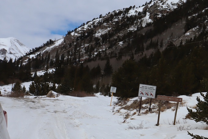
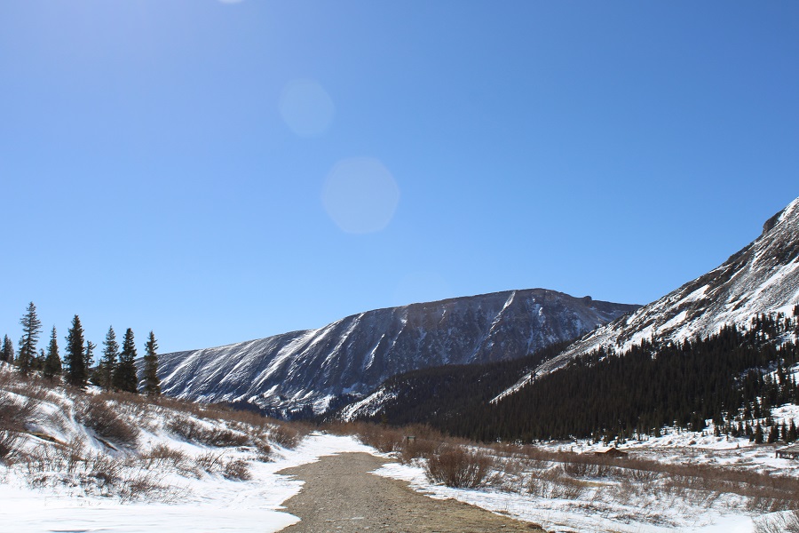
I was looking for another quick summit this week, and was halfway to the trailhead before I remembered the road to Mosquito pass would most likely be snowed in, adding about 5 miles to the hike.  Oh well, I should still be able to make it an early day.  I made it to where the road for Mosquito Pass and 12 meet and due to previous experience with this road in winter decided to park at this junction.  I could have driven about a mile up Mosquito Pass road, but eventually the drifts would have made it necessary to find a place to park.  By parking below I’d be getting in some extra mileage (if not much elevation gain). 

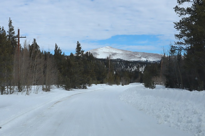
I parked, gathered my gear, and headed up Mosquito Pass road at 6am.

I was excited to try out my new camera.  I tend to go through cameras quickly, as I put them through a ton of use in extreme conditions.  The last time I purchased a camera I bought one that was less expensive, reasoning since I buy them so often I’d like to spend less money.  I found out the hard way cameras that are point and shoot don’t operate well when it’s less than 30 degrees outside. 

The past few weeks I’ve been using a stylus with my iPhone, but I’ve found when it’s extremely cold out even the stylus doesn’t work (although warming the stylus up in my mouth sometimes helps).  After my climbing accident at Garden of the Gods last week where I not only came out road-rashed and bruised but also I crushed my stylus, I decided to just purchase another DSLR.  Yes, they’re heavy, but they withstand the cold.

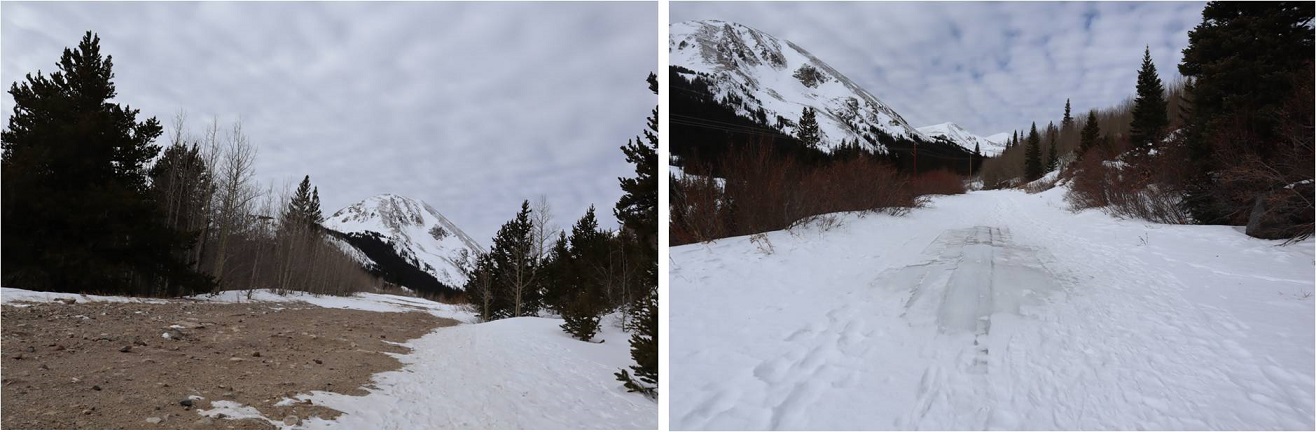
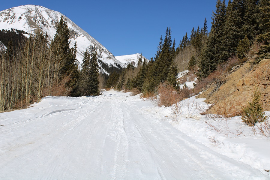
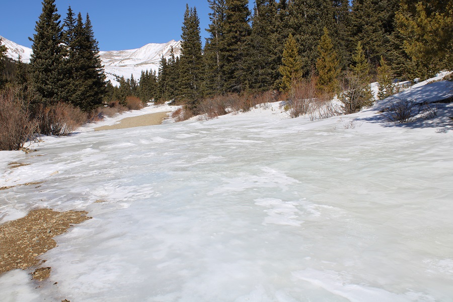
I hiked along the dirt road for 2.5 miles.  The conditions were varying, and I was glad to have worn my microspikes.

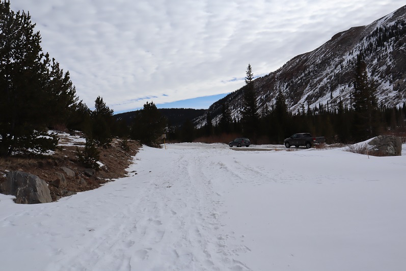
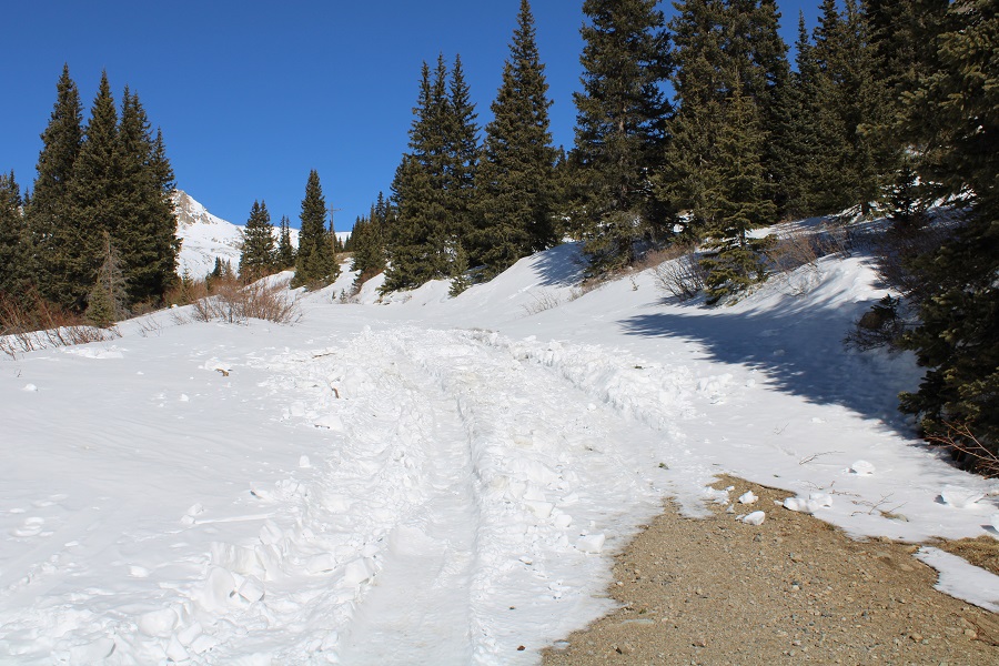
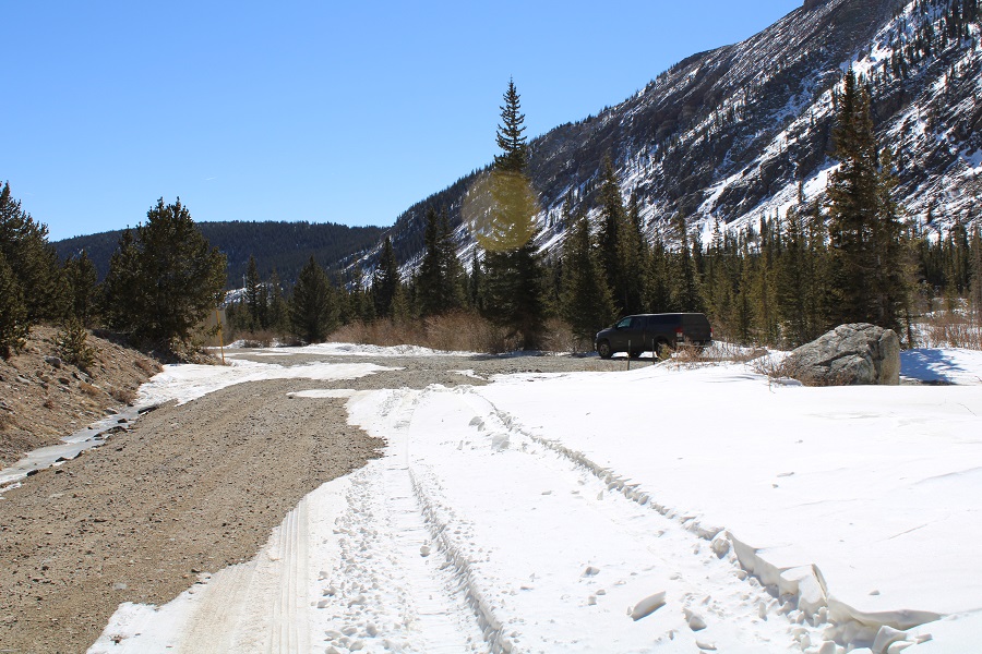
About a mile in was the furthest anyone has been able to drive recently

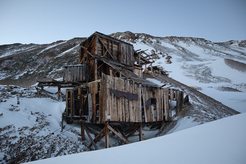
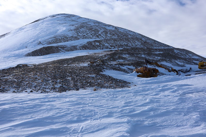
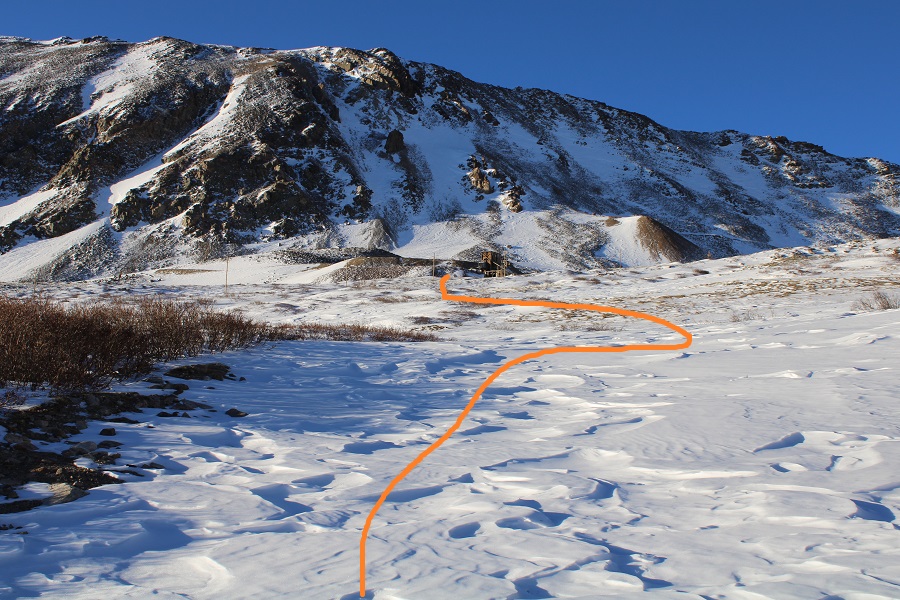
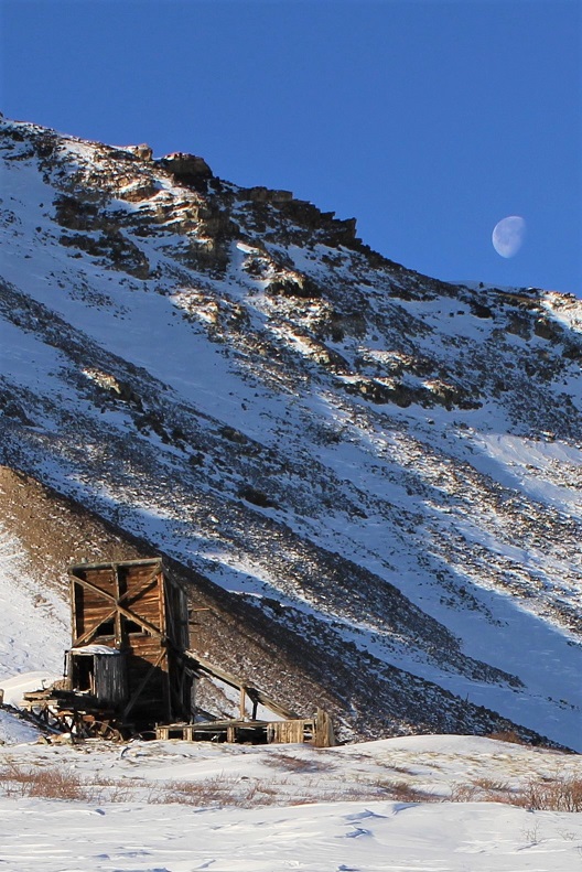
I passed North London Mill

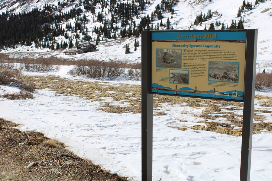
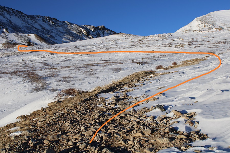
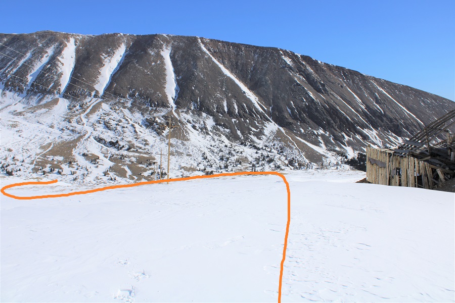
After passing North London Mill I turned left at the junction

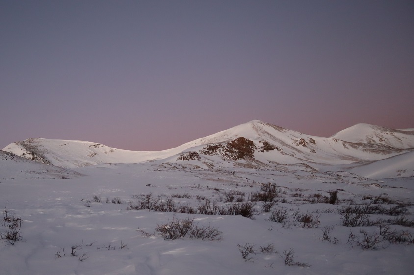
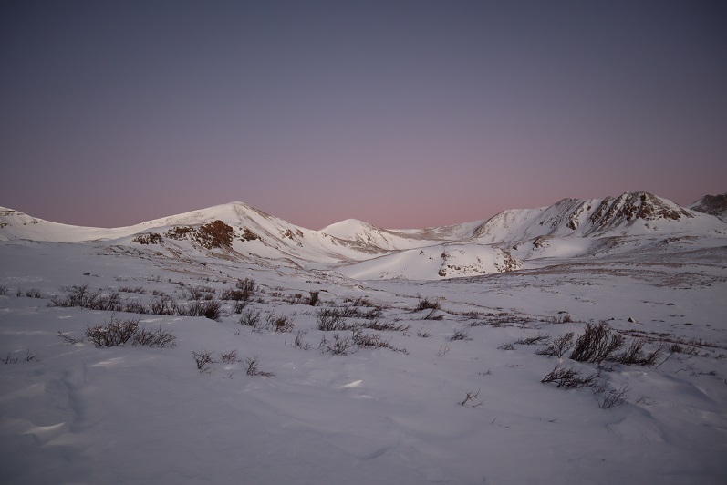
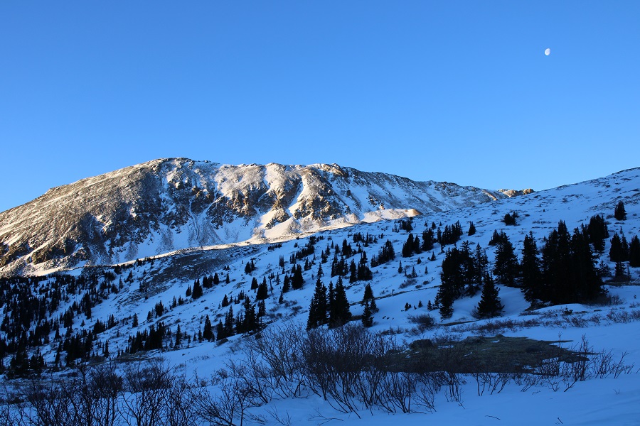
It was here the sun began to rise and I started trying out my new camera

It was also here I started postholing more than I could stand.  I decided to put on my snowshoes, and wore them until I made it to the Mosquito/London saddle

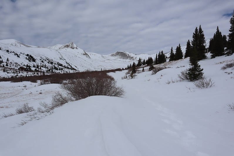
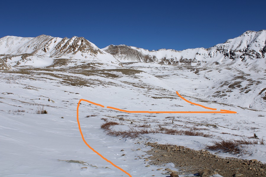
I followed the road up to London Mine

At times the road was completely covered in drifts

The road was covered in snow as I got closer to the mine, so I just had to kind of wing it.

The moon was just going behind the ridge as I reached the mine

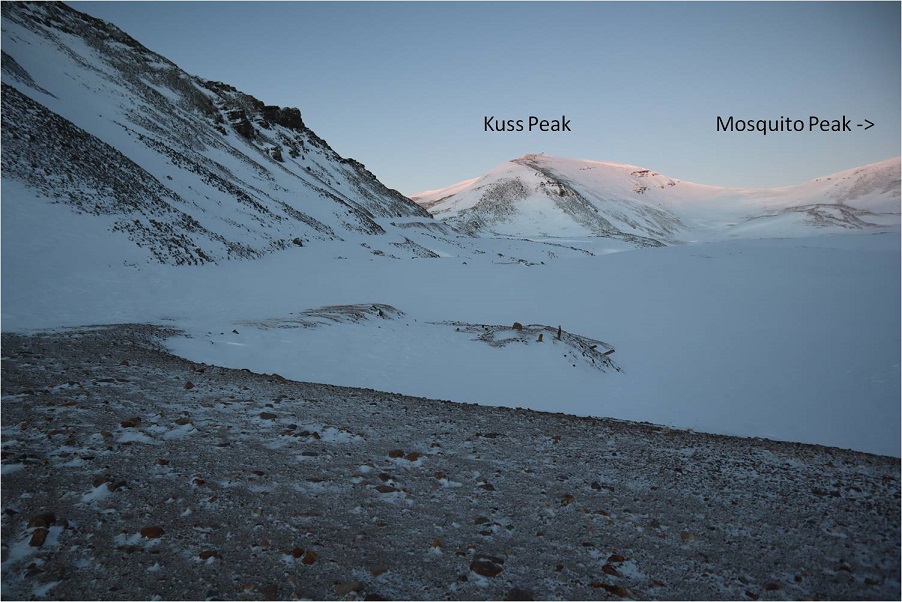
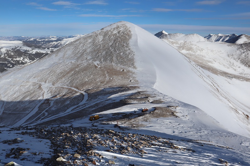
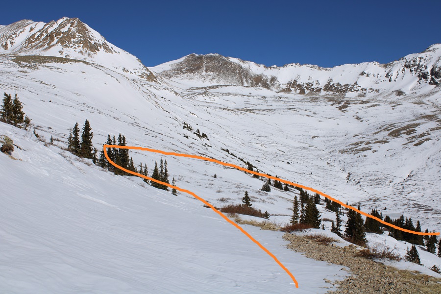
I continued past the mine, heading west

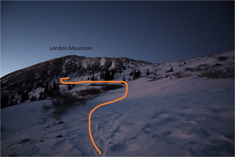
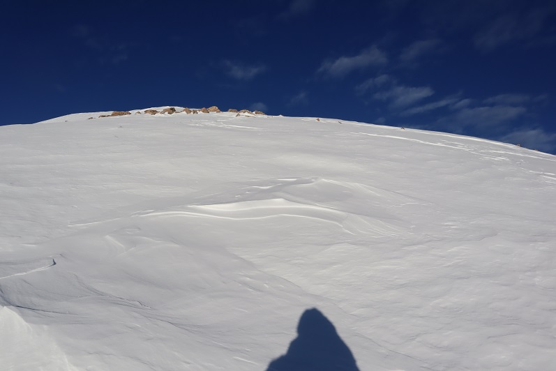
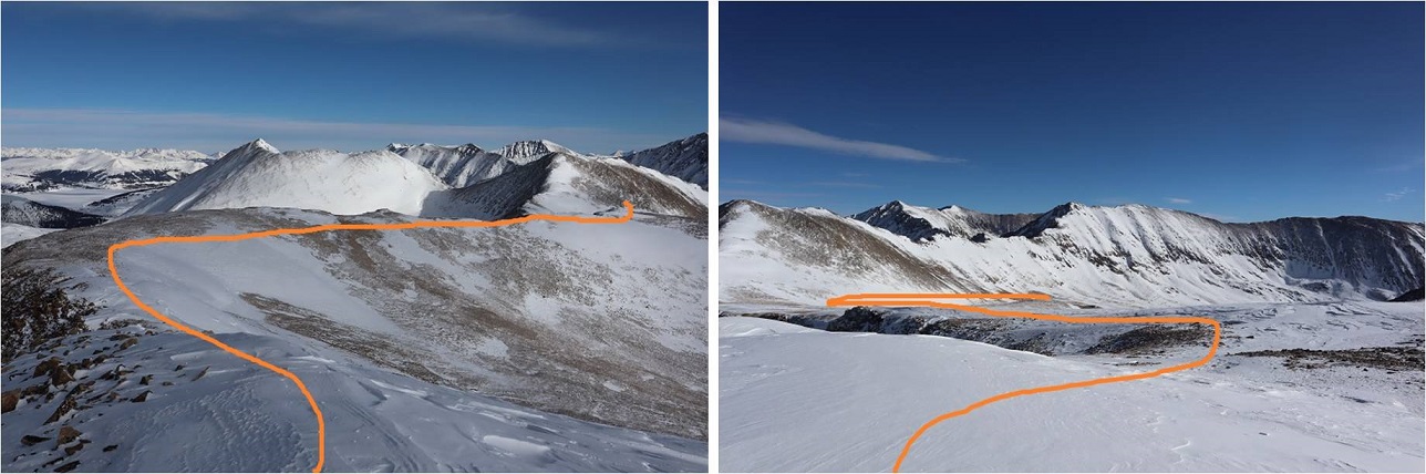
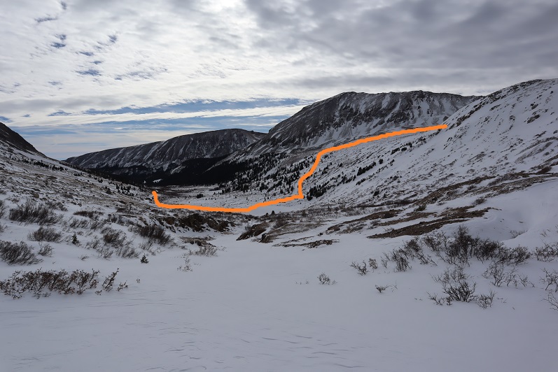
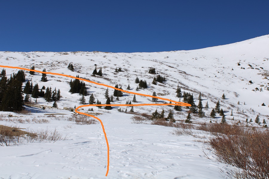
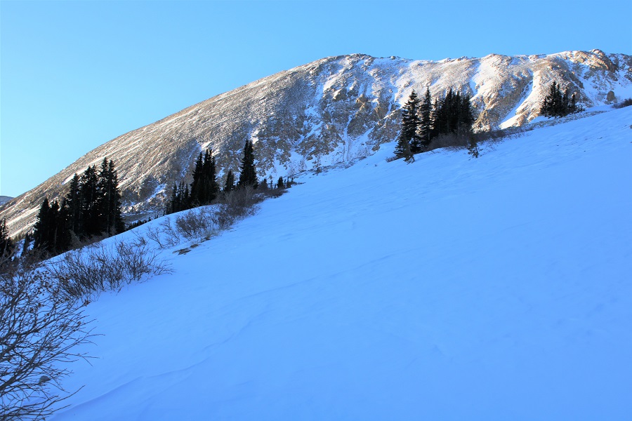
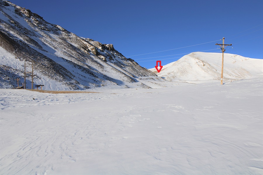
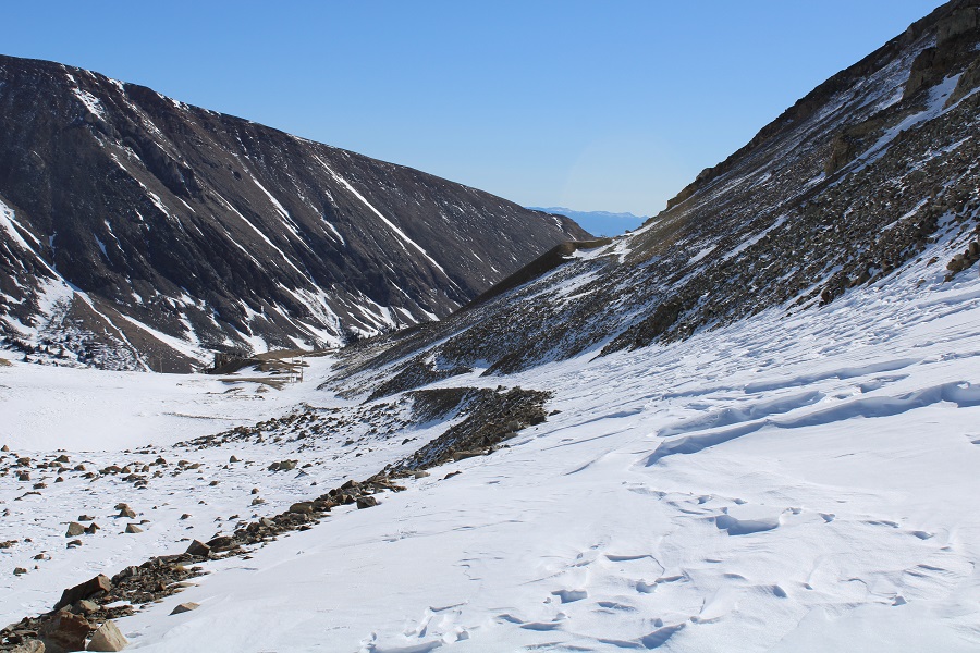
And followed the road to the saddle.  From a distance this road looks mild, but I’ve taken this route in winter before, and the drifts can get pretty steep and go down quite a ways into the drainage (the pictures don’t do the drop offs justice).  It’s a good idea to have traction and an ice axe for this part in winter

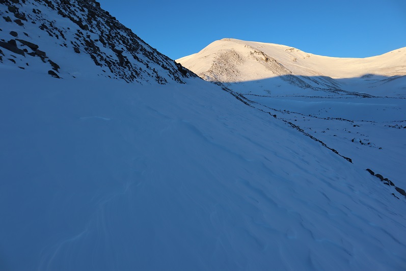
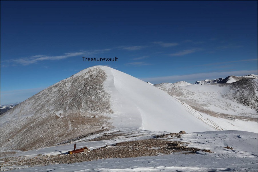
I made it to the London/Mosquito saddle and took off my snowshoes, turned left, and followed London’s ridge southeast.

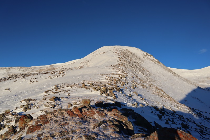
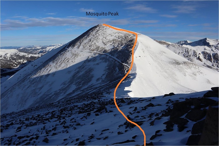
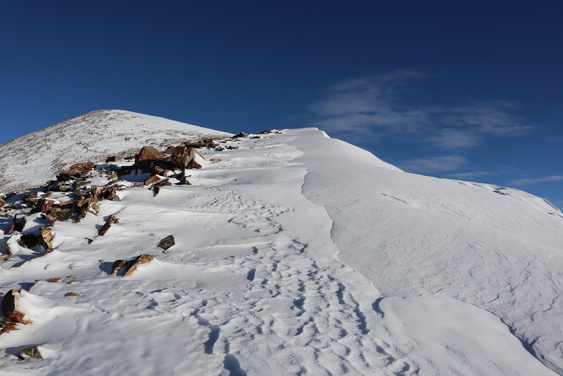
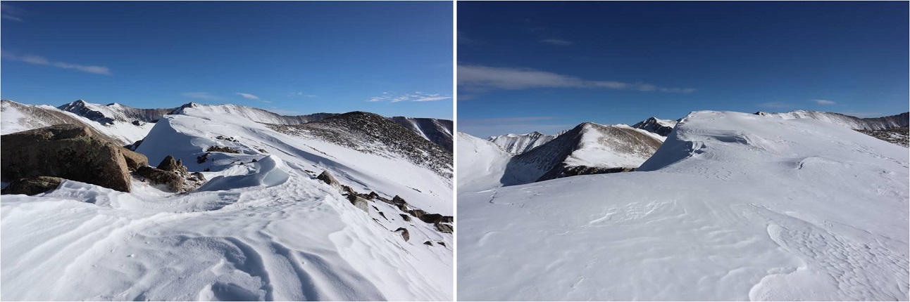
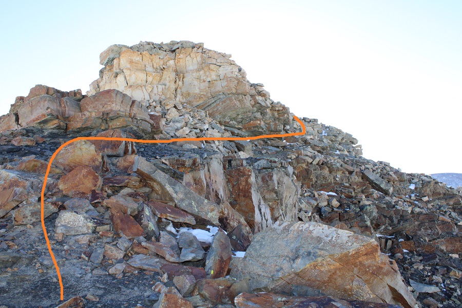
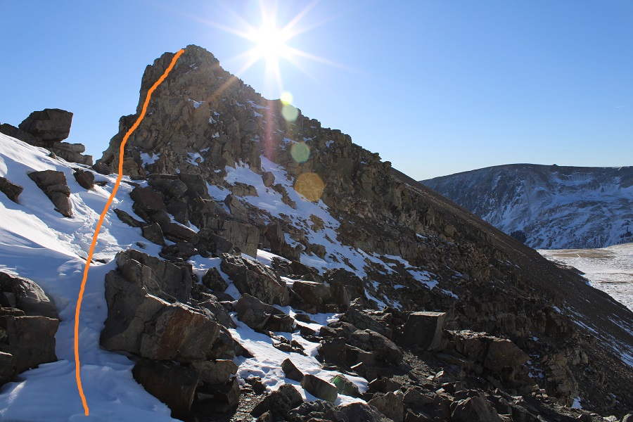
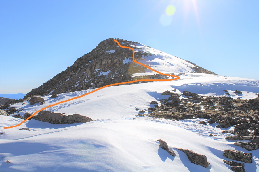
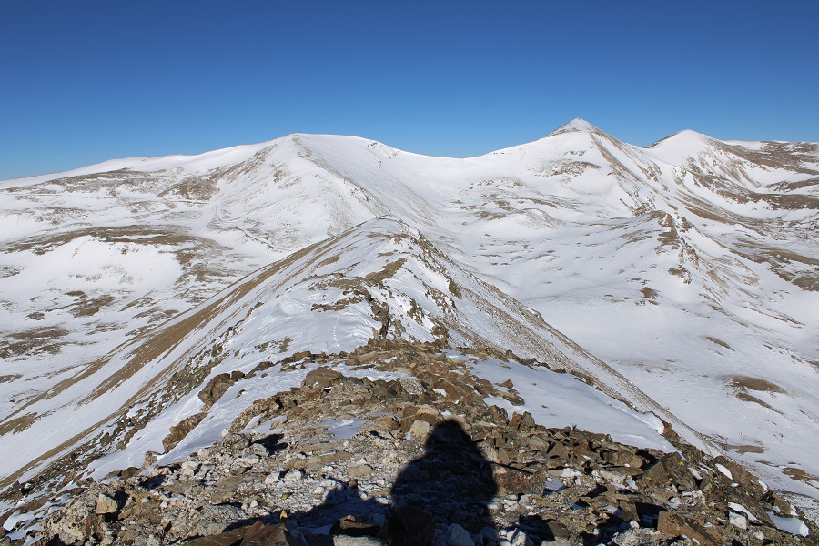
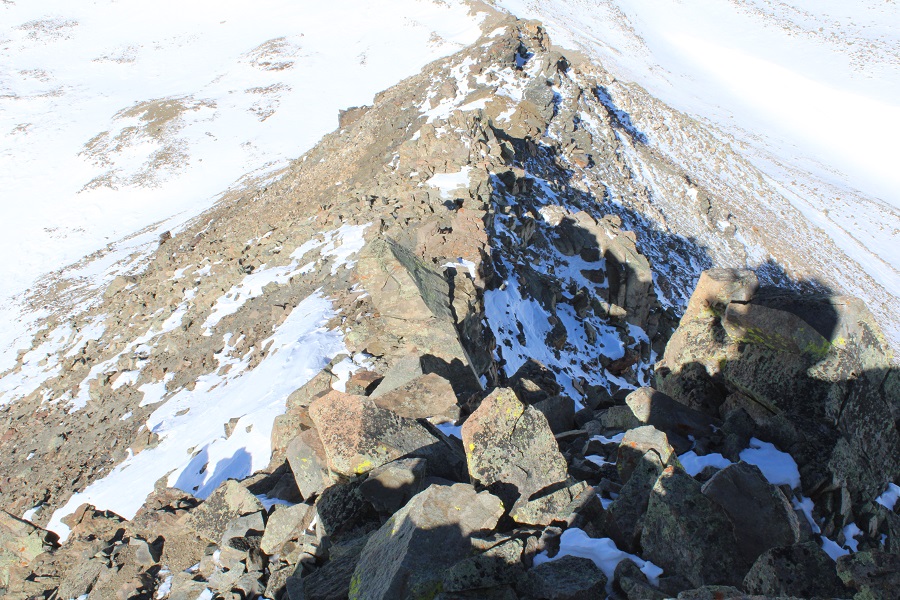
This ridge goes for almost exactly a mile.  After initially skirting to the right, I was able to stick to the ridge proper the entire time, and only postholed a few times in the snow.  This is all class 2, with the snow making it an easy class 3 in just a few areas.  Also, I didn’t remember it until I got back home and looked at my pictures, but the one drawback of this camera are the sun spots when directly facing the sun.  I know what causes them, I just need to be more diligent in the future against preventing them.  Here’s the ridge route, with a bunch of false summits:

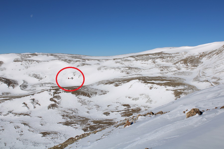
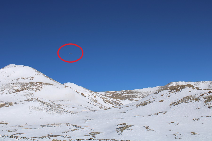
About halfway along the ridge I heard a loud buzzing, looked around, and saw a biplane flying very low.  I watched it go around the mountains and through the passes.  So cool!  I wanted to wave, but didn’t think they could see me, and also worried they might think I needed help if I did. 

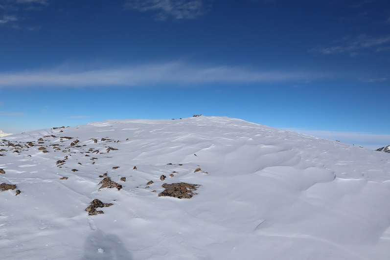
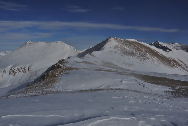
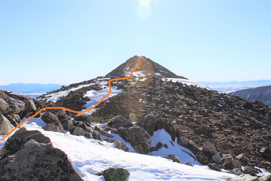
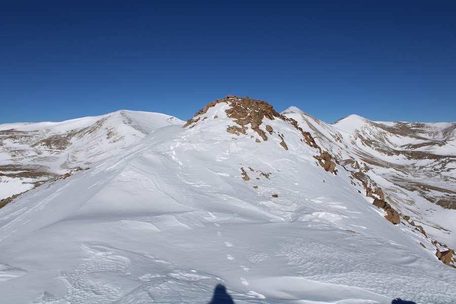
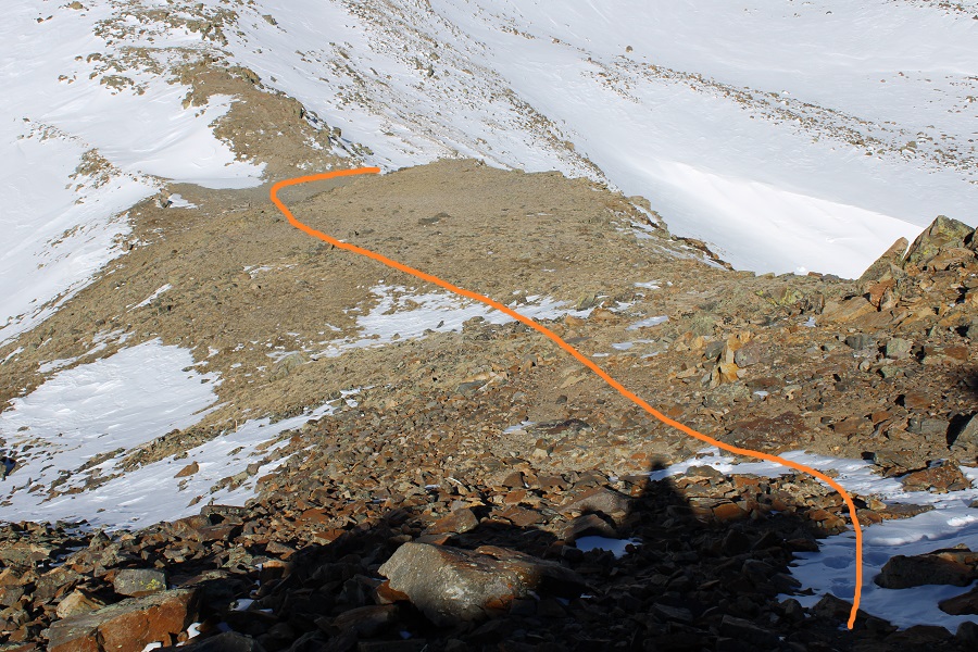
Here’s the final trek to the summit

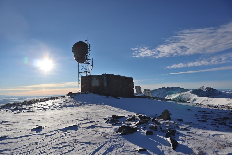
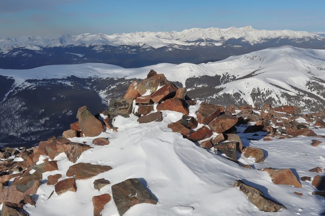
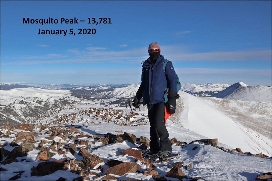
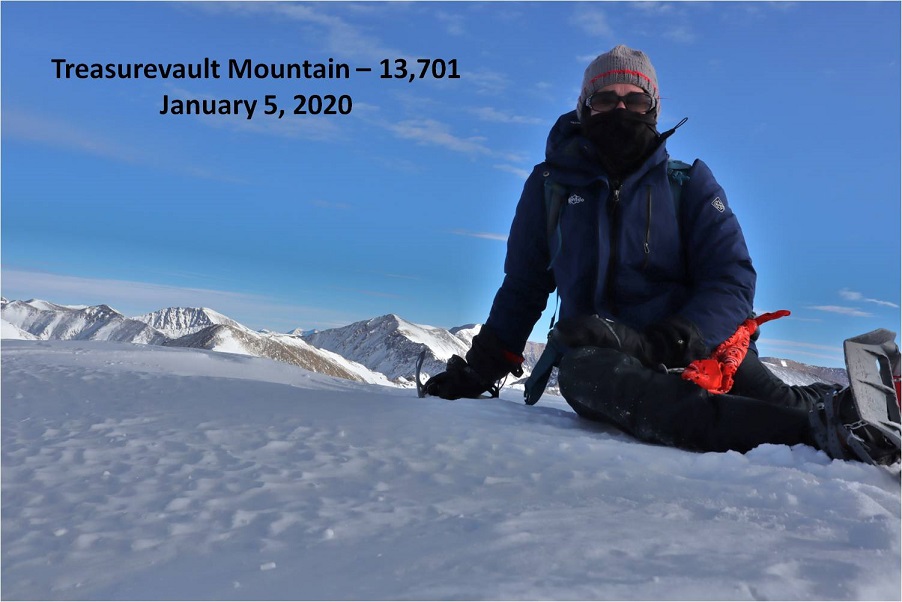
I summited London Mountain at 8:30am

London Mountain Summit

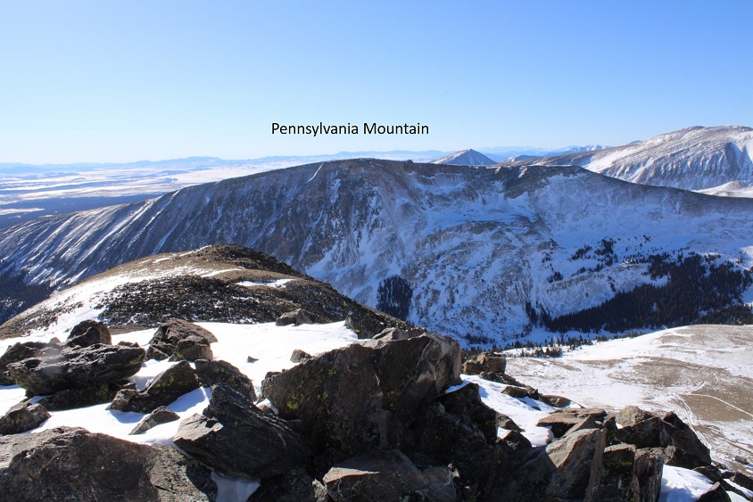
I had a good view of Monday’s summit:  Pennsylvania Mountain

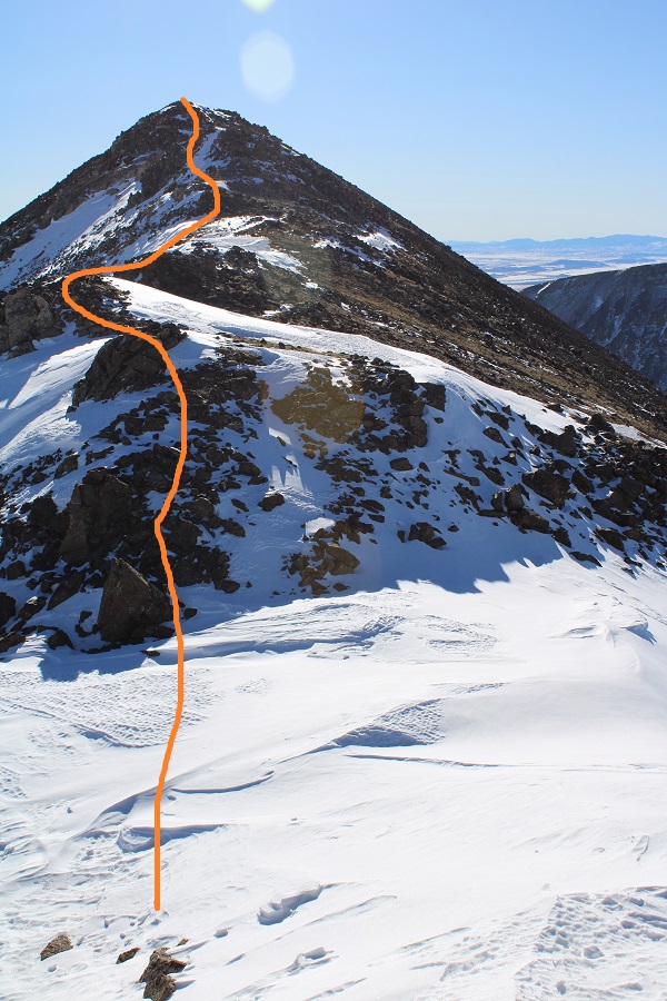
Here’s the trek back down the ridge

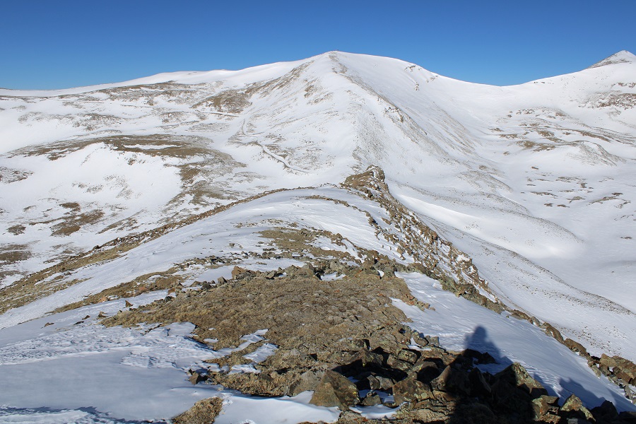
Yes, this is all class 2/easy class 3 to avoid snow

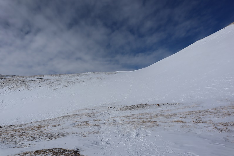
And back towards the mine

Here I heard another loud buzzing and saw a helicopter fly overhead.  It didn’t look like a rescue helicopter.

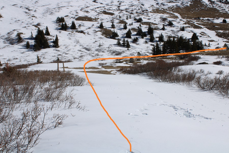
Here’s the path the road takes back down

I made it back to where I’d put on my snowshoes, took them off, and turned right onto 12 and followed it back to my truck.  About halfway back my microspikes broke, both of them, so I guess it’s time to get out the needle nose pliers again.  I made echoing clanking sounds as the chains scraped the dirt as I walked the rest of the way back.

I made it back to my truck at 10:45am, making this a 10.63 mile hike with 2305’ of elevation gain in 4 hours, 45 minutes

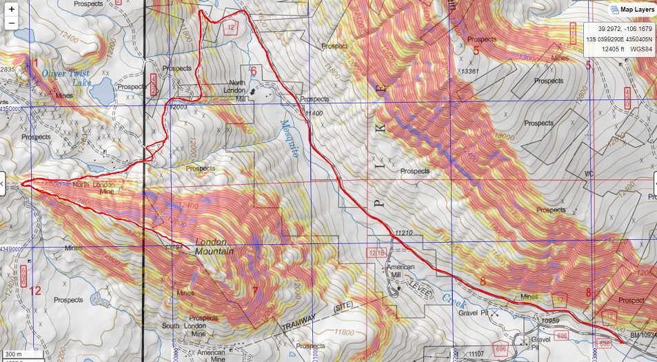
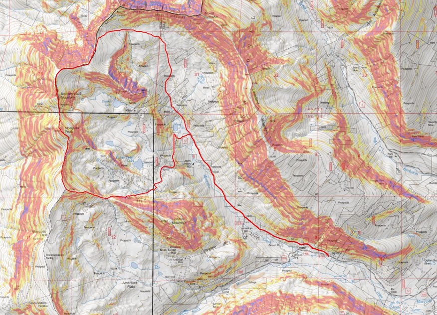
Here’s a topo map of my route:

Kuss Mountain (UR) – 13,560, Mosquito Peak – 13,787, & Treasurevault Mountain (UR) 13,706

1

RT Length: 12 miles

Elevation Gain: 3409’

Time: 6.5 hours


I’ve been excited to head to the Mosquito Creek/Pass area since I was here last month. I’d avoided the area in the winter in years past, thinking it would be closed, but the 2WD dirt road in is actually plowed quite a ways.


2


In fact, it’s plowed at least past the turnoff to Mosquito Pass, which is where I parked.


3


I started on the trail at 5:30am, wearing my snowshoes. I kept them on all day even though they were overkill at times.  The 4WD road was impassible in a vehicle, with the conditions ranging from bare dirt to ice and drifts with several feet of snow.


4


I followed the road, making fresh tracks as I went


5


Passing the London Mill


6


And hiking along the road for a few more yards until I reached the junction of 12 and 856. Here I turned left (west) and followed the snow covered dirt road


7


8


The road was covered in drifted snow and difficult to walk in, even with snowshoes. Around this time the ptarmigans began to wake up and the sun started to rise.  I could see the white birds flying against the pink landscape and thought to myself how lucky I was to be here right now.


9


I continued following the road around London Mountain towards the North London Mine


10


11


12

From the mine is where things got a bit tricky, as the road I was supposed to take was covered in snow.


13

It didn’t start out difficult, but about a quarter of the way to the London/Kuss saddle I switched my trekking pole for my ice axe. The path felt similar to the alleyway on Kit Carson and I was glad I was wearing my snowshoes:  a lot of the snow was consolidated but every few steps I’d sink up to my knees in an unexpected drift.


14


15


I breathed a sigh of relief when I finally made it to the saddle. From here it was a straightforward hike up the ridge.


16


I kept my snowshoes on, and they became helpful towards the end


17


Cool findings at the top


18


Also, it was windy


19


Making this a loop, next I was headed for Mosquito Peak. There were cornices the entire way, but sticking to the ridge it was easy to avoid any danger.  Snowshoes here were overkill but I was too lazy to take them off.


20


Looking back up at Kuss Peak


21


And up the ridge to Mosquito Peak


22


Snowshoes were helpful once again for the final push to the summit


23


24


Summit photo


25


I was anxious to finish this ridge loop before the wind picked up this afternoon so I didn’t stay long on the summit of Mosquito Peak. I turned towards Treasurevault Mountain and immediately slipped on the soft scree/snow mix, landing on my knee.  Wonderful.  I could tell before I even hit the ground it was going to hurt, but picked myself up right away and headed down the side of the mountain, more careful now, realizing the snow was sugary atop loose scree and talus.


26


At the Mosquito/Treasurevault saddle I saw a bunch of mining equipment, which I thought was pretty neat for 13K+.


27


Here’s looking back up at the scree/snow that is the ridge down from Mosquito Peak


28


And a look up the ridge to Treasurevault Mountain. All three of these peaks had similar ridges to their summits.  Snowshoes were nice.


29


30


There weren’t any rocks to set up my camera on and my trekking pole was tied to my backpack so I just set it up on the snow for a picture. Not the best, but it gets the point across.


31


Completing the loop turned into a really long ridge hike from Treasurevault over to Mt Tweto, which felt more like 2 ridge hikes


32


The cornices were fun to look at along the way


33


Just before the saddle with Mt Tweto the wind really began to pick up. I’d considered re-summiting Mt Tweto again today, but with the increased winds thought it would be best to just head back.  I’m kind of kicking myself for that decision now…


34


There was a lot less snow here today than there had been last month. Here’s the route back into the basin


35


36


And back up towards the saddle for Mt Tweto


37


Hiking out of the basin I aimed for the trail I’d hiked on the way in, making this upper part a loop


38


The snow here was sugary and I kept sinking to my knees while wearing snowshoes. Here’s another view of the route I’d taken up to the London Mine.  On my way out I was just headed back towards the road, as all the 4WD roads in the area were covered with snow and I couldn’t find them.


39


Here’s a look back at my trek out of the basin


40


I followed the snow packed 4WD road back out


41


And just before making it to the road noticed a recent (and small) avalanche slide.


42


I made it back to my truck at noon, just as it was starting to get really gloomy out. It felt like snow was approaching.


43


This was a really fun and easy winter hike. I look forward to exploring more of the area this winter, but will most likely do so from the South London Mine side next time.


44