Mt Princeton in Winter – 14,197 and Tigger Peak – 13,300

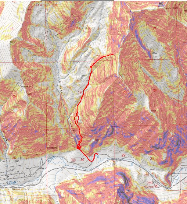
RT Length: 15.4 miles

Elevation Gain: 5615’

There was a fairly recent conditions report on this peak, I so I chose it figuring there’s be a trench to treeline.  I had some appointments I needed to be back home by 4pm for, and this seemed like a logical choice for today.

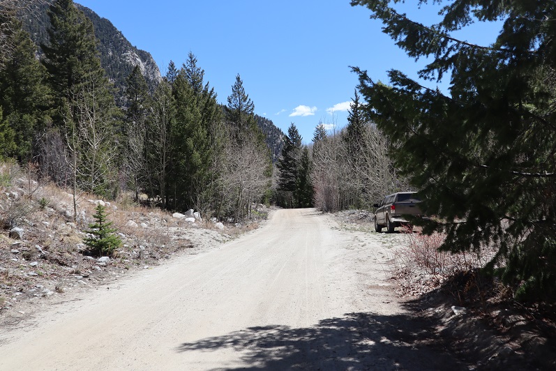
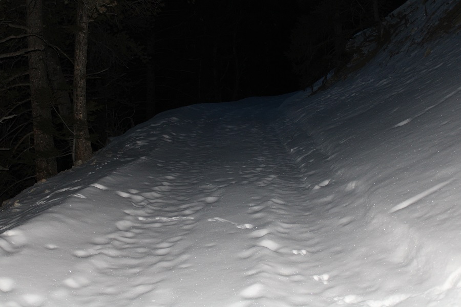
I arrived late, as I woke up to 6 inches of snow at home and had to shovel my driveway before leaving the house.  The roads were icy so I took the drive slow.  I pulled into the parking lot just before 5am and was surprised to find a fresh layer of snow on the ground.  The entire lot was covered, and there were no tracks from any other vehicles.  I parked near the entrance and put on my gear.  I was on the trail by 5am.

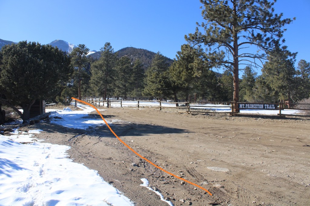
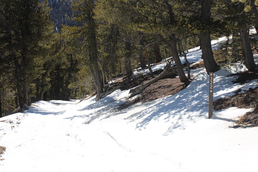
The trail starts at the west end of the parking area.  There’s a bathroom and plenty of parking and excellent signage.

I followed this road (Mt Princeton Road/322) as it switchbacked up the east side of the mountain.  I was the first one making tracks, and wore my microspikes the entire day (but lugged along snowshoes).

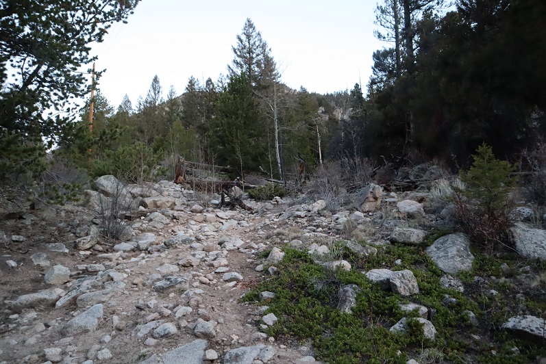
I continued following the road 3.3 miles to the communication towers

At the towers I turned left and followed trail/road 322A

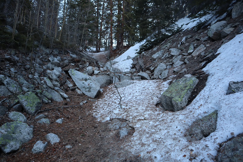
This is where the snow started getting deep.  There wasn’t a visible trench, so I postholed a bit, but was stubborn and didn’t put on my snowshoes.

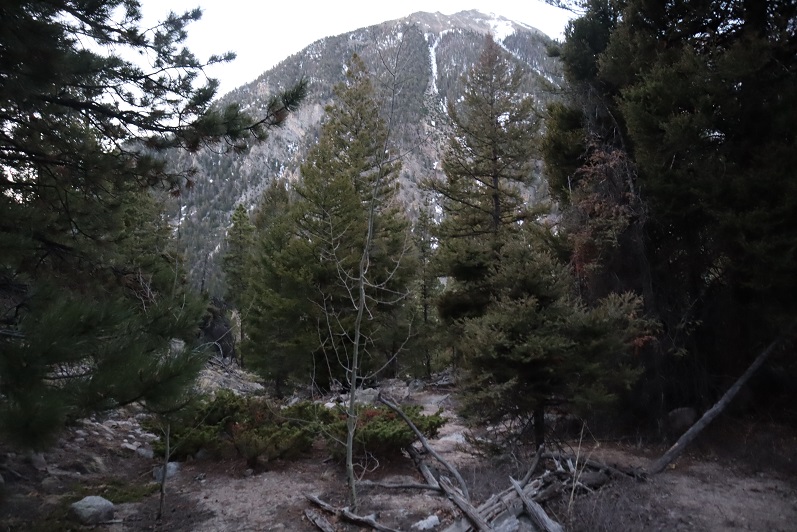
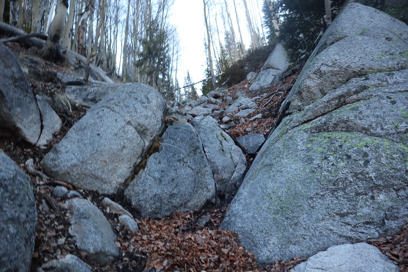
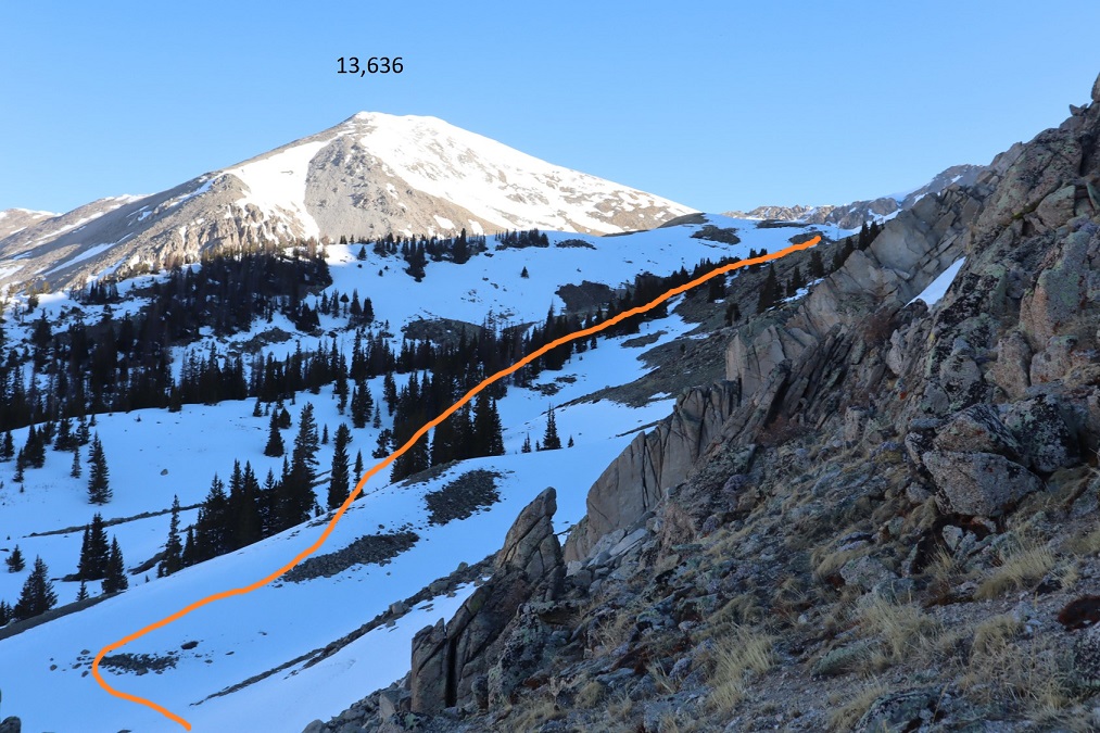
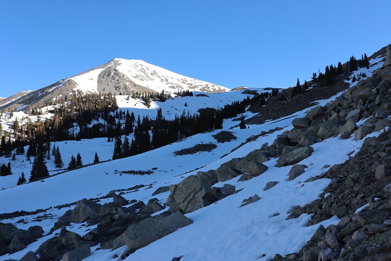
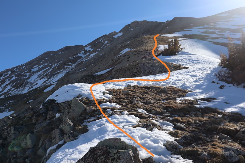
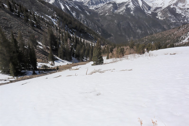
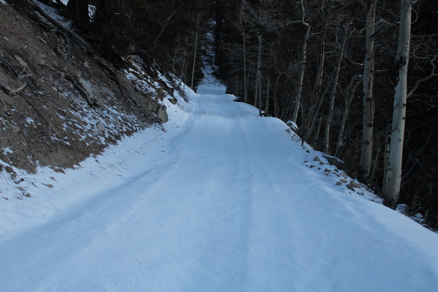
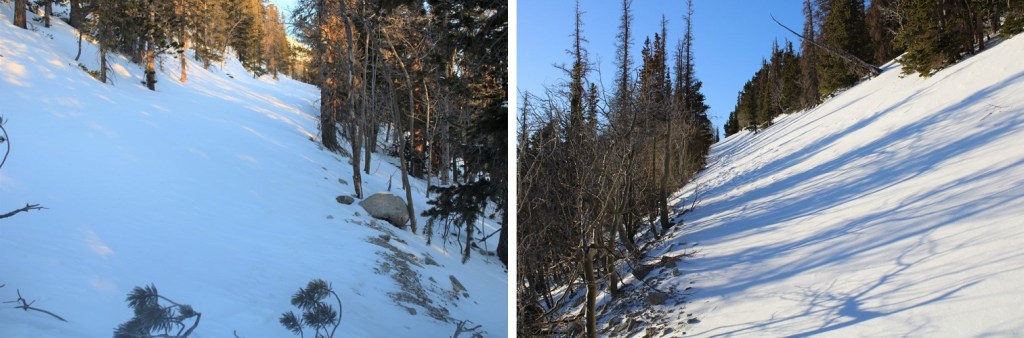
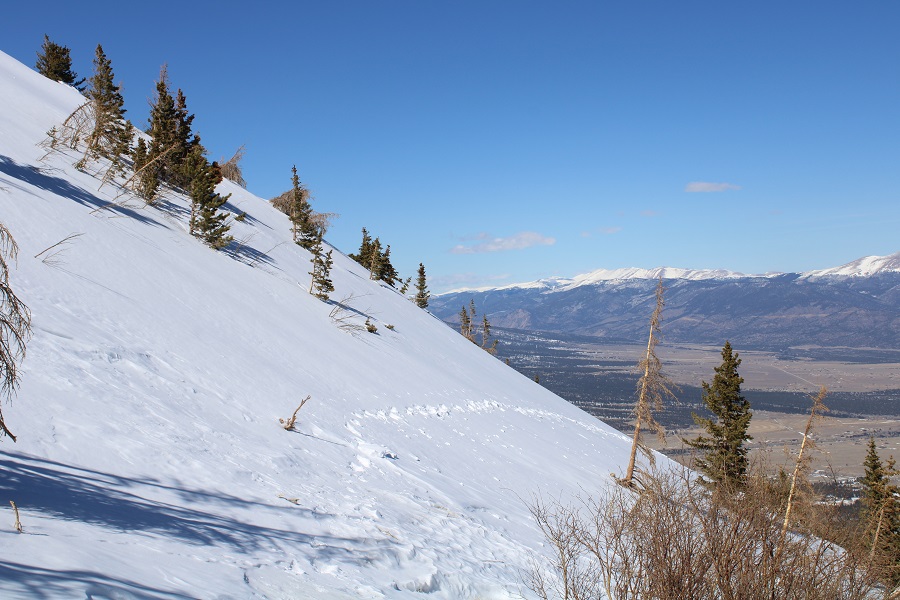
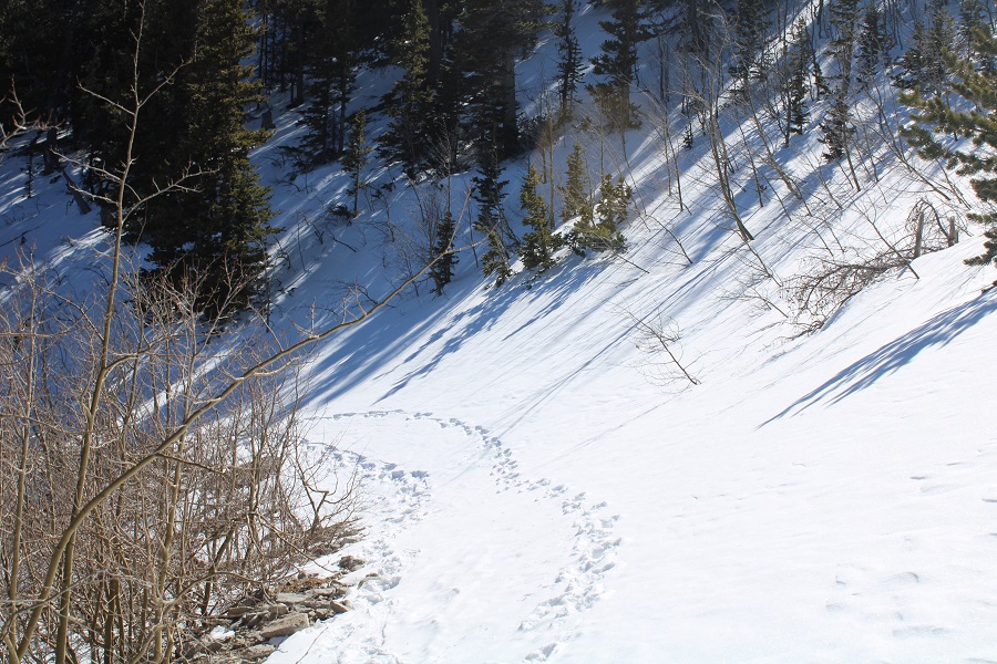
I was still following the road, but there was a lot of snow in this area.  The drop-offs were steep (better pictures later, just be aware of avy danger here).

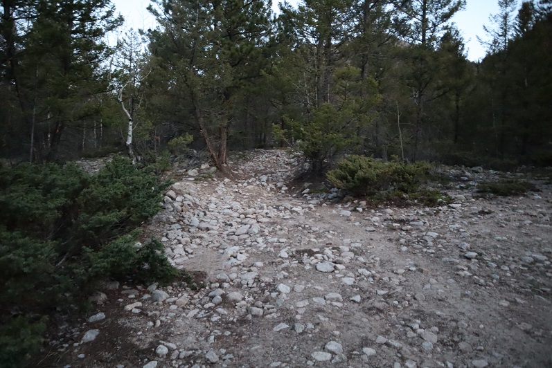
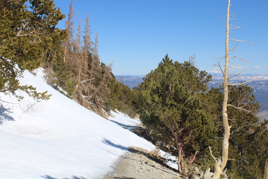
I followed the road to treeline, and then gained the ridge to the right (continuing on this road will take you to the Lucky Mine, and another access point to summit Tigger, but I found the snow was too steep covering the road and decided against that route)

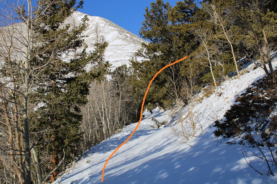
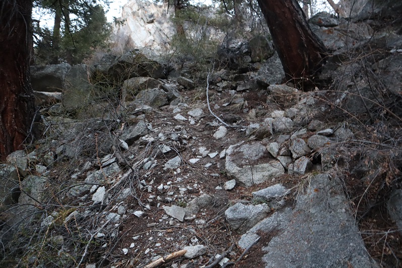
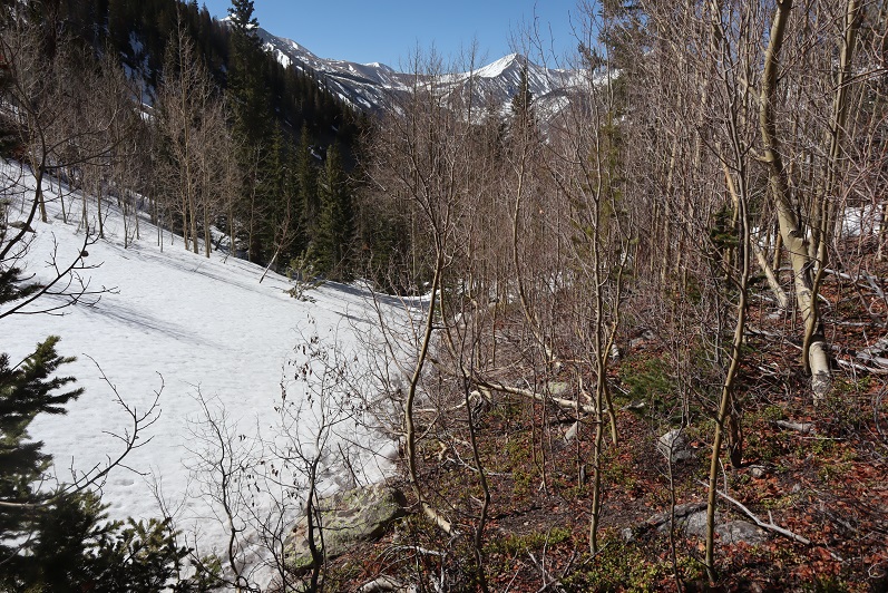
Once on the ridge it was windblown, and I could easily see the summer trail. 

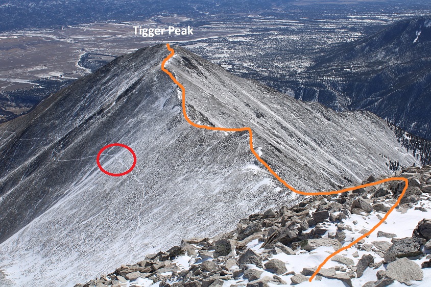
At this point, what I should have done was gone straight up and over Tigger Peak. 

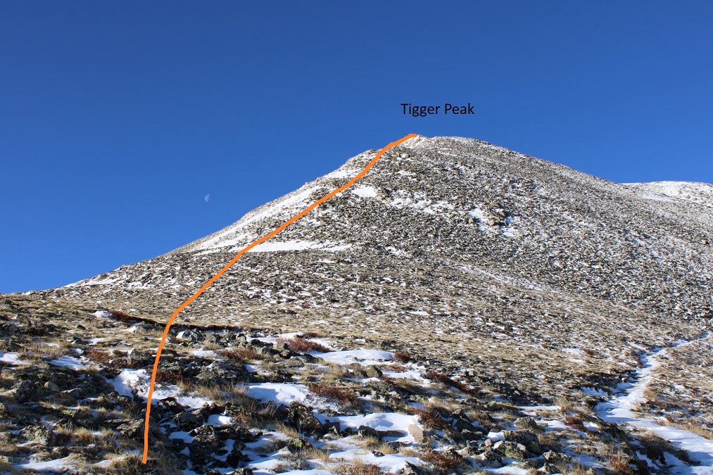
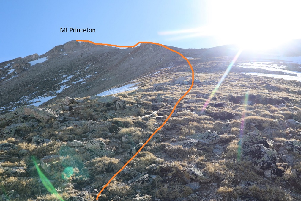
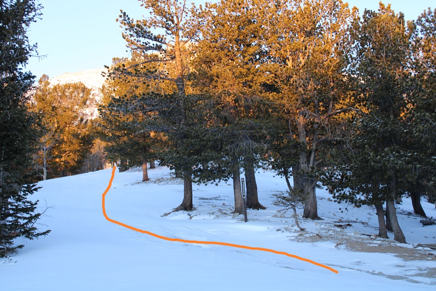
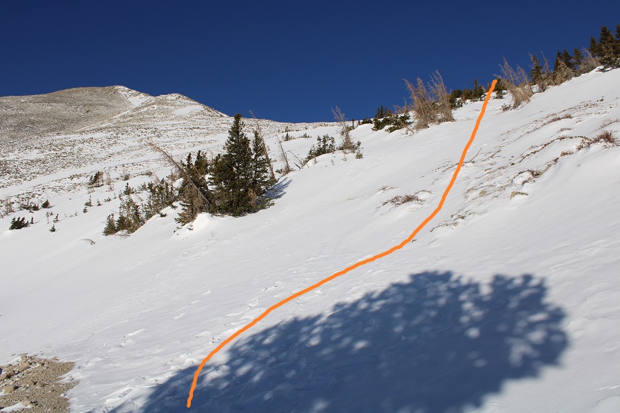
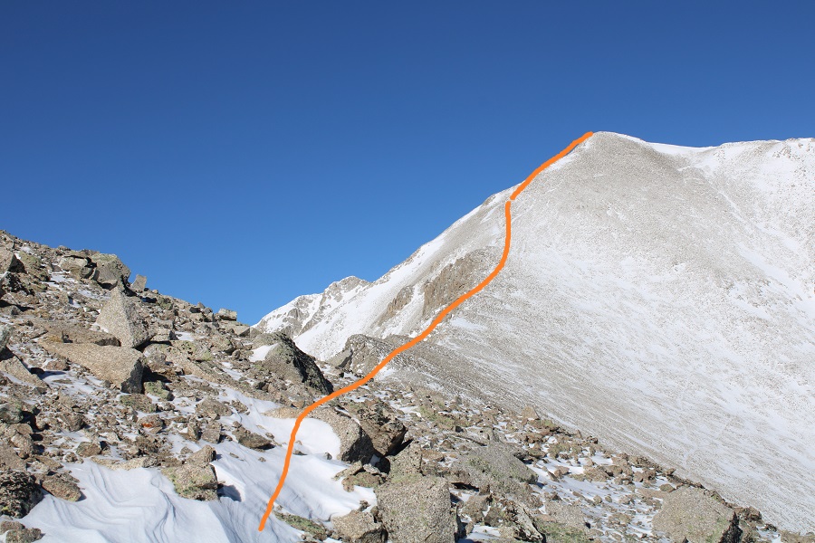
But the trail looked easily to follow, and the mountain looked windblown, so I continued to follow the summer route.  Here’s the overall summer route

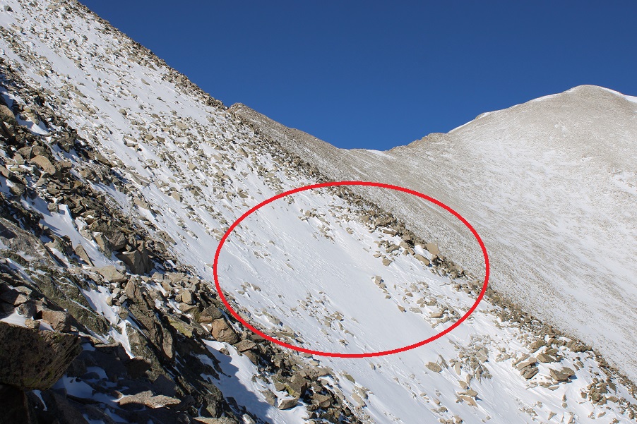
As I said earlier, I was following the mostly bare trail.  I crossed a couple of slide areas without difficulty, and then came to one that gave me pause.  I could see remnants of old footprints/tracks in the snow further ahead, but I did not feel comfortable crossing this section this morning, even though I had my ice axe and gear. A slip would have been too costly, especially since I hike solo.

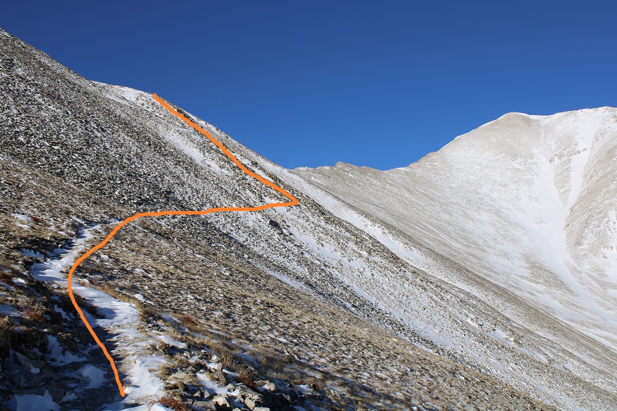
I decided instead to change direction immediately and head south to the ridge, rock hopping to the top.  Most of these rocks were large, and luckily, few of them moved.  The snow in-between the rocks was troublesome at times, and I postholed to my waist, but I felt more comfortable with this route.

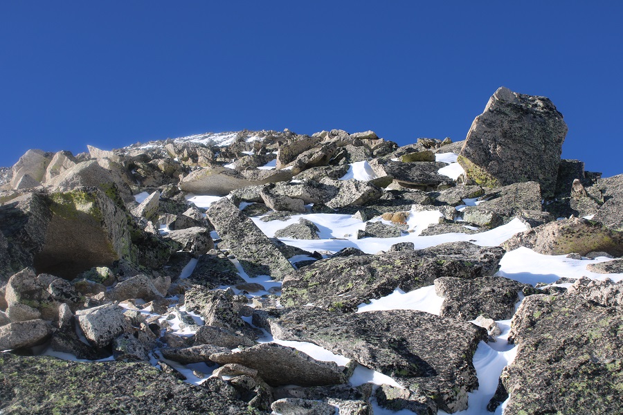
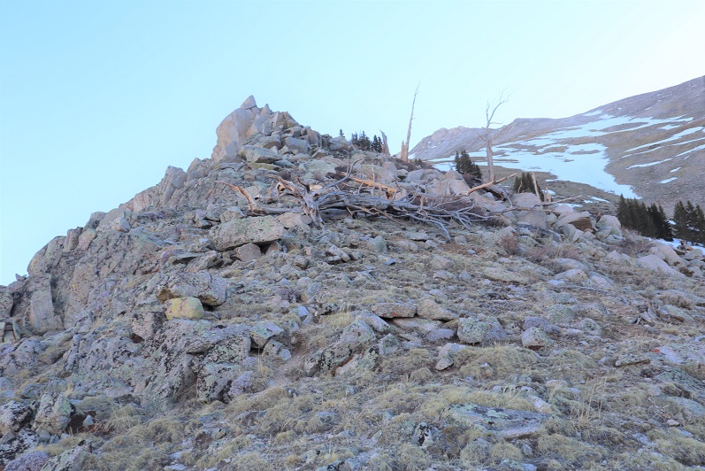
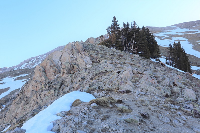
Once on the ridge I followed it northwest to the summit.  There were several social trails here, but staying on the ridge proper, or going slightly east worked well.

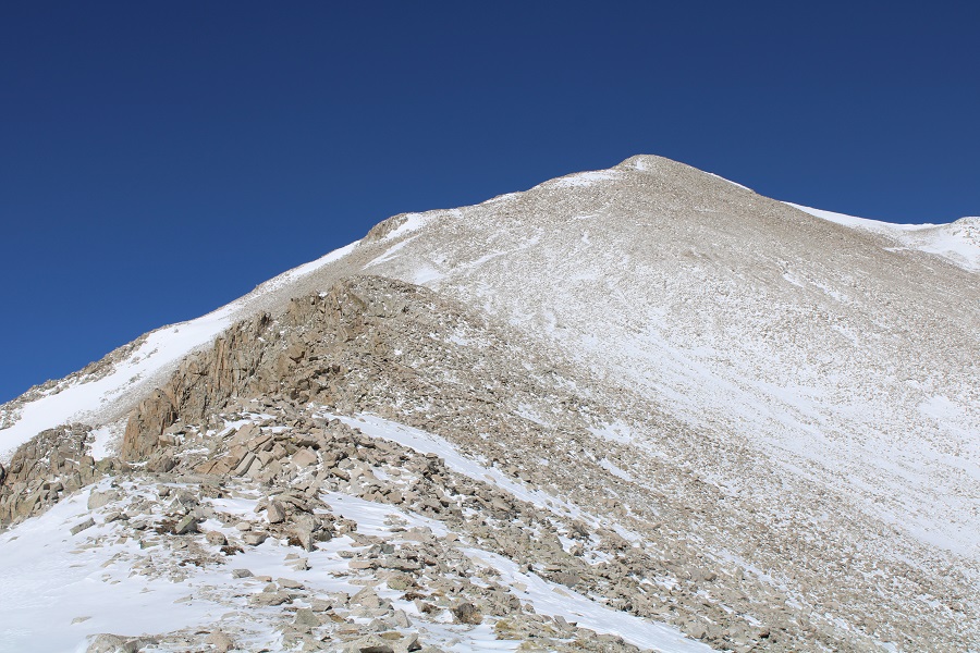
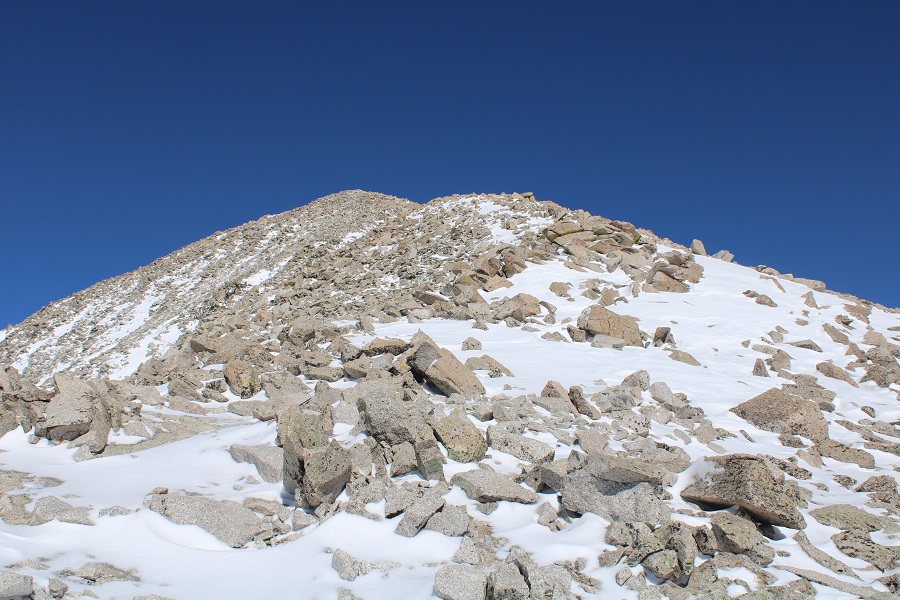
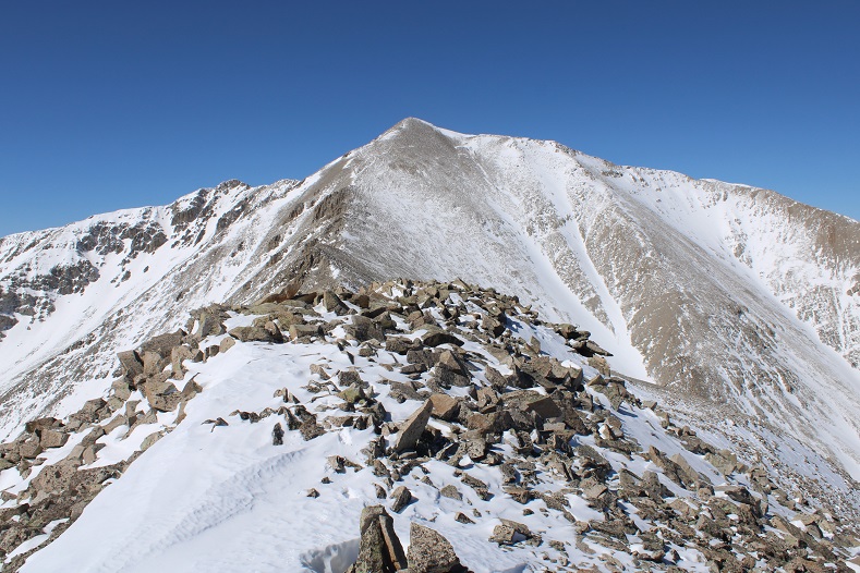
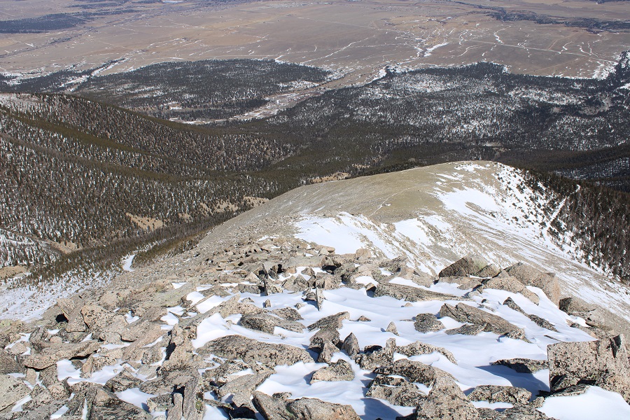
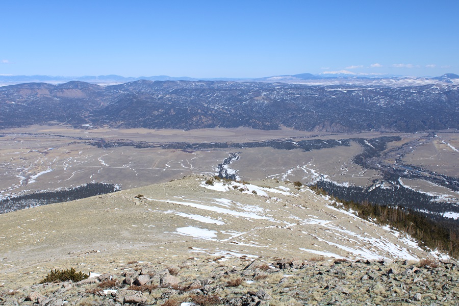
I made it to the summit at 10:45am
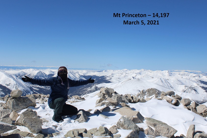
Mt Princeton:

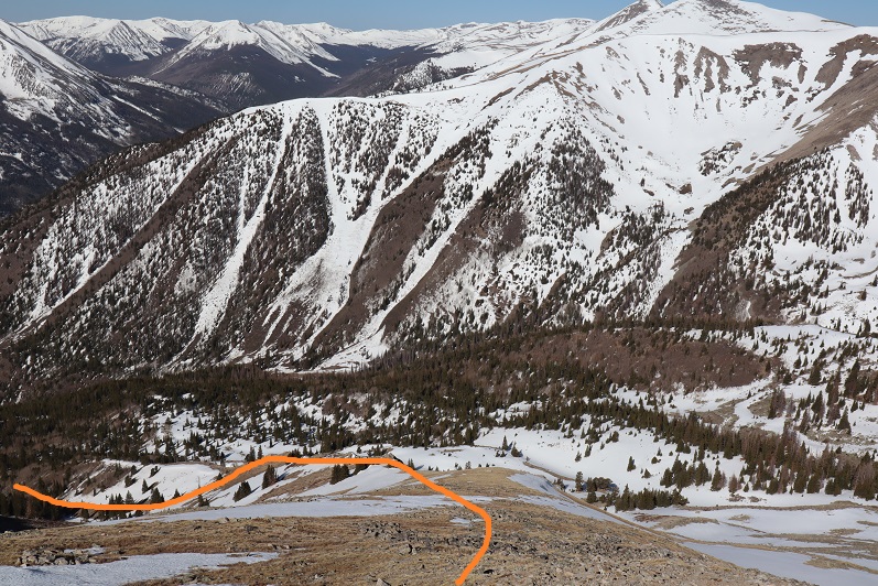
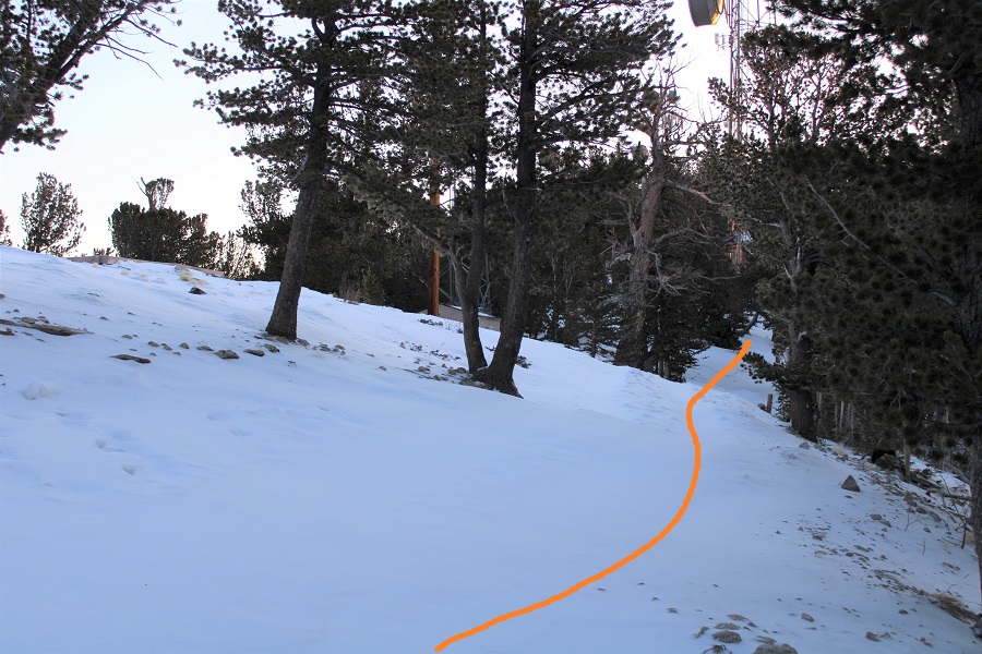
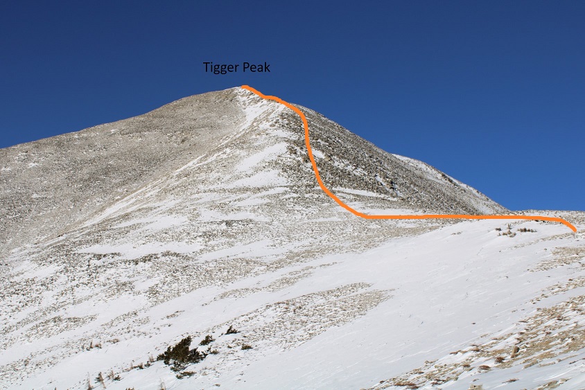
It was a gorgeous day above treeline!  However, I had plans and needed to bet back down.  I decided to head back over Tigger Peak.  Circled is the small slide area I wished to avoid

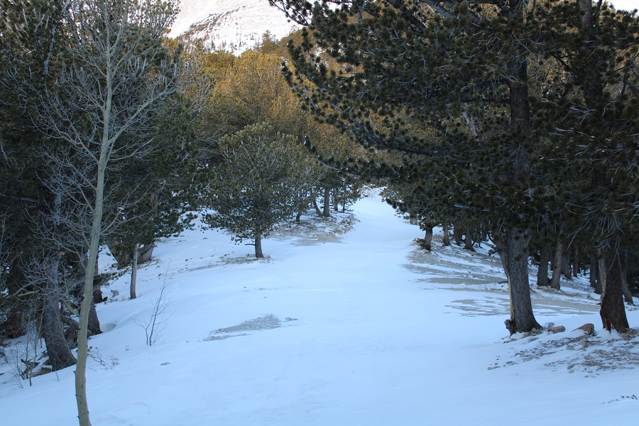
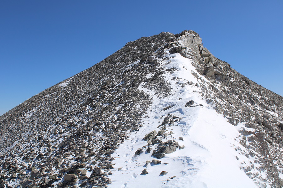
Here are some pictures of the ridge to Tigger Peak, complete with a few small false summits

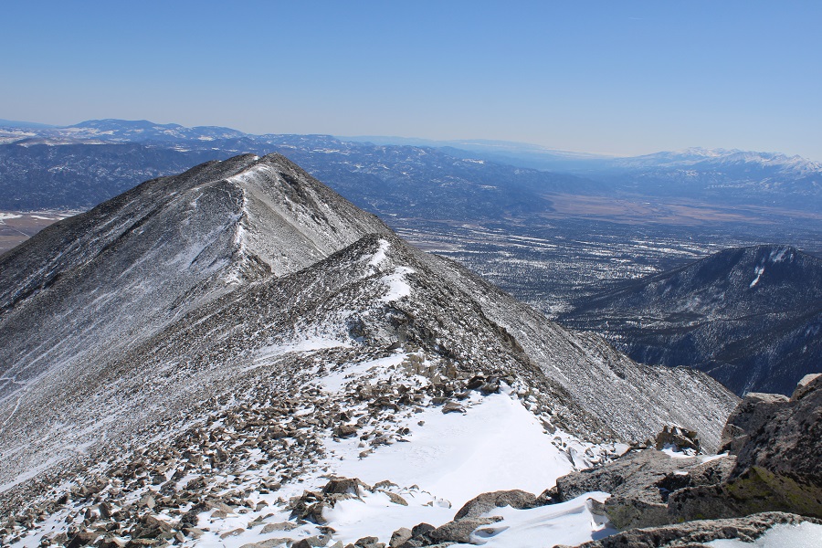
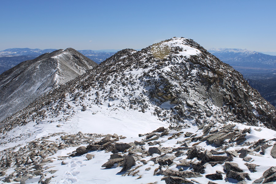
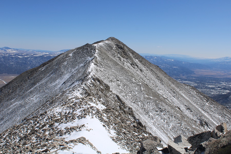
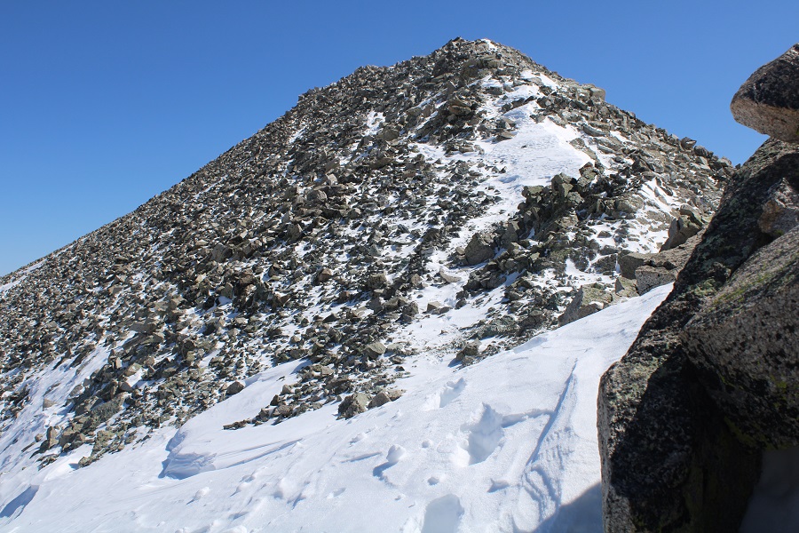
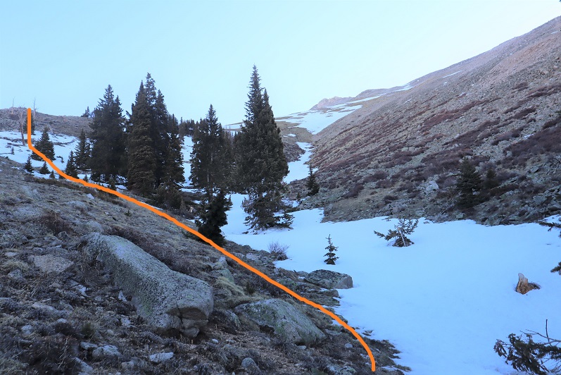
From Tigger Peak, here’s looking at the descent point

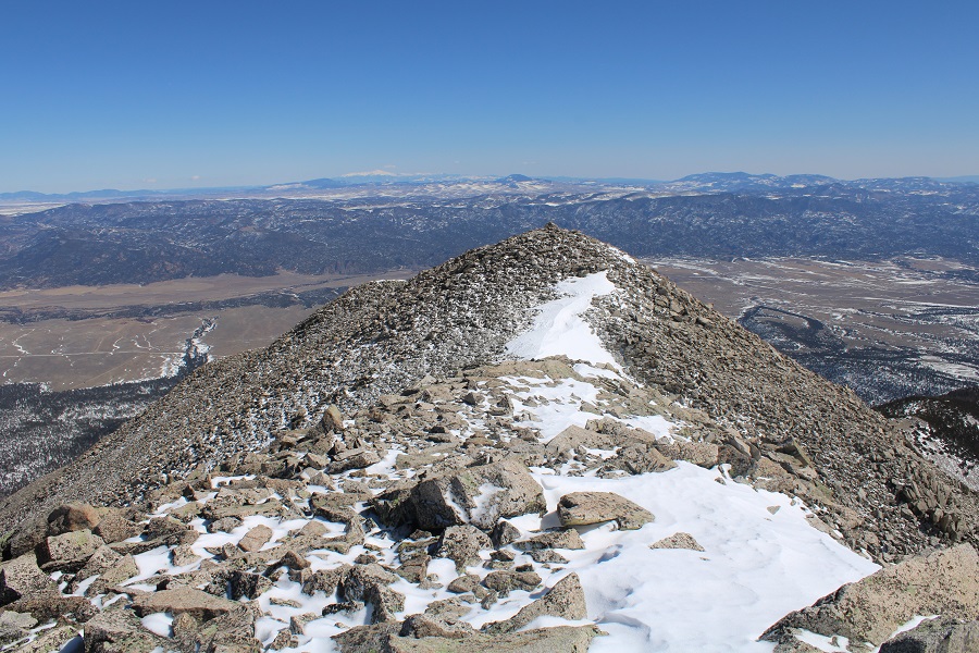
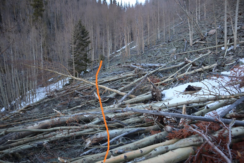
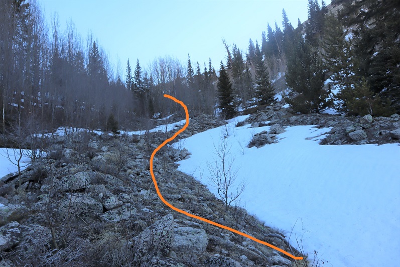
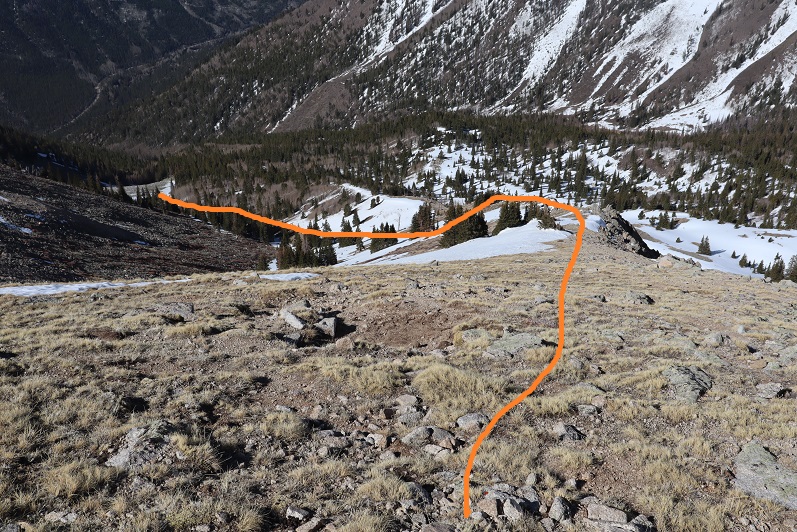
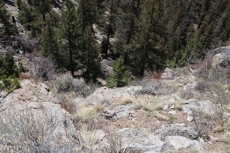
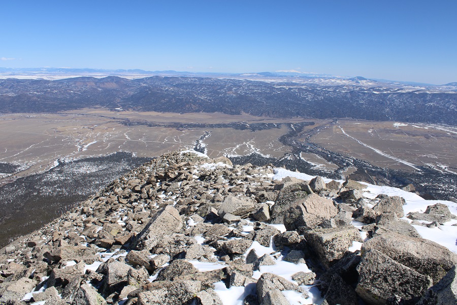
I continued hiking the ridge, and then started the longest part of my day:  rock hopping back down to the trail.  I just had to head northeast, and I could see the trail in front of me, but a lot of these rocks moved and progress was painstakingly slow.  Here’s the route

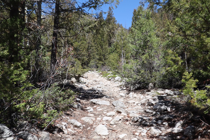
From there I picked up the trail and followed it back to the road

And followed the road back down to the trailhead. 

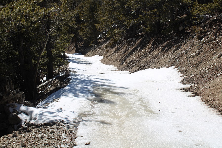
Here are some better pictures of how steep some sections on the road were

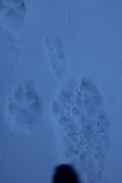
Something cool:  I was the first to make prints on my way in, but on my way out I saw coyote prints following my tracks.  Some of the prints were directly in my footsteps.  Looks like I had a stalker.

The snow on the road became slushy as I descended. 

It was downright muddy by the time I made it back to my truck

I didn’t see another person the entire day, which was a shame because it was a perfect day to be above treeline!

I made it back to my truck at 2:45pm, much later than I’d originally anticipated.  Luckily, I had cell reception and could call my appointments and move them to 6pm.  This ended up being a 15.4 mile hike with 5615’ of elevation gain in 9 hours, 45 minutes.

You can buy the Mt Princeton summit sticker here

13,626 – (attempt) from Grouse Canyon

1

RT Length: 5.67 miles
Elevation Gain: 3772’

Note:  My successful summit of PT 13626 can be found here.

I got a late start on this one. My alarm didn’t go off and I woke up an hour late. Then I got stuck for an hour on HWY 24 around Manitou. I’m not sure why the road was closed, but I sat there for over an hour behind a Lay’s Delivery truck, stuck about 100 feet from the off-ramp. I could see flashing red and blue lights, but other then that it was dark. I’m guessing there was an accident just before we arrived. This made me really late to the trailhead, but I was hoping that since this is a shorter hike I’d avoid the mushy snow. I was wrong.

I arrived at the trailhead and was on the trail by 6am.

2

The sun was already starting to rise. I followed 292 for a tenth of a mile and turned right onto the trail

3

You can drive a vehicle up this road, but I’d say it’s more 4WD than I’d like. I was glad I’d parked where I had.

4
Just before the real start to the trail there was a warning sign:

5

Hmmmm. I looked at my topo map and couldn’t find Agnes Vaille Falls anywhere. Well, I was planning on summiting 13,636 and not Mt Princeton, so I figured I’d just keep an eye out for danger and not ascend/descend anything that looked like a “falls”.
There wasn’t much of a trail, but there were cairns

6

7

8

The problem was the cairns didn’t lead me to the right place. They led me to a small waterfall (oh no! Was this the falls?)

9

So I turned right (northeast) and headed up the steep mountainside to avoid the falls and ascend to the ridge.

10

This is actually much steeper than it looks. I found game trails and cairns everywhere, but none of them seemed to lead anywhere. Around 10,000’ I reached a plateau/ridge of sorts and turned left (north) and followed some cairns across the mountainside

11

It was pretty obvious to me I was the first one on this ‘trail’ all year

12

I came to an avalanche area. I don’t think it’s from this year; maybe last year? I just headed towards the ravine, being careful to watch for rolling logs

13

I followed the ravine to treeline. This was actually harder than it sounds, as the snow was already mush in areas, yet solid in others. It was like playing a reverse game of whack-a-mole.

14

15

16

I stuck to the rocks wherever possible

17

18

At treeline I made my way for the ridge. Unfortunately, what little snow there was unavoidable here. It doesn’t look like a lot, but I was postholing in areas and needing crampons in others.

19

When I reached the ridge this was the route I was supposed to take towards 13,636

20
So I headed on down to the basin. The first step I took onto the snow I sank up to my knee. Drat! The snow here was crunchy: about 6 inches of crust sitting on top of millions of small boulders (think toaster ovens and microwaves). I could tell trekking over the snow here wasn’t going to be safe and would only get worse as the day went on.

21

OK, plan B: Maybe the ridge goes up and around the basin? Looking at my topo map said it was worth a try. I headed back up to the ridge and followed it northeast

22

23

24

It had been my goal to find another way towards 13,626, but as I climbed higher I realized that was too dangerous: the ridge didn’t connect properly and there was potential for rockfall. It looked like this was a popular hangout for mountain goats (tons of tracks/scat/hair).

Plan C: Well, if I couldn’t summit 13,636 today I’d just change plans and summit 14er Mt Princeton. I knew I was close (probably a mile away) and I knew I could summit from this side. Here’s the route I intended to take (Mt Princeton is actually a little further to the northeast, on the other side of the ridge

25

I kept trudging along, until finally I decided to stop and put on some sunscreen. It was around 12,800’ I here I noticed I’d lost my water bottle! Oh no! I wasn’t thirsty, but I knew it was supposed to be warm today and to go on any further without water would have been a bad idea, even if I rarely drink on hikes. Drat! Because I didn’t have any water I made the decision to turn around. I felt it was the responsible thing to do. I turned around and headed back down the ridge

26

27

The snow was getting soft, and I was postholing in areas I’d walked across before

28

Yep, it was wise not to summit 13,636 today. I followed the ravine back down, bushwhacking a lot of the way to avoid postholing up to my thighs

29

30

I took a slightly different route back down, as there were cairns and game trails everywhere. I never knew which trail I was on, but tried to mirror my ascent as much as possible. It kept getting warmer and warmer, and I was glad I’d turned back: I was getting thirsty! I ended up descending a little more east than I’d ascended, down a heavily forested scrub oak/chaparral area. It was not pretty: I had branches hitting me in the face and used my pole to fend them off

31

It was all to avoid this huge boulder (I ascended to the left, descended to the right). It didn’t feel like either way was correct, but in hindsight the left (west)was probably the safer option up and down.

32

I was so excited when I made it back to the trail!

33

I took it the short distance to my truck. When I got there I got out a bottle of juice and downed most of it. Yes, turning back had been a good idea today. I got in my truck and started driving to the next trailhead.

Here’s the topo of my route. I still got in some decent elevation gain (3772’)

34
After driving for 5 minutes I ran my hand across the back of my neck… and felt something. I pinched it and looked at it: a tick! Ah! I flapped my hand to get it off, and thought I had, but when I turned my hand over it was crawling on the back of my hand. Luckily I had a pair of pliers in the front seat. I pulled over, picked up the pliers, and squeezed the tick before throwing it out the window. Wow. That’s the second tick I’ve seen in Colorado ever, and the second tick I’ve seen this year (the other was on the east coast in March on a highpointing expedition).

I kept driving, touching the back of my neck every few minutes checking for another tick. This tick was in the same place as the last one I’d had a few months ago. Wouldn’t you know it, 5 minutes later, another tick!!! In the same place. Ewww! I pulled over and got rid of it the same way as the first.

OK, now I was seriously weirded out. Every 30 seconds or so I’d touch the back of my neck, searching for another tick. By the time I made it to the next trailhead I hadn’t seen/felt one. I parked and got out my comb to do my hair. When I looked in the mirror I saw ANOTHER tick climbing up my braid! This was getting ridiculous! I disposed of this one the same way and decided to do a thorough tick check. I re-braided my hair, careful to use the comb and try to comb out any stray ticks. I didn’t find any more, but I was weirded out for the rest of the night (and much into the next day). Nope, I definitely wasn’t hiking 13,636 through Grouse Canyon on my next attempt: too many ticks!!! 3 in one day, when I’ve only ever seen 1 in the 13 years I’ve lived in Colorado.