Geneva Peak – 13,266 and Landslide Peak – 13,238

RT Length: 9.84 miles

Elevation Gain: 2965’

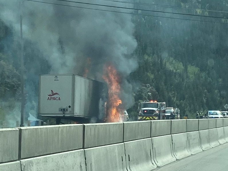
It took me longer than anticipated to get to the trailhead due to an unexpected semi fire on I70.  At first it looked like the entire hillside was on fire, due to all the smoke, but as I got closer I realized it was a semi.  West bound wasn’t closed however, so I was able to get past it faster than those travelling east (which was closed).

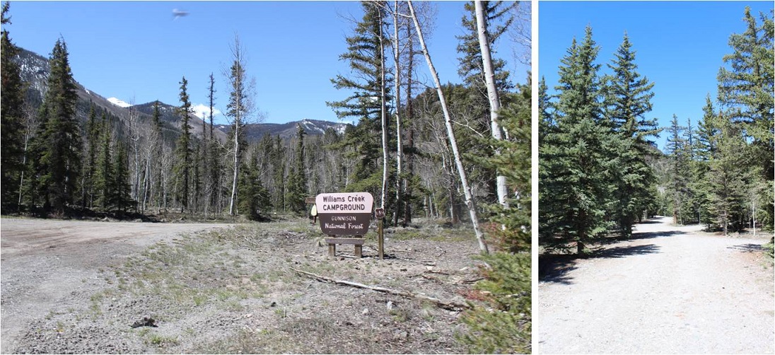
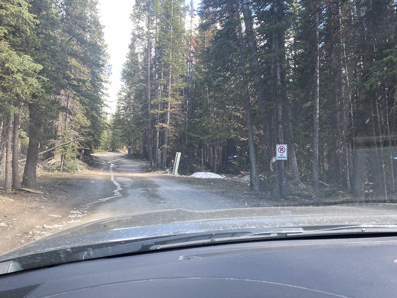
When I finally made it to Montezuma, I turned left on 285 and followed it towards Webster Pass

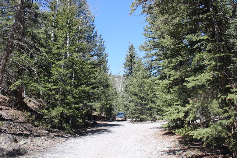
This is a moderate 4WD road (which is good, since I still don’t have my new truck).  They are serious about ‘no parking’ on private land here, and let you know you’re not allowed to park in any available pullout.

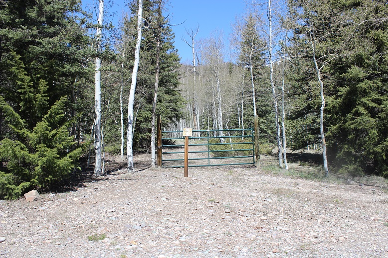
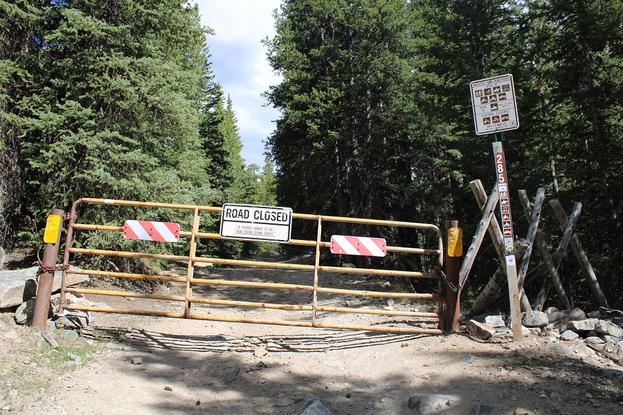
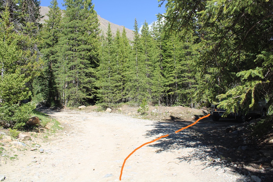
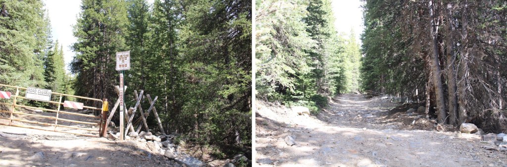
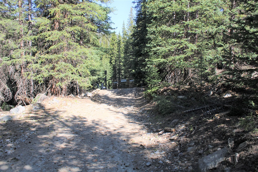
I was able to drive the .7 miles to the gate, but when I got there the gate was closed.  Had it been open, I would have been able to drive all the way to 11000’.  It was closed to allow for spring runoff (I’d find the next day it’s going to be a while before it opens:  Webster Pass is still socked in and the 4WD roads have several feet of snow in some areas).

There were 3 places to park here, but none of them were very level, so I turned to drive my truck to a spot I’d seen on my way in, just about a dozen yards or so back down the road.  As I was doing so, I noticed 3 ATVs:  The drivers drove them through the woods, around the closed gate sign, and up the road.  On my hike the next day it was obvious theirs were the only tracks. I was mad they were breaking the rules, but also hoping maybe they were ‘official’ and checking to see if the trails had melted out?  They didn’t look very official.  They also looked like they’d had to turn around.

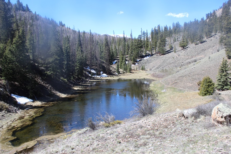
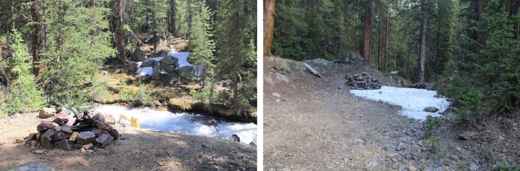
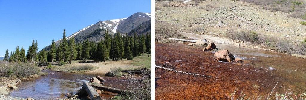
Here’s the camping spot I chose for the night:  a legal place to park at 10780’, next to the Snake River.

I got out and explored.  There are several fire pits behind the parking area, and what look like good places to put up a tent.

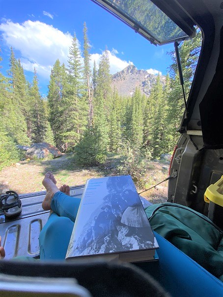
After exploring, I went back to my truck, made dinner, sipped some whiskey, and started reading a book I bought at a used bookstore in Arizona:  The Magnificent Mountain Women, Adventures in the Colorado Rockies by Janet Robertson (1990).  It’s about all the first women to summit various Colorado Mountains, mostly 14ers.  While I only made it about 50 pages in that night, so far it’s a great book, with a lot of good points and tons of background information on the lives of these women and their ascents.  Added bonus:  it includes pictures. 

After a few chapters I decided to make it an early night.  I had a lot of dental work done the day before and I was still sore.  I had a hummingbird come visit me inside the topper of my truck (that’s 5 times now that’s happened to me), cleaned up, and went to bed. 

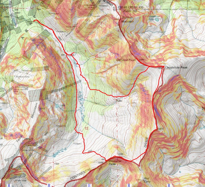
I know the route I took is not the conventional route to Geneva/Landslide, but I did this on purpose:  I’m hiking the loop with a friend next week and I’m trying to keep my streak of summiting peaks solo before going with someone.  I hadn’t yet done Geneva, so I wanted to tick it off before we climbed it together next week, so I got a bit creative.

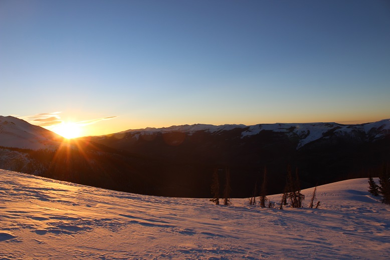
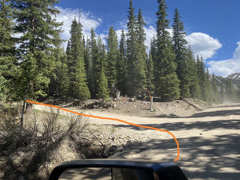
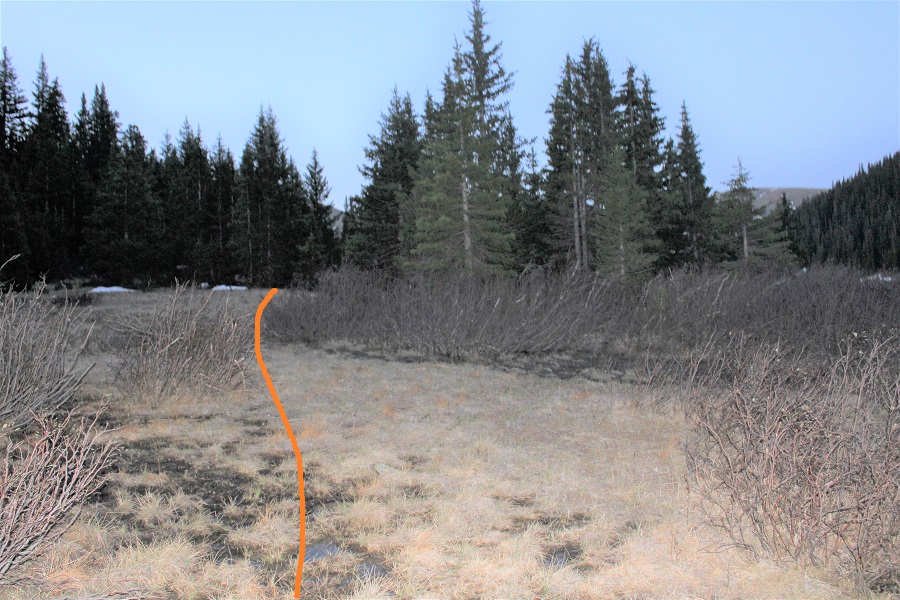
I was on the road at 5am, just before the sun rose.  I took a quick short-cut from my camping spot through the trees to the gate (saved me a total of about 5 yards of walking). It’s an obvious and well-travelled side trail. 

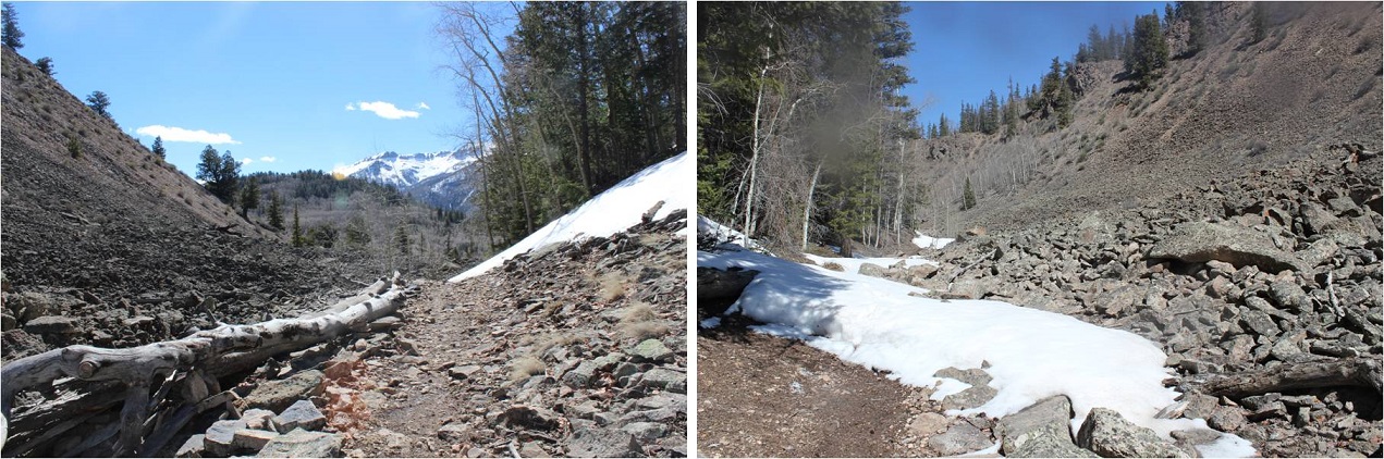
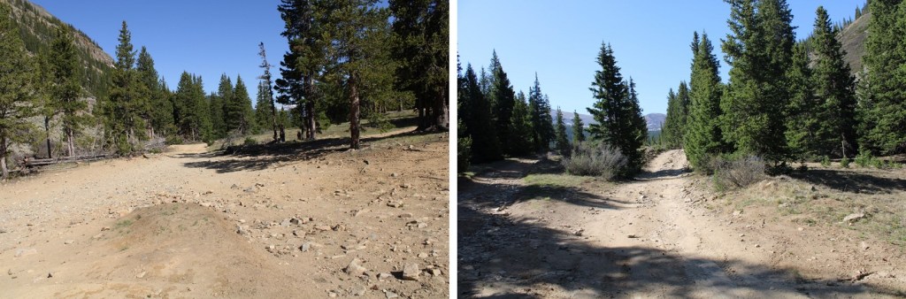
I passed the gate and continued along 285

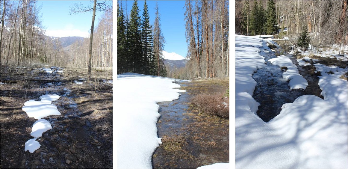
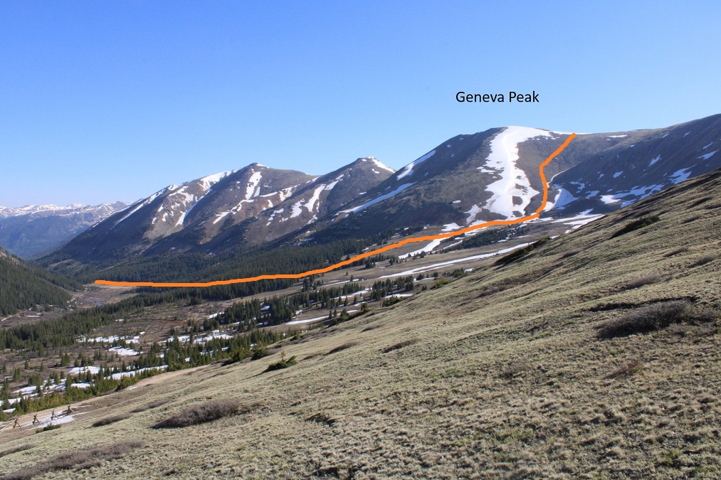
I followed this road for .85 miles, until I came to a wide-open gulch.  This is probably where I would have parked if the gate had been open. My hike would take me on a loop back to this place.

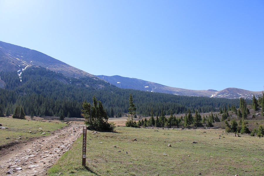
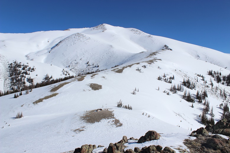
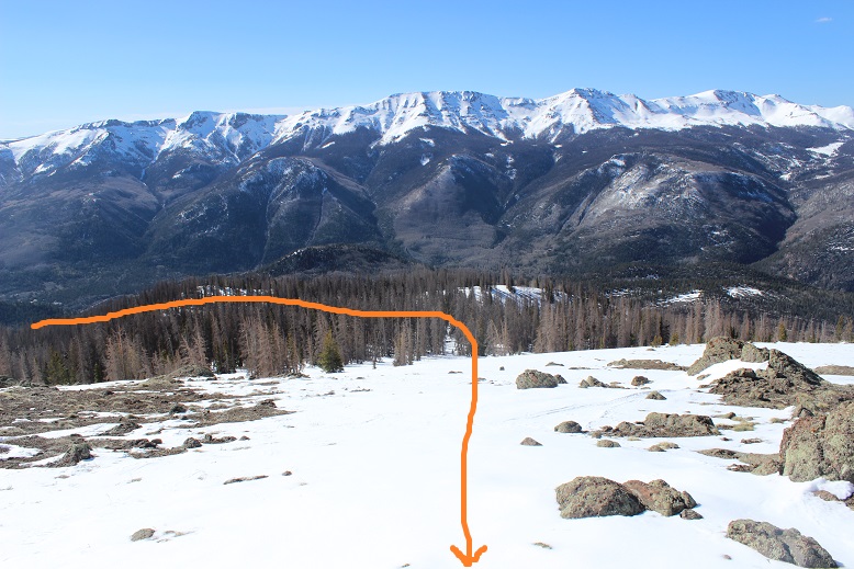
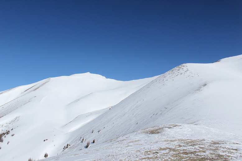
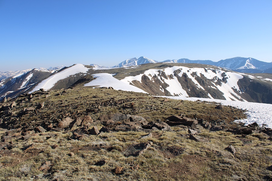
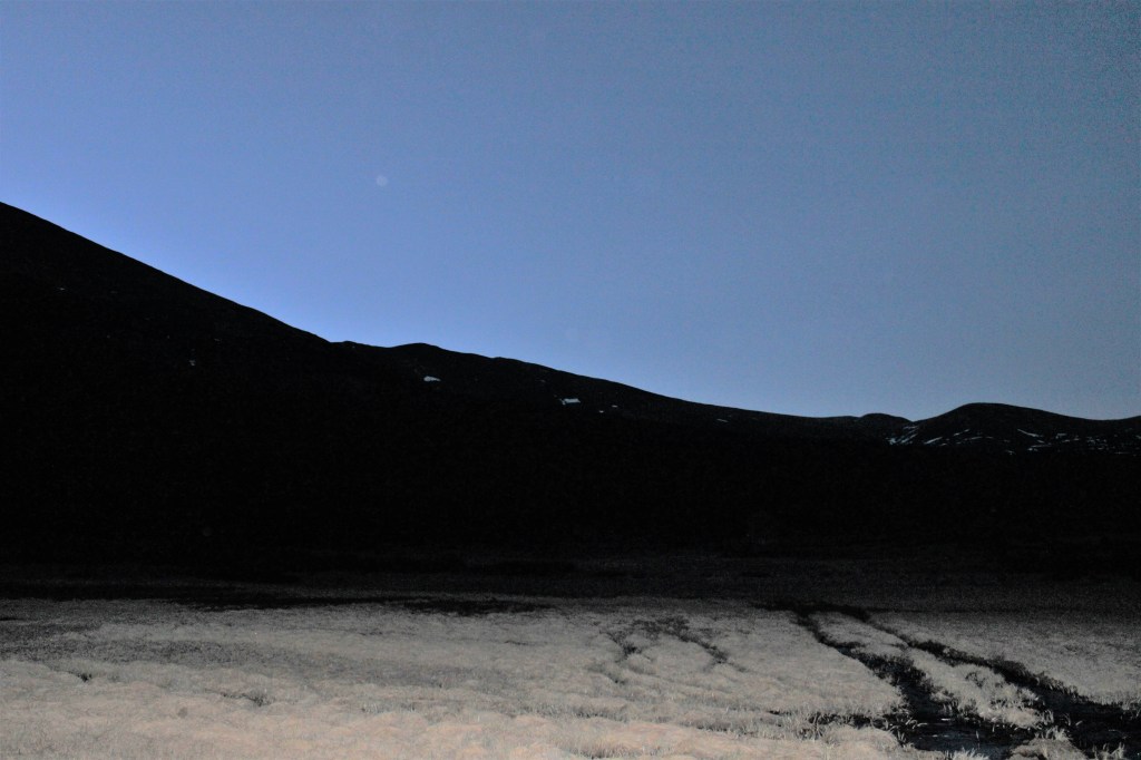
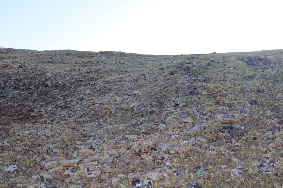
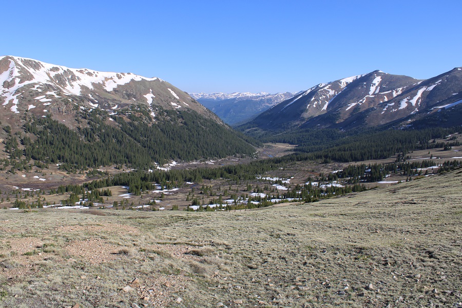
Here’s an overview of my hike to treeline: 

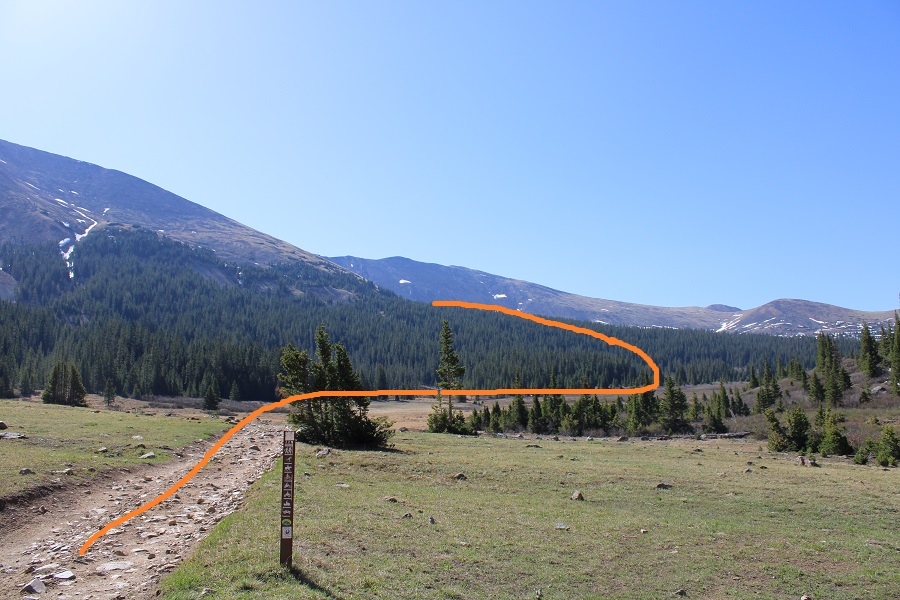
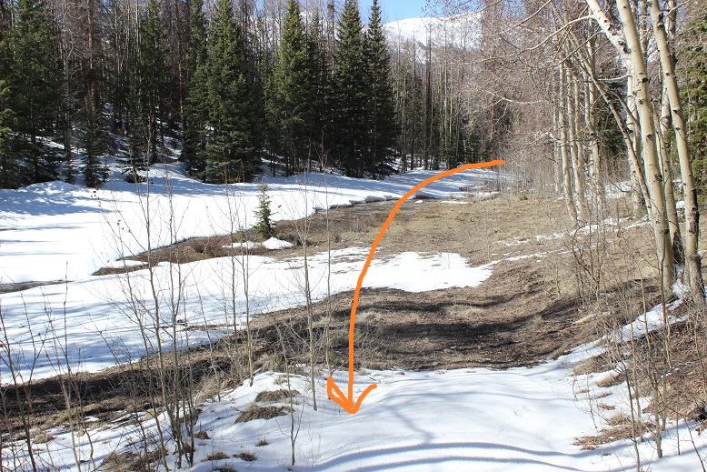
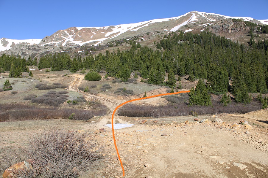
There was a sign indicating a trail that intersected the road at 11045’.  It showed there was a trail heading southeast, and indeed, in the dark it looked like there was a trail.  I knew I wanted to head this way, so I started following the ‘trail’.

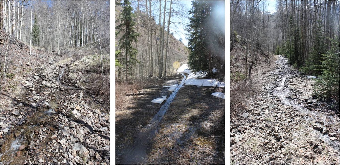
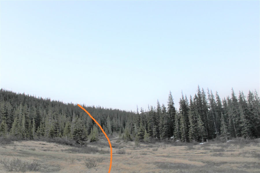
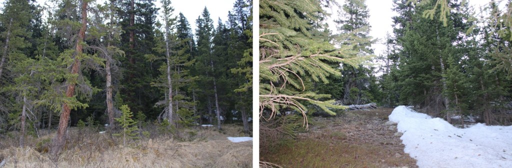
I’m thinking this was a snowshoeing trail.  But, in any event, it took me in the right direction.  The only problem?  It was under spring runout.  The entire area was marshy and I was sinking in the slush. Not fun.  I found if I stayed higher, more to the left, I was able to miss the brunt of it.  The ‘trail’ ended after about 200 feet. One thing I knew:  this was not going to be fun on my way back.  I decided to take the road down. I continued hugging the trees for three quarters of a mile, doing my best to avoid the willows

Then, at 11180’ I followed a small drainage into the trees, and headed east to treeline.

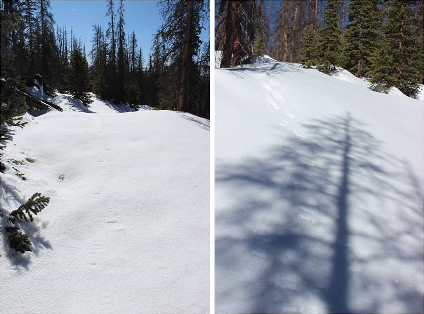
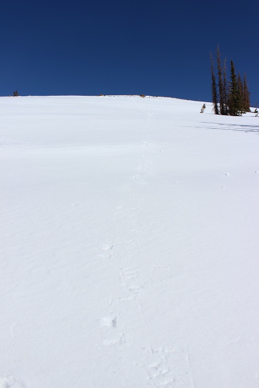
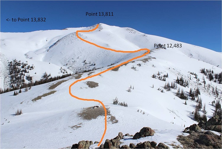
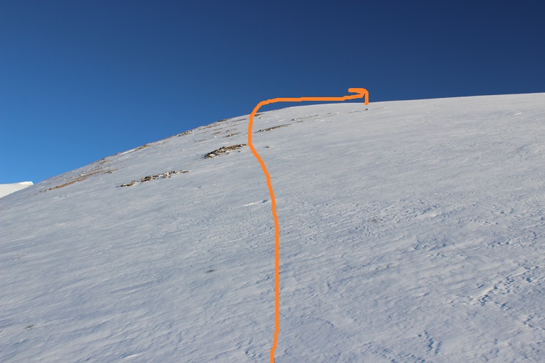
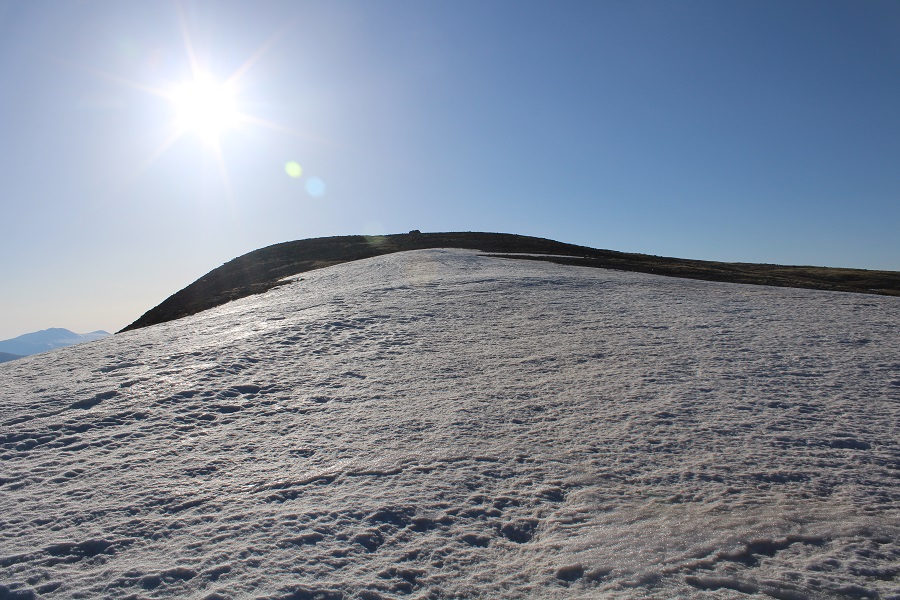
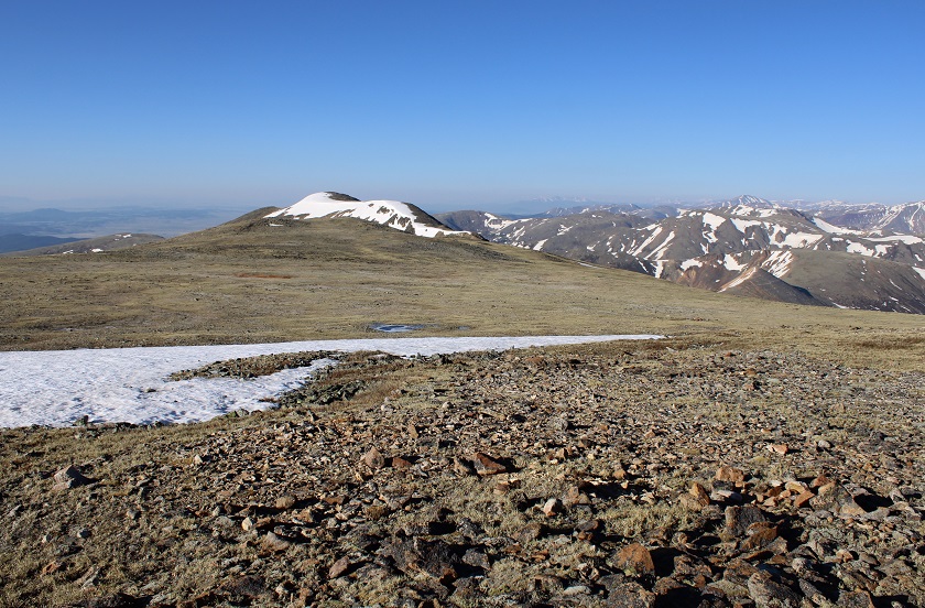
Once at treeline my route was obvious.  I just aimed for the drainage and followed it up.  Note:  This is the southeast face of Geneva Peak, and it’s pretty much all tundra.  I could have just gone up the ridge and ended up in the same spot, or followed the curve of the drainage all of the way right and done Landslide first.  Lots of choices here.

I chose to go up the drainage, straight to the small saddle between Geneva and Landslide.  This was nice and steady on tundra:  nothing unexpected.

Once at the saddle I turned left and headed towards Geneva Peak.  There was still a lot of snow here, but it was firm and I didn’t need microspikes.  I just followed the ridge northwest to the summit

The summit was covered in a cornice.

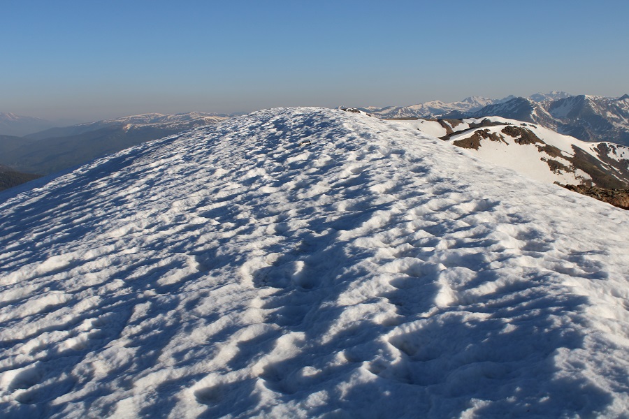
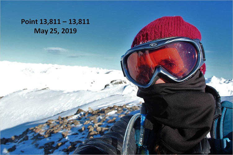
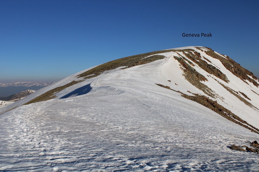
I walked a little further north to take my summit photos.  I summited Geneva Peak at 7am
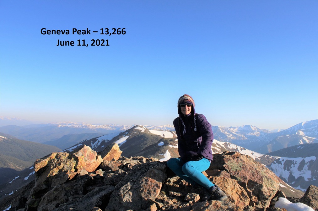
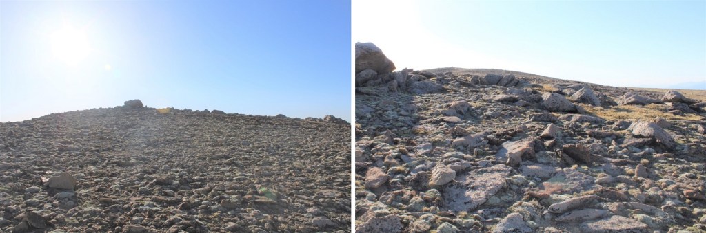
Geneva Peak: 

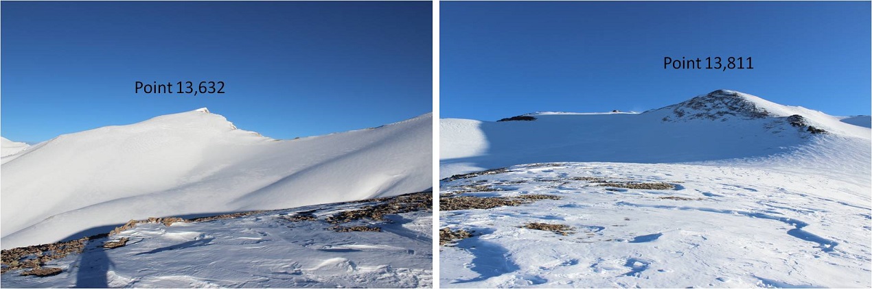
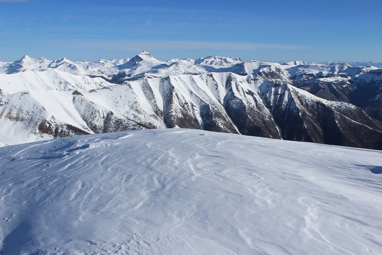
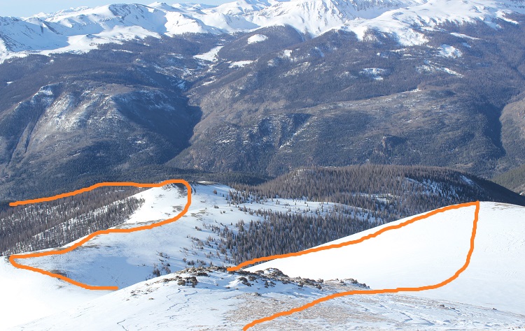
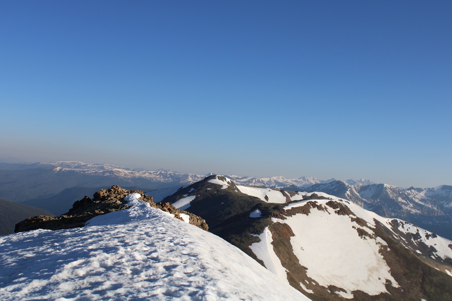
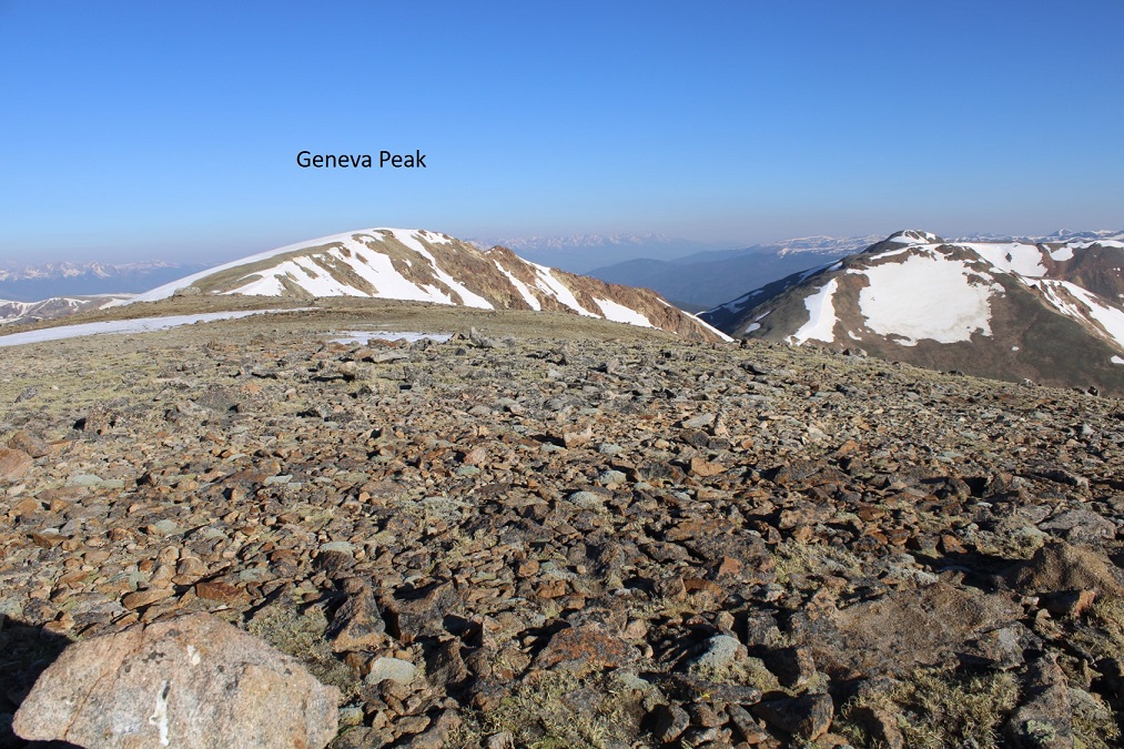
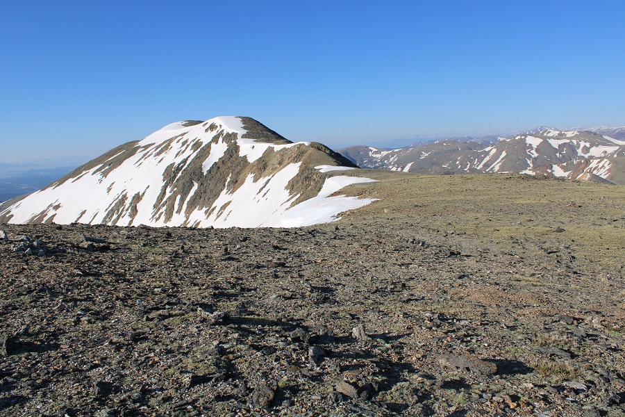
Here’s a look at Geneva and Landslide from my picture spot.

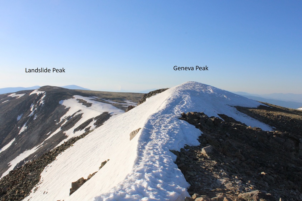
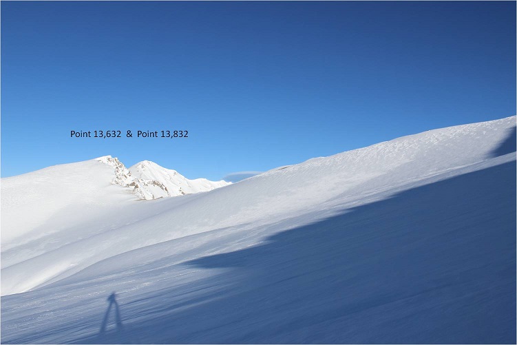
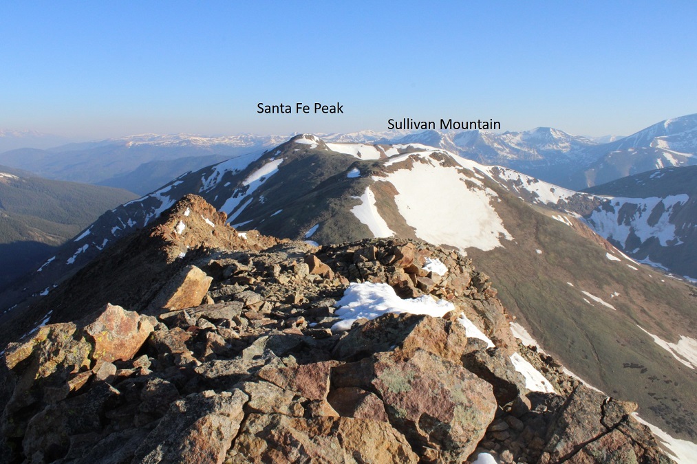
Here are some other 13ers in the area:

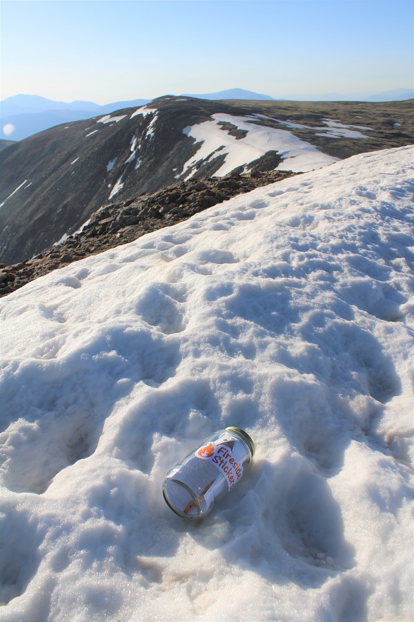
I re-ascended Geneva, left a summit register on the cornice, and retraced my steps back to the Geneva/Landslide saddle. 

This was a quick and simple hike, following the ridge east.  The snow was avoidable if I were to dip down to the right, but at this time of day it was still firm and I didn’t even need microspikes to navigate.


There’s a bit of a false summit (if you could call it that) on the way

I summited Landslide Peak at 7:15am.  I’m jumping for joy because this is the 250th unique 13er in Colorado I’ve summited solo.  Woot!
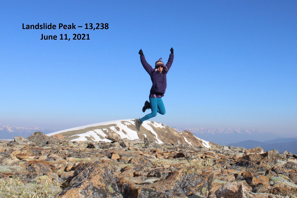
Landslide Peak: 


Here’s looking back at Geneva

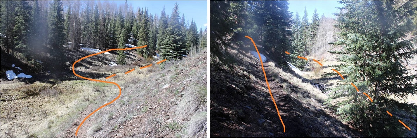
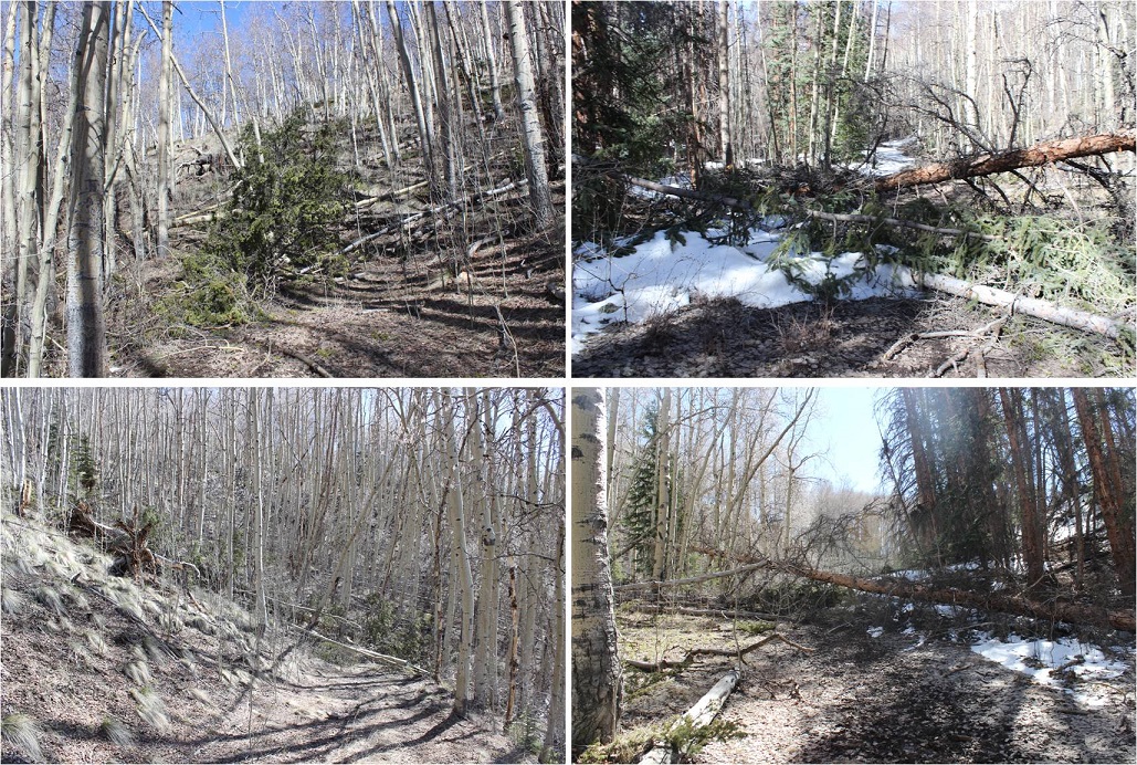
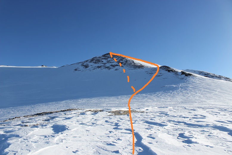
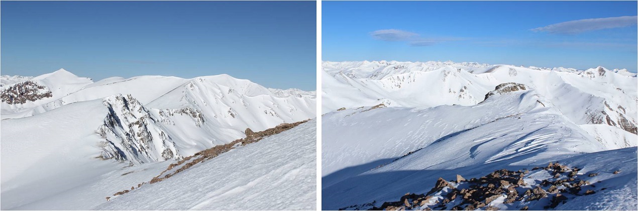
Since I didn’t want to drop back down into the basin and go through the marshy areas, I decided to hike the ridge south back to Webster Pass, then take the road back. Here’s the overall route along the ridge.

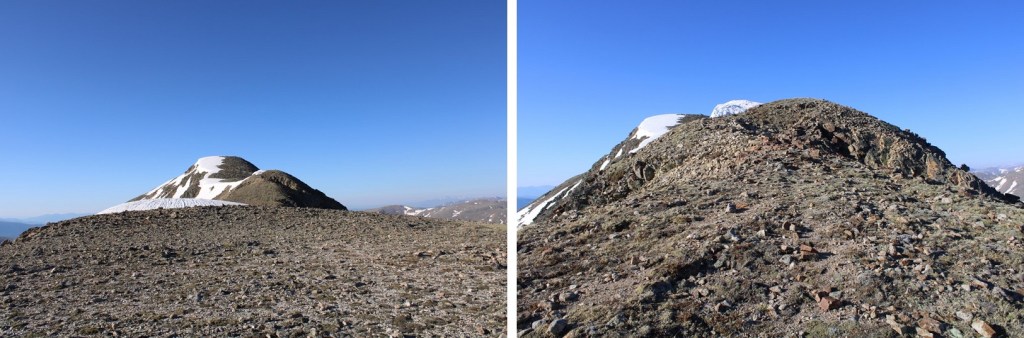
And some step-by-step pictures up and over this unranked point that is 13180’

This is easy class 2 up and over

Once at the top I made my way down to the 4WD dirt road.

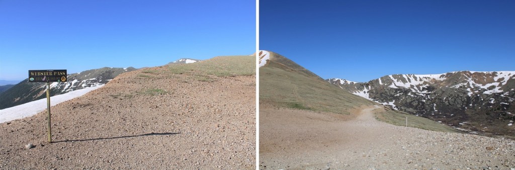
At the road I turned right, and followed it west to Webster Pass.  As you can see from this picture, even in June, Webster Pass is impassible due to snow.

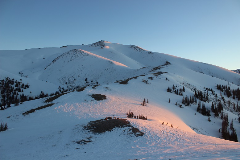
Here I had a great view of how I ascended Geneva Peak

At Webster Pass you can follow the 4WD road back, making this a loop

Here you can see the road, on the other side of the Snake River, and the path it leads out

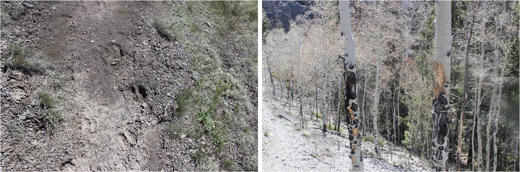
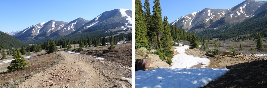
Once on the road, there were varying conditions, from dry, to muddy, and eventually to snow covered.  The snow covered portions would have been difficult later in the day, but this early in the morning the snow was still (mostly) firm and I only postholed a couple of times

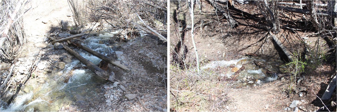
Just before making this a loop I came to a water crossing where Snake River meets 4WD road 285.  It was about 18 inches deep.  I took off my boots, rolled up my pants, and waded across, doing my best to avoid the stagnant area

Then I continued following 285 northwest, back to my truck

I made it back to my truck at 9:30am, making this a 9.84 mile hike with 2965’ of elevation gain in 4.5 hours. 

Now, off to the airport to pick up one of my Girl Scouts: We’re off to California for the week for their Senior trip to learn how to surf.  It’s our last trip before they all head off to college.  Maybe I’ll be able to find some good hikes along the beach? 

Point 13,820

1

RT Length: 13.5 miles

Elevation Gain: 4938’

So far this weekend nothing was going as planned. I took a 2 hour nap before getting up at 10pm to drive the 6 hours to the trailhead.  I’d wanted to hike Point 13,811 today but ended up getting “lost” (apparently there are two Williams Creek Trailheads geographically close to each other) and long story short the workaround was a 3 hour drive, so I missed my window to climb Point 13,811 safely yesterday.  What really stinks is I’d printed out the correct directions, set my GPS to the incorrect campground, and when my GPS took me a different way I didn’t challenge it, I just figured I was headed in the back way (face palm).  Lesson learned.

Well, I’d driven all this way and wasn’t going to drive back without a hike. I switched my plans and decided to hike 13ers Baldy and friends instead.

After hiking Baldy and friends I drove the 30 minutes to Lake City and the William’s Creek Campground. There was tension in the air in Lake City.  The residents seemed to be on edge, and for good reason:  Avalanches have closed the popular 4WD roads in the area and now the residents are worried of flooding when those avalanches thaw. Apparently so are the tourists because they aren’t here.  This is Memorial Day weekend, and the city looks like a ghost town.

I drove to the campground and was surprised to find not one of the campsites was taken. Not one.

2

I stopped to talk with the camp host and she told me she’s never seen it like this before. Her voice was quivered as she worried it would be like this all summer.  I told her I was just interested in sleeping in my truck near the trailhead but wondered what to do since the trailhead was inside the campground?  Should I just park on the road and hike in?  She told me to just pick any spot I wanted and I could camp for free.  I offered to pay, and she refused.  Wow!

She was also concerned I was going out there by myself with “all that snow”. I told her I’d be fine and I’d be gone by noon, but if my truck was still here at night she could start worrying about me.

The trail starts at the back of the campground between spots 11 & 12, so I backed my truck into spot #12 and prepared to make it an early night. A quick wet-wipe bath, 4 packages of tuna, a roll of Ritz crackers, and 3 shots of whiskey later I was sound asleep (by 3pm).

3

I woke up twice during the night but was able to quickly get back to sleep. When my alarm rang at 2am I was not a happy camper (I’m not a fan of sleeping at trailheads:  getting up is the hardest part) but forced myself out of my warm sleeping bag and got ready for the hike.  I made myself eat a bagel as well (I don’t like to eat in the morning, as it makes me nauseous while hiking, but I knew I needed the calories).  I was going to drink water on this hike too for two reasons.  1) I was dehydrated from not drinking anything yesterday (except 3 shots of whiskey) and 2) hydration is important.  I just hoped it didn’t make me nauseous.

I’d done so much research and knew I wanted to make it to treeline as the sun rose, so I needed to be on the trail early. It was 4.5 miles of intense elevation gain to make it to treeline, so I started today at 2:30am, passing through the gate between sites 11 & 12.

4

The first part of the trail was dry.

5

The trail was easy to follow as it crossed a few streams and skirted the south side of the mountain.  The stream crossings were a bit tricky in the dark, as everything was slippery and loose and the water was flowing fast.   Any logs you see that look stable over the water are in fact, not.

6

I could see lots of evidence of deer/elk/moose in the area (all 3 determined by the scat I saw) but didn’t see any wildlife.

7

The trail passed by a few ponds. The first one I had no trouble navigating in the dark

8

The second one is where I had some problems. The correct thing to do here is to go left and hug the side of the slope.  In the dark I didn’t know this and instead followed what I thought was the trail (but was really the creek).  Luckily this only lasted a quarter mile or so and I was back on track.  I didn’t even know I’d done anything wrong until I was hiking back and could see the obvious (and dry) trail above me.  The solid way is the way you should go, the dotted one is the way I took.  My advice:  stay high, stay dry.

9

Directly after I found the trail again I was in a rocky basin. However, I didn’t know this at the time, I just thought I was following a good trail (with a little bit of solid snow).  On my way back I realized it was a rocky basin.

10

Here’s where the “fun” began. We’re currently right in the middle of spring thaw after an intense winter season. At this point the trail conditions became less than ideal as the spring melt became a river in the middle of the trail

11

You can imagine how much fun this was to hike in the early morning dark when it was still pretty icy. I came to a small meadow and followed it through what had become a springtime marsh

12

This area did not smell good: It smelled infected.  Just after the meadow is where the fun began, as I was now on a very small and “defined” jeep road.  There were several areas with large downed trees covering the trail.  On my way back in the daylight this wasn’t difficult to navigate, but as I’ve found quite a bit lately, navigating downed trees in the dark isn’t a pleasant task.  Luckily they were all within the same 200 feet or so on the trail.

13

Oh, and remember how the trail was covered in ice and water earlier? Now it was covered in ice and water and snow!  So much fun!  I hopped back and forth, trying to stay on the snow.  Luckily it was consolidated and not too difficult to accomplish.

14

Here the trail became difficult to follow again due to the conditions. I was able to find the “jeep road” again at this point (here I’m looking back)

15

The steady snow began at 11,000’ and never stopped. The road was initially easy to follow, and then around 11,500’ I lost it.

16

In the dark I had no idea where the road had gone, but the snow was getting a little slushy so I put on my snowshoes and looked at my topo. I needed to head east to summit the mountain in front of me (12,000’).  I aimed east and forged my own trail, amazed at how deep the snow was in this area.

17

I made it to treeline, where both the wind and elevation gain quickly picked up. I was excited to get to the top of this hill (which was point 12,195)

18

Here’s looking back on the way I came up to treeline

19

My plan had worked! I’d made it to treeline just as the sun was beginning to rise

20

21

I took another sip of water and considered: I now had a clear view of the path to the summit.  Here’s the route I took

22

It looks easy and straightforward, and it is, but there are a few things you should know:

  • Point 12,195 and Point 12,483 are not ranked (I know, bummed me out too!)
    • Neither is Point 13,632
  • The elevation gain is steeper than it looks
  • It’s longer than it looks (about a mile and a half, maybe more)

So I started on my way. I skirted Point 12,483 and started hiking the hill to the east (it looks like you can just go straight and hike the adjacent hill but you’ll hit a gully).  So, you hike up and when you reach a small plateau you turn right and head north to the summit.

23

From the plateau if you look left you can see Point 13,632, and to the right is Point 13,811

24

I headed north to summit Point 13,811. Here the snow changed and changed and changed, from consolidated to postholing to very slippery ice. This is the route I took.  I took the dotted line up, and the solid line down.

25

I would NOT recommend taking the dotted line route. I repeat, DO NOT TAKE THIS ROUTE.  It was nasty scree mixed with ice or snow, neither which provided any traction on the 30-35* slope.  A fall here would tear up your gear and your hands if you weren’t wearing protection.

26

From halfway up I got my first good view of another centennial: Point 13,832 (and took a few more sips of water)

27

I summited to intense winds on a small cornice.

28

There was no place to set my camera where it wouldn’t slide down the peak so I did my best to get a selfie (sorry, it’s terrible) and looked around

29

30

I’d really wanted to hike over to Point 13,832 today and get in both centennials, but I didn’t feel secure on that ridge. In fact, I’d kind of expected it to be more wind-blown.  I’d just hiked across snow that looked similar, and the conditions varied quite a bit.  Parts that looked secure were not, and parts that didn’t look solid were.  I didn’t want to fall and slide that far unsupported.  The fall line was so long I couldn’t get it all in one picture

31

And so I mentally prepared myself to drive the 6 hours back to Lake City sometime this summer to knock off that other point. Time to head down.   As I said before, this last 200 feet of vertical or so was not pleasant.  I wasn’t going to do that again on my way down.  Not going to happen.  But the ridge wasn’t much better:  It was all ice at a sharp angle, and when the ice gave way rocks went with it.  I’m not gonna lie:  I turned and faced the mountain at times for this part.  Also, I love my ice axe.

32

I made it to the small saddle and looked at the rest of the route down

33

And started to get nauseous. Ugh!  I knew this would happen!  Well, at least I was descending in elevation.  Here the snow had varying conditions as well, but less danger of injury

34

I made it to Point 12,483, over Point 12,195, and back down the trail, following my tracks below treeline. Here I discovered things I hadn’t seen in the dark (the correct trail, stream crossings, navigation around downed trees, rock piles, etc.) and a few things I hadn’t seen in the dark (notice the spider?)

35

Oh, an old beaver dam…

36

I was almost done with the hike when I came to a fork in the road I hadn’t remembered, and decided to take the path more traveled. This ended up being a mistake (although not an unfortunate one).  I quickly came to a trail register I hadn’t seen in the dark.  It was designed for hikers over 7 feet tall, so someone had placed a large rock at its base.  I still couldn’t see inside.

37

Now I was in a meadow. I wasn’t entirely sure I remembered a meadow at the beginning of this hike? Hmmm… things are different in the dark

38

As I walked through the meadow my arms started to hurt. You know what I’m talking about:  your arms get sore from elevation and the blood pools in your hands and you do the “Praise Jesus” walk through the woods.  Well, I was doing it now through the meadow

39

And then I saw houses? Wait. Uh oh.  This wasn’t right, but I immediately knew what had happened.  I exited the meadow and saw a sign I hadn’t seen on my drive in:  A sign for the (correct) Williams Creek trailhead.  Because of it’s placement you can’t see it driving in unless you know it’s there, but you can see it driving out.

40

I turned right and immediately saw the campground sign. Hmph.  OK, so I guess I hadn’t needed to enter the campground to find the trailhead.

41

I felt really dumb, but not really because at least I knew where I was. I walked back to the campground, through the campground to my campsite, and stopped the clock.  I made it back at exactly 11:11am

I’d hiked 13.5 miles with almost 5000’ of elevation gain in 8.5 hours.

42

Oh, and check out my pants. I seriously need a new pair of winter pants.  I’ve had this pair since 1998 when I bought it at a garage sale for $3.  Last year my crampons tore a hole in them, and I’ve been sewing them up ever since, but I think it’s time for a new pair.  This hole collects snow when I hike, which means I can stop every 5 minutes or so and unload 5lbs of snow-turned ice or I can carry it in my leg, limping unevenly as I go.

Added to that they’re bibs, which makes using the facilities unpleasant; especially when it’s cold outside. I’ve been looking for new snow pants for quite a while but I can’t find any in my size, and yes I’ve checked Goodwill and in children’s sections.  Any petite ladies out there have advice on buying snow pants that fit (and preferably look good)?  I think I’m seriously in the market for a new pair at this point…

43

On my way out I stopped by and thanked the Camp Host, wishing I had something to offer her in return (since she wouldn’t take money). Usually I give out Girl Scout Cookies but I didn’t have any this time.  She asked me to let people know Lake City is open, half of the city is in no danger of flooding, and she’d love to have some campers!  If you get the chance this summer, consider camping in Lake City at any of the campgrounds along County Road 30.  They’re open (and empty).  I drove through the Mill Creek Campground and it didn’t have any campers either…