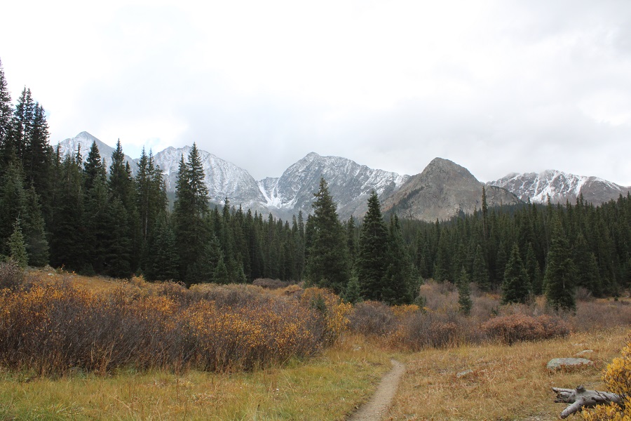
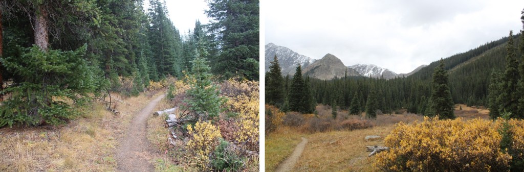
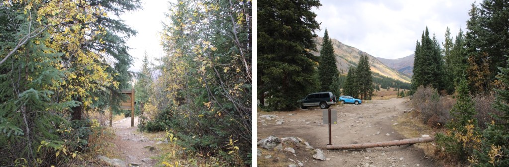
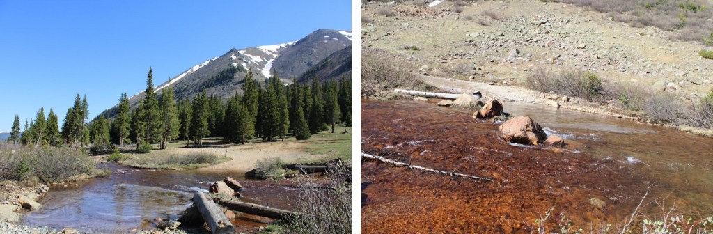
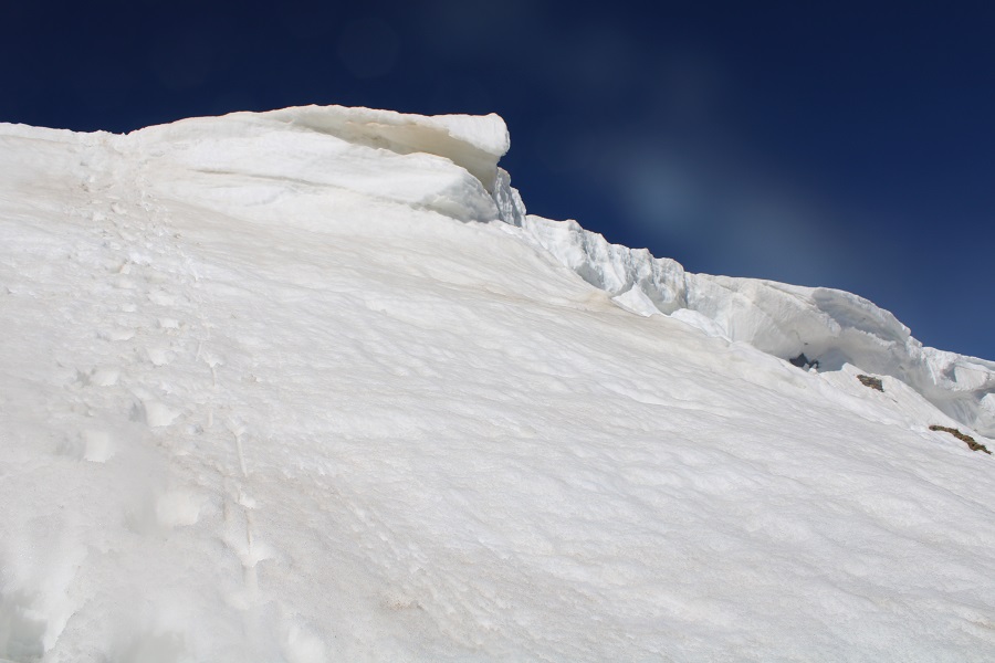
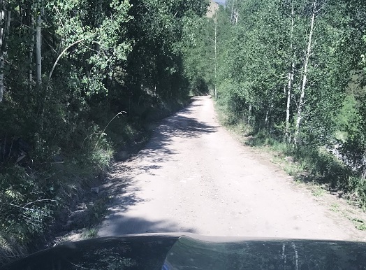
I was the only one at the Lake Ann/Huron Peak trailhead at 5pm on a Friday, and I was thrilled! The 4WD road to the upper trailhead was a little rougher than I remembered it, but the drive had been worth it to be the only one there. I jotted down some notes from the days hike, sipped some whiskey, and looked at notes for tomorrow. It was still light out when I curled up in the back seat of my Tacoma and drifted off to sleep to the sound of pounding rain: that meant fresh snow on the peak tomorrow!
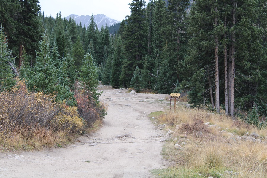
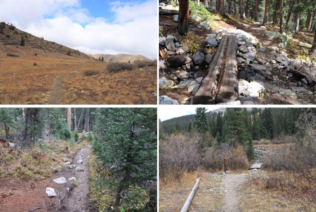
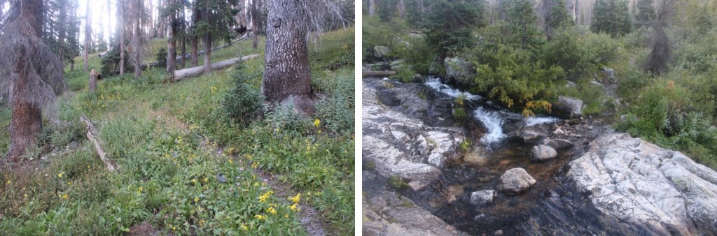
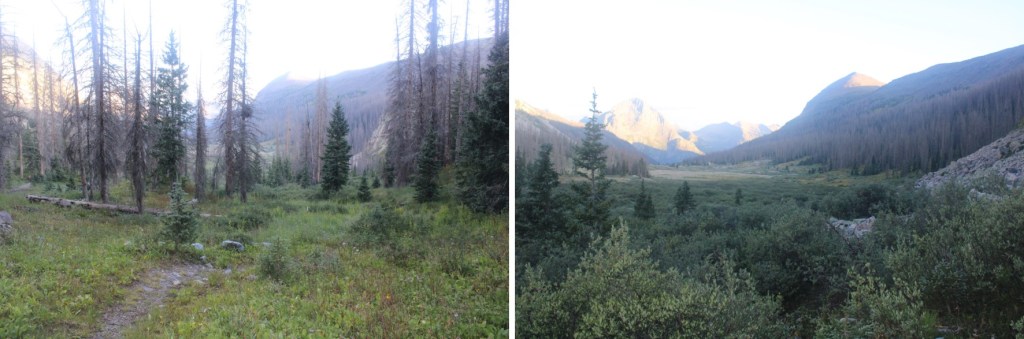
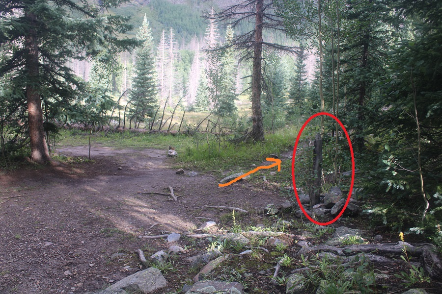
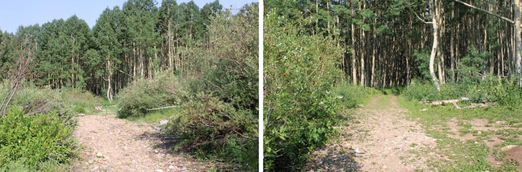
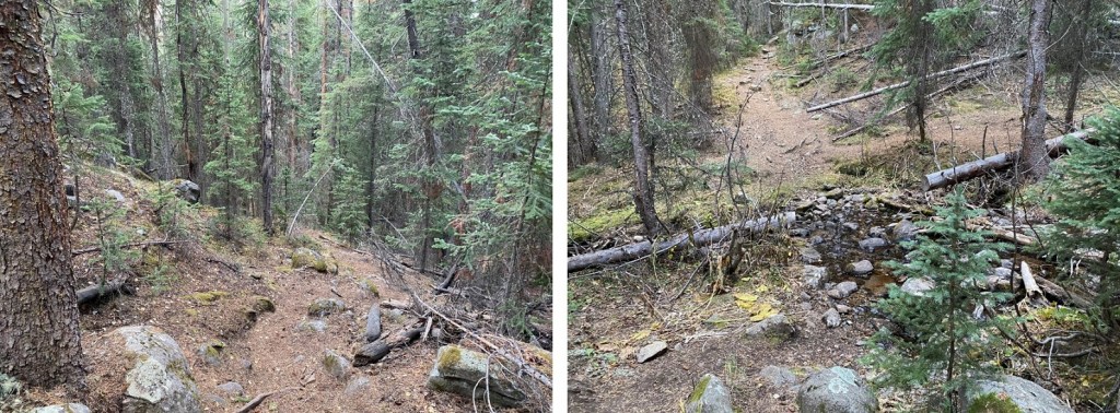
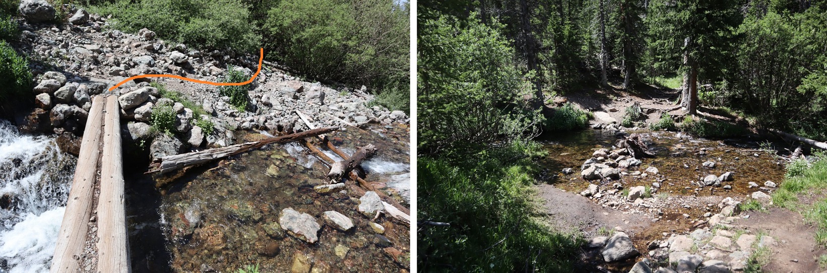
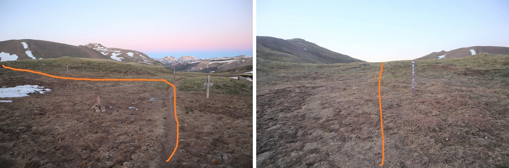
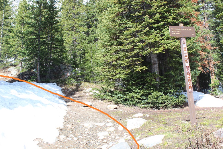
I woke up and things seemed dry outside, which was odd for the amount of rain I’d heard last night. I put on my winter gear anyway and was on the trail at 5:30am. The trail starts at the south end of the parking area, and continues heading south, towards Lake Ann. Be sure to take the Lake Ann trail, NOT the Huron Peak Trail
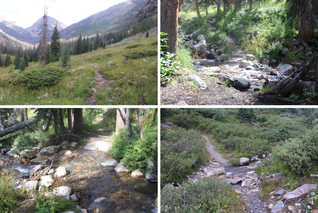
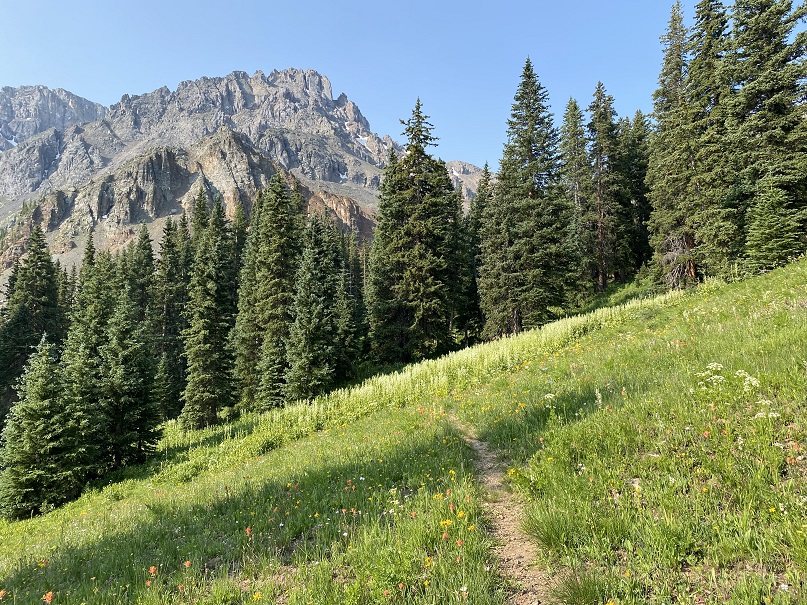
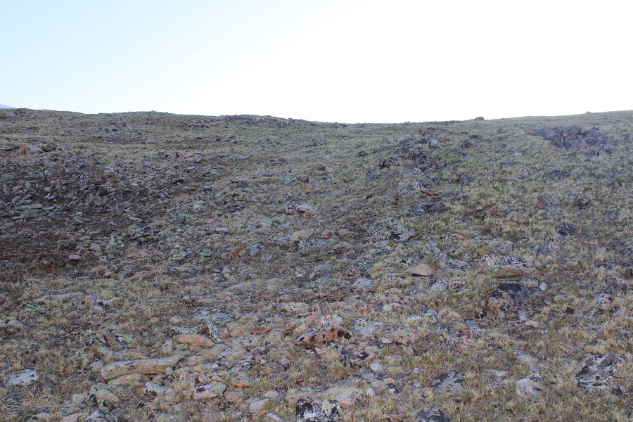
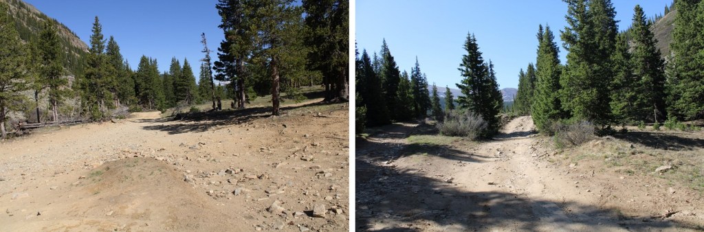
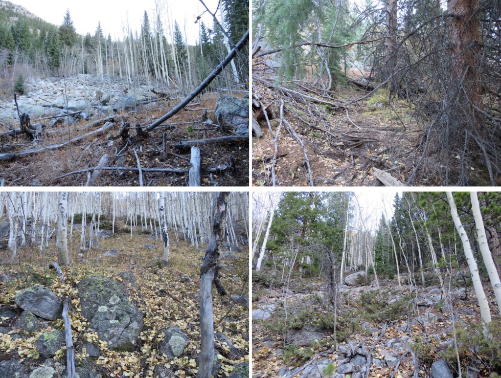
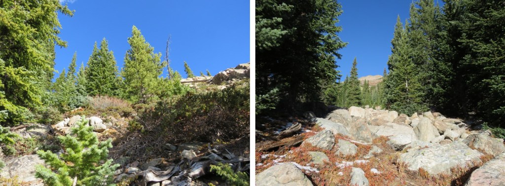
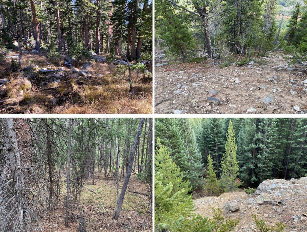
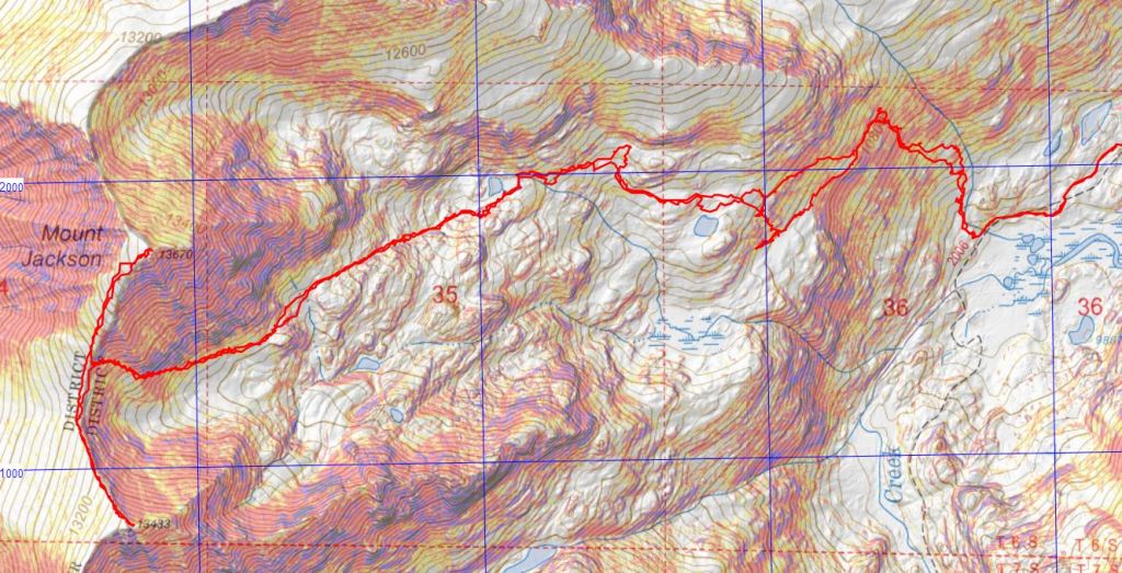
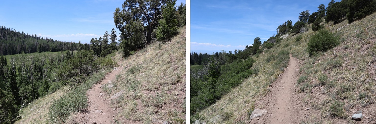
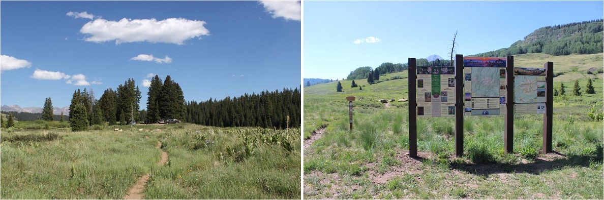
I hiked 4 miles south along a class 1 trail to Lake Ann
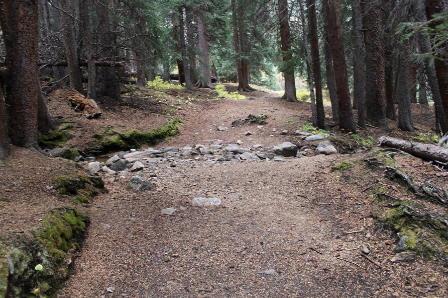
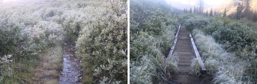
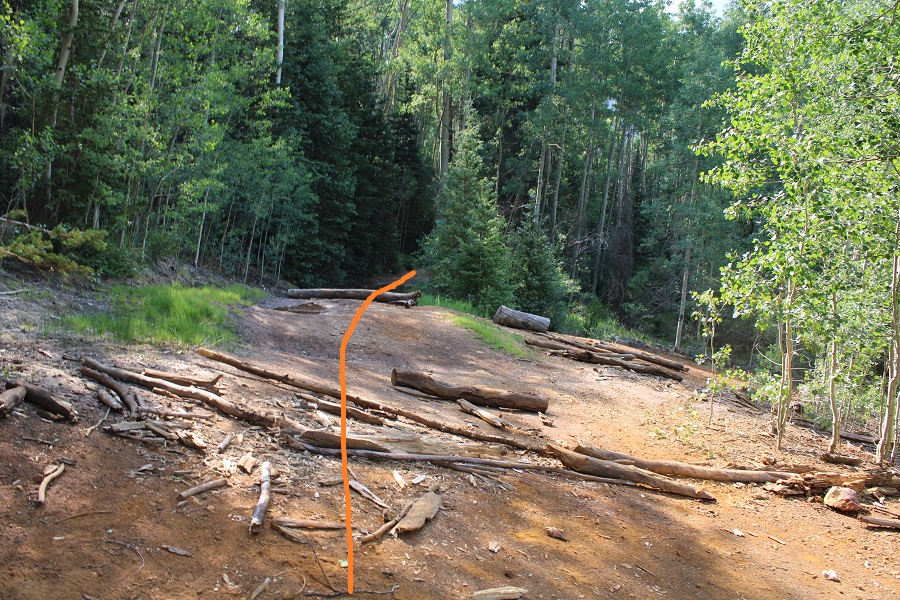
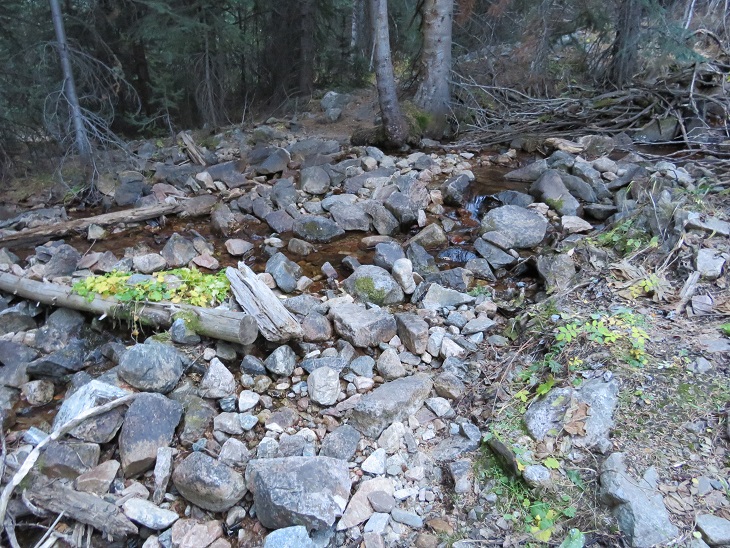
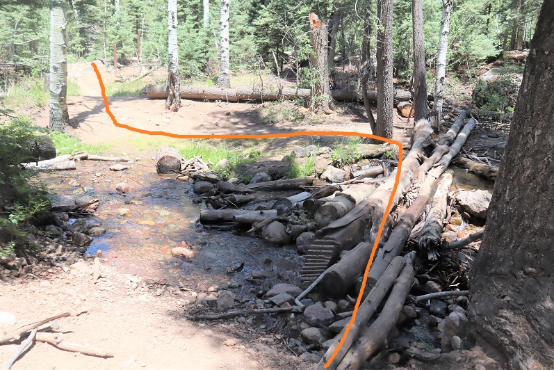
Stay left at this crossing
At the second crossing I went right
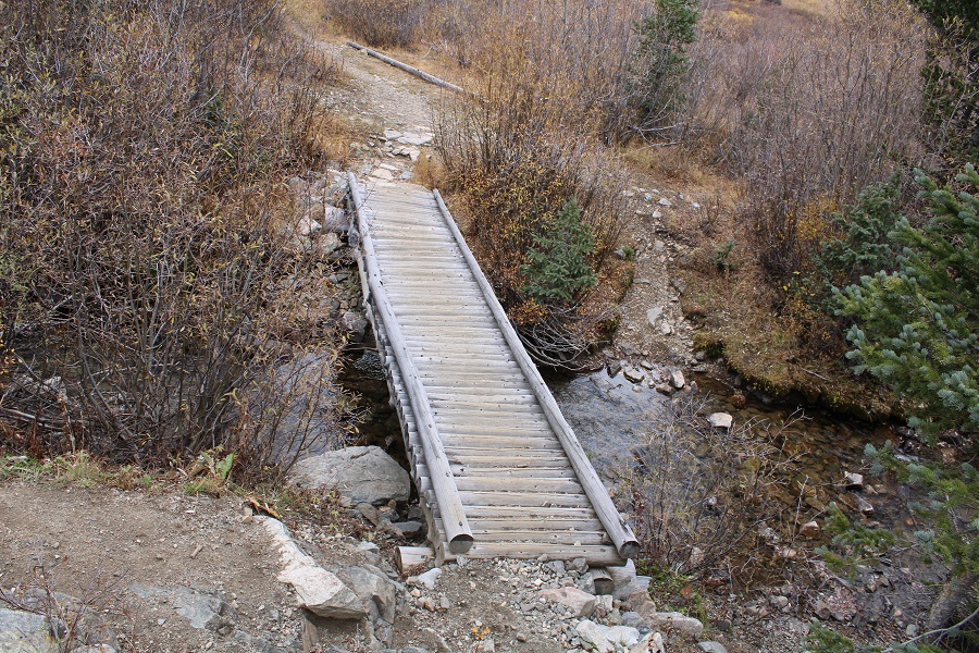
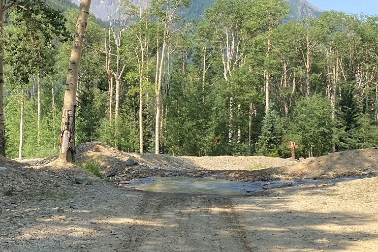
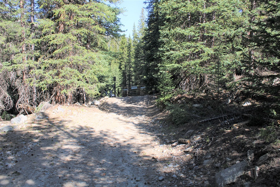
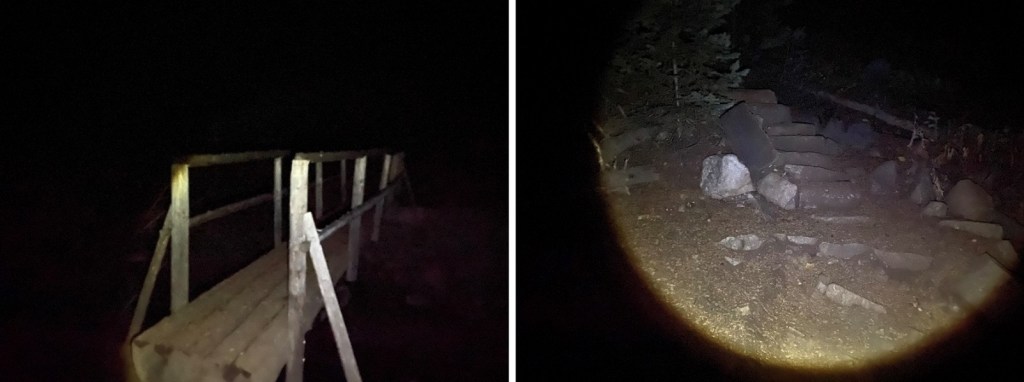
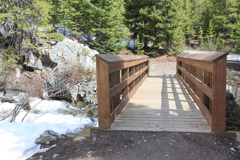
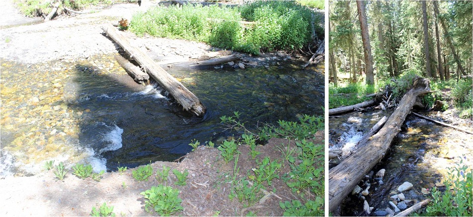
And crossed a creek on a ‘pretty-solid’ bridge
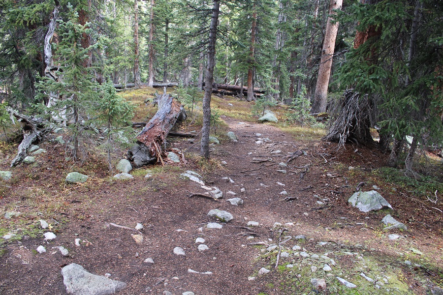
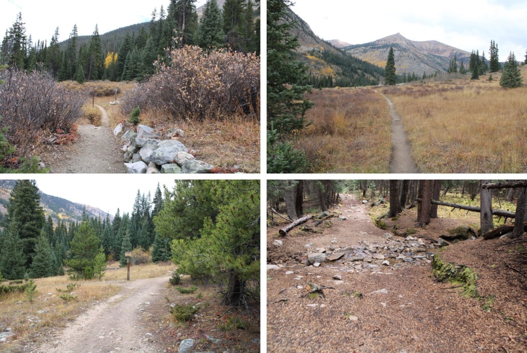
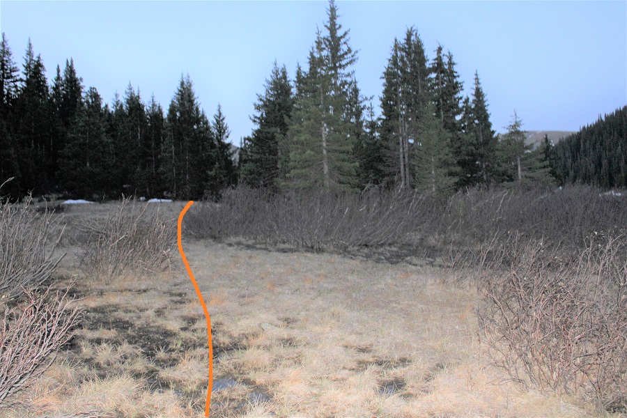
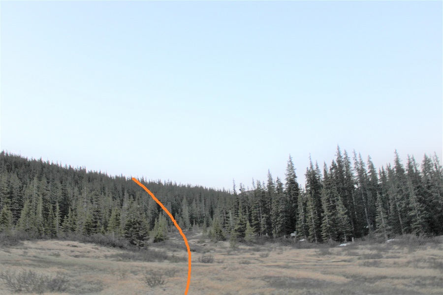
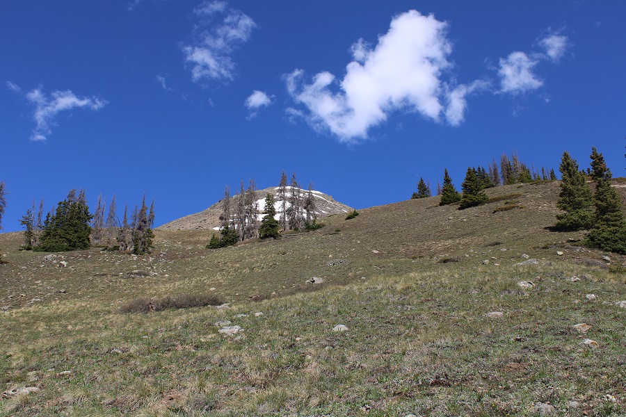
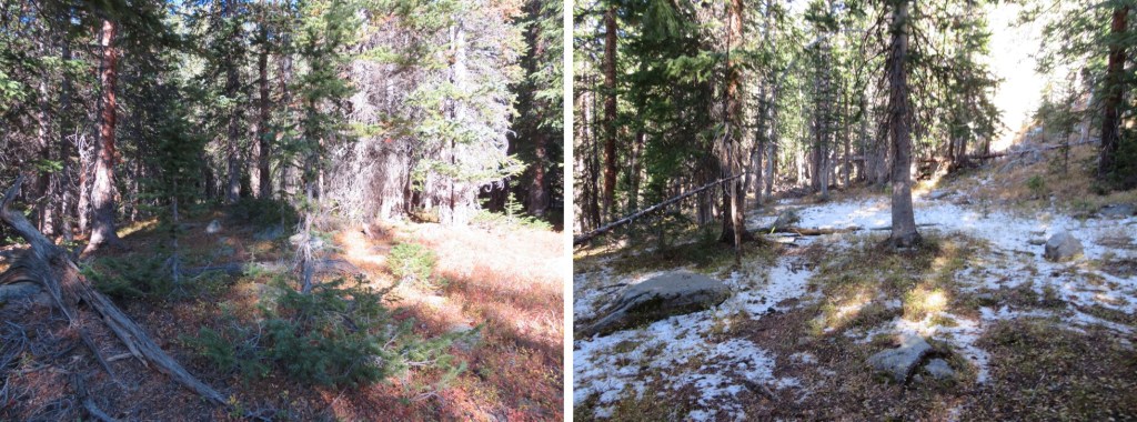
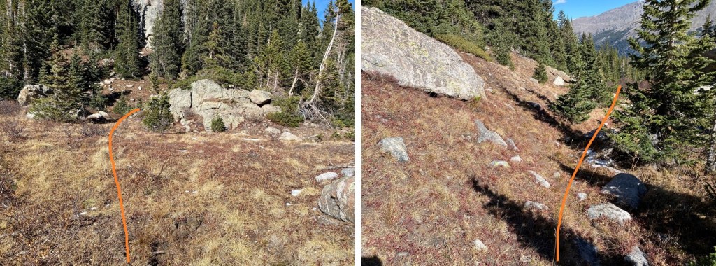
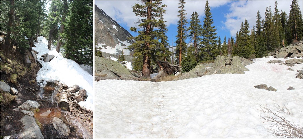
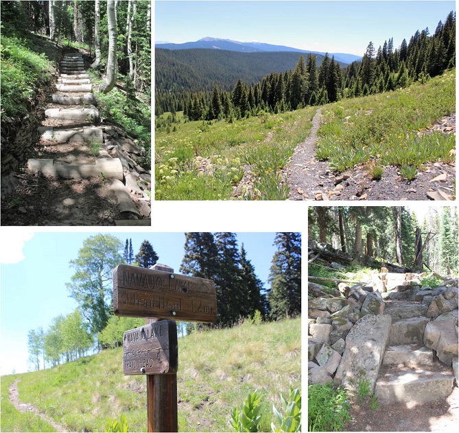
Finally, I started gaining elevation as I made my way towards Lake Ann
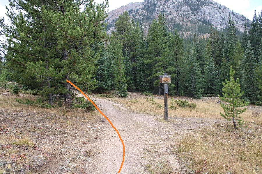
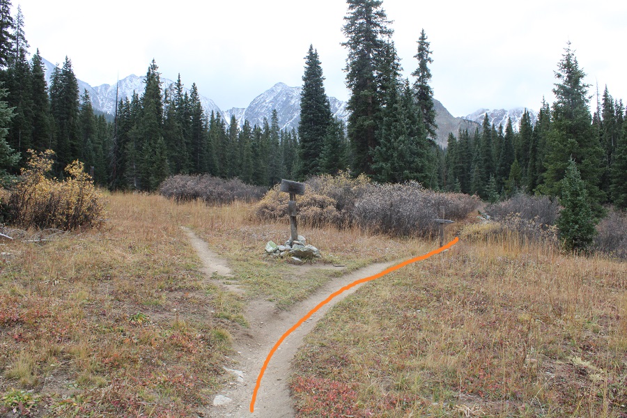
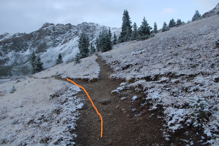
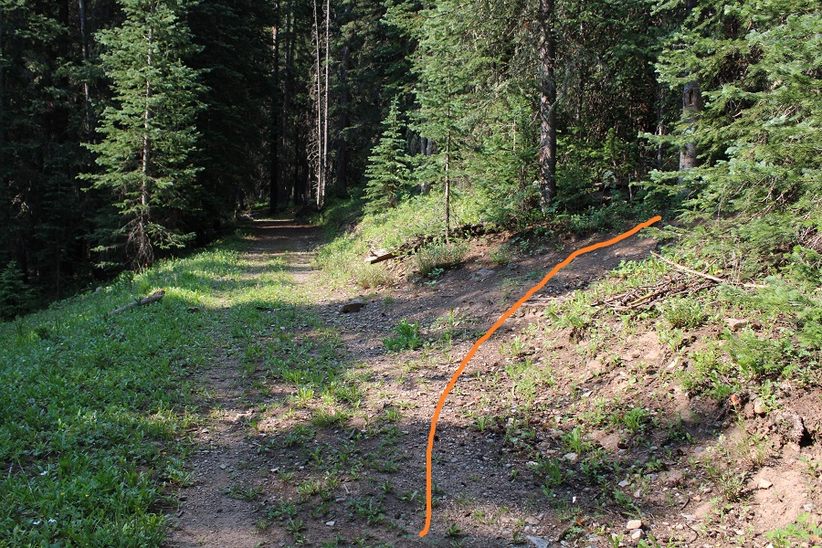
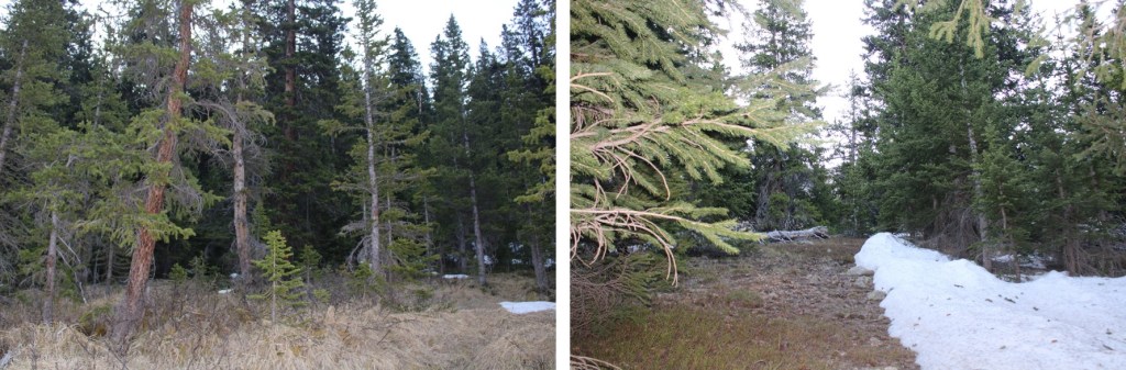
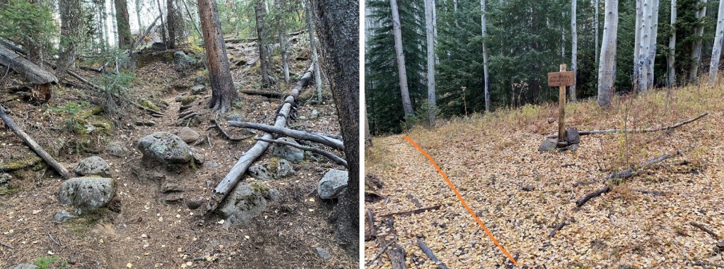
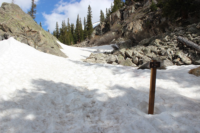
Just after making it to treeline, go left at this junction.
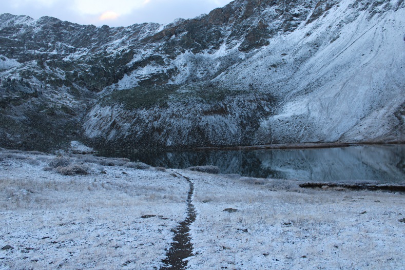
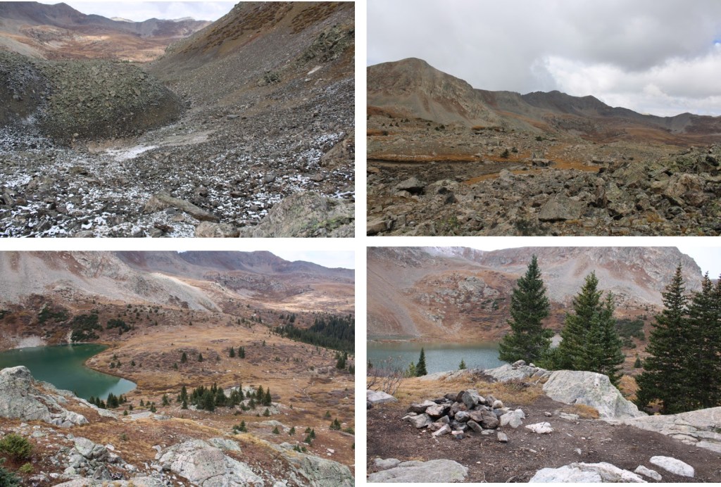
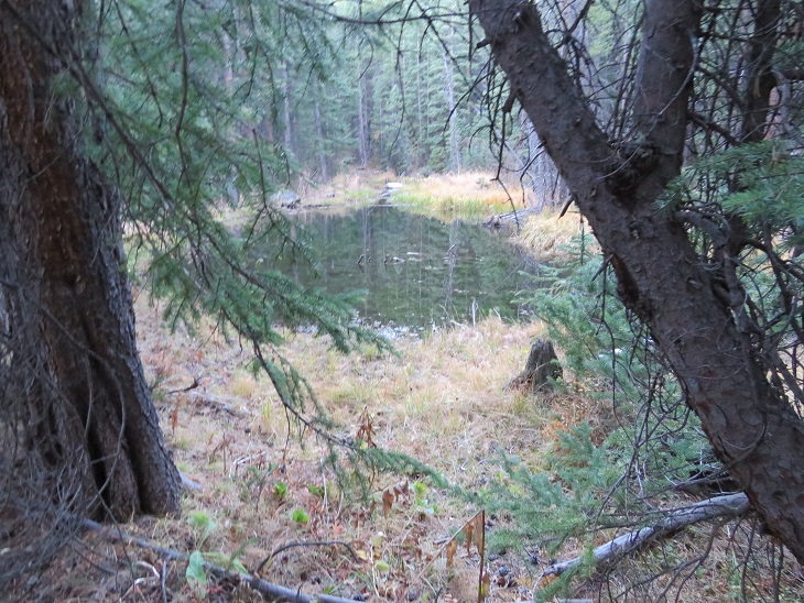
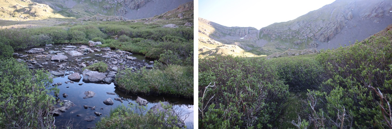
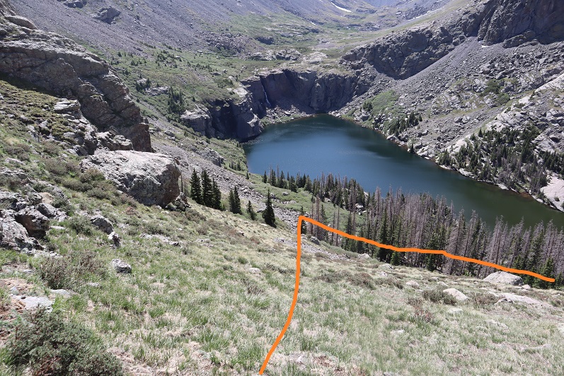
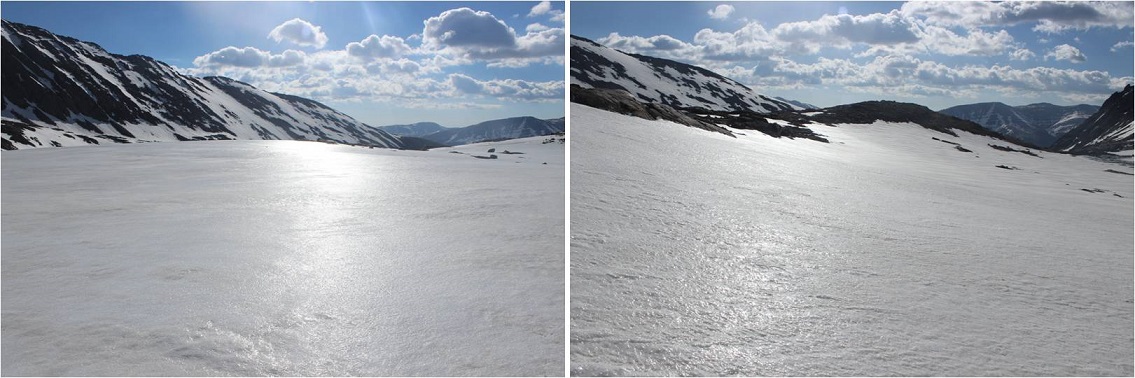
And you’ll arrive at Lake Ann
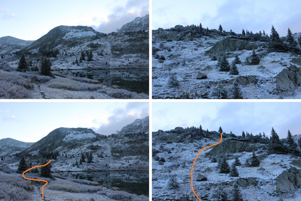
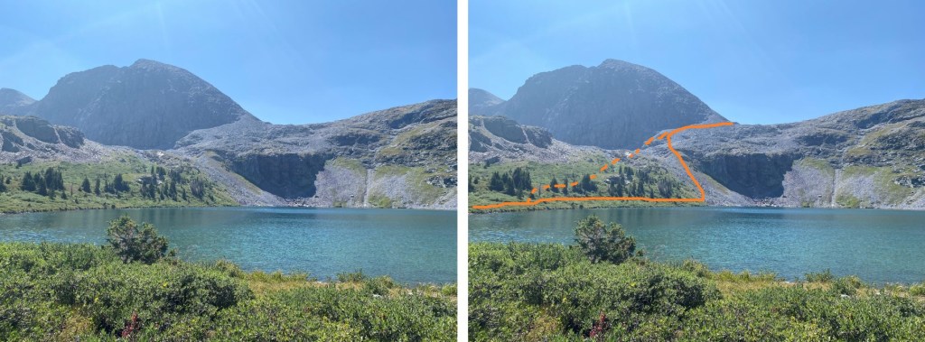
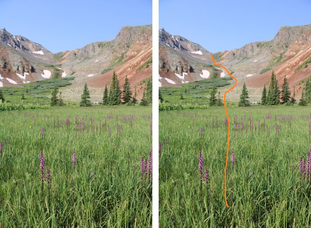
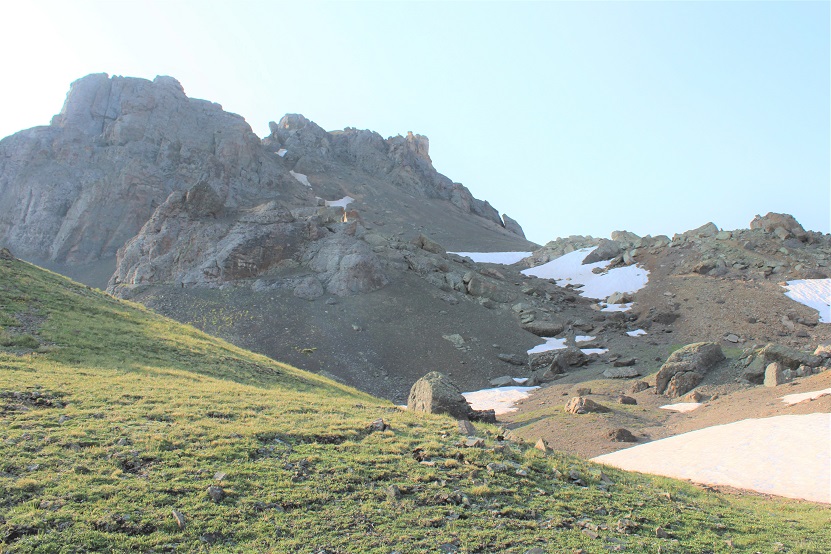
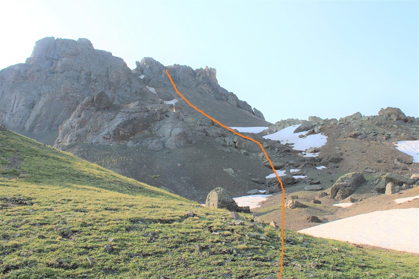
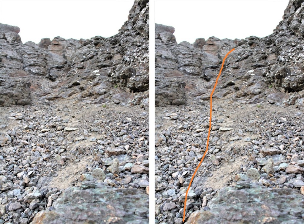
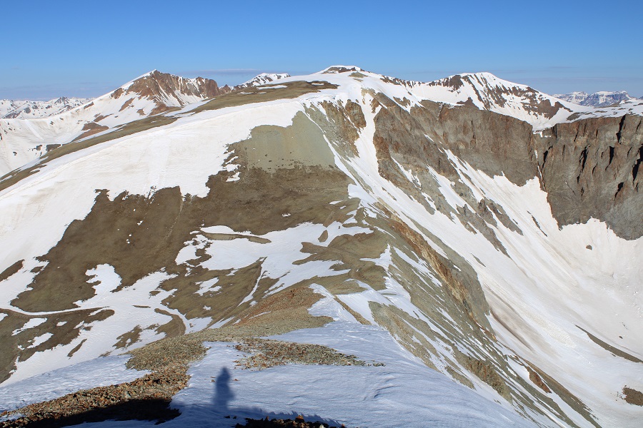
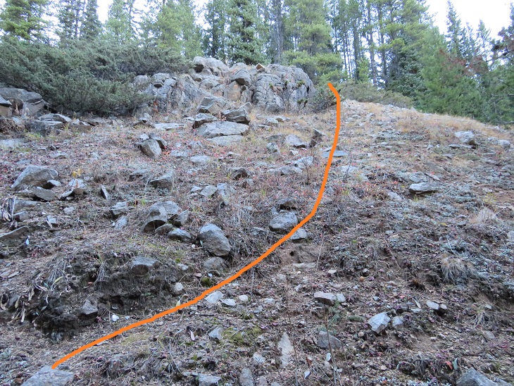
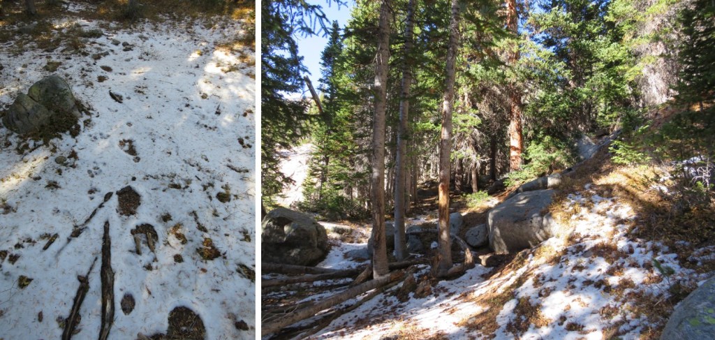
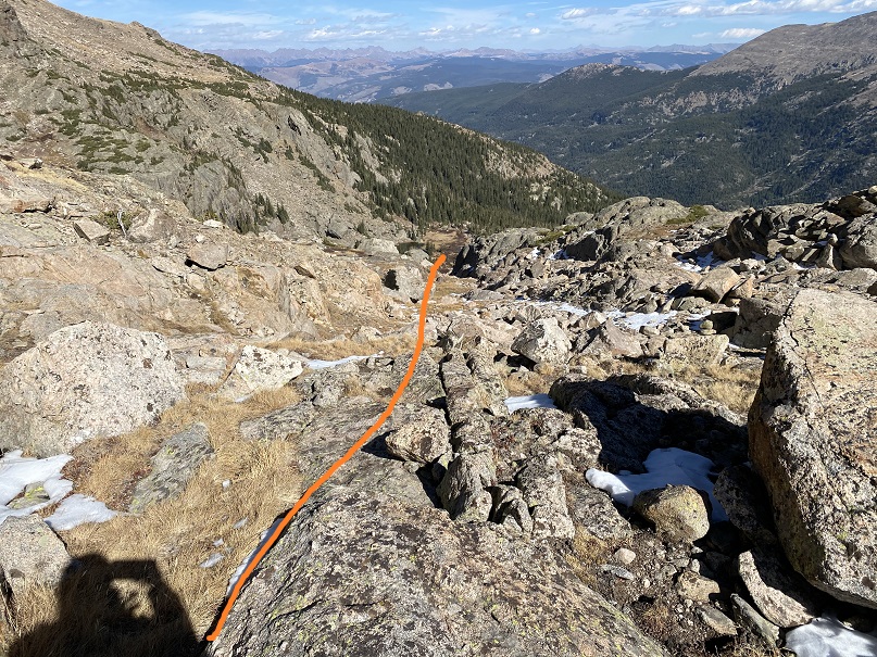
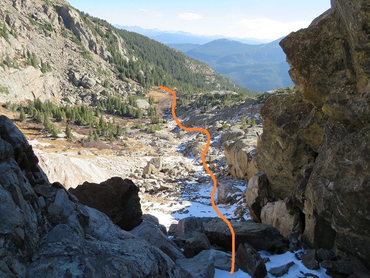
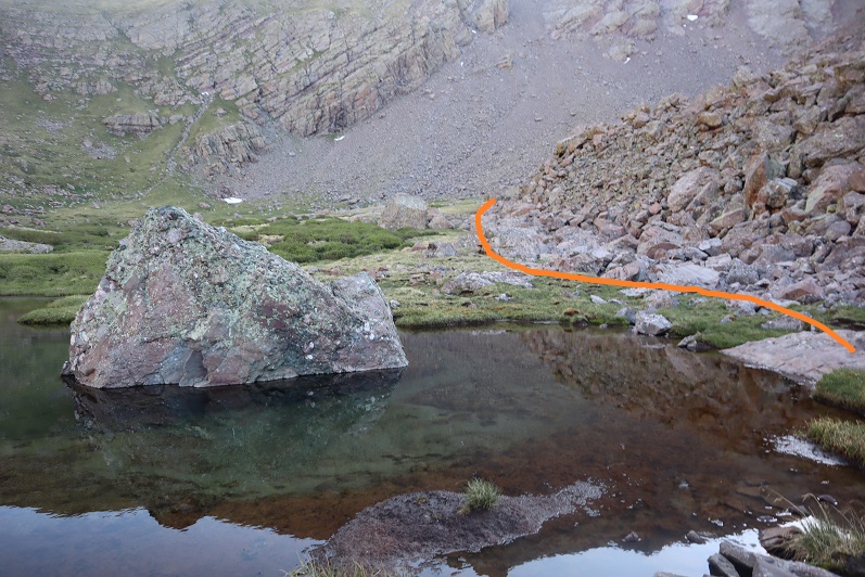
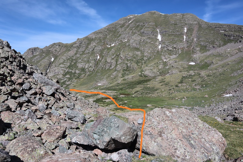
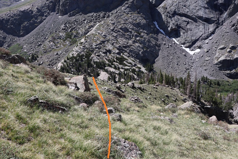
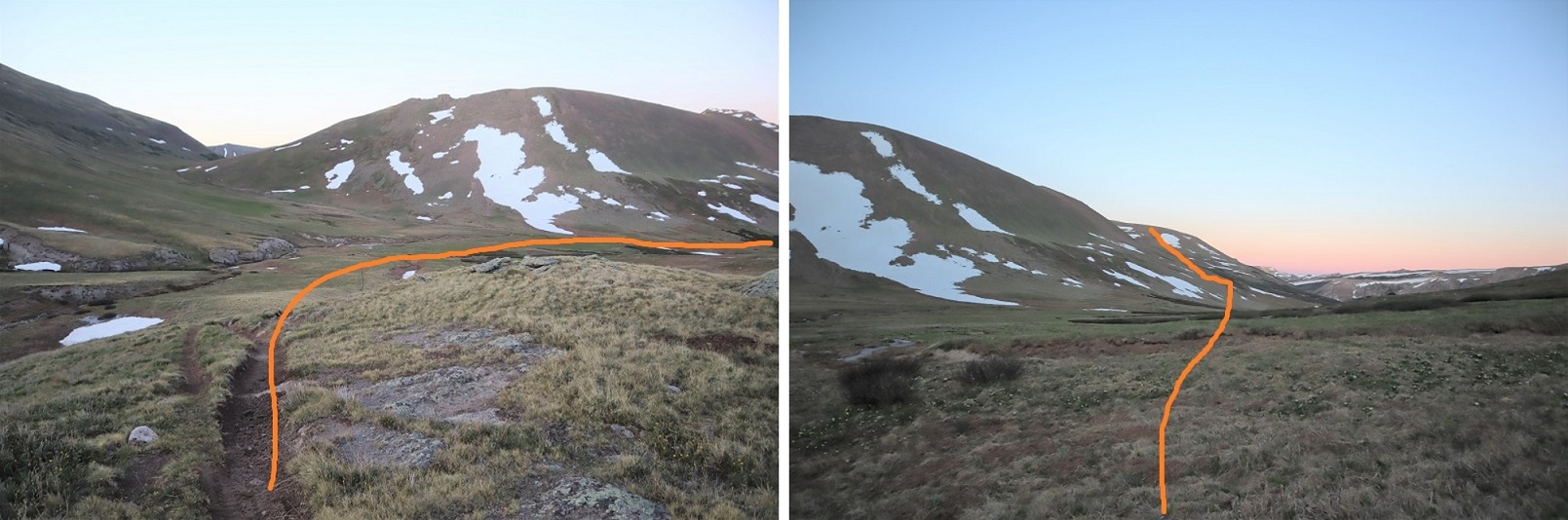
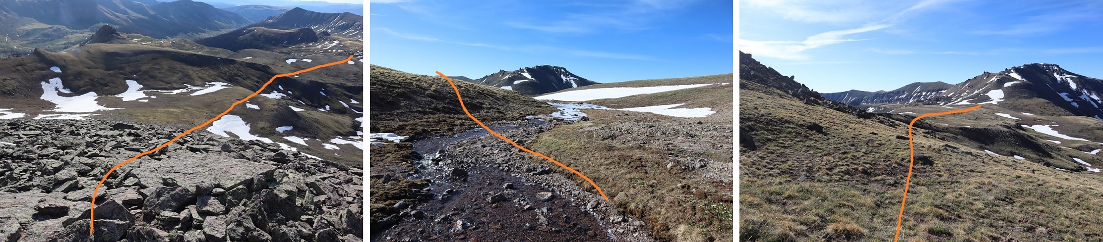
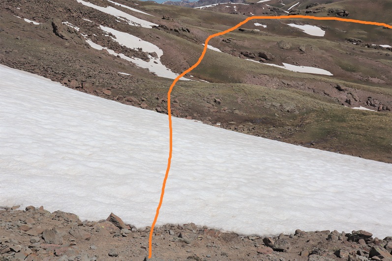
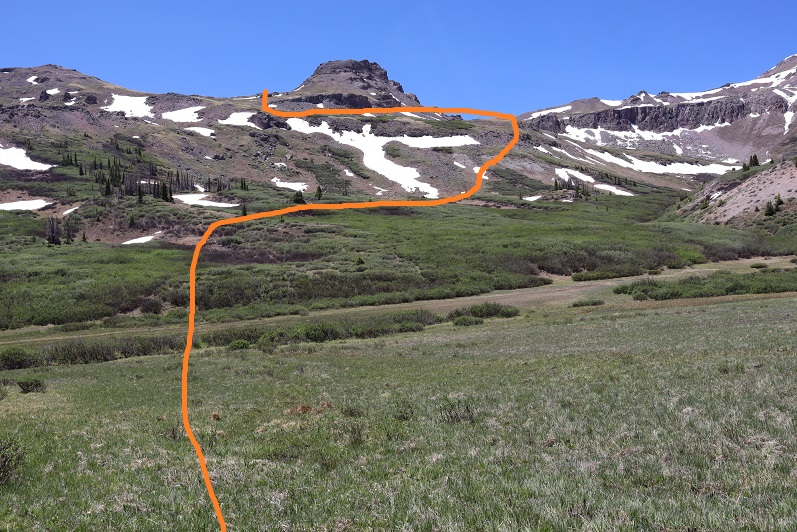
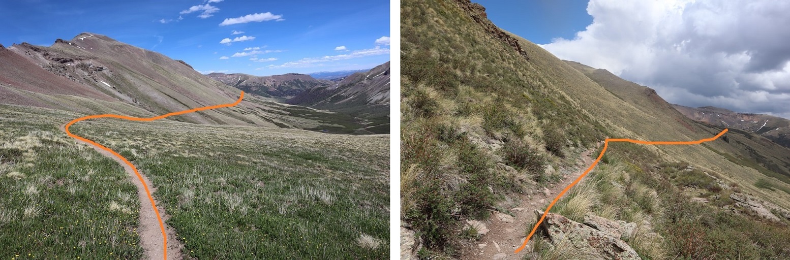
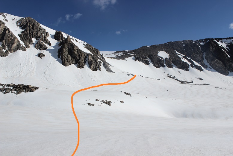
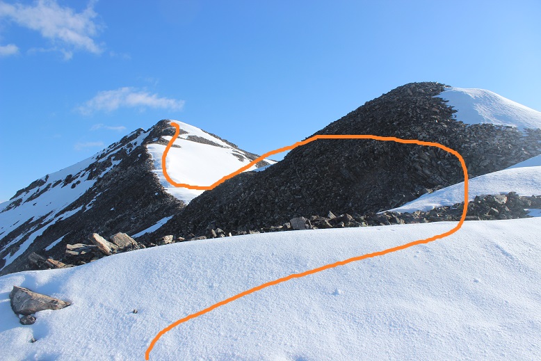
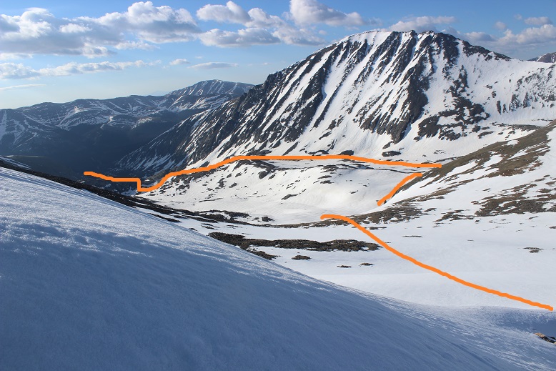
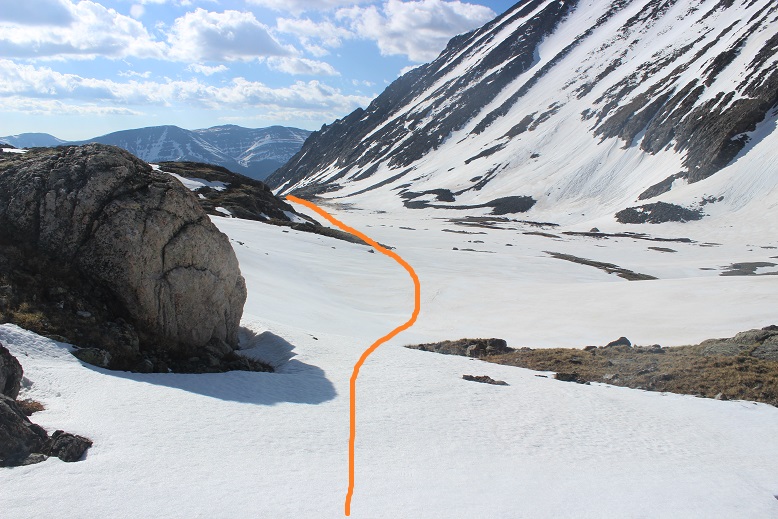
The goal is to skirt the north side of the lake, and enter the upper basin
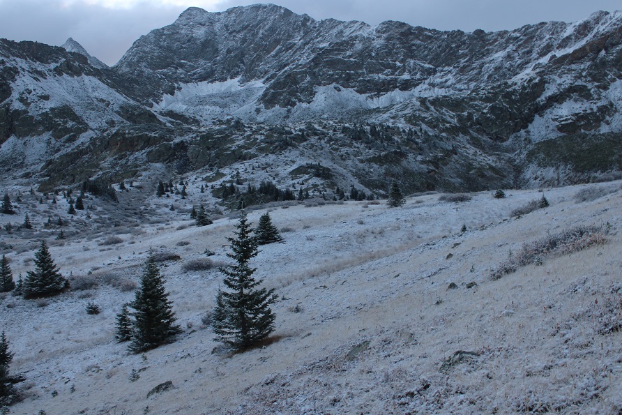
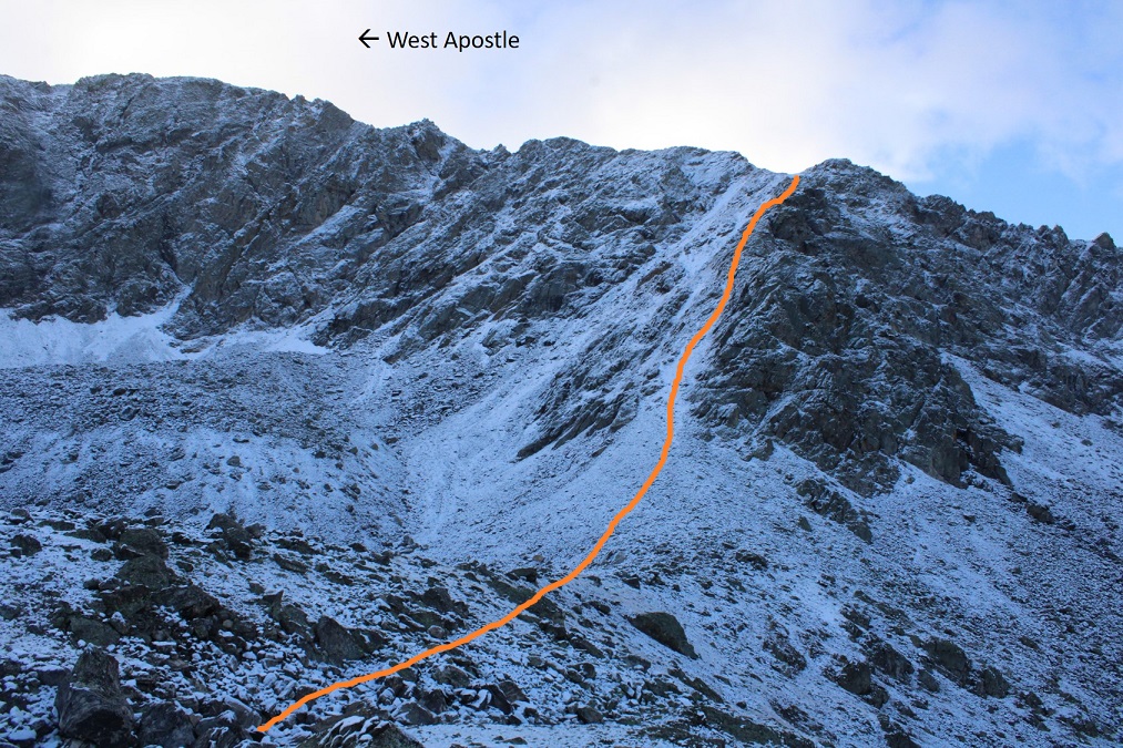
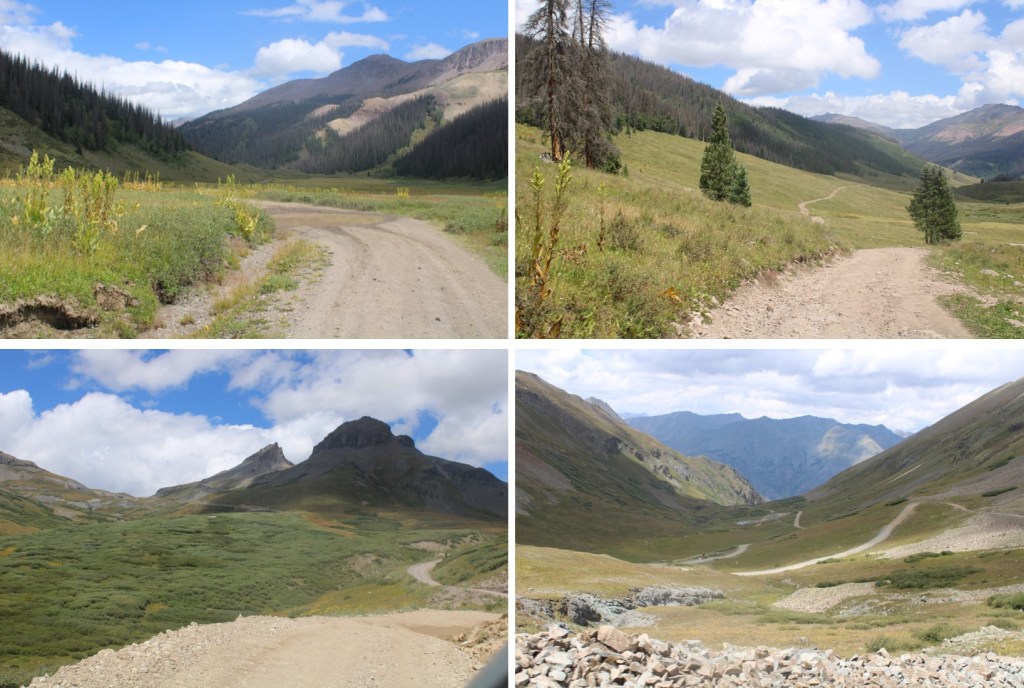
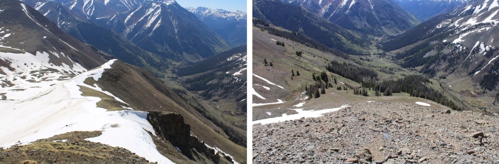
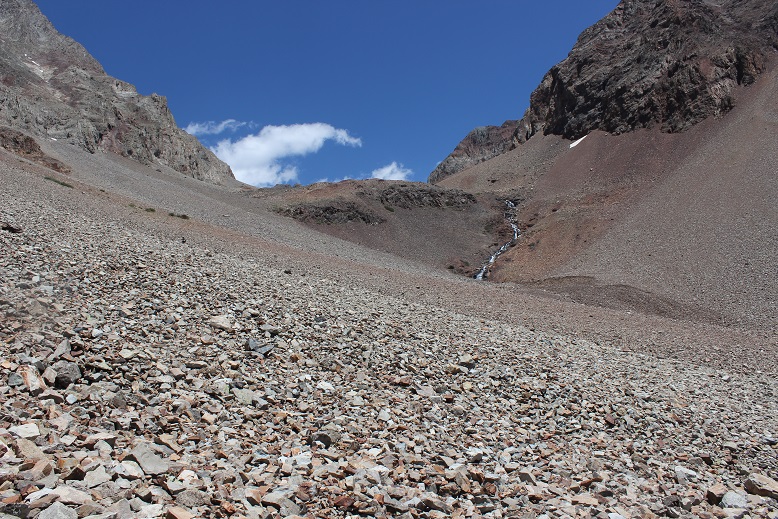
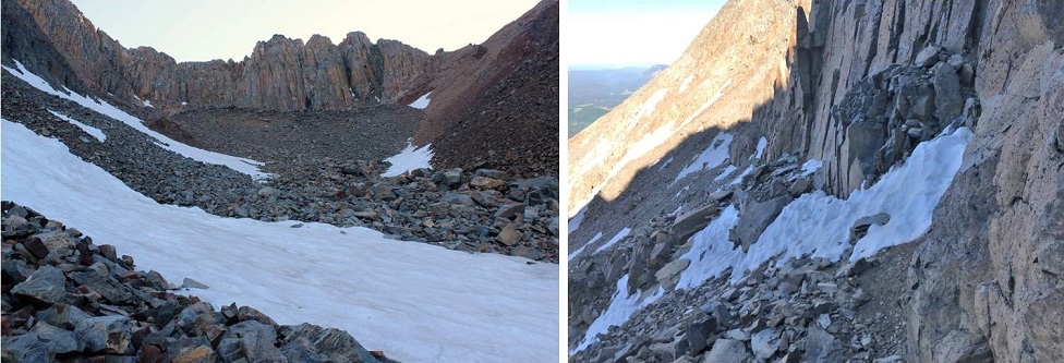
Here’s an overview of the route
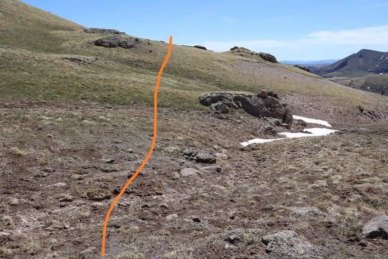
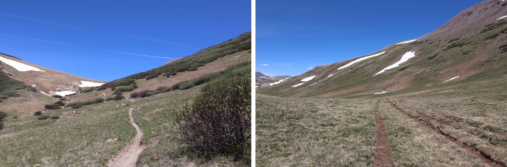
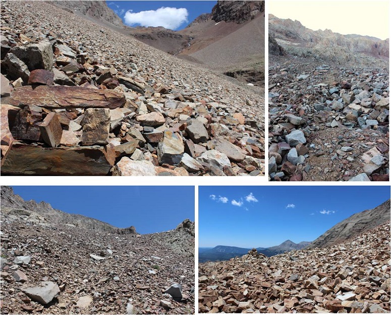
And some step-by-step pictures into the upper basin
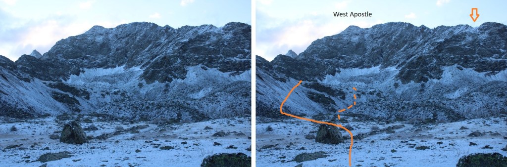
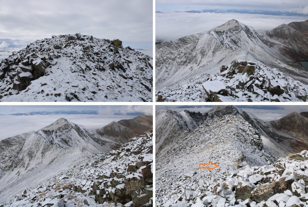
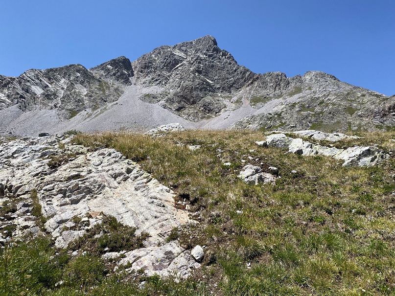
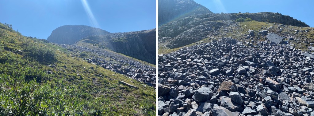
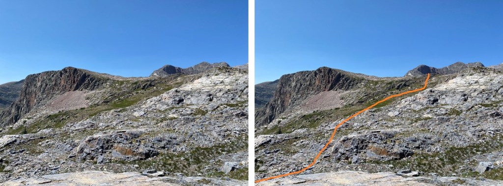
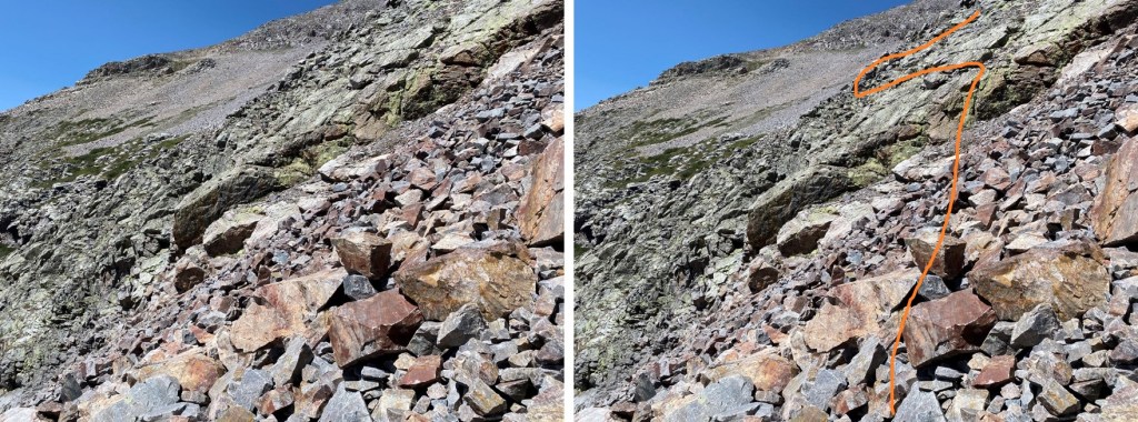
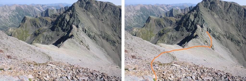
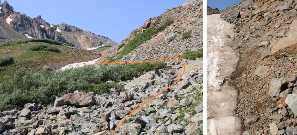
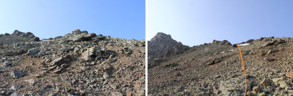
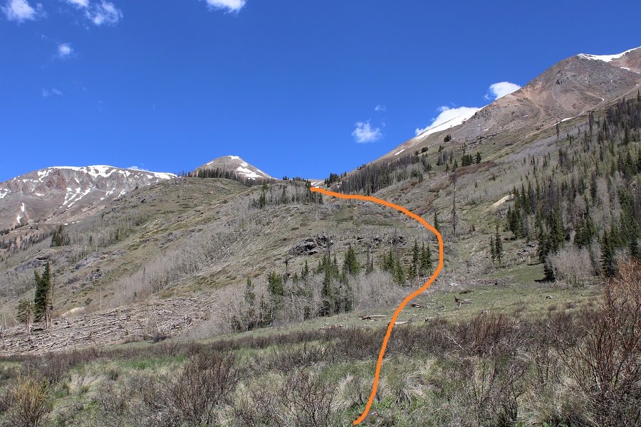
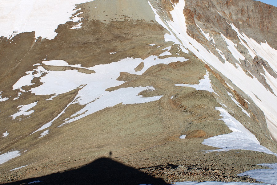
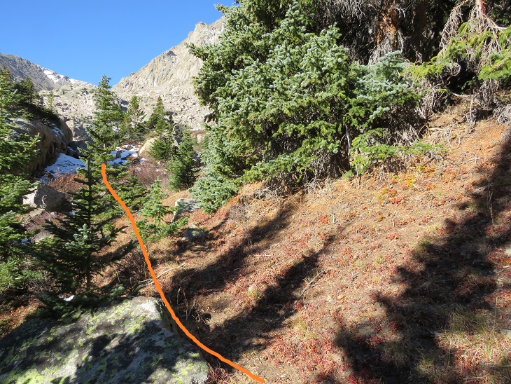
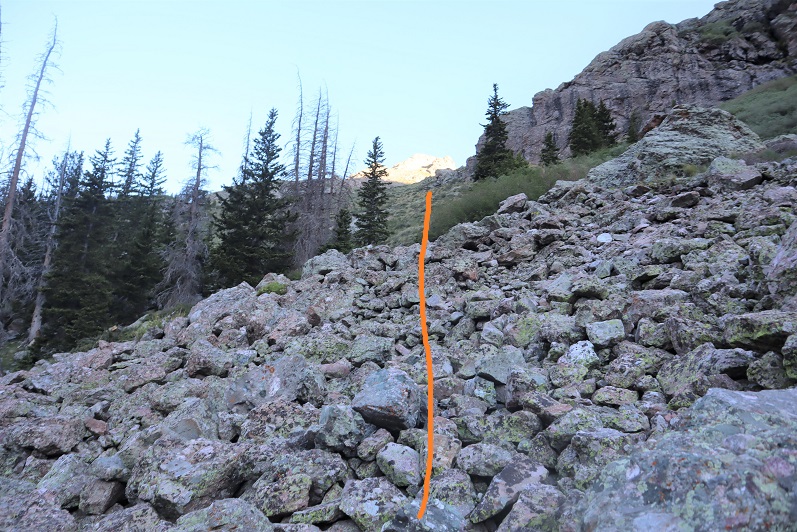
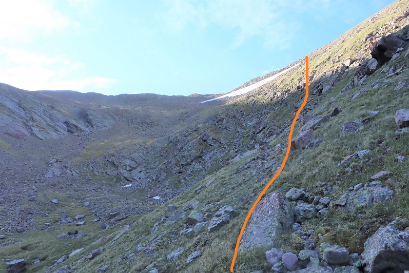
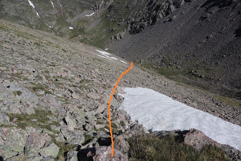
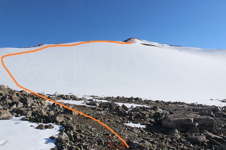
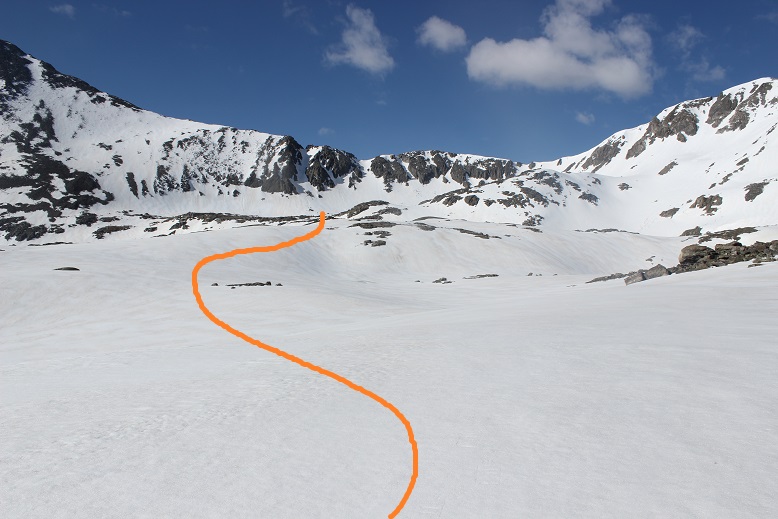
Once in the upper basin I aimed to ascend the amphitheater. This can be done multiple ways. I decided to stay left on the way up (solid line), and follow (very faint) game trails, and I went right on the way down (dotted line). The orange arrow is where you’ll eventually be aiming.
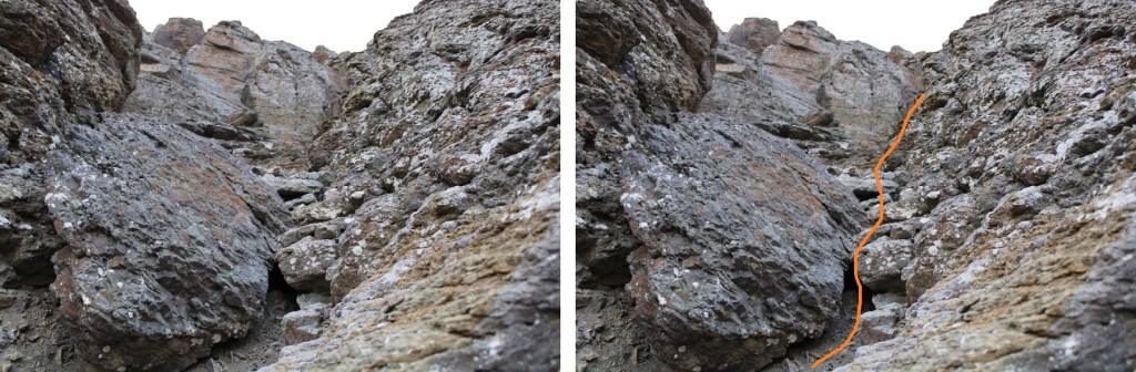
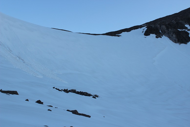
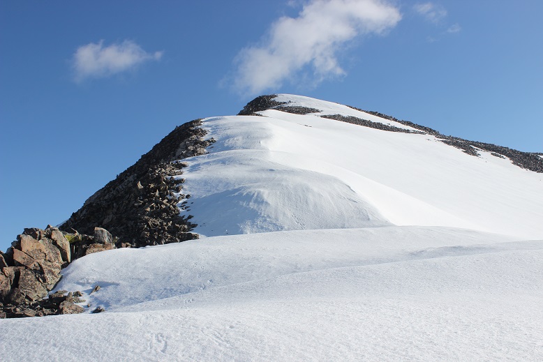
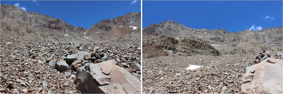
Here’s another picture of the amphitheater
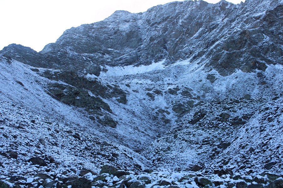
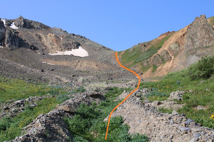
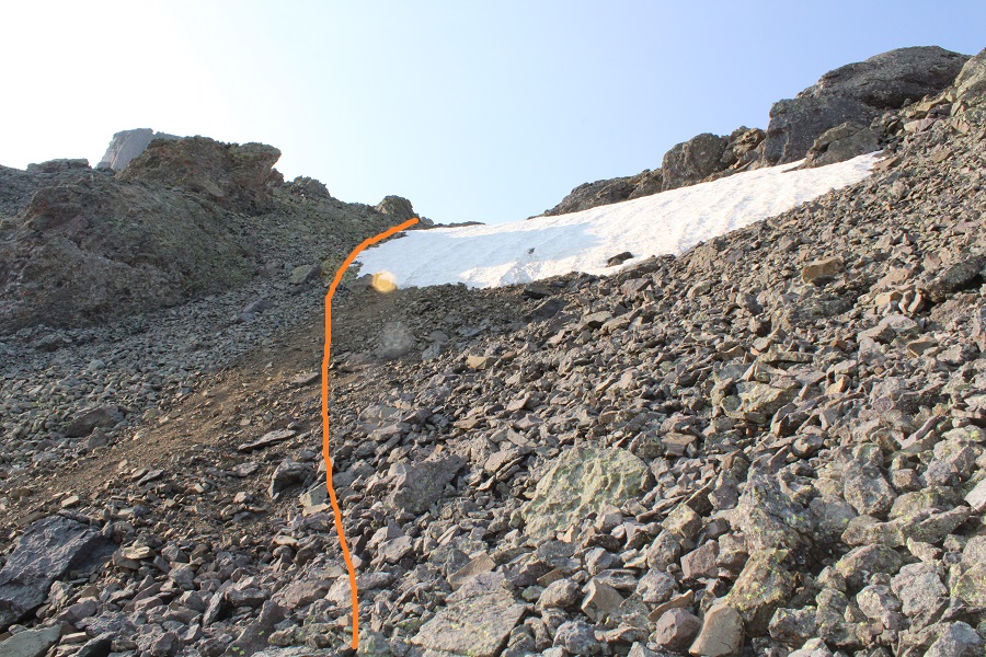
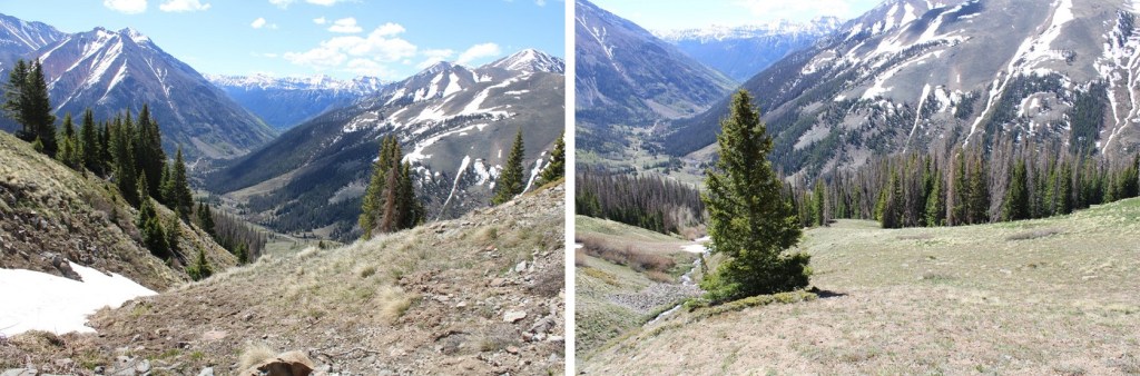
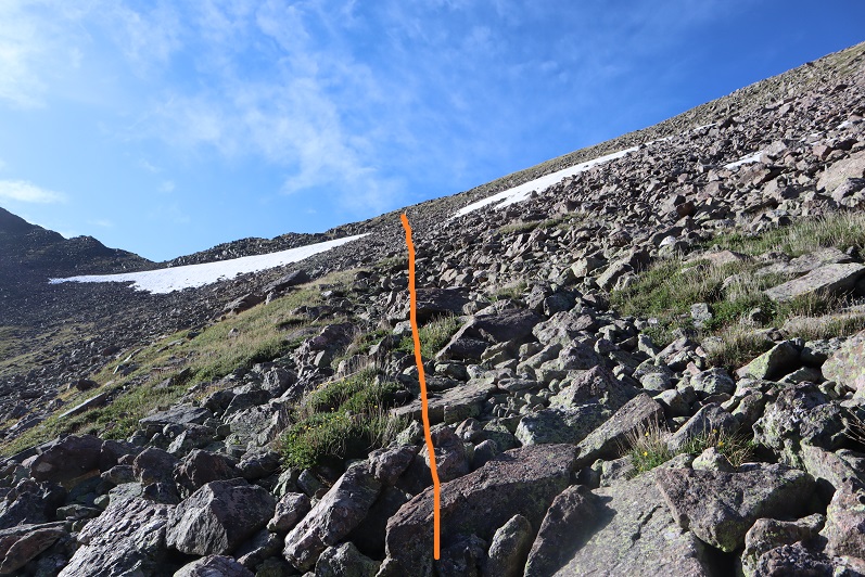
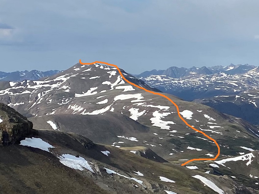
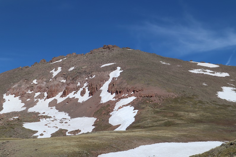
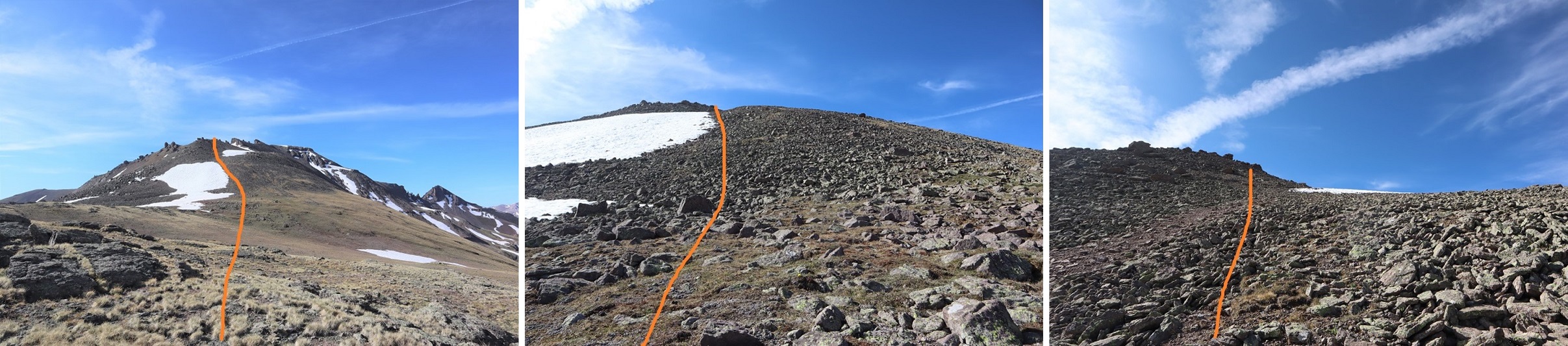
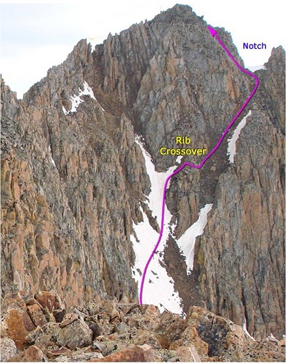
Once at the top of the amphitheater I was in another basin. I turned right, and followed the ridge. I’m sure the best way to ascend this gully is straight up the gully, but today there was unconsolidated snow blocking that route. Even with microspikes I wasn’t able to get traction the gully direct, so I took the rocks to the right.
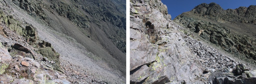
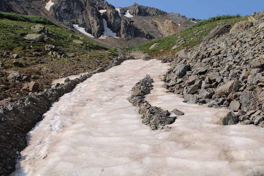
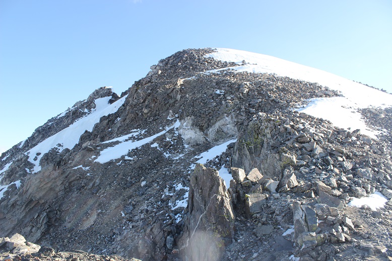
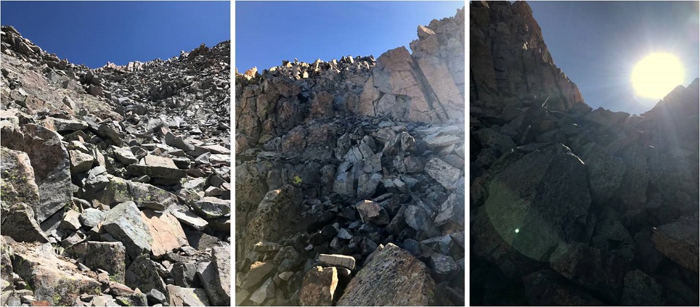
Here are some closer pictures of the gully
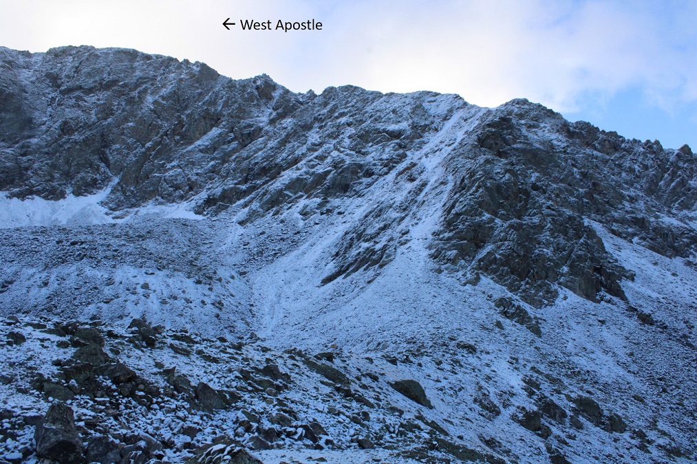
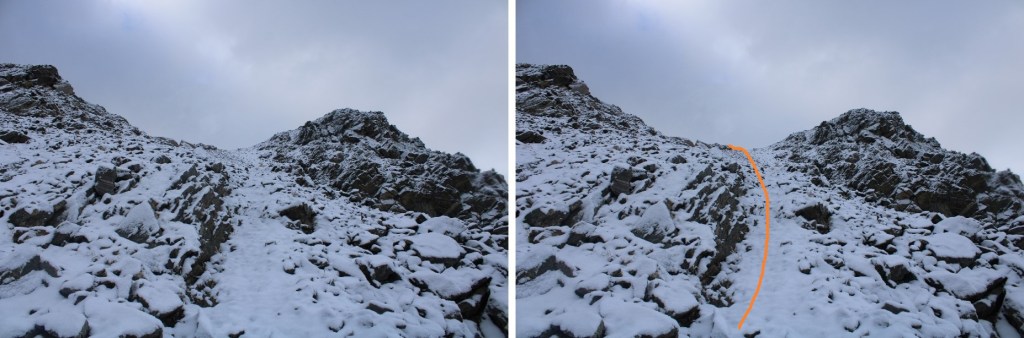
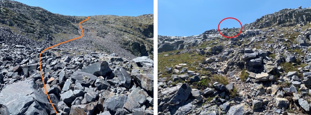
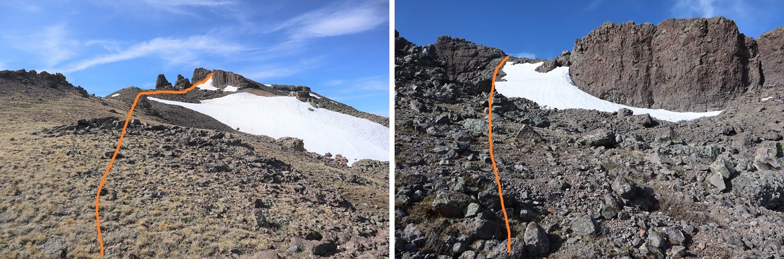
At the top of the gully I went left
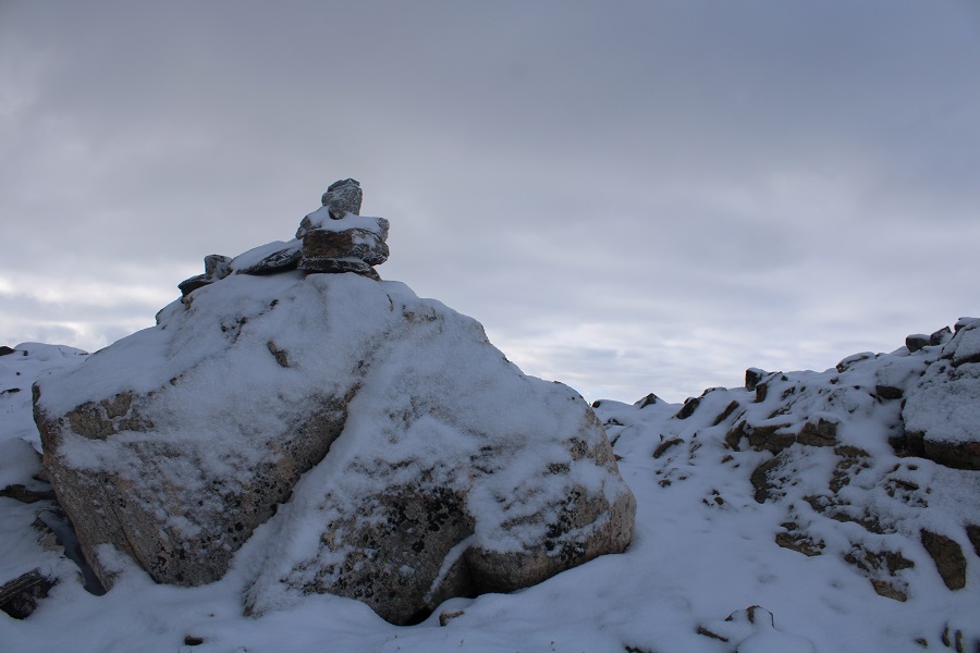
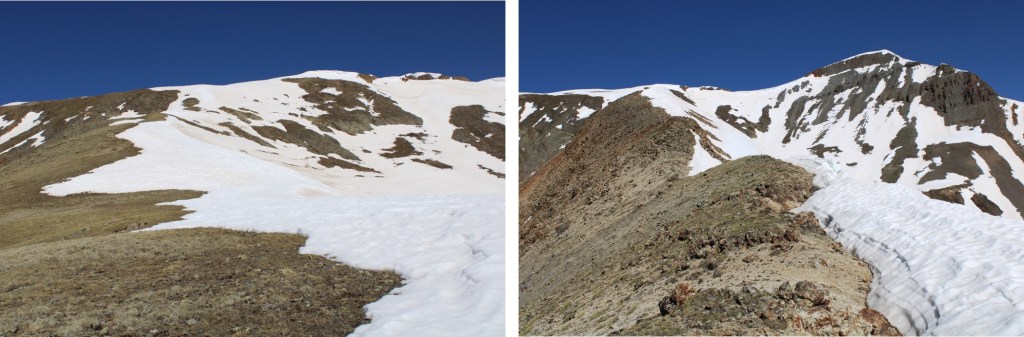
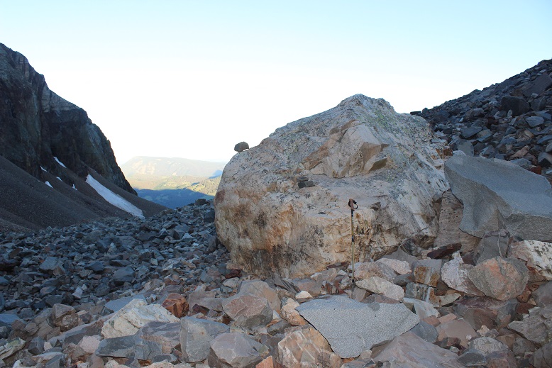
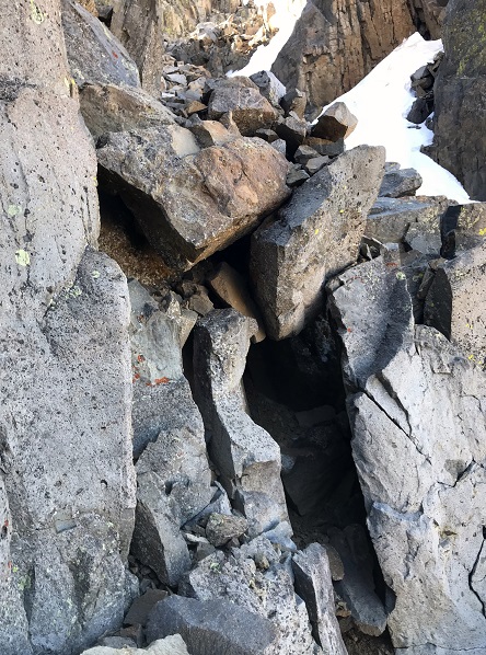
Which brought me to the ridge (and a cairn!)
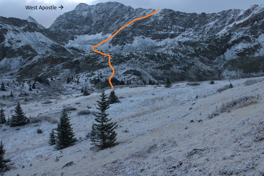
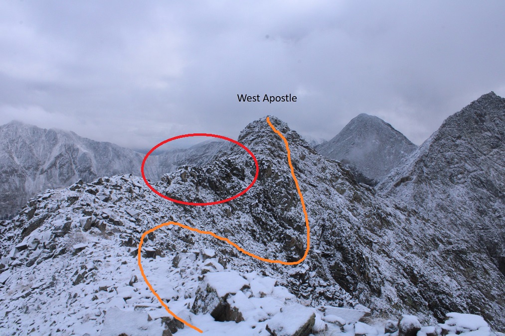
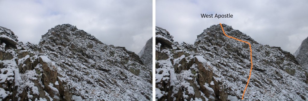
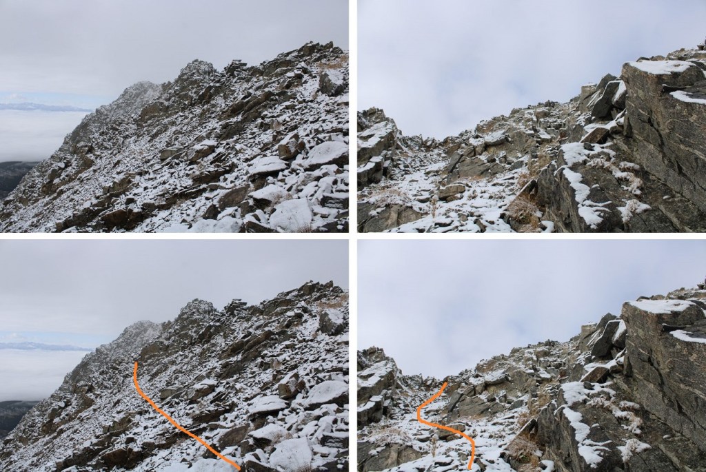
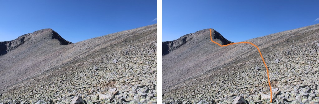
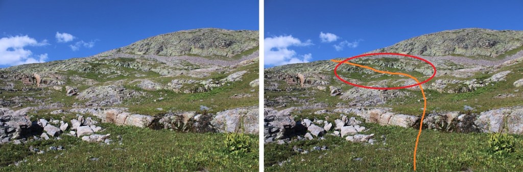
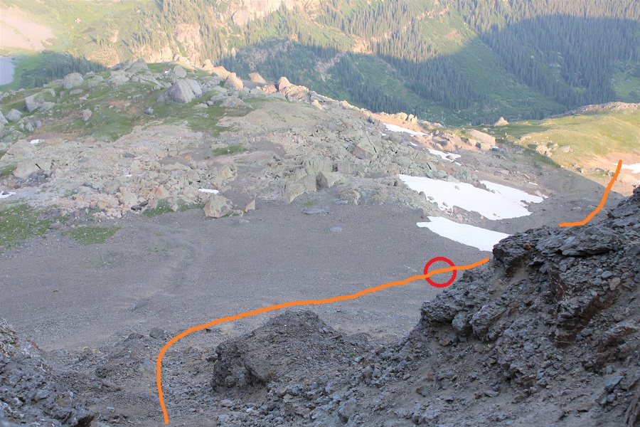
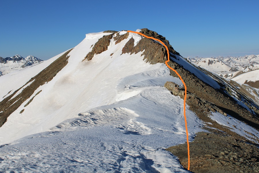
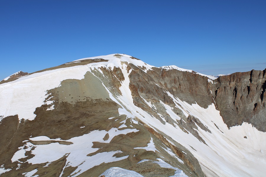
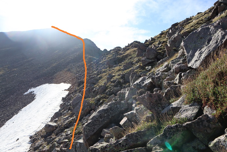
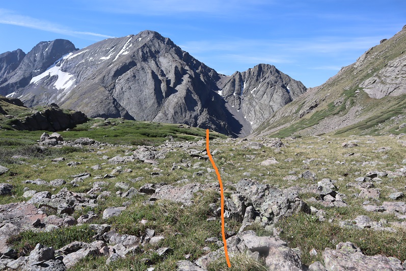
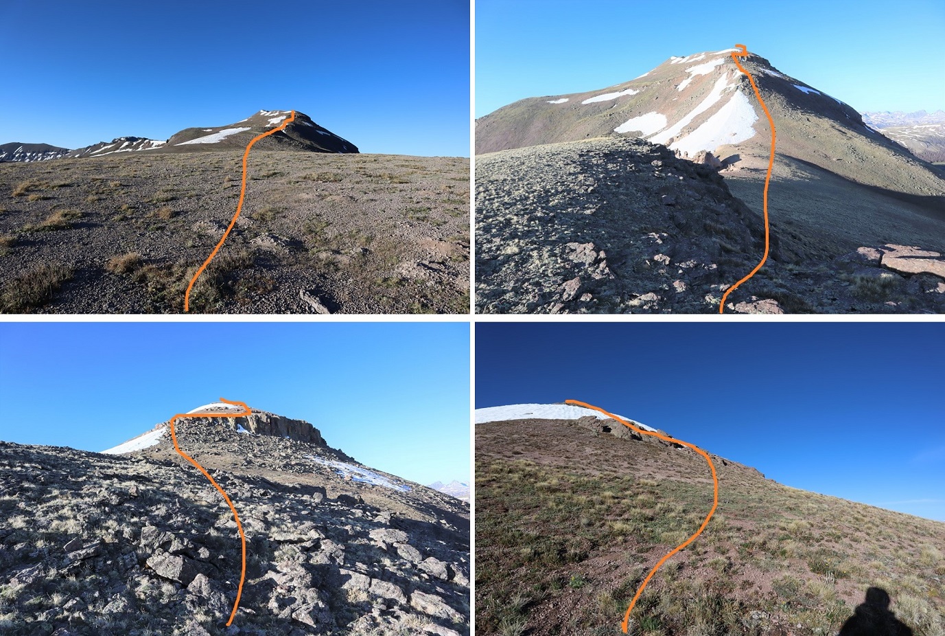
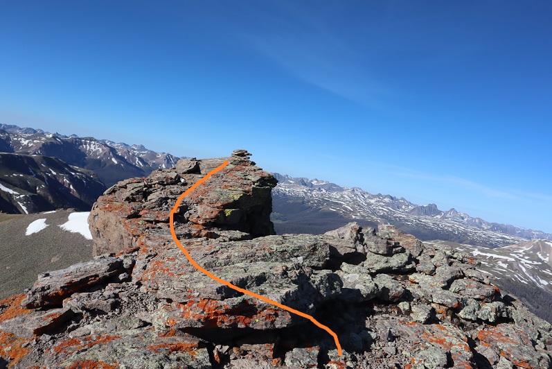
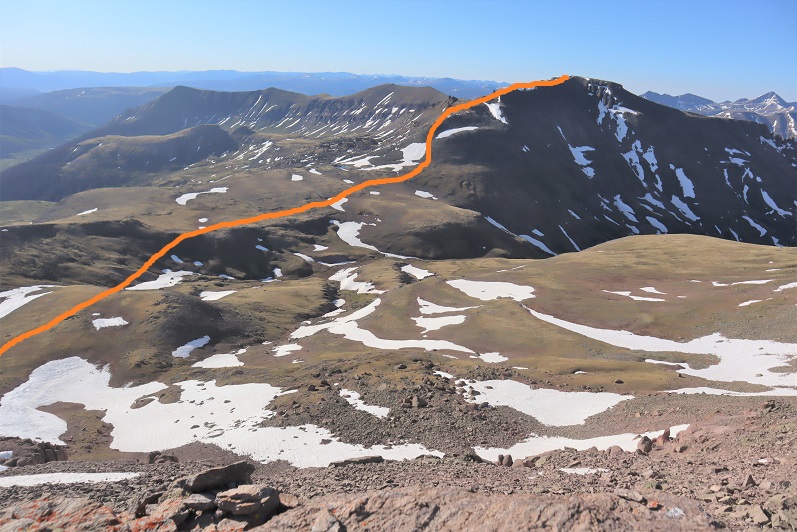
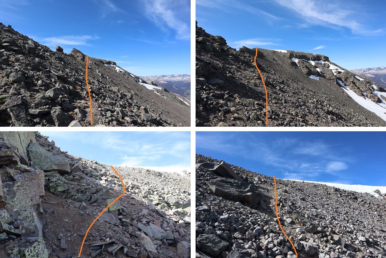
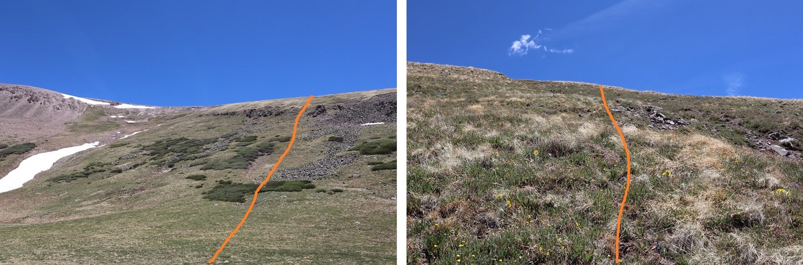
I turned left and followed the ridge northeast. This is a class 2 ridge, which I was able to stay on the top of the ridge to hike most of the way.
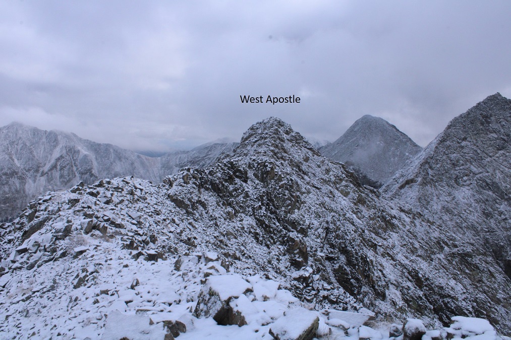
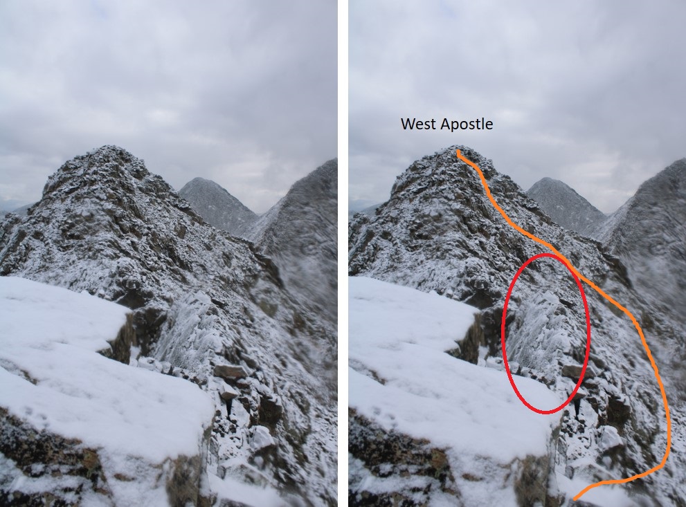
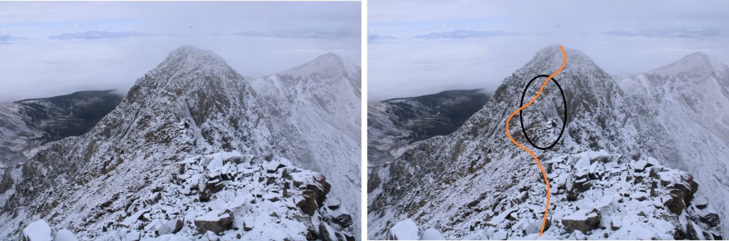
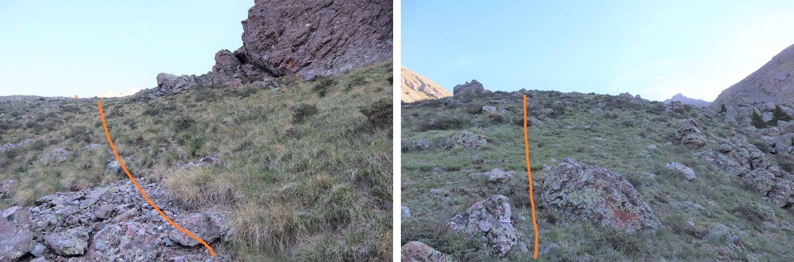
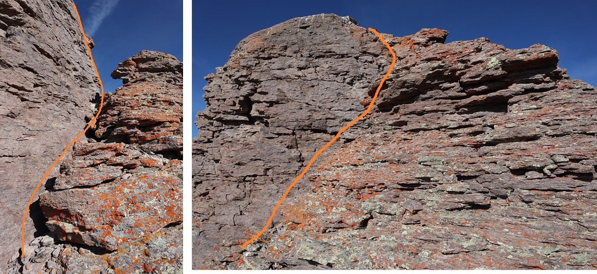
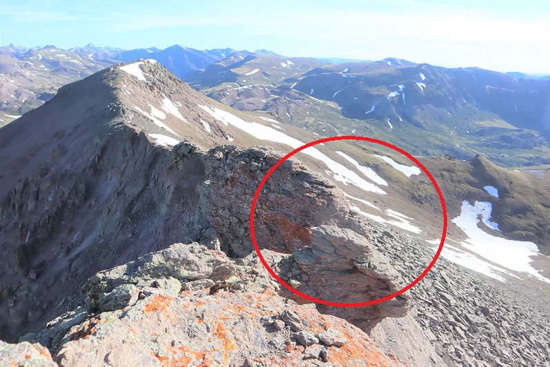
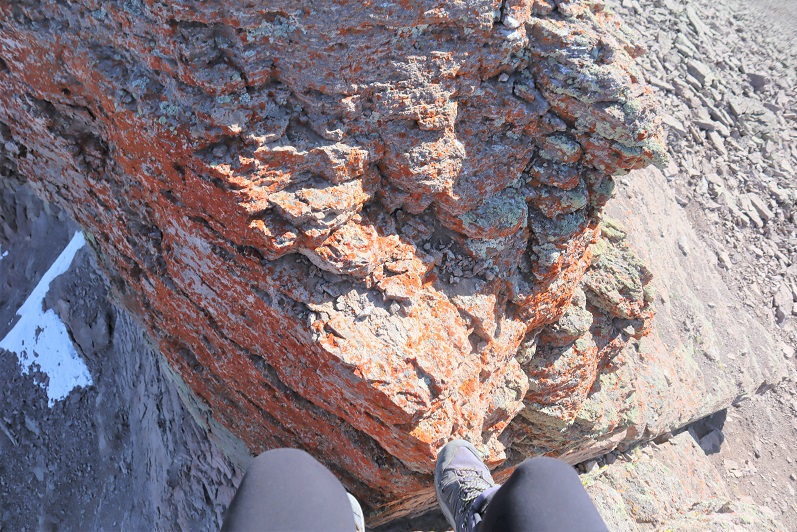
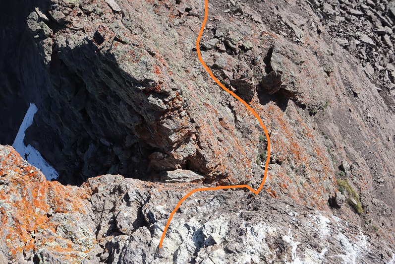
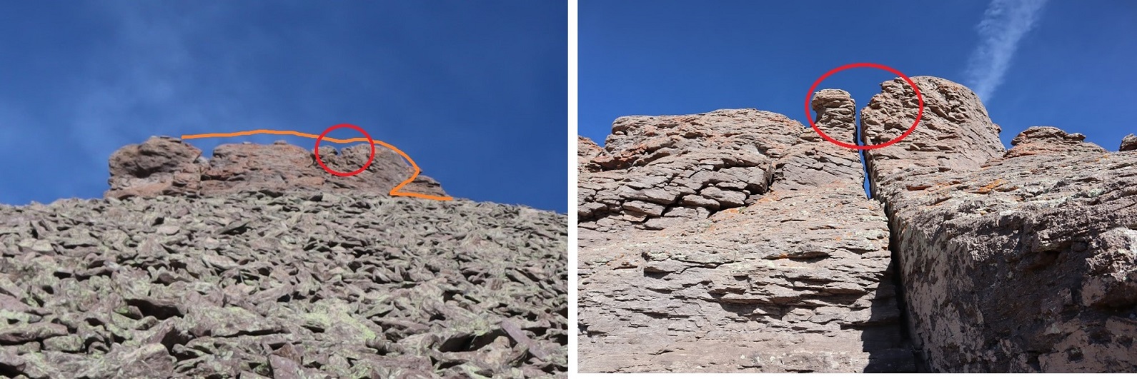
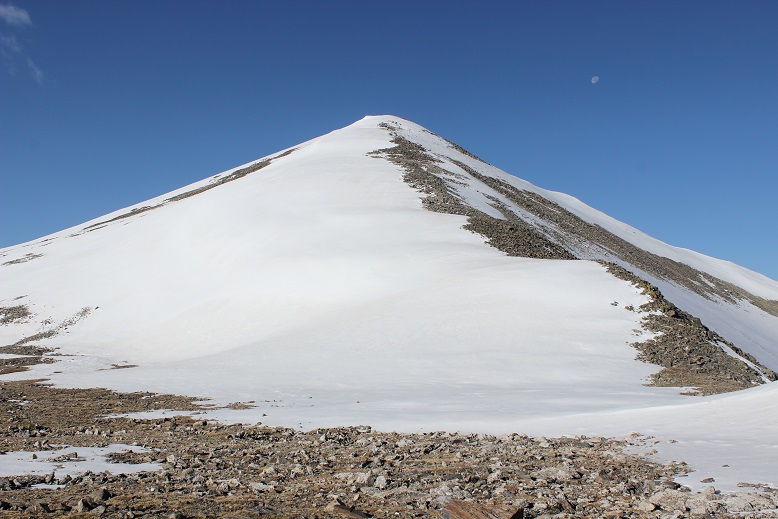
Here it gets a little dicey. If there hadn’t been snow, I would have taken the ridge all the way to the summit. However, with the snow and ice today things were slippery, and the exposure was real (to the left). I decided to dip down to avoid some of the worst of the exposure. I did this a little later than I should have, as it as getting spicy already. The area with exposure is circled in red. This is how I summited West Apostle
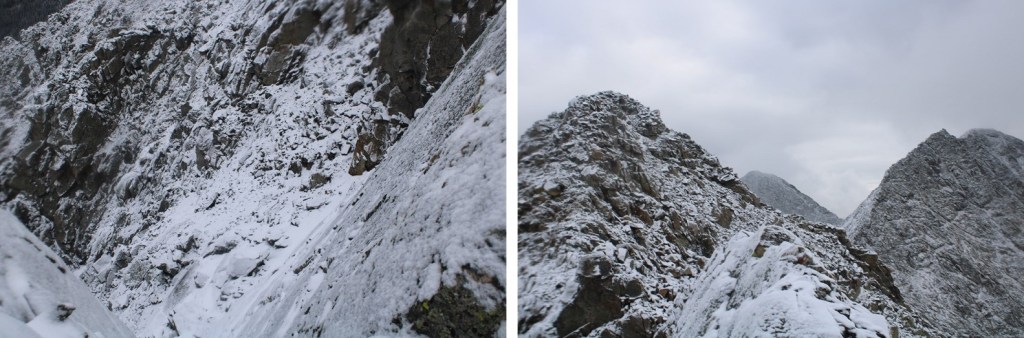
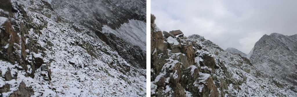
Here’s a picture of the ridge
And this is the exposure I was avoiding
So, I dipped down to the right and kept it class 2
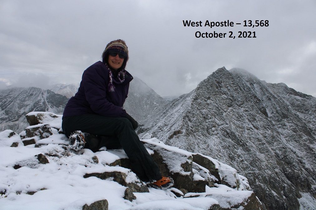
I summited West Apostle at 9:30am
West Apostle:
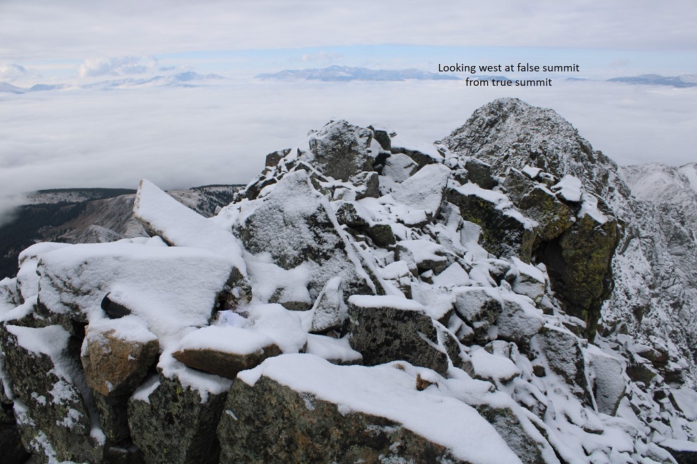
There was a summit register, but it was a pipe one missing its lid, so I replaced it with a jar. Here’s looking back at the false summit
I headed back the same way I summited, heading west, avoiding the area with exposure
Here’s what that looks like after dipping down
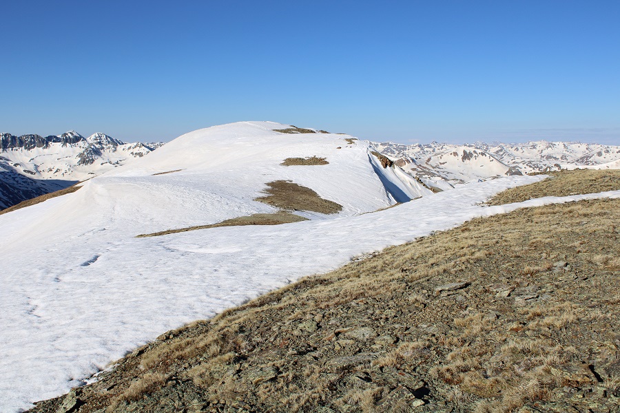
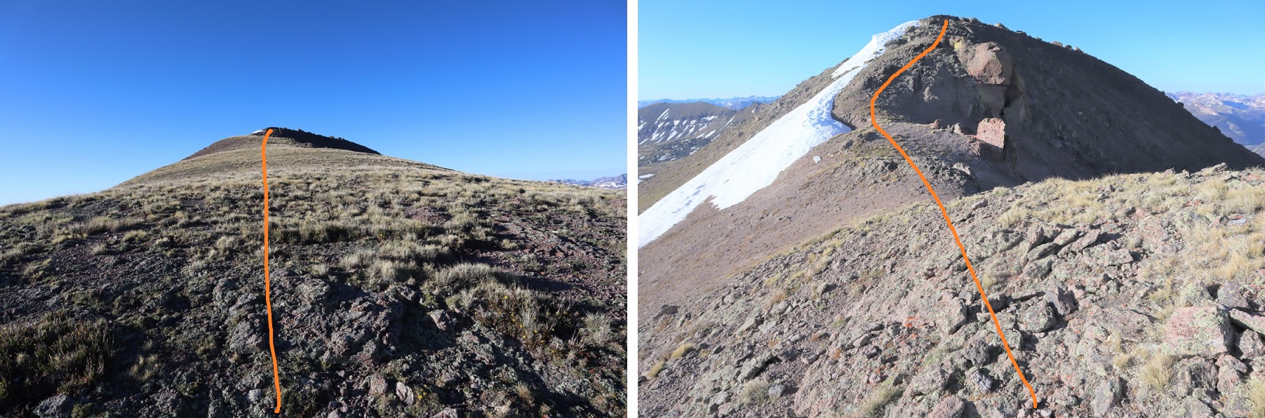
Back on the ridge, I followed it to the saddle.
The cairn was helpful in finding the correct exit from the ridge in all this snow.
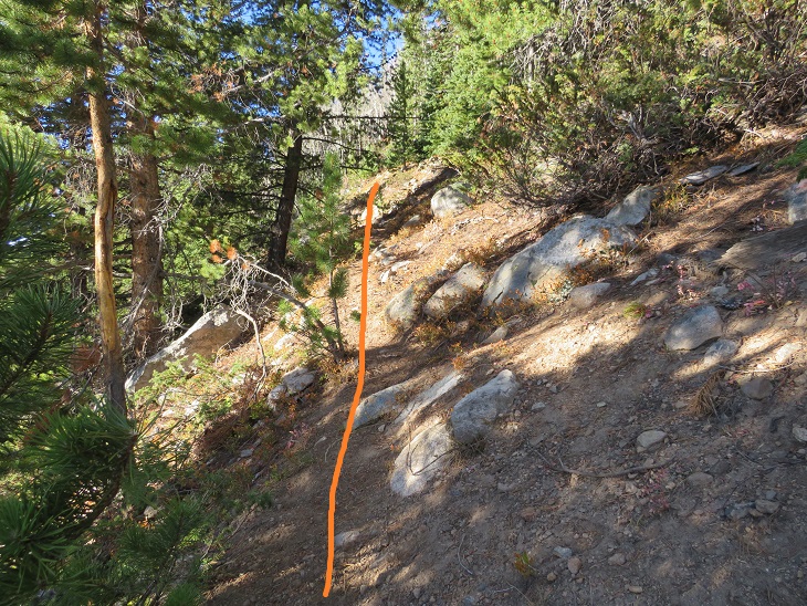
I made my way back down towards the gully, staying as much to the west as possible, avoiding the gully direct and sticking to the rocky area.
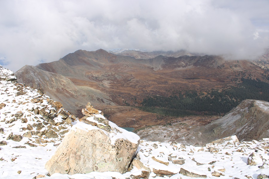
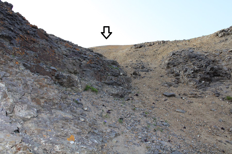
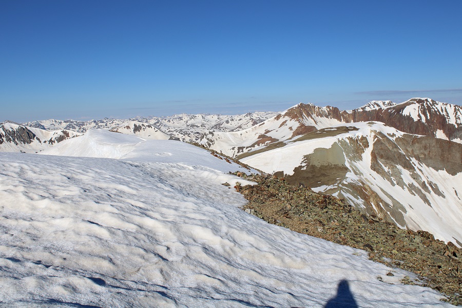
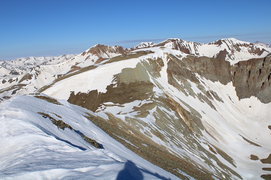
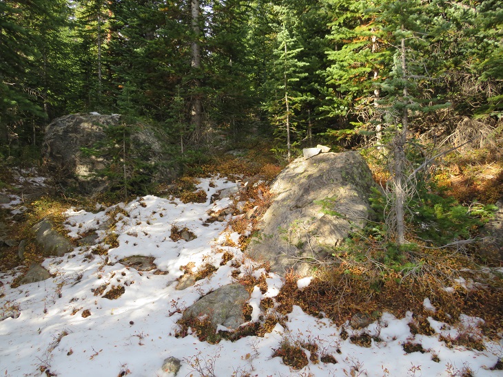
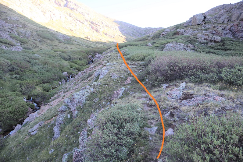
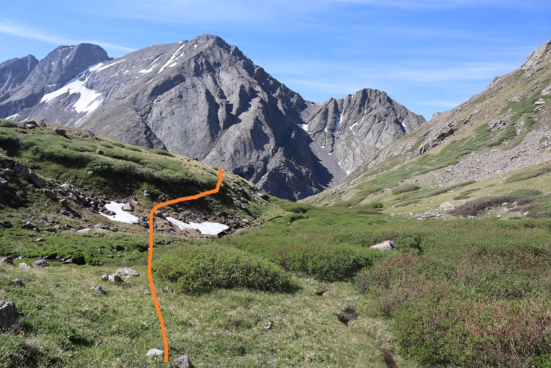
I then re-entered the basin, and headed west towards Lake Ann
Back at Lake Ann, it was easy to pick up the class 1 trail and follow it back to the trailhead.
I made it back to my truck at 12:30pm, making this a 12.04 mile hike with 3575’ of elevation gain in 7 hours.
This trip changed so many times before it even began. I have an actual job, with responsibilities, meetings, etc. I drove down to Durango Wednesday night, slept in the cab of my truck at a Walmart (the topper is still on order), got “the knock” at 10:30pm, moved, then woke up and worked/had meetings in my truck the next day. Then I drove to Hunchback Pass through Silverton (my favorite way to get to Hunchback pass). It started raining as soon as I hit the dirt road, and didn’t stop. There was a 60% chance of rain today, but I was still hoping to find a window and hike either 5 or 10 miles to a camping spot (depending on when it got dark, weather, etc.).
The road over Stony Pass was sketchy in the rain. Miles did great, but there were a few times I was worried the mud was too deep to get through. I was a bit worried about the river crossings too, but Miles once again had no trouble.
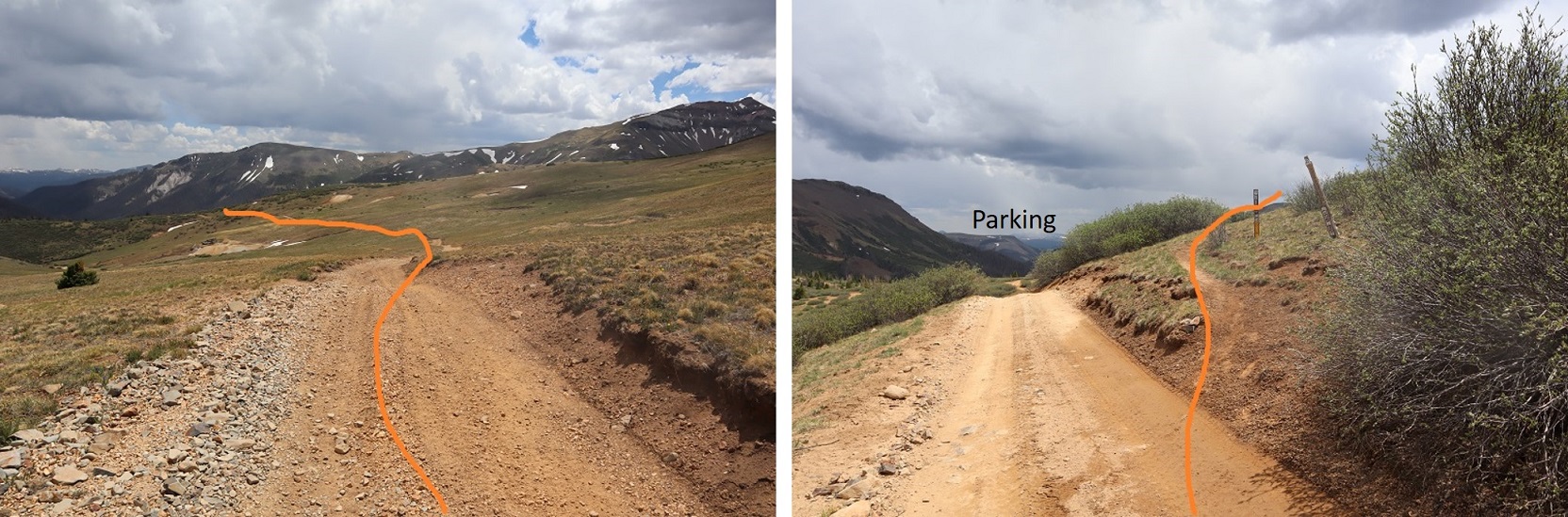
I’ve been to this area 3 or 4 times, and know the perfect place to park: It’s a pullout at 11230’, just before you hit the trees (again), and before getting to Beartown. My truck can make it further, but from past experience I know it’s going to get Colorado pinstripes from the willows and I have the opportunity to scrape the frame a couple of times as well. I love my truck, so I parked here, about 1.3 miles from the trailhead, in a flat spot with a campfire ring at 11235’.
I parked and waited for the rain to stop. The rain turned to graupel, then rain again, then hail. I could see the clouds coming over Hunchback Pass, and they weren’t getting any prettier. Wave after wave of new sets of clouds kept cycling in. After waiting for a few hours, I decided to just get some sleep. I know many of you would start out in the rain, but with my Raynaud’s I can’t risk it: If I get wet/cold that’s it for me, as I cannot warm up. I woke up every hour to check on the weather. The rain didn’t stop/clouds didn’t clear until 4:30am. That was a 15 hour rain delay that was seriously messing with my summiting plans.
I put on my rain gear to ward off water on the trail dripping from plants, and was on the trail before 5am.
Day 1 went like this:
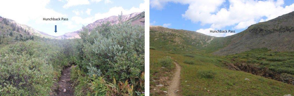
Gained 1275’ over 2.8 miles (to Hunchback Pass)
Lost 2350’ over 5 miles (to Rock Creek Junction)
Gained 2503’ over 6.4 miles (to pass over Rock Lake)
Lost 500’ over .5 miles (From pass across basin)
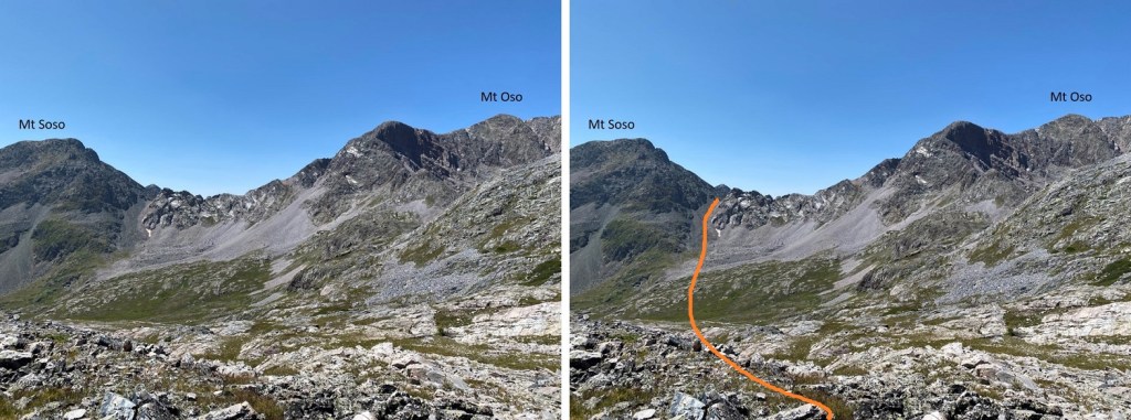
Gained 1150’ over 1 mile (from basin to Oso/Soso saddle/to Oso Summit)
Woot! Summit!
Lost 1150’ over 1 mile (back to basin)
Gained 500’ over .5 miles (back to saddle)
Made it back to Rock Lake (losing about 600’ more)
Ok, so, let’s start from the beginning: From my parking space at 11235’, it was an easy hike to the trailhead, passing through Beartown. There were two other 4WD vehicles parked here, a 4Runner and a Tacoma like mine, unmodified, so you know it’s doable (choose wisely).
Once at the trailhead (813) I followed the Vallecito Trail up to Hunchback Pass
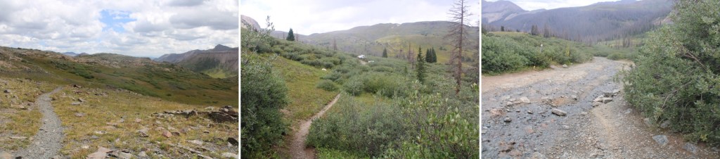
And then I headed south through the basin, following the trail down for 5 miles as it lost 2350’ in elevation
There were willows here, and I was glad to have on my rain pants. There were a few stream crossings, all easily crossable.
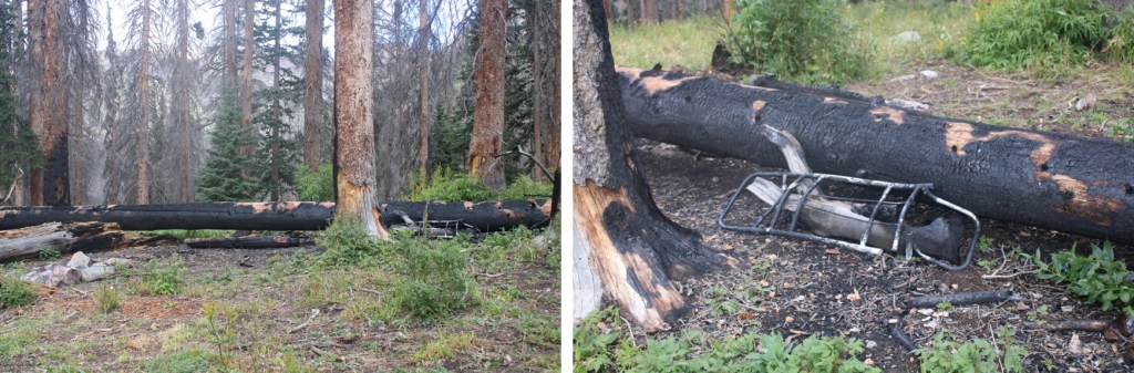
I saw evidence of someone’s fire getting out of control: looks like they lost their pack in the process. I wonder how they put it out? In case you’re wondering, yes, the ground was cold and the fire was out (I’m sure the 15 hours of rain last night had helped).
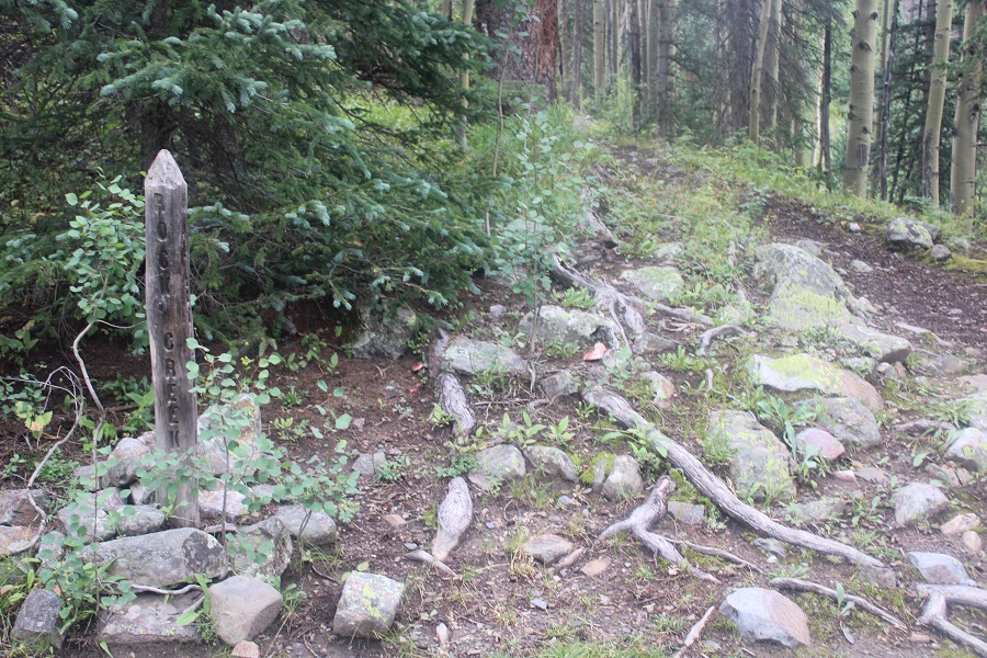
After hiking for a total of 7.8 miles (from where I parked) I made it to the Rock Creek Junction, and followed that trail southeast for another 5 miles up to Rock Lake. This trail was also class 1, and easy to follow.
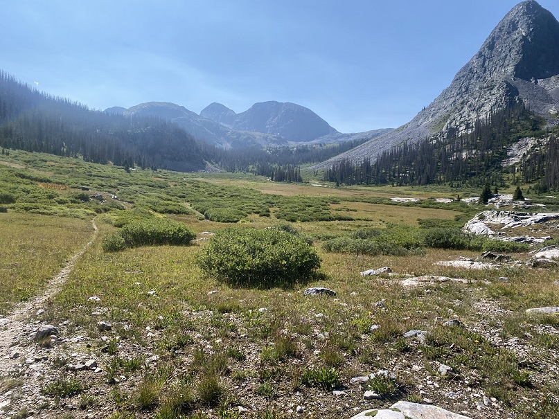
Just before making it to Rock Lake I passed through a basin
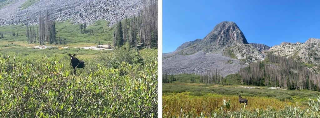
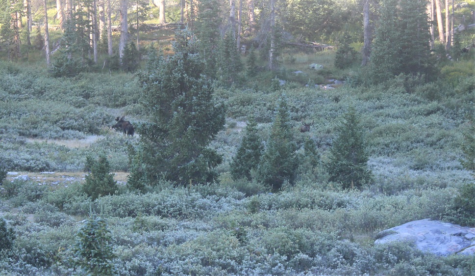
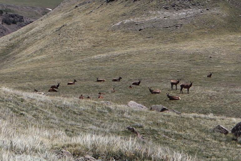
In this basin was a bull moose. I didn’t worry too much about him, because he was hundreds of yards away from me, on the opposite side of the basin. I continued on the trail, but once he noticed me, he raced towards me and stopped a few yards away. He charged me (it was a bluff). I knew not to make eye contact with him, which was what he wanted. I could actually feel him willing me to look at him. I kept my head straight and walked the trail with a purpose, ignoring him. He continued snorting and pawing at the ground and shifting his head from side to side. Then he paralleled me for about 50 yards, walking about 5 yards to the west of me. When he was done, he trotted away and took in a view of the mountains.
As he trotted away I breathed a sigh of relief, and continued on the trail, exiting the basin and making my way to Rock Lake.
I arrived at the lake at 11am and decided to set up my campsite for the night. I didn’t see anyone else here.
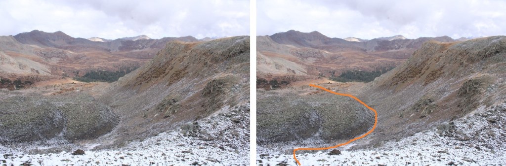
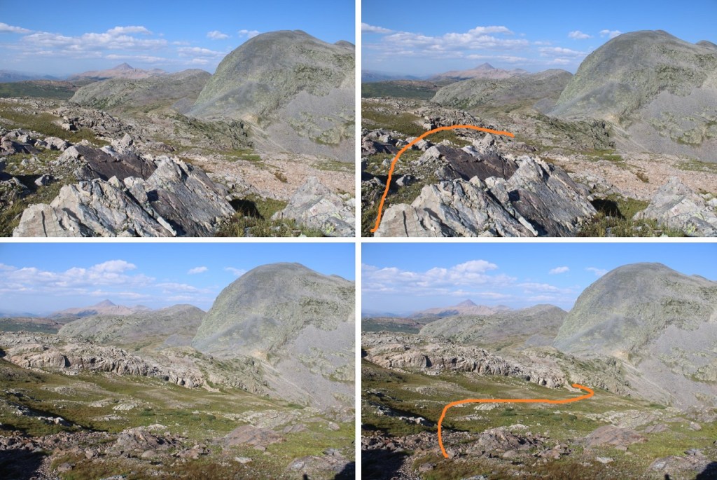
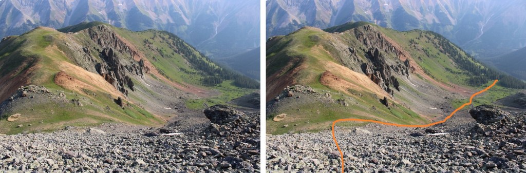
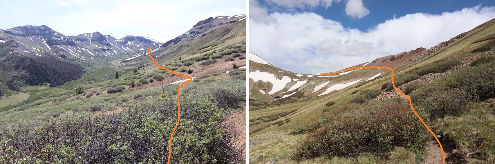
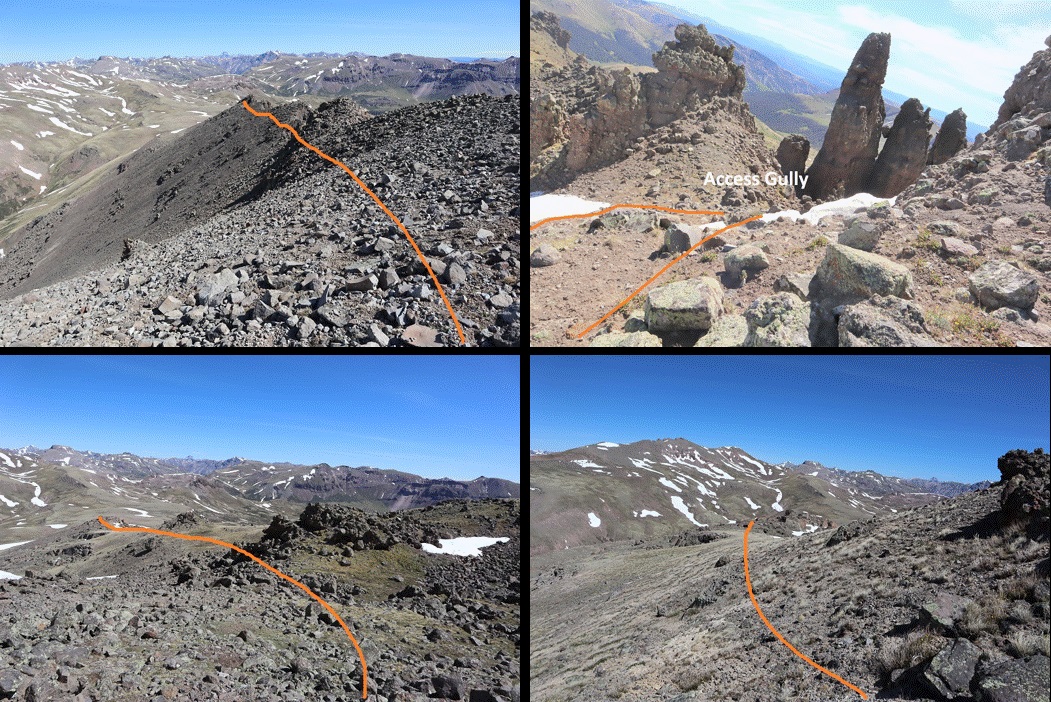
It was still early in the day, so after a quick snack I left my heavier gear and just brought the essentials: I planned to summit Mt Oso today. To do that, I skirted Rock Lake to the east and ascended the rocks
As I made it to the rocky area, I came across a cairned trail, and followed that trail southwest. Note, I took the solid line up, the dotted line down. The dotted line was easier, but both ‘went’. You can’t tell from below, but there’s a grassy area by the dotted line that helped me avoid the willows (pictures on my way down).
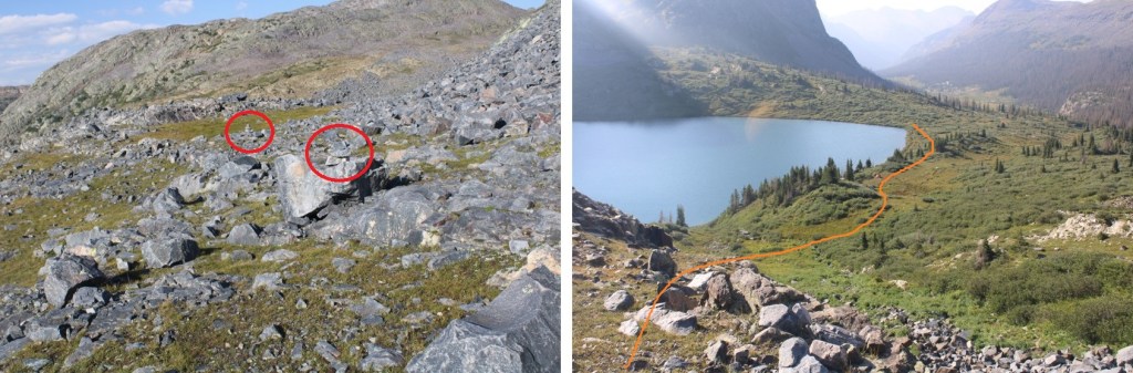
Here’s the cairned route, with the ‘exit cairns’ circled in red
Here’s where I left the trail. If you continue following the cairns, you’ll go down to Half Moon Lake. I was headed towards Mt Oso, so I left the cairns and continued heading up (west).
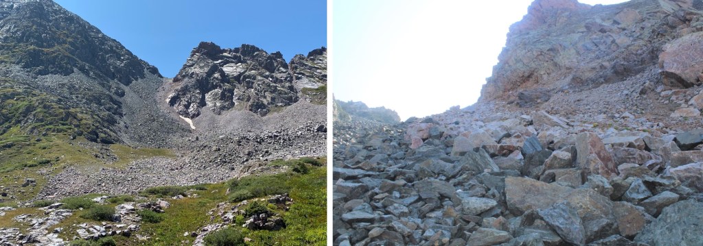
Time for more elevation loss, and gain. I was headed for the Mt Soso/Mt Oso saddle. This required me to lose 500’ through this basin, and then ascend the gully.
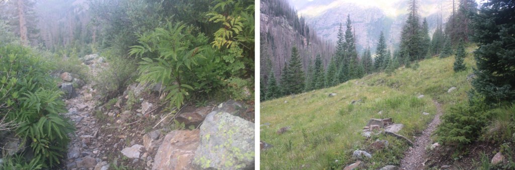
The basin was easy to cross. There were small streams and some willows to navigate, but the route was obvious (and choose your own adventure: just keep heading towards the gully/saddle). The gully was a mix of large, loose boulders, smaller loose rocks, and scree.
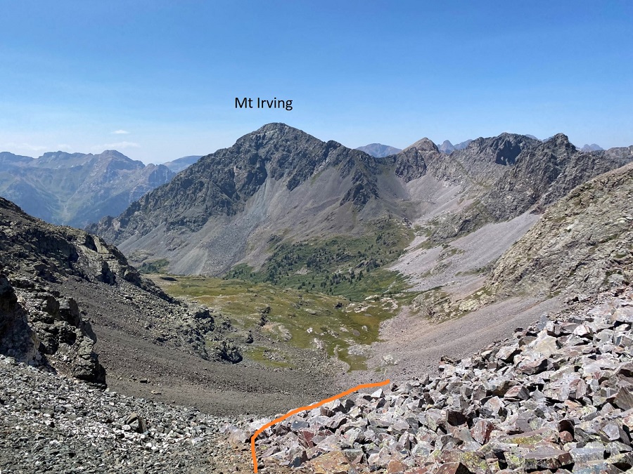
Once at the top of the gully/saddle, it was once again time to lose elevation. Being here also gave me a great view of Mt Irving. I descended the gully to the northwest, staying on the scree at the base of the rock outcroppings, rounding them, and losing 175’ in elevation.
Stay low here. You’re going to want to stay high, but you’re aiming for a green rock band to cross. It’s lower than you’d like it to be (around 12600’)
There’s a little bit of scrambling to get over the rock band. I was able to keep it as easy class 3 by taking this route
Once across the green rock outcropping, it was time to gain the ridge. I turned and headed north. The rocks here were large and loose, with some scree mixed in.
I went low just before ascending the ridge, following a scree/game trail
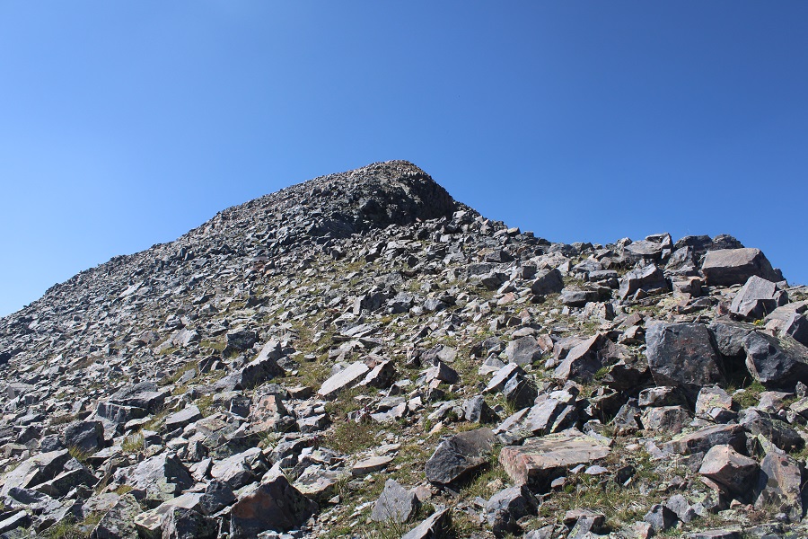
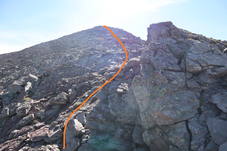
And then followed the ridge to the summit
Summit of Mt Oso
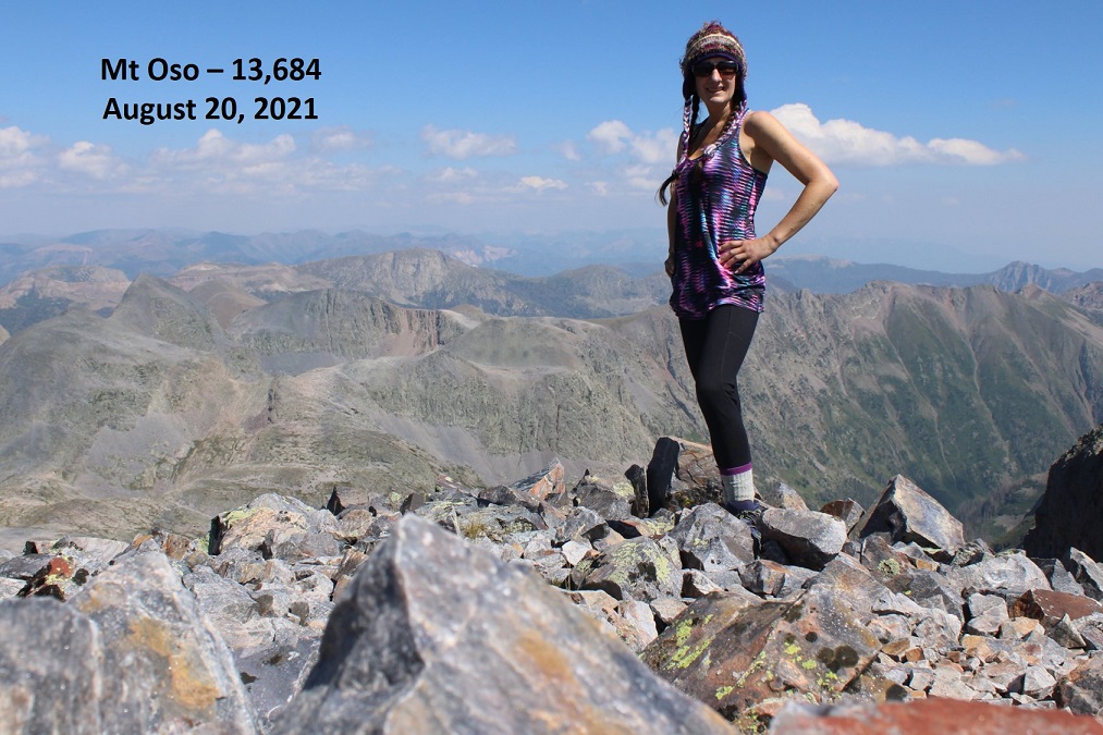
Mt Oso:
There was a large, military grade summit register, with a moving dedication inside, as well as some ceramic bowls (I’m sure that’s not what they actually are, ad that they have a purpose?).
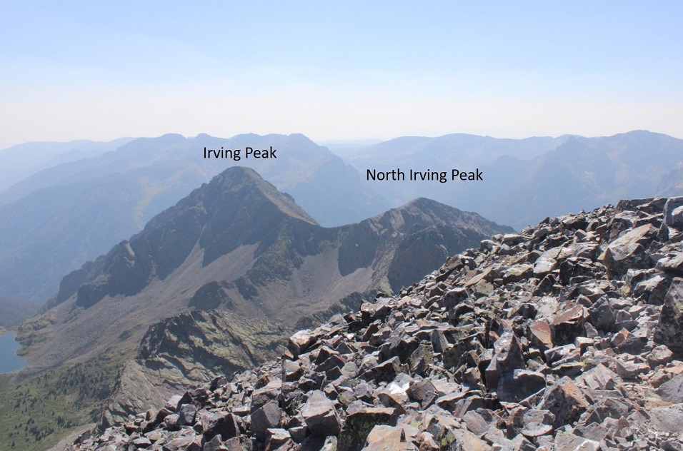
I looked over at Irving and North Irving. I did the math in my head, and there was no way I had time to loose the 1500’ of elevation, then regain 1300’ to summit Irving, plus hike back with all those ups and downs to Rock Lake before sunset. It’s important I’m in my sleeping bag before the sun goes down, which limits my hiking time. Oh well, just one peak for this trip.
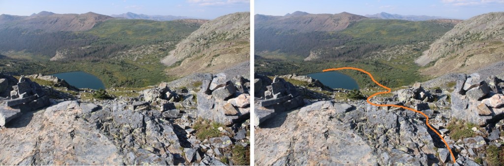
So, I turned and headed back towards the Oso/Soso saddle
Back at the saddle I retraced my steps down the gully, back across the basin, and up to the next ridge, finding a grassy bank to ascend
The route looks much different heading back, so be sure to study it on the way in. Stay just below this cliff band
And now to head back down to the trail
You know you’re back on trail when you see cairns
Back down to Rock Lake. Here’s an overall view of the route I took down, and check it out: another camper! I walked by his tent, and apologized for doing so, but told him he was camped in the only area without willows…
There are lots of cairns here to guide you back down.
I made it back to my campsite as the wind started picking up. I was glad I’d made the decision to head back. I jotted down some notes, and looked at my tracker: I’d done 18 miles today, with almost 7500’ of elevation. I sat in my tent for a while, glad I’d decided to bring a tent, listening to the wind howl outside. I eventually fell asleep, and woke up to frost inside my tent. Lovely. I quicky broke camp and headed back down into the basin. Everything was covered in a thinl layer of frost.
Oh, did I mention the trails were mucky? It was from all of that rain yesterday. The entire way in, and out, I was walking on water/mud/avoiding puddles, glad I was wearing new hiking boots that were still waterproof.
On my way out of the basin I decided not to take any chances, and wore my helmet. Towards the end of the basin I spotted the moose again. This time he had a friend, and didn’t seem to care I was there. I’ve seen over 20 moose in Colorado while hiking, and this was the first aggressive one I’ve come across. It’s interesting today he had no interest in me, while yesterday he was overly intrigued/agitated I was there.
I followed the Rock Creek Trail back down to the Vallecito Trail
Then took the Vallecito Trail back up to Hunchback Pass
And then back to the trailhead, the road, and my truck
When I made it back to my truck, my tracker told me I’d hiked 33.61 miles with 9833’ of elevation gain.
Now, for the hour and a half drive back to Silverton! Oh, also, side note: If you’re driving these back roads, make sure you know where you’re going! It’s easy to get lost back here. I met a man in a jeep as I was hiking back to my truck who was totally turned around. He wanted to know how much further down the 4WD road to the ‘real’ road. I had to tell him he wasn’t going in the right direction (this road is a dead end) and that Silverton was many, many miles away. An easy way to not get lost out there without cell service is to load your track onto CalTopo, then add a line and trace the roads you wish to take, then use that track your drive.
Just for fun, here are some pictures of the road out…
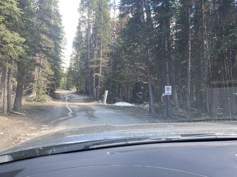
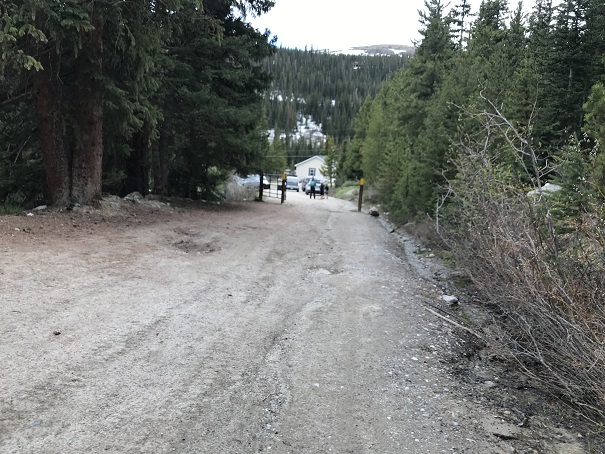
Ophir Pass Road is a serious 4WD road, but the trailhead for this peak can be accessed from the Ophir city side with just a high clearance vehicle. There were a few small water crossings, but 4WD was never needed.
I parked in a parking area about 1.3 miles east of the town of Ophir, on Ophir Pass Road, in the Iron Spring area. All the parking spots were taken but 1, and every vehicle was parked there overnight. This is a popular spot to park to backpack/hike in the area.
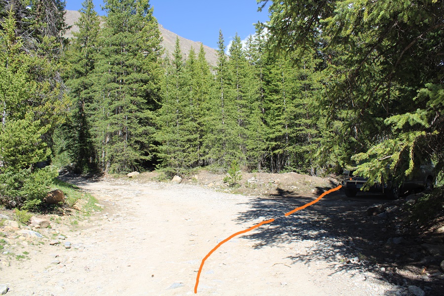
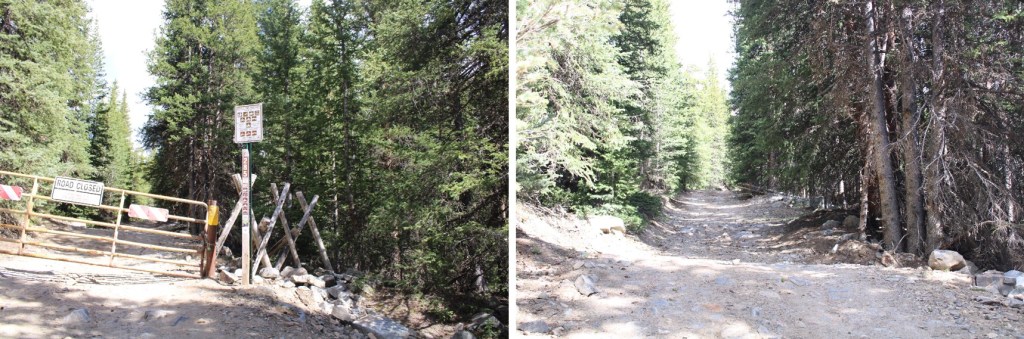
The mosquitoes were out here as well, so I made it an early night and got some sleep. I was up and on the trail by 3:45am. The trail starts on a blocked 4WD road to the south of the parking area.
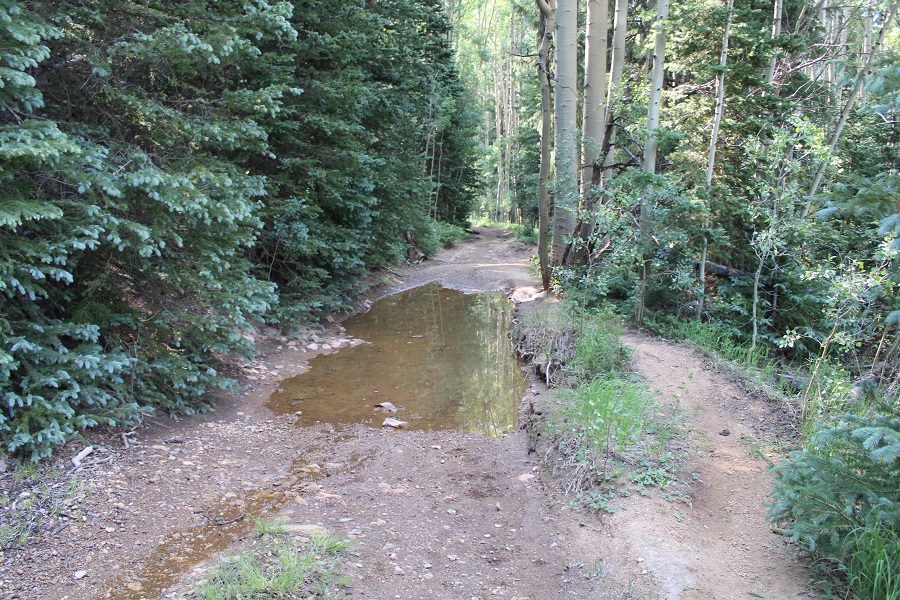
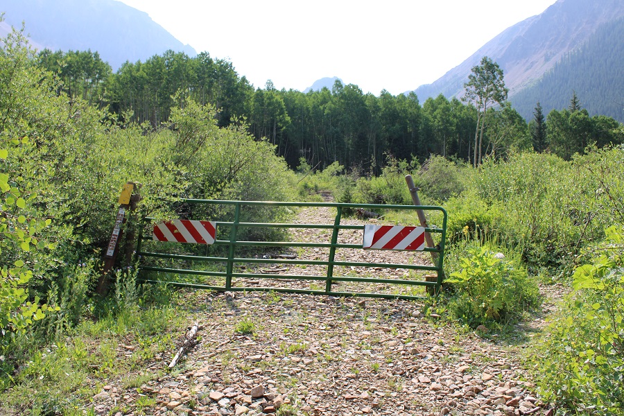
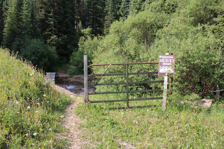
I followed this road southeast and then south, through gates, aspen trees and two stream crossings with easily crossable bridges
After the second stream crossing, I passed below some power lines, turned left to follow the trail, and started gaining elevation.
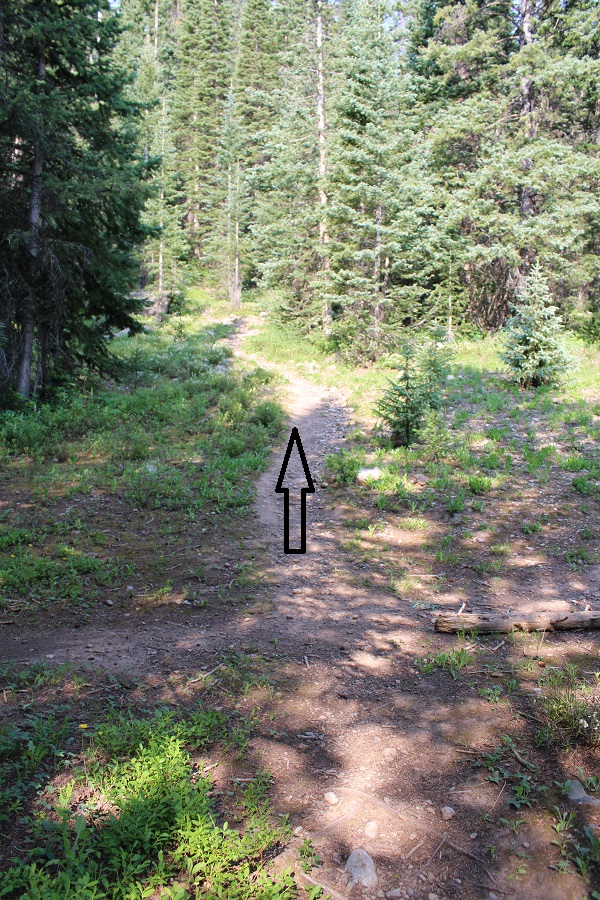
The hike below treeline was nice, and the trails were class 1, but there were no trail signs or numbers, and several trail crossings. I’ll do my best to describe the correct route.
I followed a well-defined path south.
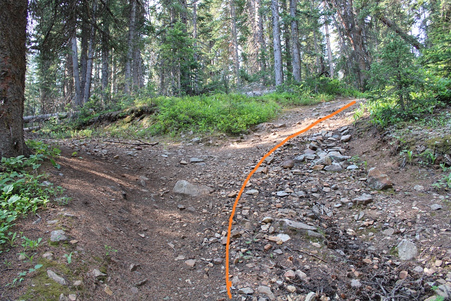
At the first fork in the road, I turned right
At the second fork I turned right again, off the road and onto a trail (I’d hiked a total of 1.15 miles at this point)
I hiked west for a few yards, and then came across a trail junction. I continued heading straight
I was now on the trail that heads south/southwest up the hillside. This is also where I ran into a porcupine. Porcupines don’t run, but we noticed each other while we were about 3 feet away from each other: He quickly turned and waddled away in the dark, showing me his full backside of quills as he did so.
I continued on this well defined trail
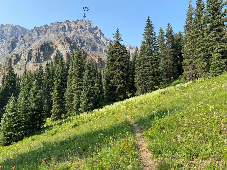
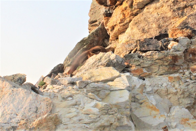
Here’s your first glimpse of V3. Look carefully, the arrow points to the exact summit, which you won’t see again until you’re there.
After hiking for a total of 2.25 miles and 11350’ I came to a small water crossing over the trail, and a meadow to my right. I left the trail and headed through the meadow. It was still dark, and there was a camper with a bright headlamp getting ready for the day. He was confused why I was ‘off trail’ and tried to direct me back to the proper trail. I assured him I was going in the right direction, apologized for walking so close to his campsite, and nicely told him I didn’t expect to find a trail to the summit.
I was now in a meadow and basin. There were wildflowers I couldn’t yet see in the dark, and willows I kept encountering. I found out the hard way to stay right to avoid the willows. The path is obvious in the daylight. Here’s the route I took.
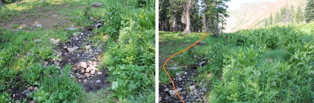
And some step-by-step pictures of my way to the saddle, first hopping across a small stream
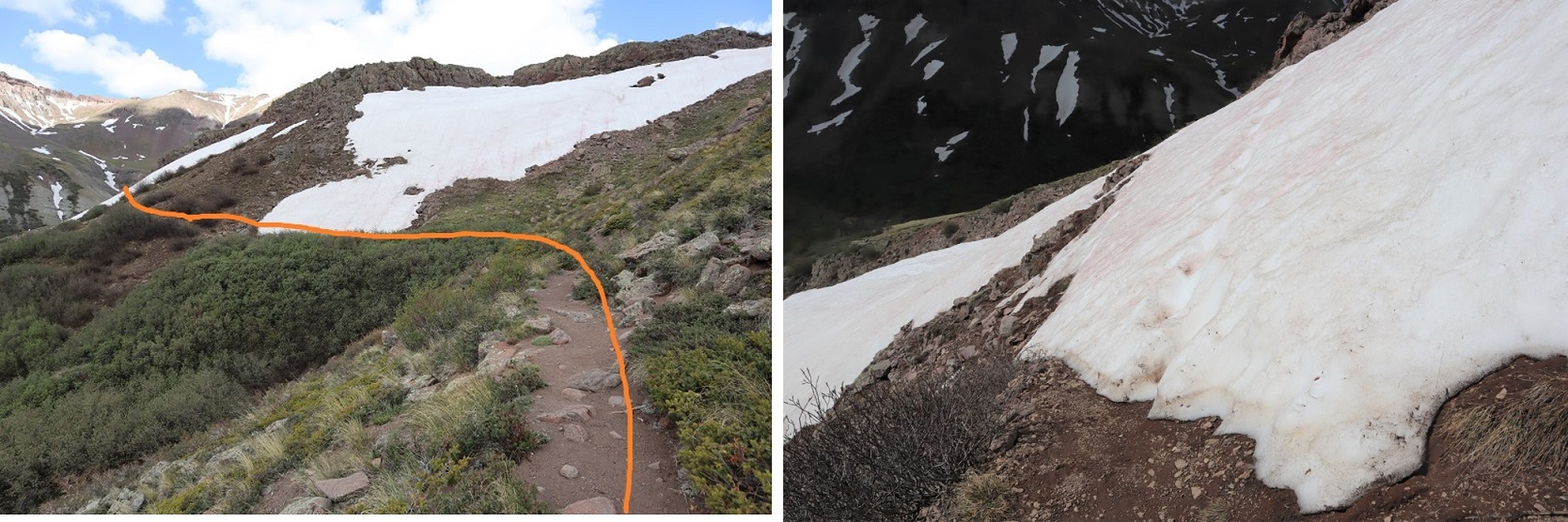
Staying right to avoid the willows and ascending a small gully that still had snow. Microspikes were helpful here, both on the scree and snow.
At the top of the gully, I was now in a rocky upper basin. I crossed a boulderfield and headed towards the saddle.
Here’s a look at the last bit of hiking to the saddle
Once on the saddle I turned left and followed the ridge southeast, staying to the left of the snow.
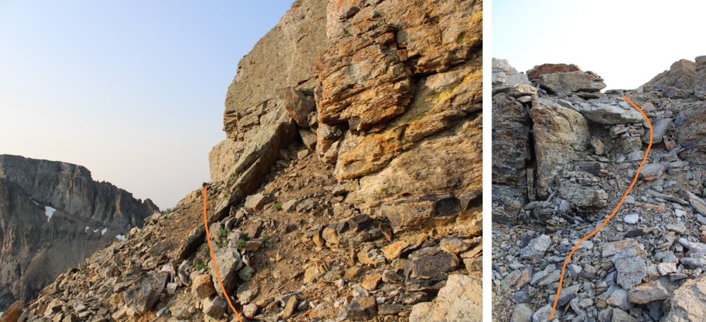
At the top of this area you can see the crux of the route. Now is a good time to put on your microspikes and helmet, if you haven’t already. It’s much steeper than it looks, and the scree isn’t manageable without microspikes (trust me on this one).
Here’s your intended route:
You’re aiming for this gully. The scree here is steep; a 45 degree angle for an extended amount of time.
Once at the base of the gully the class 4 climbing begins. The route is obvious, curving around to the right. There is really only one way to go: follow the trail set out for you from the fallen scree. Also note: the scree and rocks here are loose. Very loose. I wouldn’t attempt to upclimb or downclimb this area with another person: take turns the entire way up and down. You will be causing screevalanches on climbers below you.
Here are some pictures from the inside of the gully. Pictures do not do the steepness justice (although the pictures down give you a better perspective). When heading up, continue climbing southeast.
Here’s a look at the exit of the gully
At this point it became even steeper. I did not have on my microspikes, lost grip, and slid on my stomach backwards for a full 12 feet. I seriously thought I was going to slide all the way back down that gully. I braced myself, and without taking off my pack located my microspikes in my backpack pocket and gingerly put them on while trying to balance without much traction. It was much easier to upclimb once I put on my spikes. Here is where I aimed
I then turned right, and hiked south towards the summit block.
I made it to the base of the summit block and was surprised to see a pine marten. He sat there and looked at me. I tried to get a picture, but he quickly turned around and all I got was a picture of his tail and backside. Why are all of my wildlife pictures of animal butts?
Ok, now, don’t let this summit block scare you: yes, you can upclimb it, but you can also skirt it to the left and follow it around and have a class 2 trek to the summit, which is what I did.
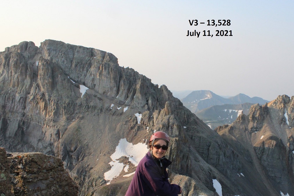
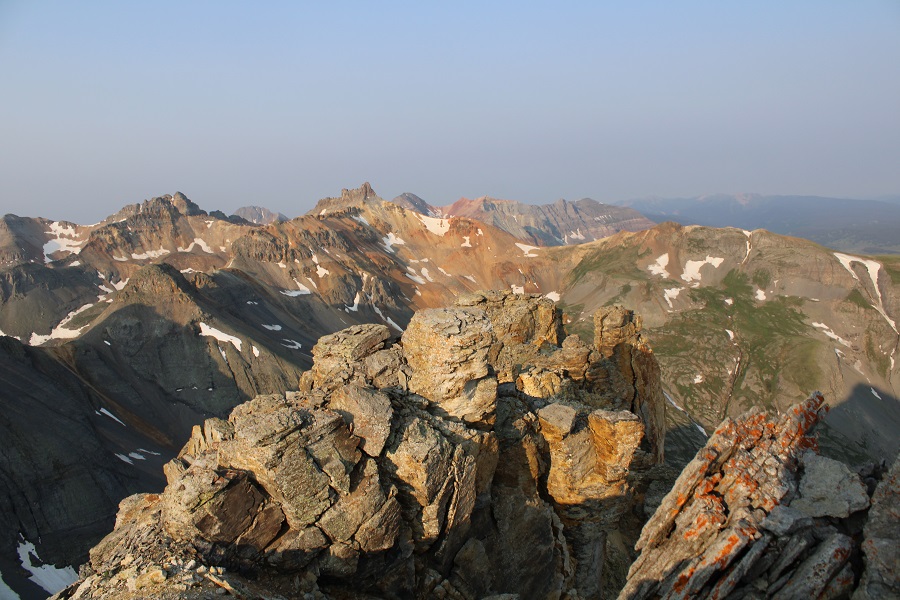
I summited V3 at 7:15am. There was a lot of smoke in the air from far away fires this morning.
V3:
I was surprised there wasn’t a summit register, so I left one. It was obvious this peak does not get a lot of visitors.
I kept my microspikes on for the trek back down, which seemed easier than the trek up. Here are some pictures of the way back down the gully. Once again, do this one person at a time, and when you’re done, head far away from the gully, as the rocks will slide and they will pick up speed as they do so.
Once out of the gully, the scree-surfing will begin. It’s always fun when you can ride the same pile of rocks all the way down the hillside.
Scree Surfing:
Here’s where you’re aiming. If you’re doing this with another person, you should be standing far away from the rockslide area while they’re ascending/descending. I’ve circled a good place to stand out of the way.
And now to hike down the ridge to the saddle, and exit the basin.
I made it back to the meadow, marveled again the wildflowers, and saw the group of campers were almost done taking down camp (I guess the man I talked to this morning was part of a larger group). I made it to the trail, turned left, and followed it back to the trailhead.
I made it back to my truck at 9:45am, making this an 8.29 mile hike with 3542’ of elevation gain in 6 hours.
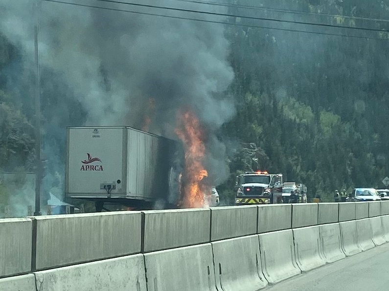
It took me longer than anticipated to get to the trailhead due to an unexpected semi fire on I70. At first it looked like the entire hillside was on fire, due to all the smoke, but as I got closer I realized it was a semi. West bound wasn’t closed however, so I was able to get past it faster than those travelling east (which was closed).
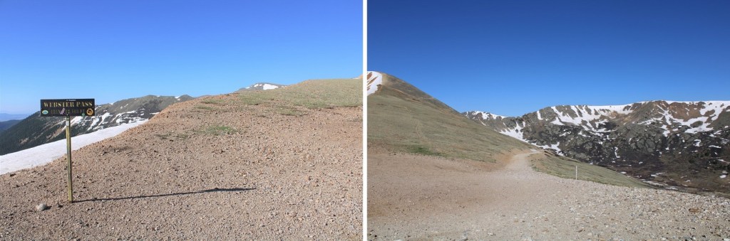
When I finally made it to Montezuma, I turned left on 285 and followed it towards Webster Pass
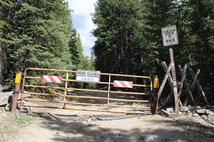
This is a moderate 4WD road (which is good, since I still don’t have my new truck). They are serious about ‘no parking’ on private land here, and let you know you’re not allowed to park in any available pullout.
I was able to drive the .7 miles to the gate, but when I got there the gate was closed. Had it been open, I would have been able to drive all the way to 11000’. It was closed to allow for spring runoff (I’d find the next day it’s going to be a while before it opens: Webster Pass is still socked in and the 4WD roads have several feet of snow in some areas).
There were 3 places to park here, but none of them were very level, so I turned to drive my truck to a spot I’d seen on my way in, just about a dozen yards or so back down the road. As I was doing so, I noticed 3 ATVs: The drivers drove them through the woods, around the closed gate sign, and up the road. On my hike the next day it was obvious theirs were the only tracks. I was mad they were breaking the rules, but also hoping maybe they were ‘official’ and checking to see if the trails had melted out? They didn’t look very official. They also looked like they’d had to turn around.
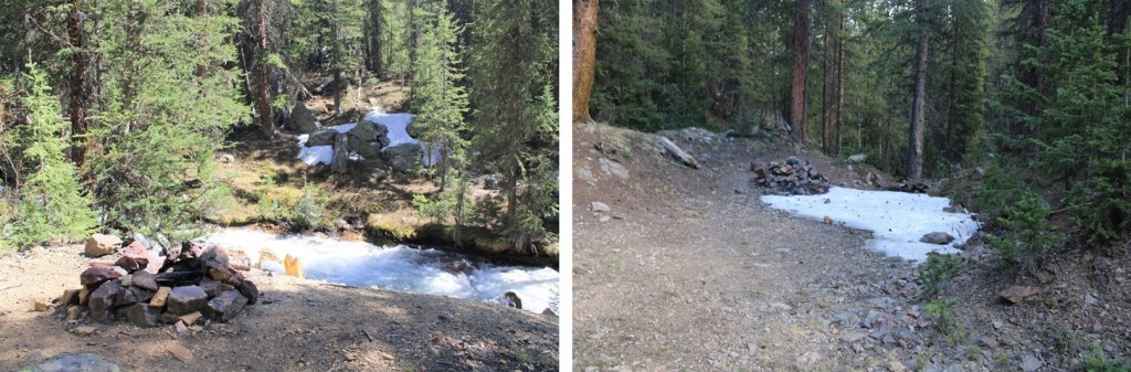
Here’s the camping spot I chose for the night: a legal place to park at 10780’, next to the Snake River.
I got out and explored. There are several fire pits behind the parking area, and what look like good places to put up a tent.
After exploring, I went back to my truck, made dinner, sipped some whiskey, and started reading a book I bought at a used bookstore in Arizona: The Magnificent Mountain Women, Adventures in the Colorado Rockies by Janet Robertson (1990). It’s about all the first women to summit various Colorado Mountains, mostly 14ers. While I only made it about 50 pages in that night, so far it’s a great book, with a lot of good points and tons of background information on the lives of these women and their ascents. Added bonus: it includes pictures.
After a few chapters I decided to make it an early night. I had a lot of dental work done the day before and I was still sore. I had a hummingbird come visit me inside the topper of my truck (that’s 5 times now that’s happened to me), cleaned up, and went to bed.
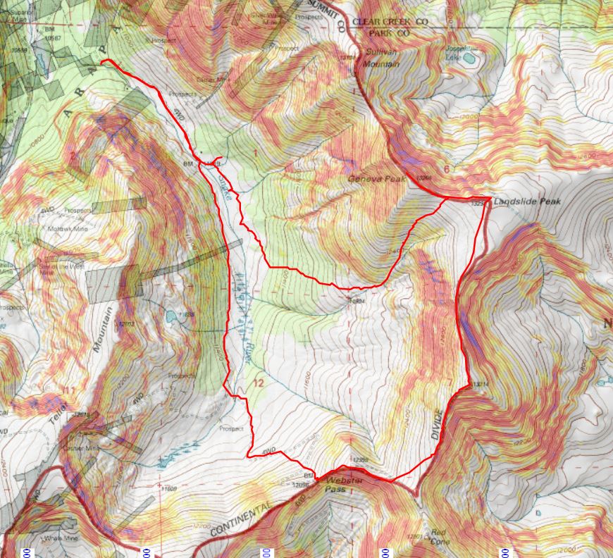
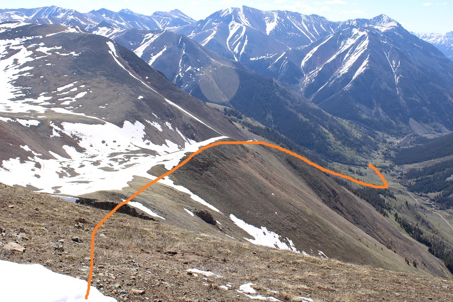
I know the route I took is not the conventional route to Geneva/Landslide, but I did this on purpose: I’m hiking the loop with a friend next week and I’m trying to keep my streak of summiting peaks solo before going with someone. I hadn’t yet done Geneva, so I wanted to tick it off before we climbed it together next week, so I got a bit creative.
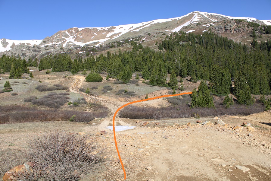
I was on the road at 5am, just before the sun rose. I took a quick short-cut from my camping spot through the trees to the gate (saved me a total of about 5 yards of walking). It’s an obvious and well-travelled side trail.
I passed the gate and continued along 285
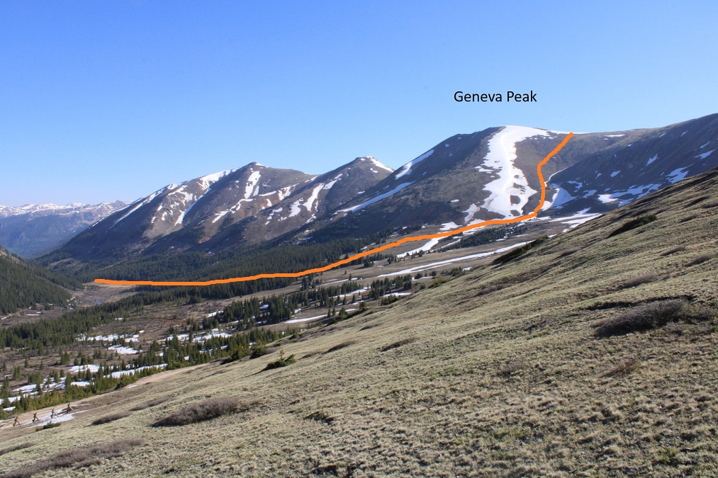
I followed this road for .85 miles, until I came to a wide-open gulch. This is probably where I would have parked if the gate had been open. My hike would take me on a loop back to this place.
Here’s an overview of my hike to treeline:
There was a sign indicating a trail that intersected the road at 11045’. It showed there was a trail heading southeast, and indeed, in the dark it looked like there was a trail. I knew I wanted to head this way, so I started following the ‘trail’.
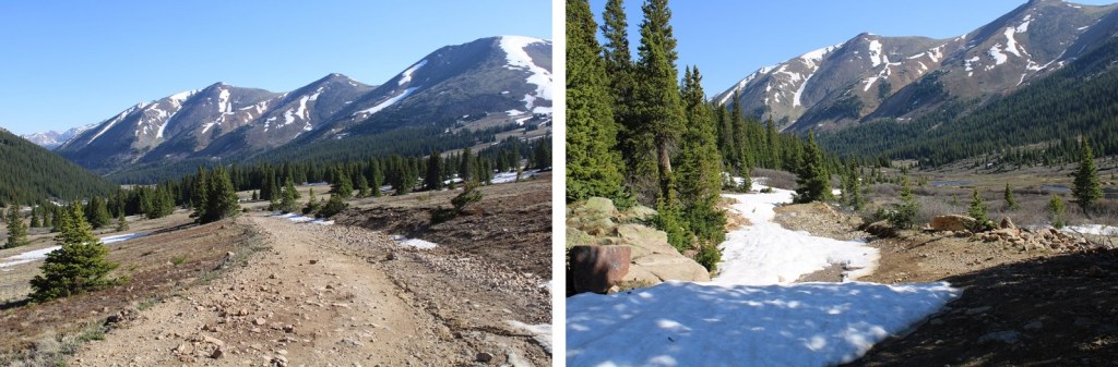
I’m thinking this was a snowshoeing trail. But, in any event, it took me in the right direction. The only problem? It was under spring runout. The entire area was marshy and I was sinking in the slush. Not fun. I found if I stayed higher, more to the left, I was able to miss the brunt of it. The ‘trail’ ended after about 200 feet. One thing I knew: this was not going to be fun on my way back. I decided to take the road down. I continued hugging the trees for three quarters of a mile, doing my best to avoid the willows
Then, at 11180’ I followed a small drainage into the trees, and headed east to treeline.
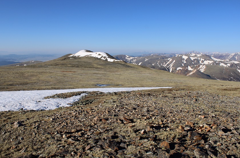
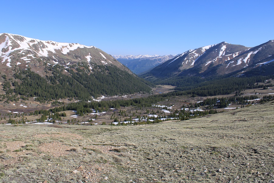
Once at treeline my route was obvious. I just aimed for the drainage and followed it up. Note: This is the southeast face of Geneva Peak, and it’s pretty much all tundra. I could have just gone up the ridge and ended up in the same spot, or followed the curve of the drainage all of the way right and done Landslide first. Lots of choices here.
I chose to go up the drainage, straight to the small saddle between Geneva and Landslide. This was nice and steady on tundra: nothing unexpected.
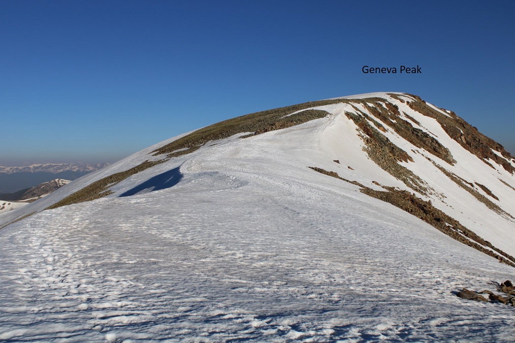
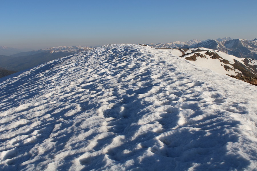
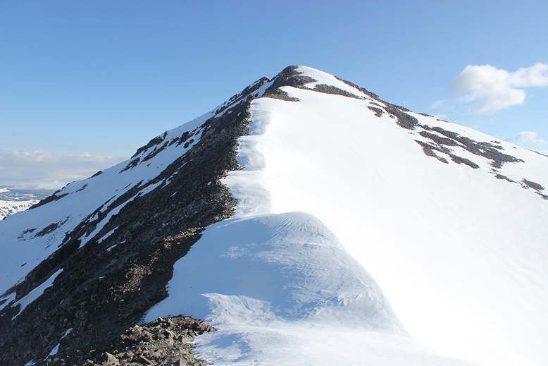
Once at the saddle I turned left and headed towards Geneva Peak. There was still a lot of snow here, but it was firm and I didn’t need microspikes. I just followed the ridge northwest to the summit
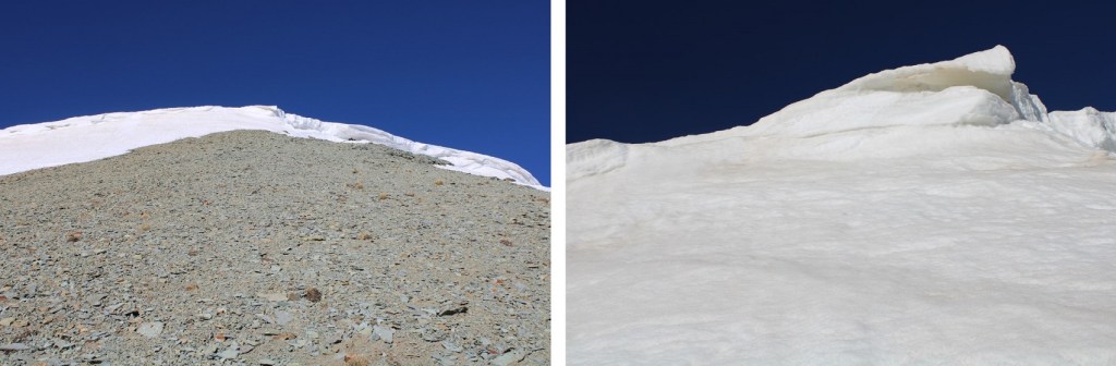
The summit was covered in a cornice.
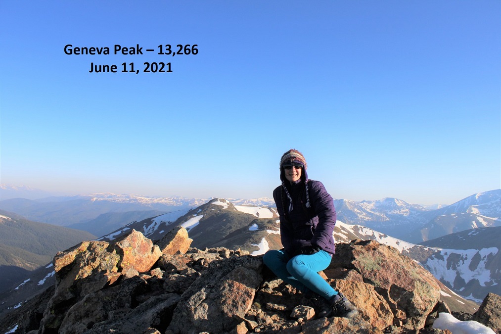
I walked a little further north to take my summit photos. I summited Geneva Peak at 7am
Geneva Peak:
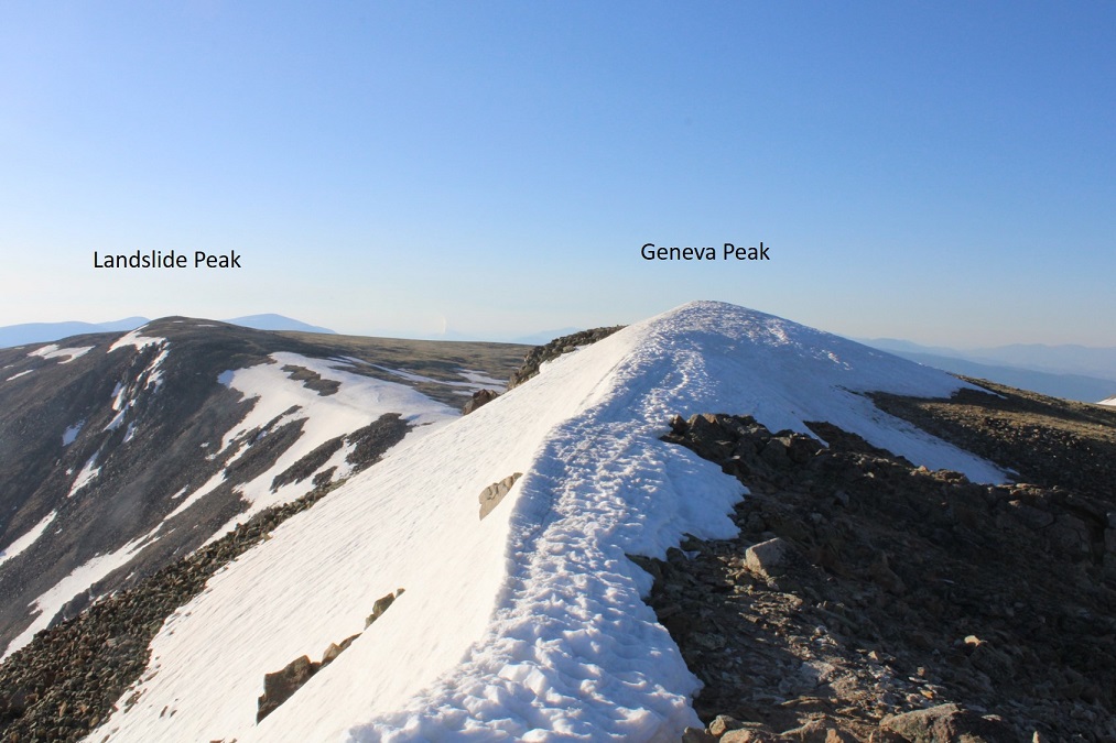
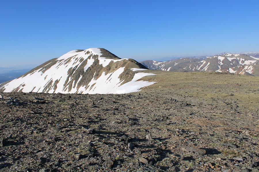
Here’s a look at Geneva and Landslide from my picture spot.
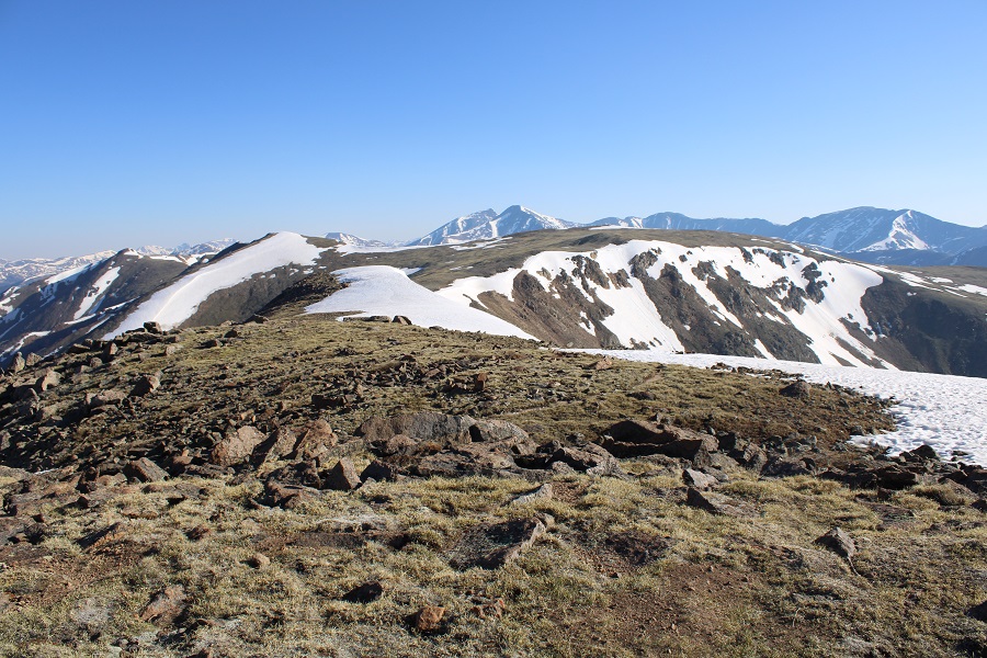
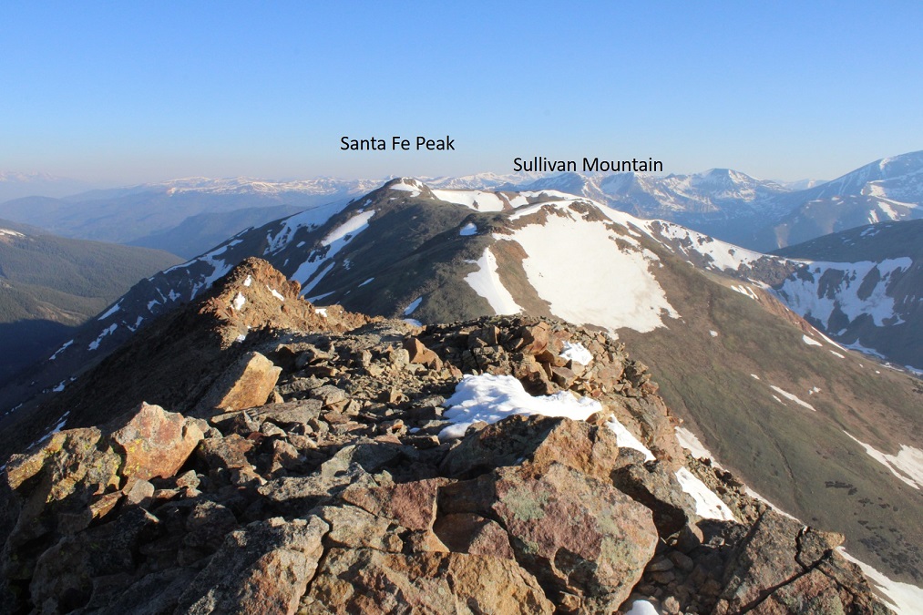
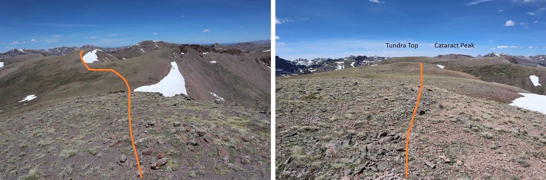
Here are some other 13ers in the area:
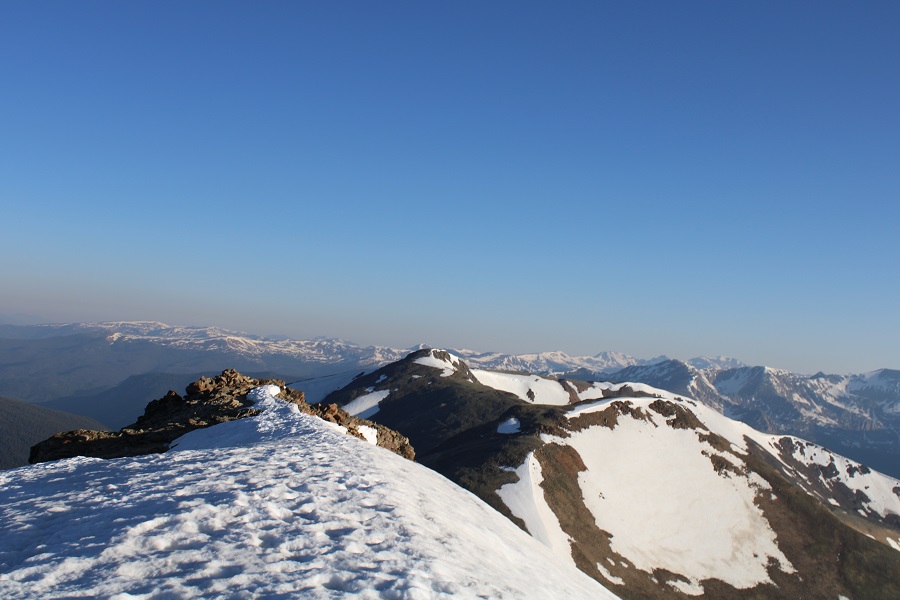
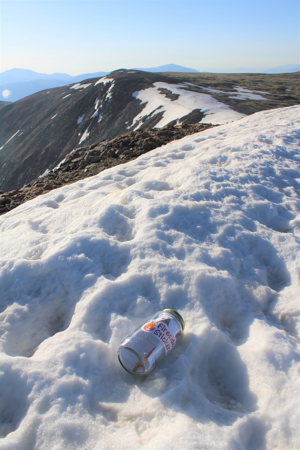
I re-ascended Geneva, left a summit register on the cornice, and retraced my steps back to the Geneva/Landslide saddle.
This was a quick and simple hike, following the ridge east. The snow was avoidable if I were to dip down to the right, but at this time of day it was still firm and I didn’t even need microspikes to navigate.
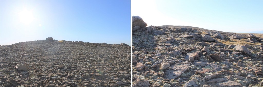
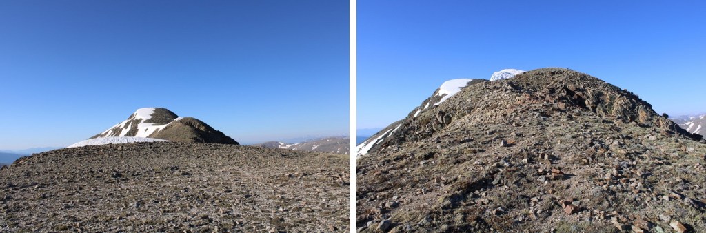
There’s a bit of a false summit (if you could call it that) on the way
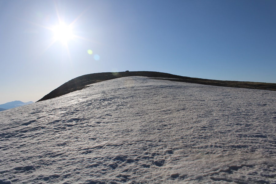
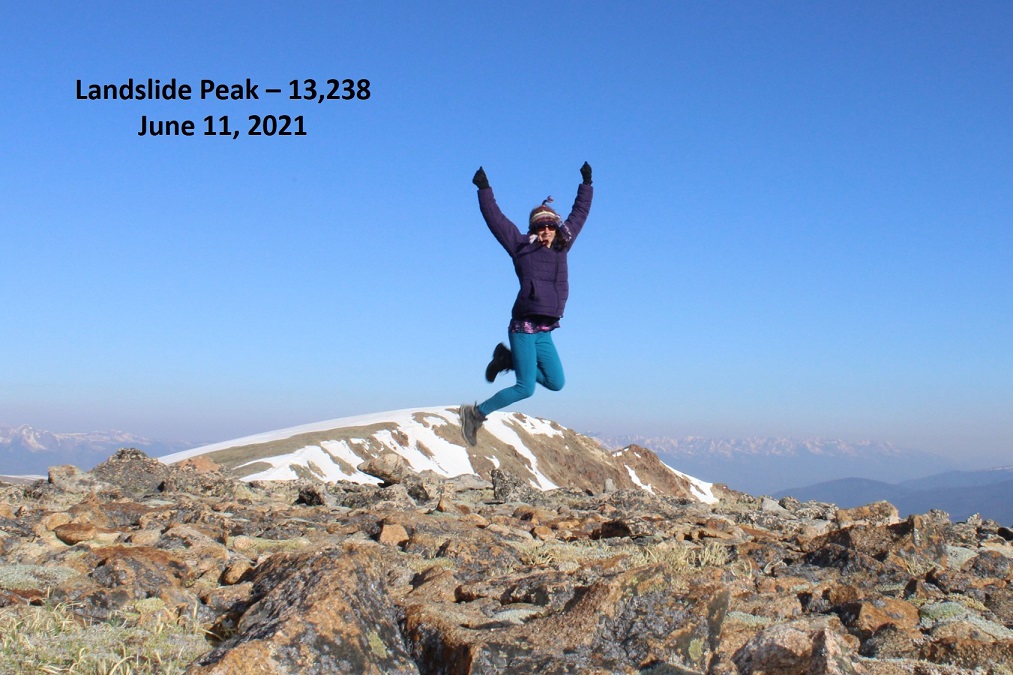
I summited Landslide Peak at 7:15am. I’m jumping for joy because this is the 250th unique 13er in Colorado I’ve summited solo. Woot!
Landslide Peak:
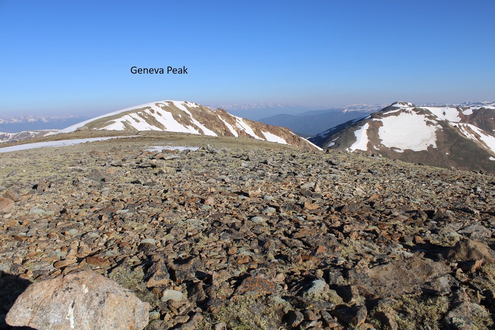
Here’s looking back at Geneva
Since I didn’t want to drop back down into the basin and go through the marshy areas, I decided to hike the ridge south back to Webster Pass, then take the road back. Here’s the overall route along the ridge.
And some step-by-step pictures up and over this unranked point that is 13180’
This is easy class 2 up and over
Once at the top I made my way down to the 4WD dirt road.
At the road I turned right, and followed it west to Webster Pass. As you can see from this picture, even in June, Webster Pass is impassible due to snow.
Here I had a great view of how I ascended Geneva Peak
At Webster Pass you can follow the 4WD road back, making this a loop
Here you can see the road, on the other side of the Snake River, and the path it leads out
Once on the road, there were varying conditions, from dry, to muddy, and eventually to snow covered. The snow covered portions would have been difficult later in the day, but this early in the morning the snow was still (mostly) firm and I only postholed a couple of times
Just before making this a loop I came to a water crossing where Snake River meets 4WD road 285. It was about 18 inches deep. I took off my boots, rolled up my pants, and waded across, doing my best to avoid the stagnant area
Then I continued following 285 northwest, back to my truck
I made it back to my truck at 9:30am, making this a 9.84 mile hike with 2965’ of elevation gain in 4.5 hours.
Now, off to the airport to pick up one of my Girl Scouts: We’re off to California for the week for their Senior trip to learn how to surf. It’s our last trip before they all head off to college. Maybe I’ll be able to find some good hikes along the beach?
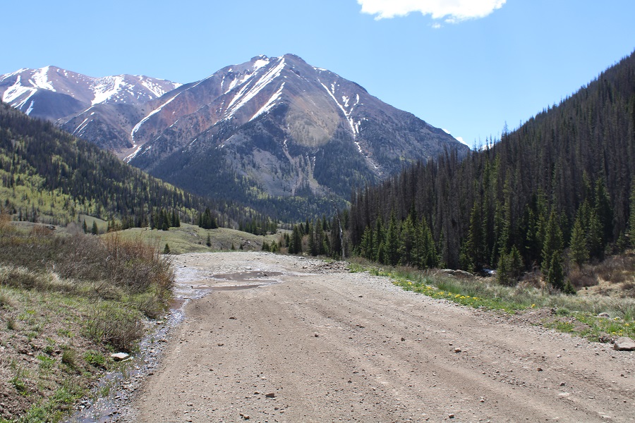
CR 30 has had some work: the road was much nicer to drive than it was last year. No more potholes! At least the firsts 11 miles or so. The last 5 were still a little rough.
I parked near Cooper Creek and settled in for some dispersed camping. There was a storm rolling in I and I got to listen to the thunder roll as I ate dinner (Pho, which was awesome) and read a little. After a while campers set up across the way. I went over and talked with them: It was a father and son duo from Alabama, road-tripping because the son had just finished college. Very cool father/son time.
I made it an early night, sleeping until my alarm went off at 3am. I hit snooze and was on the trail by 4am. The route starts out following CR 30 west for about a third of a mile, then I left the road and followed the drainage/Rock Creek northwest.
The area where you leave the road is also the site of a recent avalanche: a house was destroyed, and there are pieces of the house, roof, furniture, shoes, etc. strewn about the area for about 100 yards.
I followed Rock Creek into the upper basin, staying to the left of the creek (but hugging the creek the entire way).
Once in the basin I followed it as it curved northwest.
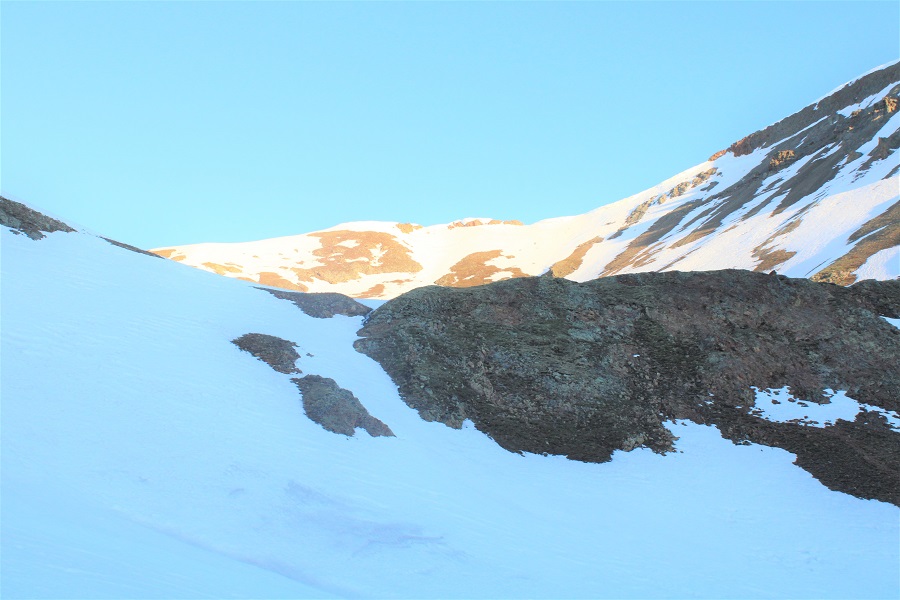
There was a lot more snow here than I’d expected: I put on my microspikes and climbed into the upper basin.
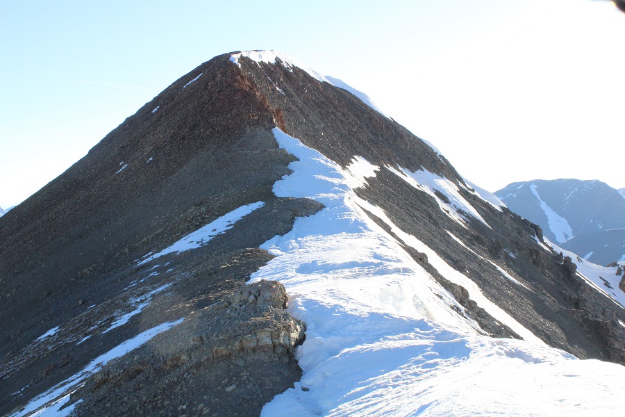
Once in the upper basin there was even more snow. Microspikes were still ok at this time, but I knew I’d want to take a different route down, as the sun was going to warm up this snow quickly and there was no telling how deep I’d be postholing. I aimed for the ridge, and once on the ridge, followed it west to a kind of saddle
At the saddle I turned right and followed the ridge northeast to the summit of 13540.
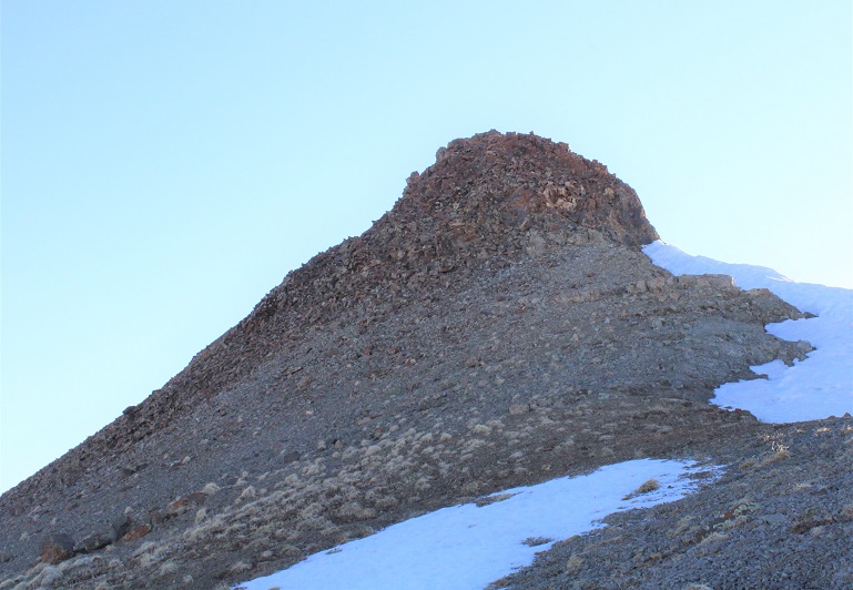
There was a class 2 rocky section to navigate. I just went up and over this.
Here’s a look at the summit
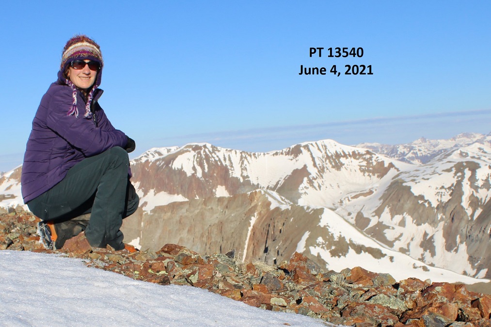
I summited PT 13540 at 7am
PT 13540:
Here’s a look back down at the upper and lower basins.
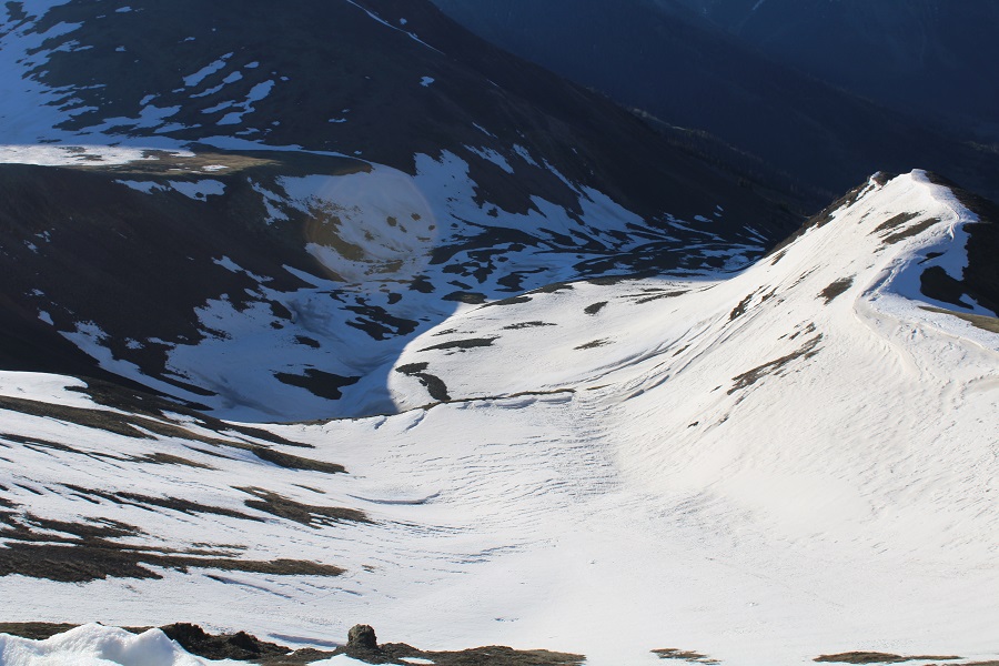
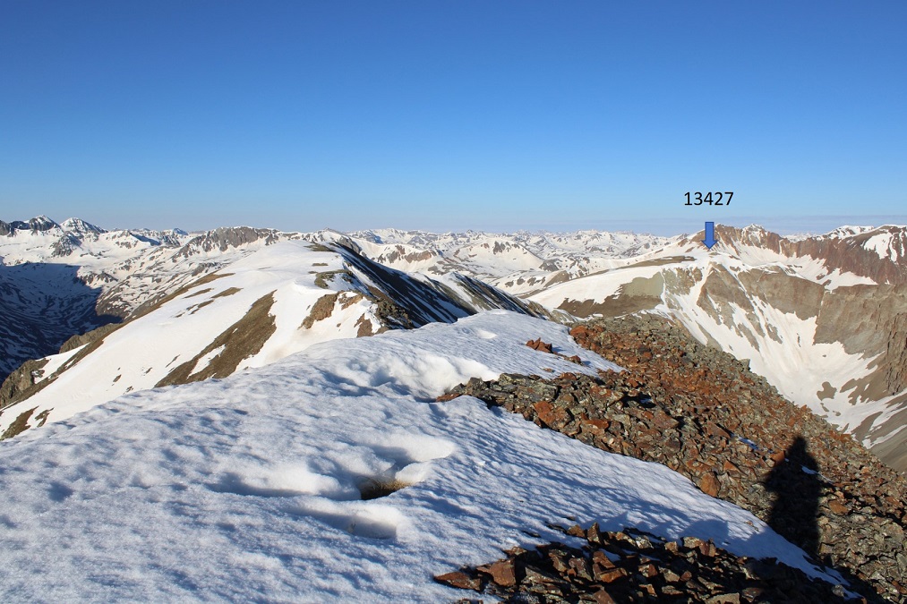
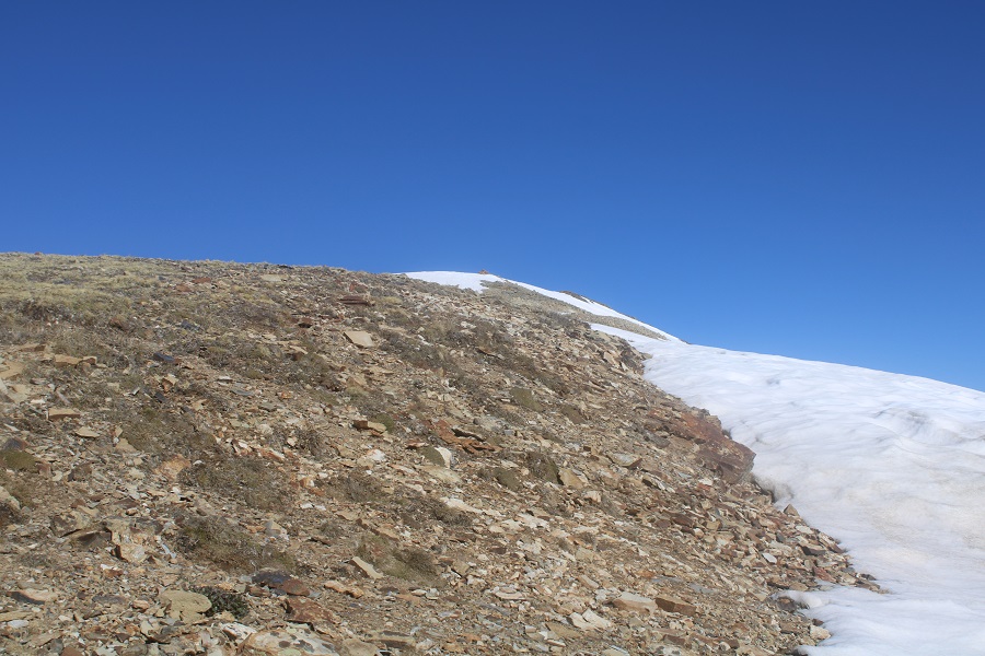
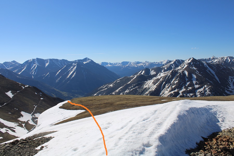
My next objective was PT 13427
Here’s the route to get there
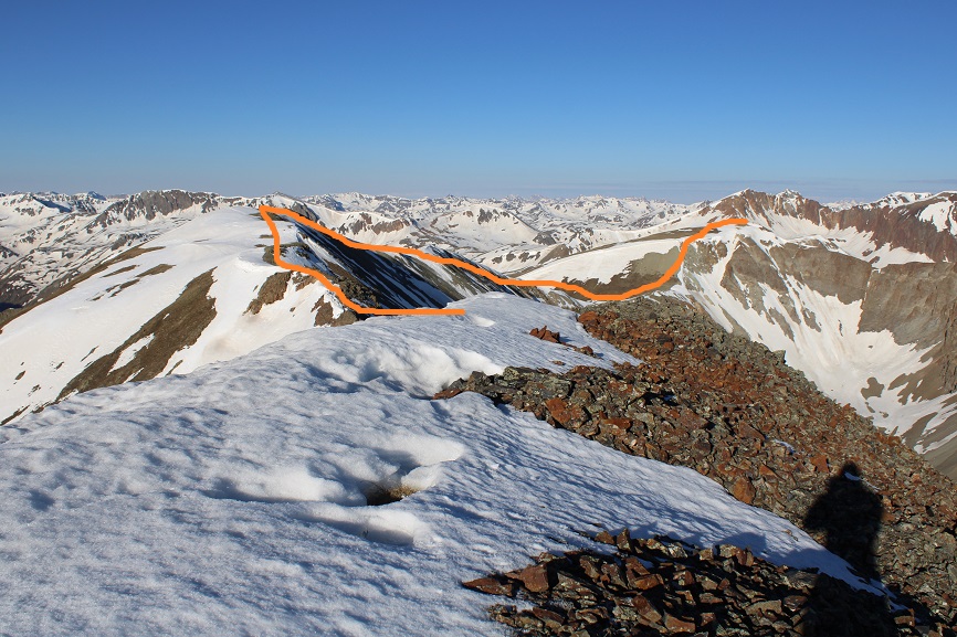
I turned and followed the ridge southeast. Here are some step by step pictures
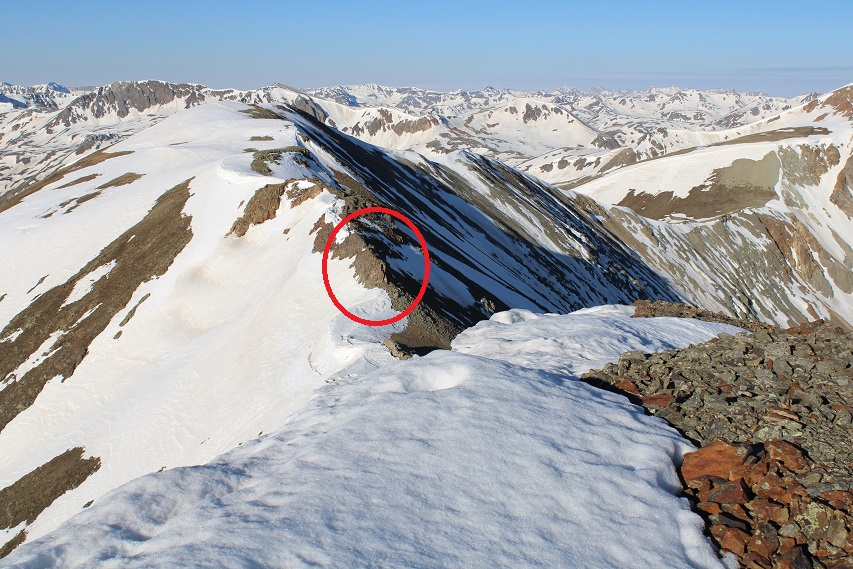
The area in the above picture, circled in red, is pictured below. I skirted this to the right
Then followed the ridge, glad I’d put on my microspikes
Eventually I came to an area where I started losing elevation. The snow was largely avoidable by sticking to the left on the ridge. I was a little worried about that cornice in front of me however
I lost about 475’ of elevation to the saddle
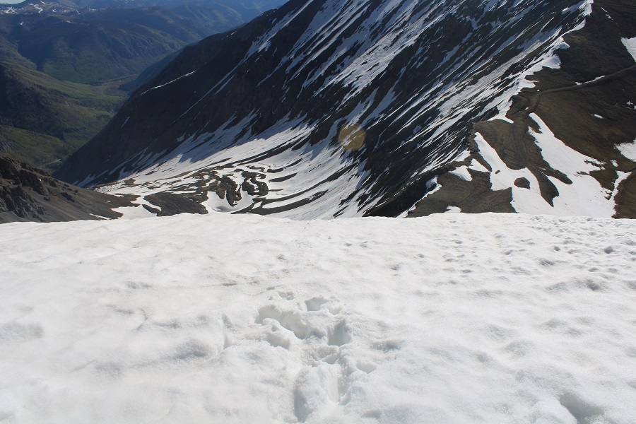
Then started up the east slope. This area was covered in scree, and quite steep. I kept eyeing the cornice, trying to find the best way to ascend. While I had snowshoes, I didn’t have crampons, so my microspikes would have to do if it came down to it. Here’s the path I chose to take to the summit, looking for a stable but accessible part of the cornice to climb.
When I got to the cornice, I was able to kick in steps with just my microspikes, although, lacking in forward facing spikes, they needed a little creative help from my ice axe at times.
Towards the top I started postholing as the cornice leveled out, and had to slide on my belly the last few feet to make it to the tundra. Once over the cornice the summit was obvious, to the north
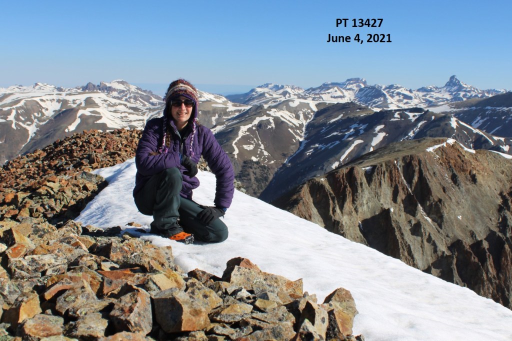
I summited PT 13427 at 8:30am
PT 13427:
Here’s a look back on PT 13540
It was still morning, but the snow was softening up quickly. I wanted to get back over that cornice asap. I turned and headed back towards the cornice
It was easy to find my entry/exit point, as I could still see the marks from where I army crawled a few minutes ago.
I did the same thing again, facing the mountain and using the steps I’d kicked in earlier. It was rapidly warming up: the tip of the cornice was now steadily reedripping water.
Here’s a look at the ridge back up towards PT 13540
I slid down the scree and followed the ridge back.
The snow was mostly avoidable until I made it to where the ridge kind of levels out for a while. From then on it was posthole city
I knew there was no way I wanted to re-enter those basins, so I decided to take the southeast ridge down. It parallels the basin, and while there was snow, a lot of it was avoidable. Where it wasn’t I was postholing. I had snowshoes, but was too stubborn to put them on. Here’s the overall route out
And step by step, first down the ridge
Then following Rock Creek back to CR 30
Here’s a picture looking up the ridge (in case you want to take the ridge up)
I came to the avalanche area, and it was then I realized a house had recently been destroyed (more on this in my next trip report on “C.T.” Peak).
I made it back to the road and followed it back to my truck
I made it back to my truck at 11:15am, making this an 8.95 mile hike with 4206’ of elevation gain in 7 hours, 15 minutes.
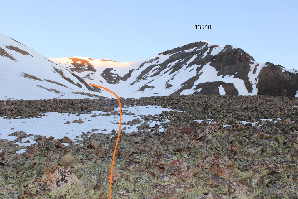
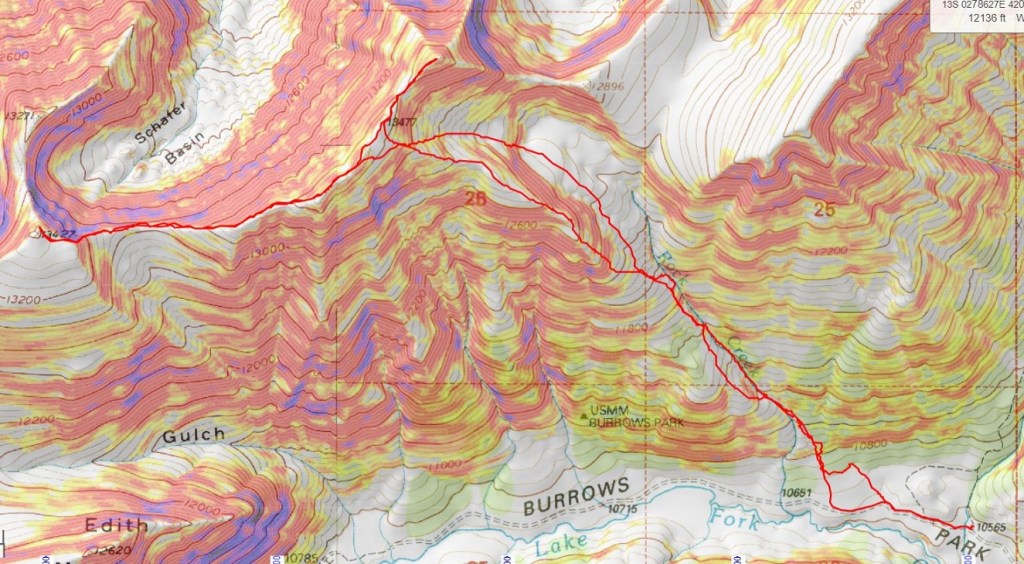
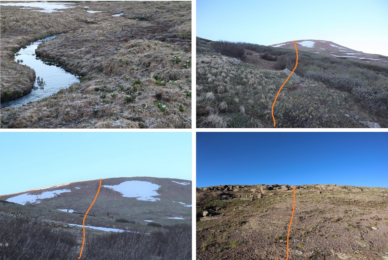
For reference, here’s a look at my route up to PT 13540 (solid line) and down (dotted line), as seen from the west ridge of “C.T” Peak.
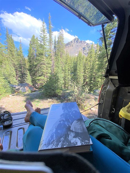
It was still early: I’d initially intended to add “C.T” Peak on today as well, but didn’t want to re-enter the basin with the way the snow was warming up, so I switched my plans and was going to do that peak tomorrow. Instead, I got out a book my daughter just finished reading and was eager for me to read as well so we could discuss it together. I walked around Argentum, found some old structures hidden way up in the hills behind my campsite, relaxed, and sipped whiskey. Dinner was a block of white cheddar cheese and some bacon. I had new neighbors, so I welcomed them, and then made it an early night. It rained.
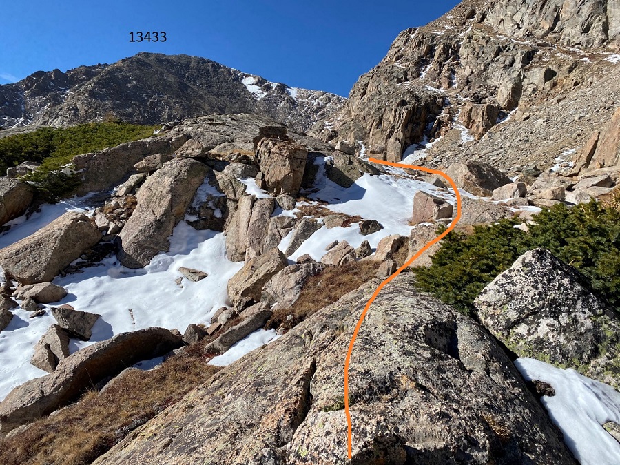
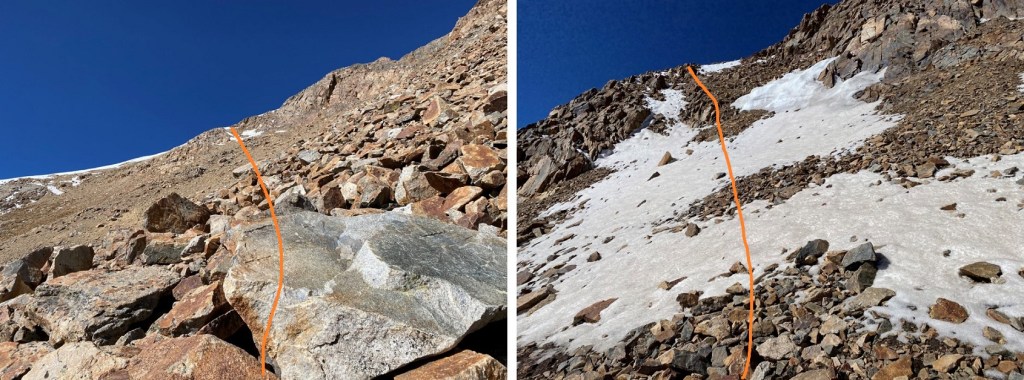
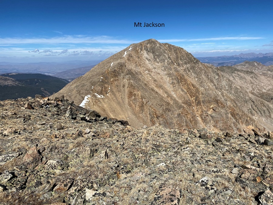
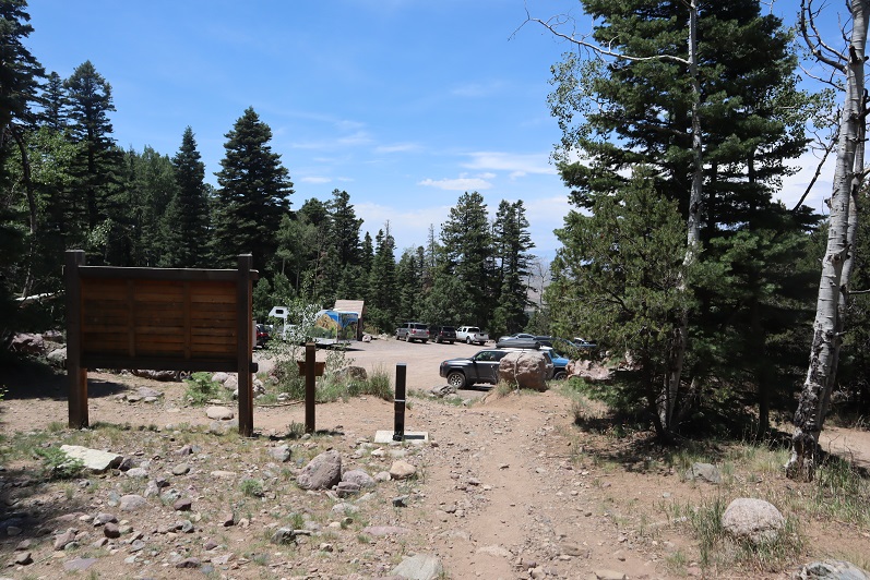
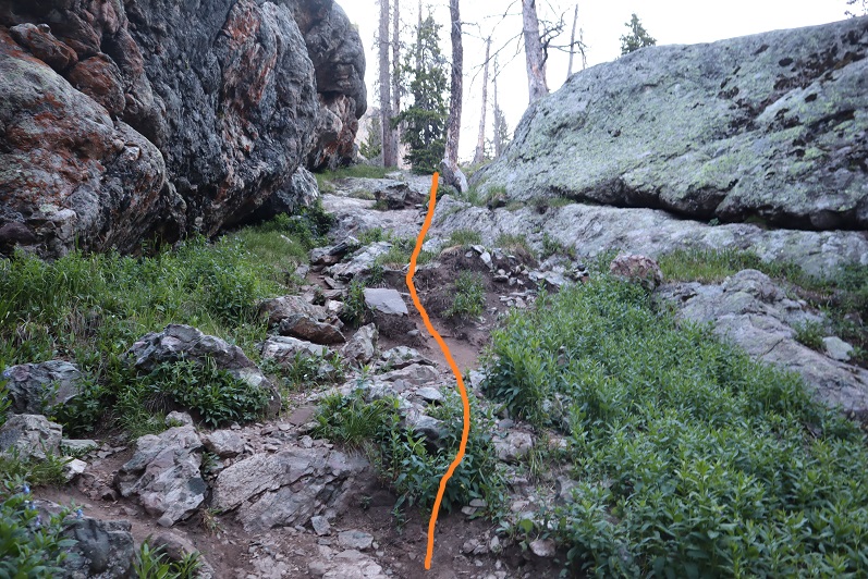
I’m not entirely sure why I chose this approach, but I wouldn’t recommend it; the route finding below treeline is arduous. In any event, if you still want to do this hike, this is how I climbed Mt Jackson and 13433.
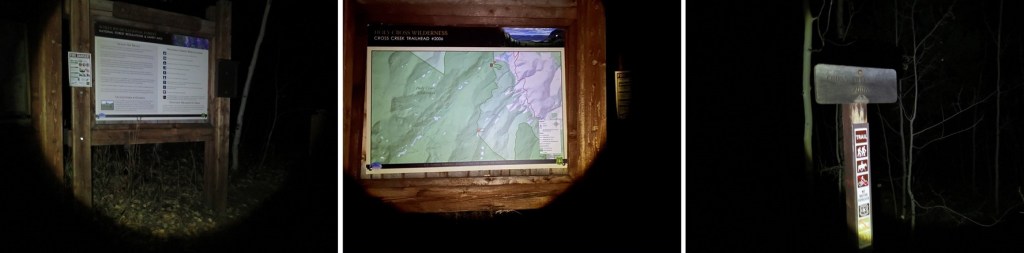
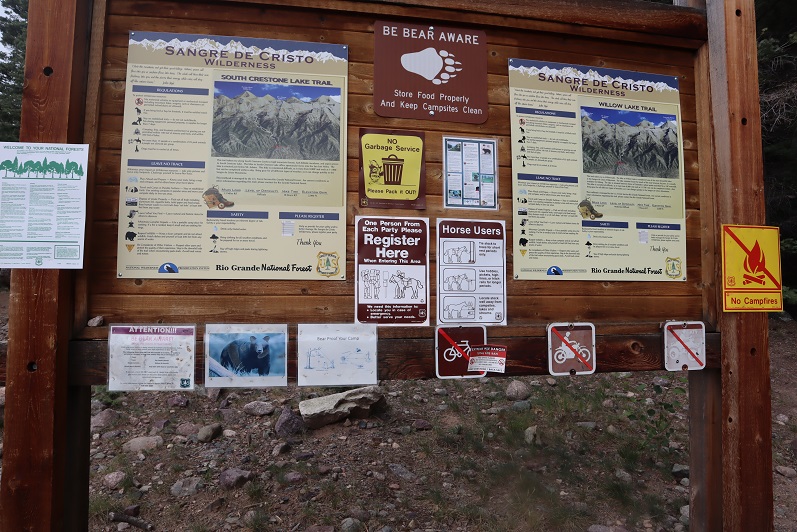
I arrived at the Cross Creek Trailhead and was the only vehicle in the lot. It’s a poorly designed lot that doesn’t offer much room but can fit 5-6 cars if everyone parks nicely. It looks more like a horse corral than a parking lot, and there’s not a lot of room to turn a vehicle around. There is parking across the way as well. I arrived and left in the dark, so unfortunately, no pictures of the trailhead. I was on the trail at 3:45am. Cross Creek trail starts behind obvious signage at the west end of the parking area.
This is an easy to follow class 1 trail. There’s a new bridge to cross over Cross Creek, and some nice stairs to ascend.
After hiking for 3 miles I came across some avalanche debris on the trail. As I was navigating at night I stepped over a log, and instead of hitting solid ground my right foot sank in watery mud up to my thigh.
I quickly extricated myself and did a quick assessment. My shoe and pants were soaking wet, cold, and covered in a layer of mud. It was only around 5am, 30 degrees outside, and I had a serious decision to make. Did I turn around now or continue hiking? I was worried I’d eventually have a Raynaud’s attack, especially if I didn’t dry out before making it to treeline (where it would be windy: I could already hear trees snapping all around me in the dark). I cursed myself for not bringing at least an extra pair of socks. In the end I decided the only way to dry off would be to keep moving, and I could do that either by heading back or forwards, so I continued on. I followed this class 1 trail for a total of about 8.5 miles as it paralleled Cross Creek, staying straight at the Grouse Mountain Trail Junction (but noting where it was in case I wanted to make this a loop).
After hiking for 8.5 miles I crossed a stream and the real route finding began
After crossing the stream, I turned right and headed straight up the mountainside, passing a small pond to my left. There is no trail here, and the bushwhacking is intense. I passed several sets of bear tracks while route finding here.
I’d gained 800’ of elevation in 1 mile heading northwest when I came upon a trail! Woot! This was a pleasant surprise. It looked like a game trail, but every now and then I’d see a cairn.
I followed this trail southwest for just over half a mile, until it suddenly ended.
There was a cairn here, but it didn’t seem to lead anywhere. I went about 20 yards in every pertinent direction and couldn’t locate a trail. The snow on the ground wasn’t helping. I got out my map and realized I’d gone too far south, so I turned right and headed north up this drainage.
At the top of the drainage I headed west. You can see how much fun route finding was here as well. I kept wishing for treeline so I’d have a visual of my route. On a positive note, my shoes and pants had dried out, so while I was still dirty, at least I was dry.
I also passed more bear tracks here. These tracks had a different gait than the ones I’d encountered before, so I figured there were multiple bears in the area.
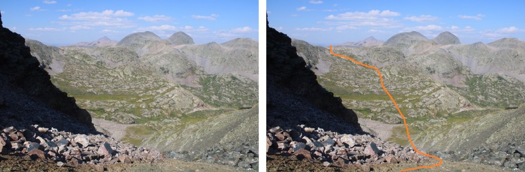
Hiking west eventually led me to a marshy area, and here I was finally able to get a good view of where I was headed
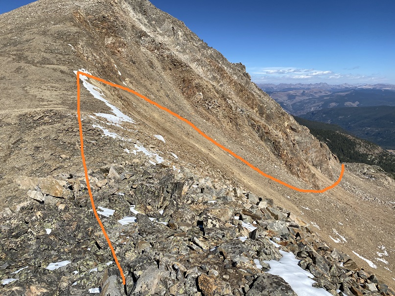
I skirted the marshy area to the south and then headed southwest. It’s important to head up over the rocky area and not stay low because going low will lead you to a large rock wall bordering a pond with no way to cross. Here’s an overall view of the route
And step by step up the (first) gully
And second and third gullies. This was really just one long gully that leveled out at times and started again. The snow was bothersome because it was sugary and every once in a while, I’d posthole. It did make me roll my eyes at being worried my feet would be wet from the swampy water: the snow had made sure of it.
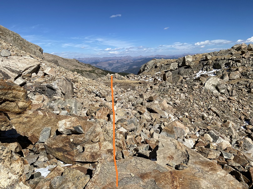
At the top of this long gully I continued southwest
Until I hit another (you guessed it) gully. It was here the battery in my camera died and I had to switch to using my cellphone (I’m still figuring out my new camera, and the battery seemed to die rather quickly).
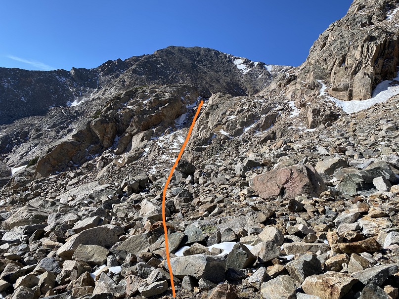
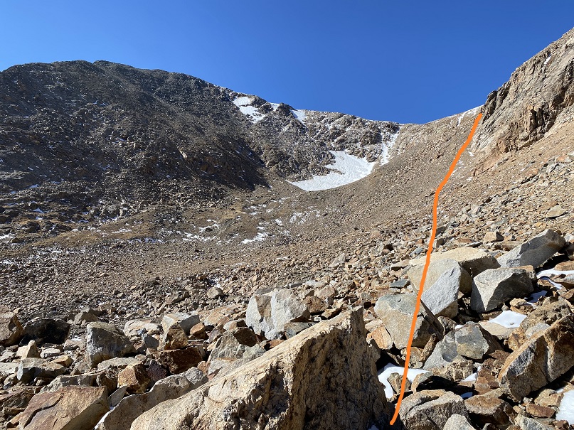
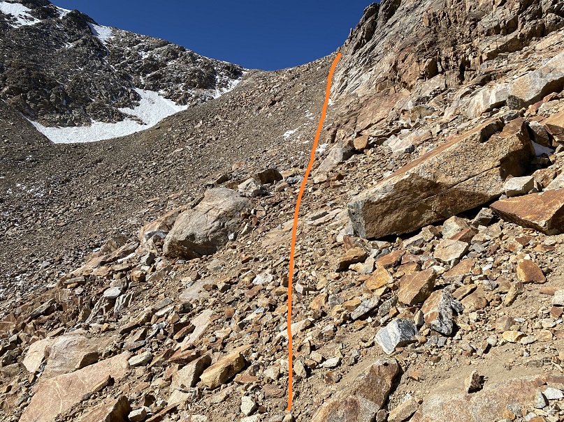
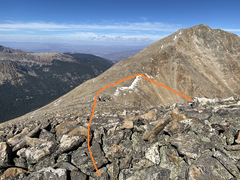
Here I got my first good look at the upper basin. There are several routes I could have taken from here. I’d heard there was a path up the north side of 13433, but I wanted to gain the saddle between UN 13433 and Mt Jackson. I figured my best shot for today would be to stay high and hugging the south side of Mt Jackson. Here’s my overall route
And step by step.
The ground here was surprisingly stable, I just had to watch out for rolling rocks every now and then
Here’s how I gained the saddle
Up until this point I wasn’t sure which peak I was going to climb first. I had the possibility of making this a loop (coming back down via the Grouse Mountain trail), but once I got to the ridge I was able to feel the wind I’d been hearing all morning. Winds were predicted at 20-25mph, sustained, with 45mph gusts. They were at least that. And brutally cold. I wasn’t sure I was going to be able to make one mountain today, let alone three. I got out my balaclava and heavy-duty winter gloves, turned right, and headed north to the summit of Mt Jackson. This was a fairly easy ridge hike.
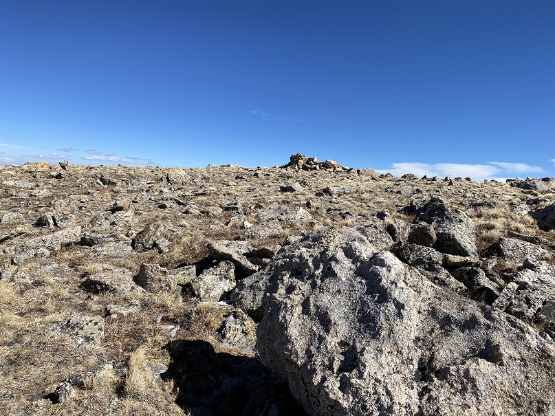
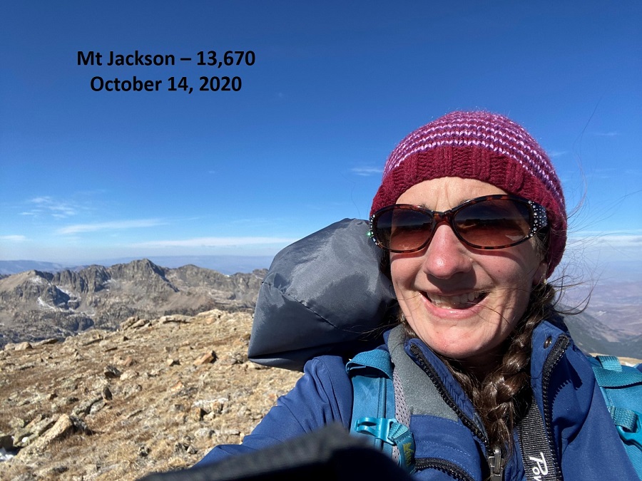
I summited Mt Jackson at noon. The summit was relatively flat.
Mt Jackson:
The wind was blowing so hard all the straps on my gear were slapping me in the face and several times I had snot fly into my sunglasses. Ah, to be a mountaineer! I turned and headed back the way I came, bracing myself against the wind as I made my way towards the Mt Jackson/13433 saddle.
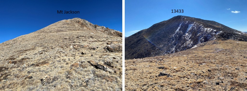
From the saddle here’s looking back at Mt Jackson and up at 13433
It was a short and simple ridge hike to the summit of 13433. I summited at 1pm.
UN 13433:
Here’s a view of Mt Jackson from 13433
At this point I couldn’t feel my fingers, so I quickly retraced my steps back to the saddle. The wind refused to let up, and was blowing loudly long after I left the ridge. I saw two crows playing with the currents above the saddle.
Here’s my route back down into the basin
And down the gullies
Here’s how I ascended the rock to avoid the pond to my left
And headed back out of the marshy area
Let the route finding begin again. I tried to re-trace my steps, but it just wasn’t happening. I kept looking for my original route in, but finally realized that wasn’t going to happen. I knew Cross Creek Trail was below me, and as long as I headed down and east I’d eventually run into it. So I headed east.
After wandering down and east and down and east I connected up with Cross Creek Trail and followed it back to the trailhead. I heard trees snapping in the wind the entire hike back. They’d make a loud, booming sound I initially thought was rockfall, except there were no reverberations from rockslides, just a loud crack and boom!
I got back to my truck at 8pm, making this a 28.33 mile hike with 6674’ of elevation gain in 16 hours, 15 minutes.
I chose this peak for today because it was the closest one on my list of unfinished bicentennials to Cielo Vista Ranch, where I’d just spent the morning hiking. I drove to the Willow Creek Trailhead and backed into the only available parking space. Vehicles were parked and double parked in each space, as well as several hundred feet down the road on the drive in. This is a popular trailhead and it was a Saturday afternoon.
It was raining a bit as I got out and looked around. There is an open and stocked bathroom here, and lots of signage.
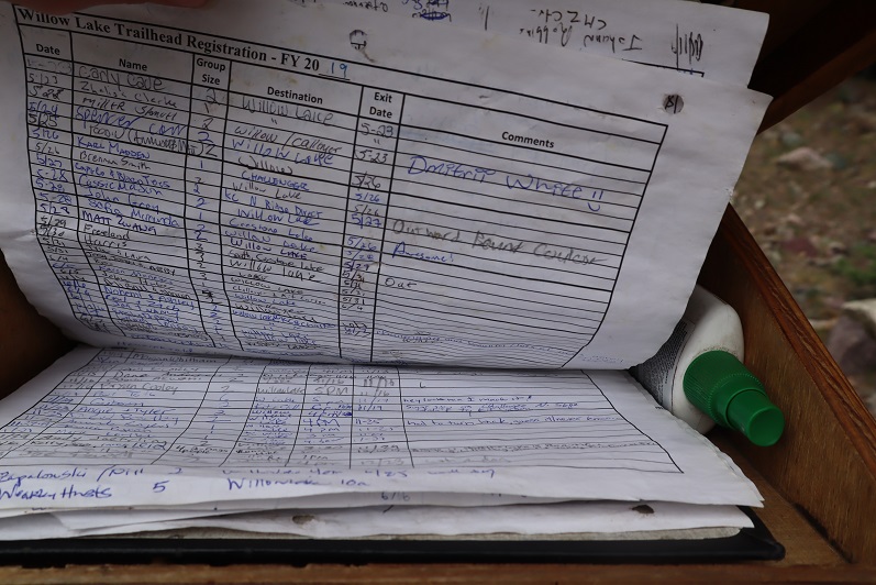
I opened the trail register container and was disappointed to find another full register. Every page was so full people were just writing in the margins of past pages. This one is from 2019. There were probably 7 pages total, which could probably get filled up here in a week. How are these useful when they aren’t kept up to date? Signing these seems useless.
I went back to my truck and got my stuff ready for the hike tomorrow. I didn’t have a flashlight so I decided to use my phone’s flashlight app. That meant conserving battery, so I put it in airplane mode. Then I people watched. There was a man hiking with a small dog in a basket, a group of about 20 high school aged backpackers returning from what looked like their first outdoor experience, and two men hiking in to Willow Lake to summit Challenger and Kit Carson tomorrow. I spent a good 30 minutes watching a man trying to turn his pulled trailer around in the parking lot. He must’ve been looking for a dispersed camping spot and wasn’t able to find one before the trailhead. Turning his rig around in the parking lot of the Willow Lake trailhead was his only option, and it took dozens of attempts. His rig was loud and he set off several car alarms in the process. It was all quite entertaining.
When the mosquitoes came out I decided to call it a night and went to bed early. I woke up at 2:30am, decided I was way too comfortable, and went back to sleep. The only bad thing about having a bed in the back of my truck is I don’t seem to want to get up in the mornings. I was on the trail by 4am.
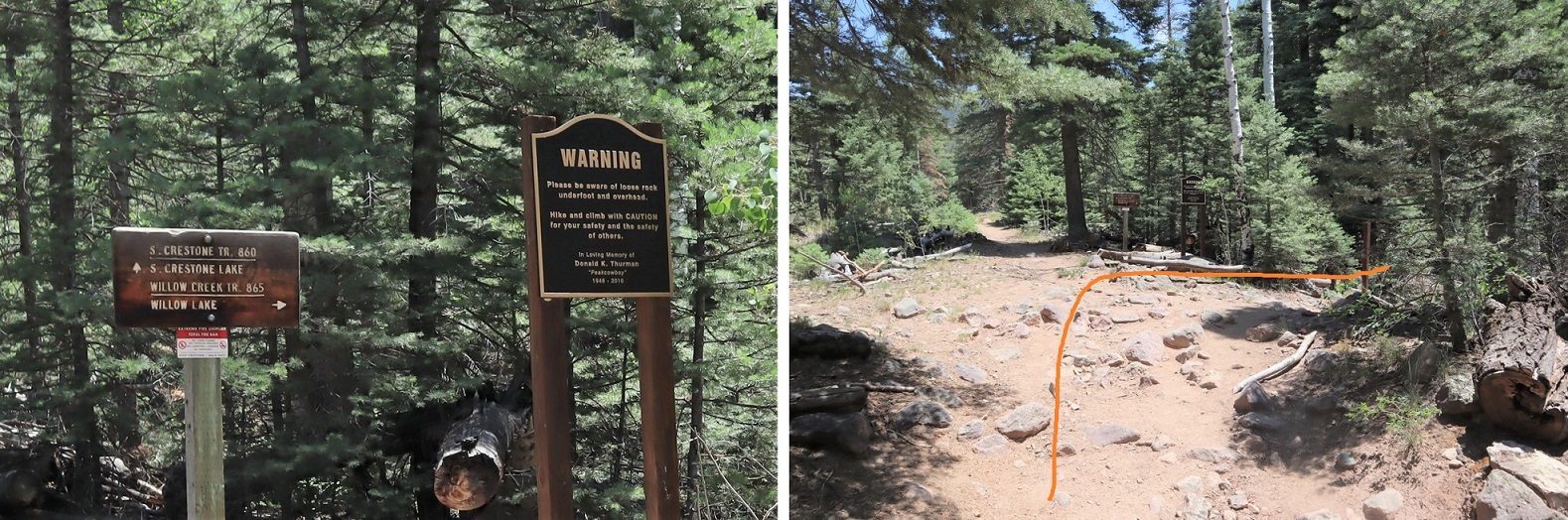
The trail starts at the east end of the parking lot and almost immediately comes to a junction. I turned right here, crossed a creek, and continued on a sandy trail.
During the first mile of this hike, as I was hiking in the dark, I kept hearing chirping. It sounded like one of those bird boxes that’s put in the middle of nowhere to monitor birds and chirps every few seconds was out there somewhere, and broken. It wasn’t chirping on my way back, so it either ran out of battery or was an actual bird going crazy at 4am. The Willow Creek Trail is a class 1 trail that switchbacks all the way up to Willow Lake. Here’s an overview
And some pictures of the trail
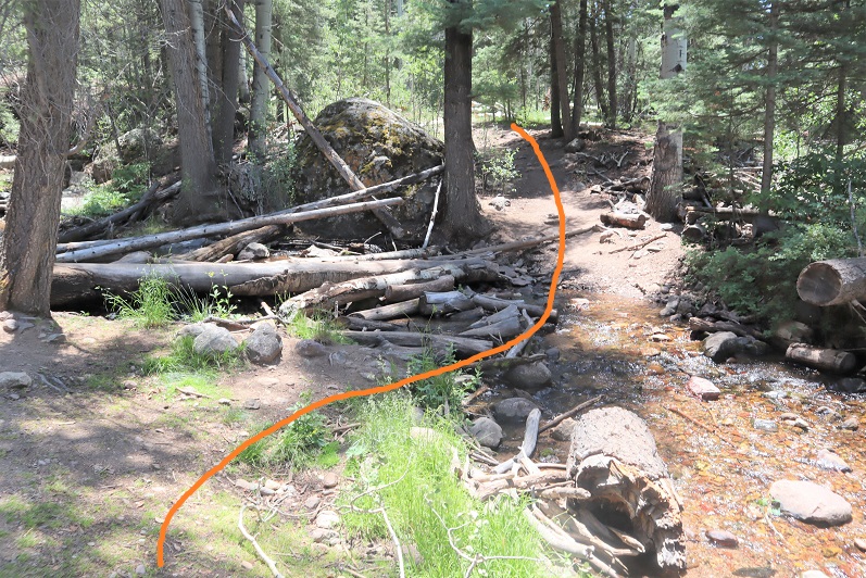
There are a couple of streams to cross, each with bridges/rocks
Before making it to the lake there’s a camping area. Someone has set up communal bear bag hanging areas, which I think was a brilliant idea. What’s even better is people actually seem to be using them. I saw two such areas, but there may be more.
After the camping area it’s a short distance to Willow Lake. I went up this rocky area
And was greeted by this sign and the lake. I turned left at the sign
I made it to Willow Lake after 5 miles of hiking
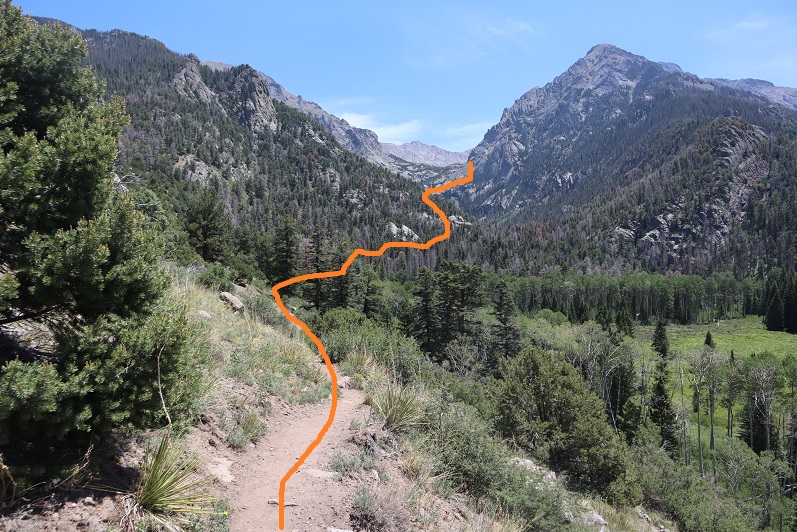
I continued following the trail until just before the boulder field. At this point I left the trail, turned left and continued north/north west up the hillside
There is no trail, but the route is easy to follow, as after I gained this small ridge I kept the creek to my left and willows to my right and continued north up to the basin.
It’s important to try to stay as much in the center here as possible, as to the right there are willows and shallow ponds to contend with. (I made this mistake on my way in, but was able to avoid it on my way out. I scared several deer out from willows in the process.). At the end of the basin you turn right and head east
This area was a bit mushy, so I went to the right around this rock/water to avoid getting wet, and then entered another basin
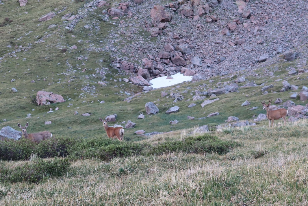
There were a lot of friendly deer here who didn’t seem to mind my hiking past them. I gave them room, but they let me get within 20 feet of them with no problem.
I headed east into the second basin, which was full of large rocks
There are a lot of ways to summit this point. I decided to gain the ridge and follow it to the summit of PT 13580
Once on the ridge it was an easy hike to the summit. The only problem was the sun was rising directly in front of me as I was hiking and I couldn’t see anything due to the glare. These pictures are from the way back down. While hiking up this ridge I heard someone from over on the Kit Carson/Challenger side yell “rock!” every couple of minutes. It’s amazing how sound carries out here.
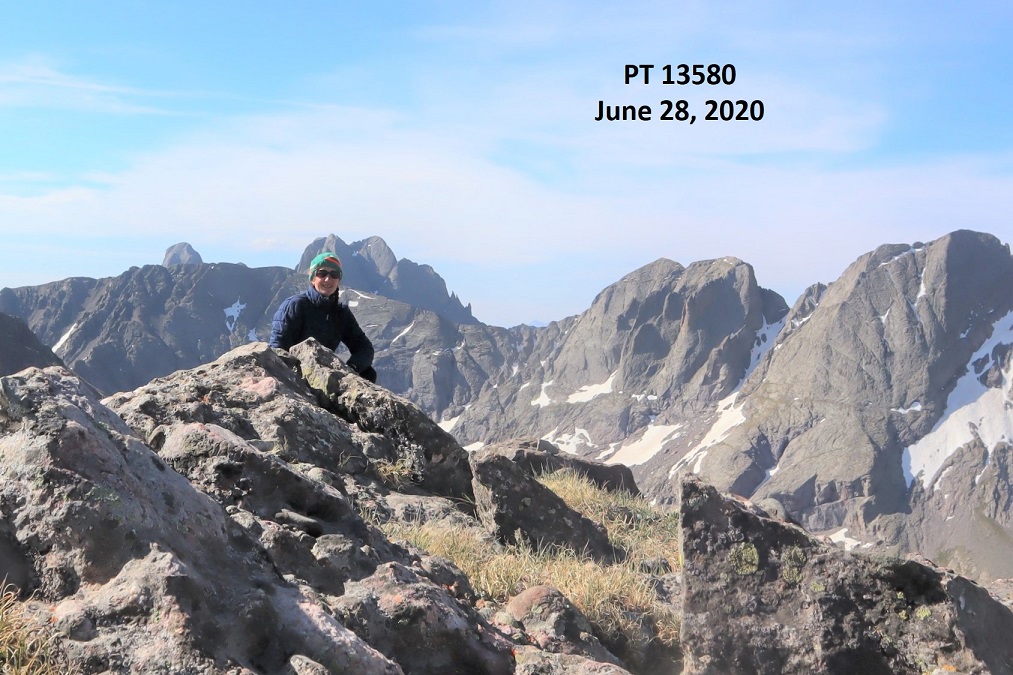
I summited PT 13580 at 8:45am, after 6.8 miles of hiking
13580:
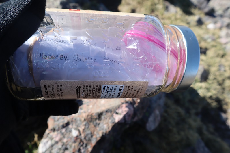
There was a summit cairn at the top, as well as a summit register. I didn’t open it, but I could read through the glass it was recently placed there (6/20/2020?)
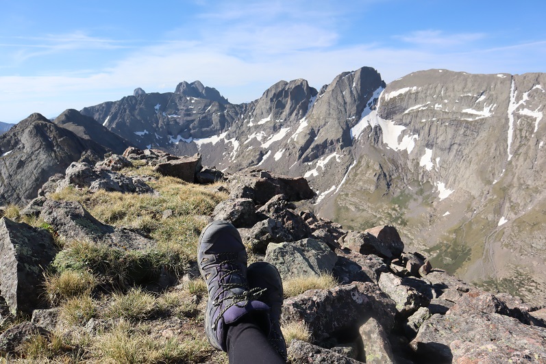
It was a beautiful day and I stayed for a long time on the summit, enjoying the views
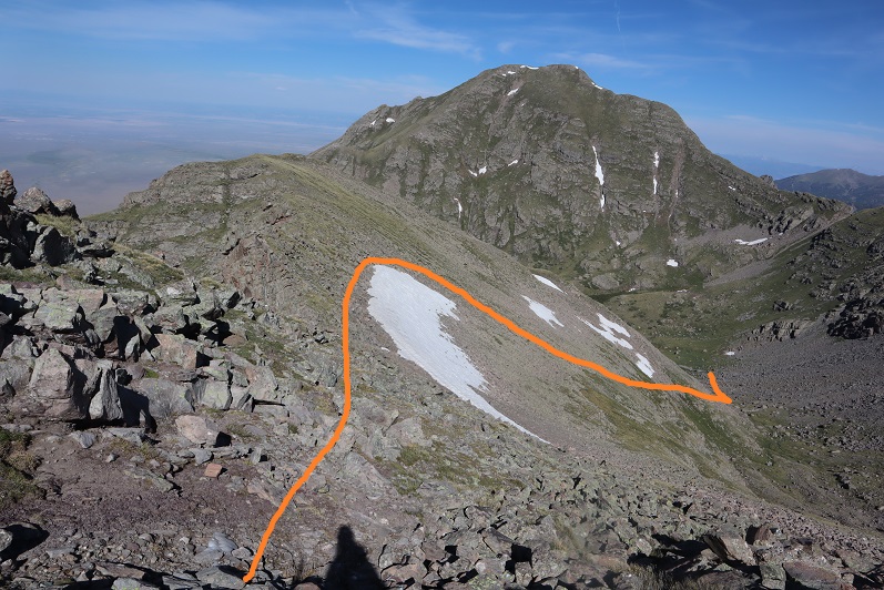
When it was time to go I retraced my steps back down the ridge into the basin. Here’s an overview, with Willow Lake to the south
And step by step…
Staying higher and dryer this time in the lower basin
It was easier this time to avoid both the willows and the creek
Once Willow Lake was in view it was easy to make my way back down to the trail
There are some beautiful waterfalls here
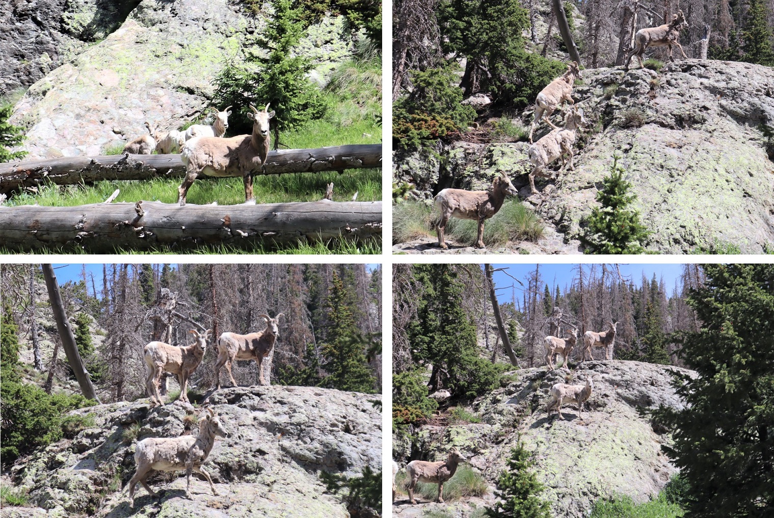
I made it to the camping area and was startled to see bighorn sheep just off the trail. The camping area was full of tents but the hikers were all out hiking. It seems while everyone is out hiking for the day the sheep came to play. They posed for me while I took a few pictures. Yes, they were a little unkempt, but friendly enough.
Here are some shots of the class 1 trail back down to the trailhead
I made it back to my truck at 12:30pm, making this a 13.38 mile hike with 4934’ of elevation gain in 8.5 hours. Here’s a topo map of my route. Oh, and just for reference, using my iPhone’s flashlight took up 66% of it’s battery in 2 hours (while on airplane mode).
I drove back home, cleaned up, and noticed I was full of mosquito bites. Curiously, they were only on the left side of my body.
I woke up before my alarm again today, but not because I was well rested: I was cold! As I turned on a light I realized I only had half of my blankets covering me. There wasn’t any wind last night, and when I looked outside I could see tons of stars. The clear skies had made for a cold night. I jumped in the cab of my truck to warm up and get ready for the day, noticing it was 32 degrees outside (as compared to yesterday morning’s 43). It was amazing what difference a few degrees makes.
I turned the truck on to turn on the heat and was once again disappointed to notice my ABS and Traction lights were still on, as well as my 4WD light still blinking. That was going to haunt me all day.
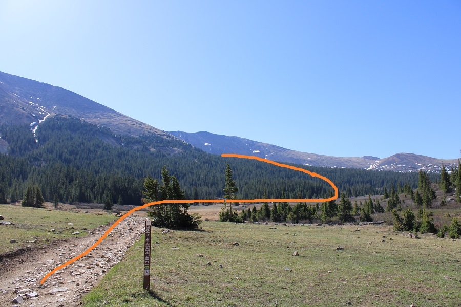
I was on the trail by 3:30am, and it was so cold I turned back at one point, intent on sitting in my truck a little longer, but I immediately turned back again: I’d knew I’d warm up a bit once I started moving. The weather forecast was better for today, but I still wanted to get an early start. I followed the 4WD dirt road 821 to the class 1 Trail 813 as it lost a total of 400’ as it wound down the canyon, and then gained almost 1000’ to the top of the pass.
There was one small section of snow to cross, but luckily the elk had already done a great job blazing the trail.
Once at the top of the pass I continued along the trail, dipping down into the basin, losing another 700’ of elevation.
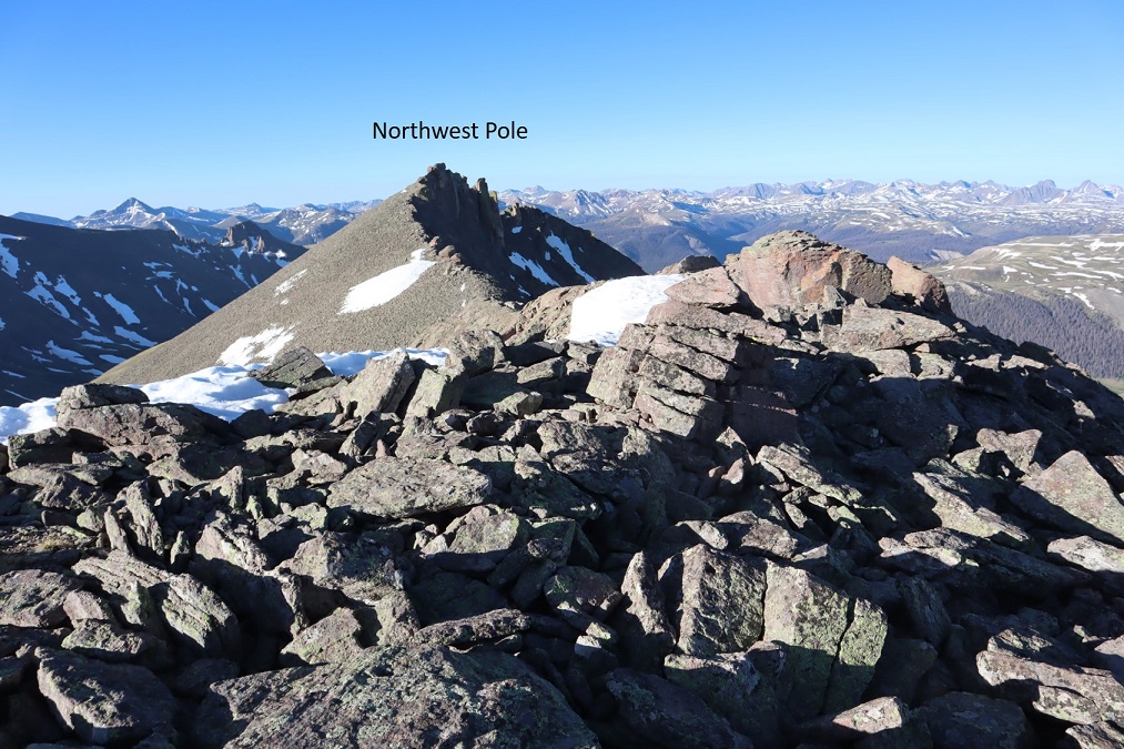
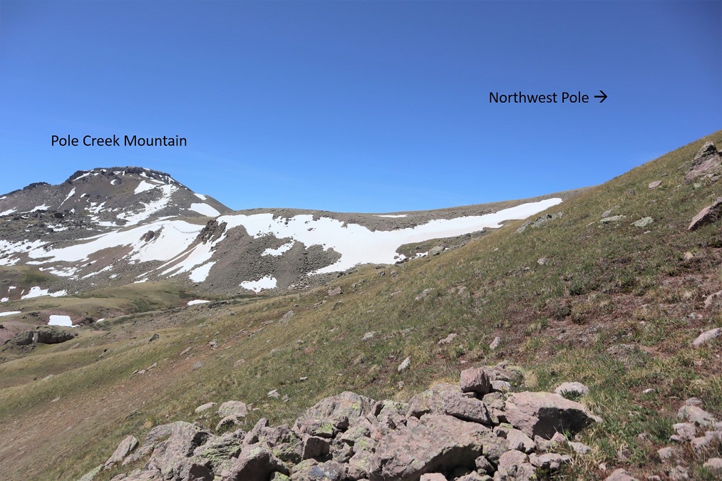
After hiking for a total of 5 miles at this junction I turned and followed 822 southwest to the base of the Northwest Pole Ridge.
In the basin I left the trail and headed for the Northwest Pole Ridge
My goal here was to gain the ridge and follow it to the summit of Northwest Pole. Here’s an overview of the route:
And what it looks like gaining the ridge (yes, tons of elk out there today). Also, the basin was marshy, but since it was so cold and early in the morning it was frozen and crunchy. There were ribbons of water that I hopped across. I wouldn’t want to pass this area when it’s soggy and wet.
Once on the ridge it’s easy to see the snow free path to follow, all on tundra. This is all easy class 2
From the top of the ridge you dip down a little bit and then back up on loose rock
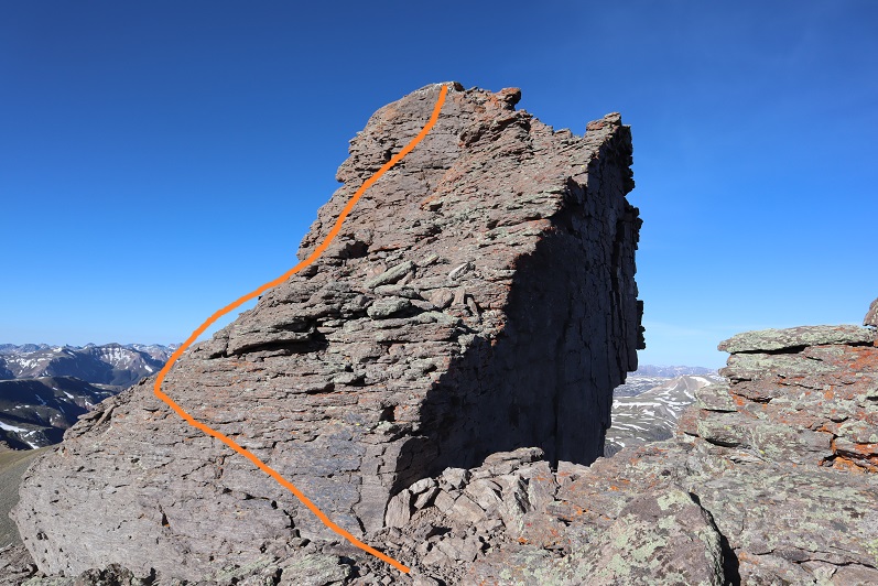
The crux of this climb comes at the very end. I spent some time trying to figure out how I wanted to summit. At first I tried to gain the block at the area where all the bird droppings were, but it didn’t look like it was the easiest way. Next I tried summiting up a chimney, but about halfway up I knew I’d need rope to get back down (I’m short) so I stopped and looked for another route. In the end I was able to summit by going up the area with all the bird droppings, just from a different angle. There is a lot of exposure here and small scree on the rocks, making it slippery and a fall dangerous.
Here’s the route I took:
I aimed for the bird droppings. Here’s what that looked like from a couple of different angles.
From there I traversed along the exposed edge towards the summit.
It looks easy, but this is the exposure, and yes, it included a trust jump (once again, I’m short, it could have been more of a long lean for someone over 6 feet tall, but I had to jump). Here’s looking back on the jump area (it’s too difficult to see in a picture coming from the other way, but this picture offers a good look back on the ridge too)
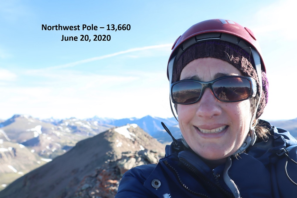
I summited at 9:45am
Northwest Pole:
Here I am getting ready to jump the area on the way back.
And from the top where the bird droppings are back down. Yes, it’s as steep as it looks
Back on solid ground I took a picture of the summit block and how I traversed it. I circled where I jumped.
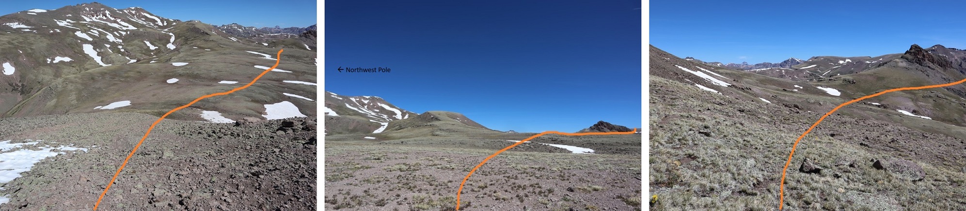
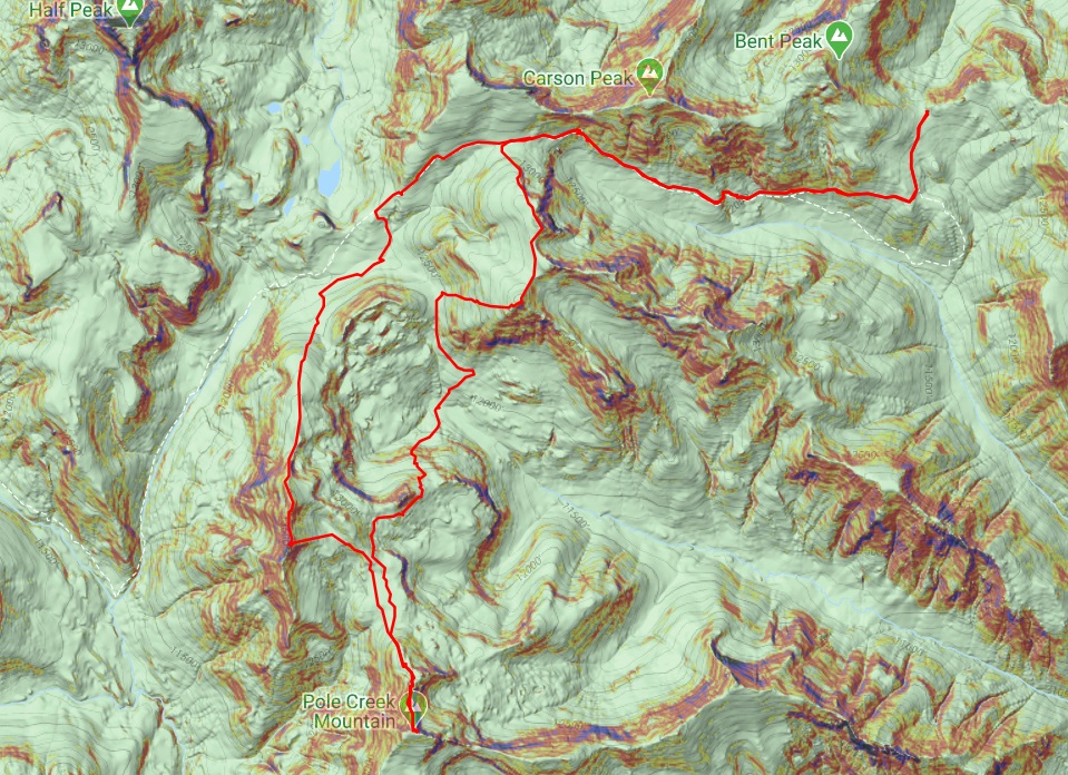
Time to head over to Pole Creek Mountain. Here’s an overview of the route from Northwest Pole
I descended east towards the basin, first on loose rock that gave way to tundra, losing 850’ of elevation, crossing a stream, and heading back up towards Pole Creek Mountain.
Here’s looking back at Northwest Pole
I continued southeast towards Pole Creek Mountain. Here’s how I ascended; the snow was easy to avoid, and I used it to track where I wanted to go:
After ascending the ridge I aimed for the access gully, which had snow but enough dry areas to pass easily without traction
Then I just followed the ridge south towards the summit
I summited Pole Creek Mountain at 9:45am, after almost 10 miles of hiking
Pole Creek Mountain:
I headed back the same way I’d come in, following the ridge and then going back down the small access gully. Everything looked totally different on my way back and I second guessed myself a few times, but keeping Northwest Pole in sight helped.
Once back down in the basin between Pole Creek Mountain and Northwest Pole I wanted to stay high on my way back out to avoid the snow below Pole Creek Mountain to the east
I headed north, and then east around this small peak.
There was some snow here, but elk in the area make a great trail and traction wasn’t needed
I rounded the east side of the small peak
And unexpectedly came across a small herd of elk! This was so cool! I’ve heard of elk doing this, but I’d never actually seen it before: the mama elk were laying in a circle, with the babies laying down inside and two sentries standing guard. I saw them a split second before they saw me (the wind was blowing towards me, so they hadn’t heard/smelled me) and I was able to get a picture before they took off
As soon as one of the elk standing guard saw me I could almost hear him say:
“See? This is why we always employ the safety circle! Always! This is not a drill! Move! Move! Move!”
And they were off and down the hillside, out of sight.
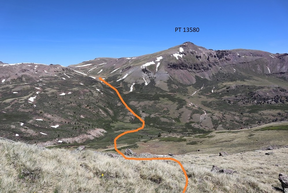
Well, that had certainly been a neat experience! I continued rounding the peak and then made my way down the hillside, all the way to the basin floor. Here’s an overview of the route I took
And looking back, here’s the route I took down into the basin. For obvious reasons I’m now referring to this as “dementor ridge”
Once in the basin I was at the lowest elevation I’d be at all day, and still had a lot of hiking left to do. I aimed northeast until I hit a trail, and then followed it up. This was trail 822 that would bring me back to Trail 813 (if I chose to go that route). This was actually easier than it looks because there are a lot of good elk trails in the area, passing through the willows.
I followed the trail to a sort of a saddle, and stopped to think
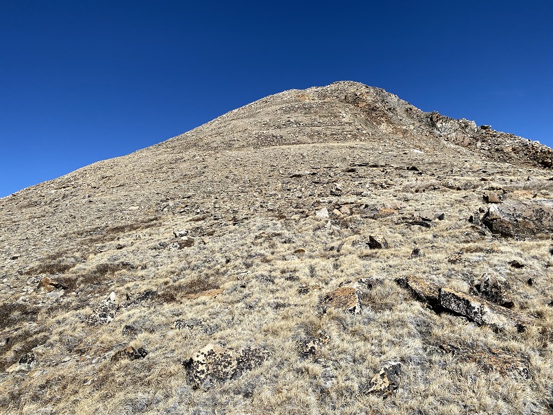
From here the trail obviously dipped down once again, losing several hundred feet of elevation before reconnecting with Trail 813 and gaining the pass, then dipping back down into the basin and up again out. Here I was, sitting directly below PT 13580, a ranked 13er that I’d want to hike sometime in the near future, but in which I dreaded that drive into Carson Pass that would be necessary again next time. It was still early in the day and the weather was great. I decided to just summit PT 13580 now while I was in the area. I’d done some scouting yesterday and today, and I was sure the route from the summit of 13580 back to the pass ‘went’ easily and would be snow free. I turned right and headed east up the mountainside. This was a very straightforward hike up tundra
At the top the tundra turned to rock, all class 2 and easy to navigate
At the top of this rocky area was the summit. I summited at 2:15pm
PT 13,580:
Here’s a look back at the route
Now I decided to stay high on the ridge and aimed north, following the ridge towards the peaks I’d climbed yesterday
And then back down to the pass and trail 813
The hike out was uneventful. It was a beautiful day and I just followed the class 1 trail back. Oh, and I saw the moose again, in the same spot as yesterday.
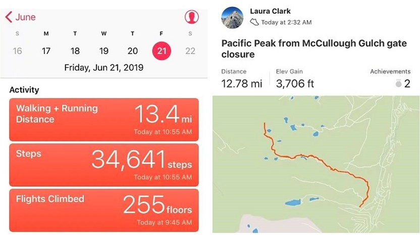
I made it back to my truck at 4:15pm, making this a 19.67 mile hike with 5926’ of elevation gain in 12 hours, 45 minutes. Here’s a topo map of my route:
When I made it back to my truck I noticed a marmot running out from underneath. Great. I decided it would be best to try to drive my truck down today in the daylight in case I got stuck, but because I also didn’t want to encounter other vehicles (if possible) I decided to eat dinner first and take my time. Also, I wasn’t even sure yet my truck would drive.
When it was time to go I was able to get the truck to move and tried to see if I could get 4WD to engage by driving the truck around for a bit, but that didn’t work. So I decided to just go for it and head back down the road, going as slow as possible. I probably maxed out at 2mph. When I got to about a mile from the end of the 4WD road I saw another vehicle turning around. It took them 20 minutes to do so, and by this point I was feeling pretty confident about my truck.
I made it back to the 36, kept trying different things to get my 4WD light to stop flashing and realized it was hopeless. I drove home and the first thing the next morning went to the dealership. The diagnosis: rodent damage. One of those darn marmots, chipmunks, pikas (etc.) had bitten through the wiring. Luckily it was fixable, and I was out of there within a few hours. They put rat tape over the wires to hopefully prevent this from happening again. I’d never heard of rat tape before, but it sounds like it should be on all wires.
I consider myself lucky: after years of leaving my truck in the backcountry this is the first time I’ve ever had this issue where it’s caused concern. I’ve chased some porcupine’s out from underneath my truck before, but that was before any damage was done.
I’ve done some serious thinking about the issue, and I think a physical barrier is the only way I’m going to keep rodents out. So here’s my idea: tomorrow I’m going to Home Depot and buying a large tarp and some bungee cords. When I park at the next trailhead I’m going to lay out the tarp, drive over it, and then secure it around my truck with bungee cords to prevent critters from getting underneath.
This is just a thought at this point, but something I hope to implement and test soon.
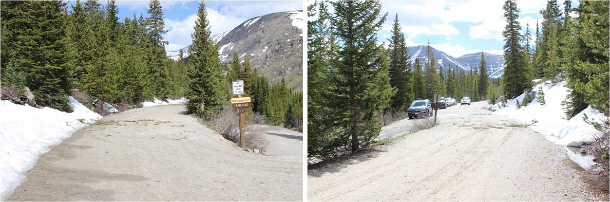
There are so many routes up Pacific Peak I wasn’t sure which one to take? I ended up making the decision the night before, and decided on the Southwest Slopes because I liked the way it looked best on a topo map (particularly the headwall area). I arrived at the Blue Lakes road and found the gate closed to the McCullough Gulch Trailhead. So I parked at the closed gate, right next to a small stream of water running off the road. I gathered my gear and was off at 2:30am.
About 20 yards into my hike I heard a loud noise that sounded like a large animal slipping and sliding on the scree below the road and to the right of me. Well… at least whatever it was was running away from me. Quickly. The 2WD dirt road to the trailhead was clear, dry, and easy to follow. I was confused as to why it was still closed, since besides some extremely minor avy debris and a short area with water running by the side of the road, the road was clear.
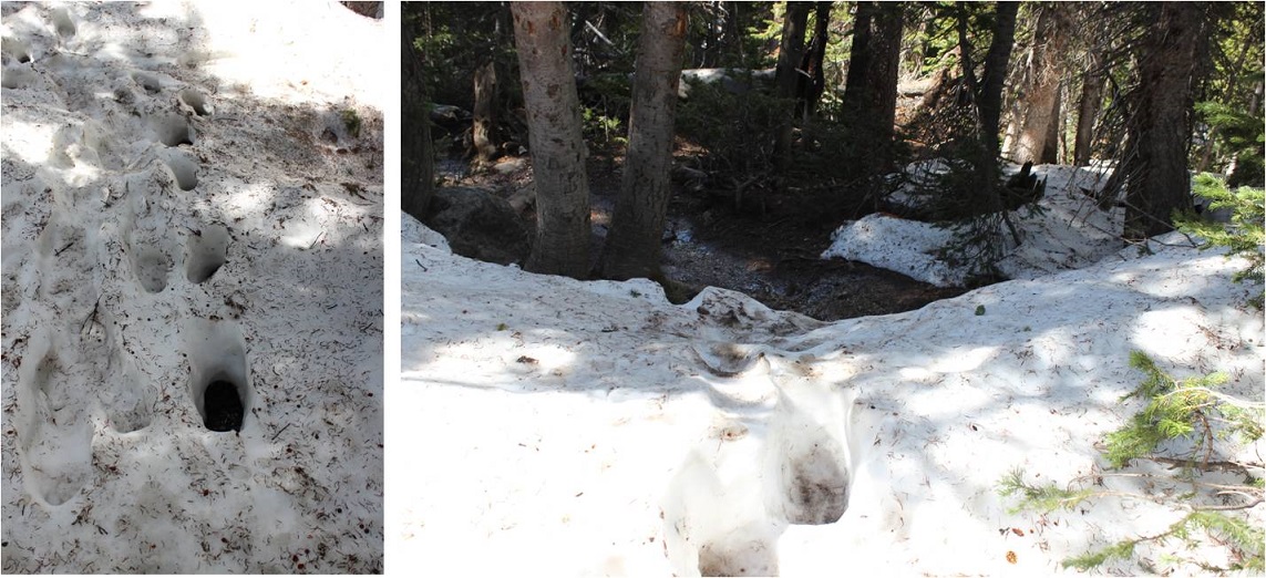
I hiked on this dirt road for 2.2 miles from the closed gate to the start of trailhead. This is where the snow started, and in the dark obscured the beginning of the trail.
For the next mile the snow was intermittent and soft. I’d need snowshoes for about 30 steps, then not need them for dozens of yards, and then I’d need them again for 30 steps or so.
I crossed a bridge
And headed left on a trail (the road ended here)
This is where I put snowshoes on and wore them for the rest of the hike. This is also where the trail finding became difficult. I kept losing and finding the trail and losing it again, so I gave up trying to stay directly on trail and just headed northwest, keeping the creek to my left and the ridge to my right.
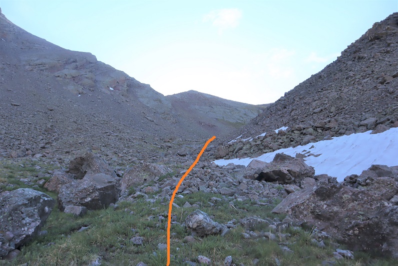
At the end of the boulder field I came across a sign indicating the trail kept going straight. Here I turned right (at the cairn) and followed the gully up and to the northwest, avoiding the large boulders
At the top of the gully I rounded the hillside and was deposited below a lake. I walked around the right side of the lake, found the rock rib, and decided to climb the snow next to it to the notch(so I didn’t need to take off my snowshoes again).
Here’s a look back down from the notch
I was at the top of the waterfall area and just needed to turn the corner to the right to see more of the basin
Wow! Lots of snow here! I headed northeast, skirting what was probably a small lake to my left and couldn’t help but wonder how many feet of snow I was standing on top of? Way to go June 2019 in Colorado! You’ve got the snow thing down!
I kept rounding the basin, staying to the right
Once again: So. Much. Snow! I kept heading northwest towards the end of the basin. It’s best to stay high here so you don’t have to regain elevation.
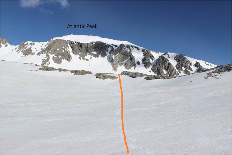
I made it to the headwall. This is the crux of the route, and I decided it was time to take off my snowshoes and put on my crampons. I got out my ice axe and garden tool (haven’t purchased a second ice tool yet). The sun was just starting to rise
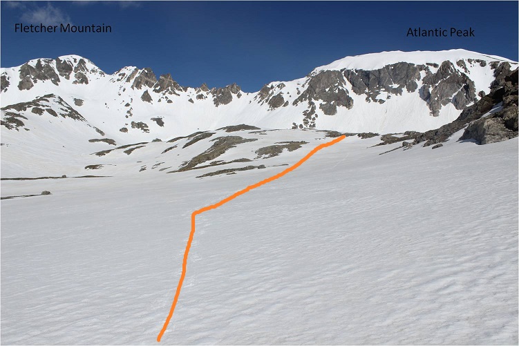
I was pleasantly surprised at the conditions of the headwall: continuous snow coverage that was consolidated just right for crampons. It was tiring, but I had no difficulties gaining the top of the headwall. I mentally high fived myself for choosing this route today. Ok, just a few hundred more feet of elevation gain and I was there! I made it to the saddle between Atlantic and Pacific, singing “Home for the Holidays” as I went. To be honest, I that song was in my head for most of this hike. Oh, and that’s a false summit…
There was a lot of snow here, and some of it felt steeper than the headwall
It seemed pointless to summit the false summit, so I skirted the bump to the left and continued towards Pacific.
From here the postholing began. The snow here looks solid, but it hugs a ridgeline and much of the snow underneath has melted away, leaving a hollow cap. At times the cap was thick enough to support my weight, and at others I postholed up to my waist into (or between) large rocks. I have a few bruises from the fun
Still, it was better than hiking with crampons on the rocks (I was too lazy to take them off, so I stuck to the snow)
Here’s a look back on the route from the saddle to the summit
The wind was intense here, so I decided to head back down. I made it to the saddle and Atlantic looked very inviting. I’ve already summited Atlantic, and I’m on a bit of a time limit today, so I didn’t feel it necessary to summit Atlantic as well (but it was tempting… you should do it!).
I had to stop and enjoy the view from the area just below the saddle (where the wind finally let up a bit). It was breathtaking!
From here you can see most of the route back. It’s important to follow the basin and stay close to Quandary Peak on your way out to exit in the correct area.
OK, time to start down the headwall.
The headwall was steep (so steep you can’t see the route down it here), but not as bad as a lot of gullies I’ve done lately. It’s supposed to be 40-45 degrees at points, but I was able to walk down the entire headwall without turning and facing the mountain.
At the base of the headwall I switched out my crampons for snowshoes, but kept ahold of my ice axe. I followed my tracks southwest
Rounded the ridge, and walked out of the basin
The snow was really starting to soften up at this point. For June 21, this is a ton of snow!
I made it down past the rib area without incident, and was just getting ready to skirt the small lake when it happened.
I was stepping off a rock and into snow and immediately my left leg sank and slid up to my upper thigh. I’ve postholed thousands of times, but never experienced anything like this: Try as I might, I couldn’t move my leg. It wasn’t hurt, but my snowshoe was stuck in the snow and keeping me from being able to move my foot and leg.
As I’d stepped on and slid into the deeper snow the snow had immediately softened up and settled like concrete around my leg, making it immobile. I thought to myself “So this is what they mean by not being able to get yourself out of an avalanche because the snow settles like concrete” and got to work. Luckily, this hadn’t been an avalanche and I still had my ice axe in my hand, so I started digging myself out. It took me a solid 15 minutes of work to free my leg. Also, my butt was now wet from sitting in the snow for so long. Lovely. At least no one was around to see.
The hike back to the trailhead was uneventful. In the light of day I was easily able to follow the trail and saw things I hadn’t before, like the log bridges and small pools and the actual trail itself…
There was also a lot of evidence of postholing from previous hikers using the trail. I hadn’t seen any of this in the dark (I’d paralleled the actual trail)
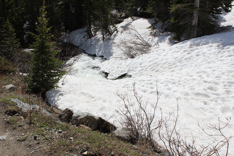
There was a snowbridge over the creek, and the creek was raging!
Back on the 2WD road I started seeing other hikers. Quite a few of them actually, and I figured they must have opened the gate. Sure enough, they had and there were cars parked at the summer trailhead as I passed.
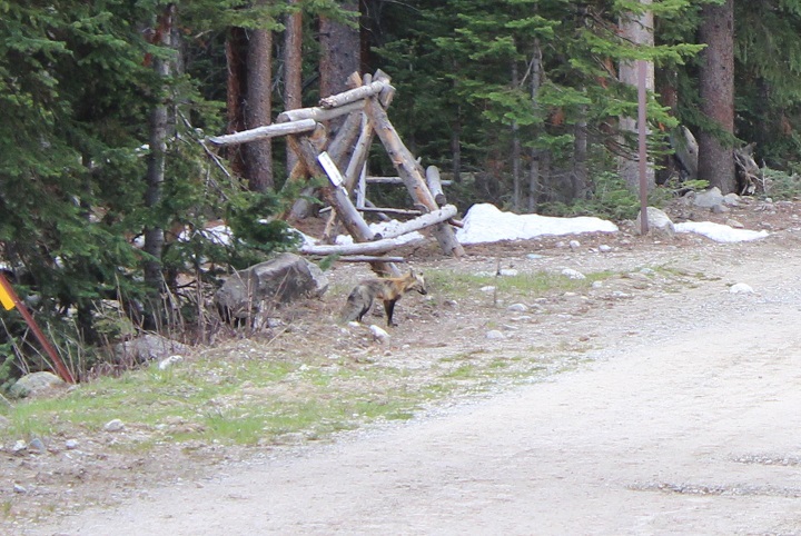
I still had 2 miles to go however, but on a positive note, I saw a rather scruffy looking fox on my way back
I made it back to my truck at 10:45am, making this a 13 mile hike with 3700’ in elevation gain in just over 8 hours.
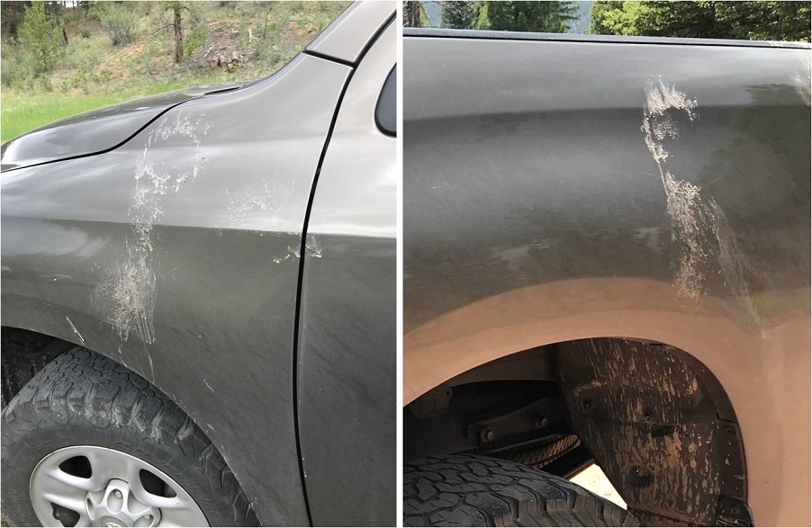
Ugh! It looked like some kids had thrown mud at my truck! There was dried mud/dirt on every corner, like someone had used my truck for target practice with mud pies. I was going to have to wash it after picking my daughter up from camp (she’s a counselor at a Girl Scout Camp and off this weekend so I was on my way there now to pick her up). It was a 3 hour drive, and I made it in plenty of time before release. While we were walking back to the truck my daughter said “How did your truck get so dirty?” I told her I it happened at the trailhead this morning. She went and took a closer look, put each of her hands on two of the marks and said “Mom, how big are bears?” That’s when I took a closer look at the blobs and realized no one had thrown mud at my truck: It’d been visited by a bear! I could see swishes of hair and even faint claw marks on the paint. Cool! Maybe that’s the animal I’d heard at the start of my hike? Now I didn’t want to wash my truck! Luckily, I took a few photos before it rained on my way home. I just wish I’d looked at the ground around my truck when I’d noticed the mud… I would probably have seen bear tracks!
It’s 7:30pm on Saturday night, and I go downstairs to find all 3 of my teenagers hanging out in my youngest daughter’s room. My son is sitting in a chair in the middle of the room serenading everyone, trying to figure out how to play a Bruno Mars song on his accordion. My oldest has her laptop in her lap, and my youngest has her headphones on (but takes them off when I enter the room).
The kids ask me why I’m not driving to the trailhead? Didn’t I have a long drive and hike ahead of me tomorrow?
Me: Well, you see yesterday I saw a really big bear when I was coming home from hiking. A really big bear. I didn’t realize we had bears that size in Colorado! I’m stalling because I don’t really want to hike solo in the dark for longer than I have to with bears on my mind.
My son: I thought you talked to us yesterday about not letting other people’s fears dictate your hikes?
Me: Yes, but currently, this is my fear.
My youngest: That’s fair.
My oldest: But you’re not hiking the same mountain, right?
Me: You’re right! Hey, I’m not even hiking in the same mountain range. Thanks! I’m out!
My oldest knows how I think, and knew just what to say to get me moving. I’ve hiked for miles and miles in the dark solo dozens of times, but for some reason seeing that really large black (cinnamon colored) bear yesterday kind of freaked me out. Sure, it was running away from me, but it wasn’t the smallish black bear I’m used to seeing. I encountered it during the day, but it’s not something I’d like to repeat at night. I know I’ll get over it after a time or two of hiking at night again; the experience was just still fresh in my memory and didn’t sit well.
So I drove the 6.5 hours to the Kilpacker trailhead. Quick note: the driving directions given on the dot com are correct, but I misinterpreted them. The instructions said to drive to Lizard Head pass and continue south. So when I got to Lizard Head Pass sign I turned south into the lot, thinking this was the pass, and looked for a route south. This wasn’t the pass, and I circled the parking lot twice looking for it. It was dark and the road was a half loop, leading to other trailheads and me to believe I was missing the turn off. I figured I must have missed something? Nope, there was no turn at Lizard Head Pass: just continue driving when you see it and don’t go into the parking lot (unless you need to use the restroom, because they have one there and not at the trailhead).
The 2WD dirt road in was a bit narrow in places, but easy to navigate. I put my truck in 4WD because I could, but it wasn’t necessary.
I signed the trail register at the well marked trailhead and started my hike a little before 4am. In the dark. Here’s proof:
The first 5 miles of this hike are really easy. Very little elevation gain (in fact, you lose more than you gain it seems, which stunk on the way out) and no real challenges. That is, if you put aside the fact when you hike in the dark your sense of hearing intensifies and every shadow becomes a mountain lion/bear/rabid squirrel coming at you at full speed. About 2 miles in I heard a large pine tree fall 20 feet in front of me on the trail, which was a first for me (but it’s gotta happen a lot, right?).
I came upon the stream crossing and it was more difficult than anticipated. You see, when I came upon it in the dark I saw a broken log in the water, with no way to cross. I walked up and down the banks a few times until I noticed an in-tact tree that was easy to cross. It’s one of the fun challenges of hiking at night! (I had a GPS but it wasn’t helpful in this situation, as it showed the crossing far from both logs, in a place where there were no logs).
So, how did I deal with my bear thoughts? I diverted my mind to a speech I’m writing for a presentation I’m giving next week at a conference on sensor technology, tapped each and every log and large rock I passed with my trekking pole to make noise, and said “Hey Bear!” more than I have in years. It worked, because I didn’t see any animals (which was also kind of a downer because I actually like seeing animals when I hike).
The route was very well maintained until I reached the basin.
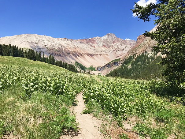
I reached the basin just as the sun was coming up. This was a very large basin filled with a lot of talus.
From here the route wasn’t difficult to follow, but everything looked the same, making cairn finding a fun game.
I never did see the cutoff for El Diente because I wasn’t looking for it. I was focused on route finding for Mt Wilson, but here it is (I found it on my way back down).
I left my trekking pole near a large rock, fully expecting a marmot or pika to destroy it (it’s time I got a new one anyway).
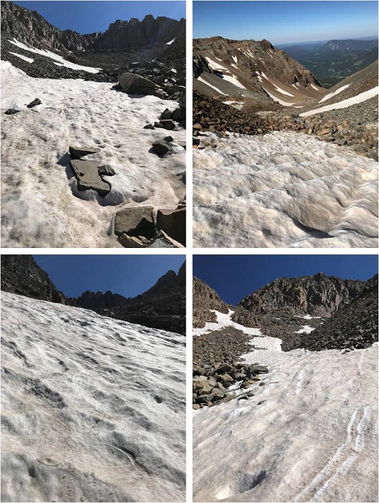
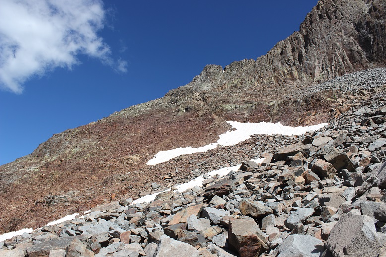
I chose to do Mt Wilson first because it’s further and there was a chance it would have snow. I wanted to get the snow part of the hike done in the morning before the snow softened. The jury was still out on the traverse. After hiking through miles of talus I came to a drainage area with larger rocks. I could see a snow free line to where I needed to go so I didn’t put on my crampons and spent the next hour and a half carefully hopping from rock to rock up the drainage.
Once I made it to just below the gullies below the summit it was much safer for me to put my crampons on, so I did, and left them on until I was about 150 feet away from the summit (when rock climbing became necessary).
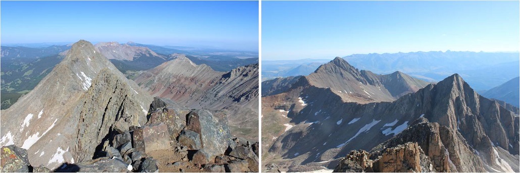
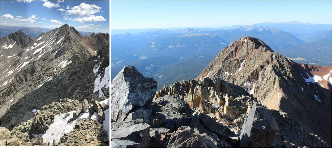
Here’s the route I took (I’m using the photo from 14ers.com because mine don’t have this great of a perspective).
After making it to the notch rock climbing was necessary. Yes, it is important here to look back at the way you came. You’ll be surprised at how different it looks from this perspective!!!
There was one class 3 move
And the rest was a fun uphill scramble with the added bonus of the sun blinding me as it was just rising over the ridge
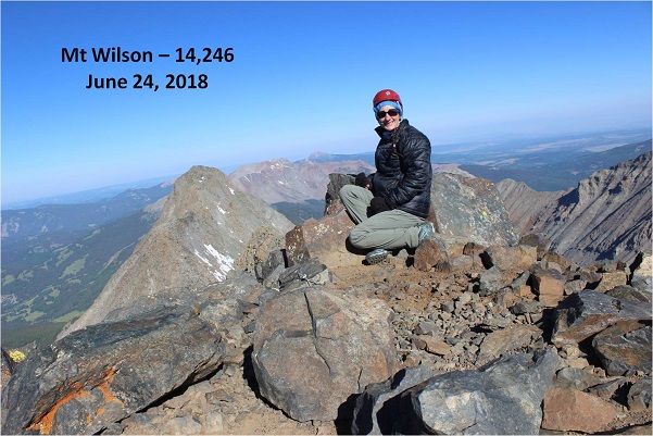
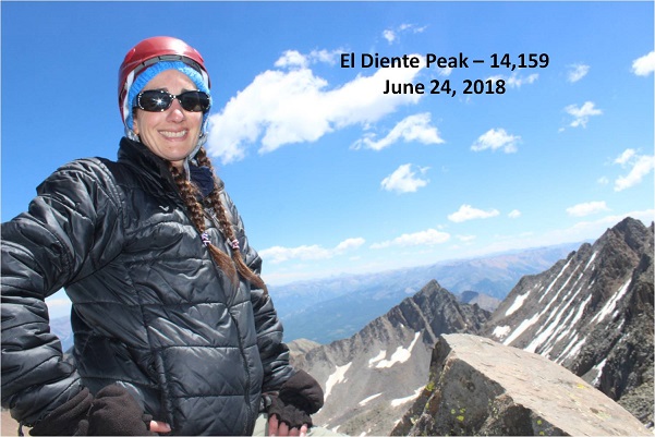
Wow! What a beautiful day for a summit!
I took a summit selfie, a summit video, and was back on my way.
This time I put on my crampons for the gully and kept them on as I was descending most of the basin, straight down the snow. Wow! What a difference from hoping rock to rock! This was so much easier! I wished I’d have done this on the way up: I’d have saved quite a bit of time.
Now it was time to head over to El Diente. I’d made the decision I wanted elevation gain today, and the best way to do that was to descend Mt Wilson and climb El Diente instead of doing the traverse. Also, I didn’t have a map or instructions for the traverse with me and this seemed like a safer option, even though the traverse was snow free.
The pink “v” is what you’re supposed to do if you hike each peak separately, but I found an established cairned route and took the blue line.
I still looked for and traversed the rib, but I took a route from the west instead of the east.
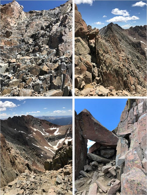
I climbed the gray gully and hiked just below the organ pipes
After gaining the ridge I actually moved from the south side and traversed the north side of El Diente. The north side had some snow directly on the route, but it was easily navigable. Here’s a picture looking back at the north side part of the trail and also of the traverse.
Here was the crux of the climb for me: I rounded the corner and since there was snow on the direct route from this point on I made a few class 4 moves to gain the summit. (It’s a steeper climb and those rocks are larger than this picture makes them look).
I couldn’t tell where the exact summit was. My GPS kept switching between points, and some were obviously not the summit (it was doing this for the north and south side of the mountain too, which was frustrating). There was no summit marker so I just stood on multiple high points on the ridge, just to be sure I hit the ‘actual’ summit. The high points were quite narrow so this picture is closer than I’d have liked.
Take a look at that ridge heading back to Mt Wilson!
I was much more confident on the way back down El Diente. Both of the climbs I did today were completely within my abilities. They were fun, and while there was exposure I wasn’t scared at all (not even much of an adrenaline rush). These routes seemed very similar to the Mt Sneffles ridge route. The only downside? The talus! OMG, that stuff didn’t quit! Talus stinks to hike in because all of the rocks are of irregular size, none of them are stable or large enough to securely put your foot down, and they cause you to slide when hiking downhill. It’s hard on the knees and impossible to hike down fast without slipping.
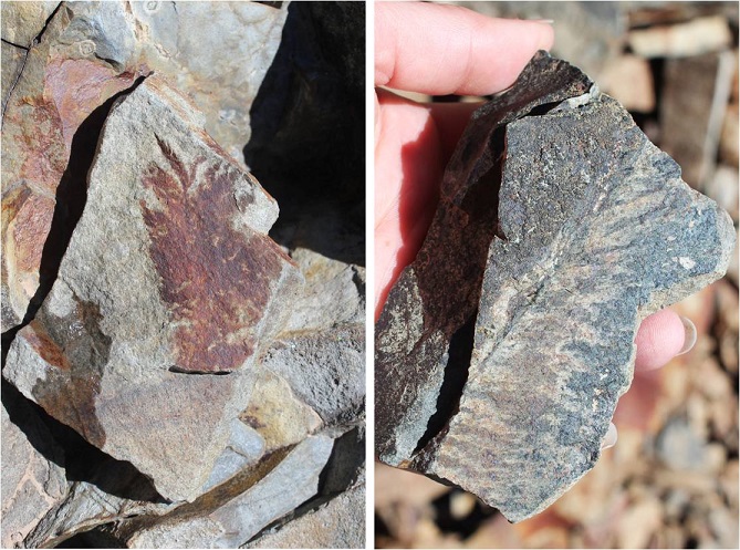
The only good thing about talus? It’s gorgeous to look at! I found several pieces that looked like they contained fossils of plant material. I left them there for the next hiker to find.
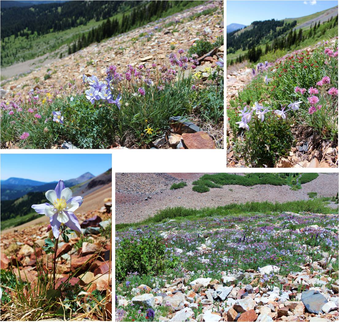
On the way back down I was able to see flowers that weren’t visible in the dark. Absolutely stunning! Pictures don’t do them justice!
I turned around before exiting the basin to get a good look at the waterfall
Here’s more of that talus route down…
I was able to retrieve my trekking pole with only minor bite marks. Due to the bite size I’m assuming a pika was involved, and was pleasantly surprised it wasn’t destroyed. I’ve heard stories of the rodents ruining gear, but they only seemed to have a nibble this time. Apparently they didn’t like the taste of the cork handle.
This hike made for a long and beautiful day, as I made it back to my truck at 4pm (and home at 10:30pm, so door to door it was a 27 hour day). I actually stopped at treeline to let some hikers pass (two young men trying to run down the talus to catch up with/pass me, and falling several times doing so… I figured I’d just let them pass since I wasn’t in a hurry today). To make sure they were well ahead of me so we wouldn’t play leap frog I waited for about half an hour in the meadow, enjoying the view. Talus might be tough to hike in, but it sure makes a beautiful mountain!