Mt Kruetzer – 13,122 and Chalk Rock Mountain – 13,064

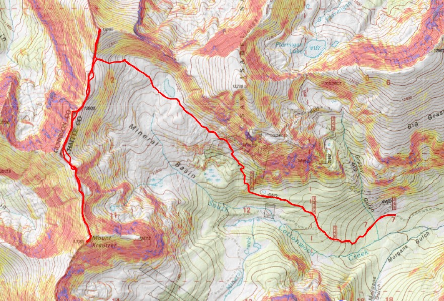
RT Length: 10.43 miles

Elevation Gain: 3117’

My plans for this weekend changed last minute.  I got gas and was on my way, but suddenly my engine light turned on, saying there was a transmission problem, and to get to my dealer right away. I have less than 25,000 miles on my truck, so this concerned me.  I decided to pull over on the side of the road to google what could be wrong.  The next exit I came to there was a man wearing only jeans, holding a 6 foot 2×4 over his shoulders, swaying back and forth on the side of the off-ramp.  It was 1am.  I decided to wait for the next exit. 

I googled the warning notification, and it turned out the light could be one of over 40 things wrong.  With cars and mountaineering, hope is not a strategy.   I thought about it for a minute, and finally decided driving 6 hours and then another hour off road was probably a bad idea, so I turned around and headed to the nearest dealership, and slept in my truck until they opened at 7am. 

Bugs.  Bugs were what was wrong.  Bugs on my windshield and bugs on my grille were obscuring the sensors from doing their jobs.  The sensors were now clean, and I was good to go, with the admonition I should wash my truck more often.  To which I replied “It’s a truck.  It’s supposed to get dirty.  If not, you have no business owning a truck.”  Seriously though, washing my truck in the summer lasts a good 6 hour drive to the next trailhead, and doesn’t seem worth the money.  I got a high five and was out of there, now a day behind, so summit modifications would need to be made. 

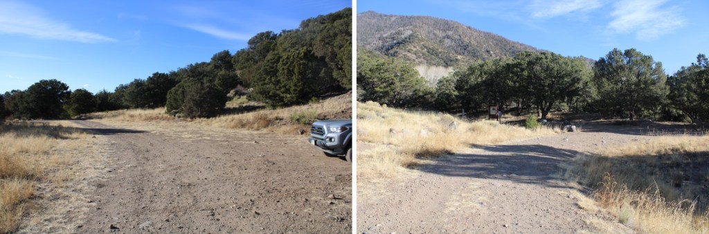
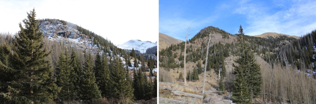
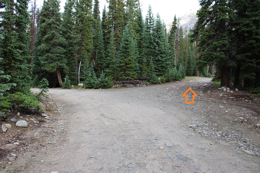
I made it to the trailhead in a thunderstorm, which I’d expected.  It was my plan to wait it out, and start in the morning.  I parked 6 miles past Cottonwood Lake, at the junctions of 344 and 349.  There are dispersed campsites closer, but I planned to be here for a few days and this made a good base camp. 

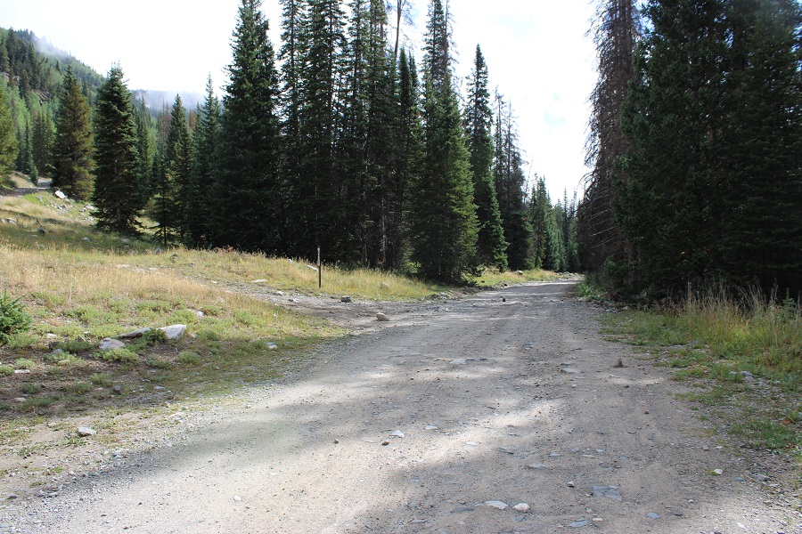
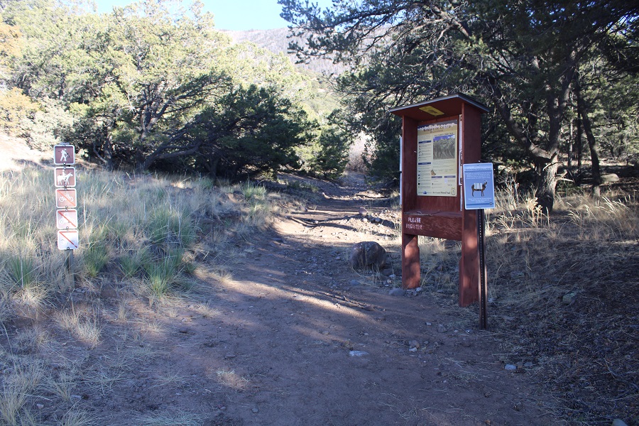
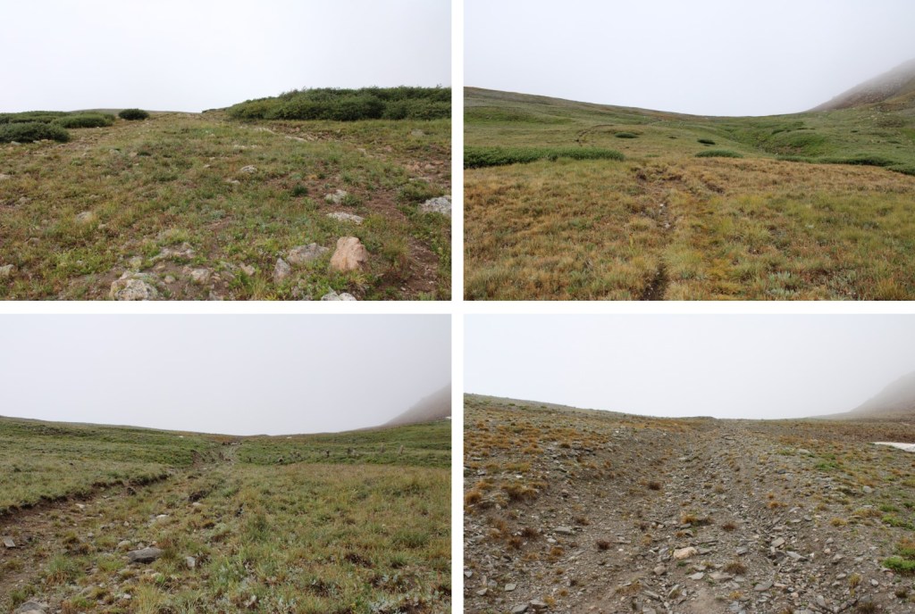
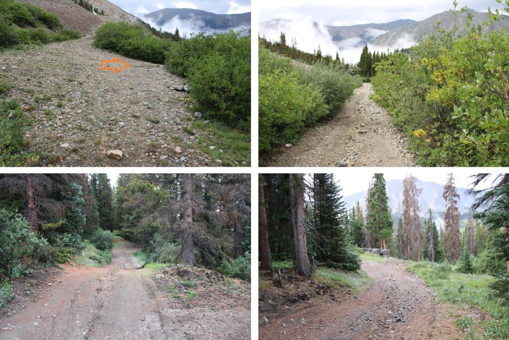
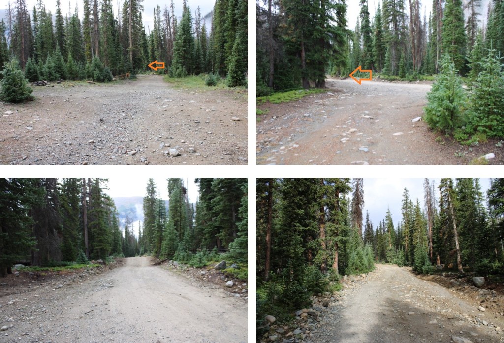
I was up and on the trail at 4:15am to a clear, starry night ski, hoping to get in my summits before the clouds and rain came at 9am.  I followed road 344 west for 1.4 miles.

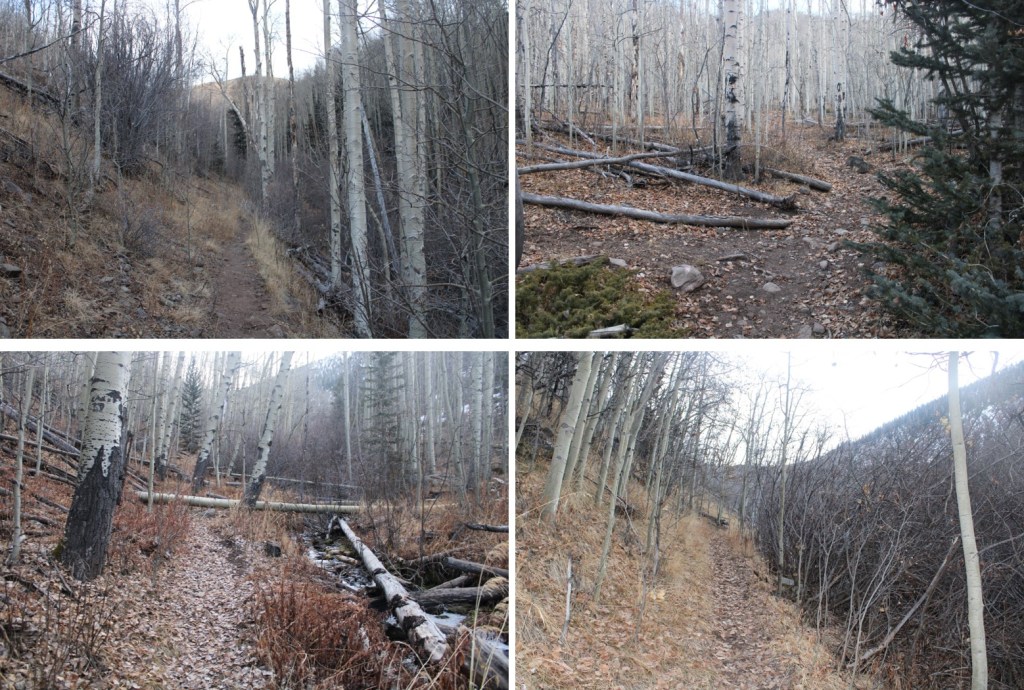
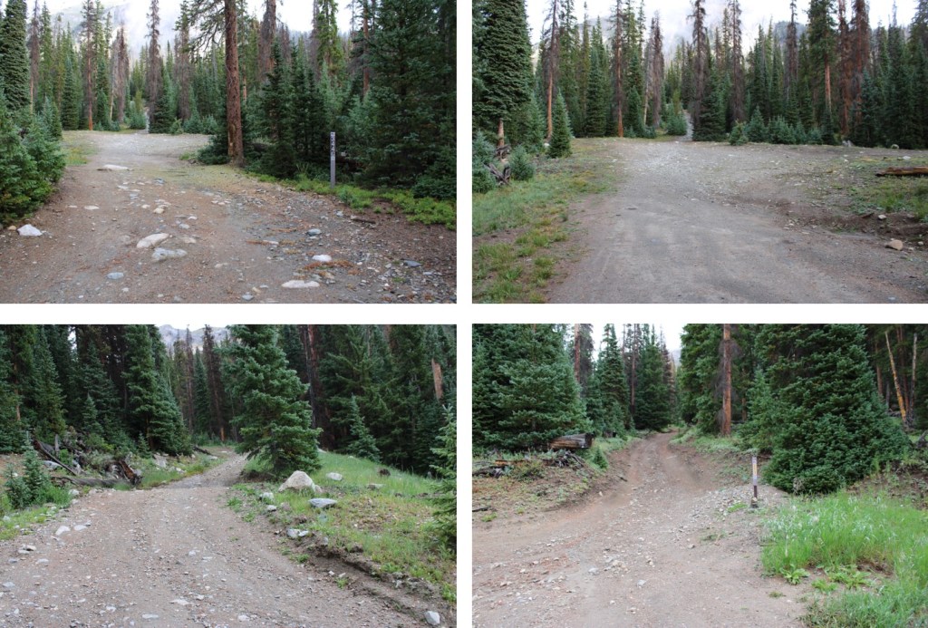
I then turned right onto  344G.  There were several dispersed campsites here as well.

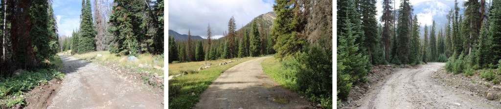
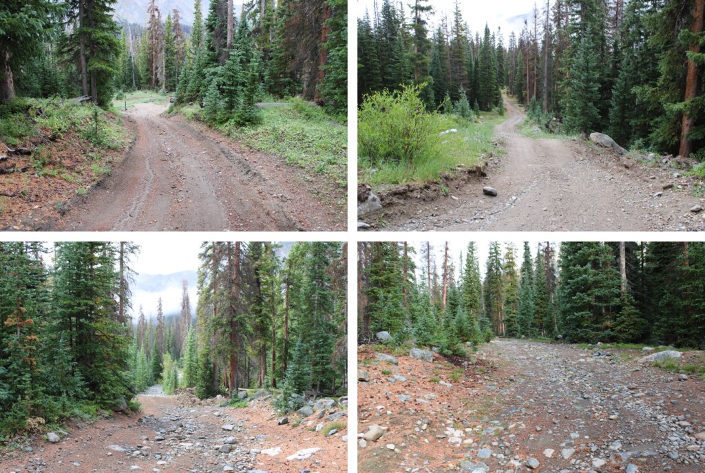
I followed this road all the way to 12,020. 

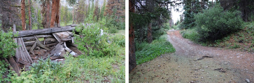
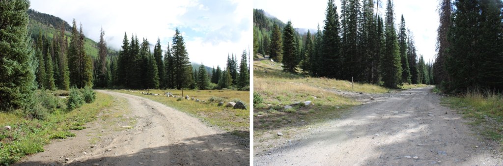
I passed an old log cabin

Staying left, I continued to 12,020

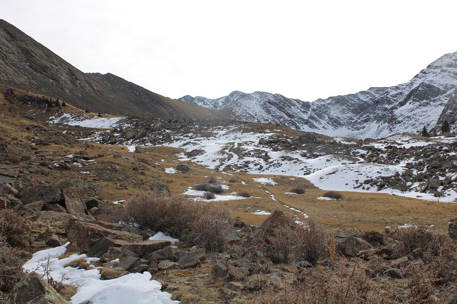
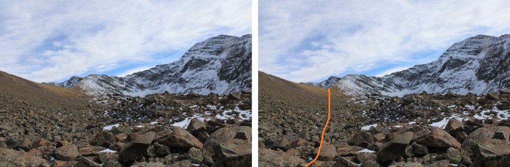
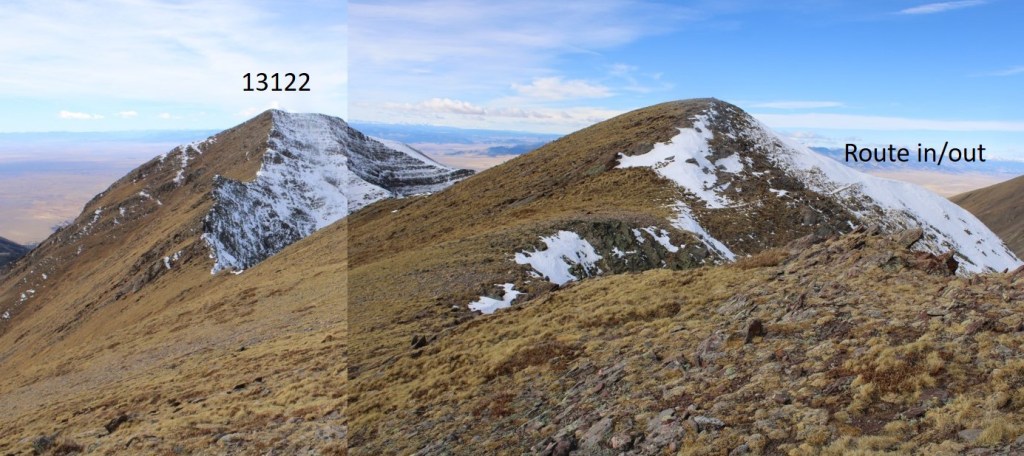
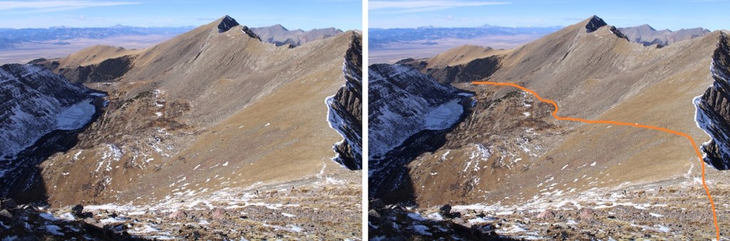
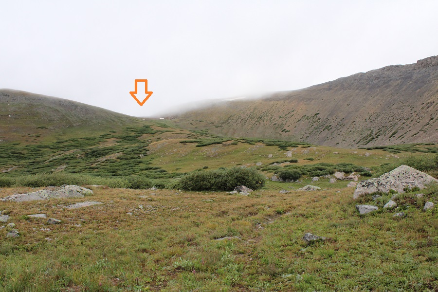
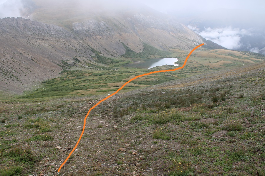
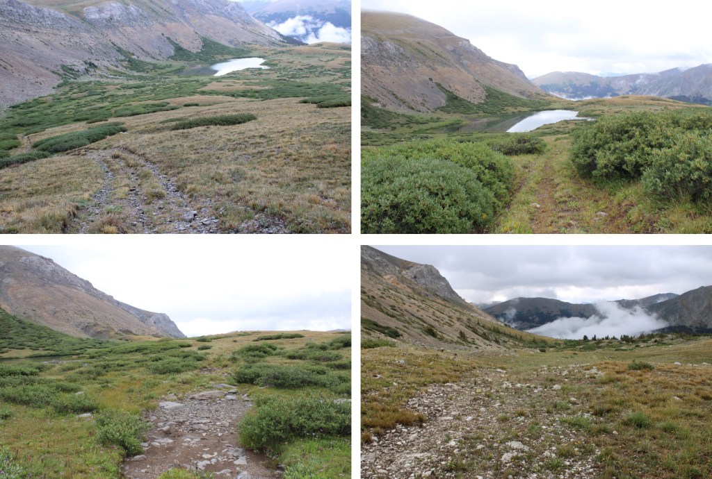
At 12,020 I turned left, and followed a trail northeast through Mineral Basin

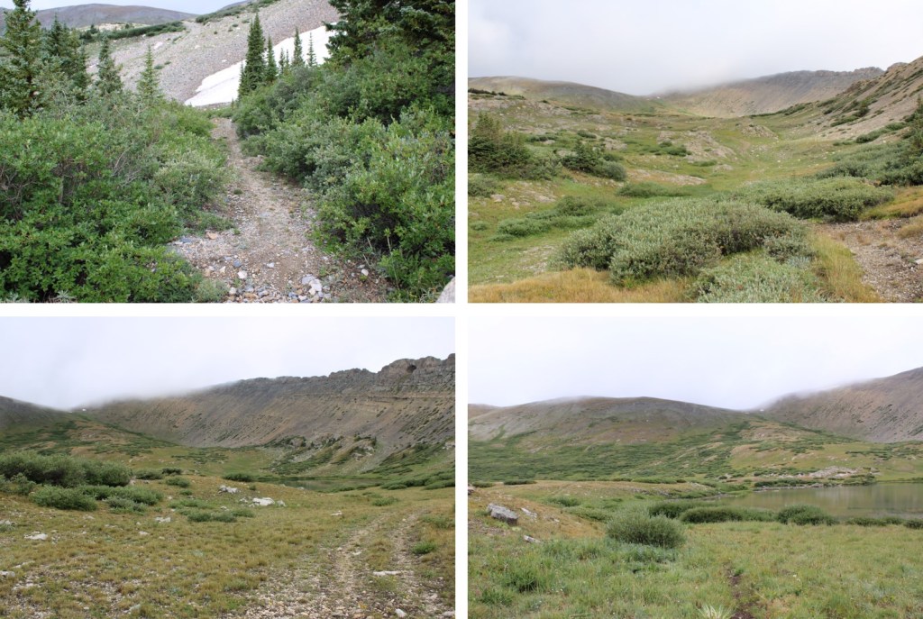
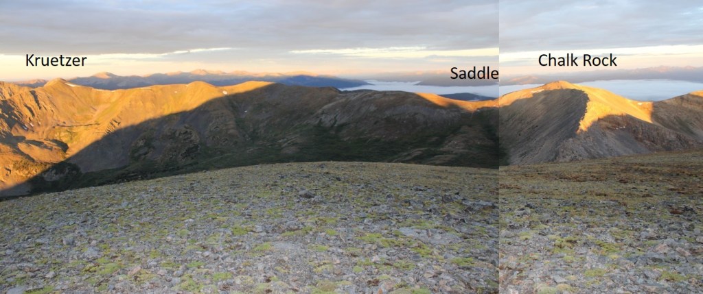
This is where I was headed, towards the saddle.  The road is sometimes a trail, sometimes two ruts, but it goes all the way to the saddle.

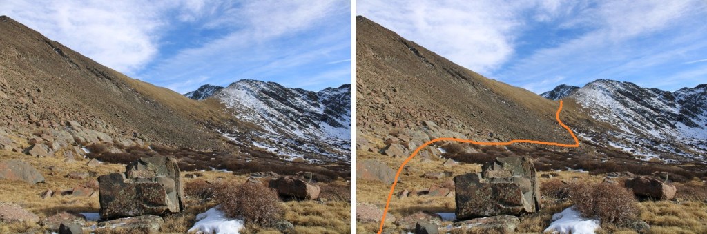
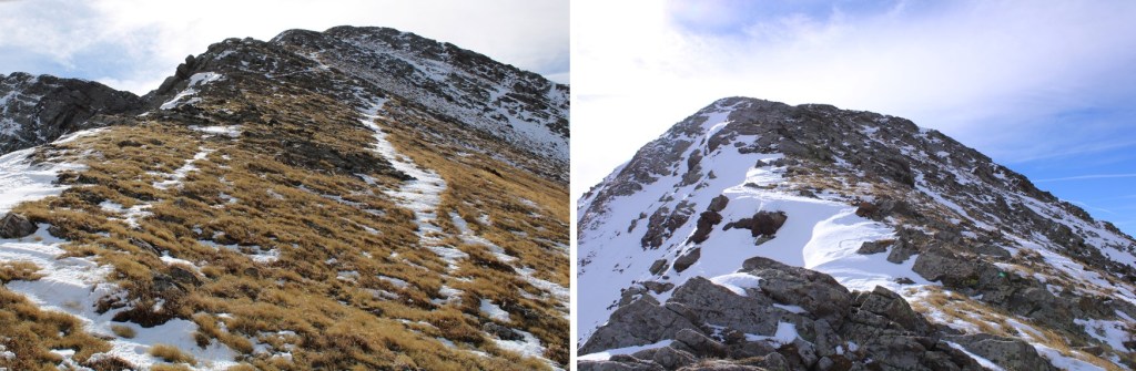
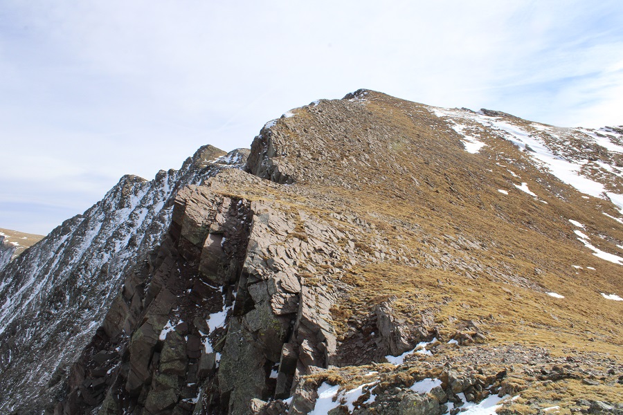
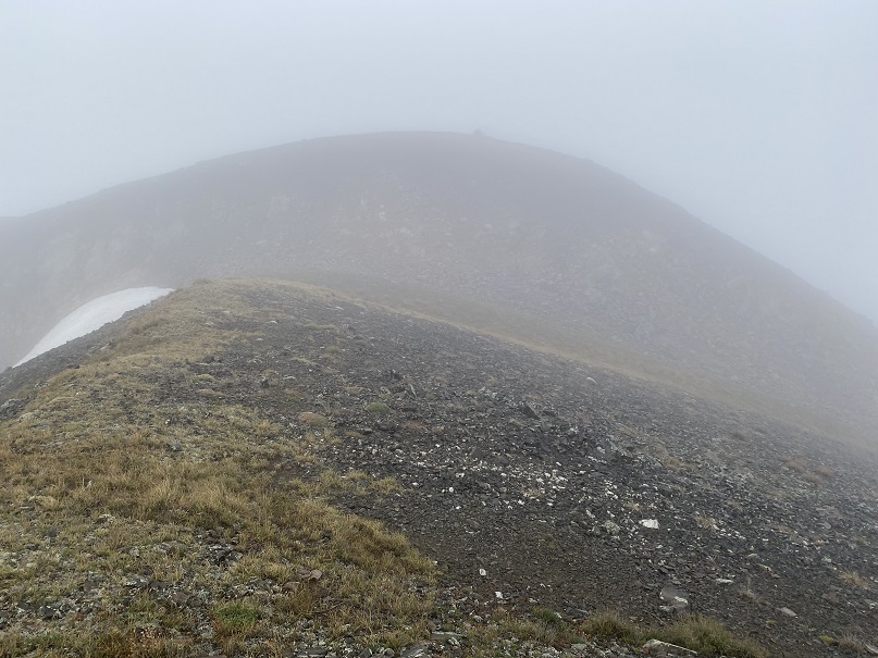
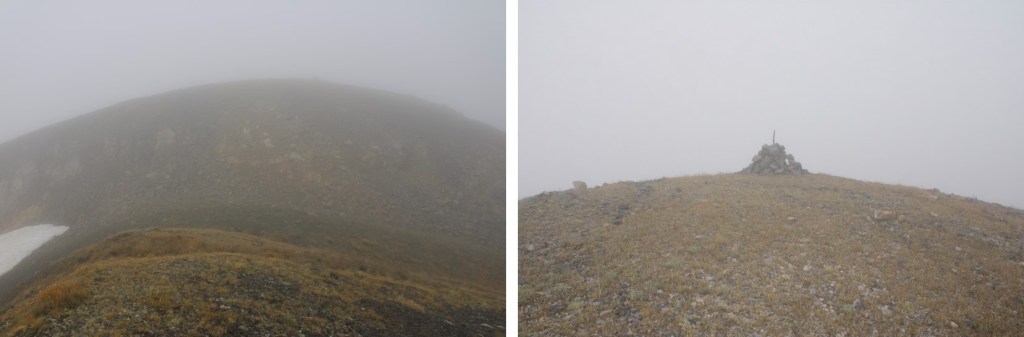
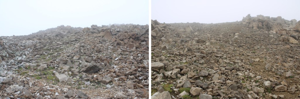
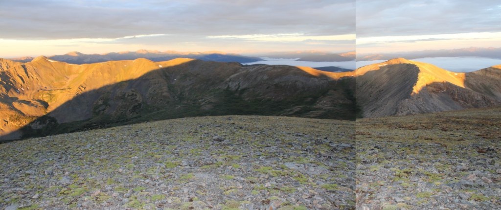
I’m going to apologize for the pictures on the ridge.  The weather forecast said 57% sky cover until 9am, when the clouds were supposed to roll in, but as you can see, they arrived early. I thought about waiting the clouds out, but it was obvious they were just accumulating.  At one point I even turned back, knowing I’d need to do this hike again anyway to get better pictures, but turned around again and summited, because I was so close.  While this is a class 2 ridge hike, I hiked it with my compass out the entire time, as I couldn’t see more than a few yards ahead of me at a time. I’m going to show you some really terrible pictures of the route, but know from the saddle it’s .7 miles southwest, and then .8 miles south/southeast along the ridge, mostly on tundra with a few rocks thrown in. 

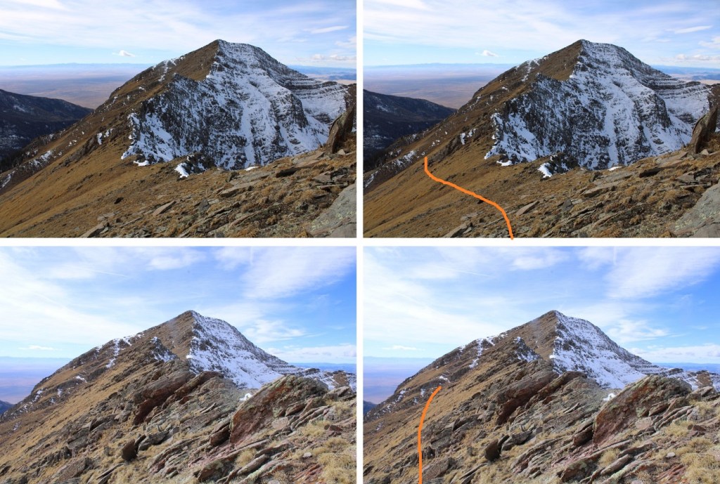
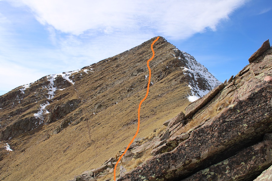
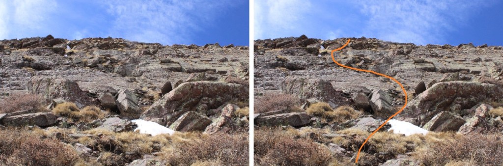
At the saddle I turned left, and headed up the ridge

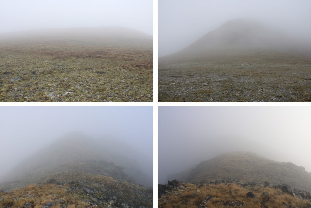
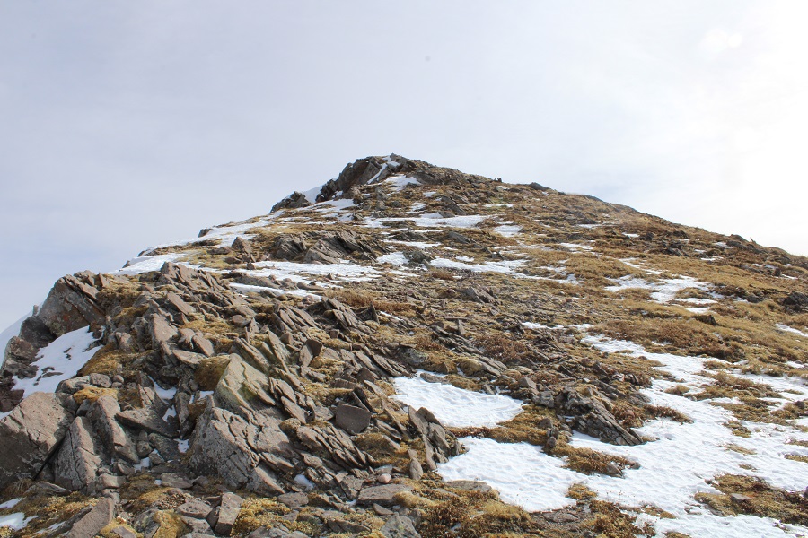
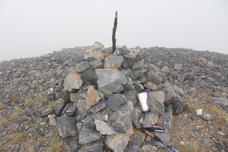
The summit is obvious, after quite a few false summits.  Here I saw a mountain goat run past me into the mist.  The summit was noted by an obvious cairn (that needs a new summit register)

It’s important to note by this time I was feeling like a popsicle.  I could not feel my hands and my feet felt like blocks of ice. Apparently it’s wet and cold hiking inside of a cloud. 

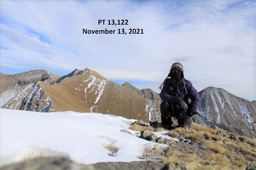
I summited Mt Kruetzer at 7am
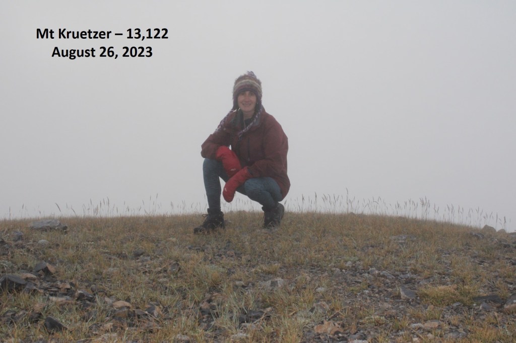
Mt Kruetzer:

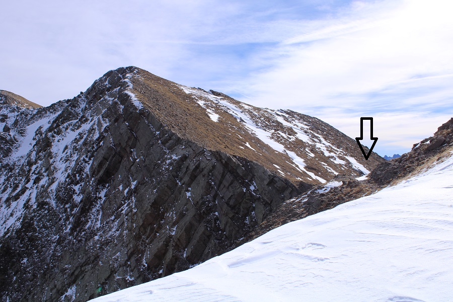
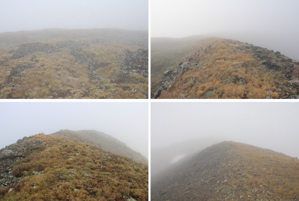
I made my way back to the saddle.  I’ll apologize again for the terrible pictures, and promise to climb these peaks again someday so I can get better photos of the route.

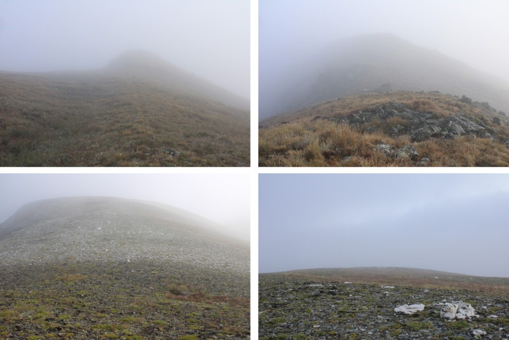
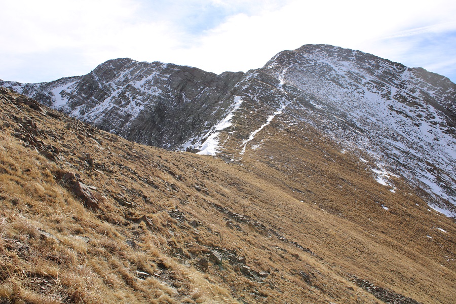
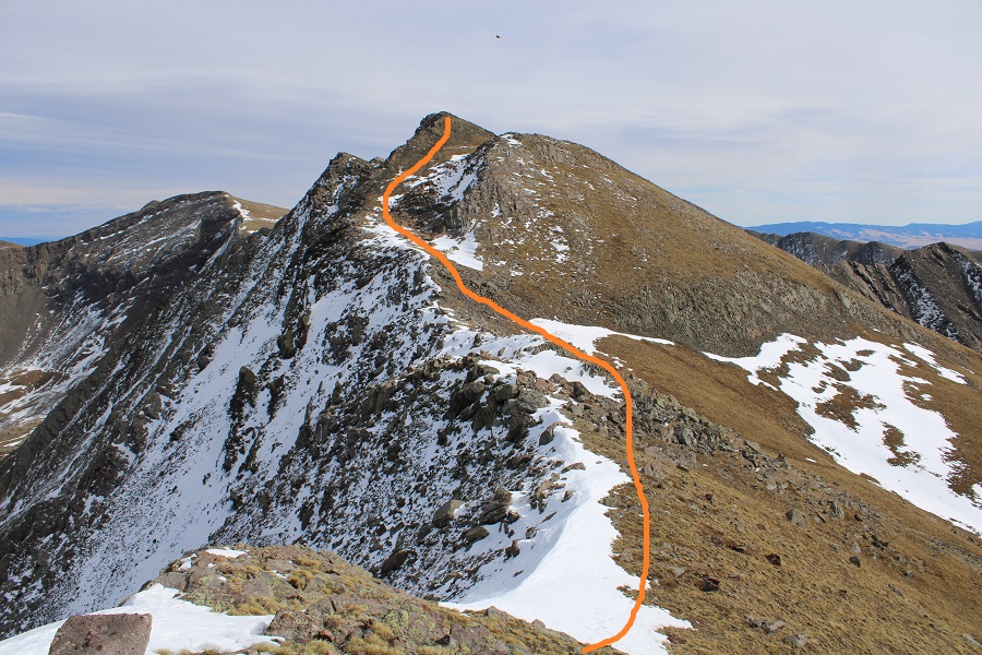
Back on the saddle, I headed northeast towards Chalk Rock mountain

This is the route I took up.  It was obvious why it’s named “Chalk Rock Mountain”.  There were game trails here, and the summit was surprisingly close. From the saddle, it was only .3 miles to the summit.

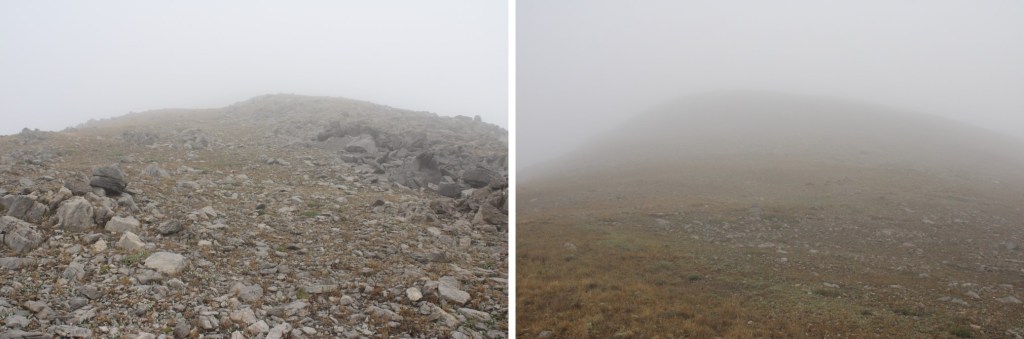
The summit was relatively flat, without a noticeable cairn

I summited Chalk Rock Mountain at 8:10am

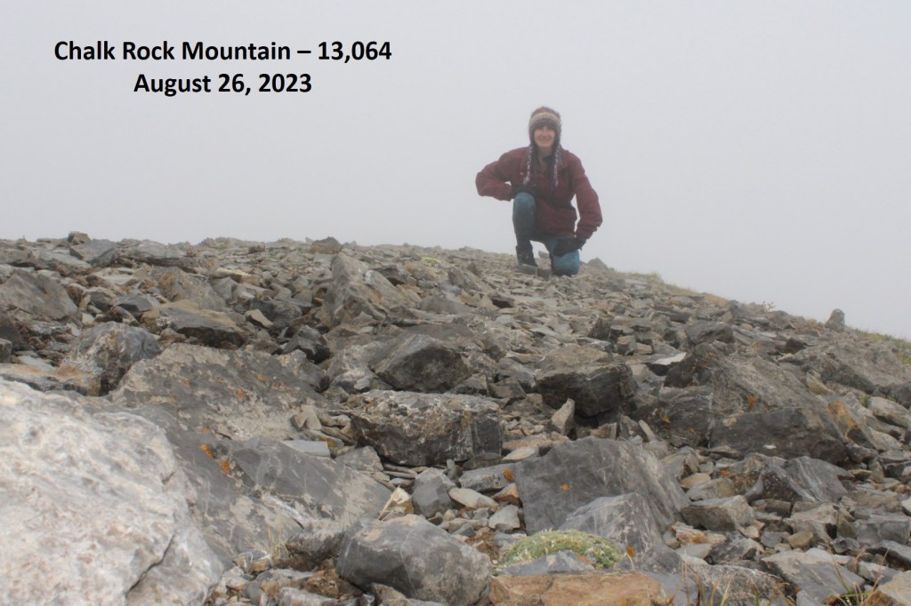
Chalk Rock Mountain:

More than ready to be out of the clouds, I turned around and headed southwest back to the saddle.

Back on the saddle, I turned left and followed the road back down into the basin

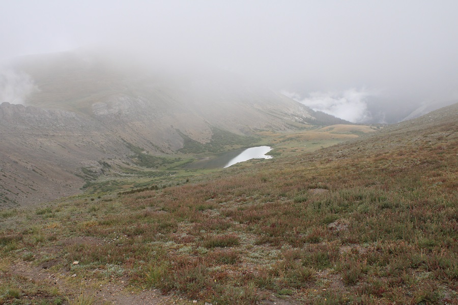
This is the route out of the basin

I turned right onto the road and followed it back down

Back at road 344 I turned left, and followed it back to my campsite

I made it back to my truck at 9:45am, making this a 10.43 mile hike with 3117’ of elevation gain in 5 hours, 30 minutes. Now it’s time to dry out my shoes, socks, and feet for tomorrow morning.

On to the next trailhead!

Oh, and this is what the mountain looked like as I hiked down.  The clouds never went away!

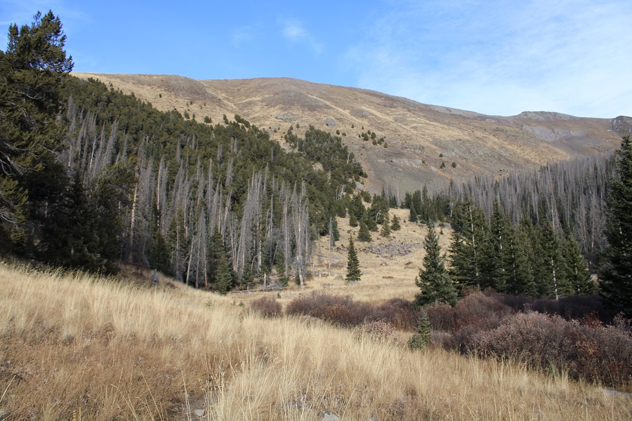
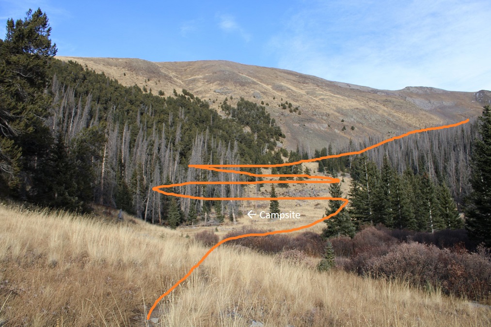
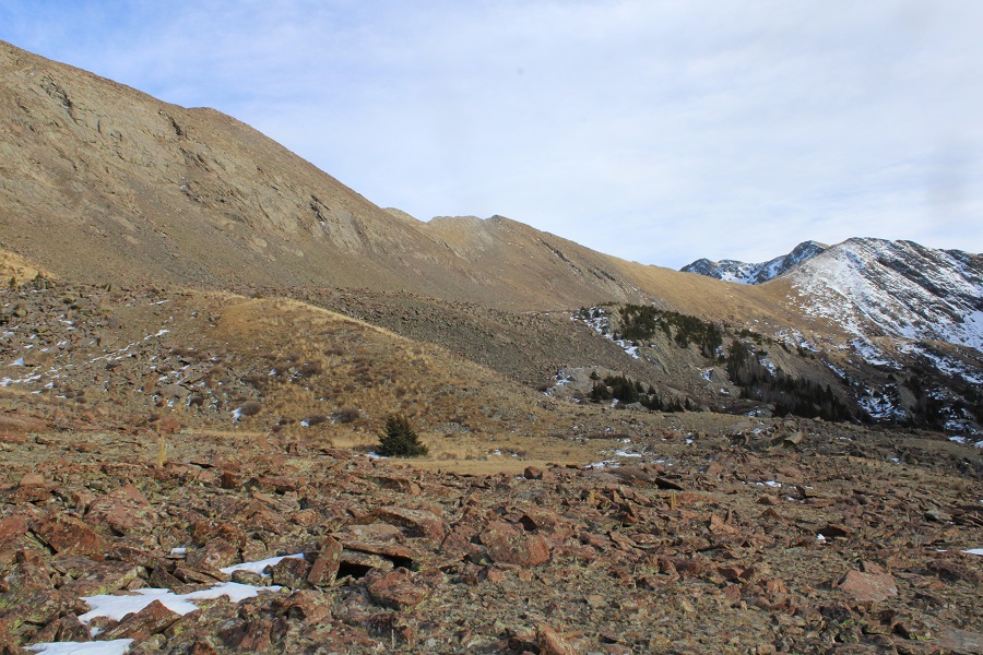
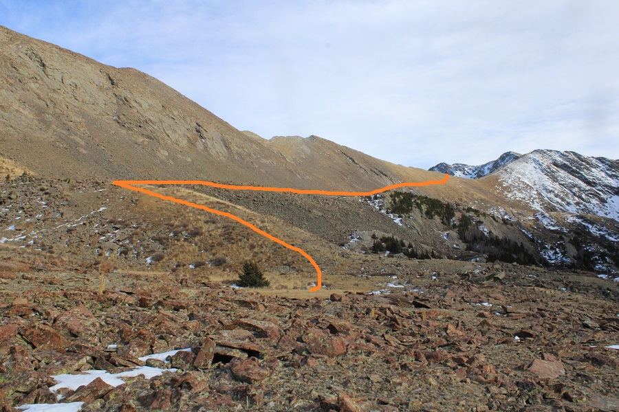
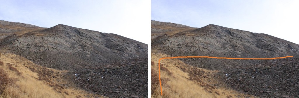
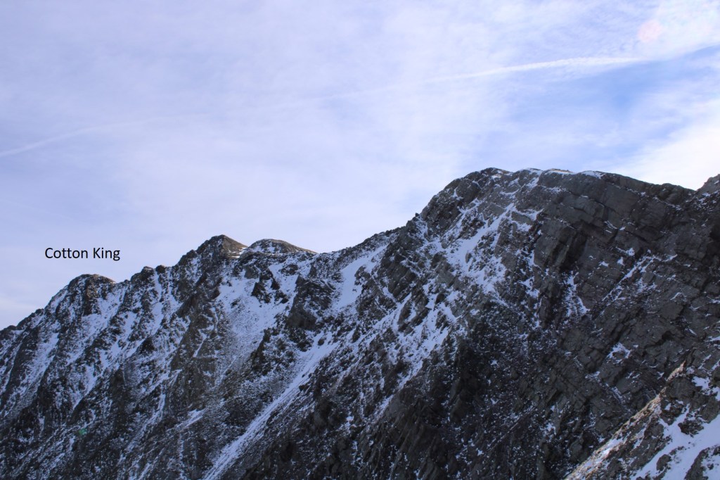
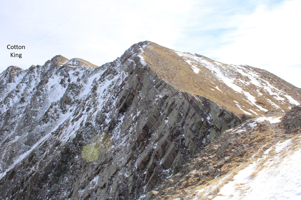
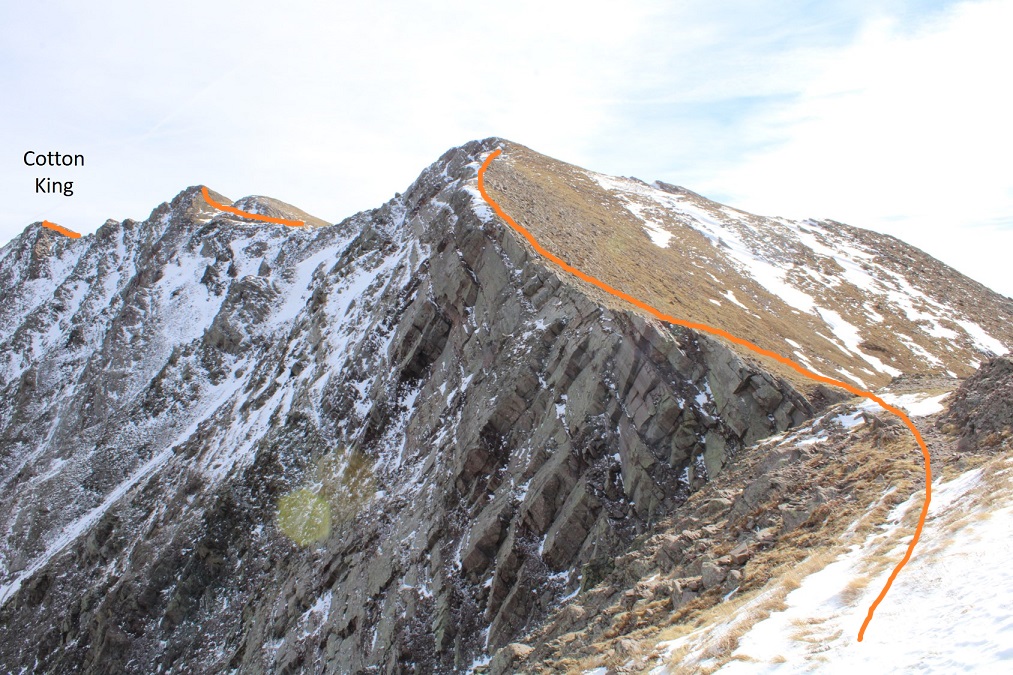
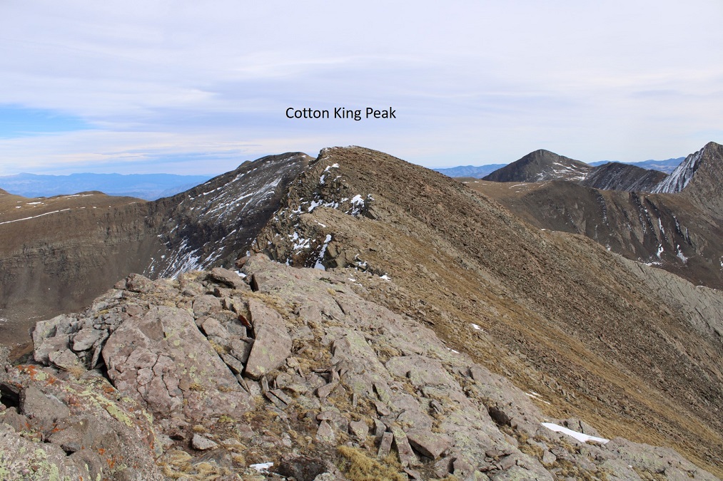
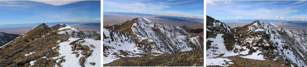
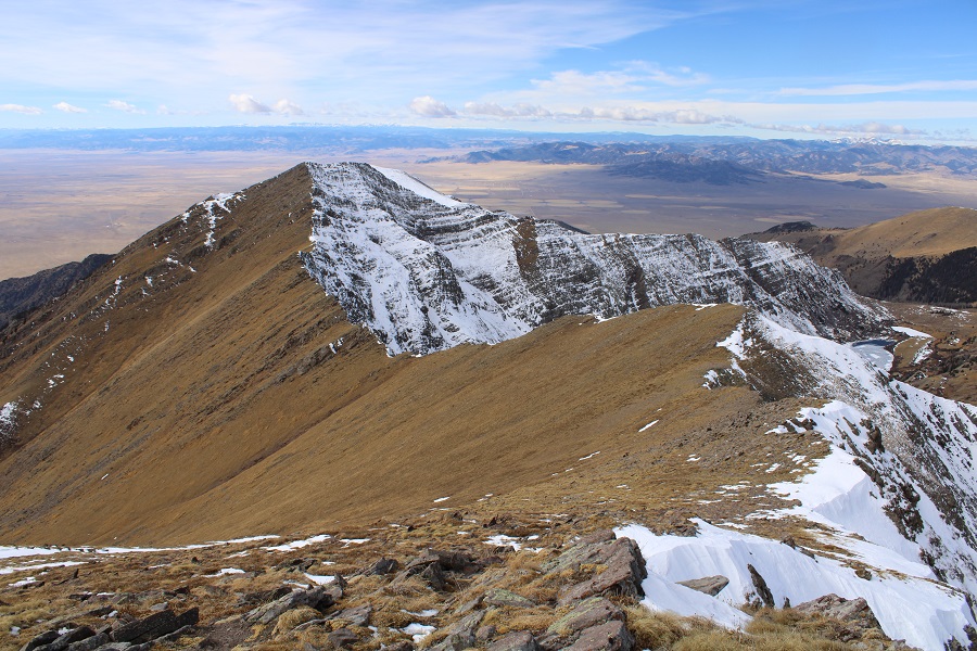
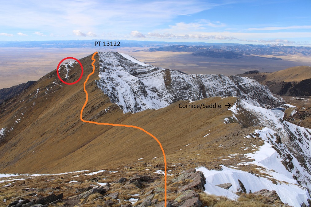
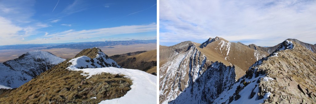
The next morning I hiked Jones Mountain B.  Unlike yesterday, the there were no visible stars, as the sky was cloudy.  However, once I made it to the ridge, I could see Kruetzer and Chalk Rock were clear.  Here are some more visuals of the route

As you can see, it’s mostly a ridge hike.

Cotton King Peak – 13,490 and PT 13,130

RT Length:  18.96 miles

Elevation Gain:  6296’

It’s that wonderful time of year when I start and end hikes in the dark.  I’d slept at this trailhead, quite comfortable, and didn’t want to get up.  That’s the only downside to loving your sleep set-up:  you don’t want to get out from under the covers.  Eventually I got up, and was on the trail at 5:30am.

The Wild Cherry Trail is at the end of a fun 4WD road.  There’s plenty of parking, and I had the whole place to myself the entire night (and the next day/night as well, odd since it was a Friday/Saturday/Sunday).

I followed this class 1 trail as it meandered and switchbacked alongside Wild Cherry Creek (no creek crossings this time)

The creek was running, but still kind of frozen

I was slowing down as I made it to a meadow with some nice camping spots at 11000’

So.  Many.  Switchbacks.  I was not feeling it.  I was hiking slow, my knee still hurt from yesterday, and for some reason, I felt unmotivated.  I looked at my tracker:  I’d gone (almost) 5 miles.  I’m good at playing mental games to keep myself motivated.  I decided to hike to 5 miles, then turn back.  A 10 mile day is pretty good, right?  When I hit 5 miles, I told myself I’d just go to the lake, and kept hiking. 

Just after the meadow with the camping area I switchbacked a few times, then entered a rocky area.  There was still a trail here (there’s as trail all the way to Peanut and Cherry Lakes).  It was here I encountered snow.  Mine were the first tracks since it snowed last (a few weeks ago?)

I knew I was getting close to the lake when I saw the sign warning me not to camp or bring livestock within 300 feet of the lakes

I continued following the trail, just wanting to see the lakes before turning back…

Once I made it to the lakes I had a visual of the rest of the route, and there was no stopping me now (visuals help my mood tremendously).   Also, the sun had come up, which made everything better: I’m not a fan of gloomy days (which this one started out to be).

With my newfound energy, I was now aiming for this saddle

I could see a sort of plateau hugging the south side of Mt Owen, and that’s where I wanted to be

Here’s an overall look at my path to the Mt Owen/Cotton King saddle

First, at around 11830, before making it to Peanut Lake, I found a grassy hillside and ascended it north

This brought me to 12000’, and a boulder field.  I stayed high (left), and followed the boulder field southeast towards the Mt Owen/Cotton King saddle

There are some willows to navigate, but if you stay high, you can avoid them.  There’s also a game trail that picks up in the tundra.  It goes as a trail about 75 percent of the time, and is easily seen from below

Once on the saddle, I didn’t follow the obvious, snow-covered trail (for obvious reasons), but instead took the class 2 ridge south.

This is a good time to get a visual of where the summit of Cotton King Peak actually lies:  It’s at the end of the ridge to your left.  Looks can be deceiving:  There will be false summits.

Ok, so I continued up the class 2 ridge

Just before topping out there was a trail that went left.  There is currently a small cornice forming, but I was able to navigate the terrain with just my trekking pole (I had microspikes and didn’t feel the need to put them on)

Now I just needed to follow the ridge.  This is all class 2. Here’s an overview:

And some step-by-step photos.  Up the first ridge

Then I skirted the next false summit to the left, through a gully

I was convinced this was the summit, but alas, no. 

I followed the talus and rocky ridge east to the summit of Cotton King

I summited Cotton King Peak at 11:30am

Cotton King Peak: 

Earlier this morning I’d made a mental deal with myself that if I summited Cotton King, I’d come back for PT 13122 another day.  Well, I’d changed my mind:  I was getting both in today.  I turned and re-traced my steps back down the ridge.

The route up 13122 looked easy enough

But as I got closer, I realized the normal, class 2 route up to the summit was full of snow (circled in red).  I wouldn’t be able to summit that way.  Instead, I kept mostly to the ridge, on class 2 terrain, until my final move was difficult class 3 up a chimney to the summit.  Here’s the overall route.

And some step-by-step pictures

I kept this part class 2 by staying lower than I’d wanted to where the rock outcroppings were

For the final push to the summit, I aimed for the snow areas, just for a good visual, and then followed the tundra/rock gullies to the summit. This kind of reminded me of the gullies on the Maroon Peaks. 

Here’s the route I took.  You can clearly see the ‘summer’ route to the left, covered in snow just before the ledge.

I just looked for a break in the rocks, and followed those towards the ridge

Here’s the class 3+ chimney I used to ascend the ridge

I summited PT 13122 at 1:10pm

PT 13122:  

It looked like the true summit was further west, but I can assure you, the true summit is just as you gain the ridge. I walked over to the other side to check it out.

I know some people make this a loop, and continue heading northwest down the ridge, but I’d taken a look at the ridge down earlier in the day, and with the current snow, it didn’t look fun: either snow or cliffs to navigate at the moment. It would have been faster, in better conditions.

From the summit I made my way back to the Cotton King/PT 13122 saddle. 

Then I followed my tracks back to the trail staying high in the boulder field

And once on the trail I followed it back to the trailhead

I made it back to my truck at 5pm, making this a 18.96 mile hike with 6296’ of elevation gain in 11.5 hours.

I decided I’m giving myself a down day tomorrow, and I’m just going to stay tonight at this trailhead, then drive home and hit the treadmill tomorrow.  I had some spaghetti for dinner, read a bit, and enjoyed having cell service.