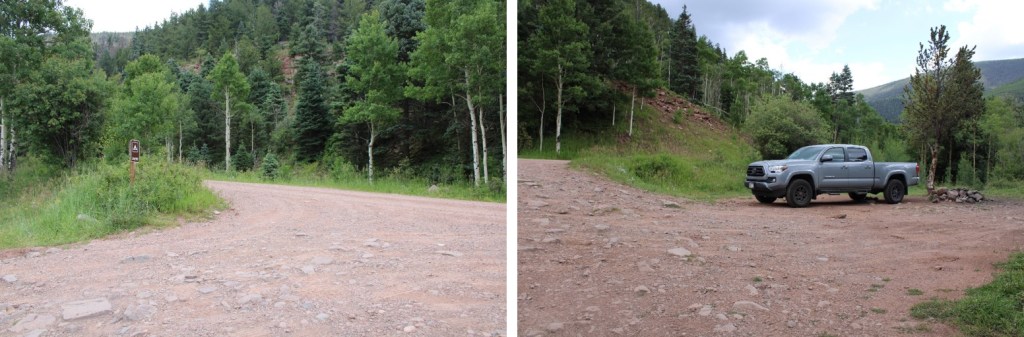
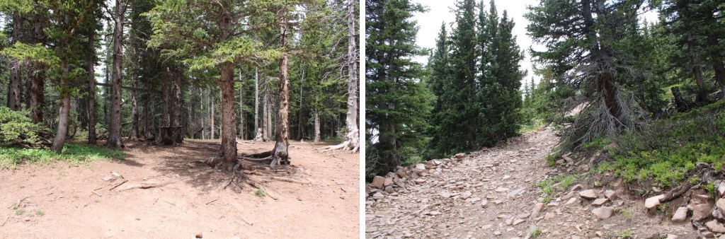
I started at 5am from the South Fork Trailhead, at the end of 28 and Trail 702. The road was a well maintained dirt 2WD road, with about 5 parking spaces at the trailhead.
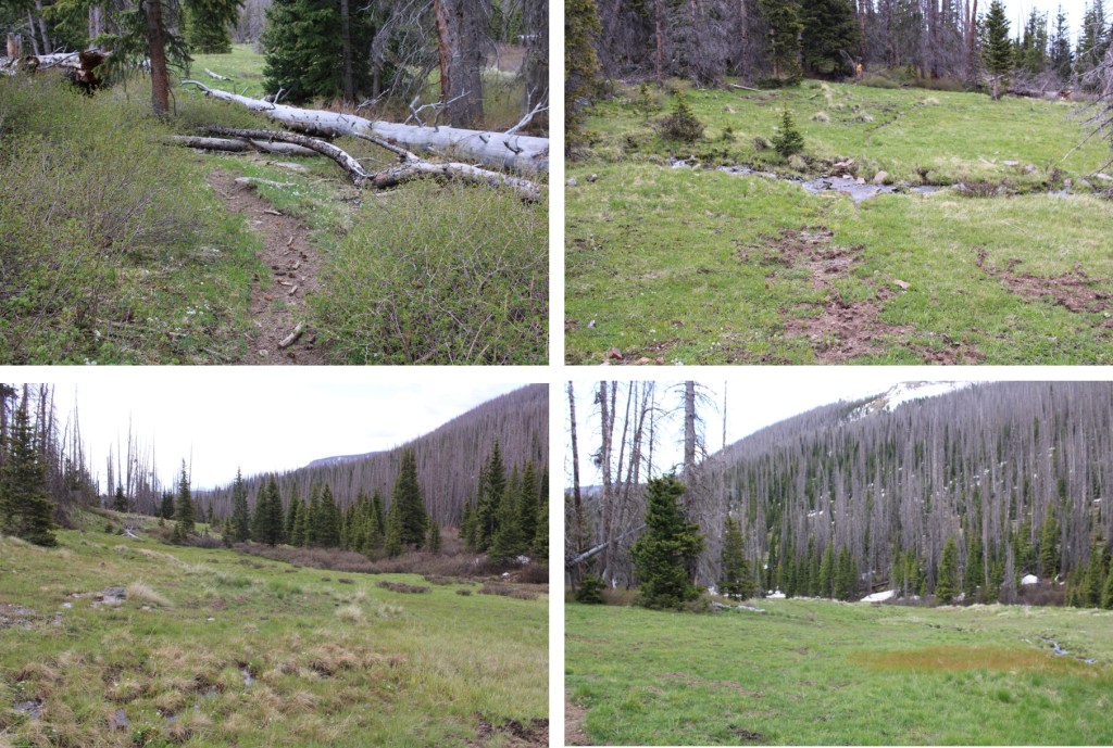
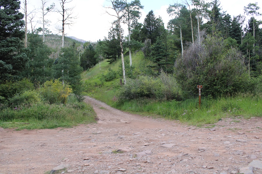
Instead of taking the trail, I followed the road that had been blocked off
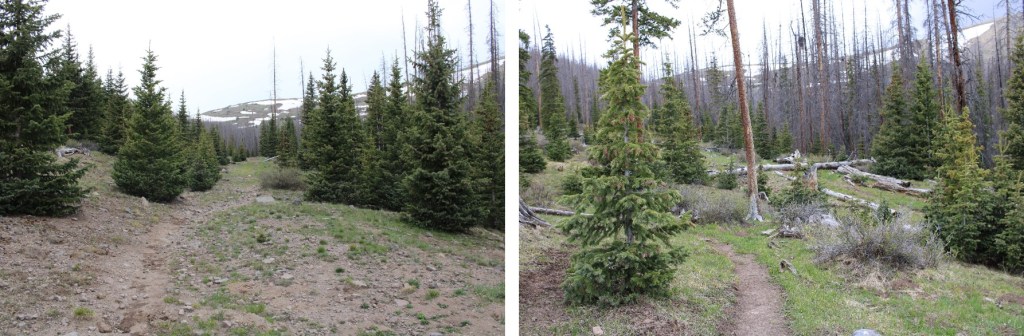
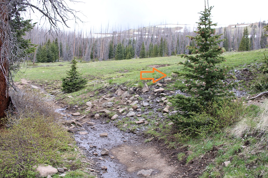
This road eventually became a trail. I followed that trail northwest to the stream crossing
The I was able to cross by hopping across the rocks and jumping a few feet at the end.
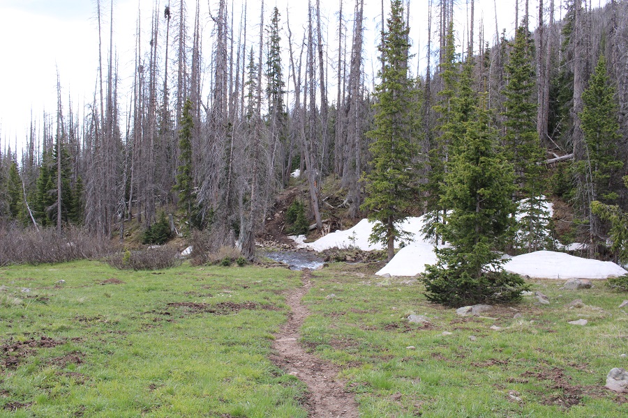
A trail picked up on the other side, but quickly dissipated. To combat this, I just kept heading north-northwest up the basin, towards the gully I could see ahead of me to the northeast (I know that sounds contradictory, but I had to make my around the trees to get there. If you’re doing this in the daylight, the gully should be obvious above the trees).
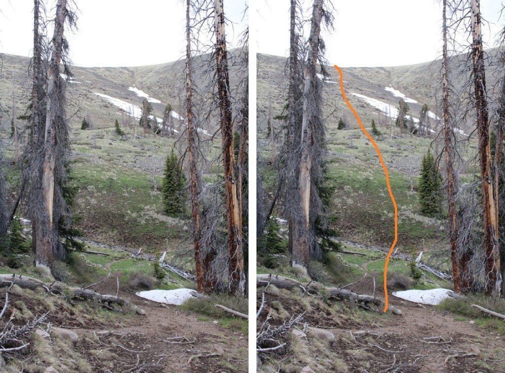
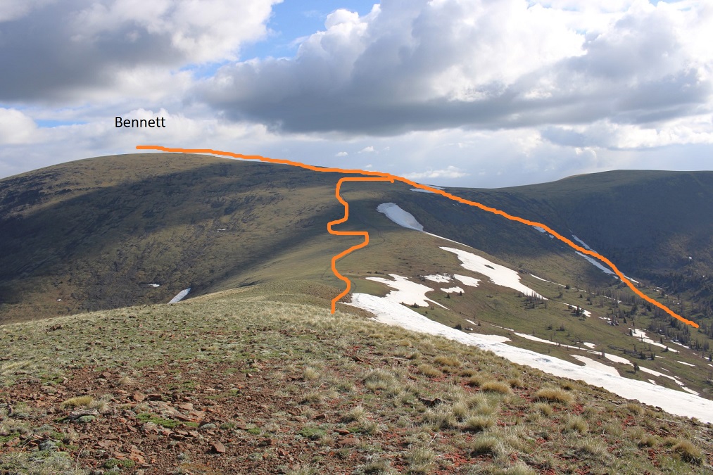
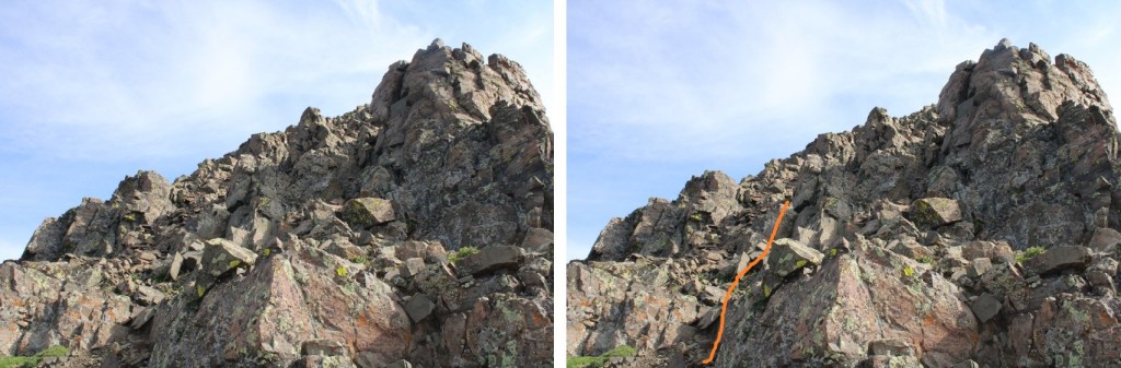
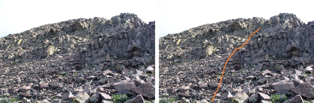
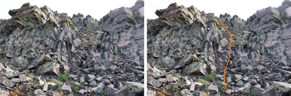
After hiking a total of .81 miles, I came to South Rock trail, turned left, and followed it about 20 yards to a small stream crossing and a ravine. I turned right, and followed the ravine to the gully, staying in what looks like an avalanche runout.
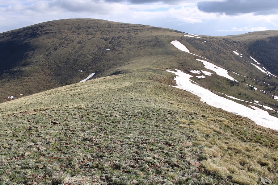
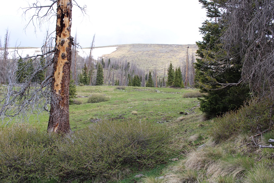
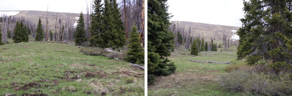
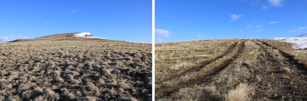
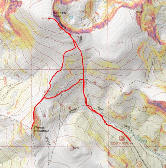
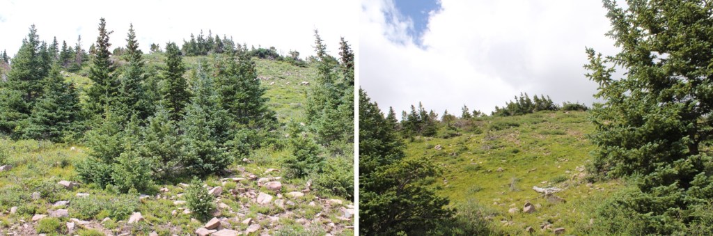
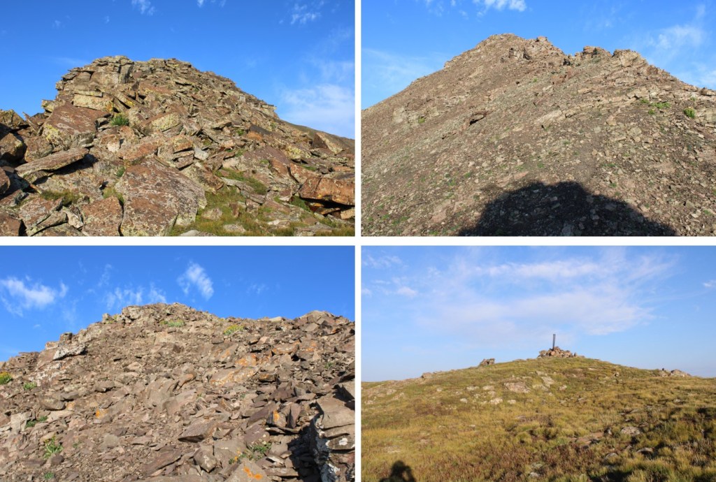
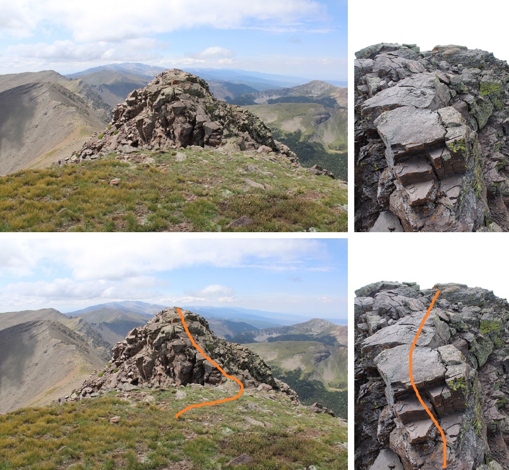
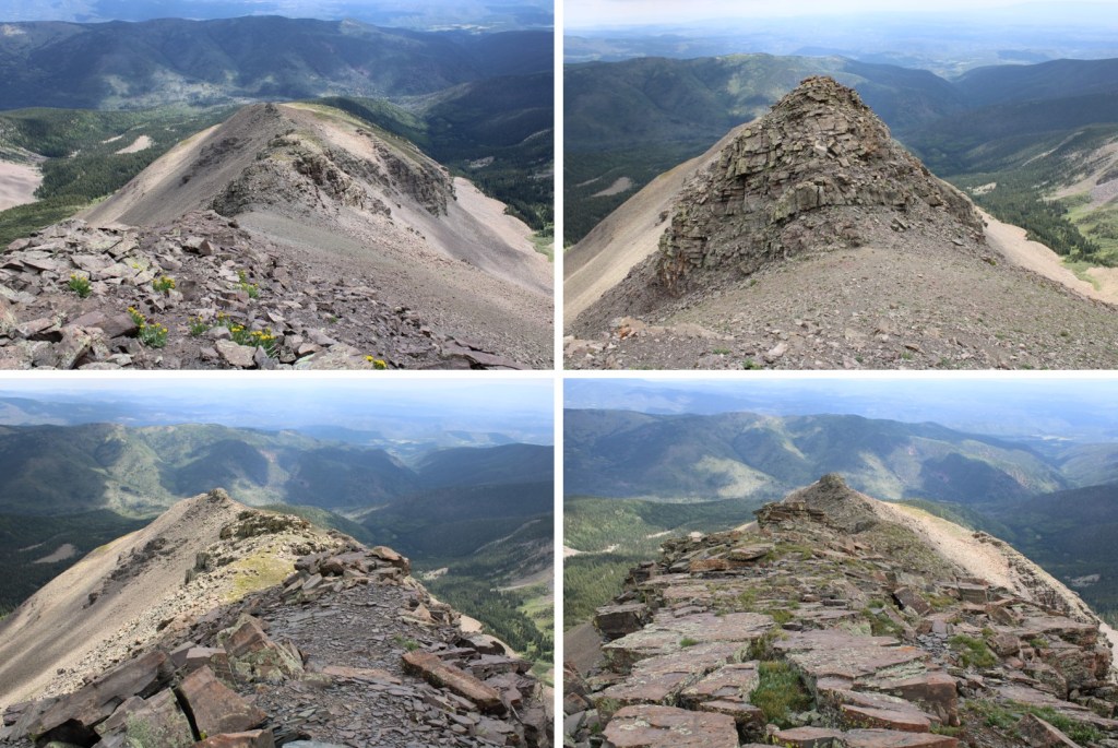
This is the route I took up the gully. This was easy to navigate, all class 2. I just kept heading north.
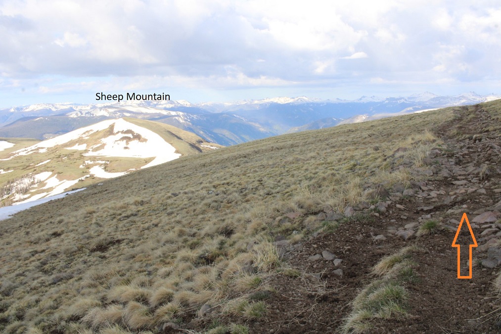
Here are some pictures of the route
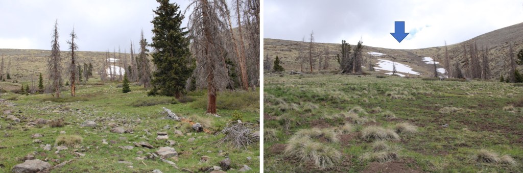
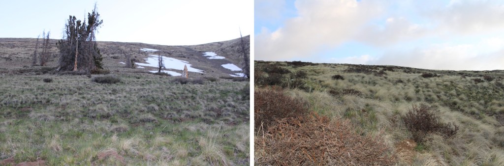
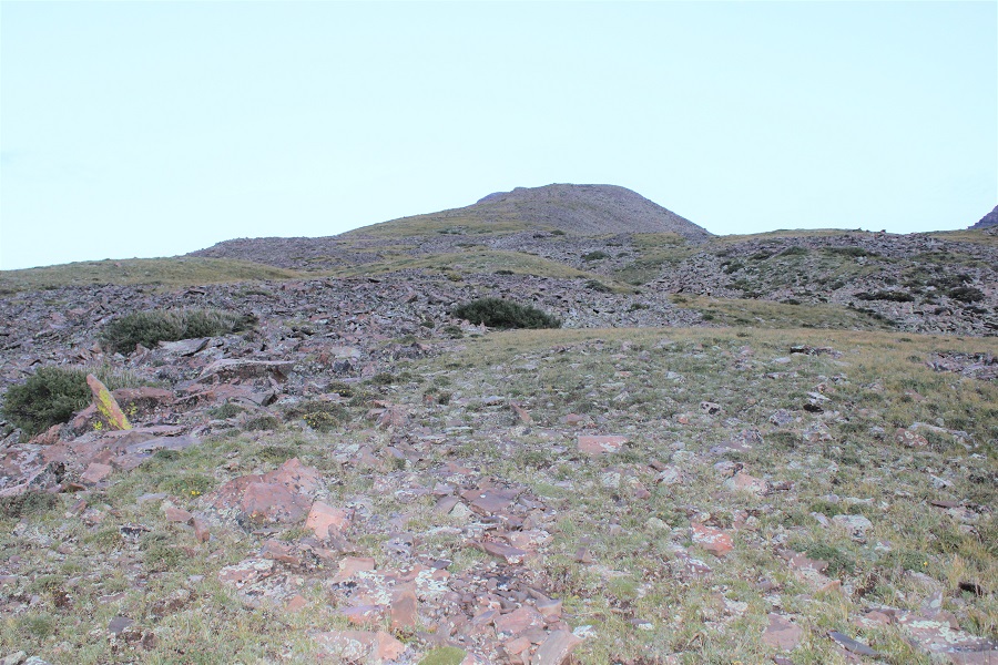
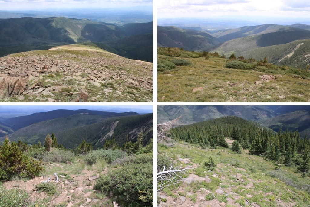
At the top of the gully I headed northwest, which included a lot more class 2 ascending on grassy tundra
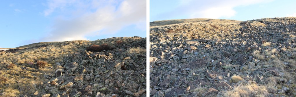
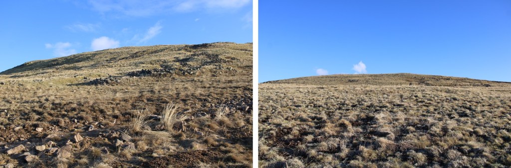
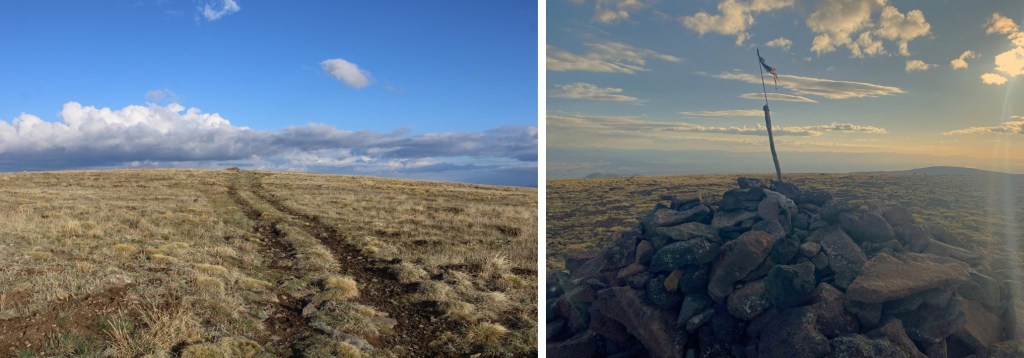
I eventually came upon an ATV road, and followed that to the summit
I summited Bennett Peak at 6:45am. It was 2.37 miles to the summit from where I parked.
Bennett Peak:
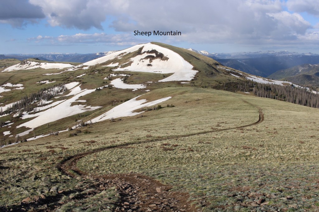
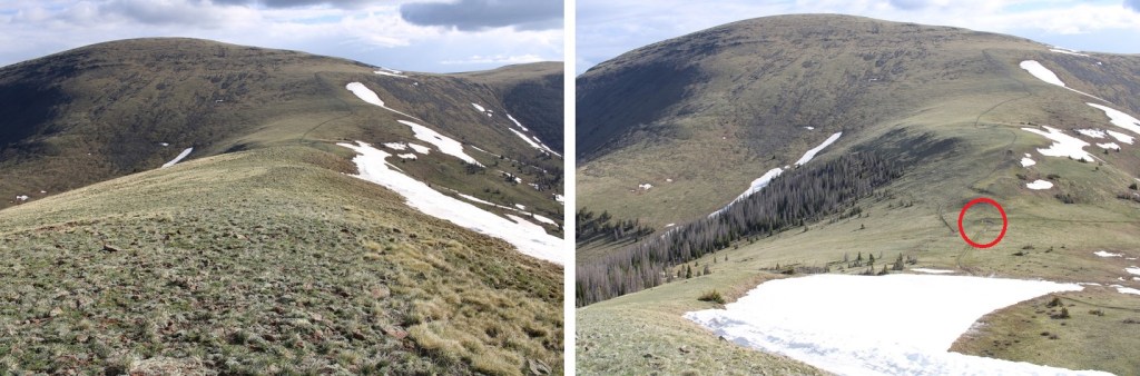
My next objective was Sheep Mountain, but I wanted to take the ATV road to get there, so I headed back south, the way I’d come in, towards the road.
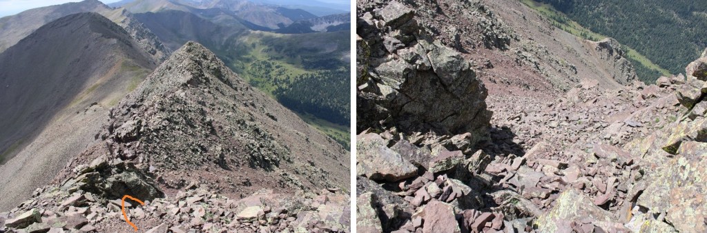
Here you can see the road below I was aiming for
When I made it to the road I turned right, and followed it southwest to the Bennett/Sheep saddle
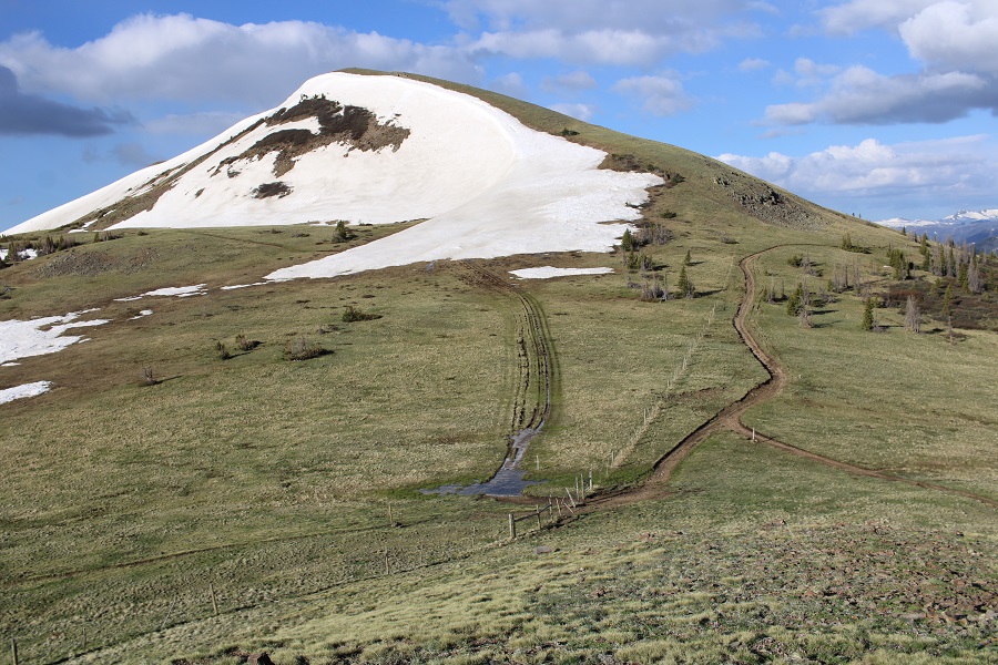
As you can see, this was an easy descent to the saddle
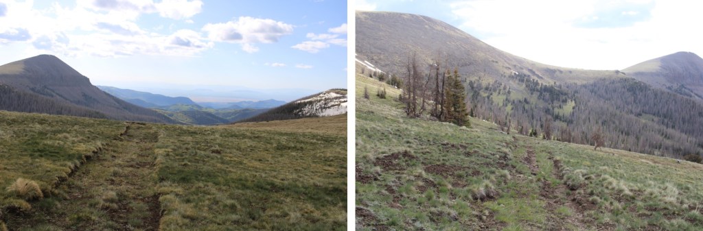
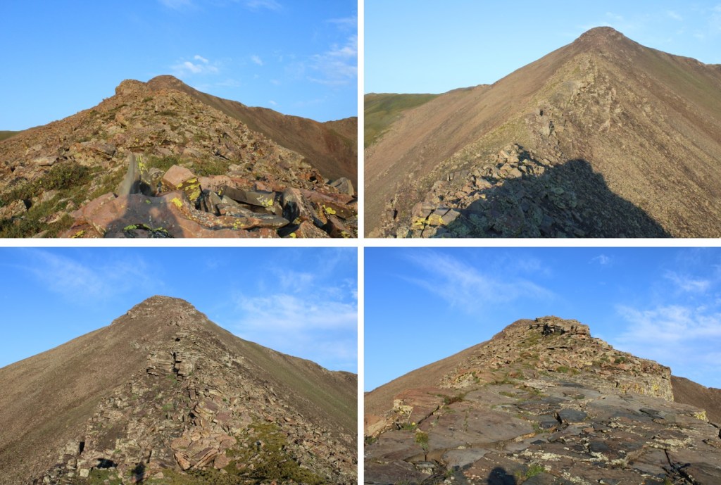
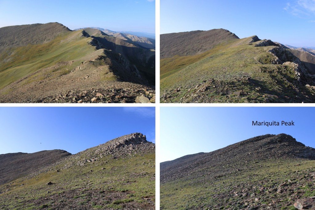
I hiked down to an open gate at the saddle, walked through it, and ascended the ridge
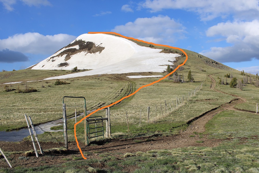
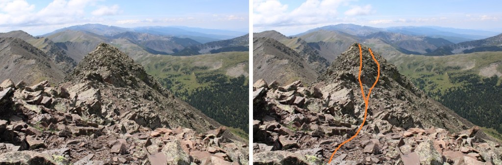
Here’s my route
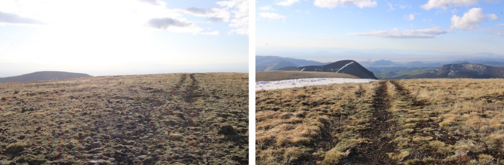
And some pictures of the class 2 ridge covered in tundra
And the false summit
Here’s the real summit
There was no summit register. It was 1.6 miles from Bennett to Sheep
I summited Sheep Mountain at 8am
Sheep Mountain:
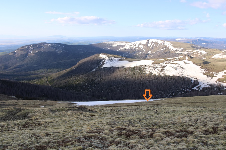
Here’s a look back in the route from Bennett Peak to Sheep Mountain
And the route I took up the gully to the summit of Bennett, and over to Sheep
I turned and headed back towards the Bennett/Sheep Saddle. Specifically, to that open gate
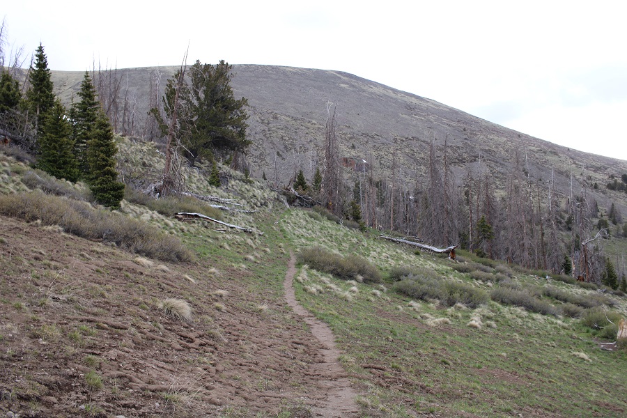
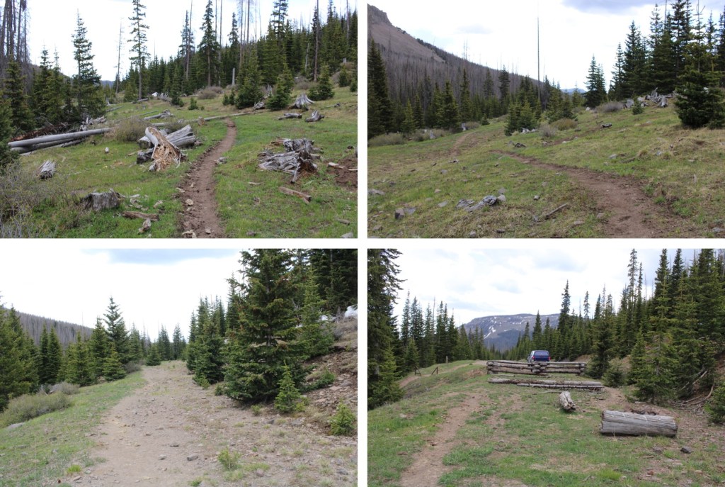
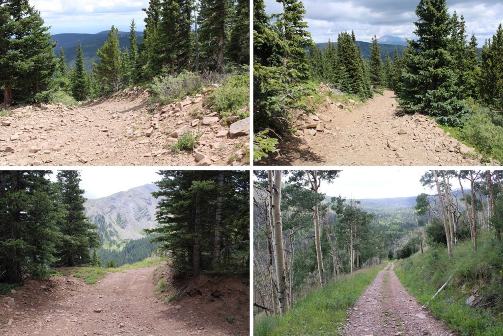
Once at the gate, I turned right and followed Trail 700 back towards the gully (I’d noticed it on my way up, and thought it would be a convenient way back down). You could also take it to the saddle and summit that way.
It actually became a nice trail
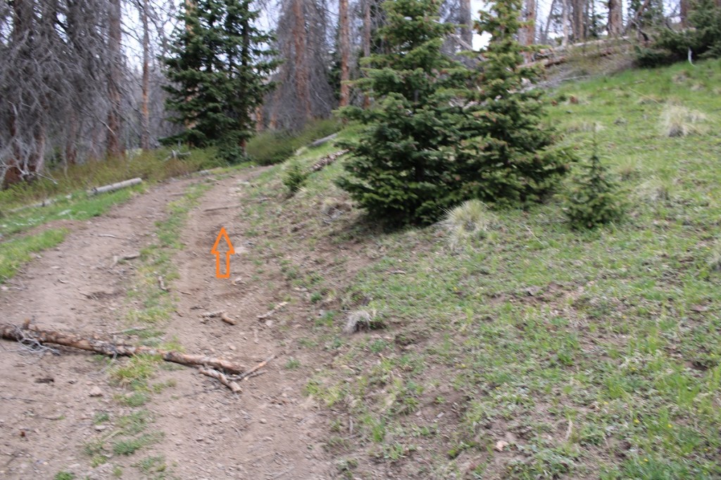
When I made it back to where I’d ascended the gully, I turned right and followed it south, and then southeast, back down to the road
This was a drainage, and very marshy
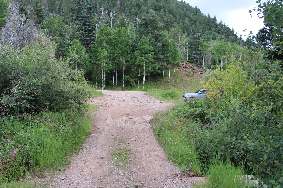
I turned left at the road, and followed it for about 20 yards before turning off the road and heading back down to the creek.
There are a lot of game trails here, but they aren’t all consistent
I crossed the creek again, which was a little more difficult with the rising temperatures and rising water level
I then picked up the trail on the other side, and followed it south back to my truck
I made it back to my truck at 9am, making this a 6.91 mile hike with 2451’ of elevation gain in 4 hours.
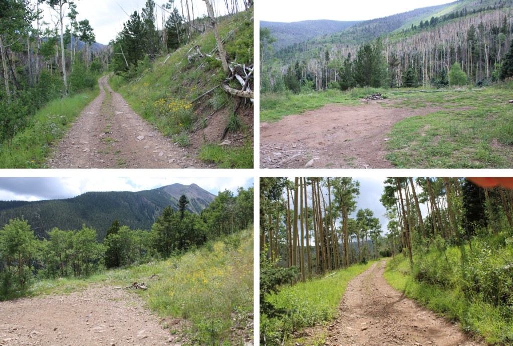
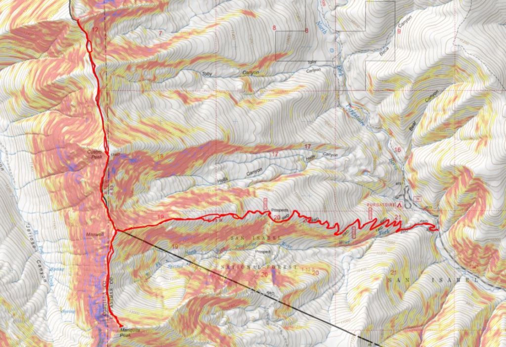
There’s a lot of dispersed camping spots along 34, and just before reaching the Purgatorie Campground off 34 there’s dispersed camping spots on the left, at the junction with 437. It was dark when I arrived, so I parked at the camping spot on the side of the road and was on the trail at 4:30am.
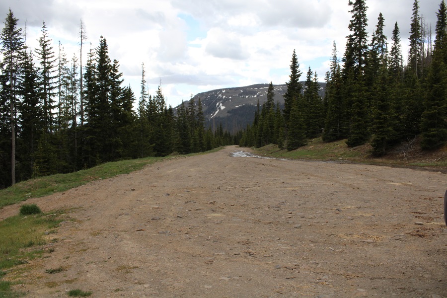
The trail follows road 437, and, although I didn’t know it at the time, my Tacoma could have easily made it all the way to 11700’ (the end of the road). However, by the time I figured this out it wasn’t worth going back to get my truck, so I kept on hiking.
I followed 437 for just over 3 miles to 11700’. There were several dispersed camping spots along this road as well, mostly at switchback junctions.
Just before the last surge of elevation gain there’s a kind of junction in the road. Turn right here, as taking the road to the left doesn’t go anywhere. There will be a nice camping spot on the right, and then a steep section of road and you’re at the end of the road (and another campsite)
Where the road stops the fun begins! I headed west to treeline by ascending this hill. If you look carefully, you’ll find cairns here that will get you to treeline: there are several cairned routes here.
Once at treeline the route will be obvious: Juts follow the ridge west. I brought a helmet, but didn’t feel the need to wear it at all today. The toughest part of this route is easy class 3, and usually just a move or two at a time.
You can stay on top of the ridge the entire way to the summit: even if it looks like you’ll cliff out from far away, you won’t. Here are some ridge views…
I summited unranked Mt Maxwell and took a look around. On the summit there was a property boundary marker, and just a little further west was a “No Trespassing” sign. I’m not sure why anyone would want to continue west, as the terrain cliffs out, but this is the boundary for the Trinchera Ranch. This was the one and only “No Trespassing” sign I saw. I did see property/boundary markers, and made sure to stay on the San Isabel National Forest side of the markers.
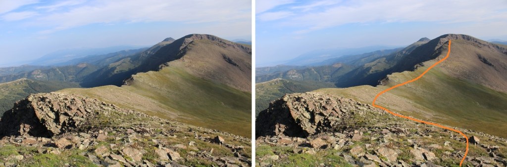
I decided to give the boundary line plenty of space, knowing they have game cameras set up here, and turned and headed south towards Mariquita Peak, being sure to stay at least 50 feet east of the ridge to ensure I was on San Isabel National Forest Land, even if I couldn’t see a boundary marker. I hear the rules for accessing this property change, so be sure to have the most up to date information. This was the most up to date info I could find: https://cpw.state.co.us/learn/Maps/RFW_Trinchera_South_geo.pdf
Here’s the route I took to Mariqueta Peak
The beginning of this hike was rocky (better pictures on my way back), then became an easy tundra/ridge hike, before once again becoming rocky. There was nothing technical about this hike. I descended just under 300’ to the saddle, and then ascended about 400’ to the summit.
On the summit there was another property marker, this one placed inside the summit cairn. I made sure to stay east of this marker as well. I summited Mariquita Peak at 8am.
Mariquita Peak:
Here are some pictures of the path back to Mt Maxwell (once again, I stayed east to remain on National Forest Land)
As I ascended Mt Maxwell I stayed right, avoiding the rocky sections
I re-summited Mt Maxwell at 11am
Mt Maxwell:
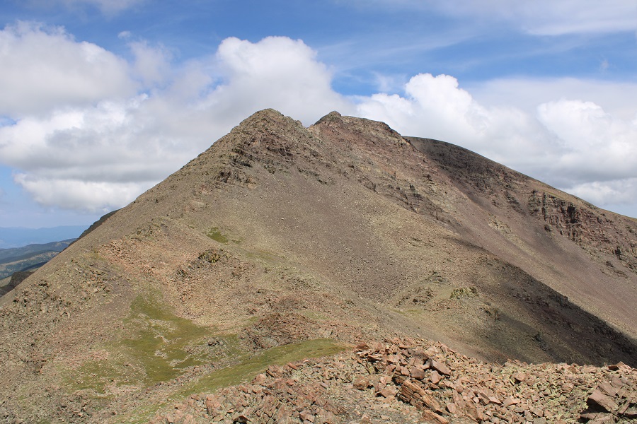
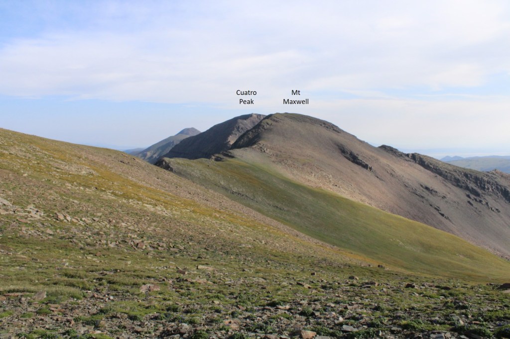
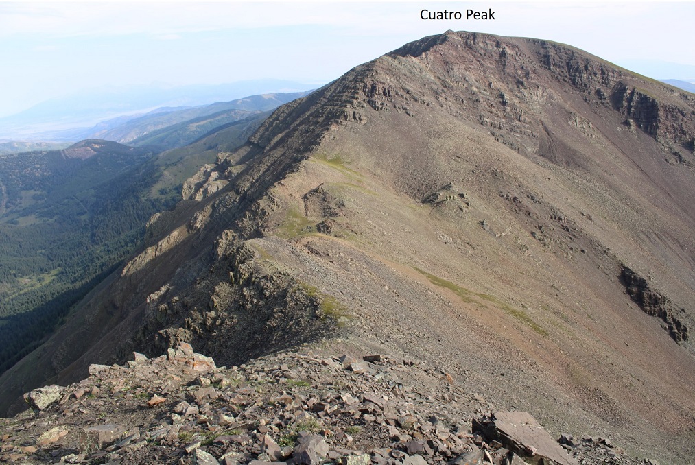
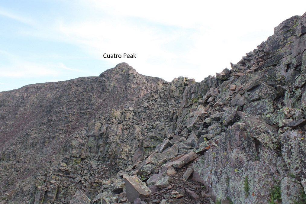
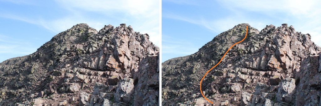
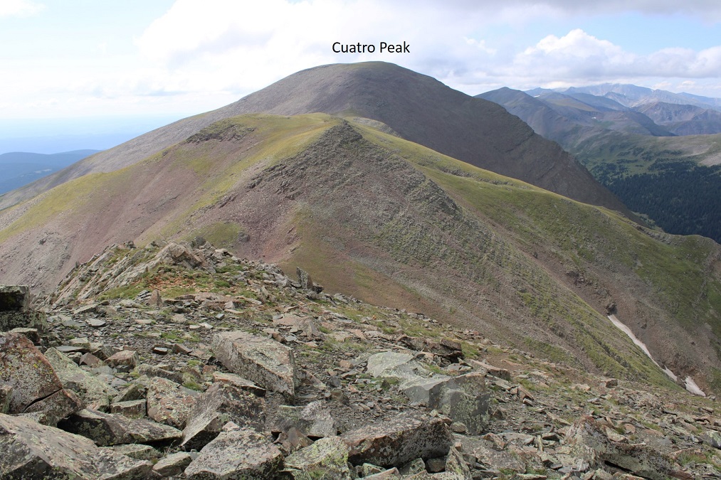
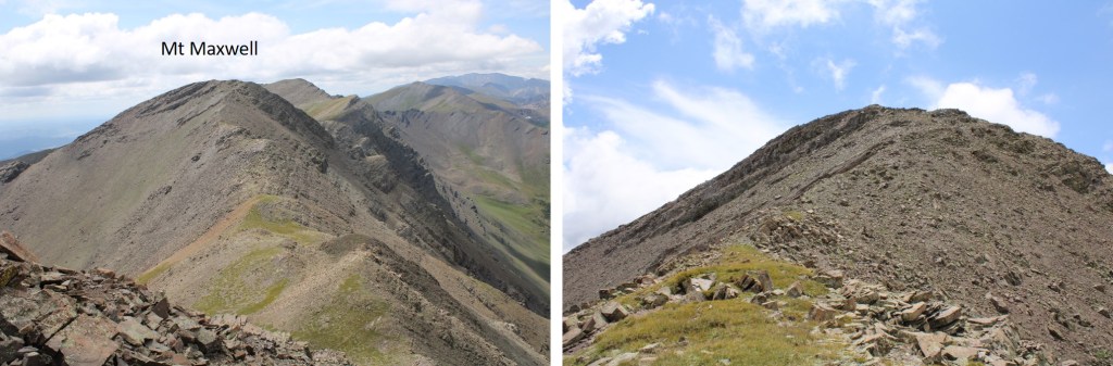
From Mt Maxwell, Cuatro Peak (to the north) looks daunting
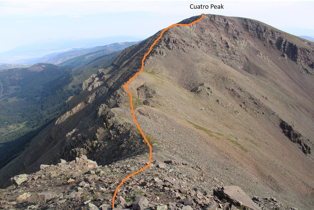
It’s actually a lot easier than it looks. Most of this hike is class 2, with just a few easy sections of easy class 3. Here’s the overall route I took, staying west initially until I made it to the ridge, and then taking the ridge all the way to the summit.
I headed down to the saddle. This was rocky but easy to find traction
Once at the saddle I made my way to the ridge
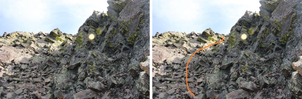
This next part looks daunting, but it’s all class 2. Here’s the route I took to the upper ridge
It’s choose your own adventure, but there are plenty of game trails for reference. Here are some pictures of the route up to the ridge. There’s an easy class 3 gully, that really only requires one or two class 3 moves.
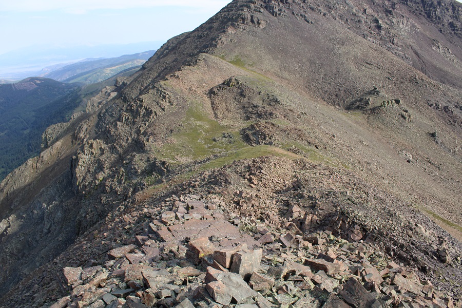
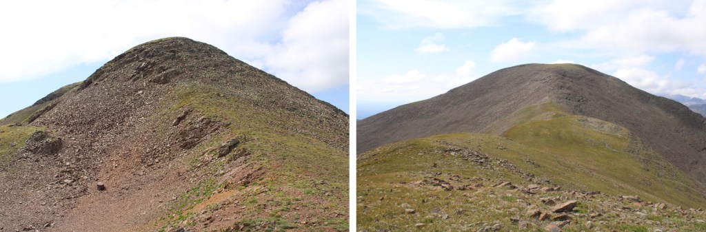
Once on the ridge it again looks daunting, but you can pretty much stay on top of this ridge the entire way to the notch. If you do feel you need to dip down, go left (west). You’ll lose and need to regain elevation, but there’s less exposure.
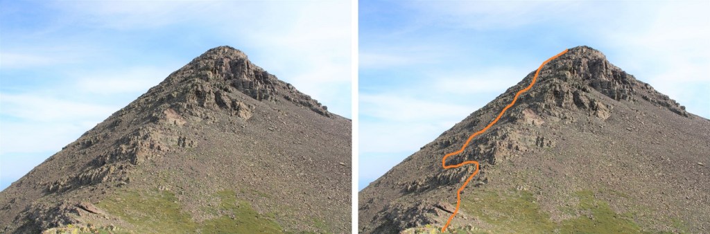
There was one final gully to ascend with some class 3 moves to get out of the gully. Here’s the overall view
And the final push to the top
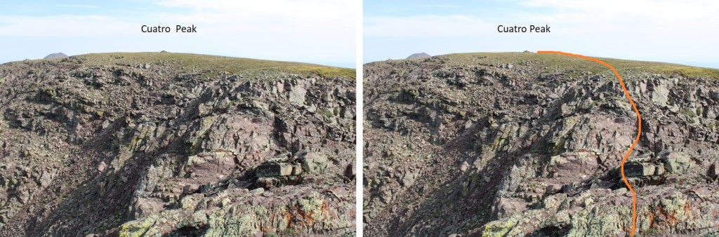
Back on the ridge you’re so close to the summit! But there’s a final chasm to cross. I stayed on the ridge proper, downclimbed a short, easy class 3 section,
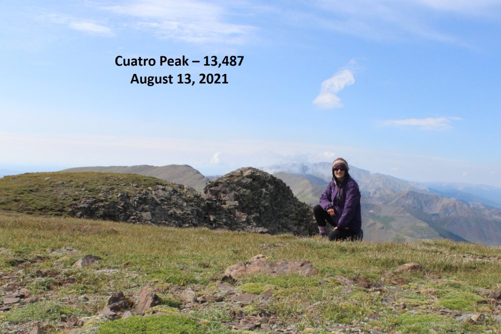
I summited Cuatro Peak at 9:40am
Cuatro Peak:
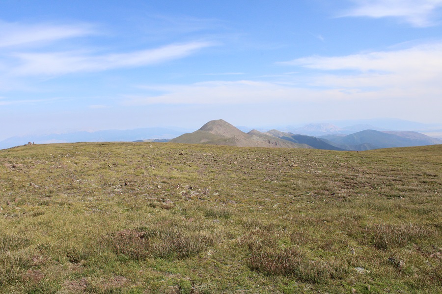
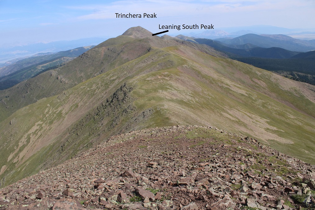
I followed the ridge north to continue on to Leaning South Peak
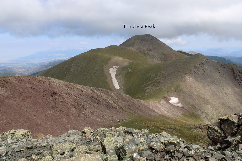
This was a class 2 ridge hike, mostly on tundra, except for the areas that lost elevation, where there were rocks and scree thrown in. I was aiming for Leaning South Peak, but there’s another ranked peak (Trinchera) beyond
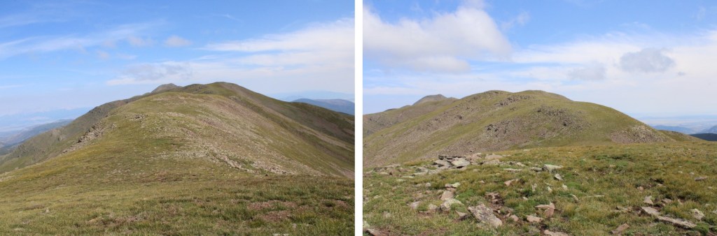
I continued following the ridge north
Just before the last bit to Leaning South Peak I lost 240’ of elevation, then gained 310’ of elevation to the summit of Leaning South Peak. No need to stay high here, as you’ll be losing elevation anyway (although on the way back it was easier to go straight up to the ridge).
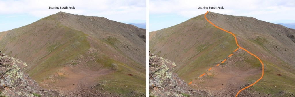
Here’s the path I took to the summit, solid line up, dotted line down. I liked the dotted line better on the way back.
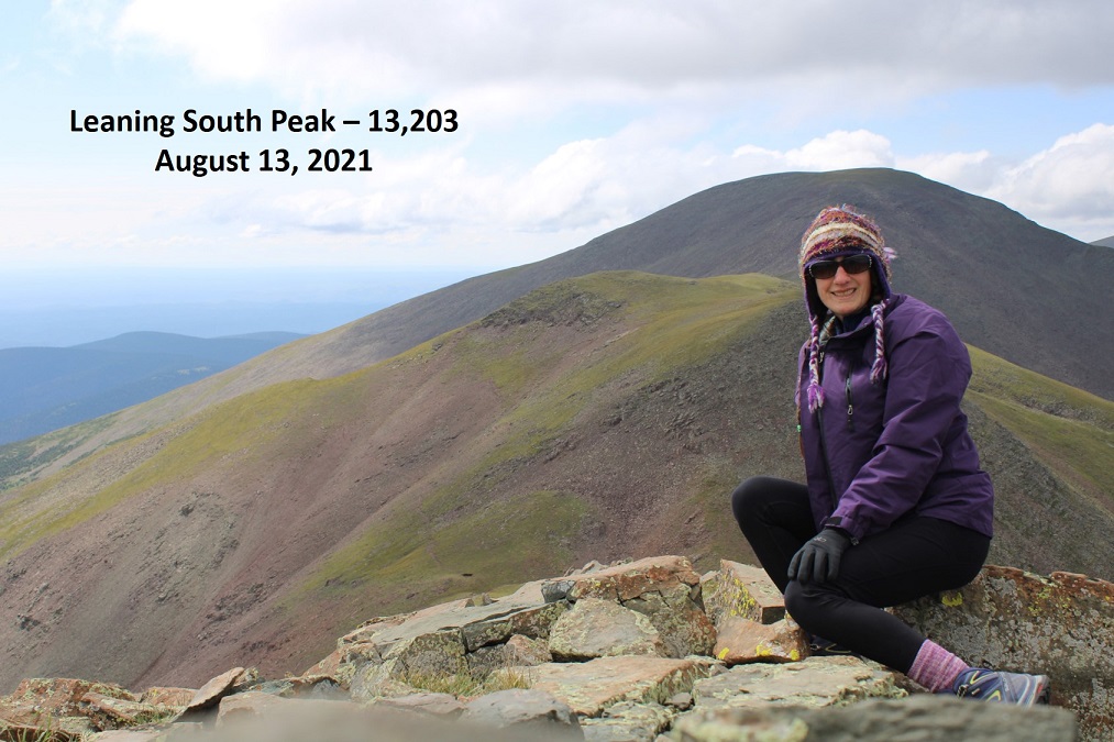
I summited Leaning South Peak at 10:30am
Leaning South Peak:
There was a summit register, but it was broken and the papers inside were wet and unreadable. I replaced the summit register and turned and headed back, as the weather was starting to turn and it’s a long way back. You can make this a loop if you’d like, by continuing on to Trinchera and then heading down to Blue Lakes Campground (etc., depending on where you park your vehicle), but I already had Trinchera Peak, so I decided to turn back. Here’s looking over to Trinchera for those interested
From Leaning South Peak, here’s a view of the route back to Cuatro Peak
And a few pictures from along the way to Cuatro
Once back at Cuatro Peak I made my way back onto the ridge. This is easier than it looks
Then back down the gully…
And across the ridge. Route finding here was much easier on the way down. You can either stay on the ridge, or dip to the right
And back to the saddle and up Mt Maxwell
Then it was back down the ridge. This is also easier than it looks, and goes to easy class 3.
From the ridge I aimed for the willows and treeline, and eventually the road
And followed the road back to my ruck
I made it back to my truck at 2:30pm, making this a 15.73 mile hike with 6807’ of elevation gain in 10 hours