Fairview Peak – 13,224 and Green Mountain 12,692

RT Length:  7.75 miles

Elevation Gain:  2314’

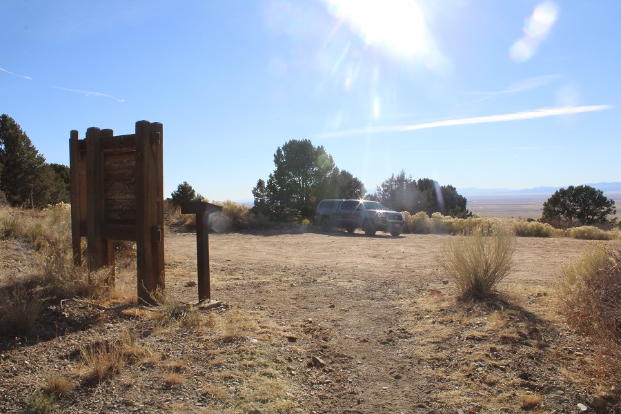
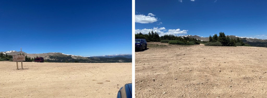
I drove up to Cumberland Pass from Pitkin the night before my hike, and settled in.  The road was dirt 2WD, with a few places where clearance would be helpful, but otherwise it was an easy drive.  There was someone in a tractor grading the road, so I can only imagine it will get better from there.  I people watched for a few hours, then had the pass to myself for the next 18 hours, as it was only busy during the afternoon.

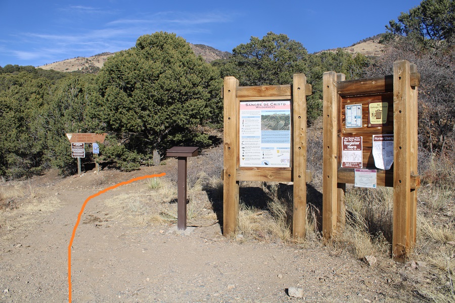
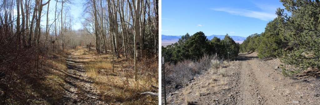
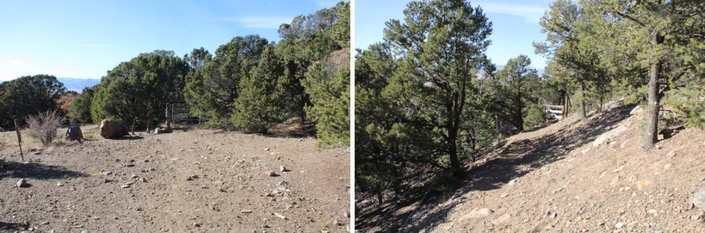
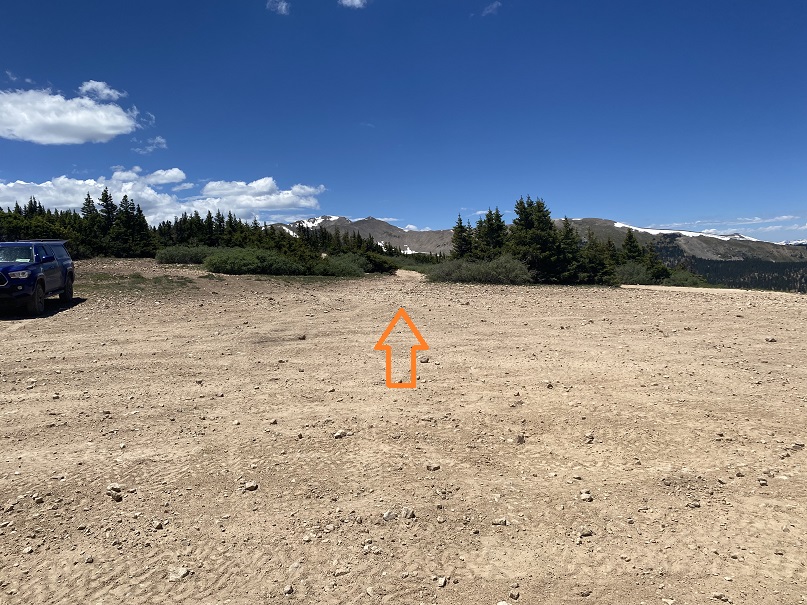
The next morning, I was on the trail at 5:30am.  I actually followed a 4WD road, at the west end of the parking area.  Side note:  On this hike I saw over a dozen grave markers.  I’m not sure if there were bodies buried underneath, or ashes spread, but it seemed excessive. 

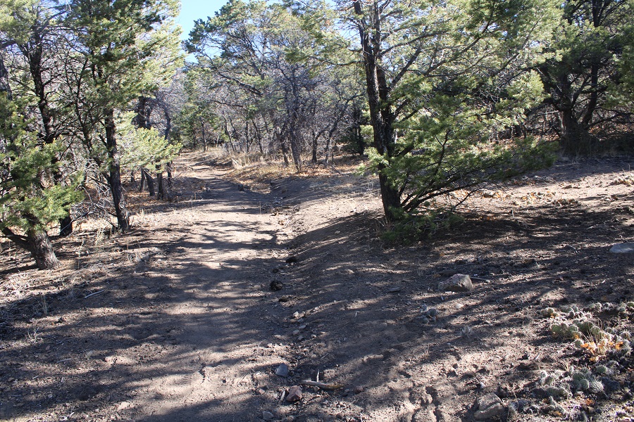
I followed this road west and then southwest as it gained and lost elevation. 

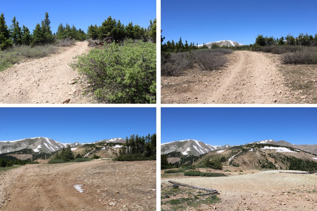
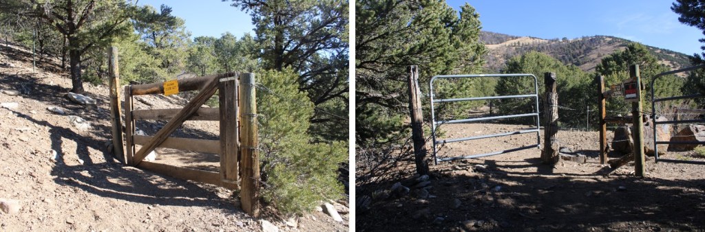
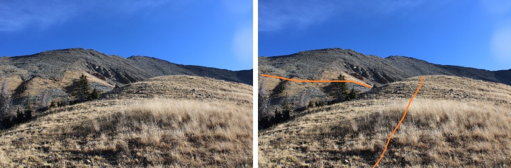
After hiking for a little over a mile the road didn’t end, but it was snow covered, so I followed the ridge. 

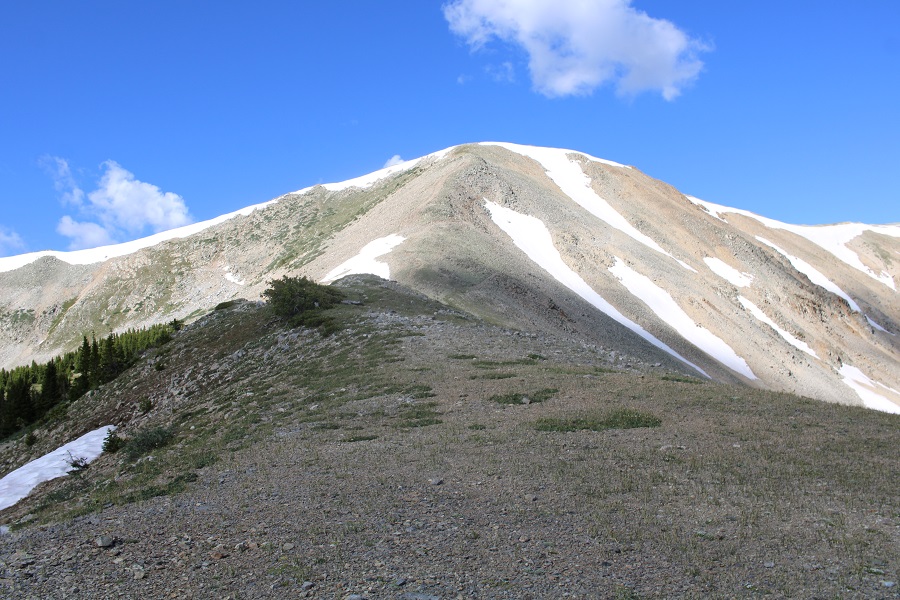
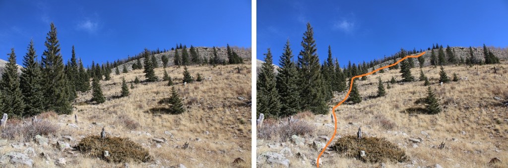
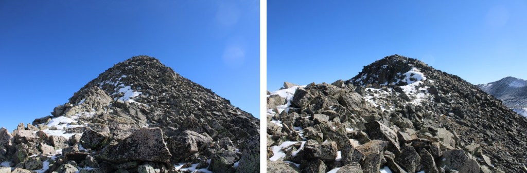
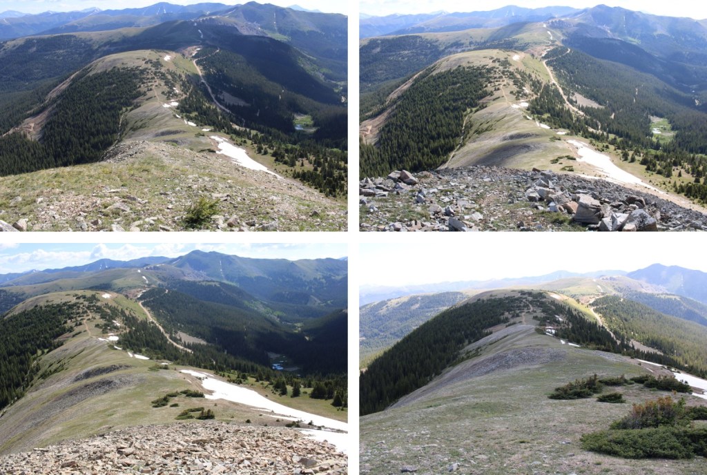
Here’s the route up to Green Mountain

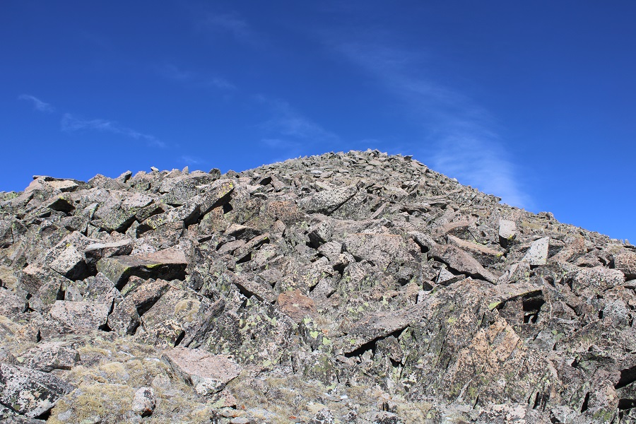
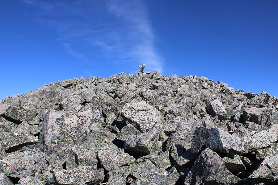
I could tell there was a road here at one time, but it hasn’t been used in quite a while.  At points it was a small trail, and at others it resembled a runnel.  It was rocky, but only about 650’ of elevation gain to reach the unranked summit. Here are some pictures of the route.

The summit was to the left (south)

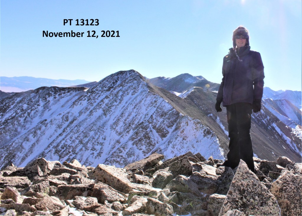
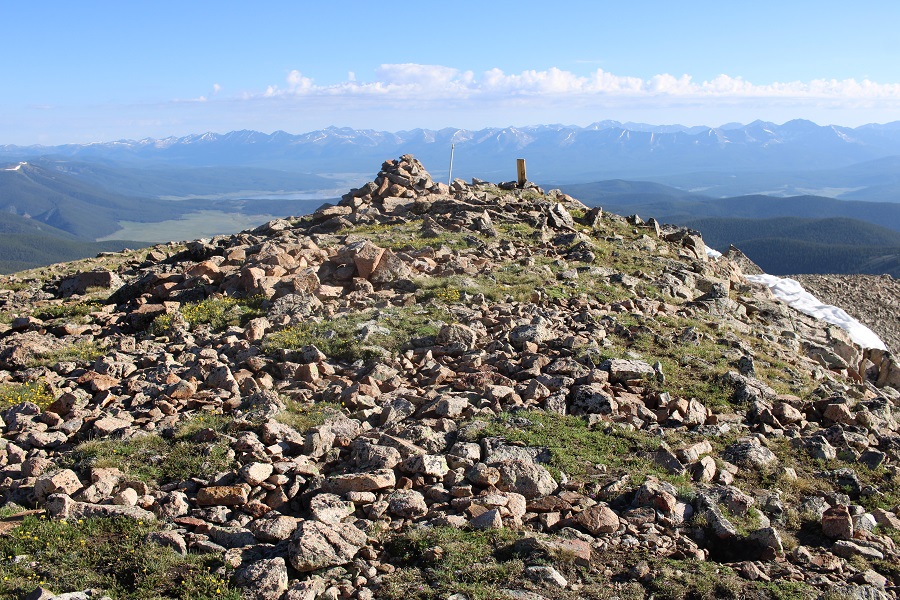
I summited Green Mountain at 6:20am

Green Mountain:

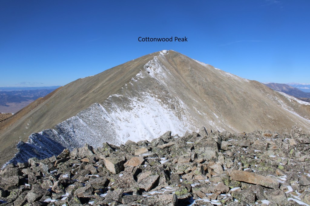
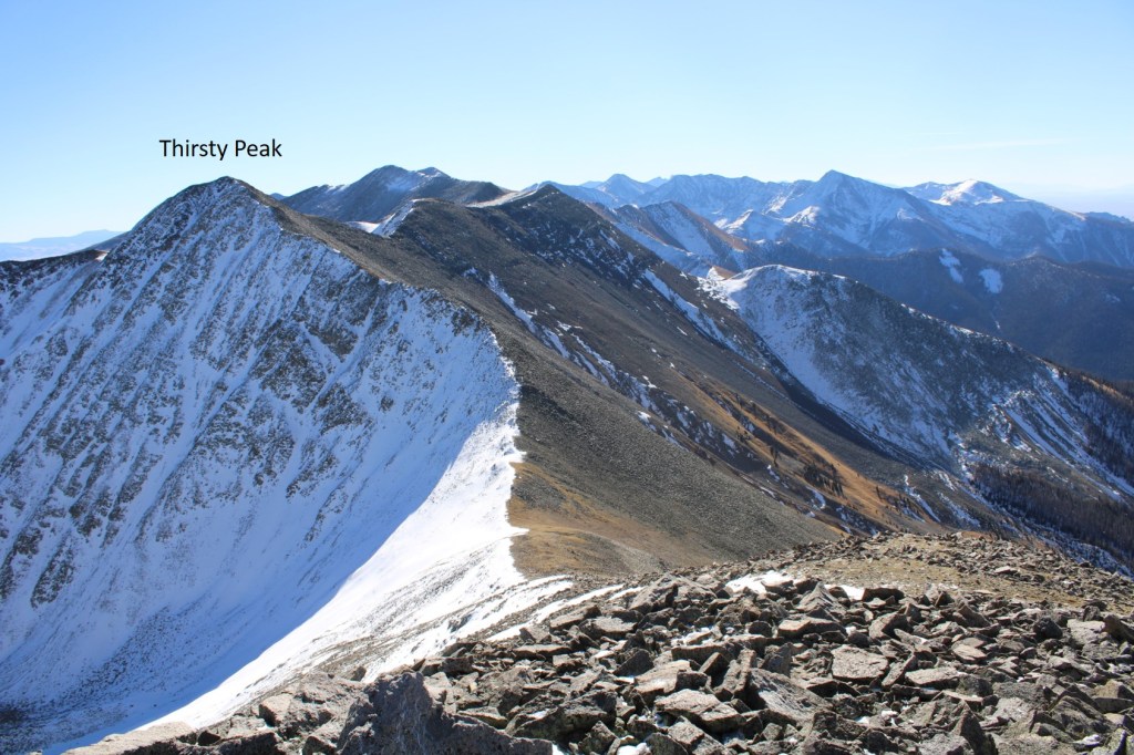
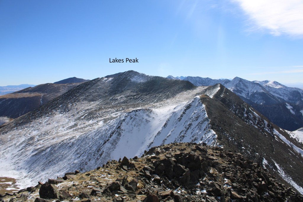
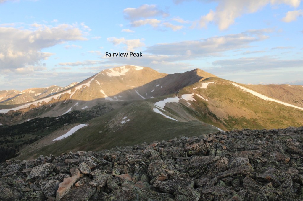
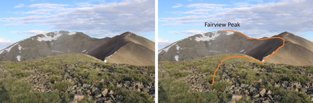
From Green Mountain I turned around, and looked northwest.  I could clearly see the summit of Fairview Peak, and the route I needed to take to get there.

This was going to be a ridge hike, with a lot of ups and downs, but also fairly straightforward.  I headed northwest, and followed the ridge.  There were a lot of mines in the area.

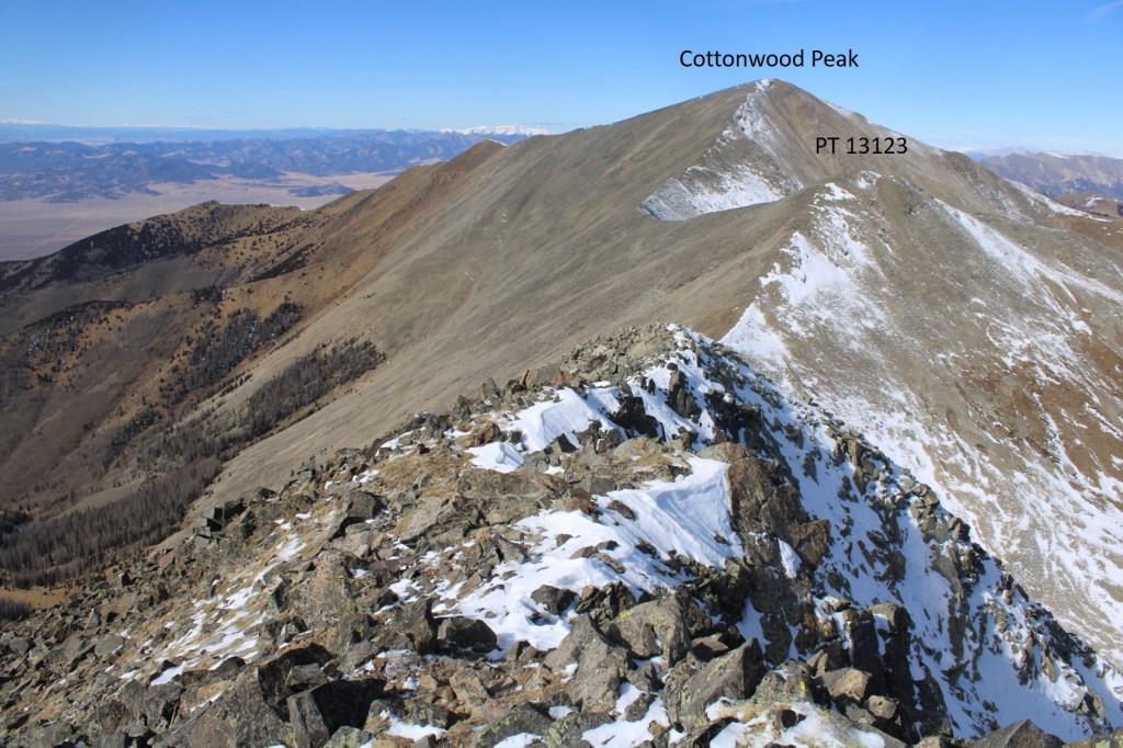
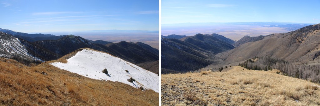
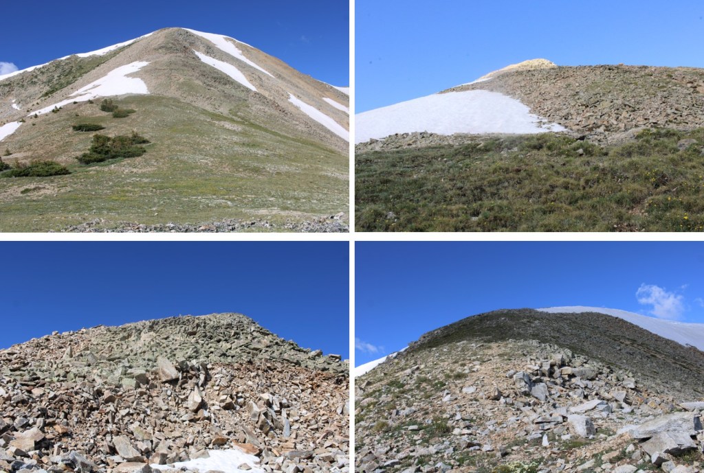
Here’s the view looking over at PT 12556 (not ranked, etc.).  There were 5 crosses in a circle at the summit.  I’m not sure of their significance.

This was fairly easy terrain, mainly tundra that eventually became rocky

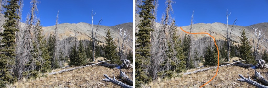
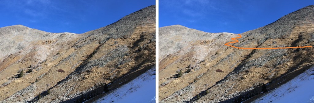
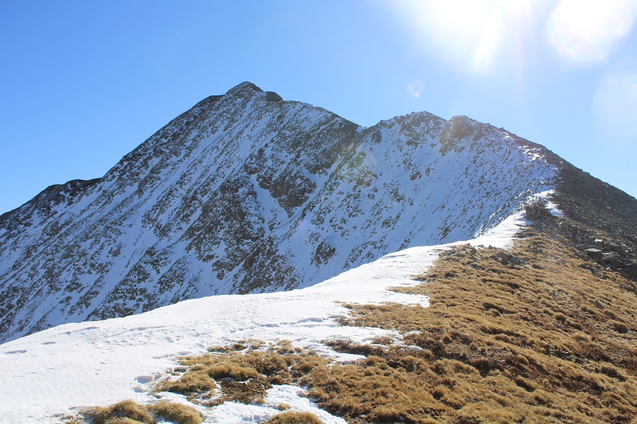
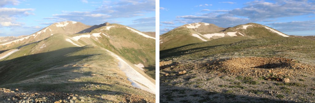
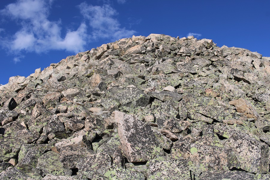
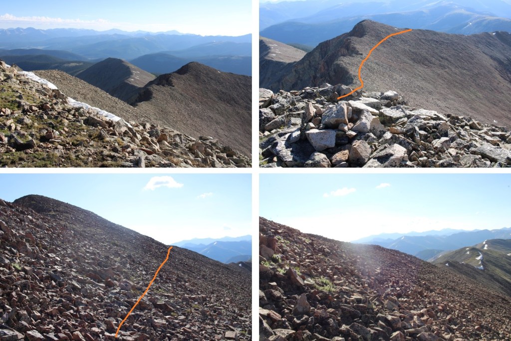
From 12556, this is the route I took over to Fairview Peak, skirting one of the points on the ridge to the left by traversing over rocky, but stable terrain.

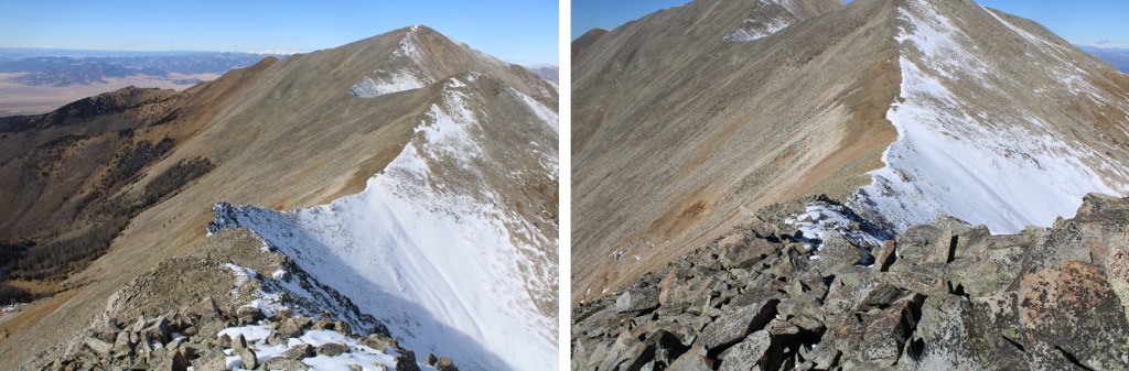
Here are some pictures of the route, which was very rocky

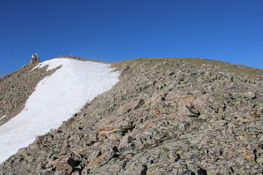
At the top of the ridge, I could clearly see the summit hut at the top to my left.  I headed south to the summit

I summited Fairview Peak at 7:45am

Fairview Peak:

The summit hut was open, so I went inside.  There was still a lot of snow on the floor.  It didn’t look like anyone had been there yet this year.  There were tools, ladders, and a box with the history of the structure and improvements being made inside. 

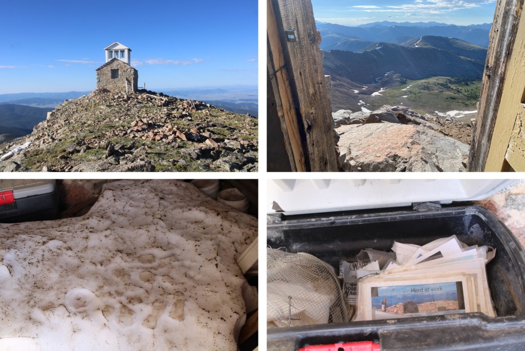
From inside the structure, I could see Green Mountain to the southeast

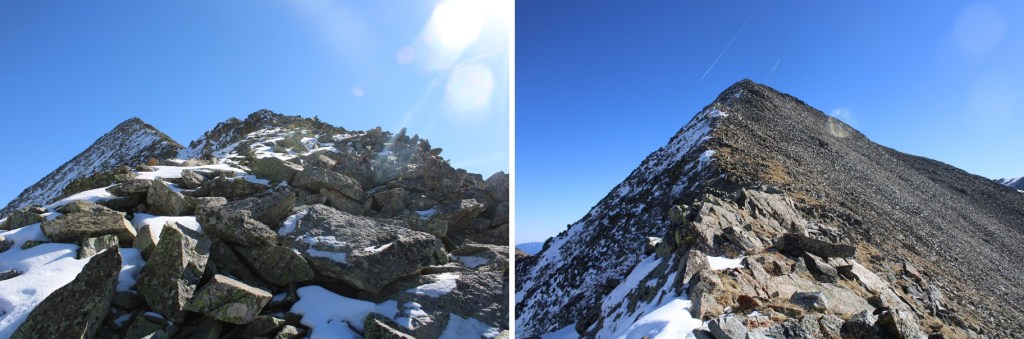
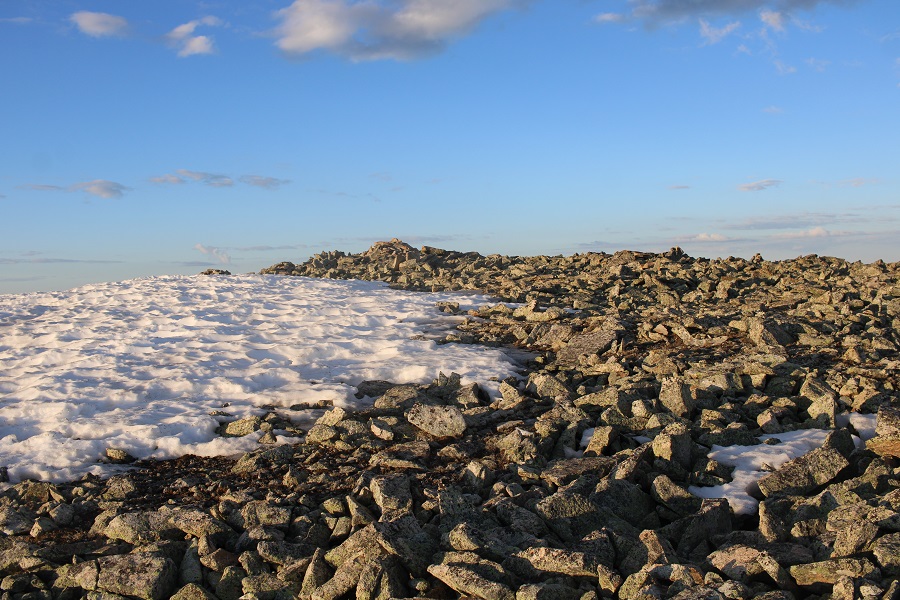
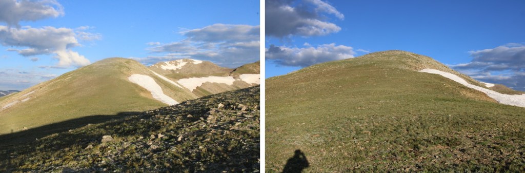
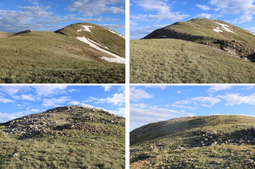
I turned and headed back the way I’d come, back down the ridge

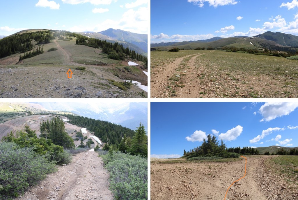
Here are some pictures of my route back to Green Mountain

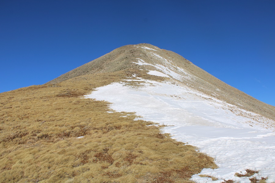
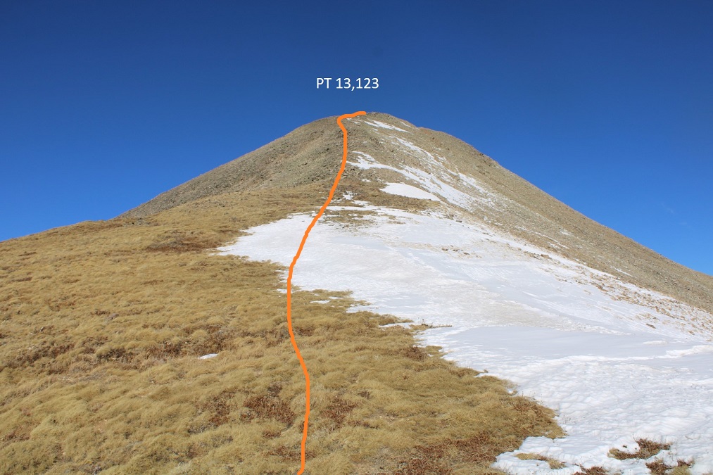
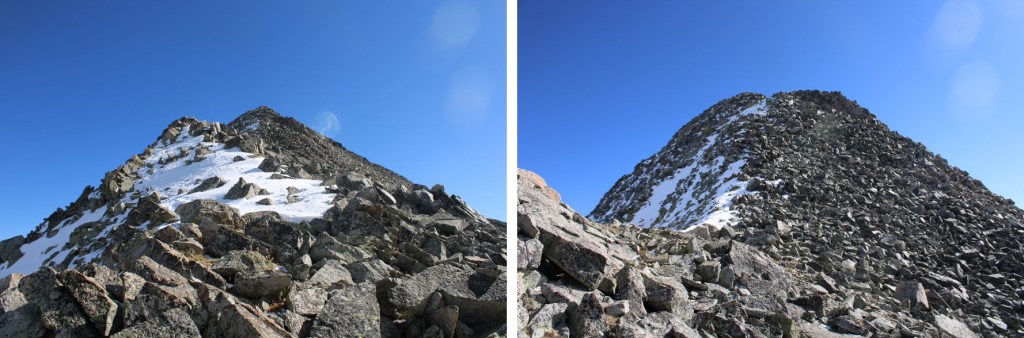
Here’s a look at re-gaining the last 225’ to the top of Green Mountain

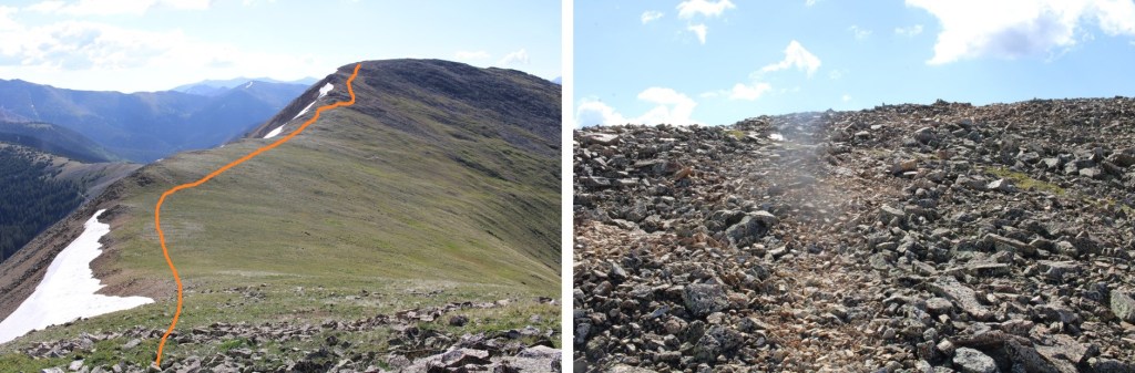
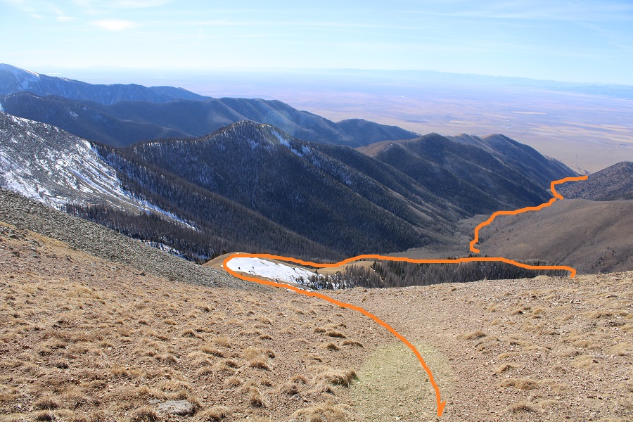
From the summit of Green Mountain, I headed northeast.  I could clearly see the road I was aiming for that would take me back to Cumberland Pass.  I’m sure you can see the road in this picture, but snow blocked my access to get to it, so this is the route I took.

Here are some pictures of my way back to the 4WD road, which started out rocky and then turned to tundra

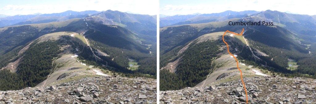
And from the road back to Cumberland Pass

I made it back to my truck at 10am, making this a 7.75 mile hike with 2314’ of elevation gain and a ton of searching for cool rocks in 4.5 hours.

On to the next trailhead!

PT 13,128 and Thirsty Peak – 13,224

RT Length:  14.15 miles

Elevation Gain:  5370’

For those of you who’ve been following my truck situation, the topper for Miles finally arrived!!!  More than 4 months later, but let me tell you, it was worth it!  I’m so glad I did a trial run with my last truck (‘Truck Kirk’… if you get it, you’re awesome, and we should be friends), and got everything I wanted this time around.  This weekend was my first time trying out the new set-up, and I’m thrilled.  Plexiglass instead of glass gives me blackout windows, which are great for irregular sleep patterns that are sometimes necessary to wake up at 2am and hike.  Added bonus:  plexiglass doesn’t shatter! I put up Reflextrix around the windows to keep in the heat, and set up my Buddy heater in the corner.  I re-used the foam bedding from the Tundra (after cutting it a little to fit), built the cabinets myself (not bad considering the only ‘shop’ experience I have was in a 7th grade Industrial Arts class), and commissioned my daughter to paint them.  She used pictures I’d taken while hiking, and all I have to say is I love them!!!  We left a few of the lids to the cabinets blank, so if we meet at a trailhead, I expect you to add your signature to one of them so I can remember you.

Ok, moving on to the trip report.

I arrived at the trailhead the night before to get plenty of rest before the hike.  I talked with some local hunters, pre-signed the register because I’ve learned pens don’t work in the early morning when they’re cold, and got to bed just as the sun went down.  At 5am I was up and on the trail, heading south through the scrub oak.

I was at the wrong trailhead.  After .25 miles of hiking, I knew I was on the wrong trail.  I pulled out my cell phone and started the compass app (which works moderately well): I didn’t want to deal with a flashlight and a ‘real’ compass in the dark.  While I was following the cell phone compass-directions, I tripped.  No worries though, because my cellphone broke my fall.  All I can say is:  good thing I had a screen protector on my phone.  Also, my knee still hurts.

To save time I brought up a gpx file (which I only use when absolutely necessary) and realized it looked like I was going in the right direction, but about half a mile too far south.  Ugh.  I hoofed it back to the trailhead, signed out of the register by scratching on the paper with a pen, got in my truck, and drove to the Hot Springs Trailhead, about half a mile north.  I got there, jumped out of my truck, ready to go, signed the register, and was off.  It was now 6am.

The correct trail starts at the Hot Springs Trailhead.  There are two different trails that originate from this trailhead.  I went right, following Garner Creek Trail 752.

This is a wide, class 1 trail

I quickly came to a gate, and then another gate.  I passed through both, closed them as instructed, and continued on my way.

I followed this (mostly) class 1 trail for 6.3 miles to the 13123/Thirsty Peak saddle.

Even though I wrote it on the topo map, I forgot them: My stream crossing shoes.   Creek crossings.  Have I mentioned them?  I stopped counting at 10 on this trail.  Good news; they’re all easily crossed.  Here’s a visual…

I passed some camping spots with hunters still sleeping in their tents, came to a bit of a clearing, and had a visual of where I was aiming; the saddle between PT 13123 and Thirsty Peak.

I continued following the trail as it headed northeast, crossing several more streams.

After hiking for about 5 miles, I was just below treeline.  Here the trail stopped, but the cairns picked up.

At the top of pile of rocks I was now just at treeline, and on a ridge. I followed the ridge east, and then north, staying directly on the ridge.  Here’s an overall view of the route.  There were cairns here.

Here are some more pictures of the ridge.  The cairns are circled.  Most of the cairns were shorter than the grass, but they were accompanied by large branches sticking up from their centers, so they were easy to make out. 

Once above treeline the trail faintly resumed.  I headed north to the 13123/Thirsty Peak saddle

Once at the saddle I turned left and followed the ridge northwest to the summit of PT 13123, gaining 425’ in elevation.  This started out as tundra, but quickly became rocky. 

I summited PT 13123 at 9:55am

13123:

I could see Cottonwood Peak to the northeast (not on my agenda for today)

I turned and headed back to the PT 13123/Thirsty Peak saddle.

From the saddle, it was a class 2, rocky ridge hike to the summit of Thirsty Peak. I gained just over 500’ from the saddle to reach Thirsty Peak (unranked). 

I summited Thirsty Peak at 11am. At the summit I heard a coyote yipping.  I got it briefly in the video, but just at the very beginning. 

Thirsty Peak:  

Here you can see the reason Thirsty Peak is unranked:  Lakes Peak

I turned and headed back to the 13123/Thirsty Peak saddle

And then re-traced my steps back down to the ridge

Here’s an overview of the route out

Here are some pictures of the way back to the trailhead

I made it back to the trailhead at 2pm, making this a 14.15 mile hike with 5370’ of elevation gain in 8 hours. 

On to the next trailhead!