Nellie Peak – 13,106 and East Nellie Peak – 13,091

1

RT Length: 13.72 miles

Elevation Gain: 3833’


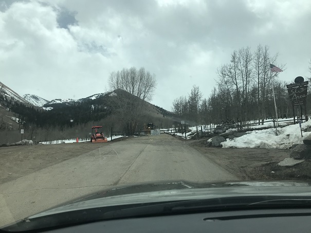
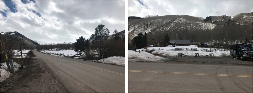
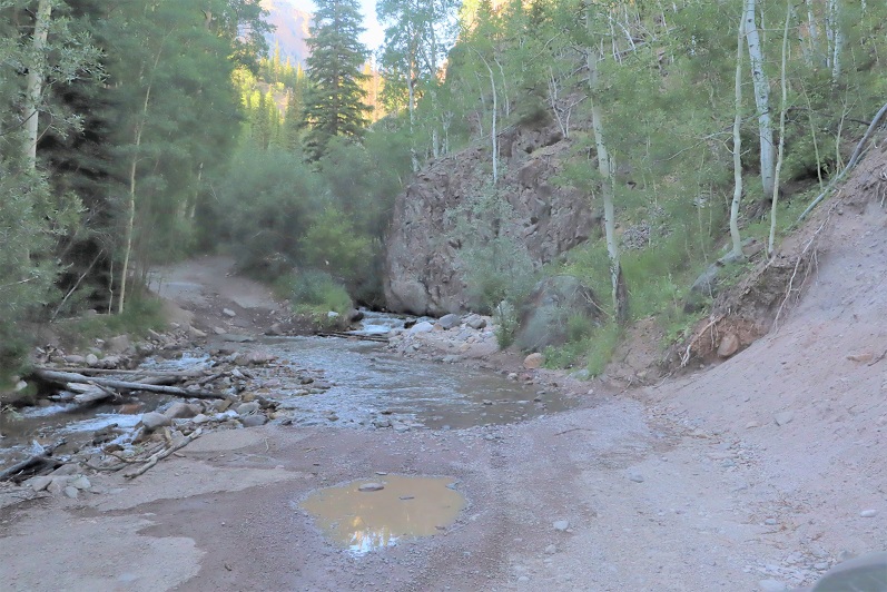
Wow, the 4WD road to Nellie Creek is much worse than I remember!   It’s absolutely 4WD from the turnoff, all 4 miles to the trailhead, with 2 creek crossings. Have I mentioned I love my truck?

2

3

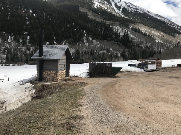
I made it to the trailhead, which was empty. There were a few dispersed campers in the area however, taking shade beneath the trees.

4

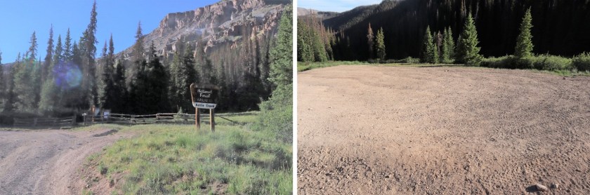
The trailhead was also very much in the open, so I turned around and drove a short distance and parked my truck in a narrow parking spot under the trees, just off the road. There were mosquitoes all around, so I ate dinner in the back of my truck, jotted down notes and checked my topo map for tomorrow.   I decided to go to the trailhead to take a look around and get a visual for the start of tomorrow’s hike. There was a couple with a dog standing in front of the trail maps when I arrived. Their dog charged at me, barking loudly. The couple seemed surprised and apologized for their dogs behavior. That dog barked all night long.

I walked back to my truck, took care of a branch that had been scratching the roof of the truck like a critter trying to get in, and read for a bit before turning out the light.

If you couldn’t already tell by the tone of this post, from the time got to the trailhead I wasn’t ‘feeling it’. This rarely happens to me, and I was thinking maybe I need a short break from my goals? Or maybe expand them a bit? I love to hike, but today I couldn’t seem to get myself out of bed to start. I blame it on yesterday’s failed attempt on Coxcomb, which put my training into a different perspective.

Also, I was still worried about the injured horse. My mind had a lot to think about and I couldn’t turn it off. I finally started on the trail at 4:15am.

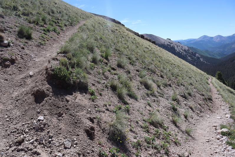
The trail starts at the north end of the parking area and follows a well defined, class 1 trail.

5

6

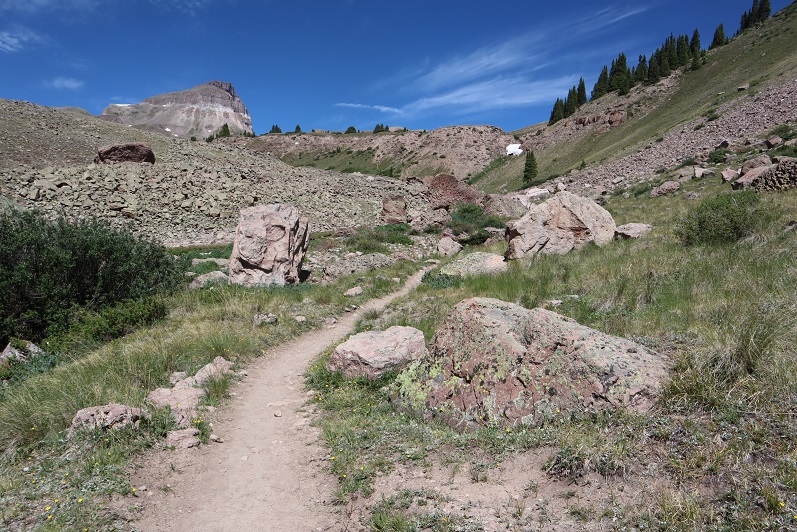
After hiking for 1 mile I turned right at this sign and switchbacked up the side of the mountain

7

After hiking for 2 miles I made it to the top of the pass

8

It was still dark at this time, and I knew I needed to descend a couple hundred feet. The trail seemingly ended and it took me a while to figure out which way to go, but there is an actual trail here that picks up again after about 50 feet of absence. In the daylight it wouldn’t have been an issue. I finally found it and descended in to the basin. And descended, and descended, and descended. I looked at my altimeter, concerned I’d lost too much elevation. At this point I’d lost 800’, and I could tell I’d need to lose several hundred more before starting to gain elevation again. The sun was starting to rise and I still didn’t have a good visual of the peak I’d intended to climb. I still wasn’t ‘feeling it’ and didn’t like the prospect of gaining 1000’+ at the end of today’s hike after climbing up gullies (I’m not a fan of gullies). I decided to call it and turn around. I headed back up towards the pass. I’d much rather get my elevation gain in the beginning of the hike, rather than at the end. However, I wasn’t done hiking for the day; just changing my plans. When I made it back to the pass I turned and headed east up the side of Unnamed PT 13106 (which I later found out is nicknamed Nellie Point, so that’s how I’ll refer to the peak. Names are better than numbers IMO).

9

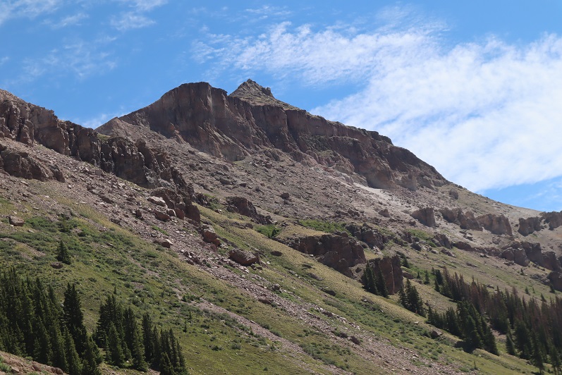
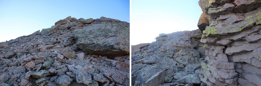
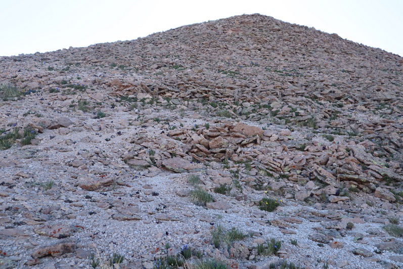
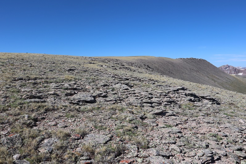
This was mostly a tundra hike until the end, when the tundra turned into very large rocks.

10

These rocks were fun to navigate, kind of like a maze with large obstacles to go around. All class 2. My mood improved dramatically and I was excited to be out adventuring.

11

12

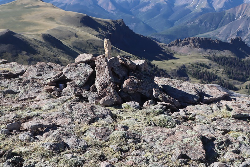
There were several large cairns on the long summit. I wasn’t sure which one was the actual summit until I found a summit register inside one of the cairns. It was kind of in the middle of the summit area (which was about a quarter mile long).
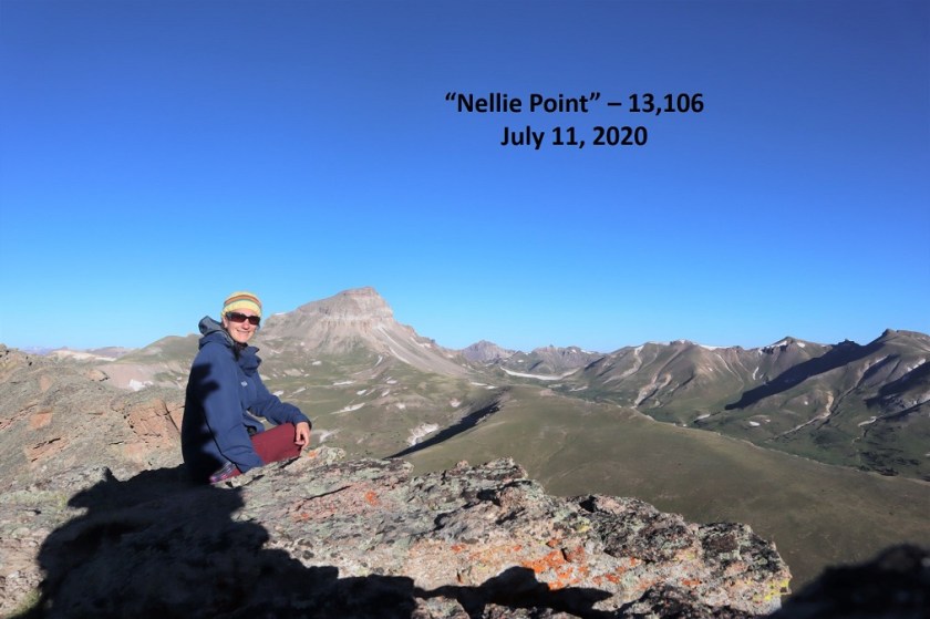
13

14

Nellie Peak:

From the summit of Nellie Peak I continued following the long summit northeast. There was still some leftover snow here from winter, which didn’t pose a problem at all.

15

While on the ridge I scared a Ptarmigan mother and her chicks (they scared me too, as I didn’t notice them until the mother squawked). Immediately the chicks dispersed and the mother pretended to be injured, leading me away from her babies. I kept telling the mother I didn’t want anything to do with her or her chicks, but unfortunately she was leading me exactly in the direction I needed to go. She did a wonderful, if unnecessary, job leading me away from her babies. When she felt I was far enough away she flew back in their direction, chirping to gather them all together again.
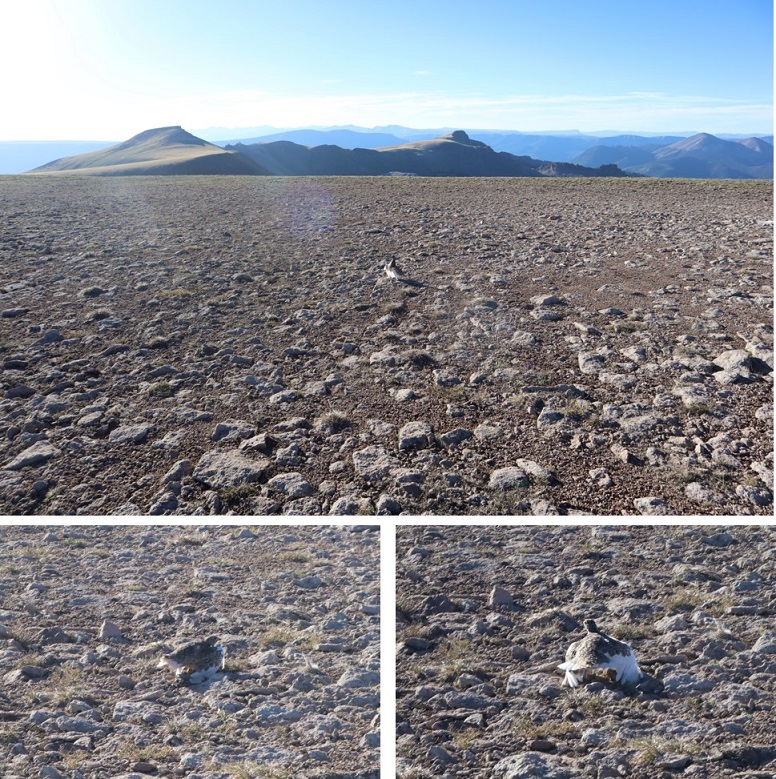
16

Ptarmigan:

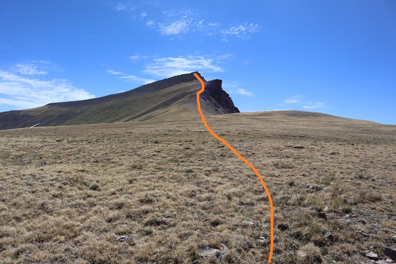
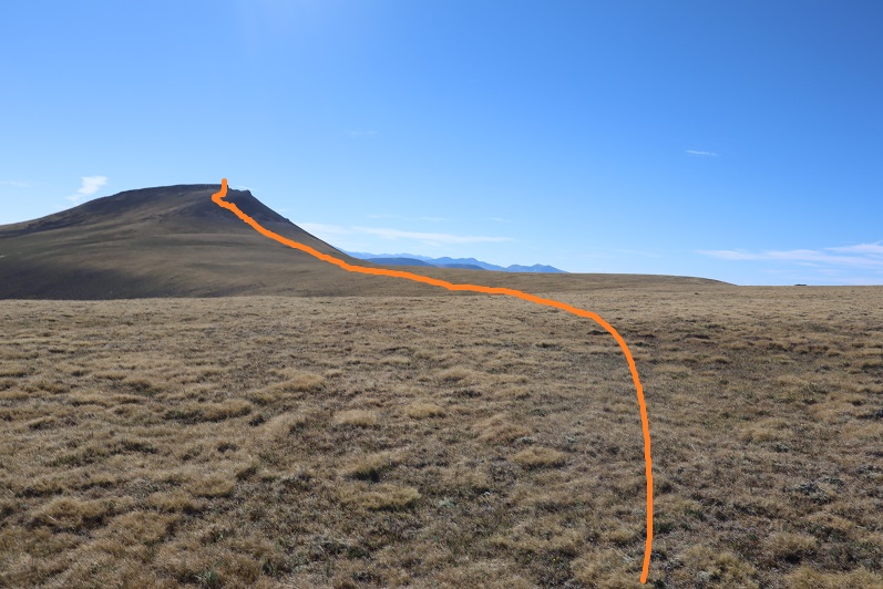
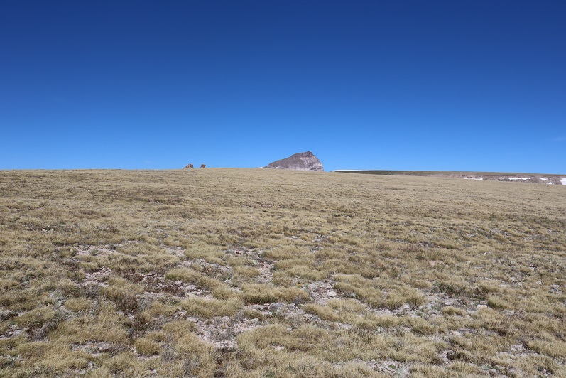
From the summit ridge I could see East Nellie Point, but getting there isn’t as easy as it initially looked.

17

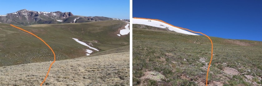
I followed the ridge almost to the saddle and then turned and headed east, losing 600’ of elevation. Luckily this part of the hike was mostly on rolling tundra and wasn’t too taxing.

18

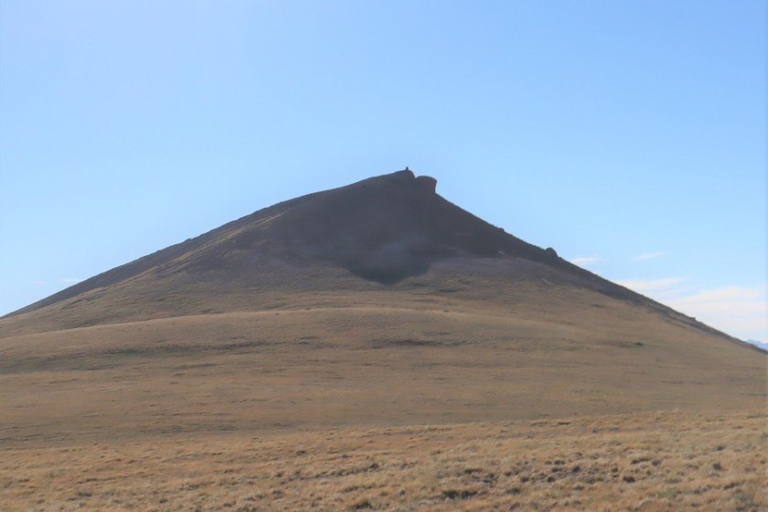
Once at the bottom I was able to avoid the small pond/creek and ascend the hillside towards East Nellie PT.

19

This was still rolling tundra, and there were even game trails in the area (and tons of elk tracks). At the top of the tundra hill I had about a quarter mile of tundra to walk through to the final summit push (if you could call it that).

20

21

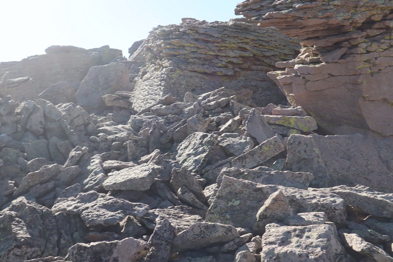
The final push to the summit was rocky and there was no trail, but it was straightforward

22

There was a large cairn just before the summit

23

The actual point of this summit was difficult to tell as well. Once again I knew I was at the summit when I found the summit register stashed inside a cairn

24

25

26

Summit Photo:

27

East Nellie Peak:

Here are some photos from the hike back down. I decided to make this an out and back hike, retracing the steps I took to get here from Nellie Pt.

28

The tundra can be vast. Luckily, I could keep Uncompaghre Peak in my view most of the time, and just kept heading towards that 14er.

29

I also had a good view of Silver Mountain (my original choice for a summit today). With this view I could see there was still snow at the top of the access gully, so it had been a good idea for me not to attempt that peak today because the snow was unavoidable and I’d left my ice axe in my truck (I had my crampons). I was feeling better about my choices.

30

I hiked down to the valley and then back up to the ridge

31

I followed the ridge back to Nellie Point

32

33

34

And back down to the pass

35

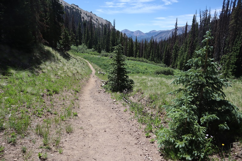
And the class 1 trail that leads you back to the trailhead

36

37

38

39

The trailhead now had several vehicles

40

Also, I came to the conclusion it’s impossible to get a bad photo of Uncompaghre

41

I made it back to my truck at 11:15am, making this a 13.72 mile hike with 3833’ of elevation gain in 7 hours. Obviously, I made this hike more difficult and added more elevation than needed, but in the end I was happy with today’s hiking change of plans. In fact, I wished I’d have made the choice to change routes earlier. Any day above treeline is a good day. The 4WD road was easier to navigate driving down than it was driving up.

Here’s a topo map of my route

42


Change of Plans… The Cathedral and Hanging Lake Story

1

After climbing Lackawanna yesterday I drove 4 hours to Ashcroft and arrived at 1pm. The winter closure started here.

2

My intent was to spend the night, wake up early and attempt Cathedral Peak in the morning. There were tons of vehicles in the lot when I arrived, and groups getting ready to leave for the day.

3

This is a popular trailhead as a starting spot for many winter activities (mainly skiing and snowshoeing, not necessarily mountain climbing).  I asked about conditions and was told the snow was firm in the morning and soft in the afternoon (lol!).  I saw some snowshoers with a guide ready to go out for a short trek (dressed in jeans) and several groups on hut expeditions.

The bathroom was open but dirty, so I got out my Clorox disinfecting wipes and quickly cleaned it so I could feel better about using it over the next few days.

4

It was still early but I decided to make some Mountain House Stroganoff for dinner and go over my notes for tomorrow. There wasn’t any recent information on this peak, and in fact not much information at all, so I wanted to be prepared.  I checked the weather report I’d saved on my phone and calculated start times.  I wanted to be on the trail no later than 2:30am so I could potentially make it to the Lake by 5am, with a summit between 5-7am to avoid the warming of the snow and avy conditions.

As I was sitting there, all I could think of was how beautiful the mountains were, and how perfect the weather was right now. It was probably spectacular here in the fall.  Even though I’d hiked a centennial already today I wanted to be out there hiking again.  I gave it some serious thought but in the end knew the snow at this time of day would be too soft, so it wouldn’t be worth the attempt anyway.

The sun was already warming up my truck and I began to feel sleepy. By 3pm I’d decided to try and get some sleep because I was waking up super early to hike tomorrow and needed my rest after this morning’s climb.  At 5pm I was woken up by an intense thunderstorm but was able to fall back asleep.

5

My alarm went off at 1:30am and I woke up to 3 inches of snow outside but check this out: I was warm!

6

I’ve never been warm sleeping at a trailhead, but for some reason I was this morning, even though it had obviously snowed. I didn’t want to get up but I also knew I didn’t have a large window of opportunity for this climb, so I had to get going.  I was on the trail by 2am, following Castle Creek Road.  After a little over a mile I saw a gate and a sign indicating I was to take this trail

7

I exited the road, climbed over a 5 foot tall ice wall and landed face first in the snow. Boy, was I glad no one was here to see me do that!  How embarrassing!  I picked myself up and in the 3-4 feet of snow (in the dark) struggled to get on my snowshoes.  This was going to be an interesting hike!

For the next mile and a half I postholed up to my knees in the snow, doing my best to route find a class 1 trail that hadn’t been hiked in quite a while, buried under several feet of snow. I came to an avalanche area.  After a few minutes I found my way around it, but quickly came to another one… or maybe it was a continuation of the first?  I’m not sure, but this avalanche was very recent and in the dark I couldn’t find a way around it.  This was a 15-20 foot wall of compacted snow with tree trunks and branches sticking out from every angle.

I had 2 options: Wait for daylight to see if I could find a passable route, or cut my losses, head back to my truck and drive to the next trailhead. I knew if I waited until daylight I wouldn’t have enough time to complete or even attempt the climb past the lake, so I decided to just head back.  That postholing had sure worn me out!  I was incredibly tired, but it was probably due a little bit to yesterday’s elevation gain/climb as well.

I hiked back to my truck as the moon rose over the mountains and in and out of the clouds. I no longer needed my flashlight and wondered to myself if the moonlight would have made a difference in my navigating the avalanche?  It was 5am when I made it back to my truck.  I stowed my gear and hopped in, intent on driving to the next trailhead for the peak I’d intended to hike tomorrow. For reference, here’s where I encountered the avalanche

8

My truck wouldn’t start. Drat!  I got out, cleaned 3 inches of snow/ice off the hood of the vehicle and popped the hood.  After fiddling around with the battery for a bit I was able to get the truck started and I was off.  This had certainly been an interesting morning!

As I was driving to the next trailhead I saw a sign for Hanging Lake. This hike has been on my bucket list for years now, but it’s so short and so far away it hasn’t seemed worth the drive.  Well, today I was right here, the new reservation system begins next week and I’ll most likely not go if I have to reserve a spot.  It seemed my day was already shot and I wanted to turn it around, so I took the exit for Hanging Lake.

I arrived to a half full parking lot at 7am. (I’ll apologize here: My camera was fogged up due to the change in conditions from snow to warm, so the pictures came out a little hazy).

The trail is well marked and easy to follow. I walked along the river on a well kept paved trail for about half a mile

9

And at the official trailhead turned left

10

There’s a sign with some rules and information

11

As you can see from the sign, there are 7 bridges to cross.  This hike can be summed up in a few simple pictures:

Bridges:

12

Stairs:

13

And signs every ¼ mile or so letting you know how far you’ve gone:

14

There were a few short sections of snow/ice, but traction would have been overkill

15

There were also a few waterfalls along the way

16

And signs of a recent avalanche

17

After a mile of hiking up 1000’ or so in elevation I came to a steep set of winding stairs and arrived at Hanging Lake.

18

Wow! Talk about beautiful!

Hanging Lake: Video

I took a selfie to prove I was there

19

And a few pictures of the lake itself (it has fish!!!)

20

21

I saw a sign on my way in for Spouting Rock and decided to see what that was all about. It was a 2 minute walk up more steps to an area just above Hanging Lake.

22

Spouting Rock is a waterfall.

23

The hike back down was very quick. The only drawback was navigating through all the people on the trail!  This is a very popular hike, and on a Saturday morning the last weekend before the reservation system started quite busy, even for 8am.

24

I made it back down to the river and followed the sidewalk back to the parking lot

25

There’s a nice bathroom there

26

And the parking lot was full!

27

I made it back to my truck a little before 8:30am, making this a 3.5 mile hike in 1.5 hours.

28

Relive: Video

The hike had totally been worth it! Bucket List item checked off!  I was now in a much better mood, and ready for my next adventure!