“Baldy no es Cinco” 13,313 & Baldy Cinco 13,383

1

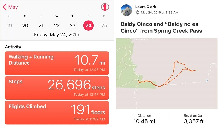
RT Length: 10.5 miles

Elevation Gain: 3357’

So far today nothing was going as planned. I took a 2 hour nap before getting up at 10pm to drive the 6 hours to the trailhead.  I’d wanted to hike Point 13,811 today but ended up getting “lost” (apparently there are two Williams Creek Trailheads geographically close to each other) and long story short the workaround was a 3 hour drive, so I missed my window to climb Point 13,811 safely today.

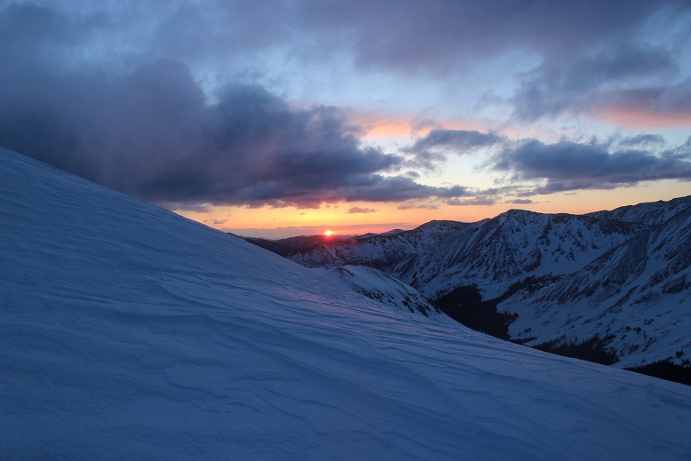
I’d driven all this way and wasn’t going to drive back without a hike. I switched my hiking plans around and decided to hike Baldy and friends today instead.  I drove faster than I should have and I made it to the Spring Creek Pass trailhead at 6:45am (after leaving at 10pm last night).  It had snowed overnight and it was really cool seeing a black moose in contrast to the white snow on the ground and hanging from the trees.  This lifted my spirits a bit (moose was too far away to get a good picture).

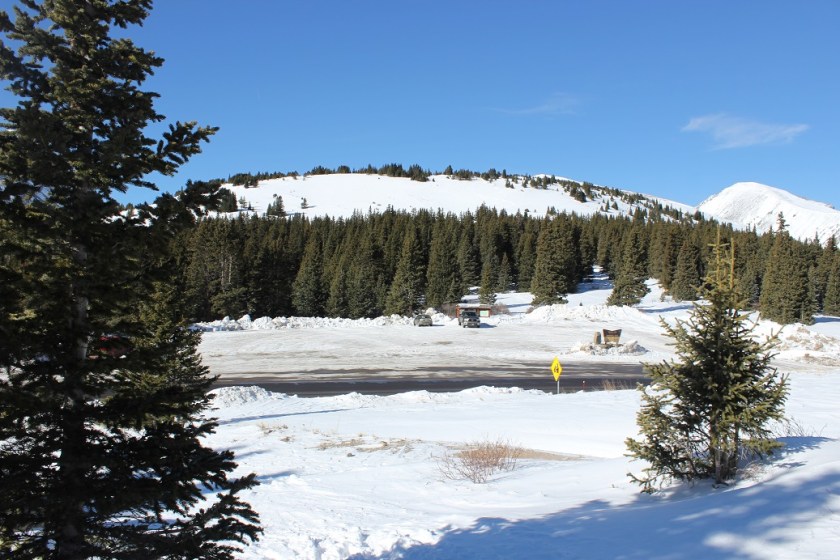
When I arrived at the trailhead it was covered in a layer of ice a couple inches thick so I decided not to park in the parking lot but just at the entrance to the road.

2

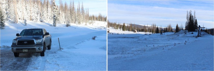
I’m sure this was going to make some people mad when they arrived later in the day, but I tried to allow as much room as possible so after the ice melted other vehicles could drive past.   And to be fair, a snow plow had put a foot or so of snow at the entrance to the parking area, so I guessed they expected people to still park on the road.

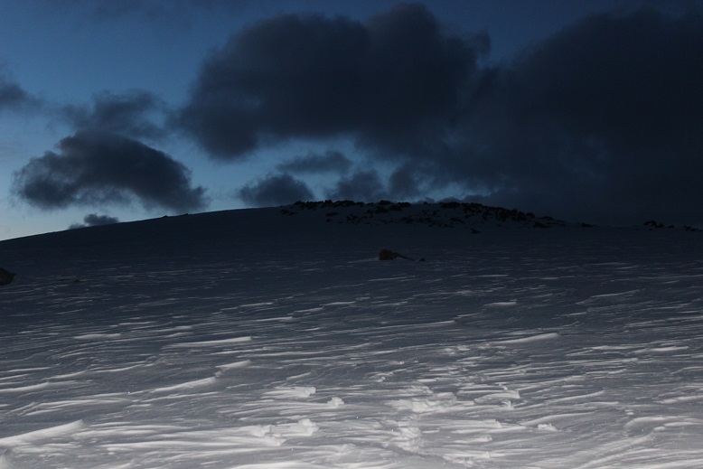
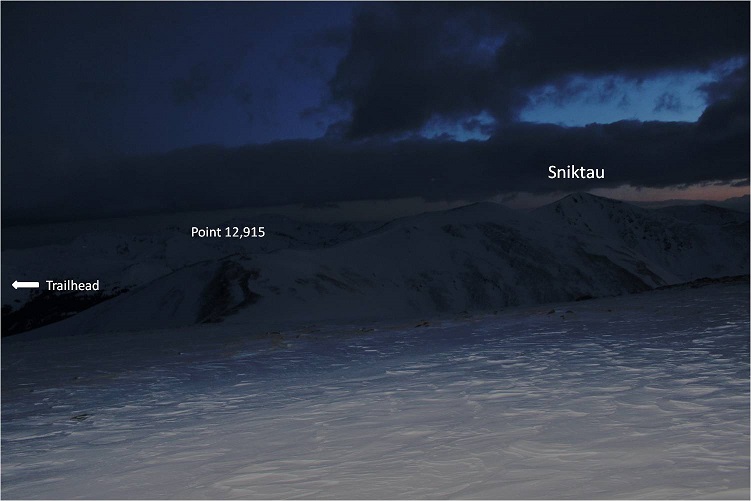
I’d planned on studying the route while spending the night at the trailhead (you know, after hiking point 13811 today), but since that didn’t happen I was just going to bring along my notes and hike from memory. On a positive note, I was starting this hike in the daylight, so while there was no visible trail route finding was easy.  I’m pretty sure this is the first hike I’ve done this year that’s started before sunrise.

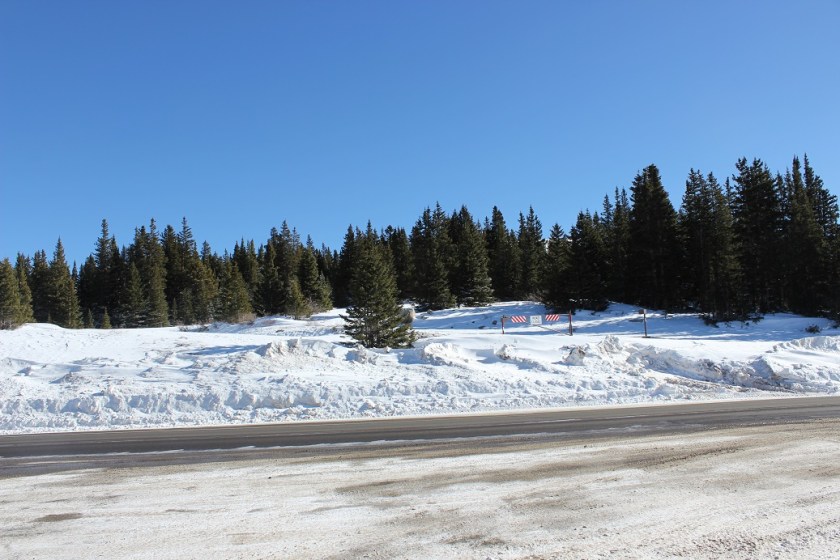
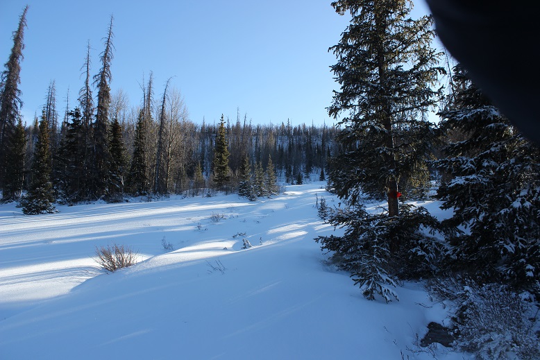
I crossed the road and a small creek and looked for an obvious sign of a trail. There wasn’t one, but I knew I was aiming for the bowl, so I started hiking southeast.  Once again, I was glad I was doing this in the daylight.

3

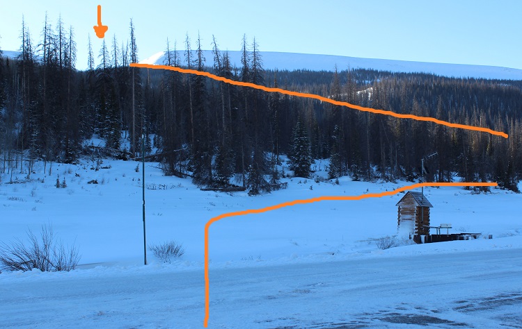
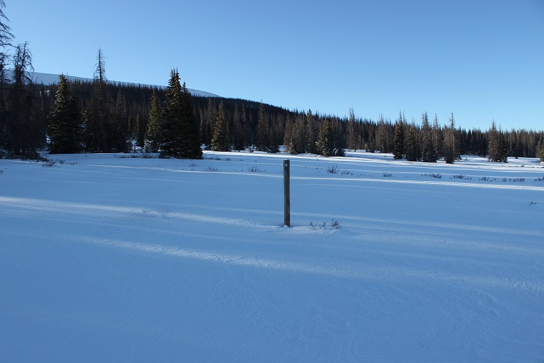
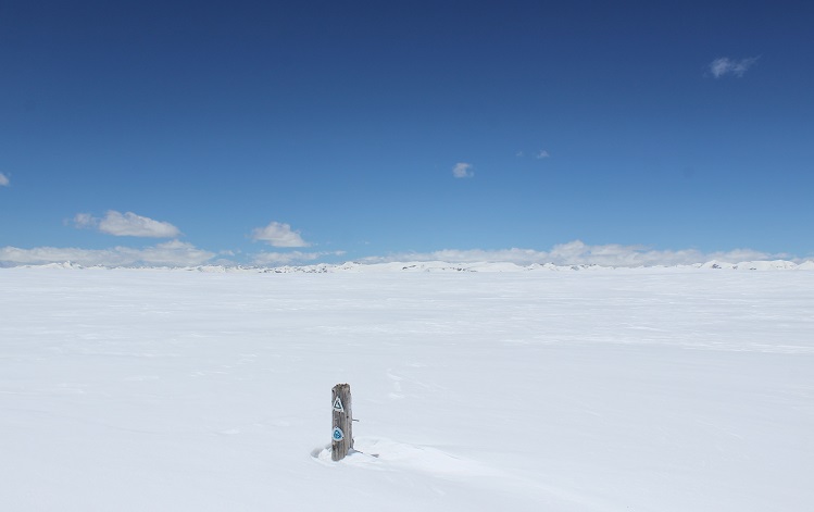
The trail follows the Colorado Trail, but with all the snow last night there was no clear path to follow. I was excited when I saw a trail marker (woot!  I was headed the right way!)

4

From this marker I turned left and headed towards the trees

5

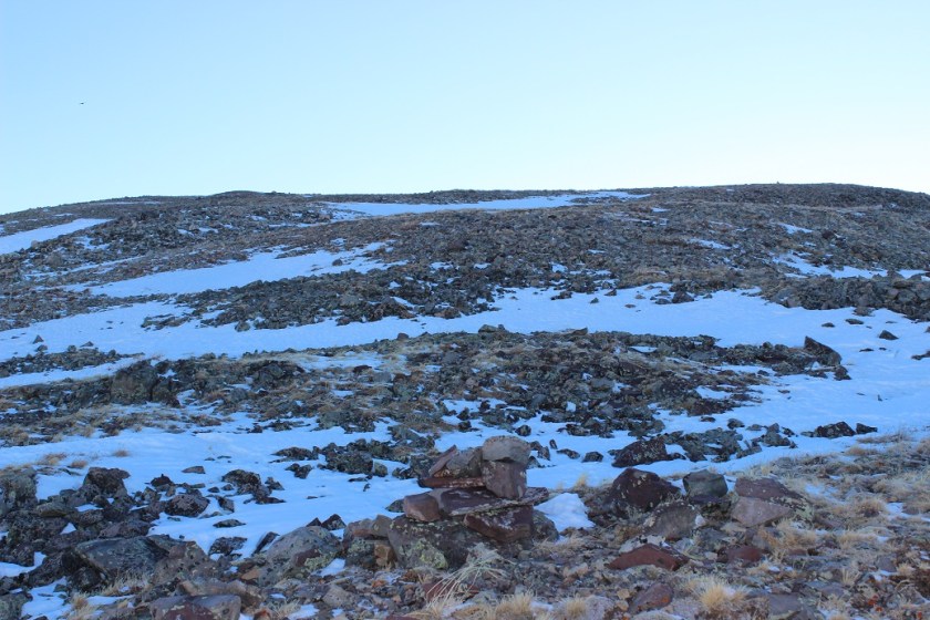
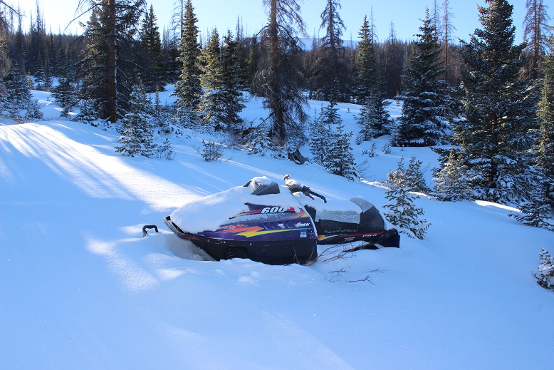
Looks like someone lost a snowmobile…

6

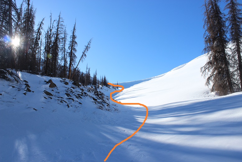
I encountered a clearing and once again entered the trees, aiming for the gully that led to the bowl/mesa

7

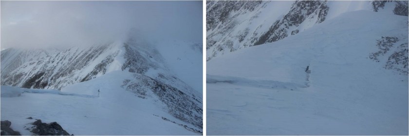
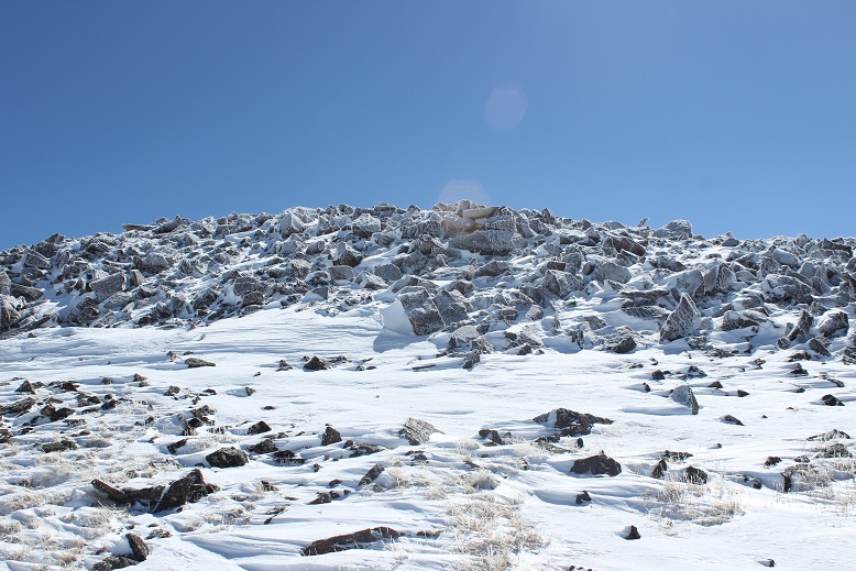
Wow! This was so cool!  I made it to treeline and followed this drainage path.  At first I wasn’t sure this was the correct way (it looked a bit dangerous), but it was

8

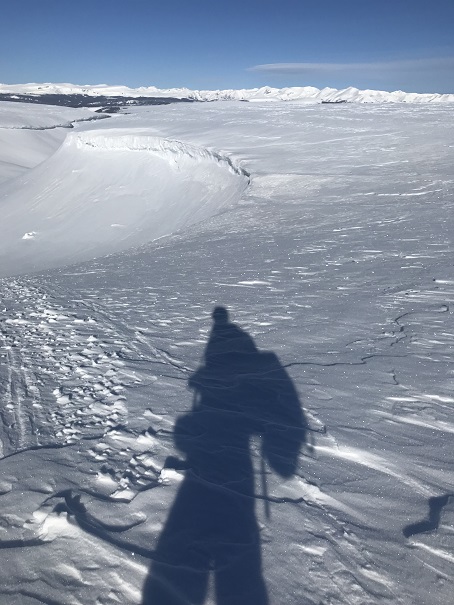
Why was it dangerous? Check out those cornices!  They looked ready to drop at any moment (and in fact, a few already had).

9

10

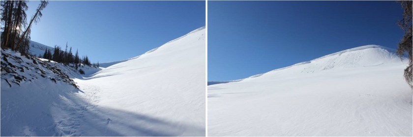
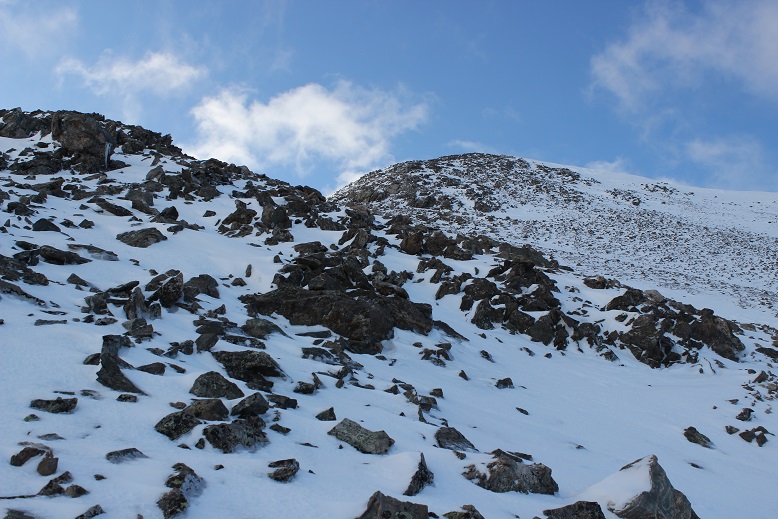
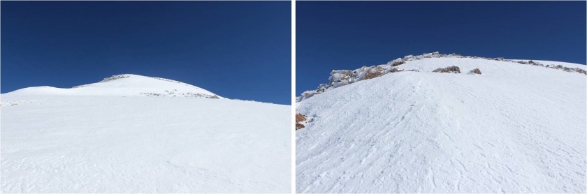
OK, so I headed directly up and over the lip of a bowl that’s steeper than it looks

11

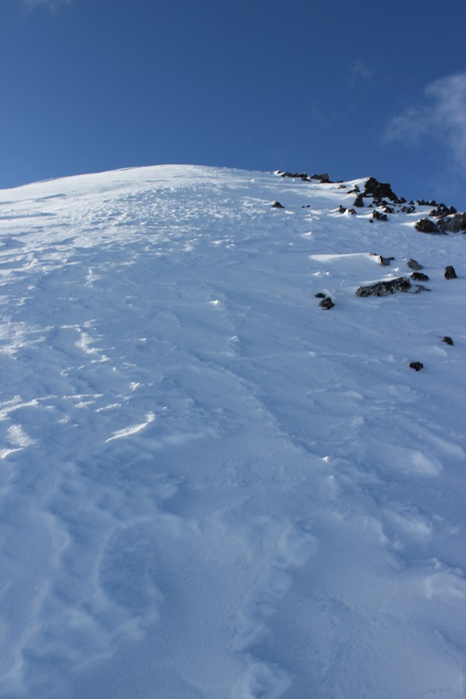
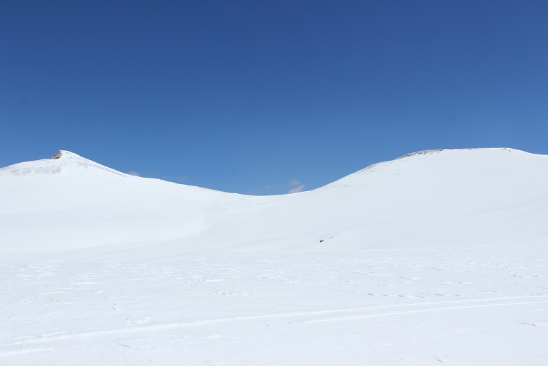
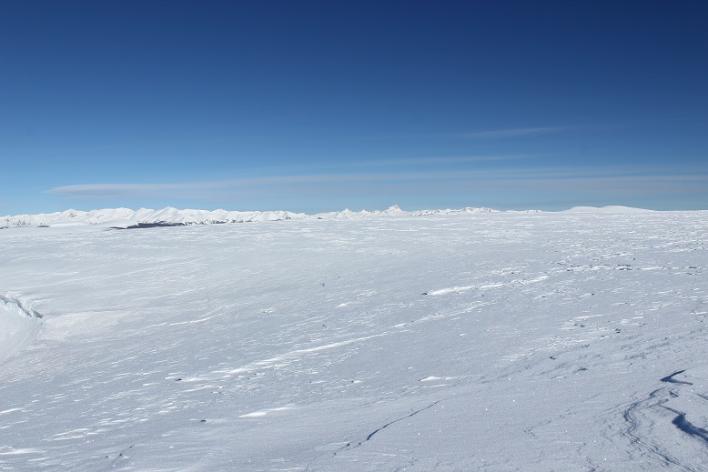
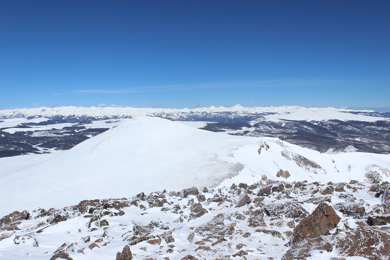
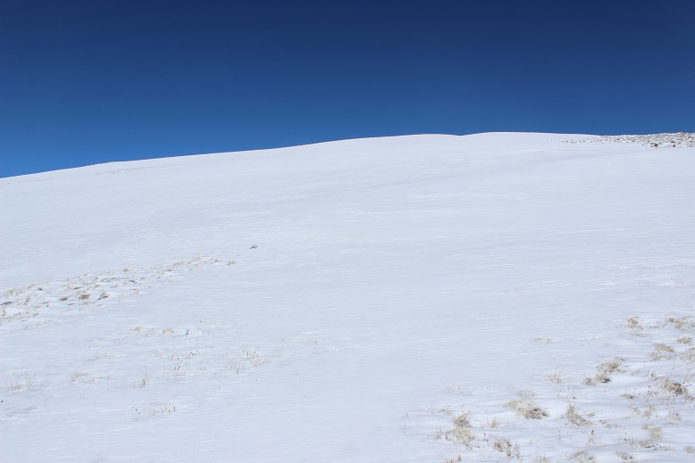
And everything was white. I was on top of a very large mesa that had just been dumped on with snow.

View from Mesa:

I turned around to look at my path back down the bowl

12

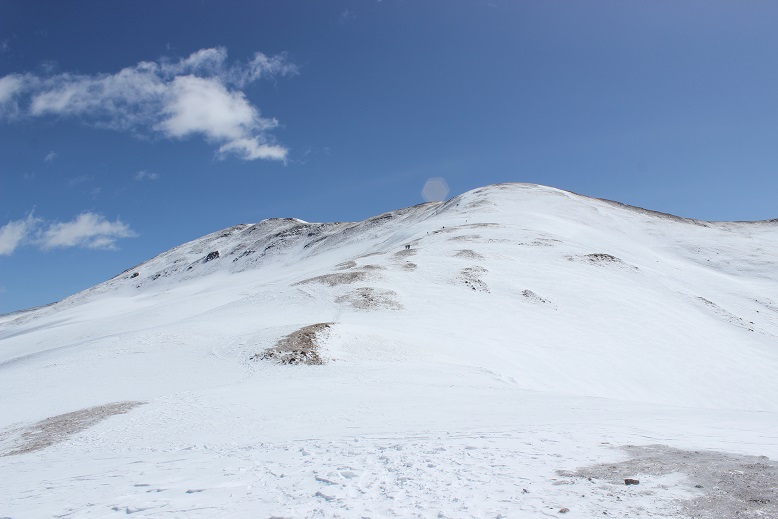
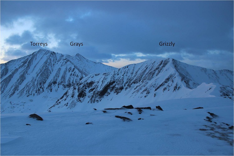
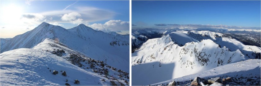
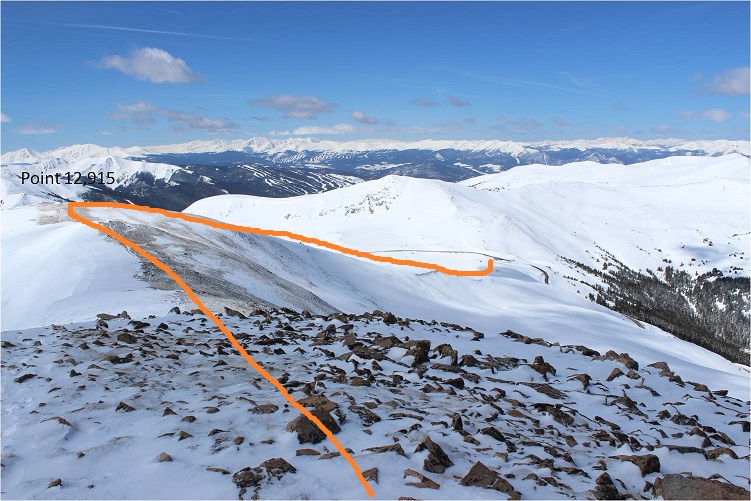
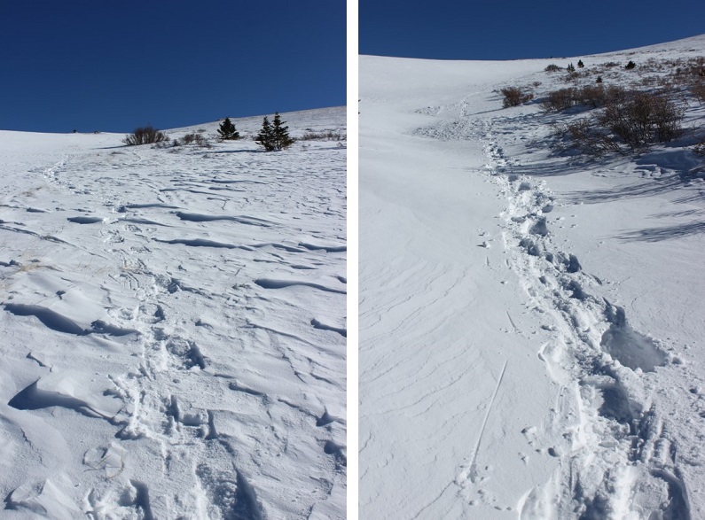
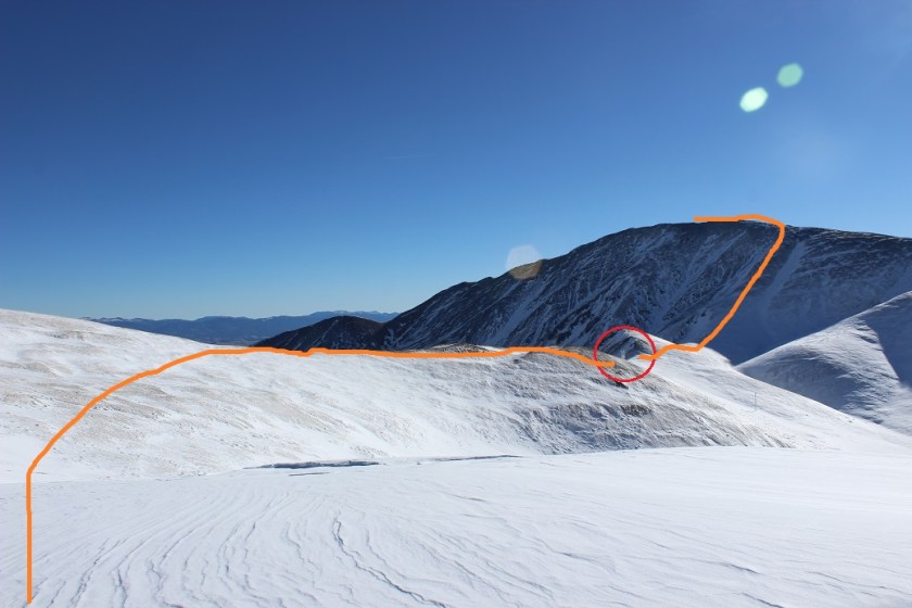
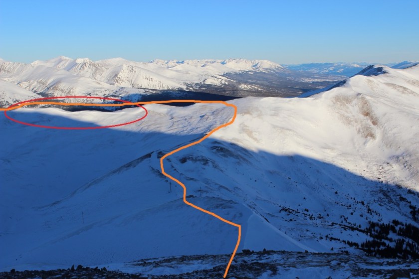
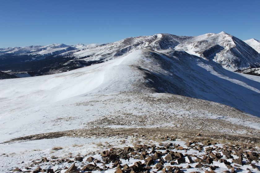
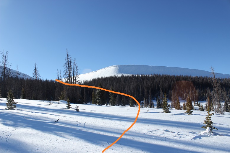
Time to get my bearings. The mesa was large, but the peaks I’d intended on hiking were obvious.  I wasn’t able to find a lot of information about these peaks, so I wasn’t exactly sure what to expect or the best way to attempt the climb.  I decided to cross the mesa and pay attention to optional routes, making sure to look behind me every so often so I wouldn’t get lost on my way out (a real consequence in all this snow).  The wind was erasing my tracks as soon as I made them.

13

14

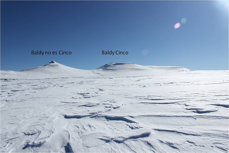
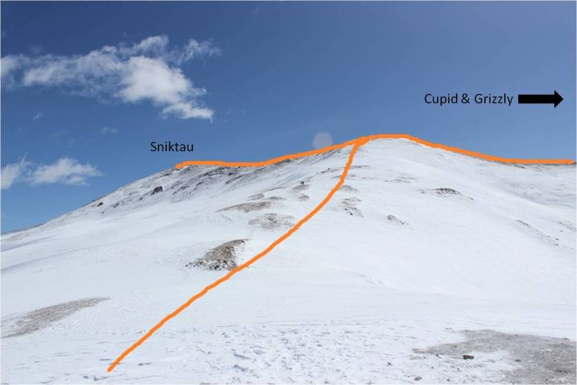
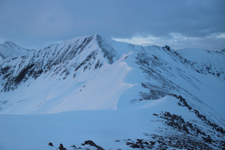
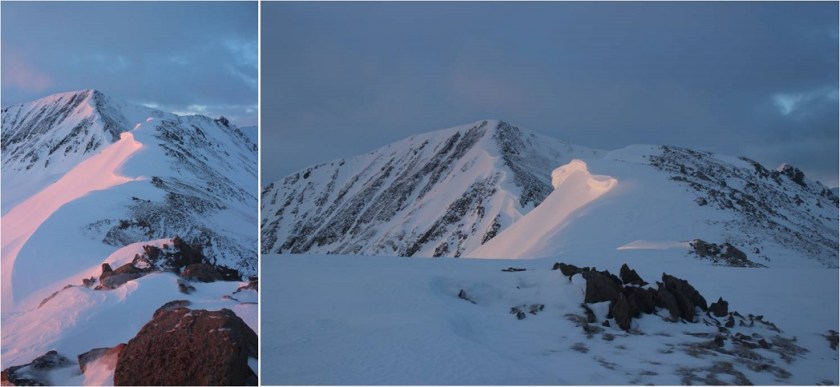
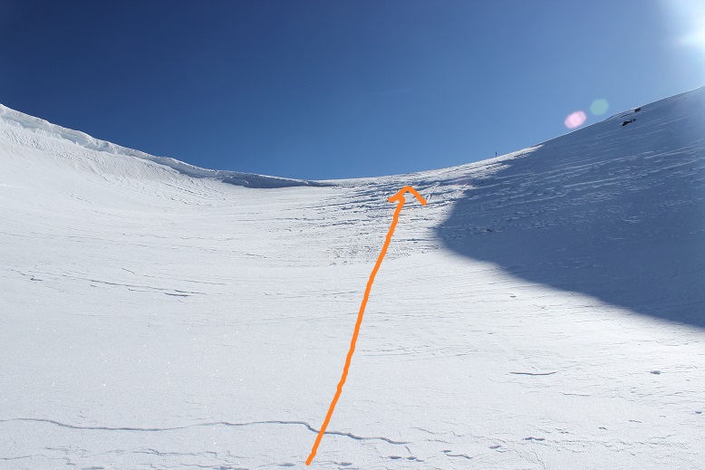
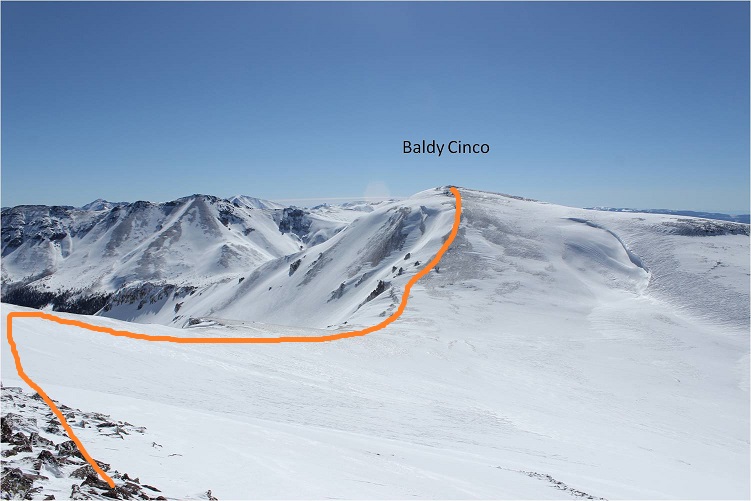
As I got closer to “Baldy no es Cinco” (which means “Baldy is not five” in Spanish) I noticed a trench and was worried I wouldn’t be able to cross the area, but by sticking to the right (east) I was able to avoid losing too much elevation or entering the trench

15

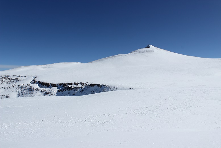
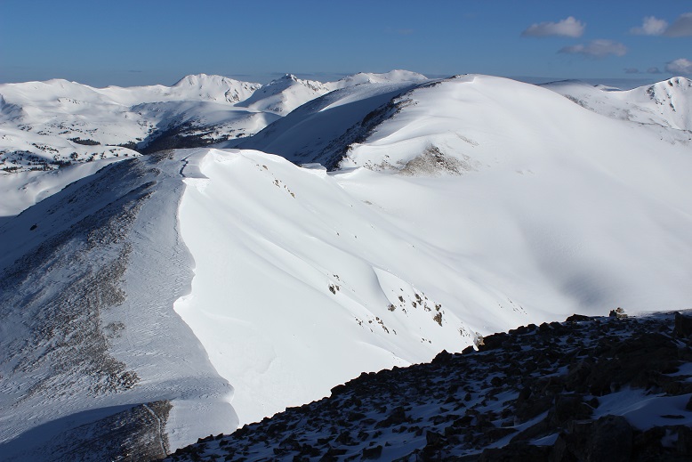
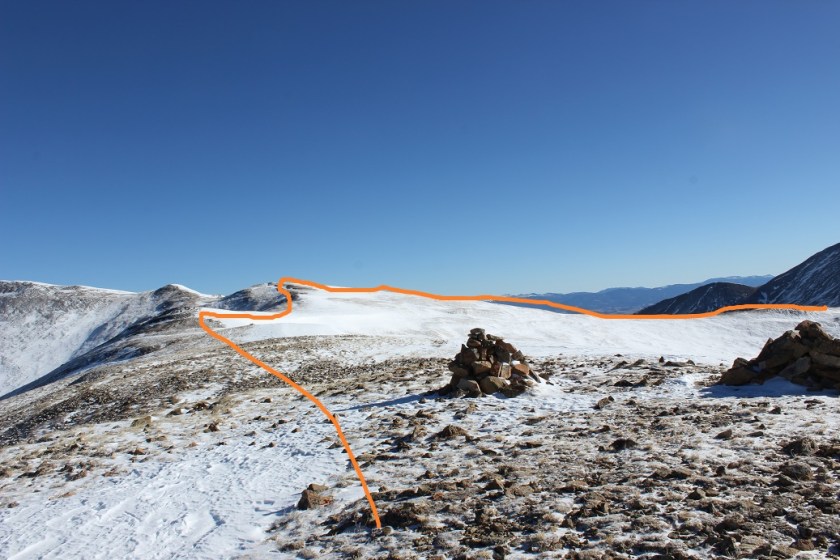
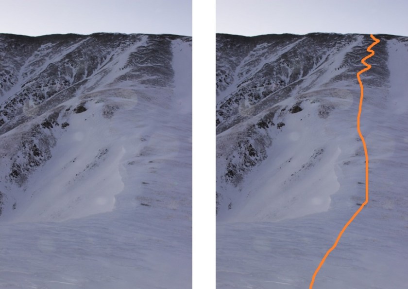
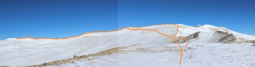
Here’s the route I took up “Baldy no es Cinco”

16

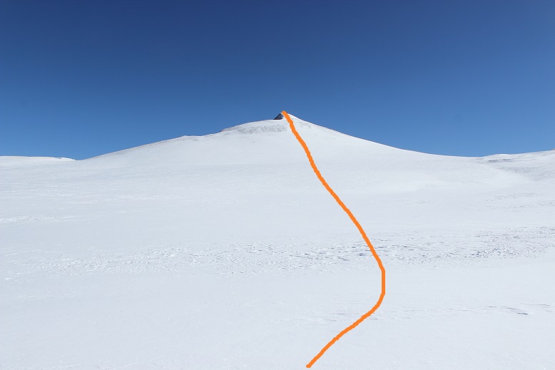
Please note, I would not advise taking this route up. It gets very steep and I needed to use my ice axe and crampons, and it felt sketchy at times.

17

Luckily the snow was very firm. If I were to do this again, I’d hike to the saddle of “Baldy no es Cinco” and Baldy Cinco and hike the ridge.

18

The reason I hadn’t done this was my research had told me to just hike up the face (that’s the problem with no winter beta) and honestly, the snow was blinding, even with sunglasses on. You can probably tell by these pictures they’re overexposed and I’ve been trying to darken them up so you can see details. I wasn’t able to see details very well, and I couldn’t tell how big the cornices were on the ridge, so I didn’t attempt the saddle.  In any event, I’d advise you to take the saddle.

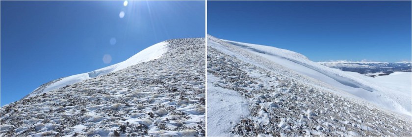
The last bit to the summit was the easiest part of this climb. It was a bit icy and windy, but the ice made for great traction (the wind I could have done without).

19

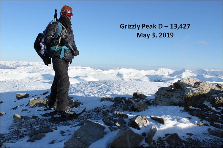
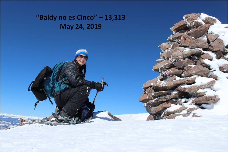
I summited at 9:15am. There was a massive cairn on the summit that begged to be in my summit photo.

20

21

“Baldy no es Cinco” summit video:

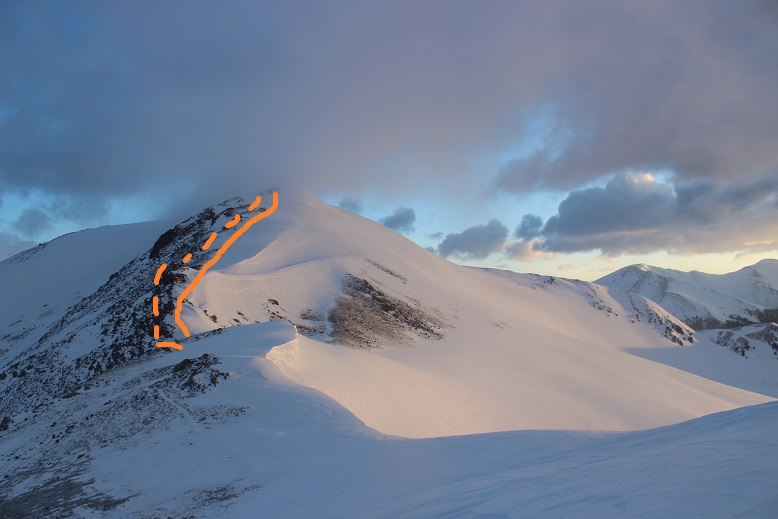
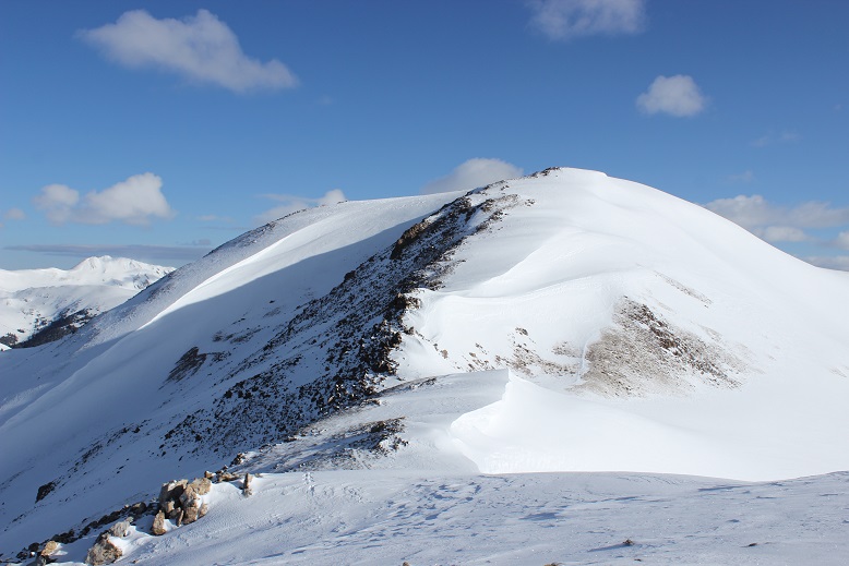
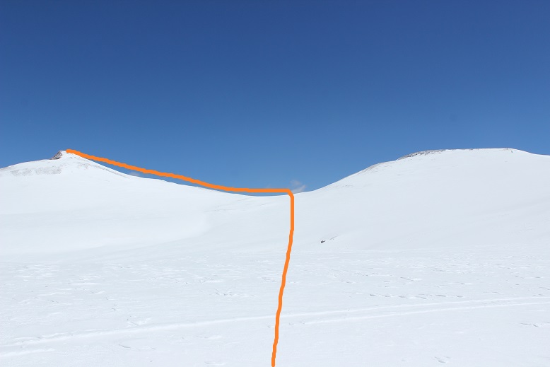
I decided to take the ridge from “Baldy no es Cinco” over towards Baldy Cinco

22

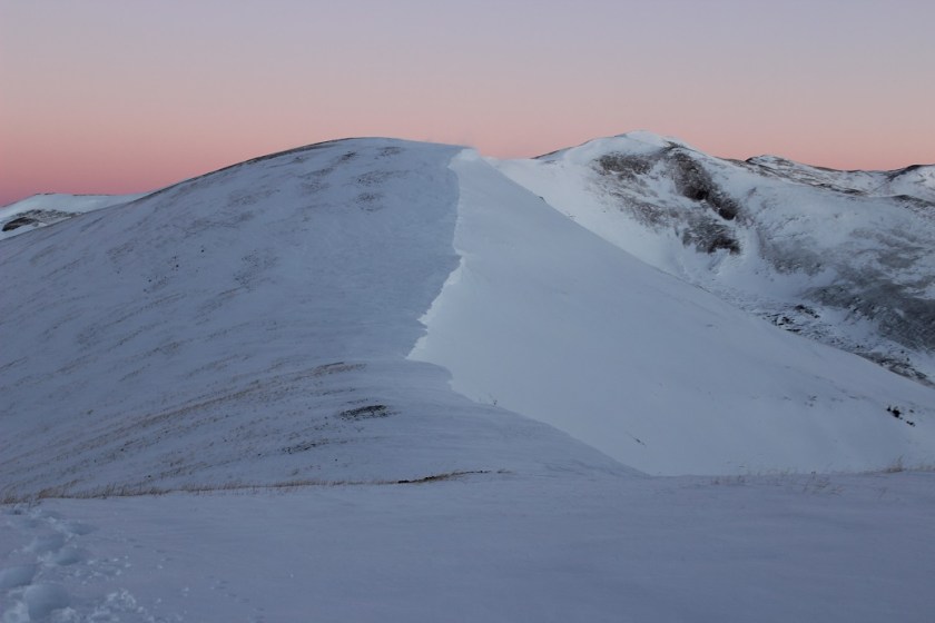
Also, the entire way down the ridge towards Baldy Cinco was one large cornice.

23
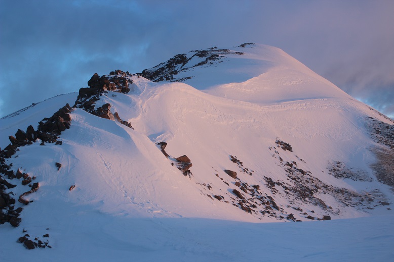
Here’s a look from the saddle back up at “Baldy no es Cinco” and towards Baldy Cinco.

24

The hike up Baldy Cinco wasn’t challenging. The terrain was a mix of ice and rock, with cornices all over

25

The summit was icy rocks

26

I summited at 10am

27

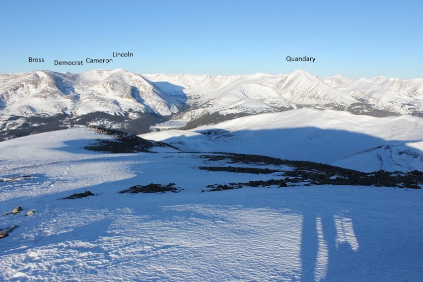
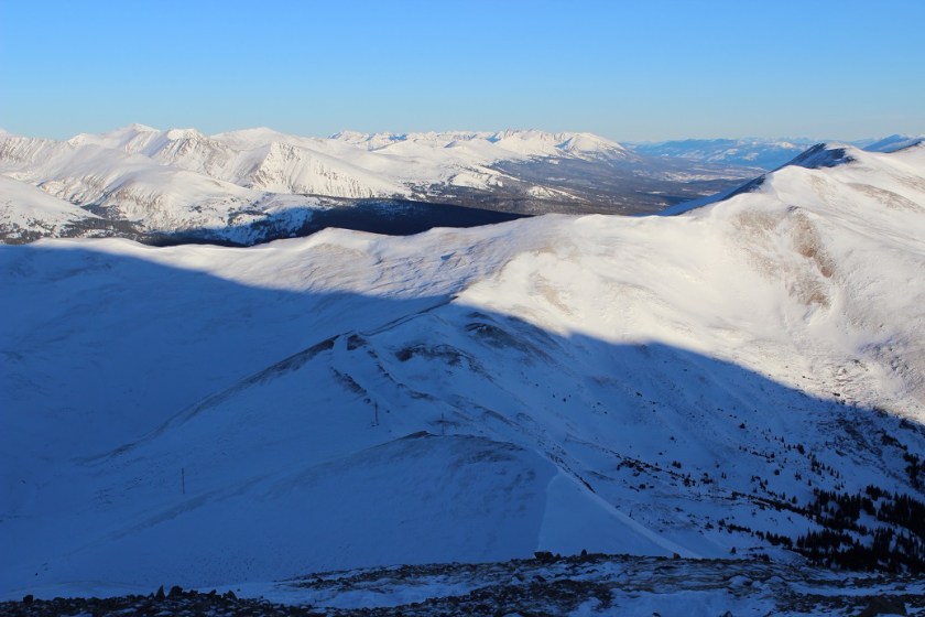
View from Baldy Cinco:

Here’s looking back at “Baldy no es Cinco” from the summit of Baldy Cinco. Check out those San Juans!!!

28

At this point I should have just turned around and headed back down the slope of Baldy Cinco, towards the mesa and down the bowl. In fact, this would have been another great way to summit these two peaks.  (Summit up Baldy Cinco, take the ridge to “Baldy no es Cinco”, and descend using the saddle)

29

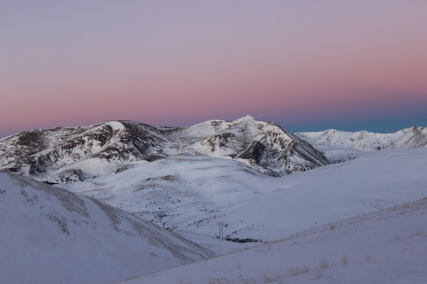
But it was still really early (10am) and I knew there were more peaks out here, calling my name. I looked over at Point 13,162A and was seriously tempted.  I didn’t have any beta on this peak, other than its location.  Once again, check out those cornices!!!

30

What you can’t see in this photo is the dramatic drop in elevation (topo suggests 800’). I decided to go for it.  Up close the cornices were intense

31

I made it to the saddle and re-assessed where I was at. Here’s a look back at Baldy Cinco and up at Point 13,162A.

32

The snow was starting to act up here. It was getting warmer and the snow was crunching and breaking under my feet, sending cornices falling.  I was starting to get tired, and wanted to save my energy for tomorrow’s hike (which had way more mileage/elevation than today’s hike, which is why I’d initially wanted to do that one first).

33

Ugh! I’d just descended 800’ in elevation, only to find a change in conditions.  I decided to head back and attempt point 13,162A another day (with unnamed 13510A and unnamed 13020C as well).

I knew in my head the route back was southwest to the mesa, but the snow was seriously blinding and I didn’t know the area “that well” (read: I could see myself getting lost if I attempted to find my way back to the mesa with just a topo map).  So instead of trying to route find in the blinding snow I decided to re-ascend Baldy Cinco to find my way back. Don’t worry, I didn’t re-gain the 800’ I’d lost, just enough elevation to see my way back visually (about 500’).

34

I skirted Baldy Cinco and headed here (where I found a huge cairn! See, that would have been the way to summit Baldy Cinco.  Oh well, today I got to be the beta).

35

36

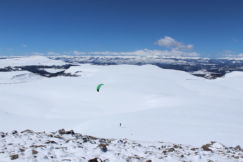
At the cairn I saw something green flying through the air. Cool!  Someone was speedriding!  They were zipping all over the mesa at high speeds.  I was able to see their snowmobile sitting in the middle of the mesa as well (great idea btw).

37

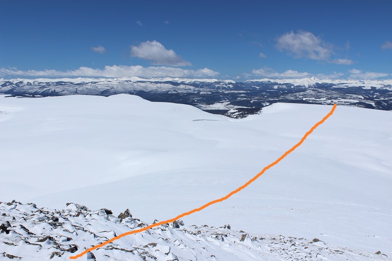
For those of you intending to hike up Baldy Cinco first via this route, here’s a look from the cairn up at the summit of Baldy Cinco

38

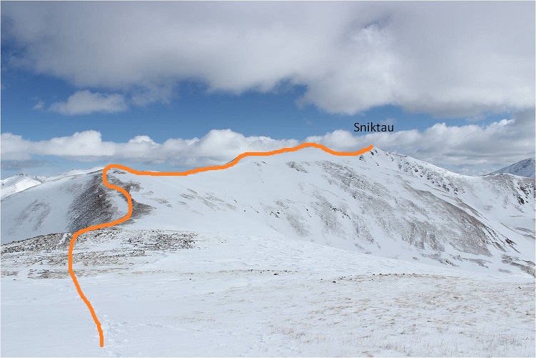
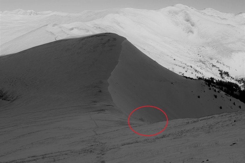
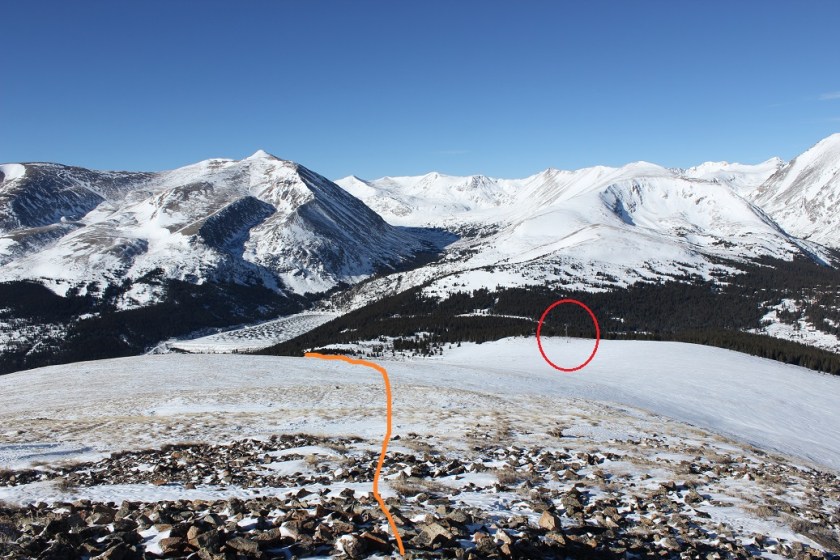
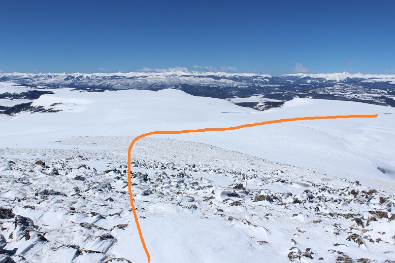
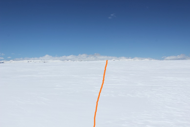
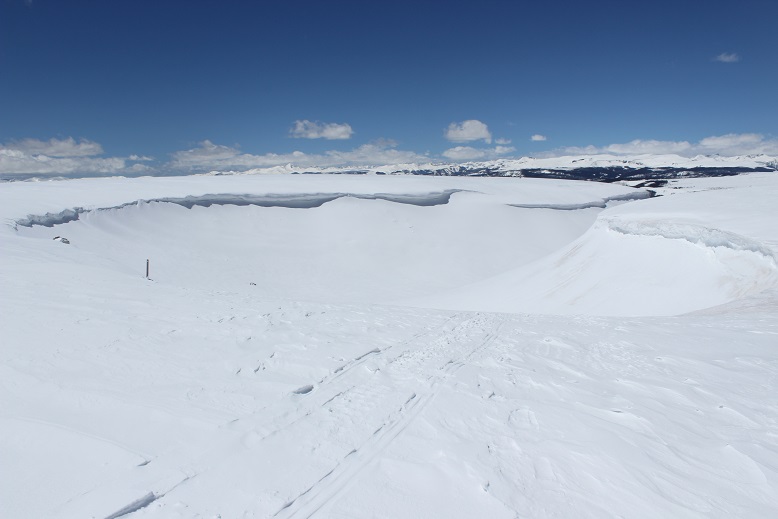
From the cairn you might think you just head towards the obvious depression in the mesa, but this is not the way to exit. I was seriously glad I’d looked back over and over again at my route so I’d know how to exit the mesa.  It’s not obvious.  In fact, it’s counterintuitive: you head away from what looks like the exit and continue to the straight part of the mesa that looks like a drop off

39

40

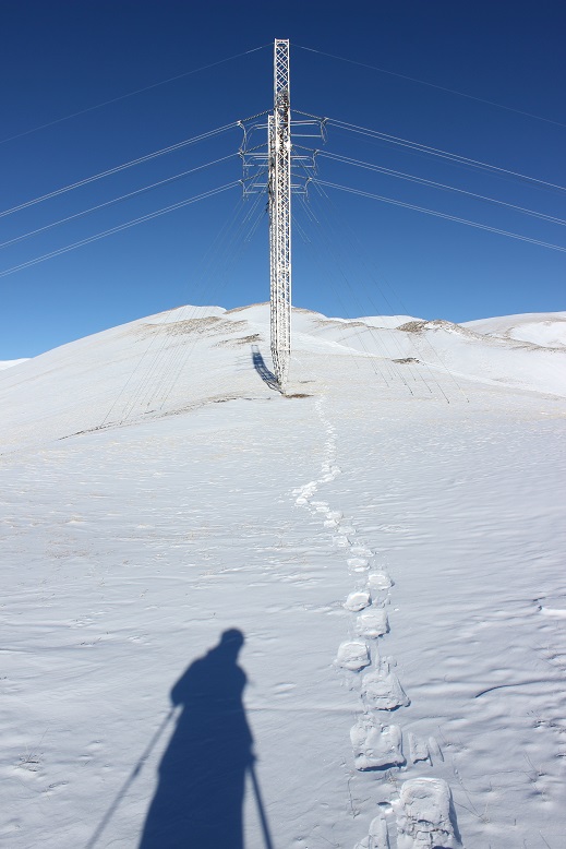
The snow on the mesa had changed dramatically: it was now quite soft under my feet and I was sinking in my snowshoes about 6-8 inches every time I stepped (quite a change from this morning).  I was so excited to see the Colorado Trail marker!

41

As you can see, it looks like you just drop over the mesa (which you do)

42

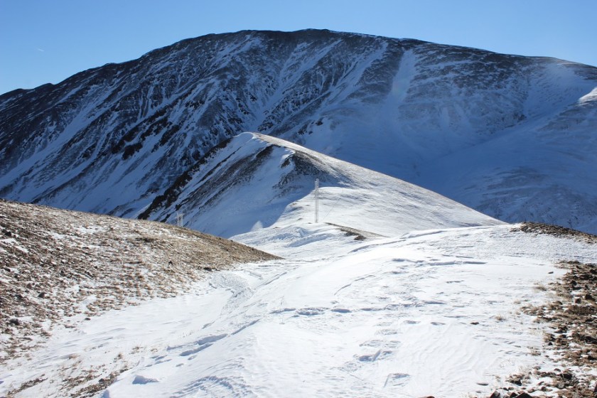
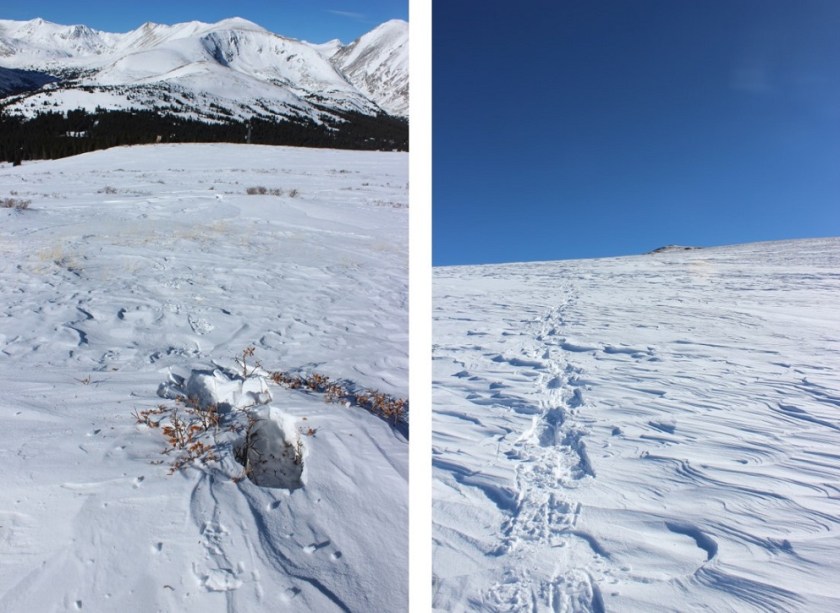
It’s a quick drop back into the bowl. Here I started seeing snowmobile tracks (it’s steeper than it looks)

43

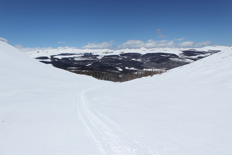
The tracks followed mine most of the way to the trailhead. Very cool!  He’d re-treaded my tracks, making the hike back easy.  I wasn’t sure what the protocol was for hiking next to/over snowmobile tread, so I decided to play it safe and just hike out parallel to the tracks (where possible).

44

When I got back to the parking lot it had indeed melted out and there were a few other vehicles parked in actual spaces

45

I made it back at 12:30pm, making this a 10.5 mile hike in 5.5 hours.

46

Ok, now I was headed to fix my earlier mistake and head to the correct trailhead. Lake City, here I come!

Relive:

47

Cupid – 13,117, Grizzly – 13,427 & Sniktau – 13,234

1

RT Length: 8 miles

Elevation Gain: 3662’

I made it to the trailhead at 4am and was the only vehicle in the lot. There was room for about 10 cars, but I’m sure when there isn’t snow there’s room for many, many more.

2

It was much colder than anticipated when I left my truck for the trail, but I figured it was due to the elevation and unexpected wind. I quickly put on my balaclava and hat. I was the only one at the trailhead when I arrived, and about a quarter mile up the trail couldn’t remember if I’d left the lights on inside my truck.  I looked behind me and couldn’t see them glowing in the dark, so I crossed my fingers and kept on hiking.   If it were light out I would have been able to clearly see the route before me up to point 12,915, but since it was dark I just kept heading straight up the ridge.

3

After about half a mile I reluctantly put on my snowshoes. They weren’t absolutely necessary, but I was getting tired of surprise postholing.  The terrain went from snow covered to ice covered to bare over and over again.

After a mile I made it to the top of Point 12,915 and decided to summit Cupid and Grizzly first, so I turned right and headed over to Cupid.

4

This was a fairly easy walk that would have been even easier without all the wind.

5

The last bit up Cupid was covered in crusty snow

6

From Cupid I could just see the route I’d taken and Sniktau in the dark

7

And Torreys, Grays, and Grizzly Peak D

8

Now it was time to head over to Grizzly Peak by continuing southeast down and along a ridge.

9

Right about now the sun started to rise, but that wind just wouldn’t let up!

10

Check out those cornices!

11

The cornices had me a little worried, so when I hit the rock outcropping I did some class 3 moves in my snowshoes while downclimbing the rocks (not my brightest idea). Once I was past them and turned around I realized it would have been safer to just have gone over the what I thought had been cornices but was actually just snow (so that’s what I did on my way back).

12

Dotted line is the route I took on my way down, solid is the way back up

13

From the saddle between Cupid and Grizzly is where the wind really started picking up and the clouds started rolling in. I was a bit upset, I mean it was supposed to be a sunny day with little wind, and at this point it was neither.  This is also where the cornices looked dangerous.  This one looks ready to drop!

14

I stayed to the right of the cornices. The clouds suddenly began to clear and I could now see the route up Grizzly.

15

I started up Grizzly and turned to look back at those cornices one more time

16

All of the sudden I heard what sounded like a gunshot and just about jumped out of my skin! It took me a second, but I soon realized the sound was an explosive for avalanche mitigation.  I heard about 10 more of them throughout the morning, and while I looked for the resulting avalanches I never saw them. Yes, the sound surprised me every time.

At this point in the hike I should have taken off my snowshoes, but I really didn’t want to carry them so I just kept them on. There is a bit of a false summit to this peak

17

And in the end I was glad I’d kept the snowshoes on because there was snow to contend with towards the summit that required snowshoes and my ice axe as well.

18

I summited right at 7am. I know this because my phone alarm went off and I called my daughter to wake her up for school.  So yes, there’s reception on top of this peak.

19

Grizzly Video

Here’s a look back on the route to get here

20

Now that the wind had driven the clouds away the views were amazing!

21

OK, time to head back down.

22

These cornices are much bigger and steeper than they look.

23

I was once again glad I had my ice axe as I just went up and over the snow on the rock outcropping, no longer worried I’d be in trouble if I fell.

24

OK, so back on Cupid I could see the route up Sniktau

25

This route had cornices too, but they were very easily avoidable and none looked in danger of falling anytime soon.

26

There’s a false summit on this one, but I’d known that from seeing it from the other peaks earlier this morning. The snow cover here ranged from nonexistent to about 2 feet deep.  I didn’t really need my snowshoes, but once again I was glad to have them on. I traded my ice axe in for my trekking pole and trekked to the summit.  The slope was nice and gentle.  I didn’t even need to stop to catch my breath.

27

I summited at about 9:30am

28

Sniktau Video

Here’s a look back on the route from Grizzly to Sniktau

29

I made my way back to Point 12,915 and headed back to the trailhead.

30

Now I started seeing people: Groups and groups of people, all hiking up the slope.  Everyone had on microspikes, and no one was wearing snowshoes.  Oh well, their loss.  I guess some people like postholing 6 inches a step for miles at a time.  Personally, I’d rather float.  This had been a pretty easy hiking day for me, and I wasn’t even tired.

31

I made it back to the trailhead at 10:30am, making this an 8 mile hike in 6 hours. Oh, and no, I hadn’t left my lights on (whew!)

32

I was really, really glad the wind had stopped sometime while I was headed up Sniktau, and now I was quite warm but still bundled up. I talked with a few skiers at the trailhead who asked me why I was still covered from head to toe and I gave them the honest answer:  I didn’t want to have to put on sunscreen.

Relive


Mt Silverheels – 13,828

1

RT Length:  9 miles

Elevation Gain: 3800’

Last night I was at an event and didn’t make it home until midnight, which meant I wasn’t in bed until about 12:30am.  Nevertheless I set my alarm for 2am, got up, and headed to the trailhead.  Yes, I was tired, but if I only hiked on the days I wasn’t tired I’d never get to hike.  Also, today was supposed to be beautiful!  I really wanted to get above treeline.

Hoosier Pass Trailhead was probably the easiest trailhead I’ve ever driven to.  It was easy to find, and directly off the main road with plenty of parking space.

2

I arrived at the trailhead 4:45am.  I parked my truck, got my gear together, and crossed the road to begin my hike around 5am.

3

It was about 19* outside, but for some reason it felt extremely cold this morning.  So cold I didn’t take out my topo map, and instead followed the tracks that led to the left.  This ended up being a mistake I noticed about ¼ of a mile in when I stopped to put on my snowshoes.  Yep, I was definitely going the wrong way.  So I backtracked back to the gate, got out my map, and re-oriented myself.  I was supposed to go east… where there weren’t any tracks.  (After the gate don’t go left, go straight).  I re-started my tracker and began again.

4

I broke trail in the dark.  This is actually much more difficult than it sounds, and the new powdered snow made it more difficult than it should have been.  I’ve never hiked in this area before, but I knew there was a good trail/4WD road here somewhere.  Unfortunately, with the snow and in the dark I couldn’t see said trail.  Everything looked the same.  I’d only notice I was “off” the trail when I’d suddenly sink to my knees in the snow.   Luckily it’s really not that far to treeline so this didn’t slow me down too much.

5

The best part about hiking in the dark?  Tonight’s Geminid Meteor shower!  I saw dozens of shooting stars, maybe more.   Every time I looked up I’d see another one.  This had me stopping quite a bit just to enjoy the sight, and was a major plus to my hiking this morning (and one of the reasons I forwent sleep).  There was no moon, the sky was clear, and there were hundreds of stars in the sky.  Wow.  Just… wow.  Colorado is amazing!!!  Why wasn’t anyone out here with a better camera than I had photographing this?!?!?

I made it to treeline and it was still very dark.  I knew the general direction I was supposed to head, so I just aimed east and kept hiking up a gentle slope, enjoying the stars.

6

When I made it to the top of the first slope it was still dark, but it was beginning to get a little lighter out.  I could see the ridge I was supposed to follow, but couldn’t really tell how deep the snow was, so I stuck to the ridge longer than necessary.  This ended up being a great idea because there were cornices I was unable to see.  Here’s the path I took.  You’ll notice where I started heading south is further than I needed to go, but once again this had been a good choice due to the cornices

7

From here I was supposed to aim for the power lines (circled in red) and continue down to about 12,400’.  Ouch!  This meant a loss in elevation of about 500’!  Here’s the rest of the route from this point

8

Did I mention it was WINDY?!?!?  Seriously windy.  The kind of wind that flings your snot into the air before you have a chance to wipe it.  I had snot on my nose, cheek, eyebrow, and I’m pretty sure I’d have it in my hair too if I wasn’t wearing a hat.The forecast had called for 10-15mph winds, and they were at least that, and steady, with 30mph+ gusts thrown in every now and then for fun.

It was much too windy for me to take off my gloves, and I was happy the sun was beginning to rise so I could now see the rest of the route before me.  I looked west. Again, wow!

9

OK, back to that wind.  It was creating cornices all over the place!  See this?

10

Here’s what it looked like on the other side

11

I crossed the final bump along the connecting ridge and found the rib I was supposed to climb that would lead me to the top of Mt Silverheels.  This looked straightforward.  Here’s the route I took, careful to avoid both gullies and the cornices

12

Towards the top of the rib the snow decreased and I was left with talus

13

Here’s a look back on the route I took to get to the top of the ridge.  By sticking to the ridge I’d avoided the cornices circled in red (which are larger than they appear in this picture)

14

From here it was a very easy walk to the summit

15

I summited at 8am.  It took me 2.5 hours to summit.

16 Mt Silverheels 13822


Check out some of the views!

17

The summit was relatively flat.  Here’s a picture of the last bit of the trek up, and another of how I get those summit-selfie photos…

18

The wind had died down a bit, so I stayed on the summit longer than I normally do to enjoy the view.

When I did start on my way down I had a little difficulty finding the exact spot to descend.  I wanted to be sure to miss the two gullies, but that exact spot was difficult to find once on top of the rib.  Finally, I decided to just parallel with the radio towers and head down.  This ended up being the correct choice, and I soon found my snowshoe tracks to follow back down.

19

The wind began to pick up again, and I noticed a cornice crumble and slide.  It was a small slide, but interesting just the same.  The red circle is where the snow came to a stop after falling

20

I continued on, aiming for the radio towers and dreading that upcoming elevation gain

21

Here’s a look back on the route down from Mt Silverheels

22

In the light of day I could see a better path over Hoosier ridge than I’d used on my trek in.  I was going to stay a bit lower, now that I could see in the daylight how the snow didn’t pose avalanche danger.   The dotted route is the way I hiked in, the solid line the way I hiked out, careful to stay on solid ground/snow and then on the ridge to avoid the cornices.

23

I saw this bone on a cairn.  The bone was about 6 inches long

24

I made it to the ridge and just followed it back

25

At the end of the ridge I saw the last bit of my hike down to treeline, and the radio towers I’d missed in the dark on my hike in.

26

The wind started dying down and I started making tracks again.  They started out pretty scarce, but got deeper and deeper as I made my way to treeline.   Every now and then I’d stumble upon a willow and sink a bit

27

Back beneath treeline I was able to see the snow frosted trees I’d missed in the dark.  Such a beautiful sight!  And the trench I’d put in this morning was still there so I deepened it a bit.

28

I made it back down to my truck at 11am, making this a 9 mile hike in 5.5 hours, with a little bit of trenching, lots of wind, and about 25 minutes on the summit.  (my first distance includes my off route hiking from the beginning, so it’s a little off).

29

Because they’re fun, here’s my relive video: https://www.relive.cc/view/2016998888

Oh, and this was my 50th 13er.  Woot!