PT 13786 & Whitney Peak – 13,286

1

RT Length: 15.85 miles

Elevation Gain: 4866’


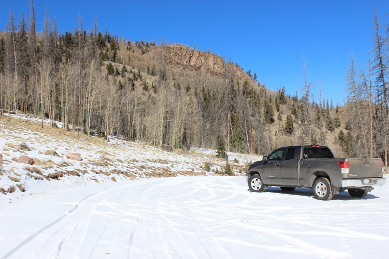
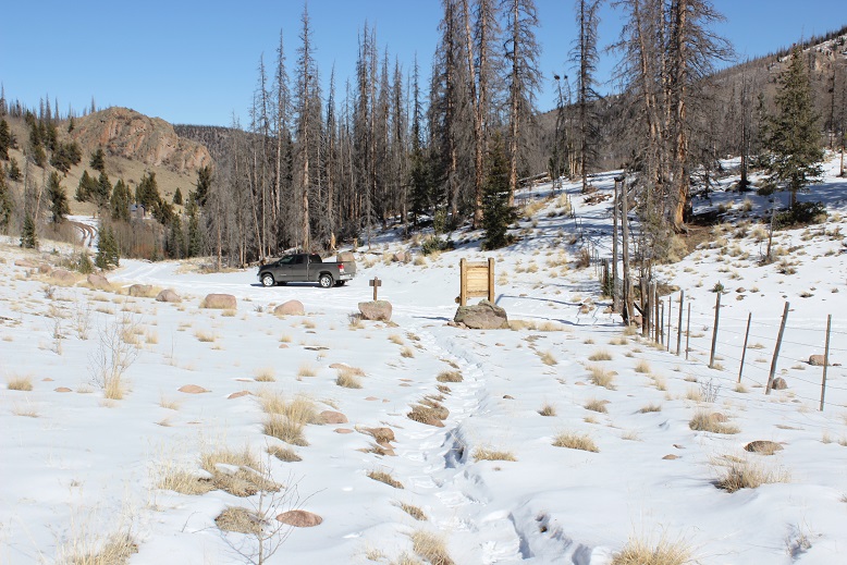
After a long day and a wedding reception I arrived at the trailhead at 10pm and quickly went to sleep.  The trailhead for this hike is located at the end of 4WD road 727.  Well, the road goes up further, but it’s excessive 4WD (pictures and description to come).  Any 4WD vehicle can make it to this point.

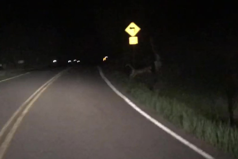
I woke up at 3:15am, intent on being on the trail by 3:30am.  Sleepy-eyed, I opened the back of my truck and scanned the area with my flashlight for wildlife.  Sometimes I see deer/raccoons/porcupines outside and like to shoo them along before getting outside my vehicle.  Nothing this morning.  Great.  So I hopped out to find an area to pee (I know you’re thinking “why is she telling me this?”  but it will all make sense in a minute).

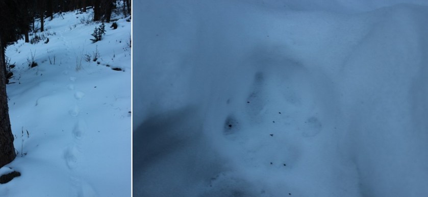
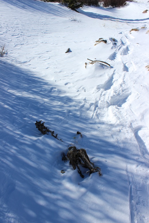
As I’m looking for an appropriate area I scan around with my flashlight and just behind the reflective trailhead flag/post/marker I notice a small greenish-yellow circle reflecting in the light.  My first thought was ‘animal’ as this looked like an eye.  But it was only one eye.  So I waved my flashlight back and forth to get a better look.  I couldn’t define a body and the circle didn’t move so I assumed it wasn’t an animal and was most likely some piece of reflective trash.

I went about my business, turning my flashlight off (others were camping in the area and in the dark I didn’t want what I was doing to be the only thing they could see).  I turned my flashlight back on and the reflecting circle was gone.  And then as I waved my flashlight around all the sudden it was back again. Just one small circle, reflecting in the glow of my flashlight.

I got into my truck to put on the heat while I put on my hiking boots and turned the car on.  At that moment 3 things happened:

  • The engine turned over and made a loud, V8- – ‘VROOM’ sound
  • My trucks daytime running lights turned on and I could clearly see I’d just
  • Scared the mountain lion walking towards my truck

The frightened mountain lion crouched to the right, did a 180 degree turn, and bounded off into the trees to my left, his long tail the last thing I saw as he hurried away.  Well, that was certainly cool!  It all happened so fast I wasn’t able to see if it had 2 eyes or 1 (I’d only seen one glow), but I knicknamed him ‘One Eyed Willy’ just the same.  It wasn’t lost on my I’d just had a mountain lion ‘stalk’ / watch me while I was peeing.  I bet not many people can say that.

I sat in my truck for about 15 minutes, this time with the high-brights on, waiting to see if he came back.  After he didn’t return where I could see him I decided to give One Eyed Willy as much time as needed to get as far away from me as possible, and instead of putting on my shoes I went back to sleep and woke up at 5:15am.  I was on the trail by 5:25am.

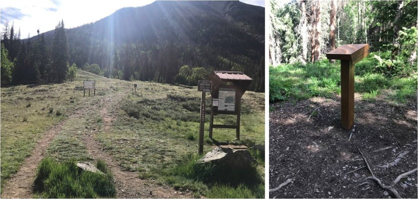
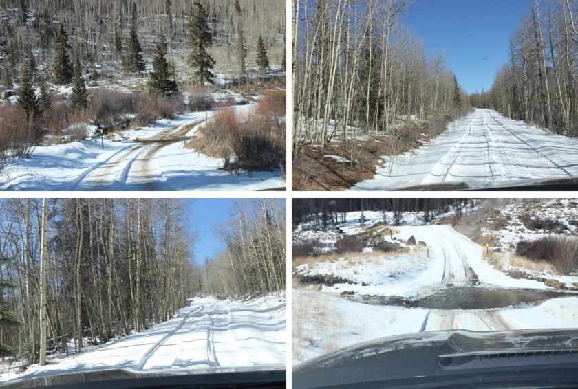
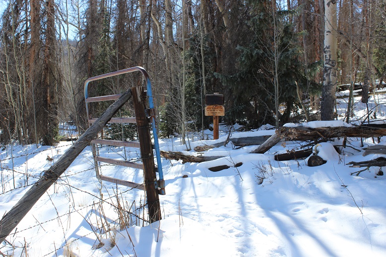
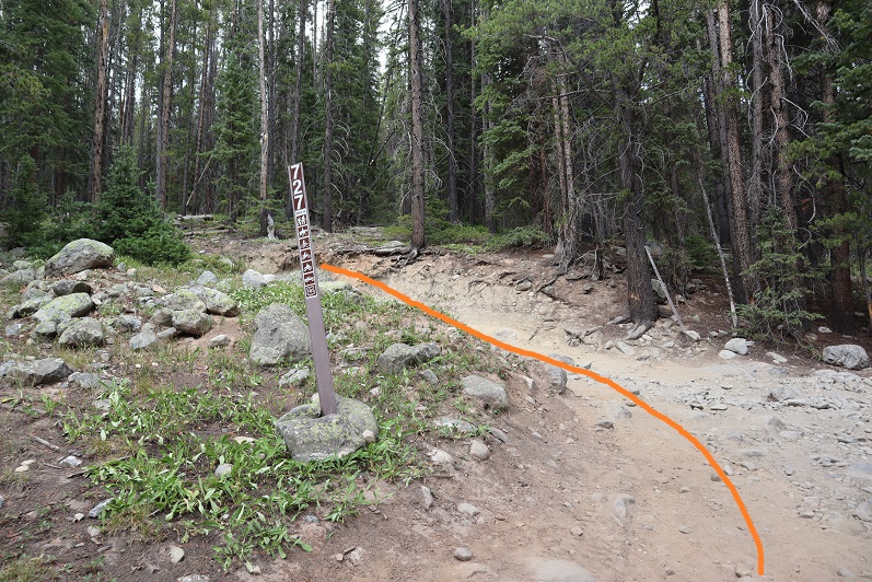
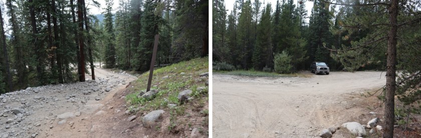
The 727 trail starts at the east end of the parking area

2

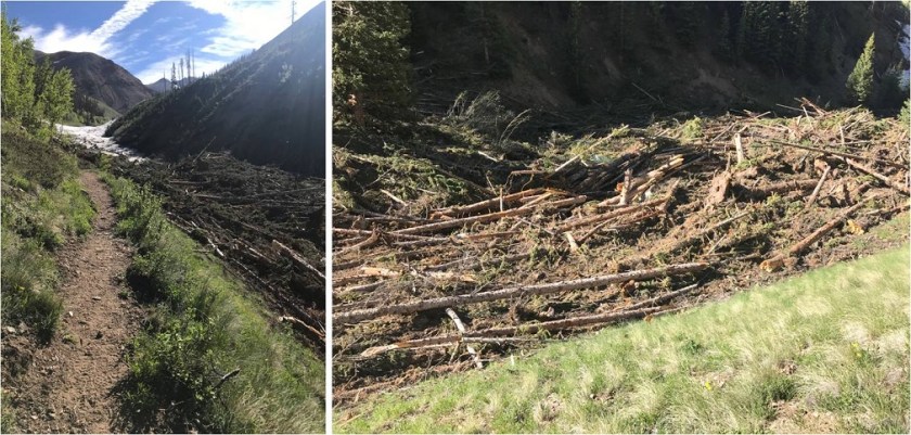
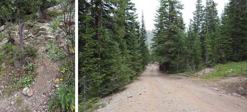
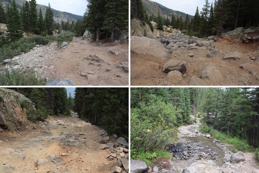
After a short distance I turned left and followed the extreme 4WD road for 1.8 miles.

3

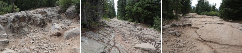
This road should not be attempted by a stock 4×4 vehicle, and unless your vehicle thinks making it up to Lake Como is easy, don’t attempt this road.

4

5

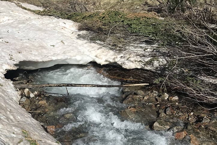
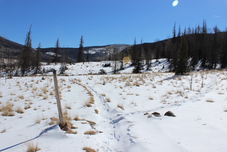
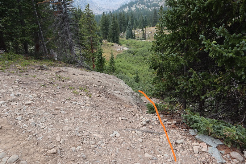
I came to an area with a creek crossing.  There’s a trail that goes to the right.  I could have followed the trail, but instead I crossed the creek and followed the road for a short bit, until the road curved.

6

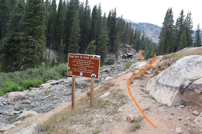
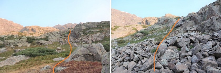
In the dark I missed the sign and followed the road, but just before crossing the creek you can take this junction to the trail instead

7

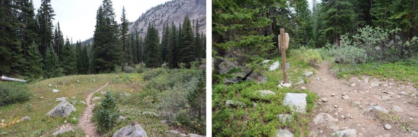
If you miss this junction no worries, just as the road curves to the left there’s a great trail that will take you to Fall Creek trail 2001 (apparently a lot of people miss the ‘sign’ and take this way, like I did)

8

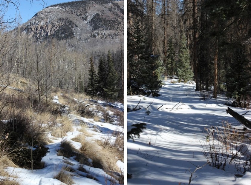
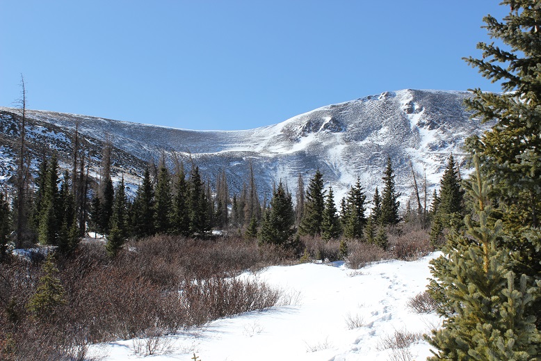
This is a class 1 trail that will take you all the way to the Seven Sisters Lakes area.

9

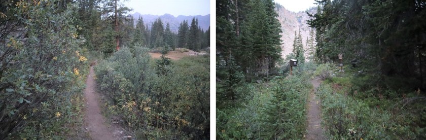
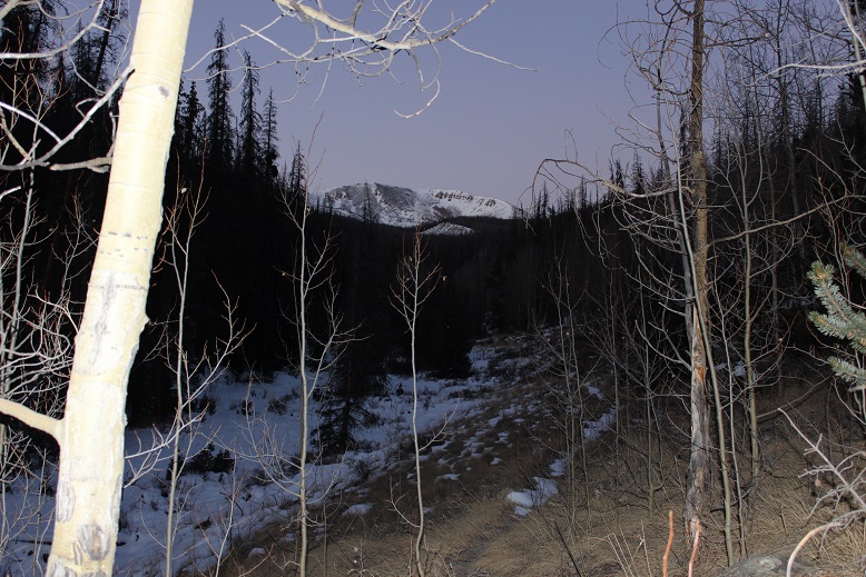
At this sign go right (going left will take you to a camping area, near a lake)

10

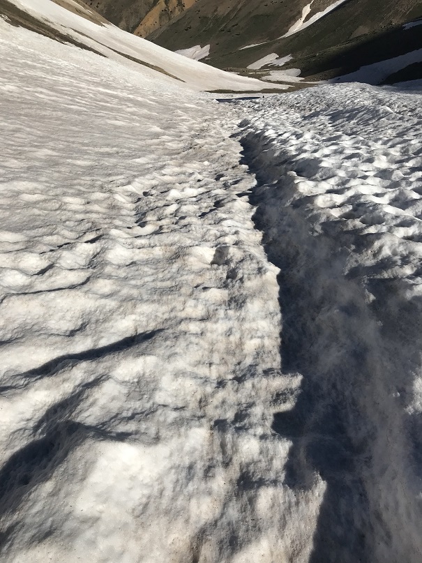
This late in the year all stream crossings were easy

11

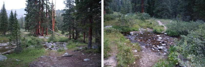
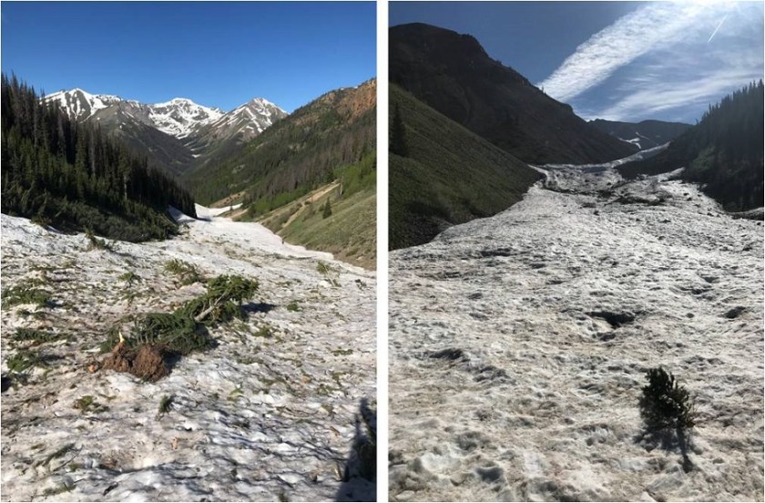
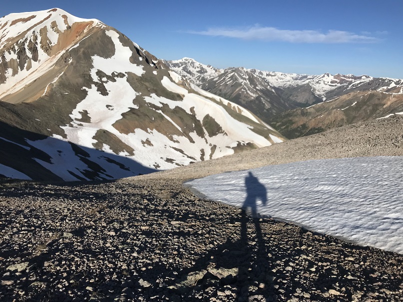
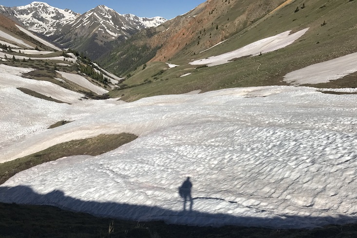
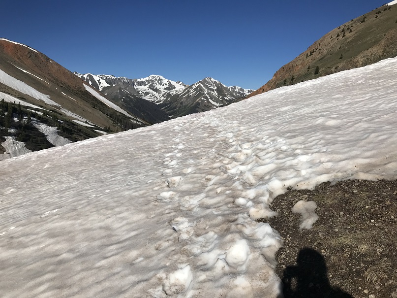
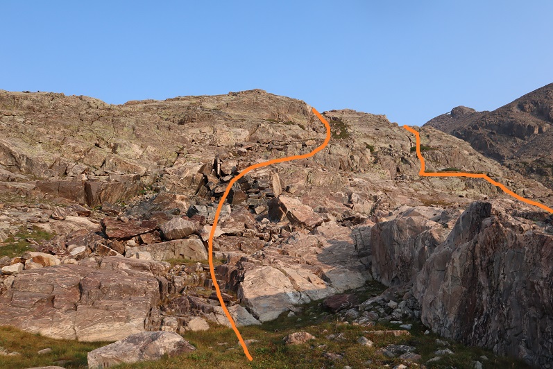
Here are a few more pictures of the class 1 trail up to the Seven Sisters Lake area

12

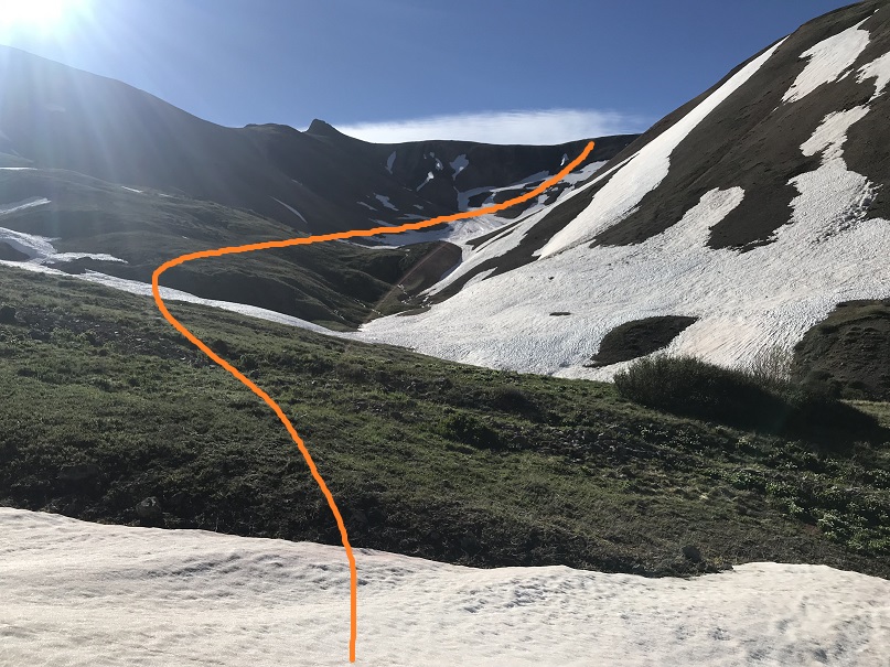
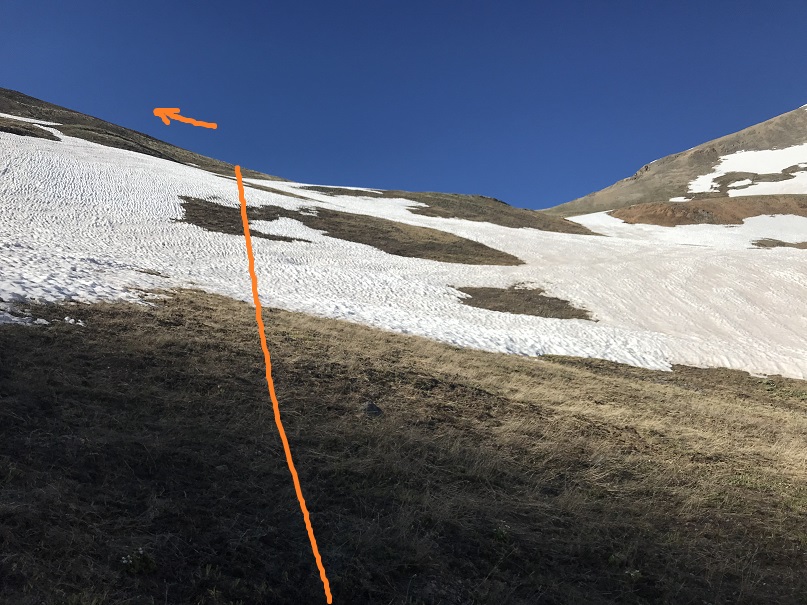
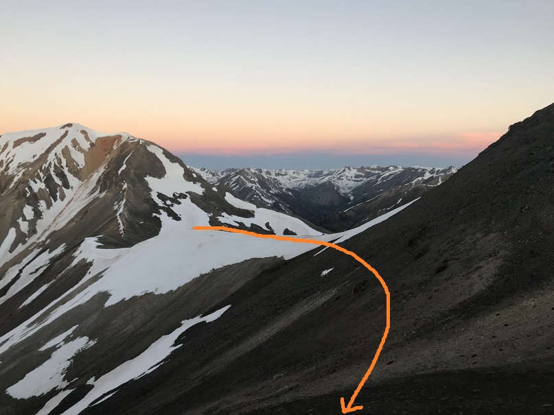
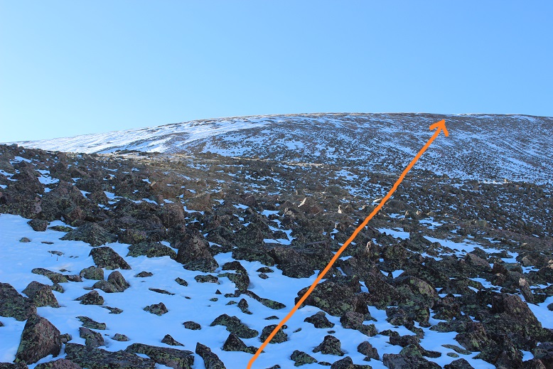
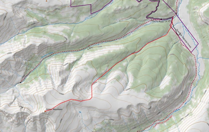
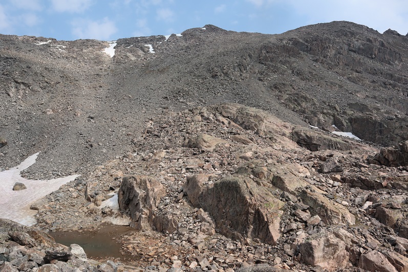
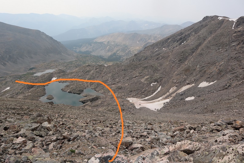
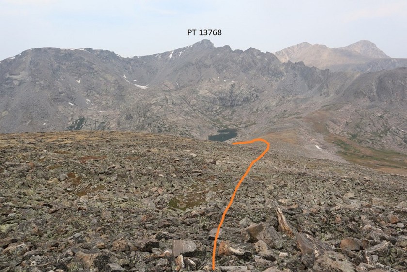
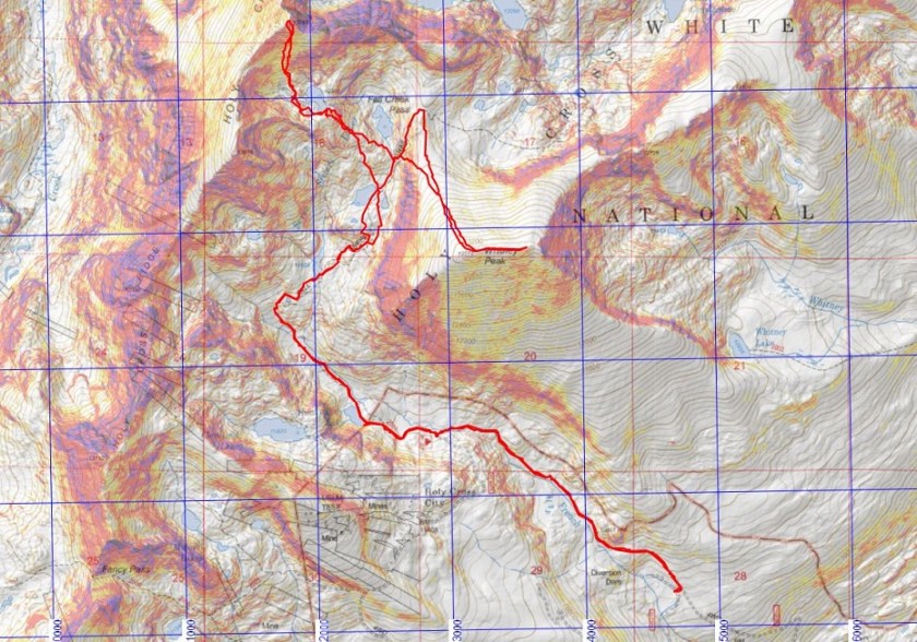
Once at the upper lake, before you reach the pass, there are several options to ascend up the slope.  In fact, I took a different route up than I did back down, and as I was coming down I saw several other viable routes, depending on conditions, snow levels, etc.  Here’s an overview of the route I took:
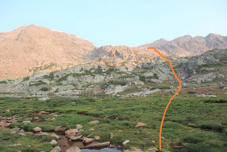
13

And step by step

14

15
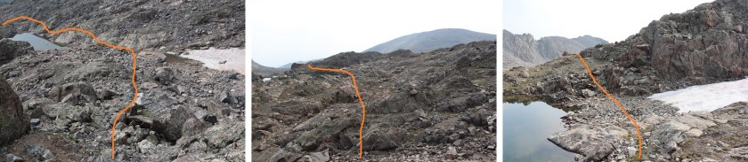
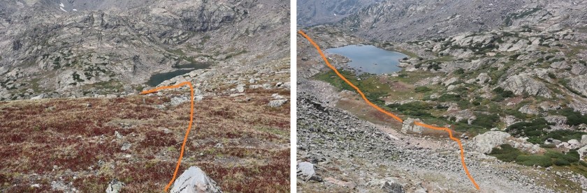
I took the ramp to the left on the way up, to the right on the way down

16

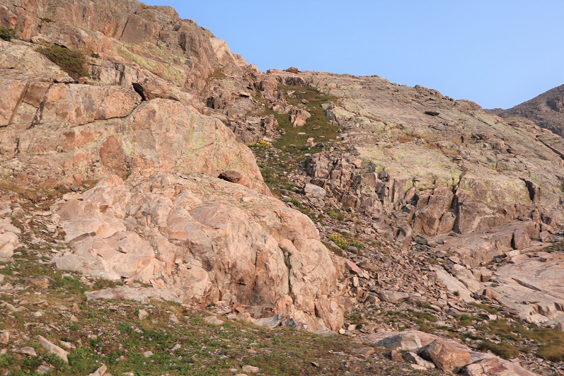
Close up of the grassy ramp

17

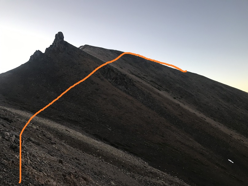
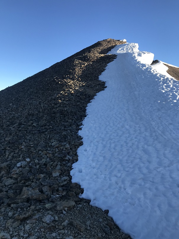
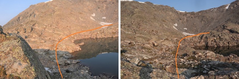
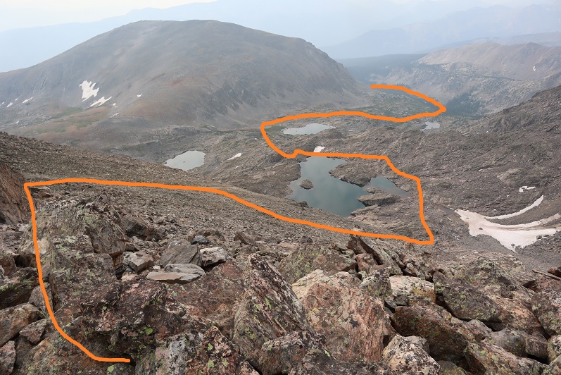
At the top of the ramp I was at a lake.  This lake looks like it shifts shoreline depending on where the waterline lies at different points in the year.  Here’s the route I took around the lake and up the side of the mountain (note:  I went right on my ascent, left on the descent, and while both were class 2, left was easier.

18

Here’s what this looked like step by step.  This is all class 2:

19

20

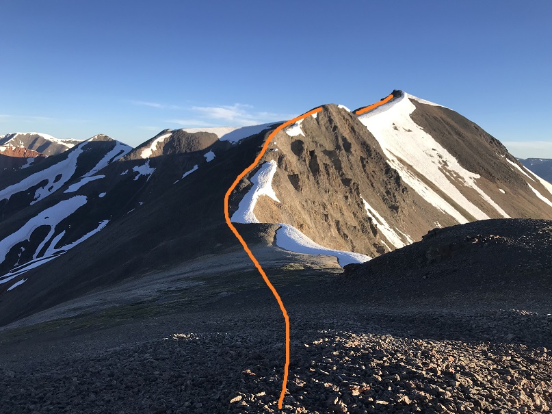
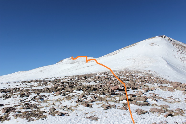
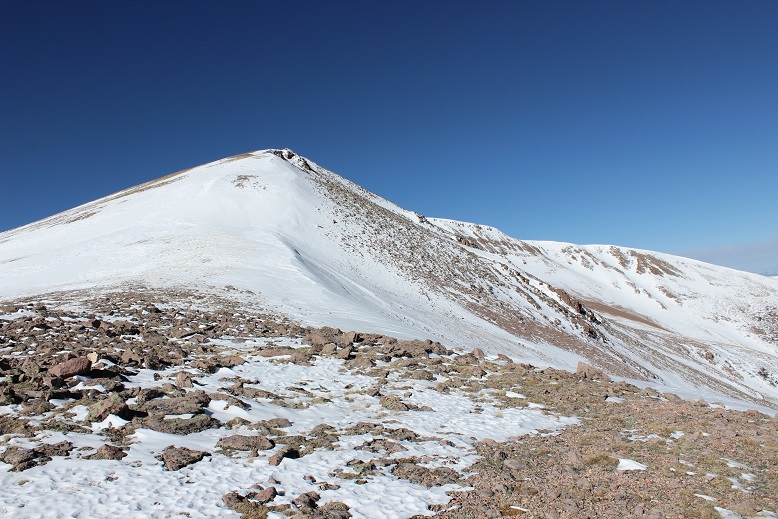
There are many ways to ascend to the summit.  You can take the saddle to the left as well and then follow the ridge, but I chose to go straight up the south face.  This area is more stable than it looks, with large rocks and boulders to hike up.

21

23

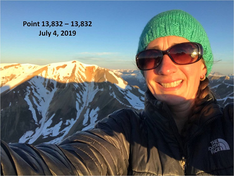
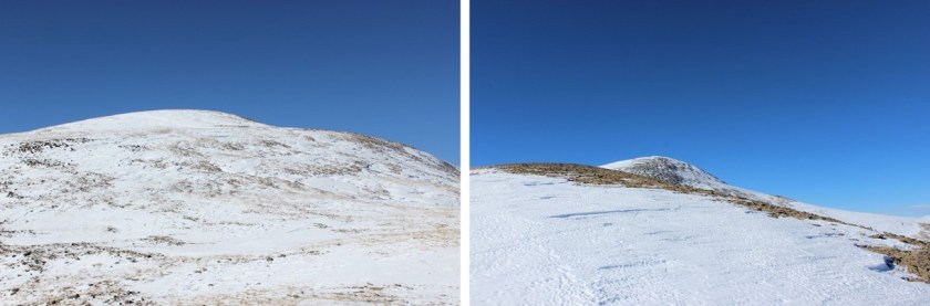
I summited PT 13,768 at 9:15am.  It was hazy due to the fires in the area, but I couldn’t smell any smoke
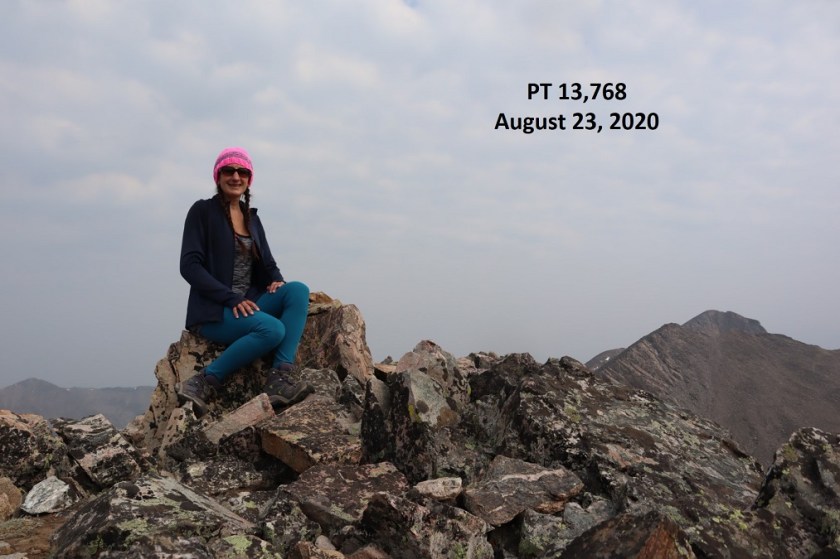
24

PT 13,768:

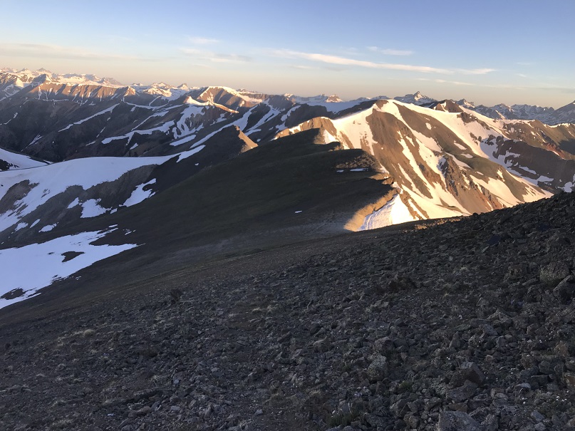
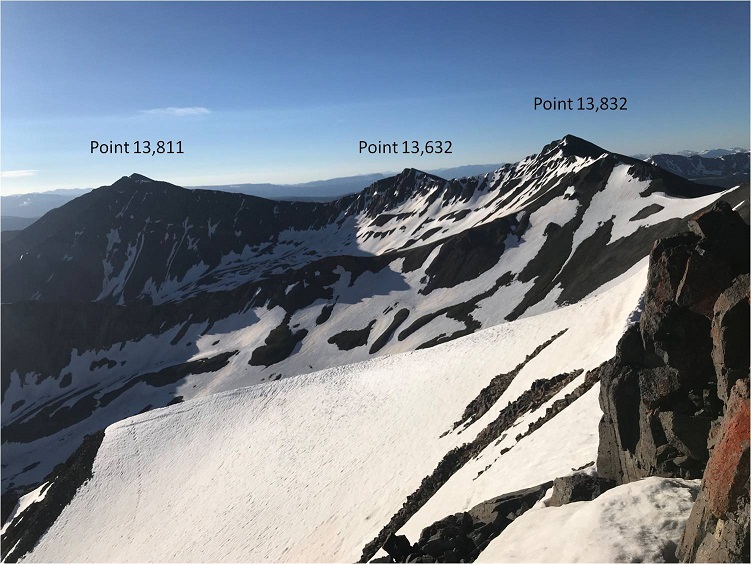
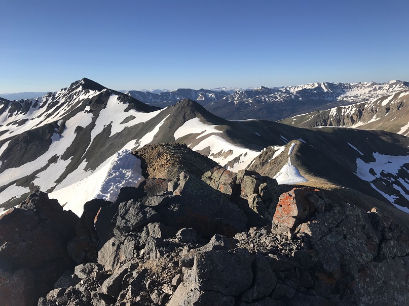
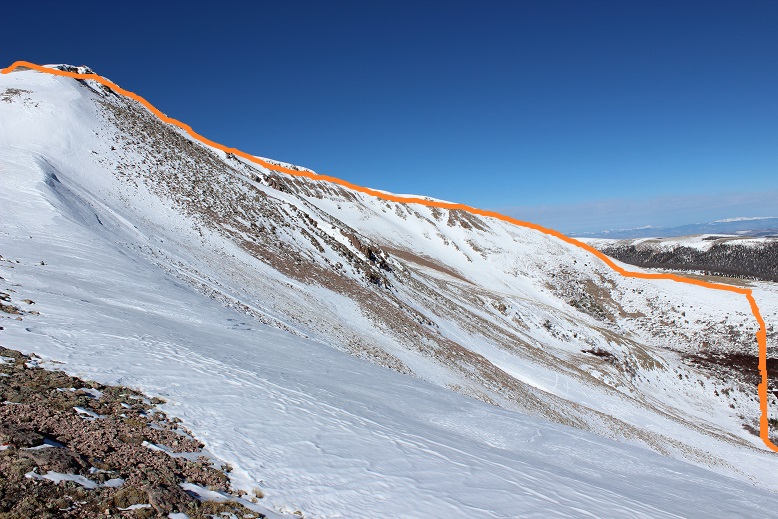
Here’s a look back at the route I took in

25

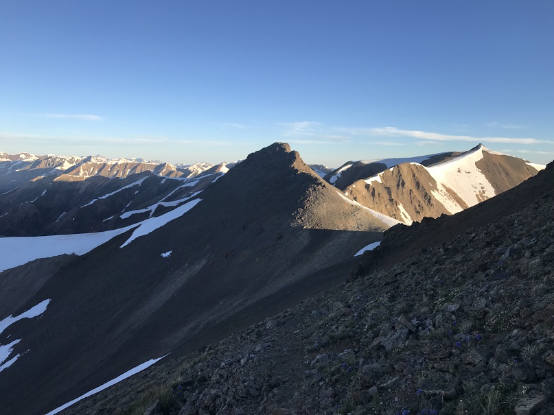
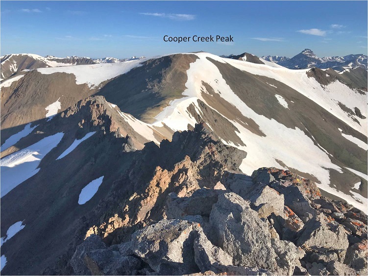
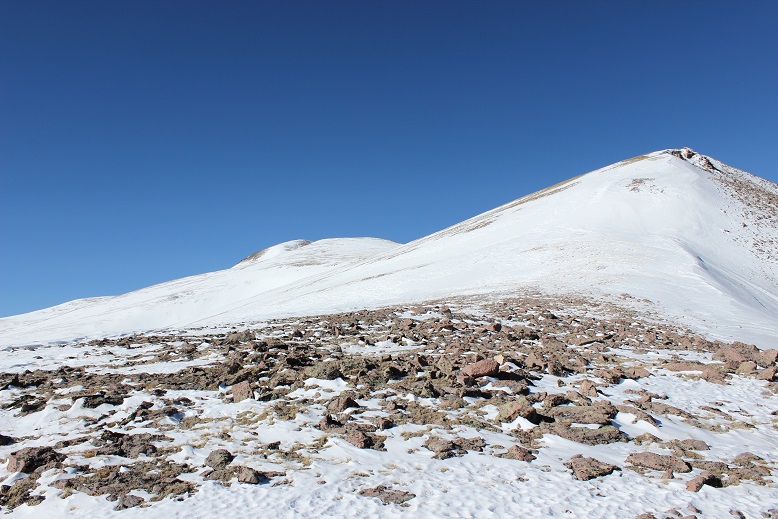
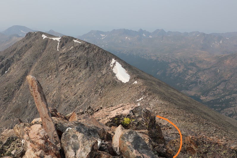
From the summit, here’s a look over at Whitney Peak and the overall route I took to get there

26

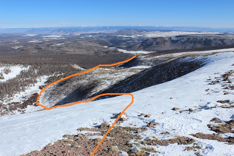
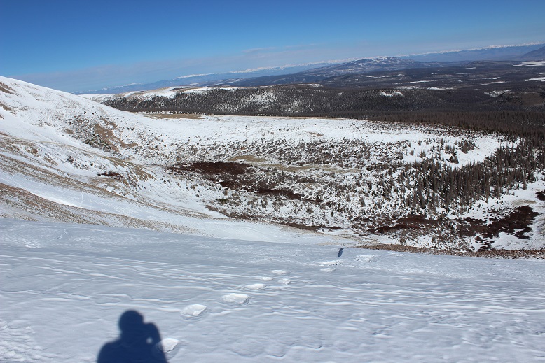
I started by heading southwest, finding a good descent point, and heading back down to the lake

27

28

29

Once around the lake I took the ramp back down and headed southeast until I connected back up with the Fall Creek Trail

31

32

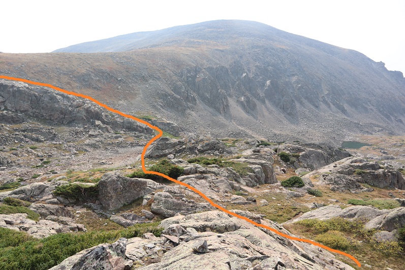
I took Fall Creek Trail up to Fall Creek Pass

33

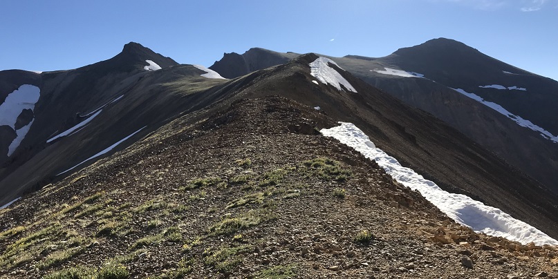
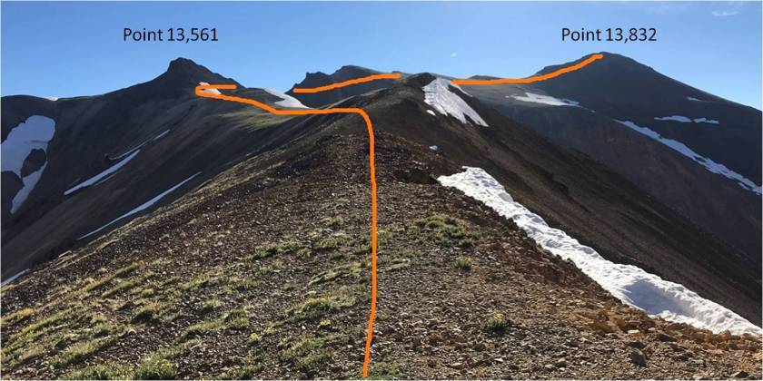
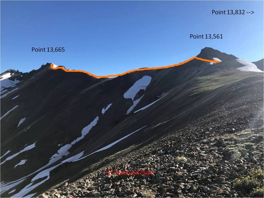
And then turned right (south) and followed the ridge.  This was an easy walk compared to the rest of the day (which had been easy as well).  If you’re in the area, hike this peak, it’s worth it!

34

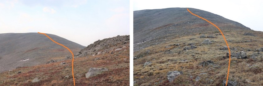
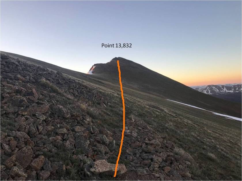
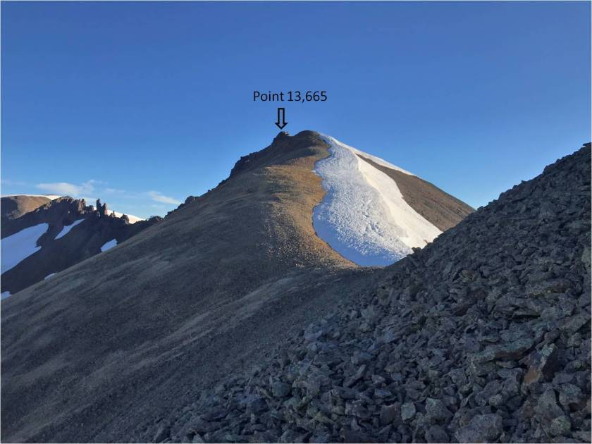
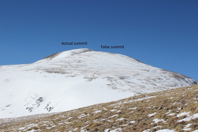
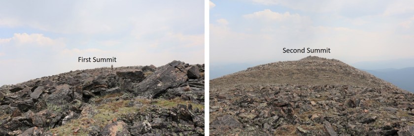
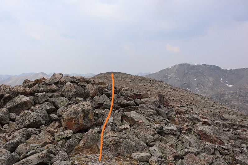
At the top of the ridge is what looks like the summit, but it also looks like the summit could be further east.  Spoiler:  I climbed to both ‘summits’ and when I got home and looked at my altimeter they had 2’ of difference in height, and the one furthest west I stood on top of, while the one more east I sat on the summit block, pretty much canceling out those 2 feet of difference.  Either way, I hit both summits, and I think both should count, especially if you don’t feel comfortable with climbing.

I crossed the first ‘summit’ and headed east towards the second ‘summit’

35

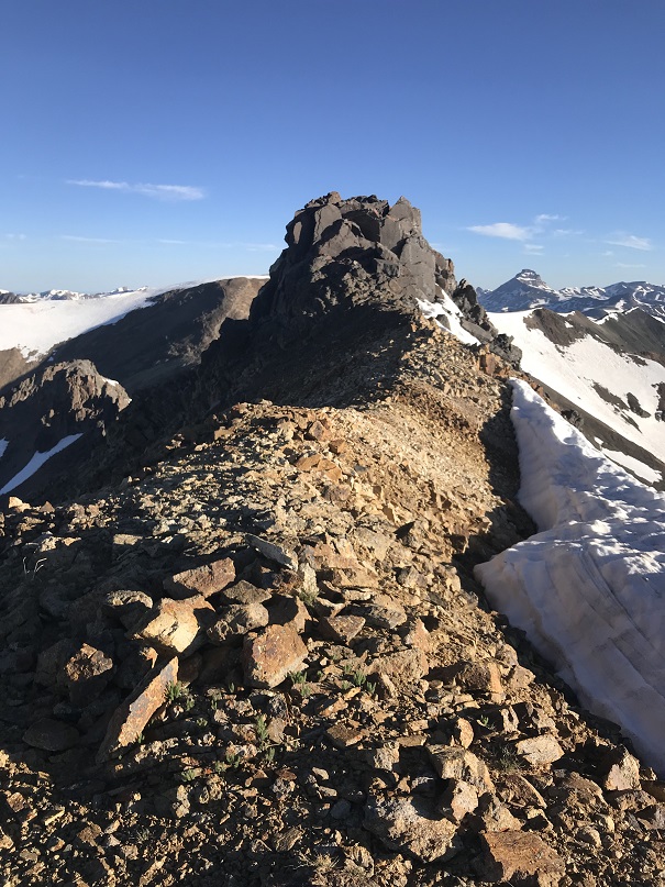
I walked over to the second summit and all around the summit block.  I’ve heard some people wondering how you can “just climb up” and let me tell you, it’s actually pretty easy and doesn’t require an explanation (but I’ll give you one).

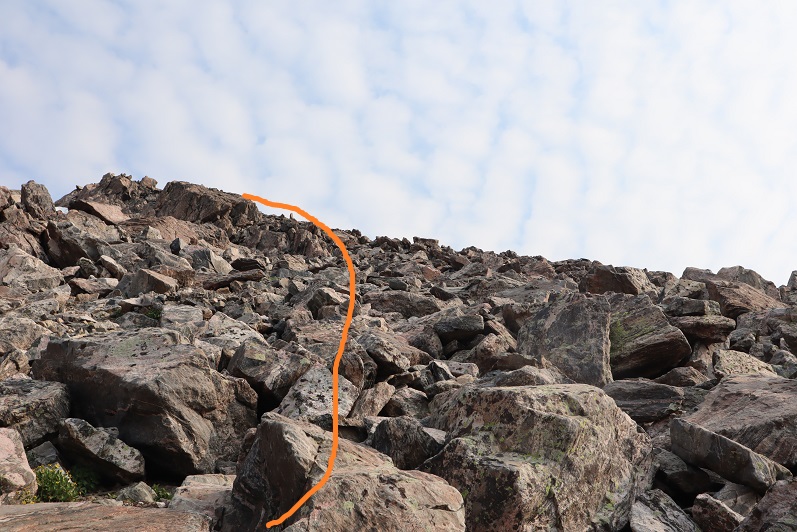
This is how you’re supposed to ascend the block:  I’ve circled where there’s a good grip to place your right hand.  Set your right knee below that as you press your knee against the rock, and then you place your left hand on the top and pull yourself up.  I’m 5’4” and this worked for me.  The two rocks at the base are very loose, so don’t trust them too much. Or, even better yet, if you’re with a friend do the ‘stand on the knee’ thing and help each other one at a time reach the summit.

36

37

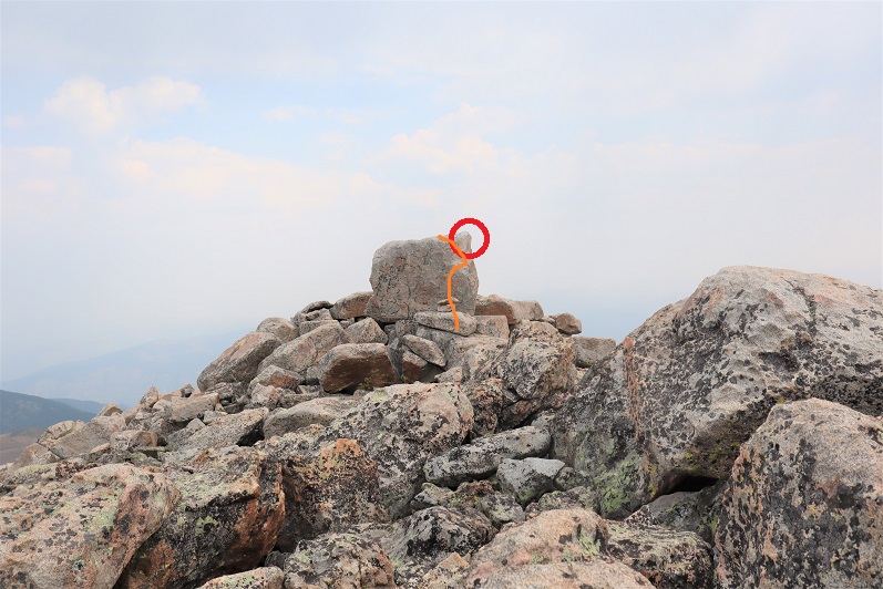
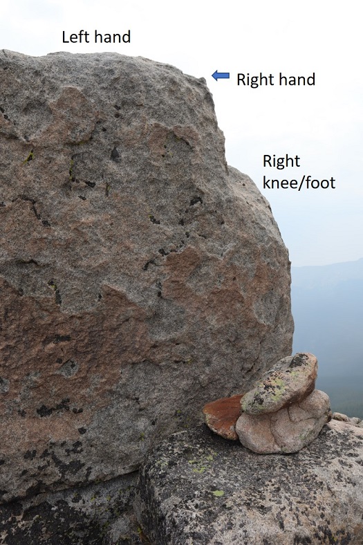
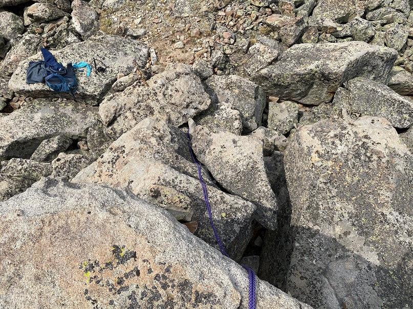
I knew I could climb up this rock, but I wasn’t sure I could downclimb.  It’s rated 5.6, and since I solo I wanted to be over-prepared.  That and I’d brought my 30 meter half rope with me just in case and it seemed a shame not to use it.  So before I climbed the rock I set up an anchor and attached my rope to it, then set the rope over the rock.  Note:  ROPES ARE NOT NEEDED FOR THIS CLIMB.  They were overkill, but fun just the same, and gave me some practice and extra leverage. Here’s my (not needed) set-up:

38

I summited Whitney Peak at 12:15pm.  The summit block is about 4 feet by 2 feet.
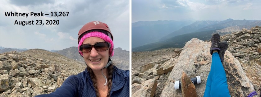
39

Whitney Peak:

1

I rappelled back down because I could.  Note:  you can just slide down on your belly until you reach the rock, but don’t aim for the rocks you used to get higher ground:  aim for the stable rock they’re rested on.

40

The rope allowed me to belay down past the unstable rocks and even a bit further, getting a secure footing on the ground.  I packed up my gear and headed east towards the other summit of Whitney Peak.

41

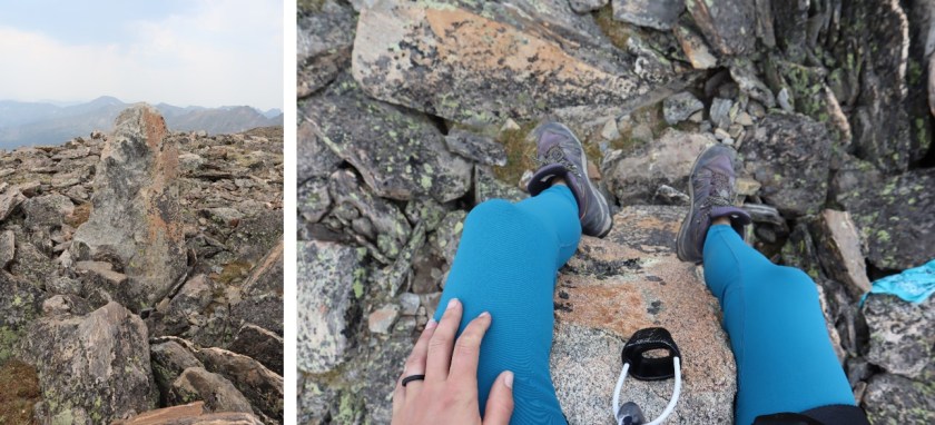
There’s a summit boulder here too, but it’s only about 4 feet high and easily climbable, so I climbed it and sat on top just in case.

42

Time to head back.  I hiked back down the slope but before making it to the pass I went left and headed down west until I reached Fall Creek Trail.  If you decide to do this there are a lot of options to make it happen, but also a few areas where you could ‘cliff out’ (you’d just have to backtrack, nothing too serious) so pick your line carefully

43

44

Once back on the Fall Creek trail I followed it out of the basin

45

And back to the 4×4 road and my truck

46

47

48

I made it back to my truck at 2:45pm, making this a 15.85 mile hike with 4866’ of elevation gain in 9 hours, 20 minutes.

49

Due to the One Eyed Willy delay I was late driving home.  Tomorrow is my daughter’s last first day of school (first day of her senior year of high school) and I wanted to make her a special dinner.  She requested my fried chicken, and I didn’t want to disappoint her.  A big thank you to the lazy construction worker who forgot to turn off the “HWY 24 is closed past Hartsel: Find an alternate route” sign, as on a Sunday night around 5pm I was the only car taking my chances and using the road.  There never was a closure, and I was able to get home in record time to make a special dinner for my baby girl.


13,838 & Pt 13,665

1

RT Length: 11 miles

Elevation Gain: 4055’

I had a totally different set of peaks in mind for the 4th of July weekend, but due to the (still) high levels of snow in the San Juan’s my plans changed a bit.  I feel a bit out of shape because haven’t been out hiking in 2 weeks: I took my Troop Hammock Camping (it snowed on us in June!) and then to Alaska/Canada for a week, staying mostly at or around sea level.  I got home the night of the 3rd late, decided to get in a 2 hour nap and was up and on the road at 9pm, headed to Lake City.  To most this schedule may seem crazy, but I suffer from nightmares when I get too much sleep so I’d rather keep myself busy.

The drive up until Lake City was uneventful, except for a cop that pulled me over doing 61 in a 60mph zone coming over a hill in Nathrop. This is the second time this has happened in the same area, which means I didn’t learn the first time.  Of course I was let off with a warning, and this time he didn’t try to give me his phone number.  Also, he had no idea where Lake City was.

I was about 2 miles from Lake City when I saw it: My first thought was “Wow!  A mountain lion!”  Then quickly afterwards “Wait, that’s too big to be a mountain lion…” I was asking myself what animal could have a tail like that and be bigger than a mountain lion when it turned and looked at me:  White muzzle, pink nose, dark alert whiskers, and tan face.  That was definitely a mountain lion!  Woot!  And a healthy one to boot:  I’m talking African Lioness size, brawny and muscular.

I slowed down my truck to get a better look.   He(she?) was walking on the side of the road, seemingly not in any hurry.  I’ve hiked thousands of miles in Colorado, and this was the first mountain lion I’ve seen here, and also by far the biggest mountain lion I’ve ever seen.  Naturalist Nerd that I am, I’ve spent whole days at the Rocky Mountain Wild exhibit at the zoo, just sitting and watching Mountain Lions.  Those mountain lions at the zoo had pouchy stomachs and loose skin, but not this guy!  He was all muscle.

I was also a Park Ranger when I lived in California, and one time I encountered a Mountain Lion as I was leading a class of 3rd graders to the picnic area.  It saw us coming, jumped out of the tree it was lounging in and quickly bounded away (30 lunchtime 3rd graders will do that to wildlife).  While collared, that one must have been a juvenile because it had nothing in size on the one currently walking front of me.

After about 30 seconds I came to the conclusion I should try to get a picture. My cell phone was in my lap, so I turned off navigation and clumsily opened the camera app.  I took a quick video and tons of pictures and studied him until he eventually turned around and bounded up the hillside.  Imagine my disappointment when the video was too dark to see anything, and none of the pictures turned out of him sitting and looking straight at me.  The best one I got was of him jumping, which wasn’t too great to begin with.  In any event, it was a cool experience.  Lake City has some big mountain lions!

2

Video

The Grizzly Gulch / Silver Creek trailhead was full when I arrived at 2:30am and I had to get creative to find a parking spot in the parking lot big enough to fit my truck.

3

I headed northeast and was on the trail before 3am, a little jumpy after seeing the mountain lion but confident he was at least 20 miles away from my current location. I just tapped my trekking pole on every rock I saw and hoped I was scaring unwanted encounters away.  Also, there’s a trail register at this trailhead; one of those big metal ones that makes a terrible creaking sound when it’s opened and closed, and a big bang when the lid drops.  After signing my name and closing the lid I’m pretty sure I scared every creature within a couple mile radius.

4

Almost immediately there was evidence of avalanche activity along the trail, and while it was still dark and I couldn’t see the downed trees I could smell the fresh pine scent that accompanies an avalanche.

5

This is a very easy trail to follow, as it parallels Silver Creek all the way to the basin. As the trail began to follow Silver Creek I found myself walking on ice.  At first I thought the creek was frozen, but quickly realized the creek wasn’t frozen but covered in a layer of ice several feet thick.

6

The ice was solid and reminded me of the glaciers I’d just seen in Alaska. It looked like an ice flow, but was most likely caused from avalanches throughout the basin.  Mixed in were various tree branches and avy debris

7

And even areas of rockslides (the creek was flowing swiftly underneath all the debris).

8

Once in the basin I ascended the slope to the saddle between Redcloud and Point 13,561. This was fairly straightforward, and while it was covered in snow I didn’t need traction.

9

At the top of the saddle I turned left

10

The sun was starting to rise so I dug in my backpack for my camera, but unfortunately must have left it at home. Drat!  I bring along my DSLR for pictures because taking photos on a phone is difficult with Raynaud’s:  any type of touch screen is an issue as my finger touches don’t always register, but it’s much worse when my fingers are cold.  I inwardly sighed and crossed my fingers there wouldn’t be too much wind, mentally resigning myself to not getting summit photos today (or tomorrow, as I was staying in Lake City hiking for a few days).

From the saddle I could see the rest of the route before me, and rejoiced it was basically snow free!

11

I looked left and was greeted with an unexpected view: I’d planned on summiting “Cooper Creek Peak” today as well, but hadn’t realized while going over my topo map there were gendarmes and a rocky ridge involved (and I didn’t have a helmet).  Looks like I was only summiting one peak today.

12

I headed towards the patch of snow on point 13,561

13

This was easy to cross. Here’s looking back at Redcloud and the patch of snow

14

I followed a faint trail across the ridge

15

The path to the summit was tundra mixed with small rocks.

16

17

I summited at 6am, thrilled I was able to take photos with my phone (yet upset I was forced to take a selfie). Also, the sun was in my eyes

18

Summit Video

I turned to head back

19

The snow patch doesn’t look so bad from here

20

I crossed back over the patch of snow and thought again about Cooper Creek Peak. It was still really early and I wasn’t tired.  I didn’t think I could summit, but I could make it to the halfway point (Point 13,665) and add some extra mileage and elevation gain to today’s hike, helping to keep me at my 10 mile/4000’ average.  Here’s the path I took from the saddle

21

This was more challenging than Point 13,832, but in no way difficult. I just followed the ridge

22

I just kept to the left of the snow, hiking up surprisingly stable scree

23

The fun part came at the end. The actual ‘summit’ is the bump to the left

24

This ended up being quite a fun (if short) scramble to the top!

25

It reminded me a bit of the final scramble on El Diente (but with a lot less scrambling to get there).

26

Yes, there were a few chosen class 4 moves and some exposure as well.

27

From here I could see the summit of Cooper Creek Peak, and once again verified I wouldn’t be climbing the ridge connecting it with point 13,665 today (next time I’ll bring a helmet)

28

I had a really cool view of PTs 13,811 & 13,832 as well

29

Here’s a look back on the route

30

I trekked back to the saddle, having fun taking shadowselfies now that the sun was in the perfect position to do so

31

32

Back in the basin the 4th of July weekend was ramping up:  I saw a couple dozen people on their way to Redcloud.  I was glad I’d started early!  The snow was softer on the way out, but I still didn’t need traction.

33

In the daylight the trail was much easier to follow: I just walked along the river of ice.

34

I made it back to my truck at 9:30am, making this an 11 mile hike with 4055’ of elevation gain in 6.5 hours

35

I hopped back into my truck and drove to the next trailhead, anxious to find a spot on a busy 4th of July weekend.  No need however, since I was the only one there when I arrived (besides thousands of mosquitoes of course).  I forced myself to eat (a bagel, tuna, and some dried fruit) and appreciated the close and clean bathroom.  Eventually some dispersed campers wearing tank tops, flip flops, shorts, and backwards baseball camps arrived and I went to talk with them before heading to bed early (I’d only had 3 hours of sleep in the past 48 and needed to do some catching up:  Luckily, even though I’m prone to nightmares I’ve never had one while camping so I was hoping to get in a solid 10-12 hours or so).

I talked with the other campers about the trail I was taking for tomorrows hike, as they’d attempted the approach today but were unsuccessful. They hadn’t been able to make it more than 2 miles due to avalanches and high creek crossings.  I mentally filed this information away for tomorrow.  Between slapping mosquitoes and trail talk I discovered they were camping to celebrate the holiday weekend with a dozen or so of their closest friends and they offered me a Coors Light later if I was interested?  I thought back fondly to my days as a young 20-something, dispersed camping in the middle of nowhere with cheap beer, and then thought of the bottle of Knob Creek I had waiting for me in my truck.  I thanked them, but they didn’t need a 38 year old parental figure spoiling their fun… and I was pretty sure I was all set in the alcohol department.

Organ Mountain 13,808

1

RT Length: 9 miles

Elevation Gain: 3500’

My hiking days got switched this week due to mandatory Friday dentist appointments. (Side note: anyone know of a great dentist in Colorado Springs that’s open nights and weekends?  I love my dentist office but their hours stink!!!).   I was willing to give up my hiking day this week for dental hygiene but when I asked my kids what they wanted to do this weekend one was gone and the other wanted to sleep until 4pm (she’s a teenager, this is doable for her) but she wanted me to take her to see the school play at 7pm.  Woohoo!  This gave me a Saturday hiking day, and I could drive further since I didn’t need to be home by 3pm.

So I changed my schedule and took a nap Friday night and woke up at 11:45pm and drove the 6 hours to the Eddiesville Trailhead in the San Juans. The weather wasn’t supposed to be spectacular (0-29* at the summit, with wind chill making it 0 to 10*) but as I was driving down the dirt road my heart sank as the temperature dropped to -5* and held there for a bit.  I got excited when it rose to 7* (I know, crazy to be happy about 7* weather) and disappointed again when it went back down to 0* and then held steady again at -5*.  With my Raynaud’s I was seriously worried a hike wasn’t going to happen today: I’ve never hiked in such cold weather and had my doubts.

I’d seen a report from earlier this week stating the trailhead was still open (woohoo!) but that it was icy. Let me tell you, they weren’t kidding!  I’ve never experienced this kind of ice before.  Granted it was -5* outside, but the dirt road was covered in 2-4 inches of ice and there was no way to gain traction on the road.  This is the very first time I’ve ever experienced my 4WD Tundra slip in the 6+ years I’ve been driving it on ice and snow.  It caught me off guard, but I straightened it out and kept it under 5mph until I reached the trailhead.  Those steep hills with tight curves were a killer!  I could tell by tire tracks several other vehicles had slid into the drainage on the side of the road in the past few days.  There was a pretty good rut going for tires which was nice, but would have made passing another vehicle a nightmare.  Here are pics from my drive out.  The creek crossing(s) were fun, especially the second one that had a thick layer of ice at 5am I got to break through with my truck:  My truck was happy!

2

There were tons of animal tracks along and through the road. Very cool!  Hopefully I’d see some wildlife today.  I saw some of the biggest white rabbits I’ve ever seen.  Seriously.  They reminded me of the jackrabbits we had in Arizona, the ones the size of racoons.  I arrived at the trailhead at 5:30am to -5* weather and snow everywhere and a gate preventing me from driving further.

3

I’m still learning about winter condition hiking and where my limits are, so I’d decided before even arriving to give it a try and turn back if needed. I’d driven all this way, hadn’t I?  I might as well use this as a learning experience, -5* weather or not.

So I put my snowshoes on in the truck and bundled up for the cold weather with multiple pairs of gloves, my balaclava, knit hat, etc. I opened the door and was greeted with intensely cold air, but luckily no wind.  I took a deep breath:  I could do this! (Probably).

The trail actually had signs, which was an unexpected treat.

4

I followed the trail through a gate and to the left (southeast) for about 150 yards

5

until I saw this post and turned right. There was supposed to be a trail here, but it was invisible in the snow.

6

My fingers were burning. Seriously burning from the cold.  I stopped and took off my felt gloves that were under my mittens and just wore my mittens.  My hands were instantly warmer, but I was giving up finger flexibility:  I would no longer be able to take off my mittens to actually do stuff (like adjust my snowshoes, take photos, look at my phone/gps, etc).  (Another side note: Someone seriously needs to invent better gloves.  I need actual gloves with finger casings for dexterity, but unfortunately they don’t keep my hands warm enough.  I need mittens that have small fingertip holes made with thin weatherproof fabric that retract inside the mitten but you can poke your fingertips through when necessary.  Someone please invent these.  But I digress…

Now that my hands were warm my hike instantly looked more promising, despite the cold weather. The lack of wind below treeline helped too.  The trail varied from large amounts of snow to just a little on the trail. It was easier to just keep my snowshoes on, so I did, even when they weren’t necessary.

7

As the sun started to rise I got my first good look at Organ Mountain (this isn’t the summit).

8

Did I mention the animal tracks? It was obvious no one had been on this trail for quite a while.  Well, no one but our 4 legged friends.  I saw tiny prints from mice, fox prints, and the biggest rabbit prints I’d ever seen.  Oh, and the deer and elk and moose prints were everywhere. This is how I knew they were moose tracks…

9

The animal tracks were super helpful for finding the actual trail. There was a trail here, but it was invisible with all the snow.  Luckily the animals knew where it was (mostly).  When the animal tracks obviously veered off the trail I just followed the creek.  This trail follows the Hondo Creek all the way to treeline, so as long as you parallel the creek you’re fine.

And check these tracks out! I instantly knew these were mountain lion tracks and got excited!

10

They followed the trail for over a mile and were headed in the same direction I was. I found it fun the lion didn’t always stick to the trail, but sometimes hopped onto logs and traversed them seemingly for ‘fun’ and then jumped back along the trail again.

11

Then all at once the tracks veered off in another direction. I decided to follow them for a bit to see if they paralleled the trail I was on or went another way.  While these tracks were hours old (I could tell by traces of elements left by the wind) I still felt it prudent to see which direction the lion had taken so I knew whether or not to be on the lookout.  Imagine my surprise when the tracks led me to its den no more than 50 feet off the route I was on!  With no tracks leading back out I quickly retraced my steps and continued my hike (sorry, no pictures:  I want to keep the kitty safe!).

I continued following Hondo Creek until treeline and got a great view of the route before me.

12

My research said to take a route to the right, but to me the left side of the mountain looked easier: Give me quick elevation gain over the long way any day!  So, despite my map and trail directions I decided to go up the left (south) face of the mountain.  It just seemed safer, especially since avalanche danger is more prominent on the north/east faces right now. Not that there was much snow to worry about.  I was worried about the wind.

13

This was a steep climb and would have been easier without the traces of snow, but the rocks were semi stable and I didn’t need to worry about causing an avalanche/rockslide below me. I kept my snowshoes on for stability.  I was able to gain the ridge in about half an hour and could see the rest of the route before me.  This is where the wind picked up (25mph) and took the 0* temperatures to new negative levels.  But I was dressed well, and as long as I didn’t take off my gloves I was ok.

14

This is the route I took.

15

And looking back down from the ridge at the route from my truck to this point

16

There are several false summits on this mountain. After gaining the ridge I was on a small plateau that gave me a break from elevation gain (here’s looking back at the plateau)

17

But there were still two other points to gain

18

I stuck to the drier areas and just followed the ridge up to 13,400’ where there was a small rock wall and a lot of wind. It wasn’t too steep and as long as I didn’t stop I didn’t get too cold.

19

20

From here I dipped down and climbed the approx. 400’ to the summit or Organ Mountain. Sorry, but I don’t have many pictures from the summit.  I couldn’t take off my gloves and my DSLR camera was doing that fun thing where it takes 50 seconds to take a picture, and I was, well, FREEZING!  That wind was brutal!  I got out my cell phone to take a video and it went from 40% battery to 9% and turned itself off before I could even start videoing, let alone take off my gloves to start the process.  Great.  I’d made it, but my camera(s) hadn’t.  Here’s the one terrible picture I got from the summit before my cameras failed.  I summited at 9:28am.

21

I didn’t stay long because I was cold and on a mission to get home before 6pm so I could take my daughter to a play tonight, so I turned and booked it back down. When I made it to point 13,400 again the wind died down for a bit and I was able to plug my phone into the solar powered battery charger I’d brought.  The phone turned on again, but my route had been lost.

I made it to the ridge and had a great view of the way I was supposed to gain the ridge to the plateau but hadn’t. No regrets!

22

Time to head back down! (Those tracks aren’t mine… I’m guessing Mountain Sheep/Goat)

23

Here’s the route I took. I just headed for the basin.  Yes, it’s steeper than it looks, but the rocks are relatively stable, especially with snowshoes on.

24

I made it back to the basin and followed it back to Hondo Creek. At the top I found the remains of what’s most likely an elk/moose, and probably the source of a few of the mountain lions’ meals (or had been this past spring/summer: the carcass had been picked pretty dry by this point).  It was the right distance away from the lion den to be its food source, and it had been buried at one point.  There weren’t any tracks here, but I didn’t stop to investigate much either.

25

Now I was racing against the clock. Luckily, I had my previous tracks to guide me back down the mountain.  Knowing I just needed to follow the creek I took a more expeditious route and stayed to the north of the creek, instead of dropping down into the creek as I had on the way up.  This made the trek much faster.

As I descended the temperature warmed up and I was much more comfortable. I made it back down to my truck at 12:15pm, still the only vehicle in the lot. This was a 9 mile hike with 3500’ of elevation gain completed in approximately 6.5 hours.

26

I immediately changed out of my gear and switched my snow boots to sandals for the drive home.

27

The drive out was much easier than the drive in, but I was more careful as well. There weren’t any vehicles parked at any of the trailheads.  I passed a truck with a trailer full of wood who didn’t seem to mind driving on the snow to get around me, and a large tractor with the biggest tires I’d ever seen wearing chains crunching down the road.  And I didn’t die from exposure!  Woot!

28