Garden of the Gods Keyhole Route & Kindergarten Rock

1

I went rock climbing with a group from church recently. This was super fun but a little out of my comfort zone, as I’m not a big ‘people person’ and usually climb alone.  Everyone was super nice and I was able to get in a run on the keyhole route at the Garden of the Gods.  It was a bit chilly out (hence the puffy) but as a bonus someone brought homemade fudge (yum!).

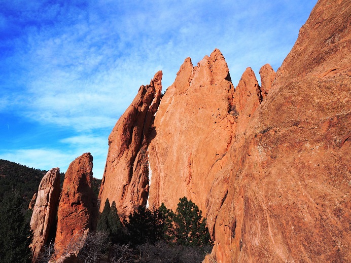
The fun started around 12:30pm with ‘Ralph’s Tree’. You see, Ralph went up first so he could stay up there and take pictures of everyone climbing.  Since he was first it was his job to climb up and then throw the rope back down.   Well, the rope got caught on a scrub bush and knotted up when he threw it down.  It took about 20 minutes for him to sort it all out, but finally he was able to get the rope unstuck and toss it down.  We all joked about it and shouted up at him to be more careful with the next rope.  Well, you guessed it, the second rope got tangled too, and we couldn’t stop laughing!  For a visual, here’s the scrub tree that was the only obstacle that needed to be avoided… and the one that tangled the ropes twice.

2

We all had a good laugh about that one and teased him in good fun until the end of the event. Eric was on belay (without shoes, of course) for the orange route and due to the slope of the rock (or lack thereof) the rope near the top had more friction than normal and he had his work cut out for him

3

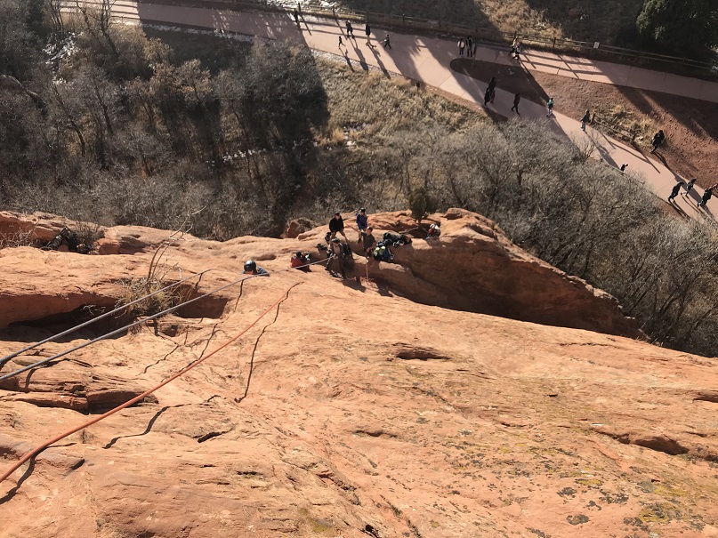
Since I was a guest I waited for everyone else to climb first. As I was waiting and watching and enjoying homemade fudge I noticed some climbers to our left topping out at a cool gully (Eric says we can try that one next).  Anyway, I thought it was a cool visual so I grabbed Eric’s mirrorless and took a few photos.  Don’t they look cool?

4

5

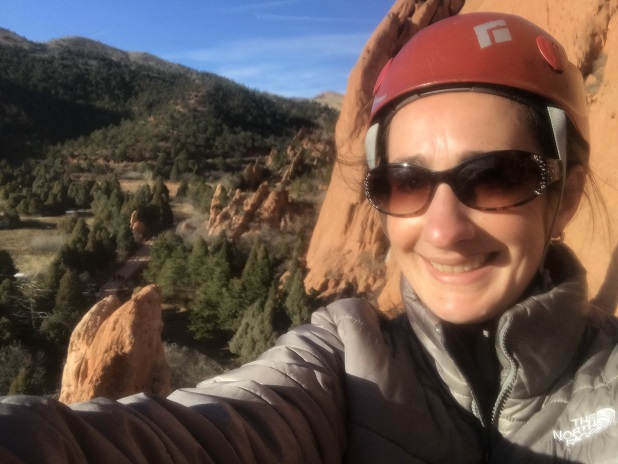
Oh, and while I was there I saw the opportunity to take a shadowselfie I couldn’t pass up.

6

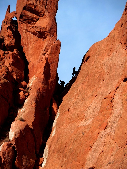
It was fun watching everyone else climb up, and while they did I took the opportunity to study their routes. Check out Curtis and Connie rappelling down together! Awwww!

7

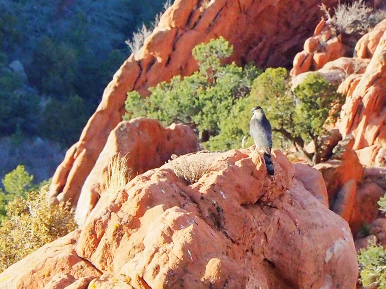
A Coopers Hawk decided to perch near us for a while

8

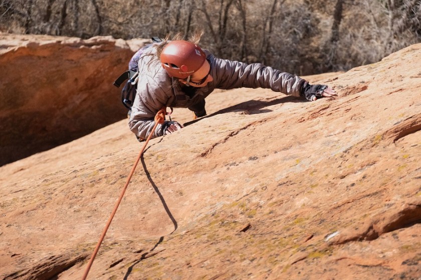
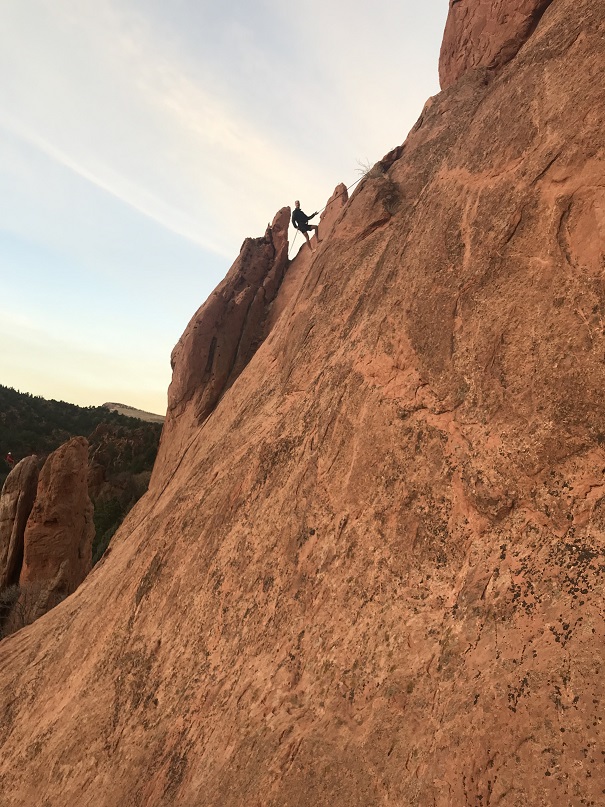
When it was my turn to climb I was totally ready. I knew which line I wanted to take and just went for it.  It actually felt pretty easy.  Ralph got a picture of me from above

9

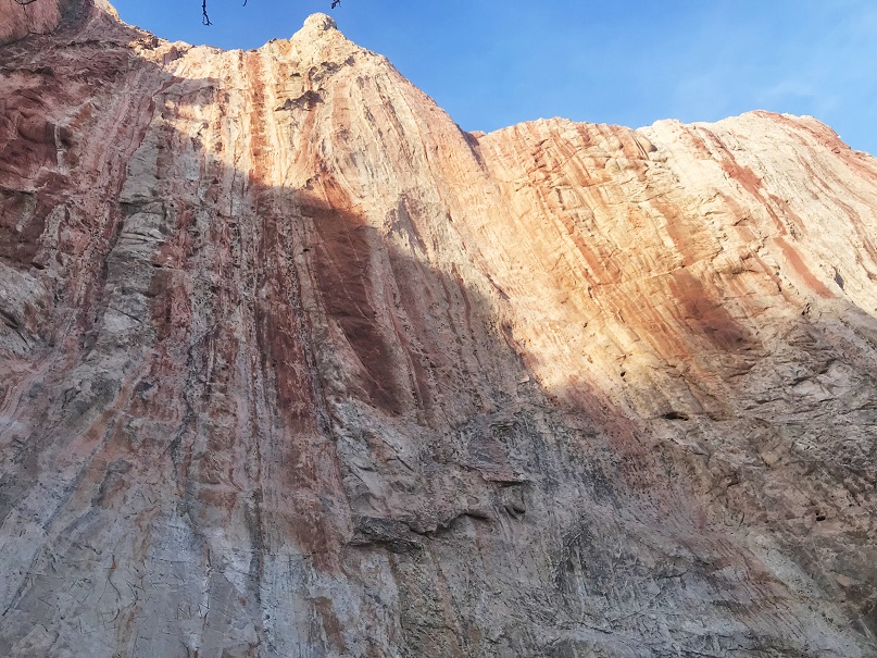
Once at the top I sat for a minute and enjoyed the view. I could hear the conversations of visitors strolling around below

10

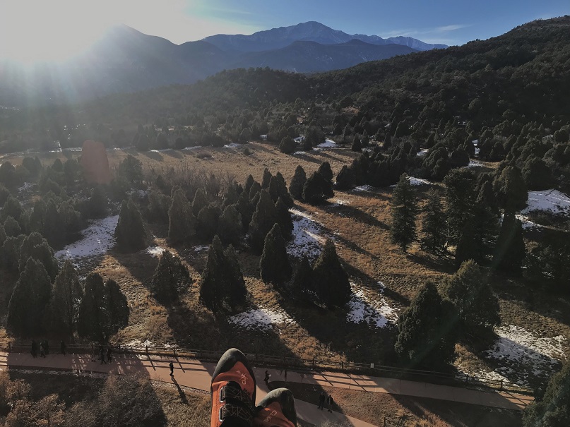
Of course I got a selfie

11

And then rappelled back down

12

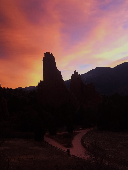
I was one of the last to climb (a few people went twice after I was done) and even though it was early the sun was fading fast. It tends to do that with Pikes Peak to the west.  I was talking with Eric and decided to get creative with my camera.

13

All in all a fun time! Afterwards I brought Emily home a pizza and then joined everyone for church.

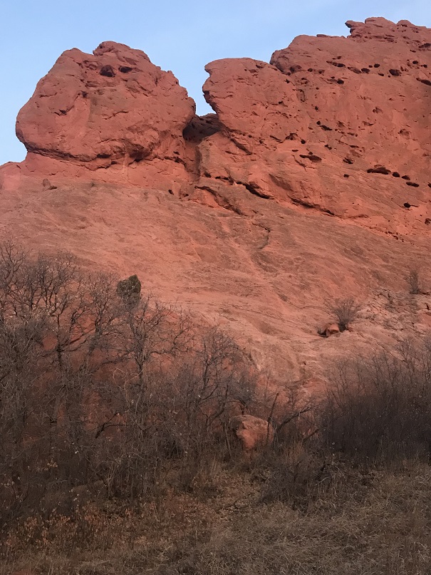
Oh, and here’s a few photos from Kindergarten Rock Eric and I climbed that one last week but I didn’t post.

14

15

And from scoping out Keyhole for this trip

16

17

18

Another cool silhouette sunset shot. That one’s on my list of climbs too.

19

Seven Bridges and Kineo Mountain 9,478

Thomas
went to camp this morning, and after Emily and I volunteered at the Humane Society
this afternoon the girls went to Denver for an event, so I decided to take an
evening hike. 
I usually hike in the
morning, but the opportunity arose and I couldn’t waste it.

I
had a difficult time deciding which hike to take, but in the end chose Seven
Bridges, with a possible summit of Kineo Mountain. 
The only reason I wanted to hike Mt. Kineo was I saw it listed on the
map.
  There wasn’t an established trail
that could take me there.
  I did some
research, and there wasn’t much information on Mt. Kineo.
  There were only 2 posts available online, no
trail maps, and those who’d hiked it had done it with snowshoes.
  I decided to take the hike because I wanted a
bit of a challenge, but not too much (as I was still sore from this weekend’s
hiking).
  I was looking for something
with an incline that round trip was about 7 miles.

I
figured with an evening hike I’d miss all the crowds out for Father’s Day. 
I was sadly disappointed.  I drove to Cheyenne Canyon and my spirits
dropped as I passed every single turnoff and parking area overloaded with
vehicles.
  Some were so full it was
difficult to get one car through, let alone two.
  I drove to the last parking area, was
extremely lucky/surprised to find the only spot available was right near the
trailhead, parked, and watched the several vehicles behind me go back down the
road, unable to find a parking spot. 

Whew!  Ok, now to make sure I was in the right
spot.
  I’ve never actually hiked this
area before, and there were no obvious signs except this one… Good thing it’s
the 18
th!

Even
though I wasn’t 100% positive I was in the right area I figured I’d hike anyway
because I’d driven this far and honestly any hike was better than none.  
The trail was packed with families, dogs,
strollers, and motorcycles (even though they were not allowed on this
particular trail, the signs indicated so, and the other hikers were not amused).
  Luckily they were all making their way back
to the trailhead.
  I was the only one
hiking in.
  

Just
by chance I took a turnoff to the right, and boom, I was on the seven bridges
trail. 
Awesome!  That’s what I’d come for!

Just
because, here are the 7 bridges, in order of appearance.

Between
bridge 3 and 4 I lost my camera lens cover. 
I was moving over to the side so another hiker could pass on his way
down, and the string got caught in some branches.
  I didn’t realize what was happening until I
got to bridge 5.
  I figured I’d just pick
it up on my way back (unfortunately it wasn’t there). 

The
hike was a steady uphill climb that crossed the North Cheyenne Creek 7 times.

It
was a rather quick and beautiful hike, and the weather was perfect. I’d made it
to the last bridge and looked at my directions for Kineo Mountain. 
I’d told myself I’d only hike it if the
weather looked good, I had enough daylight, and I wasn’t too tired.
  I wasn’t’ tired at all (it had only been
about a 2 mile hike thus far) it was a clear day and I still had plenty of
sunlight left, so I continued on.
  The trail sharply rose to the right, and this is where it got fun!

I
hiked a scree filled hillside that looked like it’d been trafficked by deer as
well. 
This was really slippery but fun
to cross. 

I
found the route more by luck and intuition than directions, but was always
pleasantly surprised when I’d ended up in the right place. 

My
directions at this point stated the trail got difficult to find, but to head east. 
Indeed, it was impossible to find.  The trial just ended.  So I brought out my compass and headed due
east.
  This ended up being a good idea,
because about ¼ of a mile into my eastward trek I found a cairn.
  Awesome! 
Unfortunately, it wasn’t on a trail at all, and there weren’t any other
cairns to be seen. I walked about 10 yards in every direction I could, but no
trail or cairns to be seen. 

I
really wanted to keep going, knowing I had to be close (my altimeter said I was
at above 9300 feet and I needed to get to 9400), but I’d already gone at least ¼
a mile off trail, and it looked like I had another 20 yards to go that would
have me circling boulders to reach the summit. 

I
got to thinking:  
the only two reports of
hikes on this mountain were from 2005 and 2013, and both said they’d been
climbed with snowshoes.
  If I’d had
snowshoes I’d be trekking in the snow, and could easily find my way back
following footprints.
  No one knew where
I was hiking (this was a last minute decision) and it was starting to get dark.
I had at least 4 more miles to hike out and back to the trailhead.
  

It
hurt, because I know I could have made it, but I decided to turn back. 
I’d gotten a pretty good workout hiking this
far uphill, which was what I’d come for.
 
This ended up being a really good idea, as it was almost dark when I
reached the trailhead.
 

On
a positive note, I saw some yellow columbines I’d missed seeing earlier (they
were at about the point I’d lost my camera lens cover). 
I’ve never seen yellow columbines while
hiking, so I considered this a bright addition to my day.
 

Oh, and I only saw 3 other groups while
hiking this part of the trail.
  A runner in
his 20s, a dad and his two teenagers (who’s turned around when they came across
the scree) and a man and a woman who looked like hikers but didn’t have a map
and wanted to know how far the trail went (it doesn’t end, but goes on and on
and on…).

So
all in all a good hike, and a lesson in humility. 
I hate turning back before summiting, but it
was the right thing to do.

Mt Herman (9,063)

Distance:  2.2 miles (out and back), Elevation Gain 898
feet

Mount Herman Trail is a 2.2 mile
moderately trafficked out and back trail located near Monument, Colorado that is
rated as moderate. It’s pretty much on my way to work so I decided to get in a
quick hike before my team landed from North Carolina and came in this
morning. 

I didn’t have a map of the area (ok,
I did, but I didn’t look at it) just directions written on paper. 
I’d take the actual map out at a last
resort.
  The directions got me to where I
needed to go:
  Exit 161 head west, make a
left on Mitchell and a right on Mt Herman Rd.
 
That was all pretty simple, but it didn’t tell me how far to drive on Mt
Herman road.
  I didn’t know exactly where
the trailhead was (in front of back of the ridge?) There were several places
that could have been the trailhead, but the actual one ended up being about 3.5
miles up a dirt road.
  The only
indication I was in the right place was this sign indicating it was trial
#716.
 

This was the only sign I’d see all
morning, except for this one telling directly behind it indicating “no shooting”.

Here’s a picture of the “parking lot”
at the base of the trail. 
Mine was the
only vehicle there (woot!
  I shouldn’t
run into anyone!)

My directions said after about a
half mile of hiking I’d reach a meadow, and to turn abruptly right to head up
the trail. 
Well, after a while it became
apparent I wasn’t on the correct trail.
 
The trial I was on was following a small stream, and wasn’t gaining in
elevation.
  That couldn’t be right with
the numbers I’d seen (almost 900 feet in a mile means a lot of uphill climbing)
so I turned back.
  Check out what the
author considered a “meadow”.

To me this isn’t a meadow, but a
campsite/fire pit. 
In no way would I
call this a meadow, and in fact it was only about 1/8 of a mile from the
trailhead, not the half mile that was indicated, and the turnoff was BEFORE
this meadow, not after it (there was another trail after that led nowhere, as
many do in this area).
  Who writes these
instructions anyway?
  In any event, I
found the correct trail (I assumed, as it abruptly climbed uphill) and hiked
on.
  Here I am taking a picture of where
the turn is while standing on the correct trail.

The trail indeed went straight up
the rest of the way. 
I was surprised to
see bike tire tracks, as it was a very difficult trail upwards.
  At several points on the trail there was no
trail, just about 50 feet of rocks in either direction, so I had to guess which
way to go.
  Luckily it was kind of like a
ski run in that I knew I just had to keep going up and eventually I’d find a
trail again to follow.
  The bad part
about this is trail maintenance.
  There
is no easy trail to follow so everyone makes their own trail, stamping down small
plants (etc) as they hike.
  That gives
way to erosion and is dangerous.

I was pretty proud of myself for
making it to the summit, as there were several times I questioned if I was even
on a trail. 
I took a few pictures…

And then turned around and gasped.  What a BEAUTIFUL view of Pikes Peak!  Pictures just don’t do it justice!  I was in awe. 
This was by far the best view I’ve ever had of the peak from any hike I’ve
taken thus far.

I wanted to stay there forever, but
I did need to make it into work this morning, so I took a selfie

And a summit shadow selfie and made
my way back down.

This time I took a different trail
(indeed, it would have been almost impossible to take the same one as there
wasn’t a clear path) and saw two small cairns I hadn’t seen on the way up. 
They were a nice gesture but didn’t indicate
much.
  I’m not sure they were indeed very
helpful either since they were at the very top of the trail.

Just as I reached the campsite/fire
pit from earlier I met up with 4 hikers who all looked like they were in high
school (maybe they’d just graduated?). 
Two
girls and two guys.
  I asked them if they
were going to the summit to watch the flyover, and apparently that hadn’t occurred
to them.
  It would be a wonderful
idea:
  They’d have the best seat in the
house!
  I’d have stayed if it weren’t for
the whole work thing.
  They had taken the
hike before though, so I wished them well and headed back to the truck.

I liked the challenge of this
hike. 
While it’s no fun not to know
where the trail is, I never felt as if I was actually lost.
  I was actually pretty proud of myself for
finding my way when I had no idea which mountain I was actually on (I knew
where Mt Herman was, but didn’t know which mountain it actually was, as it’s on
a ridge).
    

Check out the reflection of Pikes Peak in my camera lens…