US Grant Peak – 13,778

1

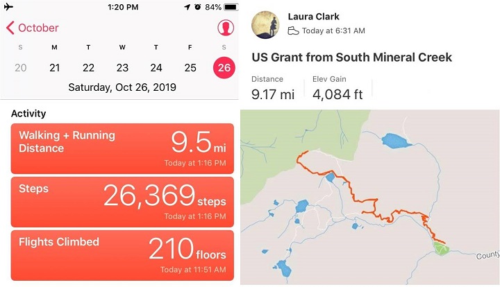
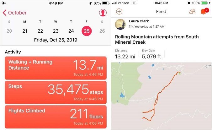
RT Length: 9.5 miles

EG: 4084’

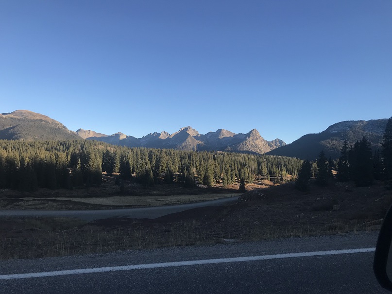
Parked at the Molas Pass Trailhead, I woke up very well rested but with a bloody nose. The stars were out and it was dark outside, but my nose runs a lot while I hike so I know what a runny nose feels like.  This was blood, and I reached for a bandana.  I slid my arms out of my sleeping bag and gasped at the cold and wondered to myself why my alarm hadn’t gone off?  I knew I’d overslept, but wasn’t sure by how much?  I fumbled for my phone, which was indeed flashing “Alarm! Alarm! Alarm!” but not making any noise.  Apparently it was going off but because of the cold it wasn’t functioning properly.  Note to self: get an alarm clock that doesn’t run on your phone.  The display said it was 5:26am.  Drat!  I’d set the alarm for midnight, and now it was much too late to begin either of the hikes I’d had planned for the day (although the 10 hours of uninterrupted sleep had been pleasant).

As I was applying pressure to my nose I considered my options. Due to the time I couldn’t hike into the Vestal Basin, but I was close to the South Mineral Campground where I’d hiked yesterday, and the conditions there had looked favorable.  The only downside?  I didn’t have any beta with me on any of those peaks.  I decided to drive to an area where I had cell service and pull up my email.  I wasn’t sure, but maybe I’d emailed some beta to myself a few weeks ago from peaks in the area?

Did I mention it was cold? I turned on my truck and the temperature read 19 degrees.  Oh, and that frost is INSIDE the window.

2

A few miles down the road I had 2 bars of service and found a pullout to park. I was there for about 20 minutes searching through my emails for information on a hike I could do today.  Not one vehicle passed me while I was there.

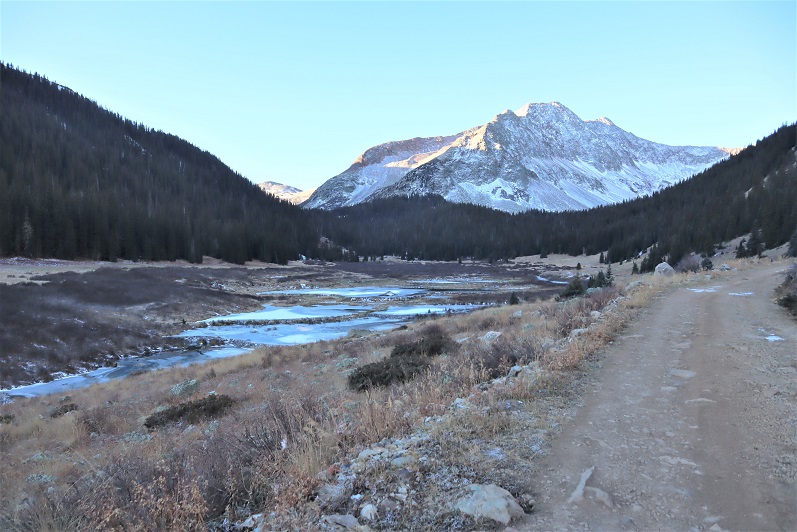
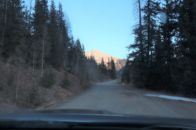
I was in luck! I had started some notes on US Grant Peak.  I hadn’t finished them completely (I’d wanted to do this peak with Pilot Knob and “V4” and possibly “V2”) but I had enough beta to go on.  It was 50/50 on whether the path would be clear enough from snow to summit, but I figured just the hike to Ice Lake would be worth the effort.  I took screenshots of my emails and drove back to the South Mineral Campground, parking in the same spot I did yesterday.

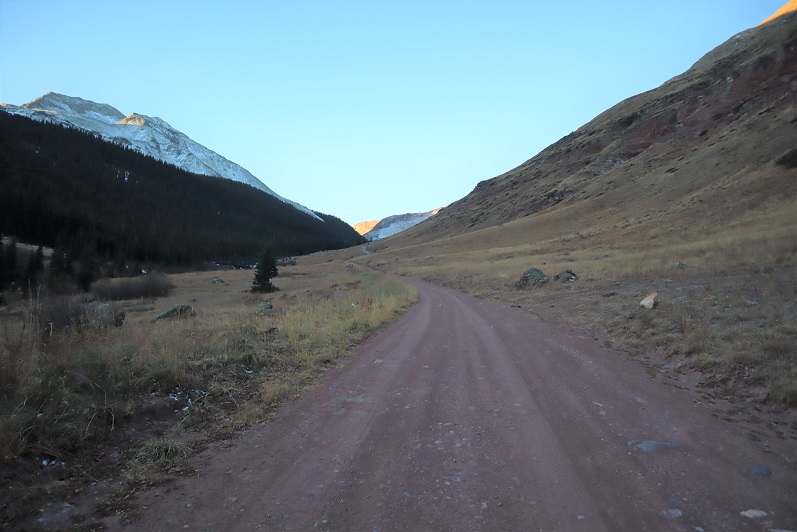
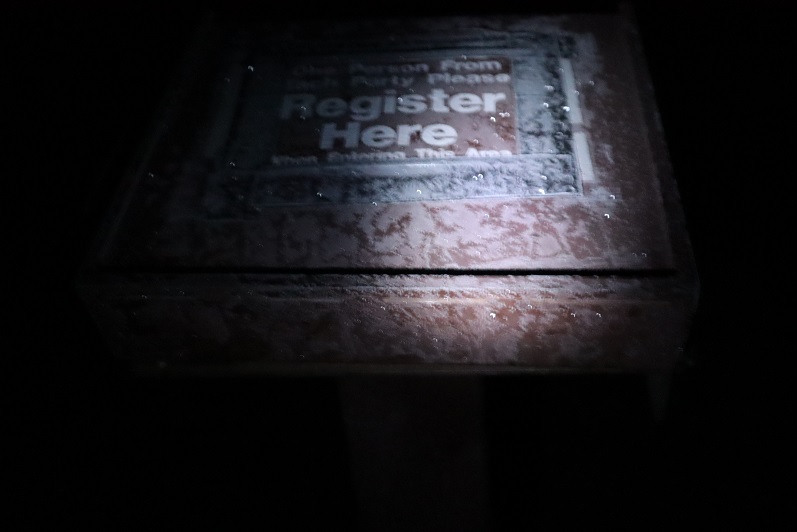
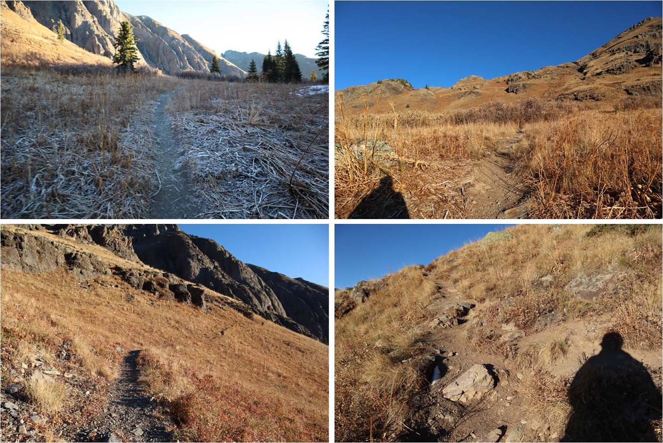
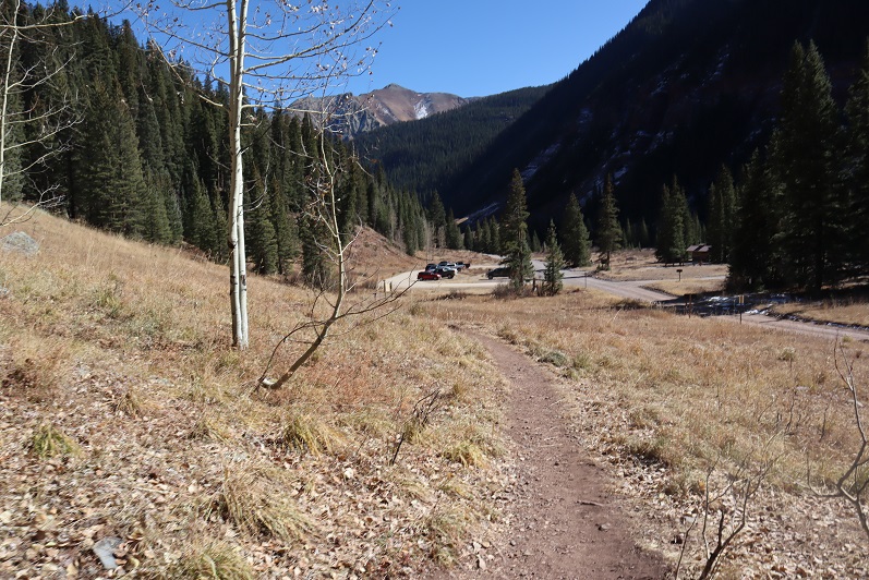
I took my time getting ready (it was colder here than it had been at Molas) and started on the trail at 6:30am. I signed the trail register and was on my way.

3

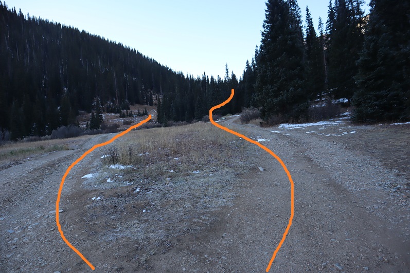
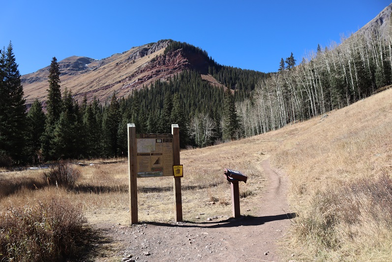
The trail begins at the west end of the parking area

4

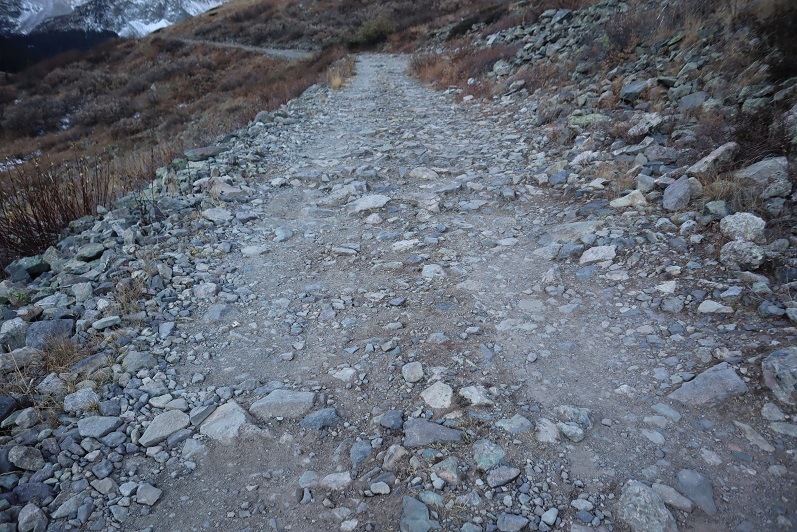
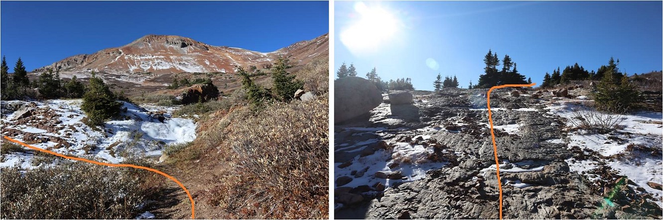
And starts by switchbacking up the hillside. There were more switchbacks than I thought were necessary, and lots of signs asking people not to cut the switchbacks.  What these trail designers may not realize is animals can’t read signs, and I’m sure the trails are being cut by deer, coyotes, etc. that would rather take the faster route.  If you don’t want people to cut switchbacks you need to design a more efficient trail.  Also, THANK YOU to all of our hardworking trail builders and maintainers out there!  You rock!

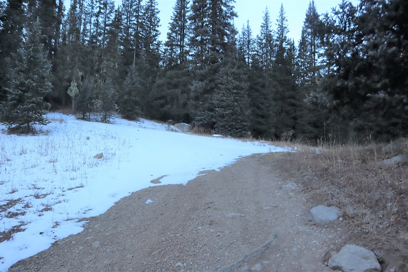
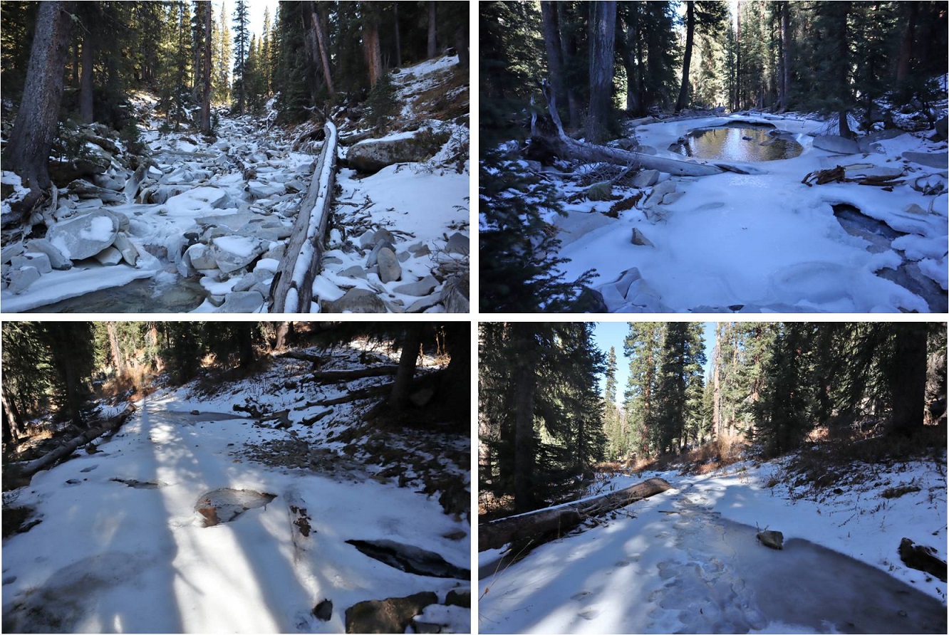
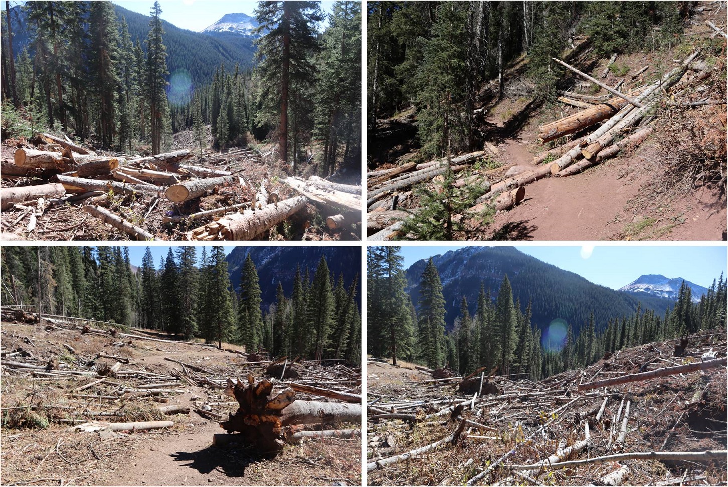
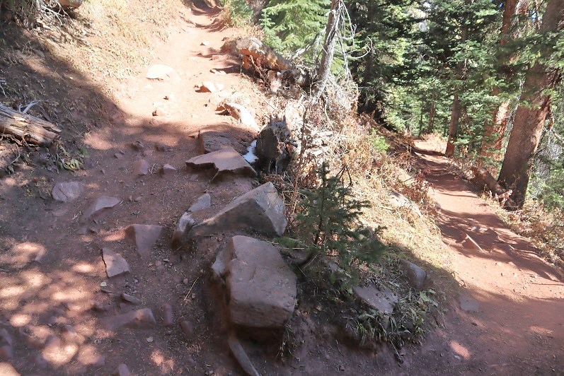
There was also a lot of avy debris that had been nicely cleared

5

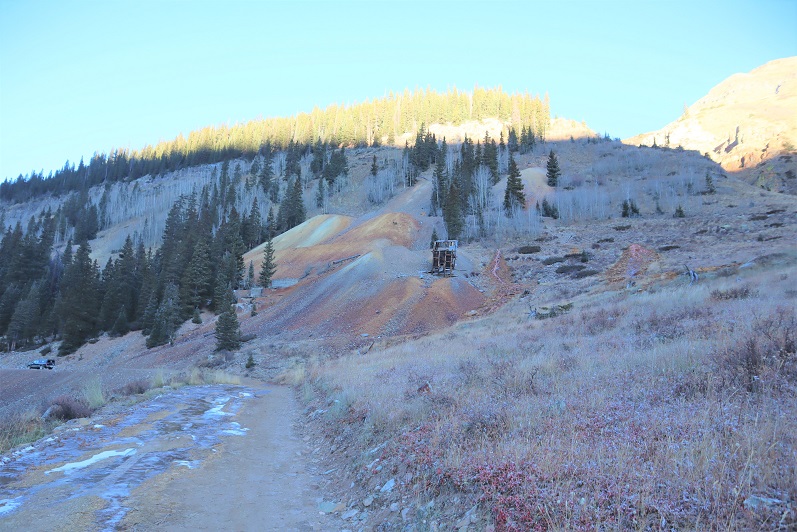
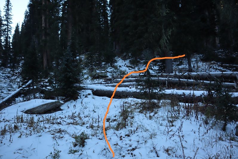
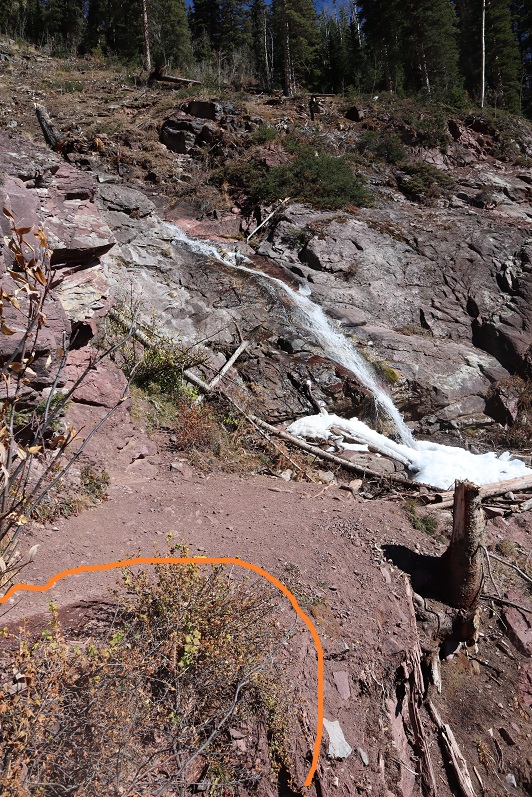
After the avy area there’s a waterfall. This is where (I believe) the switchback area you can alternately park at links up with the Ice Lakes trail. I went left here.

6

The trail exits the trees for a bit and then enters them, switchbacking again

7

8

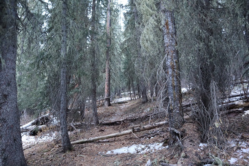
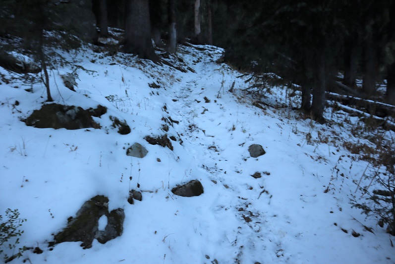
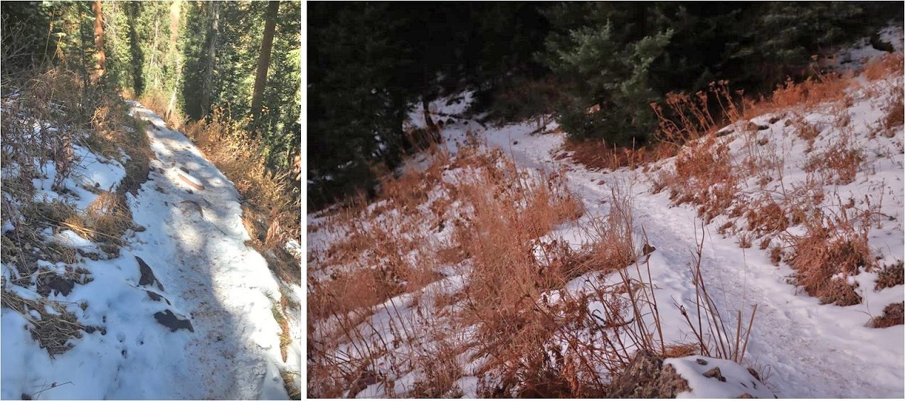
Here I encountered ice on the trail. Nothing too difficult on the way up, but slippery on the way back down.

9

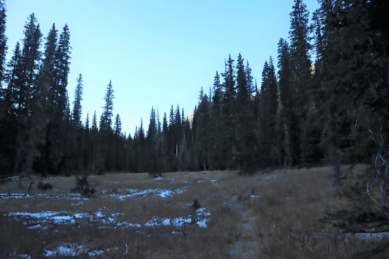
I excited the trees and rounded the corner

10

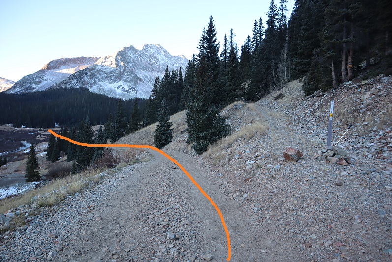
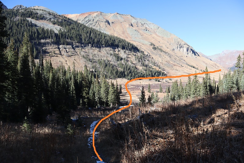
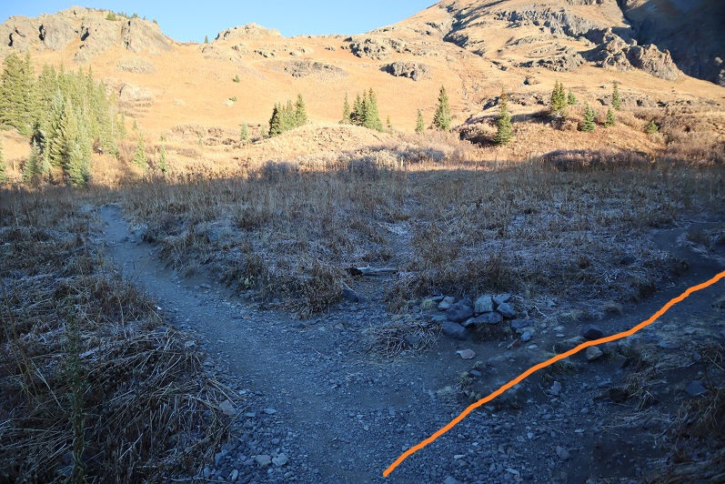
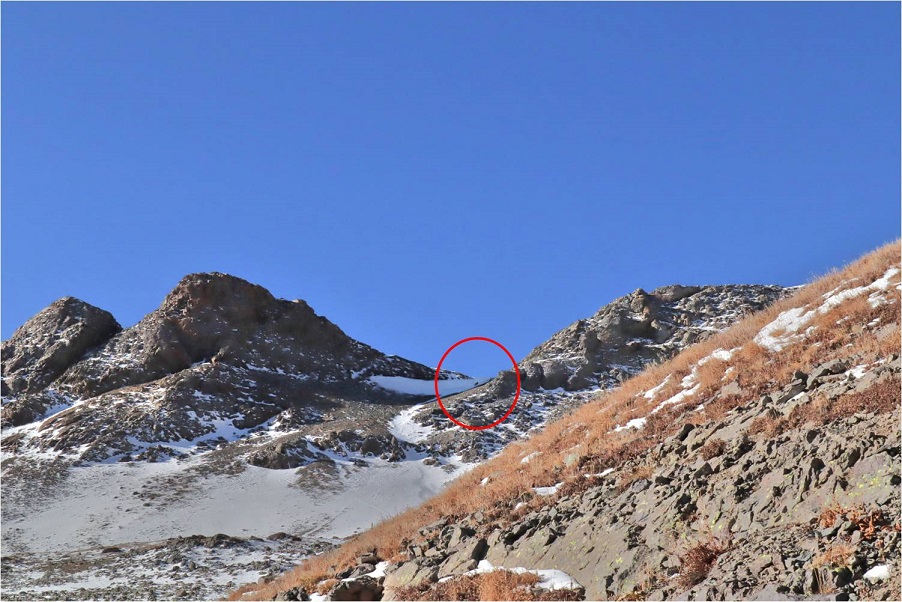
The trail is so nice I missed the turnoff and hiked about a quarter mile past it before realizing my mistake. I backtracked and took a picture of the correct route.  Turn right here onto the unmarked Island Lake trail

11

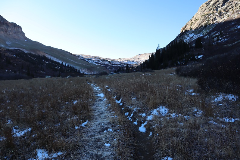
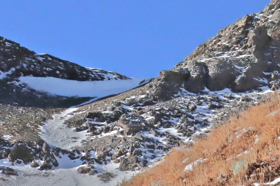
The rest of the trail up to the basin is easy to follow

12

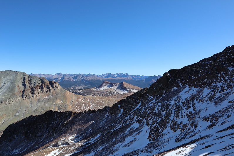
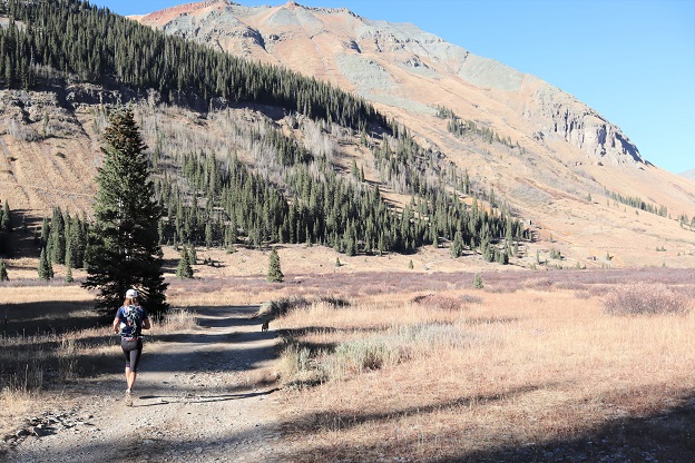
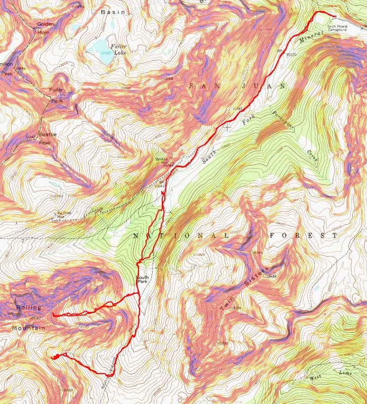
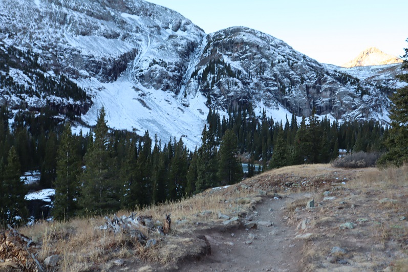
I had great views of Fuller, Vermillion, and Golden Horn for most of the trek

13

The trail all the way to Island Lake was well established

14

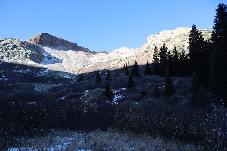
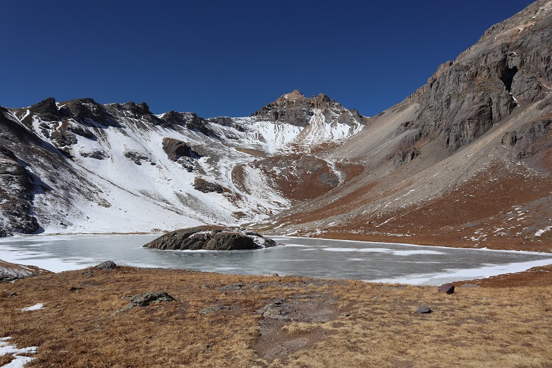
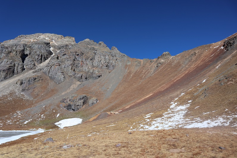
I made it to the lake and decided to take a bit of a break. Up until this point it had been slow going. I was curiously more tired than I should have been, considering I’d gotten quite a bit of rest last night.  Then it hit me:  I hadn’t eaten anything!  Adding up my calories yesterday (I’m guessing around 1000 total with the two packets of tuna and spoonful of peanut butter) and apple I’d eaten this morning, I wasn’t fueling properly.  I got out a tin of almonds and snacked as I took in the views.  Someone had left firewood.

15

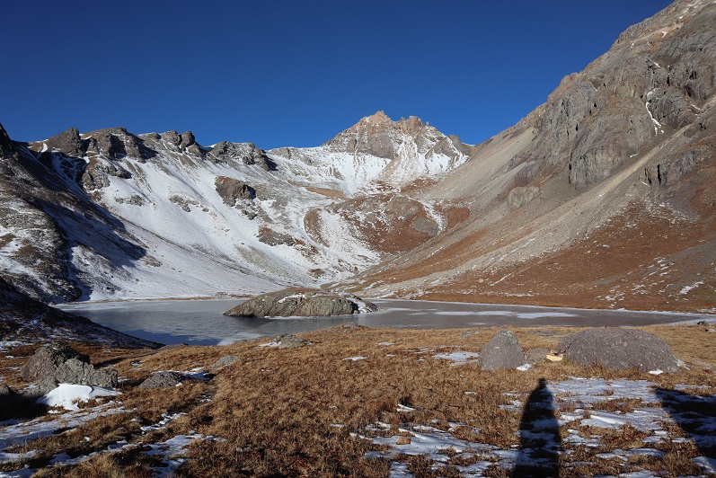
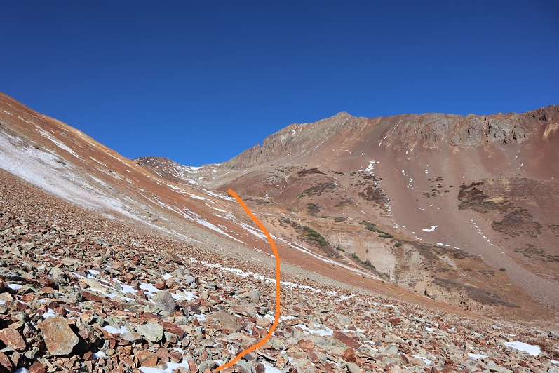
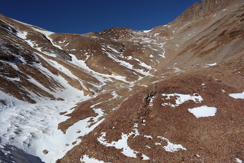
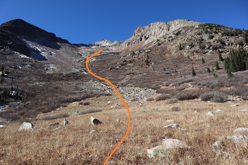
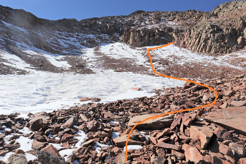
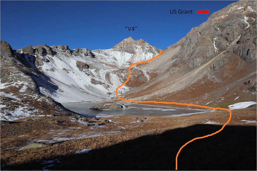
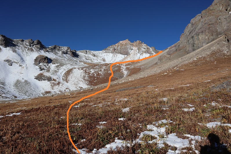
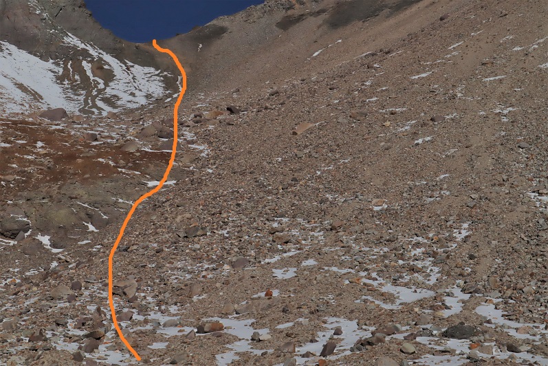
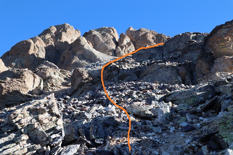
I put on my helmet, gathered my gear, and started out again. Here’s the path I took up to the saddle between V4 and US Grant

16

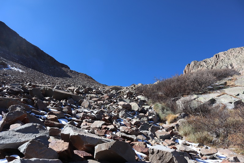
There is no clear trail around the lake, but the route was obvious. I was still a little worried snow on route may be a problem, but wouldn’t know for sure until I made it to the saddle, or perhaps even further.  This part of the hike is easier than it looked.  In my experience, gullies like this are steep and not much fun, but this one was filled with the good kind of scree (like on Red Mountain A) where it’s easy to gain traction.  I went straight up the side of the mountain and followed the gully.

17

18

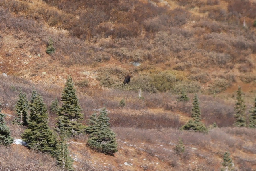
About halfway up the gully I spotted something moving out of the corner of my eye. I turned and it stopped moving.  At first I thought it was a mountain goat because of its size, but then it started walking again and I noticed it had a canine loping gate, similar to a coyote.  But it was huge!  My next thought was wolf, but I don’t think we have them in the San Juans?  Also, 13K seems pretty high for a wolf.  Maybe someone had lost a dog?  I whistled to it and it turned around, stood, and watched me until I was out of sight, which ended up being about 30 minutes.  Any guesses as to what this is?

19

20

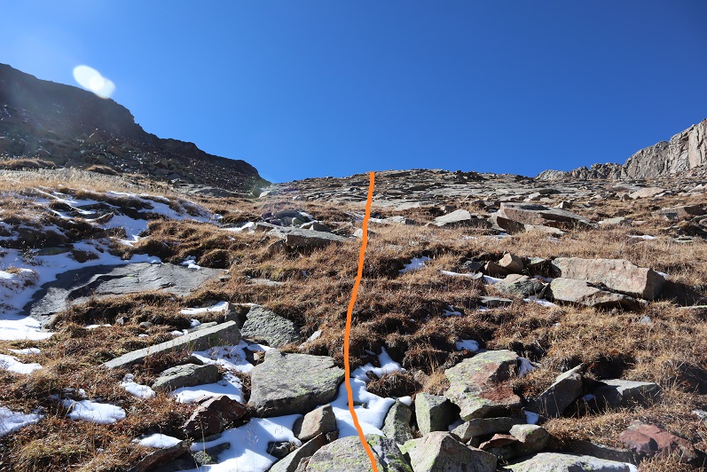
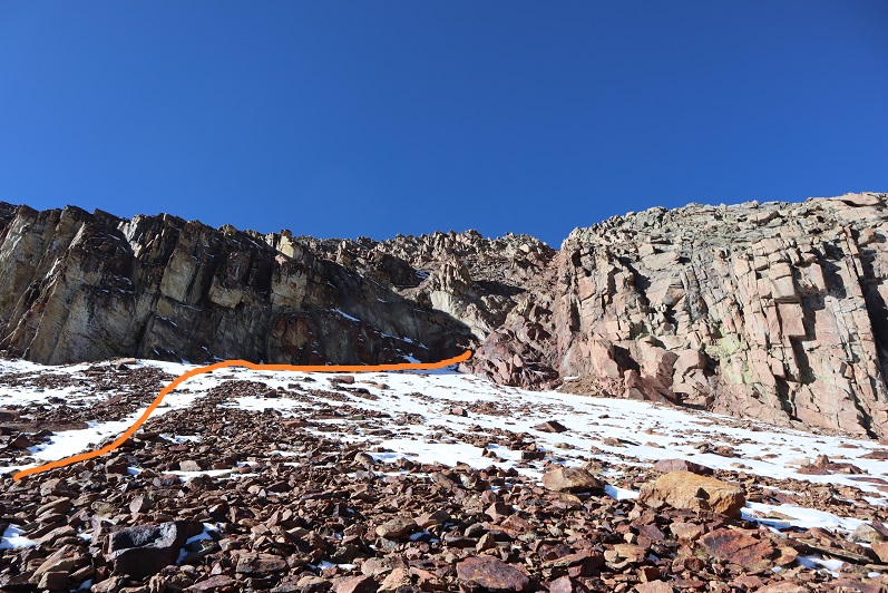
The final push up the gully to the ridge wasn’t difficult but I was going slow. This part of the hike was very mental for me, and even though I knew I was close I wanted to give up.  Stopping and turning back seemed like a great idea, and it got me to thinking:  What is it that keeps me going, even when I want to quit?  Stubbornness?  Probably.  I know if I just keep putting one foot in front of the other and stop-stopping I’ll eventually make it.  Yes, it’s stubbornness, but it’s also something more…

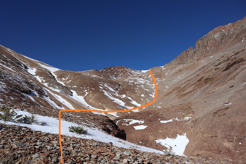
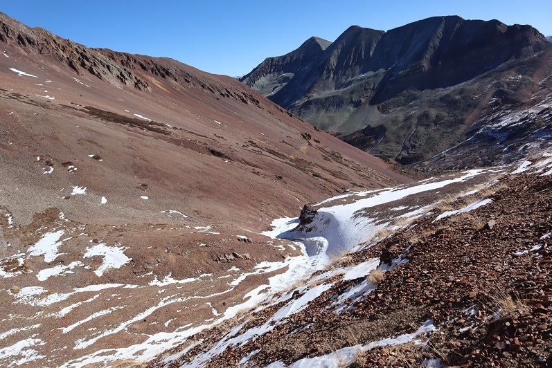
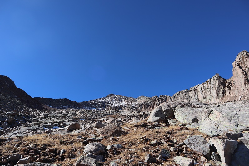
At the saddle I turned right and my spirits dropped a bit. No snow (yay!) but tons of scree and choss.  I was going to have to be careful with my footing.

21

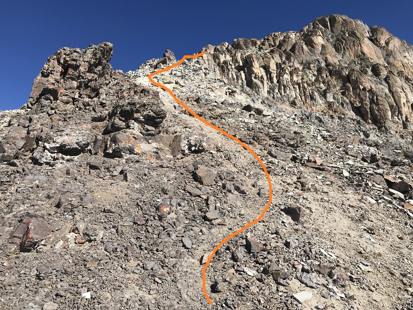
There was a very faint trail here, and a lot of gullies. I noticed in the important areas there were cairns (probably 5 total).  If you see a cairn, use it because it’s helpful:  heading up or down the wrong gully would prove nasty here.

22

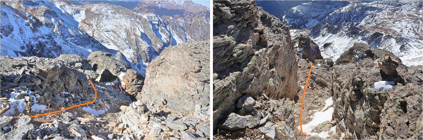
I came to an easy class 2 gully (it looks worse than it is)

23

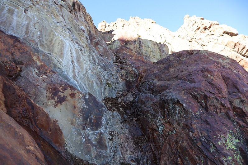
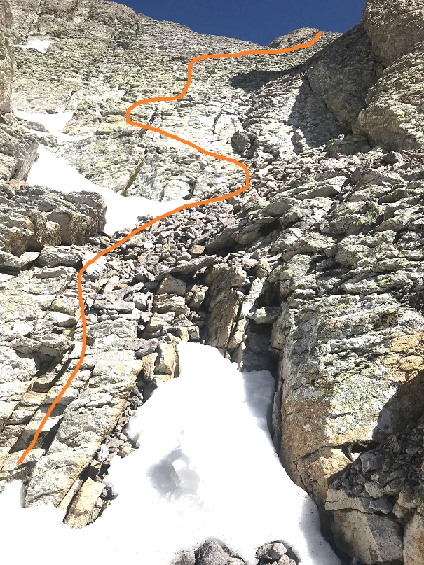
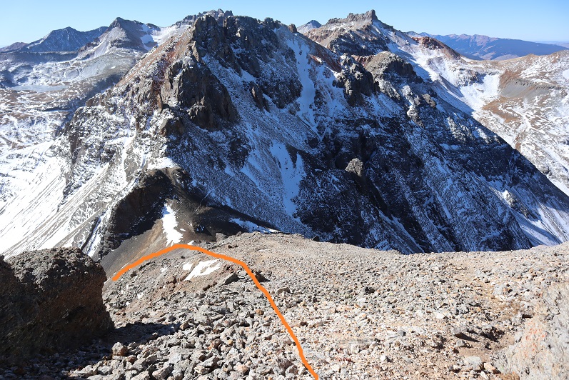
This is where the fun begins. There isn’t much left to the rest of the route, and it’s all class 3+.

24

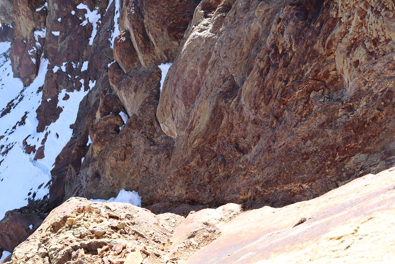
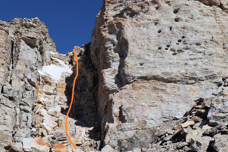
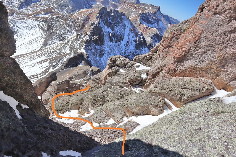
This is the class 4 crux section. Here is the route I took up the class 4 section and over the class 3 airy ledge (it felt worse to me than the airy ledge on Jagged).

25

The class 4 section was easier to me than I’d heard. I stepped on a medium sized rock and easily pulled myself up.  There were plenty of hand and footholds, and I found the climb was just over twice my body length, so no more than 10-15 feet.  Here’s the path I took (both up and down)

26

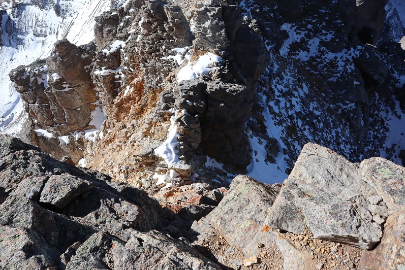
Here’s another look up from the step

27

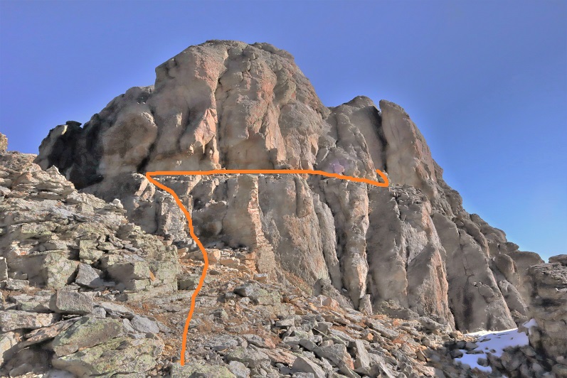
Once on the ledge I went right (the only way I could go) and carefully traversed the ledge. There was definitely some exposure here.

28

Once around the ledge I found myself at a class 3 gully. Woot!  No snow!  This was the last obstacle on this climb and I was thrilled it was (basically) snow free!  This gully had both stable rock and choss, so each move had to be carefully calculated.  It’s steeper than it looks, and would not be fun with snow.  It looked like you could take the right side straight up, but that was steeper than I felt comfortable climbing, so I kind of zig-zagged up the gully wherever I could find stable rock.  Bonus if there was dirt involved.

29

30

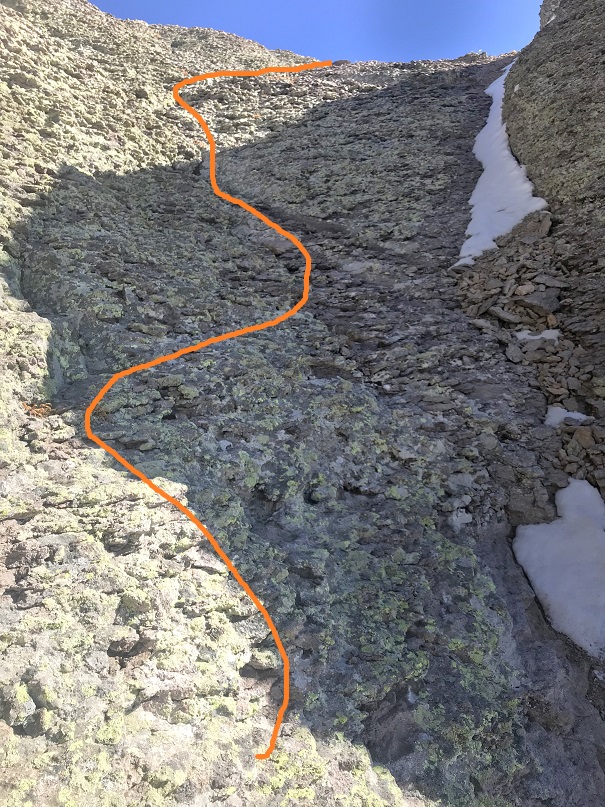
From the top of this gully it was an easy walk to the summit

31

32

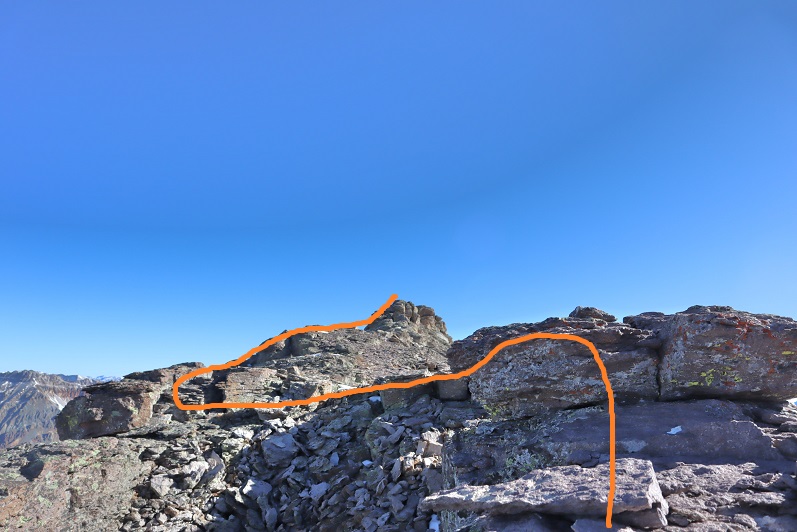
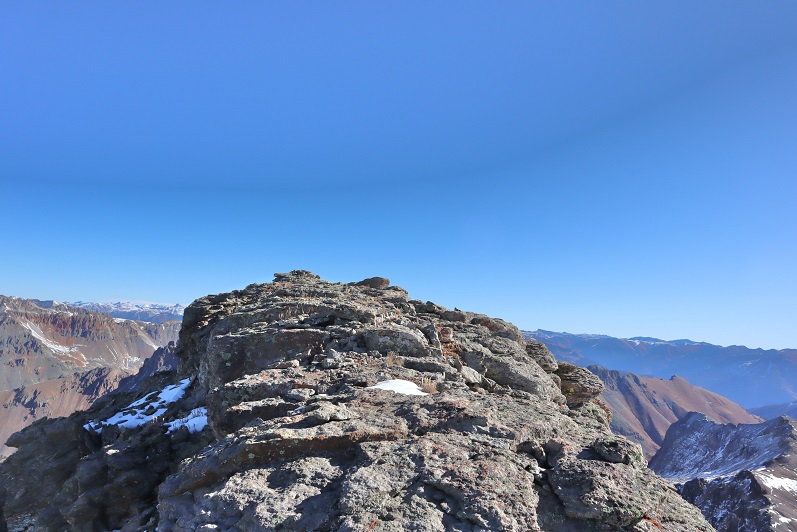
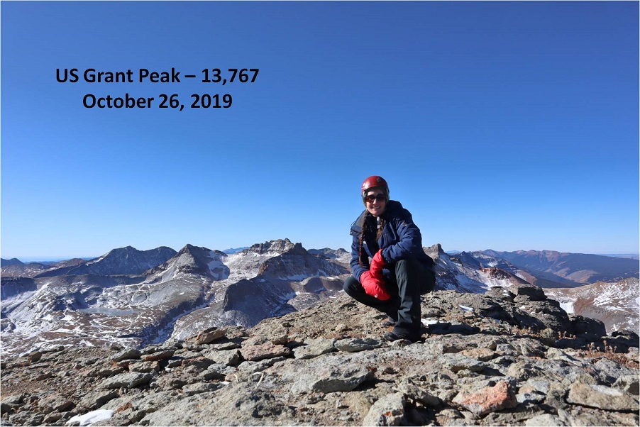
I summited at 10:20am

33

Summit Video:

It was a really nice day so I spent a lot of time on the summit, enjoying the views and congratulating myself for not stopping when I wanted to. This is why I keep going:

34

This one was tricky, so here’s how I made it back down. First back down the gully

35

36

Then across the airy traverse (don’t look down)

37

And back down the crux.

38

39

Once again, it’s important to be aware of the gullies from here. Look before you commit, as there are many game trails that look like trails.  They don’t all “go”.  Look for the cairns and second guess each route you take, especially on the way back down.

40

Looking over at “V4” I didn’t feel comfortable attempting it today, mostly because I hadn’t done any research on the route and an obvious one wasn’t visible to me from US Grant’s ridge. It looked like it had too much snow, so I didn’t even attempt it, and instead put on my microspikes, made my way back to the saddle and headed down.

41

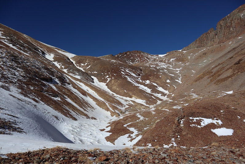
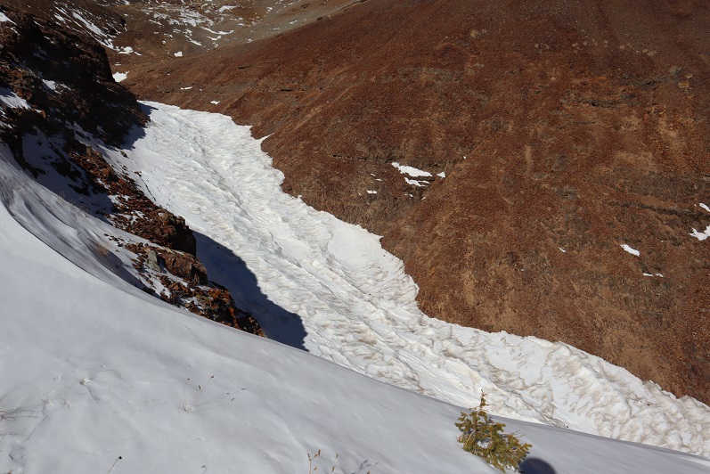
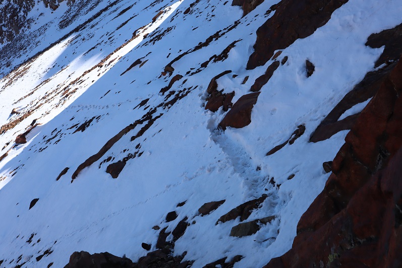
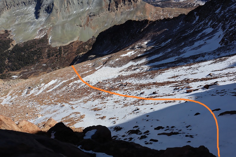
It’s amazing how different the snow can be on two sides of the same mountain. Here’s my route back down to Island Lake.  I followed the soft gully back down, paralleling the snow.

42

I took another break at the lake to reapply sunscreen and take off my microspikes and jacket (it was getting hot!). I heard some voices above me, looked up, and noticed some hikers at the top of the US Grant/”V2” saddle

43

The trek out was uneventful. I had to be careful because the snow was now icy and I didn’t want to slip (but I didn’t want to put on my spikes either).  I came across a family with three young kids (between the ages of 4-9) who were about halfway to Ice Lakes Basin and didn’t look like they were going to make it.  Their dog was off leash, barked and charged at me.  I’ve never been afraid of a dog in my life, but this one caught me off guard.  The oldest child told me not to worry, that the dog was nice and just pretending to be mean.  Hmmmm.  In any event, I warned the next couple behind them with the off leash pit bull of the off leash charging dog ahead.  Seems to me there was potential there for a scuffle.

There were several cars in the parking lot now.

44

I made it back to my truck at 1pm, making this a 9.5 mile hike with 4084’ of elevation gain in 6.5 hours.

4546

Rolling Mountain 13,693′ (attempts)

1

RT Length: 13.5 miles

EG: 5079’

I have a feeling I’m going to have a lot of second attempts while working through the bicentennials and the rest of the 13ers. There just isn’t that much quality beta out there on these peaks when compared to the centennials.  My goal with this trip report is to provide beta on a lesser climbed peak.  Please feel free to add to this beta to continue improving its collective knowledge.  Yes, I know there’s another approach I didn’t use (which I will next time).

My plans shifted and changed right up until I was driving to the trailhead. There are a lot of peaks I want to climb in the San Juan’s, and they had the best weather forecast for the weekend.  They also didn’t get as much snow as the rest of the state this week, so I was hoping to hike a few of the more difficult peaks during the nice weather window.  My plan was to hike Rolling Mountain Friday and give the Grenadiers some more time so melt out (if they needed it at all).  I’d be able to see them from Rolling Mountain and gauge if they were climbable at that point.  Plan A was to do the Trinities, Plan B was to hike Arrow Peak, both 25+ mile hikes with 8000’ of elevation gain.  I didn’t have a plan C…

I made it to the South Mineral Trailhead at 7am and took my time getting ready. It was really, really cold outside.  Luckily the drive in was nice, on a well maintained 2WD dirt road.  There wasn’t any ice on the dirt drive in (but there had been on 550, making it a slow approach).

2

I followed the Rico/Silverton trail for about 2.5 miles, first starting out actually following the trail, which wasn’t more than a game trail through dense trees.

3

I quickly realized the trail follows the dirt road and instead of spending time route finding I just hiked along the road. I could easily have driven my Tundra the 2.5 miles I hiked.

4

The worst part of the road looked like this

5

Just after the Bandora Mine I entered a small basin

6

7

Here the trail might as well have ended, as the road became covered in ice.

8

I found my away across the ice and through the willows back to the road. Here I had two options, one going to the left, the other the right.  I chose to take the trail to the right in, and the trail to the left out.  Long story short:  The trail to the right is more of a game trail so some route finding is involved.  The trail to the left is a solid trail but crosses streams at least 3 times.

9

The road to the right ended at a few campsites

10

And then a game trail took over.

11

This trail was faint and the only way I was able to follow it in the snow was due to moose tracks using the trail. They looked fresh, and appeared to be a mama and calf.

12

Since this is a faint trail the best advice I can give you is to keep the stream to your left and closely follow it.

13

Eventually I came across where the true trail picked up and route finding (for the time being) was over.

14

15

I continued to follow the trail south, past one of the possible routes up Rolling Mountain. I chose not to take this route first because on a topo map it looked like it had a tougher slope angle

16

I kept hiking until I came to the next basin. At the top of a rock slab hill I turned right (west) and left the trail.

17

I cut across the willows and headed up the slope, first on tundra, and then on terrible talus

18

19

All was going well until I made it to the top of this hill. My intended route to access the summit is outlined

20

But when I made it to the top of the hill I was surprised to find a steep downward slope, covered in snow.

21

My first thought was to just walk down it. I put on my microspikes and took a step and plunged up to my waist in snow. Wow!  That was deeper than I’d thought!  So deep and sugary I don’t think snowshoes or an ice axe would have helped.  Next I tried to traverse around the snow on the scree, my intent to find the smallest piece of ice and cross there.  However, the scree here is light and covering smooth rock slabs, making traversing the area like walking on marbles, even with spikes on.  I tried heading higher but encountered similar wide, snow filled gullies.  I retraced my steps and tried again.  I couldn’t cross this area to my right because there was as 40 foot dropoff. Glissading wasn’t an option because I sank to my waist, and I didn’t have the tools necessary to climb back up (or self arrest).

22

23

This was so incredibly frustrating! I spent almost an hour trying to find a good way through this seemingly easy section, and hit a dead end every time.  I glanced up and looked at the rest of the route.  It looked like even if I made it past this part the area I needed to gain the ridge was covered in a large snow drift.

24

At this point I made the decision to turn around and instead try the route I’d passed on my way in. Yes, it would mean a lot of added elevation gain, but I felt I’d be safer.  I had all day, so I wasn’t worried about time.  Here’s the route back to the trail.  I followed the deep drainage a little more closely this time.

25

A bonus of turning back: I saw a mama moose and her calf feeding on the willows!  Although I tried I didn’t get a great picture of them, but I was able to watch them on my entire descent.  I’m sure they’d been there all morning (I’d followed their tracks, remember?) I just hadn’t been able to see them.  They never even glanced up at me:  they were too busy eating.

26

Oh, and that drainage with the dropoff was full of ice…

27

I backtracked on the trail for about a mile and just before making it back to the South Park area I turned left (west) and left the trail. Here’s the route I took

28

This drainage was full of a lot of large, loose boulders. Not the kind that would cause a rockslide, but the kind that would roll out from under you can cause you to twist your ankle.

29

After the rocks came tundra

30

And as I made my way up this area I crossed my fingers I wasn’t going to encounter a similar snow-filled bowl like I had on the other side. Luckily, this is what I saw as I ascended.  Woohoo!  More rocks!

31

And just a little bit of avoidable ice. My goal here was to gain the ridge.  I knew I needed to head straight to the rock wall and then turn right (northeast) and ascend the ridge

32

All was going well until I made it to the rock wall.

33

Here the snow became steep, and I had to get creative to stay safe. I made a small snow trench and shuffled my way to the gully.  Here are my tracks looking back.

34

What I saw ahead of me made my heart sink: My (loose) beta told me to just ascend the gully to the ridge, and that this was a class 2 hike.  Let me tell you, this is NOT a class 2 gully, or even a class 3 gully (maybe class 3 in snow:  this would probably be an ok couloir climb).  I decided to take it one step at a time, dropped my trekking pole and headed up.

35

36

It started out class 3, but quickly the little bits of dirt and gravel that were there gave way to smooth rock. I was unable to find secure hand/footholds, and after about 70 feet of climbing I felt I was entering class 5 territory.  The rock here was smooth, and would have made a continuous slide in the rain.  If I slipped, there’d be nothing to stop me for over 100 feet.  Yes, I knew I could continue climbing up, but in no way did I feel confident climbing back down.  I should have had a helmet for what I was doing, and rope for rappelling back down.  Solo adventuring is dangerous, and I’ve promised a lot of people in my life if I felt in over my head I’d turn back.  This was one of those times.  I took a picture of the down climb

37

And one of the Grenadiers (fresh beta for tomorrow)

38

I slowly headed back down. I’d climbed much further up than I’d realized, and the down climb was much more difficult than I’d anticipated.  The entire time I was descending I kept telling myself what a good decision it had been to turn around:  this was scary insane!  Yes, it was a bit disappointing to turn back twice in one day, but I’d learned quite a lot about this mountain, and there’s still one more approach I know of I’m going to try next time.  Surprisingly, I wasn’t in a bad mood: failed attempts are all a part of the game.  In fact, I was elated when I made it back down the gully safely!  As a bonus, I now have a better idea of how I want to summit next time.  Here’s a look at the route I took back to the trail:

39

40

Once on the trail I decided to take the proper trail back down.

41

42

As stated earlier, there were no less than 3 icy creek crossings

43

Back on the Rico/Silverton trail I had one more creek crossing and then a nice walk on a 4WD road back to my truck.

44

As I was walking along the road I was passed by trail runner, running with his dog. Trail runners always impress me, but this time I was doubly impressed: this guy runs with his CHIHUAHUA, and the dog LOVES it! They run every week, this time from Molas Pass to South Mineral Creek Campground. Has anyone heard of this guy? He had me take a picture of him and his dog with his cell phone (the dog posed happily) because he never sees anyone on the trails to take photos of them

45

The entire way back I was surprised at how dry the Ice Lakes Basin seemed. It was too bad I hadn’t done much research on the other peaks I’d needed to hike in this area:  the conditions looked perfect!  I made it back to my truck at 4:30pm, making this a 13.5 mile hike with 5079’ of elevation gain in 9 hours (more than anticipated:  it felt like 8 miles).  Strava said my highest elevation reached was 13,172’.  Rolling Mountain is 13,693’

46

47

Back at the trailhead I re-braided my hair, changed my clothes and took a quick wet-wipe bath. Before long I was on my way to the next trailhead:  Molas Pass.  I drove up and got a good look at my options for tomorrow’s hike:

48

It looked to me like I didn’t need snowshoes or even traction (I’d bring traction anyway). As I sat there eating my dinner of tuna and crackers a vehicle pulled up next to me and a man and his dog got out.  They looked like they were going to be there for a while so I got out to say hi.  We got to talking, and I learned the man had recently completed the Colorado Trail after recovering from health related issues.  It had taken him 5 months (5 months!!!) and he had a new tattoo to commemorate the journey he proudly showed me, which incorporated Arrow, Vestal, and the Trinities.  We exchanged trail names (his was “Mosey” for obvious reasons).  The Colorado Trail has been calling my name lately, but I’ll most likely have to do it in weekend segments because I’ll never get the time off work to do it all at once.  He seemed appalled by this.  I told him I was sleeping in my truck and heading out early in the morning, to which he took as meaning I was homeless.  I assured him I wasn’t, just a dedicated outdoor enthusiast.  He called that hardcore.  After completing the CT he moved here from Bailey and just wanted to see the mountains again.  It was my goal to get to bed before 7pm so I politely excused myself, brushed my teeth, put Vaseline on my feet, and waited for him to leave so I could find an appropriate place to use the restroom.  I made a few notes in my hiking journal about the day’s events, had 2 (ok, 3) shots of whiskey, and took a look around me.  Yes, it did seem as if I lived in my truck (I swear I clean it up when I get home on Sundays)

49

I set my alarm for midnight and set up my bed (3 sleeping bags and a body pillow: it was supposed to be 23* here tonight).  I was still going back and forth on which peak(s) I’d hike in the morning, but figured I’d make the decision when I could see them up close.  As I’d learned today, even a little bit of snow on the trail can completely change your hiking plans.