
RT Length: 13 miles (from lower trailhead)
Elevation Gain: 4400’
Today’s Easter, and when I asked my 3 (older) teenagers what they wanted to do they said “Sleep in until 3pm and stay in our pajamas all day”. This is something completely doable for them, so I decided to let them do this and go hiking in the morning by myself. I figured I’d be back by 3pm no problem.
After Friday’s hike (trudge) through lots of snow I was looking for something a little warmer. The Sangre de Cristo range looked relatively warm, so I focused on Huerfano Peak and the Iron Nipple. I figured this was a safe route to take since I’ve already done Lindsey and am familiar with the area. Also, it was supposed to be 41 degrees with 25mph winds above treeline. That was the best forecast for the state!
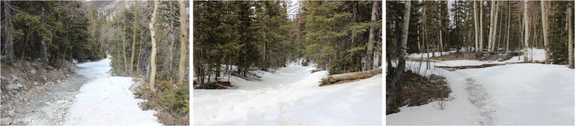
I made it to the trailhead at 6am. I parked in the lower trailhead/avalanche area. The 4WD road was open but there weren’t any tire tracks heading up the trail, just footprints. I debated trying it out in my truck (I’d just had quite a bit of fun racing through some mud puddles on the say in) but figured there weren’t tracks in for a reason. This ended up being a good choice. I could have driven maybe another half mile up the trail, but after that it was covered in lots of ice and snow. And a few downed trees.
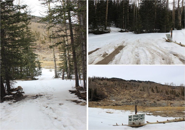
Parking at the lower trailhead added 4 miles to my round trip, which wasn’t too bad because those 4 miles don’t have any intense elevation gain.
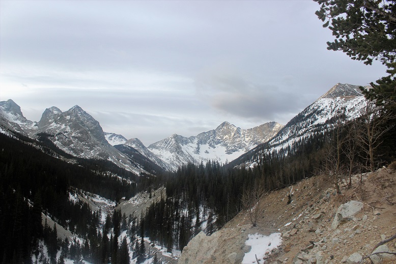
And the view was totally worth it! Check out Blanca and Ellingwood!
I stalled as long as I could with putting on snowshoes. I don’t know why I do this: If I need them early I usually need them for a while. I guess I just don’t want to stop and put them on. It was well worth the effort though: I needed them for most of the hike. (Side note: I postholed at minimum up to my ankles, and up to my elbows the entire time I was wearing snowshoes, both on the way in and out. Postholing averaged at about my knees).
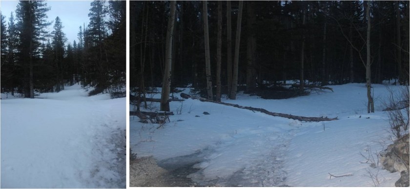
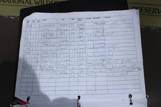
The Upper Huerfano / Lily Lake trailhead actually looked pretty clear (it was just the trail getting in that was difficult to drive). I signed the trail register, noticed no one had signed it in quite some time (10 or more days) and headed out.

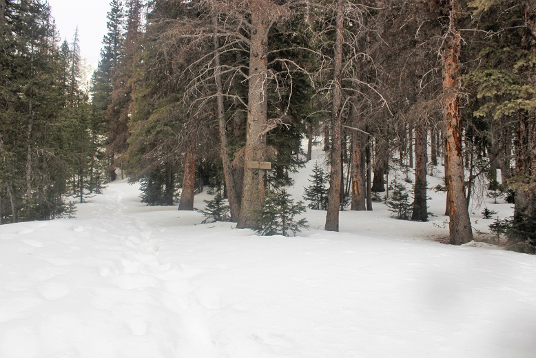
The meadow was pretty clear of snow, but it was here I saw my first mosquitoes of the day. They were everywhere below treeline, and didn’t let up!

The Lily Lake turnoff was covered in snow.
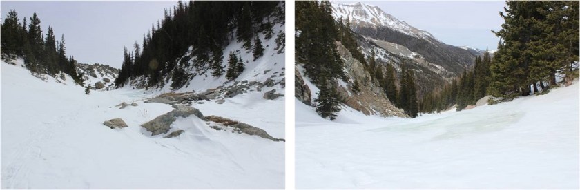
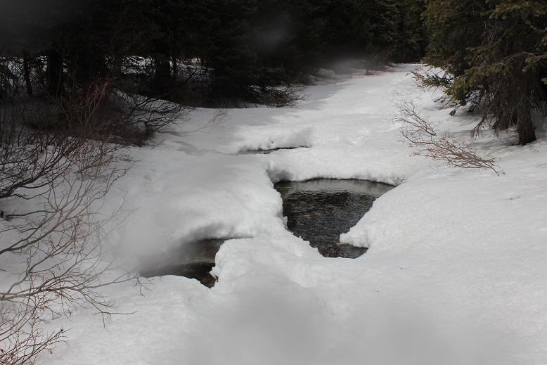
At this point I saw the stream for the first time. It was beautiful, covered in snow, with holes where the water flowed. It was not completely covered in ice (as I’d read in previous conditions reports).
This is where the hike got a little sketchy. I was following a poorly defined trench, and at one point it split: one patch going towards a river, the other up this gully.
Neither paths were correct on either my map or GPS. Since I’d seen the river wasn’t completely solid less than ¼ of a mile ago I decided to take the gully, but when I got halfway I realized what a mistake that was. I was way off route, and not sure the way I was headed up would connect with where I needed to be. So I backtracked and tried to follow my GPS through the trees.
This was as really, really bad idea. I was on course, but the snow was soft and powdery and up to my elbows (yes, I still had those snowshoes on). And it was slippery. I kept sliding, and I was on a steep hillside. Added to that I was making a trench others may think was safe in what was actually a dangerous place. This was not good. I chose the safest path I could, exited the trees, and came to the river.
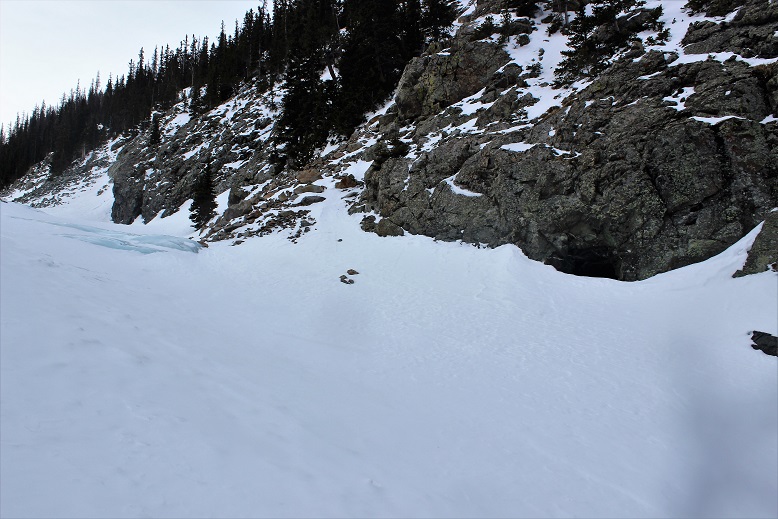
At this point the river was completely frozen, and I could see faint tracks where others had walked up the river in days prior. I walked up to the edge, used my ice ax to pound on the ice a bit and estimate the thickness of the ice, and determined it was much thicker here than the 3 inches necessary needed to hold my weight.
This was something new! I was hiking over a solid river (hey, walking on (frozen) water on Easter…) covered by about 2 inches of powdered snow. It was a bit slippery in places, but manageable. Crampons would have made this easier, but my snowshoes worked just fine. At places I could hear the water running under me, and the ice was so blue/teal/clear!

I kept following the river, and quickly came to the mine. I’d wanted to explore the mine a bit today, but obviously that wasn’t going to be possible since it was almost completely covered in snow. Yes, the whole Easter/tomb thing came to mind here as well…
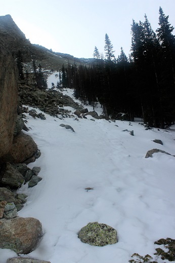
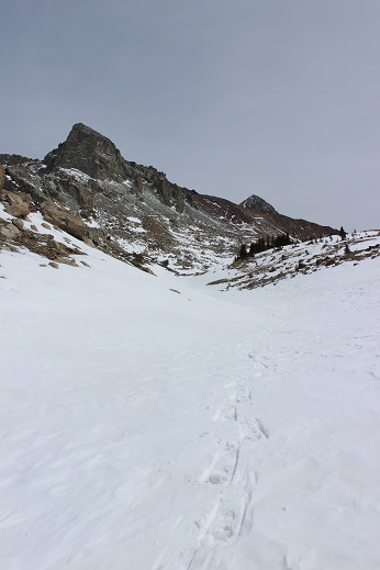
The trail continued up, up, and up, over what felt like a waterfall and eventually came to a gully. All the visible tracks (they’d been gone for a while) showed footprints going to the right, up the gully. Even though I knew I was supposed to go left eventually, I followed the tracks.
That was a long trek up a steep slope!

It was a long uphill battle that put me on the far west upper end of the basin when I was done.
I side tracked and snow-shoed my way east towards where I knew the trail picked up on the other side of the basin (there weren’t any trails visible due to the snow). I needed to use my GPS to find the exact location of the point where the trail climbed the mountain, but once I did the route wasn’t difficult to follow.
I took off my snowshoes at this point and headed up the mountainside. Now I was starting to get a bit tired. All those gullies and postholing in snowshoes was starting to take its toll!
When I made it to just below the saddle I had a good view of Mt Lindsey
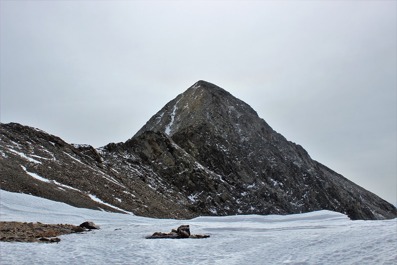
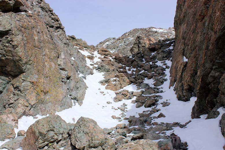
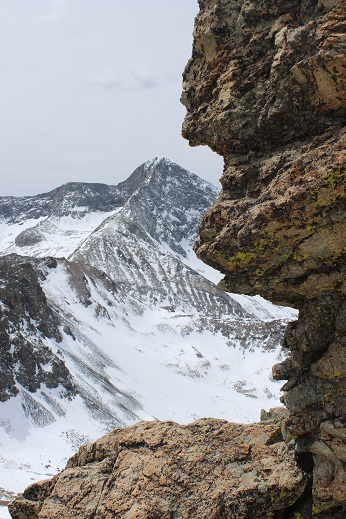
At the saddle at 13,100’ I turned north away from Lindsey and headed towards the Iron Nipple. The trick is to aim for the U-shaped notch in the center.
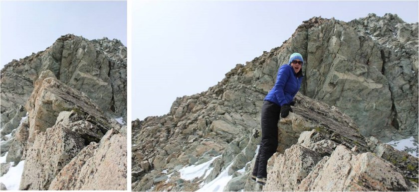
Here’s what that looked like up close
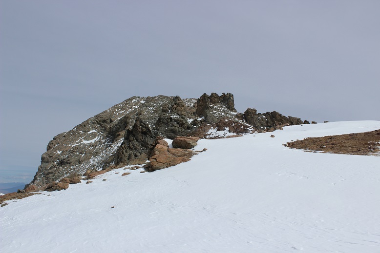
This is where the wind really started to pick up. It was way more intense than the 25mph predicted, and turned the snowshoes I was carrying into a kite. I stashed my snowshoes and trekking pole, got out my ice ax, and started towards the Iron Nipple. I’m not a big fan of the name (it gets its name because from far away it looks like a big nipple (just the nipple) and it’s a mountain made of iron. I know, who’d have thought?). From here I think it kind of looks like a Jaguar taking a rest.

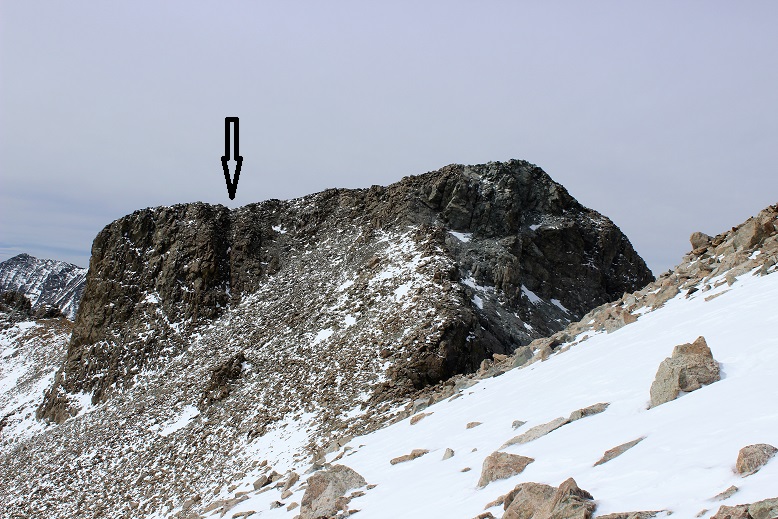
Anyway, I didn’t want to climb this peak first because they I’d have to refer to it first in all of my postings, and I mentor Junior and High School aged adventurists and I really didn’t want to keep bringing this up when talking about summit Huerfano, so I descended some class 3 boulders down the side of the cliff and followed the ridge towards Huerfano Peak.


There wasn’t a lot of snow here, but just enough to make me need to watch every foot placing. I stayed towards the top of the ridge, ice ax in hand (and used several times). When I got to the saddle I took a look back… it kind of looks more like a nipple from here. The black arrow points the route I took to descend.
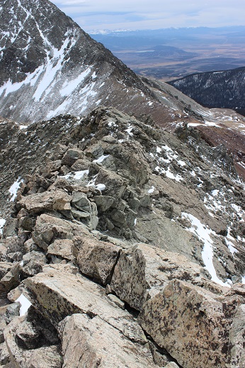
The rest of the route was pretty straightforward: I just aimed towards Huerfano and walked towards the peak for about half a mile. Here’s a summit photo to prove I summited

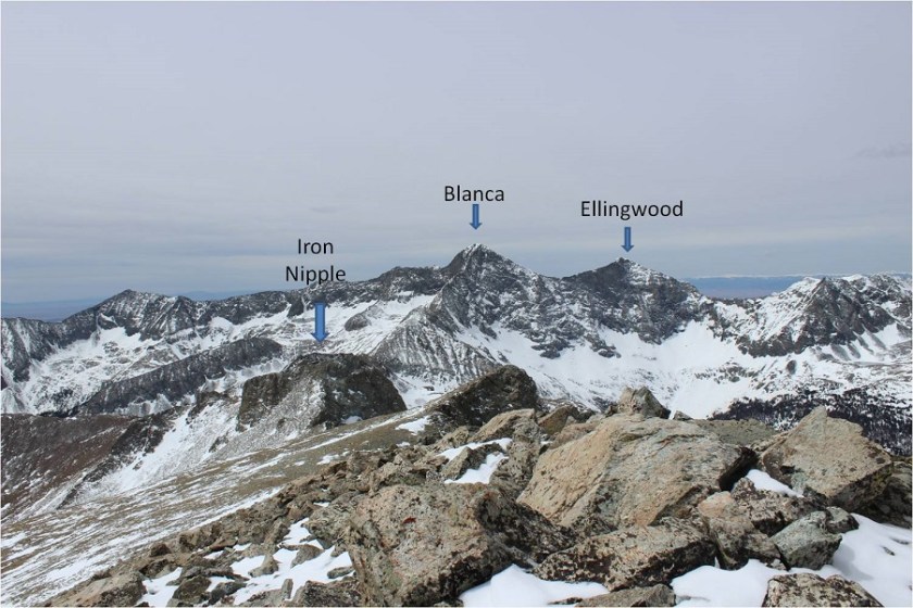
And some views of the surrounding mountains
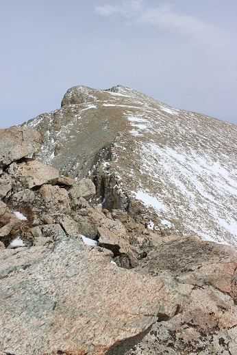
Check out Lindsey! Almost no snow!

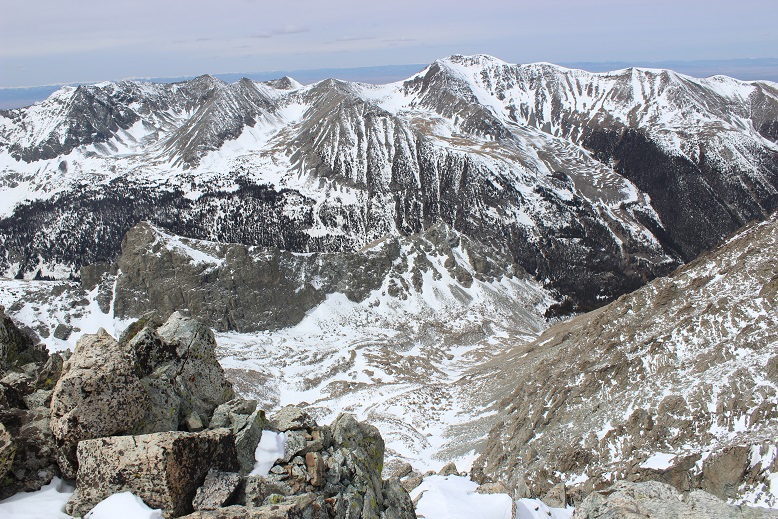
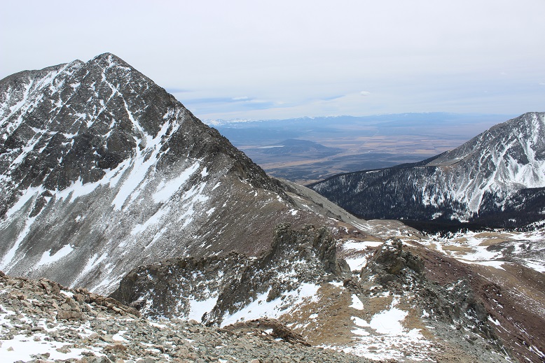
Here’s a bird’s eye view of the basin I’d entered through
And now I was on my way back towards the Iron Nipple. Did I mention it was windy? I’m guessing winds were at 50-55mph, and they didn’t let up. This wasn’t a big problem while I was hiking the saddle or talus below the ridge, but once I reached the ridge I had to keep my profile low.
I know this is going to sound like a bad joke, but the nipple actually had a lot of exposure. I wasn’t prepared for this, and it was quite exciting! I tried to get a picture to prove I was there and experiencing this exposure, but the wind kept knocking over my gorillapod with my DSLR camera. The third time it happened I almost lost my camera down the side of the cliff (ice ax to the rescue!) and I gave up getting the photo (I probably should have quit a bit earlier). There was a very substantial drop on either side, but especially the northeast side of this part of the route.
I summited and took a picture back at the ridge and Huerfano
I turned around and started heading back towards the notch. Mt Lindsey looks beautiful!
And Blanca as well
I hiked past the saddle and down the hillside towards the basin. The end provided some fun glissading!
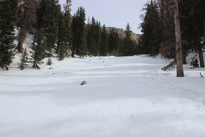
From here I didn’t want to hike back down that gully I’d hiked up, mainly because it meant hiking up out of the basin just to hike back down the gully. So I took a look at my topo map. It looked like the gully in front of me was less steep and connected with where I needed to be, so I took that route instead, and indeed ended up where I needed to be: right back on that frozen river. It was beautiful! I couldn’t help but take more photos
And a video
I decided the smart thing to do would be to follow the river down past where I’d entered and look for a logical exit point. I followed it for much longer than I felt comfortable, but a look at my topo map kept telling me I was on course with picking up the actual trail. The river did begin to open up due to weakness in the ice and I needed to exit to stay safe, but where exited was very close to the actual trail.
This was close to the Lily Lake trailhead, but 3 miles from where I’d parked my truck. Those last 3 miles took FOREVER! I don’t know if it’s because my 9 mile hike turned into a 13 mile hike, because I’m out of shape (I’m most definitely not) or because I was postholing in heavy winter boots and snowshoes up to my knees for most of this hike (that’s my story) but I was physically exhausted. My back and shoulders hurt, not to mention my quads. This isn’t normal for me while hiking: I loved every minute of it! What I didn’t love however, were those mosquitoes! It was actually quite pleasant outside, but I refused to take off layers because they were keeping me from getting bitten. I kept swatting the little buggers out of my face. I could see them everywhere (there were birds feasting everywhere as well).
I made it back to the trailhead and signed out of the register.
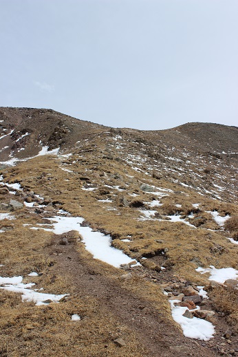
The ice on the road had melted a bit on the way out
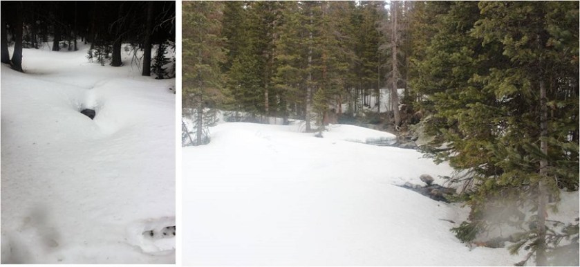
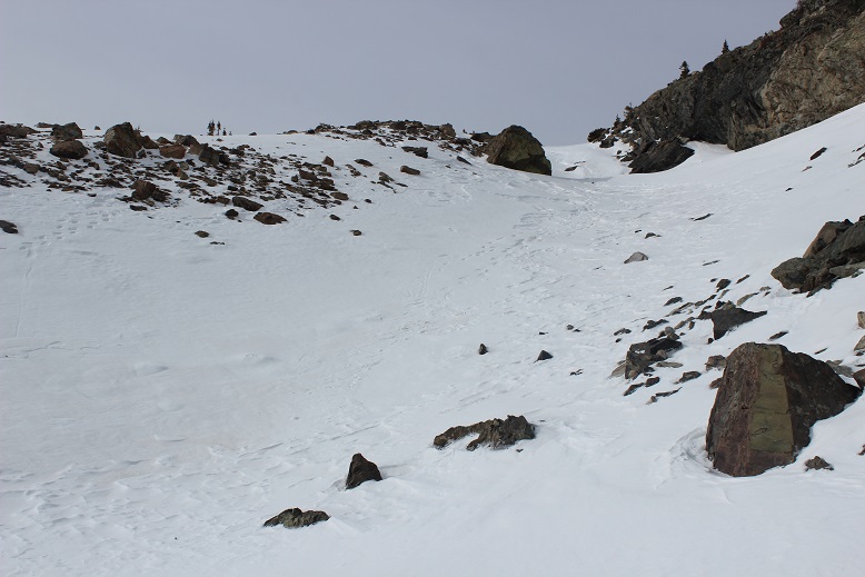
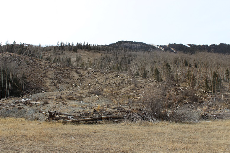
Here’s a daylight view of the avalanche area at the lower trailhead.
There was a lot of mud on the trail on the way out. I had fun driving through several very large mud puddles in my truck, making a mess of things. I absolutely LOVE my truck, and this was fun! Side note: everyone should own a truck for times like this.

I didn’t get any great photos of the big puddles or videos while mudding (because that required two hands on the wheel) but I did get a short video just driving out. The deer weren’t planned
I made it back down to my truck at 4:15pm, but didn’t get cell reception until about 5pm (that dirt road and drive in takes forever!). When I finally was able to call the kids and tell them I’d be home around 7pm I found out they’d just woken up, so no worries. Oh, to be a teenager again! It seems we all enjoyed our holiday!

I would dearly love to thank you for allowing me to tag along through your gifts of videos and writings. I sometimes wonder if your not a relation to the Clark of the Lewis and Clark expedition.You are without a doubt of the same mindset as these early explores. W hat truly amazes me is that you are a female soloing in many hazardous situations.
As you were exiting in your truck; couldn’t help but notice the many mosquitoes you wrote about. I look at all these beautiful photos of the pines and mountains and wonder if anyone ever looks past the beauty and sees the undesirable things that most people object too . Thank you once again for the grand tour of your private world. God love you and yours.
LikeLike