I got my new ice axe in the mail yesterday, but unfortunately I didn’t get my crampons, so I was at a loss as to where to hike today. I spent a LOT of time researching potential hikes, and maddingly there just weren’t many posted trip reports, so any hike would be a gamble. I decided to just pick a hike I knew would have a little snow and go for it. I wanted to summit something, but didn’t necessarily have to. I also wanted to practice self arrest with my new ice axe.
The trailhead (Montgomery Reservoir) looked easily accessible, and there were 3 potential 13er summits, so I chose to try Clinton Peak.
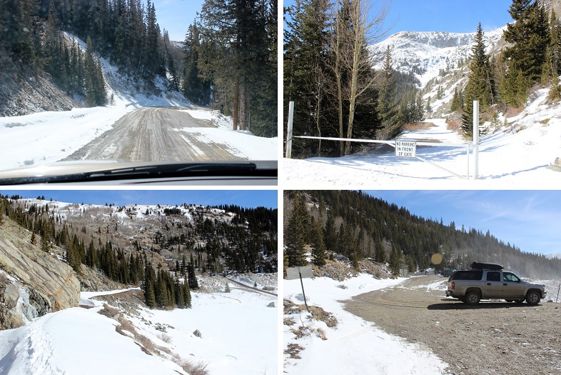
It was cold this morning! The road in was an easy 2WD dirt road, closed at the 4WD trailhead.
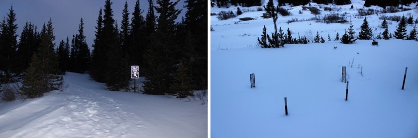
As soon as I started hiking it became apparent I’d need snowshoes. I didn’t take them off until I made it back to my truck. I was also glad I had my GPS because there was a lot of snow and the beginning of the trail was at the beginning of 2 other trails as well. I’m pretty sure I’d have chosen the wrong one. The correct trail goes past the old mill…

This mill was non operational and looked like a small gust of wind would take it down any minute. There were beams missing, nails exposed, and supports splitting in half. There was a sign telling people to “Enjoy but not Destroy” their Colorado history. I thought it was lacking more safety notices. I high tailed it out of there before the mill collapsed on me.
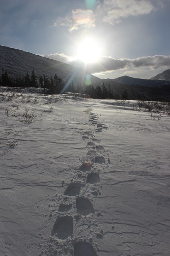
As soon as I passed the mill the trail was lost. Kind of. You see, this is what it looked like:
The snow was so deep you couldn’t see the trail! This trail was supposed to be really easy: just follow the 4WD trail for 3 miles to the lake, but the snow was so thick it obscured the road and everything else. There was no road! That meant a lot of GPS’n and Guessin’
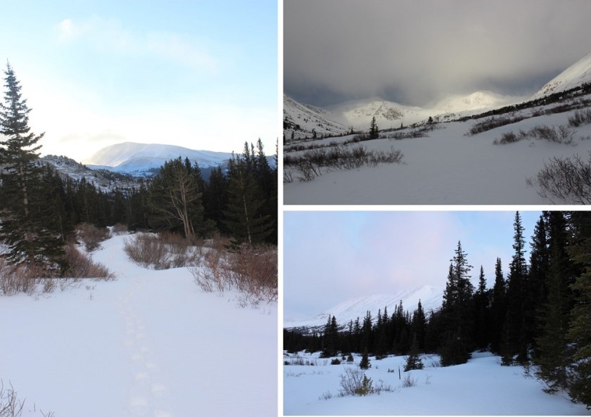
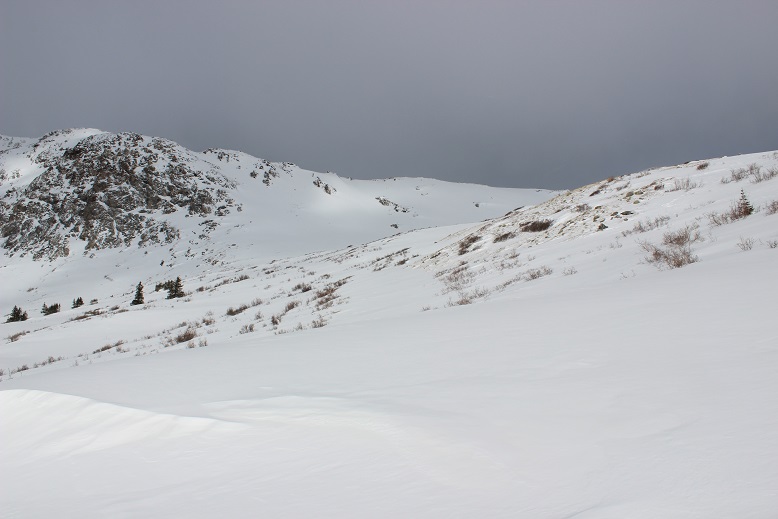
This part of the hike was an exercise in patience. What I thought couldn’t possibly be the road actually was, and what I thought was obviously the road wasn’t. I kept looking at my GPS and altering course. That took up a lot of time and a lot of battery. And I was post-holing pretty deep. Here’s a picture of a typical part of the trail. Yes, I was supposed to hike over that snow berm and around it to the right.

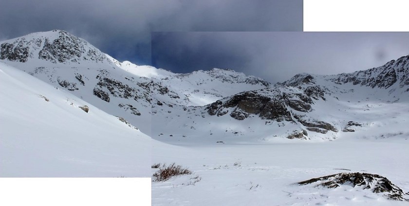
Luckily I’ve found it’s usually difficult to get lost in a basin, and this basin was no different.

Unfortunately, basins are formed by wind, and this basin gave me an in depth tutorial of how that happens. Luckily the wind wasn’t too intense (20mph). It was cold however, and the weather on top of the peaks looked nasty (so much for no snow predicted today!) At this point I realized a summit wouldn’t be likely.
This hike was long. And windy. I was breaking trail and confused as to where the trail was most of the time, but learning a lot in the process. I loved looking back at where I’d been (most prints were quickly filled up with blowing snow). Also, I need a solar powered cell phone charger battery pack thingy.
Of course once the sun came up I took a snow shadow selfie because I could

After trudging along for about 2.5 miles I went back through some trees (off course, but not by much, and honestly, my route was better anyway) and then came to the hill below the lake. This looked like it should have had an established trail, but once again the snow covered it, so I just hiked the lane of snow parallel until I reached the top. Have I mentioned I love snowshoes?
This was a long trudge! Snowshoeing actually takes a lot more energy out of you than hiking does (especially when post holing in wind). I’d expected to see Wheeler Lake when I finally made it to the top, but it was covered in snow and ice.
This drastically changed my plans. I was supposed to skirt the lake and find a trail to the left, but that obviously wasn’t possible in these conditions. I didn’t know where the lake was, how deep it was, how thick the ice was, etc. and I couldn’t see any trails on the other side.
This was supposed to be an easy 13er… one I should be able to just walk up, but with the snow obscuring everything it changed the difficulty. I briefly considered going for it and just hiking over the lake, but just as quickly dismissed the idea as being idiotic. I didn’t have enough conditions information and I wasn’t sure about the snow I’d encounter on the other side. I’m sure others would have done it, but I’m just not ready to take those kinds of chances.
So I took a lake photo to prove I’d made it this far and was off
The hike back down was a bit disappointing and took forever! Disappointing because I didn’t summit anything today. I made a lot of snowshoeing progress, and learned how to carry my ice axe comfortably, but I wasn’t challenged at all. (besides route finding). I wasn’t even tired! Turning back was absolutely the right decision, but it made today’s hike too easy (no intense elevation gain).
And that trip back! Those 3 miles kept going and going and going! I was able to (mostly) follow my tracks back, and the trail was much easier to figure out hiking towards the sun (the shadows helped me see where the road was). I corrected my path several times from the way in (just to make a more accurate trench, assuming my tracks stayed).
I was hot because of the mileage, but also because it got warm. I mean really arm. My balaclava and goggles and jacket and snow clothes all became too much, but I didn’t want to stop to take them off, so I kept trudging on in the heat. (OK, so I really just didn’t want to put on sunscreen… It wouldn’t have mattered if I’d just made it back to the truck already!!!)
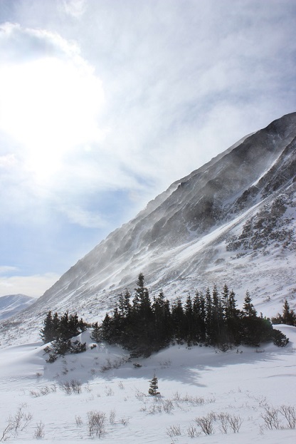
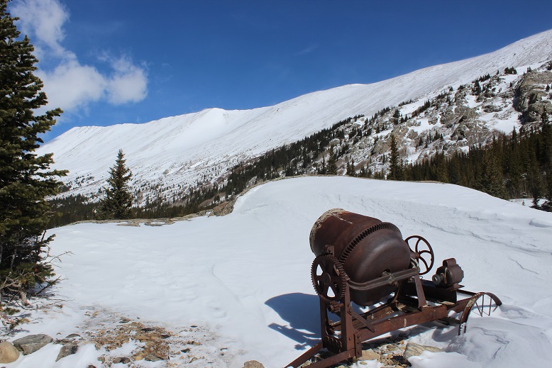
The weather cleared up from the cold and windy morning, and I was able to get a few pictures of the mining equipment
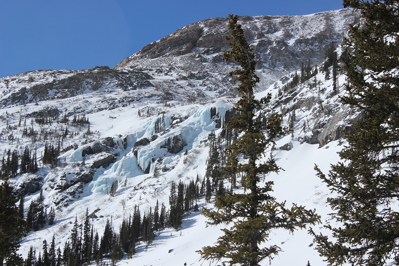
the ice flows on the hillsides
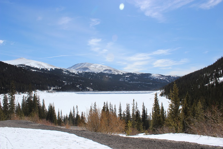
and the reservoir I’d passed in the dark on the way in
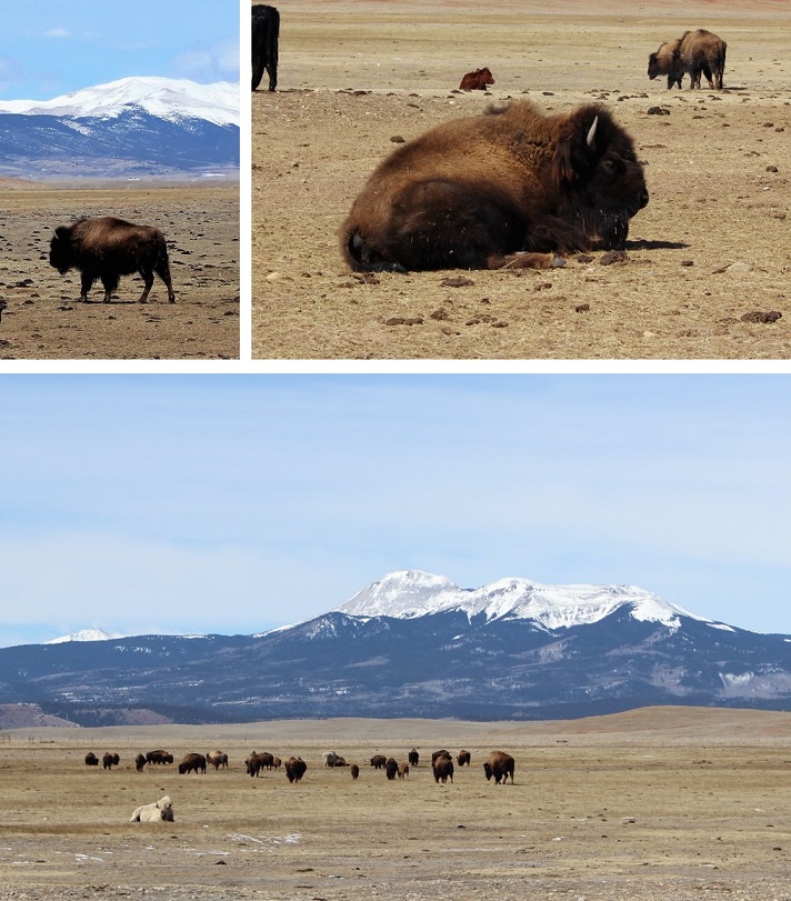
I hopped back in my truck, found out my son needed a new car battery (long story) and headed home to assist. I only stopped briefly at the 9/24 junction when I saw a herd of bison. I actually turned around because I didn’t want to miss the shot… Colorado is amazing!!!
All in all, a great (if a little disappointing) day. It’s always a bummer when you have to turn back, but I don’t do it often and only when I feel it’s absolutely necessary. Hey, any day above treeline is a great day!
… I’ll be heading back to hike this route again. Without snow.

Your amazing.where do you get the stamina to trudge these mountains high ? Thank you for your gift in pics and vids.
LikeLike
Didn’t realize that there were any bison here in Colorado.
LikeLike