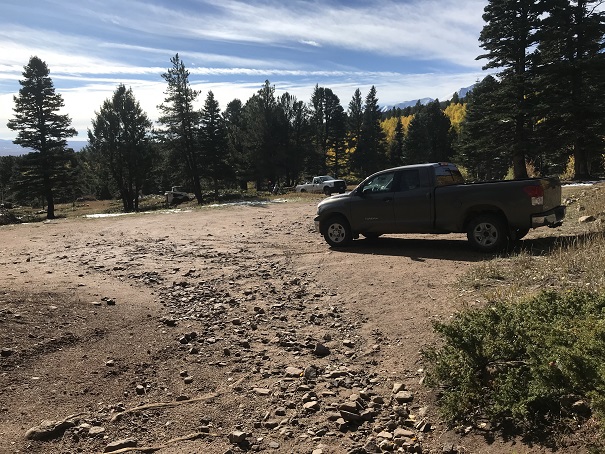
Woohoo! The mountains got their first dusting of snow of the season, and I wanted to be a part of it. The only problem? Since the snowfall had just stopped last night all over Colorado there wasn’t any beta on snowfall amounts or the conditions of any of the trails. So I picked an ‘easy’ 13er and headed out at 2am. All was going well until I made it to the dirt road at the base of the Hermit Pass trailhead. It quickly turned into a 4WD road, which normally wouldn’t be a problem, but soon it became icy and my truck started slipping! This is the first time I’ve ever experienced my truck slip in any conditions. I’m guessing there was mud under the ice. I was a bit worried but also knew the road was supposed to level out pretty soon. In addition to the snow it had been windy this week, and I drove over a few downed trees. I was 4 miles from the trailhead when I was forced to turn around due to a downed tree too big for my truck to drive over. I was a bit bummed, but I’d also been prepared for this eventuality. I didn’t have time today to park where the downed tree was and hike 4 extra miles each way. Luckily there was another 13er 5 miles away with a 2WD trailhead. I hadn’t done much research on this peak, and it was my second choice because it was more difficult than the first, but it was accessible, so I drove towards the Gibson Creek Trailhead and made it there at 5am. The parking lot can easily hold about 20 vehicles.
From the trailhead I followed the fence to a trail junction and continued straight towards Gibson Creek.

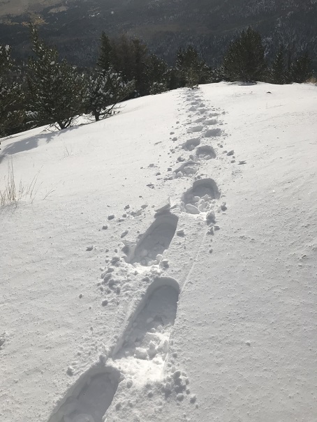
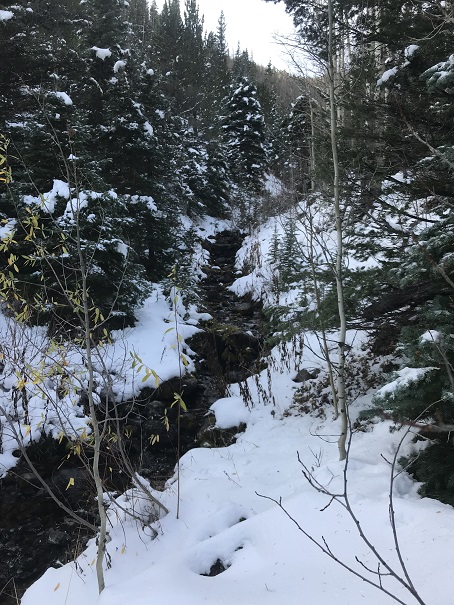
It was obvious I was the first person to use this trail since the snow fell, and route finding was a bit challenging in the dark with all the snow (about 8-12 inches). I crossed the creek a couple of times and the trail ended completely. I was met with dense forest, but knew all I had to do was climb south and gain the ridge.

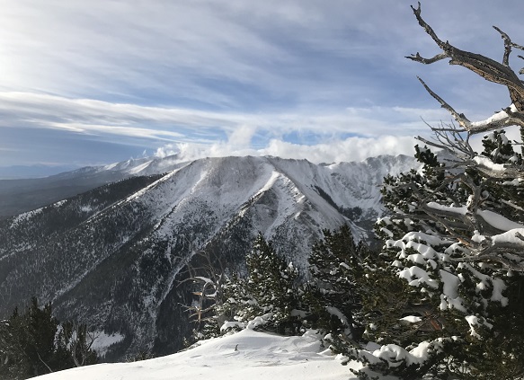
Sounds simple, right? Normally yes, but today this was a much more difficult feat than I’d anticipated. The snow kept getting deeper and deeper and the mountainside keeps getting steeper and steeper, and since I’m stubborn I refused to put on my snowshoes. That meant I was slipping quite a bit. The angle of the slope was intense. My quads and calves were screaming. I had to stop every few steps to rest my legs, which isn’t normal for me. Finally, after what seemed like forever I put on my snowshoes and reached the bristlecone pine trees at the base of treeline, around 12,000’. The wind was powerful (I’m guessing 40mph), which made the sugary snow feel like glass on my face when the wind blew. The wind also dropped the temperature quite a bit (read: I was frozen). The snow kept piling up as I reached the ridge. This is where I ran into trouble. I was supposed to cross the ridge, but there was quite a bit of snow, all piled up into a cornice, just waiting for me to trigger an early season soft snow avalanche.
I looked around for a safer route, but the only route was straight across the ridge (it dropped to either side). So I made the decision to turn around and hike this peak another time, when the snow was either more consolidated or gone altogether. I didn’t want to turn back, but I also didn’t want to risk causing an avalanche. Summiting is optional, making it back down is mandatory.
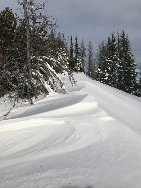
Since the sun was now up I could enjoy the beauty of the snow on the trees as I trekked back down.
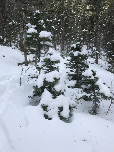
Route finding was also much easier on my return trip, since all I had to do was follow my snowshoe tracks. Also, downhill in snowshoes is much easier than uphill without.

VIDEO:
I crossed the stream again several times.
And followed the snow and leaf covered trail back to the trailhead

At about 9500’ the snow was pretty much gone altogether

I made it back to the trailhead much earlier than anticipated, since I’d only hiked about 6 miles this morning. However, in the daylight I was greeted with fall colors I hadn’t seen this morning in the dark and about 10 forest service workers clearing downed trees.

I’d thought fall was over for Colorado, especially with the recent snow, but I guess not! All through Westcliffe I saw the leaves change.

What beautiful photos,especially the the opening picture.That should be framed and hung on the wall. It’s amazing what a picturesque view can be seen from your rear view mirror as you drive away with thoughts of your just finished climb.There are a few things missing n this hike.One of which was a shadow photo and one on the summit.But than again , it was still a successful day for you. Thank you for allowing others and that of myself to enjoy your writings and pics.
LikeLike