
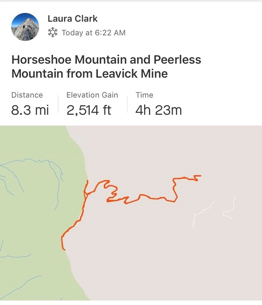
RT Length: 8.3 miles
Elevation Gain: 2500’
I needed a successful summit today. I mean I really needed one. The past two peaks I’ve attempted to summit have been thwarted by downed trees on the drive in or early season wind slab avalanche danger at treeline. If I didn’t get in a summit today I was ready to call off alpine hiking for the year. Maybe.
Last year I was new to alpine hiking and decided to take the winter off from 13ers and 14ers and instead map out the entire North Cheyenne Canyon area peaks, most of which do not have established routes. I was able to learn quite a bit about route finding and navigation below treeline, while still staying in the relative warmth of 8K to 12K peaks where I felt I couldn’t get ‘too lost’.
This winter I may choose to do the same in another area, depending on my success rate with hiking/climbing 13ers in winter conditions. But first, an ‘easy’ early season 13er with ‘perfect’ weather conditions (sunny at the summit and 35* with 5-10mph winds)
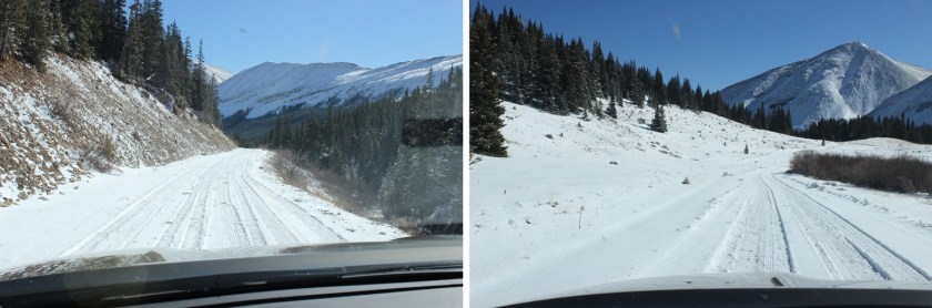
My alarm didn’t go off at 2am as planned, but fortuitously my internal alarm woke me up at 3am and I decided to still book it to the trailhead. Probably the most difficult part of this whole day was the 10 mile drive in on County Road 18. There was a 40% chance of snow last night, which I’ve found usually means if it does snow it’ll only be about an inch or so. Well, as soon as the road turned to dirt there was at least 4-6 inches of fresh snow on the road, which was unexpected. I’d been driving about 40 mph and quickly downgraded it to 10 mph (or slower).
Luckily there were fresh tire tracks ahead of me, so I knew someone must have made it down the road. I figured someone was attempting Sherman this morning and their alarm clock rang on time. From their tracks I could see where the snow became deeper in the road. At times the snow was a foot or more deep (from drifts) and at others it was non-existent. Unfortunately, the tire tracks abruptly turned off the road to the left after about a mile in, and I was now driving the road on my own.
I have a very capable 4WD Toyota Tundra that never says “no” to anything I’ve asked it to do, but I was still cautious: I knew this was a well maintained road but with all the snow I couldn’t tell how deep the snow actually was; and there were drifts. Multiple times I considered turning back, but my truck kept plowing through with no difficulties, so I kept driving on. Mental note: it’s now time to drive with a shovel in the back of my truck.
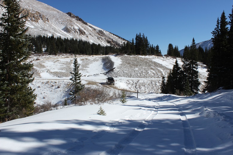
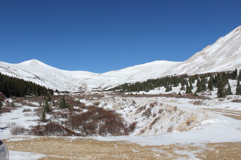
I drove too far. I made it all the way to the upper trailhead for Sherman, realized my mistake, and turned around and found the parking area after the Leavick Mine. I debated driving up the 4WD road to see how much further I could go, but decided against pushing my luck. I’d made it safely this far and didn’t want to chance my summit today by doing anything stupid. This ended up being a grand idea because less than a mile up the road there were several tracks in the snow indicating vehicles in the past few days had tried to continue further and failed. With the added snow from last night there’s no way I’d have made it. Here’s a picture from the drive on my way out. Most of the snow had melted or been packed down by this point.
I parked at the Silver Horseshoe Road junction and put on my snowshoes while sitting in my truck. I kept them on for the entire hike. I started at 6:25am. Here’s where I parked.
From the beginning the road was covered in snow. And it was dark. And silent. And beautiful. The first part of the hike was relatively easy: I just followed the snow covered dirt road.
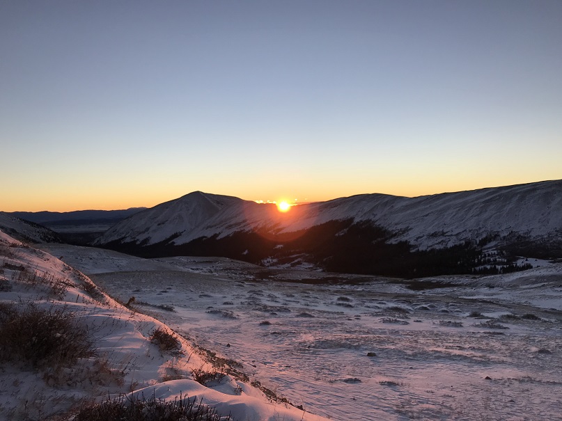
Around 7am the sun began to rise. I slowed down to enjoy the experience. I love sunrises!
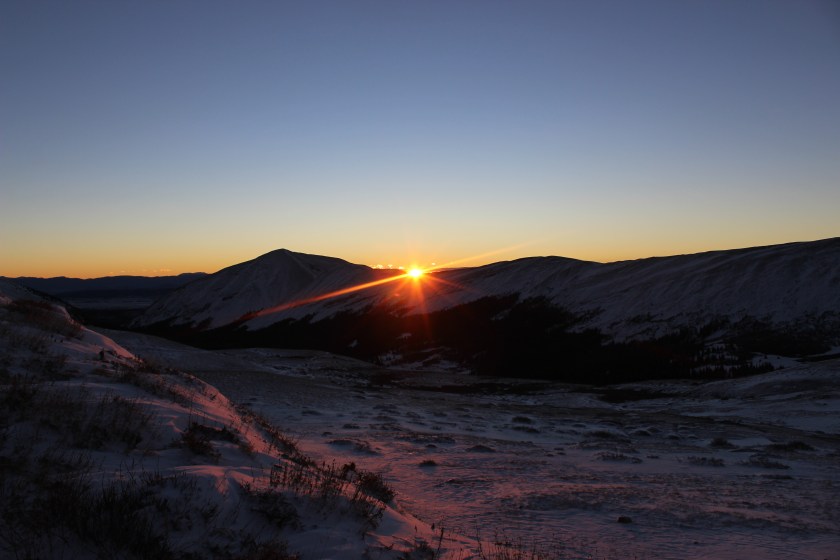
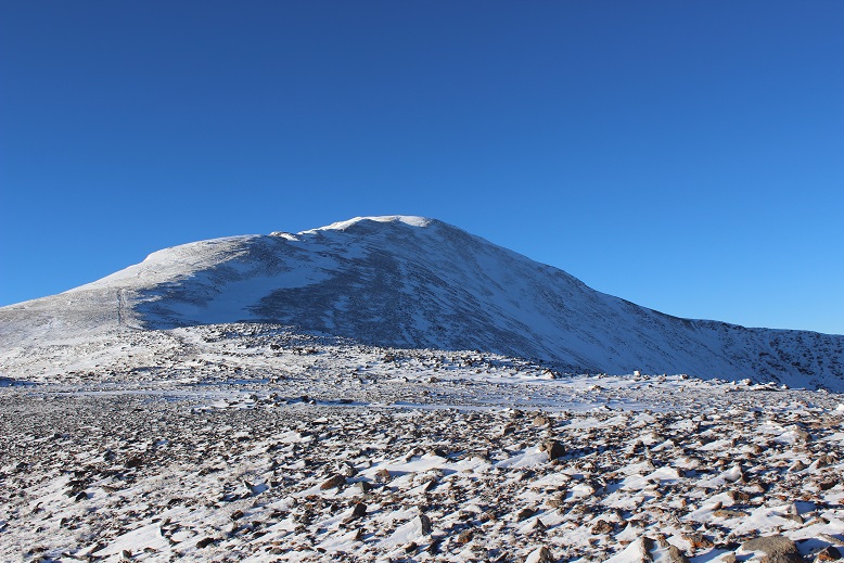
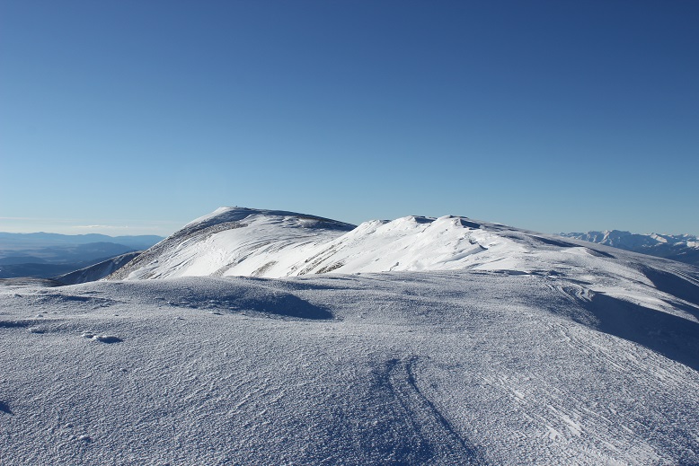
I got my first view of Horseshoe. What an amazing mountain!
And Peerless. It looked like there was wind up high, but the forecast said it was supposed to die down this morning, settling around 5-10mph. So I trudged on. Snowshoeing takes more energy than hiking!
Being the first one on the trail has it’s perks: I saw numerous animal tracks from the night before.

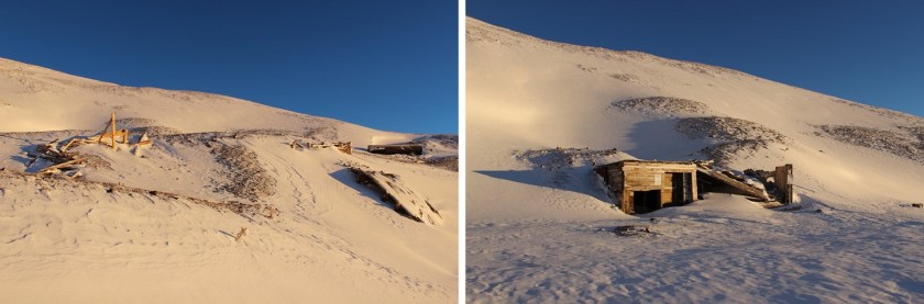
At 12,600’ I passed an old mine.
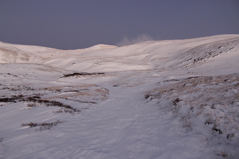
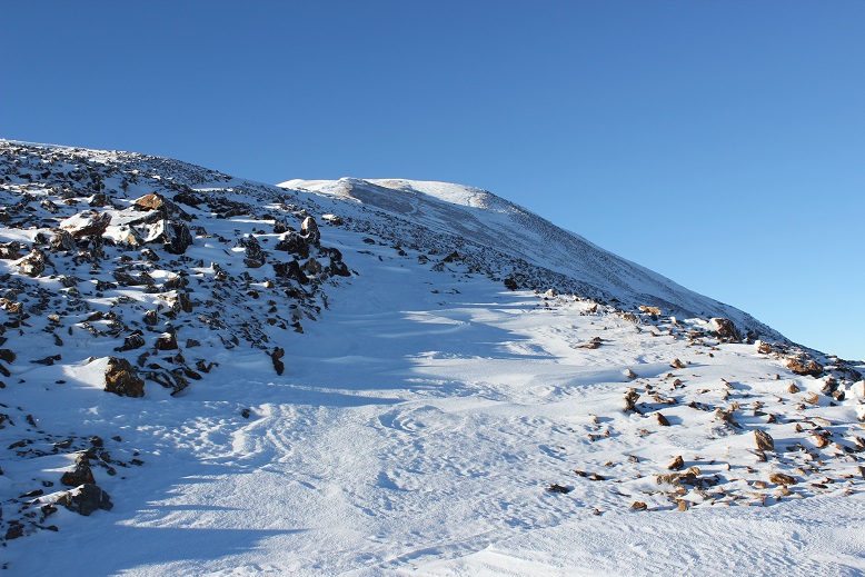
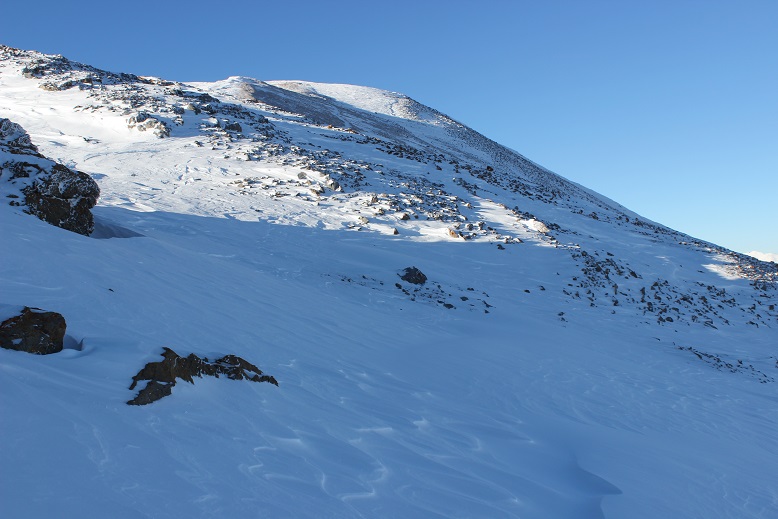
From here as I gained in elevation the road became more difficult to find. It was covered in snow drifts, making it blend in with the mountainside. I did my best to stay on route and probably didn’t, but could see my intended destination (the Peerless/Horseshoe saddle) and just kept aiming for that while avoiding pockets of soft snow.
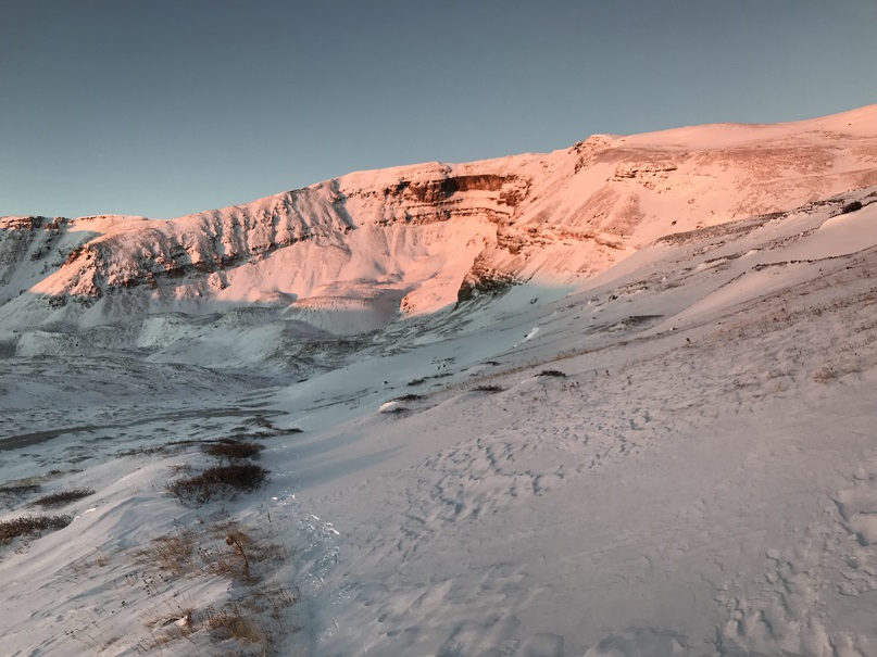
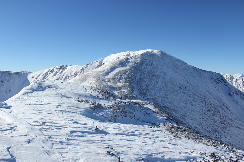
I made it to the 13,200’ saddle and turned left (south). I had a great view of the route before me.
I did a physical check here. The hike thus far had been tiring but not difficult. I was sweating and could still feel my fingers. I wasn’t a popsicle yet. This was fantastic! I decided to keep hiking. On the ridge the trail was either covered in snow or held no snow at all. I kept my snowshoes on either way.
The only part that gave me pause was here. I wasn’t sure if the snow was consolidated or not. I continued on, knowing if I slipped I wouldn’t be falling too far. Second mental note of the day: Bring an ice axe from now on.
I followed the ridge and was surprised by a false summit. Well, surprised is the wrong word. I’ve come to expect them, but today it wasn’t appreciated because as soon as I made it to the top the wind picked up. Luckily, while it looked far it was actually an easy hike over to the true summit.
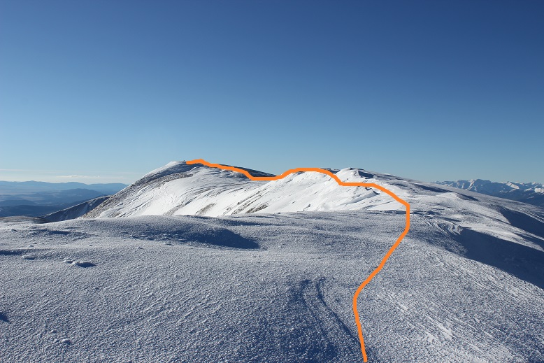
Here’s the route I took
I had fun here learning about different types of snow. I wasn’t able to always tell what was snow and what was ridge, so I traversed carefully. Luckily here the ridge was wide and most of the snow as consolidated.
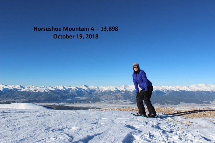
I summited at 8:45am
VIDEO:
Up until now I hadn’t been too cold, but on the summit the wind picked up. I took a few pictures of the amazing view

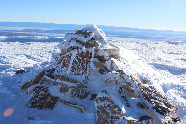
The summit cairn
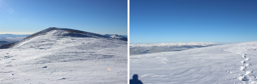
And took a look at my route back down.

It had been my intention to summit Peerless as well (an unranked 13er) but my fingers were burning. I was clapping them together, putting them under my armpits, in my pockets, etc., but they just weren’t warming up. I needed the wind to settle down. I told myself I’d make the decision whether or not to climb Peerless when I made it back to the saddle.
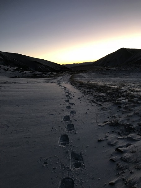
Here’s my snowshoe tracks. I love snowshoe tracks!
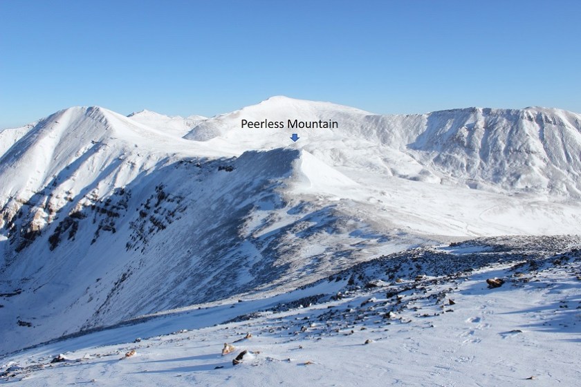
And here’s my next target: Peerless
I made it back to the saddle and looked at the route back up to Horseshoe
And up to Peerless
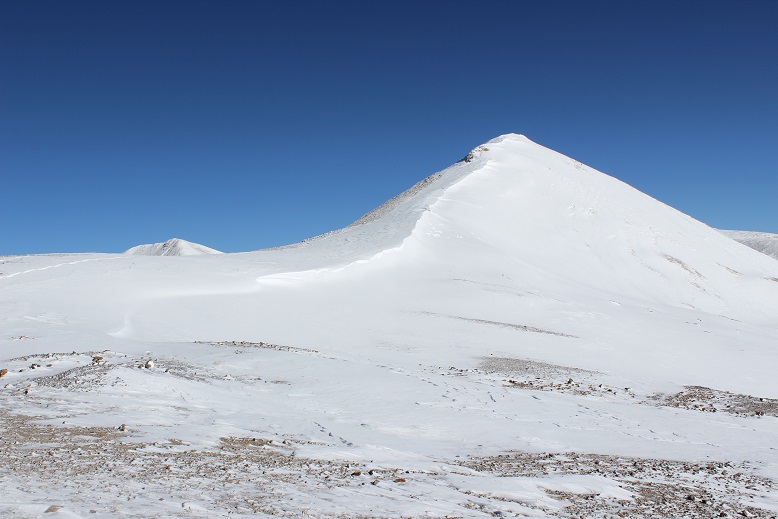
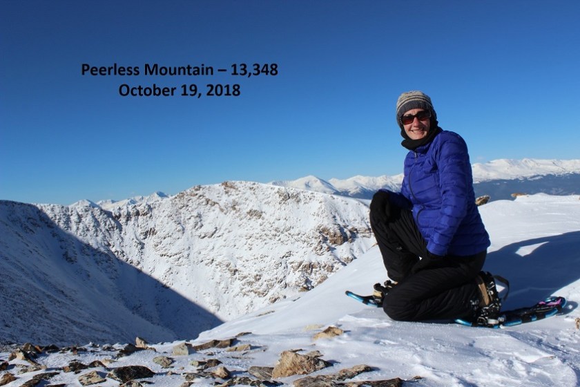
It looked like a cornice was forming on Peerless, but there was an open path if I stayed to the left and avoided the snow. The wind had stopped, and while I couldn’t feel my fingers they were no longer burning, so I decided to go for it. It was a quick 150’ trek to the summit. I summited at 9:25am
VIDEO:
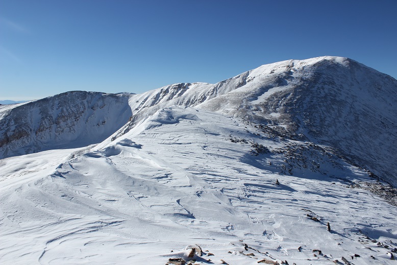
Here’s a look back at Horseshoe from Peerless. The only difficult part was deciding which snow was stable to hike on, and which was part of the cornice/loose snow. In other words, I wasn’t sure where the mountain ended and cornice began, especially as I got higher up.
The trek back down was very easy as there hadn’t been much wind and I could just follow my snowshoe tracks. I noticed a lot of new holes in the snow from critters who weren’t quite ready yet for winter.
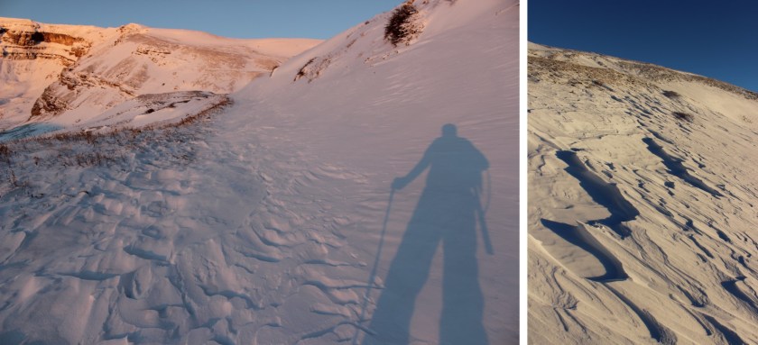
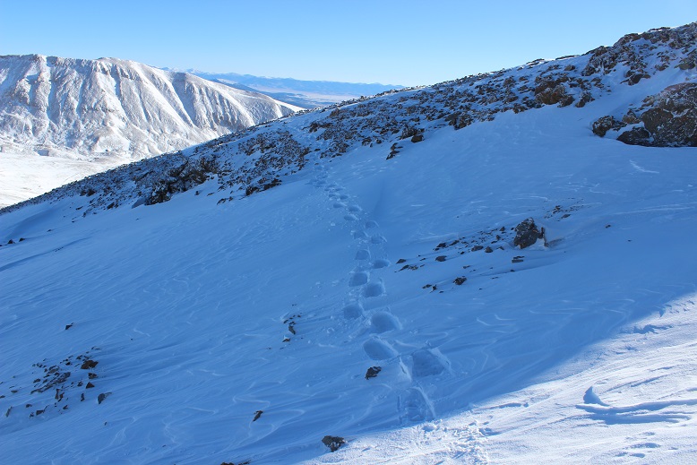
The entire hike in the snow seemed to continually change. It would be consolidated for 10 steps or so, and then suddenly become soft and I’d sink to my shins. On my way back I was able to capture the experience in a photo

Here’s what the 4WD road looked like on my way back out

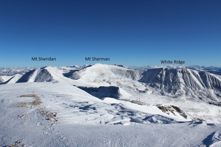
And I know a lot of people are wondering what Sherman looks like right now…
I made it back to my truck at 10:45am, making this an 8.3 mile hike with 2500’ of elevation gain in 4.5 hours.
Here’s my STRAVA route:
And Relive visual: https://www.relive.cc/view/1914862651
Today was a huge learning experience for me. I know this wasn’t a difficult peak, but I learned a lot about how to navigate different types of snow, drifts, snow stability, and winter route finding. And I stayed (relatively) warm. I’m considering today a success!

The snow presents a certain serenity along with the rising of the,morning sunshine.Your shadow and your summit selfies are also and added attraction to your captivating writings. I am totally awed everytime I see and read of your hiking exploits.I realize that my comments may seem repetitious ,but you have to see your victories through my eyes.I feel honored to follow your mountain hiking even at a distance. But then again,Your writing is so descriptive that it seems like I’m actually following you at a distance. Thank You Lady Laura for allowing me to tag along via of the internet. You have braved the cold and wind,but i would like to suggest that you let” Eddy Rave” take you to” islands” via of utube.
LikeLike
Came back to watch your videos I never watched.I am amazed at the snow covered ground you cover in such little time.Take care and the best to you and your loved ones.
LikeLike