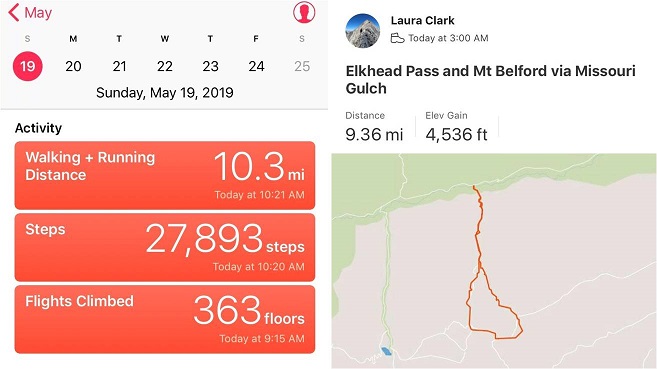
RT Length: 9.5 miles
Elevation Gain: 4536’
I’ve been eyeing Emerald Peak for a while now, doing research and looking at feasibility for summiting this time of year with the heavier than normal snowpack. Unfortunately I wasn’t able to find much information (ok, any) for summiting with snow. I did see a report from June of one year saying Elkhead Pass wasn’t passable, but it didn’t explain why it wasn’t passable.
I looked at a topo map and studied the slope angle of Elkhead Pass: it didn’t look that steep. I know a lack of reports for peaks over specific months usually means there’s a reason no one has summited during that time of year, but I wanted specifics. I decided to be the beta and go out and see just why Elkhead Pass isn’t passable in winter. And hey, maybe it was? Maybe it was passable with more snow?
The drive in to Missouri Gulch was easy on a well maintained 2WD road.

I arrived at 2:45am, surprised to be the only vehicle in the parking lot. Hmmm… this is a pretty popular 14er trailhead. This didn’t make much sense, especially for a Sunday. Maybe I was just the early bird. (Nope, my truck was still the only one in the parking lot when I got back?)

The trail starts at the south end of the parking lot. You go left at the signs, cross a bridge and turn left to follow the class 1 trail up the mountain.

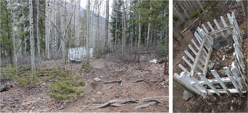
There’s immediate elevation gain that doesn’t quit. I rather enjoy this hike (this was my third time here). It’s always a little creepy hiking in the dark past the baby grave though. The worst part is I know it’s there, but never actually see it in the dark because it’s just a little ways off the road. So I know I’m passing it somewhere, but never actually know if I’ve passed it or not. (Anyone ever figure out why it’s so far away from the other graves?)
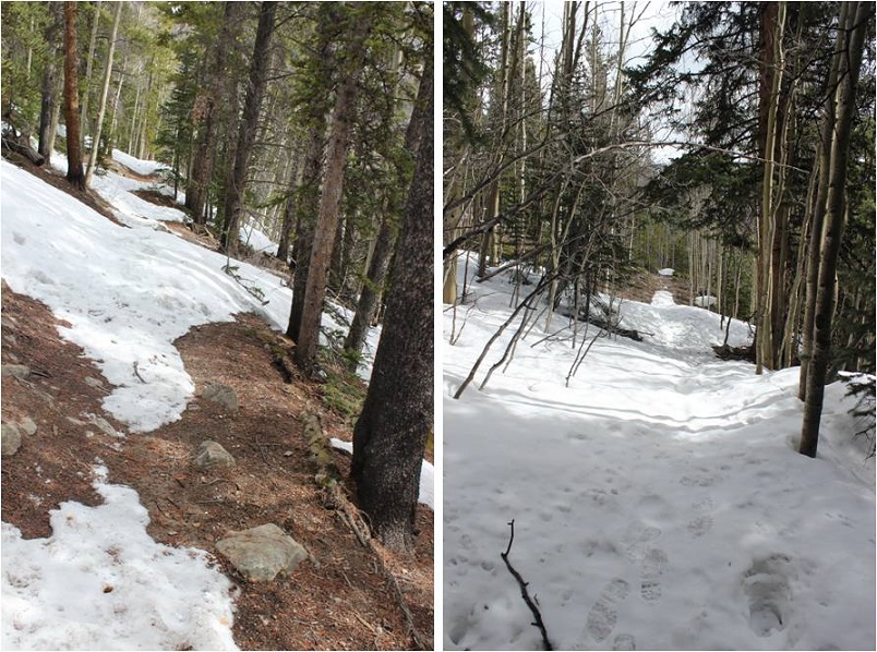
The trail conditions varied from bare to a couple feet of snow, but there’d been two hard freezes the past couple of nights so I didn’t need traction.
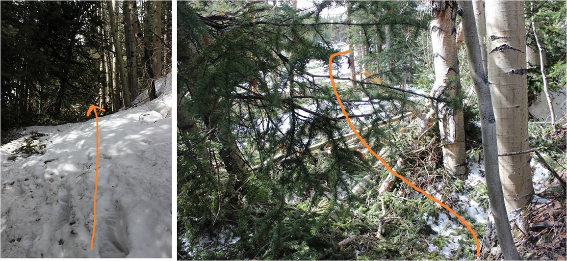
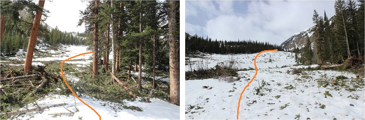
About half a mile before the cabin I came to the avalanche area. There was an avalanche here a few weeks ago, but I’d heard it was passable. It was, even in the dark. The beginning required a little creativity, but once I was in the avalanche area there was a clear path to follow that had been made by other hikers.
If it doesn’t snow again I’m pretty sure this will be the new route.
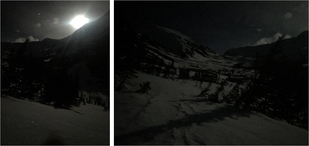
This new route picks up with the old one just before the cabin. Here the snow picked up as well and I put on my snowshoes. There was a full moon this morning, which really made the gulch come alive.
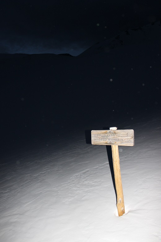
I followed the basin on my own path as the trail was covered in snow (at least most of the time). I made it to the junction for Elkhead Pass and Missouri Mountain and turned left (east).
I started hearing and seeing ptarmigans as the sun began to rise (here’s looking back at the way I’d hiked in)
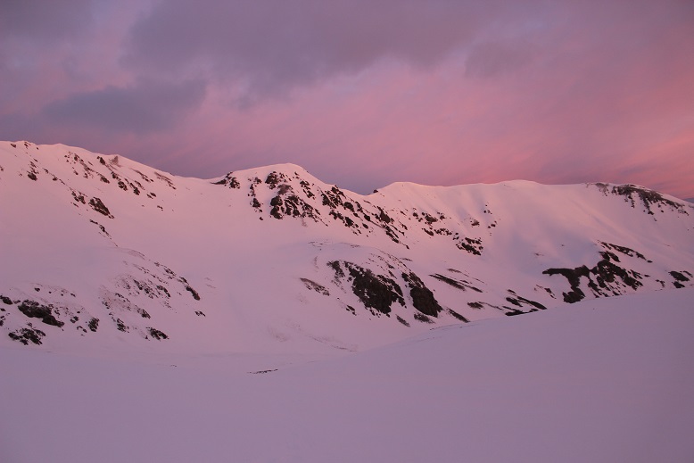
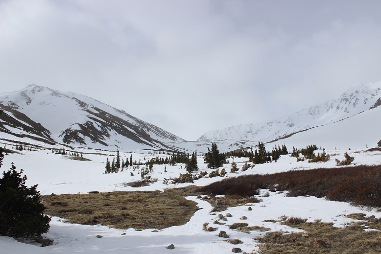
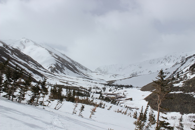
I followed the basin to Elkhead Pass, which was surprisingly easy: I’d expected more of a challenge.

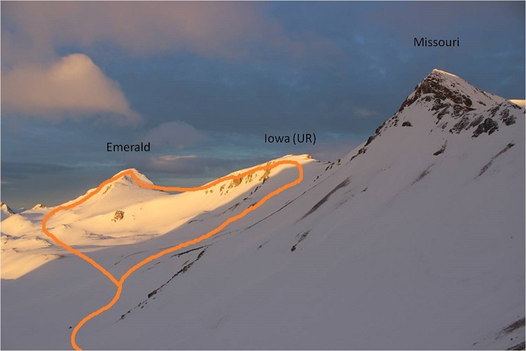
At this point I was beginning to think I was actually going to summit Emerald today. I took a closer look at the Missouri Basin (not the gulch, which I had just come from) and planned out my intended route. I was trying to decide if I should head over to Iowa or Emerald first, but from this distance I couldn’t tell what the snow conditions were on the ground, so I decided I’d decide when I got there.
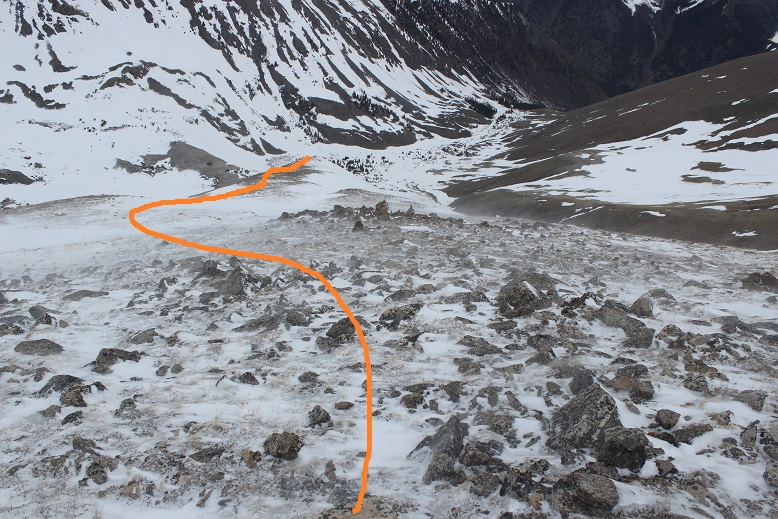
I started heading down Elkhead pass and immediately turned around. Snowshoes weren’t going to do it: this was steeper than it looked! Ok, crampons on, time to try again. I could see where I needed to go, but I just couldn’t get there. The pass was a sieve for wind: Intense wind that didn’t often let up. On top of that the ground was slick like a frozen waterfall (probably due to warming during the day and freezing at night) but the ice was covered in about 3 inches of soft snow deposited by the wind. It made for an awkward small-cornice-like structure that seemed to extend all the way down the pass. And the drop down was serious! This picture shows the easy part of the decent (camera was put away for the more difficult parts, sorry!)

I made it past the ice covered rocks to the snow covered ice and retreated up, back the way I’d come.
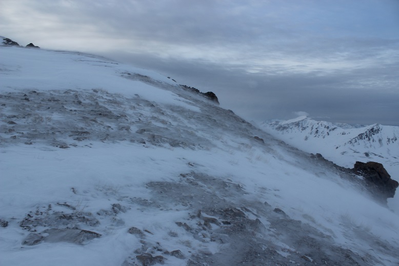
At the top of the pass I once again tried to look for an easier way down, but the snow blanketed everything and I couldn’t tell where the icy-snow pass ended and the basin-snow began. I also couldn’t truly get a feel for how steep anything was just by looking. I tried again, made it about 30 feet down, and once again felt unsafe as I couldn’t get a good hold with my crampons. A big gust of wind picked up and I hugged the side of the pass for a good minute or so waiting for it to stop, and then I used my ice axe to climb back to the top of the pass. Seriously, it didn’t look this steep on the topo map! I made it to the red circle twice.

This was frustrating. Climbing up was no problem at all (I’d done it twice already), but the down climb wasn’t happening. I felt confident someone could make it over this pass; someone with more skills than I or maybe a backcountry skier (it looked skiable, but I don’t backcountry ski, so I’m not sure). Today I was not going to make it over this pass. The problem here was, due to the wind, there wasn’t enough snow, just ice. In fact, I didn’t like the look of it at all, and will most likely attempt Emerald next time from the Rockdale Trailhead. At this point, I’d rather do Little Bear again than Elkhead Pass (seriously, summer or winter, I felt safer on Little Bear, and that’s saying something!).
Enough complaining. I was here, what did I do now? I’d taken a good look at Missouri Mountain on my way in, and that was a big nope. I turned around and immediately decided to hike up Belford from where I was.
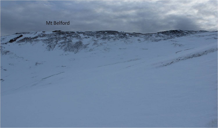
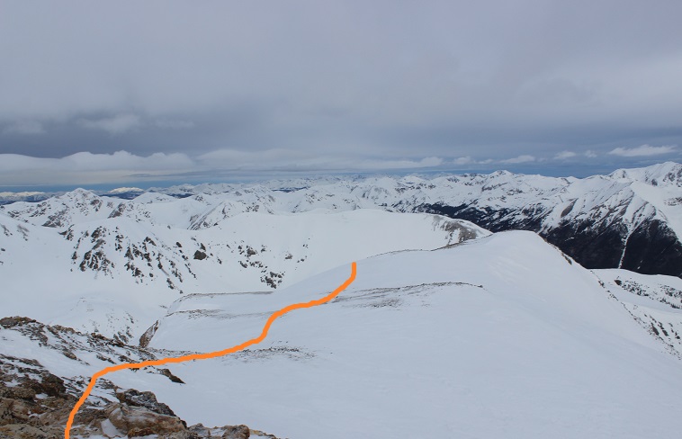
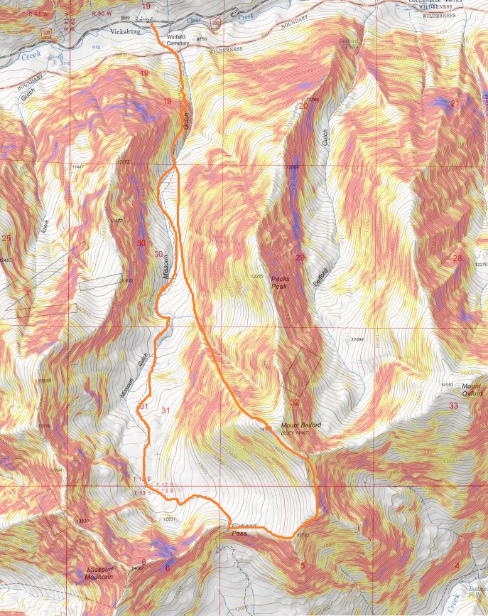
No, I didn’t have a route description or instructions, but I’d summited Belford before and knew it was just… well, right there. It looked very doable, so I decided to go for it. Here’s the route I took:
I kept heading east to the top of the ridge (the wind wasn’t stopping)


And then followed the ridge north towards the summit of Belford
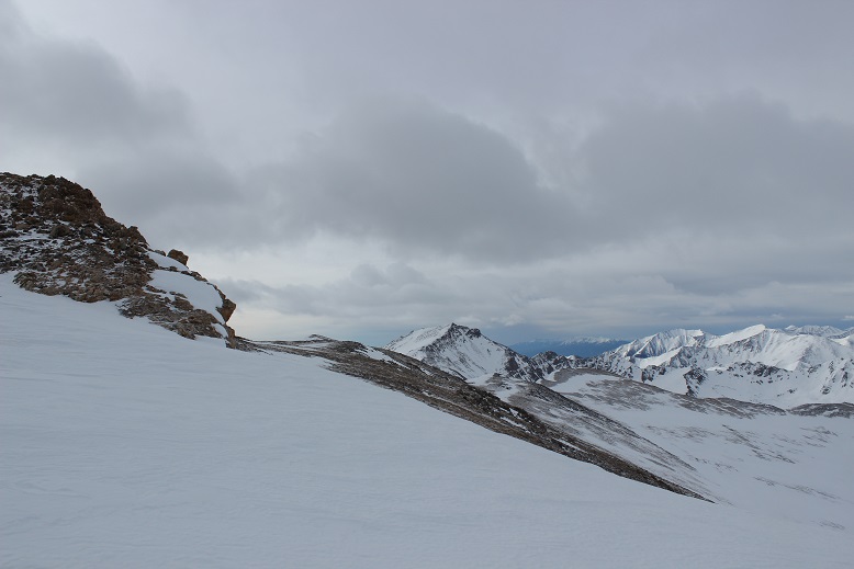
I turned and looked back on Elkhead Pass: It really didn’t look that difficult, did it? (Sigh)
The ridge had areas of deep snow that I much prefer to icy rocks, so I put on my snowshoes and headed north
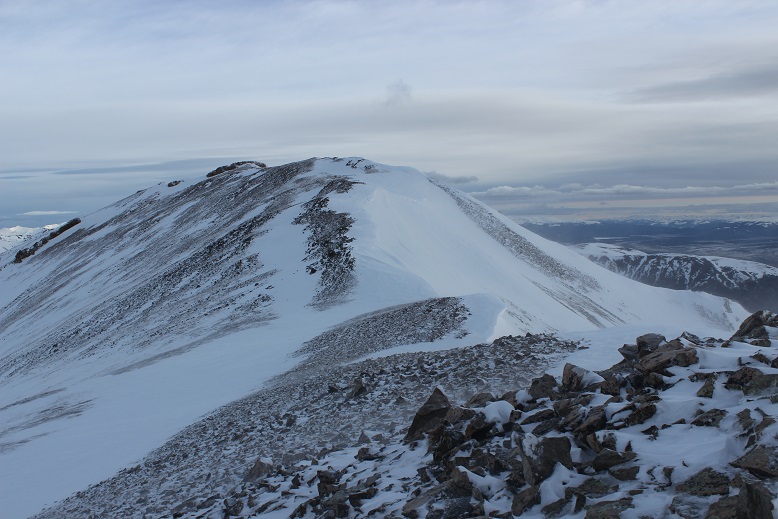
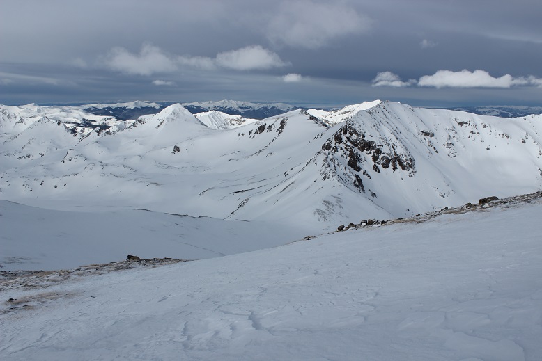
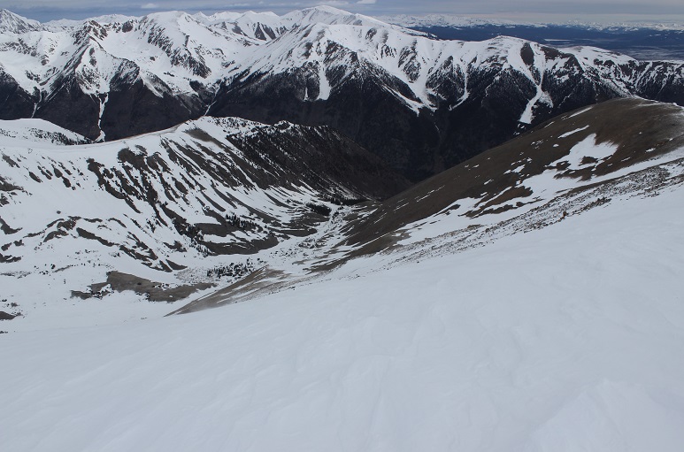
Halfway along the ridge I paused to take a look at Oxford.

It looked like fun, but there was a storm coming in and I didn’t want to get stuck in it all the way over there, so I waved and kept heading towards the summit of Belford.
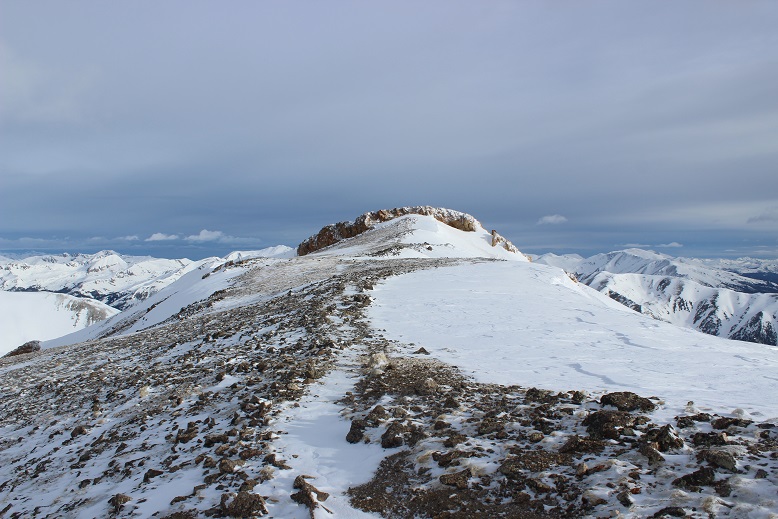
I was a little worried about the last bit of climbing, but once I was there it wasn’t so bad

I summited to amazing views and intense (intense!) wind

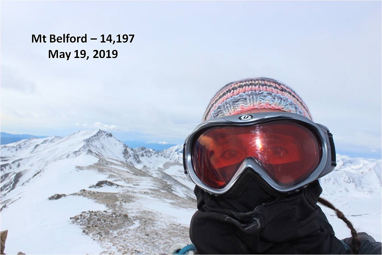
The wind was so intense it kept knocking my camera over, so I took a selfie instead (with my DSLR)
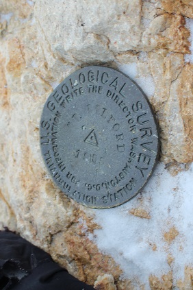
I love how this mountain has a summit marker!
OK, time to head back and make this a loop. The only downside was I hadn’t hiked up the north slopes and I’d passed them in the dark, so I wasn’t sure of their current conditions. I thought to myself I could always turn back and descend the way I’d hiked in if I needed to. I paused and tried to remember which way was down? I knew there was a huge gully I wanted to avoid… I was pretty sure this way was the correct way down?
I headed that way and found a cairn (woot!) and what might have been a trail. I turned around and looked at the way I’d come
And now I was headed down…
This was actually trickier than it sounds. While I couldn’t much get lost here, the rocks were very unstable, as were much of the large areas of snow. I did not feel secure on any of the snow on the way down: it all felt ready to fall. The wind didn’t help either.
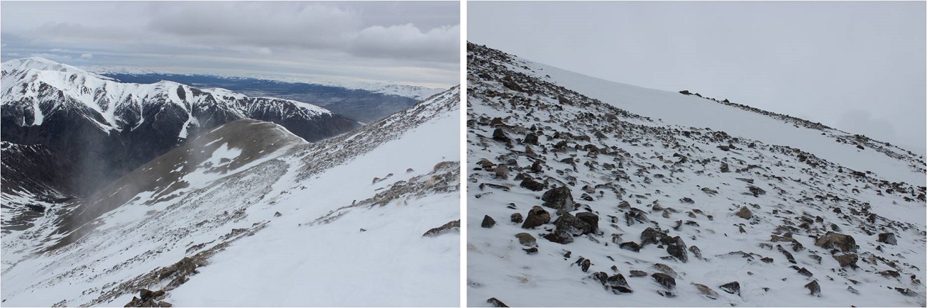
After about 300 feet the steepness mellowed out and it was a rocky walk down the ridge, avoiding the gully and slipping on the very loose rocks every 20 feet or so (I have a bruise on my bum to prove it)
There were also long sections of snow (I kept putting on and taking off my snowshoes). Here’s looking back up at the way I came down

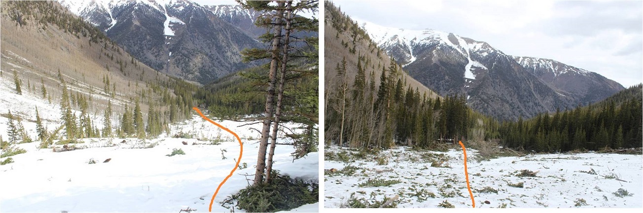
Back in the gulch I knew there wasn’t a trail, so I stayed high on the snow and made a beeline for the cabin
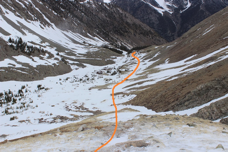
Here’s the route I’d taken earlier in the morning from the gulch to Elkhead Pass.

Just past the cabin I was able to see in the light of day what the avalanche had done. It hadn’t been a big avalanche, yet it had altered the route of the trail. Here’s the way back to the trail
The rest of the hike down I thought about what had happened today. I was a bit bummed about Emerald, but had only given that a 25% chance of success to begin with so it wasn’t the end of the world. Time to start researching alternate routes (I know there are a couple). I was excited to discover you can summit Belford from Elkhead pass. In fact, I thought it was a much easier route than the north slopes. If I were to summit Belford again I’d absolutely chose to take Elkhead Pass, as it makes the elevation gain easier.
I made it back down to my truck at 10am, making this a 9.5 mile hike (it felt like more) with 4536’ in elevation gain (it felt like less) in about 7 hours (much of that time spent trying to navigate the pass).
Here’s the Relive
Summit Sticker can be bought here

Summitted Belford via North Slopes and phew, it was definitely steep-going. Good to know you can summit via Elkhead pass! Thanks for sharing
LikeLike
You had a comment saying ( It doesn’t look difficult).Everything You do looks difficult in my eyes.I’m overtaken in the mountains You attack with assured confidence with 100 percent success.Most people consider what You do a sport,but in Your eyes it’s a way of life and love affair with the mountains.You say that Your not experienced enough in certain fields of what You do and say Your more than experienced in making right choices.I’m hoping the full moon was visible for Your complete mountaineering hike. Thank You Lady Laura.
LikeLike