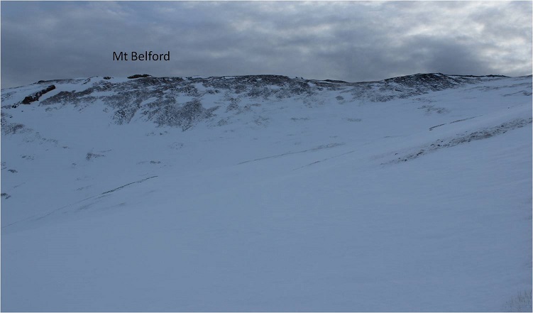
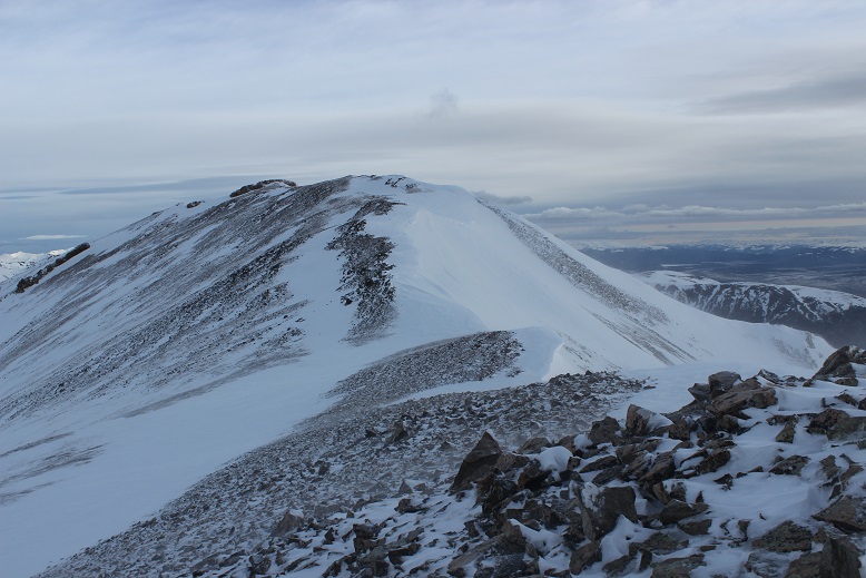
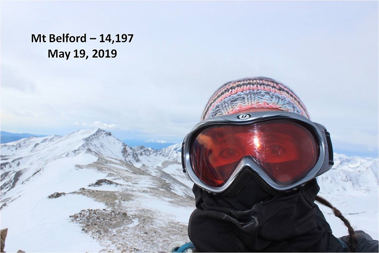
Mt Belford in Winter – 14,197

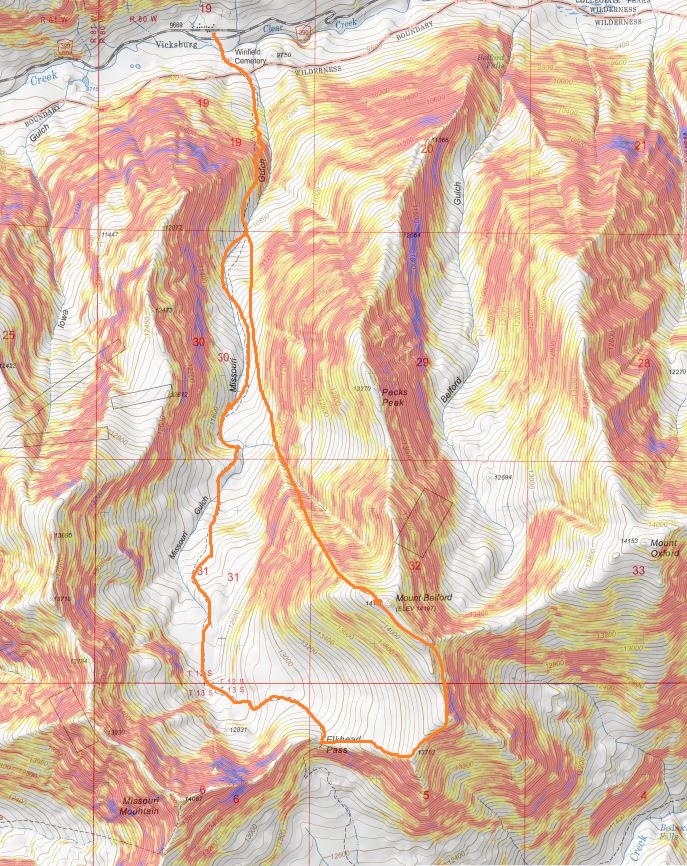
RT Length: 11.15.miles

Elevation Gain: 4764’

Note, this is the third time I’ve hiked Mt Belford, so this time I’ll just be giving a quick overview with a few pictures and thoughts.  A full trip report can be found here for Mt Belford via Elkhead Pass, and here for Mt Belford and Mt Oxford in winter conditions.

Also note:  whining ahead. 

The last 3 miles to the Missouri Gulch trailhead were terrible!  So bad I asked SkydiverHiker to drive.  We were sliding in the ruts and eventually found a turnout about .7 miles from the trailhead and stopped there.  This ended up being a fabulous idea, since the trailhead was too covered in snow to park.  It looked like someone had tried and it took them quite a while to get out.  This is the road to where we parked (easy until the plowing stopped)

Parking further away changed our plans a little, as it added an hour onto our trip.  We decided we’d probably just hike Mt Belford today, and leave Oxford for another day.  We were on the trail at 5:15am.  Here’s a look at the Missouri Gulch Trailhead Parking area
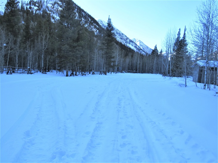
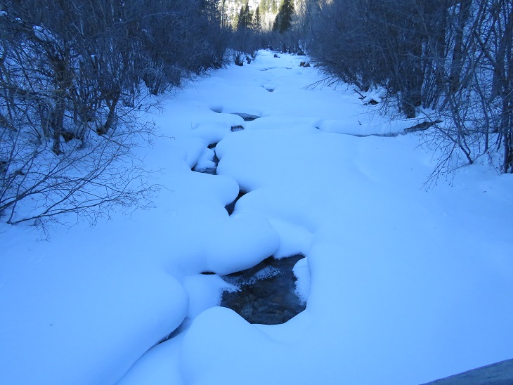
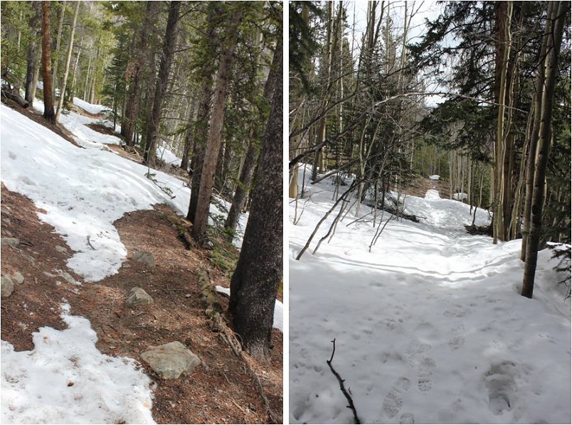
We crossed clear creek and started ascending the side of the mountain wearing microspikes.  We saw some elk tracks here, but luckily, no mountain lion tracks this time.
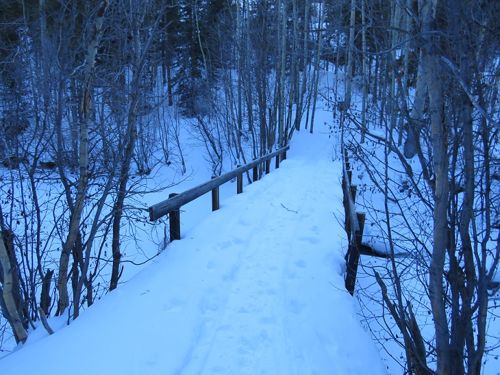
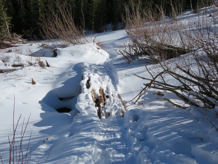
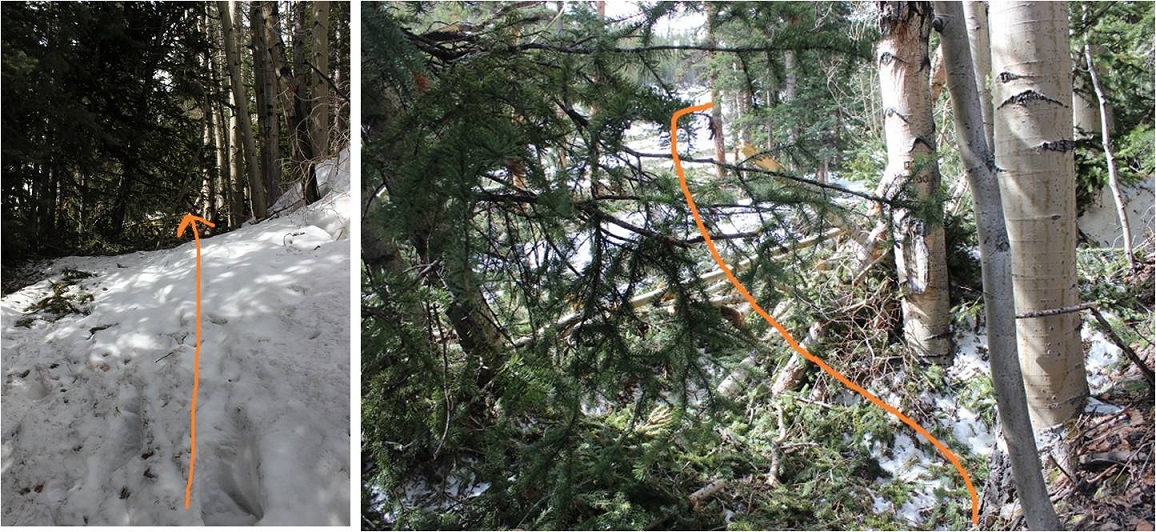
Once in the avalanche area the trench stopped.  We crossed the drainage on some sketchy, snow covered logs

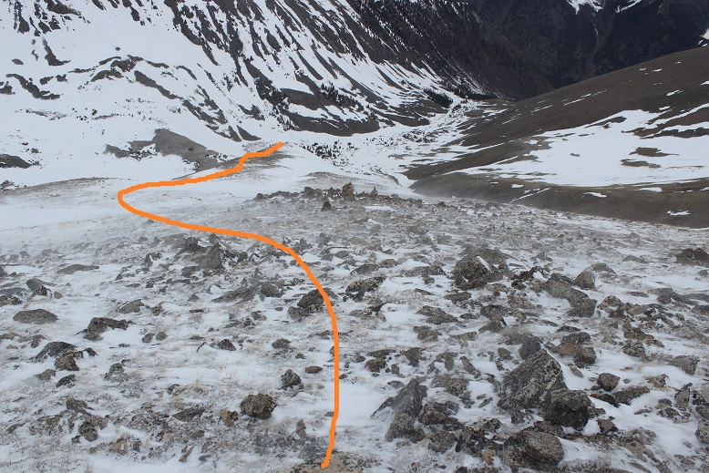
Then stopped for a bit to put on our snowshoes.  These pictures were taken later in the day on our way back down, so you can see the trench.  We put that trench in!  I’ve done this hike several times, so I knew to aim for the trees, heading south
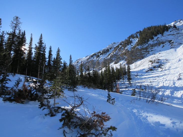
Once in the trees the trench picked up again until the cabin

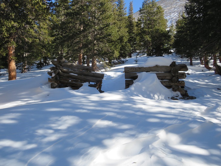
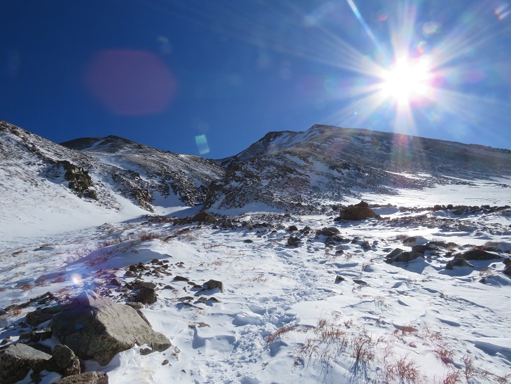
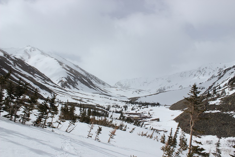
Once past the cabin the trench stopped again.  The wind in the gulch is fierce and I’m sure blows away trenches nightly that are made during the day.  No worries though, we just headed through the gulch (still wearing our snowshoes) towards Mt Belford’s Northwest Ridge
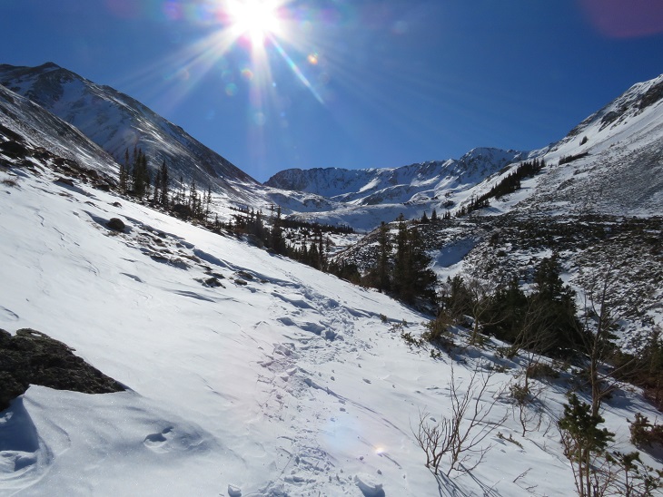
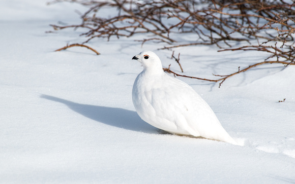
As we were trying (unsuccessfully) to avoid the willows, I heard ptarmigans chirping, but couldn’t see them. Then, all of the sudden, a ptarmigan busted out from under the snow and walked away.  It was here I learned ptarmigans huddle near the willows and stay in their air pockets when it snows to stay warm.  They can do this for days, as their food source is under the snow as well.  It was so cool to hear them calling to each other throughout the day!
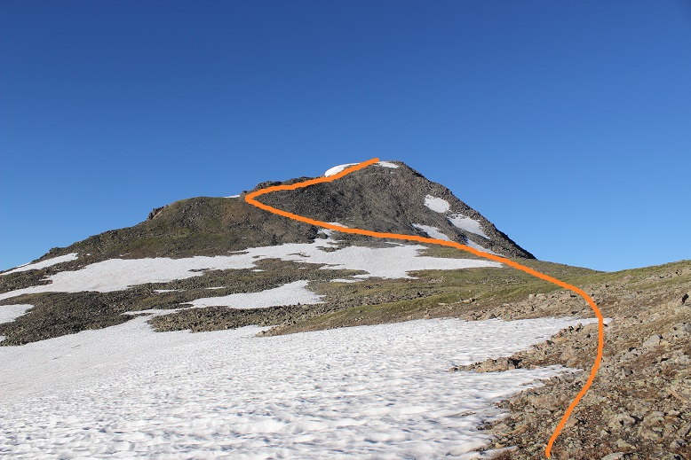
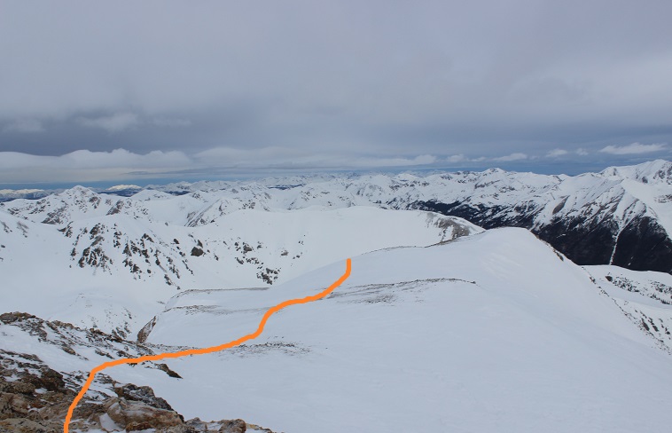
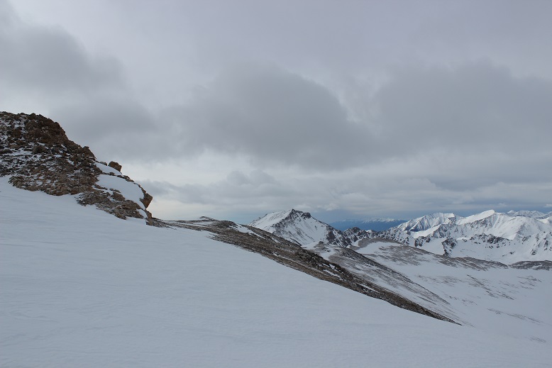
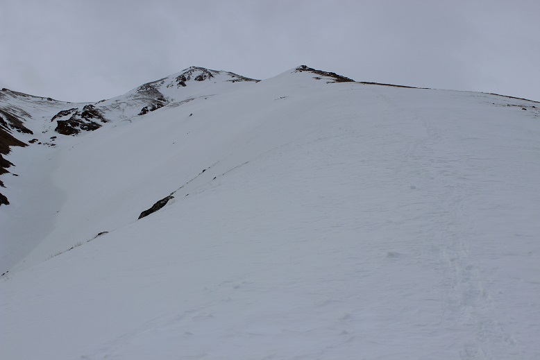
We continued through the basin, only taking our snowshoes off once we reached the ridge.  From here we followed the ridge to the summit.
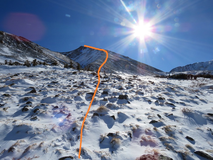
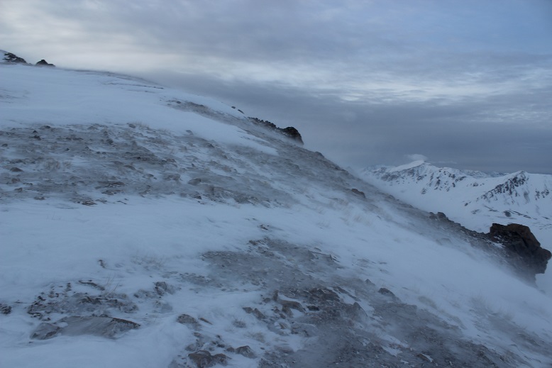
I’m making this sound MUCH easier than it was.  This is probably one of my most difficult winter summits to date.  With my Raynaud’s I need to keep moving to stay warm, and while SkydiverHiker was doing an excellent job keeping up, we still stopped more than my body would have liked.  In fact, about halfway up the ridge I was seriously thinking about turning back:  my fingers and toes were burning and the wind was more intense than predicted.  With windchill it was at least -20 degrees.  We discussed turning back, and decided to continue on (Skydiver Hiker needed a ‘win’ today, and I wouldn’t let him go on without me).  SkydiverHiker dropped his and we continued on up the ridge.  I continued with my pack because I had an ice axe and essential gear.  This continuing on included a lot of intense feelings and emotions, and there was some crying involved and also some nausea.  Have you ever hurt so much you felt nauseous?  Both SkydiverHiker and I felt that way today.  But at least the pain told me I hadn’t lost anything to frostbite.  While mountaineering is certainly physical, it’s emotional and a mind game you play with yourself as well.  I felt as if I were dying every step of the way, not because I was tired, but because I felt my fingers and toes were on fire.  I was dry sobbing at times.

We trudged to the top, where my camera stopped working (I really need to find a better cold-weather camera) so the photos we have are SkydiverHikers from his phone.  About 20 yards from the summit SkydiverHiker laid down and didn’t want to get up.  I didn’t know this, but his back had been really, really hurting him.  This laying down right now was (of course) unacceptable, so I made him get up and lead the way to the summit.

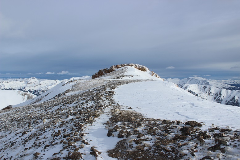
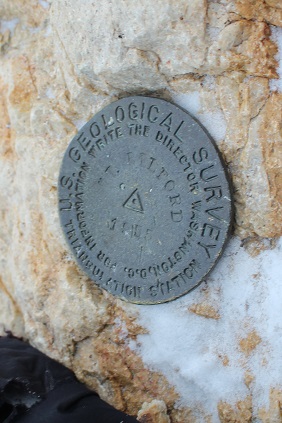
We didn’t stay long, just long enough to get a photo of the summit marker, and then we were on our way back down.

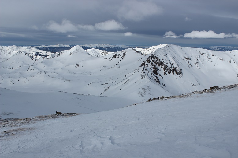
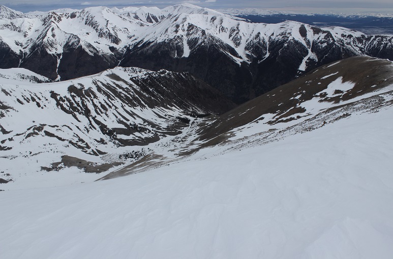
Let me pause here to show you the great views of Missouri Mountain
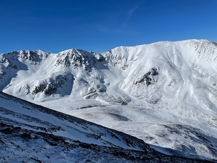
The screaming and crying continued until we made it to where we were hiking in sunlight, near the base of the ridge.  It’s amazing how the warmth of the sun made me feel better, even when it was still well below freezing. Once at the base of the ridge we donned our snowshoes once again and headed back out of the gulch, following our morning trail.  

As we warmed up our spirits lifted and we were once again thrilled to be out here hiking.  This is one of the most beautiful places in Colorado to hike, and we had it all to ourselves.  Well, it was us and the chirping ptarmigans.  We hiked back past the cabin and through the avalanche area, took off our snowshoes, and continued back to the trailhead in better spirits.  Yes, this is a mental game.   

We made it back to the truck at 1:15pm, making this an 11.15 mile hike with 4764’ of elevation gain in 8 hours.

Summit Sticker can be bought here

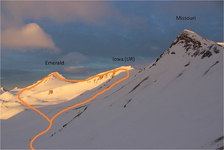
Emerald Peak 13,904, Iowa Peak (UR) 13,831 & Missouri Mountain 14,067

1

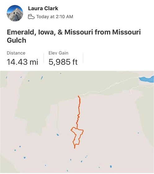
RT Length: 14.5 miles

Elevation Gain: 5985’

No, I didn’t drive straight to the Missouri Gulch trailhead. It took me forever to drive home going 50mph on the I70.  I made it home at 7am and limped out of the truck.  My feet seemed to hurt more now than they did last night.  They’d dried out, but were now red and raw.  I decided to take a few hours ‘off’ to let my feet rest.  After cleaning up and pampering my feet I took a 5 hour nap.  When I woke up my feet had dried out and I was able to get a better look.  No blisters.  That was a relief.  They were still red and swollen though, meaning I’d had a Raynaud’s attack yesterday.  It all made sense, and was most likely caused by the 20 minutes I spent trying to dig out my water shoes from the cold creek combined with a long, physical day.

Driving home had been the right thing to do. By the middle of the day my feet were still sore but I found I could walk on them.  Kind of… you see, it hurt terribly to begin walking, but after the 10th step or so the pain went away.  So I figured I just had to start hiking and not stop and I’d be fine.

At 9pm I made the decision to drive to the trailhead, try to nap for an hour, and attempt another hike. It was either that or stay home and do the treadmill thing in the morning, which did not sound appealing with sore feet.

Everything went well. I made it to the trailhead and slept for an hour before my alarm went off at 2am.  There were tons of vehicles at the trailhead.  As I was putting on my hiking boots a couple drove up in a Subaru.  We were hitting the trail at the same time, so when I got out of my truck I waved and said hi to them.  No response.  Hmmmm… ok.  Maybe they hadn’t seen me (or that the lights on in my truck)?  I turned on my flashlight, walked over to the trailhead and once again said “hi guys!”  I was hoping to just chat and see where they were going before setting off.  When I see others at trailheads I like to connect in case something happens (to either of us).  Once again, they didn’t respond (but their dog looked back at me).  Maybe the creek was making too much noise for them to hear me? Ok, well, I don’t like to be rude but I’d tried to be nice.  Maybe I’d see them on the way down.  I didn’t say anything as I quickly scooted past them and headed down to the stream, crossed the bridge, and headed up the trail.

2

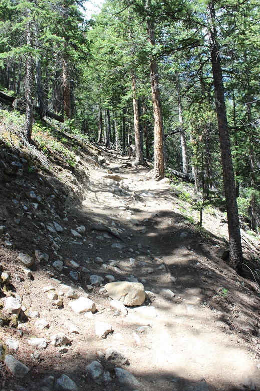
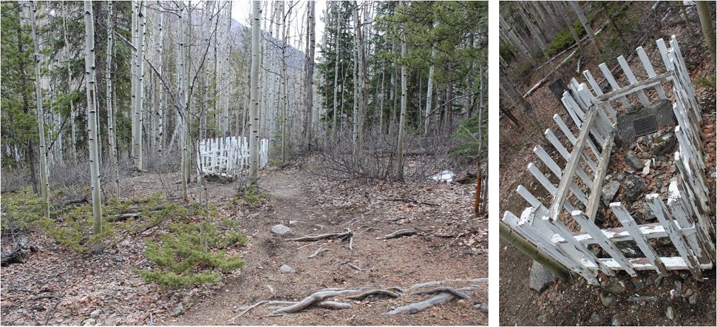
Yes, my feet hurt, but I had a plan: don’t stop.  Also, take ibuprofen every 4 hours.  The first few steps were painful, but after that as long as I kept moving the pain went away.  This was my second attempt of Emerald/Iowa, and my 4th time hiking via the Missouri Gulch trailhead.  Call me crazy, but those switchbacks are getting easier.  Also, the baby grave doesn’t bother me so much anymore.

3

The avalanche area has been nicely cleared, and now there’s a log bridge over the creek and a nicely manicured trail through the avy debris.

4

I made it to the cabin in exactly 1 hour and thought that was pretty good time, considering.

5

I entered Missouri Gulch and had no problems following the well established trail. The willows seem so much bigger without all the snow.

6

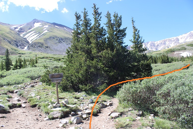
I turned right at the junction for Elkhead Pass/Belford and followed the trail towards Elkhead Pass.

7

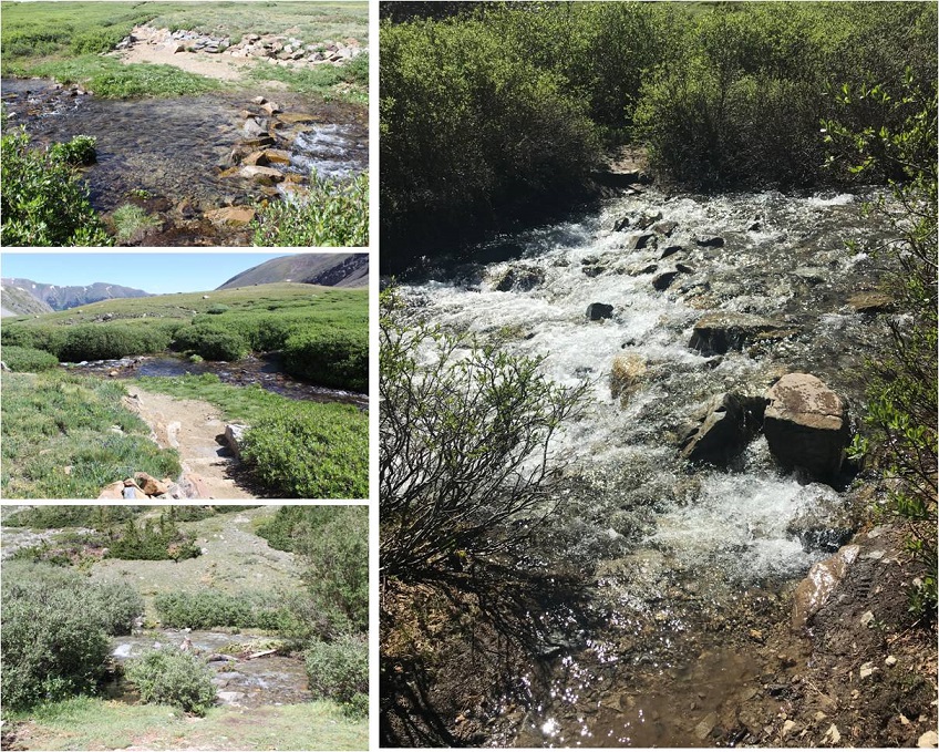
There were several stream crossings to navigate here. These were not fun in the dark, but in the daylight didn’t pose much of a problem.  Oh, and there aren’t any ‘easier’ ways to cross:  just cross them right where they intersect with the trail.

8

I felt like I was making pretty good time. It’s amazing how much easier the gulch is to navigate without snow.  I made it to the Elkhead Pass/Missouri Mountain junction

9

This is where I got a little worried: this is the first hike all year I haven’t brought along my snowshoes, and the area before Elkhead Pass looked to be full of snow.  Luckily there actually wasn’t that much and what snow there was was solid in the morning so I didn’t need traction (I had spikes and crampons in my bag, but didn’t need them).

10

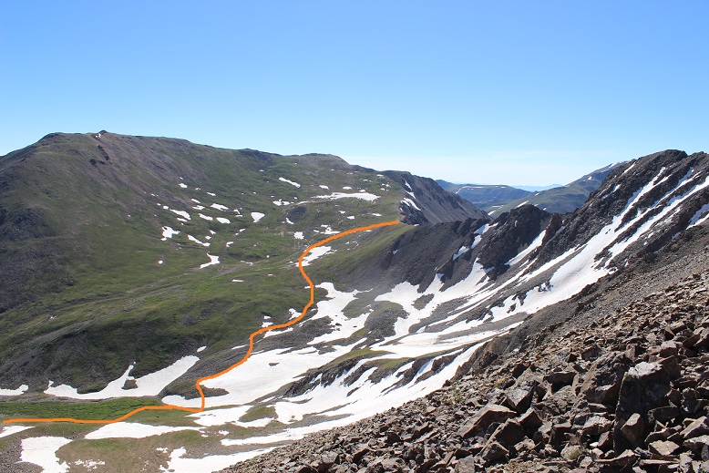
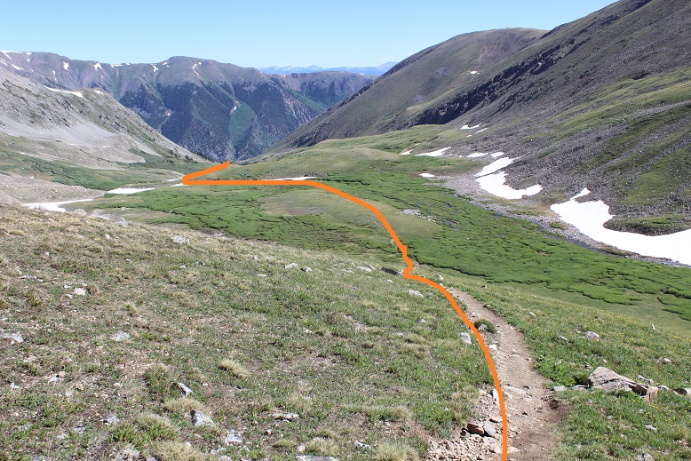
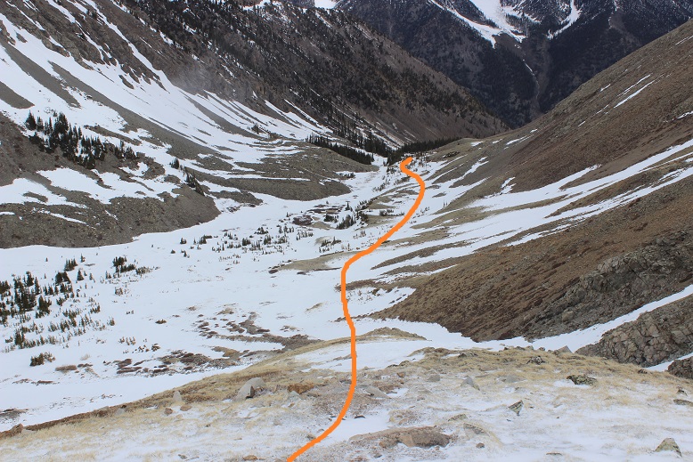
It was still dark as I navigated my way through the snow and sometimes trail up to Elkhead Pass. Here’s a look at the route from later in the day coming down from Missouri.  The snow was easily navigable, but seems like much more when you’re down there hiking through it.

12

I found myself at the top of Elkhead Pass at 5:15am. It had taken me 3 hours to get here (4.1 miles and 3580 in elevation gain).  Remembering how icy conditions had forced me to turn around here last time I was a bit worried to see snow at the top of the pass, but as I got closer I noticed there wasn’t as much snow as I’d initially thought.  (Sorry for the poor quality of the next few photos:  I took them in the dark and had to lighten them up so show details)

13

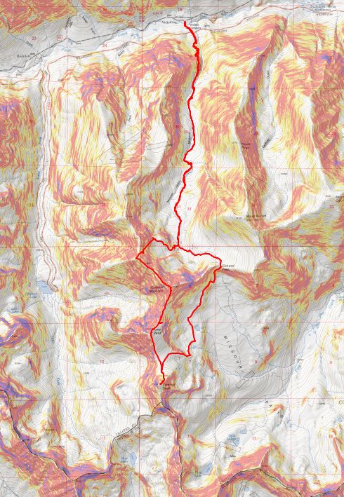
I descended Elkhead Pass, but not all the way to the bottom of Missouri Basin (Yes, Missouri Basin, not Missouri Gulch. We need to get more creative with these names people!).  I found a cliff band below Missouri and followed that towards the little lakes, as I didn’t want to lose more elevation than necessary.  Here’s the path I took hugging Missouri

14

At the cliff band I descended the least amount possible, heading towards the lakes

15

Here’s looking back at Elkhead Pass and the way down (don’t drop lower than necessary: there’s a trail that takes you all the way to the bottom; avoid that).

16

The area between Missouri and Emerald was mucky

17

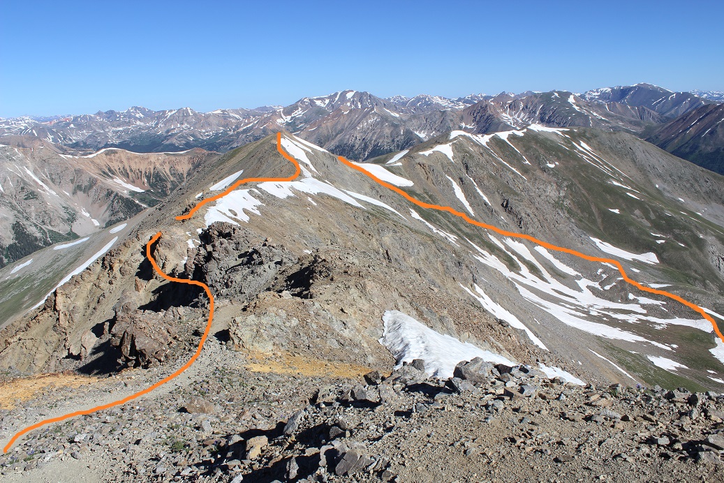
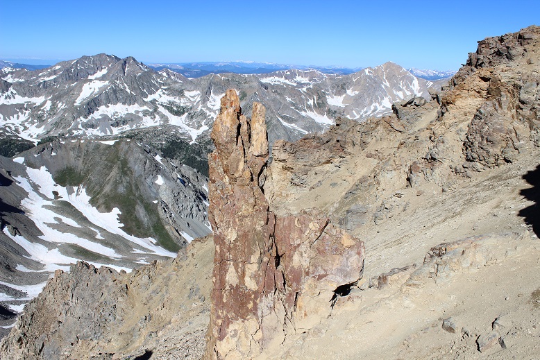
There are several ways to gain Emerald’s ridge. There was snow surrounding the access area to the south, so I went a little further north and took this path, avoiding the lakes and snow as much as possible.
18

Here’s a look back at the route and Elkhead Pass

19

Once I gained the ridge I turned right (west) and followed a faint trail up the ridge. (Note: the standard route up is the dotted line. I did not take this route because I wanted to avoid kicking in steps in the snow:  I wasn’t sure my feet would appreciate that today)

20

Instead I skirted the mountain to the northwest to the saddle between Emerald and Iowa and summited via Emerald’s north slopes

21

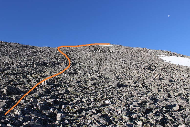
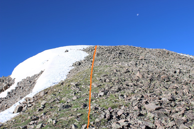
The last 500 feet or so to the summit were filled with scree/talus and tons of goat/social trails. Just aim for the ridge

22

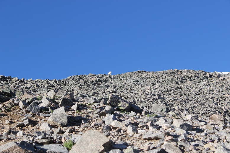
I had a goat watch me the entire way, then disappear when I reached the ridge

23

From the ridge I turned right (west) and walked my way to the summit

24

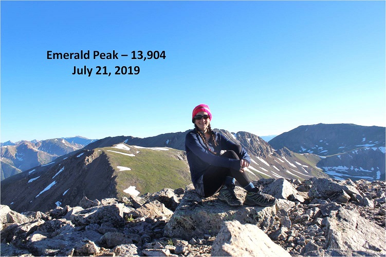
I summited Emerald Peak at 7:20am

25

Emerald:

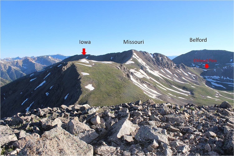
Despite the threat of forecasted afternoon storms this morning was beautiful! I looked over to Iowa and back at the route I’d taken thus far.  An idea came to me:  it looked like similar elevation gain/loss going over Missouri as it did going back over Elkhead pass.  I might as well tag Missouri again.  I decided to wait and see if the weather held out before making a final decision, but it seemed a draw either way.   Oh, and my feet were holding up, so that’s a plus.

26

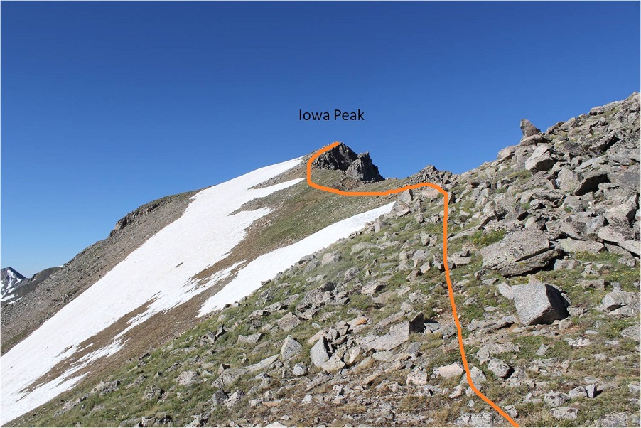
The route to Iowa and Missouri was obvious. I headed down Emerald’s north slopes and towards the Emerald/Iowa saddle and up to the summit of Iowa

27

The hike up to Iowa’s summit was easier than expected; I just stayed to the left of the snow on the ridge. Once again, a goat watched my ascent.

28

29

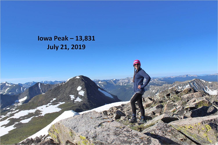
I summited Iowa Peak (an unranked 13er) at 8:10am. You can see Emerald Peak in the background of this picture

30

Iowa:

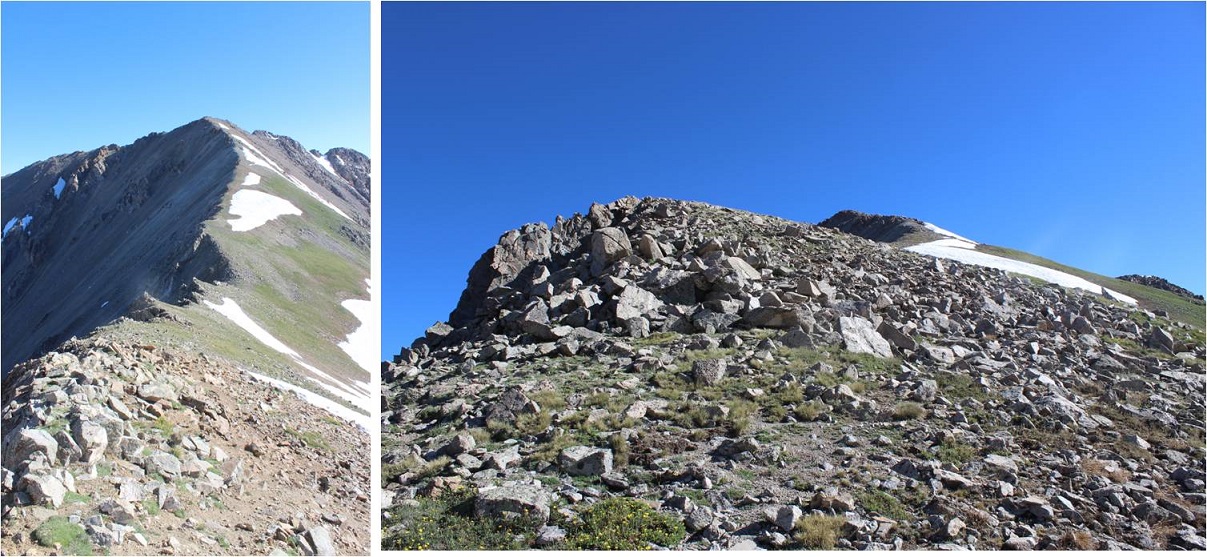
The decision had been made: on to Missouri!  Initially I tried to descend Iowa too far to the right (east) and had to turn back due to snow I didn’t particularly want to cross.  To avoid all snow it was easier just to follow Iowa’s ridge to the Iowa/Missouri saddle.

31

Looking back at Iowa from the Iowa/Missouri Saddle

32

The ridge up to Missouri was much, much easier than anticipated. I don’t know if it was the ibuprofen I took on Iowa or just conditioning, but I felt the ridge from Iowa to Missouri wasn’t very challenging at all.  In fact, when I made it to the top I’d assumed I was only halfway up, and actually asked the 10 other people I saw as I was approaching “Is this seriously the summit!?!?”  (Note to self:  not a good question to ask a group exhausted hikers when you aren’t even winded.  Tone it down a bit.).

33

I reached Missouri at 9am and asked one of the other hikers to take my photo because I thought it would look silly setting up my gorillapod.

34

Missouri:

Missouri had been an added and unexpected bonus peak today, and it has a summit marker!

35

Here’s a look back on Emerald and Iowa

36

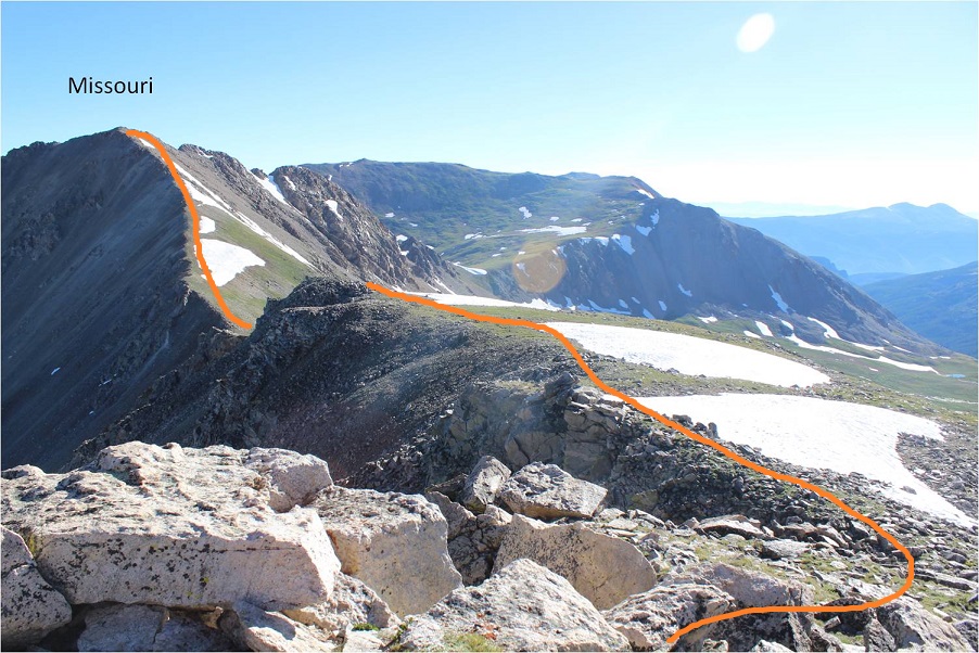
Knowing I couldn’t let my feet stop moving for long I thanked the photographer for taking my picture and headed back down via Missouri’s northwest ridge. There’s a great trail the entire way from the summit back to the Missouri Gulch Trailhead.  Here’s the route of the ridge

37

The crux area was much easier to navigate than I remember it being when I hiked Missouri last time. This time I could even hold onto the rock face for added stability if needed

38

Is this rabbit named?

39

Here’s a look back at the ridge

40

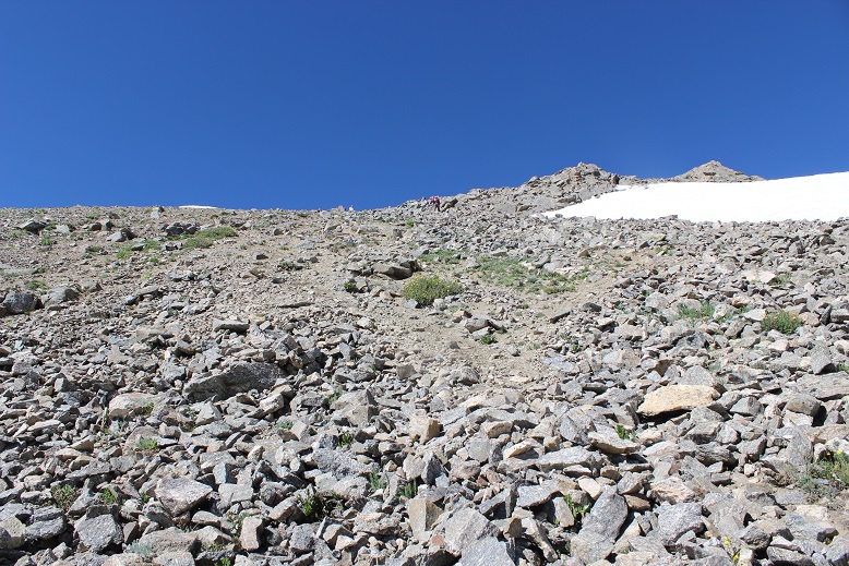
Exiting the ridge is marked by a cairn (and today a tiny bit of snow). After rounding the corner get ready to do some scree surfing.  (Note:  if you’re not a fan of scree (who is?), microspikes help provide traction.  Seriously, try them on scree, it’ll change your life).

41

Looking back up at the scree slope to gain the ridge

42

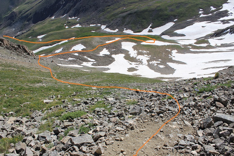
There were some slight snow fields to cross, but nothing that required traction

43

From here there’s an obvious trail back down to the gulch.

44

45

I met tons of people hiking on the way down from Missouri. It was the perfect day for a 14er, there are 3 in the area, and everyone was out.  I made it back to my truck at 11:45am, making this a 14.5 mile hike with 5985’ in elevation gain in 9.5 hours.

46

47

My feet did not look pretty when I was done but I was very pleased with today’s hike. I didn’t feel tired, even at the end.  My feet successfully made it the entire way without complaining (too much). I think the ups and downs in elevation gain on the ridges gave me little breaks that made all the difference.  I’m sure you could do this hike in reverse and feel the same way. I never saw the couple I’d seen at the trailhead in the morning, but I’m hoping they stayed safe and had a fabulous hike as well!

Mt Belford 14,197 via Missouri Gulch and Elkhead pass

1

RT Length: 9.5 miles

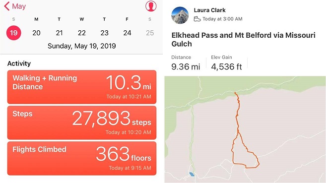
Elevation Gain: 4536’

I’ve been eyeing Emerald Peak for a while now, doing research and looking at feasibility for summiting this time of year with the heavier than normal snowpack. Unfortunately I wasn’t able to find much information (ok, any) for summiting with snow.  I did see a report from June of one year saying Elkhead Pass wasn’t passable, but it didn’t explain why it wasn’t passable.

I looked at a topo map and studied the slope angle of Elkhead Pass:  it didn’t look that steep.  I know a lack of reports for peaks over specific months usually means there’s a reason no one has summited during that time of year, but I wanted specifics.  I decided to be the beta and go out and see just why Elkhead Pass isn’t passable in winter.  And hey, maybe it was?  Maybe it was passable with more snow?

The drive in to Missouri Gulch was easy on a well maintained 2WD road.

2

I arrived at 2:45am, surprised to be the only vehicle in the parking lot. Hmmm… this is a pretty popular 14er trailhead.  This didn’t make much sense, especially for a Sunday.   Maybe I was just the early bird. (Nope, my truck was still the only one in the parking lot when I got back?)

3

The trail starts at the south end of the parking lot. You go left at the signs, cross a bridge and turn left to follow the class 1 trail up the mountain.

4

There’s immediate elevation gain that doesn’t quit. I rather enjoy this hike (this was my third time here). It’s always a little creepy hiking in the dark past the baby grave though.  The worst part is I know it’s there, but never actually see it in the dark because it’s just a little ways off the road.  So I know I’m passing it somewhere, but never actually know if I’ve passed it or not. (Anyone ever figure out why it’s so far away from the other graves?)

5

The trail conditions varied from bare to a couple feet of snow, but there’d been two hard freezes the past couple of nights so I didn’t need traction.

6

About half a mile before the cabin I came to the avalanche area. There was an avalanche here a few weeks ago, but I’d heard it was passable.  It was, even in the dark.  The beginning required a little creativity, but once I was in the avalanche area there was a clear path to follow that had been made by other hikers.

7

If it doesn’t snow again I’m pretty sure this will be the new route.

8

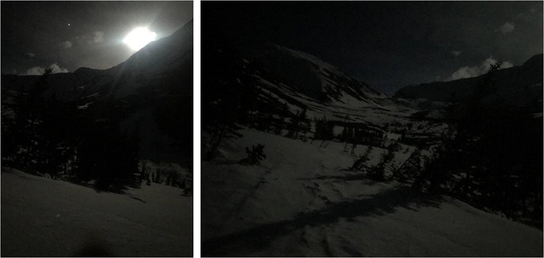
This new route picks up with the old one just before the cabin. Here the snow picked up as well and I put on my snowshoes.  There was a full moon this morning, which really made the gulch come alive.

9

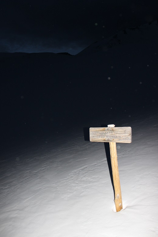
I followed the basin on my own path as the trail was covered in snow (at least most of the time). I made it to the junction for Elkhead Pass and Missouri Mountain and turned left (east).

10

I started hearing and seeing ptarmigans as the sun began to rise (here’s looking back at the way I’d hiked in)

11

I followed the basin to Elkhead Pass, which was surprisingly easy: I’d expected more of a challenge.

12

At this point I was beginning to think I was actually going to summit Emerald today. I took a closer look at the Missouri Basin (not the gulch, which I had just come from) and planned out my intended route.  I was trying to decide if I should head over to Iowa or Emerald first, but from this distance I couldn’t tell what the snow conditions were on the ground, so I decided I’d decide when I got there.

13

I started heading down Elkhead pass and immediately turned around. Snowshoes weren’t going to do it: this was steeper than it looked!  Ok, crampons on, time to try again.  I could see where I needed to go, but I just couldn’t get there.  The pass was a sieve for wind:  Intense wind that didn’t often let up.  On top of that the ground was slick like a frozen waterfall (probably due to warming during the day and freezing at night) but the ice was covered in about 3 inches of soft snow deposited by the wind.  It made for an awkward small-cornice-like structure that seemed to extend all the way down the pass.  And the drop down was serious!  This picture shows the easy part of the decent (camera was put away for the more difficult parts, sorry!)

14

I made it past the ice covered rocks to the snow covered ice and retreated up, back the way I’d come.

15

At the top of the pass I once again tried to look for an easier way down, but the snow blanketed everything and I couldn’t tell where the icy-snow pass ended and the basin-snow began. I also couldn’t truly get a feel for how steep anything was just by looking.  I tried again, made it about 30 feet down, and once again felt unsafe as I couldn’t get a good hold with my crampons.  A big gust of wind picked up and I hugged the side of the pass for a good minute or so waiting for it to stop, and then I used my ice axe to climb back to the top of the pass.  Seriously, it didn’t look this steep on the topo map!  I made it to the red circle twice.

16 Elkhead Pass

This was frustrating. Climbing up was no problem at all (I’d done it twice already), but the down climb wasn’t happening.  I felt confident someone could make it over this pass; someone with more skills than I or maybe a backcountry skier (it looked skiable, but I don’t backcountry ski, so I’m not sure).  Today I was not going to make it over this pass.  The problem here was, due to the wind, there wasn’t enough snow, just ice.  In fact, I didn’t like the look of it at all, and will most likely attempt Emerald next time from the Rockdale Trailhead.  At this point, I’d rather do Little Bear again than Elkhead Pass (seriously, summer or winter, I felt safer on Little Bear, and that’s saying something!).

Enough complaining. I was here, what did I do now?  I’d taken a good look at Missouri Mountain on my way in, and that was a big nope.  I turned around and immediately decided to hike up Belford from where I was.

17

No, I didn’t have a route description or instructions, but I’d summited Belford before and knew it was just… well, right there. It looked very doable, so I decided to go for it.  Here’s the route I took:

I kept heading east to the top of the ridge (the wind wasn’t stopping)

18

19

And then followed the ridge north towards the summit of Belford

20

I turned and looked back on Elkhead Pass: It really didn’t look that difficult, did it?  (Sigh)

21

The ridge had areas of deep snow that I much prefer to icy rocks, so I put on my snowshoes and headed north

Halfway along the ridge I paused to take a look at Oxford.

24

It looked like fun, but there was a storm coming in and I didn’t want to get stuck in it all the way over there, so I waved and kept heading towards the summit of Belford.

25

I was a little worried about the last bit of climbing, but once I was there it wasn’t so bad

26

I summited to amazing views and intense (intense!) wind

27

The wind was so intense it kept knocking my camera over, so I took a selfie instead (with my DSLR)

Belford 2

I love how this mountain has a summit marker!

29

OK, time to head back and make this a loop. The only downside was I hadn’t hiked up the north slopes and I’d passed them in the dark, so I wasn’t sure of their current conditions.   I thought to myself I could always turn back and descend the way I’d hiked in if I needed to.  I paused and tried to remember which way was down?  I knew there was a huge gully I wanted to avoid… I was pretty sure this way was the correct way down?

30

I headed that way and found a cairn (woot!) and what might have been a trail.  I turned around and looked at the way I’d come

31

And now I was headed down…

32

This was actually trickier than it sounds. While I couldn’t much get lost here, the rocks were very unstable, as were much of the large areas of snow.  I did not feel secure on any of the snow on the way down:  it all felt ready to fall.  The wind didn’t help either.

33

After about 300 feet the steepness mellowed out and it was a rocky walk down the ridge, avoiding the gully and slipping on the very loose rocks every 20 feet or so (I have a bruise on my bum to prove it)

34

There were also long sections of snow (I kept putting on and taking off my snowshoes). Here’s looking back up at the way I came down

35

Back in the gulch I knew there wasn’t a trail, so I stayed high on the snow and made a beeline for the cabin

36

Here’s the route I’d taken earlier in the morning from the gulch to Elkhead Pass.

37

Just past the cabin I was able to see in the light of day what the avalanche had done. It hadn’t been a big avalanche, yet it had altered the route of the trail.  Here’s the way back to the trail

38

The rest of the hike down I thought about what had happened today. I was a bit bummed about Emerald, but had only given that a 25% chance of success to begin with so it wasn’t the end of the world.  Time to start researching alternate routes (I know there are a couple).  I was excited to discover you can summit Belford from Elkhead pass.  In fact, I thought it was a much easier route than the north slopes.  If I were to summit Belford again I’d absolutely chose to take Elkhead Pass, as it makes the elevation gain easier.

I made it back down to my truck at 10am, making this a 9.5 mile hike (it felt like more) with 4536’ in elevation gain (it felt like less) in about 7 hours (much of that time spent trying to navigate the pass).

Here’s the Relive

39

40

41

Summit Sticker can be bought here