
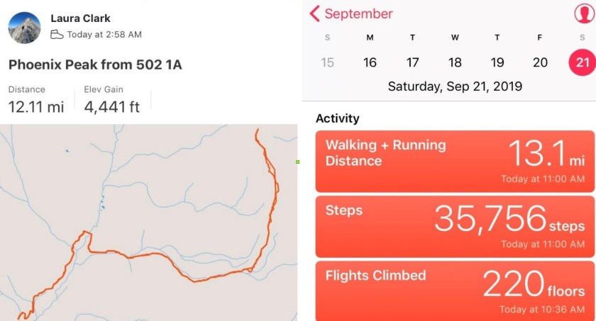
RT Length: 12.5 miles
Elevation Gain: 4441′
The last couple of trip reports have been rough to write: I’m traveling for work and using my work laptop computer for these write-ups which isn’t ideal. My work laptop doesn’t have simple functions like spellcheck (so please go easy on me there), everything I have is a “reader” and the keypad is slow, inaccurate, and last night it stopped working altogether. I googled the nearest computer store and this morning walked 2 miles to buy a computer mouse. I’m hoping the problem’s solved, but not holding my breath as the laptop is several years old and I’ve taken it to dozens of states and multiple countries so the hardware has been switched several times (I work for a software company, so this is a security measure). Side note “just in case”: I’m using this computer during off working hours, and not using it on company time.
After summiting Rio Grande Pyramid yesterday I hopped right back in my truck and drove the short drive to Creede, CO. I knew the ‘easy’ road in (503) had been washed out, so I was getting creative and took in the 502. I Google wasn’t going to get me there, so I’d created the route on Caltopo and turned it into a gpx file. I credit this ability to those who’ve challenged my summits, as a few months ago I wasn’t even aware this sort of thing was possible because I don’t use a GPS when hiking. Now knowing this is a possibility with Strava it’s opened up a lot of back country roads for me! Woot! I made it to my desired area with no difficulties.
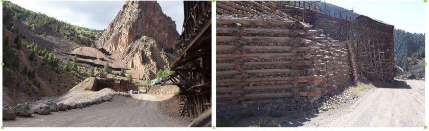
At the north end of Creede I took the West Willow Creek Road up past numerous mines and then turned right onto a 4WD dirt road after the Midwest Mine (County Road 502).
From this point on I was glad I’d creaded a GPX file, as the roads itersected a few times and it was nice to know I was going in the right direction. The road was easy 4WD with little room for passing but luckily I was the only one on the road on this Friday afternoon.
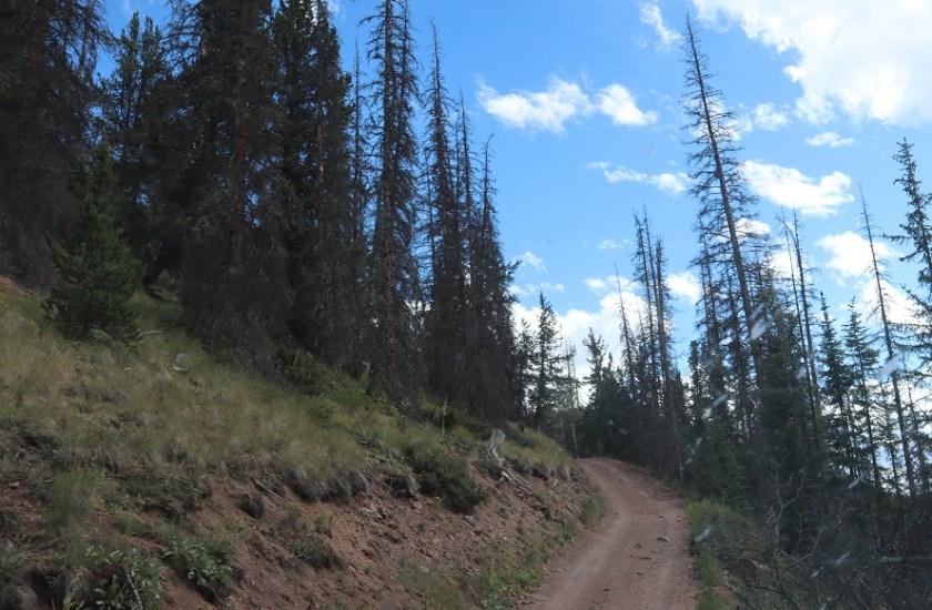
There were 2 hairpin turns where I had to back my truck up a couple of times to navigate, but my Tundra had no problem making it to the 502/502-1A junction.
When I made it here I got out of my truck, looked at the 502-1A 4WD road and said “nope”. I wasn’t doing that road to my truck (this ended up being a stellar idea). I carefully backed in to a spot big enough for 2 vehicles if we both parked nicely and got out my maps/info for tomorrow. I’d parked next to a small creek that hadn’t been on the map but I knew where I was on the road.
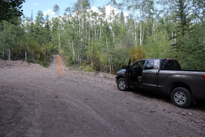
Today had been a long day so I had some tuna, a few pieces of beef jerky, some dried fruit and two shots of whiskey before heading to bed rather early (5:30pm?). I was parked at the beginning of 502-1A and a little worried because the area was so small that I’d impede traffic but on the positive side I didn’t see one vehicle that night.
It was a cold, cold night. My altimeter told me I’d parked at 10,000′, and the forecast told me it was supposed to be a low of 30* at the summit (a few miles and several thousand feet of elevation away). It was colder than 30* where I parked. I woke up halfway through the night and put on socks (they were off because they needed to air out after yesterday) and I even got out an extra sleeping bag and put on my knit hat. It was so much colder than last night! I was thrilled when my alarm went off at 2:30am, and puzzled when the first thing I saw was a vehicle coming down the road at me. Kind of interesting the only vehicle I’d see at all was one at 2:30am. They didn’t stop and I never saw them again, so I’m not sure where they were headed. I put on my winter gear (winds were expected again today and it was already below freezing outside). I was on the trail by 3am.
I started the morning with a Raynaud’s attack in my hands and was worried this would prematurely end my hike. I put on my gloves and pumped my fingers back and forth: this hasn’t happened in a while and I wasn’t happy.
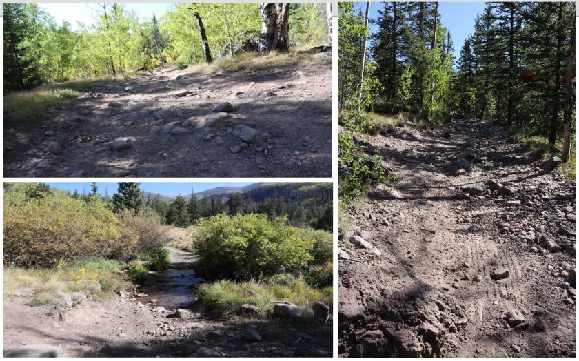
Immediately I was glad I’d decided to park my truck and hike to Phoenix Park. The road was what I’d consider “extreme 4WD”, and nothing I’d subject my Tundra to. The pictures don’t do it justice; you need high clearance and a good dose of insanity to navigate this road.
The only downside? The road started around 10K and seemed to loose hundreds of feet in elevation. It was actually only a couple hundred feet, but it felt like forever and I was worried it would ‘hurt’ on the way out.
After 1.6 miles I made it to the turn off from the 4WD road to the trail (787)
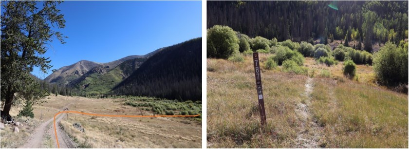
Well cairned but not well established, the 787 quickly crosses a stream
and comes across an avalanche area. I’m not sure when the avalanche occured, but there’s a trail to the left of trampled down grass to follow
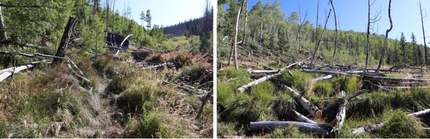
This trail doesn’t look like it’s used often, and would be difficult to follow if it weren’t for the numerous cairns marking the way as I headed northeast

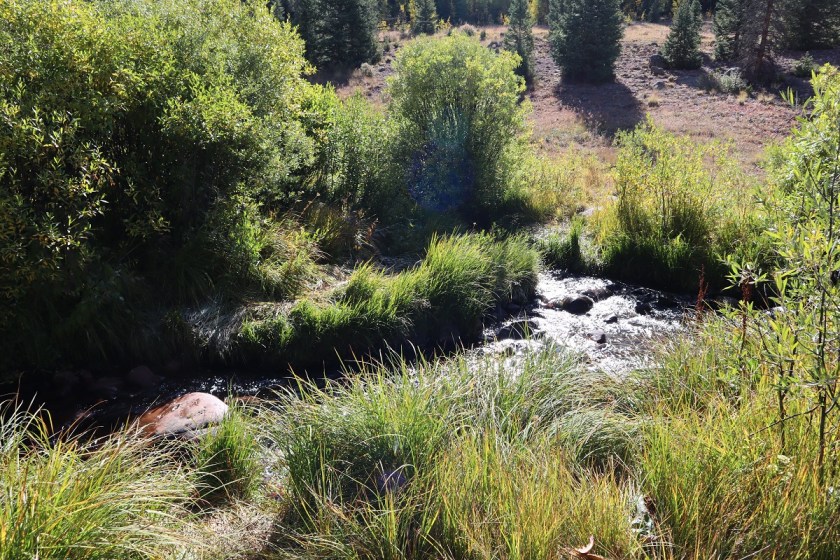
Still hiking in the dark I was now starting to get really cold. I switched my gloves for my mitts and trudged on, glad there wasn’t any wind. At 2.3 miles I came across another stream crossing and then quickly another at 2.4 miles

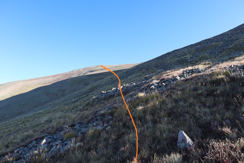
At this point I began to regain all the elevation I’d lost earlier in the morning. I could tell I was surrounded by raspberry bushes and lots of shrubs and plants turning fall colors, all covered in frost. I scared a bunch of ptarmigans at one point and they scared me as well. About halfway to the top of this area I could smell sheep (I used to raise them, and they have a very distinctive smell). Since it was dark I decided to figure out where they were: I hit my trekking pole harshly against a tree and heard to my right a loud snap, bleat, and rustling. The sheep went in the opposite direction and I continued on, following the cairns. I crossed one final stream at 4 miles. Here is where the trail ended.

I headed south until I came across a cairn with a large wooden pole, turned right (east) and followed the slope in the dark
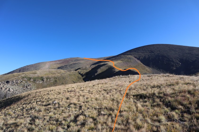
Here there was a solid trail for about 200 yards that went along the ridgeline

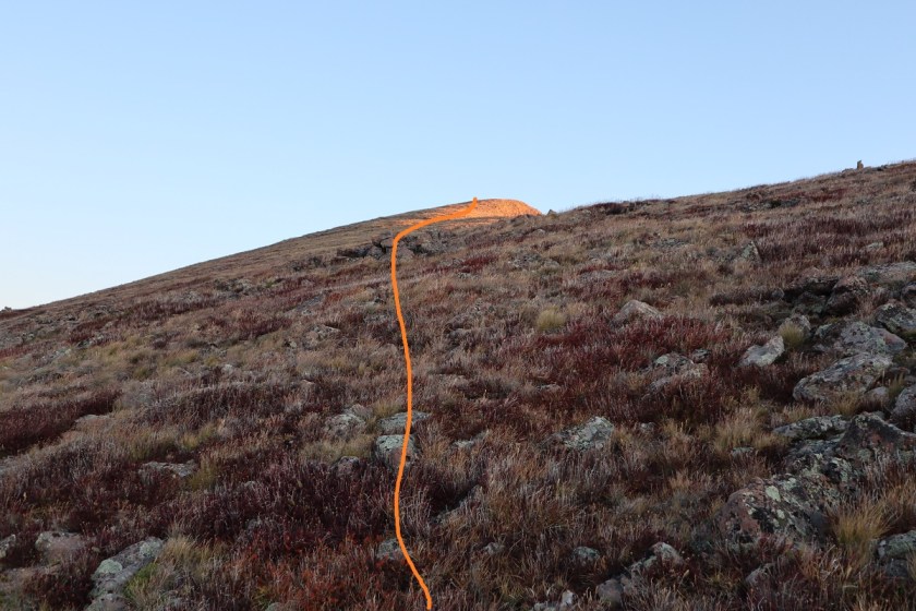
and once I made it to the end of the ridge the trail disappeared. From here I just needed to head to this point, and there was no exact way to get there so I took what I felt was the path of least resistance. Note, this point is NOT the peak, but it’s close.
Halfway to the ridge it became windy. By ‘windy’ I mean sustained 40mph winds with a few icy 60mph gusts thrown in. It was so cold my water bladder froze (something I hadn’t anticipated with a forecasted low of 30* on the summit). I kept pumping my fingers back and forth, put on my balaclava, and trudged on, noticeby tired from yesterday’s 25 miles. I heard an elk bugle in the distance and thought how amazing it was to be out here all alone.
The sun began to rise as I was halfway to the point
The wind never stopped. There’s a lot I could say about the cold for the rest of the hike, but I’ll end it here: it was cold, cold, cold. And windy. The kind of cold and wind where the snot dries as it’s flying from your face and then comes back and freezes to your cheek (another reason I like to hike solo: not the most glamerous of moments).
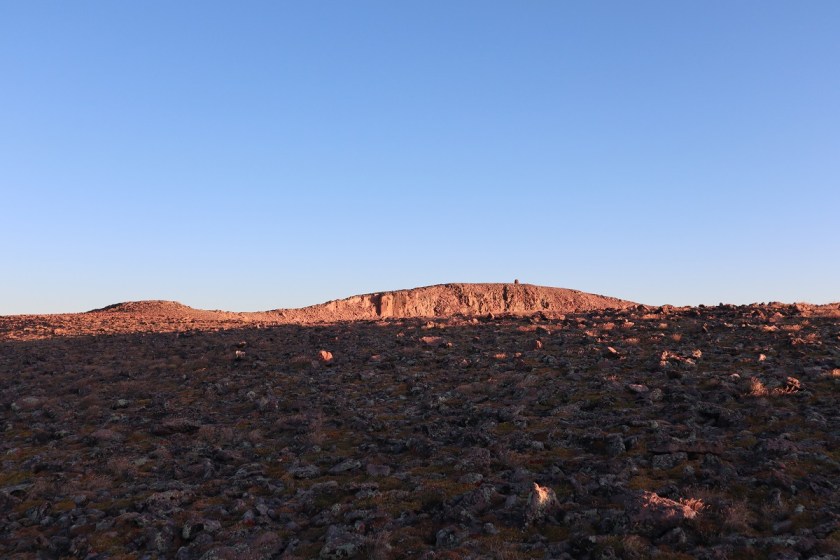
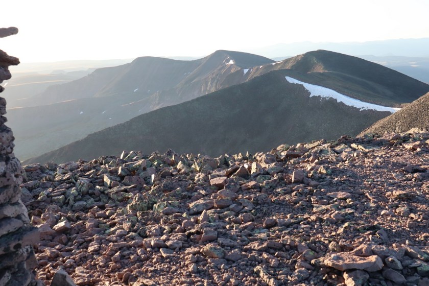
At the top of the ‘point’ I could see the rest of the route before me. Thankfully it was short and there was a well developed cairn to welcome me.
I just followed the ridge to the left as it swung around to the right
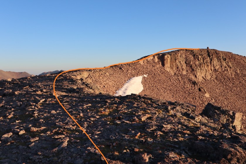
The rocks here were looser than expected but it was an easy final hike to the summit.

I summited at 8:15am
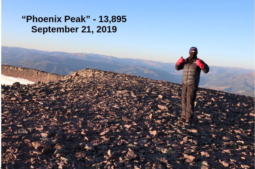
“Phoenix Peak”:
From here I could see unranked 13er la Garita Peak, but it wasn’t on my agenda today because I needed to get back home to watch my daughter perform at halftime. After getting a quick summit photo and video (the cold is telling me this may be the last of the year) I headed back down.
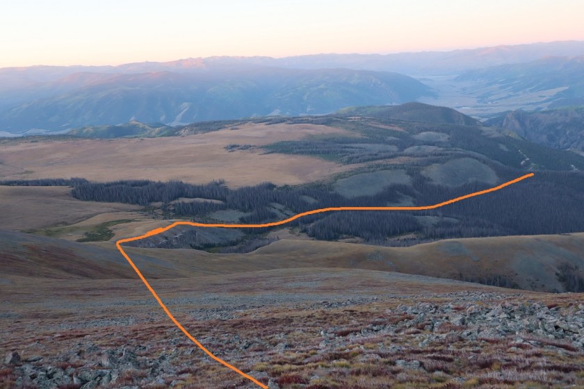
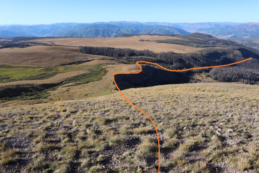
Here’s the route back down. Be careful not to desced too soon (specially if you ascend in the dark). There are two ridges you can take back down, and the correct one is the second one you see from the summit.
I made it back to the large cairn

and headed back down the hill (stay below the boulders)

The wind stopped just where it started (about a mile and a half below the summit) and I was able to warm up. Back in the treeline I took off my gloves and balaclava and tried to crunch the tube of my water bladder to get water to flow. It was light now, so I stopped when I came across a large raspberry patch. I picked one and it crumbled in my hand. Curious, I took a closer look and upon further inspection realized they were frozen! Not completely frozen but frozen enough to add a small crunch and a much needed flare to their refreshment (for in the sunlight I was now warm). I picked a handful and ate frozen raspberries for the next 10 mintues, wondering why there weren’t any animal tracks near here? The currents weren’t as tasty, so I left those for the birds.

The sheep were gone and I never saw any elk, but I did see and hear dozens of crows on my way down. I wondered what had died? There was a stream along the avalanche area

and here’s a look out from the last stream crossing back onto the 4WD road

It was still 1.5 miles back to my truck, and as I walked this road I was thankful I hadn’t taken my truck this way: it was worth the walk, and actually not that bad. The last few hundred feet of elevation gain I’d been dreading was all completed in the shade and didn’t slow me down that much.

I made it back to my truck at 10:30am, making this a 12 mile hike with 4441′ in elevation gain in 7.5 hours.

I drove home and made it in plenty of time to be at my daughter’s performance. I put all my dirty clothes in the laundry and when I changed it found a dead grasshopper in the bottom of the bin. Sorry little guy! I’m sure it got caught in the holes in my snow pants (I REALLY need a new pair, but despite shopping at multiple stores can’t seem to find one that fits).
