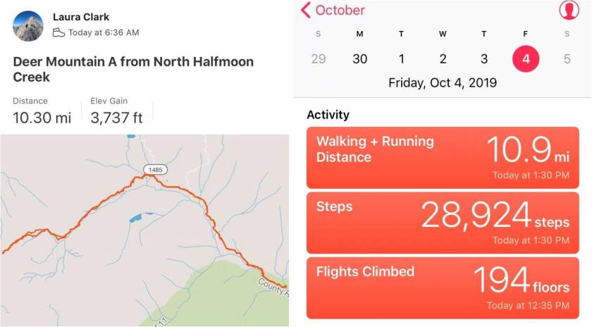
RT Length: 10.5 miles
Elevation Gain: 3737’
Immediately I knew something was wrong. It was still dark outside, but my alarm hadn’t gone off. I threw back the covers and grabbed my phone: it was 3:24am. Drat! If I were the kind of person to swear several choice words would have been uttered. I had set my alarm correctly for 11:45pm, and wasn’t sure why it didn’t go off? I need a new phone because stuff like this keeps happening.
I’d wanted an extra early start today because I was meeting a friend to go Raft-packing tonight and wanted to get there with plenty of rafting in the sun time. Oh well. I sent a quick text to my friend saying I’d be a little later than intended and was out of the house by 3:30am.
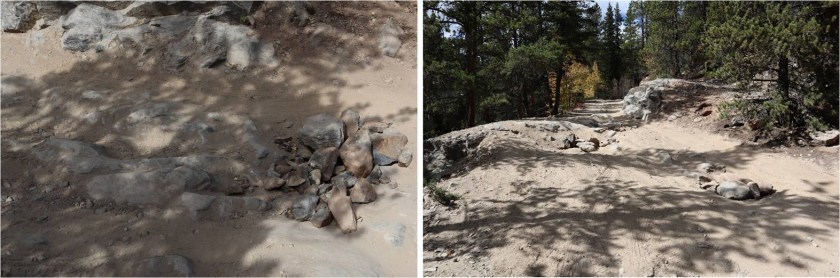
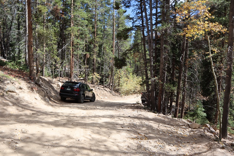
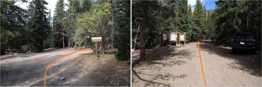
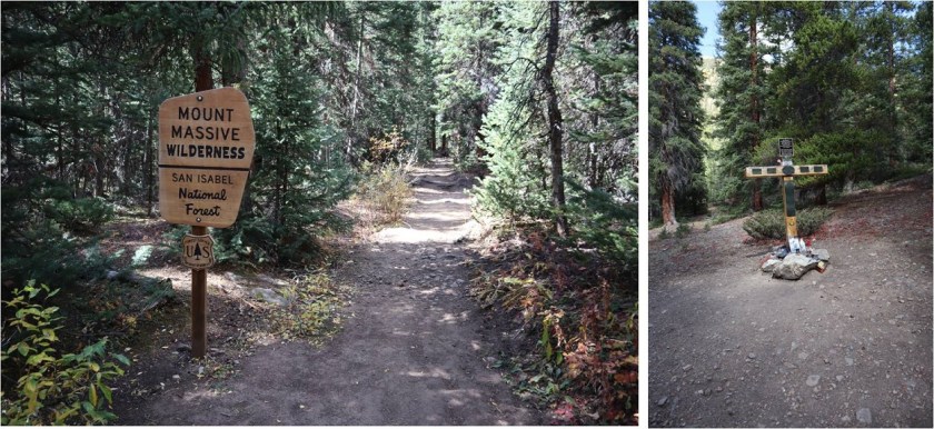
I made it to the North Halfmoon Creek Trailhead at 6:10am. Well, almost there. Someone had put large rocks in the last ‘difficult’ area before the trailhead (most likely an owner whose vehicle shouldn’t have been out here in the first place because it didn’t have enough ground clearance). In any event, I just got new tires yesterday and didn’t want to subject them to those pointy rocks (mentally grumbling because I wouldn’t have thought twice about this section if the rocks hadn’t been there). So I made a 30-point turn and parked just below the trailhead on the side of the road. When I came back another driver with a competent vehicle had done the same. I put on my helmet and started on the trail at 6:30am.
As I got out of my truck it started raining. Luckily it didn’t last too long. There was a 4Runner in the lot when I got there (the only other vehicle I saw all day). The North Halfmoon Creek Trailhead has wonderful signage.
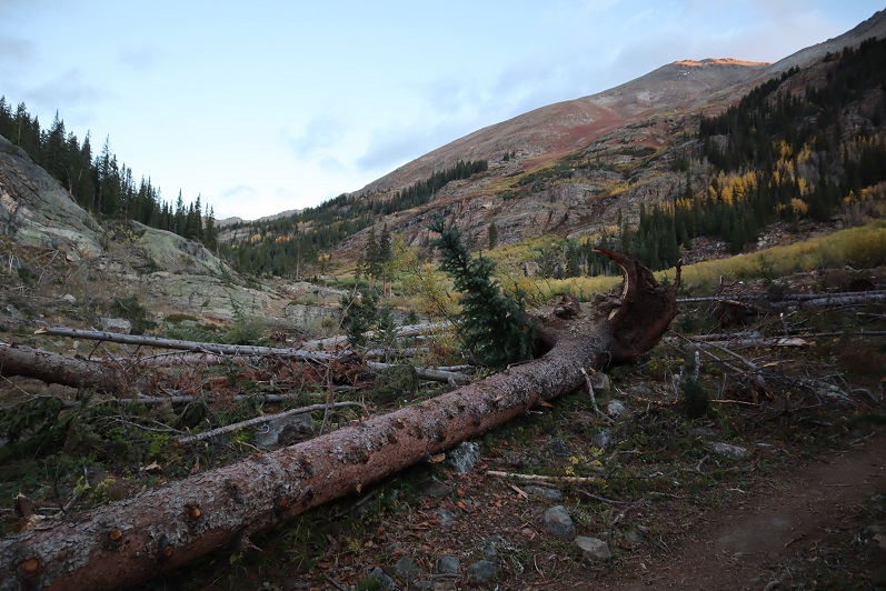
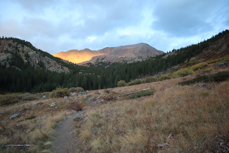
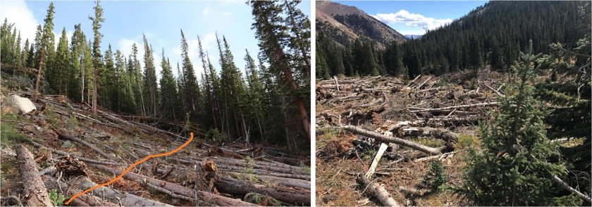
It was weird starting this hike in the daylight: I haven’t started a hike this late in a very, very long time. It made route-finding so much easier! There were a bunch of small avalanche areas along the trail which had been cleared so they were easy to walk through.
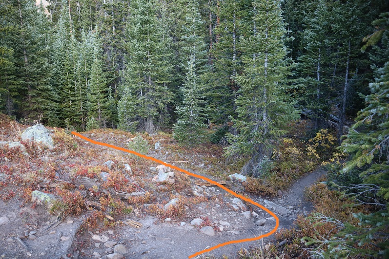
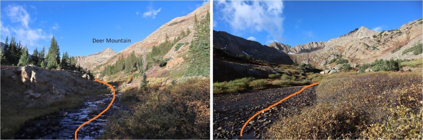
The first part of the trail is very easy to follow
I continued straight at the Mt Massive turnoff
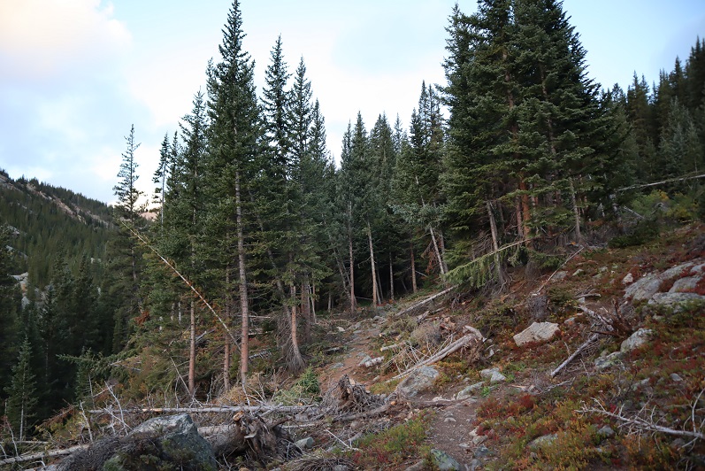
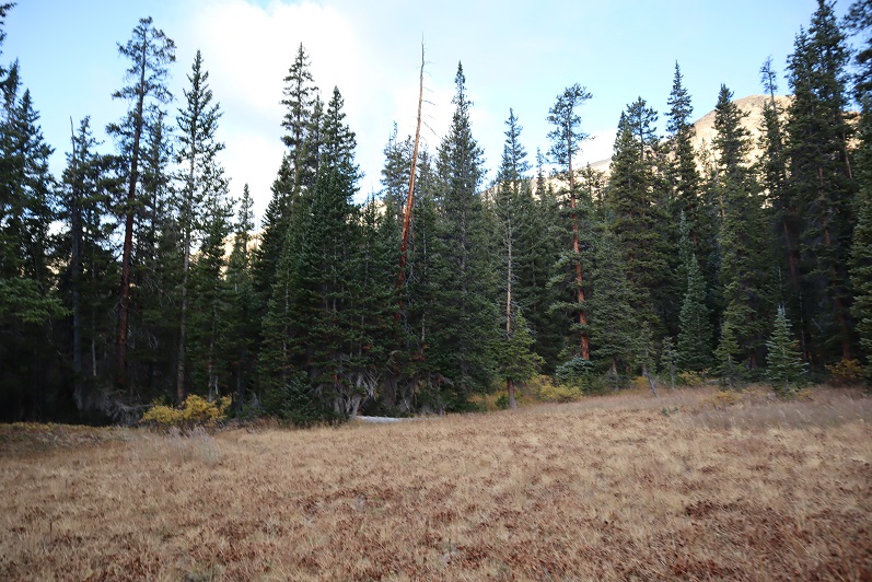
Through a small forested area
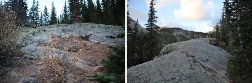
Up a large rocky area
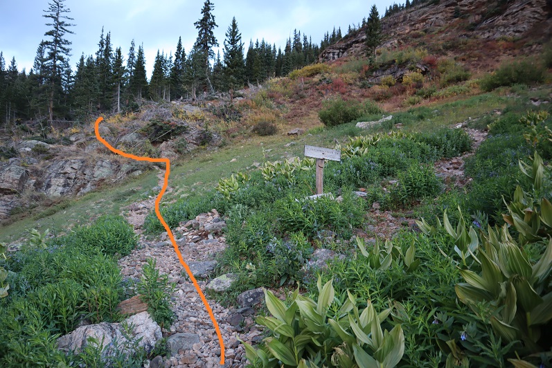
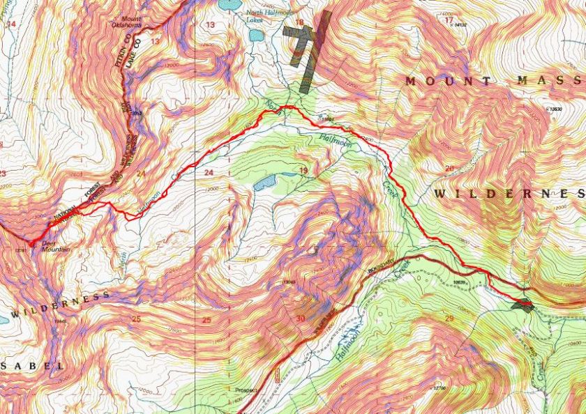
And came to this junction. Here I went left, even though it’s ‘blocked off’. I believe going the other way takes you to Mt Oklahoma.
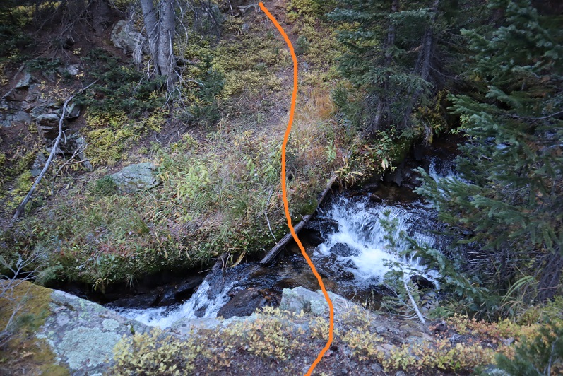
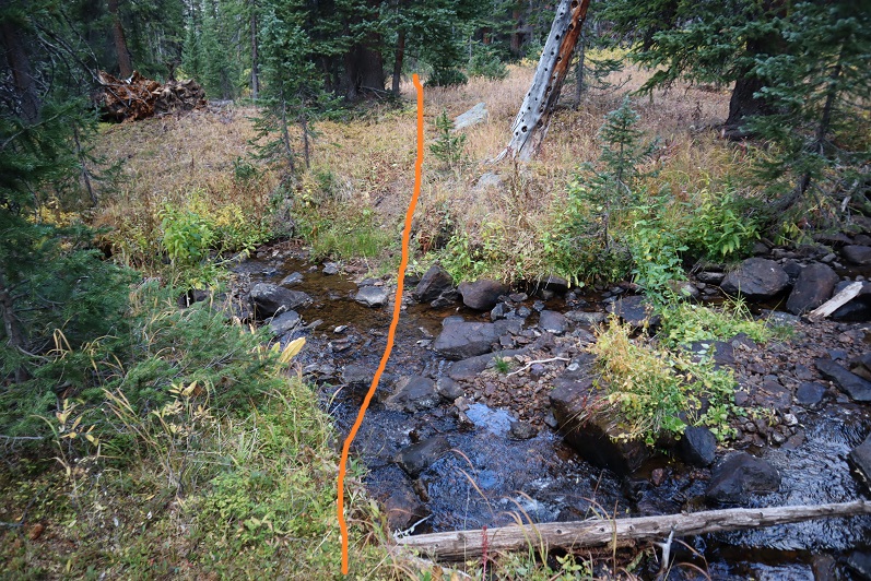
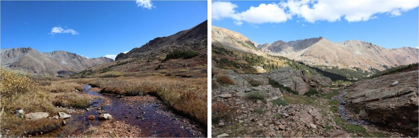
Here the trail ends and the fun begins! I traveled west, crossed a small stream
Continued across an open area back into the trees
And crossed another stream
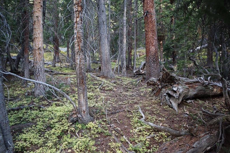
Back into the trees the ‘trail’ looks like this
I angled southwest down the mountainside, losing about 100’ in elevation. There were tons of game trails here, but not one that were consistent.

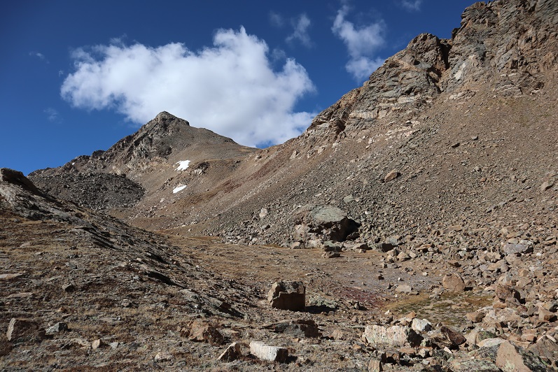
After losing about 100’ of elevation I came to a recent avalanche area. It hadn’t been cleared and there’s no straight path through the debris. It started to snow. At this point I was glad I’d started late because this wouldn’t have been fun to traverse in the dark. Luckily it wasn’t too difficult in the light of day. I just looked for the path of least resistance, crossed, and then headed down to North Halfmoon Creek. The snow ended before I reached the creek.

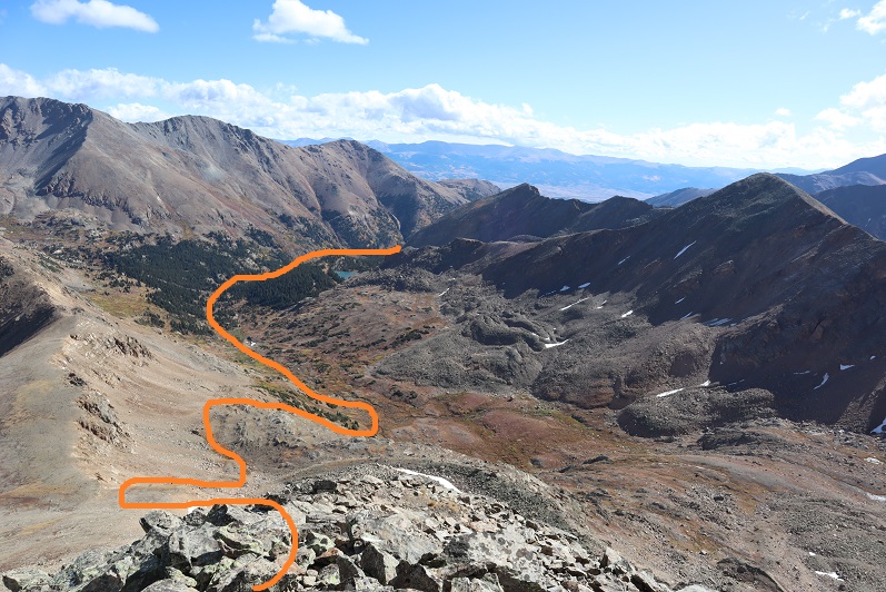
When I made it to the creek I followed it to the end of the basin. At first I walked through the willows, but (obviously) this wasn’t ideal
After a few dozen yards I looked over at the creek, noticed the top of the rocks were dry and decided to just walk along the creek to the end of the basin. This ended up being a fabulous idea and saved me quite a bit of willow-time.
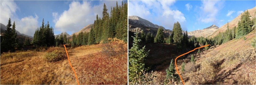
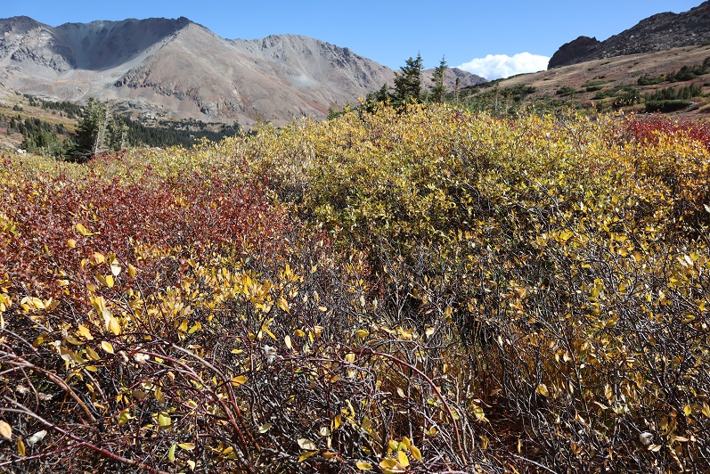
At the end of the basin the creek becomes a small trickle. Here I turned right (northwest) and headed up a grassy gully and then another, more rocky gully. The grassy gully was full of terribly mean-prickly plants.
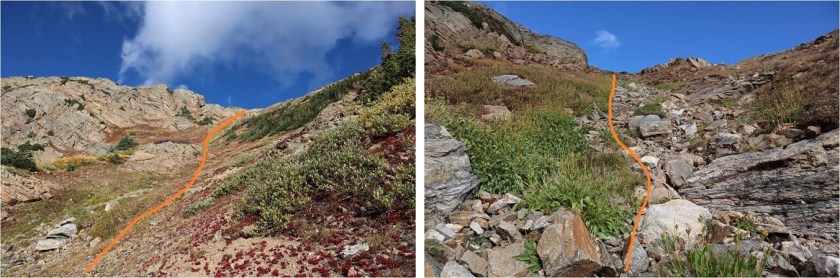
Here the terrain became rockier, with loose talus and unstable rocks. At the top of the gully I turned left (west).
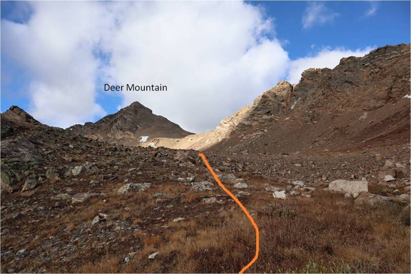
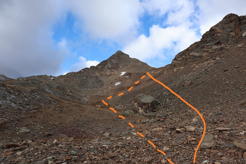
The goal from here is to gain the saddle. I took the solid line up (thinking it would be easier) and the dotted line down. The dotted line down the gully was much easier. If I were to do this again I’d take the dotted line both up and down the saddle.
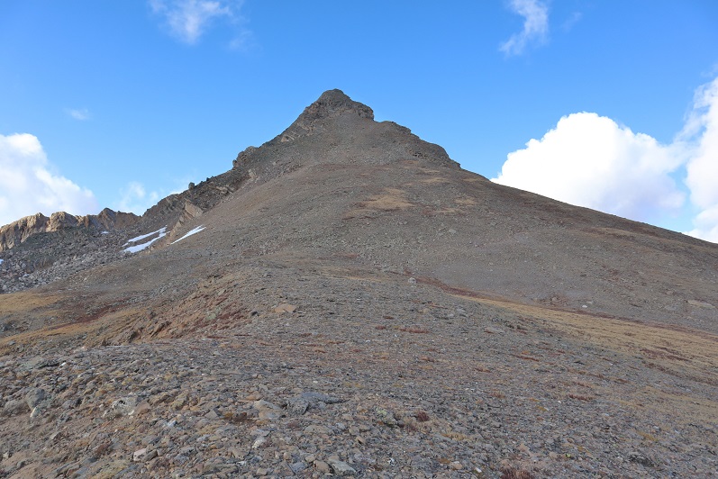
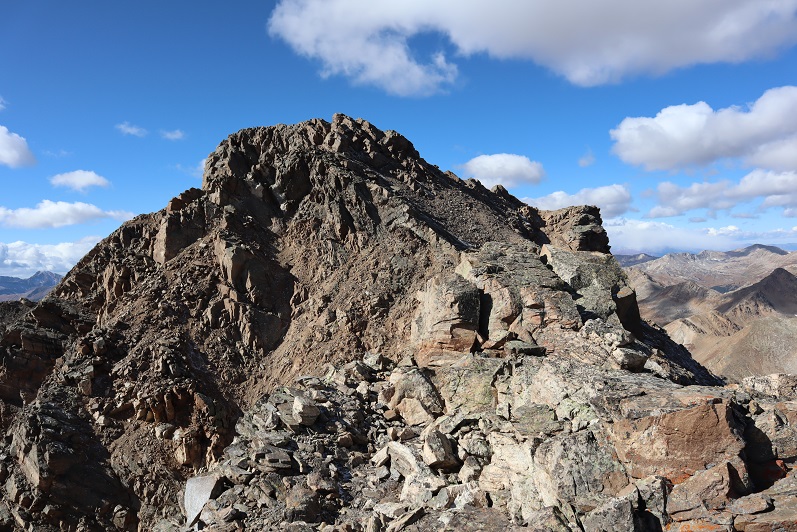
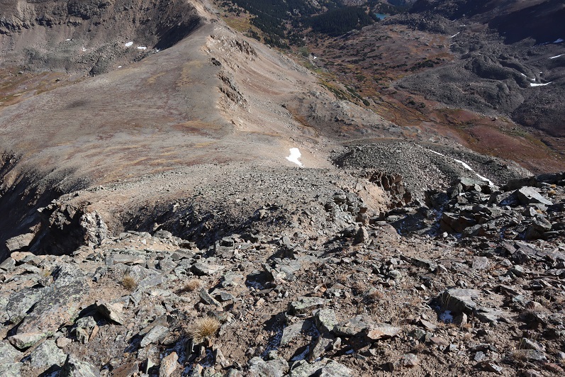
At the saddle I turned left again. My goal now was to gain this point (which is a false summit). Once again, with no trail I just headed towards the peak. This is steeper than it looks, but still class 2
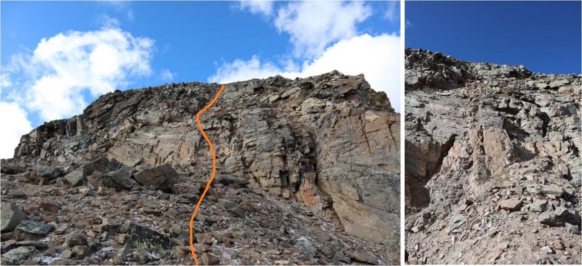
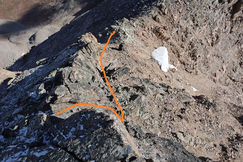
Until you get here, and then it becomes a class 3 chimney. There are several chimneys to choose from. I went straight up the center. It was a little loose, but there were plenty of hand/foot holds.
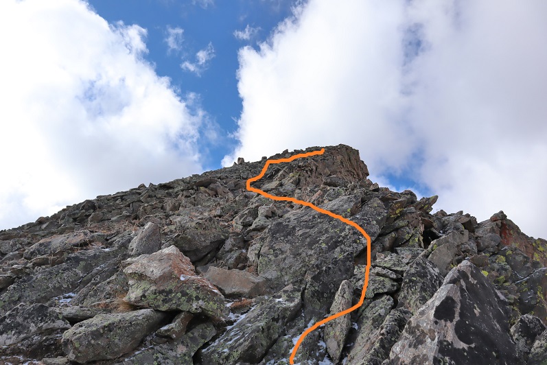
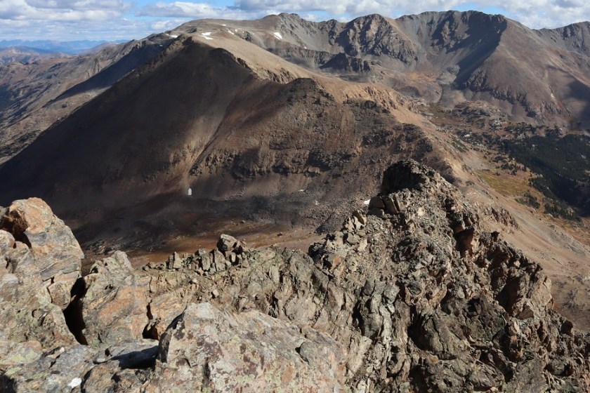
At the top of the class 3 chimney I still wasn’t there: I continued along this ridge. The best option here is to stick to the right.
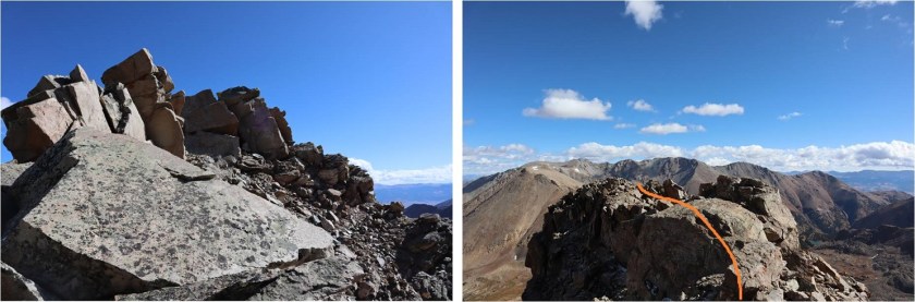
As you can probably tell by the photos, here’s where it started to get icy. What you can’t see is that it was quite windy as well. I made it to the final ridge section and had a choice: I could turn back now and attempt Deer Mountain A at another time, or be extra-super careful and continue on. I kept going, but slowed down my pace so I could be extra careful where there was snow/ice.
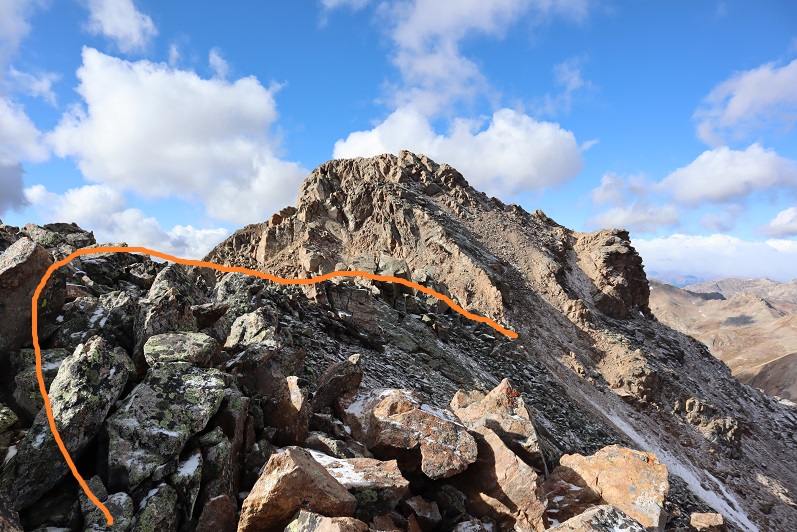
This ridge is short but packs a punch (especially with wind, which there was). The boulders here are very large and unstable, with huge gaps between them you could fall through. Also, there’s exposure. I’d liken it to Halo Ridge but add larger drop spaces and tons of exposure. I would not want to do this in winter where the snow would make invisible the huge gaps between the boulders. Somewhere along this ridge the wind swept the paper I had made with instructions on how to attempt the final summit push out of my pocket. Lovely.
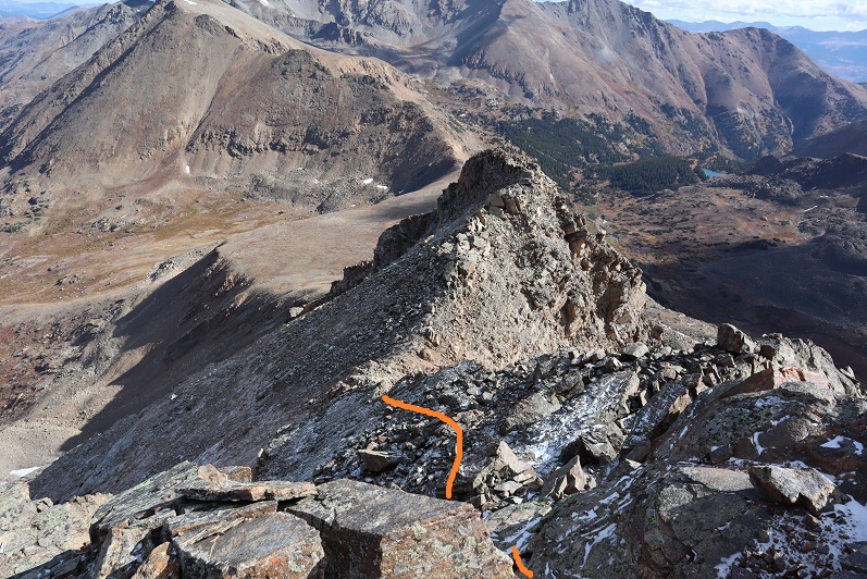
Once across the ridge I came to the most difficult part of the climb. This is class 4, and took me a few attempts to figure out (I hadn’t quite memorized the instructions I’d just lost). At first I started with the circled area, but about ¾ of the way up came to a place that felt way too committing to be class 4 (even for someone short like me) so I retreated and tried again.
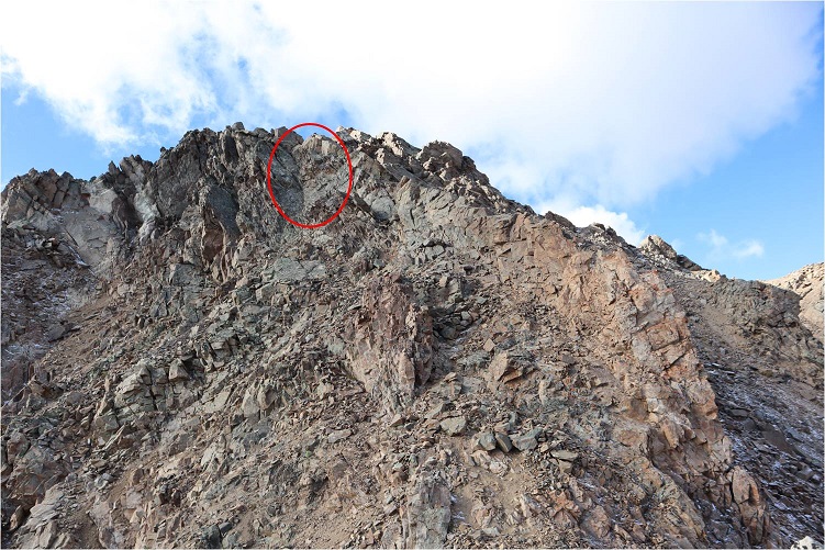
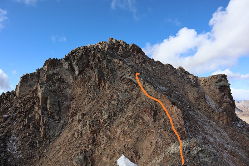
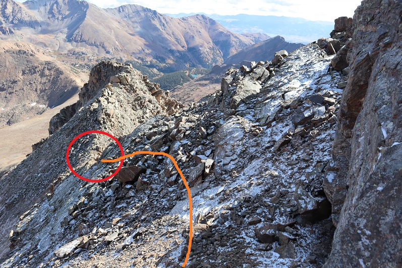
I took another look behind the ridge and decided this was not the better option, as this side was much icier than the one I wanted to climb. I tried again in another area and this time was successful making it over the ridge. I had to take off my mittens here to climb, and my fingers were becoming numb: I kept putting them on and then taking them off again to climb. Here’s the route I took. This felt solid class 4.
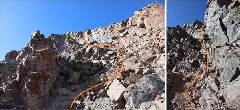
Once on top of the ridge I wasn’t happy to see all the ice (it’s pretty much invisible in these photos, but it’s there). I once again committed myself to being extra careful as I mapped out the safest route. This is the route I took (sometimes on my hands and knees on the rocks to avoid slipping)


From the top of this area it was a short walk to the summit

I summited at 10:20am
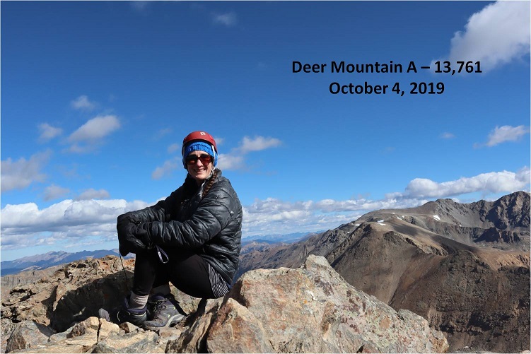
Deer Mountain A Summit:
The wind was still a steady 30-40mph at this point and I didn’t want to stay long because I was worried about my fingers. Here’s a look back at that ridge after the class 3 section.
Ok, time to head back. Here’s the route I took back to the class 4 section, aiming for a small notch in the ridge
Here’s what it looks like heading back down the class 4 area. You can see why I didn’t want to take the icy area up or down: it was flat, unclimable rock due to the ice
Back over the ridge with the large boulders
From here you can see the rest of the route back. Oh, and amazingly enough I spotted my instruction paper stuck under a rock. It took some fancy footwork, but I retrieved it and, no longer needed, I put it in my pack.
Here’s looking down the class 3 chimney
And the class 2 section back down to the saddle
At the top of the gullies I aimed for the creek and headed out. This is where my fingers started to thaw.

I followed the creek most of the way
While following the creek, about halfway to the avalanche area I came across a male hiker, surprised to see anyone this far off trail. I asked him where he was headed (expecting him to say Deer Mountain). “Mt. Oklahoma” he replied. He’d never heard of Deer Mountain. I wished him luck and was on my way. I’d hiked on over a quarter of a mile before thinking much of it, but he’d passed the route I’d taken to summit Oklahoma about half a mile before reaching me. I know there are several ways to summit each mountain, and hoped he knew of a different route. Otherwise, he was off track. I wished I’d had a way to let him know, but he also looked like a competent hiker and it was still early in the day with no chance of storms, so if he was off route he had time to figure that out. I got a picture of his vehicle at the trailhead (the only other one there) just in case.
I made it back to the avalanche area, crossed the streams, and found the trail with no difficulties. The rest of the hike out was uneventful.
I started at 6:30am and ended at 1:30pm, making this a 10.5 miles hike with 3737’ in elevation gain in 7 hours.
And now to meet my friend for some early October rafting/camping along the Arkansas River!

In a way I’m glad You were able to treat Yourself to a daylight start as Im sure it also had a positive effect on You because of Your writings.One thing You may have missed was the sun rising as I’m sure that is a plus for Your camera lens More than that it’s as if the rising sun is saying ,Good Morning Laura. I have said this before and I can’t say it enough.Your are the most amazing Woman who has ever crossed my path and continues to capture my thoughts with Your writings and photography.I do so thank You Lady Laura.
LikeLike
I look forward to the coming attractions of Your exciting life.Loving You and all You do You are never forgotten.Thany You.
LikeLike