RT Length: 13.83 Miles
Elevation Gain: 4811’
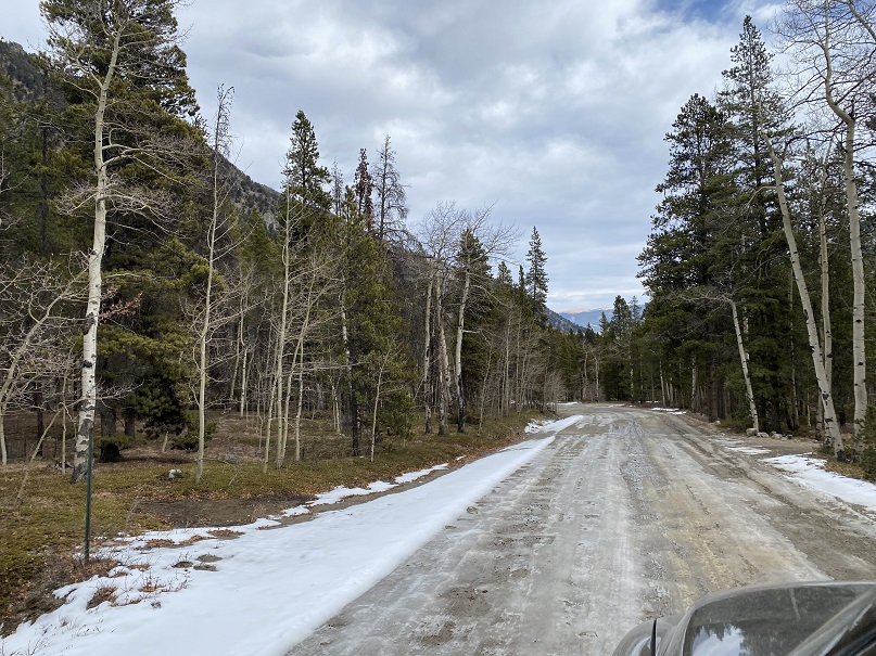
There was a storm predicted for this weekend, so I set out to try to get this loop in before the snow hit. I had no trouble driving the 2WD dirt road all the way to Winfield, even though it was icy in spots.
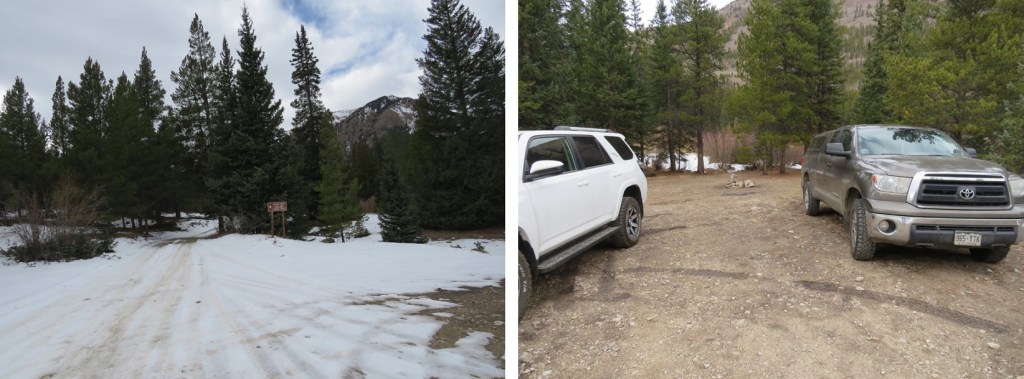
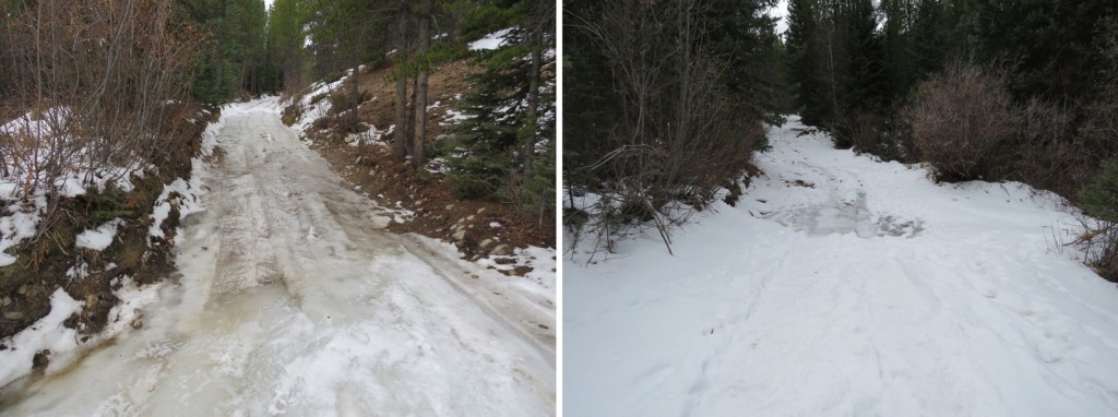
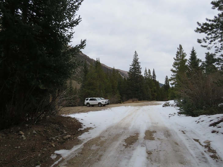
Once I made it to the 4WD road it became icy. I decided to park in the dispersed camping area and hike along the road. There are several dispersed camping areas here, and plenty of parking.
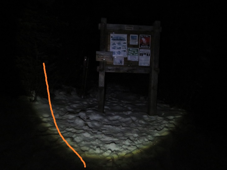
I put on my microspikes at the truck and didn’t take them off the entire hike (although they were overkill for over half of the hike). I started out following the 4WD road southwest. It quickly became icy and I was glad for the spikes. I could also hear owls on either side of the trail. They were hooting, calling to each other back and forth. We’ve recently had an owl take up residence in our backyard and the calls were similar, so I’m guessing they were great horned owls. I also heard a chirping in-between calls. I’m not sure what animal the chirping belonged to, but it happened every time an owl’s call ended, and before the next one began. In any event, the sounds kept me occupied as I hiked in the dark.
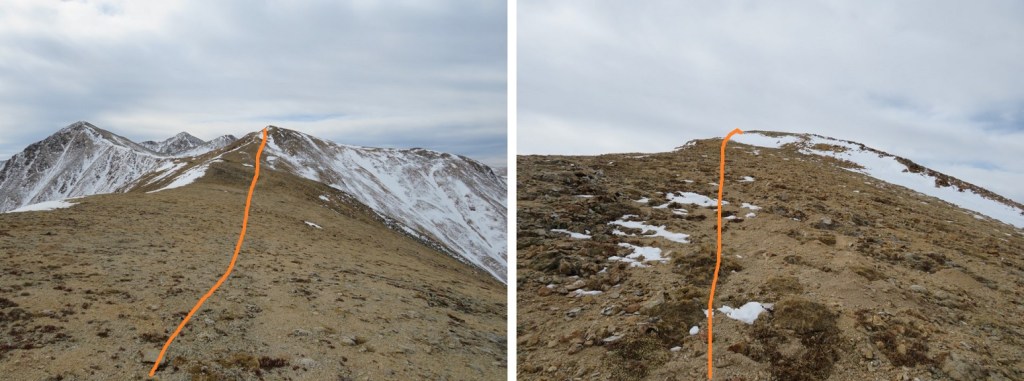
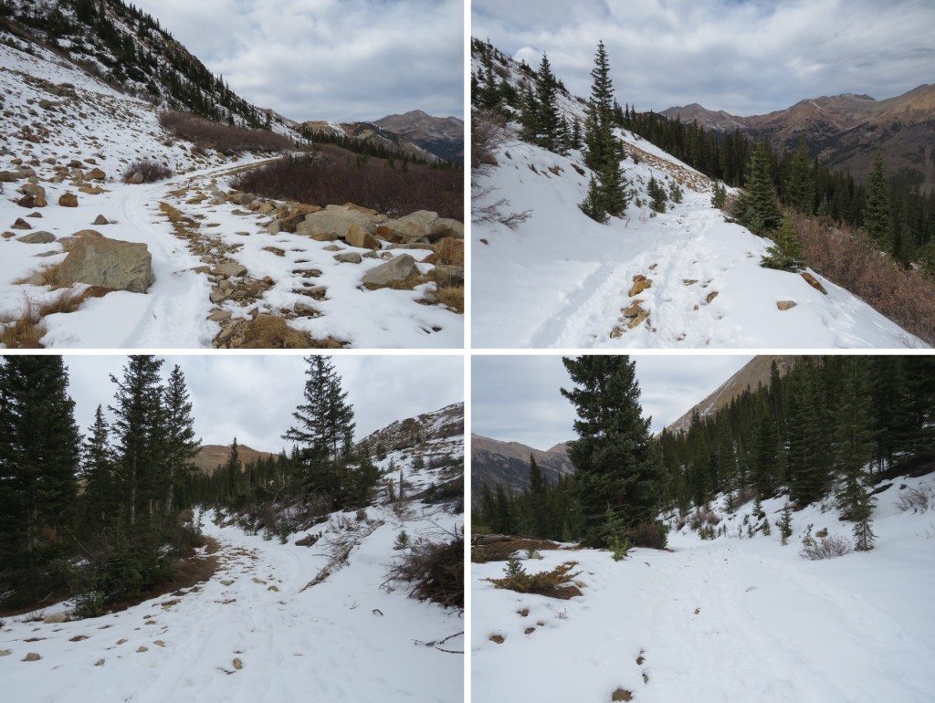
I followed the 4WD road for 2 miles to the upper trailhead (Lake Ann). Here the trail splits. I took the well marked ‘Huron Trail’ that went left up the mountainside.
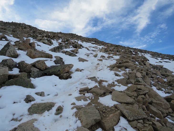
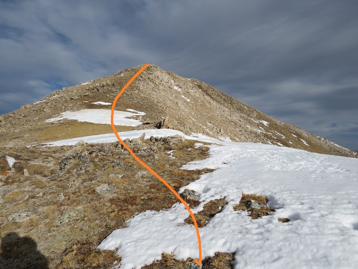
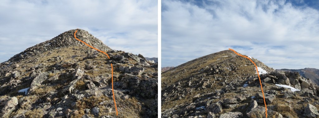
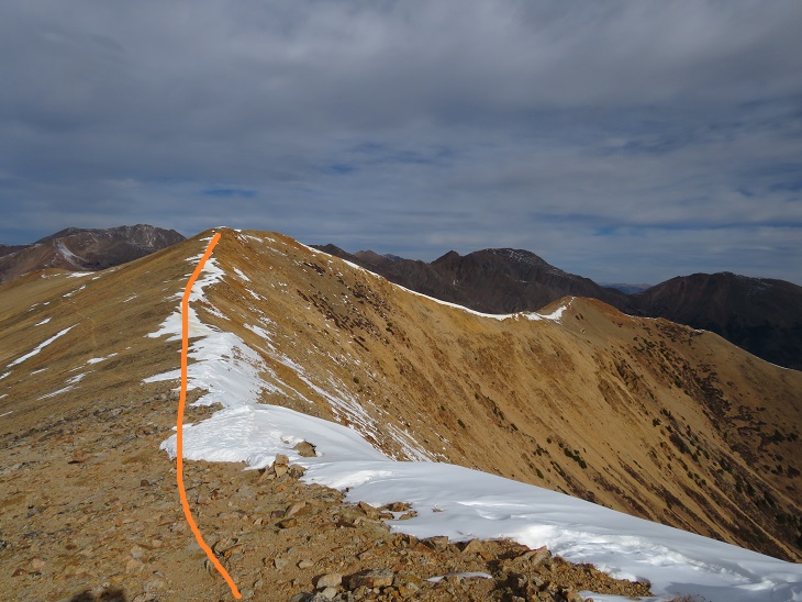
The Huron Trail is a well marked and easy to follow class 1 trail that takes you all the way to Huron Peak. This is also a well documented trail, so I’ll just add a few photos.

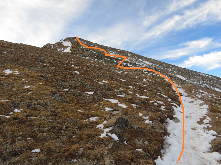
Once at the saddle the trail became increasingly icy, and I was glad to be wearing my microspikes. Also, one of them broke (I continued to wear it anyway. The other one broke as well later on, but microspikes are easily fixable so I wasn’t too worried).
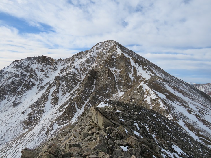
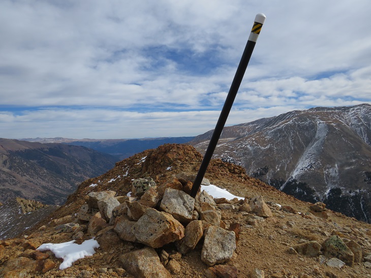
I summited Huron Peak at 7:45am
Huron Peak:
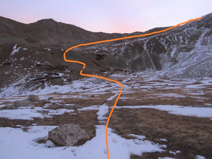
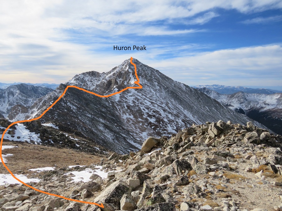
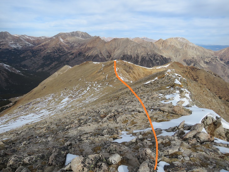
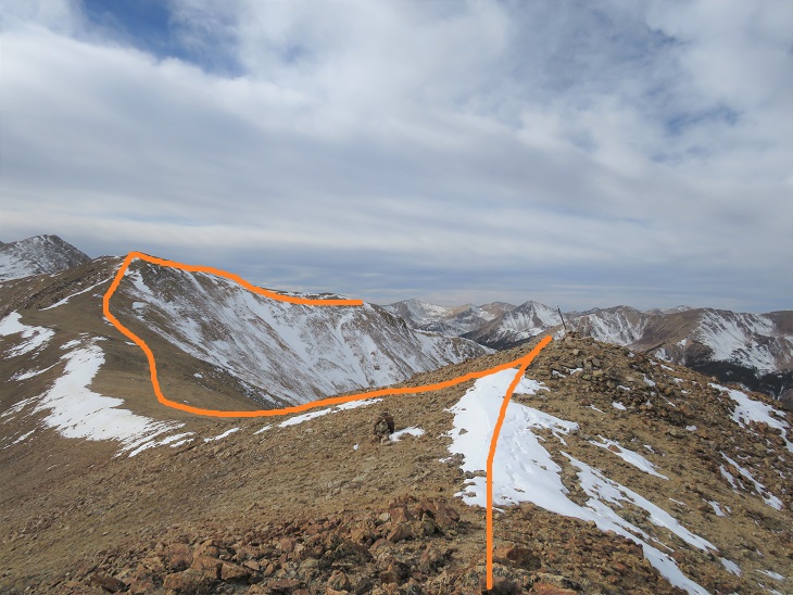
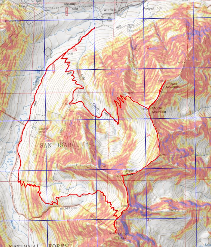
From the summit I had a great view of all the other peaks I intended to hike on this loop. Here’s the overall route, which consists of a nice ridge hike
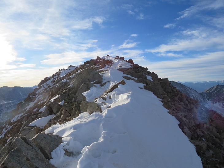
I turned around and headed back to the Browns/Huron saddle, and then over to Browns Peak. I summited the point here on my way over to Browns, but that’s unnecessary, as it’s not ranked and just adds elevation (the elevation part was why I summited the point)

I summited Browns Peak at 9:10am. Browns Peak is unranked.
Browns Peak:
Here’s a look back on the route to Browns from Huron
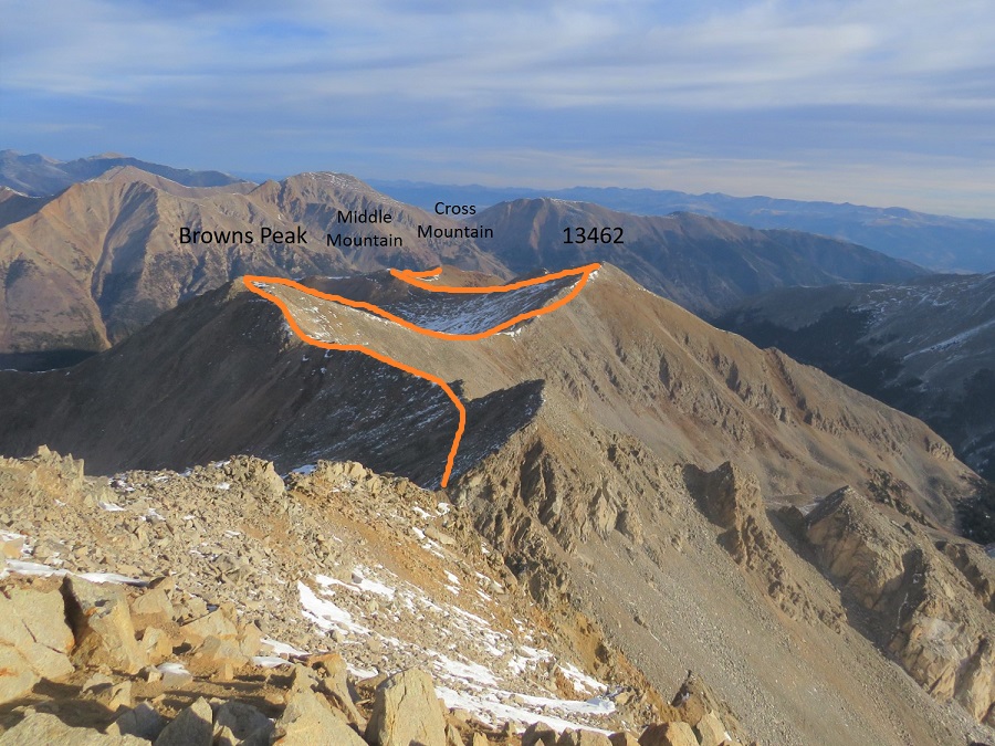
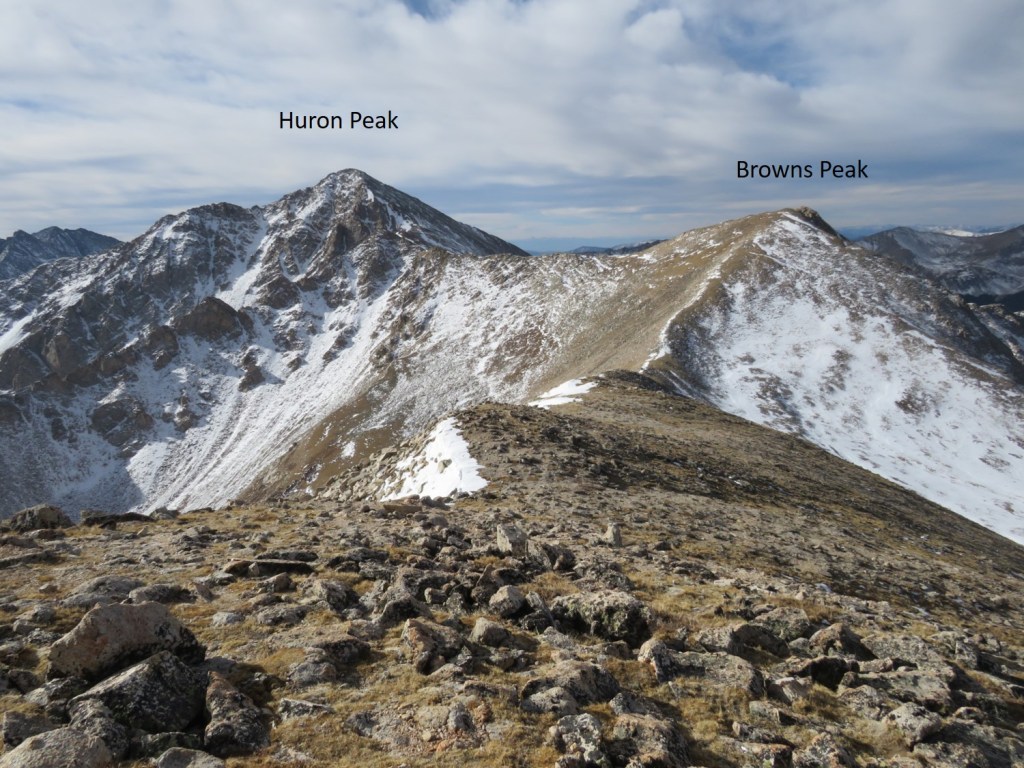
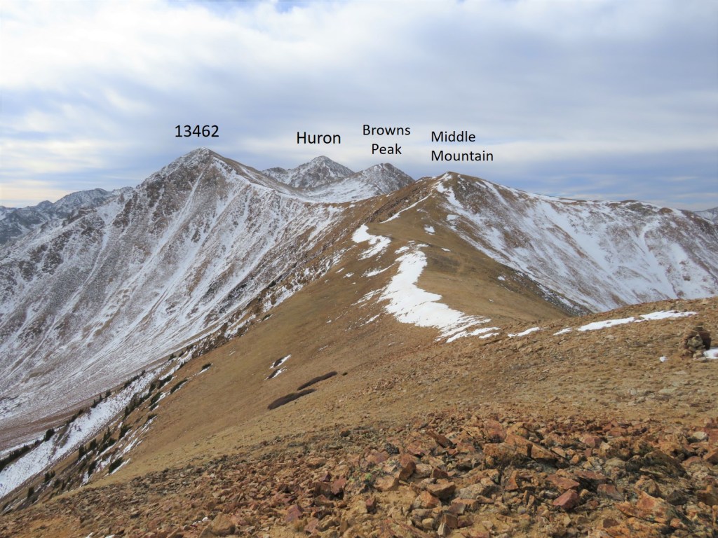
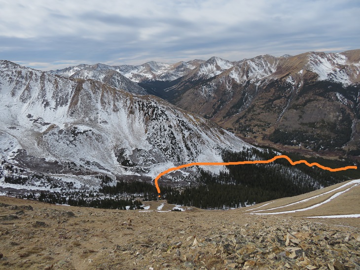
From the summit of Browns I could see my next 3 summits, as well as the trail I intended to take back down
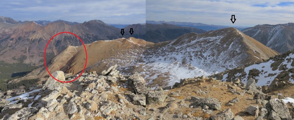
It was a simple ridge hike to the saddle and then back up to PT 13462

There was a small false summit before the actual summit
I summited PT 13462 at 9:40am
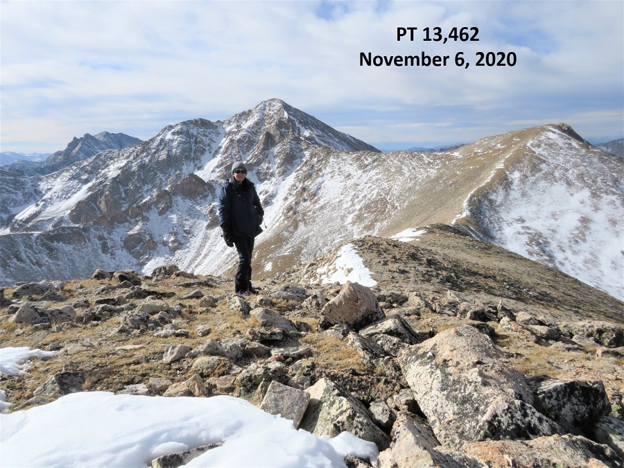
PT 13462:
Here’s looking back at Huron Peak and Browns Peak
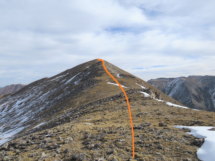
The hike over to Middle Mountain B was also a simple ridge hike. Here’s the route
I summited Middle Mountain at 10:10am (also unranked)

Middle Mountain:
Here’s looking back on the route so far

It was still early in the day so I decided to head over to Cross Mountain. This is another unranked peak, but it’s named, so I didn’t want to leave it out on today’s hike. It was a quick and easy hike northeast over to Cross Mountain.

I summited Cross Mountain at 10:35am
Cross Mountain:
Here’s a look back at the other peaks I summited this morning
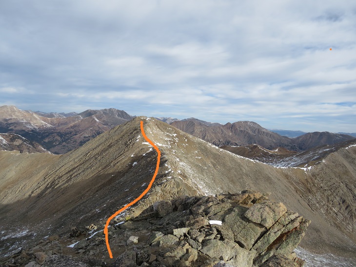
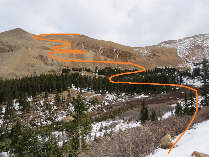
I was making this a loop, which meant I needed to re-summit Middle Mountain, turn right and head northwest down the ridge to the 4WD road. Here’s an overview of the route
First, I made my way back to Middle Mountain
Once I’d re-summited Middle Mountain I turned right and headed northwest down the ridge, aiming for the 4WD road

Then I followed the road back to my truck. Here’s an overview:
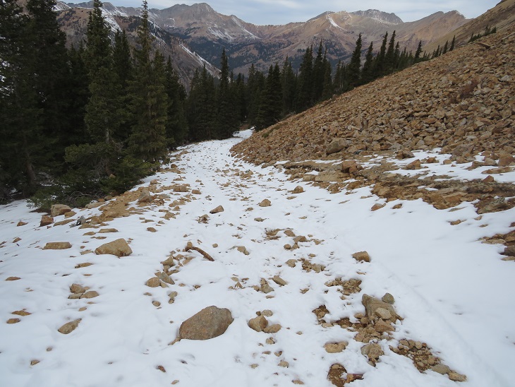
A word of caution here: the 4WD road isn’t truly a road for most of the way up the side of this mountain. It looks to be an old mining road that hasn’t been used in many years, and has experienced rockslides and avalanches, turning the road into more of a trail down the mountain and into the gulch. In other words, if you have a 4WD vehicle, or even a motorcycle, don’t plan on driving it up this road. Evidence:

Once down in Lulu Gulch the 4WD road picks up again, and is easy to follow.
Here’s a look at the hike down from the ridge
The 4WD road was indeed easy to follow, but it seemed to go on and on. And on. And on. I was very happy with my choice to summit Huron first today, as this was a very long slog back to the main 4WD road and I would have been terribly bored following this road as it switchbacked (needlessly?) down the mountainside. It kept going, and going, and going. I seriously wanted to just cut the switchbacks and make it a straight line (but didn’t)
I was thrilled when I reached the main road
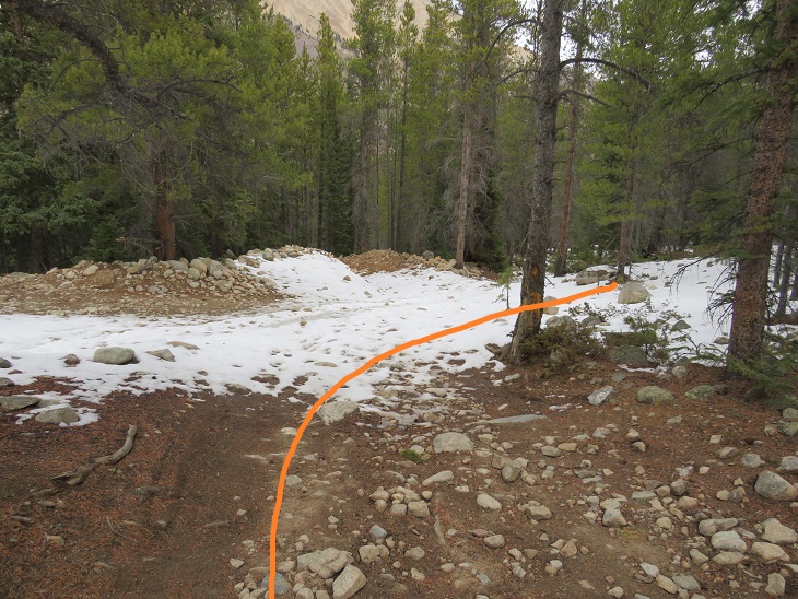
Here’s looking back at the turnoff (this is what you see when hiking in, you can go straight to the Huron Trail or left to follow the mining road and summit Middle Mountain first)

I followed the icy 4WD road back to my truck, thankful for my microspikes

I made it back to my truck at 12:15pm, making this a 13.83 mile loop with 4811’ of elevation gain in 8 hours, 15 minutes.
The Huron Peak Summit Sticker can be bought here