
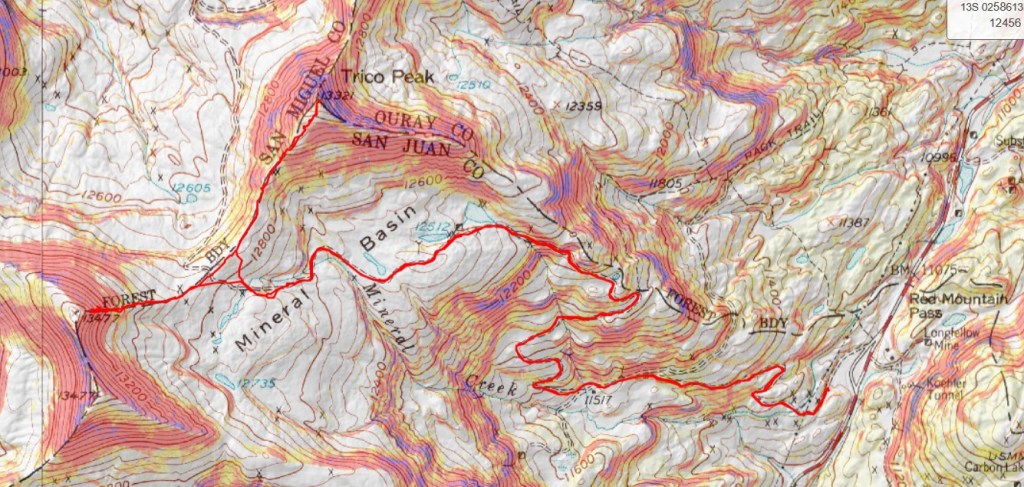
RT Length: 8.78 miles
Elevation Gain: 2844’
My stats here are going to be off (to be explained later).
I arrived at the Black Bear Pass trailhead the night before, excited to find a good camping spot near the road, at about 11,100’. If you drive a little further up, 100 yards or so, there are a few more sites.
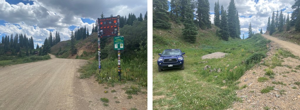
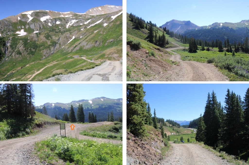
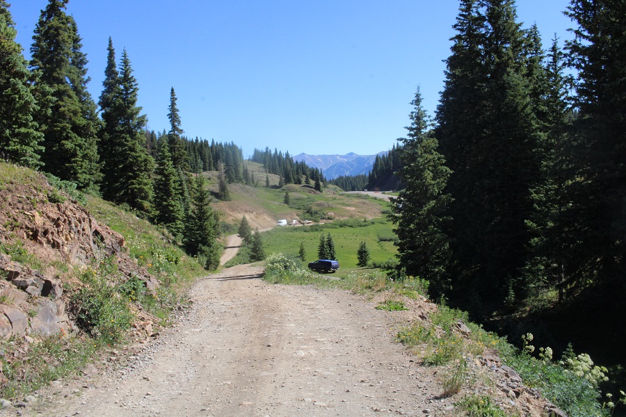
I parked, read, ate dinner, and fell asleep early. I was on the trail at 5am the next morning. The trail follows 4WD dirt road 823 for 3.3 miles to Black Bear Pass. A stock 4WD can make it to the pass, but be mindful it’s a narrow shelf road at times, with few places to pass other vehicles. Here are some pictures of the road.

After hiking for 1 mile I came to the junction for Prophyry Basin and Black Bear Pass. I went right, towards Black Bear Pass.
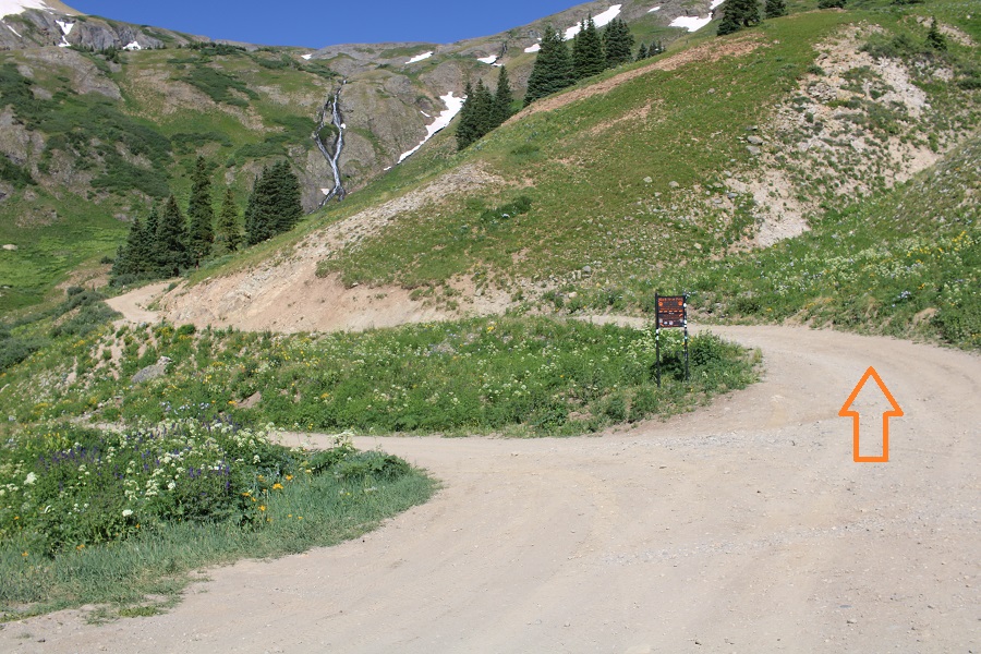
And continued on, towards Mineral Basin.
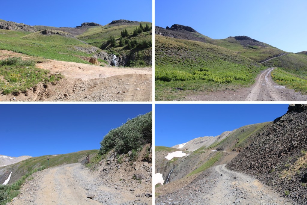
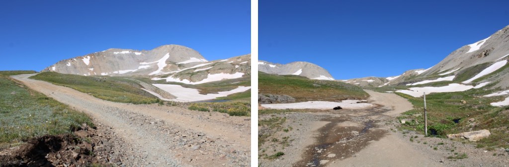
There was a little snow to contend with in getting to Black Bear Pass, so I went left to avoid it.
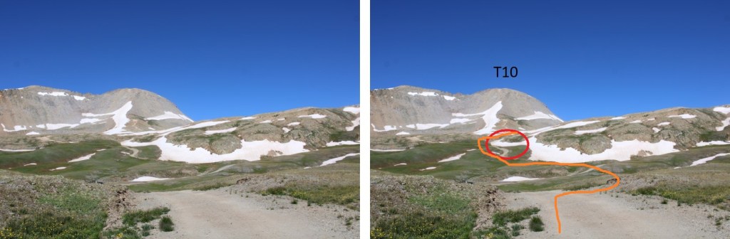
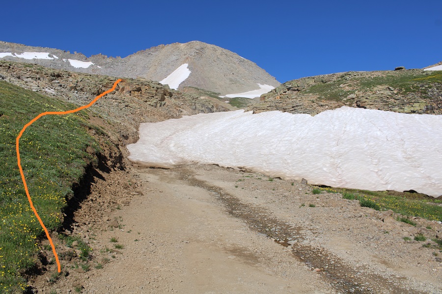
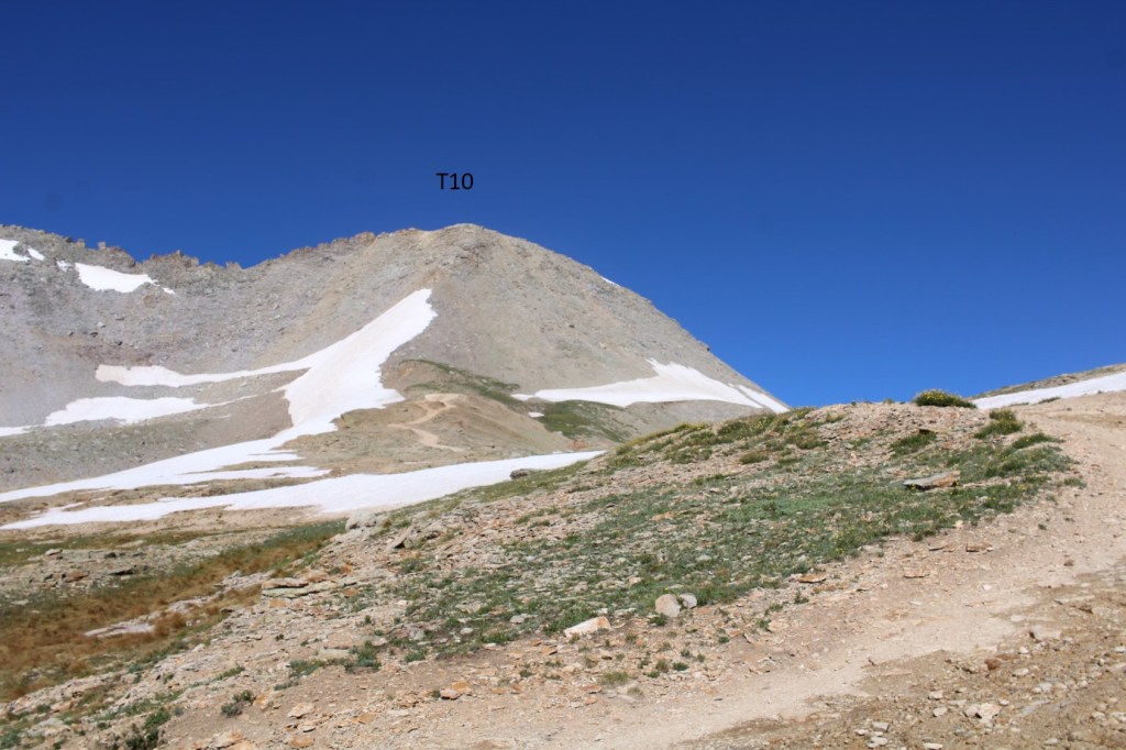
To my left I could see T10, which hadn’t been on my list for today. However, looking at it now, it looked doable from this side, so I headed over there. There seemed to be several viable routes. At the grassy area I put on my microspikes, and headed up. The first 150 feet or so were straightforward, and then the choss hit. Terrible, terrible choss that gave way as I ascended. I was creating rockslides both above and below me, which included not only scree and choss, but also microwave plus sized rocks. Nothing was stable. It looks like the route changes every time someone attempts to go up or down. I got cliffed out several times, backtracked, and tried different ways. Finally, I knew while I could have made it up, I wasn’t going to recommend this route to anyone (someone’s going to get seriously injured or die), so I might as well head back down. I made it about 100 feet from the summit before turning around. Please don’t attempt this route unless you have great balance and are good with floating and falling talus and boulders (none of the rocks were steady. None of them, and many fell with the scree). For me, this was outside of my choss-safety zone.

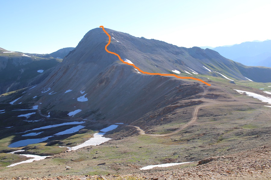
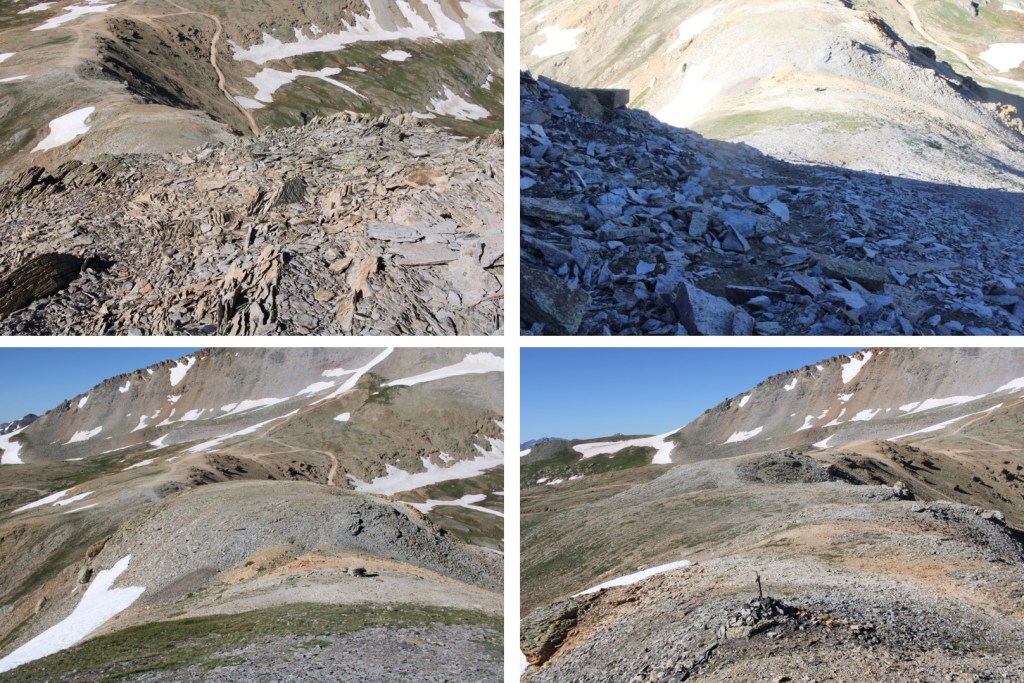
Ok, so from Black Bear pass, I headed northeast, with Trico clearly visible.

This was actually a straightforward and easy route. There’s a faint trail you can’t see from below, that will get you all the way to the summit.
Here are some pictures of the route


Once I gained the ridge, this was the overall route to the summit

There was a faint trail here as well.

I summited Trico Peak at 8am (still wearing my helmet from T10)

Trico Peak:
I took advantage of the bluebird day and 2 bars of LTE service at the summit, and stayed for about half an hour, calling people and answering emails.

Then I was on my way back down to Black Bear Pass.


Back at Black bear Pass I turned left, and followed the road 823 back to the trailhead, avoiding the small section of snow along the road.


I made it back to my truck at 10am, making this a 8.78 mile hike with 2844’ of elevation gain in 5 hours, along with a lot of route finding on T10, and spending a half hour on the summit of Trico.
On to the next trailhead!

Thank you Laura (Wild Wanderer) it’s always good to read your descriptions of your routes to the summits.Reading this article about being to dangerous to complete the summit climb.Thank you for knowing when to turn back! This means we will be able to read future hikes and climbs!
LikeLike