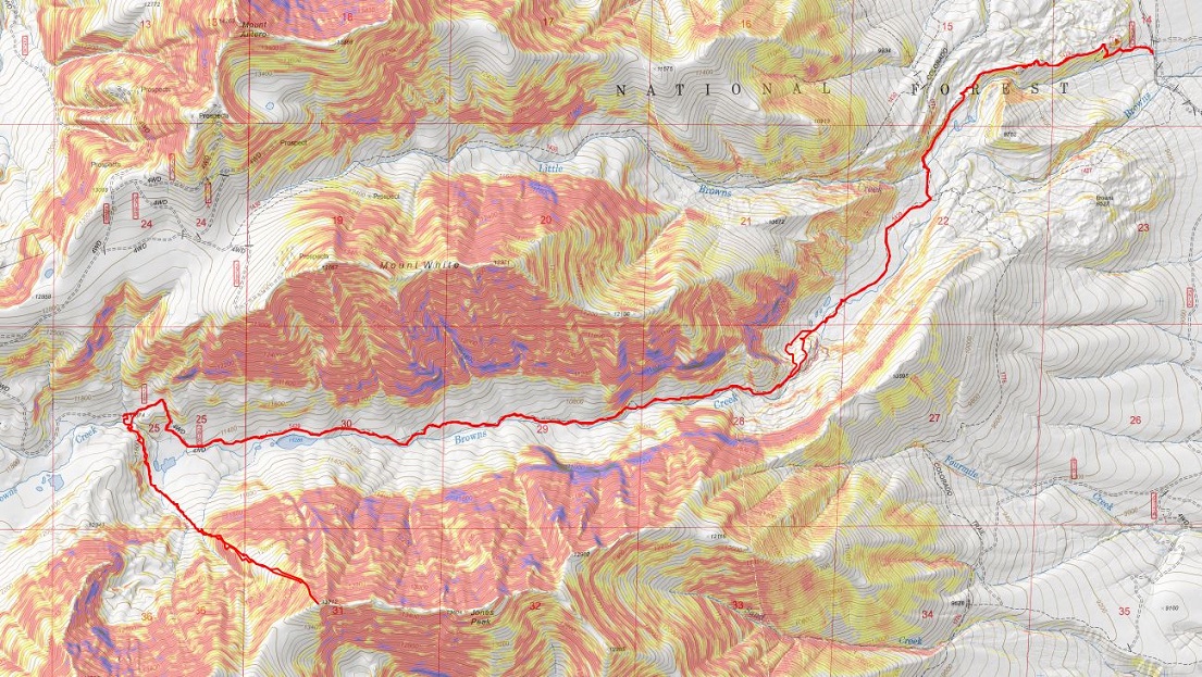
RT Length: 54.06 miles (per CalTopo stats)
Elevation Gain: 12383’ (per CalTopo stats)
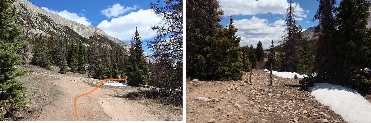
So as not to reinvent the wheel here, if you’re considering this hike from Purgatory, please see my detailed Purgatory Approach Trip report from earlier this month.
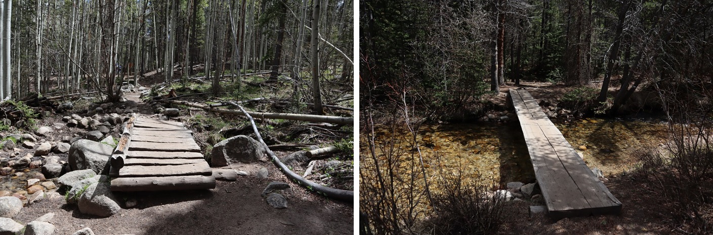
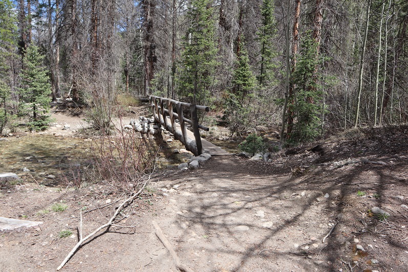
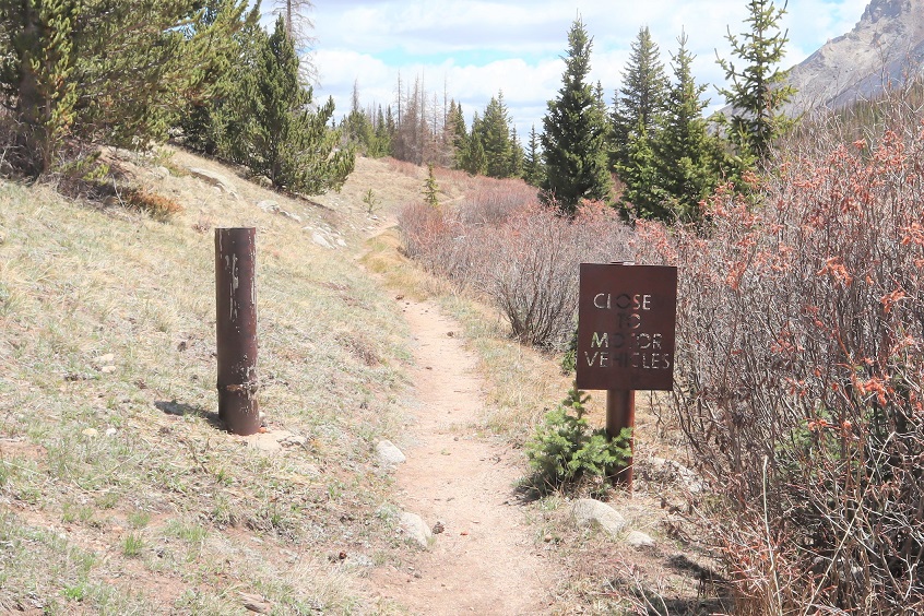
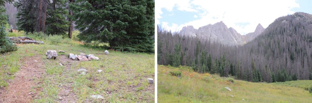
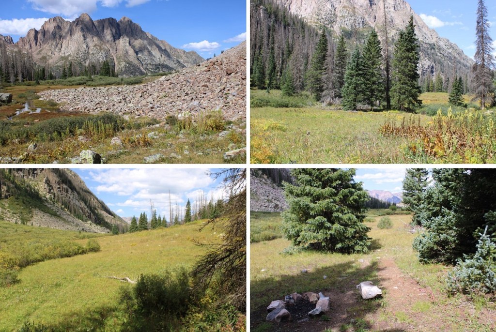
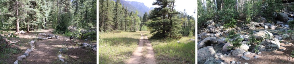
Purgatory to Chicago Basin/Needleton/Ruby Creek cutoff
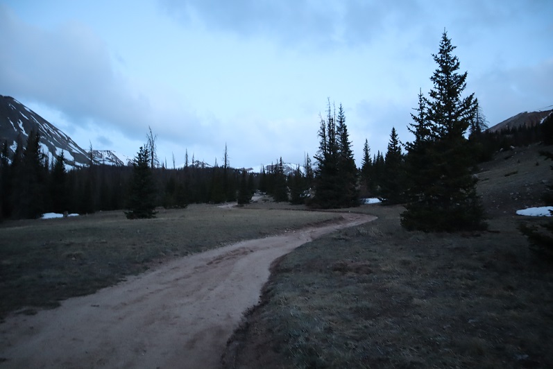
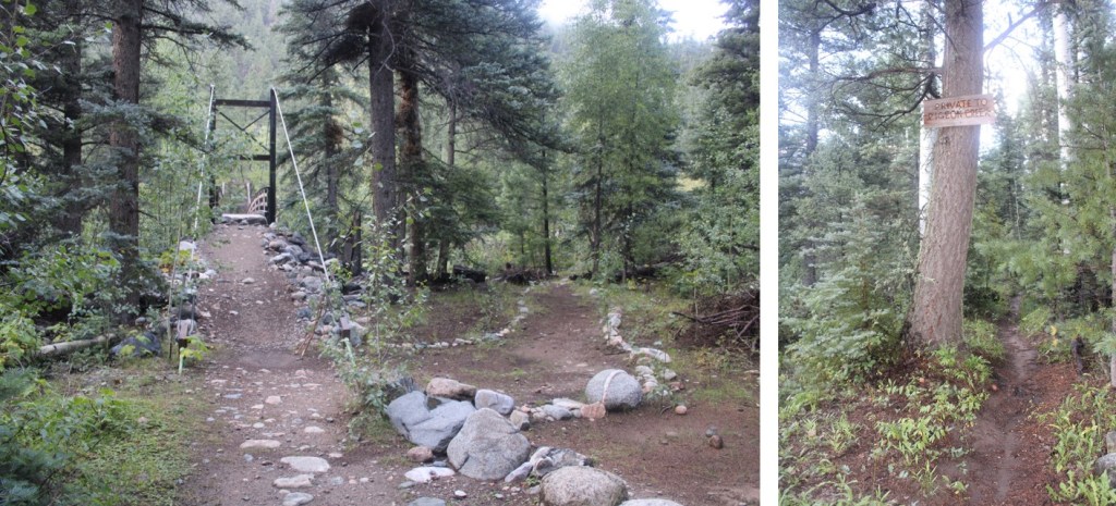
I started this day at the Purgatory Creek Trailhead around 3pm, but will start this report from the Needleton Train Stop. Oh, and it rained the entire first day. The. Entire. Day. I had on rain gear, but was soaked, and my camera lens fogged up. I was so glad to have on new hiking shoes that were still waterproof. From the Needleton Train stop, I followed the Animas River on somewhat of a trail. This trail starts out going through private property (it’s private all the way to Pigeon Creek), so please stay on trail.
I crossed Pigeon Creek, and continued paralleling the Animas River, doing my best to follow the cairns.
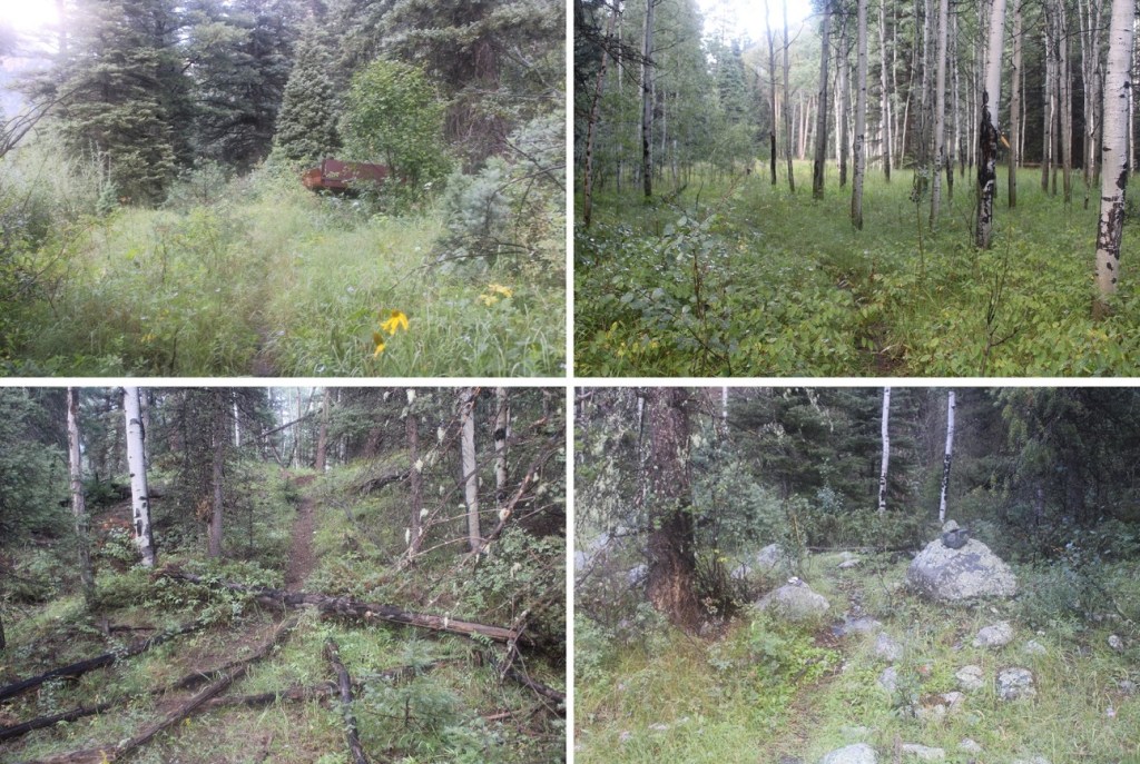
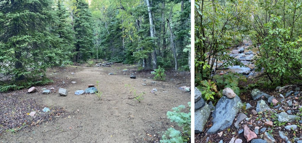
After hiking a little over a mile from Needleton I ascended Water Tank Hill, and called it a day. (For those of you wondering, Water Tank Hill is at 8250’ of elevation, and the trek up isn’t that bad, just under 200’ of elevation gain). It wasn’t raining anymore, so I set up my bivy. Note: I don’t advise this. Since I was solo and only had a bivy it was doable, but I wouldn’t set up a tent here, or camp with a bunch of people, as there isn’t much room. Also, it smells like goats. There are campsites just a bit further up the trail.

I did my best to air out my wet gear, jotted some notes down in my journal, ate some popcorn (diner!) and got to bed as the sun went down. With all the clouds in the sky it was a beautiful sunset, but my camera was still fogged up, so no pictures.
2 hours later I heard a big clap of thunder, and just like in the movies, it started pouring rain. Great. All that gear that was drying out was no longer drying out. I stuffed my jacket and pants inside my bivy, and covered myself up as the rain turned to snow (and back to rain again). As water droplets slowly dripped on my face, I thought to myself: it’s going to be a long night.
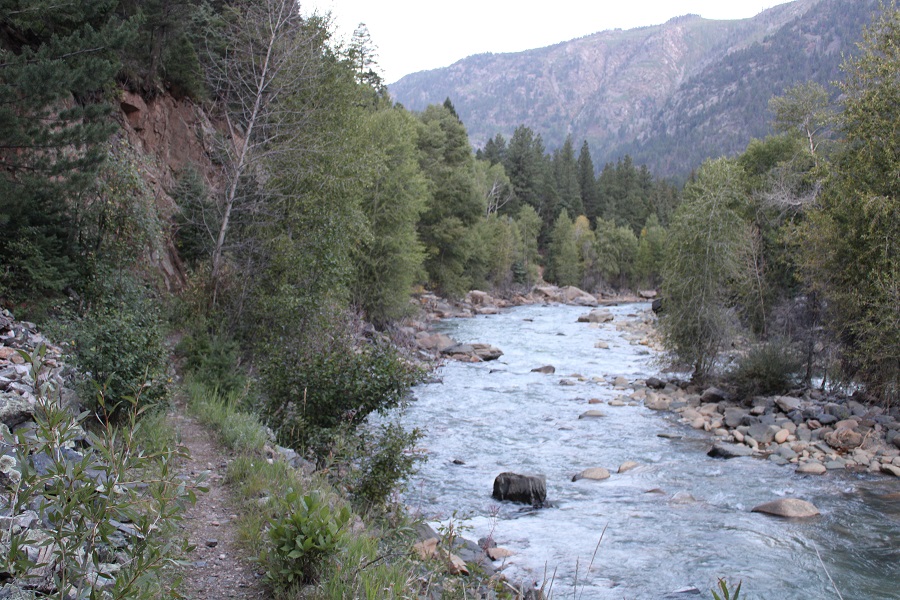
I set my alarm for just before sunrise, but I didn’t need it. I woke up, watched the bats flitter back and forth, catching their breakfast, and within 7 minutes had gathered my gear and was on my way again, still following the Animas River north.
I crossed Ruby Creek
Passed some primitive campsites, and then crossed Noname Creek
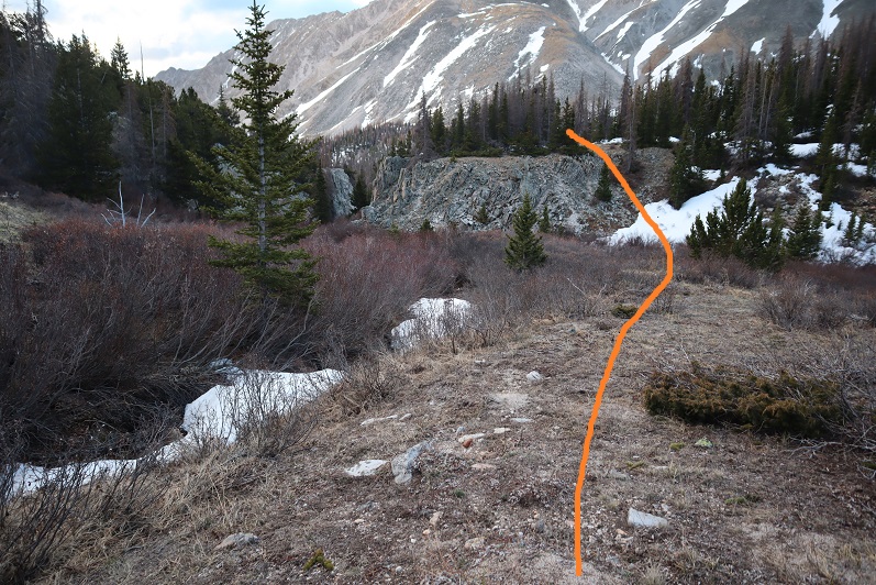
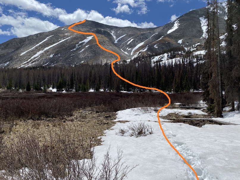
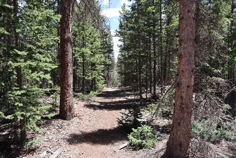
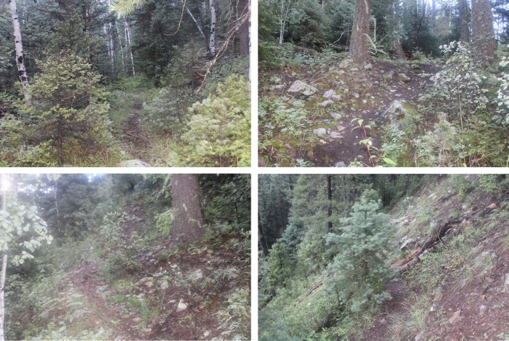
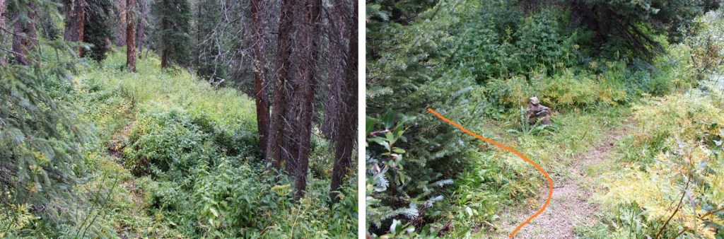
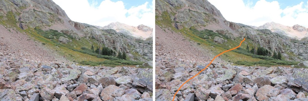
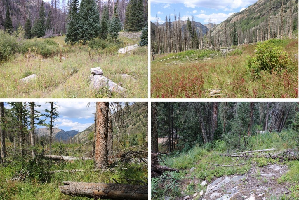
After hiking for 2.25 miles from Water Tank Hill I made it to the junction with the Noname Trail. This is actually where the trail became clearer and easier to follow. The junction is hidden by some trees. Look for the two cairns, outlining a trail, to the right. At the top of this entrance area are several blueberry bushes (but be sure to know your berries: they all grow in the same place, but they’re not all edible).

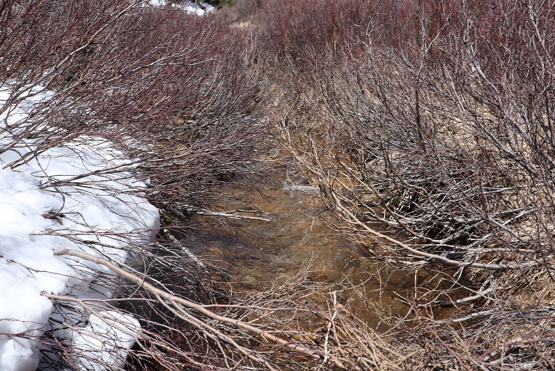
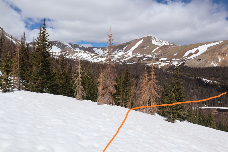
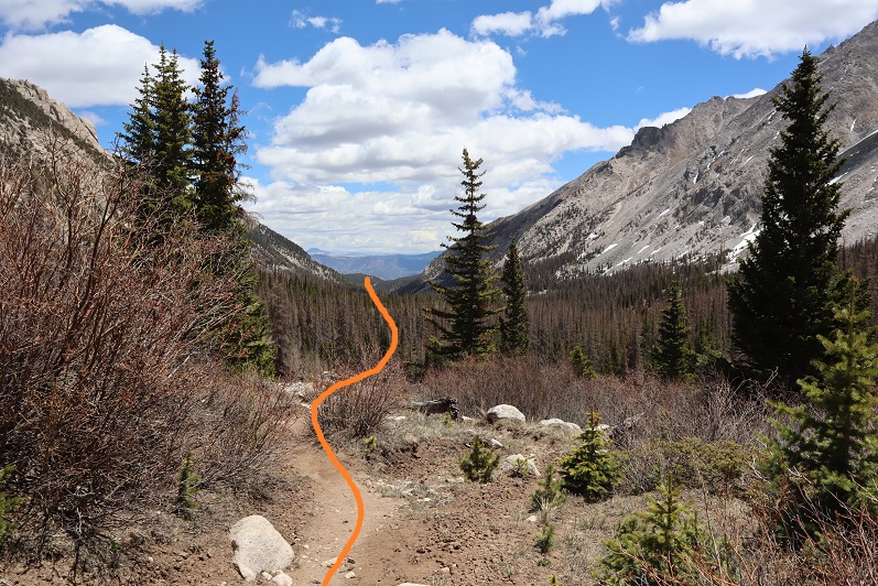
I followed the cairns east, paralleling Noname Creek as I made my way into the basin.
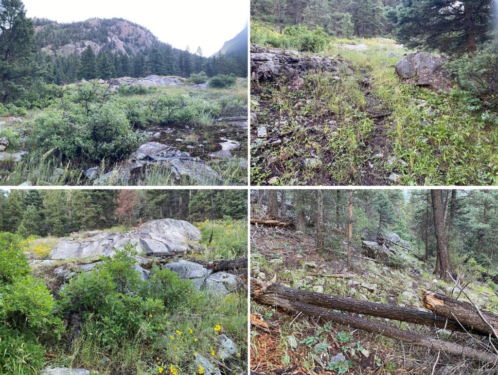
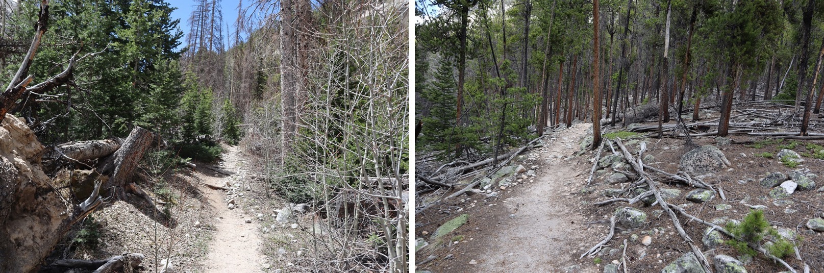
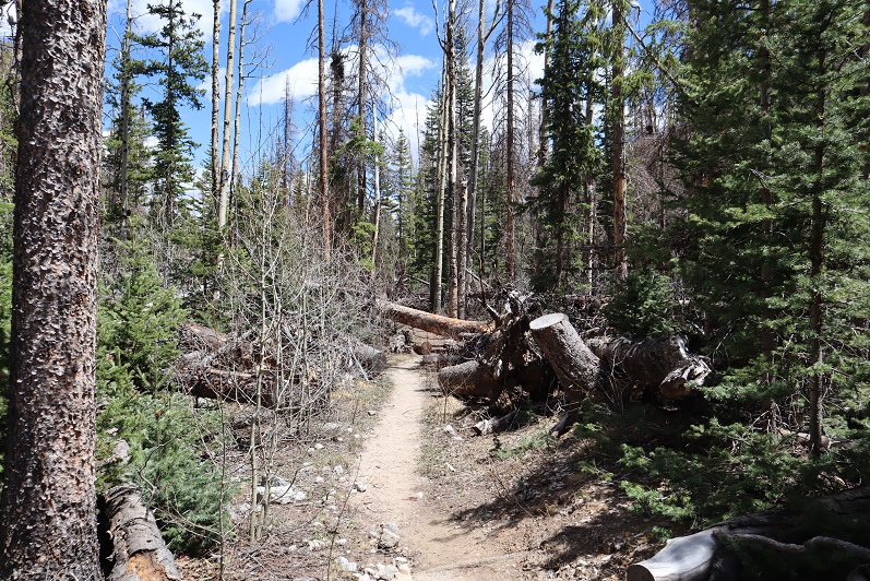
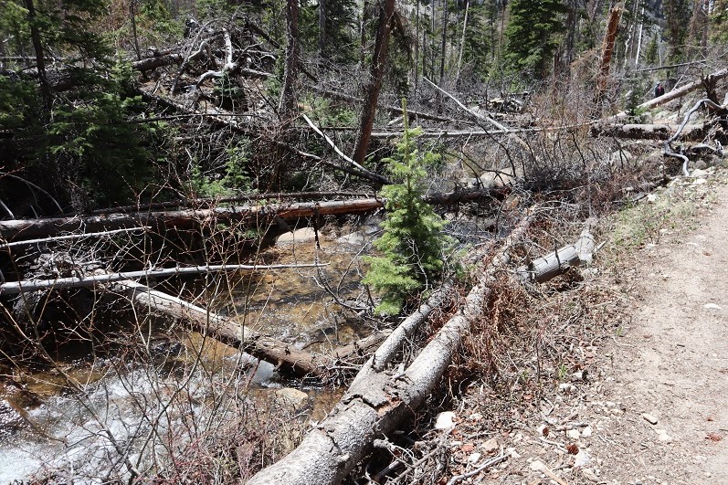
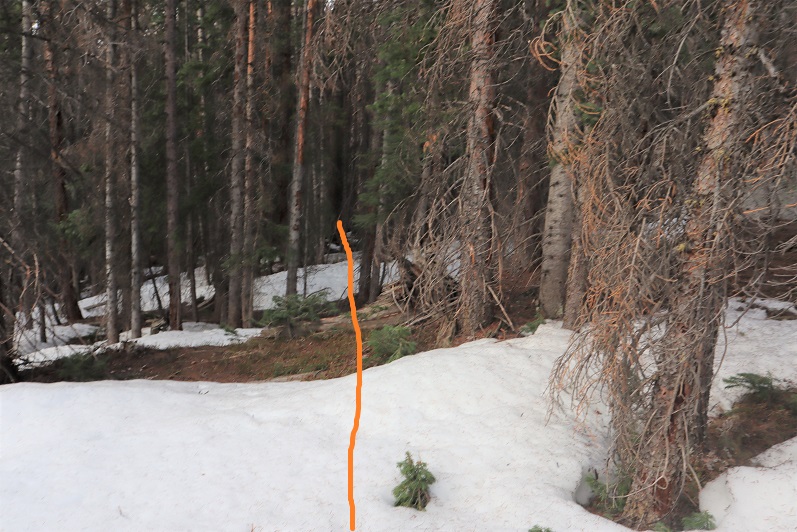
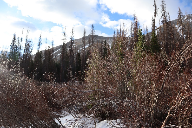
The trail here wasn’t too bad when compared to the past 3 miles. There is a slightly defined trail into the basin. The only difficult part here are all the fallen trees. Many don’t yet have a workaround, and they’re annoying. You can still see a pretty good trail though.
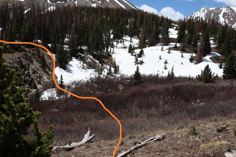
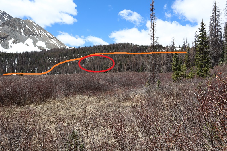
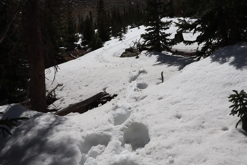
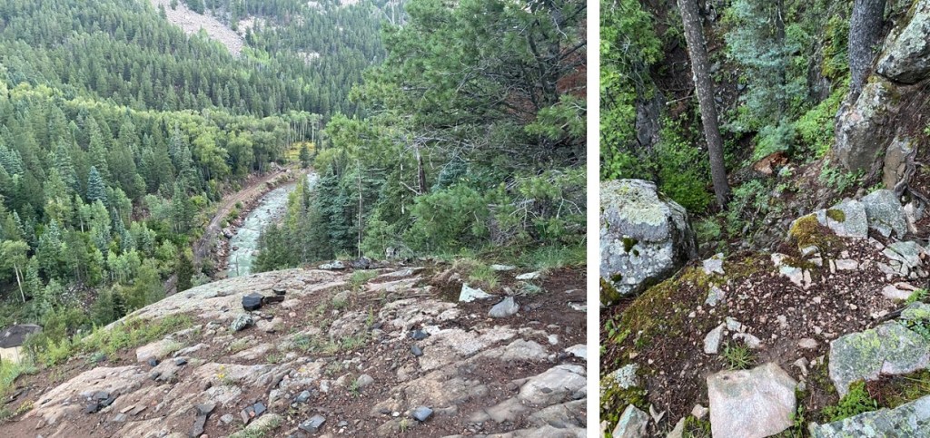
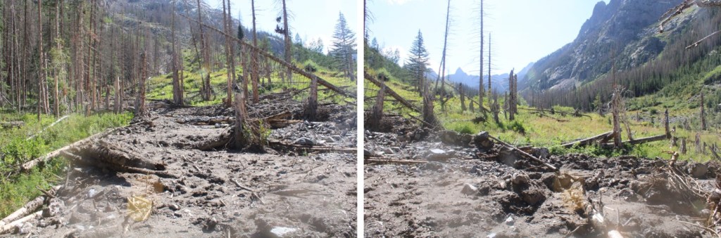
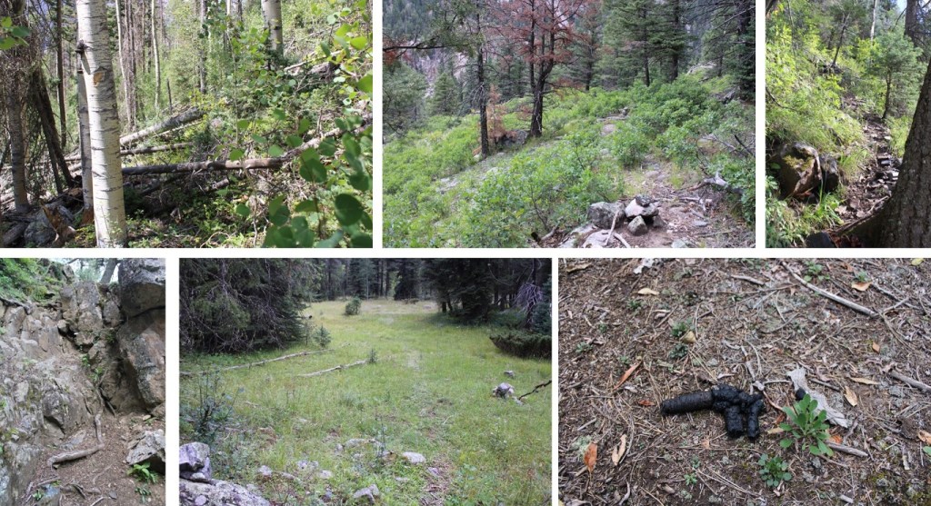
About halfway to the basin on this trail I came across the avalanche debris from a few years ago. I’m sad to say, there still isn’t much of a trail through this stretch. However, if you find a game trail, follow it! The trail parallels Noname Creek, and to follow this ‘trail’ properly you’ll need to stay further north than would seem intuitive of the creek (don’t cross the creek, always stay on its north side). This is what the avy debris looks like: it’s overgrown, so look for game trails. Note: watch your step, as the grass/flowers here are taller than the debris and you could easily find your ankle stuck between the logs, but there is a defined trail of tromped down grasses if you can find where it begins.
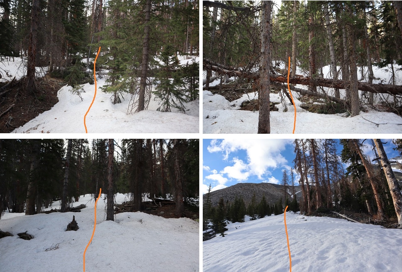
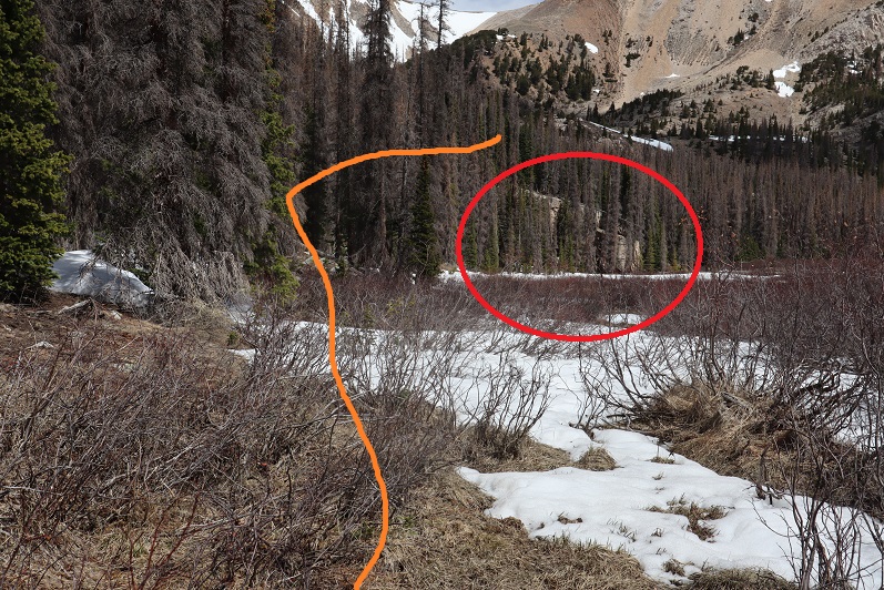
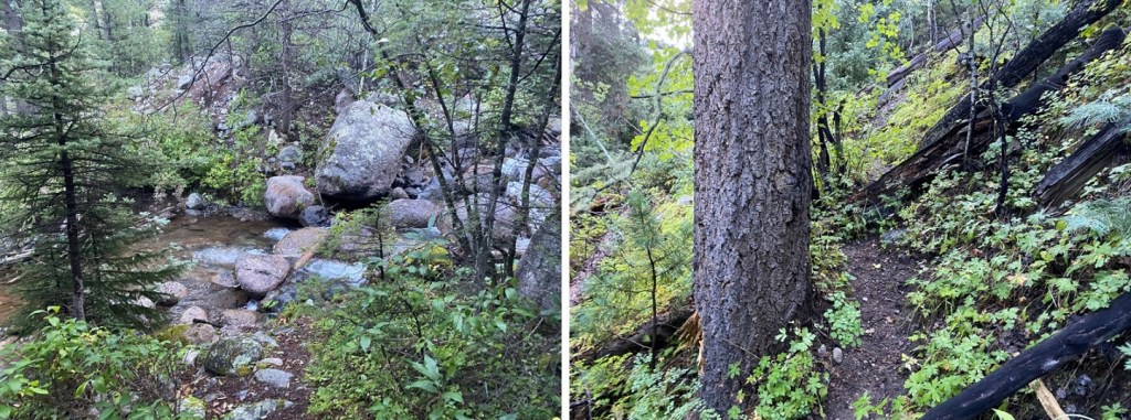
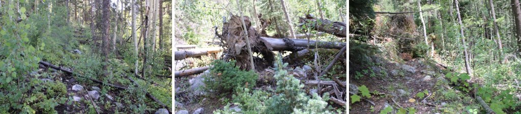
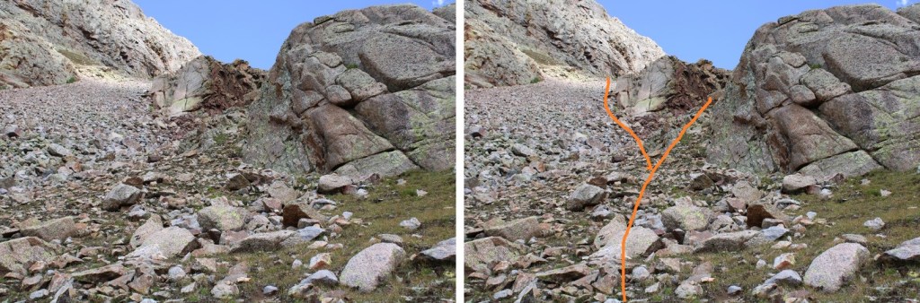
I came across a mudslide runout that hadn’t been here last time, finally found a solid game trail, and followed it to Jagged cabin

At Jagged cabin I was halfway through the basin, and decided to take a break. I ate lunch and aired out my gear from the rain/snow the night before. Within 20 minutes, it was all dry and I was ready to go again.

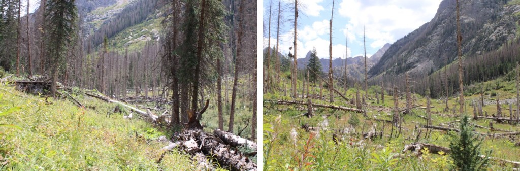
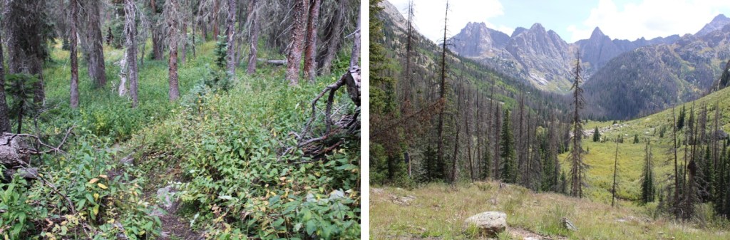
My 20 minute break over, I continued following the basin east. Willows are involved here, but the trail is much easier to follow.
I crossed a second, new mudslide runout area, placed some cairns, and continued along the trail
There’s a nice campsite right along the trail
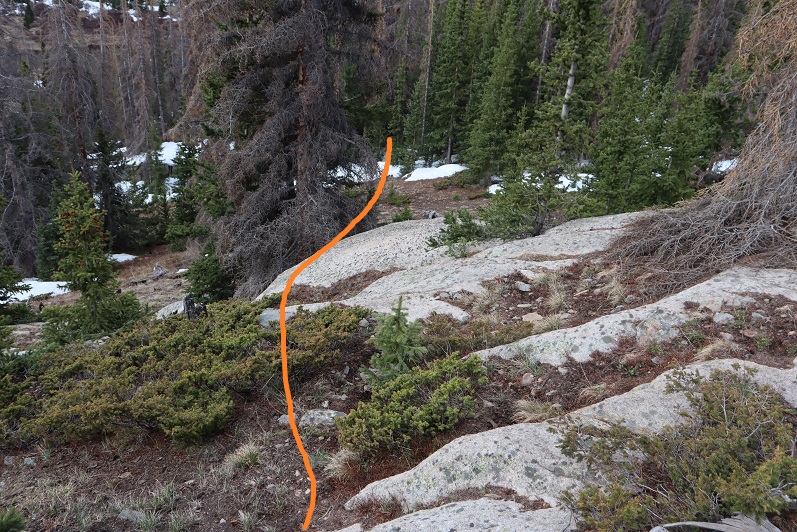
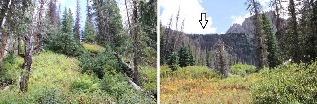
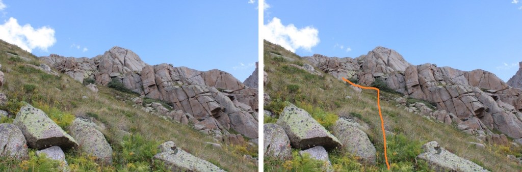
I entered more brush, and found a junction. I went left at the junction and followed the trail northeast up the mountainside.
There’s more than one trail here, but they all lead to the upper basin. If you’re on a game trail headed north, you’re in the right area.
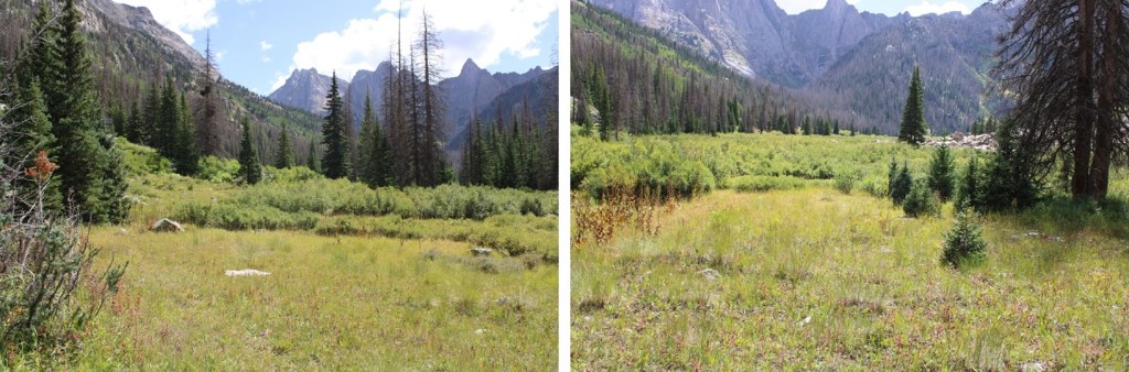
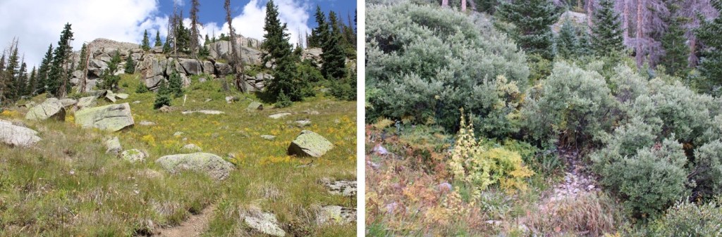
Just before reaching the upper basin there are willows. These are easy to navigate as far as willows go.
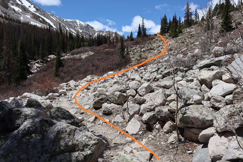
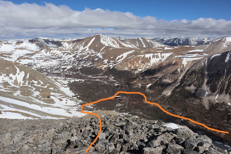
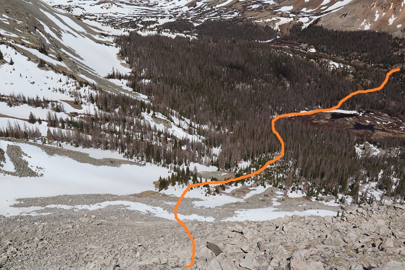
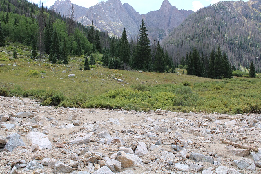
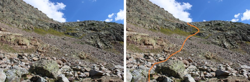
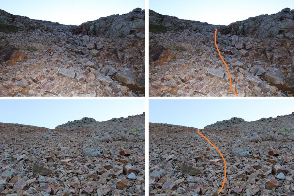
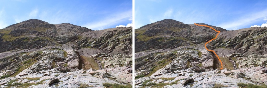
Once in the upper basin I messed up a bit, as you can probably see by my GPX track at the bottom of this post. I didn’t go with my gut instinct, and instead went with a GPX file I had. I didn’t realize until later it was a hand drawn GPX file. (Side note, it should be REQUIRED for you to post you hand drew the file if you’re going to make it available for download: I was smart enough to turn around, but not everyone would have made the same choice). In any event, here’s the path you should take to Lake 12,522, both routes work and stay at class 2:

If you have a GPX file that says to go further around the rock outcroppings, know it’s drawn in (although, to be fair, there is a way to go from the Jagged Mountain route, but that’s now what happened here). I had more than one GPX file that said to follow the outcropping and then ascend to the north, but when I attempted it, I was wearing a full pack and it was more than class 4: this should be a class 2 hike, which leads me to believe someone hand copied someone else’s hand copy, which isn’t cool (that’s the only reason I’m addressing it here; because I had more than one similar file. Go with your gut instinct and follow the obvious rock gully… you’ll even come across some cairns).
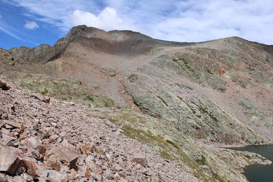
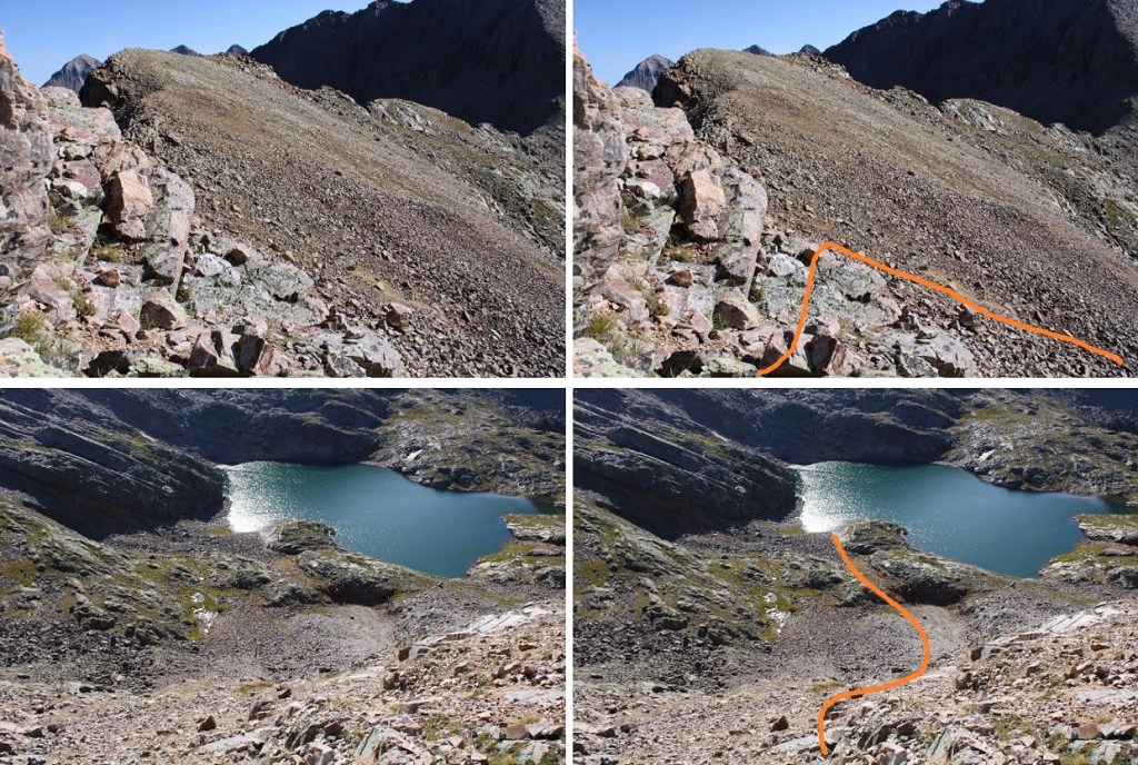
OK, enough on that rant. Here are some close-up pictures of the route to the lake at 12522’
You can’t see it in this picture, but the lake is to the lower right. To get there, I skirted the rocks high, just below the strip of tundra, and made my way to a gully runout below Peak 5, following that to the lake.

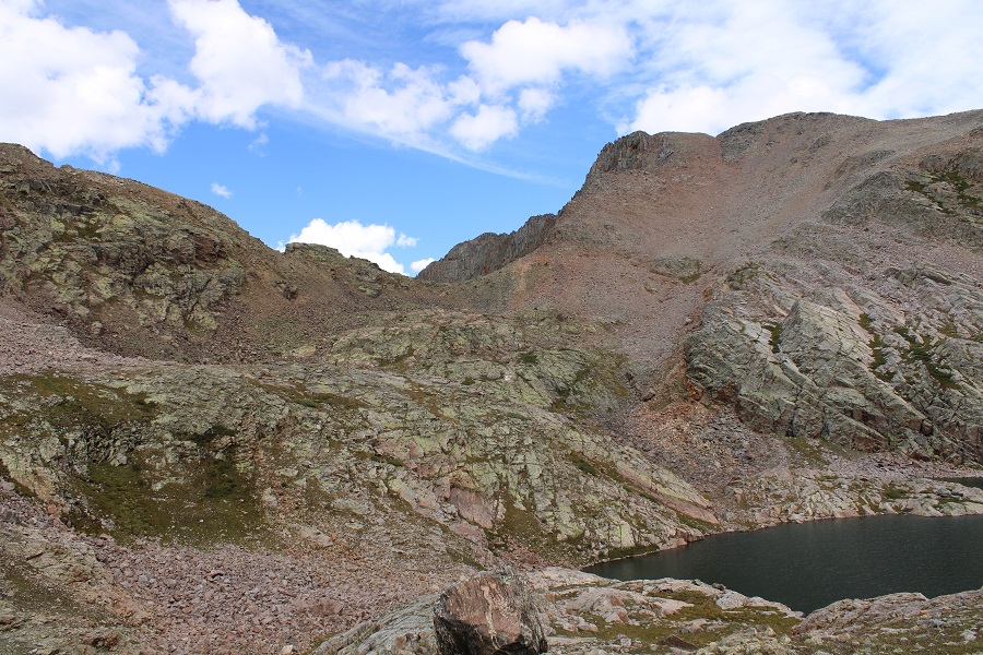
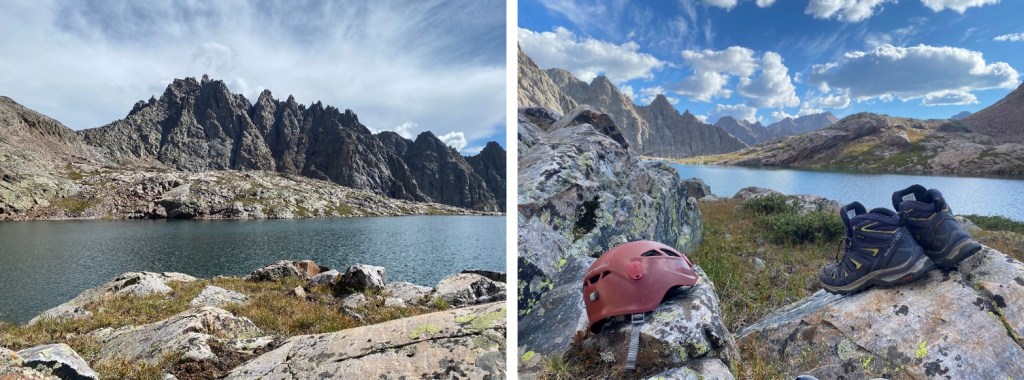
This lake has several spots to camp, but most of the shoreline is solid rock slabs that drop off into the water. It would be difficult to walk the perimeter of this lake. I set up camp on the north side. The next few hours were spent jotting down notes (I was mad I’d wasted over an hour of time route-finding, and had a lot of venting to do), trying my best to eat something, enjoying the view of Jagged, and listening to the pikas keep tabs on what I was doing, executing a call and response tactic from all across the lake. I once again made it an early night.
Pikas:
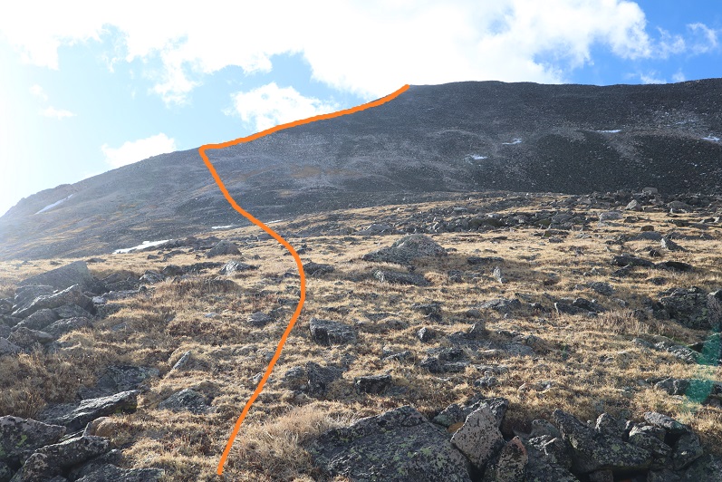
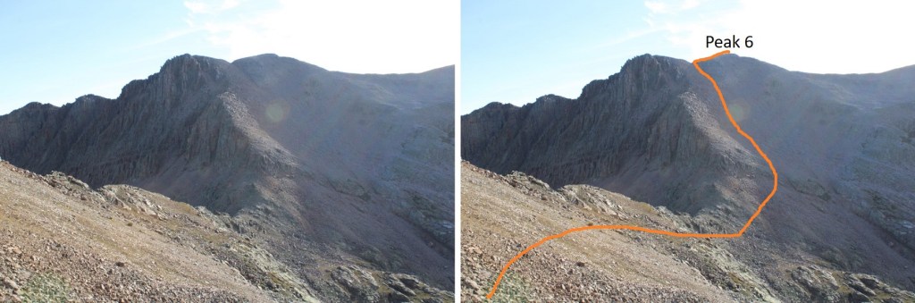
I was up at first light the next morning. To summit Peak 6, I headed northeast from my campsite, following the scree. Here’s an overall view of my route
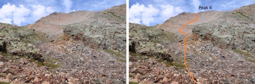
And some step by step pictures. There was scree here, and the rocks were steep, but I felt the entire route was class 2. I stayed close to the rock outcropping in the upper gully, and I saw a swift moving pine marten near the upper ridge.
Once on the ridge I turned right and easily walked to the summit of Peak 6
I summited Peak 6 at 7:15am (and had cell service!)
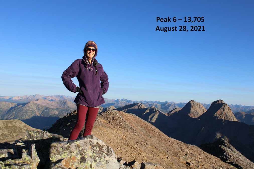
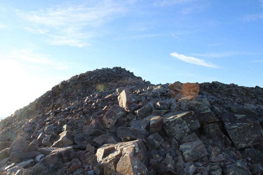
Peak 6:
I intended to summit Peak 5 today as well, but was having trouble… seeing it? For reference, here’s Peak 5 as seen from Peak 6, along with my route. Peak 5 is circled in red
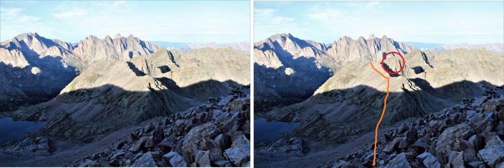
The ridge from Peak 6 to Peak 5 doesn’t ‘go’, so I descended down Peak 6, staying as high as I could on the scree, making it to just below the Peak 5/6 saddle. From there, I looked for black band in the rock, skirted under that, then aimed for a grassy patch, ascended the grassy patch, and aimed for the saddle. There is no need to stick to the ridge here

Once on the small saddle I could see Peak 5, and was a little apprehensive: that looked more than class 3. I dropped my gear, put on my helmet, and made my way over, only to find it’s an easy class 2 hike from the west side. I re-gathered my gear, and made my way over to the summit.
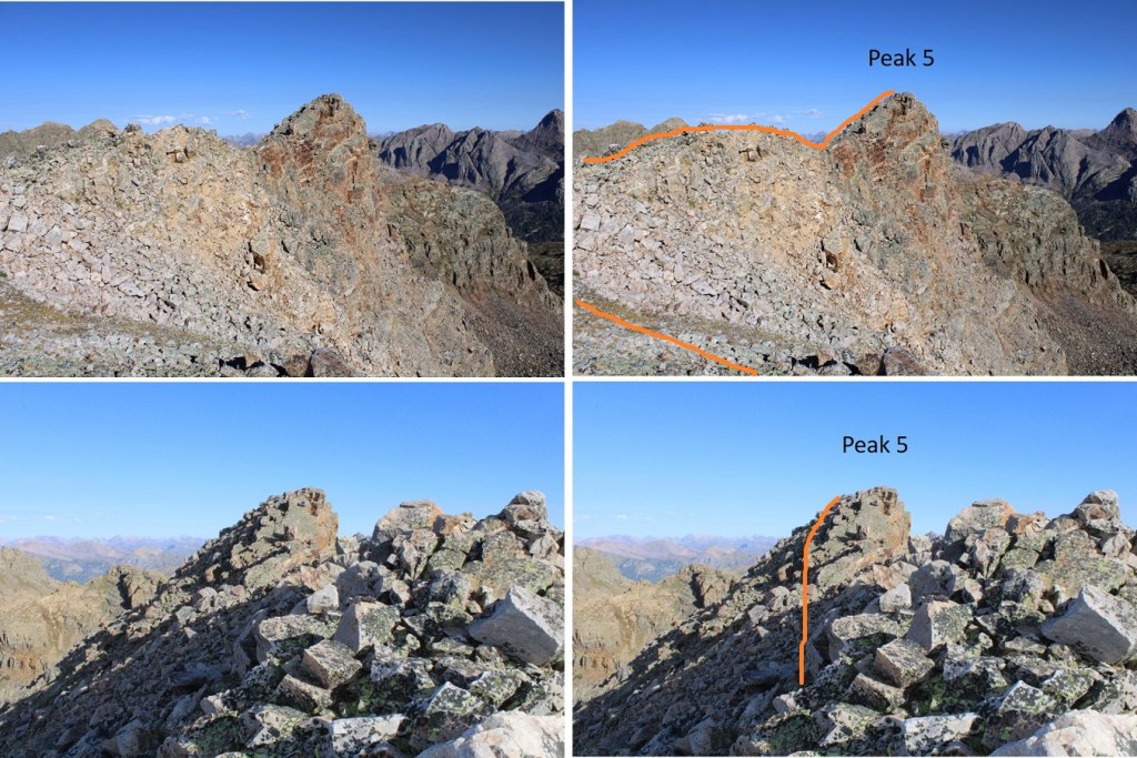
I summited Peak 5 at 8:45am. Unlike with Peak 6, I did not have cell reception here.
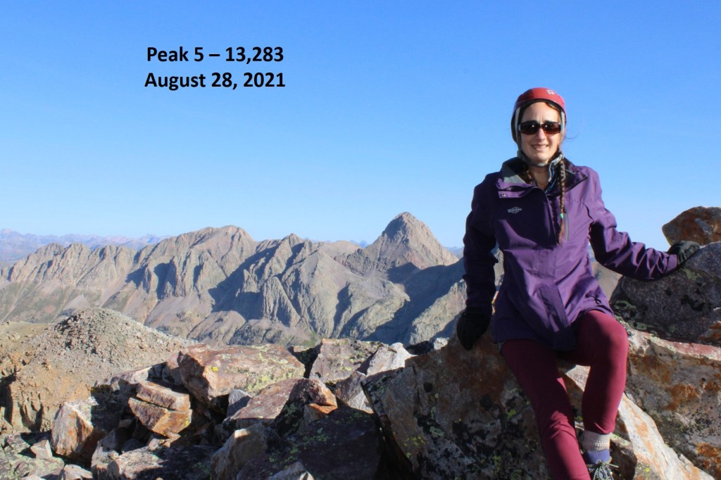
Peak 5:
I made my way back to the ridge, where I had a good view of my route down from Peak 6 to the ridge on Peak 5
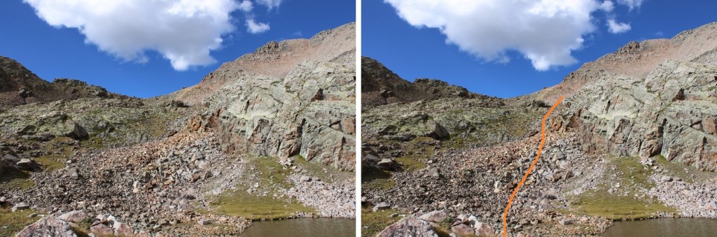
I looked for the scree gully, and followed it back down to my campsite.
It would be hard to cliff out here, but you should get a good idea of your intended route from below before you start out for your peaks. Here’s what my route looked like from the lake, down from Peak 5 (you could also take this route in reverse, ascending this way)
I retrieved my gear. It was now 10am (I’d started around 6:30am, so it was less than a 4 hour loop) and made my way out of the lake area and back to the upper basin.

Then followed goat trails through the willows to the lower basin
It took me 2 hours to make it to Jagged Cabin from my camping spot by the lake. It was now noon, so I had a snack and a quick break before heading on through the avalanche area. It was much easier to find game trails on my way back than it had been on my way in.
The trail was easy to follow to the Animas River, and I had an easier time up and over Water Tank Hill than I thought I would have (it’s really not so bad). I arrived at the hill the same time as a train, and watched it for a few minutes fill up. Then it was on my way towards Needleton and the Chicago Basin area cutoff. Along the way, just before Pigeon Creek, I saw a small bit of bear scat that hadn’t been there on the way in. I know there’s a mama bear (and sometimes cub) that frequents this area, and wondered if I’d get to see her today? (I didn’t)
There was a family staying at one of the houses at the Needleton Train Stop. They had a fire going, a generator, and were pulling water from the river. I waved as I passed and continued on towards Needle Creek. When I made it there, I decided to just spend the night. I’ve always wanted to spend the night here, but it hasn’t worked out with my schedule. I was in no real hurry to get home at this point, so I set up camp. I had the whole place to myself the entire night. It’s weird not to have a compelling reason to hurry home; now that I’m an empty nester, I’ll be able to get in more hiking time. Side note: I made the decision not to bring deoderant on this backpacking trip because it was a smellable and added extra weight. Added to that, I was wearing the same clothes the entire trip, so what good would deoderant do anyway? On this third night backpacking, curled up as tight as possible inside my bivy to stay warm in the cold, shivering and not able to get a breath of fresh air from outside the bivy due to the cold weather conditions, I regretted this decision; I could strongly smell myself and it wasn’t ideal. Good news: by the next morning I was nose blind.
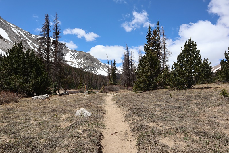
Chicago Basin cutoff:
Up early the next morning, I was on the trail by 6am, and made it back to the Purgatory parking area by 10am, making this a 54.06 mile trek with 12383’ of elevation gain.

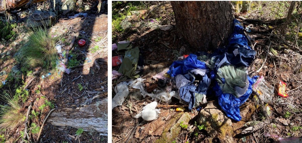
Final side note: Just before getting to Jagged Cabin, on top of a hill but paralleling Noname Creek on an obvious game trail, I found what looked to be a recent cache torn open and destroyed by critters. I’m not sure if someone left this to be used later this summer, if they ‘forgot’ their gear, or if they left it after finding it ruined, but it’s all destroyed and useless at this point. It’s also trash. There’s a full tent that looked like it had been stored properly (torn to pieces now, of course), tons of food wrappers (like, at least 10 different wrappers from Ramen, and lots of snacks: it was a ton of food at some point, but diminished to empty wrappers now), a small radio, a destroyed first aid kit, an Ursack that had been ripped into pieces, etc. I took what I could, but there was a lot to carry out. Maybe if everyone took a little bit we could clean the area up?