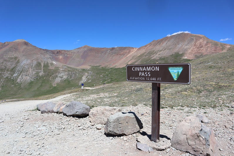
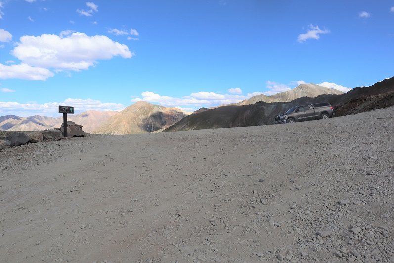
After hiking Every Mountain and Cooper Creek Peak I still had some energy left, so I decided to drive up to Cinnamon Pass and get in a few more peaks today. There were a bunch of OHVs in the parking area when I arrived. Mine was the only truck/non OHV there.
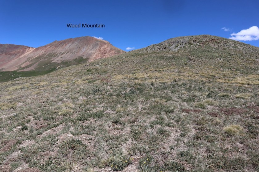
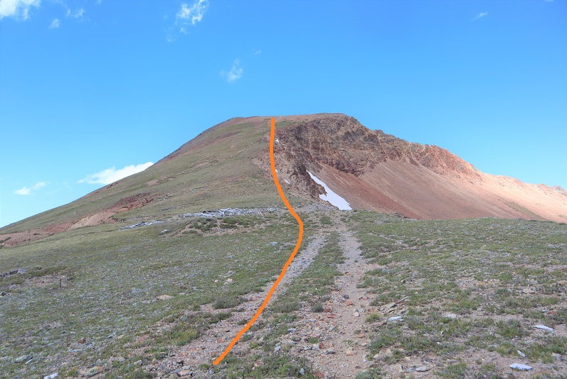
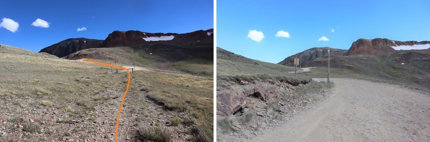
I gathered my gear and started out at 12:30pm. I began by heading north towards Wood Mountain
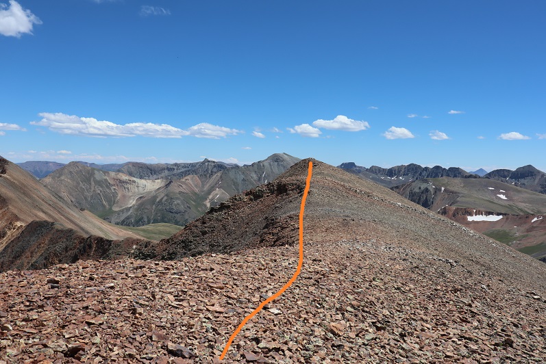
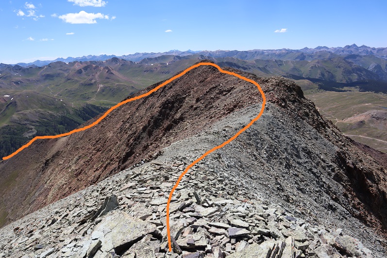
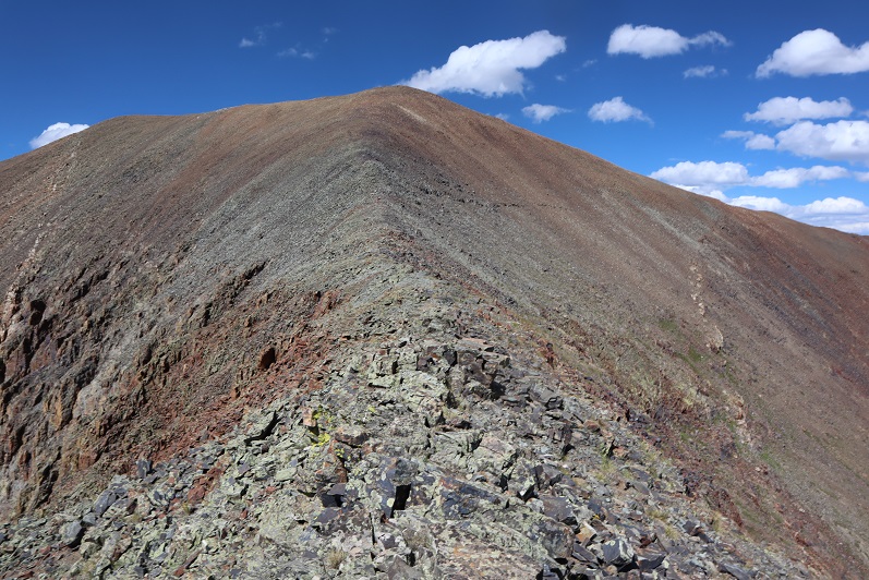
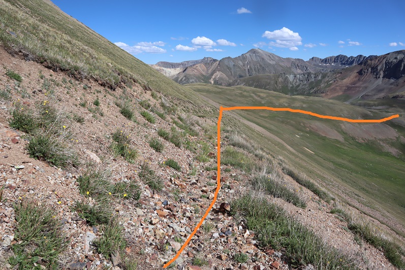
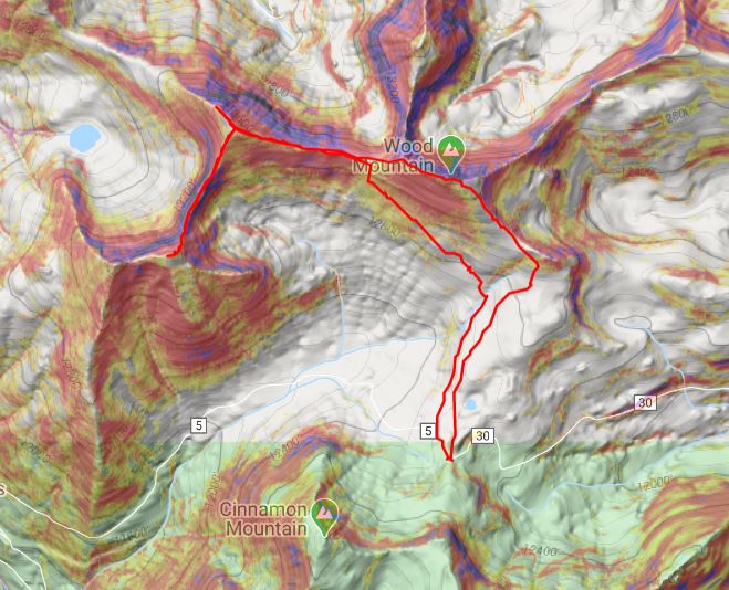
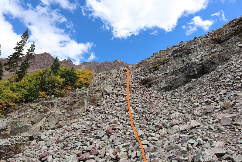
Here’s an overall view of the route
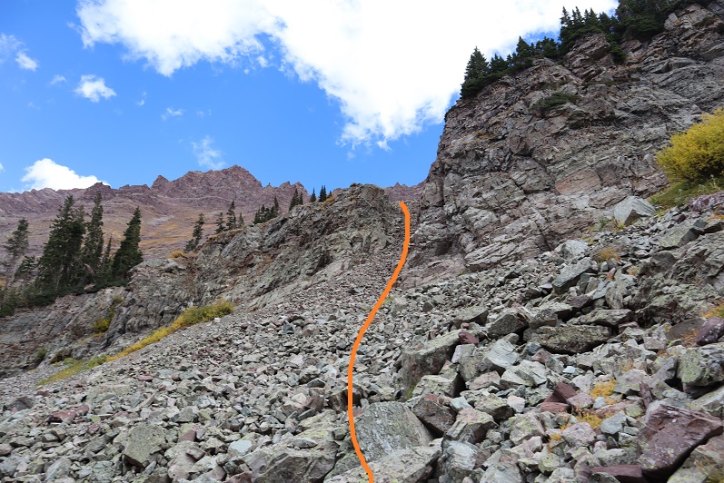
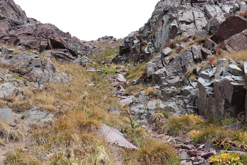
As I was hiking I came across a faint road and followed it up to the ridge
The road ended at what used to be a structure. From there I just hiked up the side of the mountain
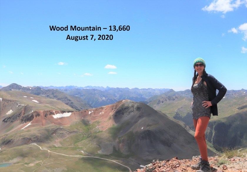
I summited Wood Mountain at 1:15pm, and while I was a little slow/tired from my hike earlier today, I couldn’t believe how easy this summit had been!
Wood Mountain:
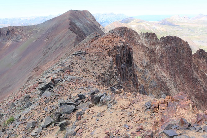
Here’s looking back down the ridge I’d just hiked up
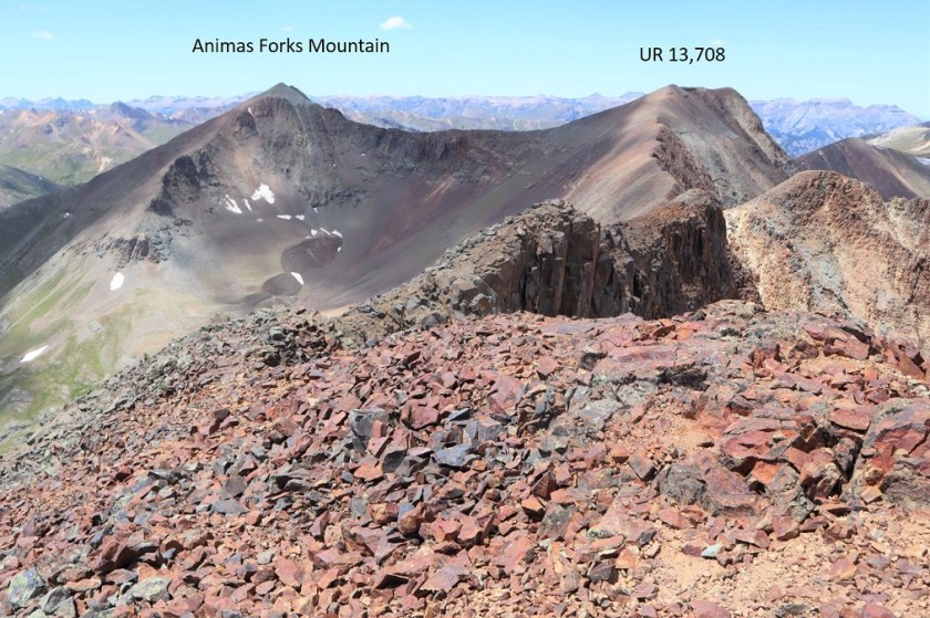
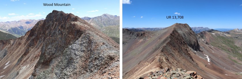
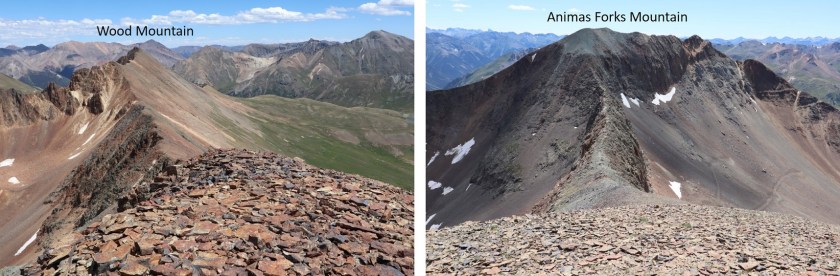
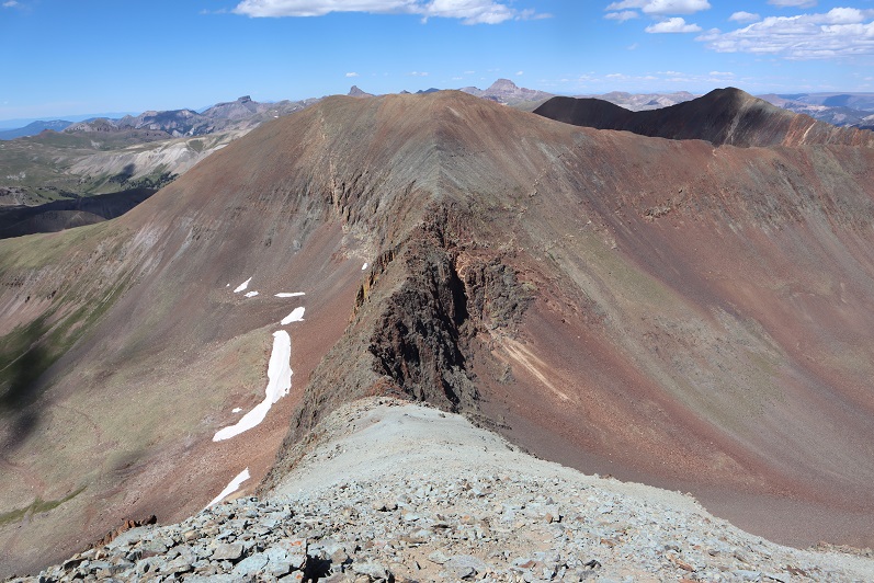
From Wood Mountain you can easily see the other two peaks I’d be hiking today: UR 13,708 and Animas Forks Mountain
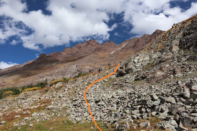
There wasn’t a trail to follow, but this was a simple class 2 ridge hike over to UR 13,708
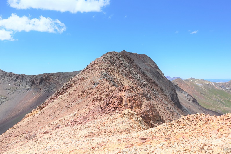
From the saddle, here’s looking back at Wood Mountain and up towards UR 13,708
And a good look at the ridge to Animas Forks Mountain
The rock here was loose rubble, but the ridge was easy to follow to the summit
I summited UR 13,708 at 2:15pm. Once at the summit I wasn’t sure I was actually there, so I walked the short distance north to the next point.
Once there I got out my altimeter and determined the first point was actually the highpoint, so I hiked back.
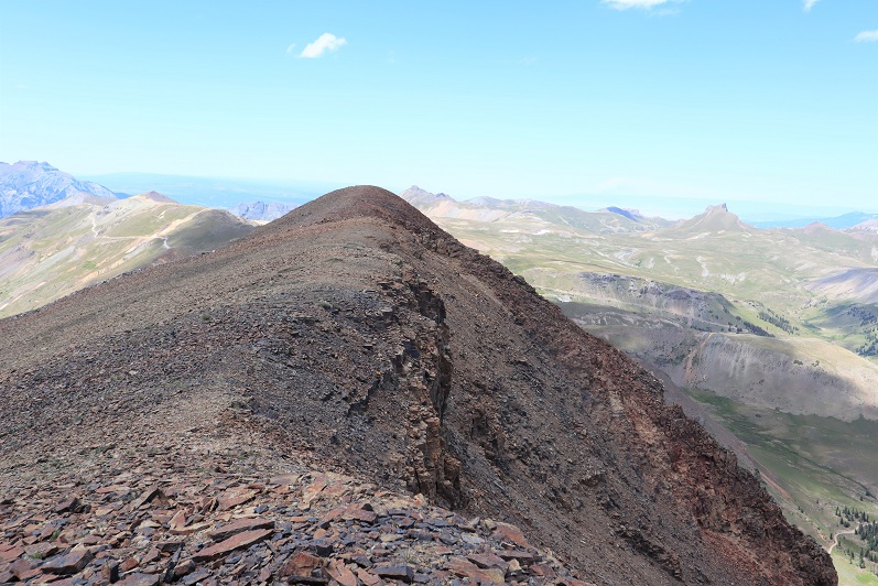
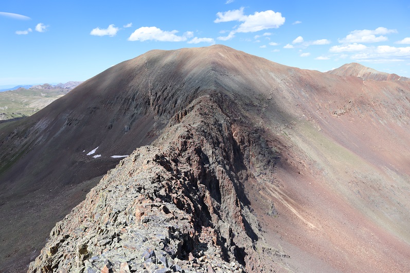
I once again stood on the summit of 13,708 and looked over at Wood Mountain and then over at Animas Forks Mountain
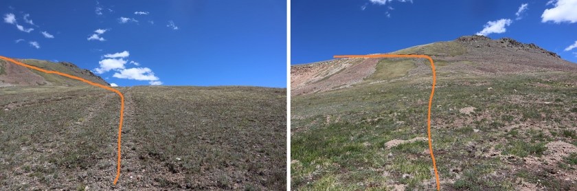
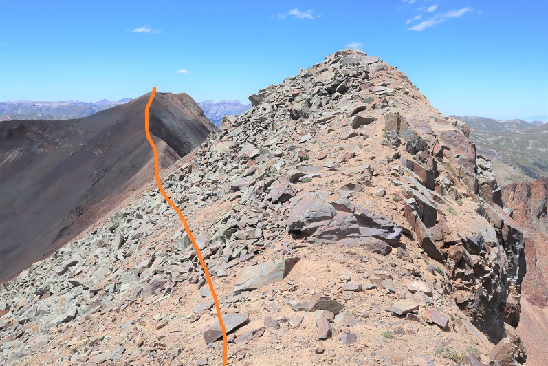
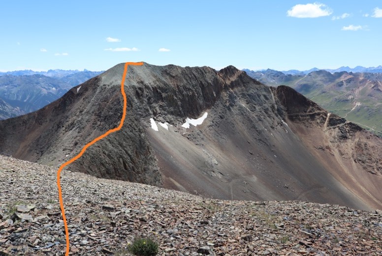
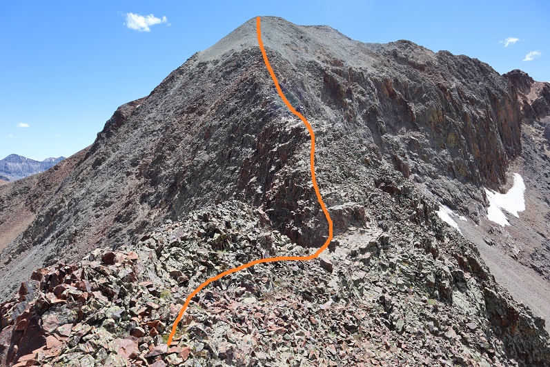
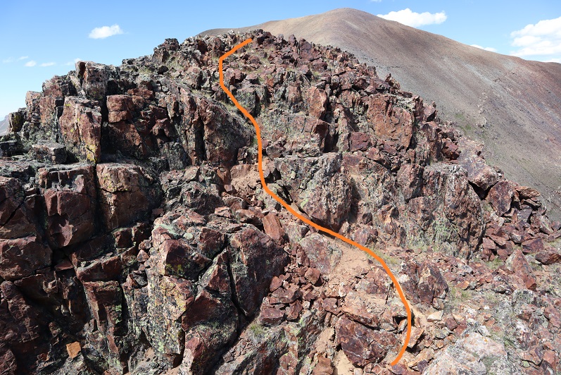
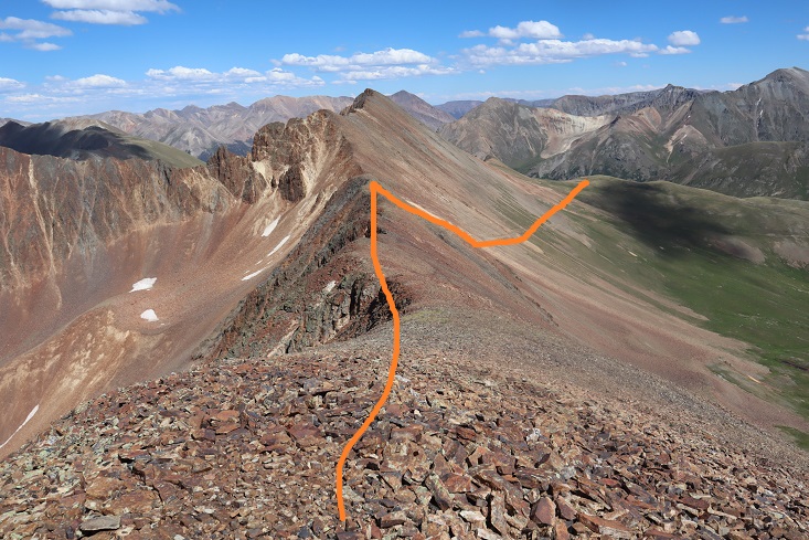
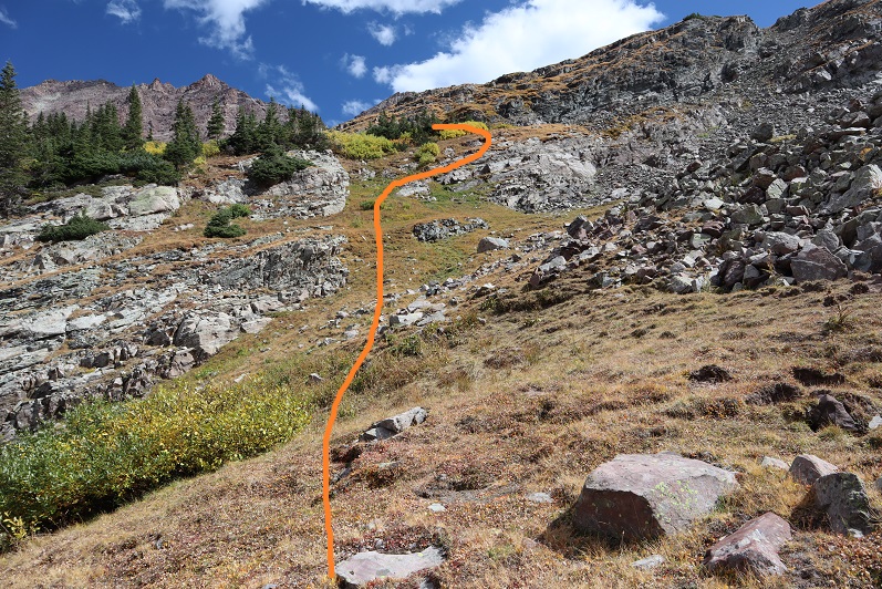
Here’s the route up to Animas Forks Mountain
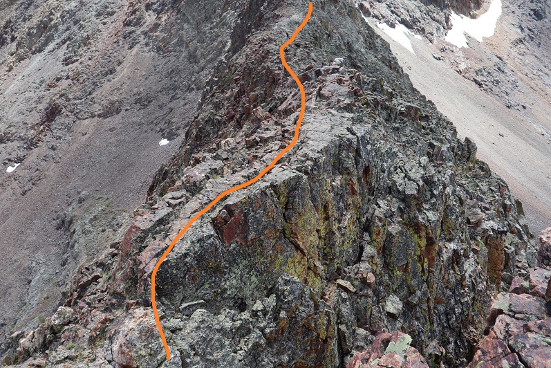
The ridge looked like more than class 2, but if you just follow the ridge it stays at class 2, just with some added exposure.
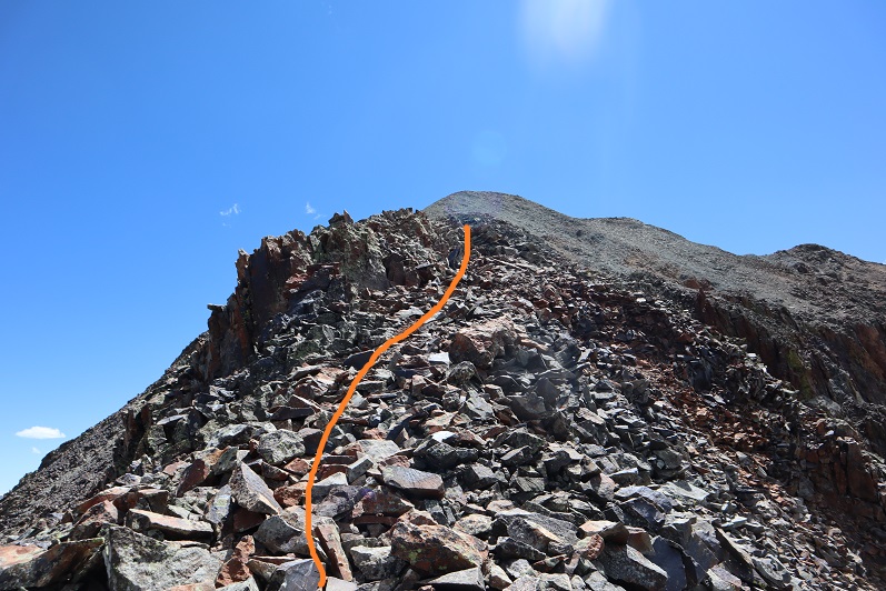
The rock is pretty solid until the very end, where it becomes loose just before it turns to gravel
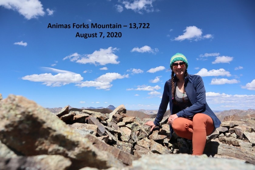
I summited Animas Forks Mountain at 3pm
“Animas Forks Mountain”:
From the summit you can see an easy way to make this hike a loop, just follow the ridge down to the road and hike the road back to Cinnamon Pass.
However, there were some mines I wanted to explore below Wood Mountain, so I decided to retrace my steps back UR 13,708. Also, when I’d taken a video at the summit of 13,708 I’d said I was at Animas Forks Mountain, and I wanted a new video with the correct name. Here’s the route back to 13,708
I re-summited UR 13,708 at 3:45pm
UR 13,708:
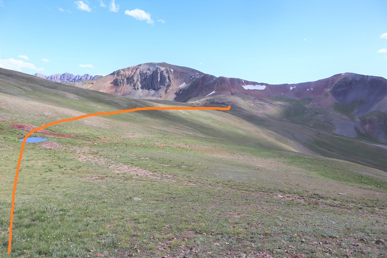
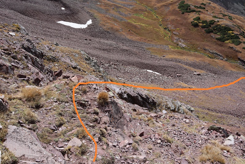
From here I made my way back to the 13,708/Wood Mountain saddle
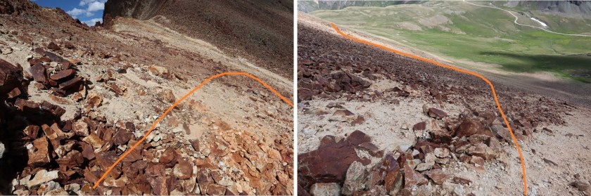
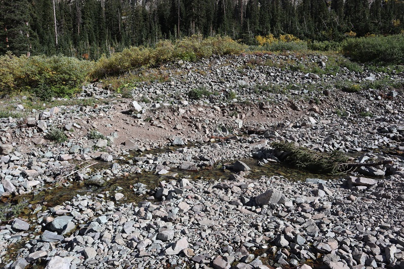
Once at the saddle I followed the sand and rock gully down until I hit up with an old mining road
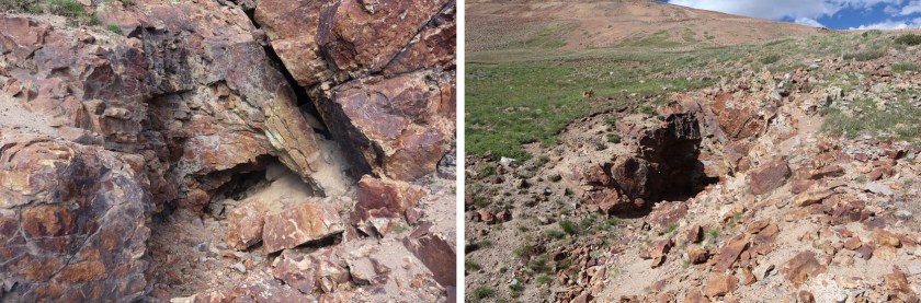
I followed the faint road until I came across a mine
The mine was completely boarded up, without even a gate/lock that would open. It was still neat to peer inside. It looked like they’d collapsed the inside.
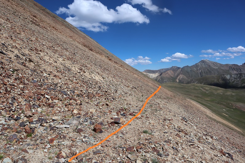
I continued following the road southeast until I came across another mine, this one not boarded up
From there it was an easy hike back to Cinnamon Pass
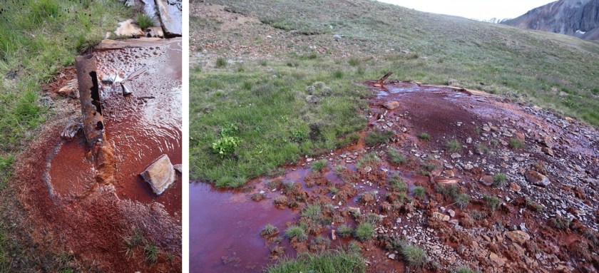
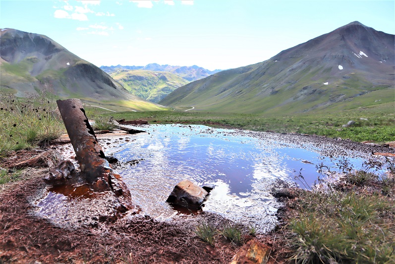
I passed some water coming out of a pipe that didn’t look fit to filter. The water was more red in color than orange, and made me wonder if that’s how Cinnamon Pass got its name?
Eventually I connected back up with the road and followed it to my truck. My truck was now the only vehicle in the lot
I made it back to my truck at 4:50pm, making this a 6.53 mile hike with 2270’ of elevation gain and lots of time exploring mines in 4 hours, 20 minutes.
I decided to drive to the next trailhead, eat dinner, and get some sleep. It ended up being an eventful and unplanned drive over Engineer Pass.
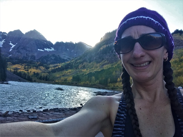
After summiting Vestal Peak I changed in my truck into new hiking clothes. I re-braided my hair, ate a packet of tuna and drove to Maroon Lake. It rained the entire 5 hour drive there and I was seriously worried my hike in the morning would be in danger. Originally I’d planned on hiking, taking a day off to rest, and then hiking again on Sunday but the weather forecast for Sunday called for 80-90mph winds so I decided to alter my schedule a bit. I was not impressed with the rain. It was raining when I fell asleep in the cab of my truck but I thankfully I awoke to a clear, starry sky at 2:30am.
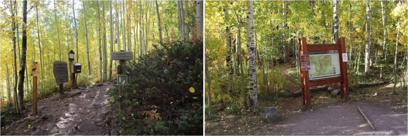
The parking lot was full of both hikers and photographers eager to get a glimpse of the fall colors. I debated going back to sleep for a few minutes but in the end decided I should probably get going. I was on the trail at 3am.
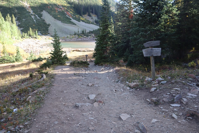
I followed the trail to Crater Lake
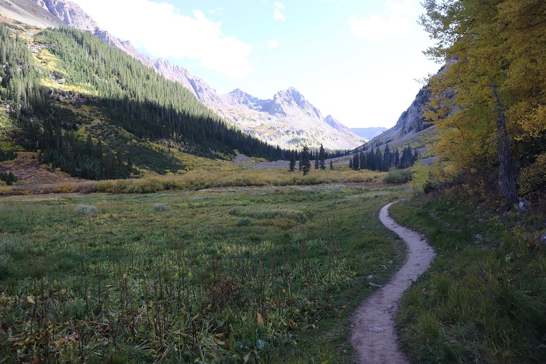
And then followed the West Maroon Creek Trail until I’d made it 3.7 miles.
This trail is so much nicer to walk when there’s no snow! Route finding was negligible
After 3.7 miles I crossed the West Maroon Creek (which didn’t have much water)
And headed east through the willows
Until I reached the base of the slope to the first access gully. This was difficult to figure out in the dark: The last time I was here the willows were completely covered in snow and I just climbed right up, but today those willows were taller than I was.
At the top of this gully is another gully
And at the top of this gully (you guessed it) another gully
Now the rocky gullies started including areas of tundra
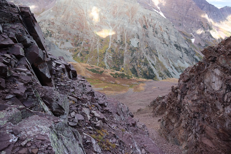
Now I was almost to the upper basin.
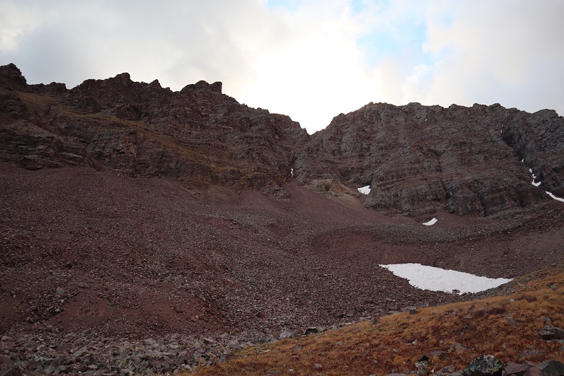
Once in the upper basin the sun started to rise and I had a good view of “Lightning Pyramid”. Traditionally you climb this peak as a couloir climb in the winter/spring, but obviously that wasn’t an option for me today and I’ve already been here in winter conditions: I wanted summer. I headed across the rocky basin, aiming for the couloir.
This next part in italics is personal and has no relevance on the trip report. Feel free to skip it if you’re just here for route information.
I’m going to summarize this as quickly as possible: I don’t consider myself to be an overly religious person. I grew up in the church but no longer attend (please don’t invite me to your church: I have personal reasons for why I don’t go). I do believe in God and find him more in the mountains than in a building surrounded by people. Often when I hike I have conversations with God. I do most of the talking, but surprisingly I started to feel him talking back (rarely, but it happened). I’m going to be honest here: If someone told me God spoke to them I’d think they were daft, so I totally understand if you think that of me, but I think what I’m going to say needs to be said (for me at least). Also, once again, I’m not a ‘preachy’ person and will most likely never mention anything like this again in a trip report.
For some reason I’m a ‘people-pleaser’. I have a need to be liked and I go out of my way to be friendly and helpful. I feel I need to be ‘perfect’. I don’t do well with rejection. I’ve always been an avid hiker but started seriously tackling peaks after I got a divorce. My ex had supervised visitation of the kids one day a week and on that day I’d go hiking. After my 13th summit of Pikes Peak I met someone on the way down who asked me which other 14ers I’d done. My response: “What’s a 14er?”
Obviously I was immediately hooked and after about 20 14ers I was hiking and talking to myself/God about how amazing Colorado and the mountains and hiking (etc) are and felt God speak back to me. He told me to hike all of the 14ers in Colorado solo. This idea intrigued me: I was both excited and scared. I wasn’t sure I could do it. Also, I didn’t really know why I should?
After hiking about 30 14ers solo I was sitting in a Girl Scout board meeting and Girl Scouts had just partnered with The North Face. We were brainstorming fundraising and marketing ideas and suddenly it all became clear: I could be the first woman to solo all the 14ers! Girl Scouts focuses on first women to do ‘stuff’. We could market this jointly with The North Face, the girls would get exposure to outdoor experiences and(hopefully) some free gear. It all seemed clear now: This must be why I was doing this! I felt I had purpose and direction.
I was so excited when I summited all 58 14ers solo because I felt I was doing it for a cause. Anyone who follows the 14ers site knows what a disaster that turned out to be, and honestly I just wanted it all to go away.
I kept hiking because I like to hike. On my first centennial after finishing the 14ers I felt God telling me to keep hiking the rest of the centennials solo and I balked. Once again, I wasn’t sure I could do this (hello class 5?) but after mulling it over I was willing to give it a shot. I knew I’d write up trip reports and post them to my website because that’s what I do, but he told me to keep posting to the 14ers site as well (I did not want to do this, but I did).
If you were to ask me why I was hiking all of the centennials solo I’d tell you I didn’t know. I honestly didn’t know, but I also wouldn’t have told you it was because “God told me to” because then you’d think I was totally nuts. But that was why I was doing it: Because God told me to.
Then Thunder Pyramid happened. At first I was confused because I knew I’d summited, and then embarrassed, angry, and frustrated. Why was this happening to me? Not only were people commenting on the 14ers site, but they were going through my LinkedIn page and challenging my accomplishments, posting negative comments on my website, facebook, and Instagram (sorry David for ghosting you: I honestly thought the feeling was mutual). People unfriended me both online and in person. They made up reasons to ‘prove’ I was lying and if they couldn’t find negative information they assumed or made it up. The dislike button was hit on my trip reports and I took it all very personally.
The hardest part was just because they were loud didn’t mean they were right. I knew I wasn’t lying but I couldn’t change their minds. I’m also sure they think their behavior was justified. I think it bordered on harassment. It was definitely bullying.
So here I was, halfway to the summit of PT 13,722 and all of this was going through my head, in addition to the anti-climatic day I’d had yesterday when I’d finished hiking the centennials solo and didn’t ‘feel anything’. I was asking God why I just couldn’t get excited about finishing the centennials solo? I didn’t want to post anything on the 14ers site because I didn’t want to go through the drama again. I mean, I know I shouldn’t care what other people think about me…
That’s when it happened. As soon as those words went through my head everything stopped and suddenly it felt as if I was getting the biggest, warmest, most enveloping hug I’d ever had. Overwhelmed I broke down and started crying big crocodile tears, taking huge breaths in and out between sobs.
That was it: I wasn’t hiking for a cause or to help others but because God wanted to teach me a lesson. He wanted me to realize it doesn’t matter what other people think. He just chose to show me that lesson through something I love: hiking.
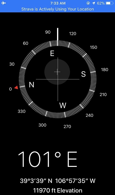
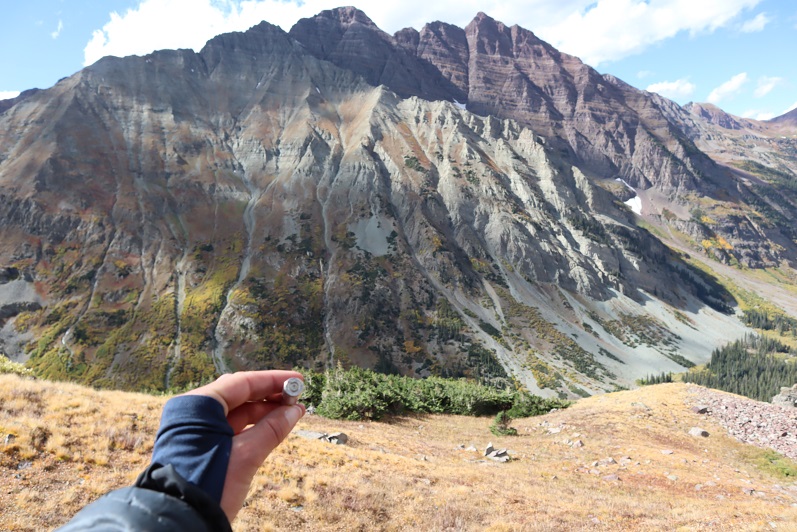
“Wow” I thought: “He had me hike all the centennials solo to teach me not to care what other people think”. A simple lesson we teach out kids and that everyone knows but that I have difficulty accepting. This moment was so powerful I got out the altimeter/compass on my phone and took a picture of where it happened. I thought about just saying it was at 12K but ultimately figured that diminished the experience.
I wiped away my tears, looked at the mountain in front of me and thought to myself “So, if it doesn’t matter what others think of you why don’t you just turn back and go home?”
The answer? “Because I Love to hike”
With light shoulders and a renewed purpose I started off again. It took about 10 steps before another thought overcame me: “Why did God think I needed to learn this lesson? What is he preparing me for where I need to be ok with not caring what other people think about me?” (I squinted and closed my eyes, crossed my fingers and repeated: Please not politics, please not politics, please not politics).
Ok, moving on…
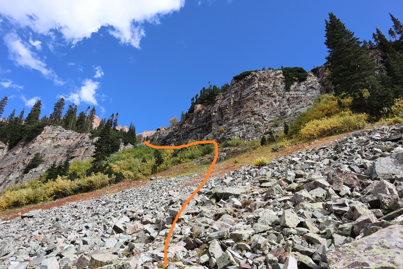
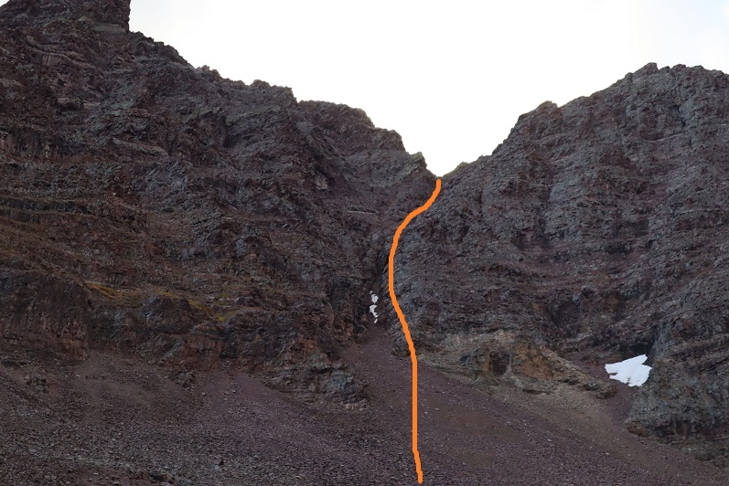
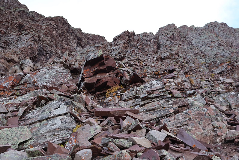
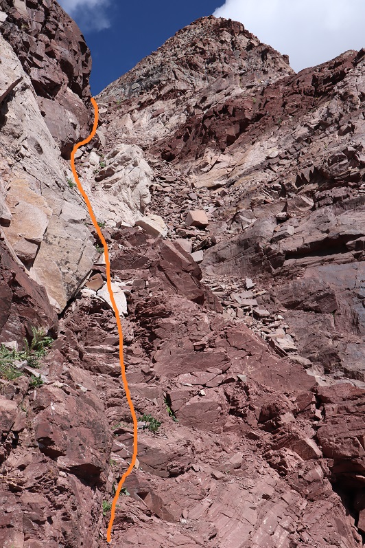
I trudged up the talus towards the couloir. This talus was nasty and each step hurt my ankle (not sure what I did to it yesterday, but it felt bruised). I made it to the base of the couloir and had a decision to make: How was I going to ascend this thing? It looked like it contained (more) nasty scree, so I decided to take the rocky rib to the right. This is the route I took:
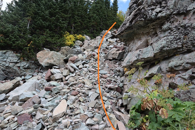
I need to stress this might not have been the safest way to ascend. The rock was extremely loose and I had to check and re-check hand and foot placement with every step. It was sustained class 4 bouldering for a good 1000’ of elevation. It was slow going, but I love bouldering and that’s just what this was.
I stayed closely to the right of the couloir for as long as I could, but eventually I had to enter the couloir for the last part of the climb. This area was very loose and I’d suggest you stay as close to the rib on the right as possible.
Here’s looking back down the rock rib/couloir and into the basin
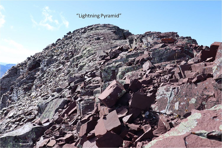
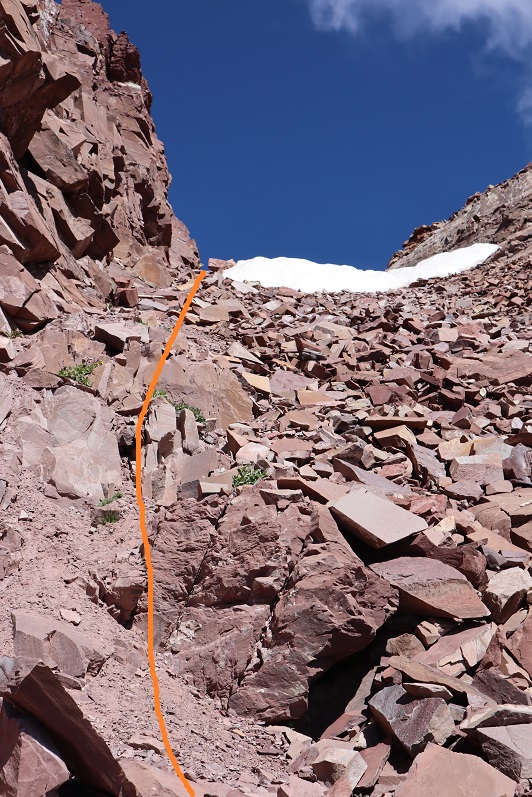
I made it to the top of the couloir and turned right (south), carefully climbing up the ridge
This was actually much easier than it looks (and easier than the climb to this point). I made it to the top of the ridge and saw an easy path to the summit of “Lightning Pyramid”
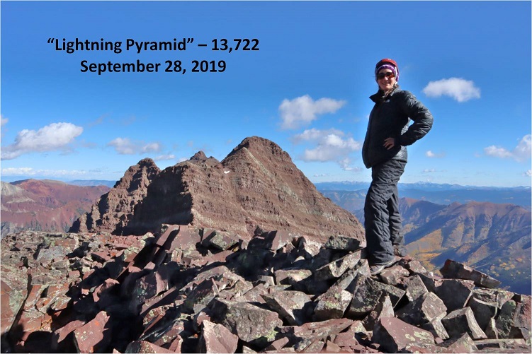
I summited at 10:20am
Lightning Pyramid summit:
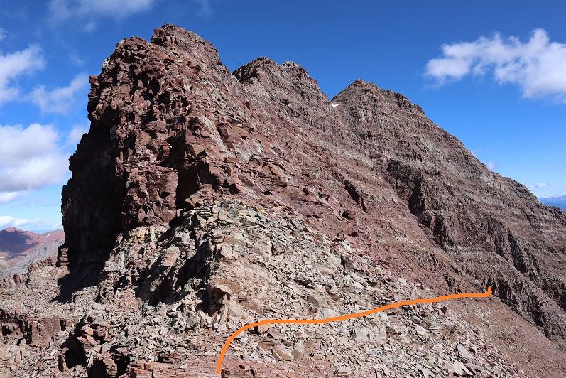
Ok, now time to head over to my old friend, “Thunder Pyramid”. I couldn’t find a lot of specific information about this traverse, so I had a lot of figuring out to do. I’d heard heading straight up and over the ridge wasn’t fun, and it in fact didn’t look like much fun, so I decided to scope out another way.
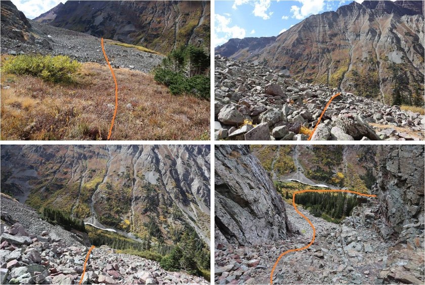
I headed back down to the saddle
Once there instead of hiking up the ridge I decided to stay level with the saddle and hike across the right (east) side of the mountain. This was surprisingly easy
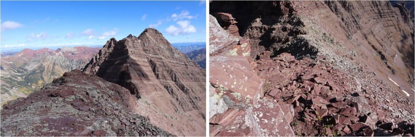
Here’s looking back at “Lightning Pyramid”
I stayed at the same level as the saddle until I came to a gully. This area took some careful footwork but little climbing. It may have risen to class 3, but realistically was class 2
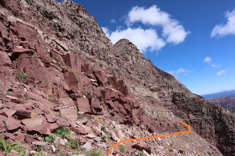
Next I came to a gully. This gully was very loose and I kept to the left side for stability, holding onto rocks and handholds in the boulders where available. This felt like class 3
At the top of this gully was another gully. I just aimed for the snow.
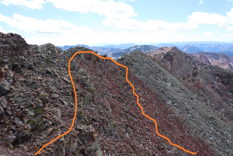
At the top of this gully is where the route picks up with the standard route up “Thunder Pyramid”. I turned right (north) and ascended the ridge
The top of the ridge wasn’t the summit however. I took the solid route up, the dotted route down. If I were to do this again I’d take the dotted route both ways because it doesn’t lose elevation.
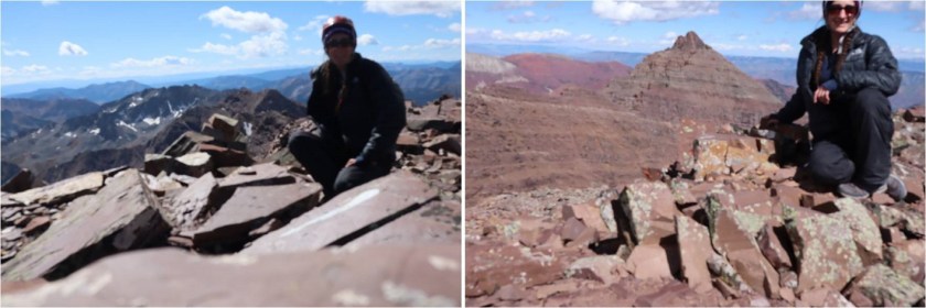
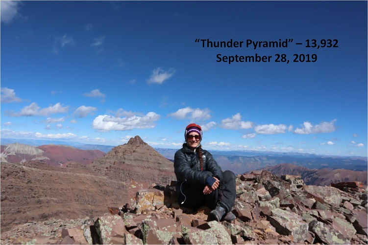
I summited “Thunder Pyramid” at 12:15pm. It took me just under 2 hours from “Lightning Pyramid”. Unfortunately, most of the pictures I got at the summit I realized were blurry when I got home (still figuring this new camera out)
But I did get one “ok” picture
Thunder Pyramid summit:
Up until this point doubt had crept into my mind: maybe what others were saying was true and I hadn’t really summited “Thunder Pyramid” last time. Maybe I’d ended up close but not exactly there? I’d been in a hurry because I’d been having a Raynaud’s attack and I didn’t take my normal number of summit photos/videos (I don’t usually get videos in winter conditions because it’s a death sentence for me to take off my gloves to operate the camera). So today I walked all over that summit, looked around and confirmed what I already knew: Yes, I had indeed summited the last time I was here. Also, the weather today was absolutely perfect! Those 50mph winds never materialized.
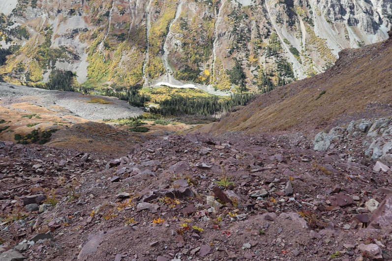
I decided to head back down the way most people hike up. I made my way back to the ridge and down the gully
Check it out! Now I know why it’s called the “White Gully” (Last time everything was white)
The descent down “Thunder Pyramid” was no more fun than the ascent up “Lightning Pyramid”, and considering both the gullies and couloir I’d say it’s probably easier to do Thunder first and then traverse over to Lightning. Also, I know this is usually done as a snow climb, but I felt much safer on the scree and talus than I had on the snow. When it was covered in snow I felt like if I slipped I’d fall and never stop sliding. Here I knew I could slip but I wouldn’t fall very far. This climb wasn’t ‘easy’ but it definitely wasn’t as difficult as I’d anticipated.
Hiking down was like déjà-vu (as it should have been)
I made it almost to the bottom of the gully and turned left
And descended the slopes into the basin
Also, I found a shell
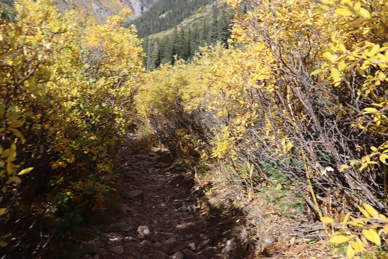
I made my way back to the West Maroon Creek Trail and hiked out, loving the fall colors in the daylight.
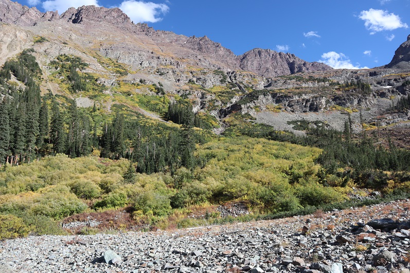
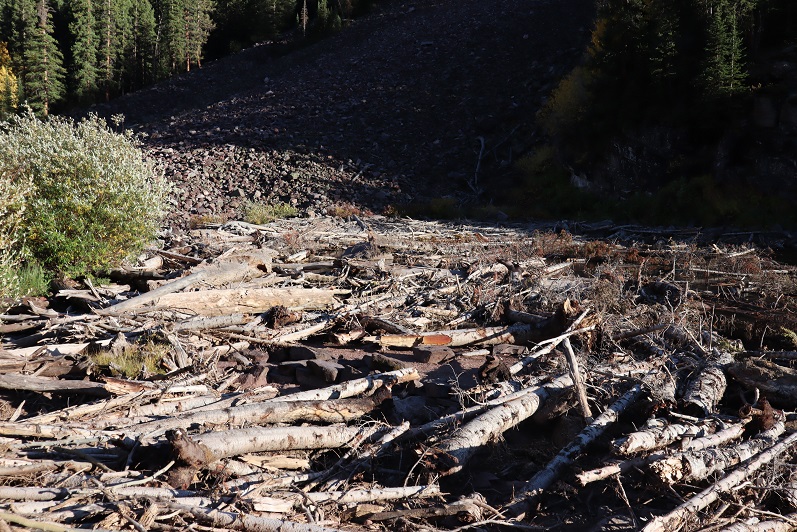
There were a ton of people around Maroon Lake when I got there, all enjoying the fall colors. The base of the lake resembles the Snowmass log jam
While the 50mph winds never materialized on the summit(s) today it was really very windy at the lake. I decided to head to my truck to clean up and then watch the sunset. There was a line of cars waiting for a parking spot and I had to tell no less than 50 of them I wasn’t leaving. None of them took it well, but it had been a long day, and I figured I’d earned watching a good sunset.
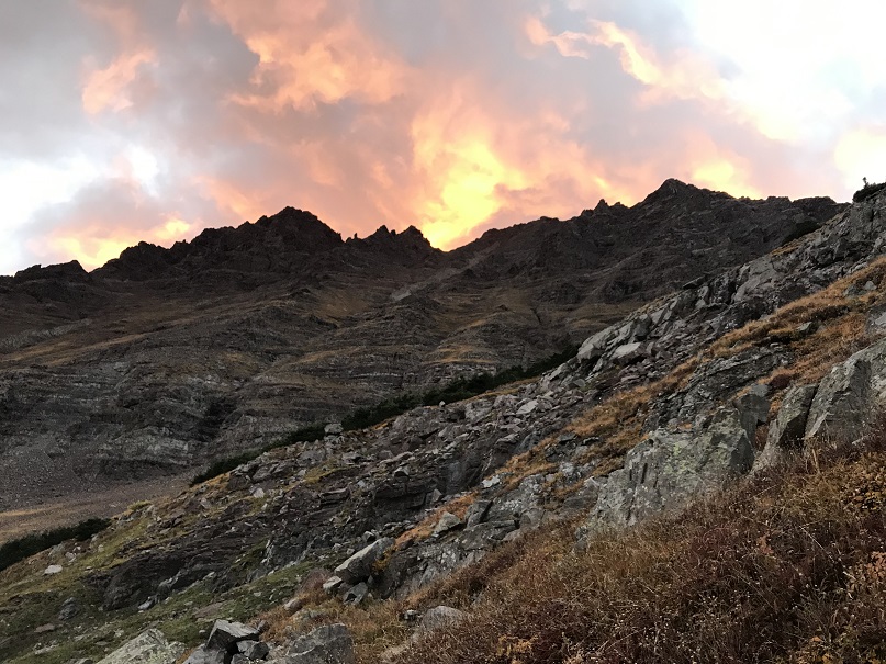
I made it back to my truck at 5:15pm, making this a 12 mile hike/climb with 5062’ in elevation gain in 14 hours.
I enjoyed the sunset
And as soon as it was over I hopped in my truck to drive home. There was a line of vehicles waiting for a parking spot that lasted for over half a mile down the road. The shuttle had stopped for the day and I drove 2 people down to the bus stop because they’d missed the last bus. They were a nice couple from Georgia who were happy not to have to walk those 13 miles back to their hotel. I hope they enjoy Colorado as much as I do!