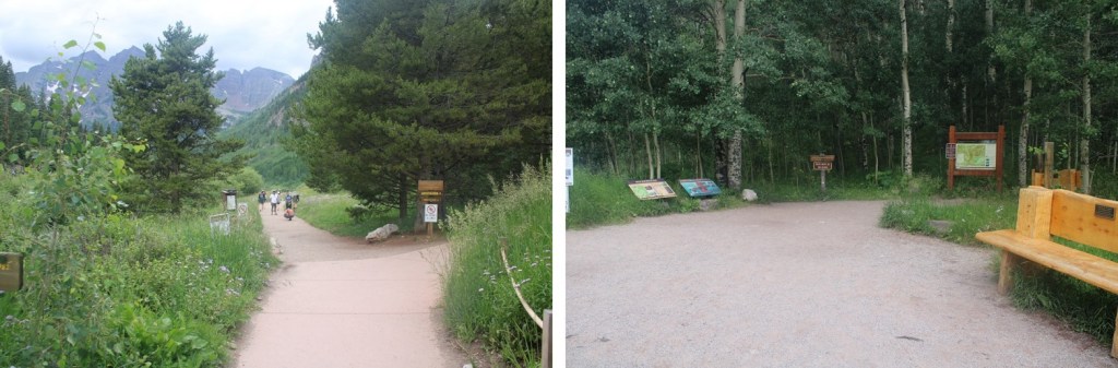
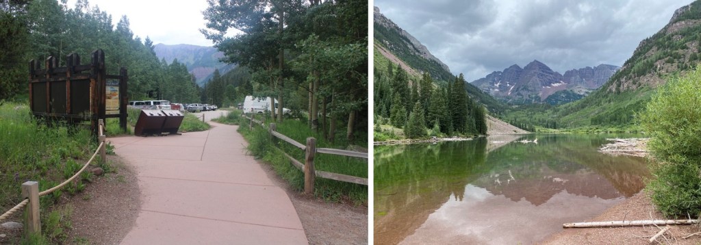
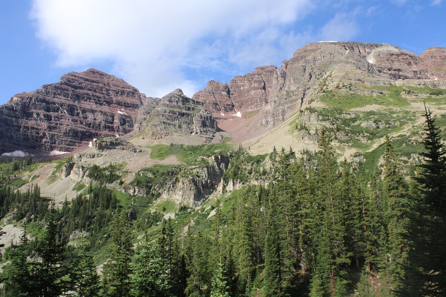
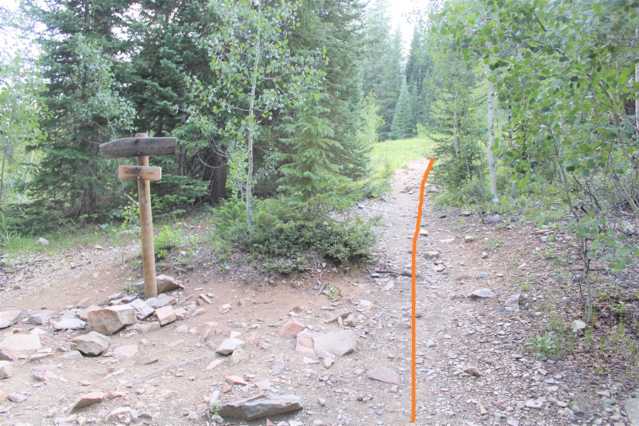
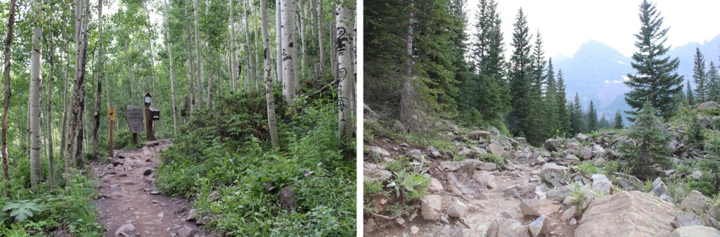
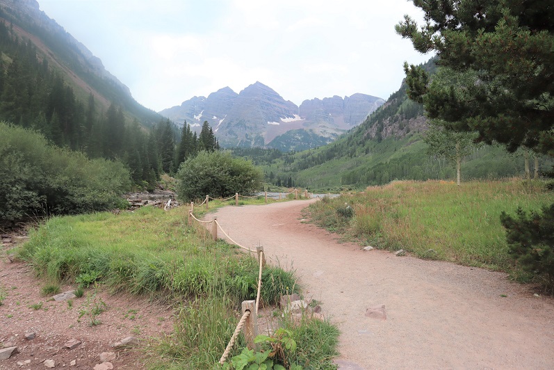
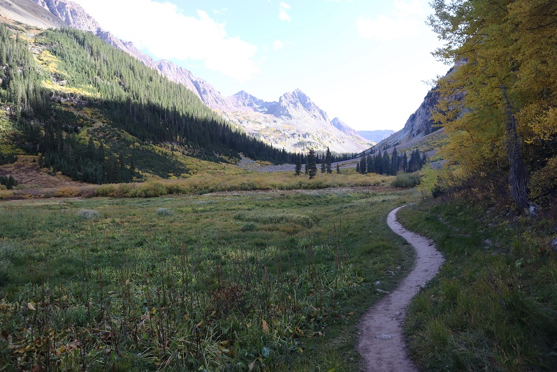
I decided to hike these peaks from the Maroon Bells area because I had a pass and was already there. I knew today was going to be a straightforward but long day, and it was supposed to storm in the morning, so I was up extra early and on the trail at 2am. I started at the Maroon Lake trailhead, and passed a few deer grazing in the dark. I skirted Maroon Lake to the right, and continued on the trail towards Crater Lake.
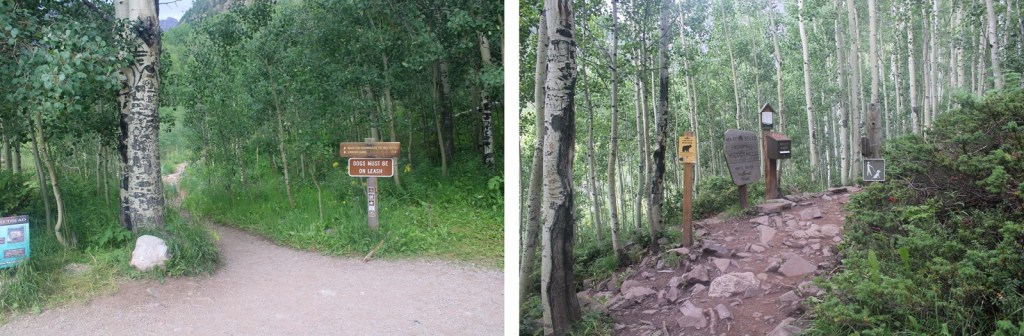
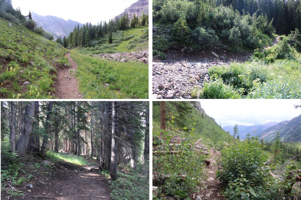
At the first junction I continued straight, and followed Maroon Snowmass Trail 1975 up into Minnehaha Gulch.
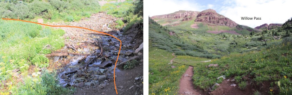
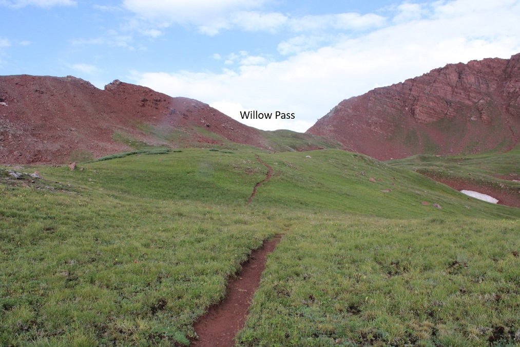
I continued on this trail all the way to Willow Pass.
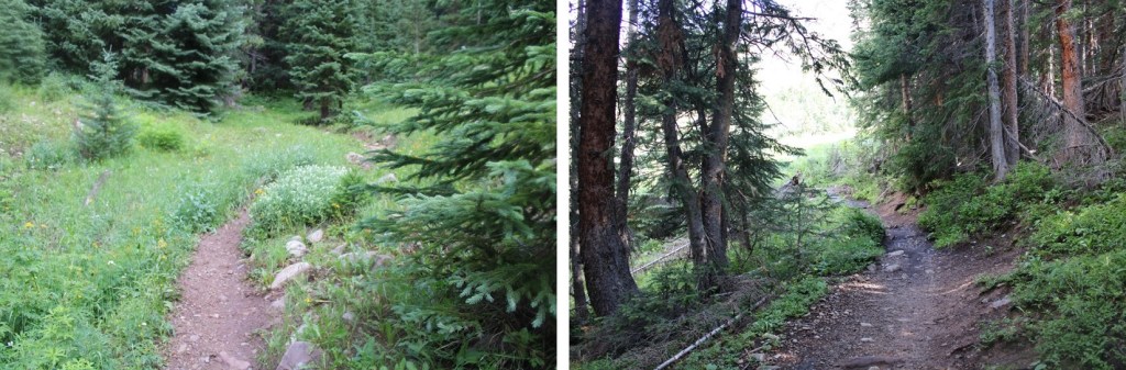
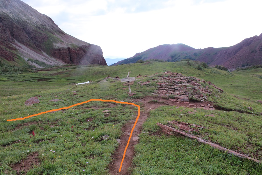
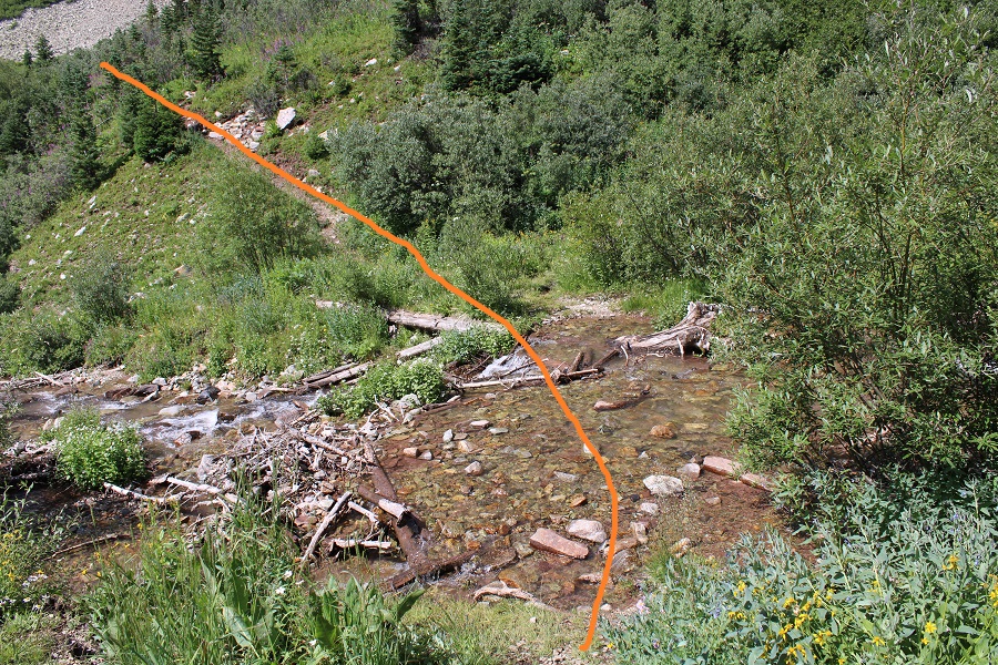
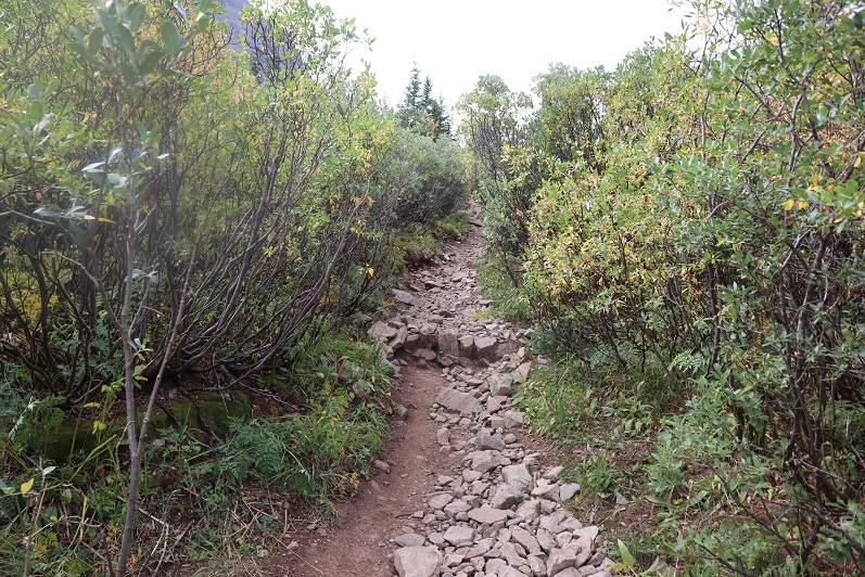
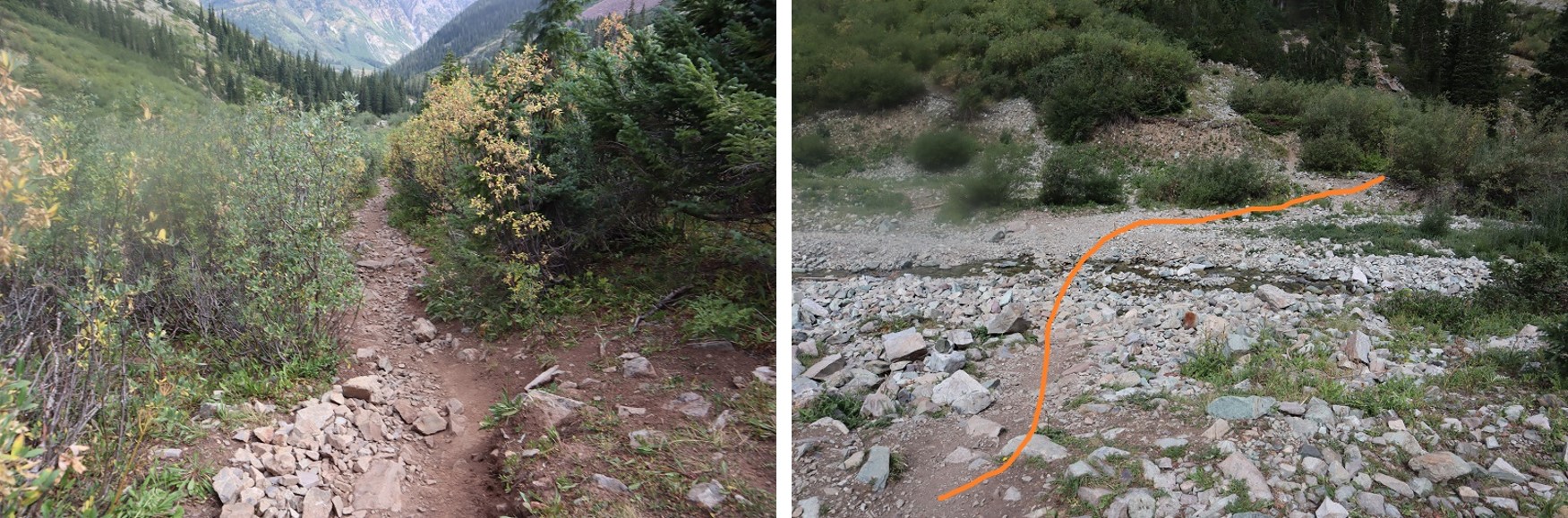
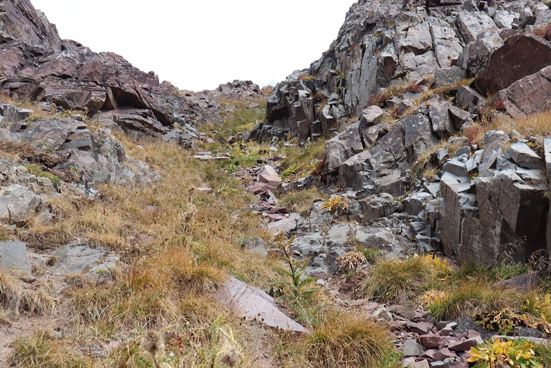
This is a class 1 trail that crosses a creek, then heads north through the basin.
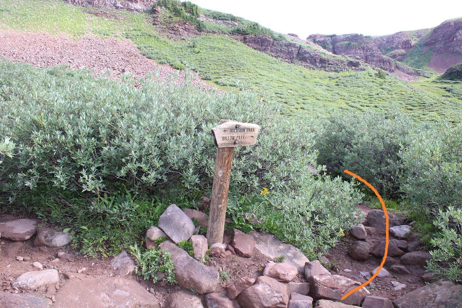
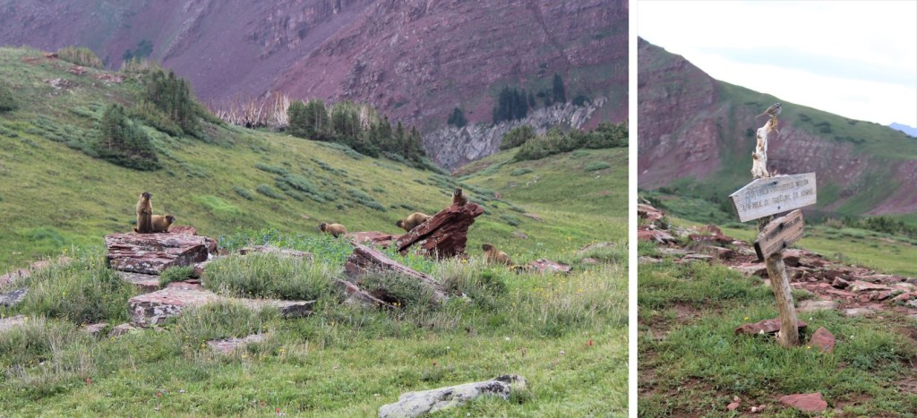
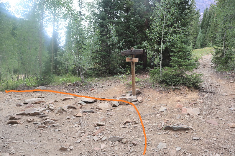
Stay right at this sign
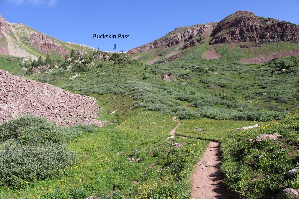
And follow the trail to Willow Pass.
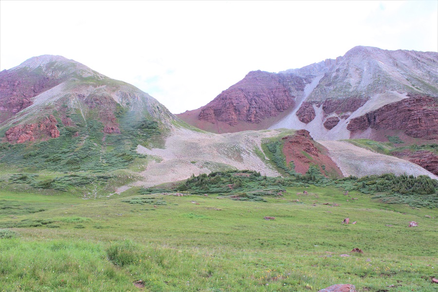
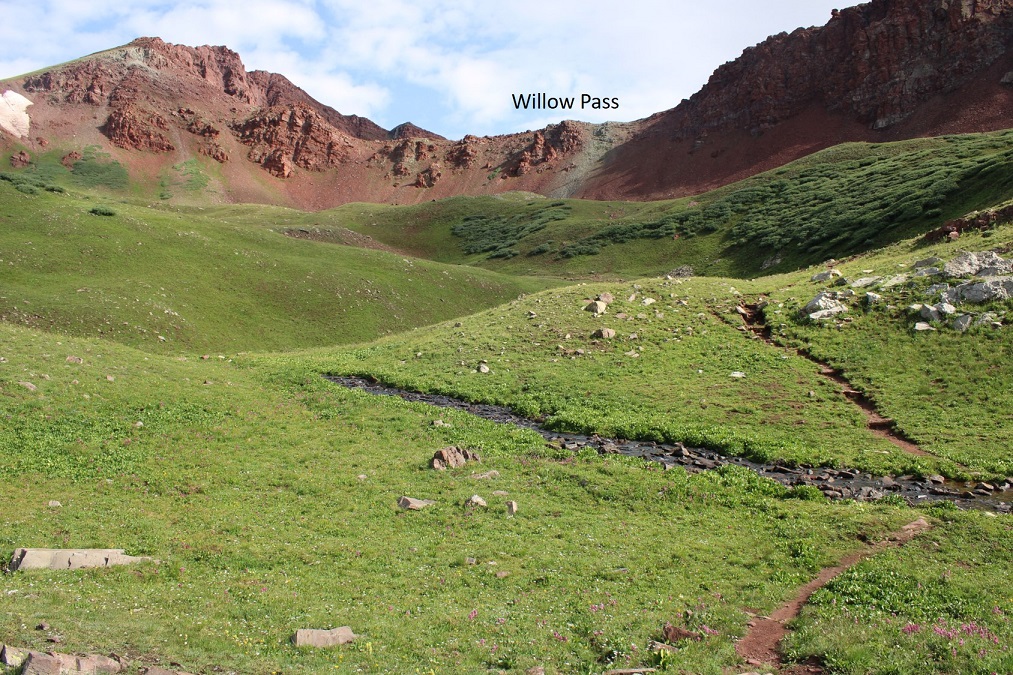
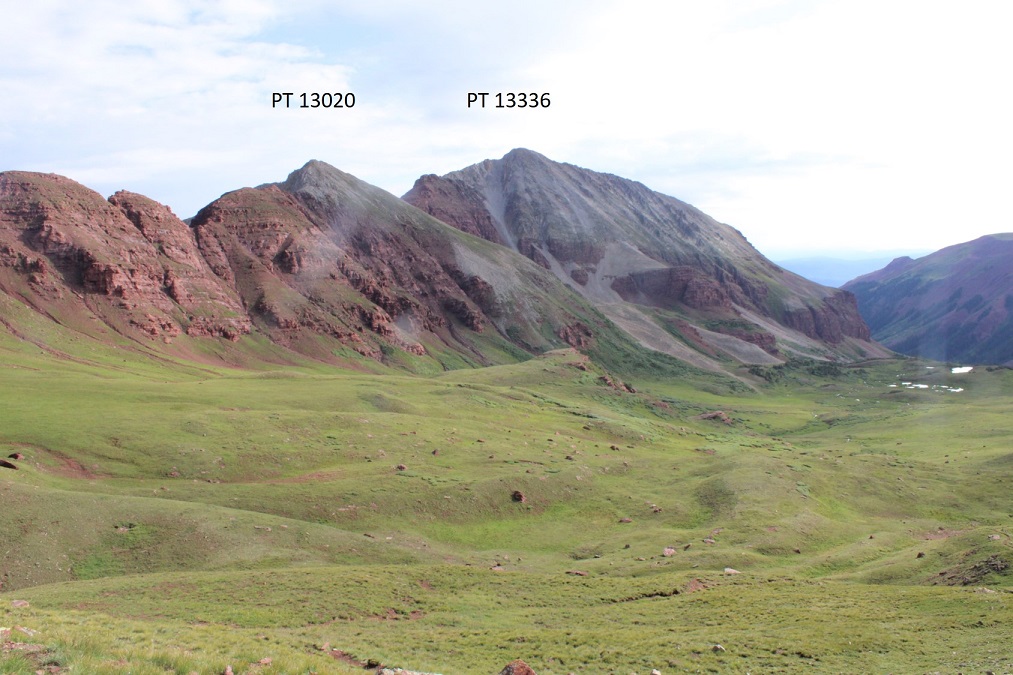
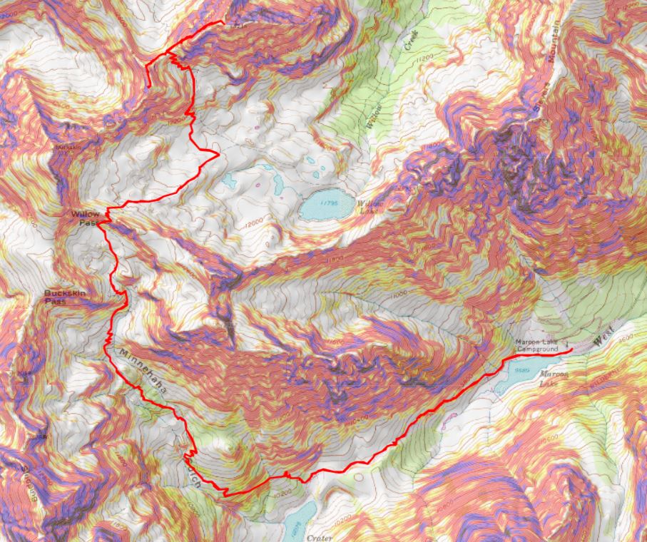
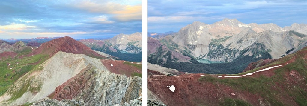
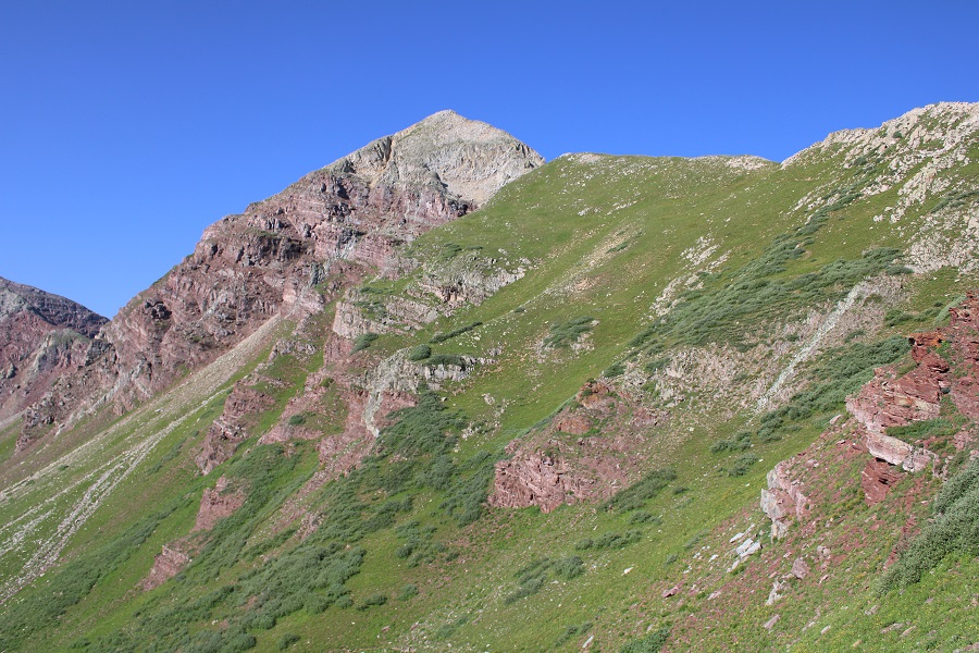
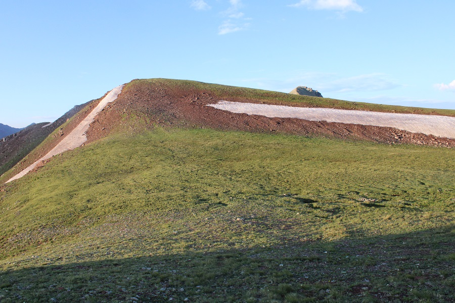
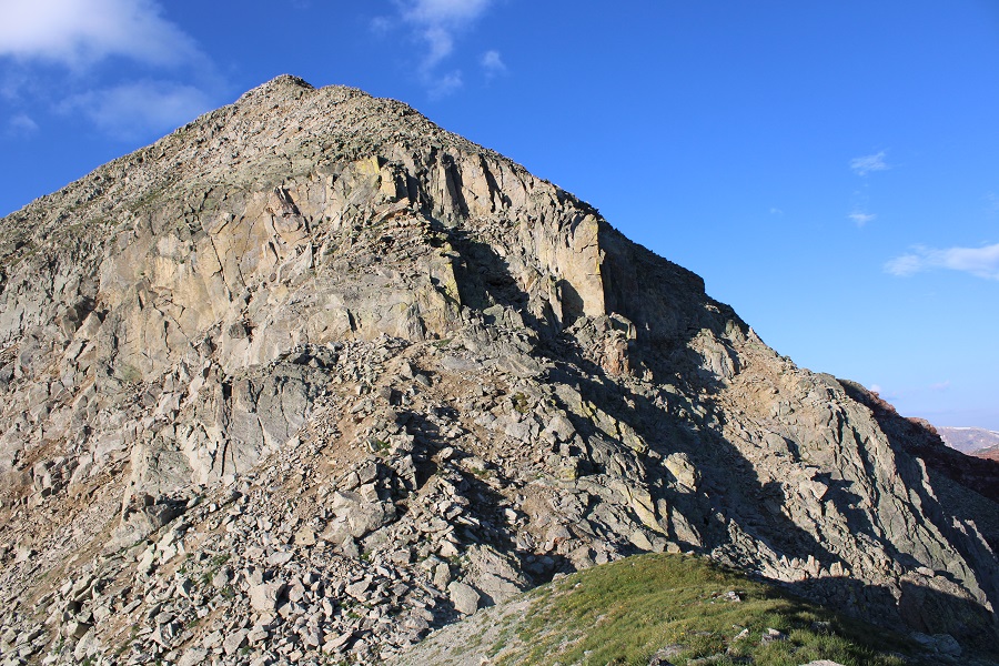
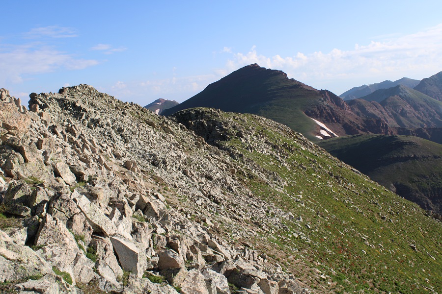
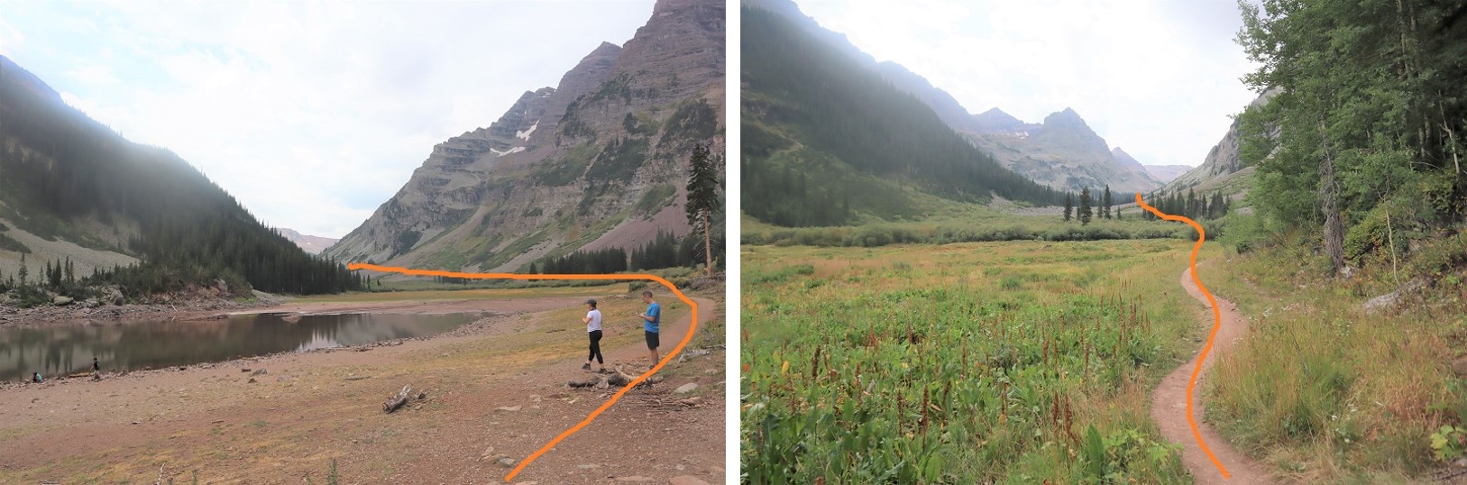
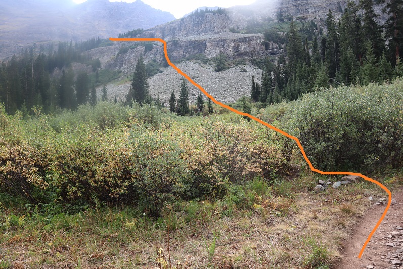
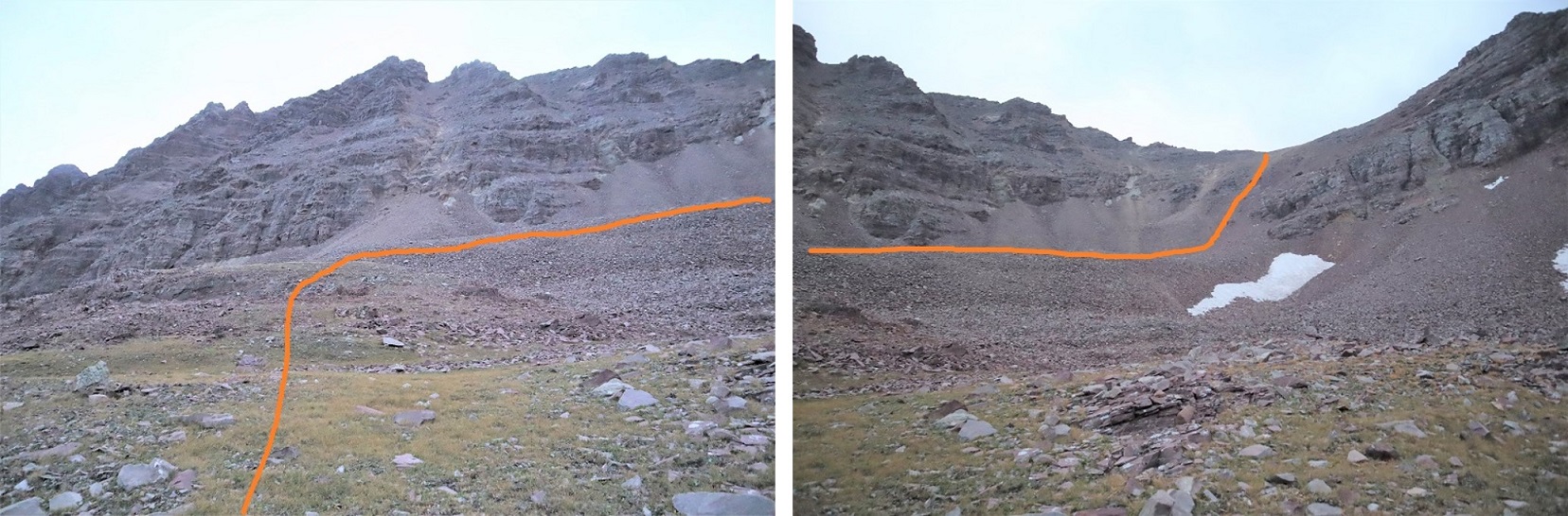
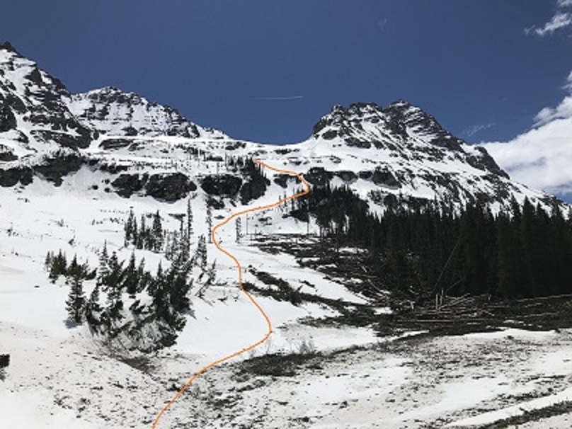
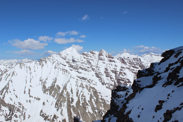
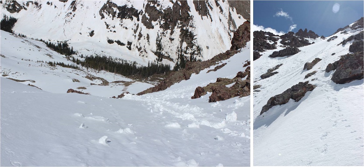
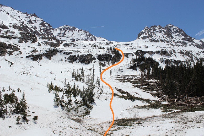
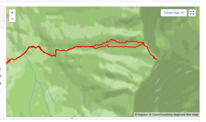
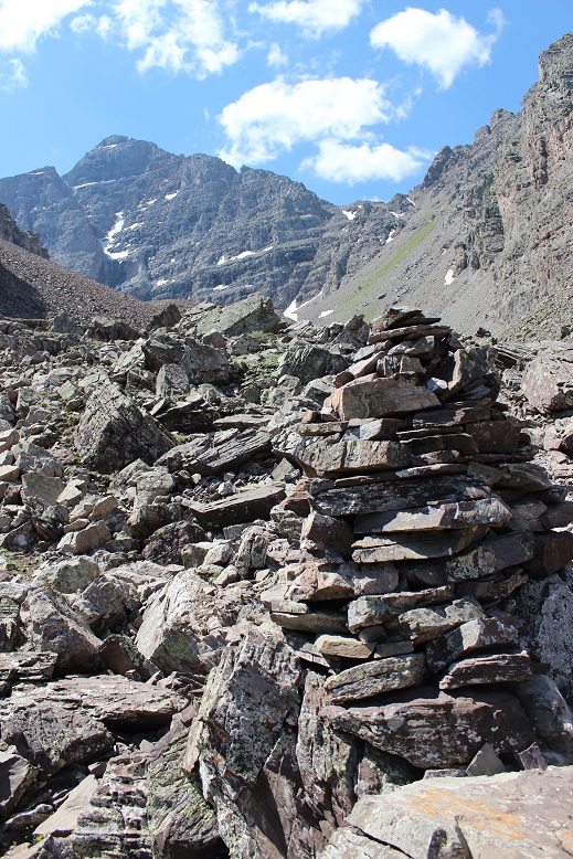
CalTopo tells me I hiked 5 miles from the parking area to Willow Pass. From Willow Pass you can see today’s peaks
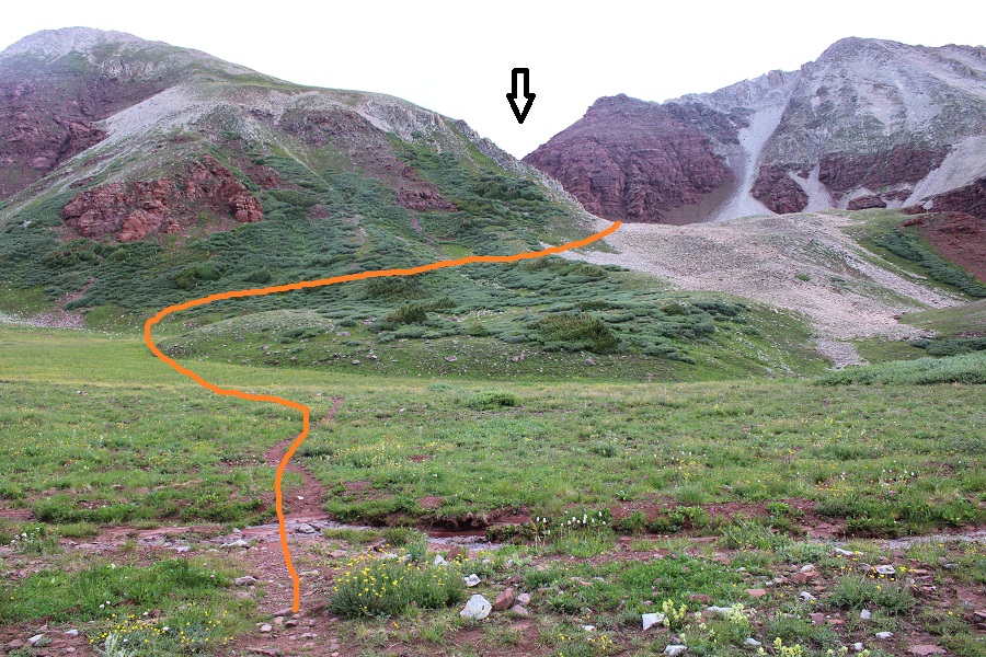
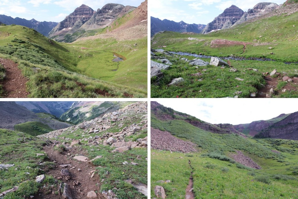
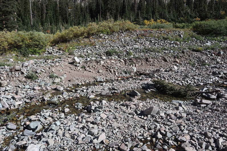
From Willow Pass I descended 560’ into the basin
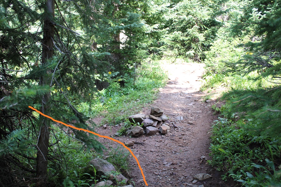
I came to the Junction for East Snowmass Trail/Willow Lake, and turned left, following the East Snowmass Trail.
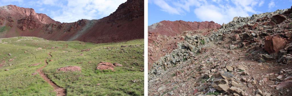
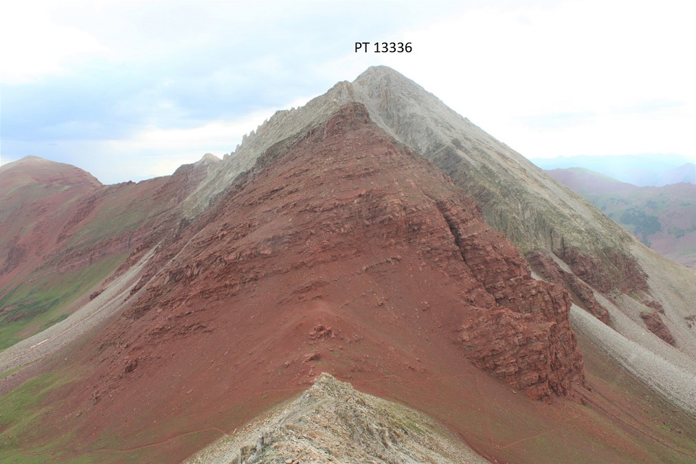
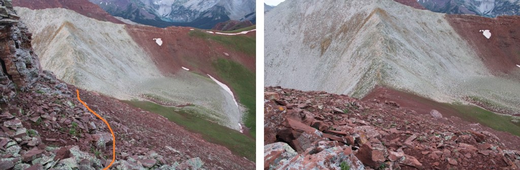
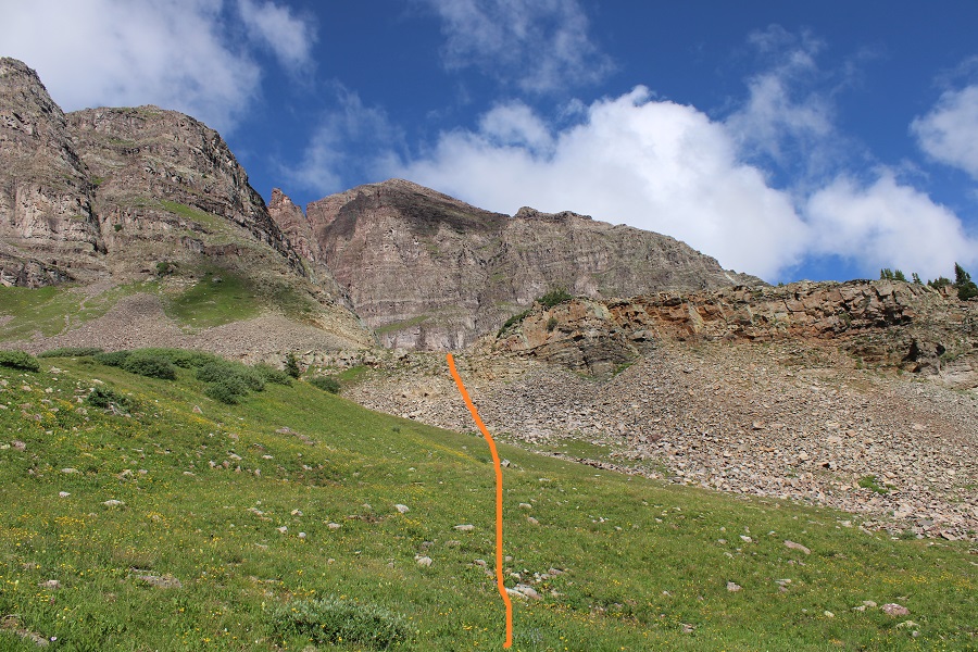
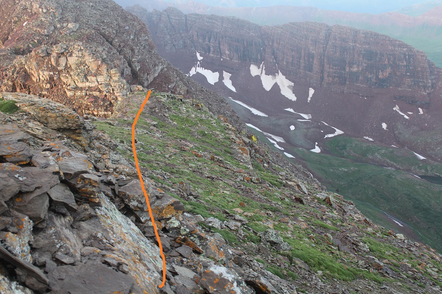
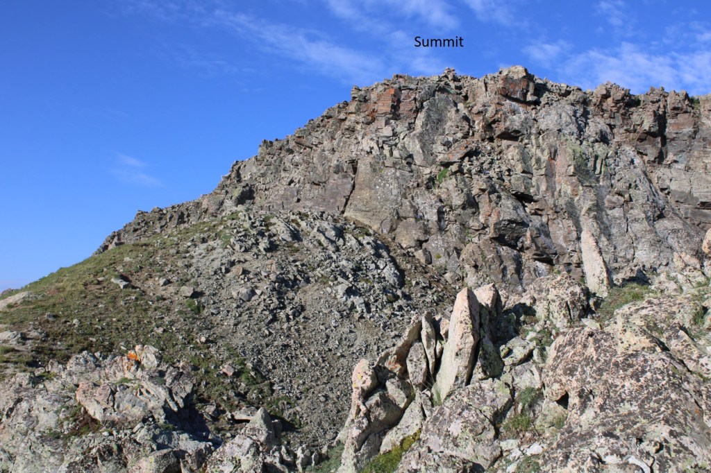
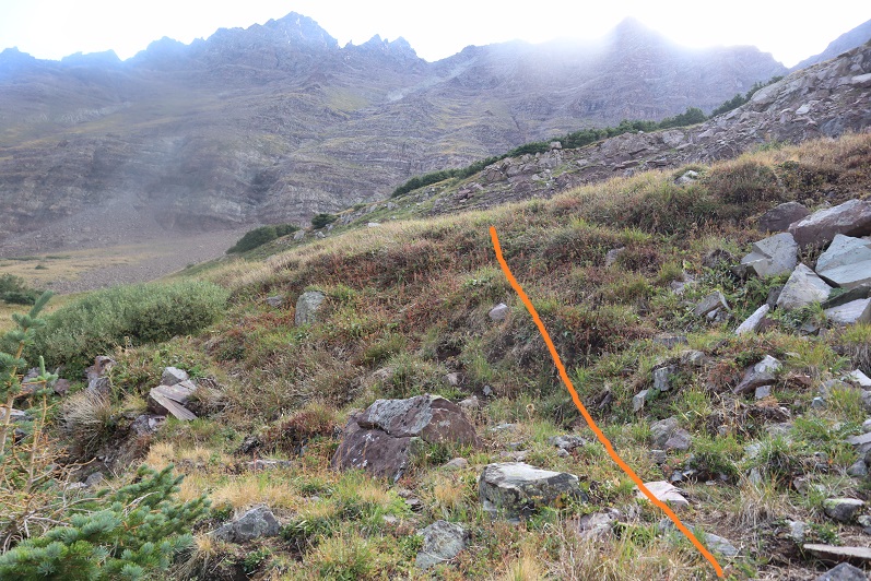
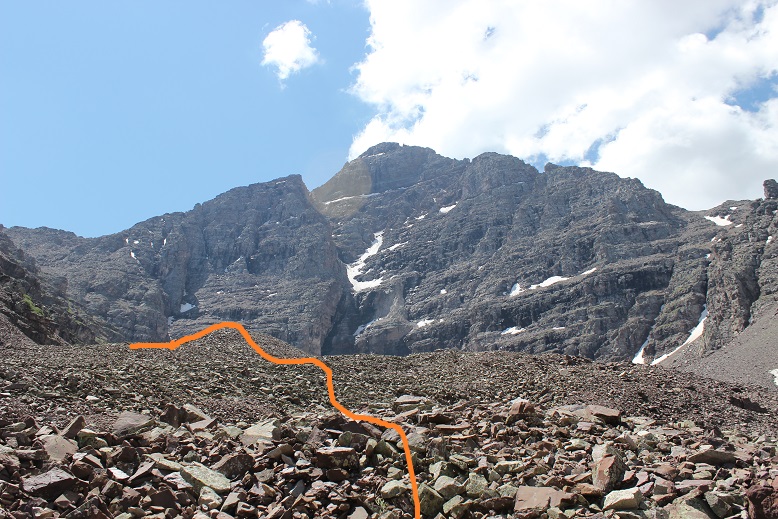
I was now following the trail towards the saddle of PT 13336 and PT 13020
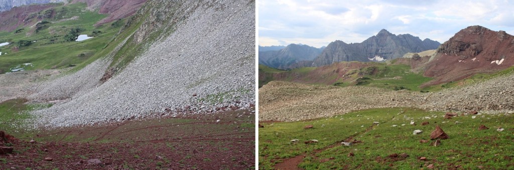
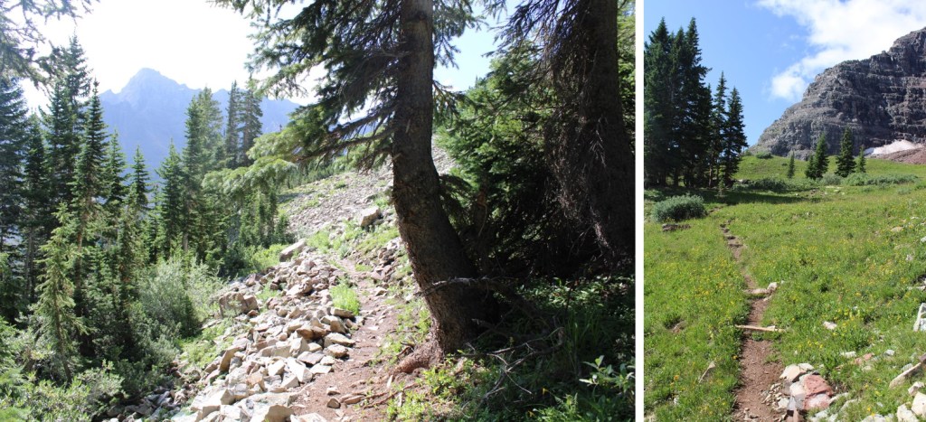
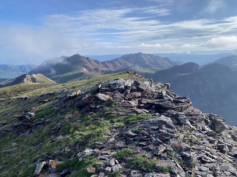
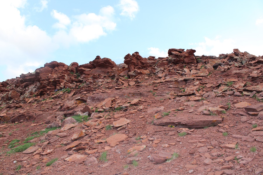
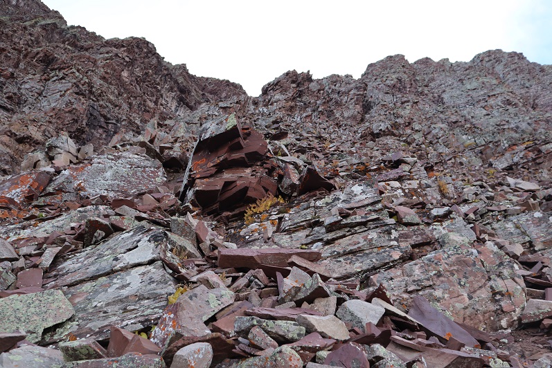
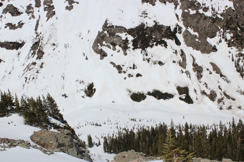
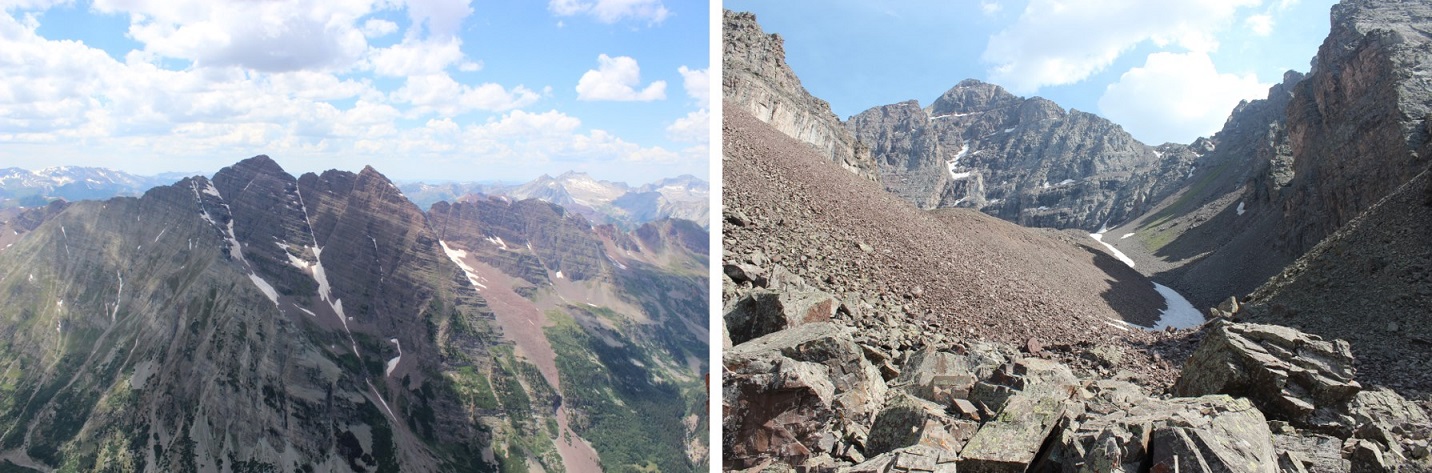
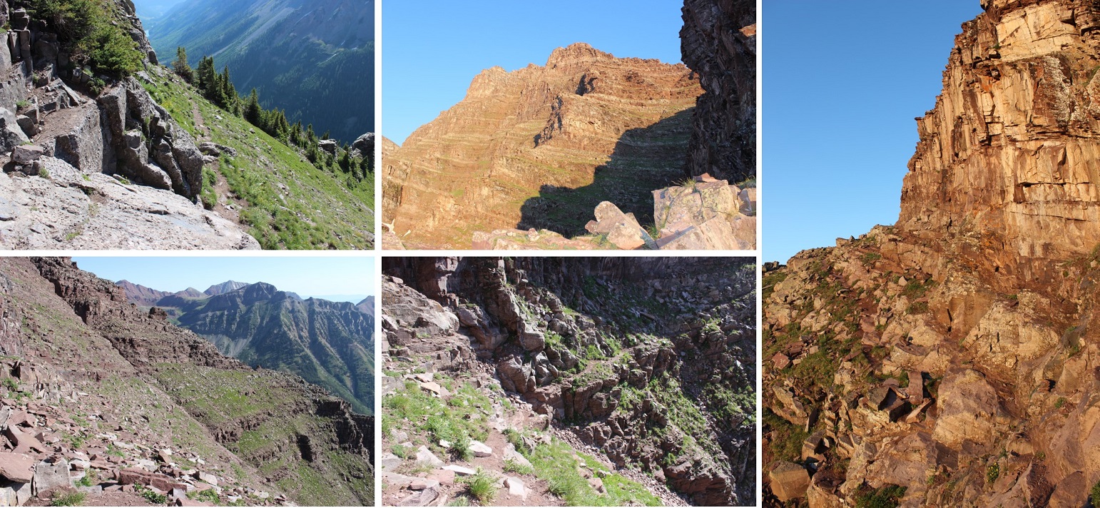
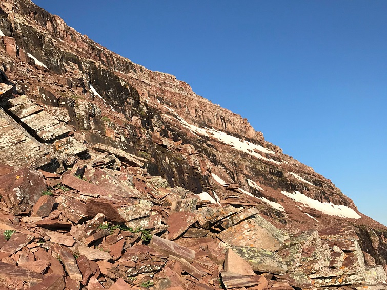
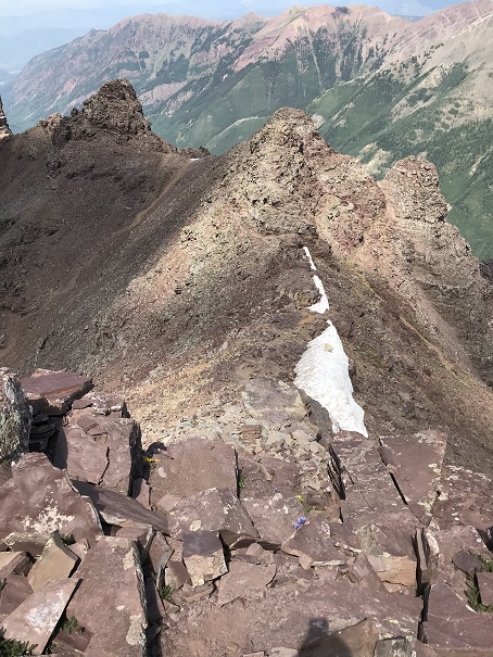
The upper basin was really neat, as I could see two different types of rocks, one coming from each mountain. The color contrast was interesting. The trail was still class 1 to the saddle, staying on the tundra/red dirt.
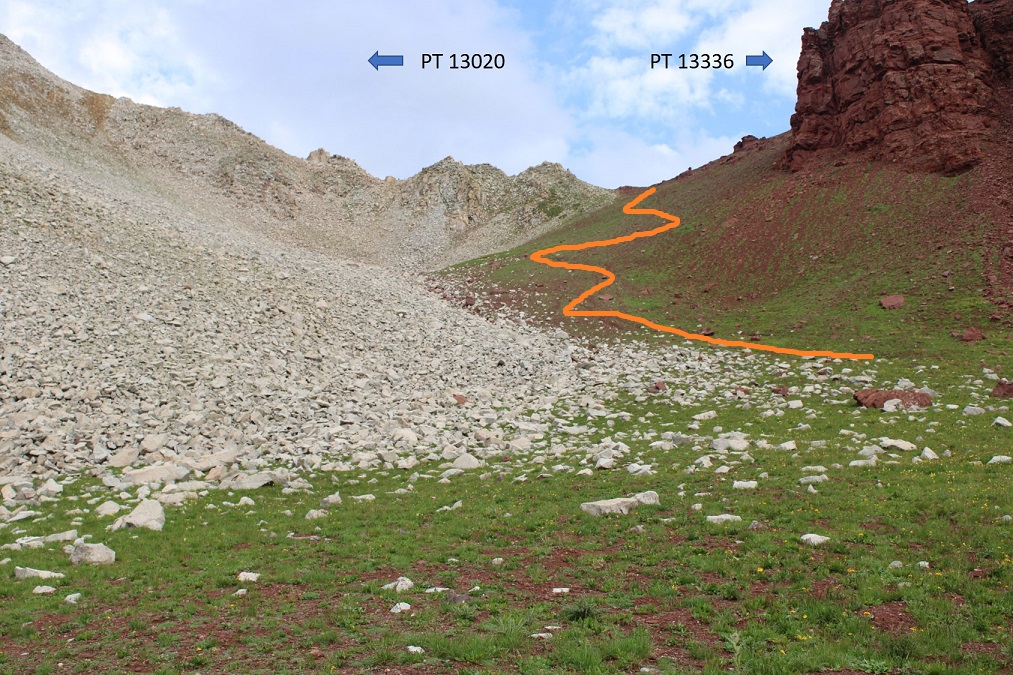
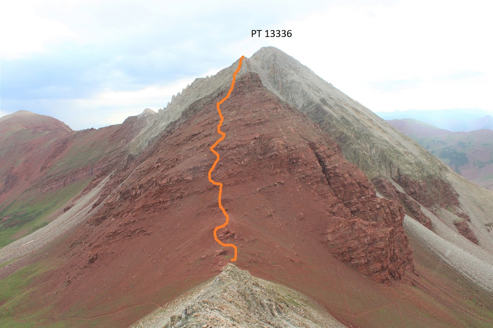
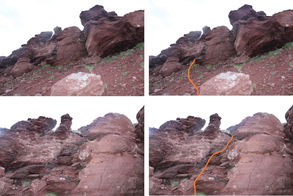
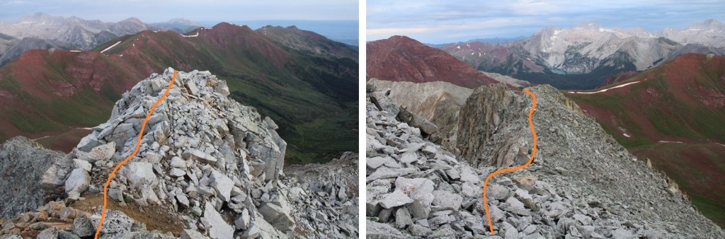
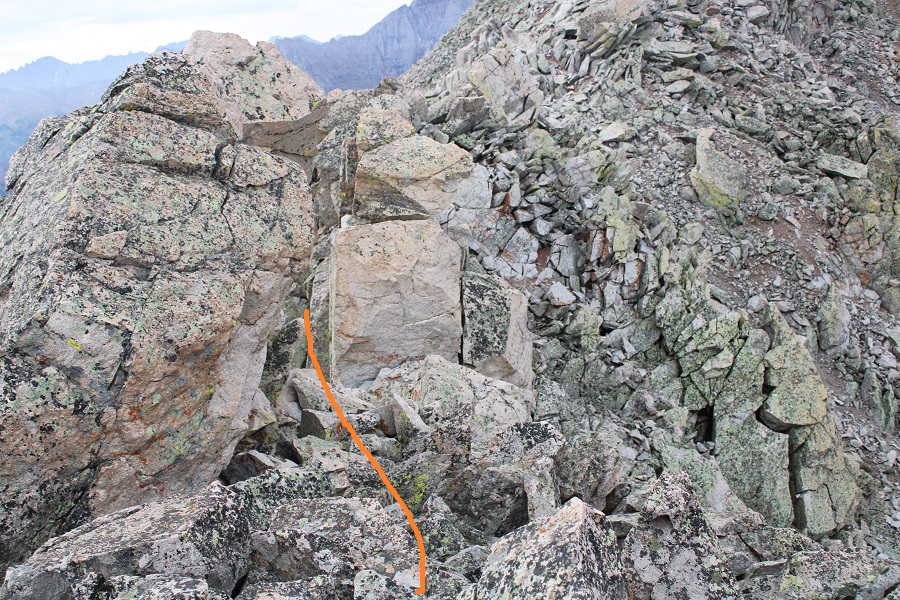
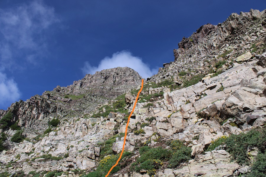
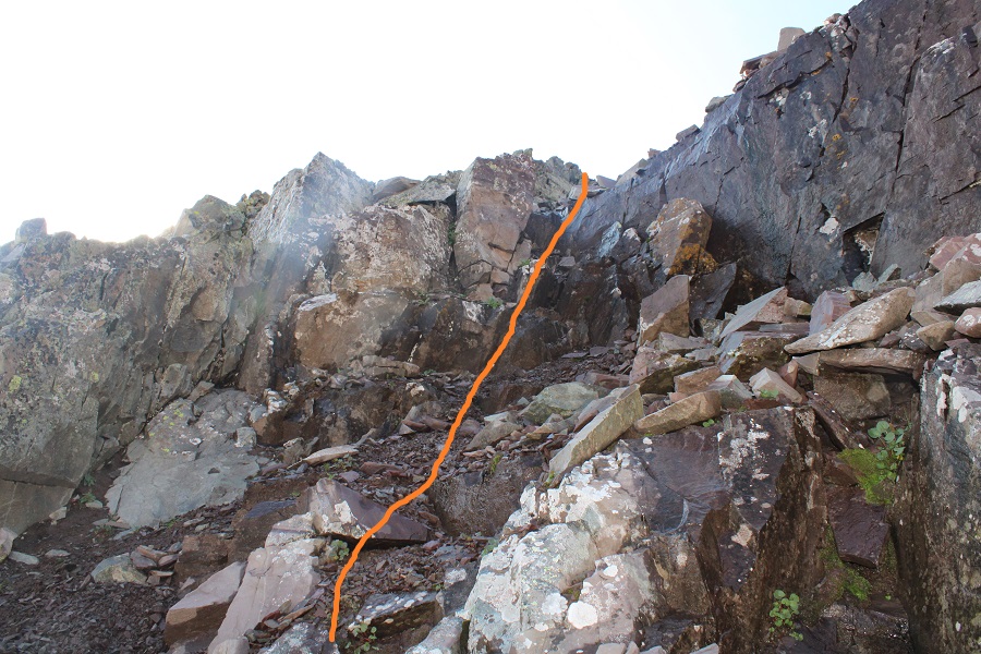
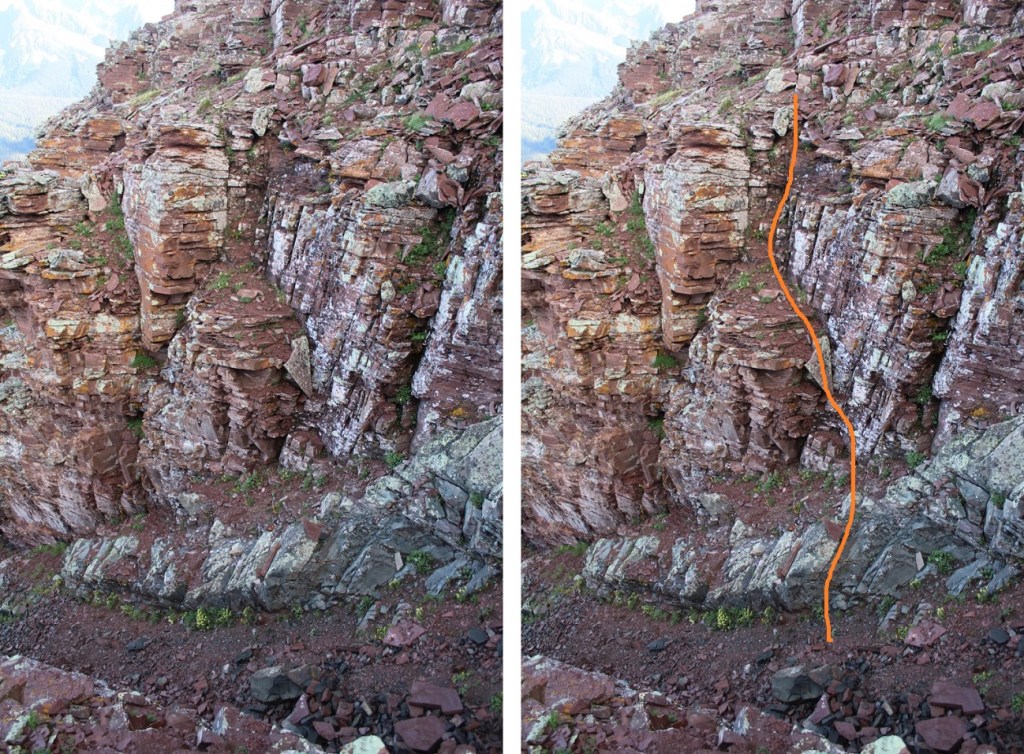
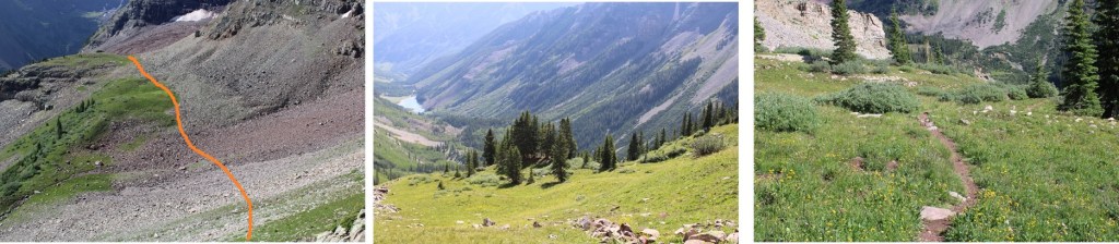
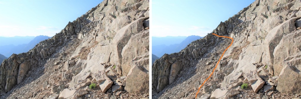
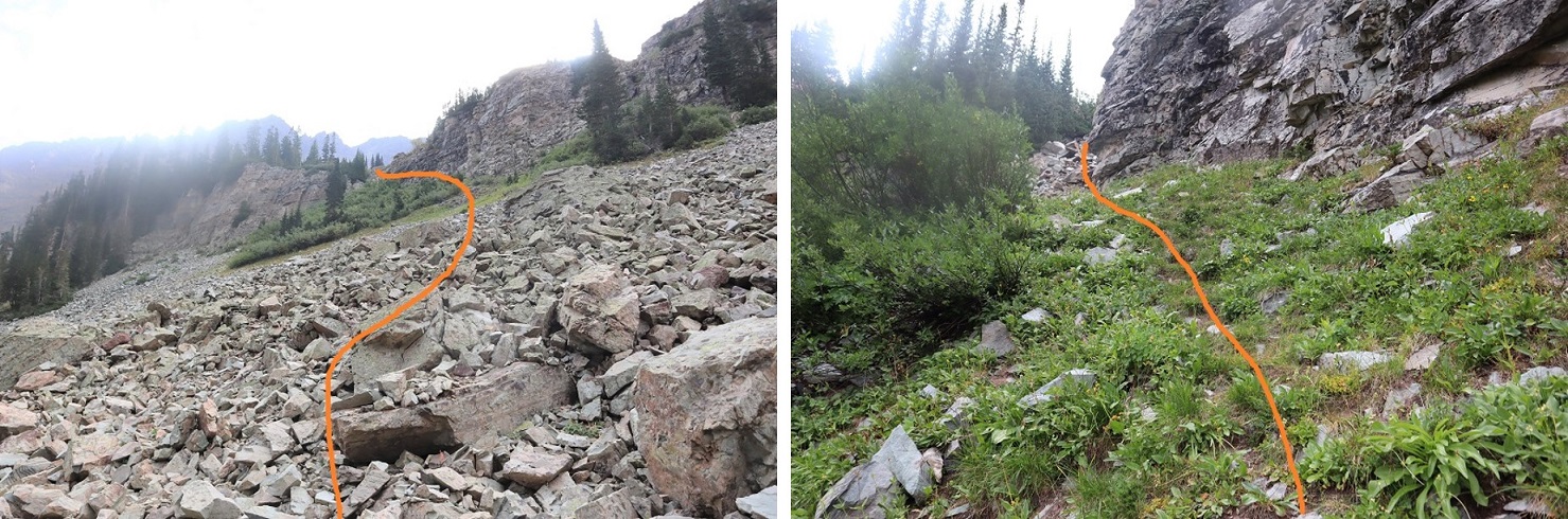
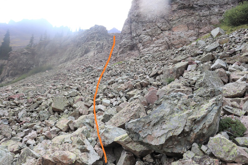
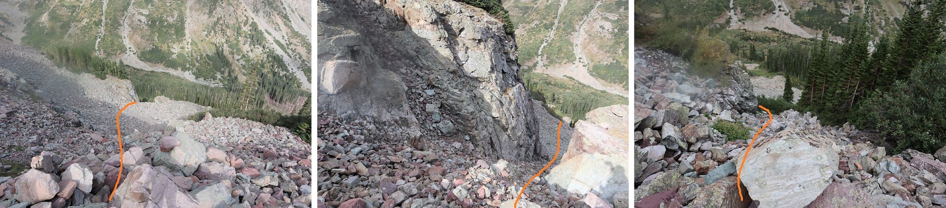
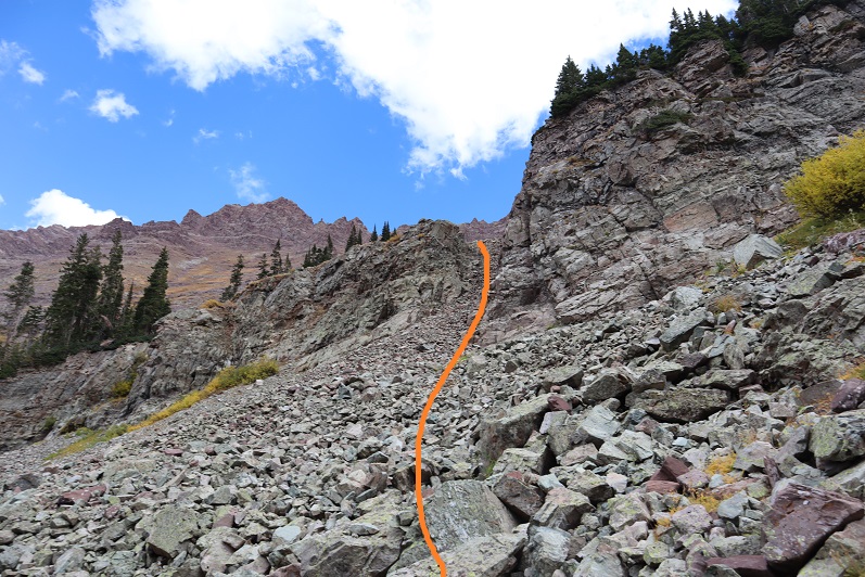
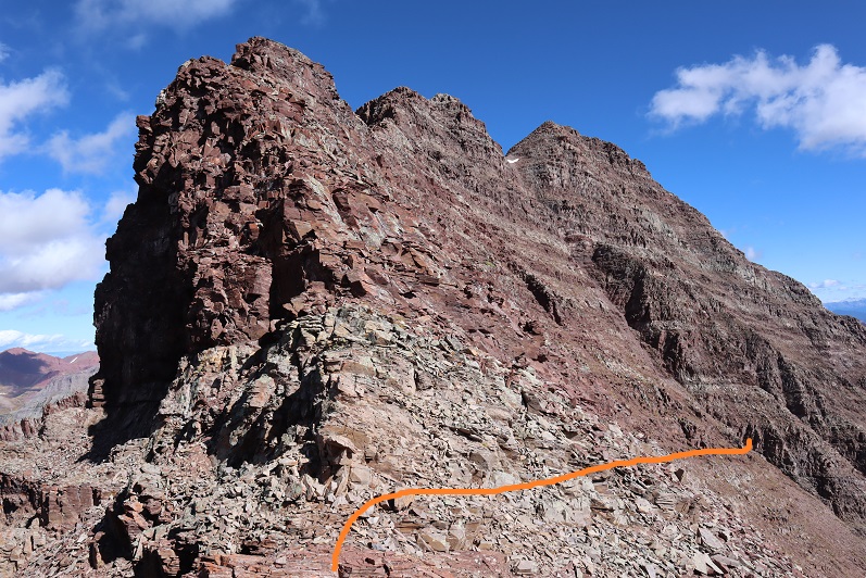
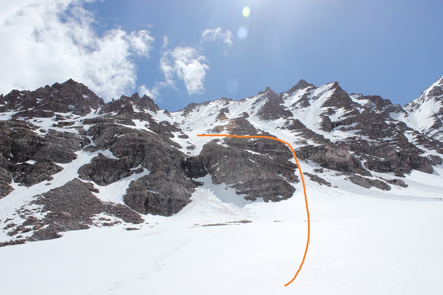
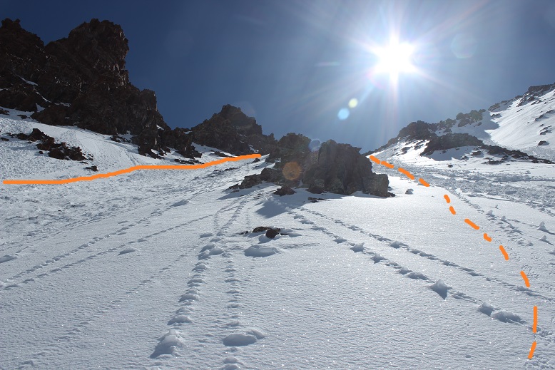
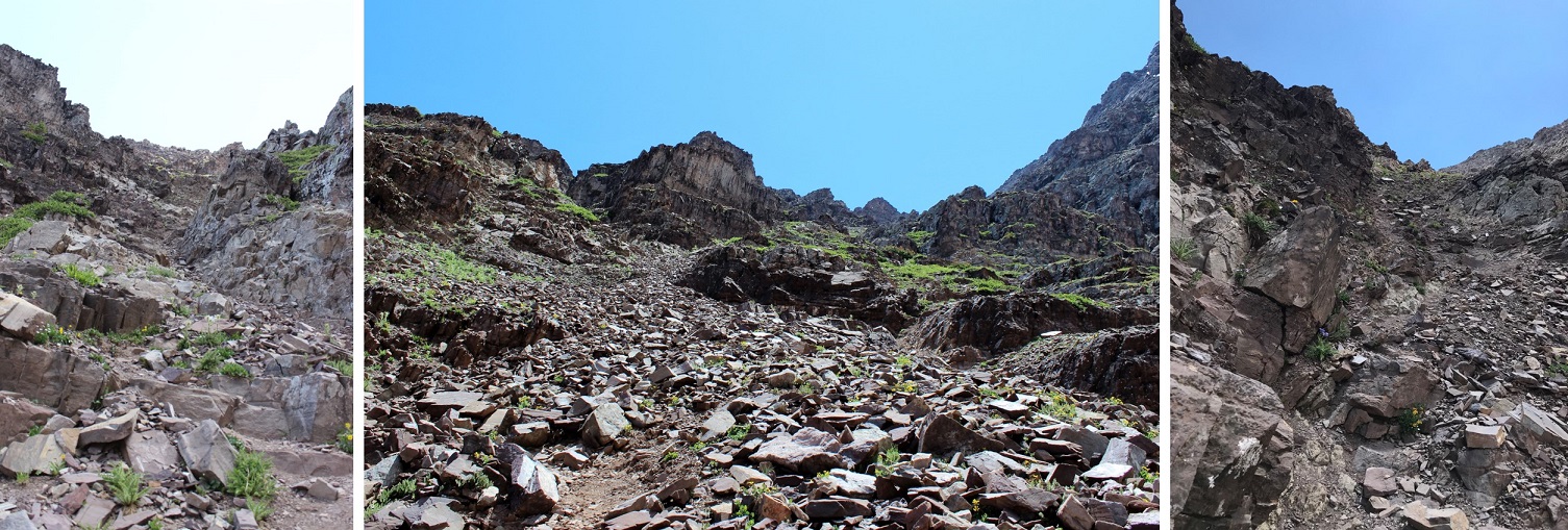
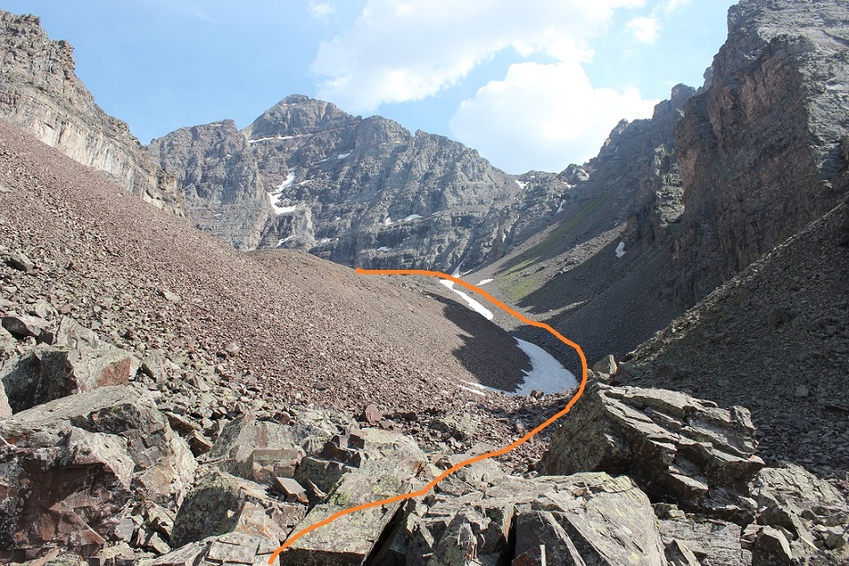
Once at the saddle it’s a good idea to put your helmet on. I decided to tackle PT 13336 first. This is class 3, and takes place on loose rock. You may want to put on your microspikes for added traction. The red dirt was mushy because it had recently rained, but it was still loose. Here’s the route I took, as seen from higher up on PT 13020 later in the morning:
And here are some step by step pictures of the route:
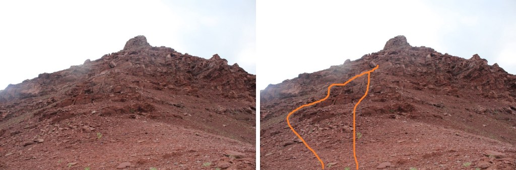
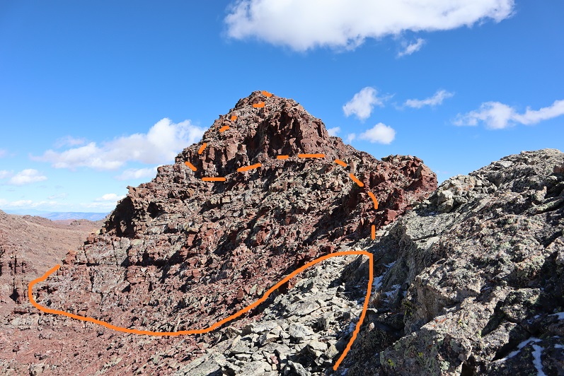
Easily walk around the first two obstacles to keep this part class 2
Next, you can either skirt the next obstacle to the left to keep this class 2, or go straight up and over if you like class 3
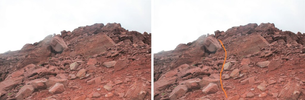
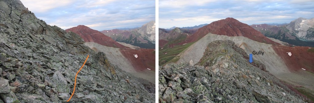
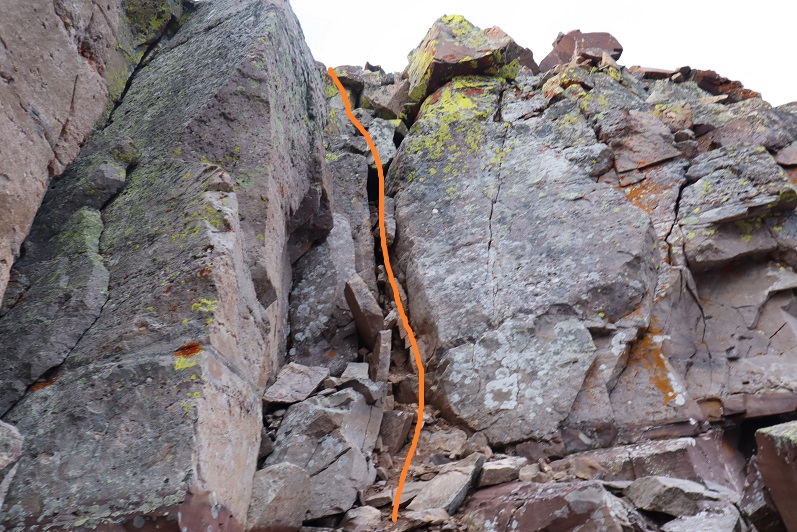
Now, keeping the ridge in front of you, the route becomes class 3. Head between these two boulders and ease a little left
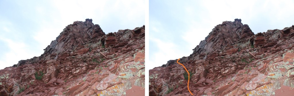
Look for a break in the rock formation and scramble up
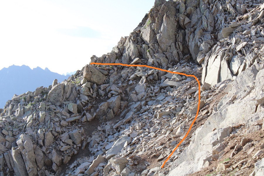
You can now clearly see the ridge. Keep the ridge to your right, and skirt the north side of the ridge. There is no need to go up and over the ridge at this point.
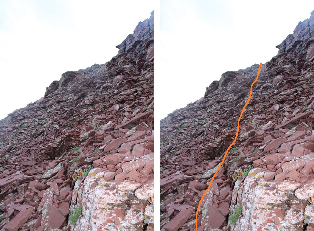
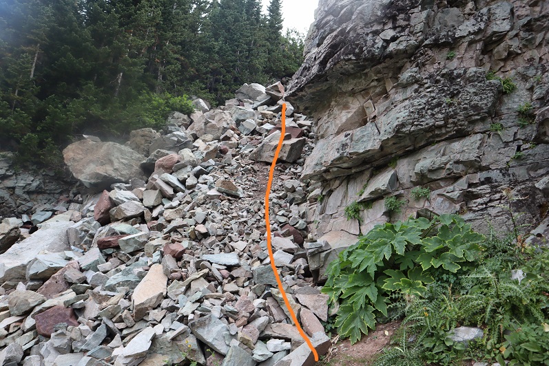
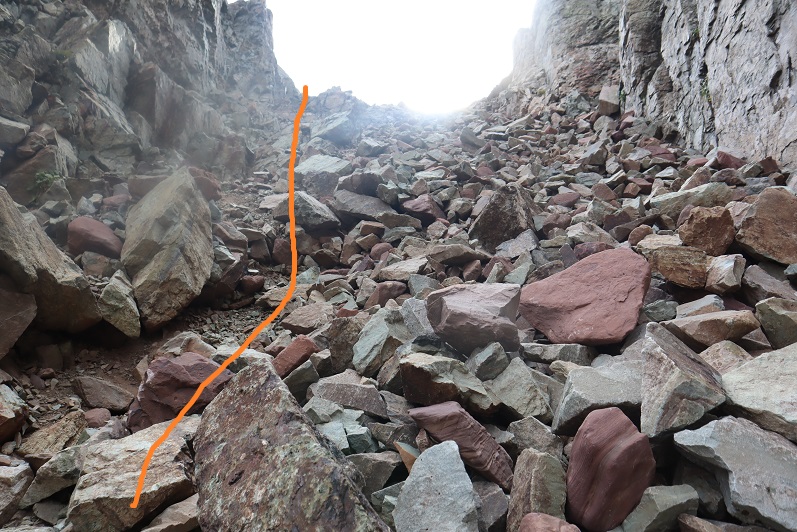
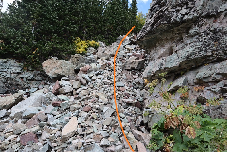
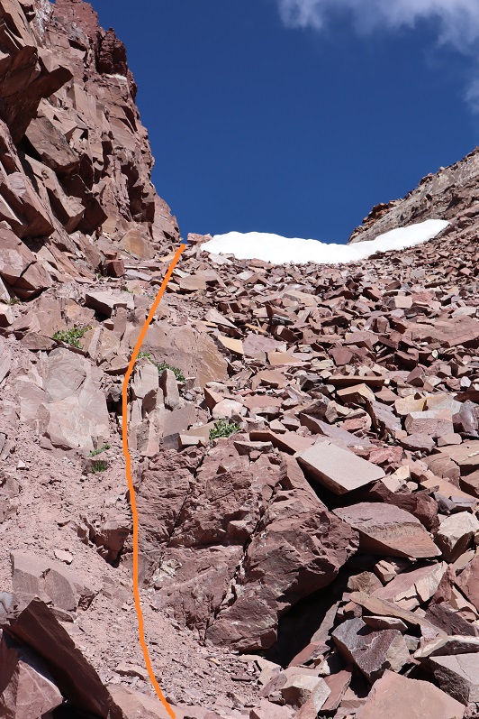
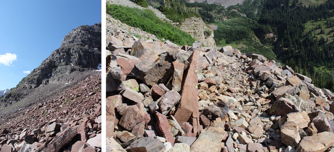
The rock here is loose, and only gets looser. Follow the loose rock up a sort of side gully.
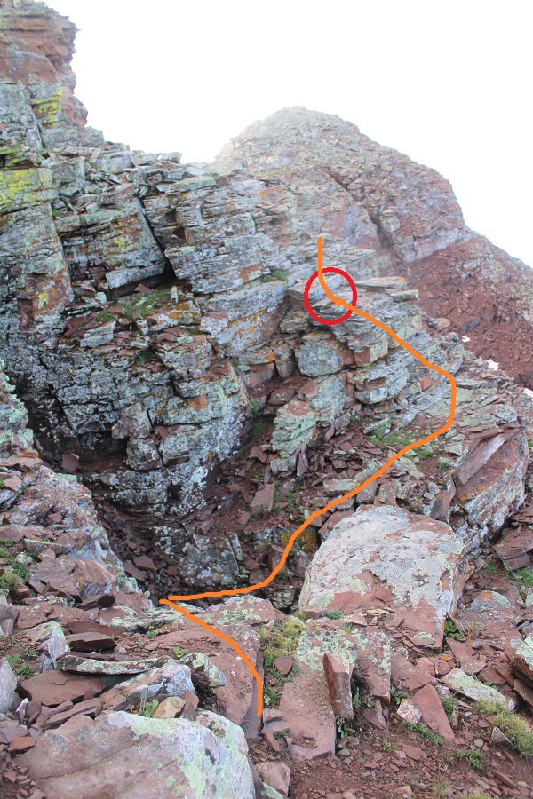
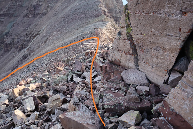
At the top of this rubble the rock changes. It’s no longer the loose Maroon rock: it now becomes the loose Snowmass rock. This rock is very slippery when wet, and even when not, so take care. These rocks are not stable. Just assume they all move. Cross this gully high. There is still no need to gain the ridge, you can stay just a bit below
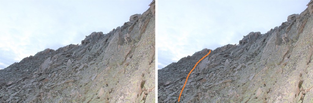
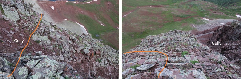
I have a feeling the terrain here shifts often, so pick your way carefully. I traversed the ledge by staying about 50 feet below the ridge, and then gaining the ridge through a gully
At the top of the ridge you can see the true summit of PT 13336. The terrain stays just as loose as before.
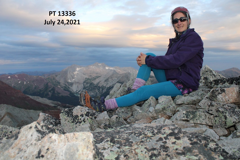
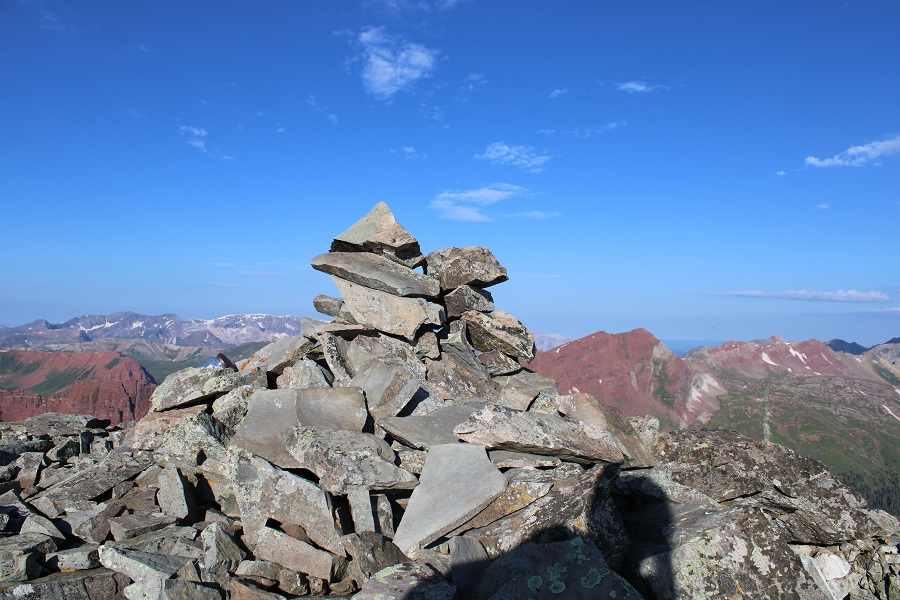
I summited PT 13336 at 6:10am
PT 13336:
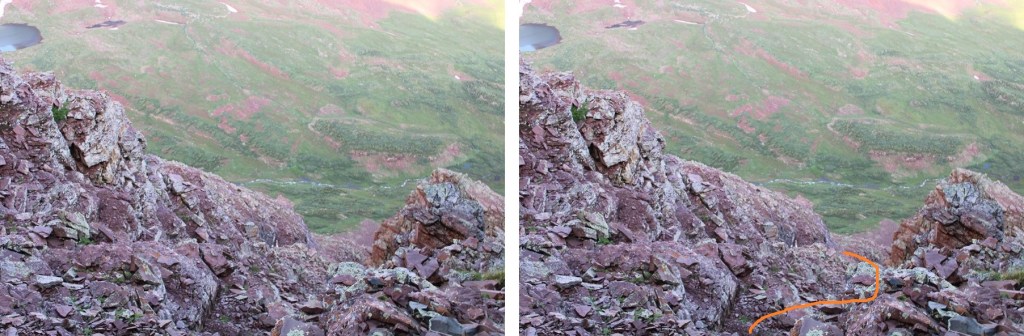
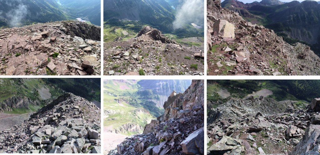
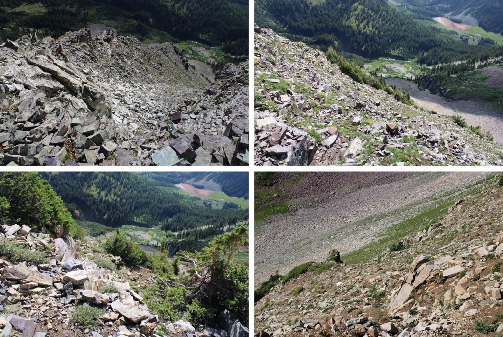
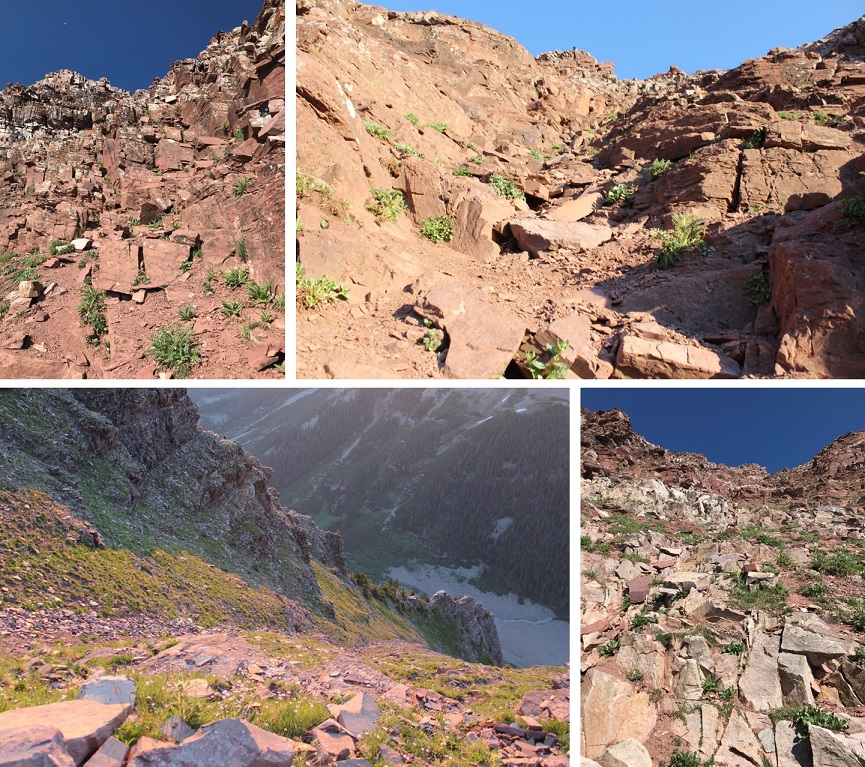
Here are some pictures of the way back to the saddle
Across the gully
And down the maroon scree
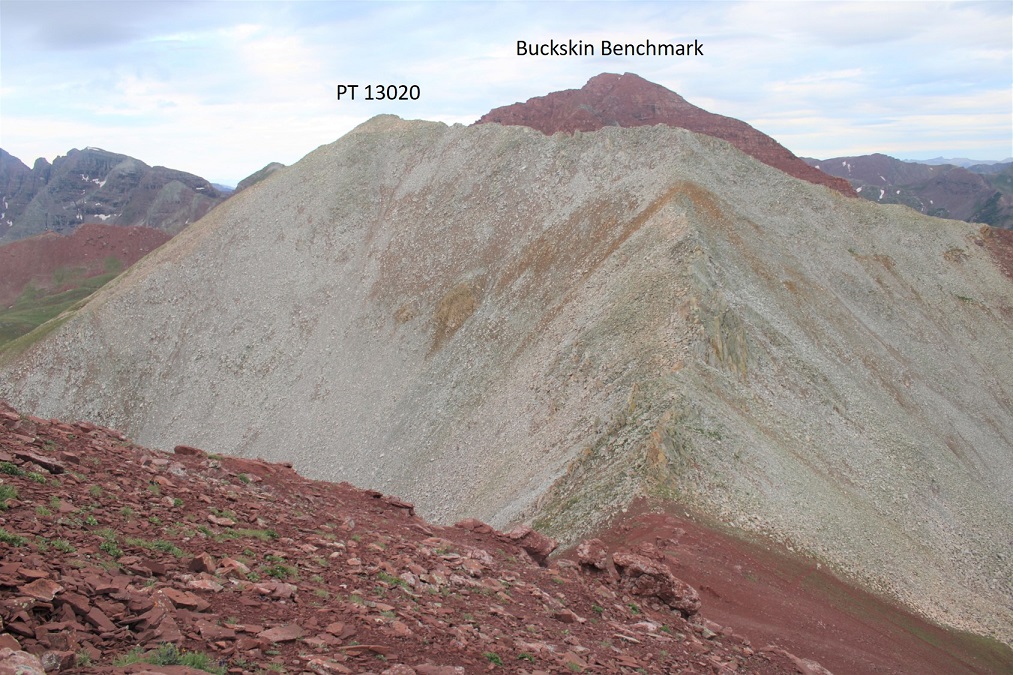
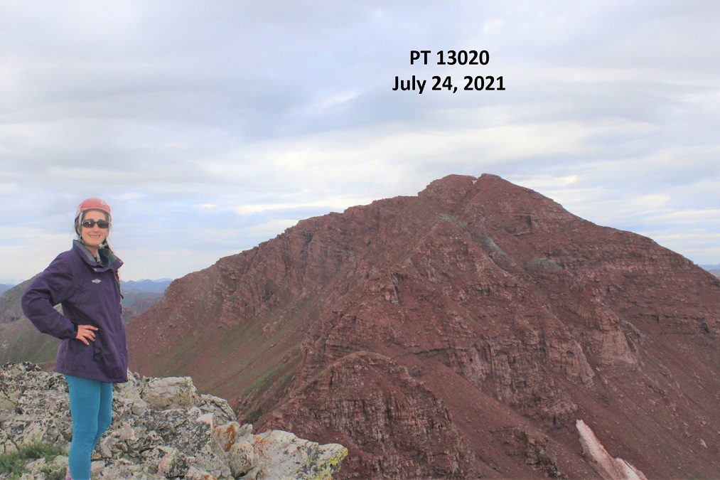
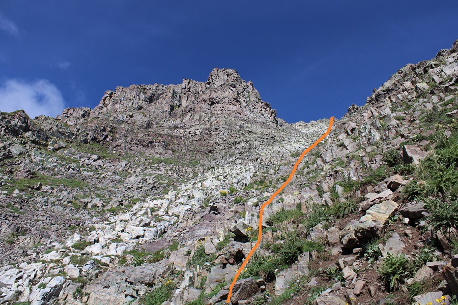
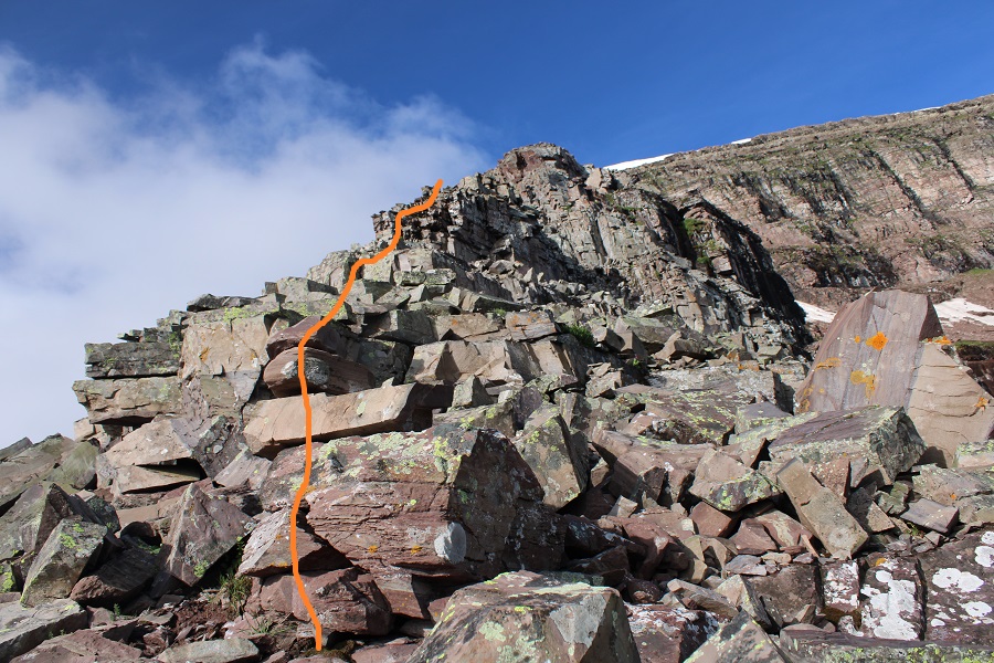
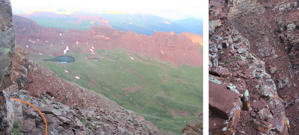
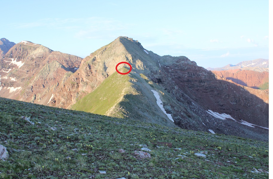
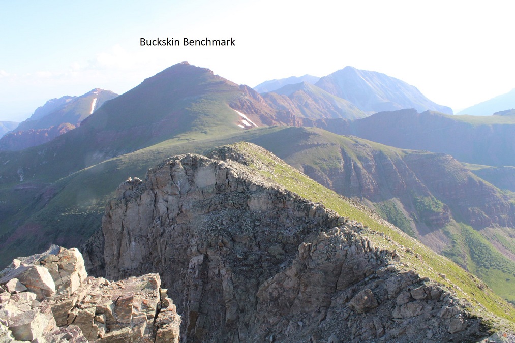
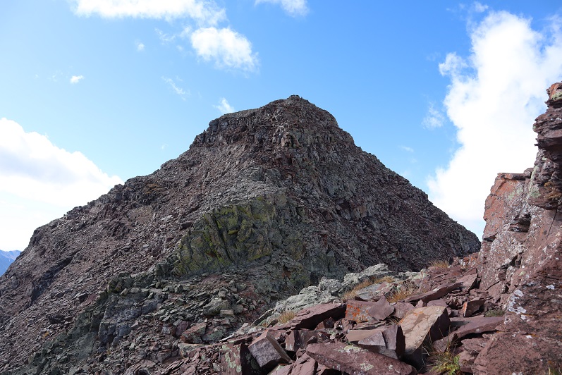
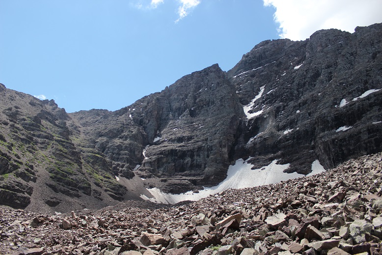
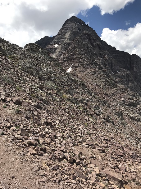
From here you can see the summit of PT 13020 and Buckskin Benchmark
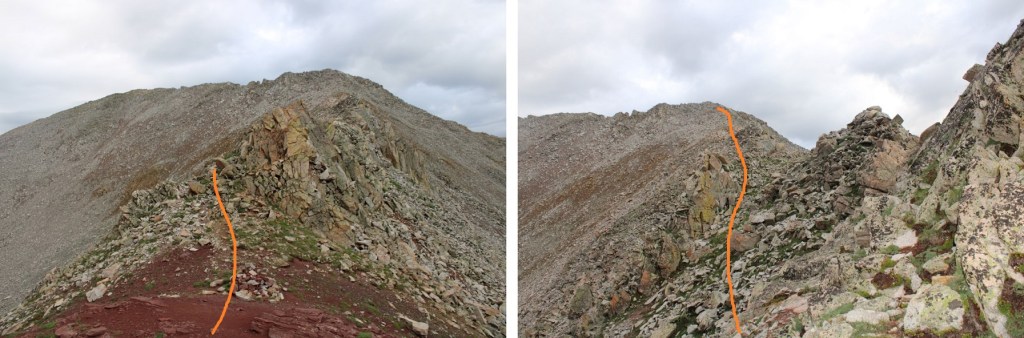
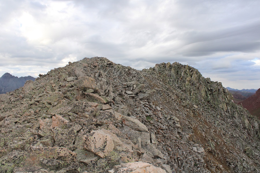
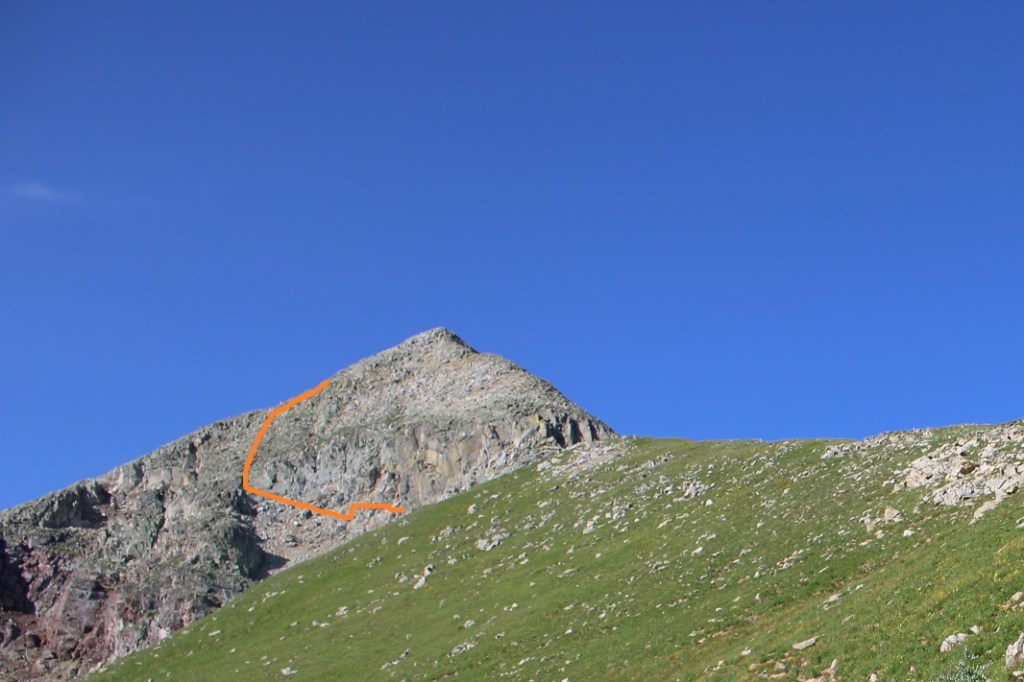
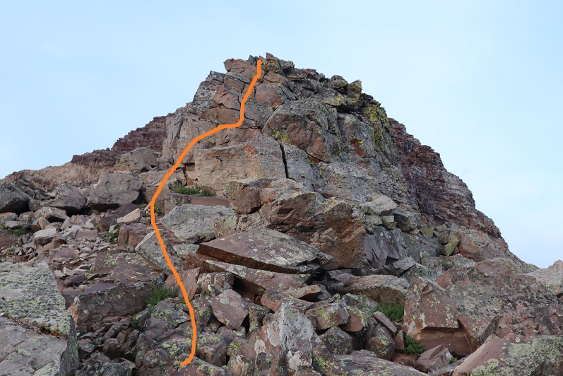
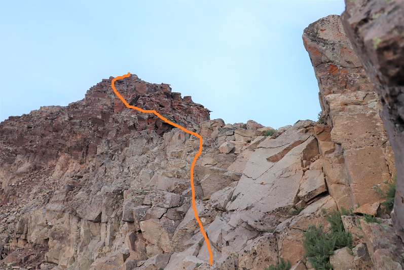
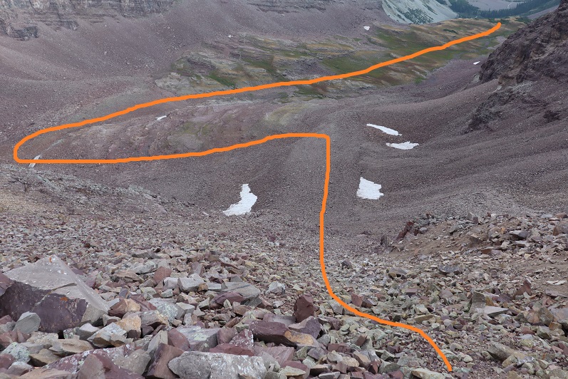
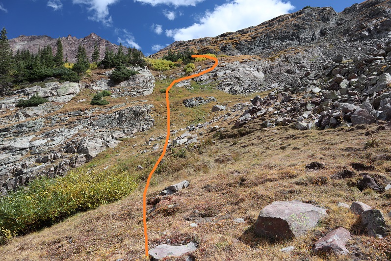
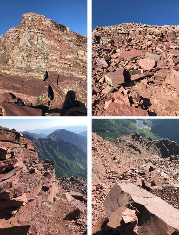
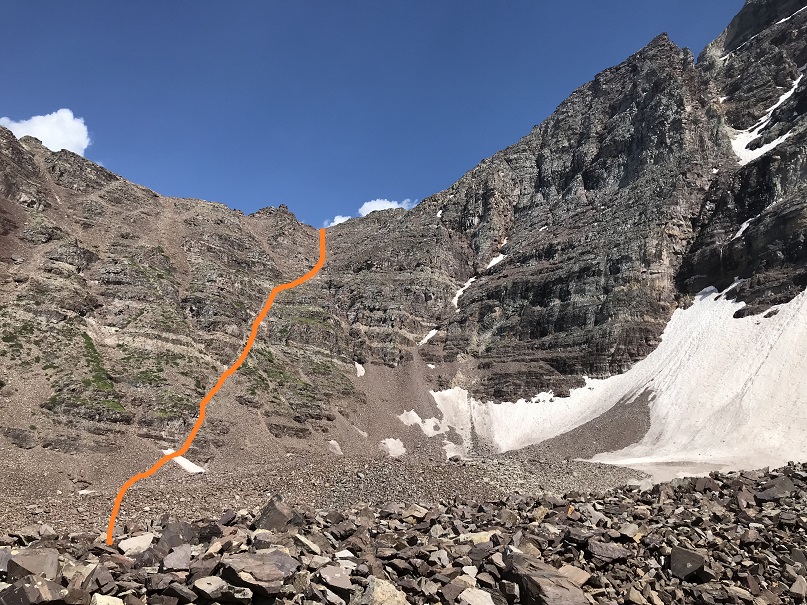
It was a simple ridge hike, with just a few fun moves to the summit of PT 13020. Here’s the overall route
And some step by step pictures. To gain the upper ridge, I skirted the rock formations to the left, but still stayed as close to the ridge as possible.
Once on the upper ridge I followed it to the summit of PT 13020, only dipping down to the left once through a gap in the rocks to keep this class 2
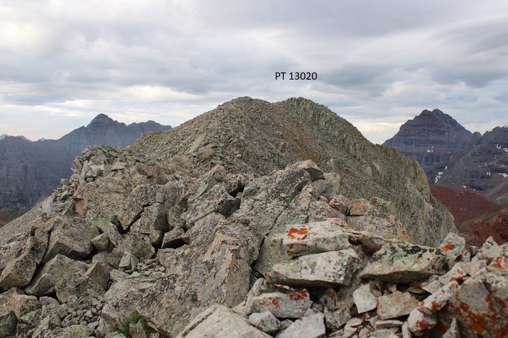
I summited PT 13020 at 7:20am.
PT 13020:
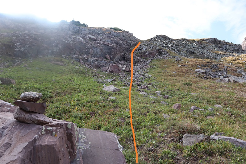
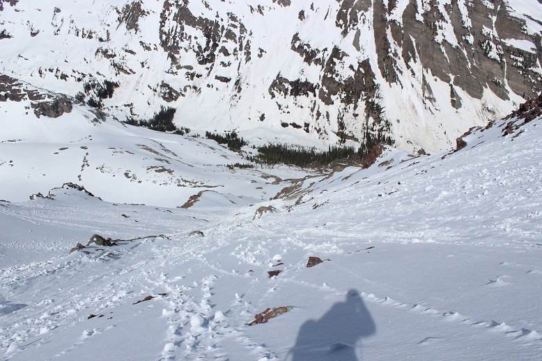
It was starting to rain, so I headed back down the ridge to the saddle.
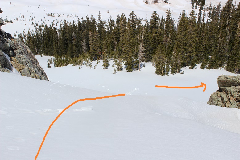
Once at the saddle, I followed the class 1 trail back to Willow Pass
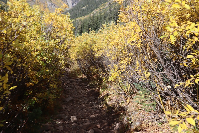
There was a large family of marmots at the Willow Lake/East Snowmass/Willow Pass Junction. As I approached, several jumped underneath the grass, not wanting to be photographed. I turned and headed southwest towards Willow Pass
And from Willow Pass I followed the trail back to the Maroon Lake Trailhead
I made it back to the trailhead at 10:45am, making this a 16.3 mile hike with 5815’ of elevation gain in 9 hours, 45 minutes
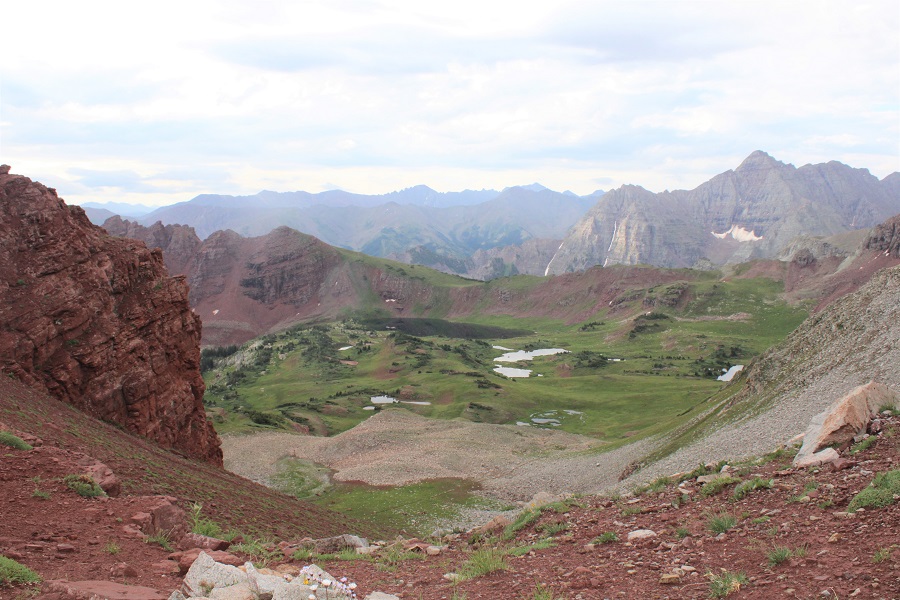
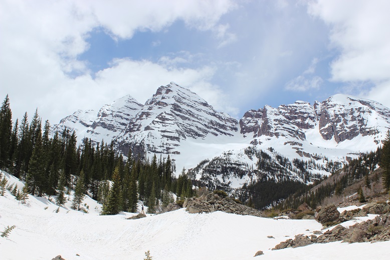
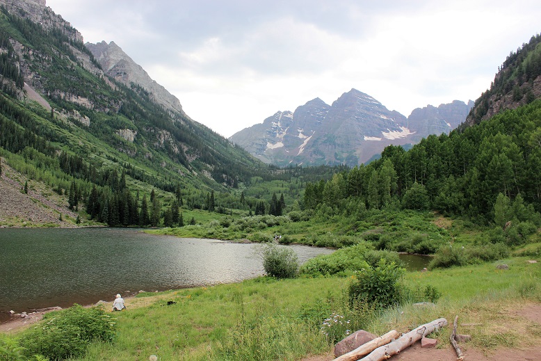
And, just because I have room for one more picture, can we all take a minute to appreciate jut how beautiful this area is?
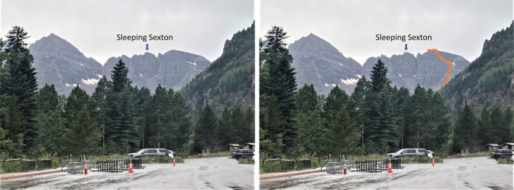
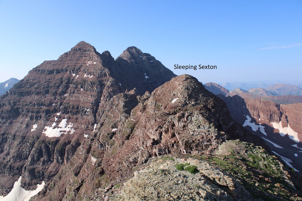
This was actually my second attempt on Sleeping Sexton: I was here last week but got turned around at the false summit due to getting ‘buzzed’. I figured it was for the best however, because I had done some serious route finding that morning and now I could provide a clear and useful GPX file for the route, instead of one with a lot of attempts that didn’t lead anywhere.
I made it to the Maroon Bells welcome station, and this time the attendant recognized me. We chatted for a bit, as he was interested in some of the summits I was doing. Then he referred me to talk with someone at their offices in town, and we’re basically best friends now.
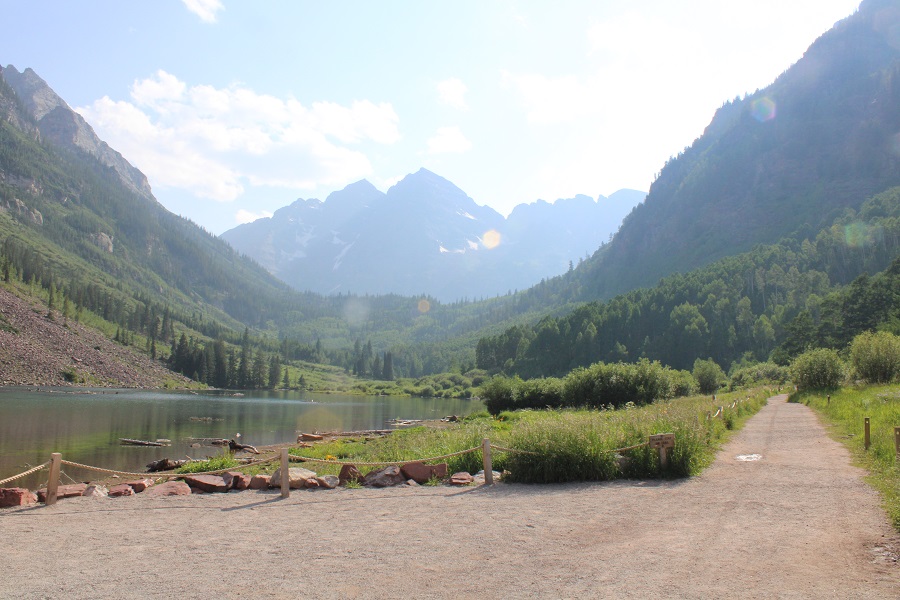
It was raining when I arrived, but people were walking around Maroon Lake anyway.
I was on the trail at 2:15am.
From the parking area, here’s an overview of the route above treeline to the false summit
The trail starts by skirting Maroon Lake, then taking the Crater Lake trail southwest.
There was a full moon out, so I didn’t need my flashlight.
At the junction for Crater Lake I continued following trail 1975 northwest. This is the trail you take if you’re doing the Northeast route for North Maroon Peak. There are camping spots just before the next junction.
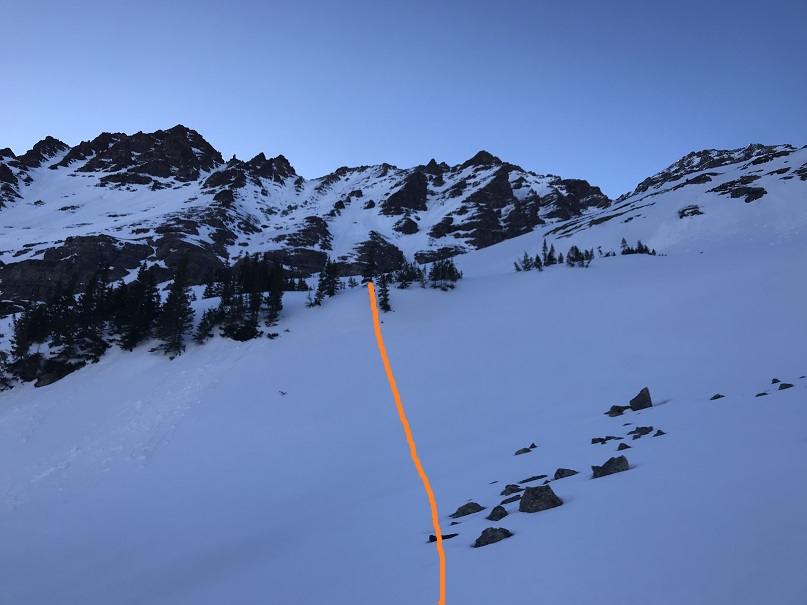
The trail continues to be a well defined, class 1 trail. At about 10775’ there’s another junction. If you’ve hiked North Maroon Peak before, you’ll recognize this trail. I turned left here and crossed the creek, following the North Maroon Peak Trail (still class 1)
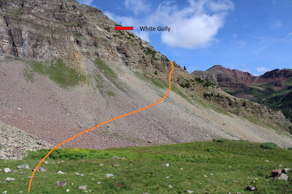
Here’s an overview of the trek to the false summit (or ‘the crown’) from the creek crossing. I followed the North Maroon Peak’s Northeast Ridge Route until I made it to tundra, at about 11,600’. I then left the trail and headed northwest, behind this outcropping, to the base of the white gully. I then trekked up the ridge and followed the white gully until it ended. Here’s a basic overview.
Here are some step by step photos of the way I accessed the white gully: I followed the North Maroon Trail to treeline
At 11,600’ I left the North Maroon Trail and headed northwest
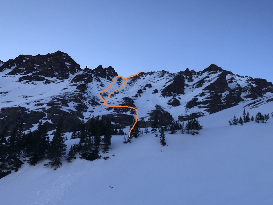
Here you can see the base of the white gully. I didn’t want to climb straight up the gully, as it was very steep. Instead, I accessed the ridge, and followed the ridge to the white gully. (I did this after spending a lot of time last week trying to see if the smaller gullies ‘went’ to access the white gully, and turned back every time because I didn’t have rope. I believe it’s much easier to access the ridge first and then head up).
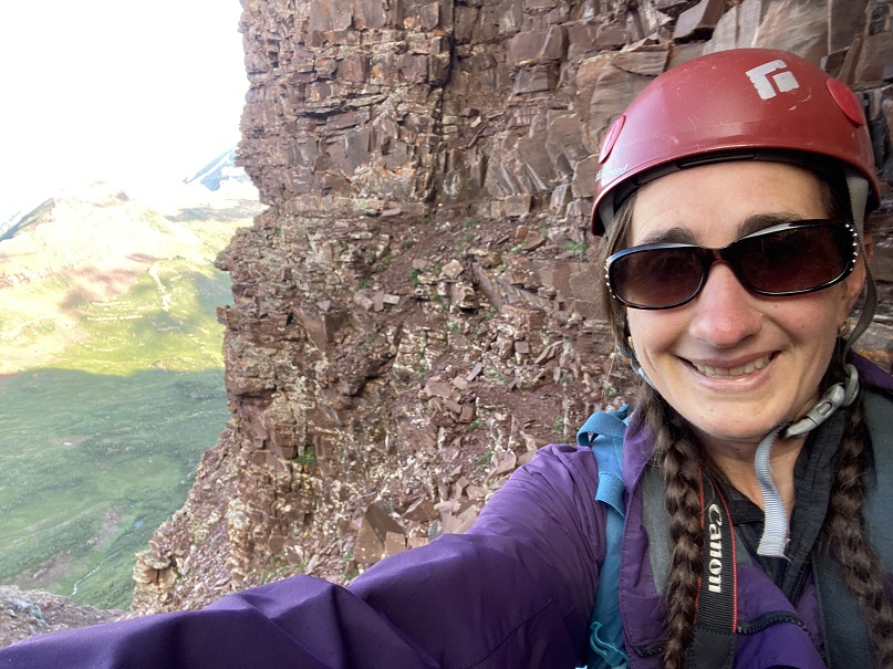
Here’s exactly where I entered and exited the ridge. I found this to be class 2 and direct access. Now’s a great time to put on your helmet if you haven’t already done so.
Once on the ridge I followed it west, staying in-between the ridge and the white gully (to the right of the gully, but left of the ridge). If you look for them, you’ll find game trails here (you may have to duck under some branches to use them though).
Once near the white gully, I found the terrain to the right to be more stable than the white gully itself, especially on my way down.
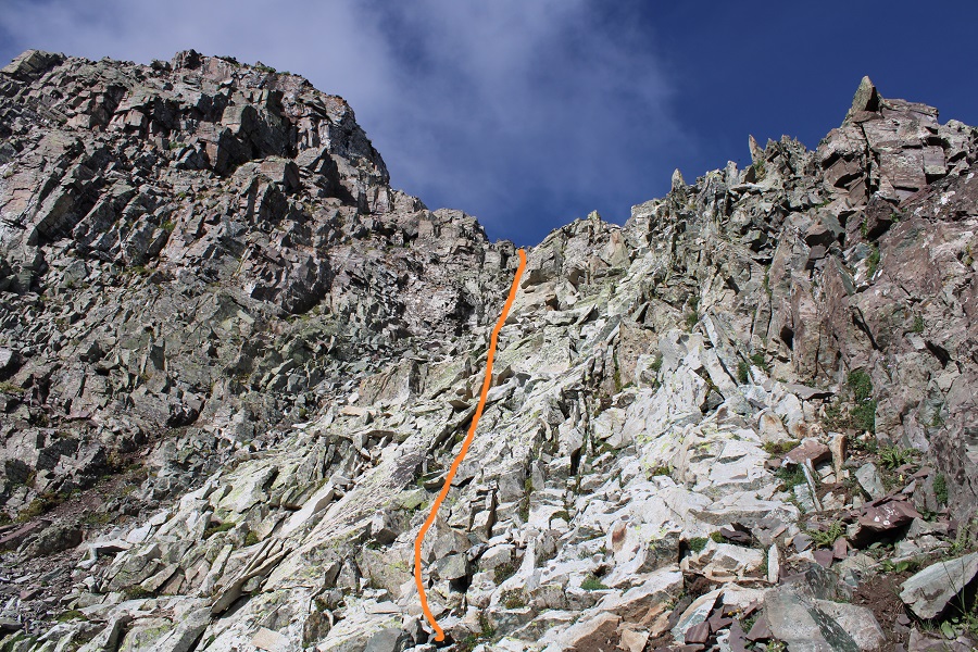
Topping out of the white gully felt class 3
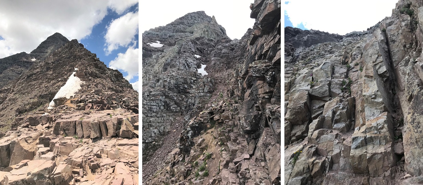
From here it became ‘choose your own adventure’ as I followed the ridge southwest. I started out rounding the ridge’s north side, and then went back and forth between north and south sides of the ridge a few times. There are cairns here, and nothing is more difficult than class 4. In fact, if you’re extra careful/spend a lot of time route finding, you can probably keep this at mostly class 3. Here’s the route I took:
From the top of the white gully I rounded the corner and made my way back to the ridge. It had rained the night before, so I had to be extra careful with every foot placement (wet = slippery)
Once back on the ridge I followed it for a ways
Before hitting a bit of a shelf and crossing over to the south side of the ridge
I followed the ridge to the false summit / ‘the crown’
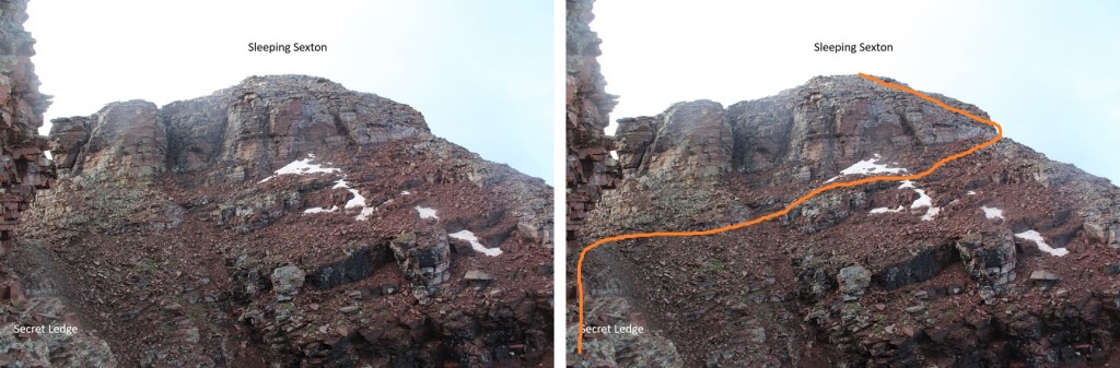
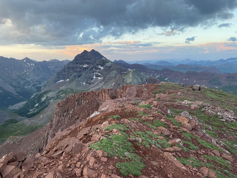
From the false summit you can see the true summit of Sleeping Sexton
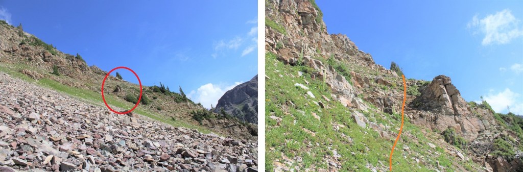
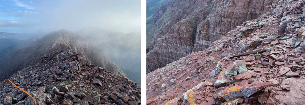
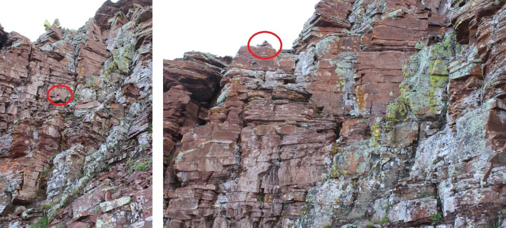
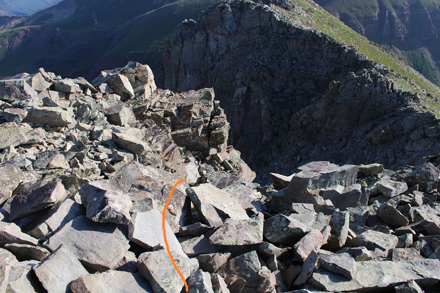
And now, the fun route finding begins! I descended the false summit 125’ and crossed a gully. There were cairns here to help in the crossing (circled in red). These are steep and go at class 3/4
After crossing the first gully I descended once again, another 160’
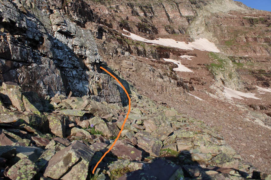
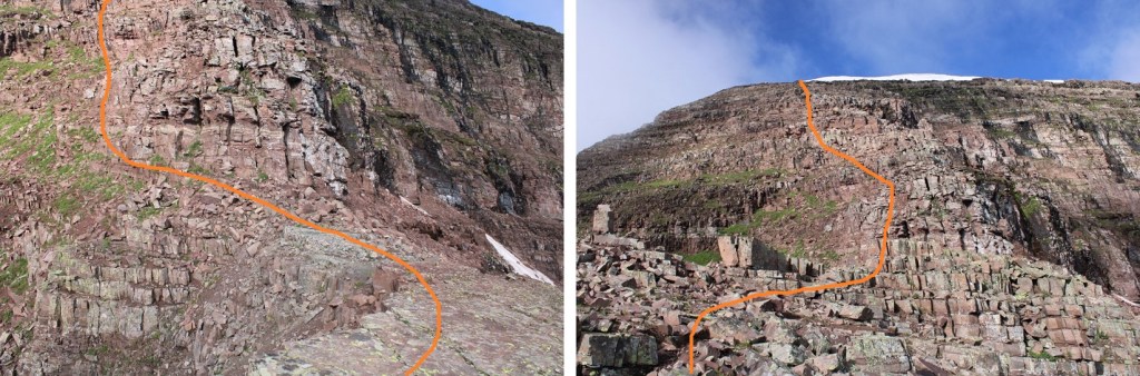
I was now at 13,130’, and parallel with the saddle between Sleeping Sexton and the false summit. I followed the contour of the mountain to the ‘secret ledge’. Here’s what that looks like heading in
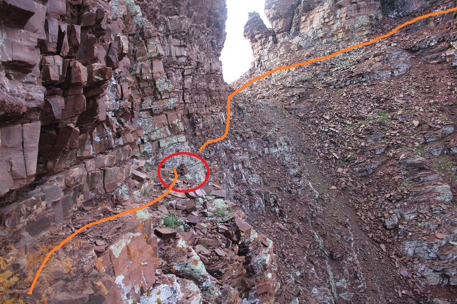
I crossed the ledge to the ‘saddle’, then skirted the side of the mountain and headed up to the summit
The ledge is not as bad as it looks. There’s a cairn here (circled in red) DO NOT DESCEND HERE. Instead, use it as a reference point and stay level with it (especially on your way back) and continue following the ledge. If you do this, it stays class 2 to the saddle.
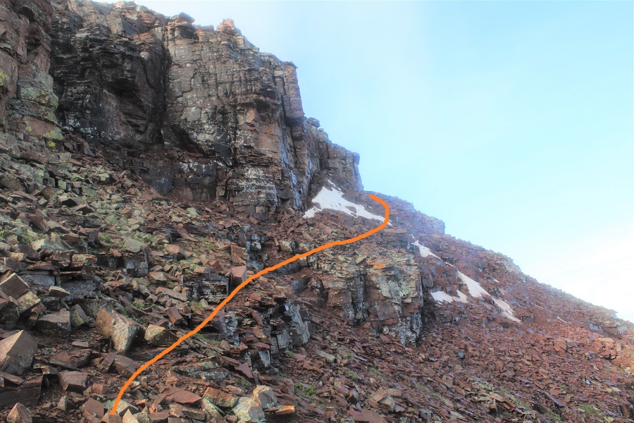
From there it was an easy trek to the summit, first skirting the mountainside
And then ascending the ridge
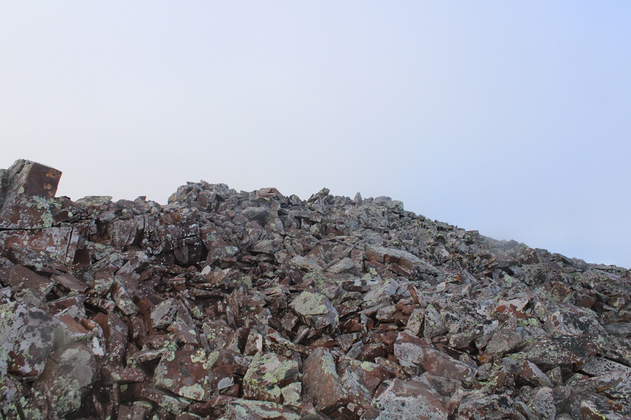
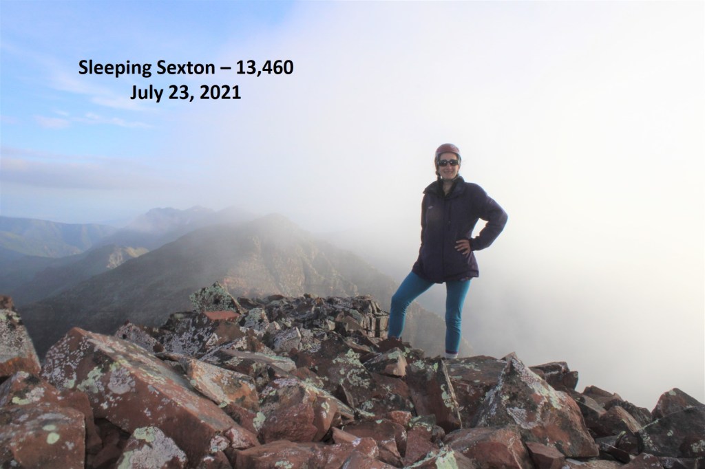
I summited Sleeping Sexton at 6:45am, just as the weather started rolling in
Sleeping Sexton:
Since the weather wasn’t cooperating I didn’t stay long. I turned and headed back the way I’d hiked in. Here’s looking back at the false summit / ‘the crown’
And a view making it back to the ledge
Here are some more images of that ledge, looking back. Remember to look for the cairn, and stay level with it.
For reference, here’s the size of the route. The route can clearly be seen over my shoulder (to the left)
I rounded the corner, and ascended the gully, aiming for the cairns
Crossed the next gully
And gained the ridge to the false summit / ‘the crown’
I actually stayed here for a bit because I had cell service. I let my family know I was ok, and downloaded the weather forecast for the next day. However, eventually the clouds told me to get going.
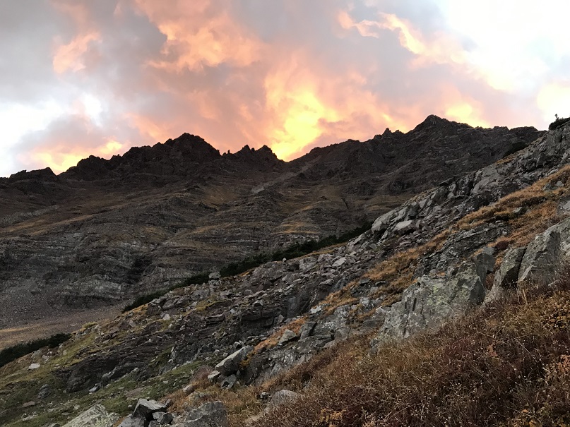
Clouds rolling in:
Here are some pictures of my way back to the white gully
Back down the white gully to the ridge
And from the ridge back to the trail
Once back on the trail it was an easy, class 1 hike back to the parking area.
I made it back to my truck at 11:30am, making this a 12.7 mile hike with 5156’ of elevation gain in 9 hours, 15 minutes.
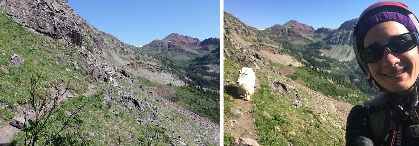
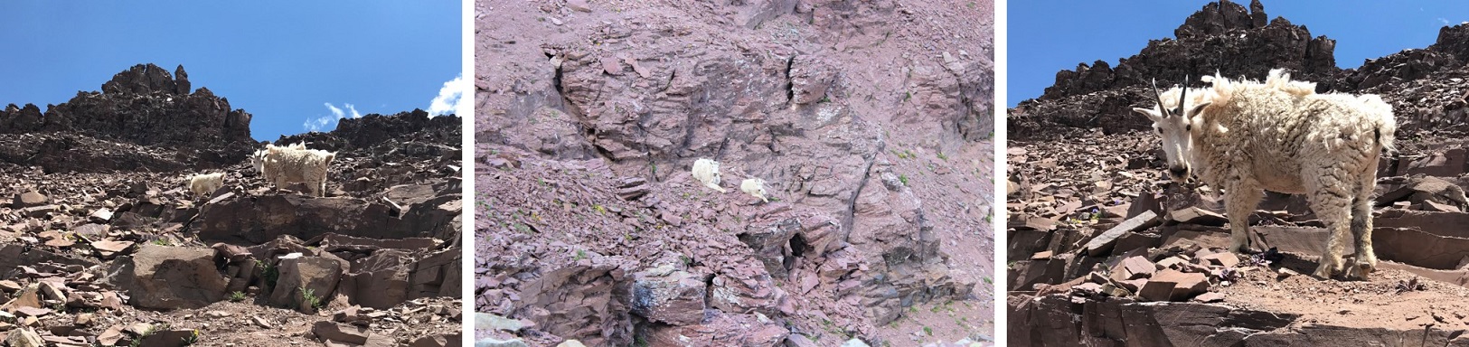
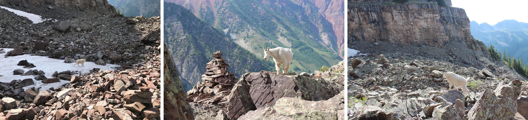
It was still early in the day, so I ate lunch by Maroon Lake, read for a bit, looked at topo maps for tomorrow, and jotted down notes in my journal before making it an early night. Oh, I forgot to mention the goats: They were the same two goats I saw last week, and if for no other reason than them, wear your helmet until you make it back onto the class 1 trail: They were kicking rocks down the gullies the entire time I was there.
I’ve said it before, and I’ll say it again: I’m NOT a fan of the permit system. Even though I was on their website exactly when permits were released, I wasn’t able to get an overnight permit for Maroon Bells on a date I could go, so I had to get three back-to-back permits instead. When I pulled up at the gate my paperwork confused the attendant. He didn’t know what type of a parking pass to give me, but settled on an overnight pass that expired in two days time. He then asked me to park in the further lot, as the closer lot was intended for day use.
I balked at this: I’d wanted a 2 night pass, but because of the reservation system I couldn’t get one. Instead, I paid 3 times what those who were able to score a longer permit were paying for the same amount of time in the park. I felt if I was paying that much more, the least they could do was give me a better parking spot. Also, while annoying, the main reason I don’t like the permit system isn’t because of stuff like this: it’s because it encourages bad decision making among people who feel they need to hike/continue when dangerous because it’s difficult to get a permit, etc. One of the reasons I left California in 2006 was because of the permit system, and all the fees associated with said system. I hate seeing it brought to Colorado.
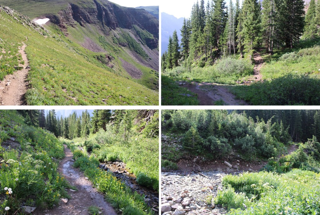
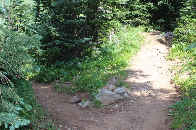
Ok, rant over. I was on the trail around 5:30pm. It was my intention to camp around 11,000’ and start early the next morning. For those of you who haven’t hiked the Maroon Bells area before, the trail is obvious:
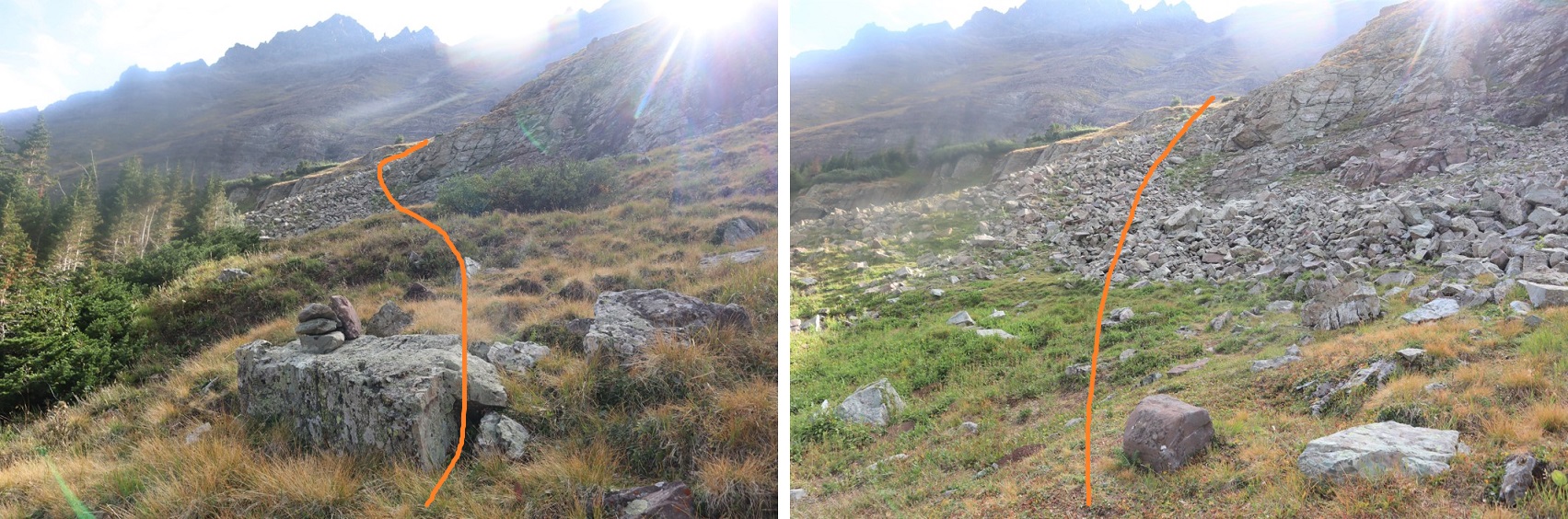
I followed the trail west, staying right at the junction for Crater Lake
And continued up the hillside to my camping spot at 11,100’. I was surprised no one else was camping here, as it’s the perfect spot.
I’ll spare you the details of the next day’s hike, as I came back to this spot, spent the night, and started from here the next morning. I’d gotten to bed early after a long day of hiking, and woke up to sunlight. I looked at my phone and it showed 5:30! Ack! I initially thought I’d slept through my alarm, and started rolling up my sleeping bag. About 30 seconds later I realized I’d only been sleeping about an hour, so I happily went back to bed and slept soundly until 3:30am the next morning. I left my new water filter bag inside my tent and was on my way.
I was on the trail by 3:45am, heading northeast along the well-defined trail through Minnehaha Gulch. I crossed a stream and continued along the trail, not really ‘feeling it’ today. I was more tired than I should have been, and wasn’t feeling very motivated.
I followed the trail all the way to Buckskin Pass
Once at Buckskin Pass, I turned right and headed north towards Buckskin Benchmark
This was an easy, class 2 hike, mostly on tundra
Towards the top it got a little rocky, but stayed class 2. I saw several ptarmigans here, and a few crows
Right about now the sun was starting to rise, along with my motivation.
Here’s the last bit to the summit. It stays class 2 if you keep left
I summited Buckskin Benchmark at 6am
Buckskin Benchmark:
The benchmark
The views from up here were amazing! My spirits lifted, I actually ate a snack, and headed back down to Buckskin Pass.
On my way down I made some mountain goat friends (those are Snowmass and Capitol peaks in the background)
My next peak was PT 13039
It was a tundra walk back to Buckskin Pass
And a trail hike up to the point circled in red
This is where it got interesting. I wanted to go straight up and over the face, but it seems as if there have been several slides in the area, and nothing went at class 2. This was supposed to be a class 2 hike, so I looked for a better way. My advice here is NOT to go directly up one of these gullies (you probably can, but they all looked sketchy/prone to slides).
Instead, dip down to the left. This area stays class 2.
Here’s what my route looks like from below
Once I was past this area, I turned right and headed southwest to the ridge (still class 2).
Then I followed the ridge south. I could clearly see the cairn indicating the top of 13039
At the edge of the ridge is where it got spicy. It turned form a class 2 hike into a class 4 climb. I looked around for an alternate route, and realized the only way up to the summit was to climb the 30-40 feet or so up the chimney/gully to the summit block
I was a little disappointed because I’d left my helmet back in my tent. I debated if I should continue or not, and in the end I figured I did enough class 4 climbing yesterday without incident and was warmed up: I should be fine today. Also, I’d recommend wearing a helmet. I dropped my gear and headed up with just my camera. Here’s the route I took
I made it about halfway up the chimney, and once again had second thoughts. I continued on however, because I knew the worst was behind me and either way I’d have to downclimb that area again. Here’s another angle
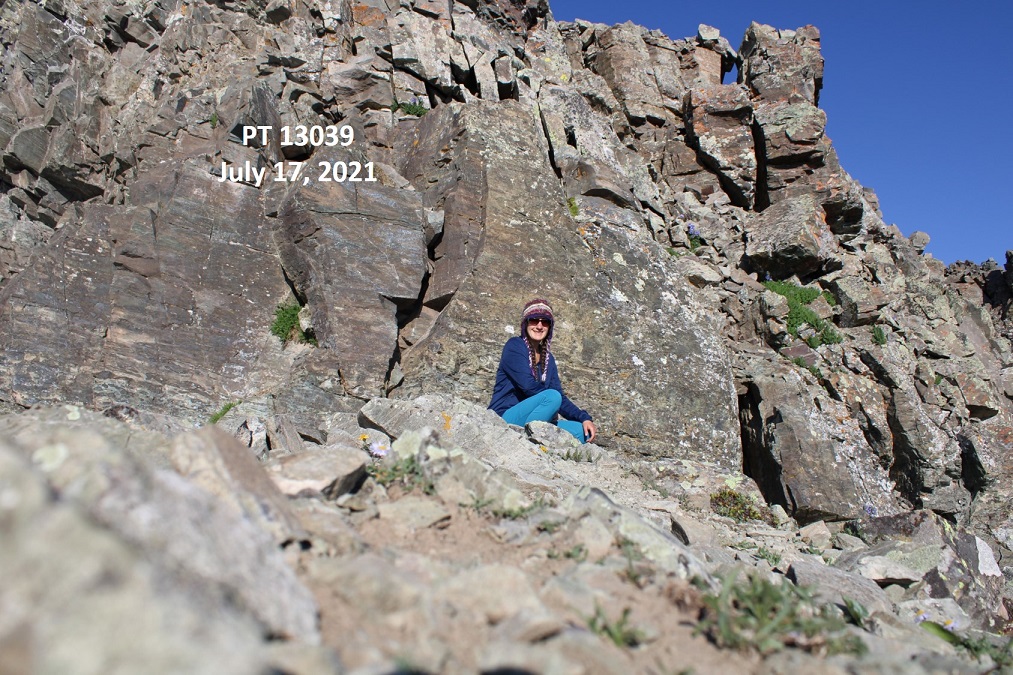
I summited PT 13039 at 7:45am
PT 13039:
Here’s looking back at Buckskin Benchmark
From the summit you can see where I left my gear.
I turned and exited the way I came
The initial downclimb was steep and committing. I turned and faced the rock for this part.
I made it about halfway down and realized I hadn’t taken a picture of myself on the summit, but I wasn’t willing to re-summit again. I figured I’d just get a photo at the bottom.
I made my way back down the ridge
And back to Buckskin Pass
From the pass it was an easy, class 1 hike back to my campsite.
Side note: there are also good camping sites at 11,500’. Once at my campsite I was disappointed to find my water filter had leaked water all over the bottom of my tent. I dried it out the best I could, packed up my gear, and headed down.
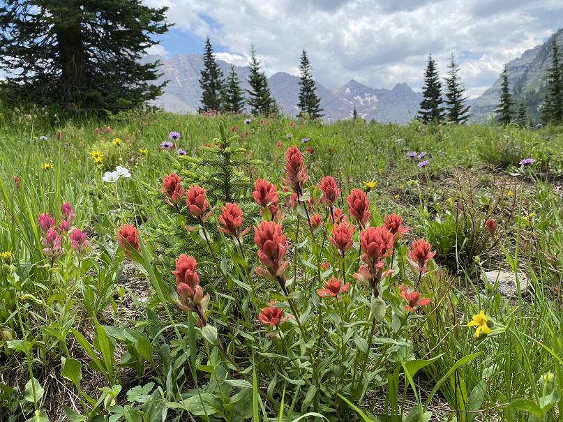
Also, the wildflowers were on point today
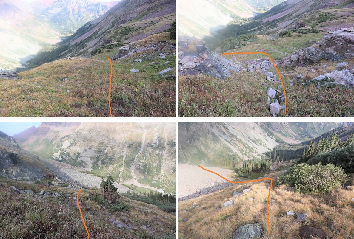
Here are some pictures from the trek out
Once I made it back to the Crater Lake area I started seeing tons of people on the trail. They travelled in groups, and were spaced about 15 minutes apart (I’m guessing this is due to the bussing times). I met one lady who asked me how fat it was to Crater Lake, and when I told her it was another mile or so she looked like I’d just told her it was another 20 miles. She was exhausted, and I’m pretty sure she turned around (the round trip hike to Crater Lake is about 4 miles). There were several groups being led by guides, which leads me to believe guiding companies may be buying up the permits.
I made it back to the parking lot, cleaned up, and headed out.
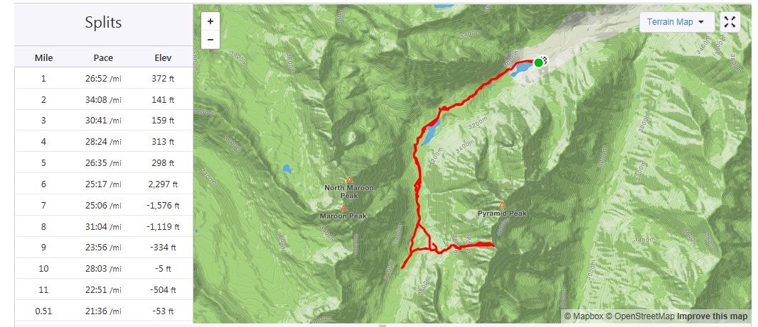
I had another entire day of hiking yesterday, so my stats are estimates based on CalTopo math: Today’s hike was 18 miles with 5800’ of elevation gain.
This is the third time I’ve been to Maroon Bells this month. I was able to secure 3 separate permits, and the past few weeks went with friends to summit North Maroon and Pyramid. Today I was here to tag a new 13er for myself: PT 13631. Since I70 is now open (it was closed due to fires) I was the only one driving on HWY 82. I didn’t pass one vehicle between Granite and Aspen. It was awesome. I did see 2 vehicles parked at a trailhead near Independence Pass, and two scruffy porcupines to go with them, merrily munching on the wires underneath. The owners of those vehicles were not going to be happy when then made it back to their cars. I’d have gotten out and shooed them, but, you know, they may be slow but they have quills. I saw three other porcupines waddling along the highway as I drove. HWY 82 is popular among porcupines.
As I passed the parking structure for Maroon Bells I saw a pear shaped bear butt running away from a trash can and then jump over a fence. It was cute to see it bounding away (although I kind of wanted to get a picture so I wished it had stood still for a second).
I had a permit to park at Maroon Bells from 12am-4:30pm. It was 1am when I arrived and I felt it was still a little too early to head out so I took a quick nap. A large group of hikers passed by at 2:40am and woke me up, so I was on the trail by 2:45am.
The trail starts at the west end of the parking area
And follows a well-defined path around Maroon Lake
At the end of the lake I followed the trail towards crater lake. I noted the signs: One said “bear activity in area” as of August 23 (August 1st had been crossed out) and there was also a sign saying there was a moose in the area. In the last few weeks I’ve seen a bear standing on the side of the road while taking the shuttle ride out and a moose standing in Maroon Lake, so I knew these signs to be true.
This is a class 1 trail to Crater Lake
I turned left at the junction for Crater Lake
And then followed the trail (still class 1) around the ‘lake’ and up the basin.
I passed a few camping areas while it was still dark. In one a large man was standing by the trail, bald, shirtless, and in possession of a rather hairy pot belly. He seemed to be waiting for me to pass by. Luckily this is a well-travelled trail, especially at this time in the morning when others are looking to summit Maroon Peak (I count the flashlights so I know who’s ahead of/behind me when it’s dark out: that large group of hikers wasn’t too far away). I could see him because he had a headlamp shining from his forehead. I didn’t see his dog, who started barking at me as I neared. Of course, I jumped. The man seemed to think it was funny. I continued on. Also, it wasn’t funny. Here’s an overview of the next few steps, as I made my way up to Len Shoemaker Basin
After hiking for 4 miles from the trailhead, and at 10515’ I left the trail to cross Maroon Creek (which at this point of the year isn’t flowing much, but earlier in the season is several feet deep). There are cairns in the area. An obvious trail picks up on the other side.
I followed this trail for .25 miles, until I saw a cairn to my left and then followed a very faint trail east through and then out of the willows, and up the side of the mountain, towards the basin.
Making it to the basin required ascending a series of gullies. I’ve been here several times, and the route gets easier to find each time. This time there were plenty of cairns indicating the way. However, the route sometimes doesn’t seem like it should follow the cairns, but trust me, it does. Here’s the route step by step into the basin. After exiting the willows and crossing a small boulder field there is a faint trail behind the next set of bushes/willows that will lead to the first gully. Now’s a good time to put on your helmet.
I ascended the loose gully, staying to the right for more traction
At the top of the first gully you’ll see another gully to your left. (These are tons of fun in winter BTW, so bring your crampons and ice axe if you expect snow). Ascend the second gully, this time sticking to the left for more stable ground
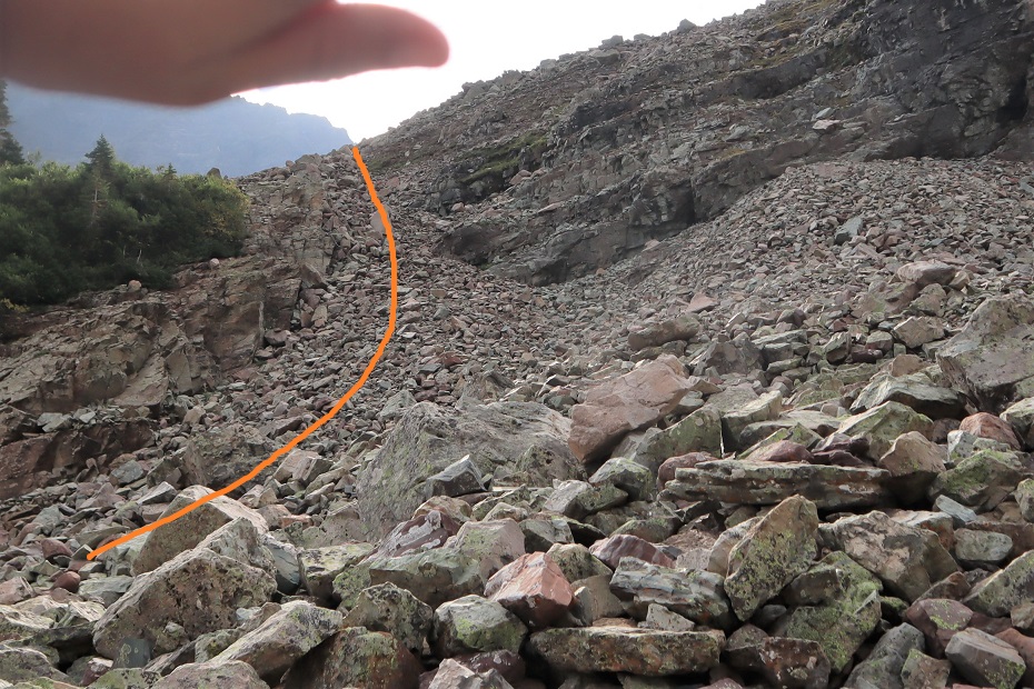
At the top of this gully is… another gully. Sorry for the hand in this picture: the sun was at an unfortunate place in the sky while I was trying to take pictures and this was my solution.
From here I aimed for the grassy slope and went behind it, angling towards the ridge
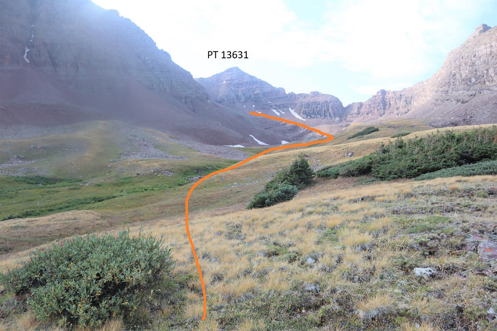
And could see another gully to my left. (This entire time I was heading east)
Next, I aimed for the grassy slopes, and the final gully that would take me to the upper basin.
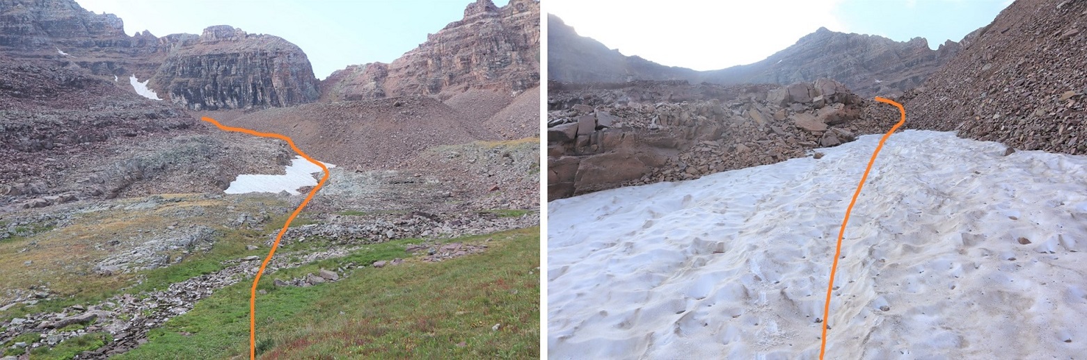
Here I got my first view of PT 13631. I just followed the basin south towards the end
The end of the basin was still holding some snow. This was a light snow year, so I expect there’s snow here almost year-round. The snow can be avoided, but I just walked over it into another basin
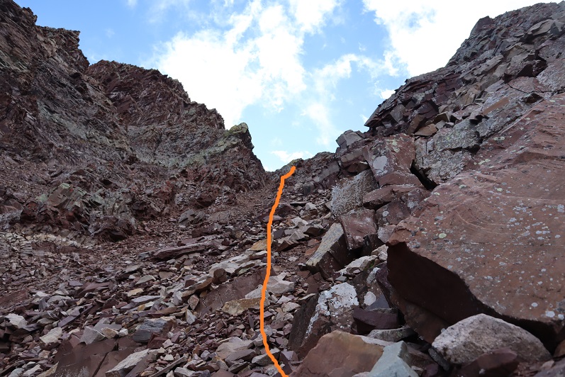
I followed the talus rib towards the base of the gully that would lead me to the saddle of Lightening Pyramid and PT 13631
This is the last gully of the day. It’s class 2 but the scree is loose. I looked for larger rocks whenever possible. There is no direct path but there are a bunch of game trails. No area seems to cliff out, so you can pick your line depending on conditions.
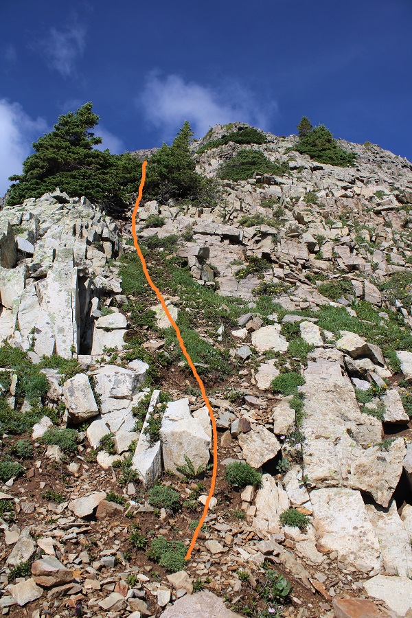
At the saddle I turned right and headed southwest up the ridge. Most of this was easy scrambling, after first initially gaining the ridge. To do this I went right, found a class 3 chimney and ascended it. This was the most difficult part of the entire hike, and I probably could have found a class 2 option around this if I tried harder. I felt this chimney was pretty easy.
Here’s looking up at the chimney. There are plenty of hand/foot holds. It’s only about 8 feet high and all of the rocks are stable.
Once on the ridge I scrambled my way to the summit. This is all easy class 3, just scout around for the best route.
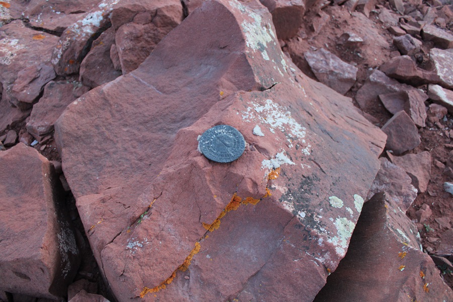
The summit is relatively flat. There’s a summit cairn with two summit registers. The metal one is closed and has 2 pens inside. The white one is open (without a lid) and is empty. Bring some paper if you want to sign this register.
I summited PT 13631 at 7:20am
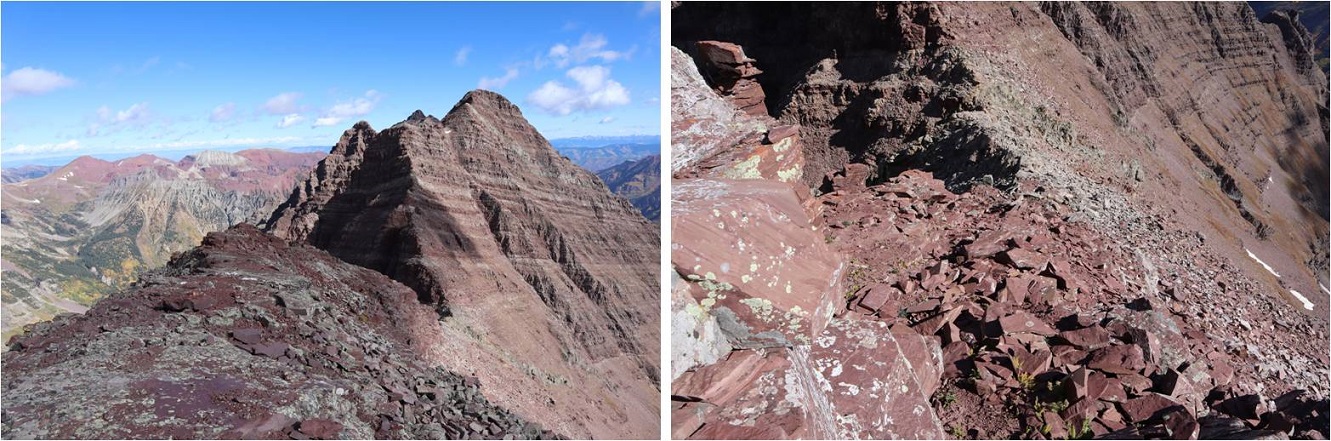
PT 13631:
The views were great, but the smoke from nearby fires shaded them a bit.
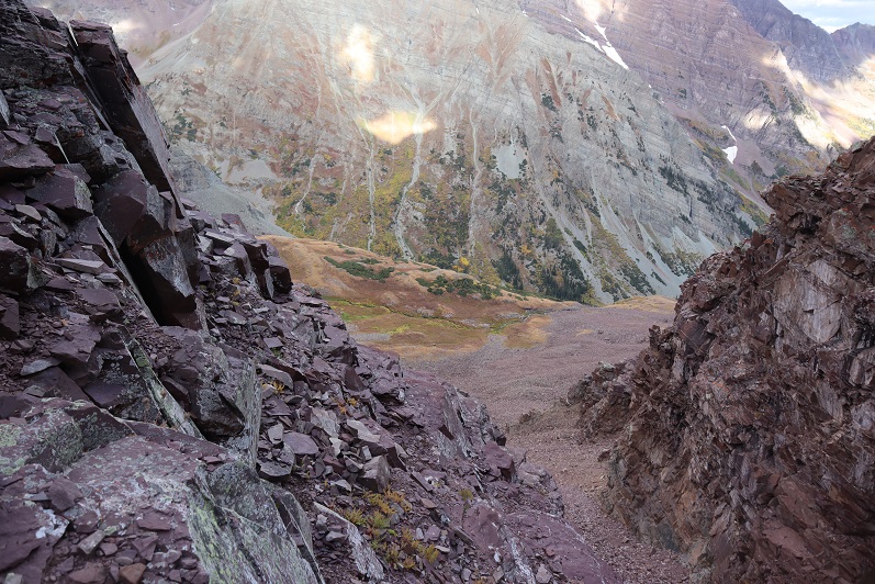
Here’s the route back down the ridge
Down the chimney (you can see my trekking pole below for reference)
And back around to the saddle.
Once again, great views
Back down the gully and through the basin
And back down the gullies, following the cairns west along the way.
Through the willows
Back to the trail that would lead me across the creek
And back to West Maroon Creek Trail 1975 and Maroon Lake
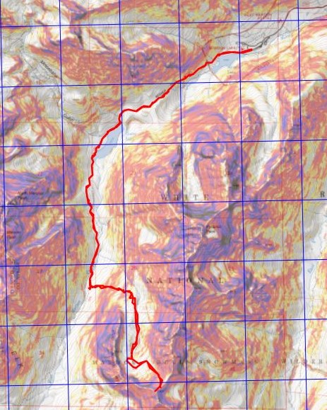
When I was here last week there’d been a moose standing in the lake. Guess what? He was still there (this time lounging by the lakeshore). Pretty cool!
I made it back to my truck at 11:45am, making this a 14.93 mile hike with 4584’ of elevation gain in 9 hours (with some time spent ogling the moose).
Here’s a topo map of my route. I have to say, the views were incredible but the peak itself was kind of a letdown. It had just been too easy, when I’d been expecting the more intense scramble over crummy rock the Elks are known for. It almost wasn’t worth bringing my helmet, but the moose was an added bonus.
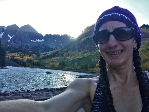
After summiting Vestal Peak I changed in my truck into new hiking clothes. I re-braided my hair, ate a packet of tuna and drove to Maroon Lake. It rained the entire 5 hour drive there and I was seriously worried my hike in the morning would be in danger. Originally I’d planned on hiking, taking a day off to rest, and then hiking again on Sunday but the weather forecast for Sunday called for 80-90mph winds so I decided to alter my schedule a bit. I was not impressed with the rain. It was raining when I fell asleep in the cab of my truck but I thankfully I awoke to a clear, starry sky at 2:30am.
The parking lot was full of both hikers and photographers eager to get a glimpse of the fall colors. I debated going back to sleep for a few minutes but in the end decided I should probably get going. I was on the trail at 3am.
I followed the trail to Crater Lake
And then followed the West Maroon Creek Trail until I’d made it 3.7 miles.
This trail is so much nicer to walk when there’s no snow! Route finding was negligible
After 3.7 miles I crossed the West Maroon Creek (which didn’t have much water)
And headed east through the willows
Until I reached the base of the slope to the first access gully. This was difficult to figure out in the dark: The last time I was here the willows were completely covered in snow and I just climbed right up, but today those willows were taller than I was.
At the top of this gully is another gully
And at the top of this gully (you guessed it) another gully
Now the rocky gullies started including areas of tundra
Now I was almost to the upper basin.
Once in the upper basin the sun started to rise and I had a good view of “Lightning Pyramid”. Traditionally you climb this peak as a couloir climb in the winter/spring, but obviously that wasn’t an option for me today and I’ve already been here in winter conditions: I wanted summer. I headed across the rocky basin, aiming for the couloir.
This next part in italics is personal and has no relevance on the trip report. Feel free to skip it if you’re just here for route information.
I’m going to summarize this as quickly as possible: I don’t consider myself to be an overly religious person. I grew up in the church but no longer attend (please don’t invite me to your church: I have personal reasons for why I don’t go). I do believe in God and find him more in the mountains than in a building surrounded by people. Often when I hike I have conversations with God. I do most of the talking, but surprisingly I started to feel him talking back (rarely, but it happened). I’m going to be honest here: If someone told me God spoke to them I’d think they were daft, so I totally understand if you think that of me, but I think what I’m going to say needs to be said (for me at least). Also, once again, I’m not a ‘preachy’ person and will most likely never mention anything like this again in a trip report.
For some reason I’m a ‘people-pleaser’. I have a need to be liked and I go out of my way to be friendly and helpful. I feel I need to be ‘perfect’. I don’t do well with rejection. I’ve always been an avid hiker but started seriously tackling peaks after I got a divorce. My ex had supervised visitation of the kids one day a week and on that day I’d go hiking. After my 13th summit of Pikes Peak I met someone on the way down who asked me which other 14ers I’d done. My response: “What’s a 14er?”
Obviously I was immediately hooked and after about 20 14ers I was hiking and talking to myself/God about how amazing Colorado and the mountains and hiking (etc) are and felt God speak back to me. He told me to hike all of the 14ers in Colorado solo. This idea intrigued me: I was both excited and scared. I wasn’t sure I could do it. Also, I didn’t really know why I should?
After hiking about 30 14ers solo I was sitting in a Girl Scout board meeting and Girl Scouts had just partnered with The North Face. We were brainstorming fundraising and marketing ideas and suddenly it all became clear: I could be the first woman to solo all the 14ers! Girl Scouts focuses on first women to do ‘stuff’. We could market this jointly with The North Face, the girls would get exposure to outdoor experiences and(hopefully) some free gear. It all seemed clear now: This must be why I was doing this! I felt I had purpose and direction.
I was so excited when I summited all 58 14ers solo because I felt I was doing it for a cause. Anyone who follows the 14ers site knows what a disaster that turned out to be, and honestly I just wanted it all to go away.
I kept hiking because I like to hike. On my first centennial after finishing the 14ers I felt God telling me to keep hiking the rest of the centennials solo and I balked. Once again, I wasn’t sure I could do this (hello class 5?) but after mulling it over I was willing to give it a shot. I knew I’d write up trip reports and post them to my website because that’s what I do, but he told me to keep posting to the 14ers site as well (I did not want to do this, but I did).
If you were to ask me why I was hiking all of the centennials solo I’d tell you I didn’t know. I honestly didn’t know, but I also wouldn’t have told you it was because “God told me to” because then you’d think I was totally nuts. But that was why I was doing it: Because God told me to.
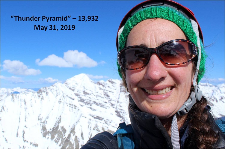
Then Thunder Pyramid happened. At first I was confused because I knew I’d summited, and then embarrassed, angry, and frustrated. Why was this happening to me? Not only were people commenting on the 14ers site, but they were going through my LinkedIn page and challenging my accomplishments, posting negative comments on my website, facebook, and Instagram (sorry David for ghosting you: I honestly thought the feeling was mutual). People unfriended me both online and in person. They made up reasons to ‘prove’ I was lying and if they couldn’t find negative information they assumed or made it up. The dislike button was hit on my trip reports and I took it all very personally.
The hardest part was just because they were loud didn’t mean they were right. I knew I wasn’t lying but I couldn’t change their minds. I’m also sure they think their behavior was justified. I think it bordered on harassment. It was definitely bullying.
So here I was, halfway to the summit of PT 13,722 and all of this was going through my head, in addition to the anti-climatic day I’d had yesterday when I’d finished hiking the centennials solo and didn’t ‘feel anything’. I was asking God why I just couldn’t get excited about finishing the centennials solo? I didn’t want to post anything on the 14ers site because I didn’t want to go through the drama again. I mean, I know I shouldn’t care what other people think about me…
That’s when it happened. As soon as those words went through my head everything stopped and suddenly it felt as if I was getting the biggest, warmest, most enveloping hug I’d ever had. Overwhelmed I broke down and started crying big crocodile tears, taking huge breaths in and out between sobs.
That was it: I wasn’t hiking for a cause or to help others but because God wanted to teach me a lesson. He wanted me to realize it doesn’t matter what other people think. He just chose to show me that lesson through something I love: hiking.
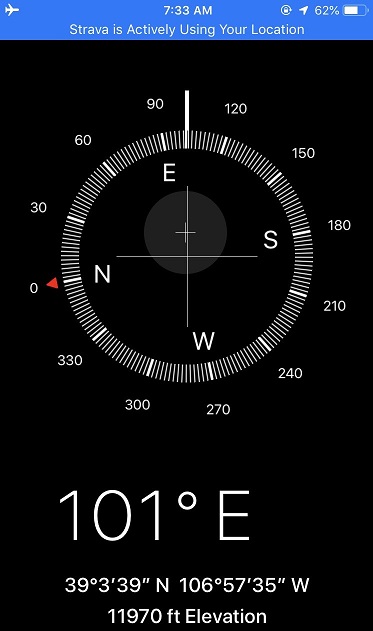
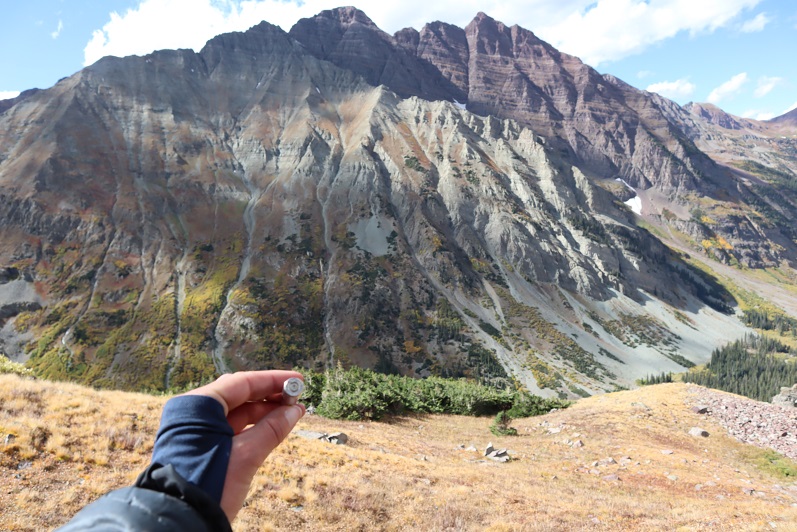
“Wow” I thought: “He had me hike all the centennials solo to teach me not to care what other people think”. A simple lesson we teach out kids and that everyone knows but that I have difficulty accepting. This moment was so powerful I got out the altimeter/compass on my phone and took a picture of where it happened. I thought about just saying it was at 12K but ultimately figured that diminished the experience.
I wiped away my tears, looked at the mountain in front of me and thought to myself “So, if it doesn’t matter what others think of you why don’t you just turn back and go home?”
The answer? “Because I Love to hike”
With light shoulders and a renewed purpose I started off again. It took about 10 steps before another thought overcame me: “Why did God think I needed to learn this lesson? What is he preparing me for where I need to be ok with not caring what other people think about me?” (I squinted and closed my eyes, crossed my fingers and repeated: Please not politics, please not politics, please not politics).
Ok, moving on…
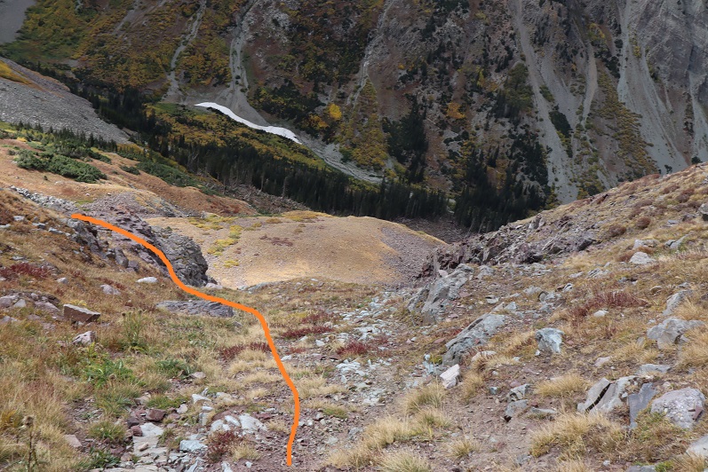
I trudged up the talus towards the couloir. This talus was nasty and each step hurt my ankle (not sure what I did to it yesterday, but it felt bruised). I made it to the base of the couloir and had a decision to make: How was I going to ascend this thing? It looked like it contained (more) nasty scree, so I decided to take the rocky rib to the right. This is the route I took:
I need to stress this might not have been the safest way to ascend. The rock was extremely loose and I had to check and re-check hand and foot placement with every step. It was sustained class 4 bouldering for a good 1000’ of elevation. It was slow going, but I love bouldering and that’s just what this was.
I stayed closely to the right of the couloir for as long as I could, but eventually I had to enter the couloir for the last part of the climb. This area was very loose and I’d suggest you stay as close to the rib on the right as possible.
Here’s looking back down the rock rib/couloir and into the basin
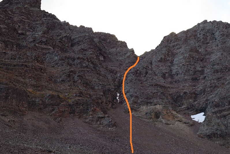
I made it to the top of the couloir and turned right (south), carefully climbing up the ridge
This was actually much easier than it looks (and easier than the climb to this point). I made it to the top of the ridge and saw an easy path to the summit of “Lightning Pyramid”
I summited at 10:20am
Lightning Pyramid summit:
Ok, now time to head over to my old friend, “Thunder Pyramid”. I couldn’t find a lot of specific information about this traverse, so I had a lot of figuring out to do. I’d heard heading straight up and over the ridge wasn’t fun, and it in fact didn’t look like much fun, so I decided to scope out another way.
I headed back down to the saddle
Once there instead of hiking up the ridge I decided to stay level with the saddle and hike across the right (east) side of the mountain. This was surprisingly easy
Here’s looking back at “Lightning Pyramid”
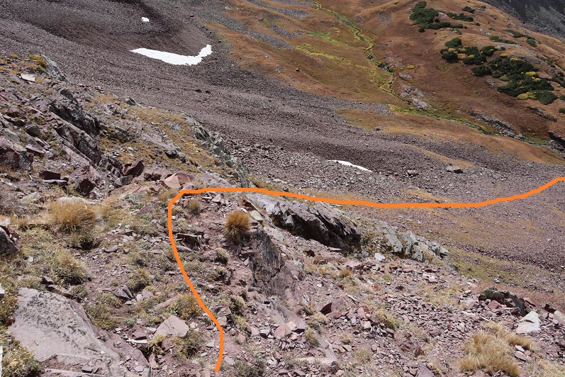
I stayed at the same level as the saddle until I came to a gully. This area took some careful footwork but little climbing. It may have risen to class 3, but realistically was class 2
Next I came to a gully. This gully was very loose and I kept to the left side for stability, holding onto rocks and handholds in the boulders where available. This felt like class 3
At the top of this gully was another gully. I just aimed for the snow.
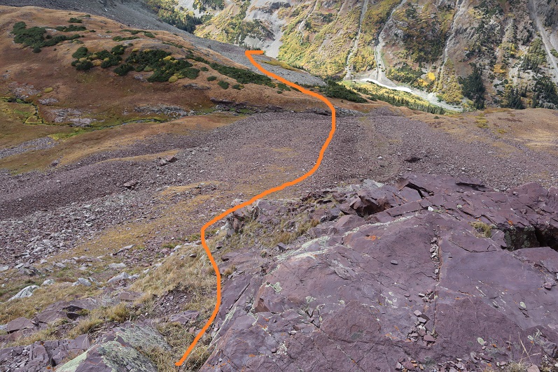
At the top of this gully is where the route picks up with the standard route up “Thunder Pyramid”. I turned right (north) and ascended the ridge
The top of the ridge wasn’t the summit however. I took the solid route up, the dotted route down. If I were to do this again I’d take the dotted route both ways because it doesn’t lose elevation.
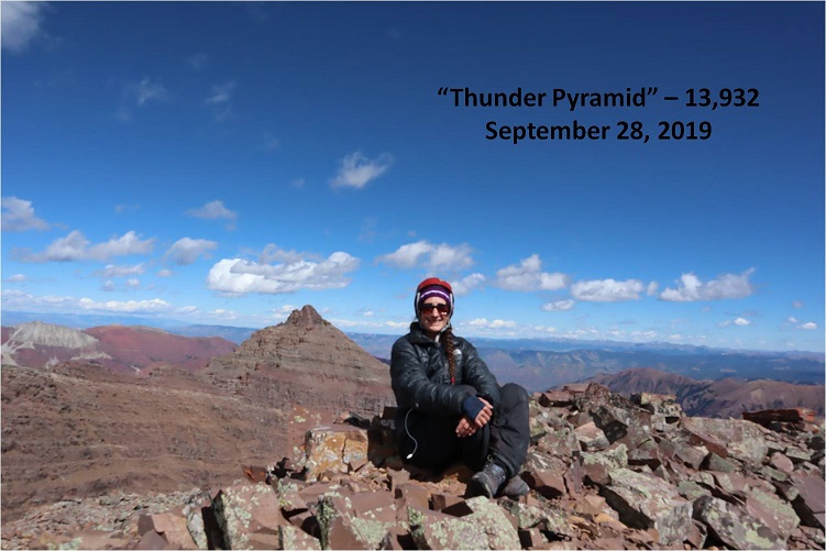
I summited “Thunder Pyramid” at 12:15pm. It took me just under 2 hours from “Lightning Pyramid”. Unfortunately, most of the pictures I got at the summit I realized were blurry when I got home (still figuring this new camera out)
But I did get one “ok” picture
Thunder Pyramid summit:
Up until this point doubt had crept into my mind: maybe what others were saying was true and I hadn’t really summited “Thunder Pyramid” last time. Maybe I’d ended up close but not exactly there? I’d been in a hurry because I’d been having a Raynaud’s attack and I didn’t take my normal number of summit photos/videos (I don’t usually get videos in winter conditions because it’s a death sentence for me to take off my gloves to operate the camera). So today I walked all over that summit, looked around and confirmed what I already knew: Yes, I had indeed summited the last time I was here. Also, the weather today was absolutely perfect! Those 50mph winds never materialized.
I decided to head back down the way most people hike up. I made my way back to the ridge and down the gully
Check it out! Now I know why it’s called the “White Gully” (Last time everything was white)
The descent down “Thunder Pyramid” was no more fun than the ascent up “Lightning Pyramid”, and considering both the gullies and couloir I’d say it’s probably easier to do Thunder first and then traverse over to Lightning. Also, I know this is usually done as a snow climb, but I felt much safer on the scree and talus than I had on the snow. When it was covered in snow I felt like if I slipped I’d fall and never stop sliding. Here I knew I could slip but I wouldn’t fall very far. This climb wasn’t ‘easy’ but it definitely wasn’t as difficult as I’d anticipated.
Hiking down was like déjà-vu (as it should have been)
I made it almost to the bottom of the gully and turned left
And descended the slopes into the basin
Also, I found a shell
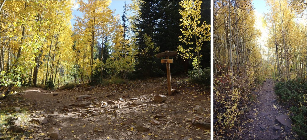
I made my way back to the West Maroon Creek Trail and hiked out, loving the fall colors in the daylight.
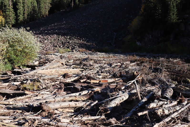
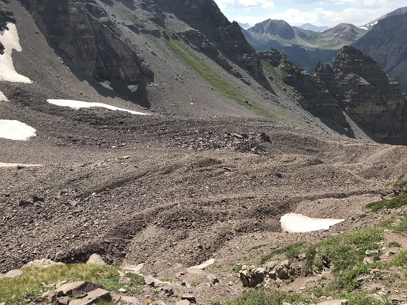
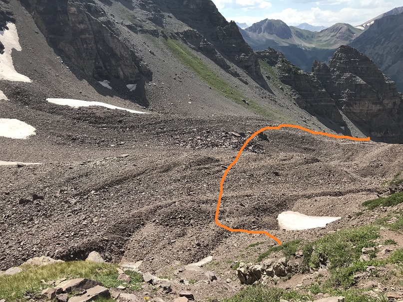
There were a ton of people around Maroon Lake when I got there, all enjoying the fall colors. The base of the lake resembles the Snowmass log jam
While the 50mph winds never materialized on the summit(s) today it was really very windy at the lake. I decided to head to my truck to clean up and then watch the sunset. There was a line of cars waiting for a parking spot and I had to tell no less than 50 of them I wasn’t leaving. None of them took it well, but it had been a long day, and I figured I’d earned watching a good sunset.
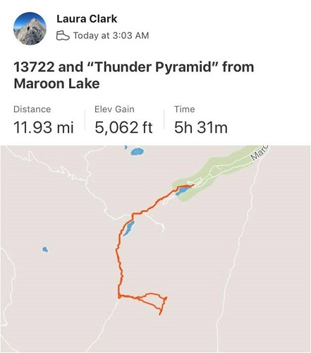
I made it back to my truck at 5:15pm, making this a 12 mile hike/climb with 5062’ in elevation gain in 14 hours.
I enjoyed the sunset
And as soon as it was over I hopped in my truck to drive home. There was a line of vehicles waiting for a parking spot that lasted for over half a mile down the road. The shuttle had stopped for the day and I drove 2 people down to the bus stop because they’d missed the last bus. They were a nice couple from Georgia who were happy not to have to walk those 13 miles back to their hotel. I hope they enjoy Colorado as much as I do!
I did a ton of research on this one, as I didn’t want to have to attempt it twice. I’d been watching the weather for the past few weeks for this peak, and now that the road was open into Maroon Bells I figured this would be my best chance of making this peak a snow climb this year. The night before the attempt I was re-reading previous conditions reports and someone mentioned they’d have liked to have had 2 ice picks for this peak. This seemed curious to me, but if someone’s going to give honest advice I was going to take it. The only problem: It was 6pm and I didn’t have a second ice axe. I gave it some thought, and a wild idea came into my head: I wonder if I could use a hammer? Probably not the best idea, but maybe just bring it along just in case? I went to the garage to find a hammer and found a very cheap adze hoe I’d bought at the dollar store last year. It had three prongs, was very lightweight, and I thought this looked even better than a hammer! I had no intention of relying on this as my only source of stability (I brought along my ice axe) but I thought I’d have it “just in case”. I got out some paracord and made a quick leash for it and attached a carabineer to it and put it in my pack, never intending to actually use it.
When I made it to the trailhead there were two other vehicles in the lot. I got my gear together and as I was ready to go I noticed a young man getting his gear ready, so I went over to talk with him to see which peak he was climbing. He was a bit surly (which I attributed to it being 2:30am) and he told me he and his friends were going to snowboard down Pyramid. I wished them luck, put on my helmet (so I wouldn’t forget to later) and was on my way.
I was surprised to find they’ve recently roped off Maroon Lake (on my way out I saw dozens of people step over the rope for pictures, so unless they have personnel there monitoring visitors I don’t think the ropes are going to make much of a difference).
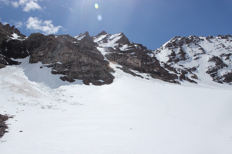
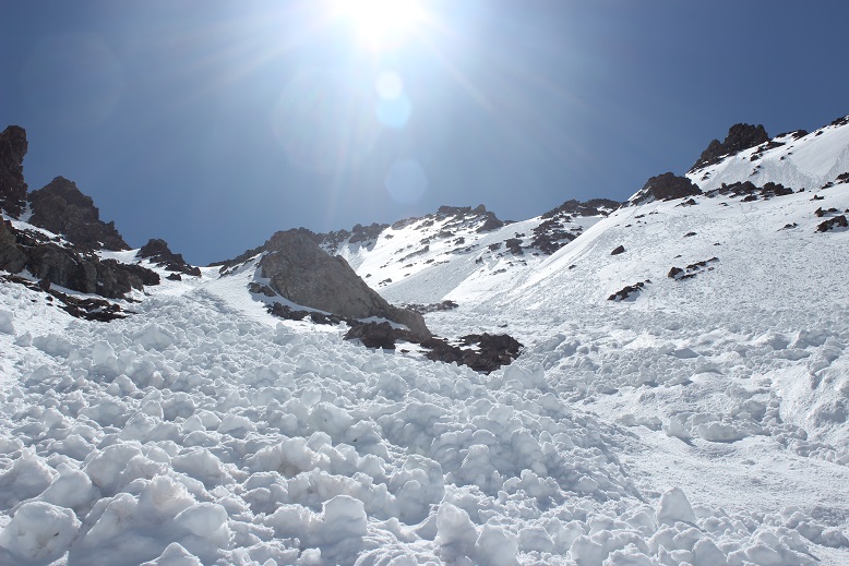
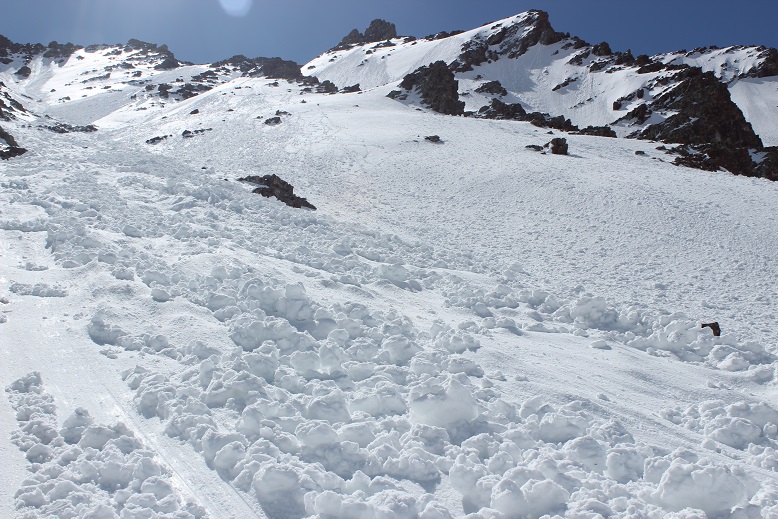
The trail was dry until I hit 9950’, about half a mile before Crater Lake. Luckily the snow was firm so I didn’t need to put on my snowshoes. Crater Lake was covered in recent avalanche debris, but even in the dark it was easy to navigate through.
After Crater Lake the trail pretty much stopped: it didn’t look like anyone had been out hiking past Crater Lake yet this season. There was a thick layer of snow and what seemed like avalanches everywhere the trail was supposed to be, so I just worked my way through the willows and followed Maroon Creek as best I could. I postholed a bit in the camping area, but otherwise the snow was firm. It was about here I turned around and saw someone’s headlamp in the dark. It looked like someone as hiking North Maroon Peak this morning, and making good time. Cool!
I never saw the creek crossing as it was covered in snow, and in the dark I accidentally went too far and had to backtrack. When I made it back to the correct spot to ascend the first access gully I noticed an avalanche had occurred here as well. The good news is it makes it easier to see your entire route. Here’s the route I took up the first access gully.
This was much steeper than it looked. At the base I put on my crampons and looked for a good route. Boy, was that steep! The snow was consolidated enough to need crampons, but the slope angle was so steep I couldn’t just walk up it either: I needed to kick in steps. I decided to take out that adze I’d brought with me and try it out. Kicking in steps was difficult because the snow was so hard. I’d kick about 15 times for each step.
However, the adze was amazing! In fact, I liked it better than my ice pick. It wasn’t practical for self arresting, but those 3 prongs were great for traction! I had the adze in my left hand, and once in the snow it felt more secure than my right hand did holding my ice axe. Wow!
It’s really important to pick your line from the base of the mountain because once you’re climbing the terrain is very steep and it’s hard to tell where the actual summit is. This is the route I took.
From the top of the first access gully I needed to ascend a band of cliffs. This is the route I chose to take
After the cliff bands there’s over 1500’ of gully to climb. This sounds straightforward enough, but the route was really, really steep. Added to that there were unavoidable frozen roller balls and avy debris littering the whole route.
It wasn’t lost on me I was climbing up a slide area, but the entire mountain was a slide area. The debris on the mountain was actually helpful while upclimbing because it gave my feet stability (most of the time, when it wasn’t sliding out from underneath me). I knew I was climbing on a ticking time bomb: as soon as the sun warmed up the mountainside all this debris would become slush and slide (hopefully after I’d made it down). I tried to decide if it was safer to hike down the slide areas or on the firm snow on steeper terrain that looked like it was about to slide. I wasn’t sure?
Progress was very slow going. If I were to lose my balance and fall self arrest would be difficult at this angle, and I was going to slide a long, long way if that happened. So I couldn’t fall. I made sure each step was secure, having at least 3 points of contact at all times. This entire stretch required kicking in steps, often times on terrain that fought against me. Did I mention the adze? It was amazing!!! I didn’t care how silly I looked, I was so glad I’d chosen to bring it along.
I was in a race against the sun, and kept reevaluating my current situation. The snow was firm and I was making good (if slow) progress, but I told myself to stay out of harm’s way I needed to make it to the top of the gully before the sun crested the saddle. If the sun made it before me, I was going to have to turn back for safety reasons.
Most of the trip reports I’d read said to take the right gully, but that wasn’t an option for me as the safer terrain today was to the left. I topped out of the gully at a small saddle between Point 13,820 and Thunder Pyramid. Here I stopped to catch my breath. I’d done it! I’d beaten the sun! Woot! It was now a quick 300’ or so climb to the summit. But was that really the summit? I took out my phone and pulled up Peakbagger. Yep, that was it: I needed to go right. I put my phone away, took off my crampons for the climb, crossed the saddle and sank up to my arms in soft snow.
Drat! I seriously had to hurry! The sun was going to warm up the mountainside fast. Here’s the rest of the route
Whoops, my camera was still covered in snow from that unexpected dip. Here’s a better picture of the route I took
It looks steeper than it is. I’ve heard this is class 4-5, but I was able to keep it at class 3-4.
I made it to the top, took a quick selfie (my gorillapod is still broken: another’s on its way so hopefully this DSLR-selfie thing can stop soon)
And booked it back to the saddle. Pyramid is looking wonderful this morning
As are the bells
The sun was heating things up fast but Thunder Pyramid was still (mostly) in shadows
I put my crampons back on, grabbed my ‘tools’, and began descending. I descended a little more to the right than I’d summited, with the intention of climbing the smooth snow instead of the avy debris (which I was worried would fall). Solid line is how I summited, dotted line is how I descended. Neither was better than the other.
I had to turn and face the mountain the entire way down, and wouldn’t you know it? Slick as snot. This side was no better, and probably worse.
If anything, there seemed to be more avy debris here, none of it stable.
I tried to avoid the areas that had recently slid because they were very, very slick. I was also happy to see some of my kicked in steps on the way back down!
Evidence of wet slab avalanche
Downclimbing was just as hard as climbing up, with the added anxiety of making it down (safely) before things started to slide. I made it to the top of the cliff bands and was finally able to turn around and walk down
The snow was seriously starting to soften up fast. I kept increasing my speed until I made it to the cairn at the top of the first access gully. Here was where I could finally breathe a sigh of relief: I was out of the danger zone! I figured it was time for some self care: I reapplied sunscreen (knowing on my way down I’d already done some damage), took off my gloves (it was warm here!), exchanged my crampons for snowshoes, and looked back at the route I’d taken down the cliffs.
I also took a picture of my ‘tools’. I was so thankful for the conditions report that suggested I bring 2 ice axes! The adze wasn’t an ice axe but it had proven extremely useful. I was glad to have had it with me.
Just as I took this picture I heard a loud pop and then a crash that sounded like thunder. It startled me at first, until I realized one of the waterfalls had warmed up and dropped a bunch of ice down its chute. Then I heard it again, and again, and again. The entire basin had warmed up at the same time and was filled with icefall. I’d made it down in perfect time! Woot! I sat there and waited for the crashes to stop, just enjoying the experience while I was there.
But I wasn’t out of the woods yet. I’d thought I could descend via the avalanche area and skip going back down that steep access gully, but when I made it to the avalanche area it cliffed out
Ugh! I had to backtrack up to the cairn and get out my tools one more time. The snow was very soft at this point, and I should have just glissaded down the access gully, but I didn’t want to take off my snowshoes (etc) so I turned and faced the cliff and descended in rapidly softening snow.
After heading down I turned right (instead of left, the way I’d initially made my way in the dark) and was able to safely descend via the avalanche area. This will probably be the new route
Here’s looking back on the route
And now to head back down the basin to Maroon Lake.
The willows were much easier to navigate in the daylight, but unfortunately I was postholing in the snow. There was avy debris hugging the base of the mountains, so I tried to stick to the creek as much as possible.
Maroon Creek is beginning to thaw
And the avalanche area covering Crater Lake didn’t look so intimidating in the daylight
Oh, and you haven’t experienced spring snowshoeing in Colorado until you’ve snowshoed over avy debris. There’s no other experience like getting a pine branch stuck in your snowshoe. And don’t bother removing it: another one will take its place with your next step.
It was really nice to hear all the birds chirping on my way out. After Crater Lake the crowds picked up and so did the slush. I was very thankful to have my snowshoes. Every tourist I passed commented on how ‘smart’ I’d been to bring them. Ha!
The last part of the trail was over a path with just enough rocks to slow you down, but at least it was snow free.
I started at 2:30am and made it back down at 1:30pm, making this an 11.5 mile hike/climb in 11 hours.
Disclaimer: I’m NOT advocating the use of garden tools in place of proper mountaineering equipment. There are tons of reasons why this was a bad idea, but in the end it worked out well. The next day I went to REI to buy a second tool. I asked an employee for help, and she couldn’t recommend anything to me at the moment (apparently ice climbing gear isn’t in season in June). The only thing she could recommend was a second ice axe, exactly like the one I currently have (which I thought was overkill, too much weight, etc.). So I’m currently in the market for an ice pick for my left hand and keeping the adze in my pack until that happens. Hopefully sooner rather than later.
The plan: Eat an entire pizza by myself and fall into a pizza induced coma for 4 hours before waking up and driving to the trailhead.
All was going well at 6pm as I jumped into bed after eating an entire pizza (plus 2 pieces of garlic bread, washed down by a glass of wine and 3mg of melatonin). I fell asleep almost immediately as my body began happily processing all the calories I’d just ingested.
At 6:30pm I was woken up by my son playing his accordion in the kitchen. He was multitasking, making himself dinner and practicing his scales. Ugh. I tried to wait him out and get back to sleep but it was no use. His playing was obviously going to last a while. I tried calling his name a few times (loudly) in between sets but he had the stove fan on and couldn’t hear me.
I did not want to get out of bed to ask him to stop. Lately I’ve had vertigo, a complication from Raynaud’s, not enough sleep, and dehydration. For those of you who don’t know what vertigo is, it’s an intense spinning of the room that makes you nauseous. It feels like I’ve had way too much to drink and then try to lay down suddenly: the room spins dangerously like I’m on a spinning carnival ride, and it’s awful. It only affects me as I’m lying down or getting up, and it only lasts 5 excruciating seconds or so, but it sucks and I wanted to avoid it as much as possible. So I lay there for 10 minutes trying in vain to get my son’s attention and finally gave up. I steeled myself for the room to spin, got out of bed, held onto the side of the bed for a second as the room spun and waited for the spinning to stop. When it did I walked into the kitchen.
My son looked up with a ladle in one hand and the other pressing scales on his accordion. He was immediately gave me a sideways smile. He obviously hadn’t known I’d been trying to sleep (he thought he was the only one home) and promised to keep it down while he cooked. I thanked him, went back to my bed, steeled myself for a second round of nausea, lay down, and the next thing I knew my alarm was waking me up at 10:30pm to head to the trailhead.
The drive to the trailhead was uneventful. I didn’t see any deer, which was weird, but I did see a porcupine crossing the road on the 82. Despite triple checking my directions I once again went to the wrong trailhead (this Maroon-Snowmass/ Maroon Snowmass / Maroon Trailhead / Maroon Creek thing really stinks) but noticed my mistake early on and backtracked to the correct trailhead. I paid the $10 fee at the Rangers Station (pay the fee people!) and parked at the trailhead. There were two other cars in the parking lot when I arrived. I jumped out and hit the trail at 3:15am (15 minutes behind schedule due to re-routing… I had time to make up).
While I hadn’t seen any deer on the drive in, as I was passing Maroon Lake I saw about a dozen deer all along the trail. They stopped to look at me and then quickly bounded away. My directions said to hike 1.75 miles to reach a trail junction, and then another .75 miles to another trail junction. I found the first junction just fine, but it seemed like I was hiking a lot further trying to find the second one. I had my GPS, and it wasn’t 100% syncing up, but I’d talked to a couple last week who said the GPS files in the Maroon Bells area had consistently been 50-150 feet off for them, so I didn’t think anything was wrong. Until I saw headlamps hiking up the other side of the hill, about 150 feet across from me. Ugh. I looked at my topo map and I was indeed off course; by about a mile in distance and 500 feet in elevation gain. Double ugh.
So I backtracked, found what was considered the junction (which I’d missed in the dark), crossed the stream in the dark, and headed up the hill.
I’m a pretty quick hiker, so even though I’d started out over a mile behind the headlamp group I caught up to them halfway up the hill, just before the talus field. Yes, they were hiking North Maroon too, just taking a breather before continuing on. I had serious time to make up now, so I didn’t stop to chat long and was on my way. I’m not a fan of talus, but the trail here was well maintained.
I made it across the talus, under the cliff bands, and over a glacier area, and up about 200’ of steep terrain through some trees before the sun began to rise.
I took a break here to watch the sunrise because this type of beauty is what hiking is all about.
From here I could see both Crater Lake and Maroon Lake. For the rest of the hike I used them as indicators of which direction I should head (especially on my way down). They should always be in the same position as you’re hiking this mountain.
Now was the time to apply sunscreen and start drinking water. I almost never drink water when I go hiking. I always bring 2 liters, but rarely take more than a sip because I just don’t get thirsty. But this vertigo thing had me re-arranging my priorities. If drinking more water would make it go away I’d drink more water: I carried the water, I was going to drink it. So every time I remembered I had water I took a sip.
After the sun rose the gullies began. There are two types of gullies in my opinion: good gullies and bad gullies. The bad gullies tend to be anything labeled “2D”.
These were good gullies. They weren’t too steep, required climbing (not shuffling through scree) and were well cairned. If you couldn’t see a cairn you weren’t on the trail (I know, because I replaced many of them so this would be the case). There was a 1st gully and a 2nd gully and both had the same terrain. The only problem was sometimes the cairn would be behind and above you, not directly on the trail (this made sense though, since climbing was involved).
I took another few sips of water.
The second gully was very similar to the first, with grassy slopes and steep, loose rock. When I’d reached the top of the gully I was on a class 3 ledge. This meant a lot of scrambling, following the ridgeline toward the summit.
I took another few sips of water.
There is a rock band here that required class 4 climbing to navigate, but offers a class 3 variation by going around the band. Here’s a picture of the class 3 climbing
DO NOT TAKE THE CLASS 3 ROUTE in the next few weeks: It has a lot of runoff water on the route and is steeper (more exposure) than the class 4 chimney, making the class 4 chimney a safer option. It was also more fun! The only downside to the chimney was my height. I could tell where I was supposed to step, but my legs weren’t long enough to reach. So I used my back a lot and balance where necessary to push myself up the chimney. Luckily it wasn’t too long and didn’t have too much exposure, so if I fell I wasn’t going to fall too far. Here’s a look at the Chimney:
The last bit of climbing was all class 3 over ledges up towards the summit, with a few solid rock gullies thrown in for fun.
I took another few sips of water.
I summited at 7:30am. I took a bunch of summit photos, drank more water, and reapplied sunscreen. I was happy with my progress, and kind of excited I could name most of the surrounding peaks.
I took a summit photo
The way down was much easier than the way up, as I followed the route I’d nicely re-cairned. It was almost too easy! In the beginning I just followed the ledge…
I met 2 other pairs of hikers, made small talk, and wished them well. The weather was very, very nice: not a cloud in the sky!
I took another few sips of water.
I made it to the bottom of the gullies and was almost to the talus field when I met my first goat of the day. We took a quick selfie and then passed each other in silence. He wasn’t too interested in me.
I tiptoed across this huge expanse of talus (and lots of spider webs) down the trail.
It was well maintained and easy to follow in the light. As I was crossing the creek I had a decision to make: it was still before 10am, and the weather looked nice. Should I attempt Pyramid Peak as well?
The downside was I’d have to hike all the way back down to 10,000’ in elevation and re-gain over 4000’ to summit. That made for a very long day, but it was good training for the Chicago Basin. On the positive side the weather looked good (50% chance of rain but not thunderstorms), it was still early, and if I summited today I could save 9 hours in driving time and that $10 entrance fee needed for another hike. One trip report I’d read said the record time for hiking up Pyramid was 1 hour, and many considered it a quick jaunt. It was settled. I was attempting it. I took a few sips of water and reapplied sunscreen, albeit haphazardly (I’m not a fan of sunscreen, but on this nice day it was necessary since a jacket was overkill).
I got out my GPS and looked at the connecting route. After consulting with my directions, which said the turnoff was just before crater lake, I decided to just cut around crater lake and hook up with the connecting trail.
This ended up being a lot more complicated than it sounds, and while I did eventually connect up with the correct trail it was after a lot of hiking through dense forest up and down hills and through dried up lakebeds… all off trail. I was glad I was wearing pants. I was also very tired when I made it to the connecting trail. I wasn’t’ sure I’d saved any time, and I was pretty sure I’d increased my elevation gain in the process. I took some more sips of water. I took the route in blue
In any event, I made it to the Pyramid Trail and began the hike up the path that led to the amphitheater. This trail was well maintained, if covered in a lot of talus. I was basically climbing up stairs the entire way, but well constructed stairs.
When I made it to the amphitheater the trail ended and the serious talus began. Luckily there were a few very large cairns indicating the exit of the trail.
But it looked like this was where the trail ended. My research said to hike through the center of the amphitheater towards Pyramid’s North Face and then turn left to hike up a gully. My GPS had me sticking towards the middle/left. So that’s what I did. I hiked straight through the middle of the area, which was a very bad idea (but probably not so bad in winter with snow). The rock here was loose. I mean, very loose. Have you ever hiked up a 100 foot mountain of corn? Probably not, but I have, and that’s exactly what it felt like: loose, unstable, and with every step up you sink in up to your shin and fall back 2 feet. It’s grueling, not very productive, and even scary at times. I kept drinking water. Here’s the path I took…
When I made it to the top of one hill there was another one in it’s place, and then another one, and when that was over the larger talus began. I just kept aiming towards the gully, trudging on. I made it to some rather large boulders and saw a couple hiking down. We chatted about the route ahead. They told me the rest of the route was cairned and very similar to North Maroon Peak. I told them I was glad it was cairned up ahead and that at this point I was exhausted and never wanted to see Pyramid again. They looked at me quizzically and hiked on (more on this later). I took another sip of water.
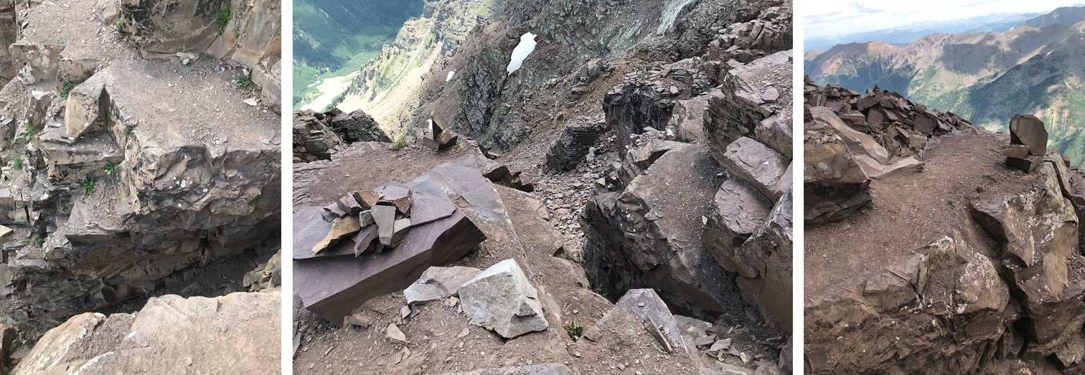
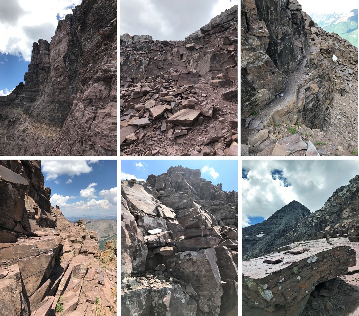
OK, I’d made it to the gully. This is the 2D gully that gives all gullies a bad name. It’s 1000’ of intense elevation gain, loose rock, and no, it was not well cairned. Here’s the route:
This took me forever to climb. I was cursing the entire way, getting more and more exhausted with each step. I never wanted to see this mountain again. Never. This sucked. In a big way. This was torture! How could people enjoy this??? I thought all these things also mentally knowing I was tired to begin with: it probably wouldn’t have been so bad if this was the only mountain I was climbing today. But I’d already done about 7000’ of elevation at this point, and I was tired.
And it was hot. I took another sip of water as the sun went behind a cloud. Well, that was positive. Wait, a cloud? Ugh! Clouds were rolling in. Hmmmm. I studied them for a minute. They didn’t look ominous, but I’d need to keep an eye on them.
With about 150’ of elevation gain before reaching the saddle I encountered two men hiking down. They seemed upset. Worried about the weather, I asked them how long it would take to summit after reaching the saddle and they said at least two hours. I couldn’t believe that, as 2 hours seemed excessive. Then I asked if they’d summited and they replied: “No. There are too many cairns that lead to nowhere but up, and each of them ends in a class 4 move. We decided to turn back”.
Well, it was a class 4 hike, what did they expect? I was a little put off with the 2 hours to the summit from the saddle, but I’d come this far, so I was going to keep at it: I really didn’t want to come back to hike through all that talus and scree another time if I could help it.
I was almost to the top of the gully when I slipped and put my hands forward to catch myself, lading on a rock and breaking my phone screen in the process. Ugh! Have I mentioned I never want to see Pyramid again? I’ve had a cell phone since 1996 and never once cracked a screen. I’d just about had it with this mountain…
I reached the saddle and began seeing goats. They were usually in pairs of two, a few were mother/baby pairs, and covering the ridge from here on out. They liked lounging on patches of snow and cold rock ledges, which made sense considering they were covered in dense fur. They amused me. I took pictures and more sips of water.
I kept watching the weather and it wasn’t getting any worse, so I continued on. This part of the hike was indeed similar to North Maroon, but included a lot of sustained class 4 climbing. I followed my GPS route up to the top, which was not well cairned. There were steep ridges, narrow ledges, and class 4 obstacles to navigate. I was in heaven!
Check out the leap of faith! I’d heard about this but it wasn’t in my instructions, so I was thrilled when I came across it. It’s about 4 feet wide and requires you to jump over the gap or fall about 20 feet down. Luckily I was jumping down (not up) and it felt doable, so I took a video of the process. (Side note: on the way back down it was a different experience as I was jumping up in elevation and not down and I didn’t feel I could make it. As soon as that thought came into my head I steeled myself and jumped: I had no time for those kind of thoughts. Oh, and I made it just fine).
I felt pretty good about myself after this, took another sip of water, and continued on. I encountered a lot more class 4 climbing that wanted me to be a few inches taller to make it easy, and pretty soon I was at the summit! It felt wonderful! I was so proud of myself! That was the most sustained class 4 climbing I’ve ever done… and it was FUN!!!
And there was a summit marker! Woot!
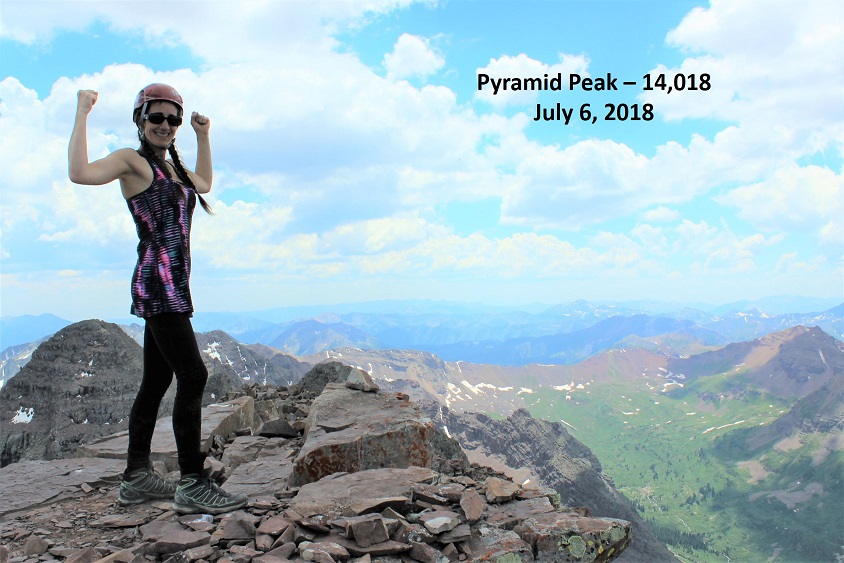
I summited at 2pm and took a summit selfie to prove I’d made it.
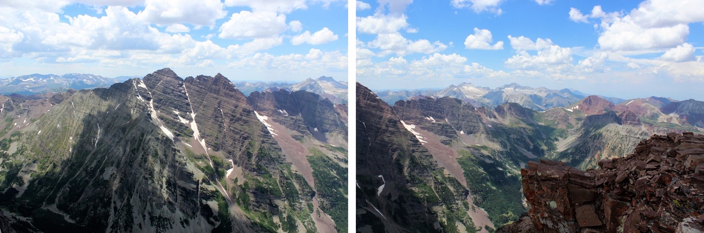
And a video of the surrounding mountains.
And reapplied my sunscreen and took another sip of water… oops! I was out of water! How could that happen? I never run out of water! Never! This wasn’t good. Hmmmm. Well, I rarely get thirsty when I hike, I’d just have to remember that and start down right away. I’d considered hiking Maroon Peak as well today but didn’t feel comfortable attempting it without any water. I had 5 pieces of butterscotch candy in my emergency kit, and while this wasn’t an emergency, sucking on candy would help keep my mouth moist, so I unwrapped a piece and began my descent.
This time I saw a very well cairned route following the ridge down. It also looked well traveled and was pointing in the correct direction, so I decided to take this route down instead of my GPS route. This ended up being a fabulous idea!!! It contained sustained class 4 moves but was easy to navigate due to all the cairns.
The weather was still holding out, and in fact it was looking better. Any chance of rain had dissipated. As I was climbing down those class 4 moves there were many times I wished my legs were just a little longer. These moves had to be easier with another 6 inches of height. I knew where I was supposed to step, my legs just weren’t long enough to make it there without getting creative. Many times I just slid the extra few inches to reach a ledge and went on faith (after looking several times to make sure the hold was solid). Just before reaching the saddle at the top of the gully I spied some goats lounging on ice and came to a quick solution to my water problem.
No, I didn’t want to drink goat water, but ice and snow this high is good to drink if you can find some that’s clean. I walked over to where the goats were (they quickly stood up and walked away) and found a flat rock. I dug in the snow with the rock about a foot deep until I found “clean” snow, and then used this snow to fill my water bladder. A bladder full of snow really only equates to about ¼ of a bladder full of water, so I had to do this several times on the hike down, but my water problem was solved! And what great tasting (and cold!) water it was! Seriously. It was fantastic.
It was a hot day. When I made it to the saddle I thought to myself I really didn’t want to slide down this gully tippy-toed. So I put on my microspikes and side stepped the entire way down. For those of you who don’t use microspikes on these types of gullies you’re missing out: it makes the descent so much easier!!! A goat seemed amused with me.
The only downside to this process was I was descending pretty quickly (but stably) and my feet began to get hot. They started to burn and I had to slow down and take it easy.
OK, back to the amphitheater.
I hadn’t been looking forward to this at all! I took off my microspikes and hopped from rock to rock across the talus. This time when I got to the big boulders I spied a cairn! What?!?! This route wasn’t supposed to be cairned??? So I followed it to the left, and guess what? There is actually a cairned route that’s pretty simple to follow on this side of the basin! I should have followed this when I entered the amphitheater, but hadn’t know it was there. Ugh! Well, I was following it now. I couldn’t help but think how much less pain I’d be in right now if I’d known about this path earlier…
I followed the cairned route near the snow line and sipped my water. It really was a hot day! Then I got another idea: I walked up to the snow, made a large snowball with some clean snow, popped another butterscotch candy into my mouth, and started eating the ice. Woot! Butterscotch snow cone! It was cold, delicious, and amazing. I jaunted out of that amphitheater a happy hiker!
I met a few more goats as I was exiting the amphitheater. They called to each other before they could see each other. I don’t know if they were welcoming each other to a party or warning each other about me…
I took a picture to inform others there’s an easier way across this talus trouble than I’d taken!!! This was most likely why the couple I’d seen in the amphitheater couldn’t understand my disdain for all that talus: there was an easier way!
The rest of the hike down was very slow going. My feet were burning at this point. My feet have never burned on a hike before, but now they were burning, throbbing, and pulsing. They hurt, and I was hiking slow. I’m not gonna lie, it sucked. And it lasted forever! I don’t think I’ve ever hiked this slow before in my life, but I couldn’t physically hike faster without causing myself more pain. So I just kept on hiking, and hiking, and hiking at a steady pace.
Here’s the cutoff I missed for the Pyramid Trail because I was bushwacking…
I met a lot of day hikers hiking up to crater lake as I was hiking out. They all seemed chipper and fresh. I smiled even though I didn’t feel like it, answered their “how much farther” questions and aimed toward the lake. This trail actually has some pretty good signs in the daylight…
I made it to the lake at 6pm and immediately pulled off my hiking boots and put my feet in the water: I’m pretty sure I heard the water sizzle. The water was cold and it felt amazing on my burning feet!
I couldn’t help but look around at everyone else enjoying the lake. They looked like their parents were all lawyers and they were visiting Aspen for the summer sporting their Nordstrom best (think sweater vests and white, flowing dresses. Oh, and hats.). I felt a little out of place with my hair a mess and dirt all over my clothes. Honestly though, they were enjoying the beauty as much as I was. We all took selfies to prove it!
I’d made it down to the lake at 6pm. I covered 19 miles in 15 hours with 8700’ of elevation gain. And I was tired! But I was proud of myself, and you know what? I’d absolutely do Pyramid Peak again, but only if it was a one summit kind of day. The class 4 scrambling totally made all the other stuff worth it!
When I made it home my kids remarked how I was sunburned in weird areas.
Me: “Well, I really hate reapplying sunscreen, so I get a bit lazy, especially in places I can’t reach.”