Casco Peak 13,905 – Frasco Benchmark 13,885 – French Mountain 13,942

1

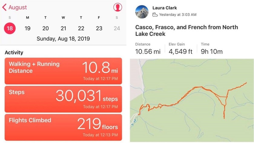
RT Length: 10.5 miles

Elevation Gain: 4549’

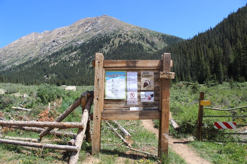
I chose this route mainly because I haven’t used the North Lake Creek Trailhead before, and since all the other routes started from trailheads I’ve already used I wanted to try something new. I began at 3am, and when I arrived at the trailhead my truck was the only vehicle in the lot.

2

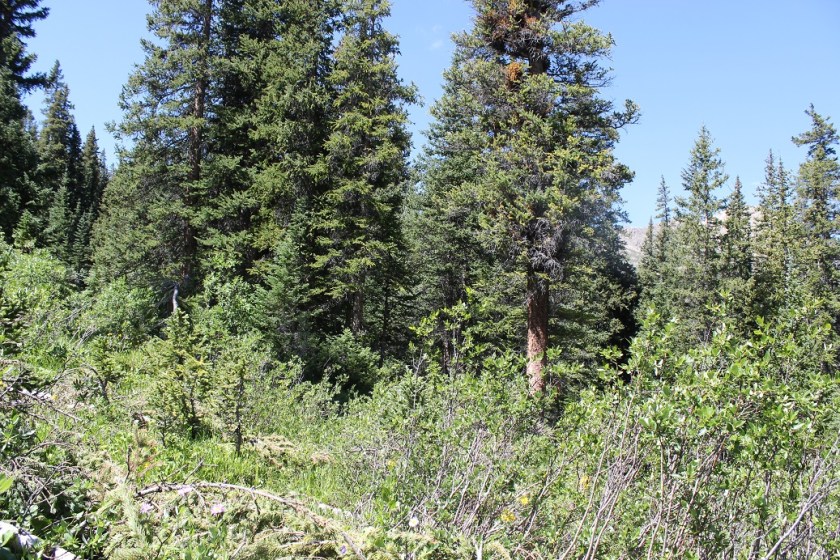
The trail begins at the east side of the parking area, heading north-northwest. There had been a recent avalanche in this area but the debris had been cleared off the path and in the dark I couldn’t even tell there had been an avalanche.

3

After about 1/10 of a mile I turned right at this boulder.

4

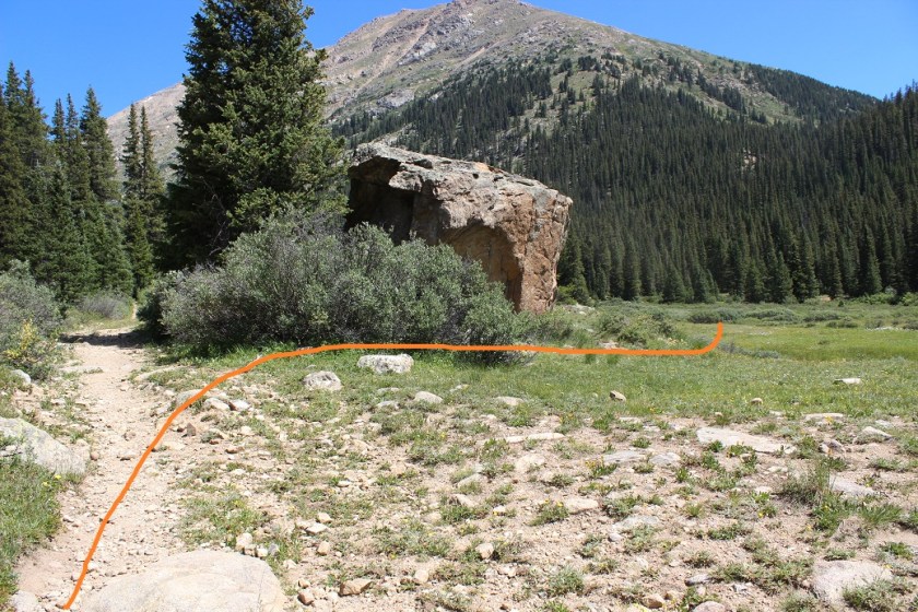
There is no distinct trail here, but if you continue northeast you’ll eventually run into what could have been a trail at one time (or a dried up creek bed).

5

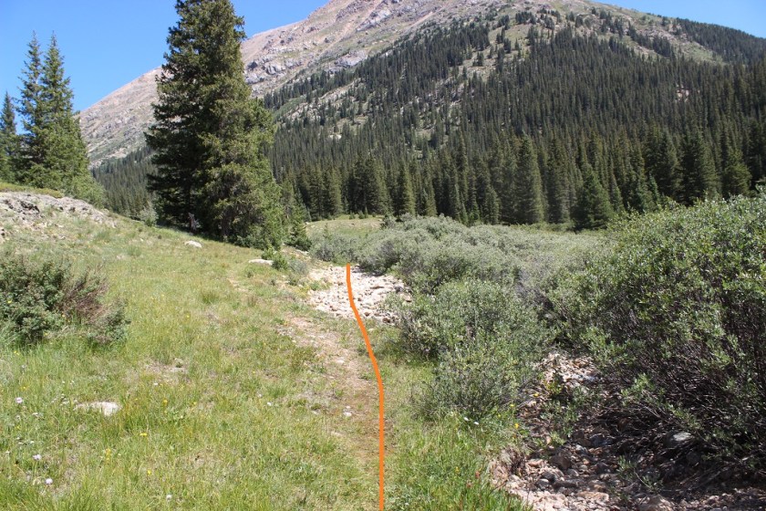
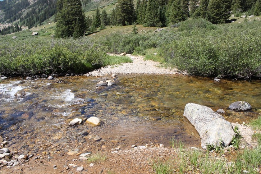
This led me to a creek crossing that was just deep enough to make it necessary for me to take off my shoes.

6

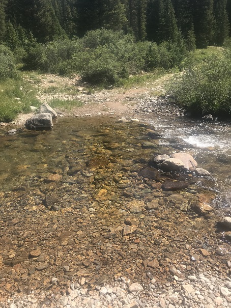
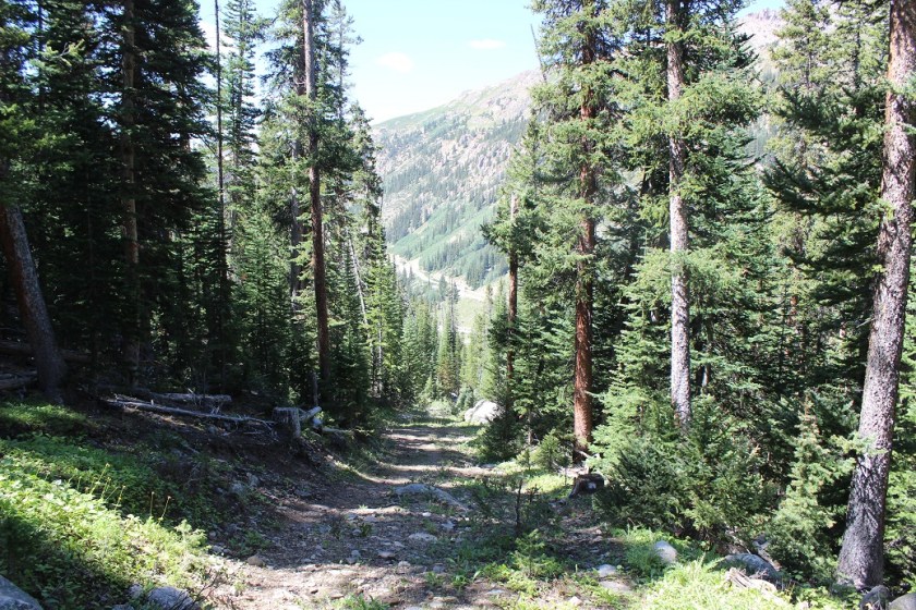
There was another crossing just after this one, but it was small and easy to cross. From here I followed an overgrown 4WD dirt road switchbacking up the mountainside.

7

Curiously there was an old outhouse right alongside the trail, which looked useable.

8

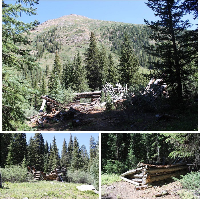
The 4WD road led to a smaller trail that led to a bunch of dilapidated cabins (I’m guessing there were 3?) and here is where the trail ended.

9

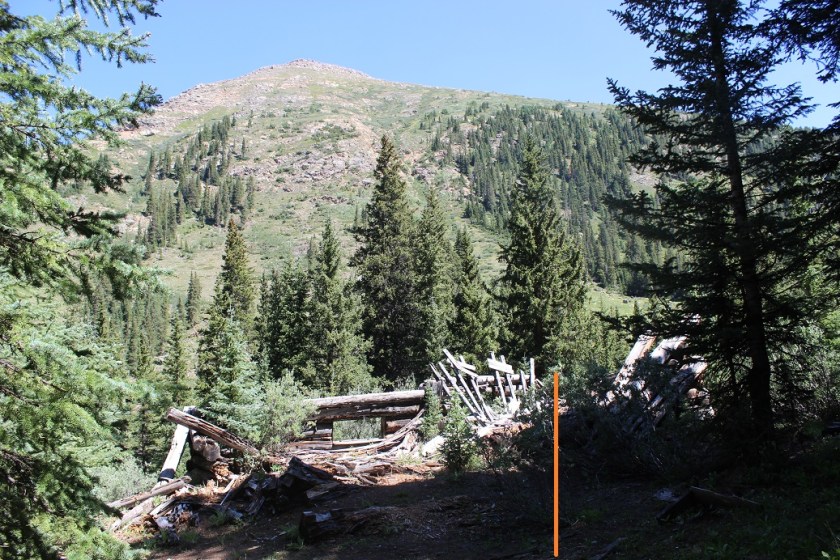
From here the goal is to head down the hillside that’s behind this cabin (a few dozen yards), cross the creek, and continue west.

10

However, I was doing this in the dark on my way in and it proved to be more difficult that it sounds, especially the creek crossing.  I was unable to find a crossing in the dark due to avalanche debris in all the wrong places, so I once again sat down, took off my shoes, put on my sandals, and crossed the creek.  On my way back I noticed snow bridges that were no longer usable, but also a few areas to cross on the rocks.

11

This part of the hike was actually a challenge in the dark, but simple in the daylight. There was no defined trail here, but many game/social trails.  I tried to follow a trail alongside the creek, but there just wasn’t one that was continuous.  What made this difficult in the dark were the overgrown grass and downed trees everywhere.

12

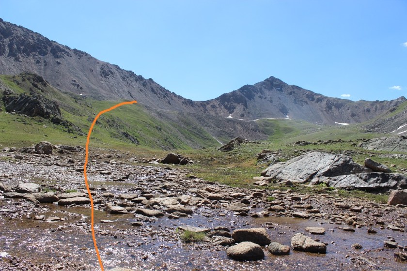
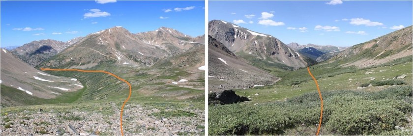
However, if you just follow the creek (staying about 10 yards to the north of it) it will lead you up and out of Lackawanna Gulch and into an unnamed basin. Every once in a while I’d come across what looked like a proper trail, and even a cairn or two, but the trail always ended (usually at a tree or bush or over a cliffside).

13

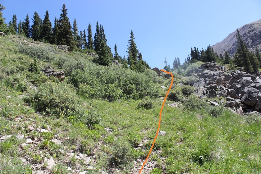
Here’s your path through the basin. You’re aiming for a low ridge at the end of the basin. Once again, there are lots of trails here, but I’m pretty sure they’re all game trails.  Also, the willows aren’t that high and the ground was mushy with water.  This wasn’t fun to cross in the dark, but at least there weren’t any trees to contend with. In the daylight it was beautiful.

14

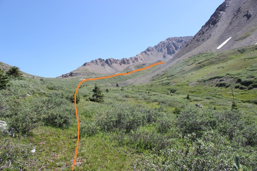
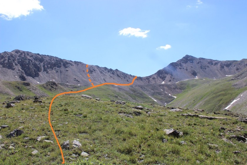
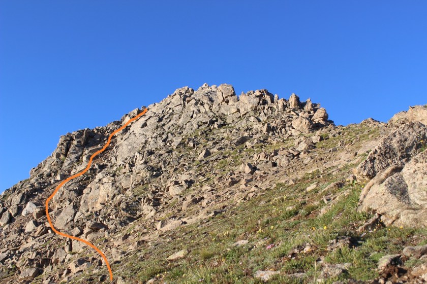
I was fully expecting to see some sort of wildlife, especially with all the hoofprints and game trails I was coming across, but alas, nope. From the north end of the basin I continued east on a low lying ridge towards Casco Peak. Knowing there was a lot of loose rock above me I was aiming for the lowest point on the ridge for my ascent.  You can basically gain the ridge from anywhere.  I took the solid line up, dotted line down.

15

Before gaining the ridge I passed through some muddy/wet areas

16

Here’s what it looked like as I was nearing Casco Peak

17

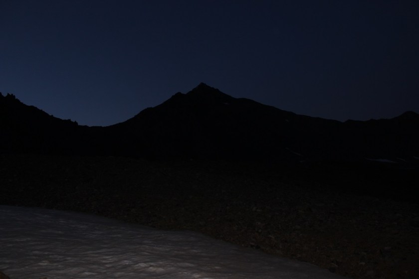
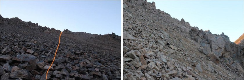
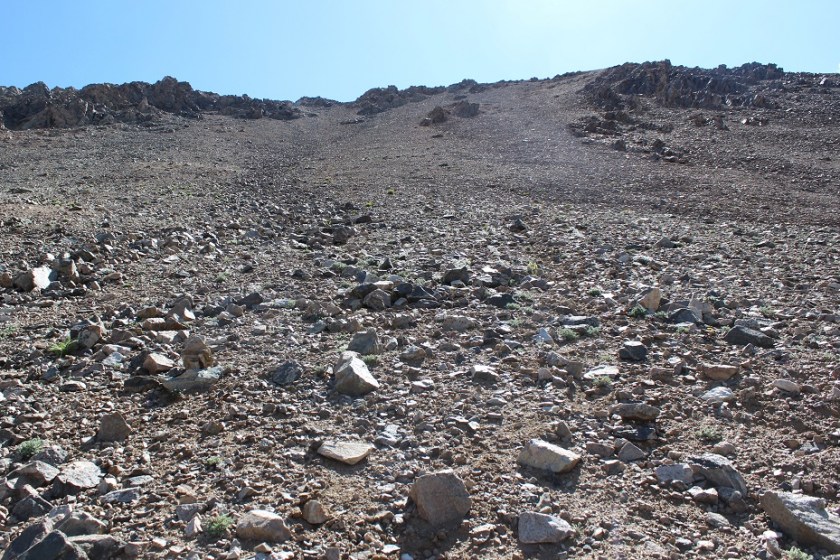
I couldn’t see much but the sun was beginning to rise, which was helpful. I could tell the scree was pretty bad in some areas, but it looked like there was talus ahead (which I prefer to scree for an ascent) so I headed for the lowest point in the ridge and began the climb. The talus eventually turned to scree just before the ridge.

18

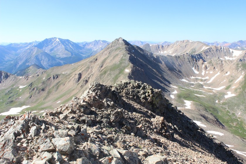
Ridge gained I turned right (south) and looked at the rest of the route before me

19

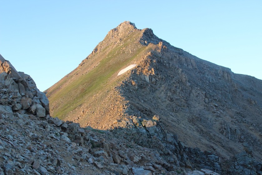
This wasn’t technical in the slightest. I just stuck to the ridge until I came to the base of the summit.  Here it became a short class 2+ trek to the top.

20

21

I summited Casco Peak at 7am
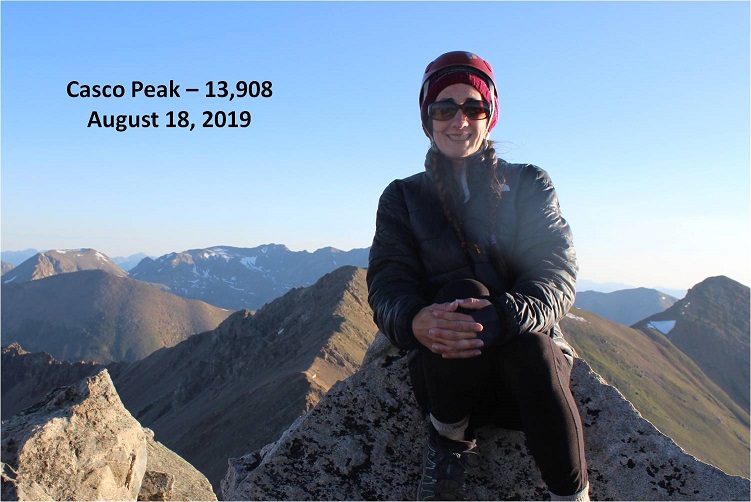
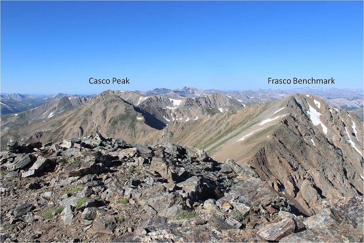
22

Casco:

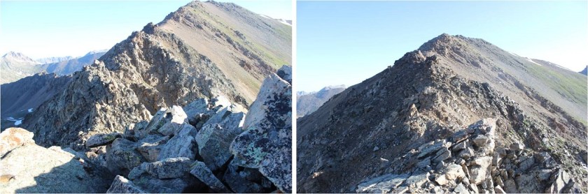
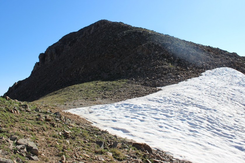
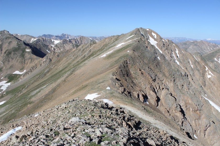
From here the route to Frasco looked straightforward, but let me tell you, that section north of the saddle (named Fiascol) was a rough and loose ridge

23

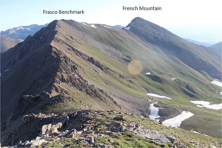
Here’s your first look at the ridge

24

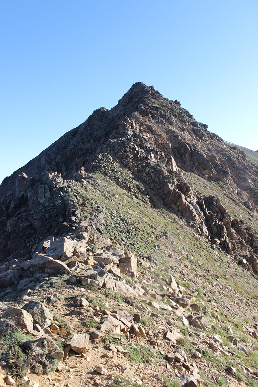
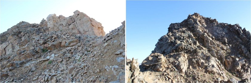
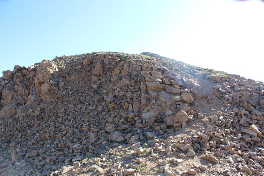
This is a class 2+ ridge that looks harder than it is. It took careful footing but wasn’t actually technical.  I mainly stayed to the top of the ridge, dropping to the left or right as needed.  Most of the time if I had to drop off the ridge it didn’t matter if I went left or right:  both ways went.  Here are some close ups of the route

25

26

The final push to the top of Frasco is actually longer than it looks, with a small false summit

27

28

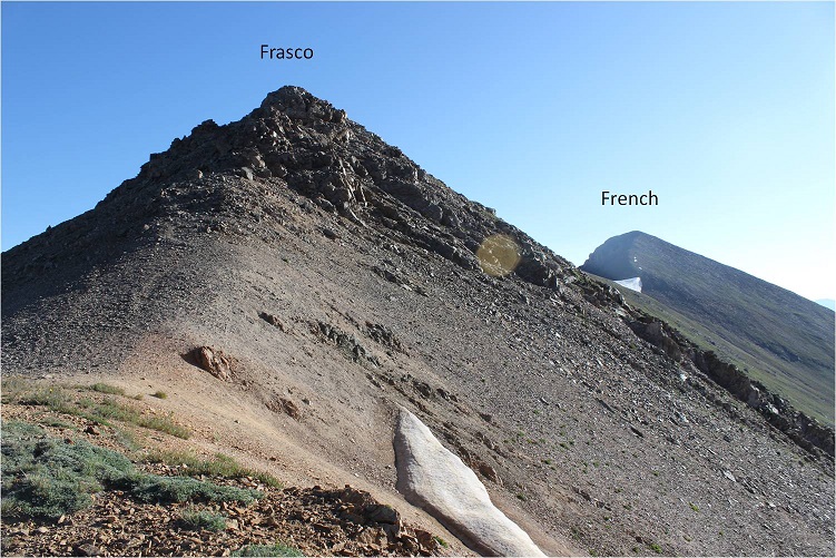
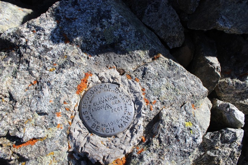
I summited Frasco Benchmark at 8:30am
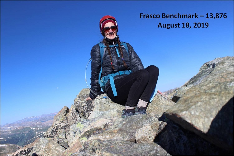
29

Frasco:

This summit had a summit marker (curious, the unranked peak had a marker, yet neither of the ranked ones did?).

30

To get to French Mountain from Frasco is straightforward: just follow the ridge (named Friscol). I was surprised at how narrow the beginning part of this traverse was.

31

I descended 250’ to the Frasco/French saddle, stayed left (north) to avoid a snow patch

32

and then ascended 320’ to the summit of French Mountain.

33

I summited French Mountain at 9am

34

French:

From French, here’s a look back on the route from Casco to Frasco to French

35

It was a beautiful day so I sat for a bit on the summit, enjoying the views before starting my way back.

36

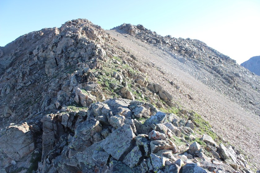
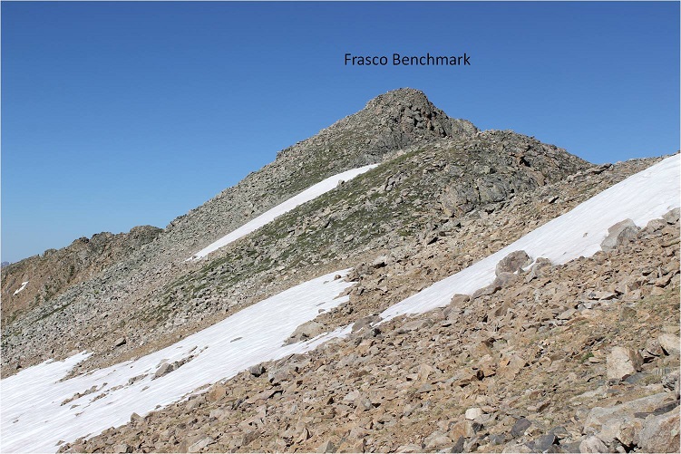
Here’s a look at the look to Frasco from French

37

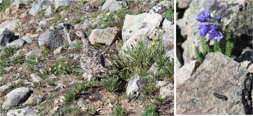
I mainly stuck to the ridgeline. Around the French/Frasco saddle I saw a ptarmigan and a caterpillar I thought was living pretty high

38

Here are the areas of avoidable snow on the ascent of Frasco from French

39

After summiting Frasco a second time it was time to head back towards the Casco/Frasco saddle for my descent. Also, it wasn’t lost on me how much easier the route looked coming up from the Halfmoon Creek area: the scree was almost nonexistent on that side when compared to the Lackawanna Gulch side.  The decent along the ridge to the saddle was uneventful.

40

However, I didn’t go all the way to the saddle: Instead I chose to descend earlier because I liked the scree here better.

41

Here’s a look at the route back down the basin and towards the creek

42

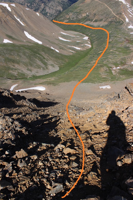
The scree here was the kind of scree you want to descend, not ascend. It allows you to scree surf, but doesn’t allow for much traction.  I put on my microspikes and headed down the slope, sliding one foot in front of the other.  I got a quick video:  quick because it wasn’t safe to take a video while scree surfing, but I was basically moving down the hillside with the sliding scree.  You can see why this wouldn’t be fun to climb up.

43

Scree:

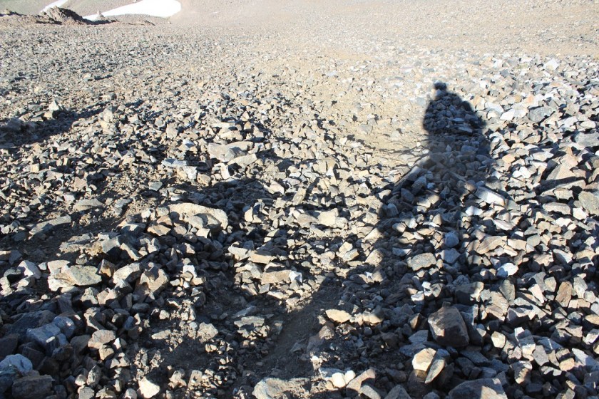
Here’s a look back up that scree slope from the bottom

44

and a look at the route out of the basin

45

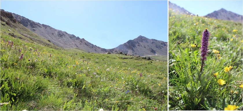
Also, the flowers here didn’t disappoint

46

As I exited the basin and descended into the Lackawanna Gulch I couldn’t help but think how much easier route finding was in the daylight. I wasn’t concerned as much with where I was because I had visuals that told me I was ‘close enough’ to where I needed to be.  I could tell the difference between game trails and actual trails (which is much harder than you’d think in the dark).

47

The hike back was beautiful! I loved seeing the cabins, flowers, trees, and creeks in the daylight.  I took off my hiking boots and put on sandals for the last creek crossing.  The cold water felt wonderful on my feet!  I decided to keep my on sandals for the rest of the trek to my truck (maybe a quarter mile).

48

When I made it back to my truck at noon my feet were still wet. This was a 10.5 mile hike with 4549’ in elevation gain completed in 9 hours.

49

50


Culebra 14,047 & Red Mountain A 13,911

1

RT Length: 8.4 miles

Elevation Gain: 3850’

I’d purposely scheduled Culebra as a hike on a Sunday because I knew I’d 100% be able to do the hike availability wise, but as the date of my reservation neared I realized it wasn’t the best time for me to hike this mountain.  I looked at the weather reports, and while the weather was fine for Culebra all weekend there were a few other summits I want to hit this weekend that would require more commitment and time than Culebra, and I needed to be back home on Friday for a 4pm board meeting, meaning I wouldn’t be able to hike at all on Friday because all other summits required more time.  I felt I could hike Culebra and Red Mountain A and be back for my meeting by 4pm, but I did not feel I could do so with the other hikes I wanted to complete this weekend.

So I did something I NEVER do.  I emailed Carlos at Cielo Vista Ranch and pleaded to change my time from Sunday to Friday.  To put this mission into perspective, to me, asking to change a time I’ve reserved 3 months in advance is beyond rude, and I honestly didn’t expect him to let me do so.  But he did, and I was ecstatic!  This freed up my Sunday to hike a more challenging 14er(s)!  Woot!  Happy dance!  Also, Carlos is amazing.  Thank you Carlos!!!

On Wednesday of this week I went to the Colorado Springs 14er happy hour and mentioned to someone who’d done Culebra last week I was planning on hiking Culebra Friday mainly so I could hike and be back by 4pm.  He blatantly told me there was no way I could do it and be back by 4pm (and I hadn’t event mentioned Red Mountain A….).

I talked with him about the hike:  It wasn’t technical, was it?  There wasn’t any rock climbing involved or anything, right?  Nothing unexpected about this hike?  I reasoned with him, letting him know I’m a strong hiker and stated some of my other summit times.  This would be my 44th 14er.  He wasn’t impressed.  I began to doubt myself. Could I really complete this hike in enough time to make it back for my meeting?  Well, I’d already committed, so I was going for it anyway.  But now I wasn’t so sure…

I don’t sleep well at trailheads, so I woke up at 1:30am, got ready, and drove to the trailhead (taking special care to use the directions from 14ers.com and not google, as per previous advice). I left plenty of time for mistakes (I’m prone to making mistakes when searching for trailheads, despite extensive research) but I made it to the gate without a hitch at 5am.  There were 3 gates all right next to each other (I wasn’t sure which one was “the gate”) and about 10 cars waiting to be let in.  Most people had slept in their vehicles overnight and were now waking up and brushing their teeth.  Hmmmm…. I wasn’t sure where ‘the line’ was so I just picked a free spot and parked.

I had an hour to kill, but I was prepared.  I went over the route a few times, and when I felt I’d exhausted that avenue I prepped my gear so I could just hop out and go when the time came.  And then I got out my knitting.  I knit hats for School in the Woods (a school that focuses on naturalist outdoor education for 4th graders and takes place completely outside, so each student gets a knit hat because it’s cold going to school in the winter outside.  I make the hats, but wear some of them on 14rers before donating them because the kids think it’s cool).

2

I was prepared to knit until the gates opened, but bless the man, Carlos arrived 15 minutes early to open the gate.  He’s my new hero!!!

I drove the 2 miles to headquarters and was greeted by 2 of his sons.  Carlos is a very charming individual, and his sons are as well.  It seems today was their first day on the job:  they were starting new check in and check out procedures, and it was more efficient for Carlos to let everyone in the gates and for his sons to check them in.  When we were all ready to go we were told check out was to be different as well:  when we were done hiking we needed to check out at the office and there’d be a code for the gate key. Please let yourself out and replace the lock and key.

3

From headquarters it’s 4.6 miles to the top of the 4WD trailhead.  The road isn’t really that rough, but the elevation gain is pretty steep.  A 4WD vehicle is needed for the grade alone.

I was anxious to get going.  This was going to be the latest start I’ve ever (intentionally) had on a 14er, and it was killing me not to be out there hiking already.  Time was ticking.

4

When I made it to the trailhead I was totally ready to go.  I jumped out of my truck, fixed one of the rocks another vehicle had kicked up while parking that looked like it could puncture a tire, grabbed my gear and headed out on the trail.  It was 6:32am.

5

I wanted (needed) to get started first.  To most this will seem like an overreaction, but I really want to summit all 58 14ers solo (as solo as they can realistically get) and I feel more confident doing this if I’m first on the trail.  That way I make my own trail and don’t follow someone else’s.  It’s “too easy” when someone is ahead of me.  Usually I do this by starting super early, but with this hike we all kind of start at the same time because we’re queued to do so.

I crossed the stream and went right, and them immediately realized I needed to go left and turned around.  Whoops!  Ok, now I’m on my way.

6

I looked toward the ridge and saw a large animal.  It was either a goat or an elk, and I’m going with elk due to the body type.  When I reached the ridge there was no sign of animal life (except for scat.  Lots of elk scat on this hill).

7

This hike has no established trail.  In fact, they don’t want there to be a trail.  It felt very similar to hiking Matterhorn Peak:  just aim for the summit and keep hiking.

8

I’m going to side track here for a bit and step on my soapbox.  I teach Leave No Trace etiquette, and one thing that really bugs me is hiking etiquette.  As far as I’m concerned, the best way to make the least impact on the environment is to hike in a straight line and create a trail for others to follow, and then to stay on that trail and properly maintain that trail.  Use one animals have made, because they follow it too.  But most Leave No Trace trainers will tell you to spread out to reduce impact.  The problem is THIS DOESN’T HAVE THE INTENDED CONSEQUENCE!!!  Instead of having low impact, everything is destroyed, especially in alpine environments.  All flowers are destroyed, tundra that takes thousands of years to grow is trampled on en masse, and tons of new routes are formed because no one wants to form ‘one route’.  I absolutely hate hiking off trail because it destroys the environment:  It destroys all of it, instead of just damaging one single area.

However, it expressly states in the contract I signed with Cielo Vista Ranch that I’m not to use an established trail, and to create a new path if I see a trail “to limit impact”, so I did so, even though it killed me to do so.  All I could think about as I did my best to hop from rock to rock to avoid crushing plant life was how I was destroying precious alpine tundra by trampling all over it.  Oh, and I saw dozens of minor trails the entire hike because there wasn’t one ‘established’ trail.  How is this low impact?!?!?!  OK, I’m done now.  I seriously love Cielo Vista Ranch.  Stepping off.

The route wasn’t difficult at all. I just aimed for a peak, made it, followed a ridge, aimed for another peak, followed it to another ridge, etc.  I couldn’t help but think what a bugger this hike would have been in bad weather with low visibility, but on a bluebird day it was phenomenal.

9

I love this cairn!  It’s the only one on the hike and quite a cairn!

10

I looked ahead and thought I saw someone standing on the summit wearing a backpack, but how could that be?  I was the first one up here?  And then I hiked closer and realized it was kind of a cairn. Kind of…

11

I knew I summited in good time but didn’t look at the time because I wasn’t going to pressure myself.  I took a summit selfie

12 Culebra Peak 14047

And a video from the summit.

As per usual I didn’t stay long, even though it was a nice day.  I looked at the route before me that led to Red Mountain A (or as I like to call it, Red Mountain, Eh?), and went for it.  A GPX file was not needed for this route on a clear day (but you should have one just I case the weather turns).  It was easy to navigate.  I just had to follow the ridge down to the saddle and then back up to the summit.

13

Despite every intention I’m sure, the route up Red Mountain had a well established path that zig-zagged up some red colored scree.  This was the best scree I’ve ever hiked on!!!  Have you ever heard of good scree?  Nope?  Well, this was good scree (you’ll have to hike it to understand).

14

I summited at 8:58am and thought to myself:  See?  This is totally doable!  You’re right on time (maybe even a little early).

15 Red Mountain A 13908

And summit video

And back down.  I made it all the way down Red Mountain and past the saddle to Culebra when I saw a fit father and son duo hiking towards Red Mountain.  They stopped to say hi.  I learned Culebra had been the dad’s 54th 14er (his finisher) and congratulated him!  High five!

Father: “We’re quick hikers.  We’re rarely passed, but never smoked.  You smoked us!”

He was referring to how we started at the same time but at this point I was about an hour and a half ahead of them in the hike. I took this as a real compliment.  I’m not gonna lie, it was quite an ego boost.  We talked for a bit about training and goals, and then we went off in our separate directions to finish our hikes.

Culebra in summer conditions on a bluebird day is not a difficult hike.  No 14er is easy, but I was feeling pretty good about myself.  I hadn’t needed to stop to catch my breath at all, I wasn’t tired or sore or experiencing any of the usual physical effects that usually occur with hiking a 14er.  I hadn’t had a sip of water and never broke open my food stash.  This was almost too easy, and I felt a bit guilty for not continuing on to hike a few more 13ers on such a perfect day.  But my schedule didn’t allow for it, so I hiked back.

When I reached Culebra for the second time I met a few hikers at summit debating whether or not to continue towards Red Mountain.  My advice:  go for it!  It’s seriously not that challenging, and you’ll kick yourself for not summiting later if you choose to hike the centennials.  They asked me to carry them down. I declined and hiked back on my own.  Oh, and I saw this marker, which I think is more of a property/survey marker instead of a summit marker?  Any insight from someone more knowledgeable?  It was at the peak…

16

As I was hiking down I ruminated over today’s experience, as well as my previous experiences hiking 14ers and the reactions of my friends and family, mostly negative.  I realized I was second guessing myself because of the fears of others, not because of my abilities or fears.  I’m not scared of hiking any 14er (I hold a healthy dose of reality to the dangers, but I’m not scared).  I know my abilities.  I know how fast I can hike, what conditions I feel comfortable (or not) hiking, and ditto for climbing.  I know I can do this, so why did I keep second guessing myself when someone says I can’t do something, like when that 14er Happy Hour guy said I couldn’t summit in a certain amount of time when I knew I could?  Or last week when my mom said it was too windy so I shouldn’t even try? Why did that make me second guess myself?

17

I came to the conclusion I can do this: I know I have the skills and abilities, and I’m not going to live my life based on other people’s fears and limitations.  Hear me out.  I second guess myself because other people are afraid or can’t do something, not because I’m afraid or I can’t do something.  I tend to overanalyze and internalize other people’s fears, and that’s going to stop now.    I know my abilities.  I trust my abilities.  I have the training, I have the knowledge, and I have the skills:  I just need to trust myself.  I know I can do this, and I will.  Stop telling me I can’t.  Or go on and keep telling me, I won’t listen.

Now I was hiking with a purpose!

There’s no trail, but you can see the trailhead at the end of the dirt road (center)

18

I made it back to my truck at 11am, making the 8.4 mile, triple summit (come on, I did Culebra twice!!! It counts as 3…)  trek in 4.5 hours.  I realize that isn’t record breaking, but it wasn’t bad.  In fact, it was just what I’d expected of myself.

On the drive back to headquarters, just after I crossed the meadow on the 4WD road I saw a very husky cinnamon colored bear run/lumber/gallop across my path and away into the hills (why do bears always run away from me as fast as they can?!?!?).  I tried to take a picture, but I didn’t get my camera out in time (I was driving) and when I stopped where it had entered the trees it was long gone.  Oh well.  Weird, a bear out in the afternoon….

I signed out and left two cases of S’mores Girl Scout Cookies as a thank you to the team for allowing me to change my reservation date without a fuss (be nice to those who help you!!!!) and was on my way.

I stopped at gate and entered the access code, only to realize I was using the wrong key box (whoops, there were two, and I missed the ‘obvious’ one).  I located the correct one and quickly exited, closed the gate, and drove home.

19

Oh, and that board meeting?  I made it home in plenty of time to shower, change, do a conditions report for 14ers.com and made it to my meeting with 40 minutes to spare.  Boom!  Take that naysayer!!!

20