Venable Peak – 13,334- Attempt

RT Length:  11.9 miles

Elevation Gain: 3921’

I made it to the trailhead late the night before, and slept in the cab of my truck.  Well, I tried to sleep. Unfortunately, there was internet access at this trailhead.  This meant I was scrolling through my phone until 1 in the morning.  I hit the snooze button three times before waking up to dawn approaching.  I threw on my gear, waved at the hunter who just pulled up in the parking area, and was on the trail at 7am.  This morning I was taking the Venable Trail, which is clearly marked from the parking area.

I followed the trail as it crossed over a bridge

After hiking for half a mile, I came to a junction with the Rainbow Trail, and continued straight, following the Venable Trail (1347). 

Just after this junction there was a trail register.  I signed it, and continued following the Venable Trail southwest

This is a class 1 trail.  Today’s conditions varied, from being covered with ice, to being bare dirt, to several inches of snow. 

After hiking for 2.5 miles, I came to the junction for Venable Falls.  Here I continued straight on the trail, towards Venable Lakes

The trail increasingly became more snow covered, but no traction was necessary.  Of course, most of the snow present was directly on the trail.  This is where I was headed

I rounded this hill (lower Venable Lake is to the right)

And after 5 miles of hiking, I made it to the lower Venable Lake

I kept following the trail

After hiking a total of 5.5 miles I came to what I assumed was a junction (it was covered in snow and the sign was missing:  only a post remained). I turned left and took Comanche Trail (1345) towards the pass.

I now had a good view of the rest of my route to the pass

More and more snow started accumulating on the trail.  It was sugary, so I put on my microspikes.  I had snowshoes, but the snow was so sugary they wouldn’t have made much of a difference.

It was slow going, and I had to spend a lot of time making a solid path in some areas through the snow, doing my best to hug the cliff, not entirely sure how wide the trail was.  I was doing find until I got to this area:

I was about 200 feet from the pass, and the snow drifts were now taller than I was.  I kept seeing snow slide down below my feet, over the cliffs, and made the decision to turn back. It hurt to turn back, but I knew it was for a good reason: I’m out here solo, and while I might have made it past the snow/cornice to the pass, I couldn’t have done so safely, and a fall would have been fatal.  The red arrow is where I turned around. You can see the tracks where I stopped

Just for reference, I was able to summit this peak via the Comanche trail the next day.  Here’s what the pass looked like from above

And look at how close I’d been to the summit of Venable! 

For those of you interested in taking this route, this is how I summited Venable the next day.  I took the solid line up, the dotted line down.  Both were class 2 (although the ridge had quite a bit of snow)

However, I wasn’t summiting today. Instead, I turned around and hiked the 6 miles back to the trailhead. 

On my way out I made plans to hike Venable and Spring from the Comanche Trail the next morning.  Added bonus: I didn’t have to drive to another trailhead, since the Venable and Comanche Trailheads share a parking lot.  I made it back to my truck at 12:30pm, which gave me plenty of time to read, drink whiskey, talk to hunters, and get some rest before tomorrow’s attempt.

Here’s a topo map from today’s attempt, and another along with the route I took the next day

You can find my successful Venable trip report here.

Coxcomb Peak (attempt) – 13,656

1

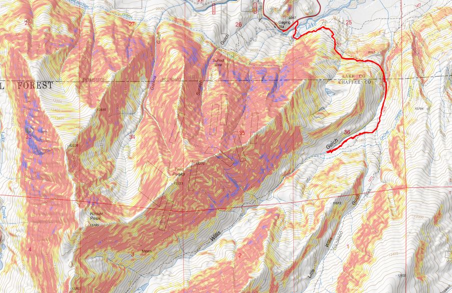
RT Length: 17.4 miles

Elevation Gain: 5544’

NOTE:  I’ve since summited this peak successfully.  that trip report can be found here.

I told myself as soon as someone posted a successful summit for either Coxcomb or Peak 15 I’d attempt it as soon as the weather was good (they’re my last 2 class 5 bicentennials). A conditions report was posted for Coxcomb where the couple summited but the woman had to be belayed up. I’ve done several class 5 peaks solo, and I’ve talked to two men who’ve done Coxcomb solo, so I felt confident I could summit this peak solo as well.  Now I’m not so sure.

The weather was perfect and I had the day off. The only problem? I needed 2 60 meter ropes for the final rappel, and I only had 1 50 meter rope. I went to REI and Mountain Chalet and bought 2 new ropes (REI only had 1, but on the positive side I got to use my dividend).

2

Then I spent the afternoon practicing my double fisherman’s knot. That’s how you tie two ropes together so they don’t come undone.

3

Confident I had the knot down, I wanted to practice rappelling with the two ropes, and I also wanted to break them in before using them for the first time in a scary situation (yes, a 175 foot rappel is committing, and can be scary, especially if you haven’t rappelled all season). I decided to go to Red Rock Open Space to break them in.

4

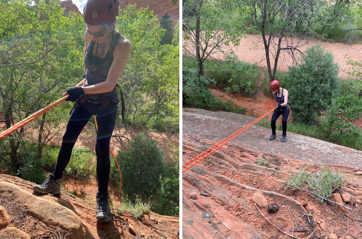
Success! I practiced setting up the anchor, tying the ropes together, and rappelling on easy terrain at least 9 times to break the ropes in. Yes, they were heavy to carry, and coiling them was no fun, but everything went smoothly. The weather forecast for the weekend was phenomenal: sunny skies with no chance of rain. I decided to drive to the trailhead the next afternoon and attempt Coxcomb peak the following day.

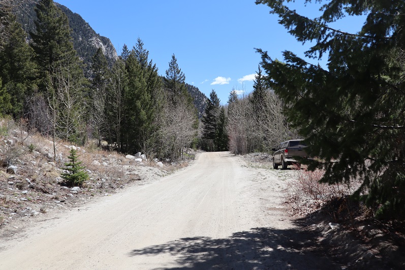
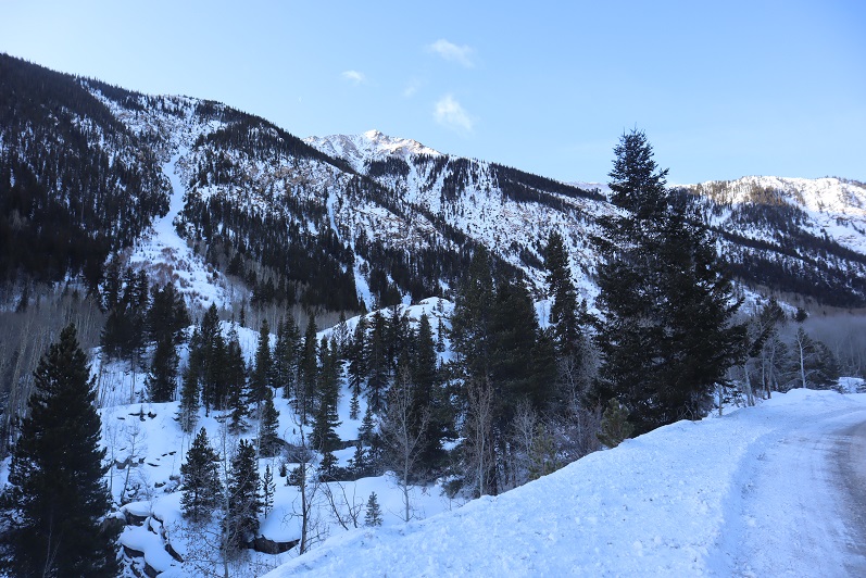
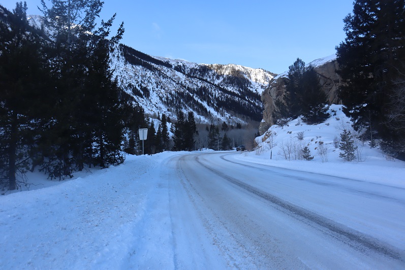
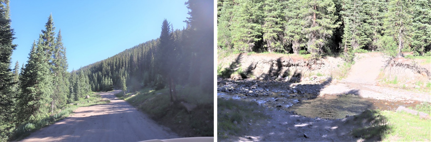
Most of the drive in to the trailhead was on a 2wd dirt road.

5

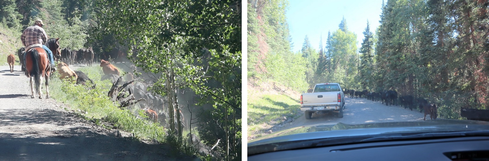
Then all of the sudden I came upon stopped vehicles along the road. A rancher was moving a herd of cattle, and the first vehicle in line didn’t feel comfortable driving alongside the moving herd so he decided to stop and park his car until the herd had moved (despite the rancher continually waving him on: the cattle would have been fine if he’d just drove slowly past). I wasn’t in a hurry so I wasn’t too bothered by the extra time spend sightseeing cattle. A lot of the other drivers were though.

6

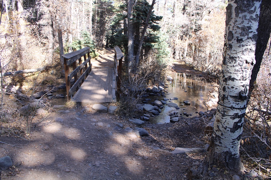
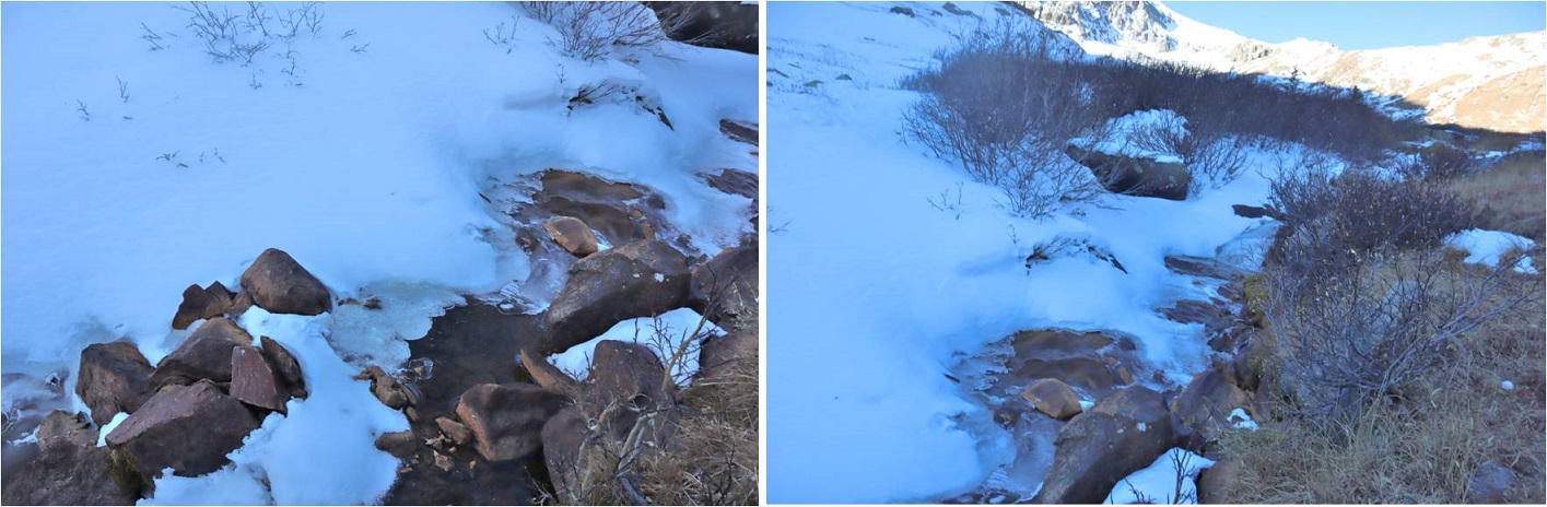
The last 2 miles to the trailhead were 4WD and included a fun creek crossing.

7

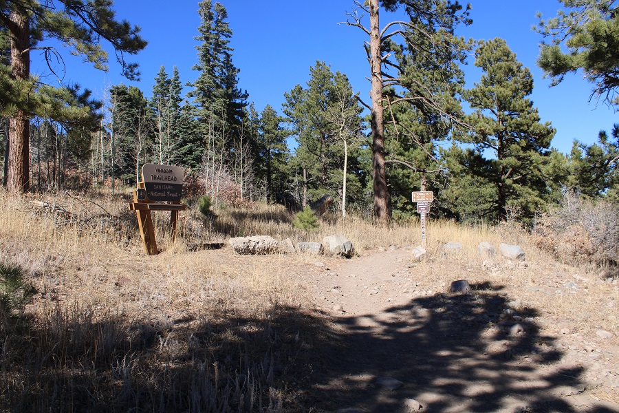
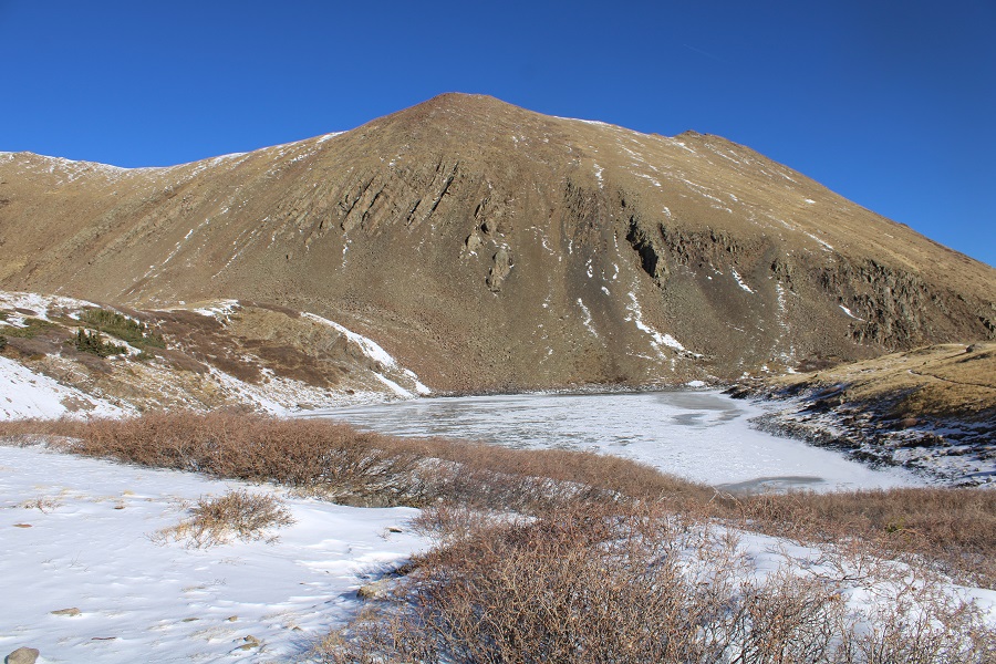
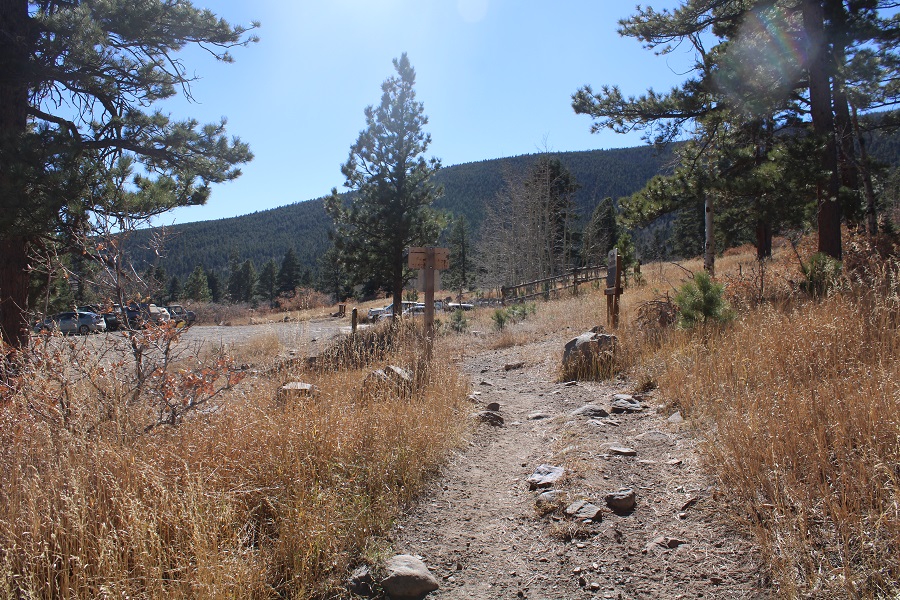
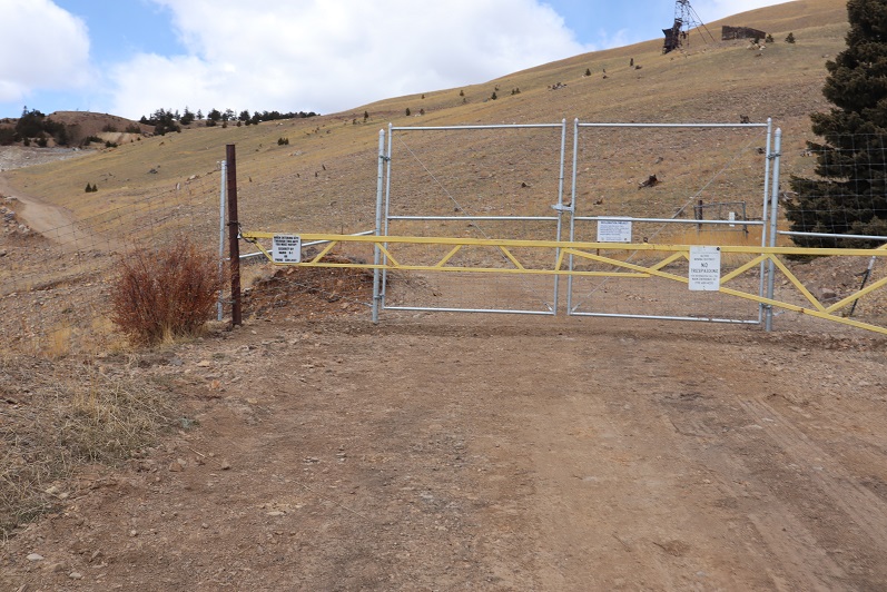
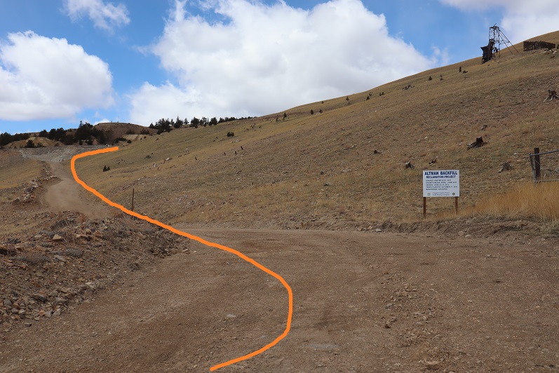
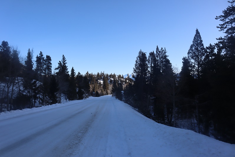
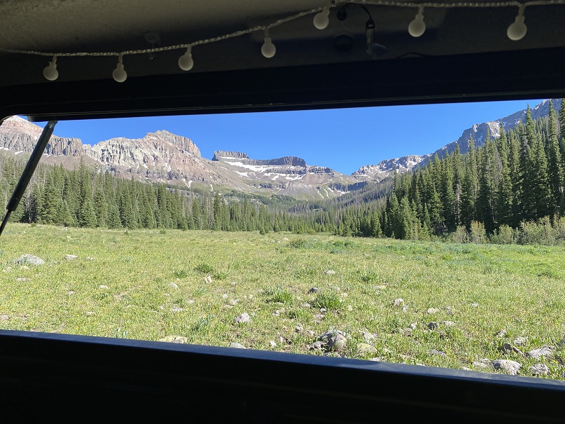
I made it to the trailhead, parked my truck, and got out and took a look around.

8

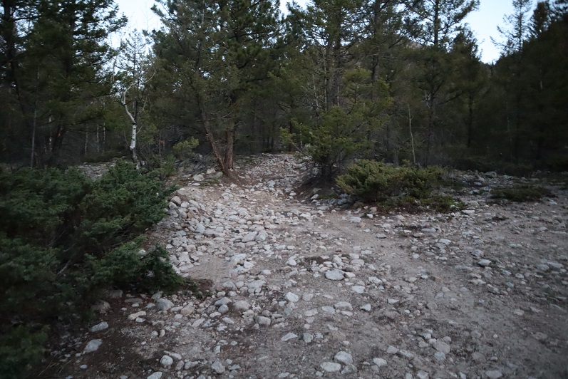
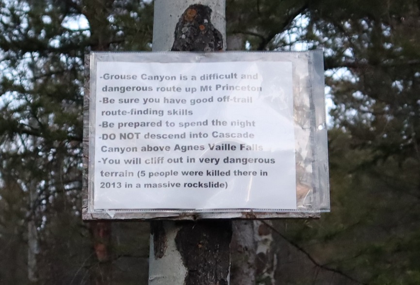
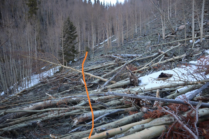
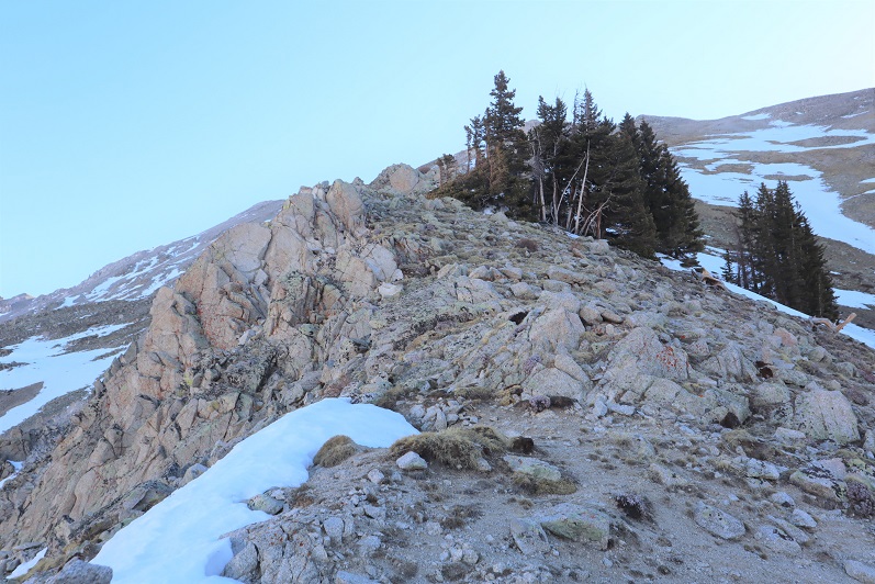
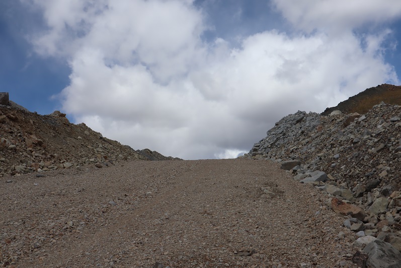
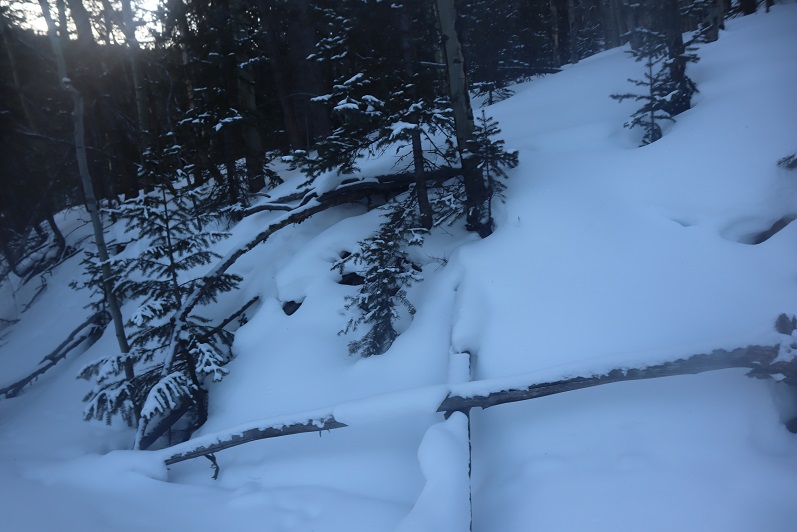
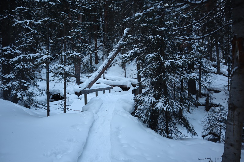
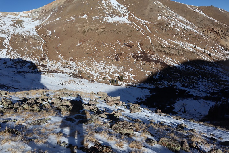
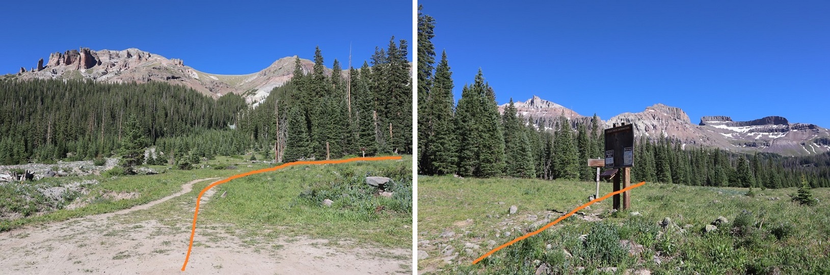
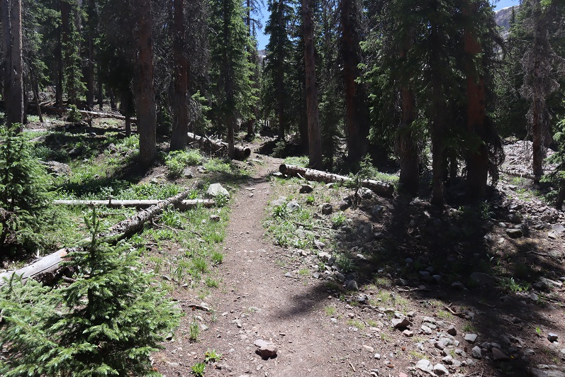
I wanted to get a visual of the route for tomorrow’s hike. I took some pictures of the trail entrance, trail register, and the way I wanted to head out tomorrow. Then I ate my dinner, did a little knitting, and generally enjoyed the view as I relaxed in the bed of my truck.

9

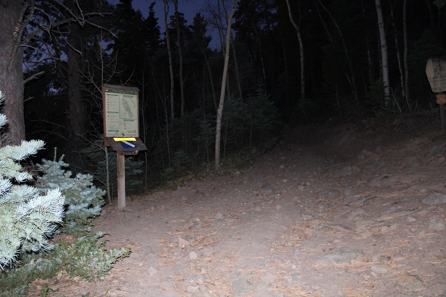
The next morning I was on the trail at 4:40am, armed with my helmet, harness, 3 climbing ropes (2 60 meter ropes and one 30 meter half rope) and my climbing shoes. My pack was completely filled, and I’m guessing it weighed 40lbs. I only took the essentials.

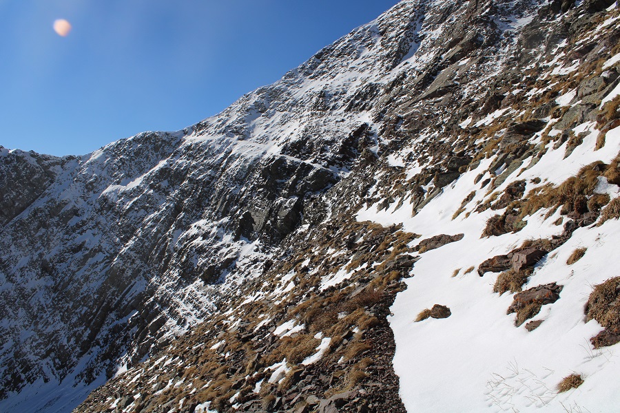
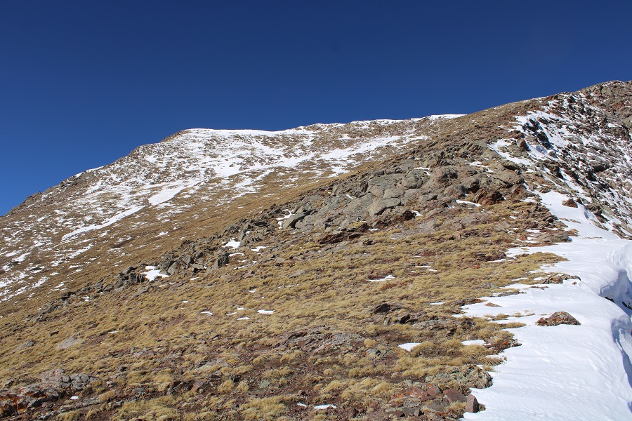
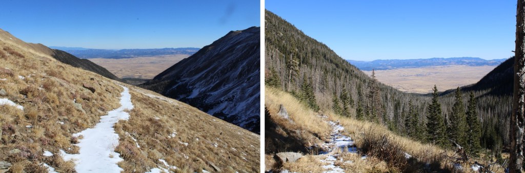
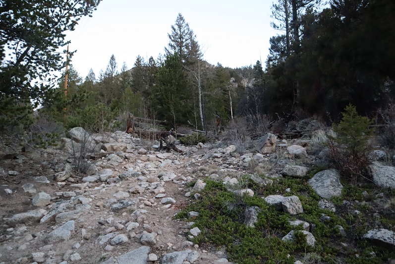
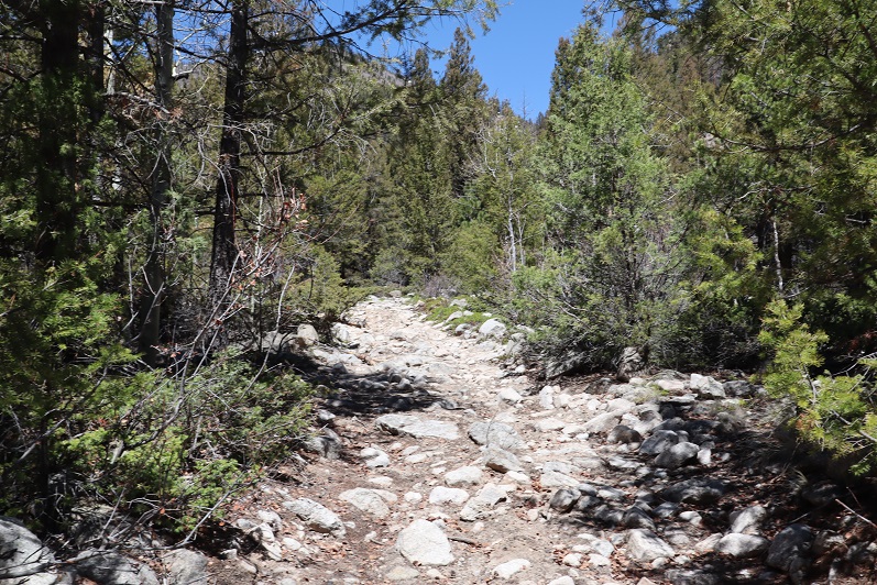
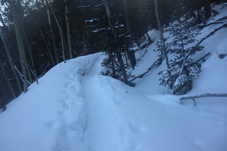
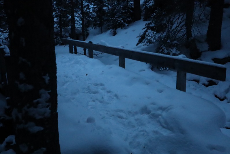
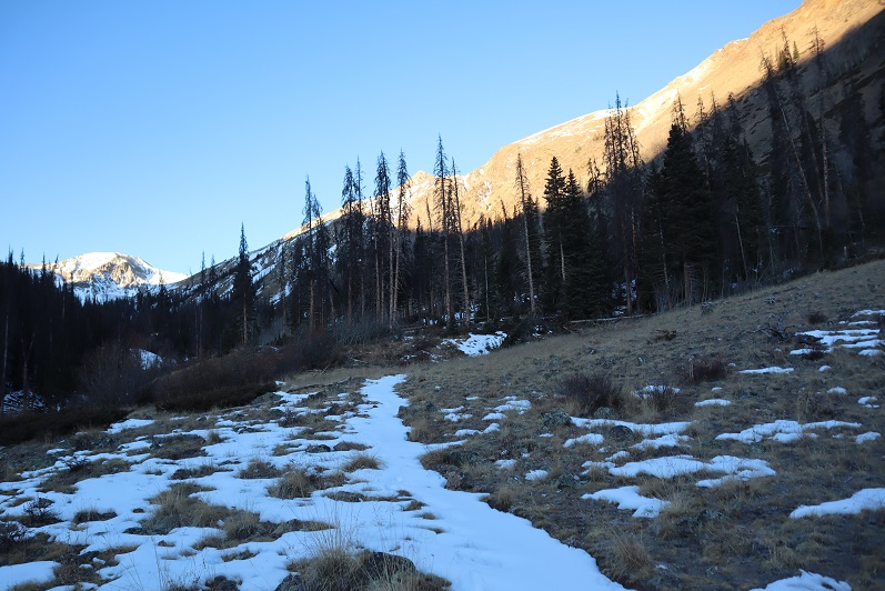
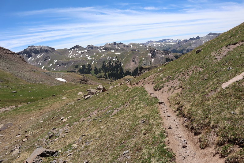
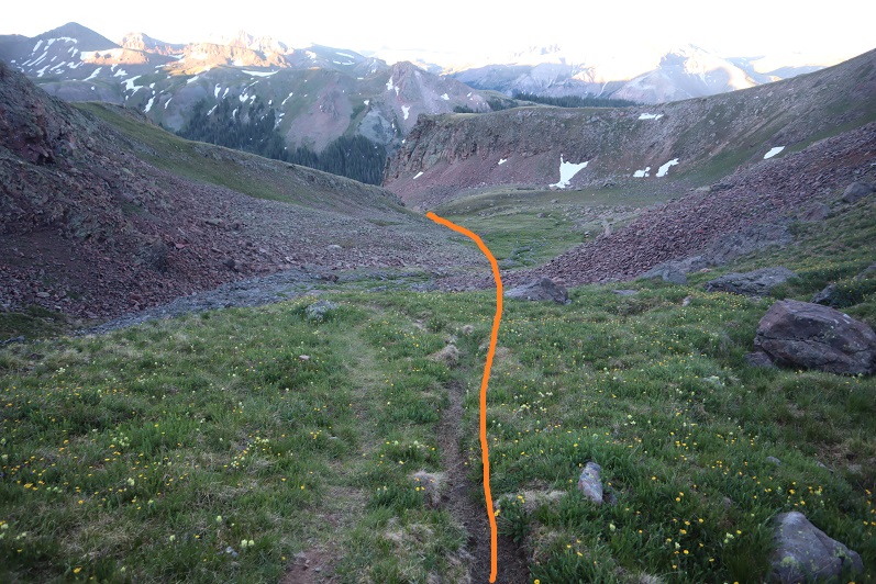
The trail starts at the east end of the parking area and heads south.

10

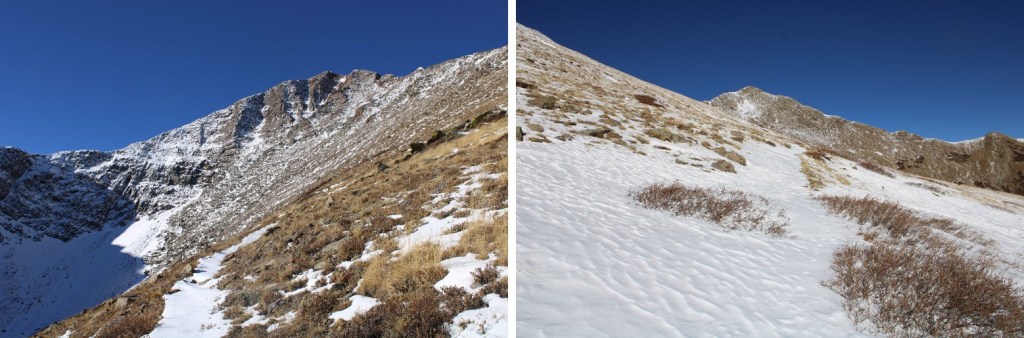
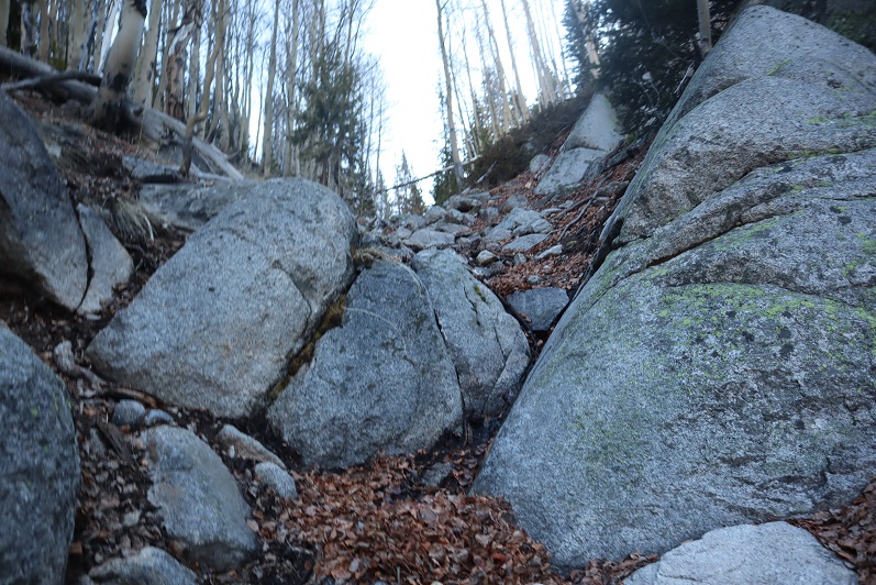
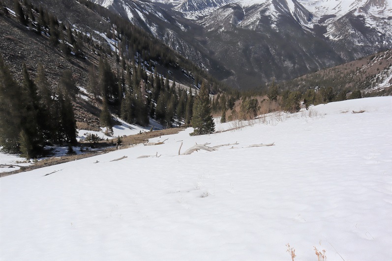
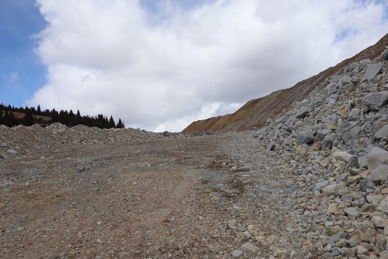
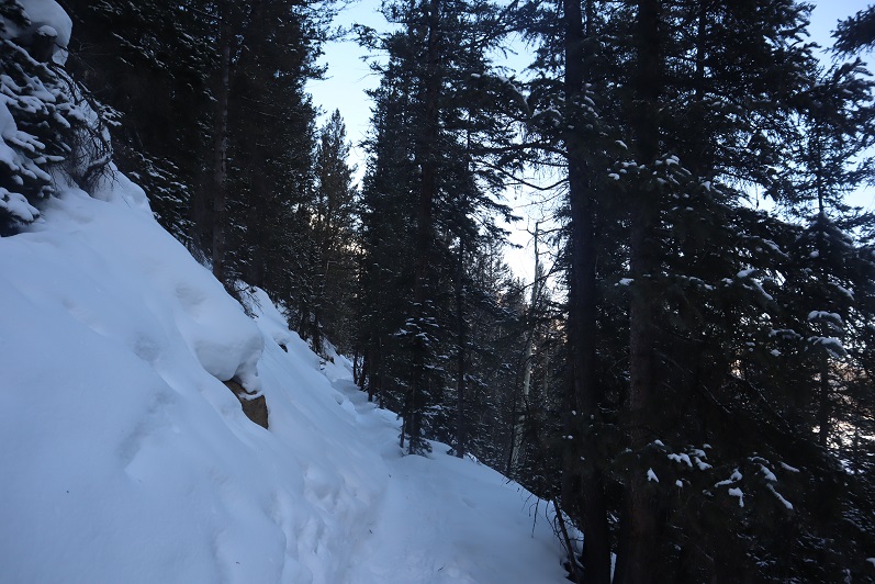
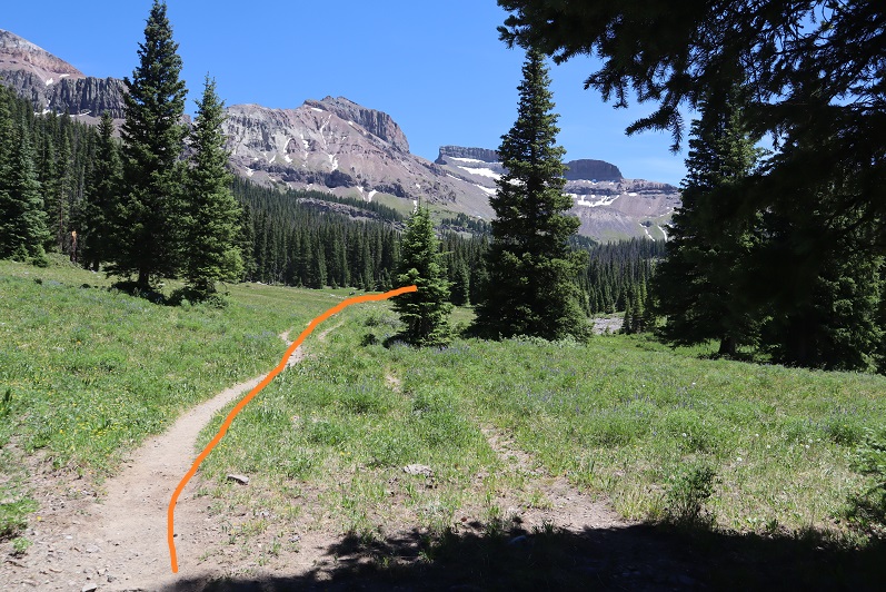
I followed the class 1 trail for 2 miles until I came to a steep section

11

12

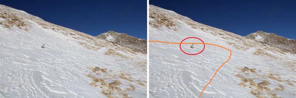
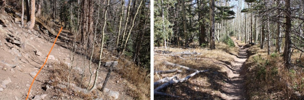
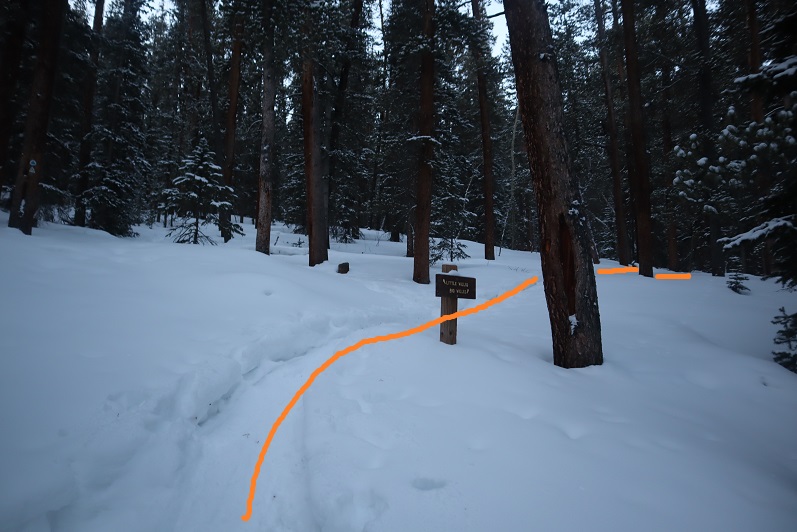
At the pass the trail diverged into two and then kind of ended. I could tell I just needed to get around the small outcropping. I decided to go up right and descend on the left on my way back down. Both sides were easy.

13

14

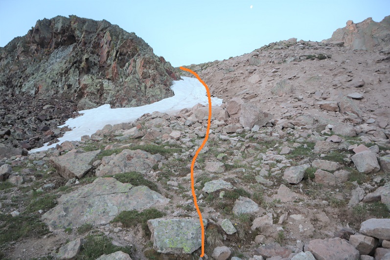
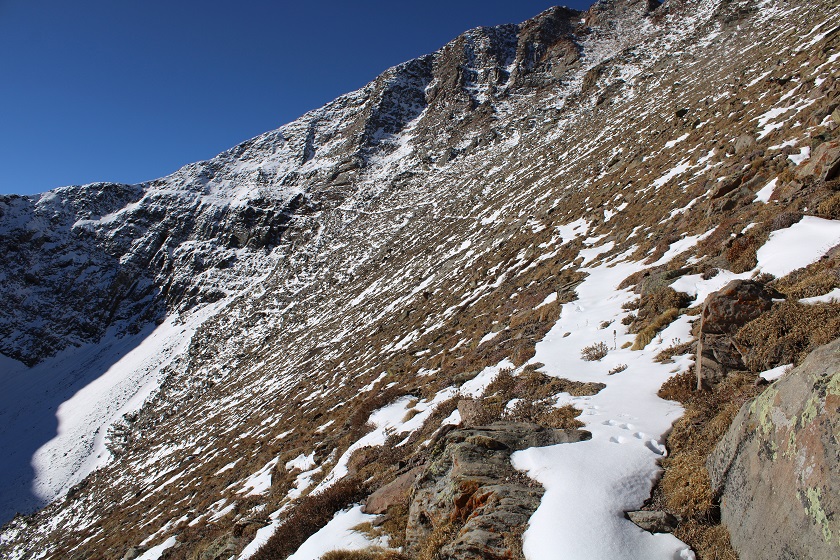
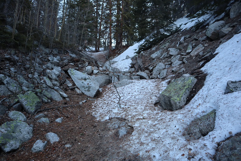
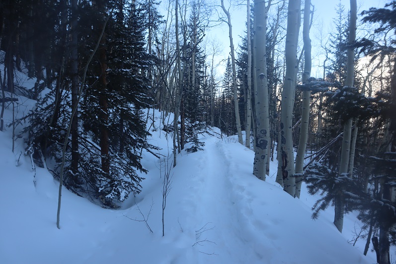
The trail picked up again after I climbed this area.

15

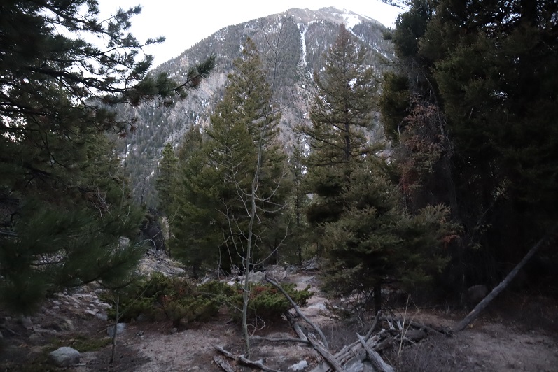
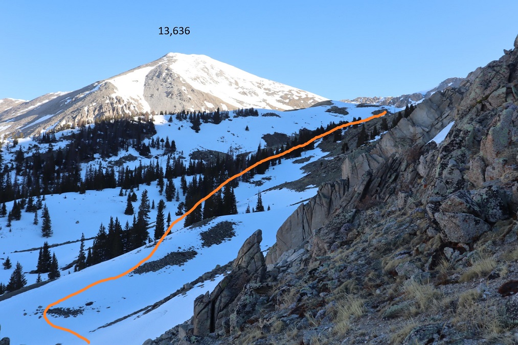
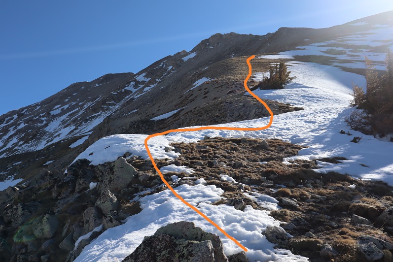
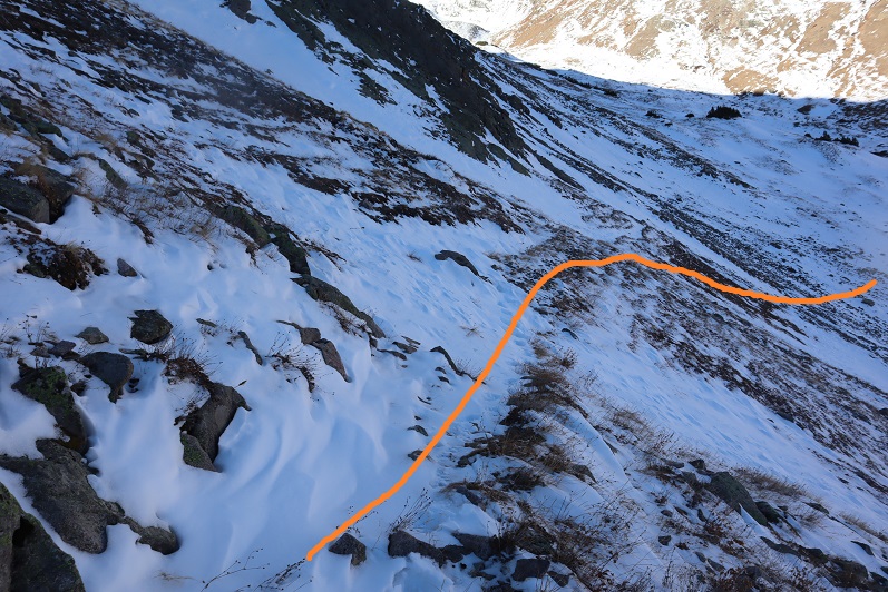
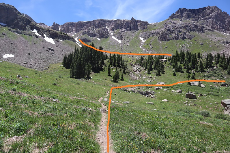
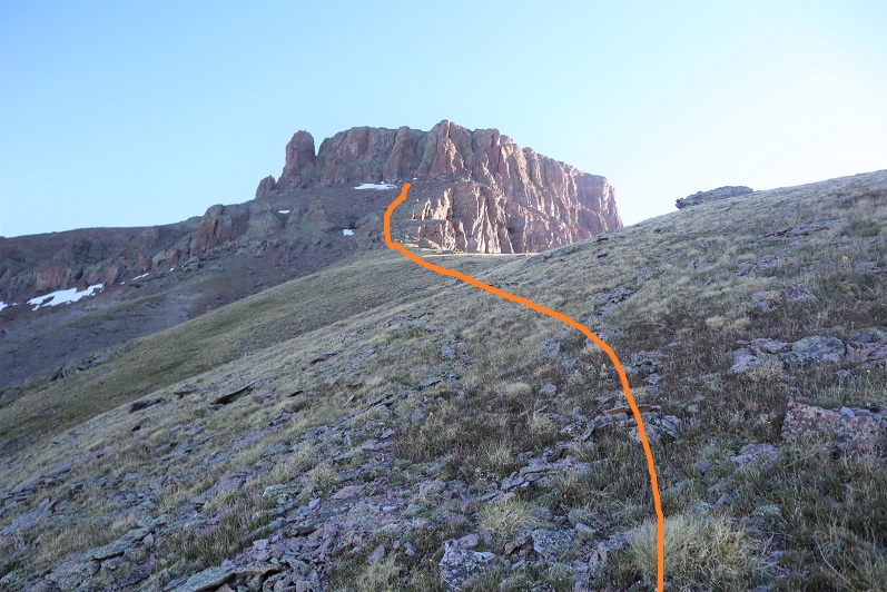
After 3.3 miles of hiking I came to the top of the pass.

16

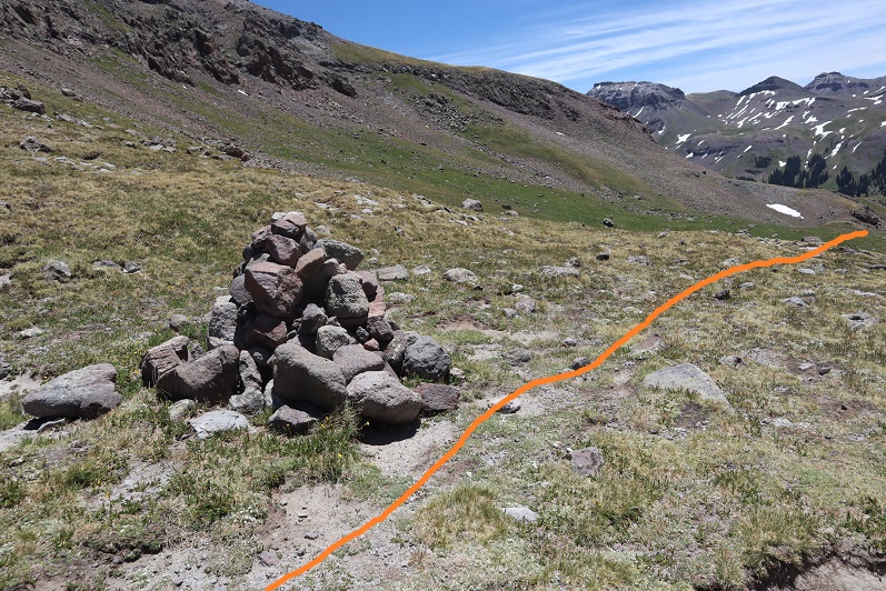
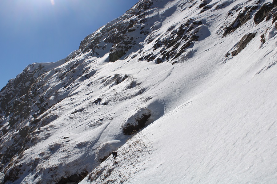
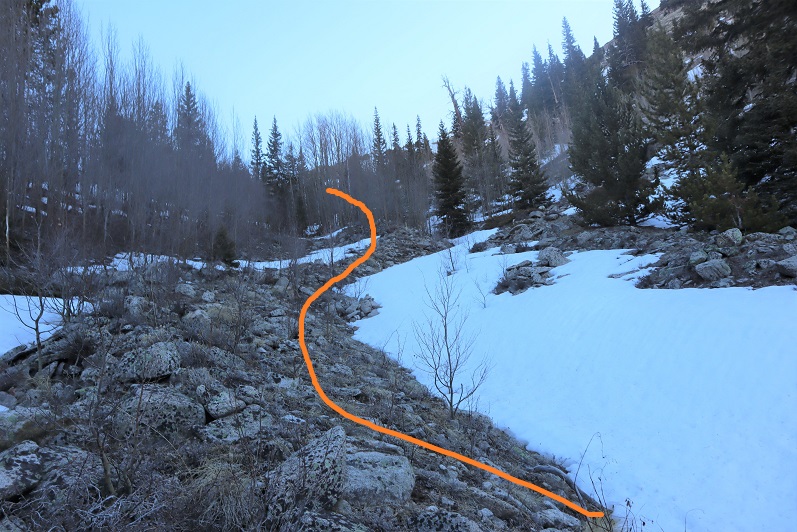
From here I continued following the class 1 trail, losing 400’ in elevation as I went

17

18

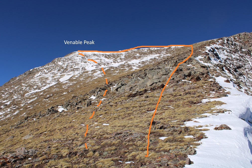
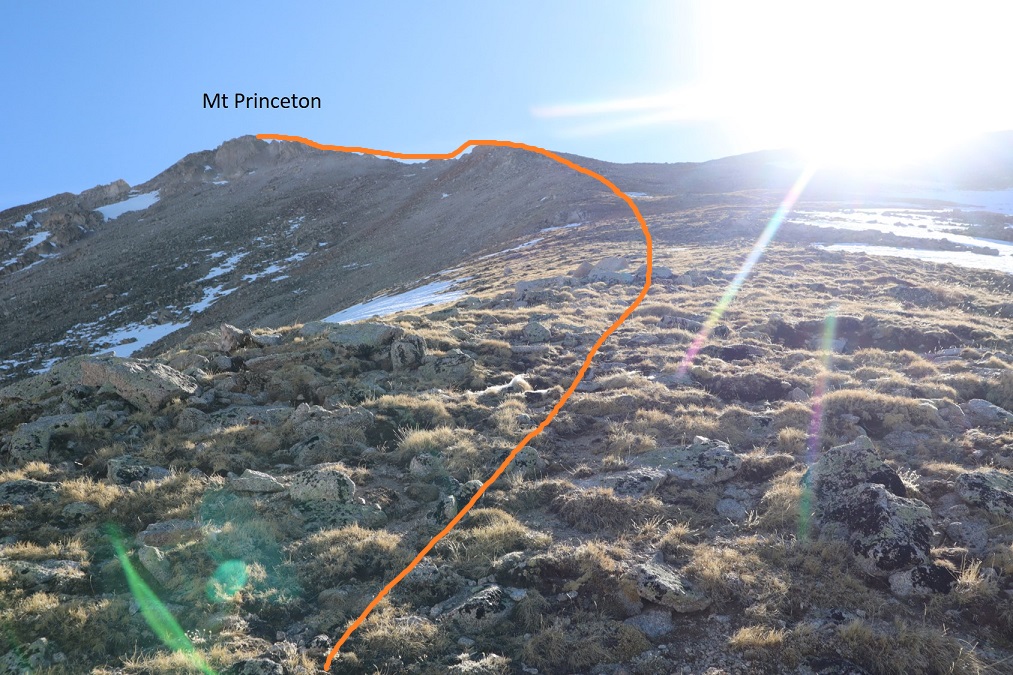
At the bottom of the pass I left he trail and headed east

19

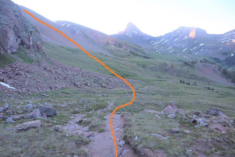
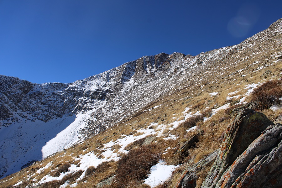
My goal was to gain the ridge and follow it to the base of Coxcomb Peak

20

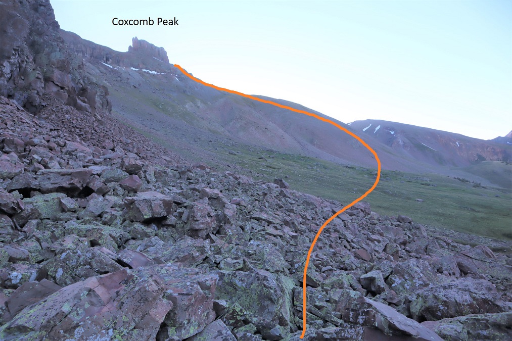
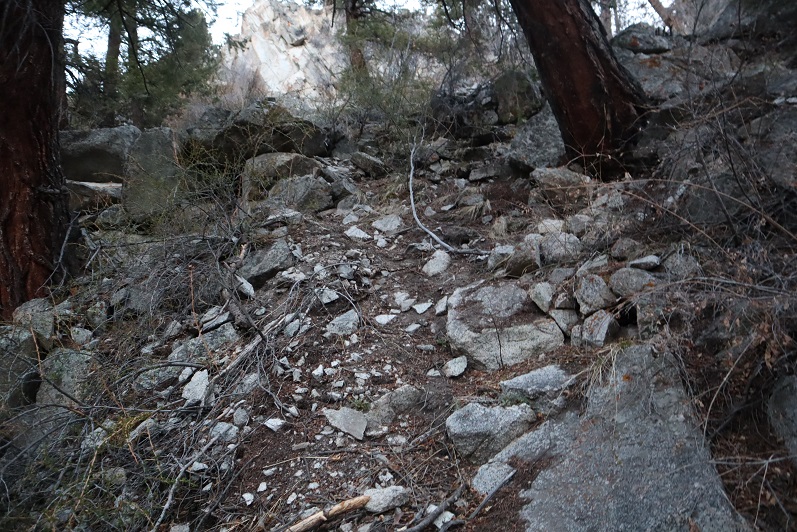
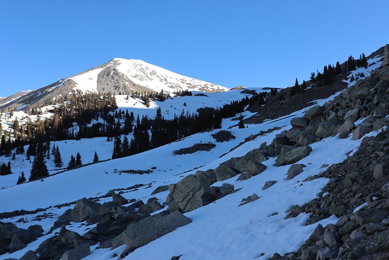
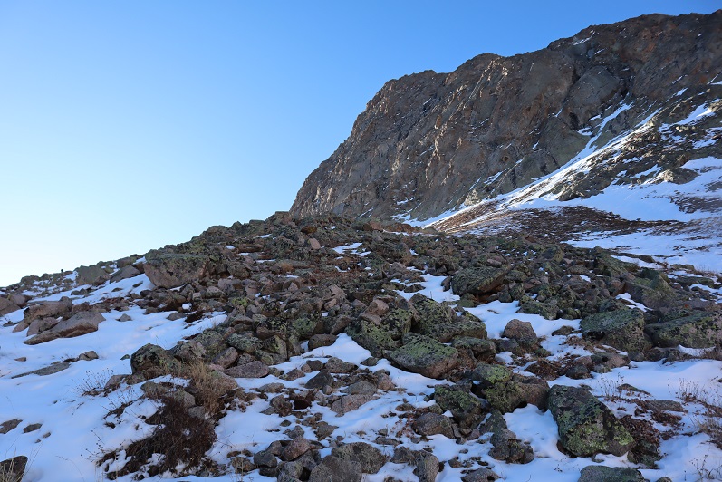
The ridge was full of loose talus

21

22

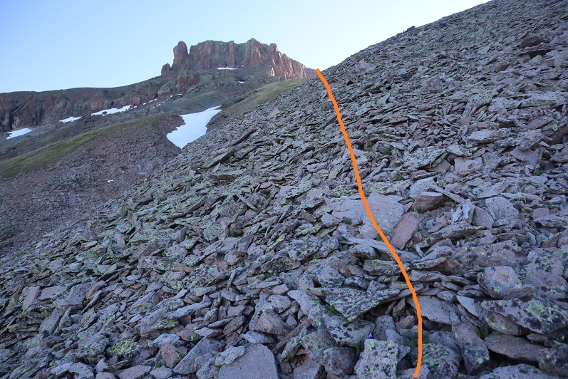
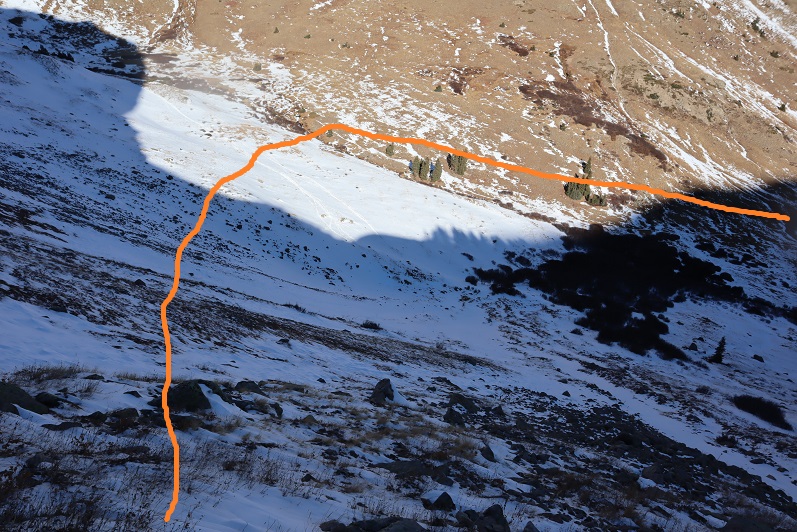
The talus eventually gave way to a little bit of tundra

23

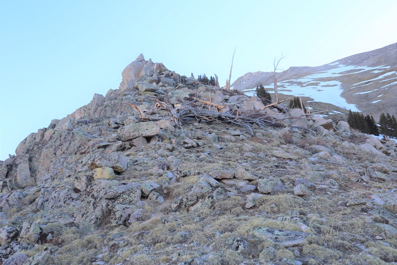
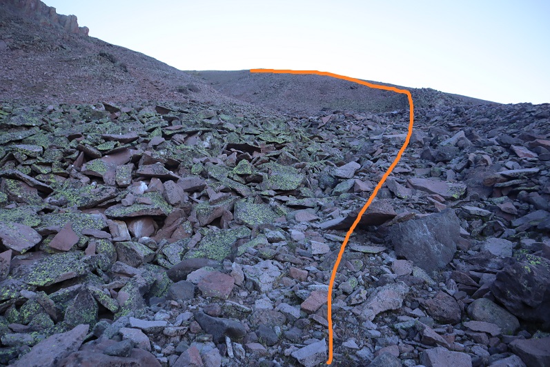
Then I came to a rocky class 3 section

24

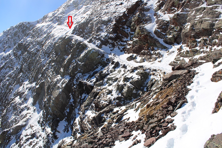
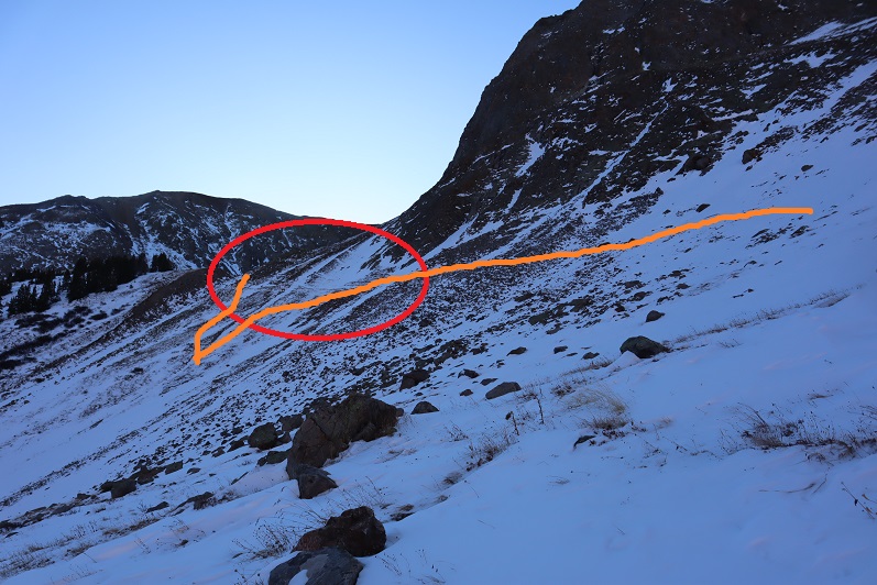
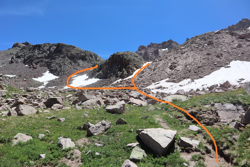
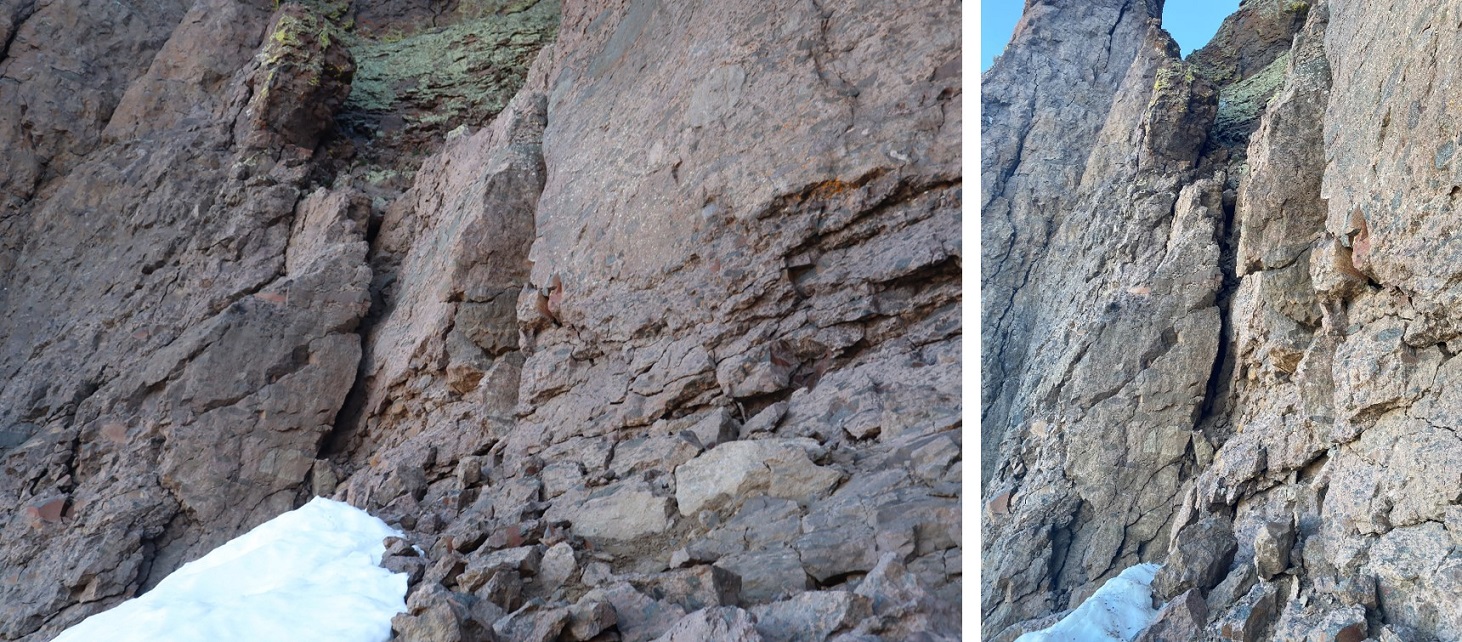
Which brought me to the base of the crux of Coxcomb. Wow! The approach had been much easier than expected. The entrance to the climb starts at the small gully. I’ve seen a few reports on how to climb this area, and every report rated the difficulty different. Some gave it class 3 (it’s NOT class 3, but there could have been a rock slide since that person posted conditions), some gave it class 4, and some class 5. The couple that summited last week said this was the most difficult part of their climb.

25

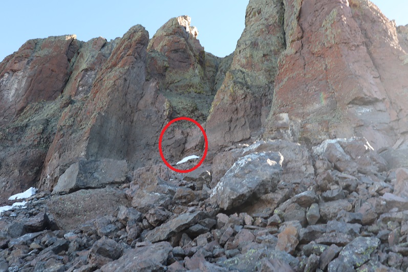
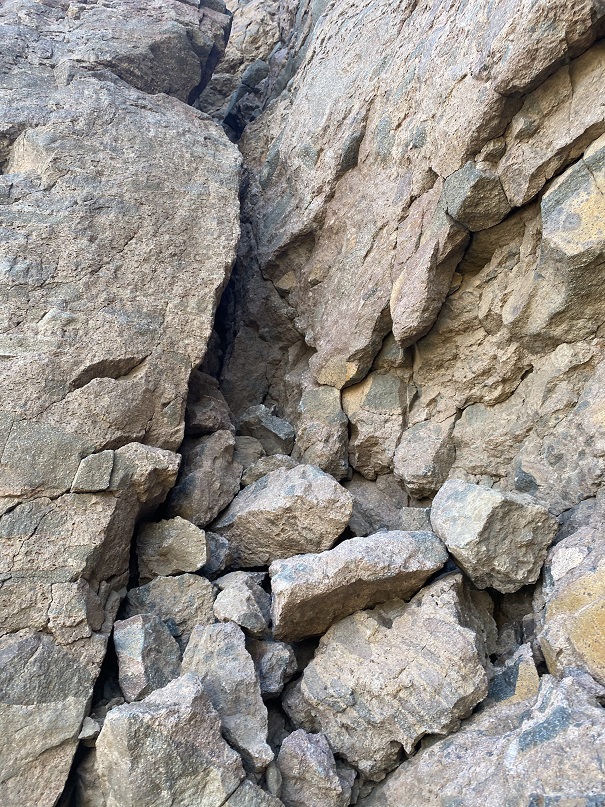
I walked up to the gully and tried to devise a plan. I decided to put on my climbing shoes and just go for it. I tried to ascend, but there just weren’t enough foot/hand holds. I tried and tried and tried. Then I tried ascending to the left but those rocks are loose and kept crumbling in my hands. I wasn’t about to put any physical weight on them.   I tried the gully again, and then the rocks to the left again. I spent over an hour trying to figure this problem out! If I were only a few inches taller this wouldn’t have been an issue. Hmph. I sat down to think. Here’s a close-up of the gully

26

All I needed were a few more footholds. That’s when it came to me: there were rocks all around! I’d just fill the gully as far as I could and use those rocks as stepping stones. I dropped my pack and spent the next 45 minutes or so filling the small gully with rocks. I even put in a chockstone for a handhold. When I felt I’d done enough I tried climbing a few feet to see if the rocks were stable. Success!

27

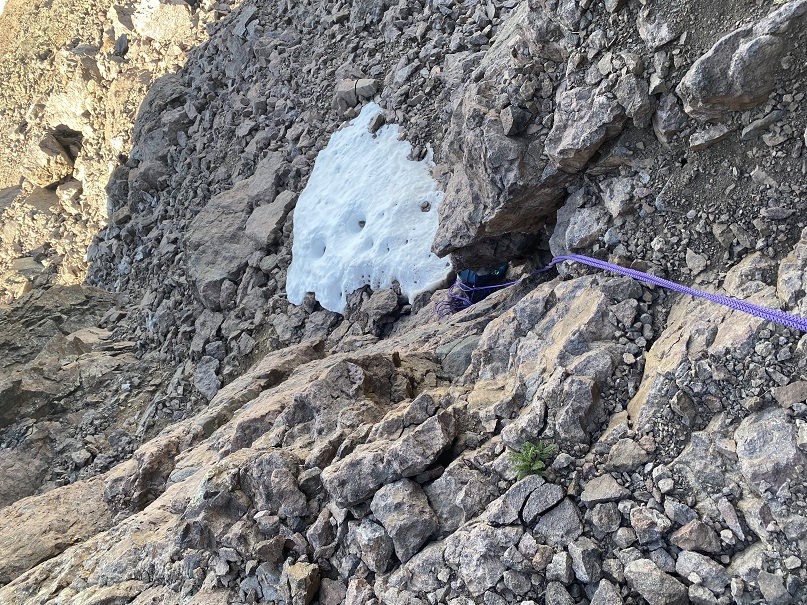
I put my pack back on and started to climb but my pack was heavy. It made me top heavy and I couldn’t pull myself over. Drat! I sat back down to think. I could see a rappel set up at the top of the gully. I decided to take my 30 meter short rope, attach it to my backpack and my harness as well, leave my backpack below, and climb up the gully without gear. Then I’d use the rope to pull up my pack. If I wasn’t able to pull my pack up I knew I could just rappel back down with the sling already in place and the rope I’d attached to my harness (I was glad I’d brought the 3rd rope!).

I looped the rope around the straps of my pack, attached the other end to my harness, and easily climbed up the gully. Success! Wow, I felt great! That had been the crux of the route for the couple who were here last week, so I now felt confident I’d be able to make this summit. I hauled up my pack, which took quite a bit of upper arm strength and balance not to fall back down the gully as I was lifting the pack up.

28

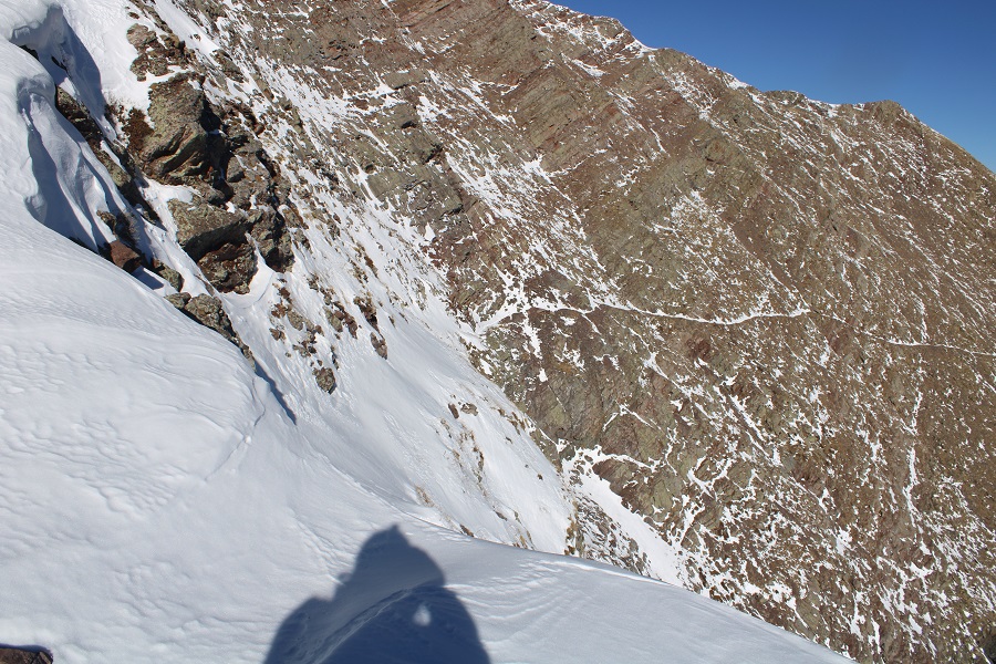
I coiled up my rope, attached it to my pack, and continued on. The next section was class 3, and only lasted about 50 feet or so

29

This brought me to a class 4 section I had to upclimb. I was able to do this wearing my pack

30

I’d made it to the base of the chimney area, also rated class 4.

31

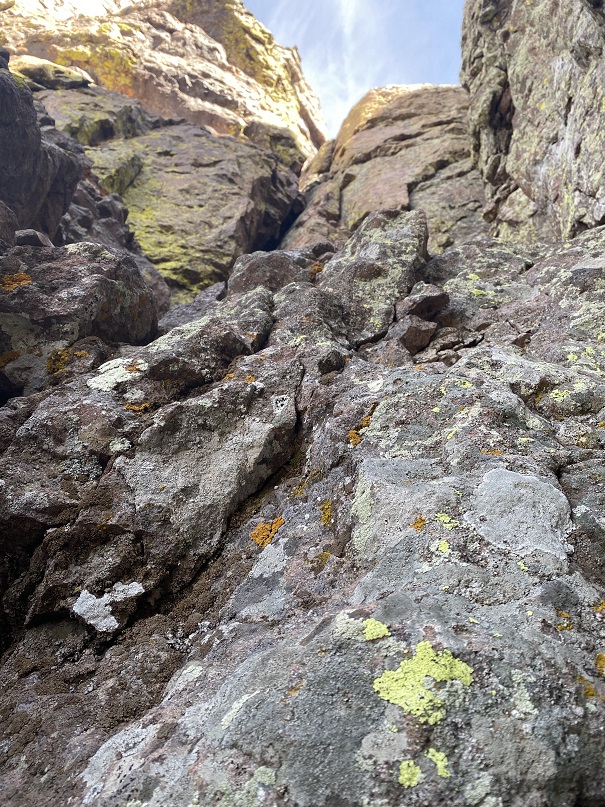
From my research I’d learned to take the ‘easier’ chimney to the left. Um, this did not look easy! I spent a lot of time determining if I was even in the correct area, and backtracked a little just to make sure. Yep, this was it. I decided to just start climbing. Boy, was this tiring work! My pack made climbing so much more difficult, but I wasn’t giving up. I made it about half way up the chimney and wasn’t able to stem with my pack on. I decided to retreat and try again.

32

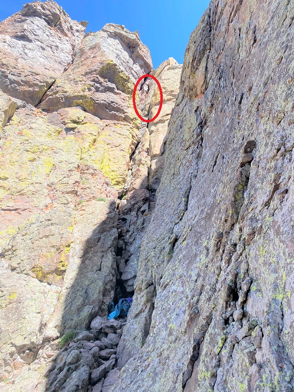
Taking off my pack had worked last time, so I decided to try that again. I rigged the rope the same way I had last time and started up. Wow! This was so much easier! I made it about ¾ of the way up the chimney when the hand/foot holds gave out. This was definitely difficult class 4 (if not class 5). The pictures I’d seen of others climbing this part made it look so much easier! They looked like they just walked up this section. They’d been roped in, and about a foot taller than I am, but still, it didn’t seem fair. From here I just needed to stem for about 20 more feet which would put me in the upper gully, and then I’d need to exit via the right side. The problem? I couldn’t see any anchors set up, or even any places to set an anchor, and without a visual of the last part of the gully I didn’t feel comfortable committing to this part of the climb, not knowing if I’d be able to rappel down. I knew if I went any further I would not be able to climb back down, so rappelling was my only option. It was here I made the decision to call the climb for the day. I just didn’t feel like I could commit to continuing on without putting myself in unnecessary danger. I kept thinking how infrequent this mountain is climbed and how I’d be stuck for weeks, if not months (or longer) if I wasn’t able to downclimb.

Note: On my drive home I came up with the idea of tying all my ropes together, carrying an empty pack up, and then hauling the ropes up behind me. The only downside to this scenario is if the ropes got caught on something while I’m trying to haul them up (a very real possibility). I need to do more research and find out if there is a sling set up in the gully, or if I just need to commit. Also, I need to practice stemming in a climbing gym with a full pack. That’s not going to be easy…

Here’s how far I made it up the chimney.

33

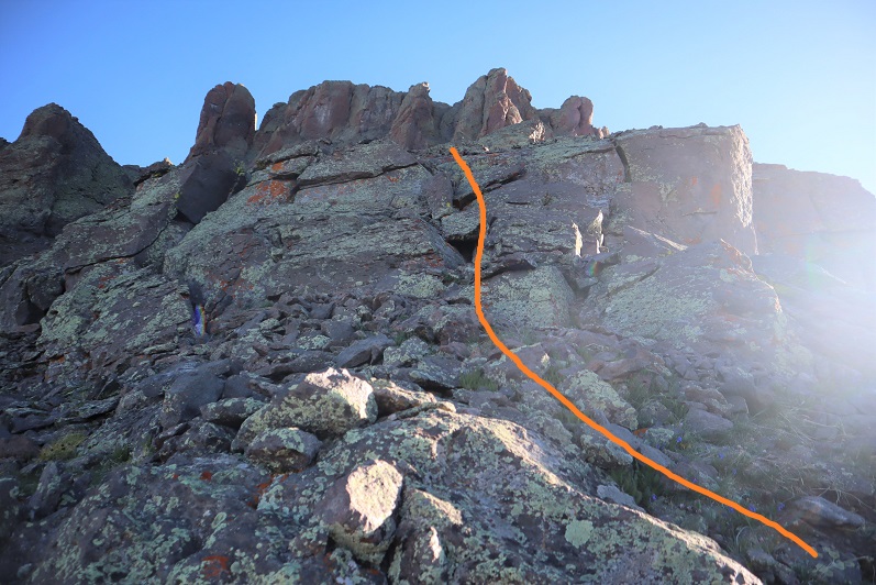
I made it back to my backpack and set up a rappel to head back down. At least I was getting some use out of my 60 meter ropes today.

34

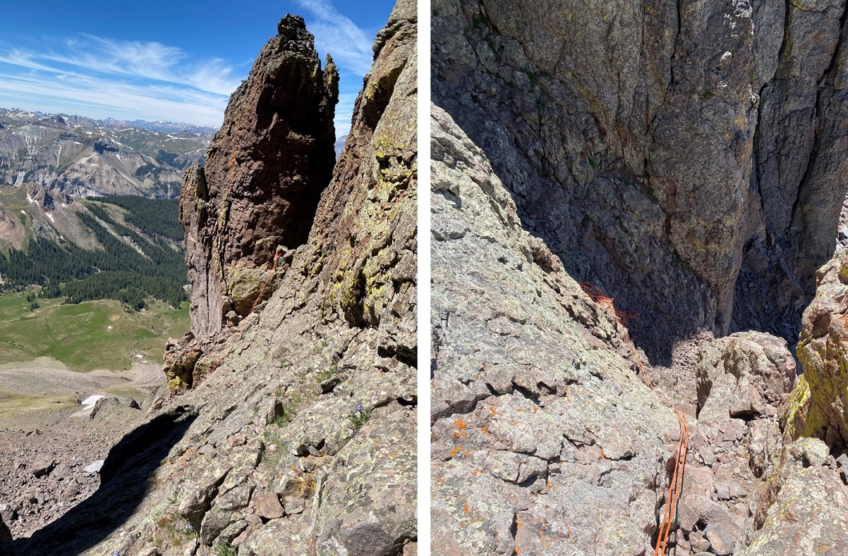
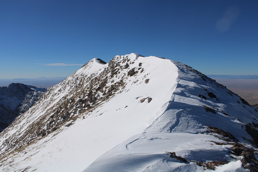
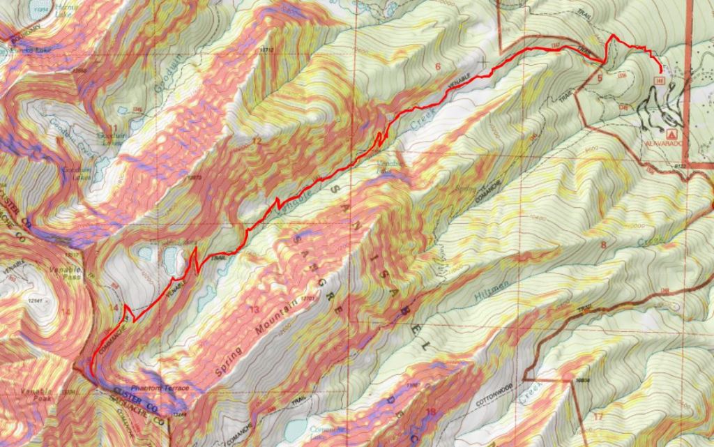
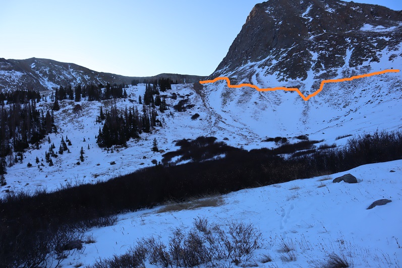
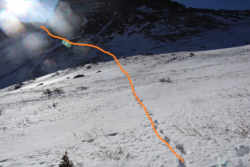
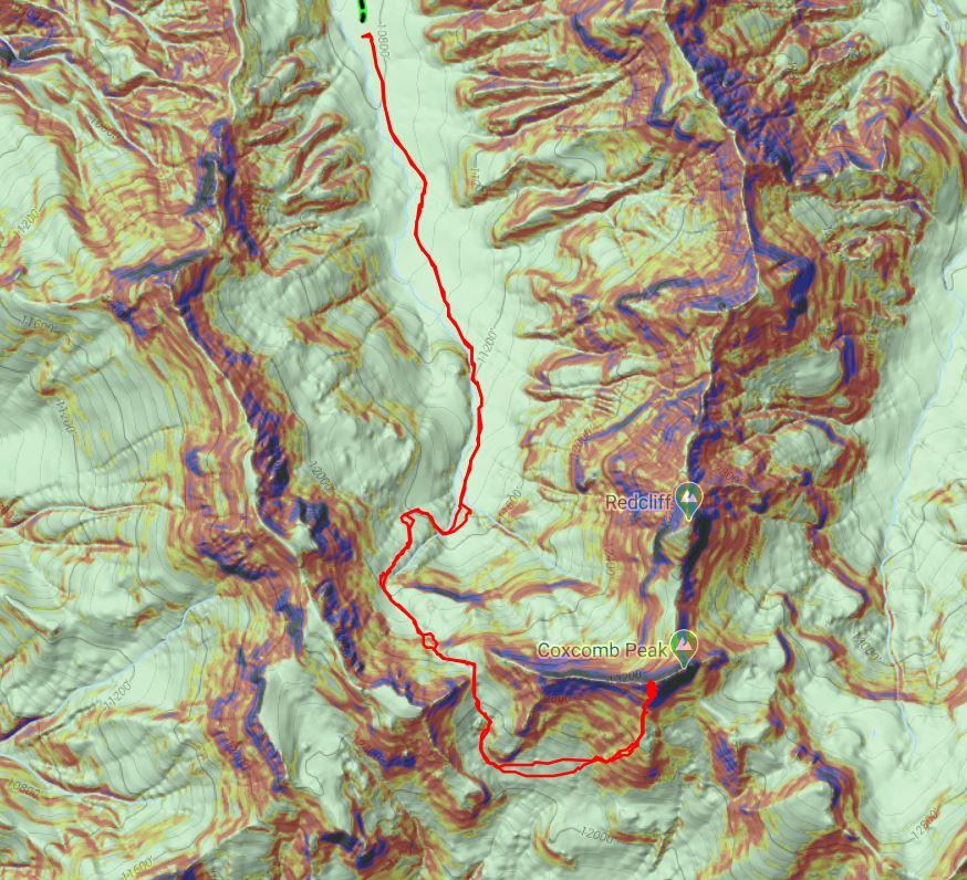
Here’s a picture of the route

35

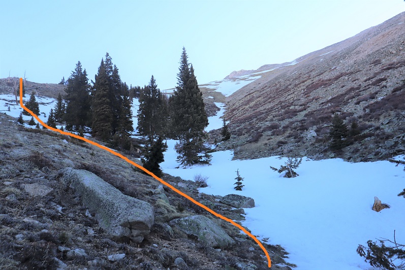
I rappelled back down, changed back into my hiking boots, and retraced my steps back down the ridge and back to the trail.

36

37

38

I followed the trail back up the pass, cursing the weight of my pack the entire way

39

40

As I was coming back down I noticed blood along the trail, and a few guys with horses down below.

41

I made it to the bottom of the pass and the oldest man there talked with me for a bit (he looked like a grandpa out with his grandsons). He wanted to know if there was more snow further along the trail. The blood I’d seen had been from one of his horses: it had spooked on the rocks and snow and flipped over backwards when it lost its footing. It had injured its hoof. I was confused as to why they were even contemplating continuing on? They had an injured animal! The man agreed with me and I’m pretty sure he decided to head back.   A little further along the trail I met up with a woman who said when the group had passed by their campsite earlier this morning one of their horses stepped on their dog (the horseback riders horse stepped on the horseback riders dog) and caused an awful commotion. And one of the boys had lost his jacket. So the group wasn’t having a great day.

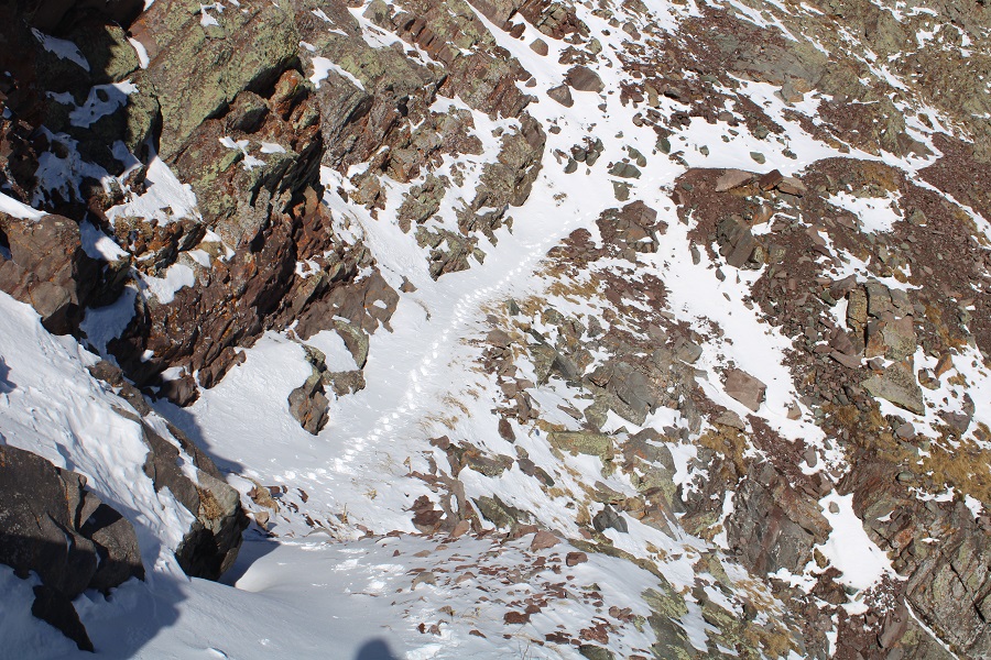
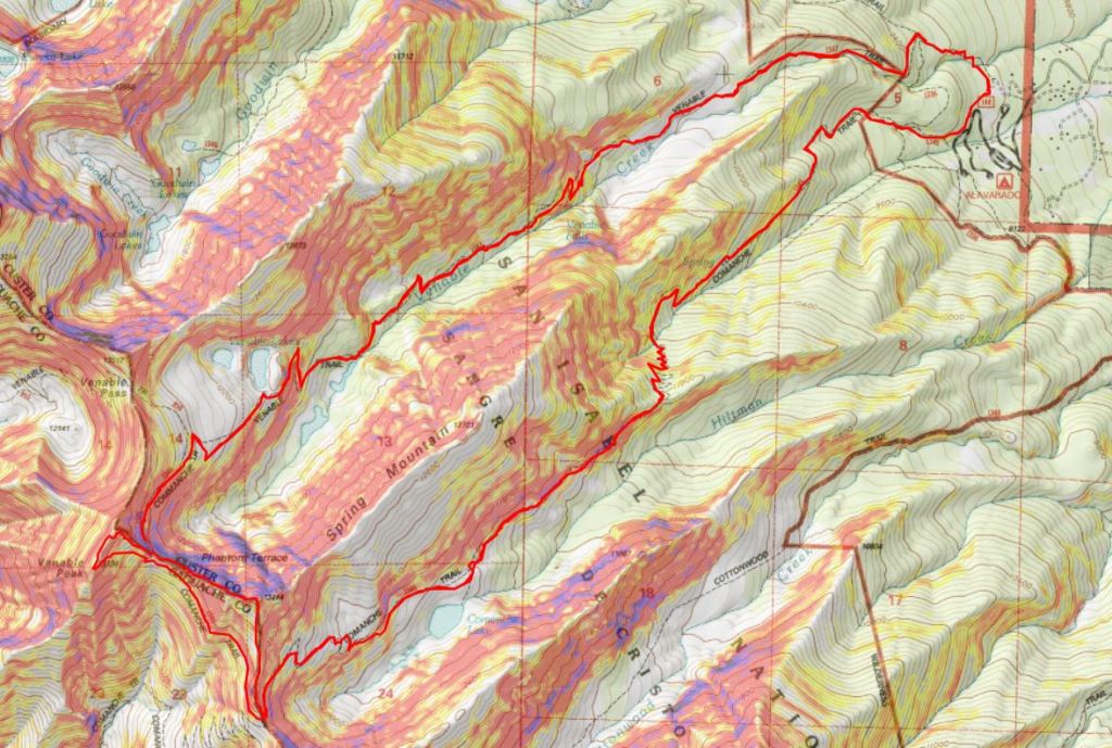
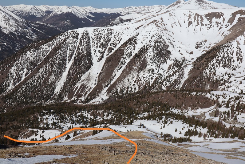
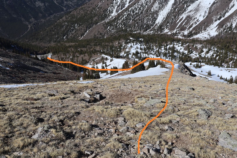
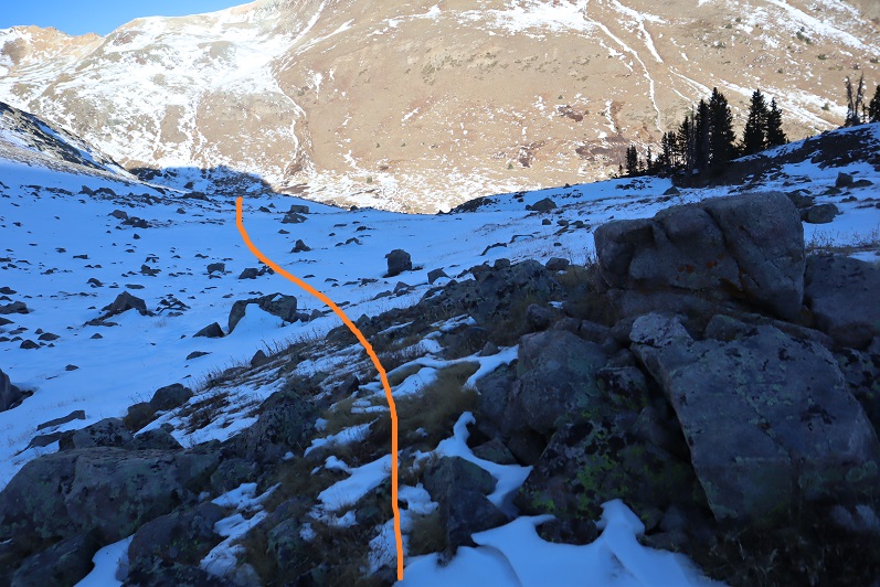
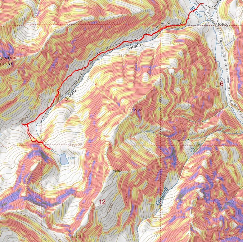
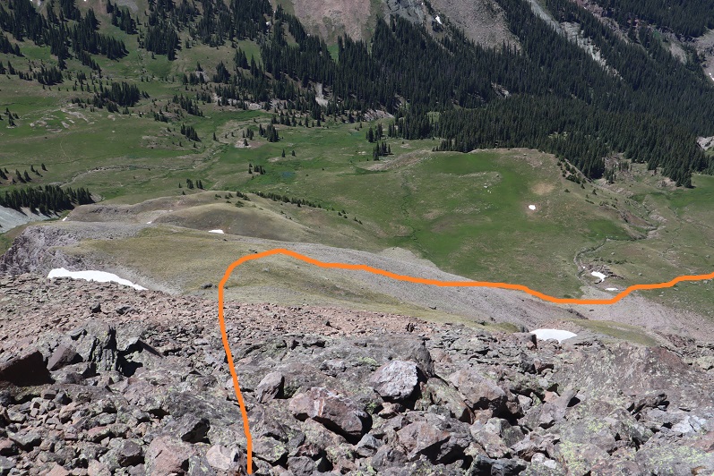
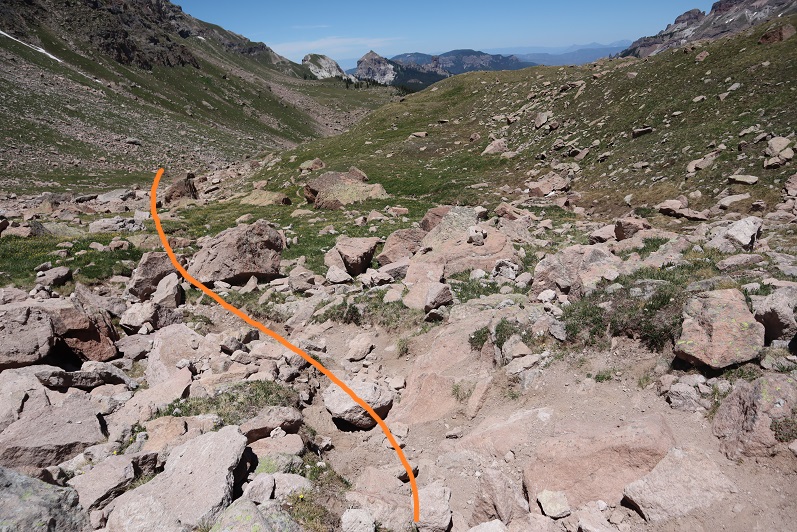
Here’s my route back down the mountain to my truck

42

43

44

45

The entire route down I ruminated on the days experiences and tried to think if I could have done anything differently. I also considered the need for a climbing partner on this route: someone taller than me who could belay me from the top. This idea doesn’t sound appealing, but it is the safest option. In the end I decided I needed more stemming practice, and I need to actually speak with people who’ve accomplished this route.

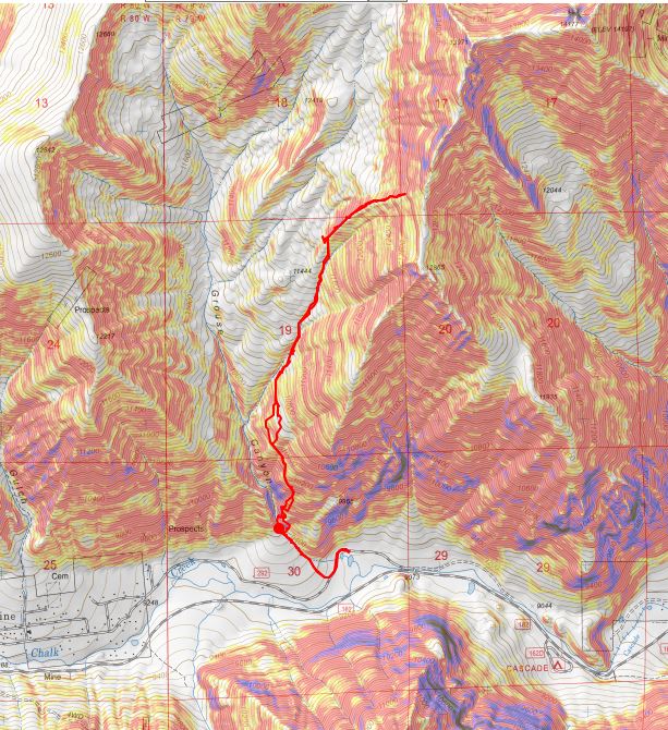
I made it back to my truck at 2:40pm, making this a 17.4 mile hike with 5544’ of elevation gain in 10 hours. Here’s a topo of my route

46

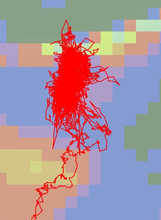
And just for fun here’s a close-up of my problem solving skills. I worked this problem for a long time!

47

When I pulled up my gpx file I found I made it to 13,560’, which means I was less than 100 feet from the summit when I turned back. Ouch. On to the next trailhead!


13,626 – (attempt) from Grouse Canyon

1

RT Length: 5.67 miles
Elevation Gain: 3772’

Note:  My successful summit of PT 13626 can be found here.

I got a late start on this one. My alarm didn’t go off and I woke up an hour late. Then I got stuck for an hour on HWY 24 around Manitou. I’m not sure why the road was closed, but I sat there for over an hour behind a Lay’s Delivery truck, stuck about 100 feet from the off-ramp. I could see flashing red and blue lights, but other then that it was dark. I’m guessing there was an accident just before we arrived. This made me really late to the trailhead, but I was hoping that since this is a shorter hike I’d avoid the mushy snow. I was wrong.

I arrived at the trailhead and was on the trail by 6am.

2

The sun was already starting to rise. I followed 292 for a tenth of a mile and turned right onto the trail

3

You can drive a vehicle up this road, but I’d say it’s more 4WD than I’d like. I was glad I’d parked where I had.

4
Just before the real start to the trail there was a warning sign:

5

Hmmmm. I looked at my topo map and couldn’t find Agnes Vaille Falls anywhere. Well, I was planning on summiting 13,636 and not Mt Princeton, so I figured I’d just keep an eye out for danger and not ascend/descend anything that looked like a “falls”.
There wasn’t much of a trail, but there were cairns

6

7

8

The problem was the cairns didn’t lead me to the right place. They led me to a small waterfall (oh no! Was this the falls?)

9

So I turned right (northeast) and headed up the steep mountainside to avoid the falls and ascend to the ridge.

10

This is actually much steeper than it looks. I found game trails and cairns everywhere, but none of them seemed to lead anywhere. Around 10,000’ I reached a plateau/ridge of sorts and turned left (north) and followed some cairns across the mountainside

11

It was pretty obvious to me I was the first one on this ‘trail’ all year

12

I came to an avalanche area. I don’t think it’s from this year; maybe last year? I just headed towards the ravine, being careful to watch for rolling logs

13

I followed the ravine to treeline. This was actually harder than it sounds, as the snow was already mush in areas, yet solid in others. It was like playing a reverse game of whack-a-mole.

14

15

16

I stuck to the rocks wherever possible

17

18

At treeline I made my way for the ridge. Unfortunately, what little snow there was unavoidable here. It doesn’t look like a lot, but I was postholing in areas and needing crampons in others.

19

When I reached the ridge this was the route I was supposed to take towards 13,636

20
So I headed on down to the basin. The first step I took onto the snow I sank up to my knee. Drat! The snow here was crunchy: about 6 inches of crust sitting on top of millions of small boulders (think toaster ovens and microwaves). I could tell trekking over the snow here wasn’t going to be safe and would only get worse as the day went on.

21

OK, plan B: Maybe the ridge goes up and around the basin? Looking at my topo map said it was worth a try. I headed back up to the ridge and followed it northeast

22

23

24

It had been my goal to find another way towards 13,626, but as I climbed higher I realized that was too dangerous: the ridge didn’t connect properly and there was potential for rockfall. It looked like this was a popular hangout for mountain goats (tons of tracks/scat/hair).

Plan C: Well, if I couldn’t summit 13,636 today I’d just change plans and summit 14er Mt Princeton. I knew I was close (probably a mile away) and I knew I could summit from this side. Here’s the route I intended to take (Mt Princeton is actually a little further to the northeast, on the other side of the ridge

25

I kept trudging along, until finally I decided to stop and put on some sunscreen. It was around 12,800’ I here I noticed I’d lost my water bottle! Oh no! I wasn’t thirsty, but I knew it was supposed to be warm today and to go on any further without water would have been a bad idea, even if I rarely drink on hikes. Drat! Because I didn’t have any water I made the decision to turn around. I felt it was the responsible thing to do. I turned around and headed back down the ridge

26

27

The snow was getting soft, and I was postholing in areas I’d walked across before

28

Yep, it was wise not to summit 13,636 today. I followed the ravine back down, bushwhacking a lot of the way to avoid postholing up to my thighs

29

30

I took a slightly different route back down, as there were cairns and game trails everywhere. I never knew which trail I was on, but tried to mirror my ascent as much as possible. It kept getting warmer and warmer, and I was glad I’d turned back: I was getting thirsty! I ended up descending a little more east than I’d ascended, down a heavily forested scrub oak/chaparral area. It was not pretty: I had branches hitting me in the face and used my pole to fend them off

31

It was all to avoid this huge boulder (I ascended to the left, descended to the right). It didn’t feel like either way was correct, but in hindsight the left (west)was probably the safer option up and down.

32

I was so excited when I made it back to the trail!

33

I took it the short distance to my truck. When I got there I got out a bottle of juice and downed most of it. Yes, turning back had been a good idea today. I got in my truck and started driving to the next trailhead.

Here’s the topo of my route. I still got in some decent elevation gain (3772’)

34
After driving for 5 minutes I ran my hand across the back of my neck… and felt something. I pinched it and looked at it: a tick! Ah! I flapped my hand to get it off, and thought I had, but when I turned my hand over it was crawling on the back of my hand. Luckily I had a pair of pliers in the front seat. I pulled over, picked up the pliers, and squeezed the tick before throwing it out the window. Wow. That’s the second tick I’ve seen in Colorado ever, and the second tick I’ve seen this year (the other was on the east coast in March on a highpointing expedition).

I kept driving, touching the back of my neck every few minutes checking for another tick. This tick was in the same place as the last one I’d had a few months ago. Wouldn’t you know it, 5 minutes later, another tick!!! In the same place. Ewww! I pulled over and got rid of it the same way as the first.

OK, now I was seriously weirded out. Every 30 seconds or so I’d touch the back of my neck, searching for another tick. By the time I made it to the next trailhead I hadn’t seen/felt one. I parked and got out my comb to do my hair. When I looked in the mirror I saw ANOTHER tick climbing up my braid! This was getting ridiculous! I disposed of this one the same way and decided to do a thorough tick check. I re-braided my hair, careful to use the comb and try to comb out any stray ticks. I didn’t find any more, but I was weirded out for the rest of the night (and much into the next day). Nope, I definitely wasn’t hiking 13,636 through Grouse Canyon on my next attempt: too many ticks!!! 3 in one day, when I’ve only ever seen 1 in the 13 years I’ve lived in Colorado.

Bull Hill – 10,808’ (Attempt)

1
RT Length: 1.6 miles
Elevation Gain: 558’

Turns out this one’s illegal. We knew once we arrived at the trailhead and saw what was before us our chances of summiting were slim, but we decided to try it anyway.

2

The gate was unlocked so we passed through and started our way up the road. It was supposed to be a quick, 1 mile hike on a road and then a short distance to the summit. We walked about a third of a mile and turned right

3

And headed up a wide, rocky road

4

5

We had a great view of Big Bull, the mountain we’d just climbed a few minutes ago

6

As we were walking along the road we heard a loud rumbling and saw a dump truck the size of a house drive past us, full of rocks. We were on an active mine, and immediately began to worry we were going to get in trouble for being here. We saw a water truck drive by, and then after hiking along the road for eight tenths of a mile we saw a white pickup truck with lights coming towards us. We asked the man in the truck for directions to the summit, to which he very politely told us we weren’t allowed to hike here and asked us to turn around. He said we could try to summit another way, on the other side of the fence (but we knew that wasn’t possible because the fence went all around). He actually offered to drive us back to the gate, but we declined. He sat in his truck and watched us hike the entire way back. I’d wanted to take more pictures, but figured he wouldn’t appreciate my doing so.

7

We had a gpx file for this route, and that person either a) made the file on CalTopo and never actually hiked it, b) hiked it illegally, or c) somehow got permission. There are no trip reports on this hike with more information. I’m thinking b is the most likely option, but I’m not going to name names.

We made it back to my truck and pondered how we were ever going to hike this ranked summit? Legally that is. I’m sure this mine is operating 24 hours a day, 7 days a week, 365 days a year. There was a phone number listed on the gate. I’m going to try to call that number and get special permission to hike. I don’t have high hopes that will work, but I’m going to give it a shot anyway.

Here’s a copy of our topo.  We were so close!

8
Oh well, on to the next peak!

Rinker Peak (winter attempt)

1

RT Length: 6 miles

Elevation Gain: 1500’

Note:  My successful summit of Rinker Peak can be found here.

winter. That time of year when I should stick to the peaks below treeline but find myself tempted by good weather and attempting higher summits anyway.  Each time I go out I’m reminded there’s a lot I still don’t know.  Today was such an event.

The weather was cold but the wind was forecasted to be nonexistent so I decided to attempt a ridge route. I picked the ridge with the best weather and made it to the trailhead while it was still dark.  Well, in actuality the Willis Gulch Trailhead was under several feet of snow so instead I parked along Highway 82.  It took me about half an hour of driving my truck back and forth along the side of the road, packing down the snow to make a parking space I felt comfortable getting out of on my return. I felt the time was well spent.

2

I put on my snowshoes and travelled a quarter mile down Highway 82 towards the trailhead. It was 9 degrees outside and I had on my new balaclava.  Brrrr!

3

From the road I was pleased to find there were tracks indicating the trail. I followed them south

4

Crossed a bridge

5

And followed Trail 1471.

6

The trail was well trenched and I was getting excited for today’s climb. There were two ways to climb this peak:  One is to take the ridge, and the other is to take the gulch.  My preference was to take the ridge but when I got to the place where I was supposed to begin ascending there was too much snow to make it possible.

7

There wasn’t a trench indicating anyone else had attempted this route since the last snow, and when I attempted it myself I sank up to my waist. Oh well, I guess I’d just continue following the trenched route and try the gulch instead.  I continued on towards my second option

8

Passed a snow covered bridge

9

And continued following the well defined trail

10

I came to a junction for Little Willis Gulch and Big Willis Gulch, where I turned right (west) aiming for Big Willis Gulch.

11

Here the well defined trench stopped, but luckily there was still an older, snow filled trench I could follow. I was postholing but at least I had a trail to follow.  The trail had tons of rodent footprints scurrying back and forth on the new snow.  I was able to follow this trail as it crossed the creek again.  This log bridge was ‘fun’ to traverse while wearing snowshoes

12

I crossed the logs and followed the trail for about 10 more yards before it abruptly stopped. Hmmm…. Maybe this was the wrong way?  I retraced my steps, crossed the stream again and went a little more south, following tracks again.  These tracks ended sooner than the last; it looked like they’d stopped because the trees were too dense and turned around.  Whoever had trenched this trail hadn’t gotten further than here and decided to turn around.  Twice.  Once again I backtracked and crossed the stream a third time (in snowshoes) intent on trenching my own trail if there wasn’t one established.  I reached the area I’d previously stopped and took one step forward

13

And sank up to my chest in snow. The only thing that kept me from sinking further was my backpack.  It took me about 10 minutes to backwards-wriggle out of the snow, and when I was safe decided to call it a day and head back to my truck.  I wasn’t thrilled with this decision, but I also knew it was the right one.  There was no way I was going to be able to continue here without skis.

As I was trudging back the thought occurred to me if I’d have taken the ridge up and headed back down the gulch in a loop as I’d originally planned I could have ended up in a very dangerous situation: If I wasn’t able to go any further from this angle, just imagine the predicament I’d be in if I’d successfully summited via the ridge and went back down to the gulch, only to discover the snow was too deep to traverse?  I’d have been stuck in the gulch, or I’d need to re-ascend thousands of feet in elevation to gain the peak to exit, making for a very, very long day.  Instantly my mood improved:  Today was worth it after all, as I’d learned an important lesson:  in the winter, if doing a ridge route, always return the way you summit.  I re-crossed the bridge

14

And followed the side of the mountain back towards the trailhead

15

16

In the daylight, Lake Creek was beautiful!

17

I made it back to the road and back to my truck, where the temperature read 12 degrees and I had frost in my hair.

18

So in the end I didn’t get in a full hike today: Only about 6 miles with 1500’ of elevation gain.  I was bummed because I had so many options for hikes today and chose one I wasn’t able to complete, but I was glad I’d at least learned a valuable lesson (or two:  I should have picked an easier peak, but didn’t want to re-summit something I’d already done.  Next time I’ll take the safer option).

19

13,795 (attempt)

1

RT Length: 5 miles

Elevation Gain: 1948’

Note:  My successful summit of this peak can be found here.

I never should have attempted this hike today, but the weather was clear and my beta told me the mountains in this area were snow free. There are so many 13ers in the San Juans I wanted to knock another one out before the snow sets in again.  As I was leaving the house around midnight my daughter asked me if I’d take her to the school musical that night at 7pm.  I did some mental math and figured I’d have plenty of time to climb this 7.5 mile peak and be back in time to take her to see the musical.

I drove in the dark to the Grizzly Gulch trailhead, a little surprised to see so much ice on the 2WD dirt road in

2

There was one other vehicle in the lot when I arrived. I’m guessing they were headed to Redcloud/Sunshine today.  Last time I was here I’d had a porcupine visit me in the middle of the night, making noise in the gravel below my truck as he tried to get up inside.

3

It was getting light as I put on my gear. From the parking lot it didn’t look like I’d need microspikes or snowshoes, but I decided to bring them anyway.  I was on the trail at 6:30am.  The trail starts at the west end of the parking lot and then crosses a bridge and heads southwest on a well defined trail.

4

5

6

Well, it would have been a well defined trail if there hadn’t been so much snow! Not enough in the beginning to put on spikes/snowshoes, but way more than I’d anticipated.

7

It was immediately obvious no one had been on this trail since the last snow, which had to have been over a week ago. What was curious was how soft and sugary the snow was after sitting for so long.  There were also tons of animal tracks visible in the snow, mostly fox and moose, and they’d been here recently by the signs of urine and scat on top of the snow.

8

Last time I was here I’d seen a moose, so even though I never ended up seeing one I was extra vigilant today. I went in and out of the trees several times and noticed much less snow in areas without trees.  This gave me hope for the rest of the trail above treeline.   Of course, most of the snow in these areas was only on the trail itself.

9

When I made it to treeline I was disappointed to find quite a bit of snow. It wasn’t the snow that bothered me, it was the type of snow:  all sugary with very few areas that were consolidated.  The drifts were the worst! 4+ feet of sugary snow that didn’t respond to snowshoes made for difficult traversing.   I put on my microspikes.  Here’s the path I took to the middle of the basin

10

There was a stream that needed crossing. It was partially covered in snow/ice and I couldn’t tell how wide or deep it was.  It took me several minutes to find a good area to cross where I wasn’t worried about falling in.

11

After crossing the creek I located a faint trail on the side of the mountain and worked my way towards it. The trail was only visible because it was covered in snow.  The walk to the trail took a long time because I was postholing with every step.

12

Climbing up the hill should have been easy, but the snow was still sugary and the talus below unstable. Rocks rolled with every step I took, so I took them slowly

13

There were several large areas of snow directly on the trail that were not passable. I tried making a bridge in the snow but it wasn’t consolidated enough to hold my weight.  Stomping it down did not create a trail so I had to descend on the talus to find a stable route.

14

Oh, and I met a few ptarmigans

15

Here’s another view of the ascent

16

All of this careful footwork meant I was going slowly. I was really excited when I made it to the top of the headwall, as I knew I’d have a view of the rest of the route to the ridge and I was hoping to find it snow free.

17

It wasn’t.  Here’s the route up to the ridge

18

I continued for about 20 yards, trudging through sugary snow that went up to my thighs and mentally did the math. This hike had taken me about twice as long as it should have to this point, mainly due to the condition of the snow.  I had 1.5 hours left before my turnaround time and looking ahead of me the snow in the gully areas looked similar to the snow I’d already had to avoid to get this far.  Unfortunately, there was no way to avoid the snow ahead of me.  There was a small lake out there I couldn’t see and I was worried I’d break through the snow and ice and fall into the lake.  I grudgingly made the decision to turn around and head back home.  That would give me time to make dinner and shower before the musical tonight.  I was super bummed because it was a 6 hour drive out here and the day felt wasted, but I also knew I’d had bad beta and couldn’t have anticipated these conditions.  The snow needs to consolidate before it’s safe to hike here.  Here’s the path I took back:

19

Postholing the entire way…

20

In this picture you can see moose tracks and the trail I needed to make my way back to

21

I followed the trail where possible

22

Aiming for the creek and the trail out

23

Here’s looking back at my tracks

24

Getting through the willows is the hardest part, especially in sugary snow

25

26

Isn’t it fun when the only snow is directly on the trail?

27

The creek was almost frozen

28

I made it back to the trailhead at 10:30am, surprised to see another vehicle in the lot. This hike ended up being a little over 5 miles with 1948’ of elevation gain, done in 4 hours.  I’d been hiking at close to 1 mile per hour this morning, which is considerably slow considering I average 2+mph normally.  The good news is I made it back home in plenty of time for the musical.  I’ll be back either in spring or summer, when the snow’s either consolidated or gone.   Here’s a look at my route:

29