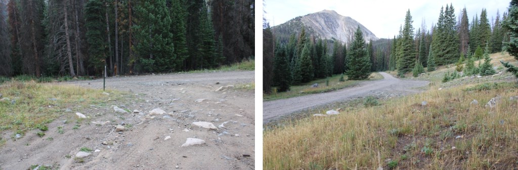
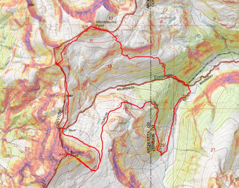
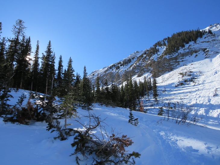
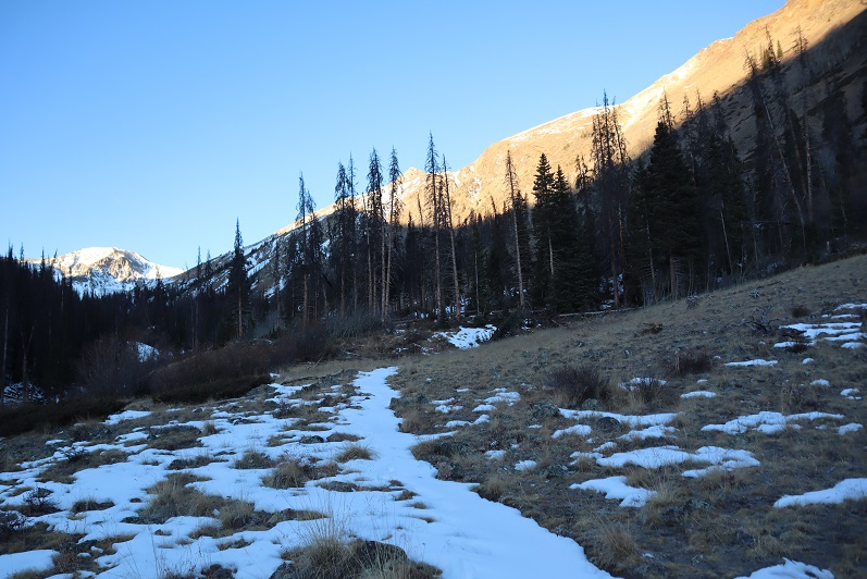
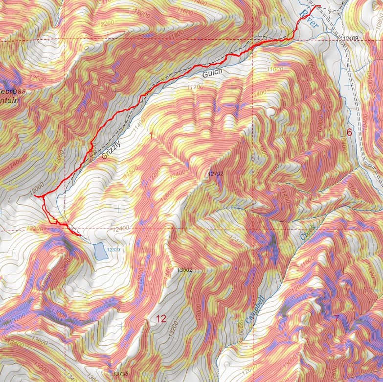
I’d parked about 6 miles past Cottonwood Lake, at the junction of 344/349. There are a few dispersed campsites in the area, and a few further up as well. I was up and on the trail at 4:45am, hoping this would be a quick hike because I had other things to do this afternoon.
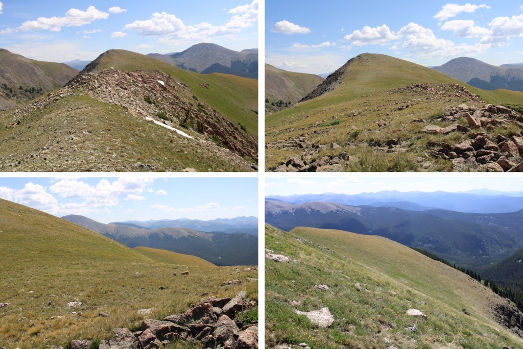
The trail starts by following 4WD road 349. It’s a narrow 4WD road, but if your vehicle made it this far, it can make it all the way to the top of the road
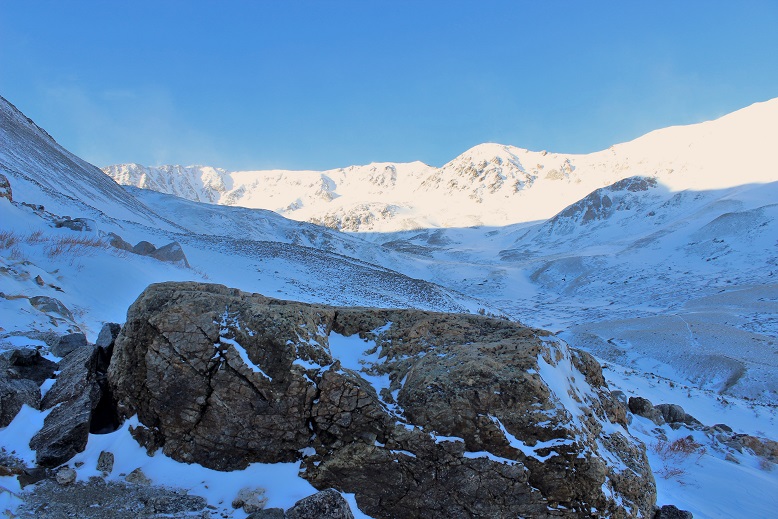
I followed the road for 2.3 miles, up to about 12,330’.
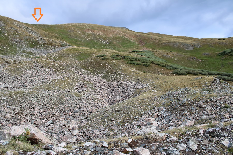
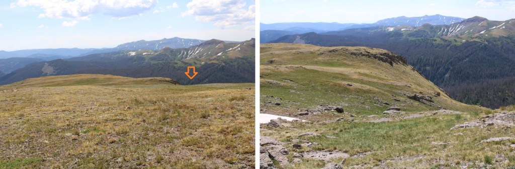
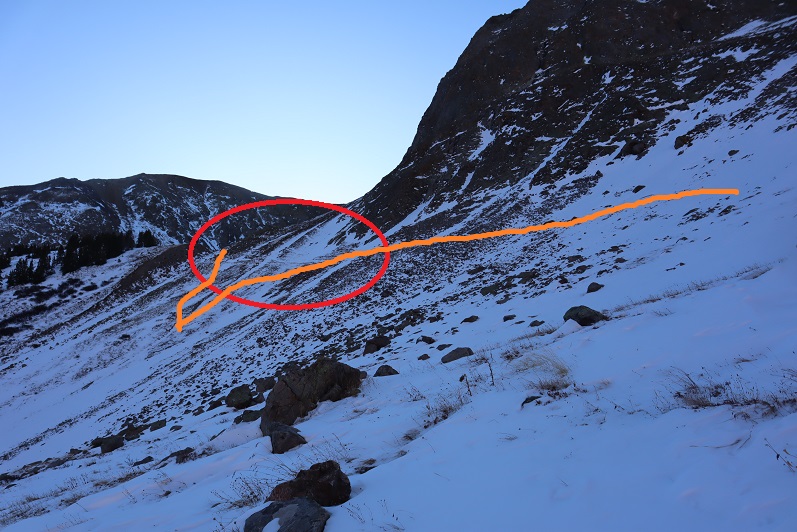
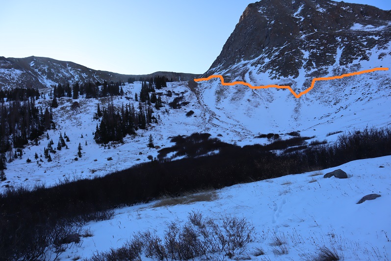
I didn’t know it at the time, as it was still dark, but I could have taken the road all the way up to the ridge, and then taken the ridge to the summit, which would have been easier. I’ll have pictures of that route on the way back down. Here’s where the road goes to:
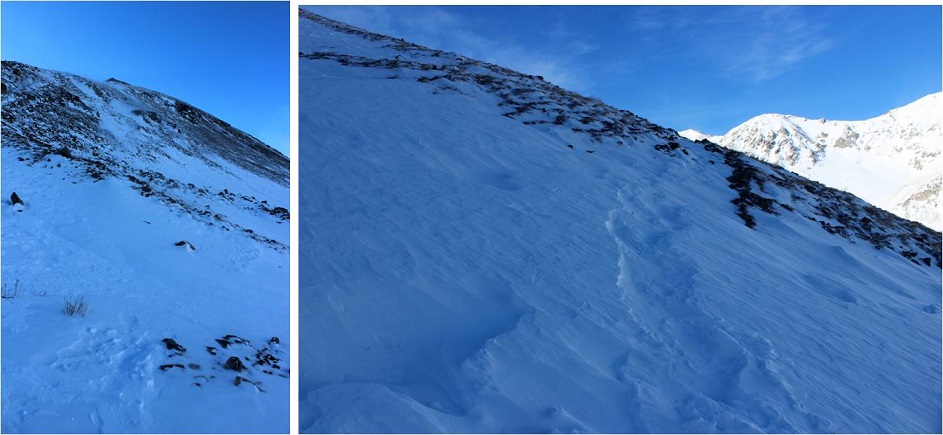
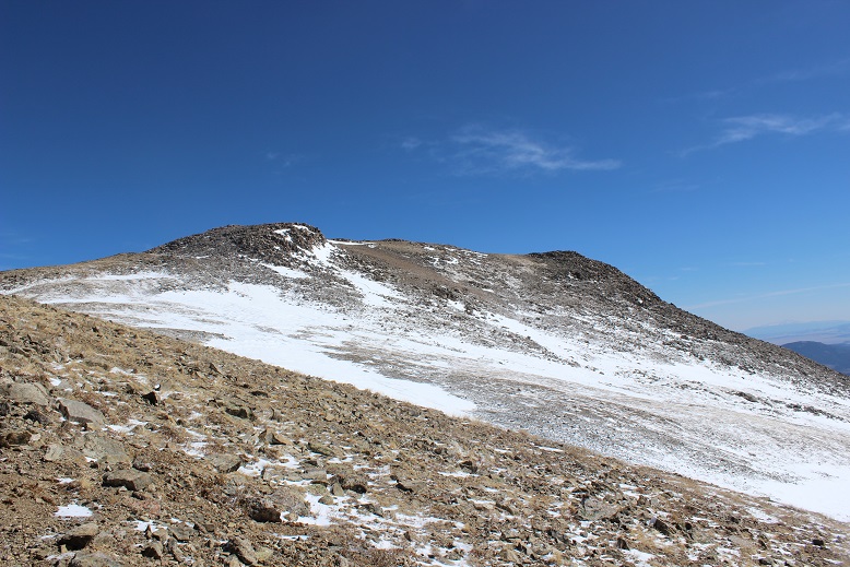
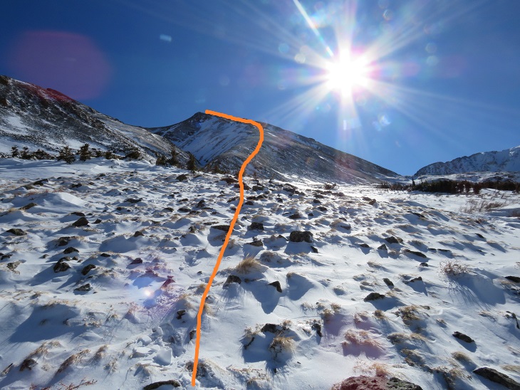
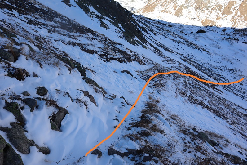
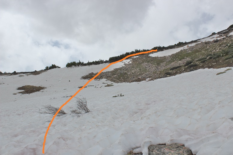
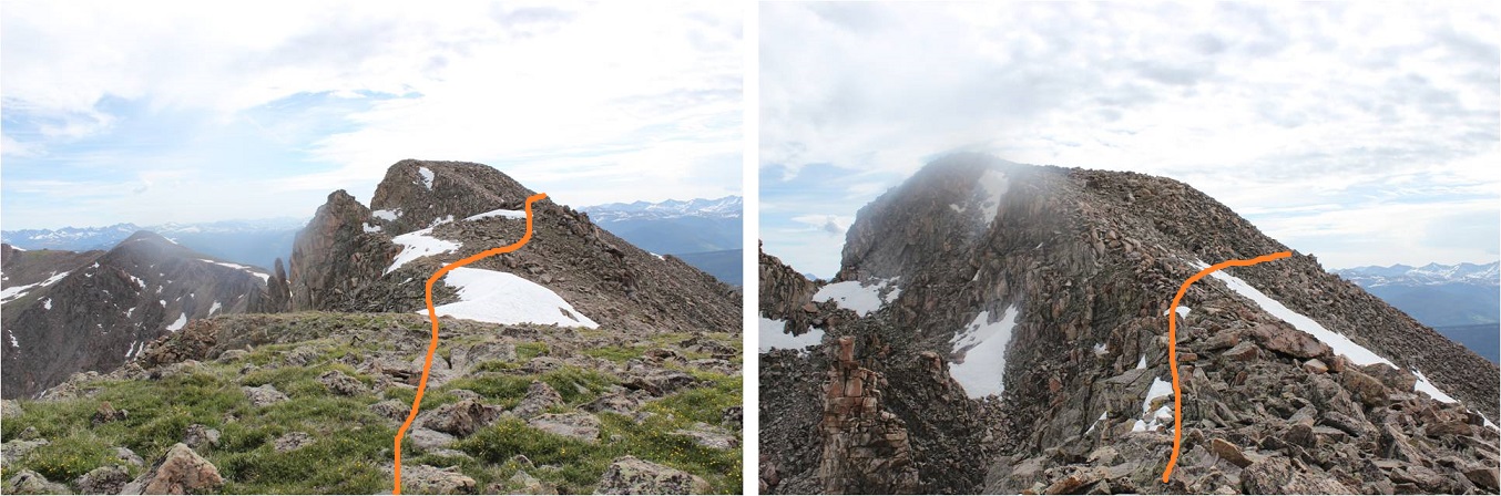
Anyway, I didn’t take the road up, instead, I decided to gain the ridge here
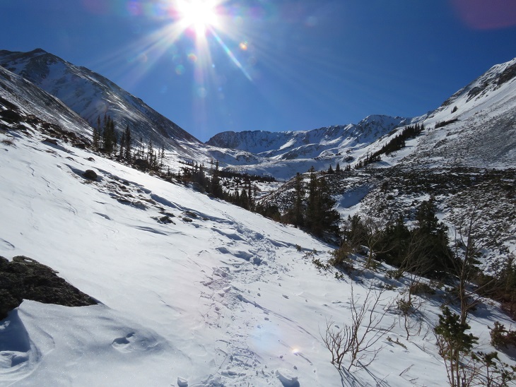
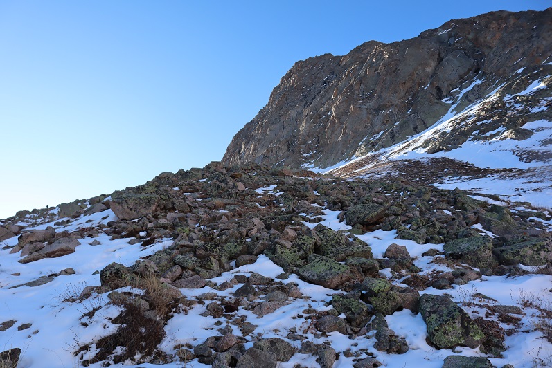
This route was very straightforward
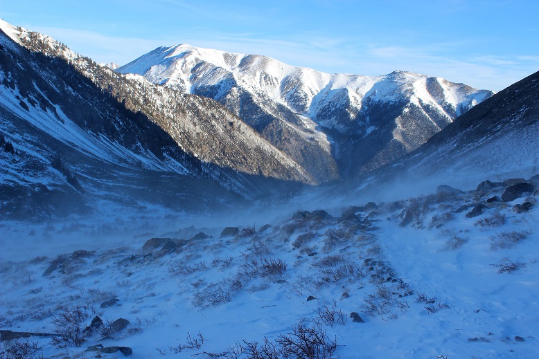
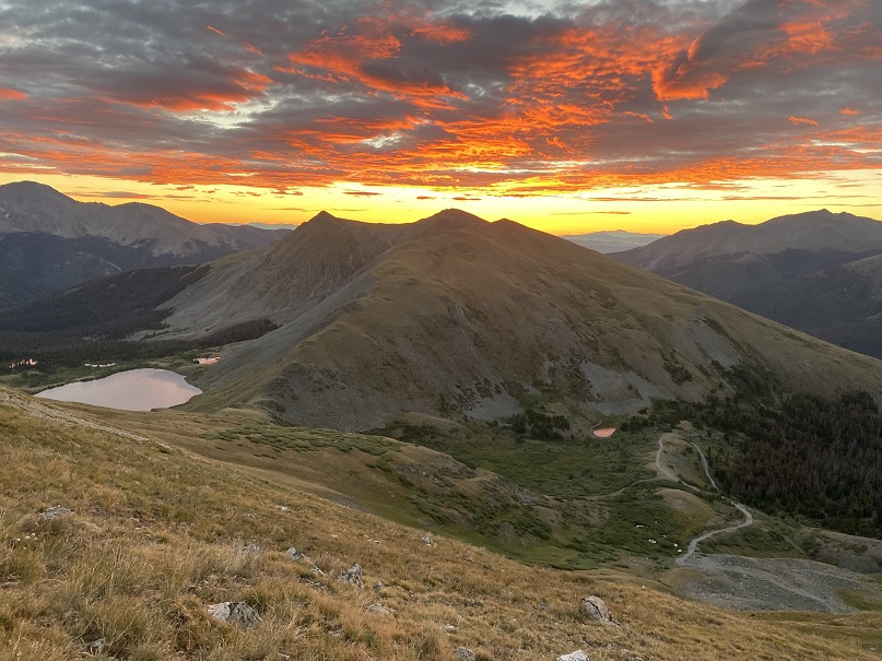
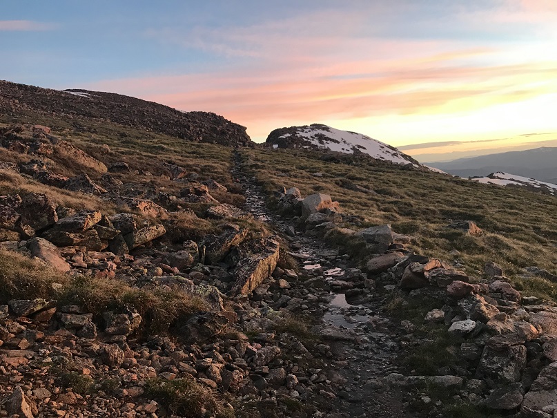
I also got to see a beautiful sunrise
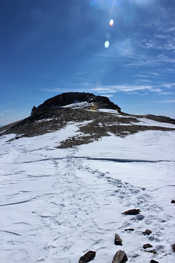
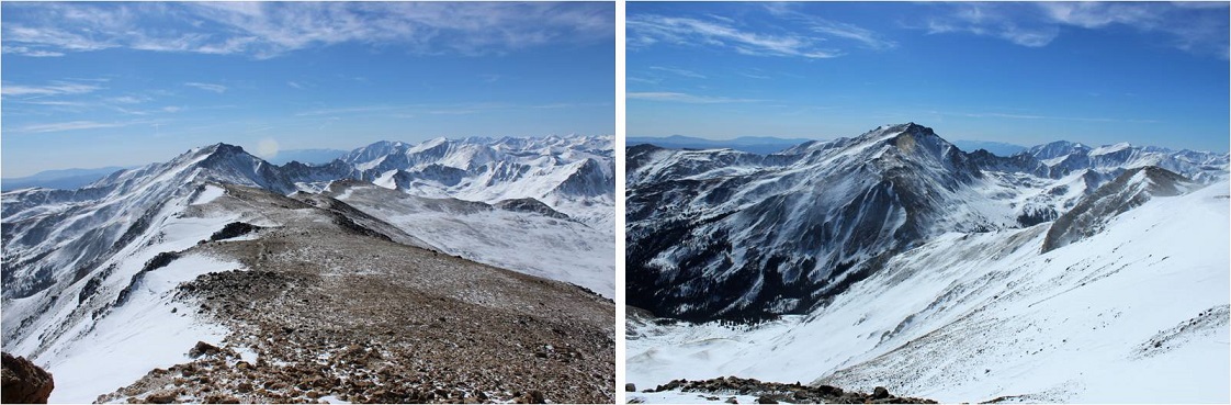
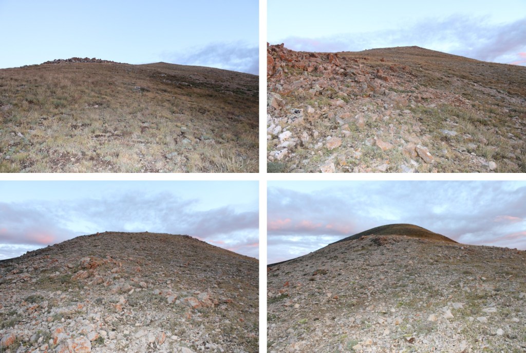
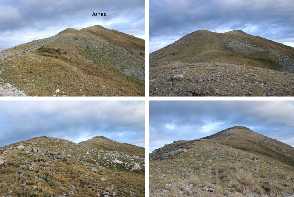
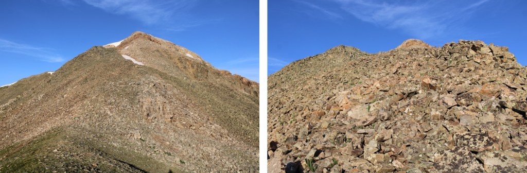
From the I turned right and followed the ridge northeast. From the ridge it was a short .25 mile hike to the summit.
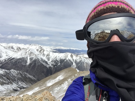
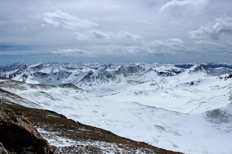
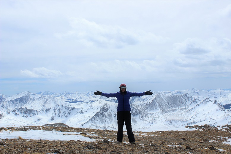
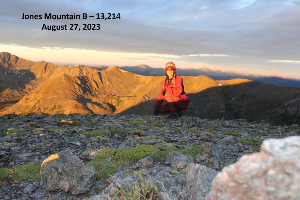
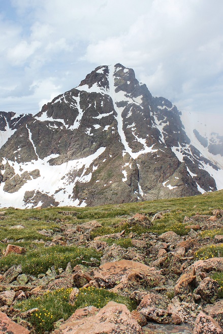
I summited Jones Mountain B at 6:30am
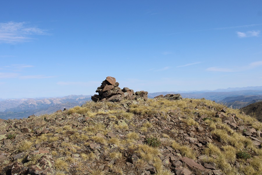
Jones Mountain B:
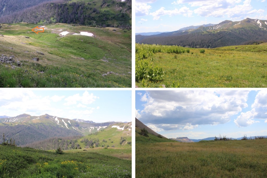
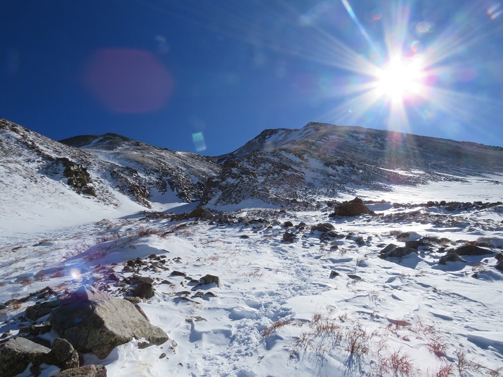
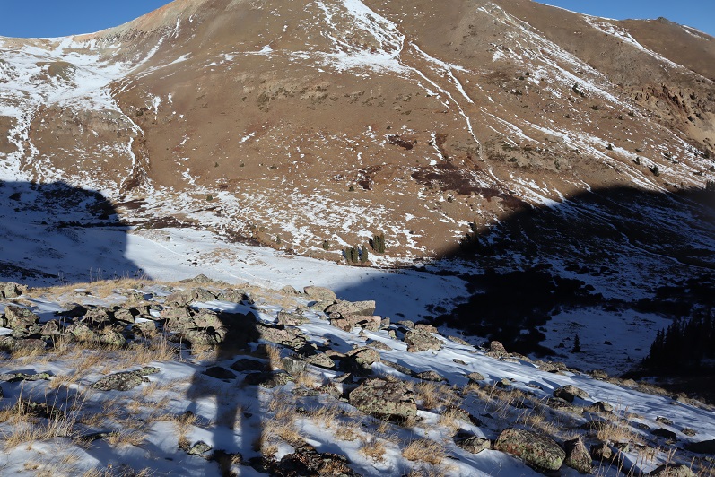
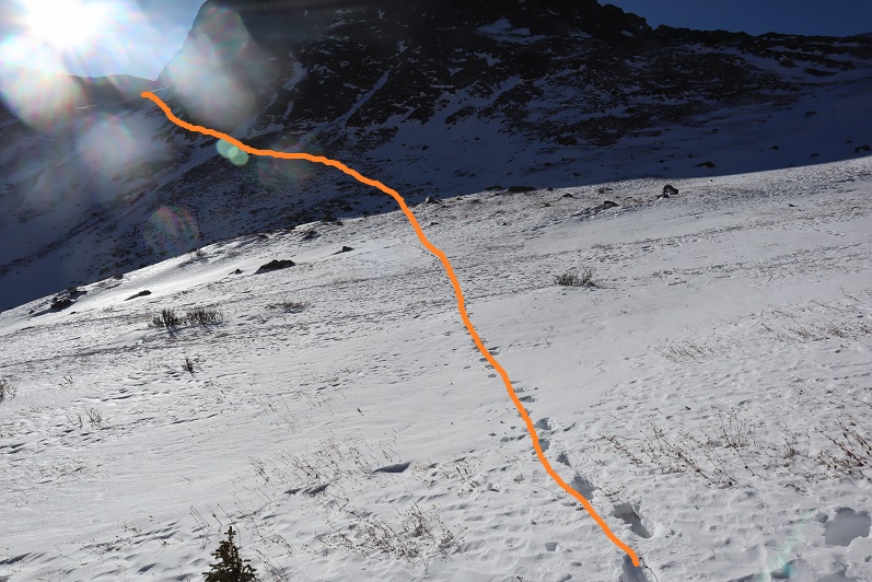
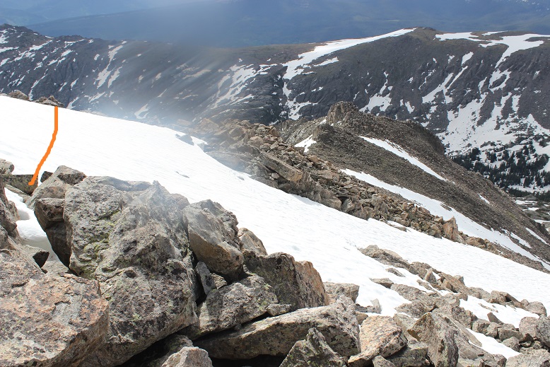
It was rather cold and windy on the summit, making it feel like fall. I turned around and, in the daylight, noticed the road I’d hiked in on went all the way to the ridge, so I followed the ridge southeast back to the road.
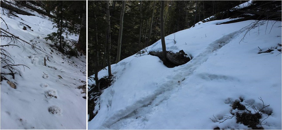
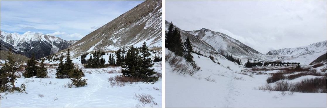
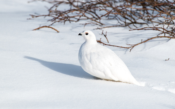
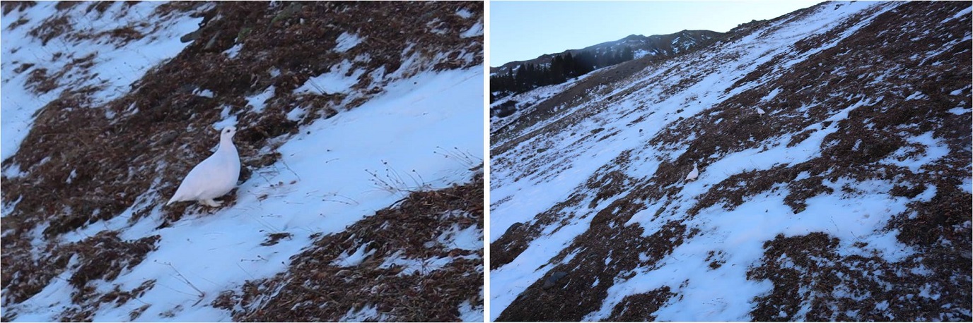
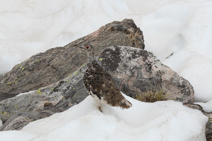
Some ptarmigans overlooking Ptarmigan Lake
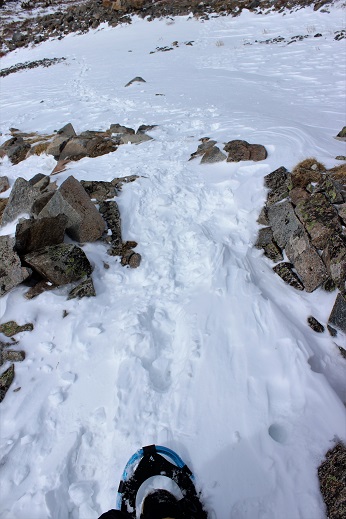
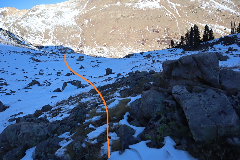
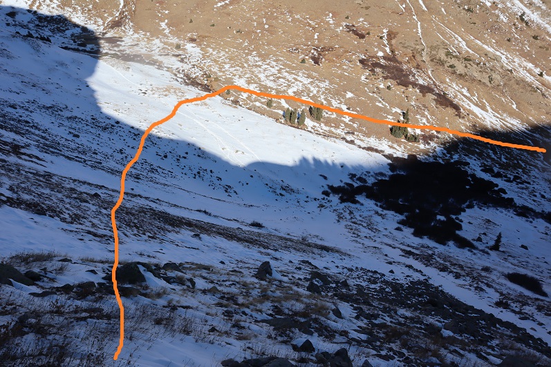
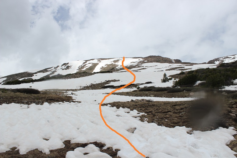
Here’s the route up the ridge from where the ridge meets the road
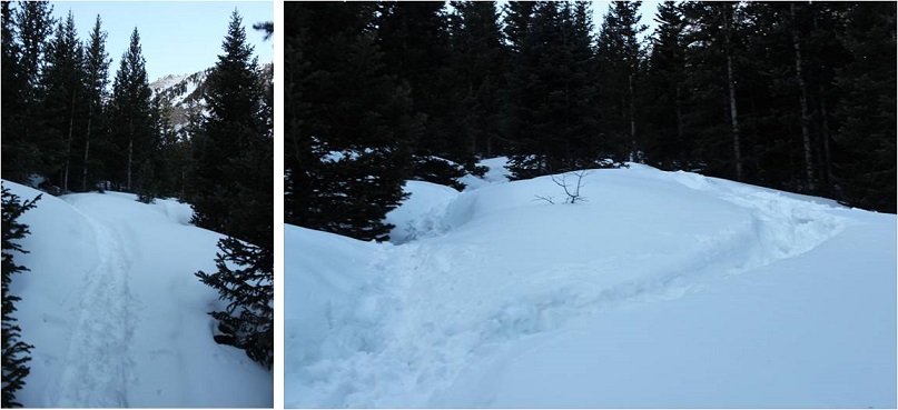
Back on road 349, I followed it all the way back down to road 344
I made it back to my truck at 7:45am, making this a 6.04 mile hike with 2361’ of elevation gain in 3 hours.
Now it’s time to head back home to harvest a couple hundred apples from the tree in my backyard before the thunderstorms hit for the day.
I parked the night before at the Summit Peak Trailhead and had the whole place to myself until I left the next day.
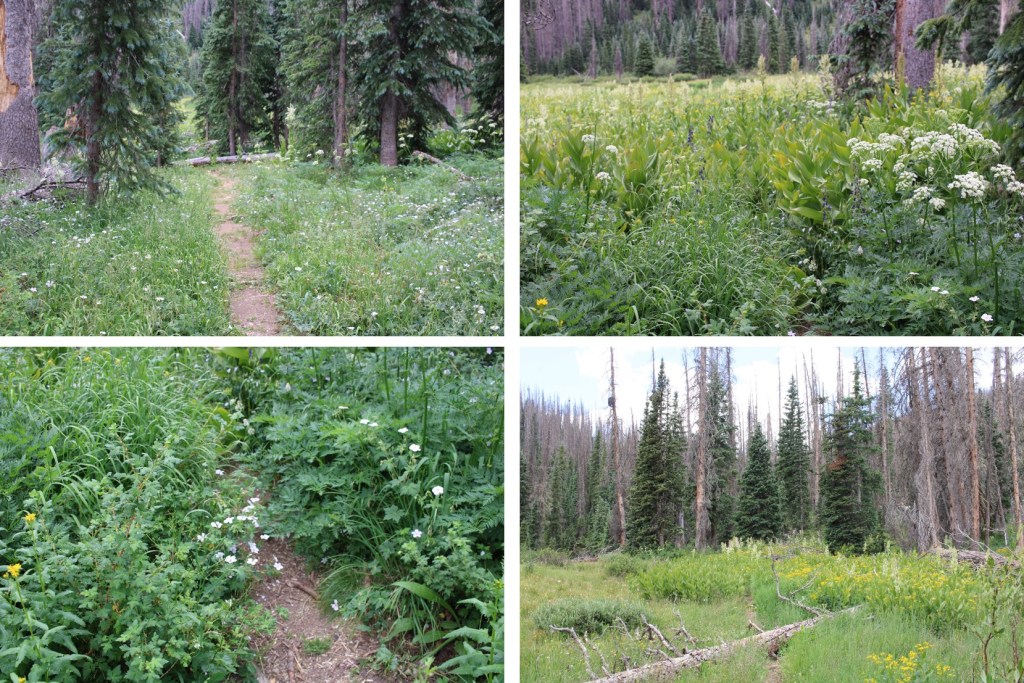
The 2WD dirt road in is in good condition, with plenty of areas to pass other vehicles. I got plenty of sleep, and was on the trail at 5am the next morning. I figured this trail would be easier to take clockwise, as in the dark it would start on an actual trail. This was good thinking, but the ‘trail’ was more of a game trail that I lost and found repeatedly. After the hike was over, I concluded this would still be the better way to go, and you’ll see why later. The trail starts at the south end of the parking area, immediately crossing a bridge over Treasure Creek and following Treasure Creek Trail 710.
The trail quickly went through a flower filled meadow, and then headed south, through an open gate and open meadow. Here the trail was easy to follow, even in the dark.
After hiking for 1.3 miles, I came to a cairn, turned right, and headed north up what was supposed to be Treasure Creek Trail. It was a faint trail for a bit, but it was easy to lose.
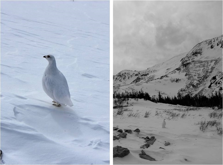
As I was hiking on this trail, I came across a rather fluffy ptarmigan. In fact, I almost stepped on her, and would have if I’d already put my flashlight away. I stopped for a second, and told her she could stay put and cover her babies if I could go around her. As soon as I said this she exploded. She jumped up into the air, and no less than 12 ptarmigan chicks cascaded out in all directions. A feather bomb had gone off, and I felt bad for her. A few seconds later I could hear her calling to the chicks, and watched them all make their way back to her. Sorry mama, but nesting in the middle of a trail, even a small trail, is a bad idea.
I continued through a faint trail that at times was a great trail, littered with flowers and pine trees
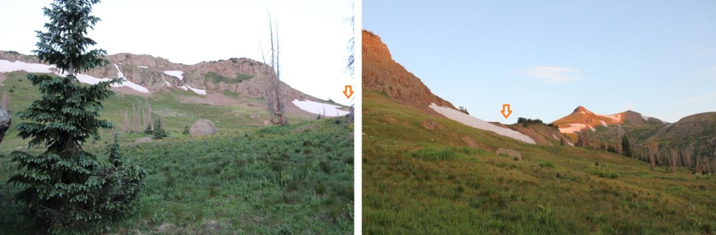
At 11600’ I turned left again, and headed west to treeline, still following a ‘trail’. I was headed to the right. (Both arrows point to the same place)
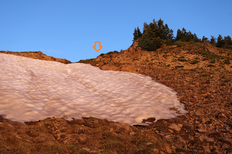
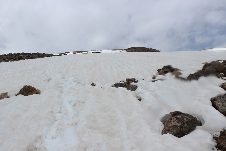
This was easy to ascend, and the snow avoidable
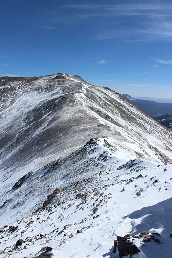
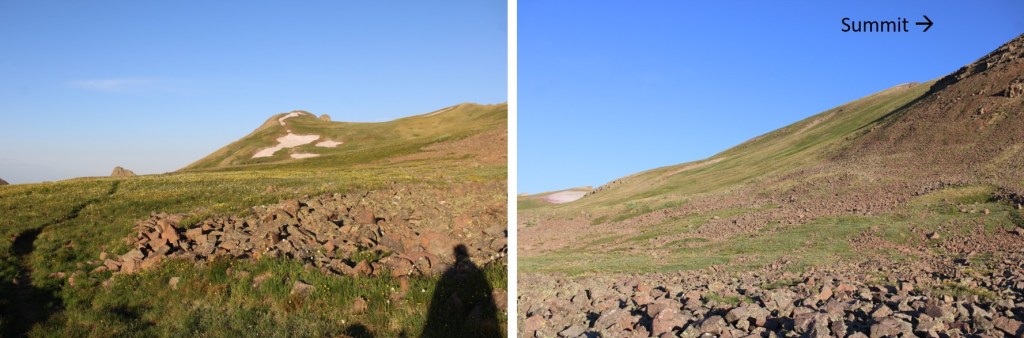
After ascending, a fairly decent trail led me south, towards the Continental Divide Trail, which skirted the south side of Summit Peak
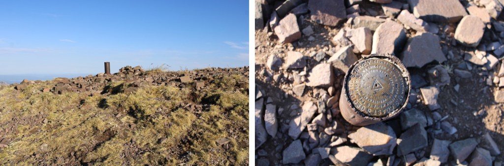
From here it was a steep tundra hike to the summit. This is choose your own adventure, without many obstacles. This is the route I took.
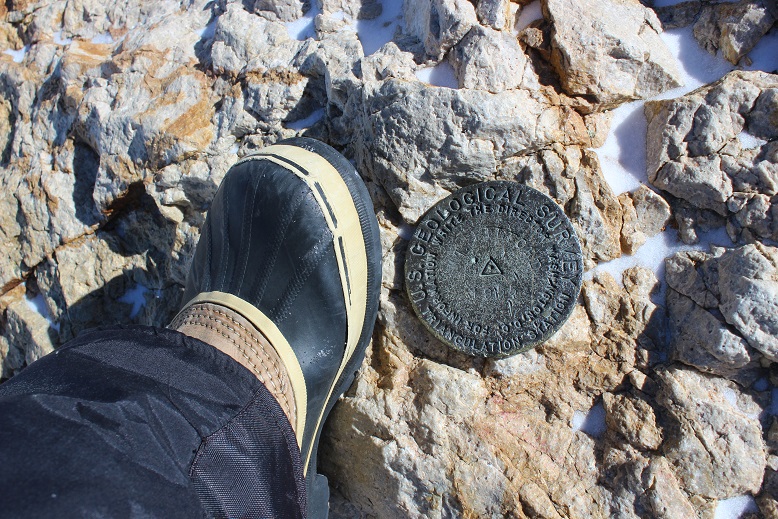
There was as summit marker at the top
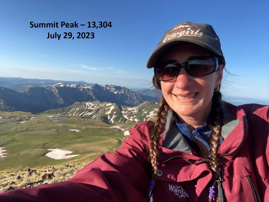
I summited Summit Peak at 7:30am
Summit Peak:
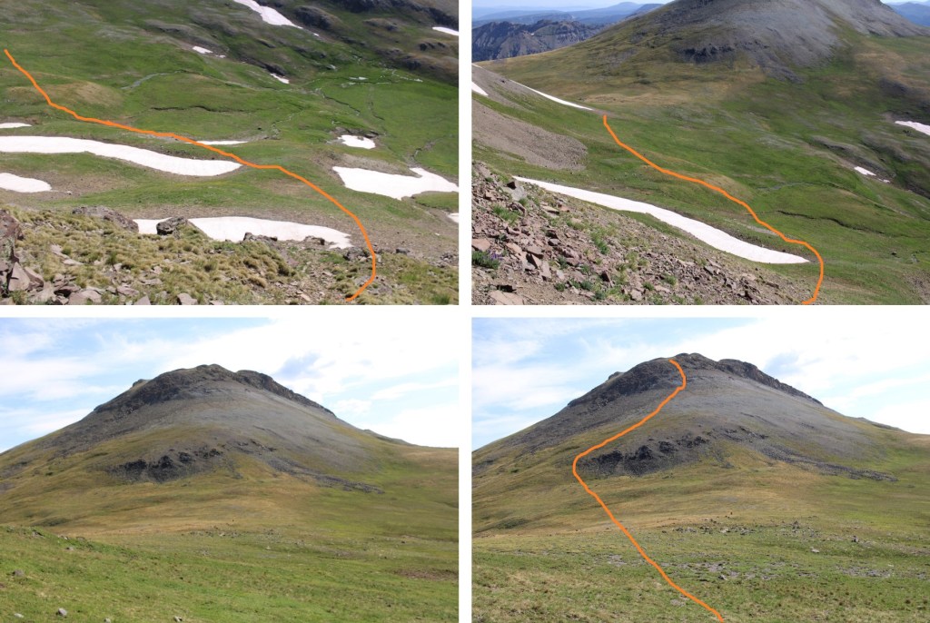
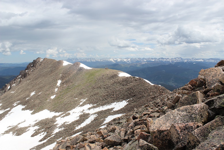
From the Summit I could see The Unicorn and Montezuma to the north
It was a beautiful day on the summit, and there was cell reception, so I spent some time there before turning around and heading back to the Continental Divide Trail. The route back down was straightforward
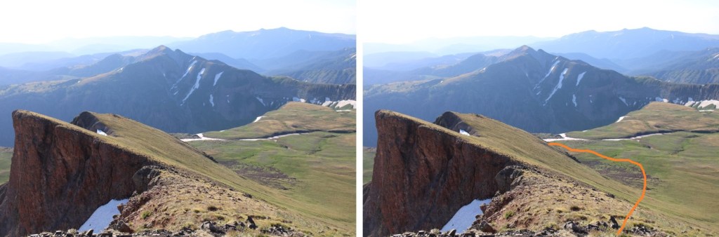
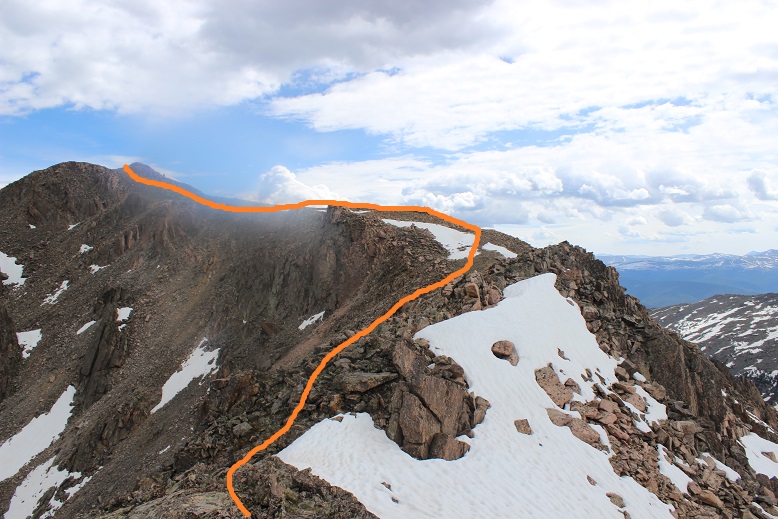
Back on the Continental Divide Trail, I followed it around the north side of Summit Peak. There were trail markers to show the way, which was a good thing because the trail was faint
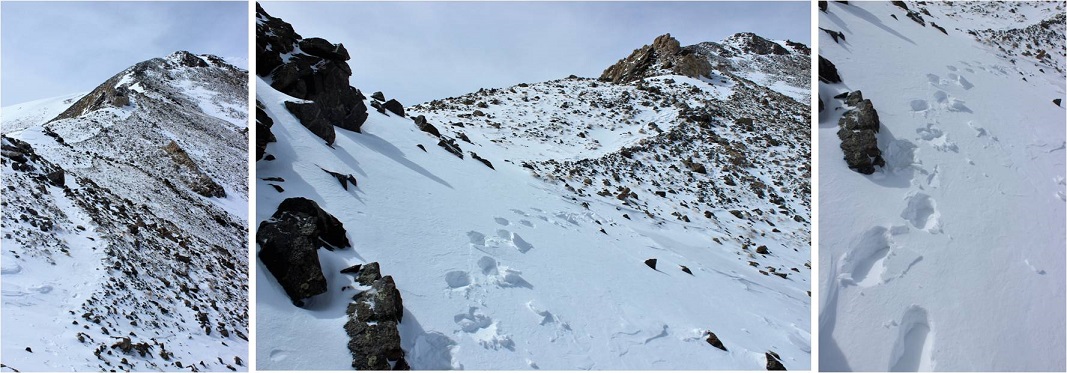
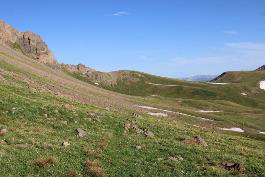
Here’s an overall look at the route to The Unicorn. There was snow on the trail in places, and it was curious there wasn’t a trenched trail over the snow, considering this is the Continental Divide Trail, and I’m sure tons of others must have been through this area already this year.
And some step-by-step pictures.
As I was doing this traverse, I could hear, but not see a herd of elk. I wasn’t sure where they were in the basin, but they sure were being loud, so I figured there were a couple dozen of them. Here I left the trail, and it became a class 2 hike, with just a short section (no more than 10 feet) of easy class 3 climbing up a sort of chimney.
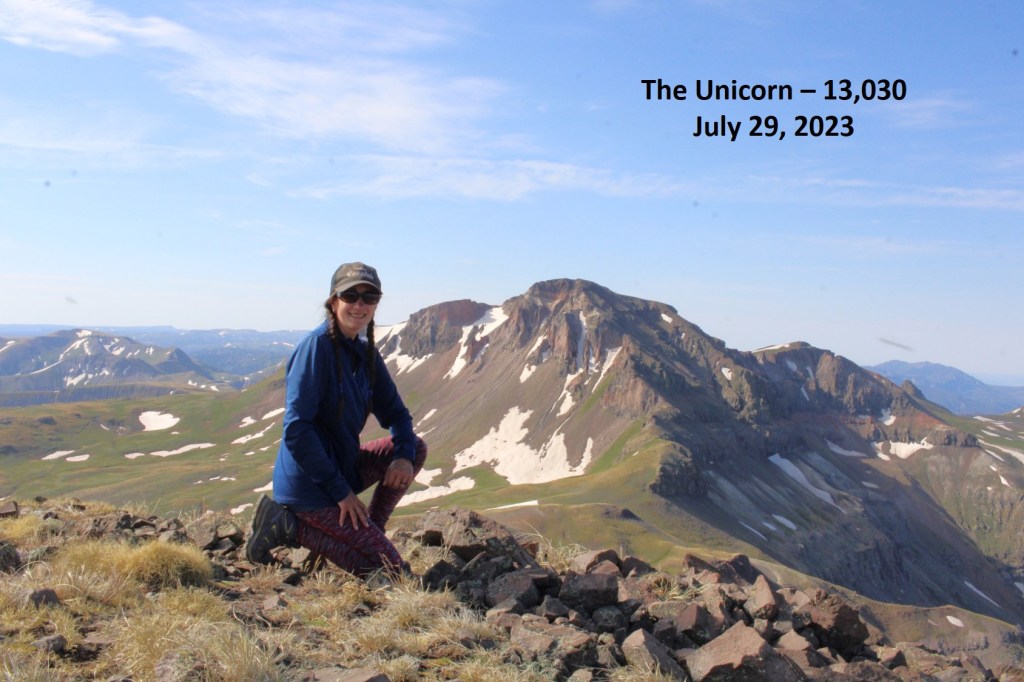
I summited The Unicorn at 9am
The Unicorn:
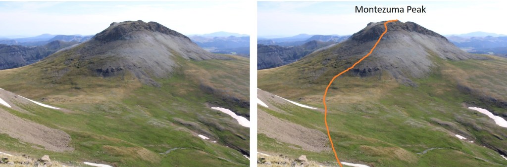
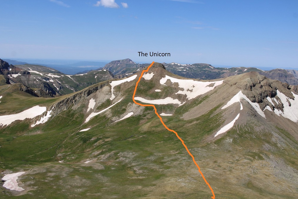
To the northeast I could see Montezuma Peak. This was my overall route to get there. It was all class 2, except for a brief period of class 2+ scree as I ascended the ridge.
This is also a good view of how I descended from Montezuma and made it back to the trailhead
I descended the short chimney
And then I headed northeast, towards Montezuma, being careful to avoid the snow fields in the way
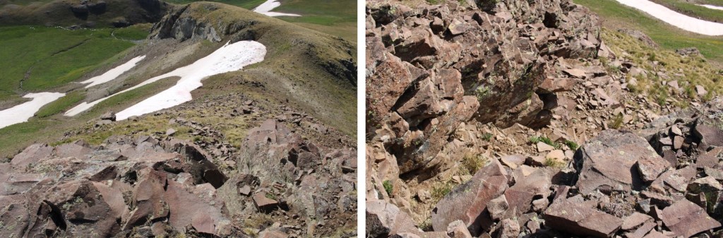
And now to climb the west face of Montezuma. It was steep, but mostly class 2 until just before gaining the ridge, where it was 2+, and choose your own adventure on the scree/talus.
After gaining the ridge I turned right, and headed east towards the summit of Montezuma
I summited Montezuma Peak at 10am
Montezuma Peak:
Here’s looking back at the route from The Unicorn to Montezuma
There were a ton of bees at the summit, so I didn’t stay long. I turned and headed east, down the ridge. This is a class 2 ridge (seriously). I just stuck to the ridge proper and had no trouble descending. Here’s my overall route down the ridge
Then I headed southeast
I planned on descending this grassy gully
As I was descending, I finally saw the herd of elk I’d heard earlier in the day. I sat on a rock for 10 minutes, just enjoying watching them. Some were resting in a circle, others were grazing, and two mamas were watching their babies enjoying a patch of snow. I hated to disturb them, but I had to get going. As soon as the wind shifted, they could smell me, and they were off. There were tons of signs they’d bedded down for at least a few nights there in the past few days.
Elk:
Once they were off I continued descending. When I made it to the bottom of the gully I turned left, and headed east along the plateau
At the end of the plateau, when I came to the trees, I turned right and descended south towards the creek. This was a lot of bushwhacking through downed trees and flowers and grasses that were as tall as I am, but I just aimed for the creek.
When I reached the creek, I stayed about 30 feet from it’s banks, and followed it (and game trails) southeast back to the trailhead. It’s important to stay above the creek because there are waterfalls to avoid.
I made it back to my truck at 11:30am, making this a 10.18 mile hike with 3534’ of elevation gain in 6.5 hours.
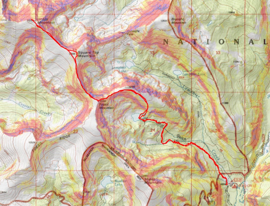
I started from Gold Creek Campground outside of Ohio City. The road in was an easy 2WD dirt road, that led me to a dispersed campground maintained by volunteers. There are about 5 sites, with vaulted toilets. I didn’t feel right using the empty campsites, as I wasn’t really camping, but sleeping in the back of my truck, so I parked at a dispersed site directly across the road, near the trailhead, at about 10,050’. Also, it was quieter, as a family with two small children and rather loud dog were staying in the campground. There was a makeshift corral for horses there as well.
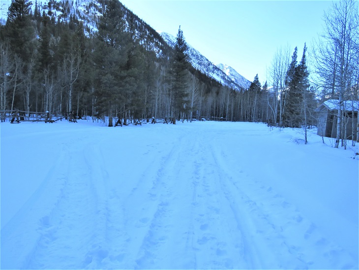
I was on the trail at 5am the next morning. The trail starts at the north end of the camping area.
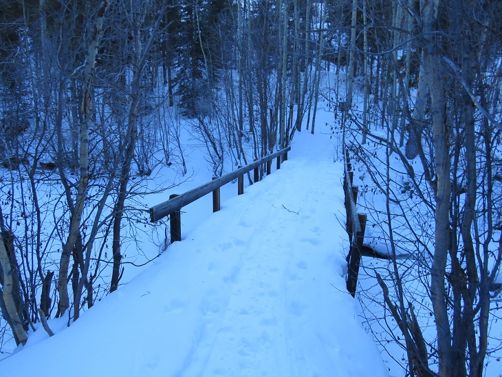
I followed Trail 532 northwest for 2.5 miles to Mill Lake. This is an easy to follow, class 1 trail the entire way to the lake.
There is one junction early on that isn’t on a topo map, but it’s well marked. Just keep going towards Mill Lake.
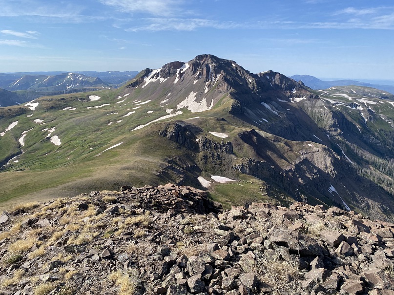
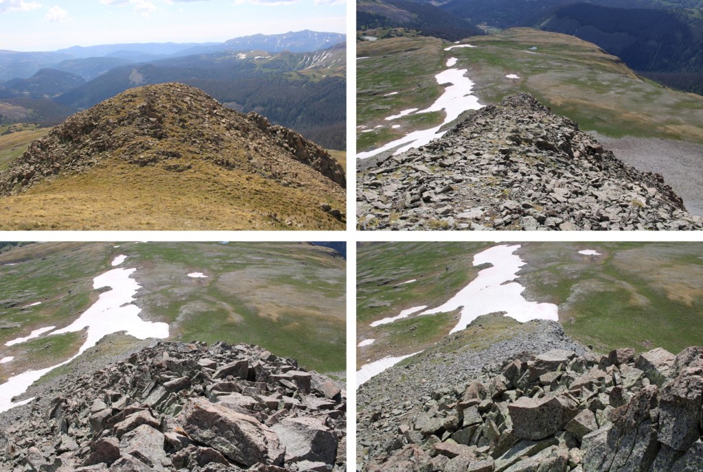
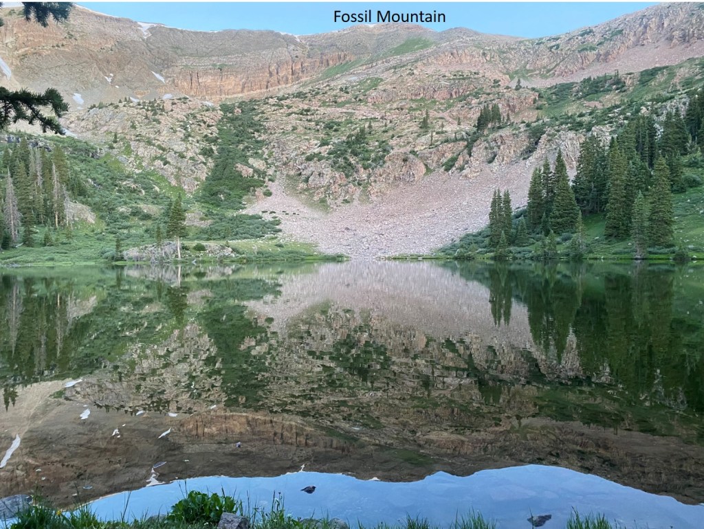
At Mill Lake you can clearly see Fossil Mountain. The easiest way to get there is to turn right, and head northeast through the trees until you see the ridge. It’s a short (100 yards at most) hike to get there, and the bushwhacking is easy.
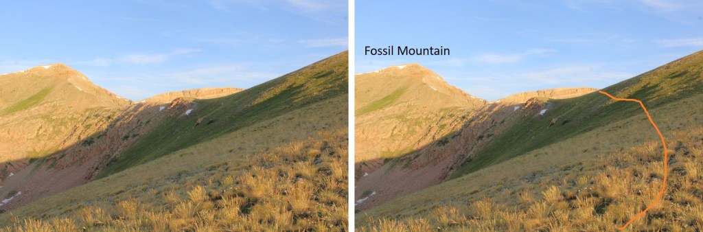
The route will be easily visible. There are rock ledges if you go to far left or right. You want to take the tundra northeast until you make it to the ridge, and then turn left and follow the ridge west. Here I gained 850’ of elevation in .75 miles
Here’s looking at the last bit of the route to the ridge. There’s no need to hike all the way to the top of this little bump in the ridge, as it isn’t ranked. I skirted it and headed towards Fossil Mountain.
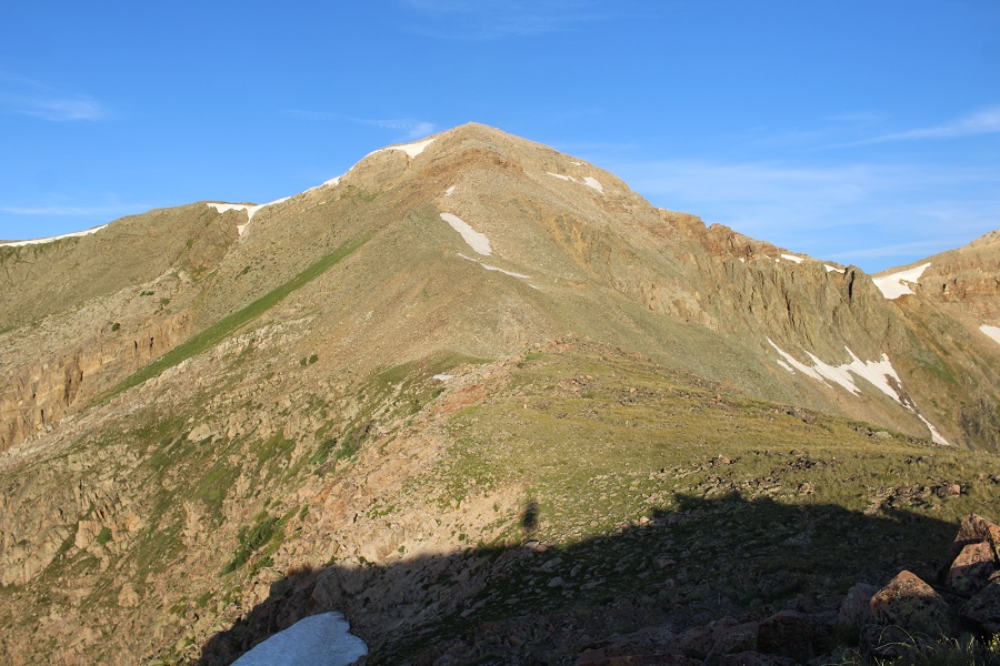
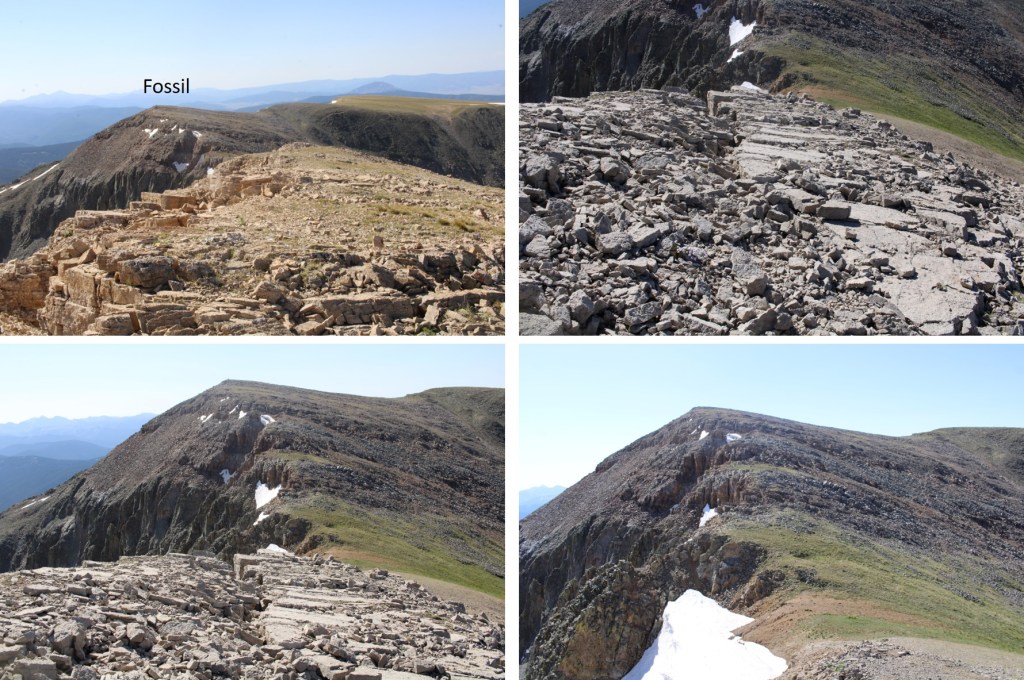
Now the hike became fun. The ridge goes at a class 2 scramble until the base of Fossil Mountain, then becomes an easy class 3 scramble to the summit.
Here’s the overall route I took
And some step-by-step pictures
I went straight up and over this large rock formation. It was easy class 3. You can go to the right to get around it, but you’ll be met with loose talus and a gully.
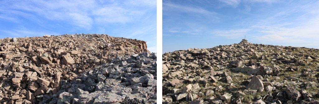
I summited unranked Fossil Mountain at 7am
Fossil Mountain:
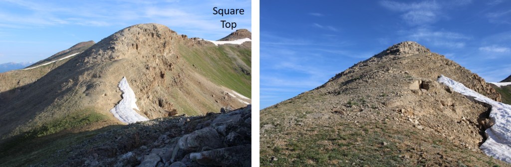
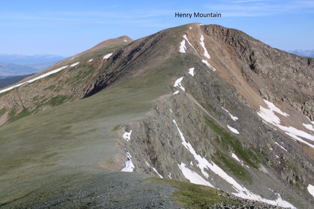
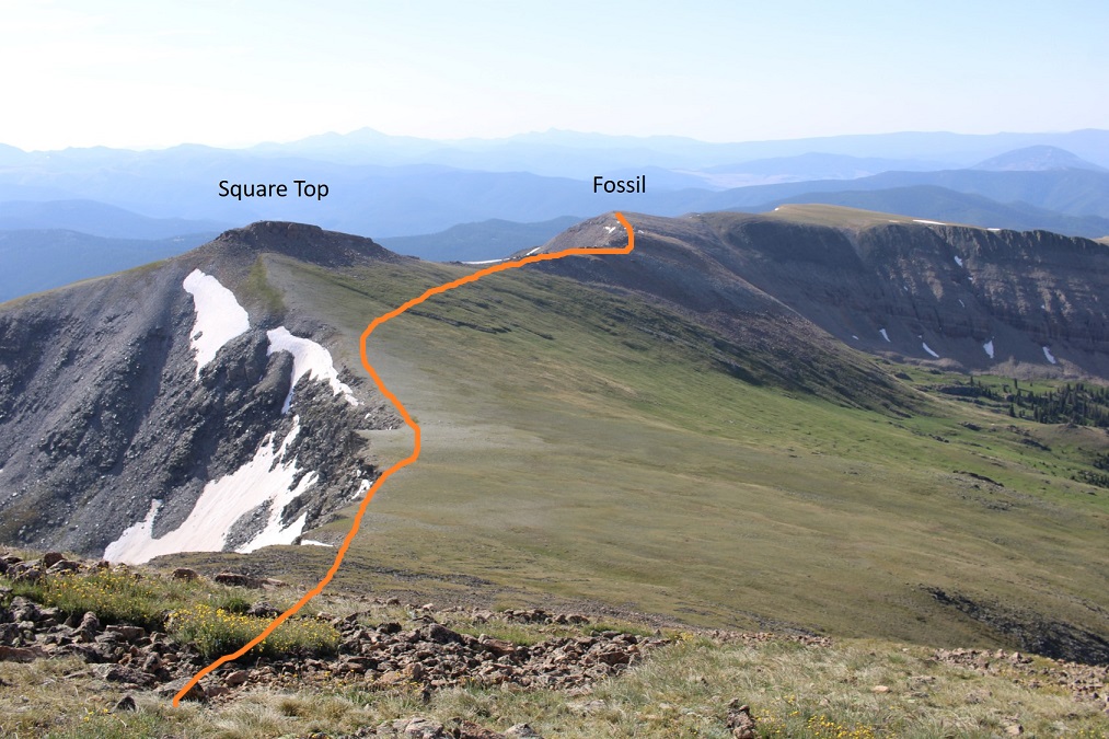
From the summit of Fossil Mountain, looking to the northeast you can see the other two peaks I was headed for today, Square Top Mountain (unranked), and Henry Mountain
It was a straightforward ridge hike to get to Square Top Mountain, where I pretty much stayed on the ridge. There were some easy class 3 moves, and at times I needed to dip to the left or right. The rock is very loose in areas, and very stable in others, so basically it keeps you on your toes. I lost about 180’ of elevation going to the Fossil/Square Top saddle. Here are some pictures of the ridge to Square Top Mountain.
From the saddle, here’s looking up at the path towards Square Top. The first half was on tundra, and then the rocks began
It was here I noticed a small herd of elk. I stayed where I was until they noticed me, then watched them watch me as they ran away.
Check out the herd of elk:
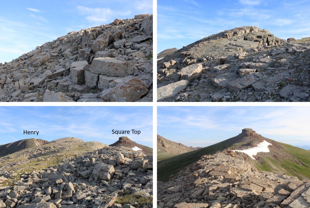
Ok, continuing with the ridge. This part looked difficult, but I found it was easy class 3 if I just kept to the ridge.
Now to summit Square Top Mountain. This was relatively simple, as there were several options. I went up the gully nearest me (and down the one on the other side). The rocks here were loose, but the angle was light.
After ascending the gully, I turned left and easily walked to the summit
I summited Square Top Mountain at 8am
Square Top Mountain:
Looking to the northwest I could see Henry Mountain
I descended Square Top Mountain to the northwest, and hiked on tundra to the summit of Henry. There were some very faint fame trails here I utilized.
As I came to the top of the ridge, I was greeted by 4 mountain moats. Usually, mountain goats are pretty tame and just watch me. These ones did for a while, but as soon as I got out my camera and they could hear the shutter snap, they took off. Well, three of them did, the other one stood and looked like he was ready to fight, but then turned and followed the others
The summit of Henry Mountain is to the northwest, so I headed northwest towards the obvious highpoint on more tundra
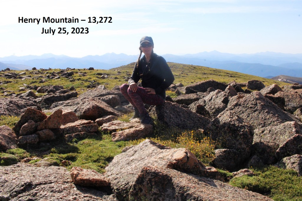
I summited Henry Mountain at 8:40am
Henry Mountain:
This was an out and back hike for me, so I turned around and retraced my steps back to Fossil Mountain
Here’s the overall route I took, skirting Square Top this time
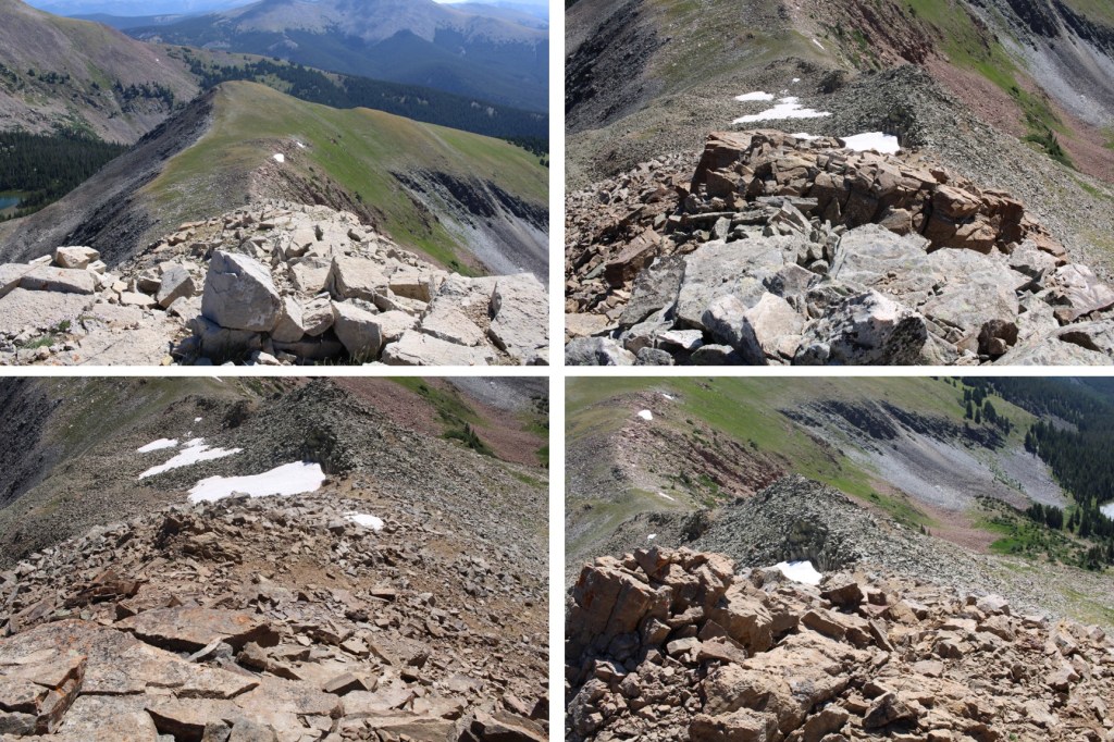
And some pictures of that rocky ridge between Square Top and Fossil
Then down to the Fossil/Square Top saddle
And up the ridge, back to the summit of Fossil. This part was class 2
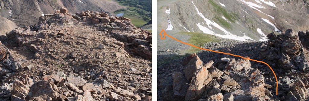
At the summit of Fossil Mountain I was greeted to 4 ptarmigans on the summit cairn. They actually led me for a bit down the trail.
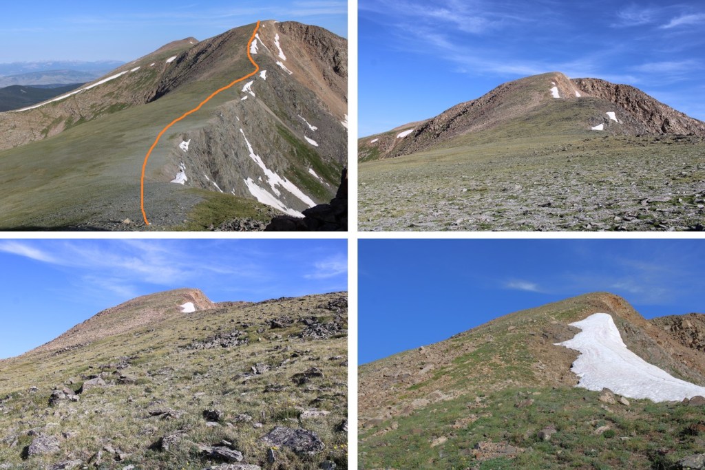
I descended Fossil Mountain to the northeast, staying directly on the ridge. Here’s the overall route. Note where I entered/exited the trees, as it kept me on tundra and avoided the rocky sections and brought me back to Mill Lake.
Here’s looking at that easy class 3 section down the ridge. Once again, I stayed directly on the ridge and kept it easy class 3
Then back towards the tundra
As soon as I came to the first group of trees on the tundra I turned right, and headed down towards the lake
After a quick bushwhack in the trees, I could see the lake and a trail below
I followed the trail around the east side of the lake, back to Trail 532, and then followed that trail back to the trailhead
I made it back to my truck at noon, making this a 10.96 mile hike with 3927’ of elevation gain in 5 hours. Please, note, I spent a lot of time admiring the wildlife and looking for cool rocks.
The last 3 miles to the Missouri Gulch trailhead were terrible! So bad I asked SkydiverHiker to drive. We were sliding in the ruts and eventually found a turnout about .7 miles from the trailhead and stopped there. This ended up being a fabulous idea, since the trailhead was too covered in snow to park. It looked like someone had tried and it took them quite a while to get out. This is the road to where we parked (easy until the plowing stopped)
Parking further away changed our plans a little, as it added an hour onto our trip. We decided we’d probably just hike Mt Belford today, and leave Oxford for another day. We were on the trail at 5:15am. Here’s a look at the Missouri Gulch Trailhead Parking area
We crossed clear creek and started ascending the side of the mountain wearing microspikes. We saw some elk tracks here, but luckily, no mountain lion tracks this time.
Once in the avalanche area the trench stopped. We crossed the drainage on some sketchy, snow covered logs
Then stopped for a bit to put on our snowshoes. These pictures were taken later in the day on our way back down, so you can see the trench. We put that trench in! I’ve done this hike several times, so I knew to aim for the trees, heading south
Once in the trees the trench picked up again until the cabin
Once past the cabin the trench stopped again. The wind in the gulch is fierce and I’m sure blows away trenches nightly that are made during the day. No worries though, we just headed through the gulch (still wearing our snowshoes) towards Mt Belford’s Northwest Ridge
As we were trying (unsuccessfully) to avoid the willows, I heard ptarmigans chirping, but couldn’t see them. Then, all of the sudden, a ptarmigan busted out from under the snow and walked away. It was here I learned ptarmigans huddle near the willows and stay in their air pockets when it snows to stay warm. They can do this for days, as their food source is under the snow as well. It was so cool to hear them calling to each other throughout the day!
We continued through the basin, only taking our snowshoes off once we reached the ridge. From here we followed the ridge to the summit.
I’m making this sound MUCH easier than it was. This is probably one of my most difficult winter summits to date. With my Raynaud’s I need to keep moving to stay warm, and while SkydiverHiker was doing an excellent job keeping up, we still stopped more than my body would have liked. In fact, about halfway up the ridge I was seriously thinking about turning back: my fingers and toes were burning and the wind was more intense than predicted. With windchill it was at least -20 degrees. We discussed turning back, and decided to continue on (Skydiver Hiker needed a ‘win’ today, and I wouldn’t let him go on without me). SkydiverHiker dropped his and we continued on up the ridge. I continued with my pack because I had an ice axe and essential gear. This continuing on included a lot of intense feelings and emotions, and there was some crying involved and also some nausea. Have you ever hurt so much you felt nauseous? Both SkydiverHiker and I felt that way today. But at least the pain told me I hadn’t lost anything to frostbite. While mountaineering is certainly physical, it’s emotional and a mind game you play with yourself as well. I felt as if I were dying every step of the way, not because I was tired, but because I felt my fingers and toes were on fire. I was dry sobbing at times.
We trudged to the top, where my camera stopped working (I really need to find a better cold-weather camera) so the photos we have are SkydiverHikers from his phone. About 20 yards from the summit SkydiverHiker laid down and didn’t want to get up. I didn’t know this, but his back had been really, really hurting him. This laying down right now was (of course) unacceptable, so I made him get up and lead the way to the summit.
We didn’t stay long, just long enough to get a photo of the summit marker, and then we were on our way back down.
Let me pause here to show you the great views of Missouri Mountain
The screaming and crying continued until we made it to where we were hiking in sunlight, near the base of the ridge. It’s amazing how the warmth of the sun made me feel better, even when it was still well below freezing. Once at the base of the ridge we donned our snowshoes once again and headed back out of the gulch, following our morning trail.
As we warmed up our spirits lifted and we were once again thrilled to be out here hiking. This is one of the most beautiful places in Colorado to hike, and we had it all to ourselves. Well, it was us and the chirping ptarmigans. We hiked back past the cabin and through the avalanche area, took off our snowshoes, and continued back to the trailhead in better spirits. Yes, this is a mental game.
We made it back to the truck at 1:15pm, making this an 11.15 mile hike with 4764’ of elevation gain in 8 hours.
Note: My successful summit of this peak can be found here.
I never should have attempted this hike today, but the weather was clear and my beta told me the mountains in this area were snow free. There are so many 13ers in the San Juans I wanted to knock another one out before the snow sets in again. As I was leaving the house around midnight my daughter asked me if I’d take her to the school musical that night at 7pm. I did some mental math and figured I’d have plenty of time to climb this 7.5 mile peak and be back in time to take her to see the musical.
I drove in the dark to the Grizzly Gulch trailhead, a little surprised to see so much ice on the 2WD dirt road in
There was one other vehicle in the lot when I arrived. I’m guessing they were headed to Redcloud/Sunshine today. Last time I was here I’d had a porcupine visit me in the middle of the night, making noise in the gravel below my truck as he tried to get up inside.
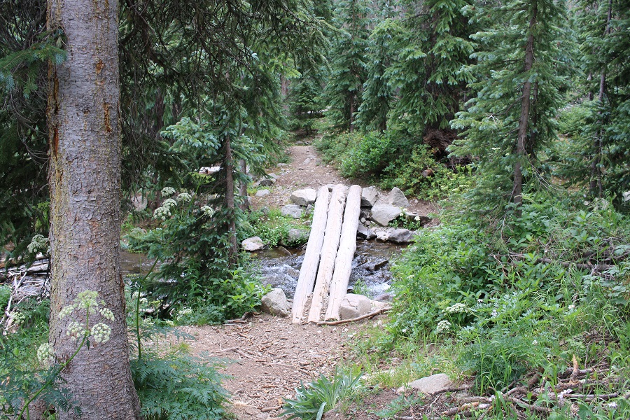
It was getting light as I put on my gear. From the parking lot it didn’t look like I’d need microspikes or snowshoes, but I decided to bring them anyway. I was on the trail at 6:30am. The trail starts at the west end of the parking lot and then crosses a bridge and heads southwest on a well defined trail.
Well, it would have been a well defined trail if there hadn’t been so much snow! Not enough in the beginning to put on spikes/snowshoes, but way more than I’d anticipated.
It was immediately obvious no one had been on this trail since the last snow, which had to have been over a week ago. What was curious was how soft and sugary the snow was after sitting for so long. There were also tons of animal tracks visible in the snow, mostly fox and moose, and they’d been here recently by the signs of urine and scat on top of the snow.
Last time I was here I’d seen a moose, so even though I never ended up seeing one I was extra vigilant today. I went in and out of the trees several times and noticed much less snow in areas without trees. This gave me hope for the rest of the trail above treeline. Of course, most of the snow in these areas was only on the trail itself.
When I made it to treeline I was disappointed to find quite a bit of snow. It wasn’t the snow that bothered me, it was the type of snow: all sugary with very few areas that were consolidated. The drifts were the worst! 4+ feet of sugary snow that didn’t respond to snowshoes made for difficult traversing. I put on my microspikes. Here’s the path I took to the middle of the basin
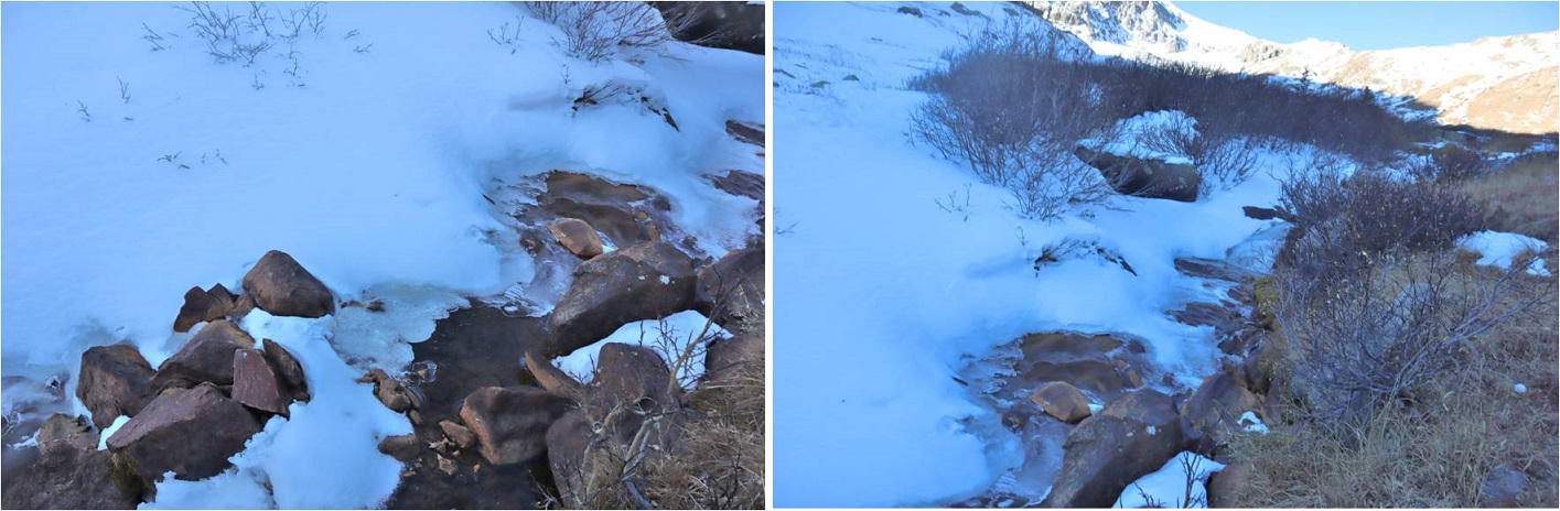
There was a stream that needed crossing. It was partially covered in snow/ice and I couldn’t tell how wide or deep it was. It took me several minutes to find a good area to cross where I wasn’t worried about falling in.
After crossing the creek I located a faint trail on the side of the mountain and worked my way towards it. The trail was only visible because it was covered in snow. The walk to the trail took a long time because I was postholing with every step.
Climbing up the hill should have been easy, but the snow was still sugary and the talus below unstable. Rocks rolled with every step I took, so I took them slowly
There were several large areas of snow directly on the trail that were not passable. I tried making a bridge in the snow but it wasn’t consolidated enough to hold my weight. Stomping it down did not create a trail so I had to descend on the talus to find a stable route.
Oh, and I met a few ptarmigans
Here’s another view of the ascent
All of this careful footwork meant I was going slowly. I was really excited when I made it to the top of the headwall, as I knew I’d have a view of the rest of the route to the ridge and I was hoping to find it snow free.
It wasn’t. Here’s the route up to the ridge
I continued for about 20 yards, trudging through sugary snow that went up to my thighs and mentally did the math. This hike had taken me about twice as long as it should have to this point, mainly due to the condition of the snow. I had 1.5 hours left before my turnaround time and looking ahead of me the snow in the gully areas looked similar to the snow I’d already had to avoid to get this far. Unfortunately, there was no way to avoid the snow ahead of me. There was a small lake out there I couldn’t see and I was worried I’d break through the snow and ice and fall into the lake. I grudgingly made the decision to turn around and head back home. That would give me time to make dinner and shower before the musical tonight. I was super bummed because it was a 6 hour drive out here and the day felt wasted, but I also knew I’d had bad beta and couldn’t have anticipated these conditions. The snow needs to consolidate before it’s safe to hike here. Here’s the path I took back:
Postholing the entire way…
In this picture you can see moose tracks and the trail I needed to make my way back to
I followed the trail where possible
Aiming for the creek and the trail out
Here’s looking back at my tracks
Getting through the willows is the hardest part, especially in sugary snow
Isn’t it fun when the only snow is directly on the trail?
The creek was almost frozen
I made it back to the trailhead at 10:30am, surprised to see another vehicle in the lot. This hike ended up being a little over 5 miles with 1948’ of elevation gain, done in 4 hours. I’d been hiking at close to 1 mile per hour this morning, which is considerably slow considering I average 2+mph normally. The good news is I made it back home in plenty of time for the musical. I’ll be back either in spring or summer, when the snow’s either consolidated or gone. Here’s a look at my route:
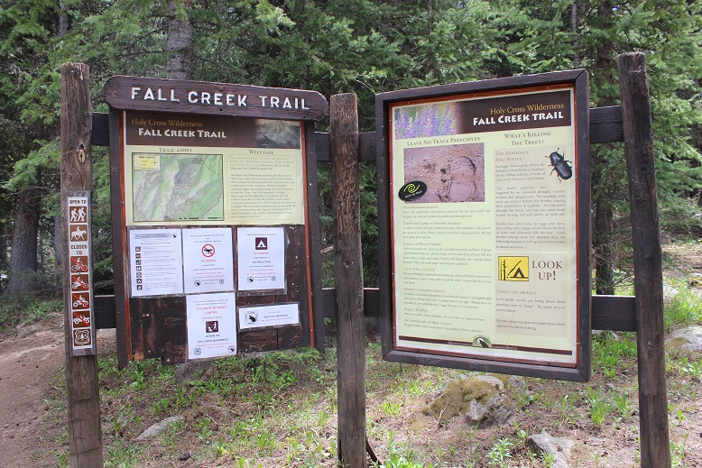
After 2 hours of sleep I woke up at 9:30pm to drive to the Halfmoon/Tigiwon/Fall Creek Trailhead. My kids think I’m nuts, but starting early when hiking above treeline really has its advantages. I was afraid of encountering afternoon thunderstorms, as there was a 50% chance after noon, and while I didn’t know if I’d be encountering any snow it was likely and would soften up during the day so I wanted an early start. The 2WD dirt road in was a little rough but easy to navigate. I arrived at the trailhead at 2:15am and took one of the last available parking spots.
There’s a ton of signage at this trailhead and multiple routes up to the same peak(s). I chose to take the Fall Creek Trail, heading south.
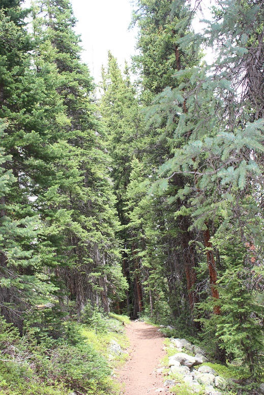
This trail is well established and well maintained. The first half mile or so was dry
And then the trail was completely covered in several inches of water. I took off my boots to cross the waterfall area (about 1.5 miles into the trail)
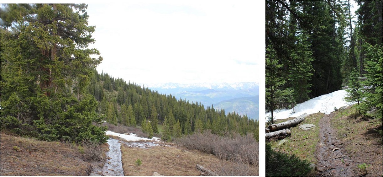
At 2.4 miles I came to a trail junction for Lake Constantine and Notch Mountain Trail, taking Notch Mountain Trail west.
This trail switchbacked up the side of the mountain for another mile or so, and where there wasn’t water there was snow
At 11,750’ I came to the base of the slope up to the ridge, and needed snowshoes
In the dark I could only see a few feet in front of me and there was a lot of snow, so here I lost the defined trail and just hiked straight up the ridge. Snowshoes were very helpful here! It’s also steeper than it looks
About 150’ from the ridge the snow stopped and I was able to follow a snow free trail to the ridge
The sun was beginning to rise, and I love sitting and watching sunrises, so as soon as I reached the ridge I ascended a small (and unranked) slope to sit and enjoy the view
The sunrise didn’t disappoint!
The best view was behind me though, of 14er Mt of the Holy Cross. Wow! It’s beautiful in the morning light.
After enjoying the sunrise I walked over to the ridge shelter and was excited to find it unlocked (well, it had a lock but the lock wasn’t securing the door).
The shelter’s actually quite roomy, with a fireplace (not that there’s any firewood above treeline) and a great view of Mt of the Holy Cross. This would be a nice place to shelter if a storm hit the ridge.
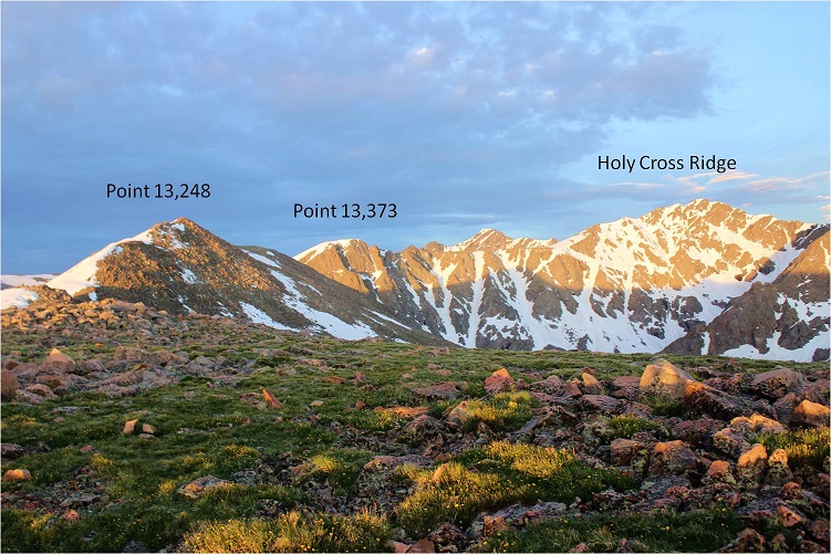
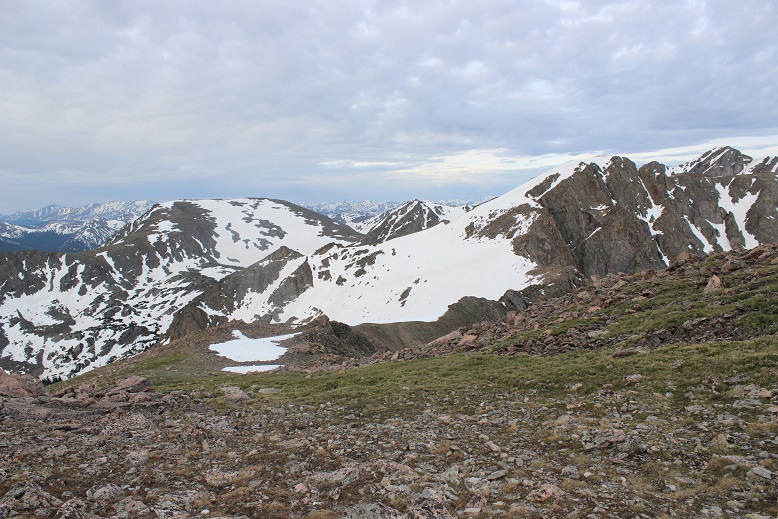
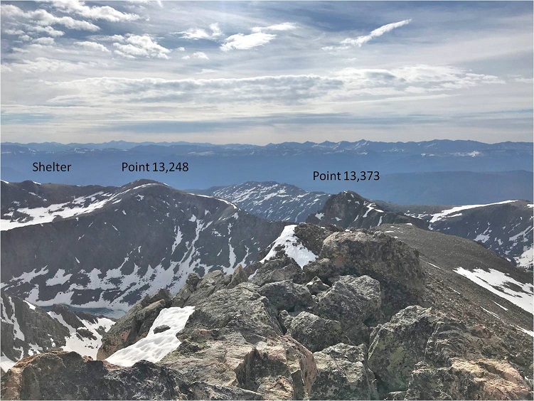
From the cabin I could see much of the rest of the route: Up Point 13,248, over to Point 13,373, and across to Holy Cross Ridge
The hike over to Point 13,248 was full of large rocks and hollow snow: the kind where you step on it and sink in a hole between the rocks up to your waist. After the first few postholes I stuck to the rocks
I summited Point 13,248 at 6:20am
Point 13,248
Here’s looking back at the shelter
And here’s the route before me. It didn’t look like the sun wanted to peak out above the clouds this morning
Here’s where I got a little nervous. The ridge looked like it was covered in more snow than I’d anticipated.
But when I made my way down there (losing about 600 feet in elevation along the way) the ridge was snow free enough to walk across. Well, not really walk, but more like scramble up and down on the rocks. Sticking to the ridge worked well.
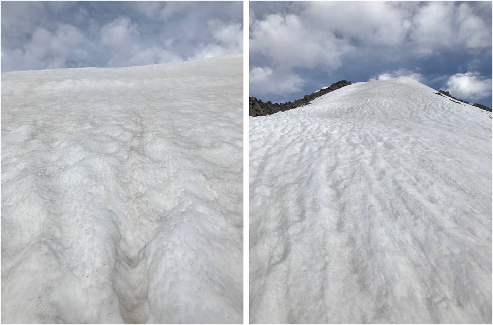
I was a bit worried about the large patches of snow I saw, hoping they weren’t hollow like the snow I’d encountered higher up on the ridge. Luckily, the snow here was solid
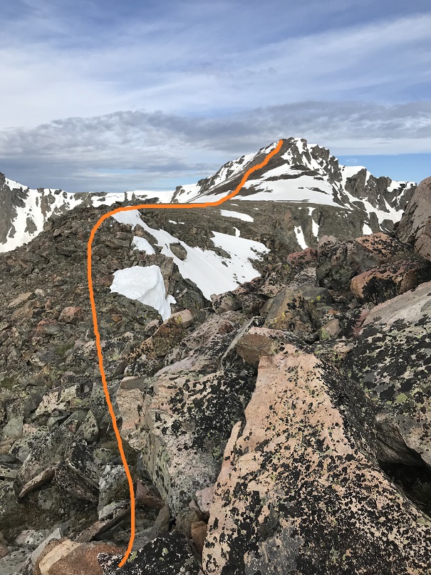
This is also where the crux of the route began. The solid line is the route I took up, and the dotted one is the route I took on the way down.
On my way up I went straight across the slope and then up the ridge
If I were to do this again I’d take the route I took down up as well. I didn’t initially because the rocks looked loose and unstable, but on my way down I found them to be stable and easy to climb through. I needed my ice axe and crampons for this part (on the way up and down) because the snow was steep. The traverse across the slope on my way in was sketchy, as every few feet or so I’d hit an air pocket and sink to my waist. I went slowly, seriously worried at some point I was going to slip and fall. Once I’d traversed the slope I needed to gain the ridge. This was steep as well. I couldn’t have done this without my ice axe and crampons
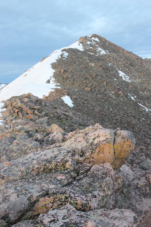
I breathed a sigh of relief when I finally gained Point 13,373. That had been more difficult than anticipated. I took a look back at Point 13,248
And at the rest of the route before me
I descended a bit, and then traversed a flat area before ascending once again. The last few hundred feet go up and down in elevation quite a bit, creating a few small false summits. My advice is not to go straight up the ridge, but circle the mountain to the left (west), gaining in elevation as you go
There were several large patches of snow to traverse here as well, and just my luck, the sun started to peek out from behind the clouds, making these crossings tricky as well
I summited at 8:30am
Holy Cross Ridge:
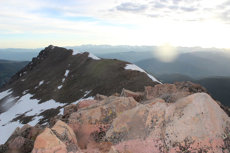
Here’s looking back on the route I took along the ridge
Ok, the sun was really warming things up and I was debating how safe the route back down Point 13,373 was going to be with soft snow. The ridge to Mt of the Holy Cross looked quite easy, and I considered just making this a loop, but I really wanted pictures of the route I took in, meaning I was going back the same way. Time to head back.
This time instead of going directly over the top of Point 13,373 I skirted the mountain to the right (east)
This put me at a great place to descend, so I once again put on my crampons and got out my ice axe and garden tool
The snow had indeed softened up, but was now perfect for kicking in steps. I felt much more comfortable traversing down than I had up, and the best part was the rocks I thought had been loose were really much larger and stable than they’d looked from across the ridge. Here’s the route I took down
And now the fun part: re-ascending point 13,248
I skirted the summit of this one as well, sticking to the left and then heading back to the shelter
Once at the shelter I met a couple eating lunch and taking a break. They’d intended on hiking the ridge today as well but were turning back due to weather/conditions. I thought this was a great idea, and noted it did look like we were indeed going to get some thunderstorms today after all.
I made it back to the switchbacks and when I came to snow put back on my snowshoes. This section looks short, but it’s actually a long and steep descent (which is made ‘easier’ with the switchbacks I couldn’t see under the snow, so I just headed straight down).
The sun had warmed up the snow, and what had been solid on my way in was now the consistency of a slushie. Each step I took I sank in the snow past my knees, and my trekking pole and ice axe were useless. I was sliding everywhere, and finally gave up and glissaded down. The couple behind me kept getting their feet stuck in the snow between rocks. The conditions were terrible, and I mentally high-fived myself for an early start: I wouldn’t have been able to descend Point 13,373 at this time of day.
Oh, and I saw a ptarmigan. I love those guys!
Snow stopped at about 11,700’ and everything was wet again, including my feet. The slushy snow had gotten inside my boots and my feet were soaked through. Changing socks wouldn’t have helped because my boots were wet as well. I didn’t even bother taking off my boots for the creek/waterfall crossings because they were already soaking wet
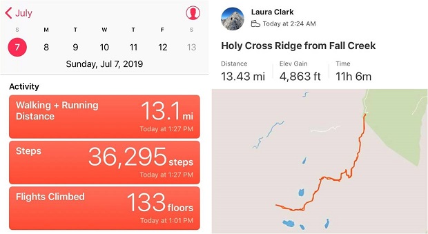
I made it back to my truck at 1:30pm, making this a 13.5 mile hike with 4863’ in elevation gain in 11 hours.
I’ve been saving this hike as a practice hike for winter conditions, since the route is relatively straightforward and it has a 2WD trailhead. Unfortunately I don’t have much time in the winter to actually hike, so it had to wait until early spring.
I woke up at 3am and drove to the Missouri Gulch trailhead. There were a few easily manageable mud puddles to avoid, but nothing anyone would get stuck driving through. I made it much faster than I thought, as I was honestly waiting for daylight for this hike. After seeing a herd of elk on 390 I made it to the trailhead at 5:45am. There was one other vehicle in the parking lot, and it looked like it hadn’t been there long (no frost on the windows, etc). This would make my family happy, knowing there was someone else out on the trail today. They hate that I hike alone.
I usually love hiking well before sunrise, but today for several reasons I decided to sit in my truck for a bit and wait:
I’m not a fan of hiking by graves in the dark. Does anyone else think it’s weird the baby’s grave is so far away from all the others? I mean, it’s across the street and up the hill and everything…
I really didn’t want to play ‘leapfrog’ with whoever was already hiking on the trail. I figured I’d give them some time to get far enough ahead of me so we wouldn’t need to pass each other/hike together the whole time.
I’ve heard reports there’s a mountain lion that frequents the area, and I’d rather not run into one in the dark. (side note: I’m not afraid of mountain lions, in fact I’d love to see one while hiking, I’d just rather it be in the daylight)
But seriously, that baby grave in the dark freaks me out.
I debated for a while which hiking boots to wear (my regular ones or my winter ones) and whether or not to bring my snowshoes. There wasn’t a recent conditions report in the past week or so, and the last one said none were needed. I left the snowshoes in the truck and headed out at 6:15am in my snow boots and winter gear. It was still dark.
I made it about .25 of a mile when something told me to turn around and go back and get those snowshoes. It’s tough to head back after you’ve already started, but the feeling was strong and I thought how mad I’d be at myself if I made it up the trail 3 or 4 miles and needed to turn back because I didn’t have the proper gear. So I hiked back to my truck, pulled them out, and was on my way again.
The trail was covered in slush that quickly turned to packed snow. As I looked on the ground I could see clearly defined mountain lion tracks (noted by size and lack of claw marks) on the trail. Cool! I also saw trails made in the snow that were obviously from a large animal (the mountain lion?) that detached from the main trail and went off into the hillside. The tracks were going the opposite direction, but that didn’t stop me from looking all over for signs of animal life/more tracks. After about 1.5 miles in the tracks disappeared.
20 minutes into my hike I passed the couple belonging to the truck. They didn’t look like they had snowshoes and I felt a bit foolish for carrying mine. The trail was pretty hard packed here, and snowshoes didn’t seem necessary. I briefly asked them if they’d seen the animal tracks, they had, and I was on my way. I never saw them again.
I crossed a small stream and decided the snow was thick enough to put on those snowshoes I’d been carrying.
The snow got thicker, but luckily others had been here in the past few days because there was a pretty good trench all the way to the cabin.
I made it to the cabin much faster than I’d anticipated. I took this trail on my way to Missouri Mountain last summer, and from what I’d remembered it had been a long slog full of switchbacks. But for some reason today it didn’t seem to take me much time at all. The cabin was surrounded in snow.
From here on out snowshoes were mandatory. There was no trail from the cabin through the willows/gulch area, so I had to make my own trail. Luckily I kind of knew how the trail went, since I’d hiked this area before. It was really cool to be breaking my own trail, and doing so successfully! This was the first real time I’ve broken trail: I hiked Humboldt Friday and broke a little bit of trail, but mostly followed others’ tracks. In fact, this was only the second time I’ve ever been snowshoeing, and I kind of liked it! It was so cool to be 5 or more feet above the trail in the snow, traversing over willows instead of around them. There was no way I could have done this a year ago, and I was proud of my route finding.
When I turned around I saw the alpine glow of the sunrise
I stayed by the creek and headed towards the Elkhead Pass/Belford Summit Junction.
The sun was really starting to come up, and the view of Missouri Mountain was fantastic!
This is where the wind really started to pick up. It was relentless for the rest of the day, hovering around 35mph. It looked like all that snow in the gulch was directly blown down from the mountains.
I looked at the route before me up Belford, and as I was ascending thought not for the first time how grateful I was to have gone back for those snowshoes.
The hike up Belford took forever. It just kept going and going and going up, up, and up. And that wind! Without the sunlight that wind was chilling. I just kept moving, pretending it was the Manitou Incline, and trudged up that mountain wearing those snowshoes, breaking trail.
There were several false summits to Belford, which were a bit annoying but anticipated.
Finally (and I mean finally, as I was exhausted) the real summit of Mt Belford came into view and I thought to myself: 4500’ in snowshoes for 4 miles was exhausting!
I was frozen, but set up my gorillapod and camera and took a summit photo.
and just because it was there (they usually aren’t) a photo of the summit marker
I took a look around. The view was magnificent!!!
I didn’t take out my instructions/map, but remembered the route to Mt. Oxford would be clearly visible from this location. It was just 1.5 miles away. I followed the clearly defined path with my eyes and my jaw dropped.
No way! There was no way I was doing that today in these conditions! That’s when I took a closer look, realized I was looking at Mt. Harvard (which I’ve already hiked), breathed a sigh of relief and looked east. There I saw the second summit I was after today: Mt. Oxford.
It looked doable in today’s conditions. That is until I made it to the ridge. The ridge down from Belford to Oxford was covered in snow. There weren’t any tracks to follow (either no one had taken this trail in the past few days or that relentless wind had covered the tracks with snow). As with any hiking/climbing challenge, I don’t make a decision to hike/climb until I’m right up next to the obstacle. I often find it’s easier than it looks when you’re up close. I decided to just take this ridge one obstacle at a time, and if I felt uncomfortable gave myself permission to turn back. This was supposed to be an easy winter 14er, so I should be able to do this, even in these conditions.
I looked for the areas with the least exposure and least snow, and began my descent. It was really cool making tracks! I carefully made each foothold by drawing a line with my trekking pole and stamping it down with my boot, making sure I had a firm stance before traversing.
It was more than I’d anticipated running into today, but nothing I couldn’t handle. Microspikes/snowshoes weren’t needed.
I made it down to the saddle and looked back up at Belford, and then up at Oxford. Wow.
The saddle was dry and came with absolutely amazing views! I stowed my snowshoes and was off.
To the north there was a small cornice that provided interesting views as well.
I looked ahead of me at the route up Oxford. Piece of cake. And it was.
The summit was actually closer than I’d anticipated (the first outcropping, not the second). I took a summit photo.
And another one of the summit marker (because it had one too!)
I turned around to see what I’d accomplished thus far today. What a view of Belford!
I started back, ready to tackle that ridge again head on, and this time uphill. I gathered my snowshoes and kept an eye on the weather, since it was supposed to snow after 3pm (it was currently around noon). While all morning it had been windy and clear the clouds were now starting to form. I hiked back up the ridge using the footsteps I’d made on my way down. It took a while but I was successful!
At the summit of Belford the second time I stopped for a bit to really take in and enjoy the view. Since now the hardest part of the hike was behind me, I felt I could afford to rest for a bit. I sat down at the summit marker and took a deep breath.
After a grueling and extremely windy 6000 feet in elevation gain in 6 miles (in snowshoes) I sat at the summit of Mt Belford, my 3rd 14er Peak today (out and back, so 2nd time here today). Suddenly the wind stopped and all was still. This is what I saw.
Immediately tears came to my eyes. It was like God knew I was the only person in the world with this view and he wanted to show off just for me. I was absolutely mesmerized by the intense beauty before me. It’s the closest thing to a religious experience I’ve ever had. All the hard work of the day and the frozen extremities that came with it was worth it! I sat there for 5 minutes before he picked up the wind again and reminded me to get my butt off that mountain: a storms coming in.
Of course I took another photo, trying and failing to capture the beauty around me.
I walked over the summit and took a look at the rest of the route down to the gulch. It looked like the sun had melted some of that earlier snow.
I was making good time, so I decided to have a little fun and use my remoteness from any other human being to practice some winter skills without embarrassment. Much of the earlier snow was gone, so I was able to safely practice glissading and running down the snow without worrying about sliding too far or out of control. I did this for most of the hike back down, laughing as I went.
Back down at the gulch, this was my view back down towards the cabin and back up at the route I’d come. As you can see, clouds were just beginning to form for that storm anticipated for tonight.
I put my snowshoes back on, crossed a frozen river of ice, and waiting for me on the other side was a ptarmigan. I knew he was a male because he had a red stripe over his eye. He just stood there, looking at me, and then slowly turned towards Missouri Mountain and looked over his shoulder, as if he was beckoning me to follow.
I took several pictures, thanked him for being so cooperative, and followed my snowshoe tracks back through the gulch and down the mountain. It looked like several people had actually hiked up to the gulch today, as around the cabin there were several new ski and snowshoe marks, but no people to be seen. The trench was also a bit more compact than it had been earlier.
The hike back down seemed longer than the hike up, and I kept my snowshoes on for most of it. Somewhere along the way I lost my beanie which was unfortunate (I’ll make another one). As I was nearing the end of my route I kept looking for signs of a mountain lion (nope) or any other form of wildlife (again, nope). As I approached the area with the grave in the daylight I realized I was ‘told’ to get those snowshoes exactly as I passed the grave… Hmmm.
I crossed clear creek and my days hike was over.
On my drive home I thought about the details of today’s hike, and how this is something I wouldn’t have been able to accomplish a year ago. I was glad I’d saved these ‘easy’ 14ers for winter-like conditions, as it allowed me to apply the knowledge I’ve learned thus far (snowshoeing, traversing ridges covered in snow), while giving me time to practice more intense skills in a safe environment (glissading, self arrest, running down a snow field).
Here are some summit videos. The views were amazing!
While there are a few twists and turns through the back
roads of Chipita Park to get there, this hike has a very obvious trailhead but
very little parking. I had to drive a
quarter mile down the road to find a driveway to turn around at so I could park
my truck alongside the dirt road.
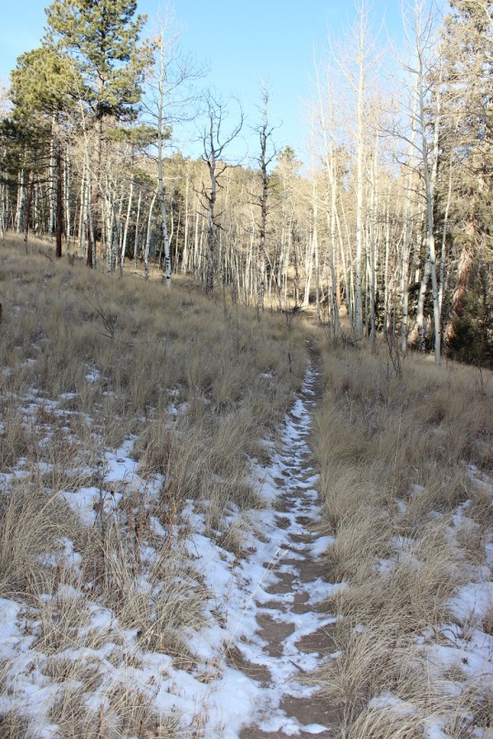
The first 1.3 miles of the trail begins with some steady
elevation gain and a lot of switchbacks.
I noticed as I was hiking there had been a lot of tree clearing/cutting/trimming
lately. I saw dozens, if not a hundred
of these piles lining the trial.
Once you arrive at the top of the switchbacks you come to a
nice meadow and a trail junction. Stay
right at the junction. I state this
because many people have told me they mistakenly went left, which takes you on
a long loop to nowhere. (OK, it goes somewhere,
but not directly: you’ll need a topo map
as there are several possible trails you can take, leading in many different
directions: just go right).
After crossing the meadow and a very small trickle of a
stream you enter an aspen grove
and then start following a forest road. While I was hiking here I heard the loud
rustle of feathers ahead of me, looked up, and saw 2 ptarmigans jump/glide from
the forest floor to the top of a pine tree.
I was able to get a picture (and video) of them, but didn’t want to
disturb them so I didn’t stay long/didn’t get great photos.
The forest road starts to follow power lines from this point
on.
This forest road will take you all the way to the Crystal
Creek Reservoir, but what fun is that? I
looked at my topo map, and figured the power lines were a straight shot to
where I wanted to go, while the road twisted and turned but eventually ended up
in the same place. It’s part of the Ring
the Peak trail system, which they made wide enough here to accommodate 4
wheelers. I’d rather hike. So I turned left and followed the faint trail
under the power lines (hey, there was little chance I could get lost this way,
right?)
Once I reached a saddle I could see the Crystal Creek
Reservoir, so I knew Mt. Esther must be to my left.
Quite a bit of tree maintenance had been done here as
well.
My directions told me to look for a cairn indicating a faint
trail, but there was no cairn, and no trail.
So I turned south and just headed towards the summit. This is what it looked like:
I headed south and up the mountain for about a third of a
mile before reaching a boulder filled summit with great views of the reservoir!
I had fun bouldering a bit (and jumping from rock to rock where
feasible). I took a few summit selfies
to prove I’d made it, one with a view of Pikes Peak and another of the Crystal
Reservoir (which I’ve taken a paddle boat out in with the kids! Fun!)
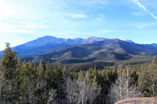
Pikes Peak looked beautiful today, as it does just about
every day
This was a fun, quick hike (7 miles in 3 hours including
stops to watch the Ptarmigan and boulder for a bit). I’ve heard it described as ‘difficult’, but I
think that’s exaggerating a bit. Yes,
the initial mile of switchbacks probably would turn many away, as well as the route-finding
at the end if you intend to summit Mt. Esther, but the hike itself is quite
pleasant and easy to follow!
7 miles
1500’ Elevation gain
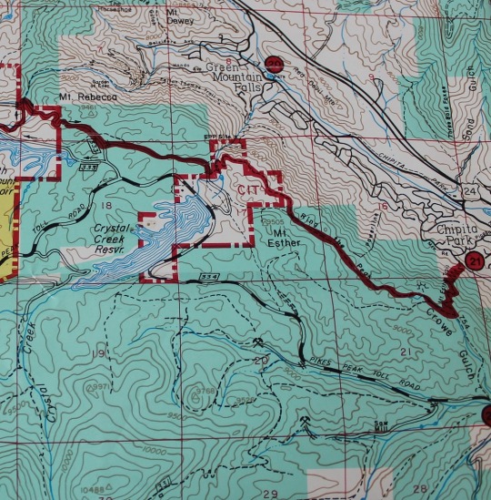
I followed the red Ring the Peak route, and then kind of made my own trail. This topo shows where the trail should be. I followed this, even though there was no actual trail off the Ring the Peak trail.


 RT Length: 11 miles