Tuttle Mountain – 13,208 and Houghton Mountain – 13,059

RT Length: 9.63 miles

Elevation Gain: 2935’

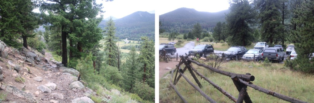
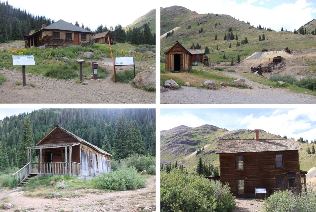
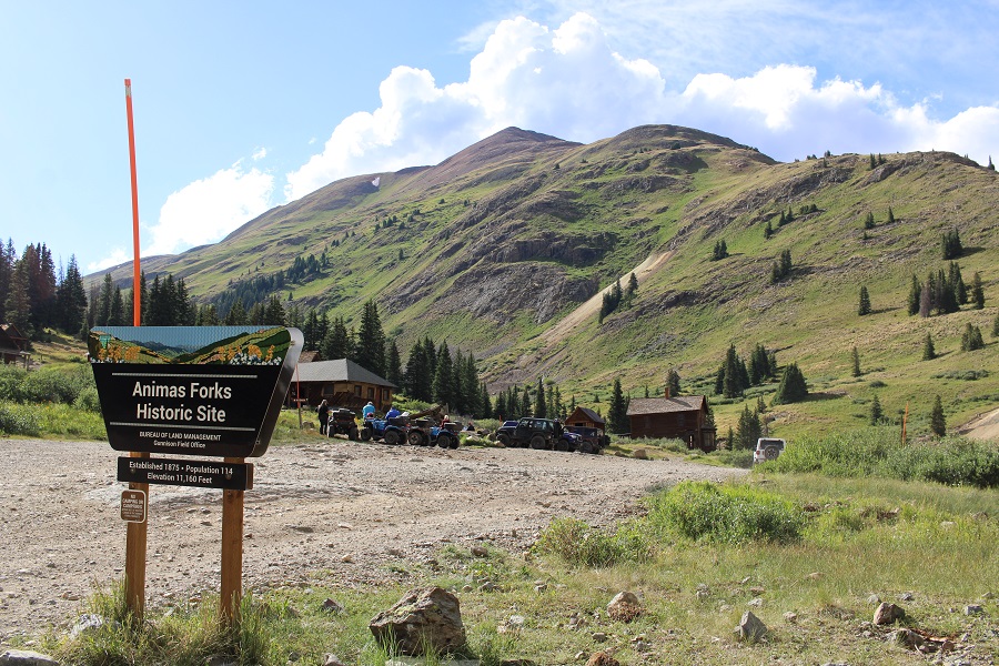
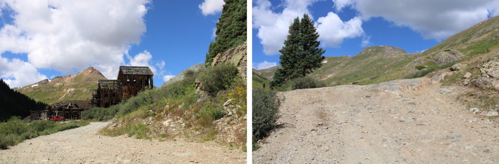
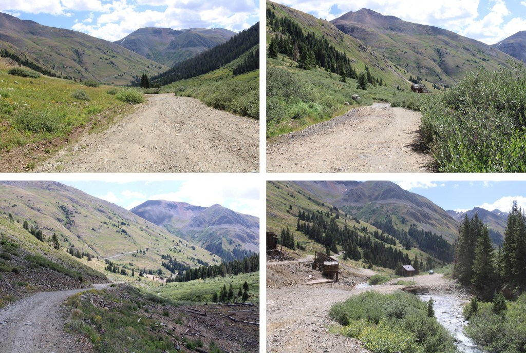
I parked at the Animas Forks Historic Site near Silverton.  A couple of notes:  the 4WD road in is 4WD, and it’s crowded!  The site however, is pretty cool.  Lots of stuff to see here, and you can go inside the structures (even the 2 story ones). 

There are plenty of spaces to park.  I chose one, and was on the trail at 5:45am, after it had stopped raining. 

I followed the 4WD road that started to the northwest of the historic site, leading towards California Gulch

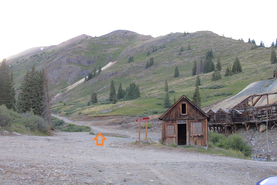
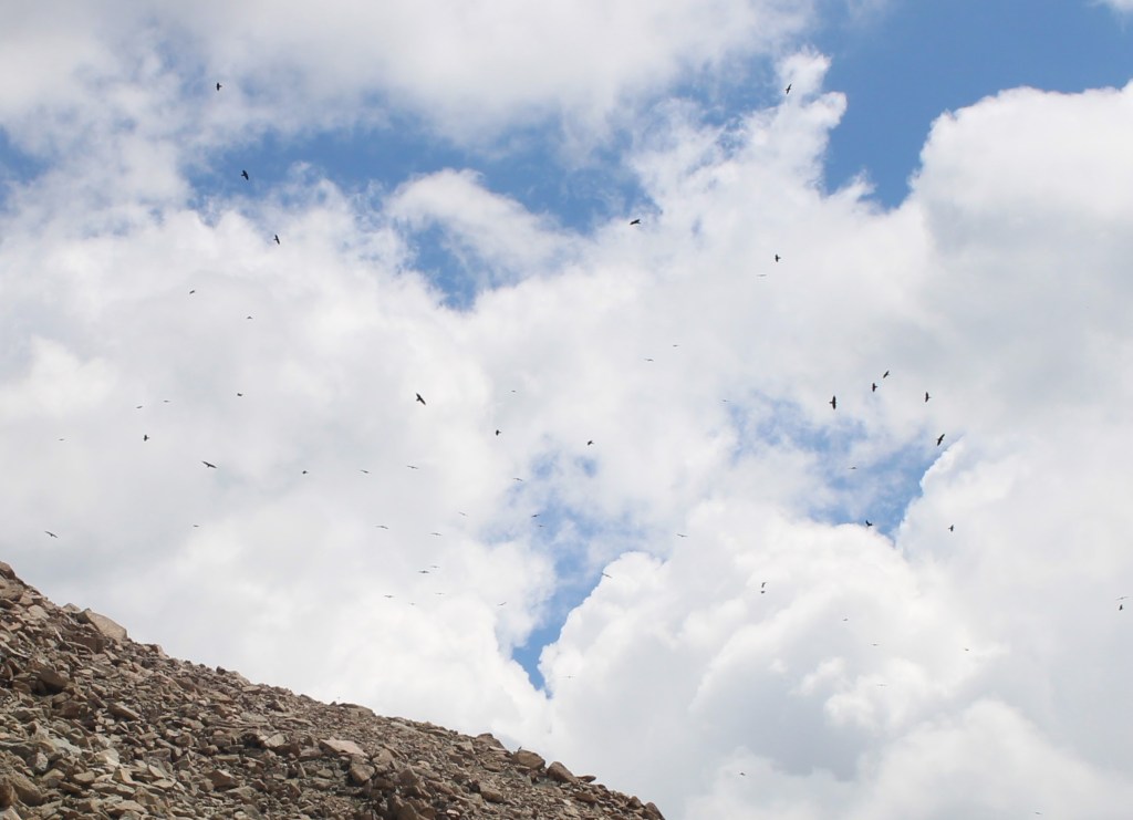
I passed a couple of mines in the dark.  Apparently, the crows weren’t happy I was there.  Nothing spooky about this at all.

Crows:

I followed this road east for 1.25 miles, to the Placer Gulch/California Gulch junction, and continued straight towards California Gulch

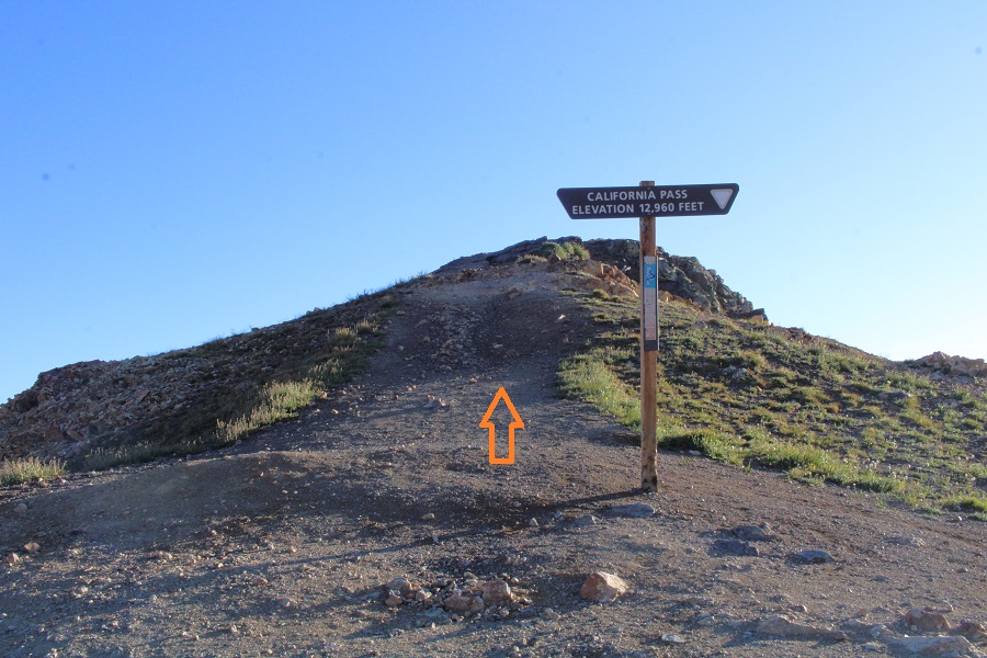
I continued following this trail through California Gulch for a total of 4 miles, all the way to California Pass.  This was an easy-to-follow 4WD dirt road, that passed a few abandoned mines.

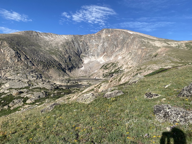
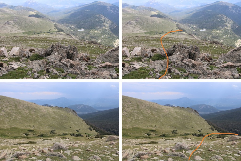
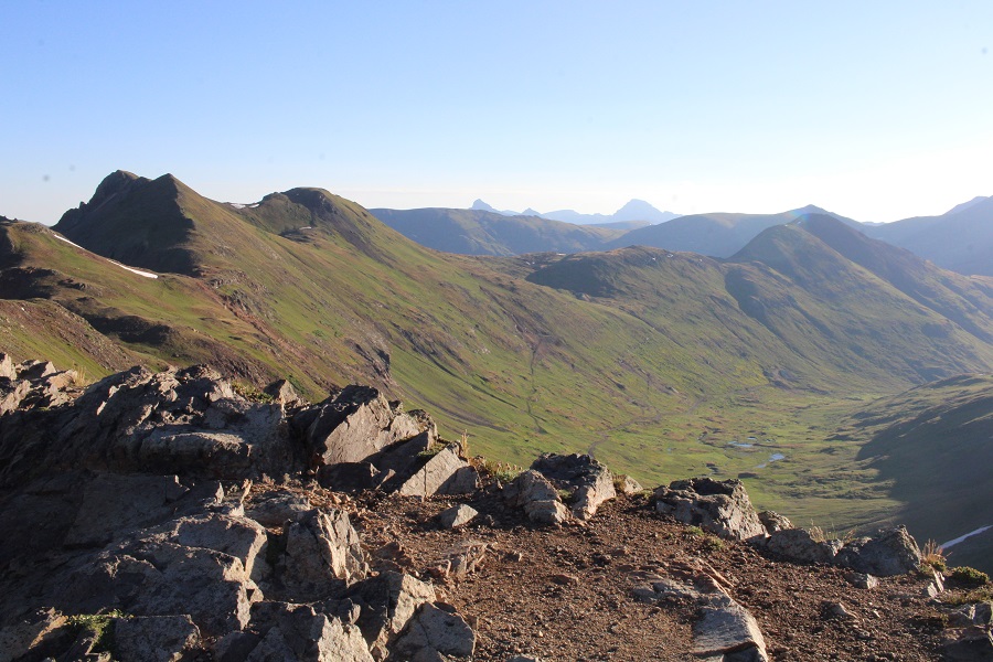
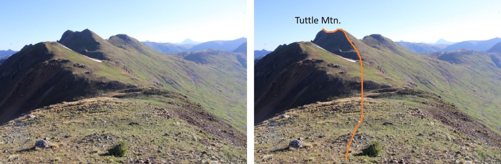
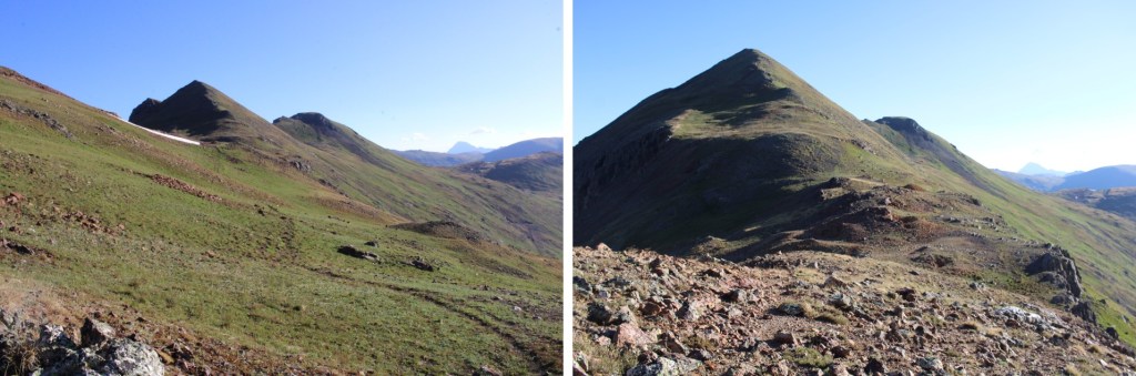
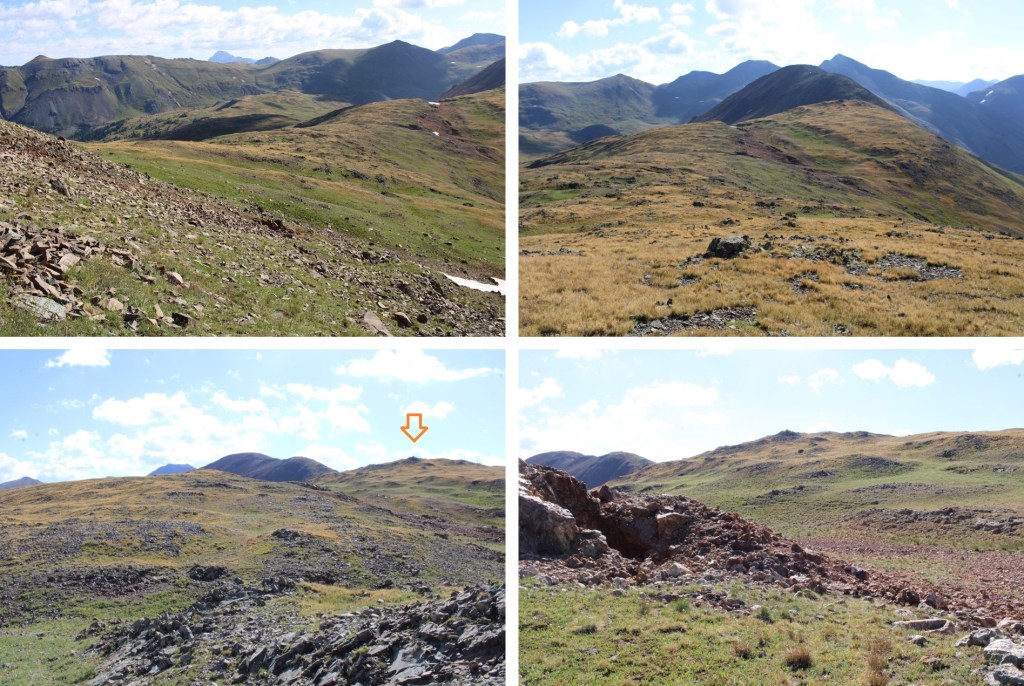
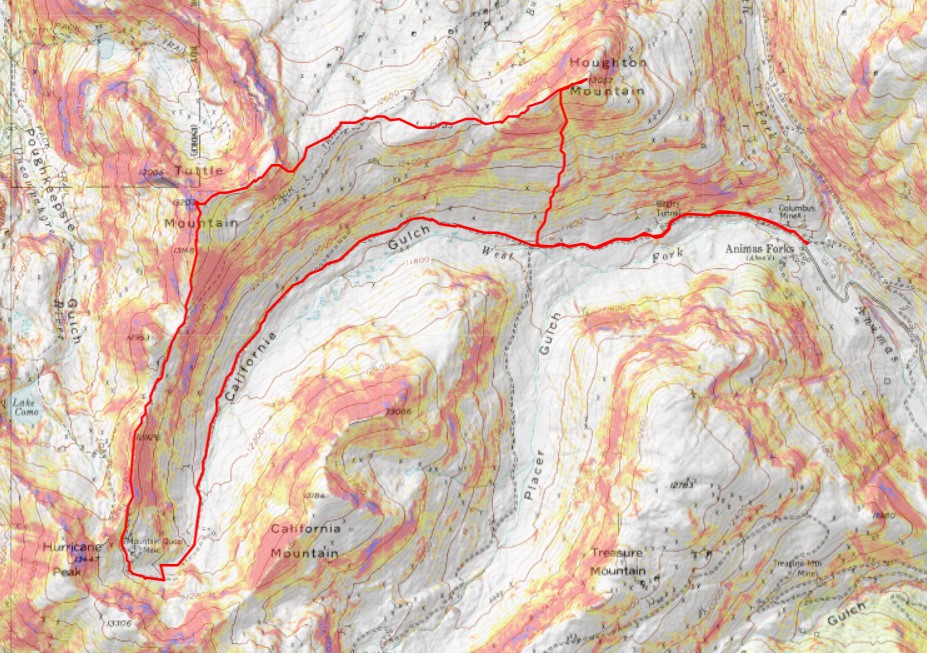
At California Pass, I left the road and followed game trails north along the ridge.  This is a class 2 ridge, and easy to follow

Also, I heard coyotes

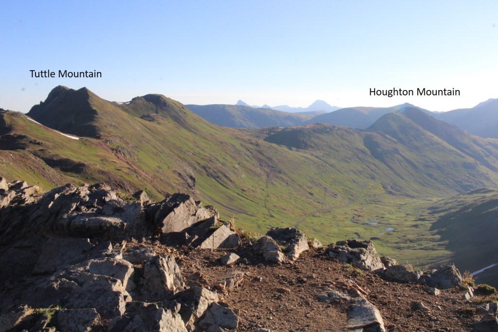
I could also see both peaks from here, Tuttle and Houghton

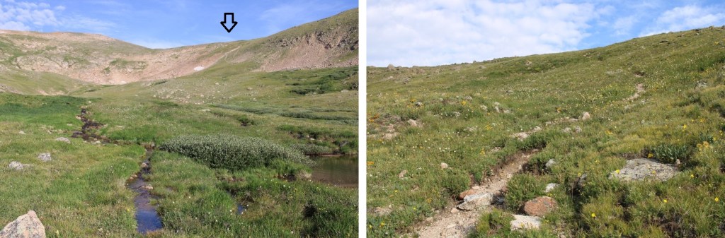
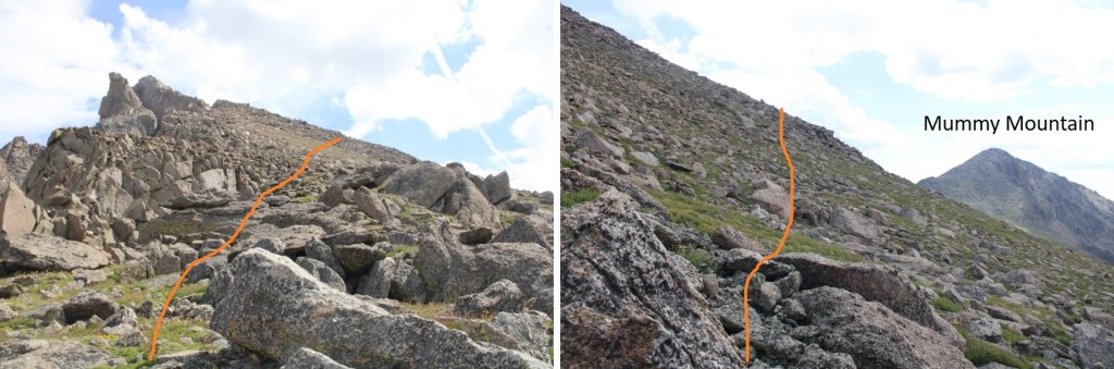
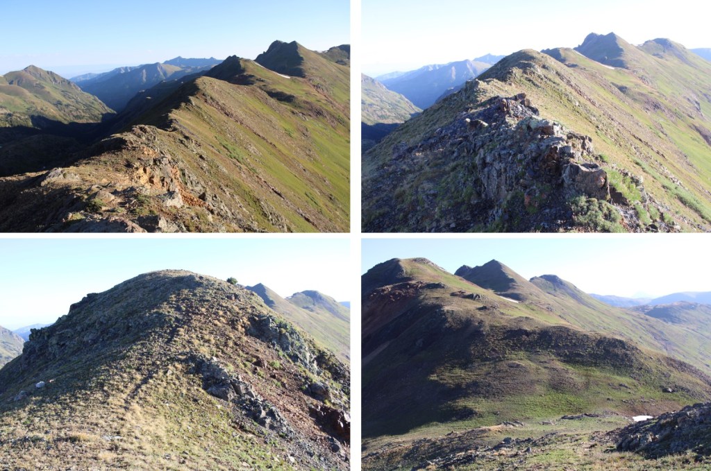
Here are some pictures of that class 2 ridge and the game trails

About halfway across the ridge I took a game trail to go straight towards the peak

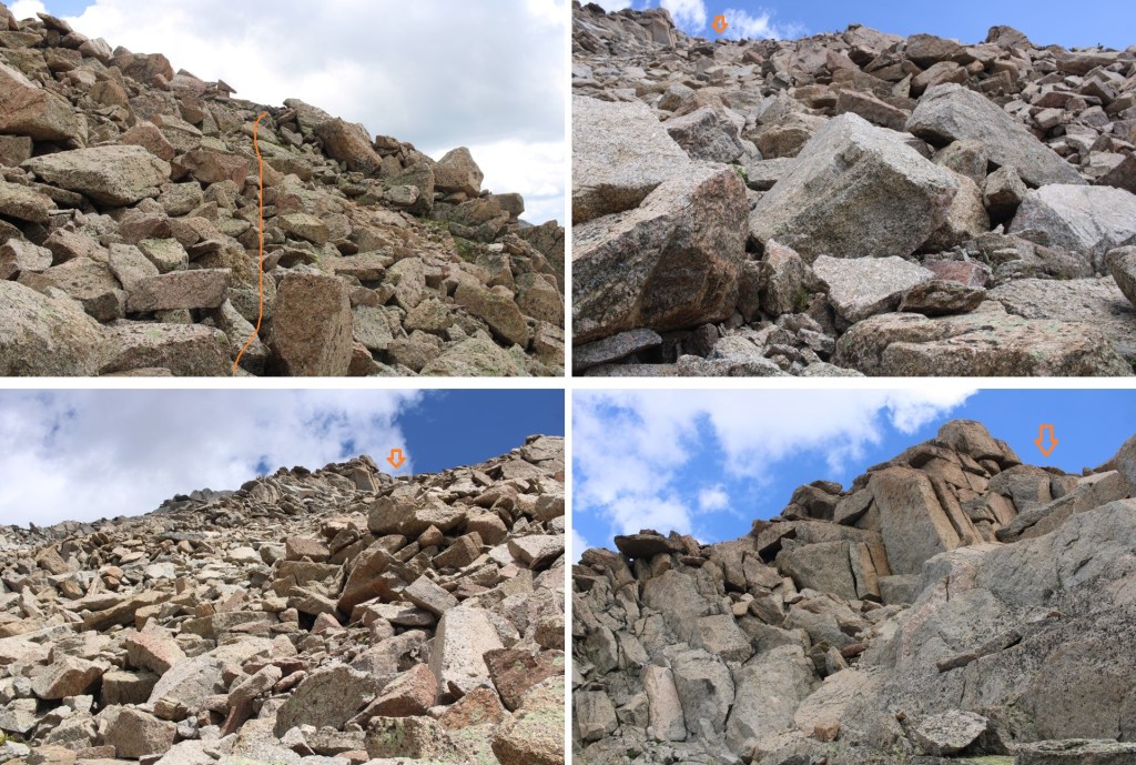
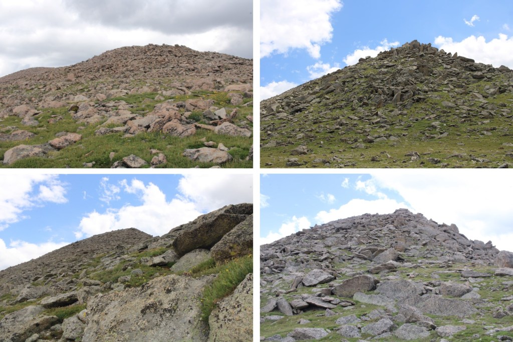
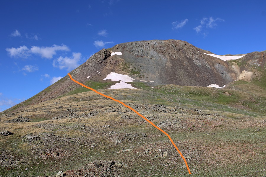
Then I ascended this class 2 ridge to the north, leading to a false summit

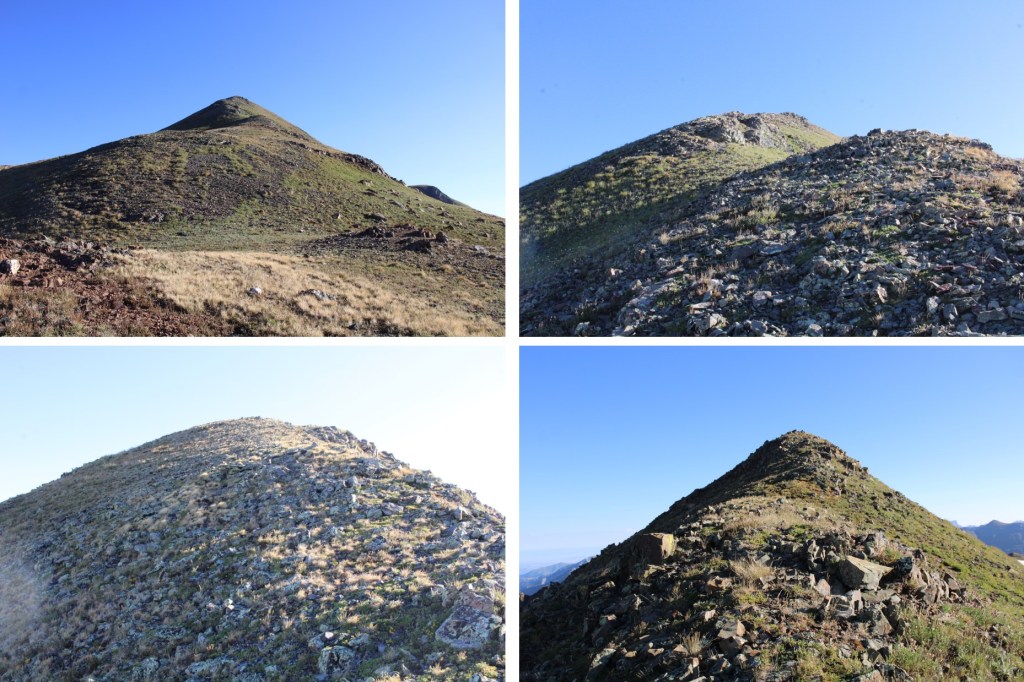
It was a quick hike to the actual summit

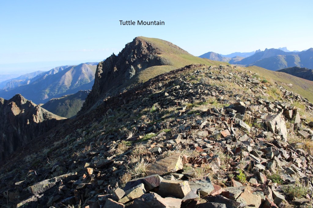
I summited Tuttle Mountain at 8:15am
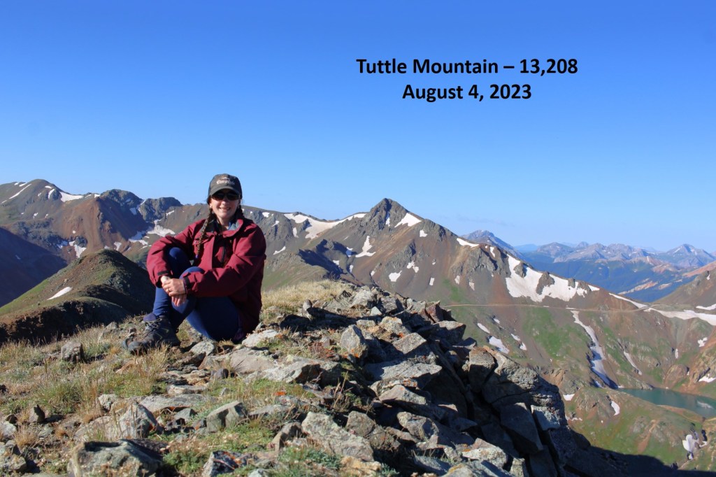
Tuttle Mountain:

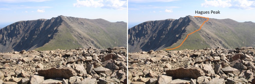
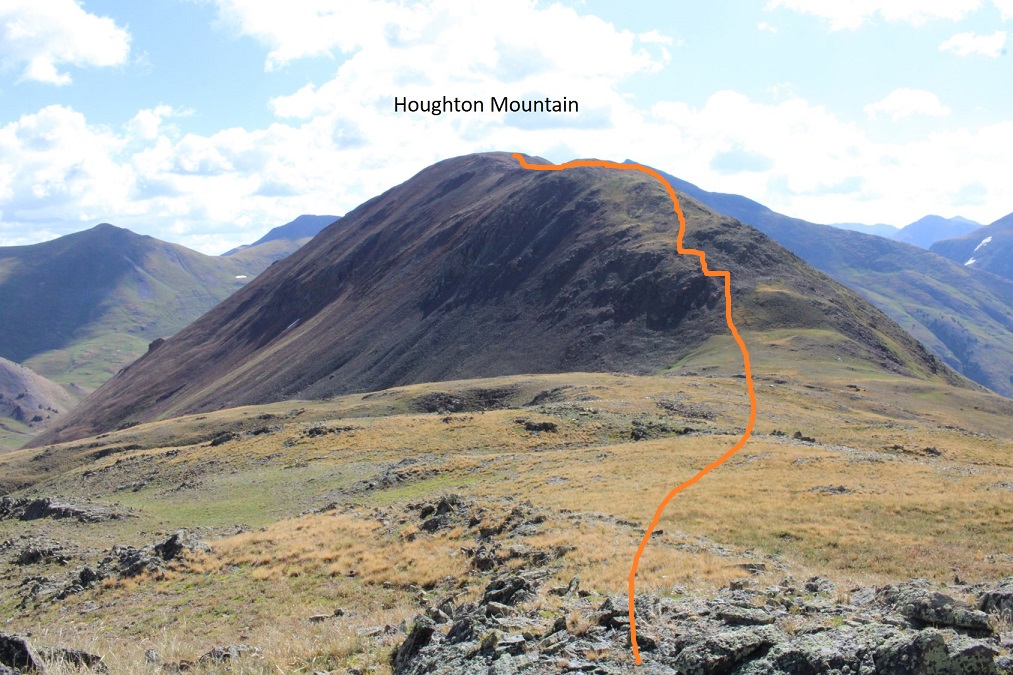
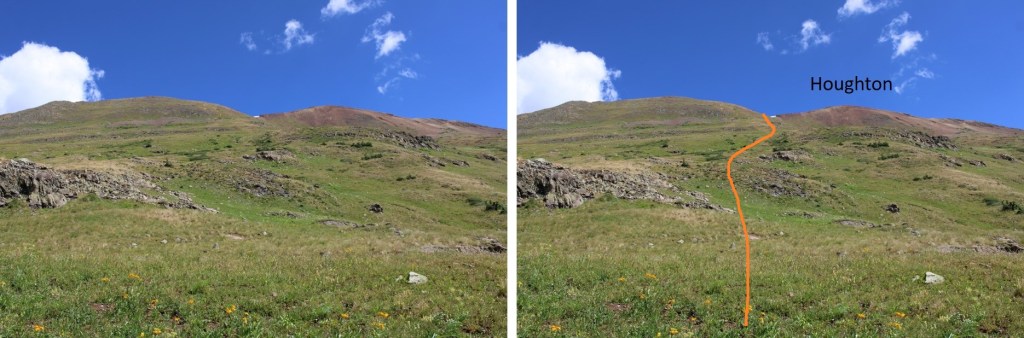
Looking northeast, I could see Houghton Mountain.  Before descending to the saddle, I’d go over this hump, then southeast for a bit to avoid some rock outcroppings. 

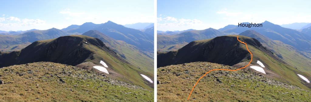
Here’s my route down to the Tuttle/Houghton saddle, first heading southeast to avoid the rocks

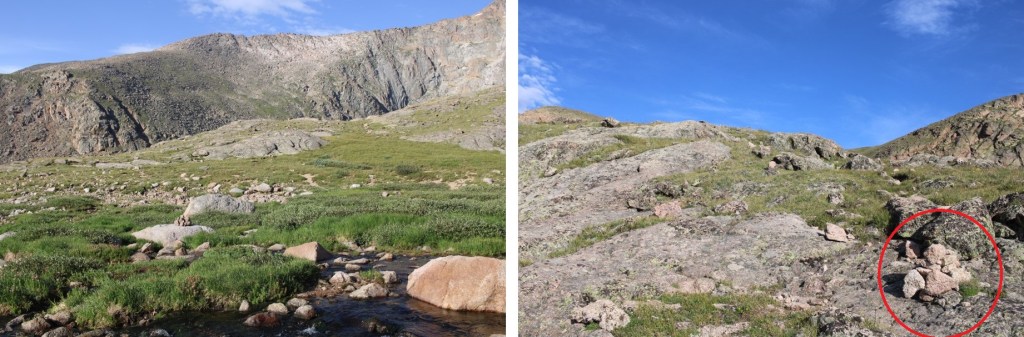
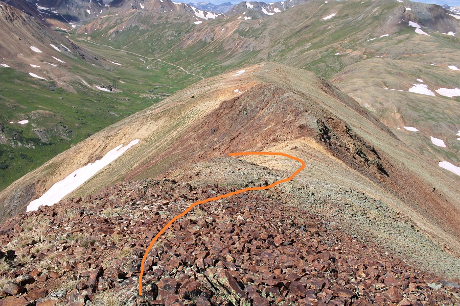
Then crossing northeast towards the saddle, and up the ridge to the summit.  This is my overall route to the summit of Houghton.  If you like cool rocks, plan to spend a lot of time in the area circled in red.

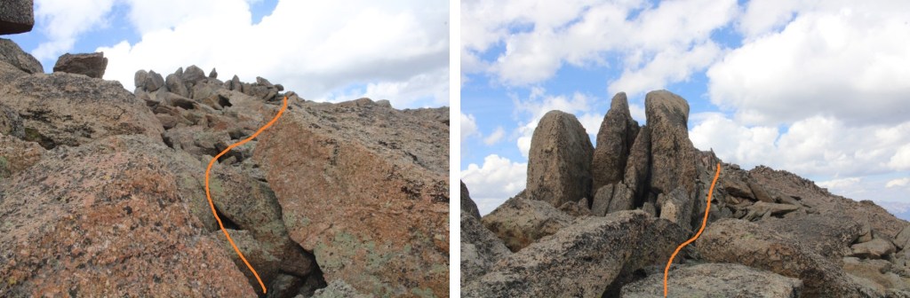
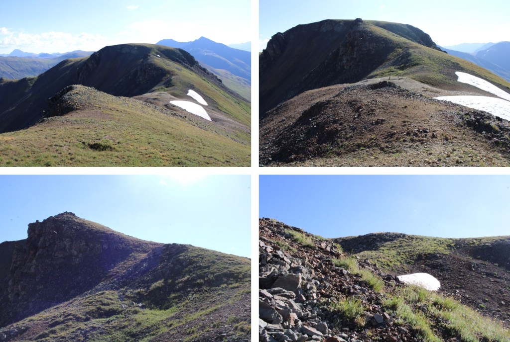
These are the rocks from Tuttle I was trying to avoid, and the route I took down

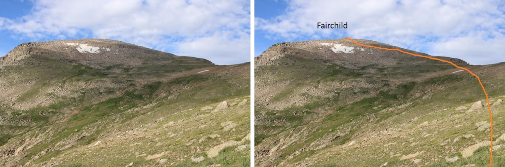
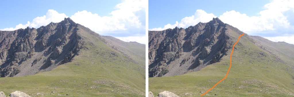
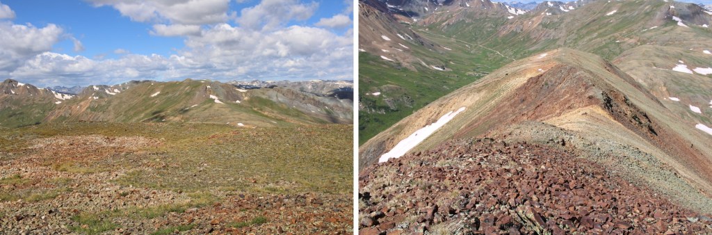
Now to head over to Houghton.  This was mostly a class 2 ridge hike through rocky, rolling tundra, littered with a bunch of mines.  It was also choose your own adventure on a wide ridge.  I was aiming for where the orange arrow is pointing.

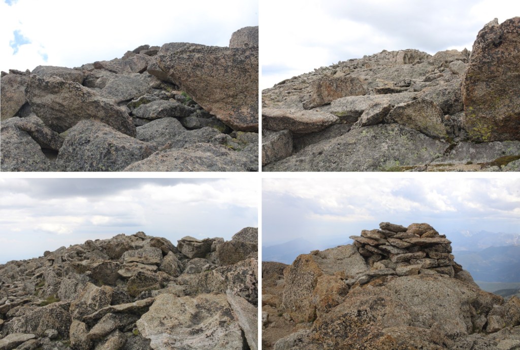
Oh, and here is a picture of one of those cool rocks I was talking about

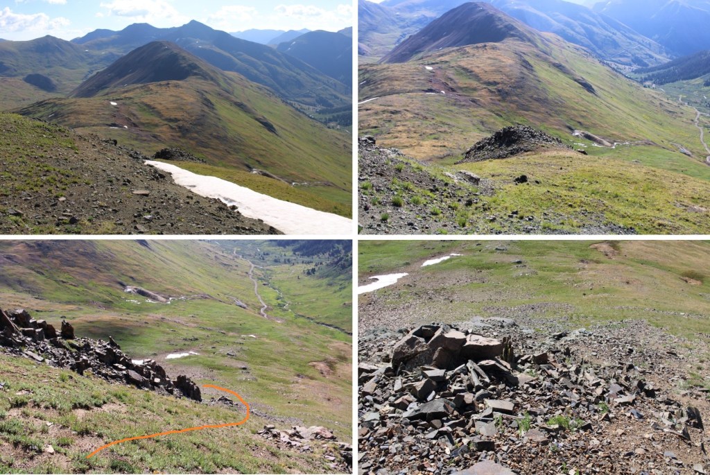
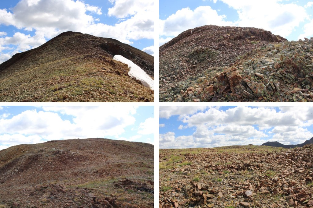
For the rest of the hike to the summit of Houghton, there are slight game trails to follow through both the tundra and eventually scree.  I just kept heading northeast, staying to the ridge

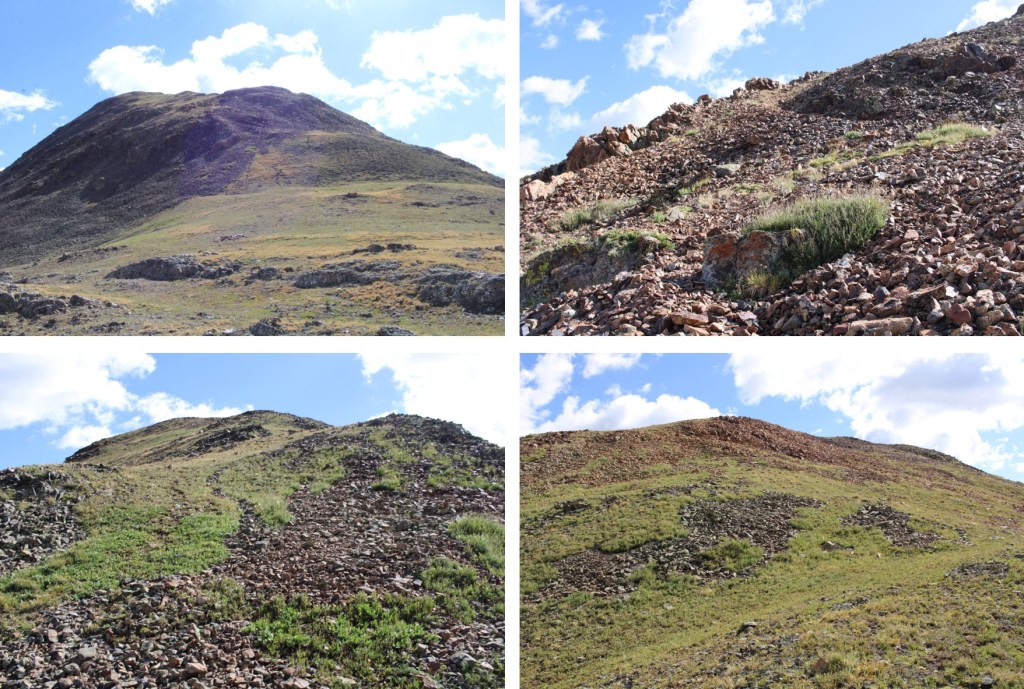
Once you see the change from tundra to rocks, notice the top of this gully.  It will be the decent route.

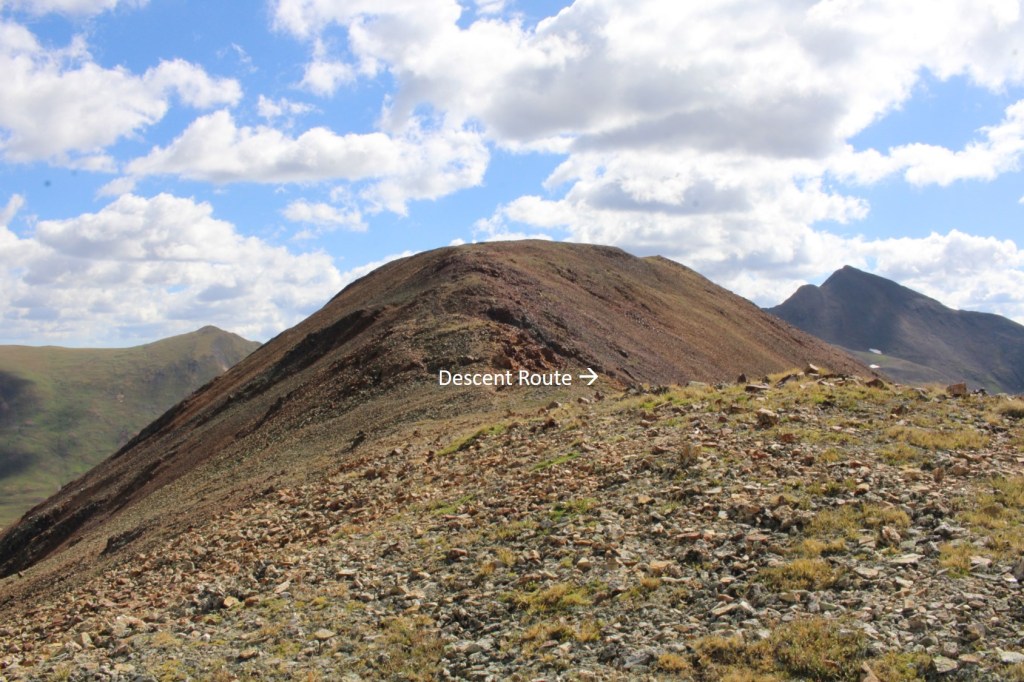
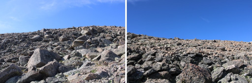
The last push to the summit was rocky, but there were game trails to easily follow

I summited Houghton Mountain at 10am
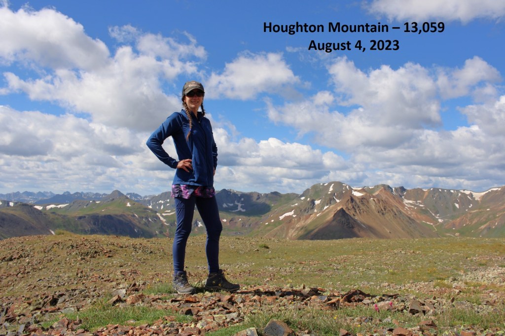
Houghton Mountain:

Now to head back down.  I retreated the same last rocky section southwest

Then turned left, and descended a gully to the south.  This is an easy, tundra filled gully, just be careful, as there are scree rocks here that have tumbled from above and are loose on the grass (but no scree)

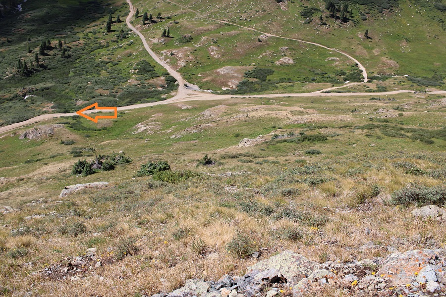
To make this easier, I aimed for the California Gulch/Placer Gulch junction, since it was easy to see (circled in red). 

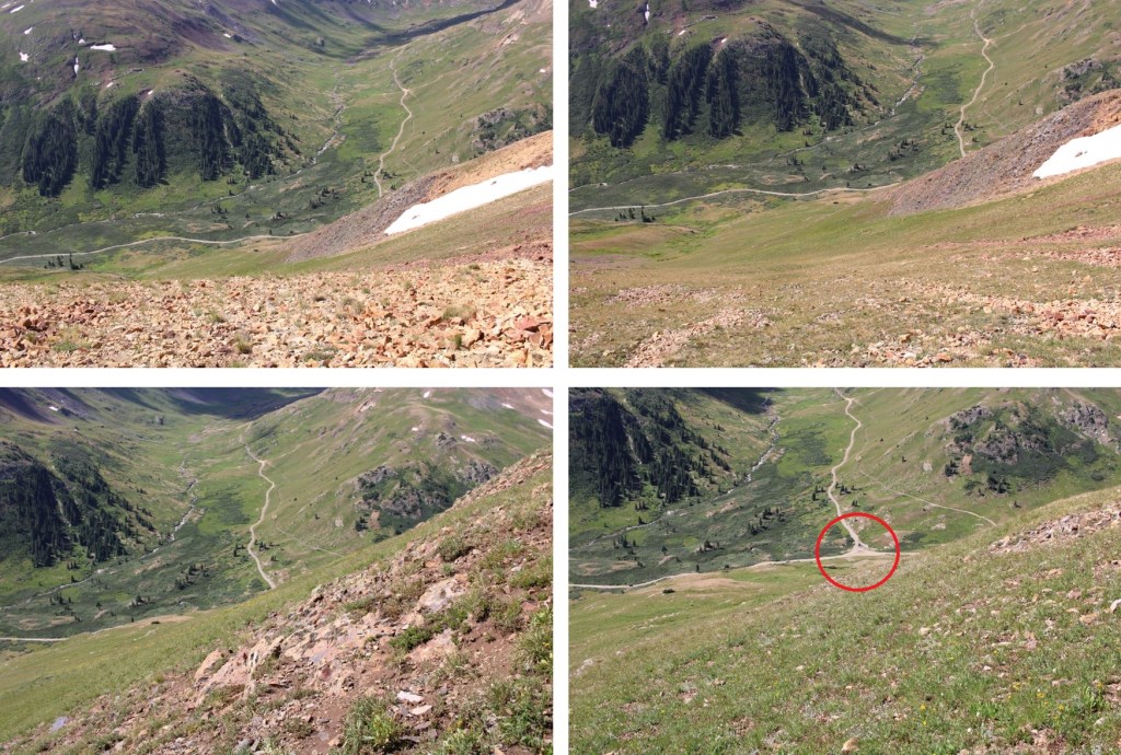
From the junction, here’s the route I took down from Houghton Mountain

At the junction I turned left, and followed the road east back to Animas Forks

I made it back to my truck at 11am, making this a 9.63mile hike with 2935’ of elevation gain in 5 hours 15 minutes. 

On to the next trailhead!

Fairchild Mountain – 13,509 – Hagues Peak – 13,56 – Mummy Mountain – 13,420

RT Length:  24.7 miles

Elevation Gain:  6931’

I made it to the Lawn Lake trailhead exhausted.  It’s been a fun month, but not one in which I’ve gotten much sleep.  I was on the trail at 4:30am. 

I followed the class 1, Lawn Lake Trail, for 5.7 miles

After hiking for 5.7 miles I came to a junction with the Black Canyon Trail, and took the Black Canyon Trail past Lawn Lake, and all the way to the Fairchild/Hagues Saddle.

Just after passing the lake I came across 3 bull moose enjoying breakfast. I took a few pictures and gave them their space

Bull Moose at Lawn Lake:

I continued following the class 1 trail up to the saddle

I crossed a small stream.  You can clearly see the trail on the other side.  The trail became faint in areas, but there were cairns and the trail became easier to see near the saddle. 

Just before making it to the saddle, I turned left and this is the route I took to the summit of Fairchild, following the ridge southwest

Here are some close up pictures.  Note, the boulders become very large near the top.  They’re all stable, but larger than vehicles.  My hiking shoes gripped the rocks nicely, but they would be treacherous if they’d been wet.

I summited Fairchild Mountain at 9:45am

Fairchild Mountain:

There was a plastic tube summit register I couldn’t open, and a rock wind break at the summit. 

From Fairchild, I looked back at the saddle and could see Hagues Peak, and my route.  Now is a good time to get a visual of the way you want to summit, as it’s difficult to see from the saddle/below.  This is the route I took, which kept it low class 3, but mostly class 2.

I made my way back to the Hagues/Fairchild saddle

And then followed the ridge until I made it to 12700’. 

I then headed northeast towards the ridge, staying on class 2 terrain.  Here are some close ups of my route

Also, there were more moths than I’d ever seen this far above treeline, and dozens of crows taking advantage of the situation

I gained access to the ridge with a few easy class 3 maneuvers.

One on the ridge, I turned left and followed it through more easy class 3 terrain west to the summit.  If there’s an option, always go right around the boulders.

The summit is circled in red

It’s just a little further southwest past the tower

I summited Hagues Peak at 12:25pm

Hauges Peak:

There were several benchmarks/elevation markers, and another summit tube (full of various loose pieces of paper, so I didn’t bother signing one).

Next on the agenda for the day was Mummy Mountain. I turned and headed back down the ridge the way I’d summited, and then crossed PT 13302, and headed up Mummy Mountain.  Here’s my overall route

And some step by step pictures

The terrain became rocky near the top, but this all remained class 2

I summited Mummy Mountain at 2pm

Mummy Mountain:

The weather had held out so far, but on the summit of Mummy Mountain I heard my first clap of thunder in the distance, and wanted to get back down to treeline as soon as possible.  I followed the ridge southeast on class 2 terrain.

I aimed for the drainage, and followed it until I made it back to the Black Canyon Trail

I followed the Black Canyon Trail North until the junction with the Lawn Lake Trail

There I took the Lawn Lake Trail back to the trailhead.  It rained the entire way.  Not the fun, misty rain, but buckets of large water droplets.  The sky thundered all around, after large flashes of lightning. 

I made it back to my truck at 5:30pm, making this a 24.7 mile hike with 6931’ of elevation gain in 13 hours.

On to the next trailhead!