Oyster Peak – 13,316 and Pearl Mountain – 13,379

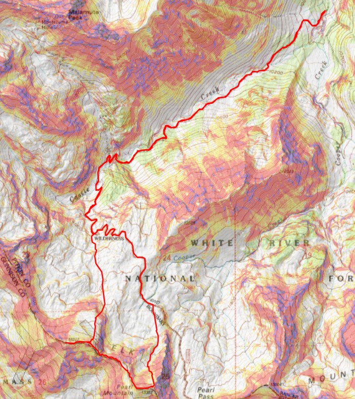
RT Length: 11.44 miles

Elevation Gain: 3923’

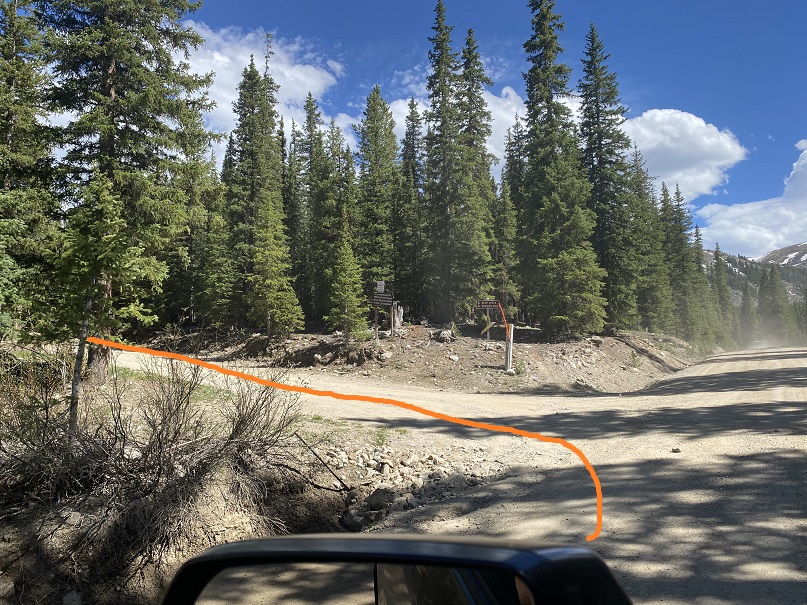
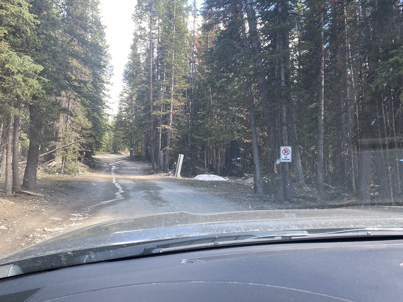
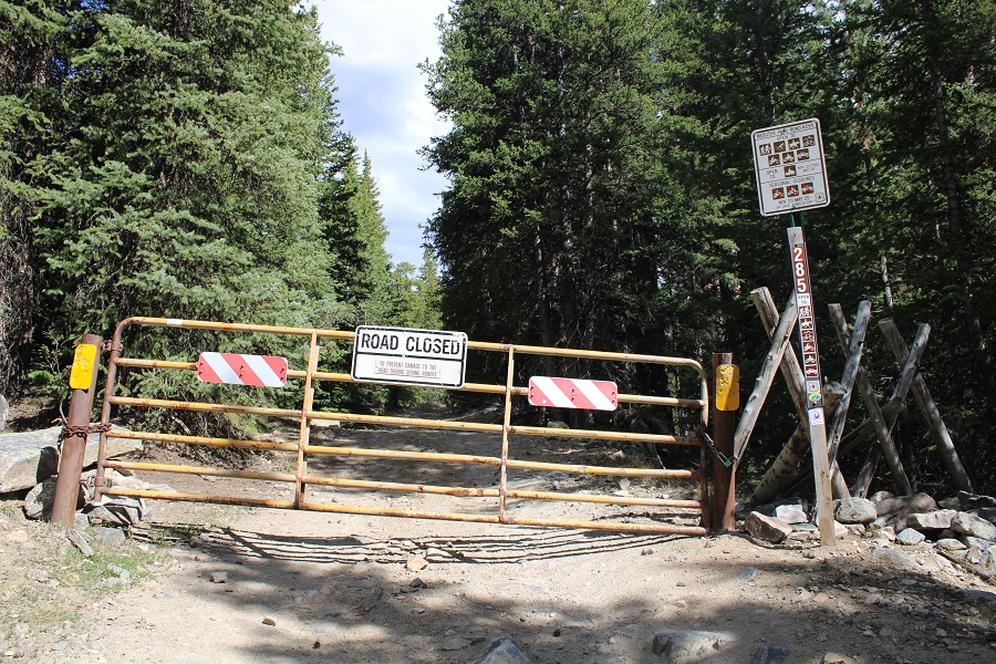
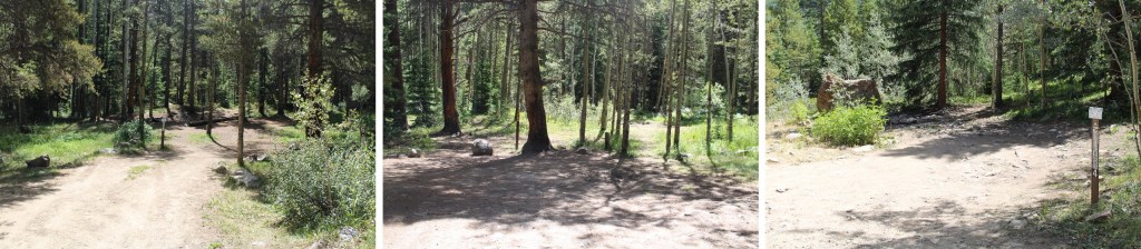
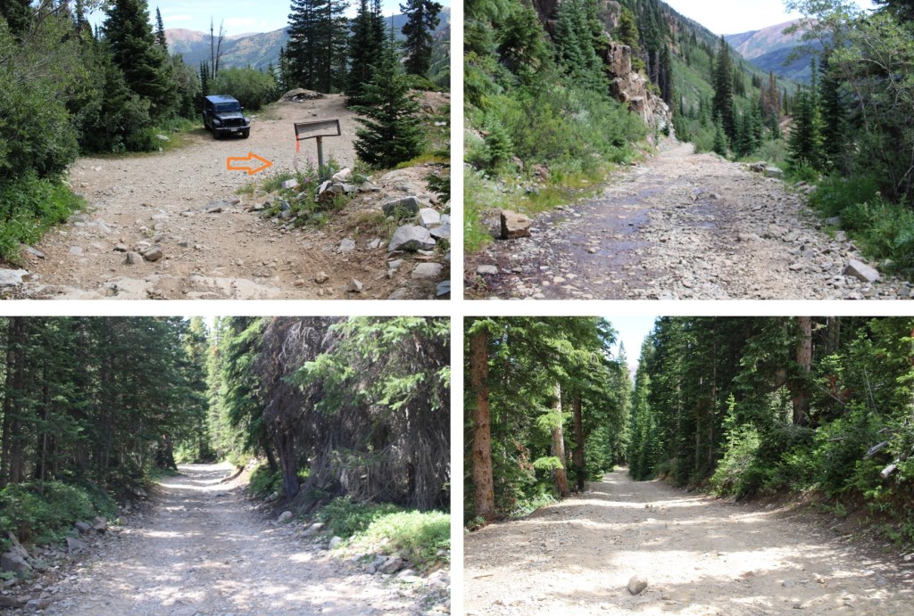
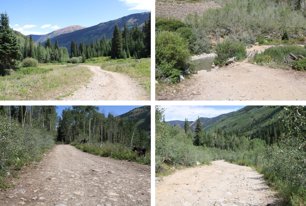
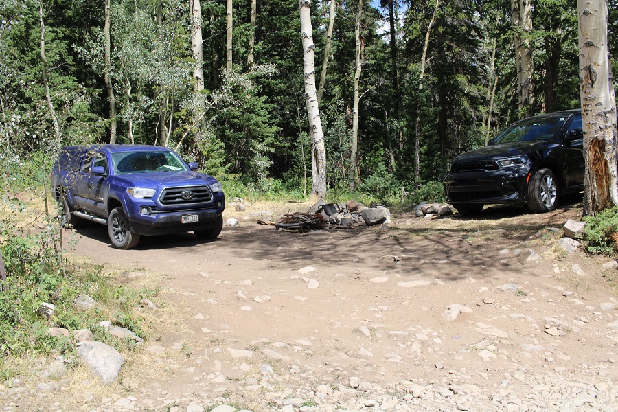
I drove past the town of Ashcroft, and right onto the 4WD dirt road that leads to Pearl Pass.  I stopped at about 9800’ at dispersed campsite #3.  There are 9 total, with signs asking you to only camp in the designated areas.  All first come.  Sites 1 and 2 were taken, so I parked in site 3. 

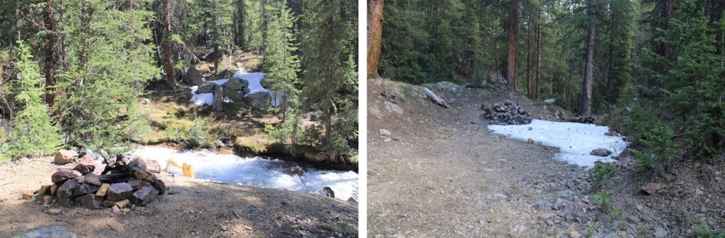
Here are a few of the other sites.

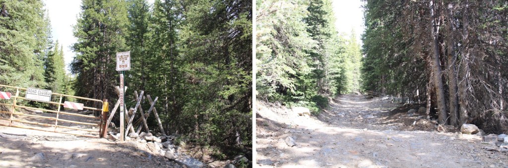
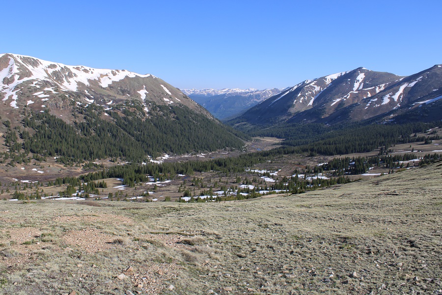
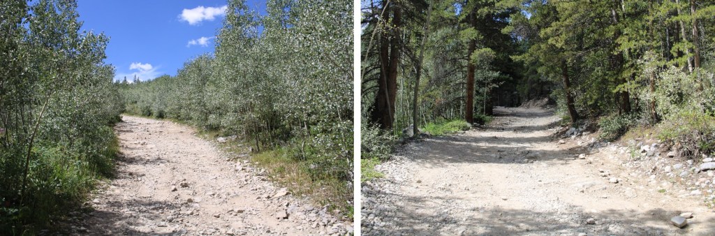
I was up and on the trail at 5am the next morning.  I followed the 4WD dirt road southwest, towards the Pearl Pass/Montezuma Mine junction.   About a mile into my hike I saw a bear on the trail (it ran away before I could get a picture) so those bear warning signs aren’t a joke. 

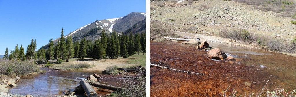
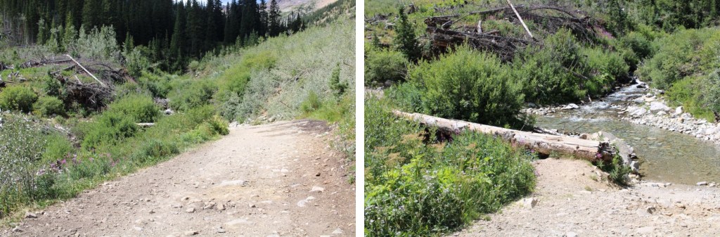
At 10200’ I crossed Castle Creek on a log bridge, and continued on

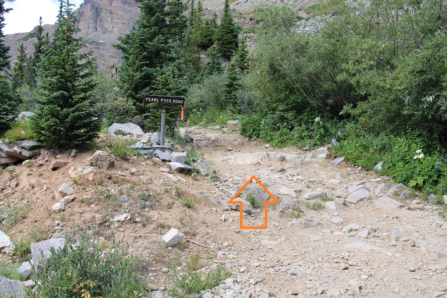
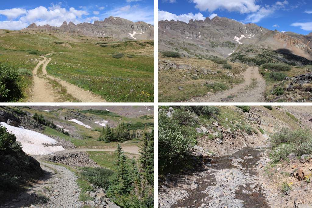
After hiking for 2.5 miles I came to the Pearl Pass/Montezuma Mine junction and went left towards Pearl Pass Road.  There are places to park here as well, and if you have a stock 4WD you should be able to make it to this point.   After this junction it’s modified, lifted (etc.) 4WD only.

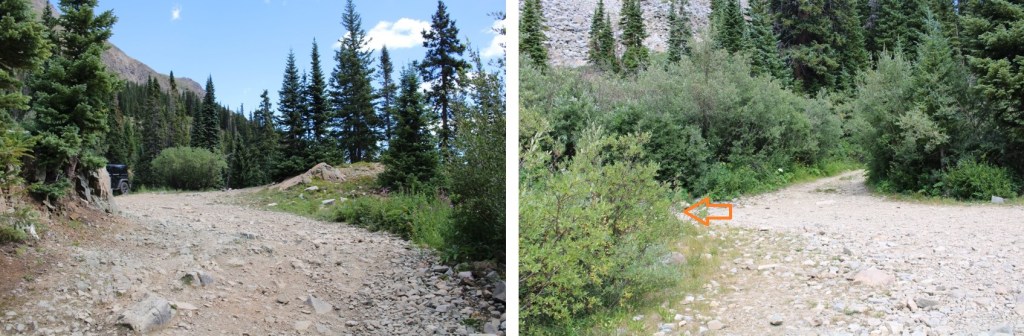
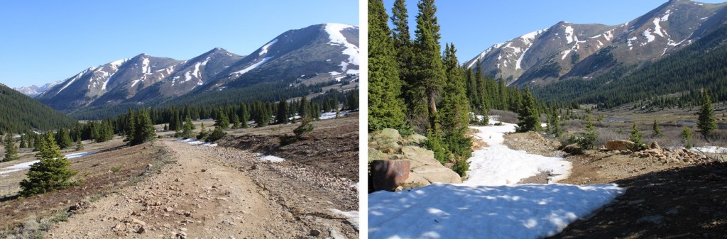
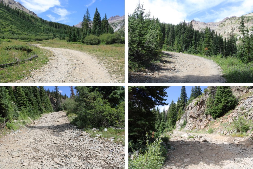
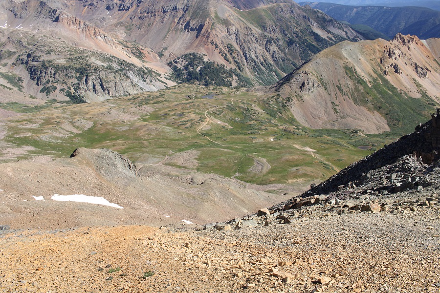
I continued on this road as it headed south.  Water from streams above ran down the road.

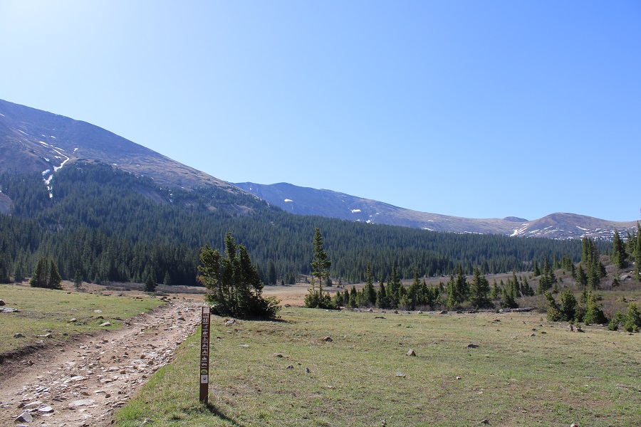
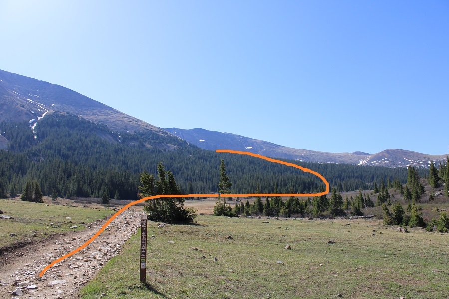
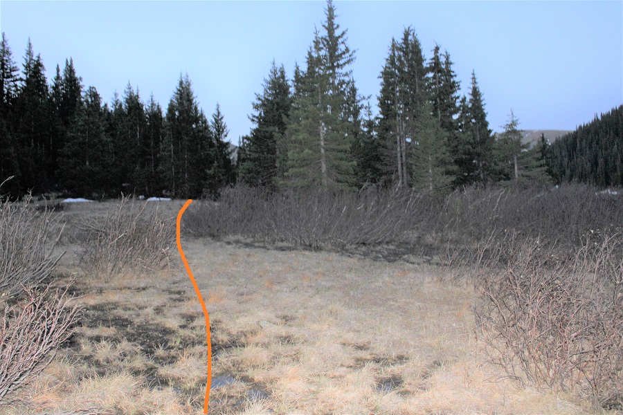
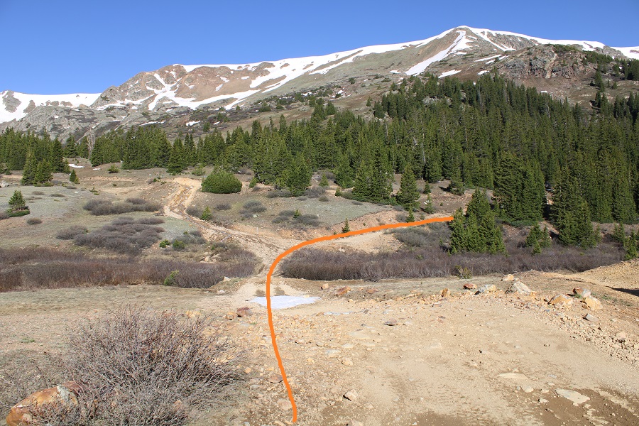
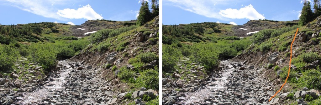
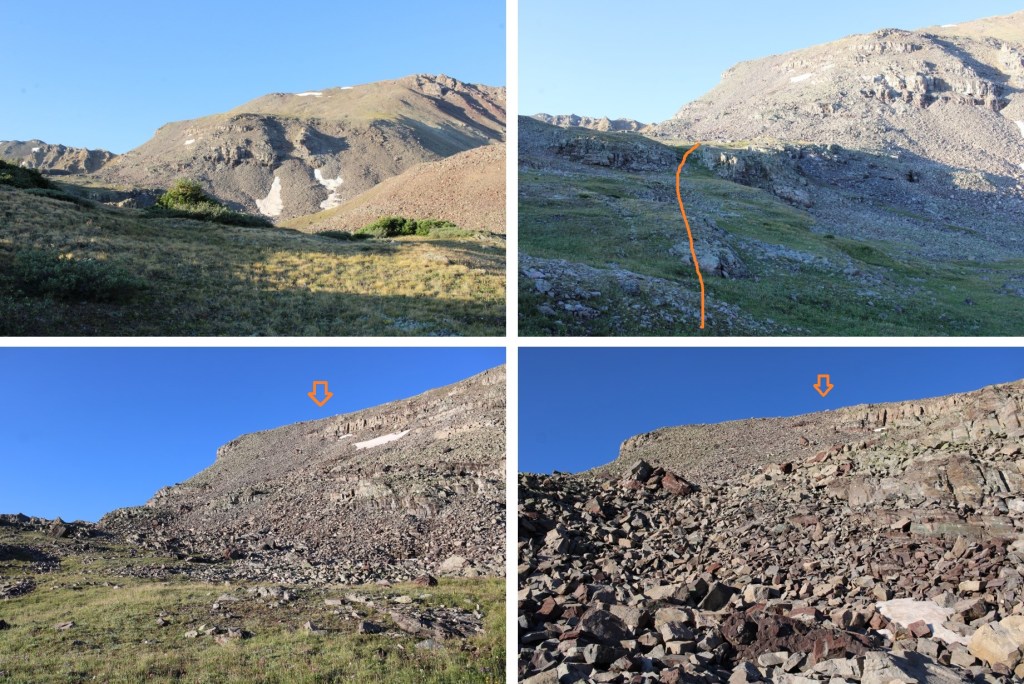
After hiking for 3.6 miles, and at 11800’ of elevation, I left the road to ascend west, up a game trail through a ravine

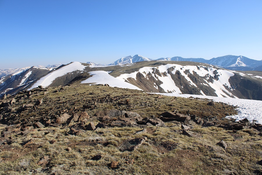
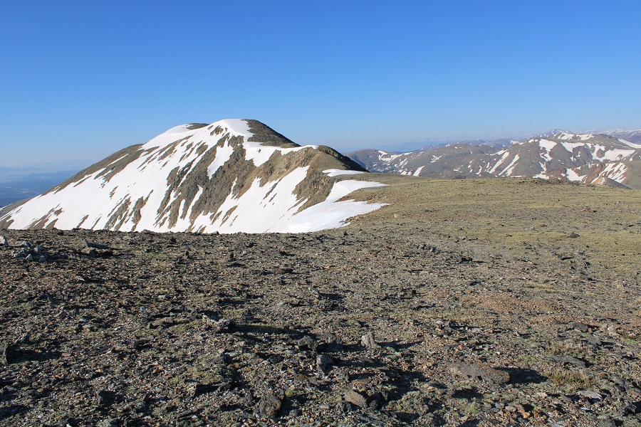
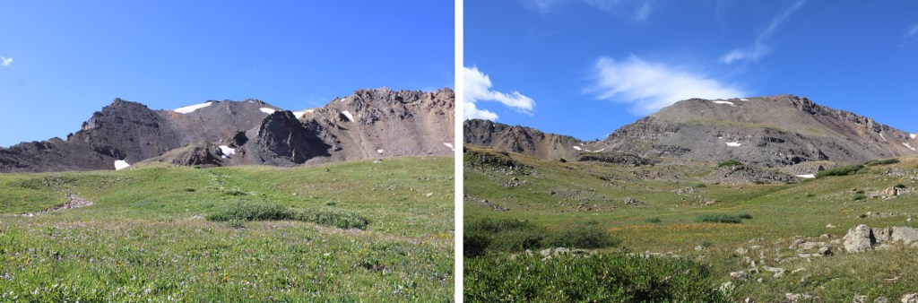
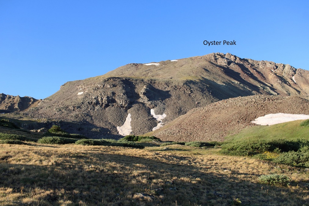
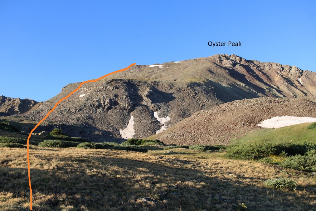
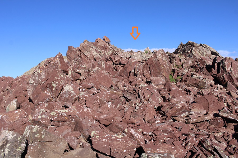
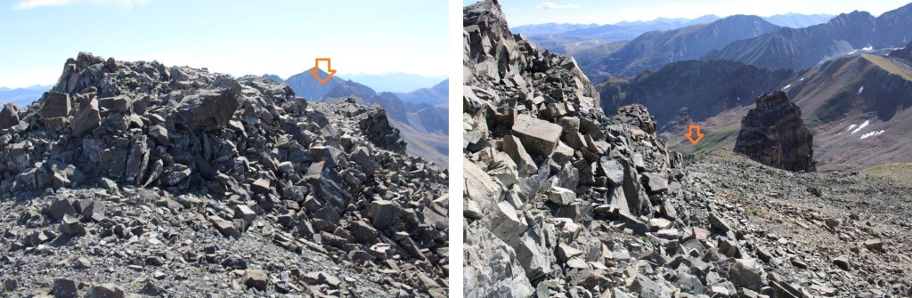
This gave me my first good view of Oyster Peak

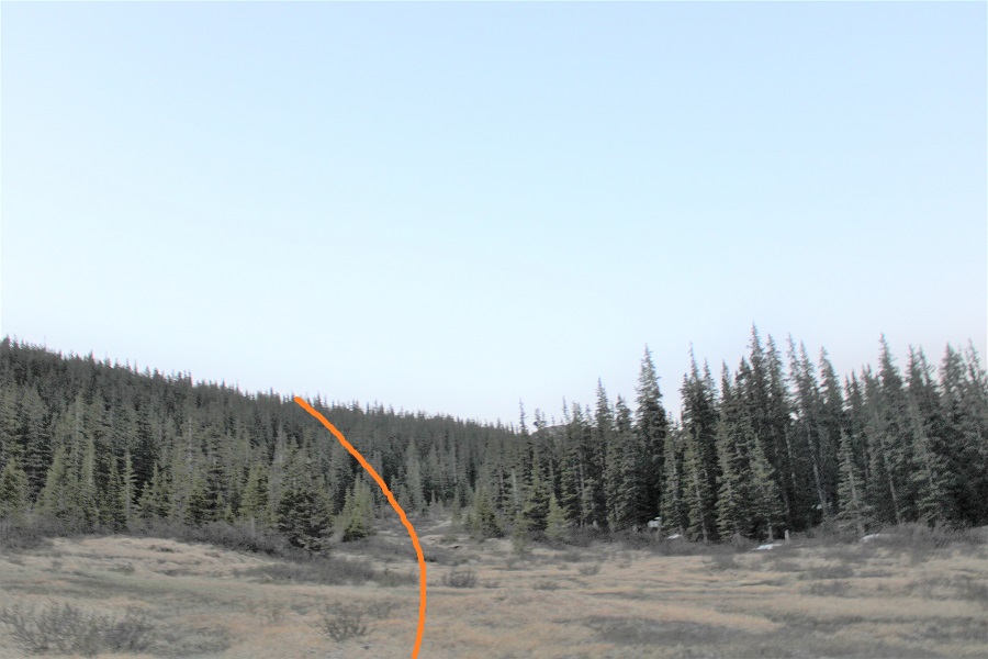
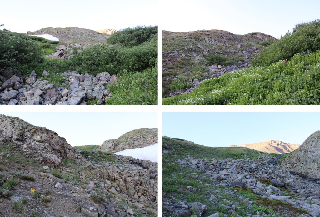
This is a choose your own adventure route to the ridge.  This is the route I took, keeping it all class 2 (although it was steep at times)

The route was rocky, and most of the rocks were not stable.  Here are some step-by-step pictures to the ridge.

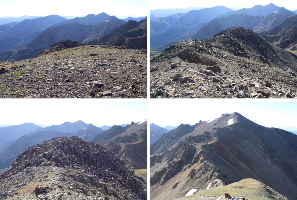
Once on the ridge I turned right, and headed north towards the summit.  This was all class 2.

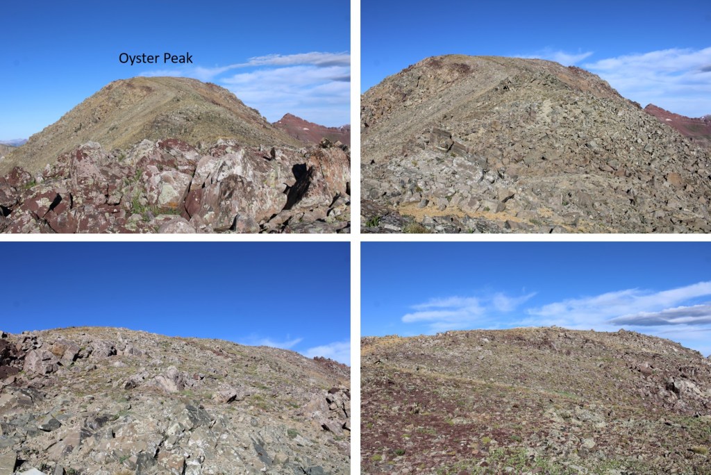
I summited Oyster Peak at 8am

Oyster Peak:

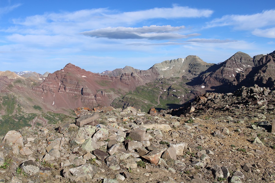
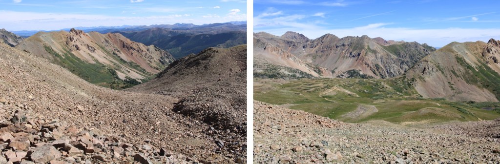
It was very windy on the summit, and a cold wind for August.  I turned around and looked southeast, at Pearl Mountain

It’s also good to note the descent route from this angle

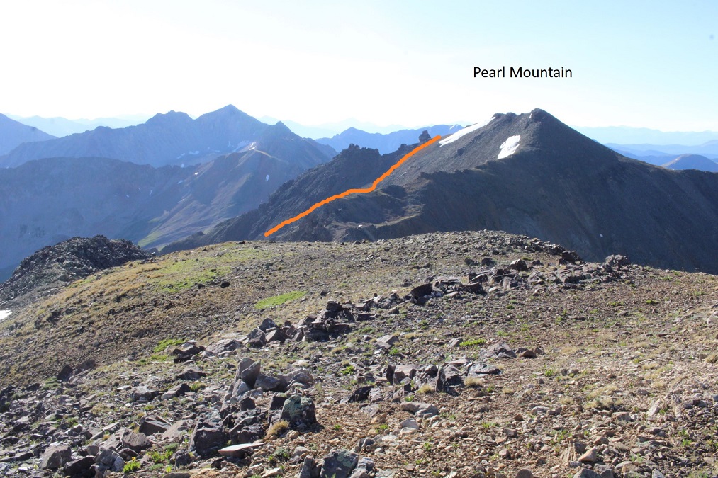
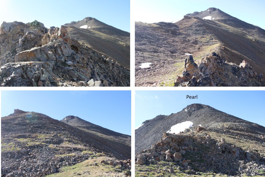
I continued southeast, towards the Oyster/Pearl Saddle.

Here is my overall route up to Pearl Mountain.  I was able to keep this mostly class 2, with just a few easy class 3 moves, mostly sticking to the ridge.  There were a few spots with exposure, made interesting by the 40mph winds. 

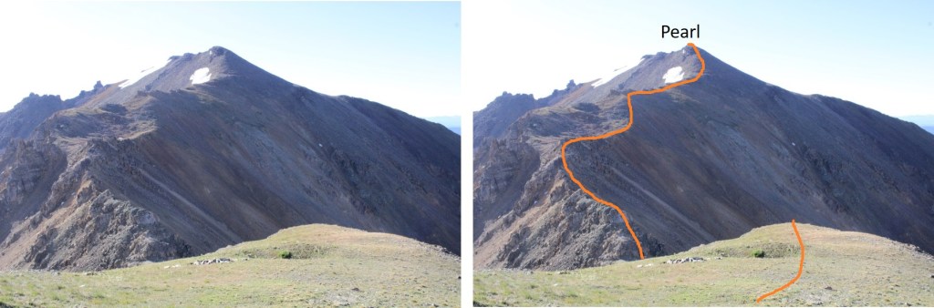
I went left at the end of the ridge to make it to the saddle

Here’s the route up the ridge.  It’s easier than it looks.

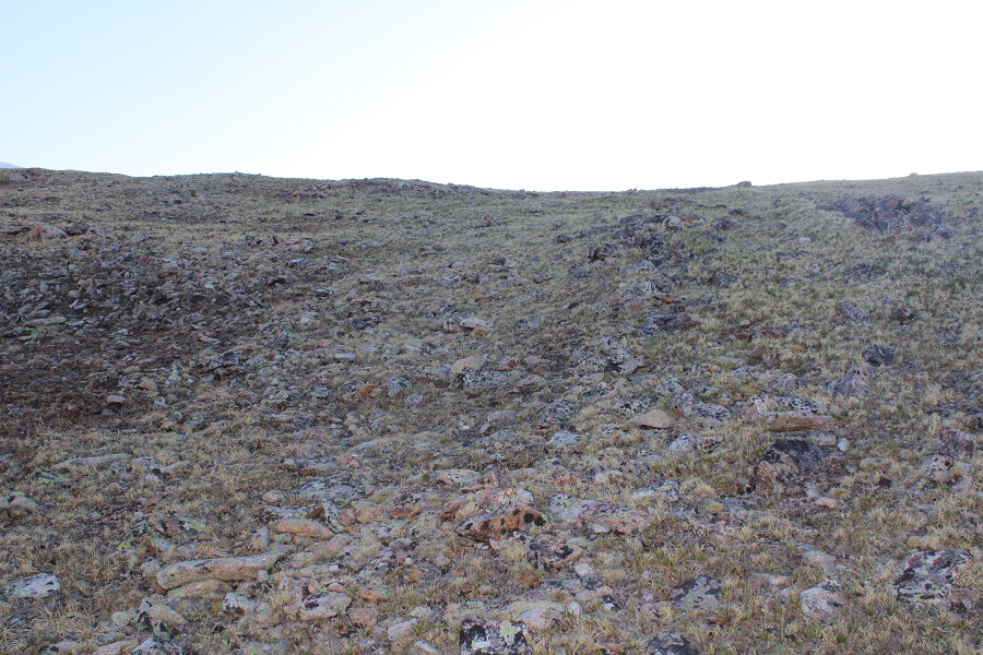
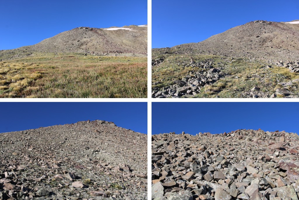
The rest of the hike is class 2, on what is loose, rolling rocks.  There are a few game trails through the rocky sections

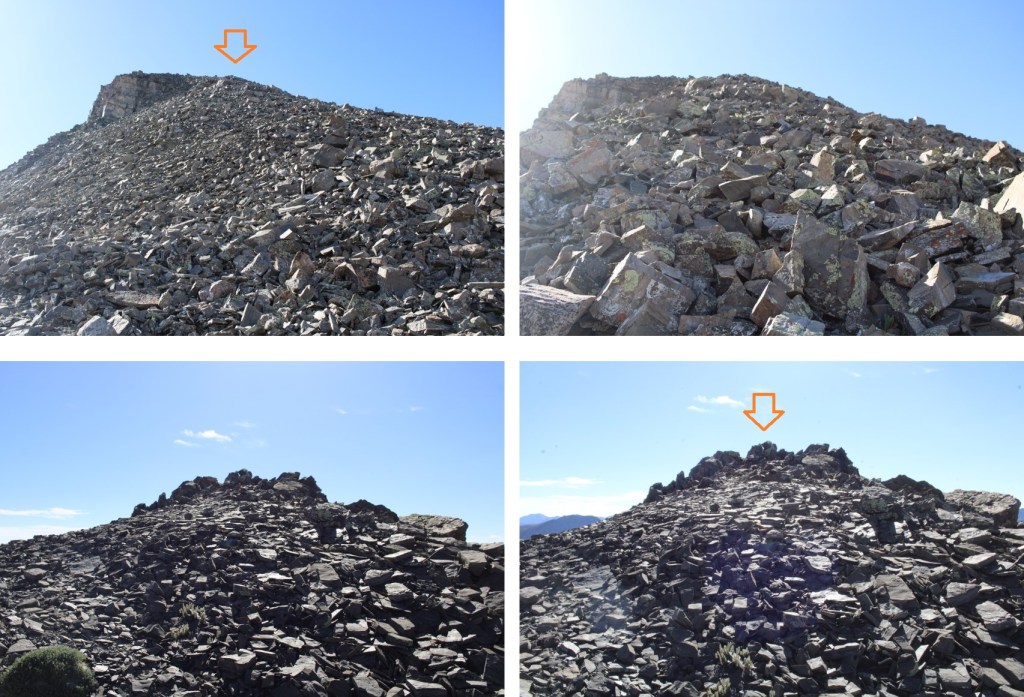
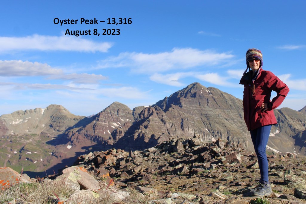
I summited Pearl Mountain at 9am
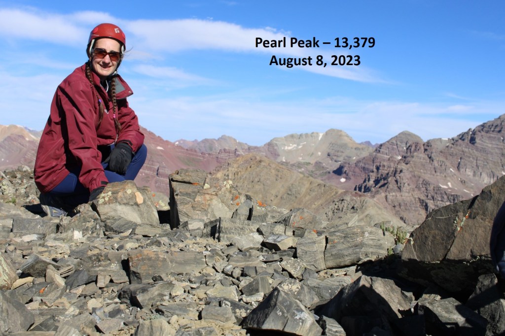
Pearl Mountain:

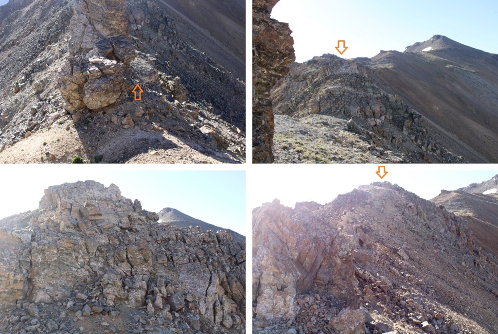
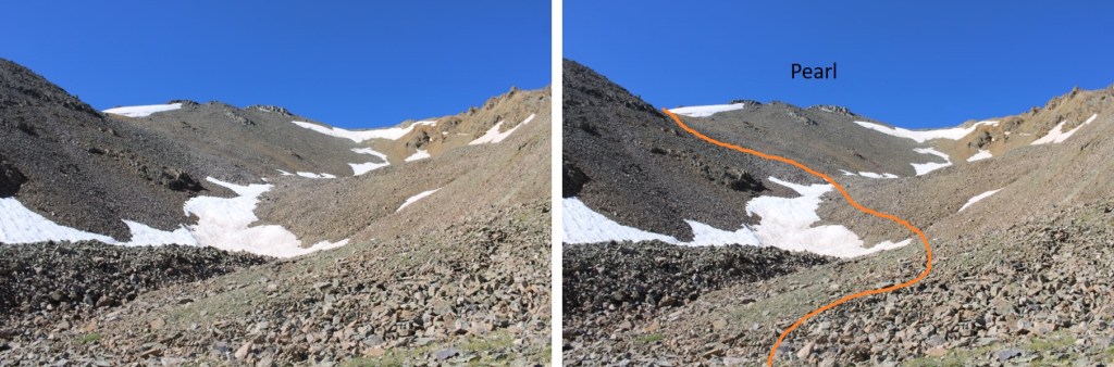
I continued following the ridge east, to an obvious orange gully.  This part of the ridge was sketchier than the first part.  In retrospect, I made some things class 4 when they could have been class 2, but the class 3 stuff was class 3, no way around it.  I stayed straight on top of the ridge

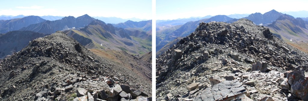
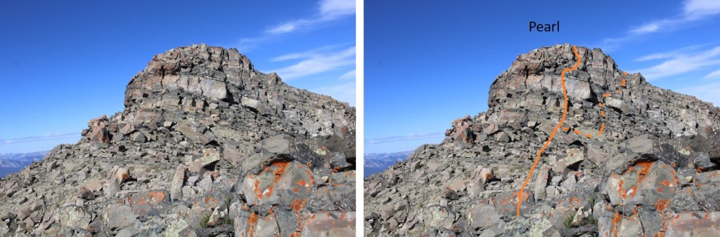
Here’s looking BACK at Pearl, the way I descended was class 4 (solid line) but when I looked back I noticed I could have descended on the dotted line, making it class 2

For the last bit of the ridge before the gully I dipped to the right, to keep it class 2

The gully is obvious, as it’s orange.  I had a small patch of snow to get through first.  I had the brilliant idea to glissade the 10 feet of snow.  This worked perfectly, except when I hit the bottom I ran into a good 8 inches of sticky mud I hadn’t expected.  I was stuck in the mud for a minute until I could pull my boots out.

Ok, now to head down the gully.  I was so glad I was going down this instead of up.  It was seriously steep.  It starts out as scree and ends with microwave sized rocks.  You can see Pearl Pass Road in the distance.  That’s what I was aiming for once I got out of the gully.

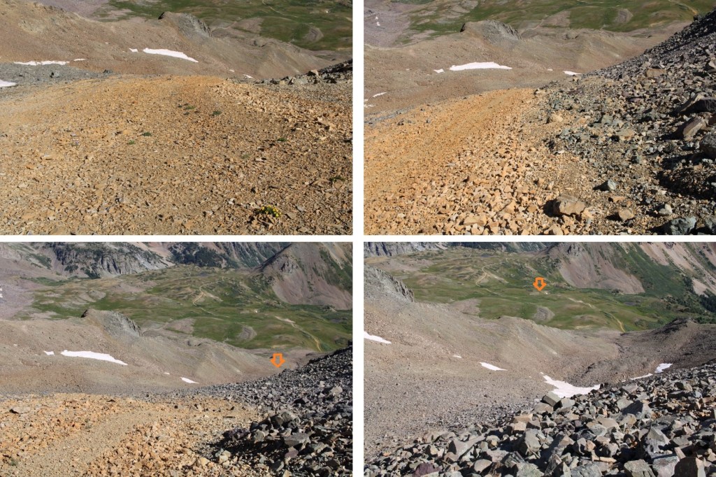
Here’s looking back up the gully

My route down the gully

And now back to the road

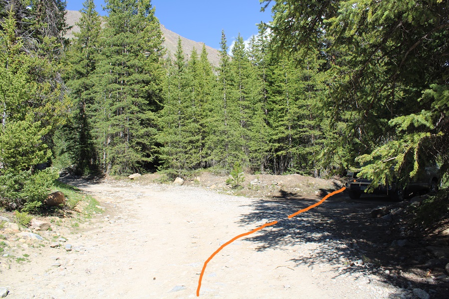
Back on Pearl Pass Road, I followed it north, back to the trailhead

I made it back to my truck at 11:45am, making this a 11.44 mile hike with 3923’ of elevation gain in 6 hours, 45 minutes

When I made it back, I was surprised to find another vehicle in my dispersed camping spot.  It was especially curious because the next three campsites were vacant.  I’ve been sitting here for the past 3 hours putting together this trip report, and they still aren’t back yet.  Edited to add:  About half an hour later I went to put my computer away, and their car was gone.  I never heard them leave. I’m not sure they knew I was here either.

On to the next trailhead!

Geneva Peak – 13,266 and Landslide Peak – 13,238

RT Length: 9.84 miles

Elevation Gain: 2965’

It took me longer than anticipated to get to the trailhead due to an unexpected semi fire on I70.  At first it looked like the entire hillside was on fire, due to all the smoke, but as I got closer I realized it was a semi.  West bound wasn’t closed however, so I was able to get past it faster than those travelling east (which was closed).

When I finally made it to Montezuma, I turned left on 285 and followed it towards Webster Pass

This is a moderate 4WD road (which is good, since I still don’t have my new truck).  They are serious about ‘no parking’ on private land here, and let you know you’re not allowed to park in any available pullout.

I was able to drive the .7 miles to the gate, but when I got there the gate was closed.  Had it been open, I would have been able to drive all the way to 11000’.  It was closed to allow for spring runoff (I’d find the next day it’s going to be a while before it opens:  Webster Pass is still socked in and the 4WD roads have several feet of snow in some areas).

There were 3 places to park here, but none of them were very level, so I turned to drive my truck to a spot I’d seen on my way in, just about a dozen yards or so back down the road.  As I was doing so, I noticed 3 ATVs:  The drivers drove them through the woods, around the closed gate sign, and up the road.  On my hike the next day it was obvious theirs were the only tracks. I was mad they were breaking the rules, but also hoping maybe they were ‘official’ and checking to see if the trails had melted out?  They didn’t look very official.  They also looked like they’d had to turn around.

Here’s the camping spot I chose for the night:  a legal place to park at 10780’, next to the Snake River.

I got out and explored.  There are several fire pits behind the parking area, and what look like good places to put up a tent.

After exploring, I went back to my truck, made dinner, sipped some whiskey, and started reading a book I bought at a used bookstore in Arizona:  The Magnificent Mountain Women, Adventures in the Colorado Rockies by Janet Robertson (1990).  It’s about all the first women to summit various Colorado Mountains, mostly 14ers.  While I only made it about 50 pages in that night, so far it’s a great book, with a lot of good points and tons of background information on the lives of these women and their ascents.  Added bonus:  it includes pictures. 

After a few chapters I decided to make it an early night.  I had a lot of dental work done the day before and I was still sore.  I had a hummingbird come visit me inside the topper of my truck (that’s 5 times now that’s happened to me), cleaned up, and went to bed. 

I know the route I took is not the conventional route to Geneva/Landslide, but I did this on purpose:  I’m hiking the loop with a friend next week and I’m trying to keep my streak of summiting peaks solo before going with someone.  I hadn’t yet done Geneva, so I wanted to tick it off before we climbed it together next week, so I got a bit creative.

I was on the road at 5am, just before the sun rose.  I took a quick short-cut from my camping spot through the trees to the gate (saved me a total of about 5 yards of walking). It’s an obvious and well-travelled side trail. 

I passed the gate and continued along 285

I followed this road for .85 miles, until I came to a wide-open gulch.  This is probably where I would have parked if the gate had been open. My hike would take me on a loop back to this place.

Here’s an overview of my hike to treeline: 

There was a sign indicating a trail that intersected the road at 11045’.  It showed there was a trail heading southeast, and indeed, in the dark it looked like there was a trail.  I knew I wanted to head this way, so I started following the ‘trail’.

I’m thinking this was a snowshoeing trail.  But, in any event, it took me in the right direction.  The only problem?  It was under spring runout.  The entire area was marshy and I was sinking in the slush. Not fun.  I found if I stayed higher, more to the left, I was able to miss the brunt of it.  The ‘trail’ ended after about 200 feet. One thing I knew:  this was not going to be fun on my way back.  I decided to take the road down. I continued hugging the trees for three quarters of a mile, doing my best to avoid the willows

Then, at 11180’ I followed a small drainage into the trees, and headed east to treeline.

Once at treeline my route was obvious.  I just aimed for the drainage and followed it up.  Note:  This is the southeast face of Geneva Peak, and it’s pretty much all tundra.  I could have just gone up the ridge and ended up in the same spot, or followed the curve of the drainage all of the way right and done Landslide first.  Lots of choices here.

I chose to go up the drainage, straight to the small saddle between Geneva and Landslide.  This was nice and steady on tundra:  nothing unexpected.

Once at the saddle I turned left and headed towards Geneva Peak.  There was still a lot of snow here, but it was firm and I didn’t need microspikes.  I just followed the ridge northwest to the summit

The summit was covered in a cornice.

I walked a little further north to take my summit photos.  I summited Geneva Peak at 7am

Geneva Peak: 

Here’s a look at Geneva and Landslide from my picture spot.

Here are some other 13ers in the area:

I re-ascended Geneva, left a summit register on the cornice, and retraced my steps back to the Geneva/Landslide saddle. 

This was a quick and simple hike, following the ridge east.  The snow was avoidable if I were to dip down to the right, but at this time of day it was still firm and I didn’t even need microspikes to navigate.


There’s a bit of a false summit (if you could call it that) on the way

I summited Landslide Peak at 7:15am.  I’m jumping for joy because this is the 250th unique 13er in Colorado I’ve summited solo.  Woot!

Landslide Peak: 


Here’s looking back at Geneva

Since I didn’t want to drop back down into the basin and go through the marshy areas, I decided to hike the ridge south back to Webster Pass, then take the road back. Here’s the overall route along the ridge.

And some step-by-step pictures up and over this unranked point that is 13180’

This is easy class 2 up and over

Once at the top I made my way down to the 4WD dirt road.

At the road I turned right, and followed it west to Webster Pass.  As you can see from this picture, even in June, Webster Pass is impassible due to snow.

Here I had a great view of how I ascended Geneva Peak

At Webster Pass you can follow the 4WD road back, making this a loop

Here you can see the road, on the other side of the Snake River, and the path it leads out

Once on the road, there were varying conditions, from dry, to muddy, and eventually to snow covered.  The snow covered portions would have been difficult later in the day, but this early in the morning the snow was still (mostly) firm and I only postholed a couple of times

Just before making this a loop I came to a water crossing where Snake River meets 4WD road 285.  It was about 18 inches deep.  I took off my boots, rolled up my pants, and waded across, doing my best to avoid the stagnant area

Then I continued following 285 northwest, back to my truck

I made it back to my truck at 9:30am, making this a 9.84 mile hike with 2965’ of elevation gain in 4.5 hours. 

Now, off to the airport to pick up one of my Girl Scouts: We’re off to California for the week for their Senior trip to learn how to surf.  It’s our last trip before they all head off to college.  Maybe I’ll be able to find some good hikes along the beach? 

“Chill” Hammock Camping

1

This year Girl Scout Troop 2393 decided to use some of the proceeds from their cookie sales to go Hammock Camping. Of course I was all about this, so we planned a couple of dates, one for June, another for July.  The theme?  “Chill”.

This past weekend was the first campout, and I just have to say, success! (kind of…)

After a long week of little sleep everyone met at my house at 6am on Saturday morning and we packed up the gear in my truck. It’s amazing how much gear is needed for a few days doing nothing!  After the 3 hour drive full of conversations centering around summer reading lists and upcoming concerts we arrived at the dispersed camping area and the girls spent some time picking out a site.  They didn’t like the first few spots, but settled on one that had creek access and trees they could set up their hammocks comfortably.

We unloaded the truck and split up into two teams: One to set up hammocks, another to collect firewood. I headed up firewood collection, which proved more difficult than anticipated.  We weren’t able to find much wood on the ground, but we were able to find some downed trees, and decided to just take those back and cut them up at camp.

2

The girls weren’t yet done setting up camp when we made it back with the firewood so I got some pictures of them in the process (the towels help protect both the trees and webbing).

3

After campsite set up the girls had fun playing in the hammocks. The girls who chose to set up their hammocks on top of each other (despite my telling them it would make getting in/out difficult) had a blast getting up into their hammocks, and then turning themselves over so they were face to face with the person below…

Getting into hammocks

4

5

The girls did a great job! The only thing wrong with this set-up?  The weather forecasted rain, and they didn’t have tarps set up yet.  That changed quickly when the weather picked up.  We got a light dusting of snow and the girls all ran to set up shelter

6

Believe it or not, the tarps were adequate. Ok, next we’re on to food.  The girls cooked their own food as well… some were in charge of fire

7

and others were in charge appetizers. The plaintain chips were amazing!

8

My favorite was the whole chicken they cooked in the Dutch Oven!

9

After dinner the girls sang songs by the campfire. Emily, just getting back from a week at Girl Scout Camp, was especially energetic.  Her call and response songs garnered less than enthusiastic comebacks, and she loved hamming it up even more!  As you can see from the photo below, the weather became colder than anticipated

10

Around 8pm the snow became heavier and even though it was still light out we decided to call it a night. It continued snowing all night long.  It wasn’t enough to accumulate, but it was wet and icy

11

12

This was the first time I’ve ever slept in a hammock, and I have to say, it’s not a bad way to camp! I didn’t sleep very well, but it wasn’t due to the hammock, it was due to the cold.  I was warm everywhere except for my feet, which felt like solid blocks of ice.  I woke up in the middle of the night to 3 rounds of gunshots, 20 at a time in rapid succession.  After that it was hard to fall back asleep.  It got down to 24 degrees. The morning was cold and the girls were slow to become cheerful.  They wanted to “chill” as much as possible, so we cooked our waffles over the campfire (ok, heated them up)

13

The snow wasn’t letting up and it didn’t look like it had any plans to stop, so we packed up our gear earlier than we’d anticipated and drove back home. Everything came back wet and muddy.  It’s currently sitting in my living room (on a dry tarp), ready for the next trip.  All in all the weekend was a success, and we expect the next one to have better weather, so it should be just as much fun!