To be honest, none of these summits is really a big
deal. I mean, I live at about 7000 feet
(traveled down in elevation to get to this trailhead) but I’m sure they sound pretty neat to my out
of Colorado friends. So why am I posting
the elevations? Basically I’ve done this
because it’s noted on the map and I just want to keep good records. I’m not trying to impress anyone. Although Mt Muscoco was a pretty good
training hike. It started to kick my
butt by the end…
Once again this morning, after hitting the gym I drove down
to Cheyenne Park. I made it to the trailhead at 7:20am and took a quick picture
of the trail. This hike didn’t look all that difficult,
but most people I know who hike and live in Colorado Springs have done Mt
Cutler several times. It’s kind of a “thing”. However, no one I’ve talked to has ever done
Mt Muscoco.
There was one other car in the parking lot, an old Subaru
hatchback. Cool. The vehicle told me it was probably someone
who liked to hike and probably wanted to be left alone. I can work with that.
This entire hike is uphill.
Mt Cutler has an elevation gain of 415 feet in a mile, which wasn’t much
of a challenge. After turning the first
ridge I heard a waterfall. I assumed it
was Helen Hunt Falls, which is a bit further up the same road I’d drove in on. But as I looked closer I noticed it was much
bigger and had different structures at its base. I
quickly realized it was Seven Falls, not Helen Hunt Falls. So cool!
I was getting a free look at the falls!
Around the next bend I saw the Will Rogers Shrine of the Sun
above the Cheyenne Mountain Zoo. Here is
where the path got tricky. The trail
branched off into several smaller trails, but they all seemed to head in the
same direction. I noticed this problem
on my hike yesterday too, and can only figure it’s due to people hiking in the
winter snow and kind of making their own trail. This happened several other times today, but luckily all trails ended up catching up with the original trail.
Mt Cutler wasn’t very impressive. It only took me about 15 minutes to hike
there, so I decided to take a quick hike to the Mt Cutler Overlook. That ended up being totally worth it! The views from here were 360 degrees of all the
Pikes Peak Region.
I spent quite a bit of time just enjoying the view. As I was getting ready to leave I heard the
chimes from the Will Rogers Shrine. So
cool and unexpected!
Now it was time to tackle Mt Muscoco. I actually went down quite a bit in elevation
as I was hiking to the turnoff, so I took my traditional “hiker selfie” that really only works with morning light.
The rest
of the hike was uphill, and while it wasn’t as steep as the incline, I’d
compare it to the first 2 miles of the Barr Trail. It also had some pretty cool stairs, but they
were all paced at about 1 and a half steps, making them useless (so it looks
like everyone just hiked on the trail beside them).
Here’s a picture of the summit.
The last ¼ mile was just like a 14er: Really close but a bugger to get there! This part of the hike was indeed a bit
challenging, but mainly because it just went straight up. It was at this point I saw three girls in
their 20s hiking above me. I quickly
passed them, and learned they were the owners of the Subaru below. This part of the hike had a bunch of trail
markers, which were needed and appreciated.
The view from Mt Muscoco was the best one of the day
(probably because it was highest in elevation).
As I stood there I saw airplanes flying into the Air Force Academy for
the graduation. Two days in a row! Awesome!
The trail didn’t end at the summit, but kept going for about
another third of a mile. I hiked it to
the end, turned around, and hiked back down.
Down was a bit challenging as it had been steep hiking up. It was definitely not a running trail.
About halfway down I met a man who’d just returned from
Poland (he was stationed at Ft Carson).
He was having a difficult time adjusting to the altitude but preparing
for Pikes Peak. I wished him luck and
told him to pace himself. He looked like
he’d already been sitting there for a while…
We had a late frost, so most of the trees and bushes had
dead new growth on them, but some were just beginning to emerge.
I also saw a few asters along the trail.
All in all, it was a really nice hike, and a little
challenging. In fact, the sign at the
trailhead says “advanced” for the Mt Muscoco trail, which I’d agree with. I was back to my car by 9am after hiking
about 4 miles in just over an hour and a half, elevation gain (estimated because it was multiple trails up and down) was just over 1300 feet .
Oh, and I saw a couple on the trail who looked like they
hated each other, hiking about 20 feet apart.
I see this a lot on trails and it makes me wonder why they hike together
if they don’t like each other? Either
that or the difficulty of the trail does funny things to our facial features as
we hike…
Please don’t mind the hot mess that is my hair in these photos: I came straight from my shower at the gym and forgot my hairbrush on the hike.
I’ve been trying to do this hike for a while now, but the
directions I’ve been finding on the web have been wrong (imagine that). The two sites with directions state the
trailhead is 3.9 miles from the initial checkpoint. So I’ve done that several times, even driing
as much as a mile in either direction, and I’ve been unsuccessful in finding
the trailhead. But after purchasing the
Pikes Peak Atlas earlier this week, and talking with a friend at the Humane Society
who’s done the hike, today I was able to successfully find the trailhead!
OK, so it’s not 3.9 miles from the checkpoint as indicated,
but more like 5.5. In any event, if you
take the USAFA southgate entrance and make a left on Stadium drive, the turnoff
will be before the next checkpoint. In
fact, it will be about 20 feet before the next checkpoint, on your left. Follow the dirt road and the trailhead will
be clearly marked. My advice is to
bring with you a sturdy hiking pole, water, waterproof hiking boots, and a
sense of adventure.
I saw some wild turkeys on the drive up…
To be honest, there isn’t much information about this hike
online, so I’ll detail it here. Please note these are “early season” conditions, and it had snowed/rained for the past 3 or 4 days, so I’m sure the water levels were higher than normal.
Yes, the trailhead is clearly marked, in multiple
areas.
It’s hard to get lost for the
first half mile or so, but after that it’s anyone’s game. I saw
two other vehicles in the parking lot when I got there, so I surmised I’d end
up meeting two different hiking parties. I also forgot my map in the car. Well, I didn’t really forget it, as I remembered when I was about 10 yards from my truck, but I didn’t feel like going back to get it. In any event, I’d taken a picture of the trail at the trailhead. How difficult could this be?
I saw several scruffy looking rabbits along the trail.
The trail goes straight up for about 90% of the hike.
Here’s the indication you’ve left the USAFA
And as soon as you get to the top of this hill there’s a
great view, and this is where you’re leaving the easily marked area of the trail.
Check out this really cool water collection pool in the side
of the mountain! I’m sure it’s a
waterfall of it’s own earlier in the season.
The first ¾ of the hike is up through a lot of loose
granite, over creeks and yes, up waterfalls.
The trail actually goes up the waterfall. For anyone who’s ever climbed up granite, you
know it’s very slippery when wet. This
was indeed the case here.
The trail is difficult to find in places, but I reasoned
since I was hiking towards a reservoir, as long as I followed the water I’d
eventually find it, right? That ended up
being a good assumption. Also a friend
of mine told me she’d recently done this hike and kept thinking it couldn’t be
right to keep crossing the waterfalls, but that was indeed how it was done
(Thanks Paige for the advice!). I was
lucky it was still early in the season and the leaves hadn’t emerged yet. Otherwise it would have been really difficult
to see through the brush to find the eventual trail.
The trail went back and forth over a steady stream of
water. I was really glad I’d brought my
waterproof hiking shoes, and wondered how I was going to hike down these slopes
(up wasn’t easy, but I had footholds).
Where there were crossings over the stream they weren’t very
elaborate: Just a couple of
strategically placed logs. This is where
a hiking pole comes in handy!
Check out these baby aspens!
I love the intense green color of the trunks.
Most of the trail us rocky granite. You can tell it’s covered in snow during the
wintertime, and I’m assuming well traveled.
Because of this there are multiple trails to the same destination, all
paralleling each other. All are
difficult.
As soon as I made it to the top of the waterfalls it was as
if I was in a different world! The
temperature dropped 20 degrees and there was snow everywhere. Water was dripping like rain from the trees
as the snow melted in the morning sun. This is where I saw my first group of
hikers. They looked like cadets, and there
were 5 of them, so I figured they could indeed have been the owners of both
vehicles, but at least one.
And there were tons of animal tracks…
After about ¼ of a mile hiking through the cold I came upon
a clearing that still had snow, but it was much warmer and quickly melting.
The reservoir was beautiful!
As I approached I saw a fisherman, and surmised he was the owner of the
second vehicle. We exchanged greetings
and I snapped a few pictures.
I could hear the sounds of gunfire (expected on base) and
the drumming of woodpeckers. I saw
several fish jumping in the reservoir. I
didn’t stay long as I actually had quite a bit of work to do today. And I was getting cold. My Raynauds was really kicking in (and
unexpectedly). My finders were red and
beginning to turn white. I knew I needed
to get to a lower elevation to arm up.
The way back down was indeed more challenging than up, as I
was hiking down slippery slopes with little footing. When hiking up it’s much easier to find a
place to put your foot, but when going back down everything just slips.
And much of the trail was covered with small creeks of
water.
Just as I made it to my truck I heard a very loud rumbling
and saw the Thunderbirds soar by! So
cool! This was totally unexpected and
awesome, so instead of taking the second hike I’d planned for today I stood
there at the trailhead for half an hour just watching them practice.
I had a very unique view of their flight, as
everyone else in the Springs was watching them looking west, and because of the
hike I’d just completed I was watching from the east. I love living in Colorado
Springs!
One of my favorite parts about this experience was seeing the cadets watch the flyover from on top of the buildings.
I’m not one to miss an opportunity to go hiking, so when
Thomas’ Boy Scout Troop decided to meet for a hike instead of a meeting I tagged
along.I brought Emily with me (against
her will) because she’d had a tough day at school and I wanted to spend some
time with her.That ended up being a
great decision!
Troop 2 is boy led, which means its chaotic most of the
time.The boys don’t fully understand
they’re supposed to lead, so there’s a lot of standing around waiting for stuff
to happen until someone “takes charge” and things get going.This is usually Thomas.It became apparent right away these boys
weren’t going to hike or do much of anything at a quick pace, so before they began
I took a group picture of the boys and then set off with Emily to hike by
ourselves.
Usually when we go to Red Rock Open Space we hike from the
lower lot down up for the first quarter mile or so, then down through the quarry,
but because of where we were parked to meet up with the Troop we decided to do
our normal hike backwards.This meant a
lot more uphill hiking, but since it’s a relatively easy hike anyway it didn’t
make much of a difference.The weather
was perfect (around 75 degrees) and we got to watch the sunset. The cool part
was we made it to the pond earlier in the hike than we would have if we’d hiked
our normal route.
There were a few
Canadian Geese with goslings swimming in the pond.Adorable!
I’m not a big fan of taking selfies, so I’m not really good
at taking them. Emily doesn’t take many selfies, but she’s better at it than I
am, so she taught me as we were hiking. We had quite the conversation about how I don’t like taking selfies
because they make me look old…
Emily’s a pretty quick hiker so we were able to keep up a
moderately fast pace.We had a great
conversation about her school life, friends, sports, ways to reduce anxiety, and
her Gold Award project.She’s excited to
get started on her project, which means she needs to compose a quick email to
the organization she wants to work with. I was surprised at how enthusiastic she is about the whole thing: she
wanted to start the email tonight.
About ¾ of the way through our hike we started paralleling
the Boy Scout Troop.They were on a
different trail, so I took some pictures.
We ended up finishing at the same time as the boys, but we hiked an
extra 2 miles.It had been a good decision
to split up.Not only did I have a great
conversation with Emily, but I hadn’t been frustrated by hiking slow.
Check out the Indian Paintbrush I saw towards the end of the
hike
While hiking Castle Rock yesterday I saw this sign at the
base of the trail, indicating if you hiked the trail 4 times you’d have hiked
the equivalent of a 14er.
So much is wrong with this photo!Who’s idea was this, and how did it make it
this far?Flat 14ers?What?My
MBA is screaming“False advertising!”
In what way does this involve climbing?
I get someone out there is trying to encourage people to
exercise, and that’s great, but a sign like this is an outright lie.It’s giving people a false sense of achievement.I’ve hiked 14ers, and they are in no way equivalent
to walking around a park 5 times.In distance
yes.Technically distance wise they’re
the same.Comparing climbing a 14er to
walking on a flat trail in a circle?No.That’s like comparing someone who’s walked in
a straight line for an hour or climbing stairs for an hour. Or someone watching
a doctor give an operation and saying you’ve performed one.Comparing someone who’s flown a plane from
Los Angeles to Miami to someone who’s done it on a simulator.Can the person who used the simulator seriously
say they’ve flown?That it’s the same
thing?Yes, they went through the same
motions, but they aren’t the same!
This sign doesn’t take into account all the factors in
addition to distance that go into climbing a 14er.Things like elevation gain, the effects of
altitude, exposure, danger, route finding, fatigue, weight of necessary gear, obstacles
on the trail, etc.
This sign needs to be changed to:You CAN hike the distance.
I was alone today at work after 11:30am. I looked out the window, and noticed that while it was supposed to be cold and raining, the clouds had not yet moved in to the point where they were causing a problem. In fact, it actually looked a bit warm outside.
So I decided to hike Castle Rock. I’ve worked just outside the trail for over 5 years and I haven’t once hiked the rock. This is a shame, and something I intended to correct.
I’d done my research a while ago, and already knew the trail difficulty, directions, etc. The city page labeled it a difficult 1.4 mile loop, and strongly encouraged only fit hikers to attempt the trail.
So I drove to the trailhead and decided to take my lunch break hiking the rock. It was only 1.5 miles, so I should have plenty of time.
The trail was really well marked. Some of it even looked like a service road. It was all uphill to the top (obviously), but it was in no way a “hard” trail. So I ran.
The base of the rock looks pretty cool…
From the top I had a pretty good view of the entire front range, but it was really windy and the clouds were coming in for an afternoon storm, so the pictures aren’t too clear. Pikes Peak is in the middle/left of the photo below.
On the way down I took another part of the loop, and encountered a lot of railroad tie type stairs. I ran down those too.
At the bottom I noticed some of the trees were beginning to bloom, so I tried to get a cool shot of the rock. This was the best I could get.
As soon as I got to my truck is started snowing pretty hard, so I’d made the hike just in time.
Final thoughts: This trail was NOT difficult. It was really, really easy. So easy I ran. I was back at work less than half an hour after I’d left, including travel time and picture time. The rock is only 6224 feet, not that much of an achievement. But I climbed to the top, which was my goal, so I considered it a win!
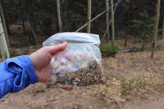
I had no intention of hiking Pikes Peak again this year. I’ve already hiked it 10 times, and my last hike was my best one (I hope your last one is your best one). But a couple of days ago my mom told me Granny loved wildflowers, and we should plant some in her honor. I just happened to have about ¼ a pound of Rocky Mountain Wildflower seeds sitting around at home. These were nowhere near enough to scatter and make a huge difference on a roadway, but they were perfect for lining a portion of the trail along Pikes Peak. The best time to disperse seeds is either October or April, and since there is no way I’m hiking Pikes Peak in April under several feet of snow I decided to go this week.
The weather Friday looked perfect! All forecasts indicated it would be in the 80s in Colorado Springs and 42 at the summit. That’s GREAT weather! Especially for the end of October. There was also a picture I’ve always wanted to take but for some reason spaced out on the past two times I’ve summited, so I planned a Friday hike.
Up at 2 am I started the coffee and got a spoonful of peanut butter as a snack. I ended up finishing the coffee on the way buy only had about half the spoonful of peanut butter. I just wasn’t hungry.
I made it in good time to the trailhead but there were 4 cop cars and a fire truck at the entrance to the parking lot. Nothing seemed to be going on (no accident/bystanders/victims) so I was a bit intrigued. One of the cops moved his cruiser and waived me on. There were 2 other cars in the parking lot. It was a nice 53 degrees. I saw a hatchback enter the parking lot as I began my hike at 2:58am.
Today I was in no hurry to summit. That doesn’t mean I hiked slow, but I wasn’t pushing myself as I was still sore from the hike earlier this week. I saw no one the entire hike up the mountain. I didn’t trip once (something that often happens in the dark because of all the loose rocks and roots). I didn’t see any animals except a rather large rabbit. I did hear what sounded like a large bird flapping in a tree but didn’t see anything when I shined my flashlight in its direction. When you hike at night eventually you get pretty good at identifying creatures in the dark by the sounds they make. I could tell it was a bird (not an owl because I wouldn’t have heard an owl) and its size by the sound it made. I can also tell if it’s a rabbit or a raccoon even before seeing the animal as different sized animals make different sounds.
There was no one visible at Barr Camp as I passed it in the dark. No tents set up on the outskirts of the camp either. The cars must have belonged to someone staying at the A-frame.
I made it to the A-frame at 6:19am. It was still dark. No one was about but the tarp was in place so I assumed someone was sleeping in the A-frame. I passed and walked about 100 yards before waking the kids up for school (I call them to make sure they’re awake. They usually are…).
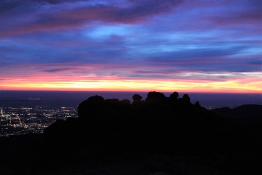
As I reached treeline I could immediately tell I wasn’t going to get the picture I’d wanted to get. It required a good sunrise and despite the fact it was supposed to be 80 degrees and clear there were lots and lots of clouds on the horizon. I wasn’t going to see a sun this sunrise. It was still beautiful:
I now had 3 miles to go to reach the summit and seriously considered turning back. I had no real reason to summit as this was a last minute trip and I wasn’t going to get what I wanted out of the rest of the uphill part of this hike (picture). I went back and forth for a few minutes in my mind and eventually decided to keep at it. Hey, maybe those clouds would miraculously go away in the next hour? While it was highly unlikely I kept hoping and watching east.
Here’s where my mood turned sour. I was sore and tired from the hike earlier this week, and while I’d made fantastic time this far it was obvious I was slowing down. I don’t know why that depressed me but it did. I could tell I was hiking “slow”. I was upset I wasn’t going to get that picture. That meant I’d need to at least TRY to hike again this year, and because of the type of picture it is I’m going to have to get up at 2am and hike for 10 miles in the dark to get it. Despite what I’m sure you’re all thinking, I don’t actually enjoy hiking in the dark alone. It’s quite scary. I’m not a fan of the dark. I don’t get the mail after dark or go on night walks by myself. I’ve been known to run from room to room when the lights are off. Hiking in the dark isn’t something in my comfort zone: I just do it despite being afraid because I like the end result.
I’d ben hiking with my good camera instead of my hand held. It was heavy, cumbersome, and now unnecessary. In addition, I hadn’t seen any wildlife on this hike. My 11th hike on Pikes Peak and I’ve yet to see a bear. That was upsetting in itself. The lack of the sunrise I’d anticipated meant I was going to have to hike in the dark again, risking the cold weather, shadows, and my fears.
This type of thinking on my part wasn’t typical and I became cognizant it must be due to low blood sugar. I hadn’t eaten anything yet and I’d hiked about 12 miles at this point. My stomach began to tighten. I told myself food was just going to have to wait until I reached the summit because I wasn’t making good time.
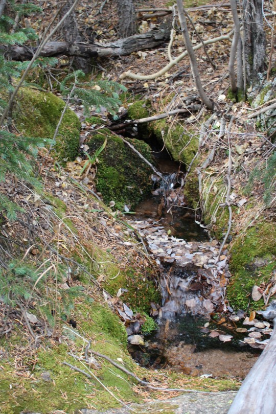
Check out the ice coming out of the mountain. Ah, geology at work, even without snow.
I summited at 7:54am. Not my best time, but not bad. I was hiking about 15 minutes behind my usual pace. Much to my surprise there was a man in a bright blue winter coat standing in front of the old summit house with his back to me. He was probably in his mid 20s, hunching out of the wind putting his pack together. I said hello and sat in the shelter of the window next to him to block the wind (as the summit house still wasn’t open).
I assumed he’d come up the back way from the Crags (a mere 6 miles and starting at about 10,000 feet, so it’s a much easier route to summit Pikes Peak). Eager to get started again he asked me if it’d been windy on my ascent. I told him no, it just started getting windy as I reached the summit. He told me to “enjoy my time” (mountaineering talk for the time spent on the summit before hiking back down), and was on his way, presumably the same way he came because he didn’t take the Barr Trail down. I
wished I’d engaged him in more information about his trip. He obviously knew what he was doing. I found myself wanting to know more details. Not for romantic reasons but personal: Which route was he hiking? What other hikes are available to me, how long do they take to hike, and are they worth it? He only had on a daypack, so he wasn’t backpacking… oh well.
I’d worn 2 pairs of gloves after reaching treeline, but took one pair off to eat. I had about 12 pieces of dried mango and my fingers were quickly turning numb. The wind was picking up and it was getting COLD quick. I put on my extra pair of gloves, took a picture facing southwest of the Junkins Fire, and started hiking down. I’d only spent 5 minutes at the summit.
This is where the wind became intense. Forecasts stated 20-25mph wind gusts, but these were sustained winds of at least 40mph. I was blown sideways several times. The wind made it miserably cold, and to top off my bad mood my right shoelace became untiled about 20 yards into my decent. Great. I had no use of my fingers at this point because they were frozen solid. I made a pathetic attempt that took way too long to tie the laces. I did a miserable job but it would be functional for a bit (hopefully I’d de-thaw soon and try again). About 100 yards later they became untied once more. I decided I wasn’t going to get far with this and just tucked the laces into my shoe so at least I wasn’t going to trip on them. This lack of support was going to slow me down.
My mind once again took a negative turn. I pulsed my fingers to keep them from getting frostbite (I have Raynauds) and thought about the hike this time. Why had it been so negative? I was upset about so many things I couldn’t control. I hadn’t seen any wildlife besides that rabbit. Not a bear, deer, marmot, pika, bird, or bighorn sheep. Nothing. What bad luck was this???
I knew my bad mood was self-caused but I couldn’t stop it. I’d thought it was due to low blood sugar levels, and indeed, eating did help quite a bit until the wind picked up, then the negativity returned. I’ve never regretted a hike up Pikes Peak. I may not have wanted to start out, but I’ve always been happy I went.
But this darn wind wasn’t letting up! Although my hair was in a bun it was hitting me in the face, as was the strap on my pack. The strap actually hurt. And I was cold.
The wind didn’t stop until I made it past the A-frame, where it abruptly ceased and warmed up at least 20 degrees. Wow. That mountain is brutal! I didn’t stop at the A-frame as I could see its inhabitants waking up and starting their day, preparing their hike to the summit.
As I dethawed I began seeing people. All asked me what it was like on the summit, to which I replied “very windy, and very cold”. They looked confused (forecasts predicted 42 degrees and light wind) but thanked me for the information. My mood brightened as I warmed up. I just needed to change my focus. No, I didn’t get the picture I’d wanted, but hadn’t I started this hike for Granny? Wasn’t scattering seeds for her the real reason I was taking this trip? Not to summit or see wild animals.
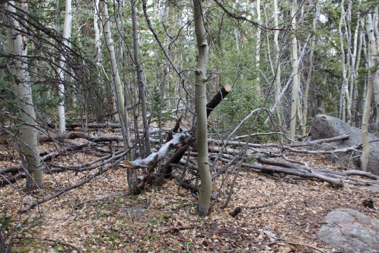
Ok. That was it. From here on out this hike was going to be about Granny and I was going to think positive. I took some “better” pictures of the downed trees along the trail. This is seriously insane and goes on for miles!
Just after MM6.5 I heard the sound of running water and my mind immediately cleared. I don’t know what it is about running water that has such a calming effect, but as I heard it I took a deep breath and smiled. This is why I hike.
Some of the trees were even happy to see me…
My mind cleared and I mentally planned where I’d scatter the seeds. I know enough about wildflowers to know they don’t grow just anywhere. Yes, I could have scattered seeds on the peak but it wouldn’t have done any good: they wouldn’t grow there because the growing season is too short. You can’t just plant seeds and expect them to grow. I needed seeds indigenous to the area not only so they would sprout, but also so they wouldn’t become an invasive species. The seeds I chose were specific to regions of the Rocky Mountains between 6000-9000 feet. In other words, they should grow here without harming the environment, and hopefully will contribute some happiness to hikers. Personally, I know I love seeing wildflowers while on a trail.
With that in mind I decided to spread some seeds near the aspen grove at Barr Camp where there was already a bench for weary hikers to sit and enjoy the view of the peak. These wildflowers will probably grow here. I hope they do, but because I wasn’t 100% certain they’d take I only planted a few tablespoons and saved the rest for another area. I also re-tied my shoe. While I was doing so I noticed someone sleeping in a sleeping bag about 40 feet from the trail. Stay warm my friend!
This is the area (below) I picked to scatter wildflower seeds in Granny’s name. I chose it for several reasons. Between MM3-3.5 is a well traveled area of the Barr Trail. I know wildflowers grow here because I’ve seen them in the past. There’s a lot more grass than flowers, but the potential for wildflowers is great. I’d like to see more grow here.
The hillside is facing the sun and has a great
view:
I plan on hiking back next year (probably in
July) to see if they take. I’ll know if they do because I only scattered
them on one side of the trail and I know what grew here before (mainly brown
eyed Susan’s, wild roses, vetch, and columbine).
The last 3 miles of the trail seemed really
slow. I was tired and sore but my mood was elevated, and while there were
a lot of unexpected clouds the weather was warm but not too hot. It
certainly didn’t feel like 80 degrees, but the clouds blocking the direct sun
probably contributed to the good weather. Did I mention it’s October in
Colorado? The mountain mahogany seeds were fun to watch!
I saw this guy too. This interestingly
enough is apparently a popular landmark on the Barr Trail. I’ve never
seen it until today, but last week someone on the trail asked me how far they
were from him and I couldn’t answer because I knew nothing about it.
I made it back to my truck at 12:27pm. 9
hours 29 minutes. Not my best time, but honestly not bad!
When I got home Emily
and I planted more wildflower seeds in front of our house and on the side by
the maple tree. We hope to get a lot of flowers, and bring them inside to
enjoy them during the summer. We’ll be reminded of Granny every year! (Side
note, we still plan to scatter more seeds on a grander scale, but wanted to do
something immediately while we had the chance).
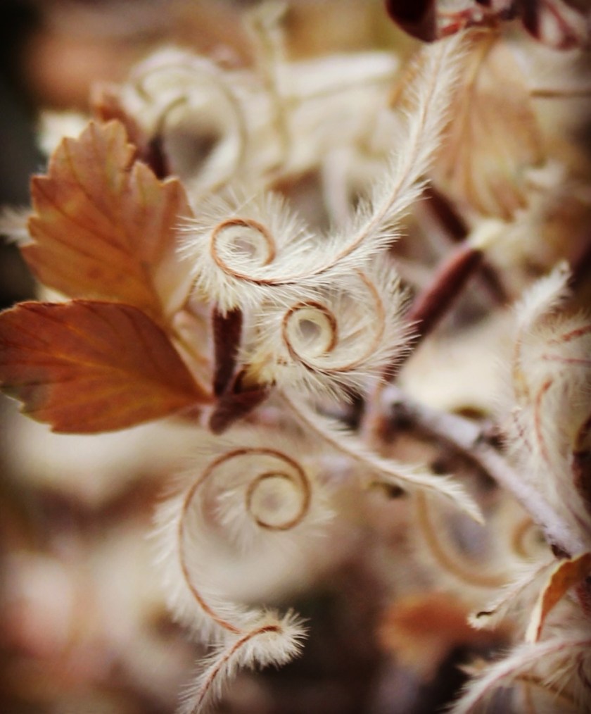
Mountain Mahogany
Mountain Mahogany, Cercocarpus ledifolius, or curl-leaf
Mountain Mahogany, is not a true mahogany.
This shrubby, slow-growing tree belongs in the Rosaceae, or rose family;
the common name derives from the dense, heavy wood of this tree, which sinks in
water; additionally, the leaves tend to curl. The scientific name for the genus
is Greek and means “tailed fruit.”
The flower consists of a small tan tube from which protrudes
a long, plumelike style covered in luxuriant tan hairs. The flowers are
arranged inflorescenses of up to 3. The fruit is a hairy achene one
half to just over one centimeter (0.2-0.4 inches) long. This plant grows on low
mountains and slopes.
It has a great many medicinal uses for various Native
American groups. I captured this image
on MM2 of the Barr Trail, descending from Pikes Peak.
The alarm sounded at 2am, but this time I was ready for it! I jumped out of bed, looked out my window, and was excited to see the forecast for today matched what I saw outside: a perfect view of Pikes Peak! And, a little oddly, a half-moon (the forecast called for no moon at night… whoops!)
I turned on the coffee, made a Nutella and peanut butter sandwich (only because last time I hiked without eating first I ended up regretting it later: I wasn’t hungry. I took two bites this time and threw the rest away). I got dressed and ready to go.
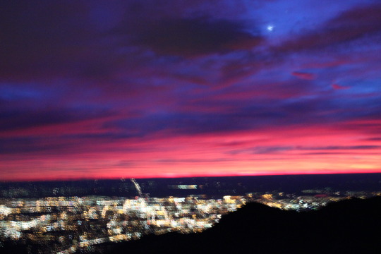
I don’t live close to the trailhead, so while I left at 2:20pm I arrived at 2:50pm. There were 3 other cars in the parking lot, and one was a couple getting ready to hike. As I paid the parking fee (still $10! Woot!) and talked to them a bit. If I pass someone on the trail I always try to strike up a conversation (for safety reasons…) This was their 2nd 14ner and first time up Pikes Peak. I wished them luck. They started as I put the parking receipt on my dashboard. I began at 2:55am but quickly caught up to them taking selfies in front of the lights of Manitou Springs. I advised them the lights would get better between MM2-3, and since this was their first time on the trail to stay left if they got lost in the dark. I then gladly forged ahead. I’m not a fan of leap-frogging fellow hikers.
The night was clear and calm, brisk but not too cold: Perfect for hiking at night! Every once in a while I’d hear what sounded like coyotes in the distance, and I could smell a fire coming from somewhere each time a breeze rolled in. The half-moon was directly above me, and I could see shooting stars as I hiked (meteor shower tonight! I couldn’t have planned that any better).
The coyote sound kept on, but I could tell it wasn’t coyotes. It sounded like yapping, and came at intervals. I deduced there must be hikers up ahead.
At MM3 my deductions were confirmed. There were two women in their 20s hiking ahead of me (car number 2). Although they’d obviously set out at an early time they were in no hurry, chatting and giggling, having a great time together. They commented that I was booking it up the mountain, and for some reason I replied “I hike this trail quite a bit, so I’m always trying to improve my time”.
While indeed this is my 10th summit of Pikes Peak, I hadn’t set out to “beat my time”. I’m not sure why I said this, but once I’d said it I felt I should follow through. My mouth has a way of running away from me at times, and the only way to rein it in is to do what I said I was going to do.
I wished them luck and forged ahead, this time at an accelerated pace, figuring my mom would be happy I wasn’t alone on the mountain (I’d seen 3 women and one man so far, so if anything happened I knew someone would eventually catch up to help).
There weren’t any scary sounds tonight or shadows lurking in the dark, but at MM5 I suddenly came upon a rather large tree in my path. This hadn’t been there the other times I’d hiked, and was a bit of surprise, but I figured trees must fall all the time in the forest and didn’t think too much of it.
I passed Barr Camp in silence. There weren’t any campers on the outskirts, and I figured the last car I’d seen in the parking lot meant someone was sleeping at the A-frame. Over the next 3 miles I crossed about a dozen felled trees and got to thinking: I’d heard 94mph winds had hit Pikes Peak last week. They must have done some damage on the lower elevations as well!
I was making really good time but wasn’t checking the time. I kept my phone in my pocket and just trudged ahead, mentally calculating what time the sun was supposed to come up this time of year and comparing my time/position on the trail to previous hikes. I figured I was about 20 minutes ahead of my best time.
Someone was obviously staying at the A-frame because the tarp/curtains were closed, (car # 3… yes, I like to know who’s on the mountain with me so I keep track as best I can) so I took my first sip of water of the hike, put on my ski gloves over my cotton ones as my fingers were getting cold, and kept going. I wanted to see the sunrise from further up the peak this time. It took quite a while for the sun to rise (40 minutes or so from first light, about mile 10.5 up the trail), and before it did I saw a really cool night-horizon-rainbow (is there a scientific word for this?)
About 2 miles from the summit the sun finally rose. Yes it was amazing. No, my selfies were not.
From treeline until I summited I kept looking for hikers below me. For some reason it became a personal challenge to summit before anyone else made it past treeline. This was an irrational challenge with no scientific basis, but I succeeded and considered it a win! At 7:43am I summited Pikes Peak. That’s 4 hours 48 minutes, and pretty awesome! The summit house was closed, so I sat in the corner of the building, huddled out of the really intense wind for a few minutes.
I’d wanted to buy the new “Pikes Peak Book” only available at the summit (funding the new summit house that was under construction), but there’s no set time for the summit house to open, and while I could see they were beginning to make the donuts inside I was slowly becoming a popsicle, so I decided to take a selfie proving I was there and head down the mountain. I’ll buy the book next time.
It felt like I’d been up there for 5 minutes, but when I checked my phone it indicated it’s been 25 minutes. Time seriously has a way of getting ahead of you on the summit!
It was really, really windy. I tried to put my hair back into a bun but with my Raynaud’s my fingers were useless. I’m pretty sure I looked like a banshee, but didn’t intend to take anymore selfies so it was all good.
I actually saw someone about a mile down the mountain. He looked really fit and was wearing an overnight backpack. I surmised he’d stayed at the A-frame, talked with him a bit to find out this was the case, then wished him luck. His 5 buddies were about 100 feet behind them. They all looked to be in tremendous shape but extremely tired.
I went another mile and a half before seeing anyone else: it was the couple I’d seen in the beginning of the hike. They’d made pretty good time! They only had about an hour to go. I gave them some advice on the 16 Golden Stairs and the false summit, then trudged on.
I had the A-frame to myself so I had a quick snack. I was finally defrosting so I took off my ski gloves and just kept on my cotton mittens. I took a picture of the A-frame and the ingenious way the inhabitants the night before had moved rocks to keep the heat in. This was something I’ve never been strong enough to do, and seriously hope future inhabitants keep in place, as it’s simple genius if you’re strong enough to move the rocks! We’d previously used out backpacks.
I could hear the two women I’d passed earlier on in the hike chatting, so I took a “secret” route around to avoid them (sorry, I’m not one for small talk if I can avoid it), and trudged on.
It was here in the daylight I realized what an impact the previous week’s wind had caused: the damage was insane! Felled trees everywhere for miles! Granted, they were mostly Aspens whose time had come, but the trail was also littered with large pine trees 4 feet or more in diameter. I moved what I could out of the trail as others had obviously done before me (I could see this in the light of day), and hoped the caretakers at Barr Camp took advantage of all this free firewood. Fast, before a forest fire took care of it for them.
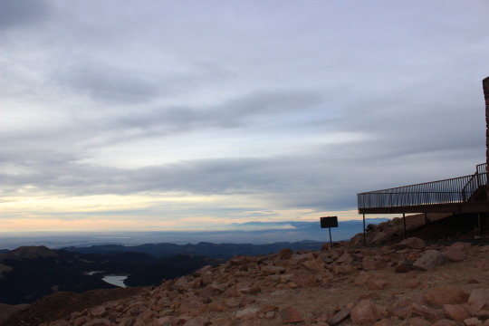
I usually stop at Barr Camp to use the restroom, but I’d made such good time so far and I wasn’t in need of using the facilities so I just kept going. I did stop really quick to compare the view from last month and today (almost a month apart to the day…)
I made it down the mountain and back to my car at 12:03pm. I’d summited Pikes Peak and hiked back down again, 26 miles and over 16,000 feet in elevation change, in 9 hours 2 minutes. To qualify for the Pikes Peak Marathon you need to be able to do it in 10 hours. I felt like a rockstar!
This time when we made it to the parking lot at the base of the trail it was halfway full. Apparently there were a lot of hikers this weekend!
Even though I’d asked them to go before we left the house, one of the girls needed to use the restroom before we started. I’m not a fan of trail restrooms, and encouraged her to wait a bit because it was probably dirty, but she insisted. So while I paid for parking she used the restroom. When she got back she said it was pretty clean, but there was a homeless person sleeping outside. Facepalm.
We started the trail at 3:06am. There was no moon to guide us, so we got a great view of Manitou and Colorado Springs as we hiked.
The girls made pretty good time. We made it to MM2 at 3:59am, which meant they were hiking a little over 2mph.
Around MM4 it got really, really cold. I’m not sure why (I’m guessing it’s due to a shift in topography) but MM4-6.5 of Barr Trail are always really, really cold. It felt like the temperature dropped at least 20 degrees. I’m guessing it was in the high 20s. It got so cold my hands started to swell and I lost feeling in my fingers. Luckily there was no wind, but I honestly felt colder than I had a few weeks ago when it was snowing. I put on my gloves, but that didn’t really help. I kept encouraging the sun to rise over and over again, knowing that’s what I needed to warm up.
We made it to Barr Camp at 6:05 (still hiking about 2mph), and about 15 minutes later the sun began to rise and we began to thaw out. The colors on the mountain in the morning are absolutely amazing! There is so much light it’s really hard to get a clear picture, but that didn’t stop me from trying:
I was really surprised at how much red was in the light this morning
Added to the red was the changing yellow of the aspens.
We made it to A-frame at 7:35am. The A-frame was occupied by an older man and his adult children. They’d hiked Pikes Peak 18 years ago and were back to hike it again. It looked like they were set up to camp all weekend.
We also learned there was a special hike today: The Pikes Peak Challenge.
The Pikes Peak Challenge is the Brain Injury
Alliance of Colorado’s flagship fundraising event.
Participants have the opportunity to raise funds by climbing Pikes Peak. We were told there were about 400 participants, but not to worry because we were hours ahead of them. Also, this wasn’t a race, they’d just be hiking.
After A-frame we saw challenge volunteers at each of the three remaining mile markers. They were all really nice and supportive, even though we weren’t participating in the event.
I tried to take a selfie with 3 marmots…
The girls were getting pretty tired when we had about 1.5 miles left to go. They were doing great, but lacking a bit in motivation. We made it to the cirque and some volunteers gave them dum-dum lollipops and they were excited once again!
We took a bit of a break at the 16 Golden Stairs. Volunteers from El Paso County Search and Rescue were there, preparing to assess Challenge hikers. We talked for a bit, and they encouraged me to sign up to join EPCSAR. It’s honestly something I’ve been thinking about, but not something I’ll have time for until Emily graduates High School.
On we trekked. This is where my “motivating” the girls kicks in the hardest. Lots of life lessons are learned at this point in the hike. It’s a fine line between encouraging them and making them hate me for making them continue. They told me later I did a great job…lol!
We made it to the summit at 9:59am! That’s just under 7 hours, and a great time for the girls!
They were exhausted, and opted to sit for a while before taking pictures. I asked them if they’d ever done anything harder in their lives, to which Julianna replied (and Lakin agreed): “The only thing harder I can think of is cookie sales”. Spoken like a true Girl Scout! They would know, they take cookie sales seriously! They’ve each sold thousands for years in a row, and know what hard work it can be.
I was proud of them, and told them they could take an extended break. A summit spider joined us for donuts…
It’s really hard to breathe at 14,000+ feet: Your body is working overtime just to breathe, and time can get distorted. When I told the girls we needed to get going because it’d already been 45 minutes they didn’t believe me. They swore it had only been 5-10 minutes. I had to show them the time to convince them!
We took a few summit pictures and began our descent.
Here is where the hike got really fun! The girls were super proud of their accomplishment, and wanted to encourage the Challenge hikers on their way up the mountain. We high-fived ever hiker we saw on the way down, and the girls would shout out words of encouragement: “You got this!" "Trust me, I’ve been in your shoes, just think positively!" "With a positive attitude there’s nothing you can’t do!”
Those girls are amazing! The other hikers thanked them for their enthusiasm, which was much needed at this point in their hike.
When we made it back to the 16 Golden Stairs we were offered more candy. This time I took a Werther’s (an indulgence I haven’t had since I was 12). Instant memories came flooding back. It totally made my day!
About a mile above treeline we had a hiker point and tell us: “See that man in the red jacket? That’s Robert Downey Jr." I was intrigued, but didn’t much believe him. That didn’t stop me from catching up to the man in the red jacket to find out for myself. Unfortunately, it didn’t look much like him: His hair was the right color, but he was a bit overweight and sported full facial hair so I couldn’t much tell if it was him or not.
We said "hello” as we passed him and kept hiking down, enthusiastically high-fiving everyone along the way.
Back at A-frame the man and his kids were still there. It didn’t look like they planned on hiking at all today. Quite a shame for other hikers hoping to snag the A-frame for themselves tonight. There were a lot of hikers around the A-frame, filtering water and milling about before tackling the hardest part of the hike.
We only rested there for about 15 minutes, then once again started hiking down. The girls were practically running at this point (it is MUCH easier to hike down than up). We saw many more hikers there to complete the challenge, all hiking up the mountain. We never saw anyone else hiking down.
We stopped at Barr Camp for another 15 minutes to use the restroom and for a snack. The girls were still all smiles!
For the rest of the hike down the girls kept up a fast pace. They still high-fived everyone they passed, but we didn’t see many more challenge hikers. In fact, the only ones we saw were those returning down the mountain because they weren’t able to summit.
When asked we told hikers we’d hiked all the way to the summit and were on our way down. Everyone was impressed, and one (very fit) woman remarked: “Wow! You all made it? Those girls are more hardcore than I’ll ever be!" The girls took that as quite the compliment!
We made it back down to the parking lot at 3:40pm, and once again the restroom was needed. This time however it was flooded.
Today I decided to hike the Western part of Mueller State Park from the Grouse Mountain Trailhead down to Geer Pond and back in sort of a loop. Total trail was 5.52 miles and took exactly 2 hours to hike. I started the hike at 11:15am without a jacket. I was a bit cold, but it looked like it would eventually warm up. It did, but it took about half an hour. It never got “hot”.
The beginning of the hike brought me to a very small (one room?) cabin. It was most obviously dilapidated and overgrown with pine trees sprouting from the floor. I questioned its odd placement and what it was used for, as it wasn’t near any obvious necessities (a road, water, etc.) and was located in the middle of a hill.
Just as I rounded the corner from the structure I came upon some burn piles. I thought how cool it was Mueller was doing some thinning, then realized the piles were over the boundary of Mueller. That got me to wondering who owned the land…
At this point in the hike I started noticing a lot of markings on the trees. Specifically the Aspen trees. Most look like they’re from deer or elk, but a few showed similarities to Black Bear markings.
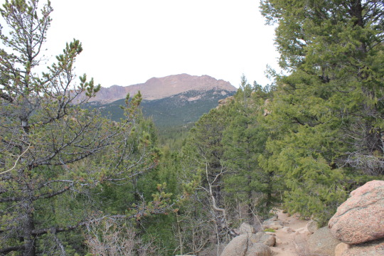
By now it was finally starting to warm up a bit. I was able to see the backside of Pikes Peak in the distance with a little bit of snow on the peak:
At this point I came upon some bike riders. I heard them before I saw them, and was a bit upset as I was sure they were scaring all the wildlife away. Why can’t people hike in silence and enjoy the sounds of nature?
As I rounded the corner I heard what sounded like a weed-wacker. I was pondering why someone would think such a device was necessary in the backcountry when I realized it was an insect. A very loud insect. I’ve heard clappers before, but this was ridiculous! I could see it flying about 10 yards away. It looked yellow in color, but I wasn’t able to get a better look at it to see what kind of an insect it actually was. It wasn’t a moth or butterfly.
The halfway point of my hike brought me to Geer Pond. This is by far my favorite pond at Mueller. I’ve spent countless hours fishing here, and love the solitude. No one was here today but I didn’t have time to stop and enjoy the pond (my kids were waiting for me back at the campsite). I took a quick picture and started my (uphill) trek back.
Mueller is a great place to hike, but unfortunately it sits at the top of a hill, so you inevitably start hiking downhill and end your hike going back up. Fortunately I would rather hike uphill, as my body is conditioned for an uphill hike.
I passed a drainage area and those bikers again. They were confused as to how I’d passed them, and I replied I’d taken a loop. I ended up passing them a third time later in my hike, to which they seemed embarrassed: “Usually the bikers pass the hikers” they noted. I smiled, talked to them a bit about reading the trial maps at Mueller, and kept hiking. They never caught back up with me.
I hadn’t seen any wildlife on this hike (except that loud insect), so I was happy to see a rabbit in the middle of the trail. It wasn’t happy to see me and bounded behind a tree. I watched it and was delighted to see a cluster of (edible) Sheathed Woodtuft mushrooms.
That was the extent of my hike. As always I was glad I’d taken the hike, but a bit disappointed I hadn’t seen more wildlife. I ended up getting quite a sunburn as well, which was totally unexpected since I’d hiked the entire time with goosebumps, wishing I’d brought along a jacket.








 Wild Wanderer