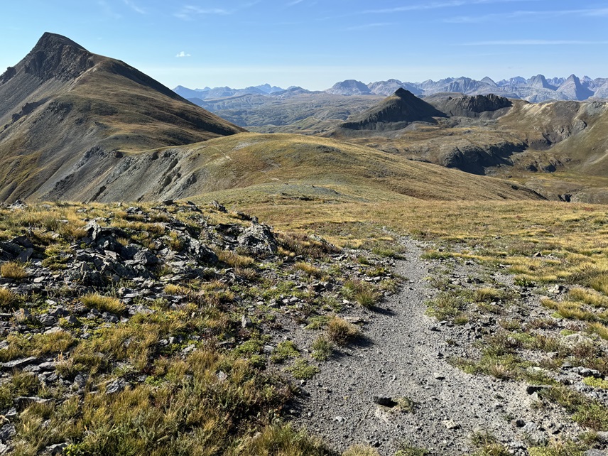
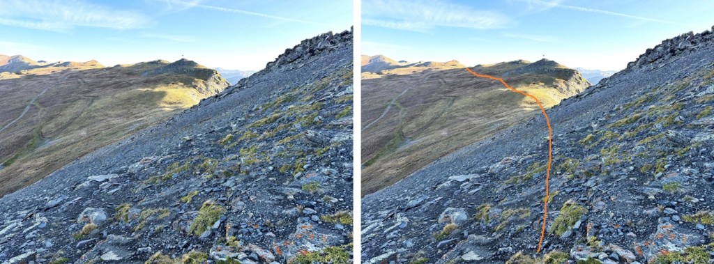
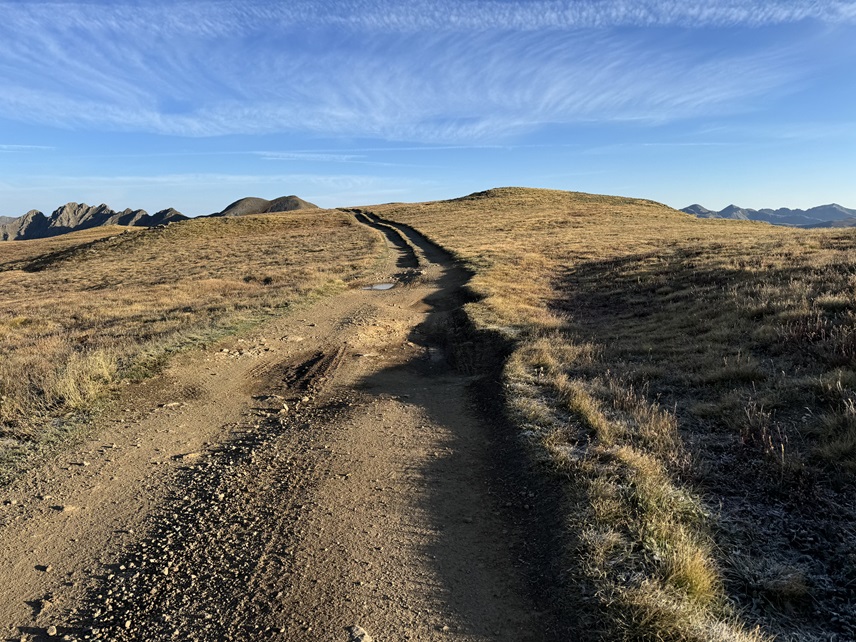
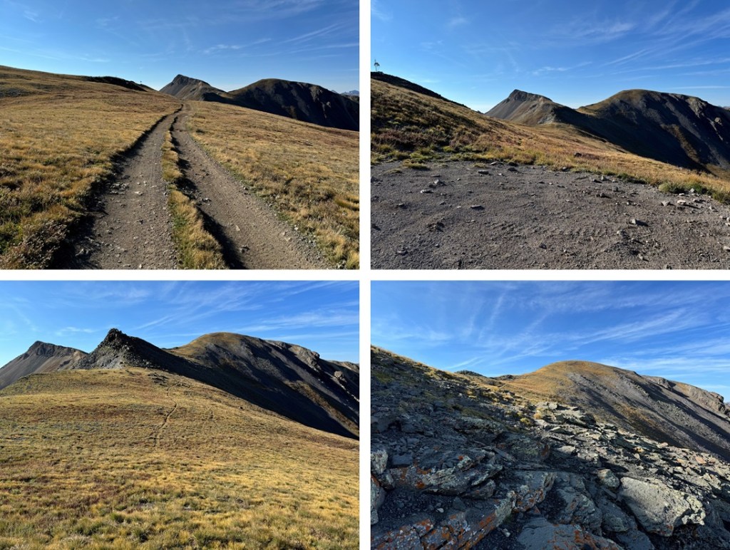
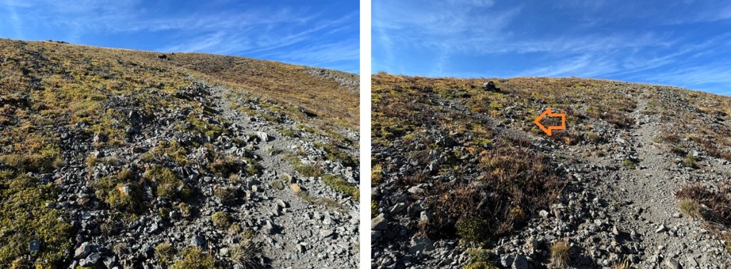
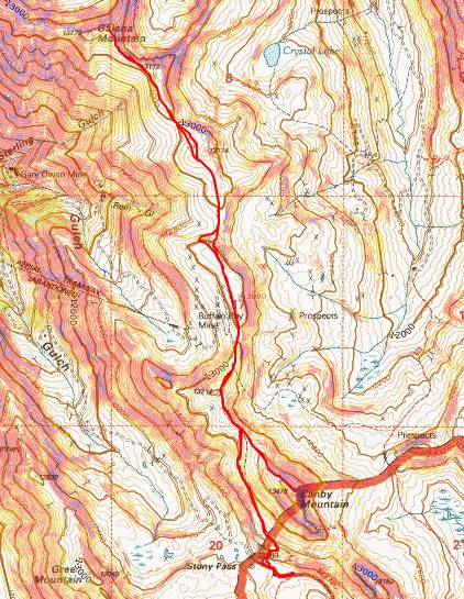
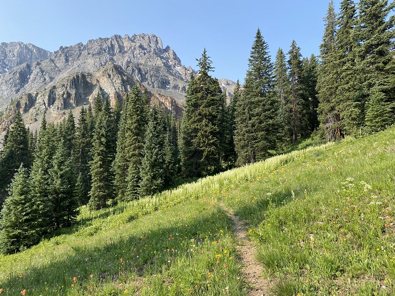
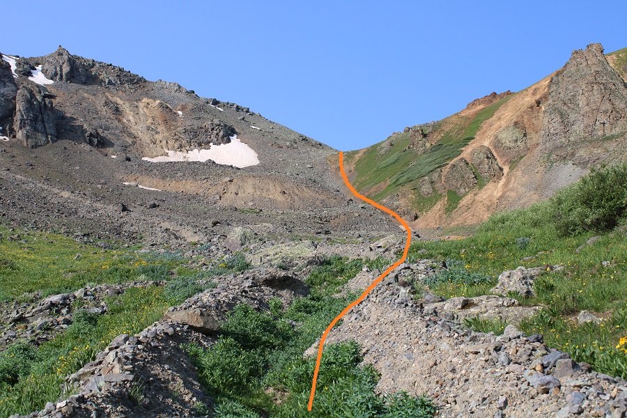
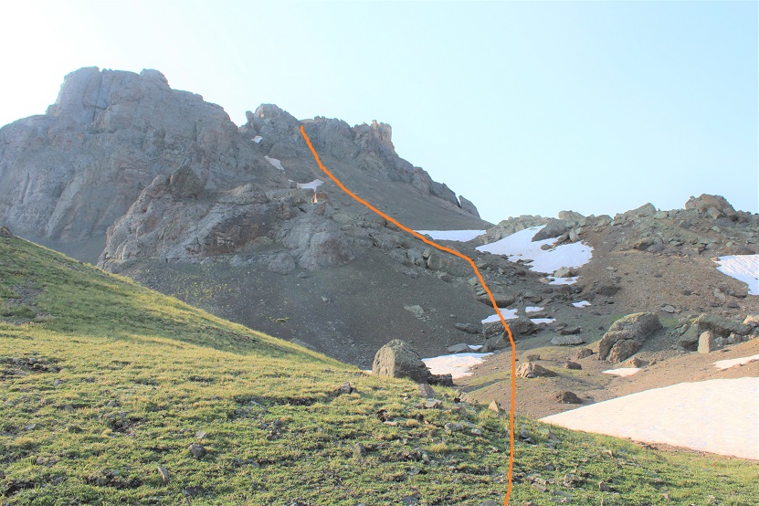
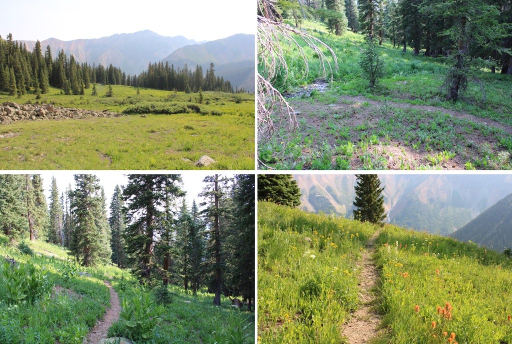
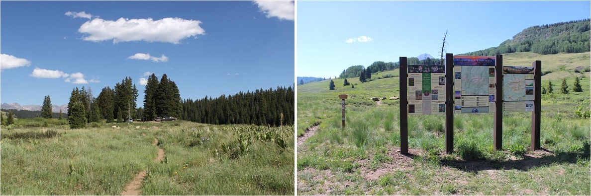
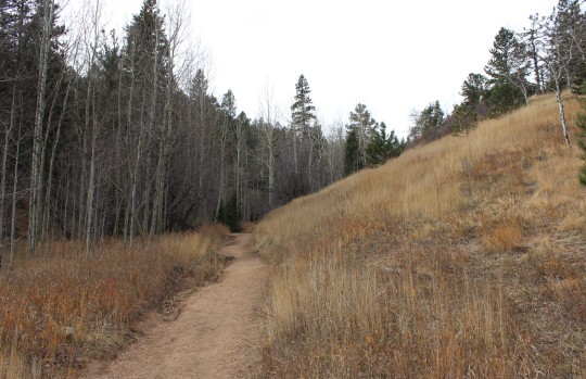
From my parking spot at Stony Pass I was on the trail at 6:30am, following the 4WD road west until the tundra met the rocks, and I was able to find a game trail that picked up on the other side. This trail starts out difficult to find, then becomes a solid trail for most of the hike. Here’s what the route looks like from below:
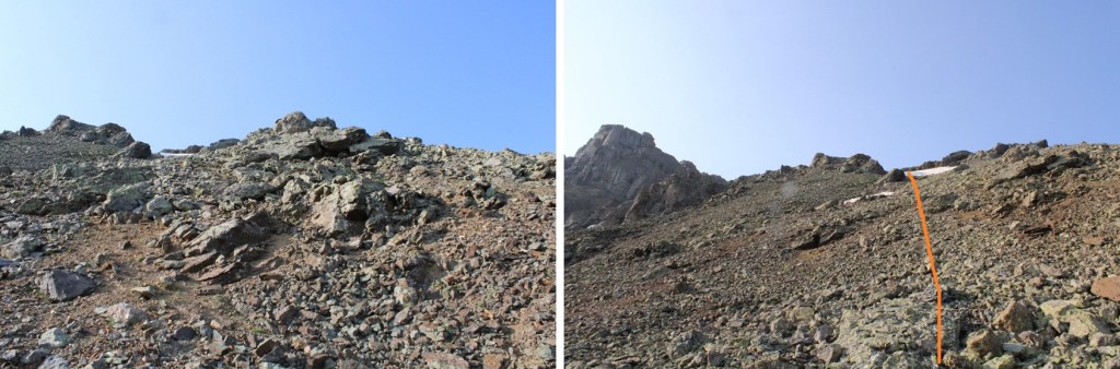
I followed this trail for .85 miles, until I made it to the ridge
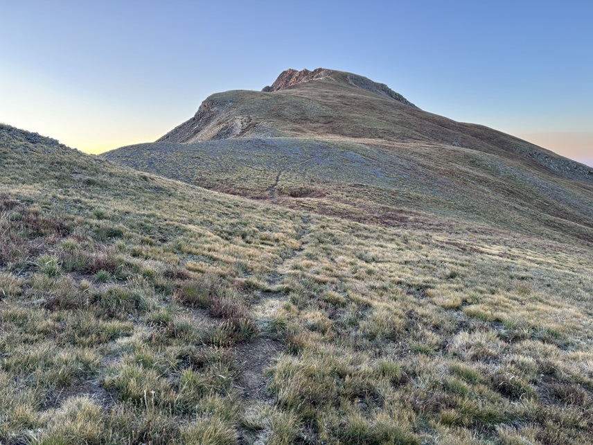
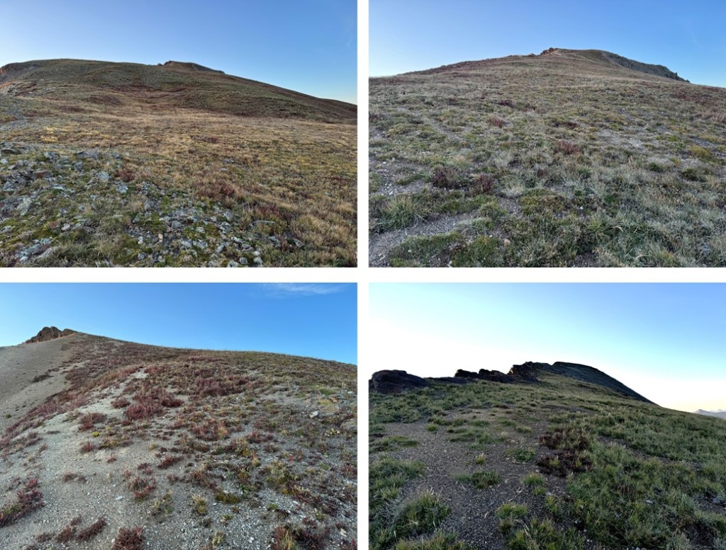
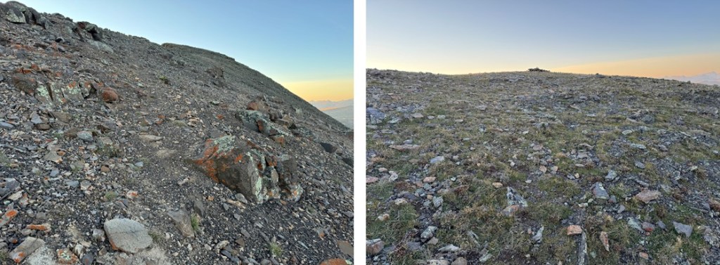
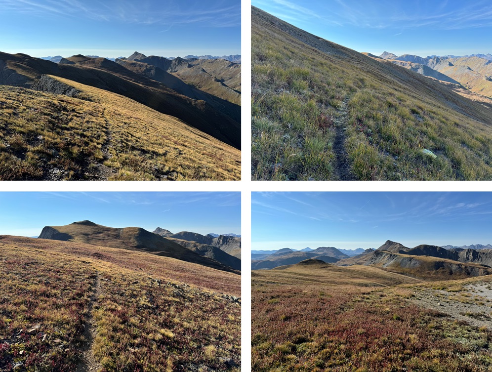
At about 13085’ I hit a saddle, turned right, and followed the ridge to the summit. This was class 2, but there are a few social trails in the area. I just kept following the ridge southeast.
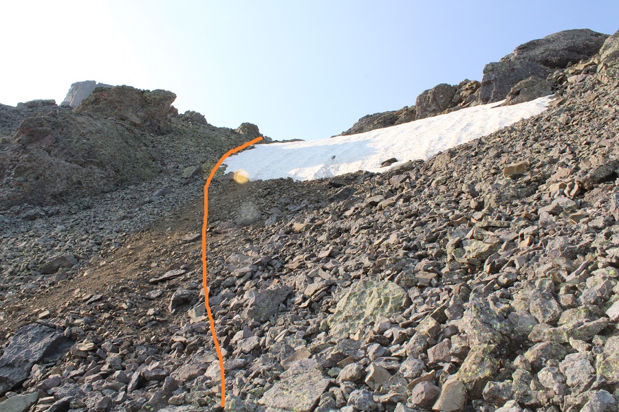
Eventually the ridge became filled with scree, but the angle wasn’t difficult, and it all remained class 2
I summited Canby Mountain at 7:10am
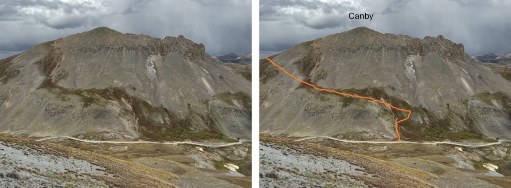
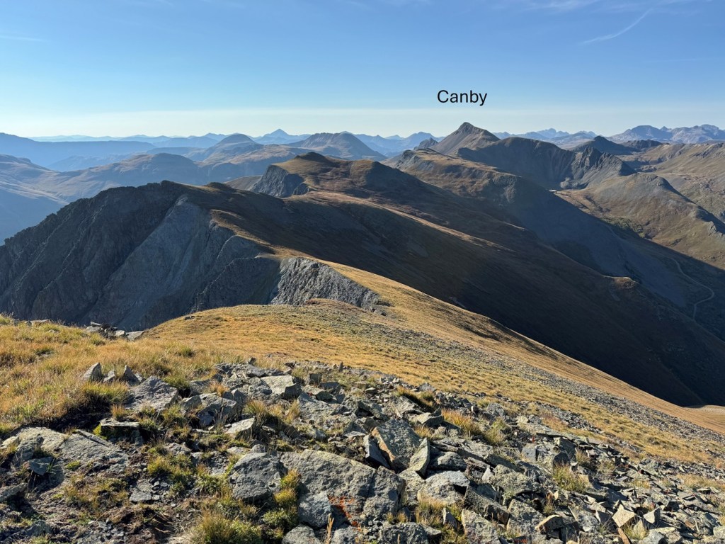
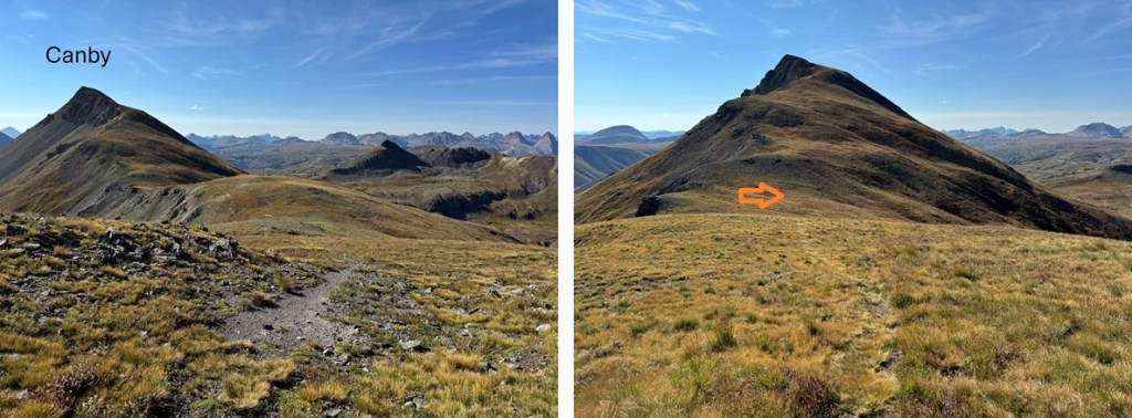
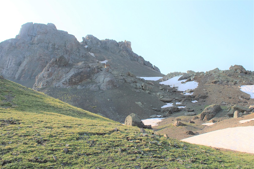
Canby Mountain:
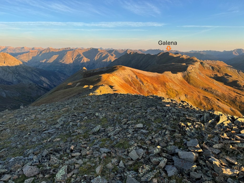
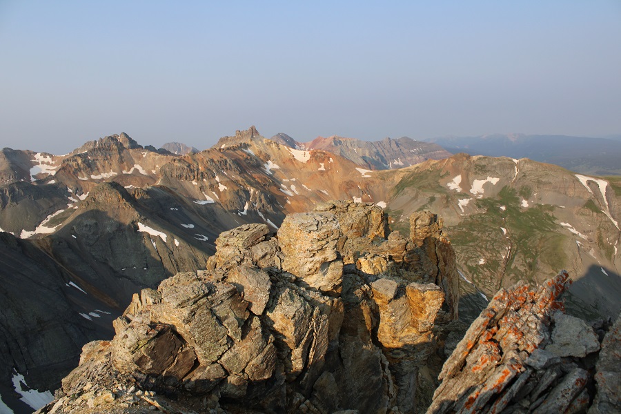
From the summit of Canby Mountain I could see Galena Mountain to the north/northwest.
It was a ridge hike on tundra to get there, and all class 2. I headed back down to the small saddle, and picked up the trail that follows the ridge.
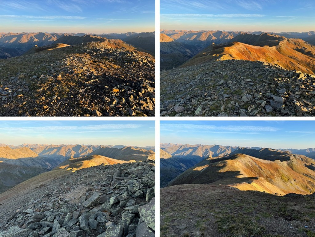
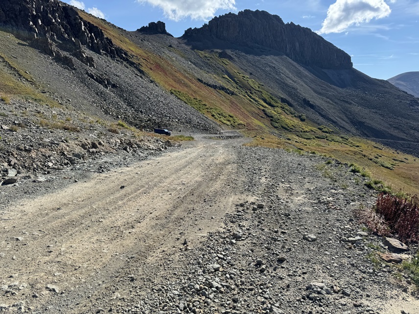
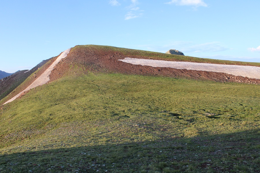
By sticking to the ridge, following it northeast, eventually the trail ends. You can continue to follow the ridge, however, when I came to the scree area (it’s obvious), I stayed at about 13000’ and skirted the ridge. There’s an obvious dirt road in the distance you can aim for, and some game trails here. I aimed for the highest point of the dirt road, and then followed it along the ridge until it ended.
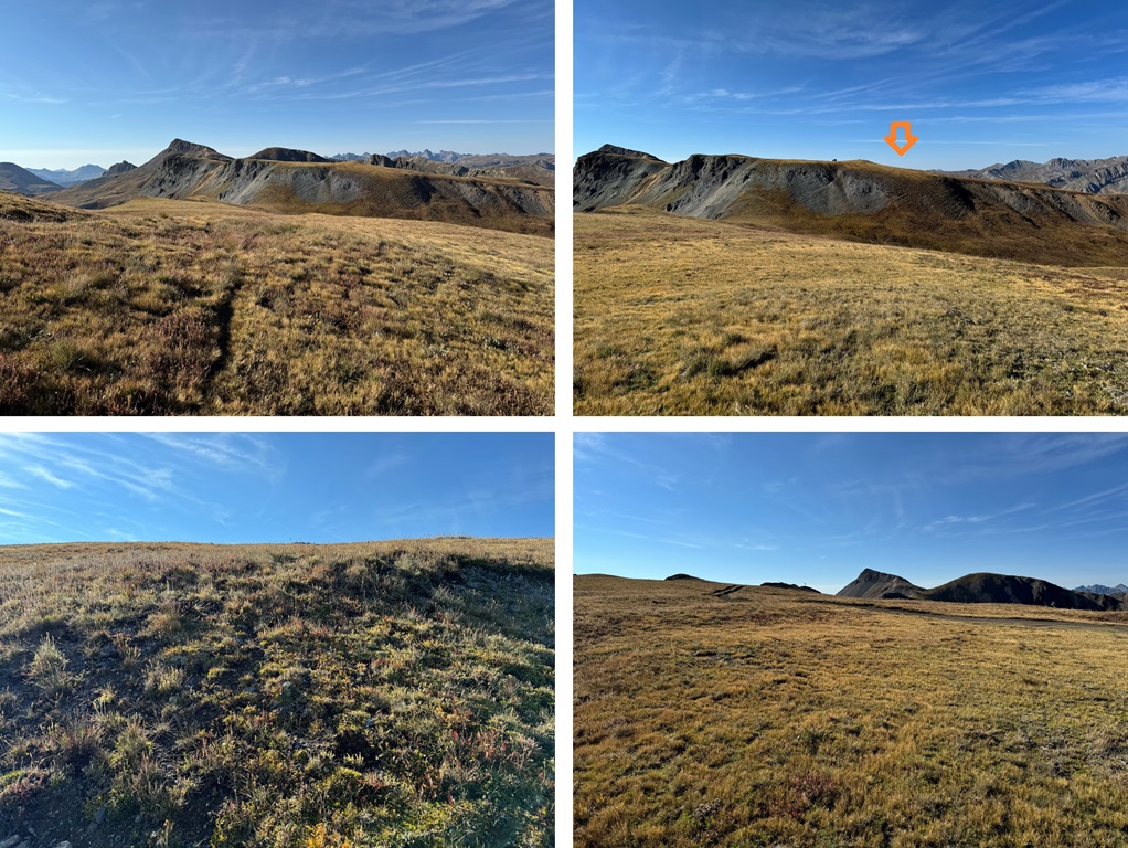
It ended in a roundabout circle, and from there I left the road and continued following the ridge northwest. This is all tundra, and there are a lot of elevation gains and losses along the way. Every once in a while I’d pick up a game trail, and follow it to make the route finding easier.
The final trek to the summit was all on tundra and included a faint game trail for part of the way.
I summited Galena Mountain at 8:35am
Galena Mountain:
From Galena Mountain, I could see Canby Mountain, and that long ridge, to the south/southwest.
I needed to get back to Stony Pass, so I descended Galena and followed the ridge back the way I’d summited, aiming for the Canby saddle.
Back on the road, I followed it a short distance, and then aimed for the ridge once again.
This time, when I was on the ridge, I noticed there was a “y” in the trail. Go left here, towards Canby Mountain
Following this path led me back to the saddle with Canby Mountain
At the saddle I turned right, and followed the trail back down to the dirt road.
I then followed the dirt road back to my truck.
I made it back to my truck at 9:45am, making this a 6.64 mile hike with 2084’ of elevation gain in 3 hours, 15 minutes.
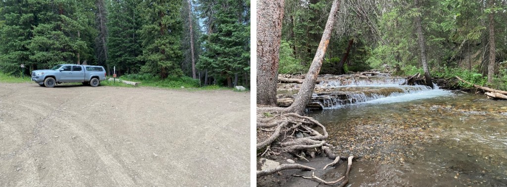
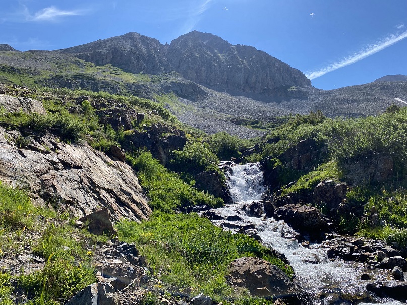
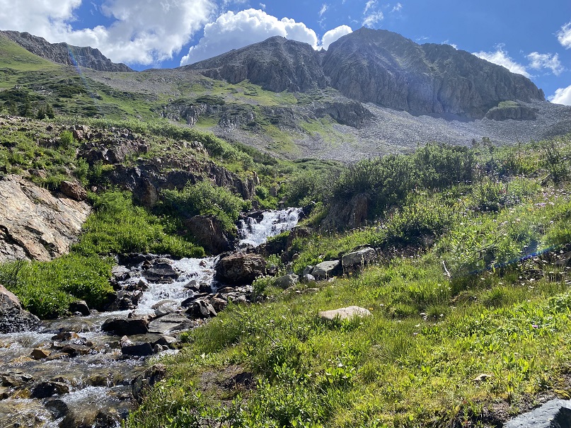
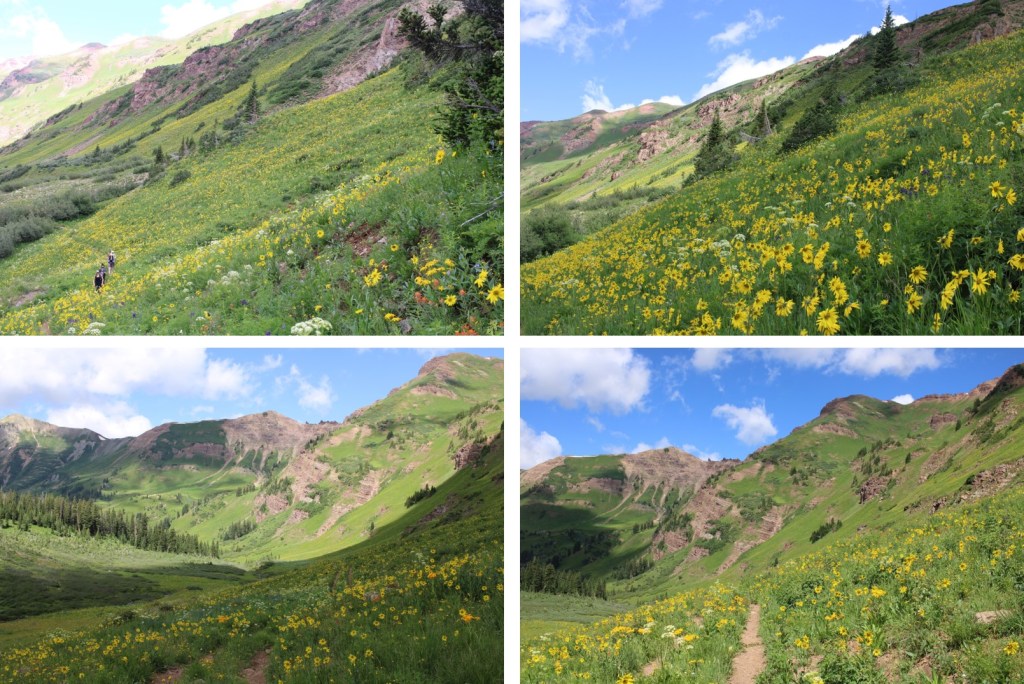
Yes, I’m recycling the approach pictures/description because all the info’s the same. The Rustler Gulch Trailhead was full. I tried to drive up the road several times, but kept getting greeted by vehicles coming down. The drivers didn’t understand up had the right of way, and all of them seemed to be in vehicles too big for them to maneuver. After backing up over half a mile for the third time, I decided to just park below. I’d find out the next day it’s peak wildflower season in Rustler Gulch, and the tourists were flooding in to see them. Parking down below added about 2 miles to my trip and 500’ of elevation gain, which was negligible. Bonus: There was a creek behind me to enjoy as well.
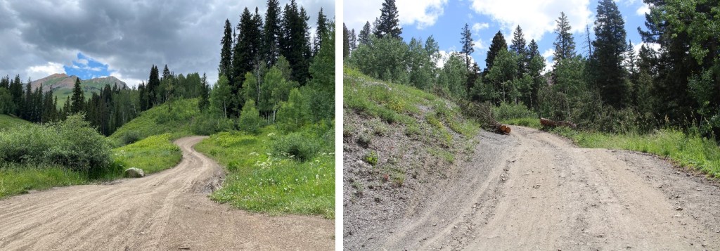
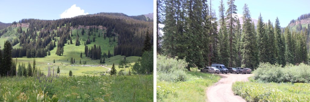
I was on the 4WD road that led to the trailhead at 2:30 am.
I followed it 1 mile to the actual trailhead, which was overflowing in the afternoon
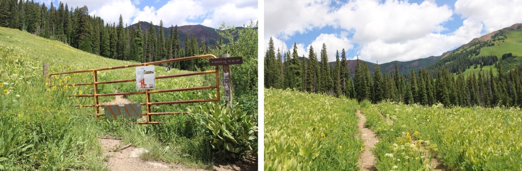
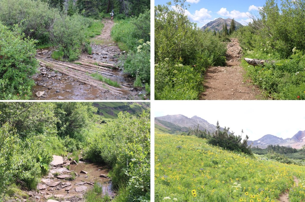
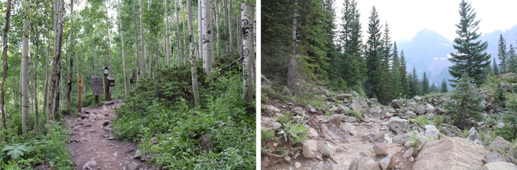
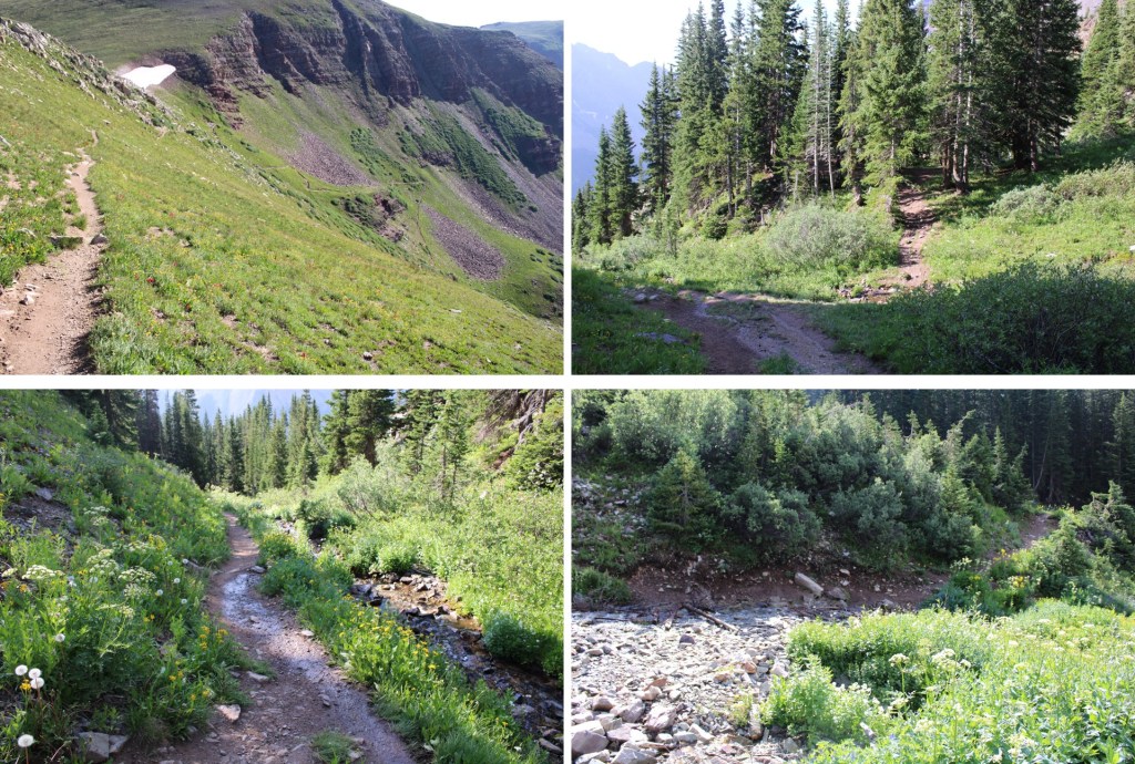
I passed around the gate, and followed Rustler Gulch trail #599 north into the gulch.
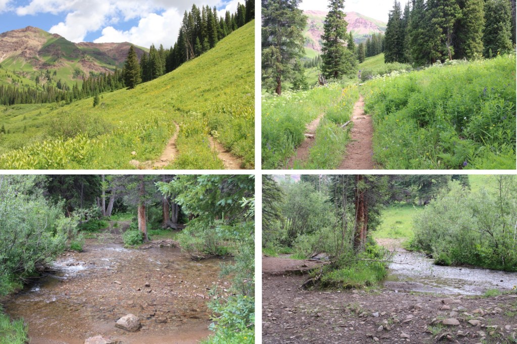
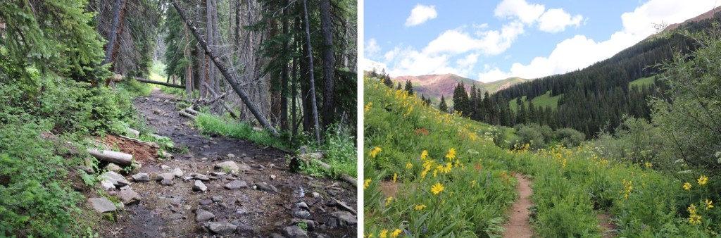
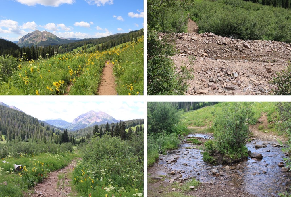
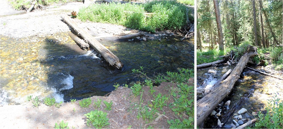
There were several stream crossings to cross, all of which had rocks or logs so my feet didn’t get wet.
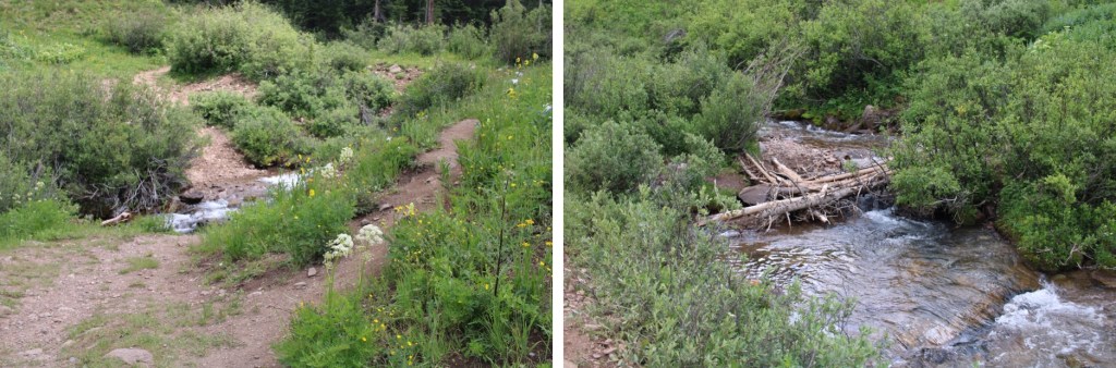
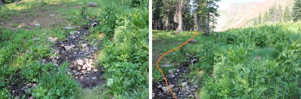
When I got to this creek crossing, I went right, and found a footbridge
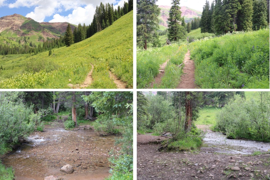
I continued following the trail, and crossing creeks, through the gulch on a well-marked trail
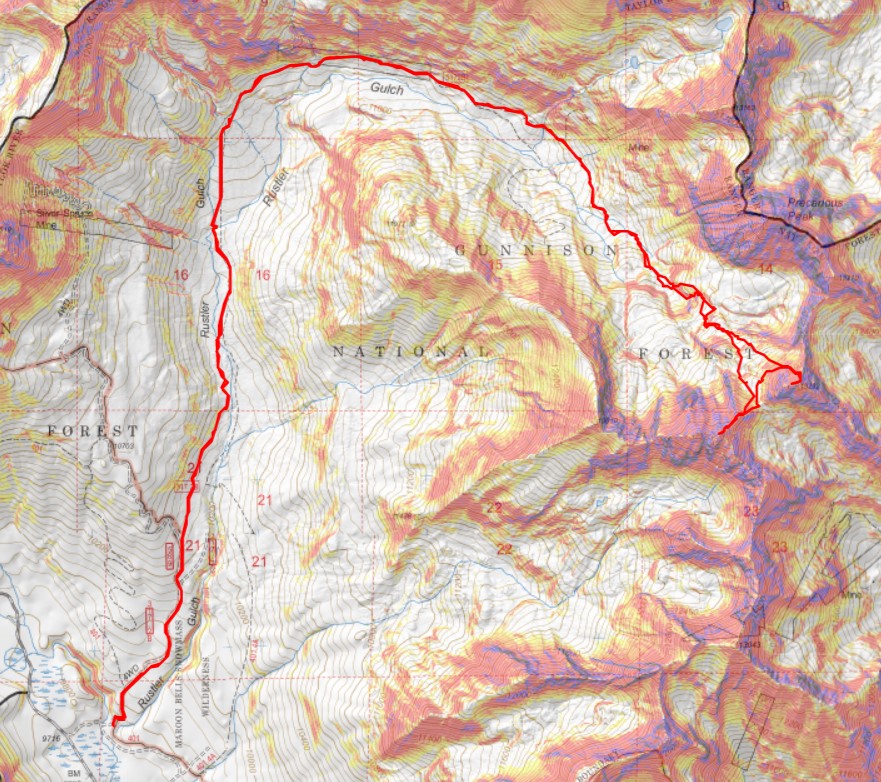
Here’s my route into the upper basin. This is all done on a class 1 trail
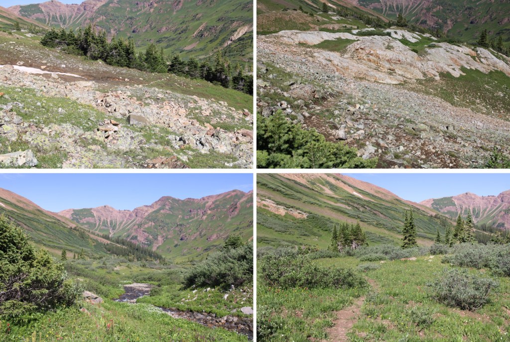
Here are some more pictures
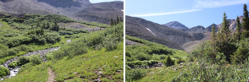
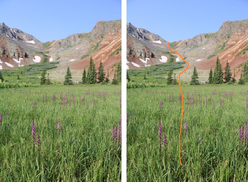
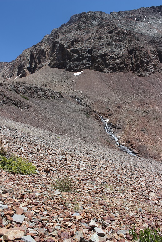
After hiking for 5.3 miles, I crossed a creek, and continued following the trail. The trail became faint, but if I looked closely, I could follow it all the way to the rocky basin
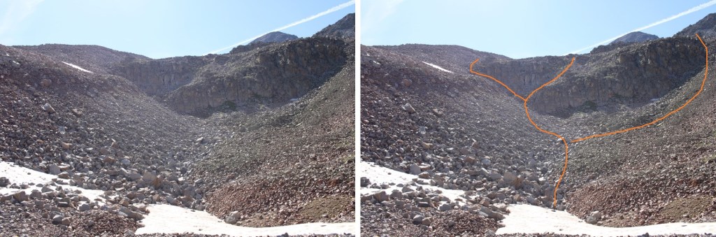
I needed to get to the upper basin. There are several ways to do this. I took the gully to the left, but you could also go right.
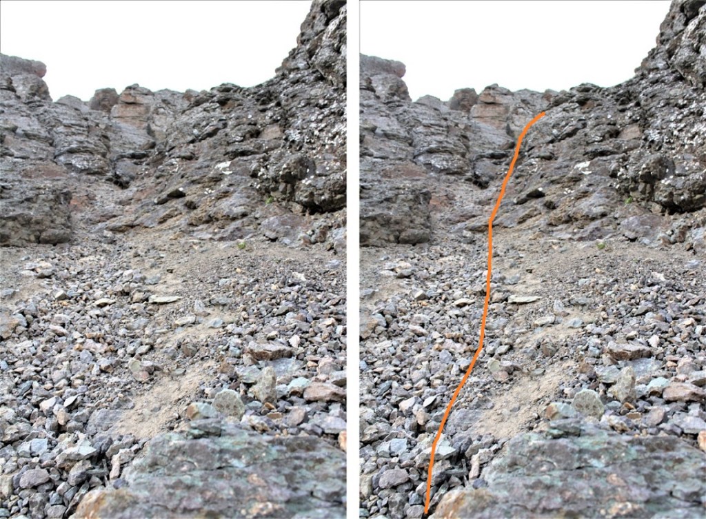
Here are pictures of my way up the gully
You have several options
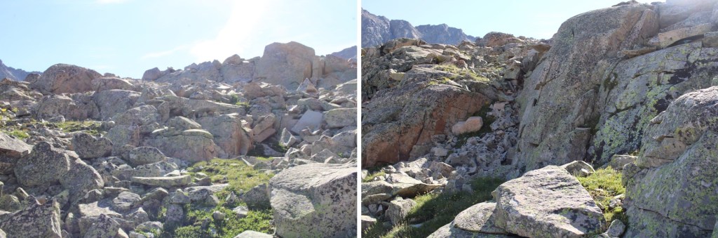
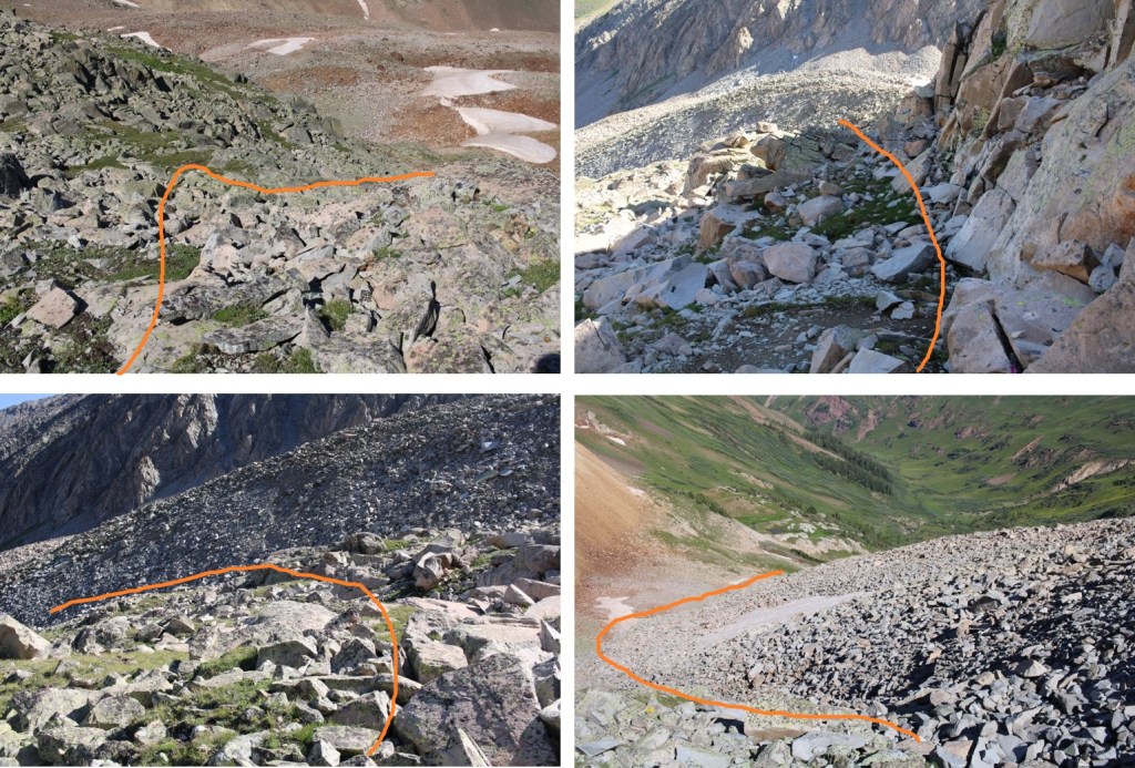
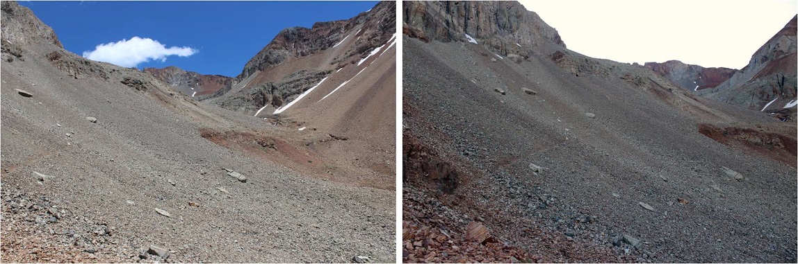
Once in the upper basin, I navigated the rock outcroppings to the right/southeast. Here’s my route
Now to get up these rocks. This was an easy scramble, and choose your own adventure.
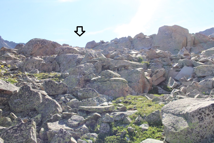
I now had a clear picture of Cassi Peak. This is the route I took to get to the top of the last set of rocks
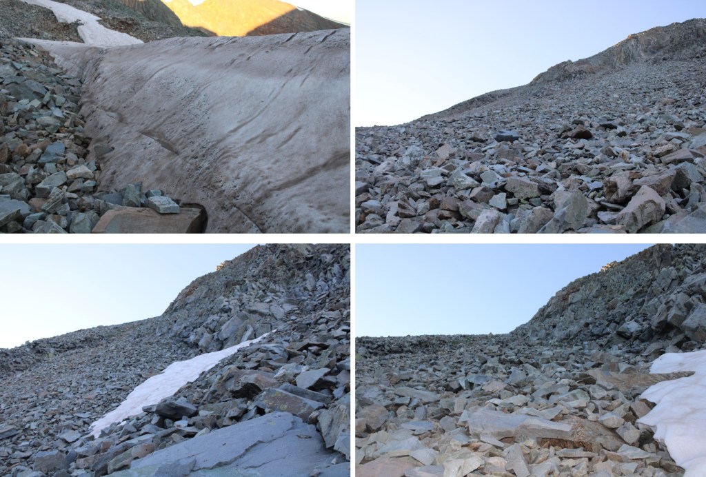
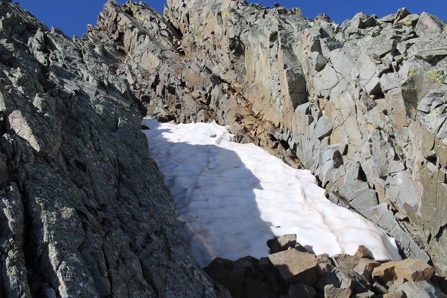
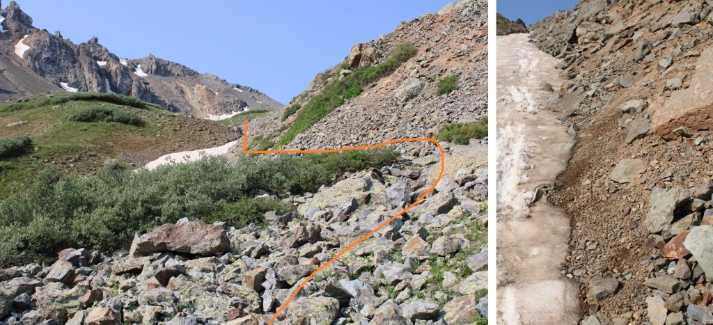
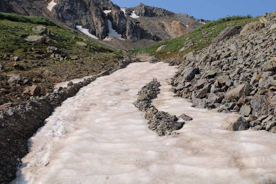
Now to get up to the ridge. This is the route I took, all class 2. The rocks were mostly stable, but the gully was steep. I had to cross a solid streak of snow several feet deep at the beginning, and was glad I’d brought microspikes
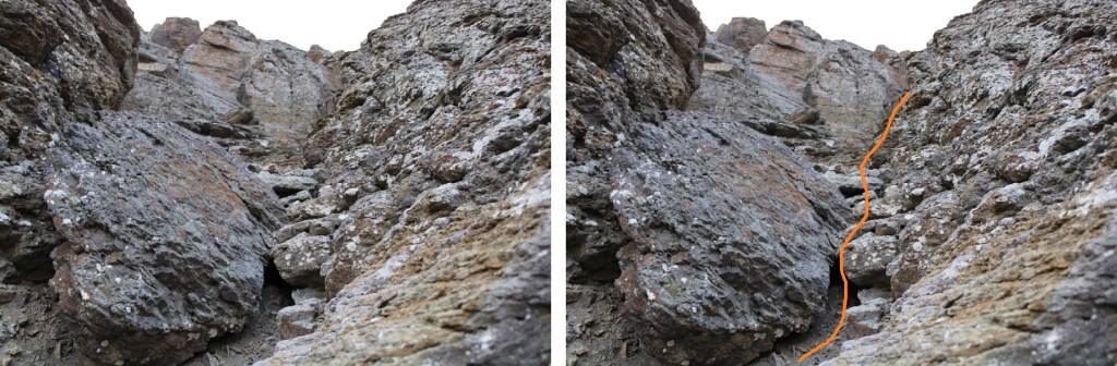
Here are some pictures of the route up the gully
Once up the gully, I aimed for the ridge, which was much more solid
Once on the ridge, I followed it south, then west to the summit
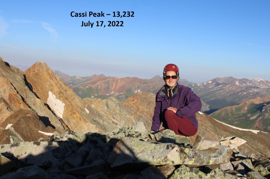
I summited Cassi Peak at 7am
Cassi Peak:
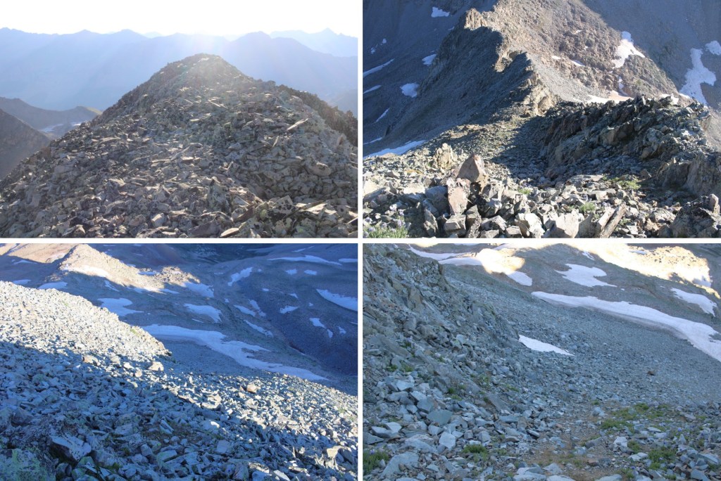
From the summit I could see Golden Tops to the southwest.
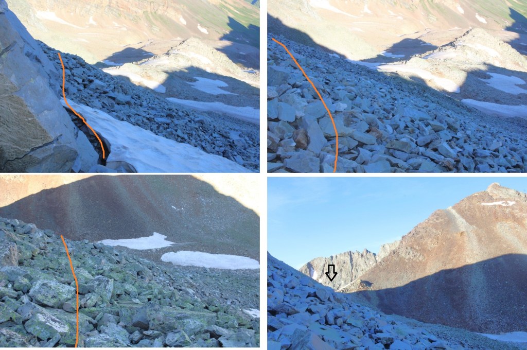
To get there, I re-traced my steps back down the ridge and through the gully
This time, when I made it to the gully, I stayed high. I actually crossed above the snow, and gasped as two boulders larger than microwaves cleaved off the rocks. Be careful in this area near the rock walls. I stayed high, as I was aiming for the Cassi/Golden Tops saddle
I climbed up some scree to the saddle
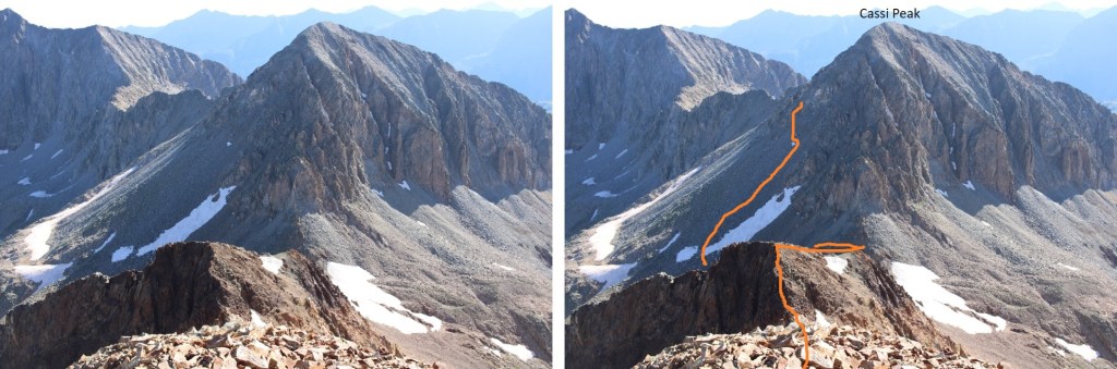
Then turned right, and followed the ridge. This was class 2, with some easy class 3 scrambling thrown in. The route will be obvious: just follow the scree rubble west
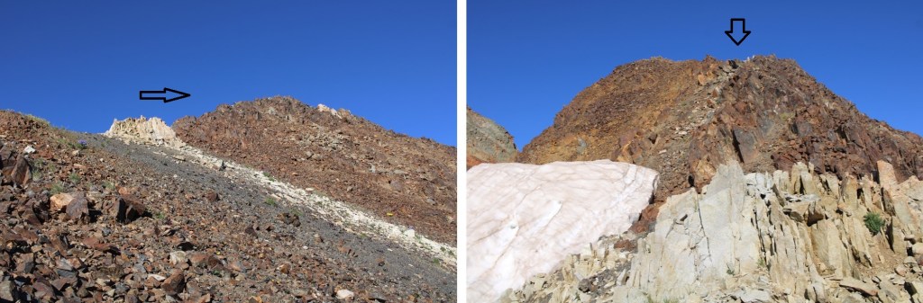
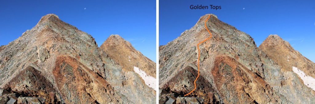
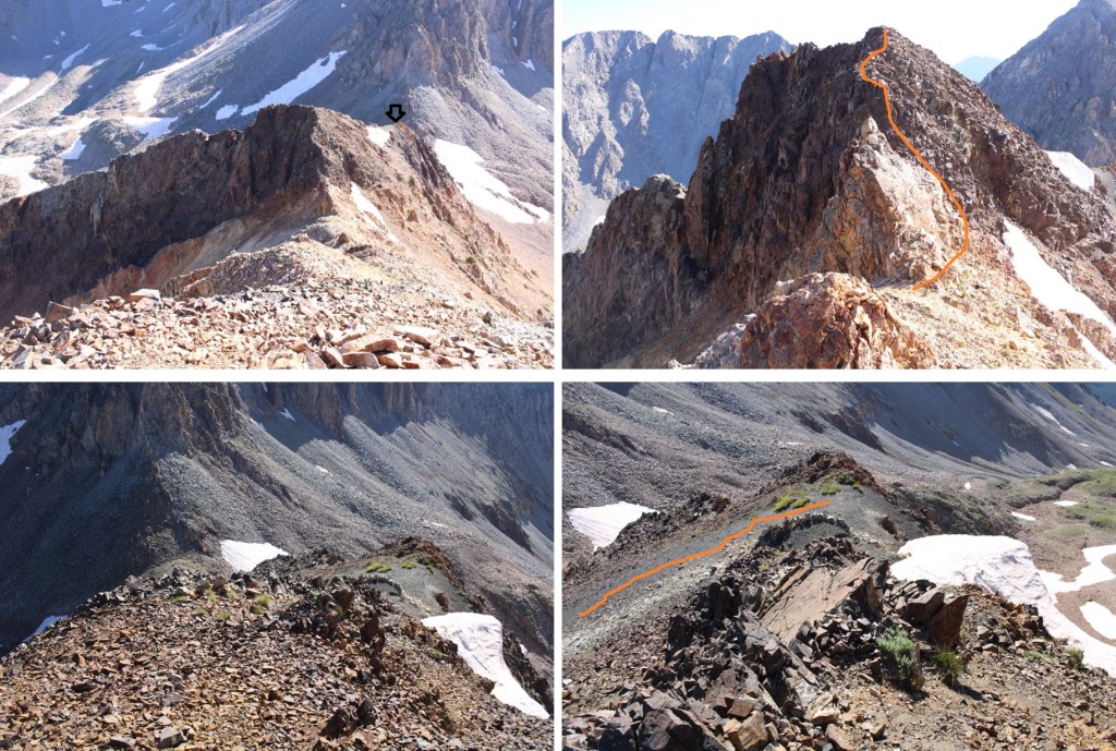
From the top of the first point I could see Golden Tops to the southwest. This is my route
And some step-by-step pictures. This is where the climb becomes class 3, heading down this small saddle. This is how I navigated the class 3 section, by going straight up and over the first obstacle, which is like a mini knife edge, then around the second to the left.
The rest of the route followed the ridge to the summit
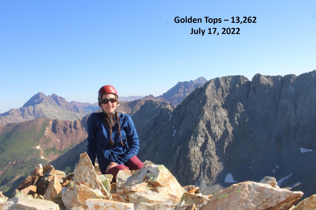
I summited Golden Tops at 8:30am
Golden Tops:
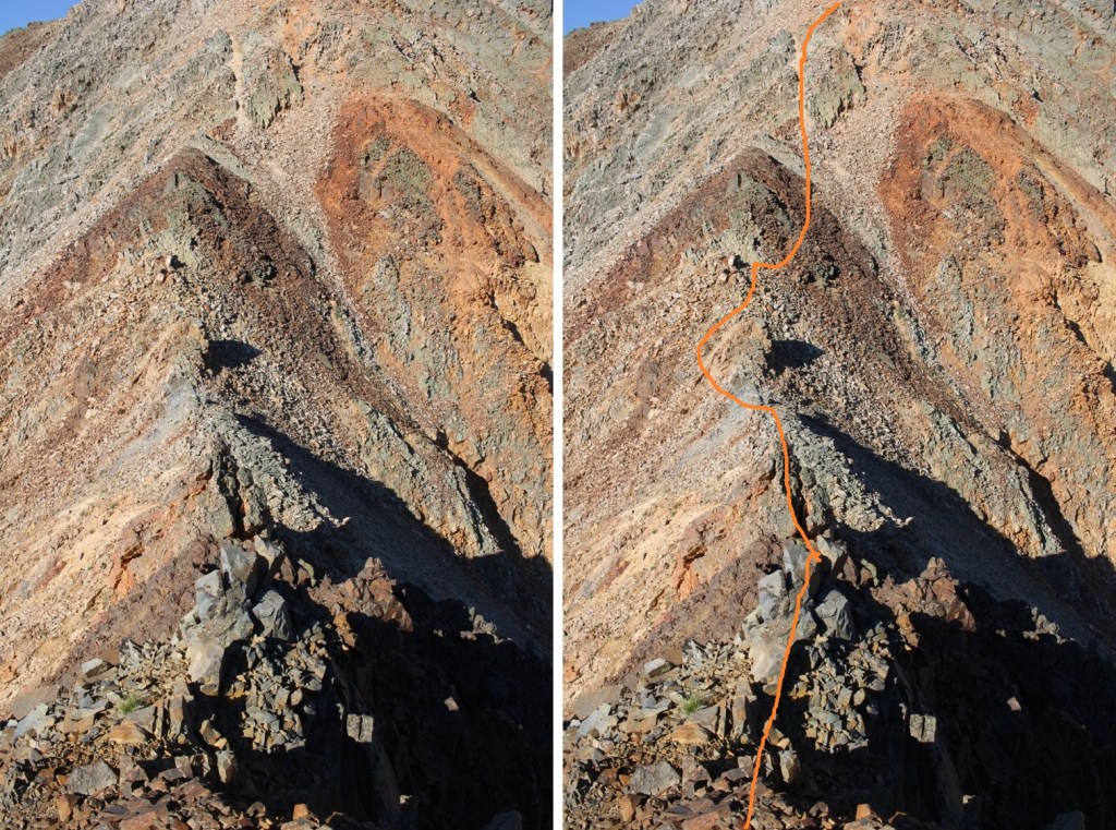
Looking back, here’s my route from Cassi Peak
Now to head back to the Cassi/Golden Tops saddle
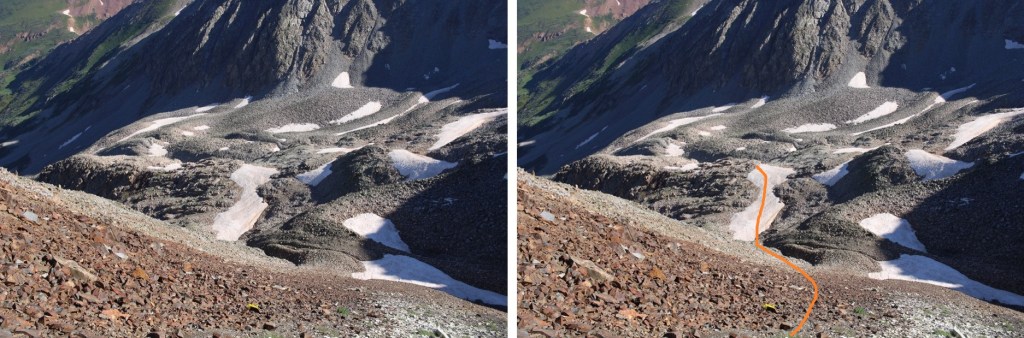
Just before making it to the saddle I turned left, and scree-surfed north, back to the rocky ledges I’d ascended that morning
And now to exit the upper basin and head into the gulch
Here I picked up the faint trail that brought me back to the waterfall and the mining area
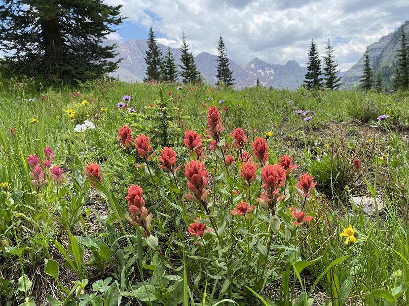
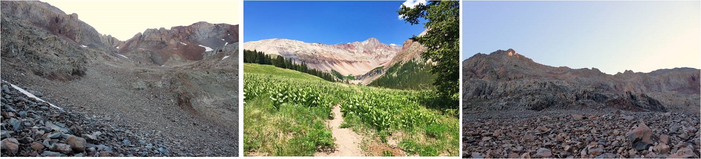
There were so many people, and so many wildflowers! I can see now why this trail was so popular.
Rustler Gulch Wildflowers:
Here are a few pictures of the way back to the trailhead
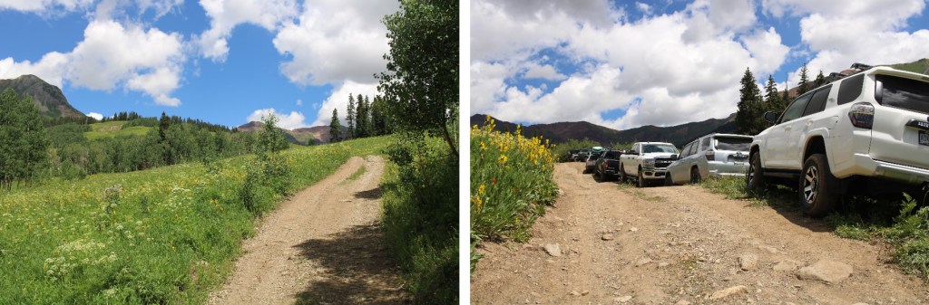
And from the trailhead to my parking spot
Here you can see even more of the overflow/2WD parking below
I made it back to my truck at 11:30am, making this a 14.51 mile hike with 4021’ of elevation gain in 9 hours.
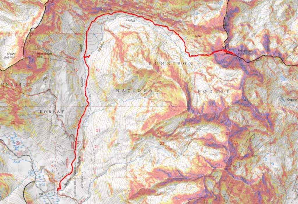
The Rustler Gulch Trailhead was full. I tried to drive up the road several times, but kept getting greeted by vehicles coming down. The drivers didn’t understand up had the right of way, and all of them seemed to be in vehicles too big for them to maneuver. After backing up over half a mile for the third time, I decided to just park below. I’d find out the next day it’s peak wildflower season in Rustler Gulch, and the tourists were flooding in to see them. Parking down below added about 2 miles to my trip and 500’ of elevation gain, which was negligible. Bonus: There was a creek behind me to enjoy as well.
I was on the 4WD road that led to the trailhead at 3:30 am.
I followed it a mile to the actual trailhead, which was overflowing in the afternoon
I passed around the gate, and followed Rustler Gulch trail #599 north into the gulch.
There were several stream crossings to cross, all of which had rocks or logs so my feet didn’t get wet.
When I got to this creek crossing, I went right, and found a footbridge
I continued following the trail, and crossing creeks, through the gulch on a well-marked trail
Here’s my route into the upper basin. This is all done on a class 1 trail
Here are some more pictures
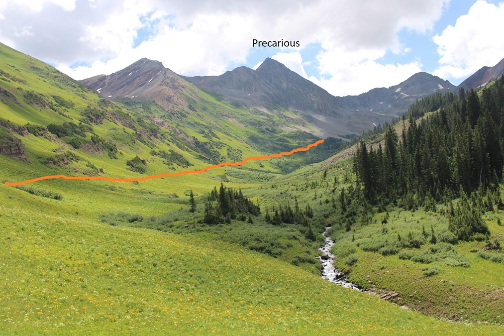
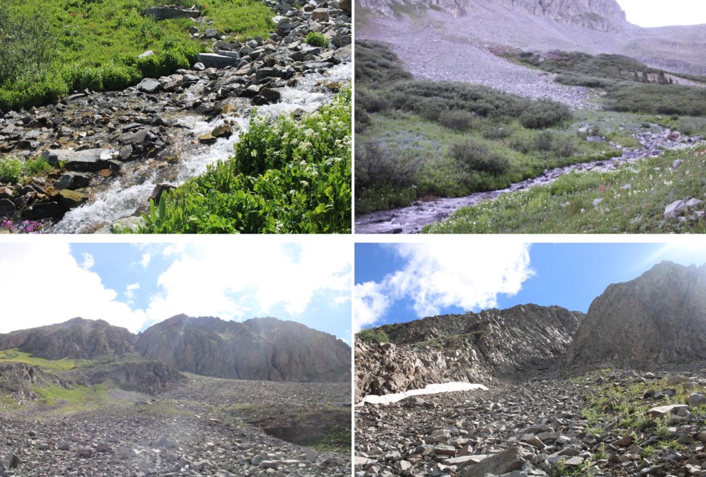
After hiking for 5.3 miles, I crossed a creek, and left the trail. I could see my route before me to Precarious’ access gully.
This is the route I took
And some step-by-step pictures to get there
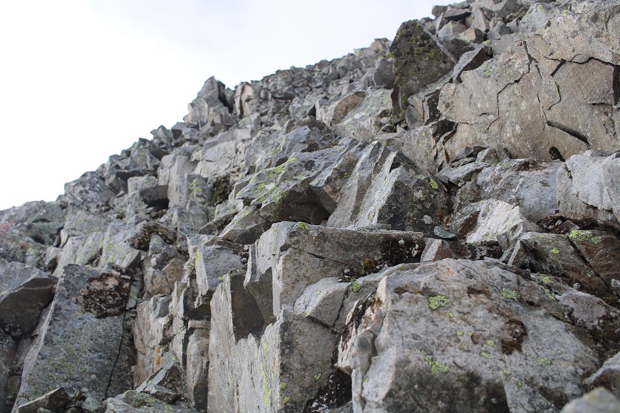
At the base of the gully I put on my microspikes and started climbing. This is choose your own adventure of 850’ of elevation gain. This felt class 2+. I’ve definitely been in worse gullies, but still be sure of every step. I didn’t have any rocks fall down the gully, but I did make a few slide a few feet. It had rained the night before, so the scree was mushy and easy to grip.
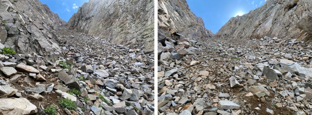
There are two ways to top out of the gully. I took the first one up, the last one down. If I were to do this again, I’d take the one closest to the top up and down, as it felt more secure. Here’s the one I took up, which still had snow in mid-July:
And the one I took down (snow free)
They both led to the same place: Class 3 scrambling.
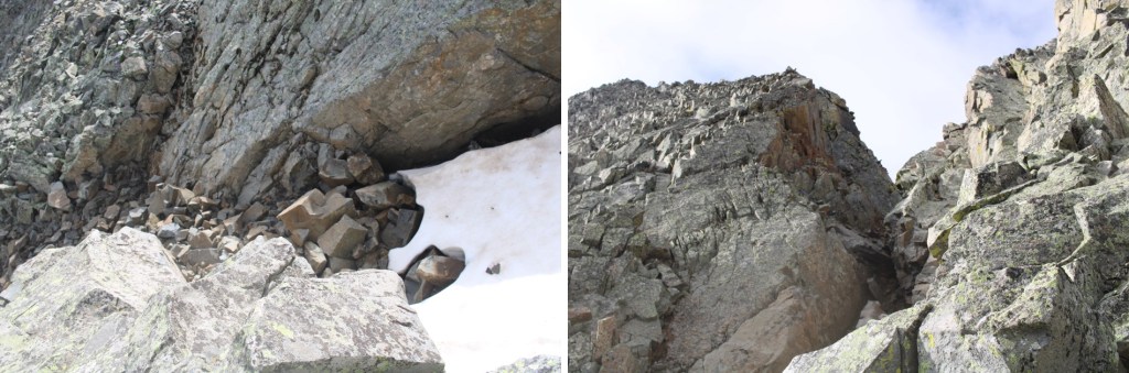
I aimed south, towards what looked like the ridge, but went too far up, where the route cliffed out. Instead, head east. At around 13190 there’s a path to go around the mountain. I had to descend about 50’
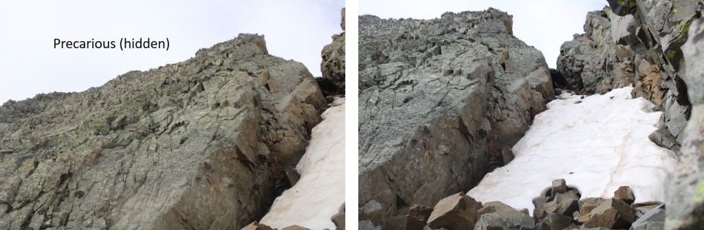
When I got there this is what I saw: A snow filled gully!!! I was so upset, thinking my climb was over…
Until I realized I just needed to cross the gully, and then head towards the summit on the other side (all class 3 scrambling).
I crossed the gully just at the base of the snow
And then scrambled to the top
To find I wasn’t yet at the top… This was all class 3 scrambling as well
I summited Precarious Peak at 8:30am
Precarious Peak: (Yes, I called it the wrong name. I knew it was wrong at the time, but didn’t care to take the video again)
There were two summit registers, and when I went to open them I found out why: The older one was sealed shut.
I backtracked the way I’d summited back to the snow filled gully
Crossed the gully
And made my way back to the ridge
Then back down to the gully that would take me to the access gully
OK, time to put back on my microspikes to descend the 850’ that is the access gully
I stopped on my way down to get a video
Precarious Gully:
Then continued to its base
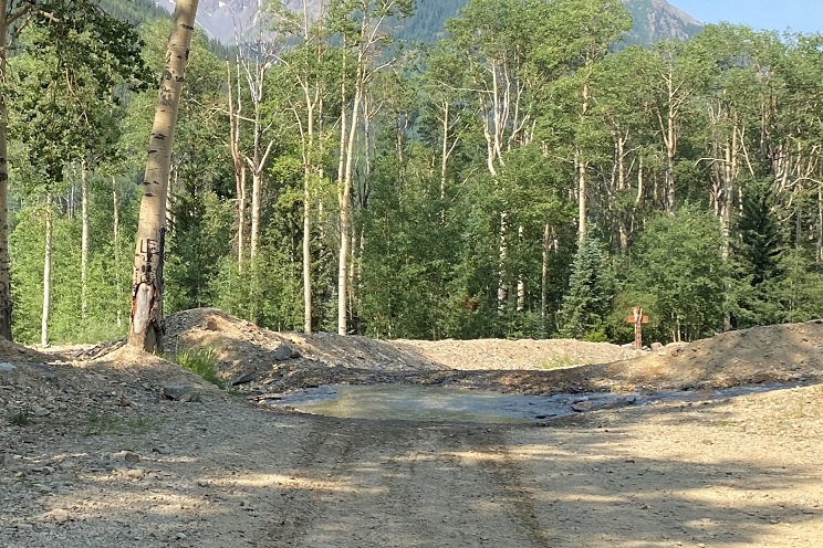
At the base of the access gully I took off my microspikes, and then headed for the obvious trail below.
I crossed the creek, and spent some time looking at some old mining equipment.
Then I followed the trail back down the gulch
There were so many people, and so many wildflowers! I can see now why this trail was so popular.
Here are a few pictures of the way back to the trailhead
And from the trailhead to my parking spot
Here you can see even more of the overflow/2WD parking below
I made it back to my truck at noon, making this a 13.79 mile hike with 3714’ of elevation gain in 8.5 hours.
I’ve said it before, and I’ll say it again: I’m NOT a fan of the permit system. Even though I was on their website exactly when permits were released, I wasn’t able to get an overnight permit for Maroon Bells on a date I could go, so I had to get three back-to-back permits instead. When I pulled up at the gate my paperwork confused the attendant. He didn’t know what type of a parking pass to give me, but settled on an overnight pass that expired in two days time. He then asked me to park in the further lot, as the closer lot was intended for day use.
I balked at this: I’d wanted a 2 night pass, but because of the reservation system I couldn’t get one. Instead, I paid 3 times what those who were able to score a longer permit were paying for the same amount of time in the park. I felt if I was paying that much more, the least they could do was give me a better parking spot. Also, while annoying, the main reason I don’t like the permit system isn’t because of stuff like this: it’s because it encourages bad decision making among people who feel they need to hike/continue when dangerous because it’s difficult to get a permit, etc. One of the reasons I left California in 2006 was because of the permit system, and all the fees associated with said system. I hate seeing it brought to Colorado.
Ok, rant over. I was on the trail around 5:30pm. It was my intention to camp around 11,000’ and start early the next morning. For those of you who haven’t hiked the Maroon Bells area before, the trail is obvious:
I followed the trail west, staying right at the junction for Crater Lake
And continued up the hillside to my camping spot at 11,100’. I was surprised no one else was camping here, as it’s the perfect spot.
I’ll spare you the details of the next day’s hike, as I came back to this spot, spent the night, and started from here the next morning. I’d gotten to bed early after a long day of hiking, and woke up to sunlight. I looked at my phone and it showed 5:30! Ack! I initially thought I’d slept through my alarm, and started rolling up my sleeping bag. About 30 seconds later I realized I’d only been sleeping about an hour, so I happily went back to bed and slept soundly until 3:30am the next morning. I left my new water filter bag inside my tent and was on my way.
I was on the trail by 3:45am, heading northeast along the well-defined trail through Minnehaha Gulch. I crossed a stream and continued along the trail, not really ‘feeling it’ today. I was more tired than I should have been, and wasn’t feeling very motivated.
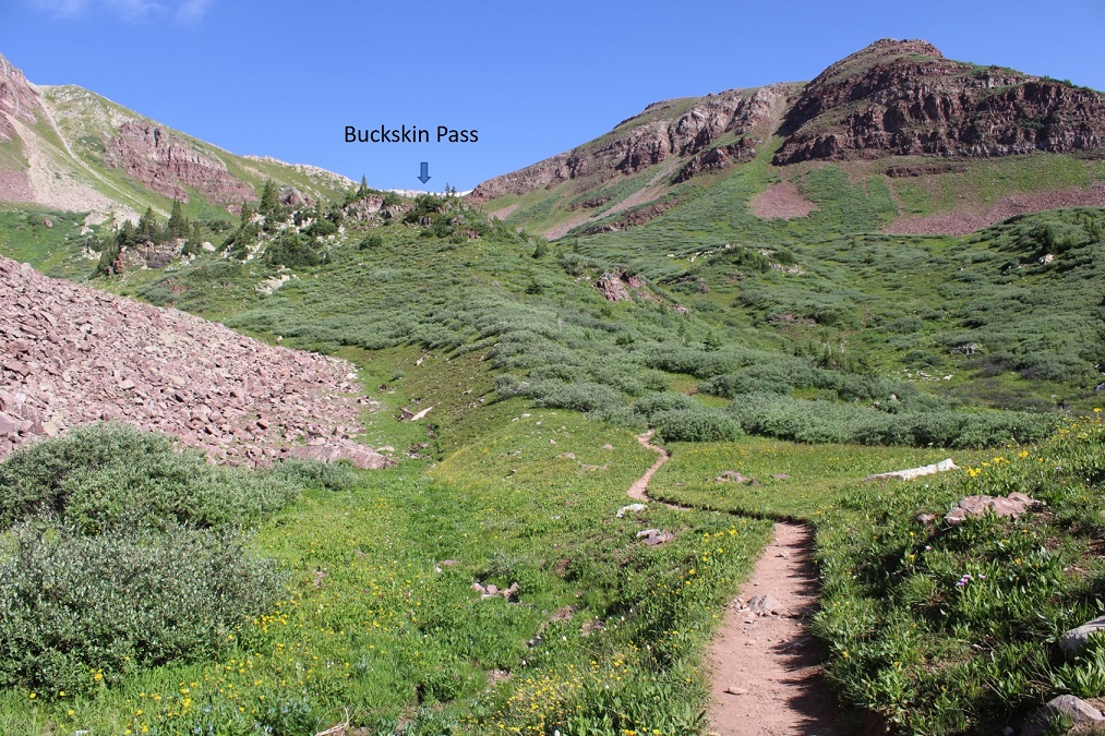
I followed the trail all the way to Buckskin Pass
Once at Buckskin Pass, I turned right and headed north towards Buckskin Benchmark
This was an easy, class 2 hike, mostly on tundra
Towards the top it got a little rocky, but stayed class 2. I saw several ptarmigans here, and a few crows
Right about now the sun was starting to rise, along with my motivation.
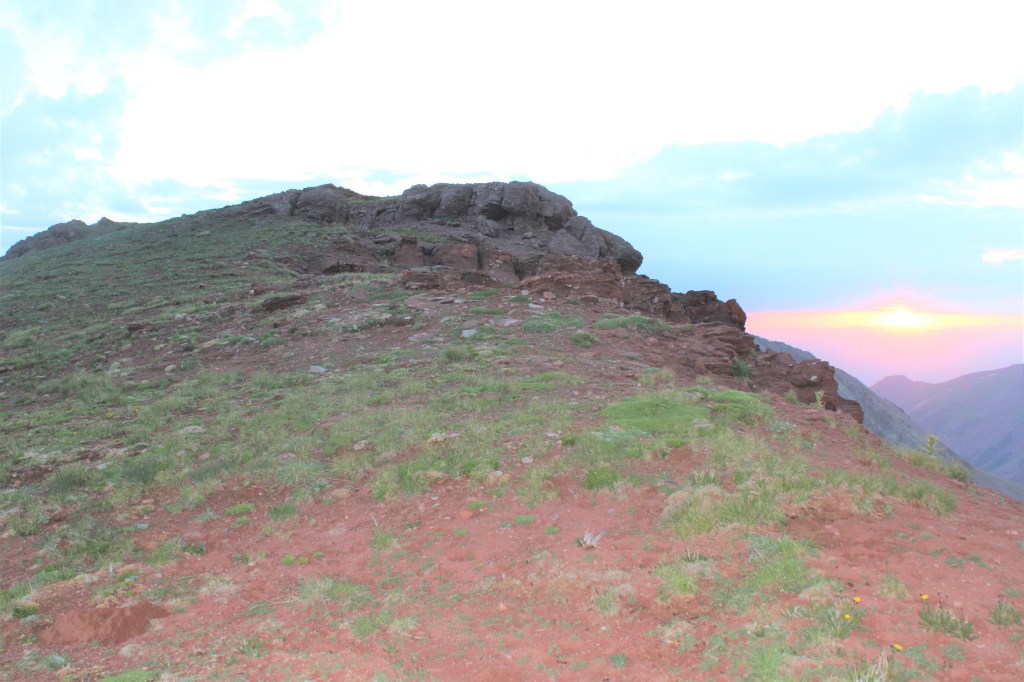
Here’s the last bit to the summit. It stays class 2 if you keep left
I summited Buckskin Benchmark at 6am
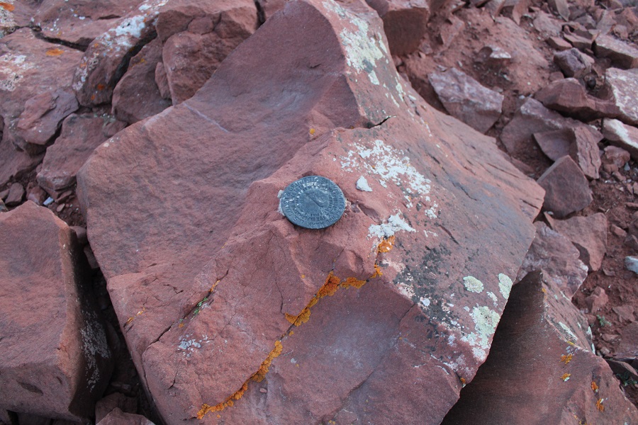
Buckskin Benchmark:
The benchmark
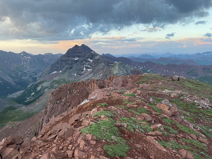
The views from up here were amazing! My spirits lifted, I actually ate a snack, and headed back down to Buckskin Pass.
On my way down I made some mountain goat friends (those are Snowmass and Capitol peaks in the background)
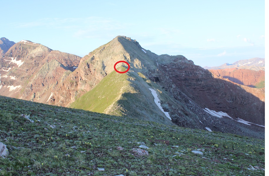
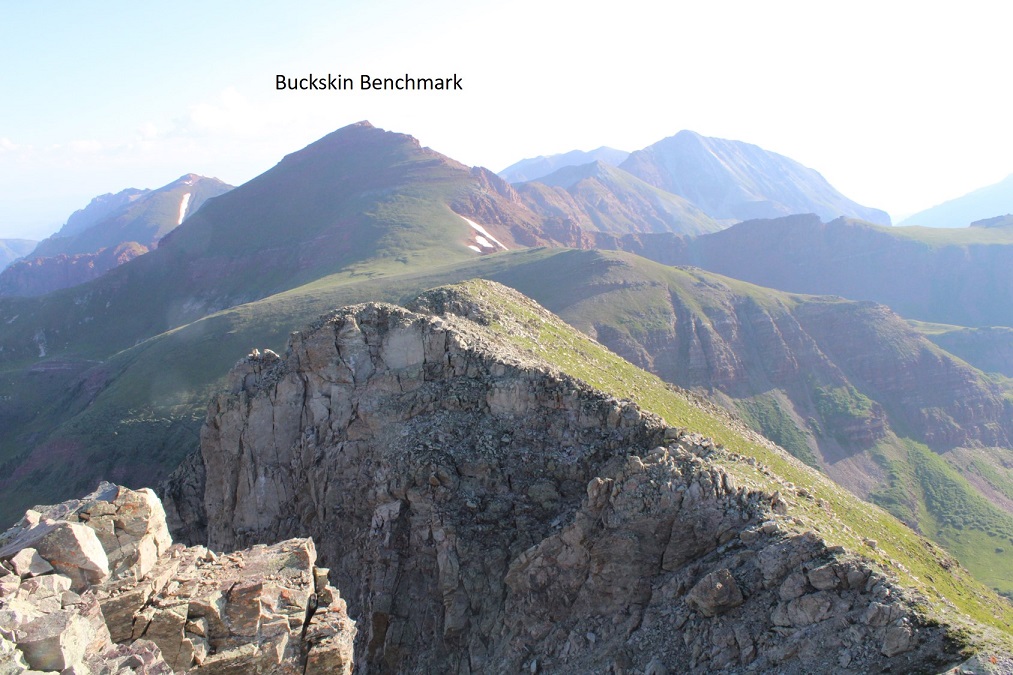
My next peak was PT 13039
It was a tundra walk back to Buckskin Pass
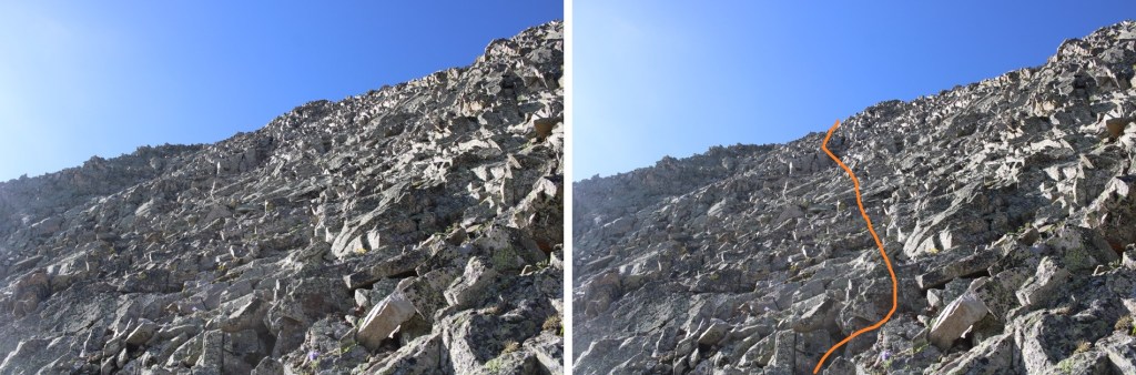
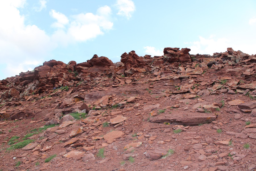
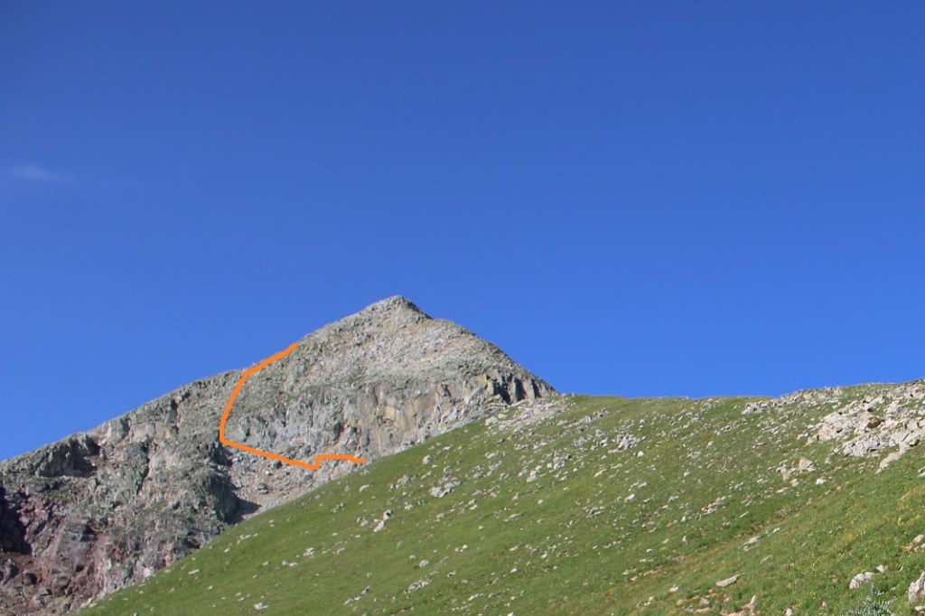
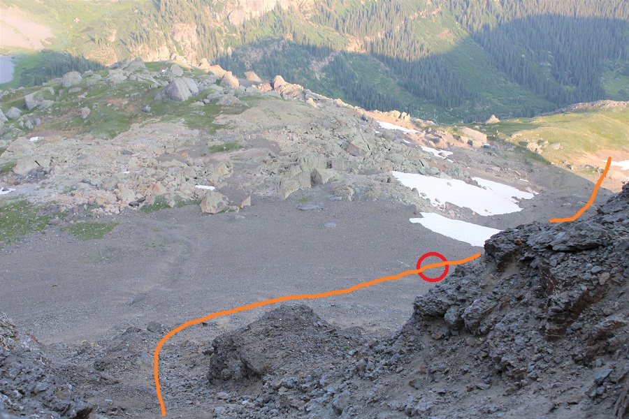
And a trail hike up to the point circled in red
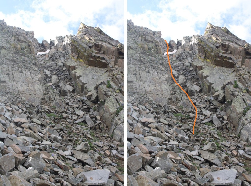
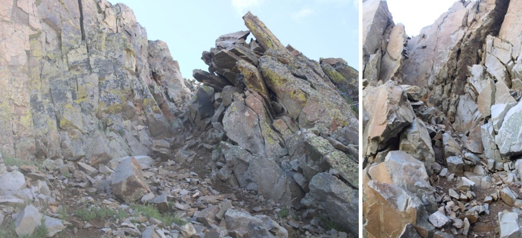
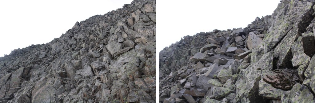
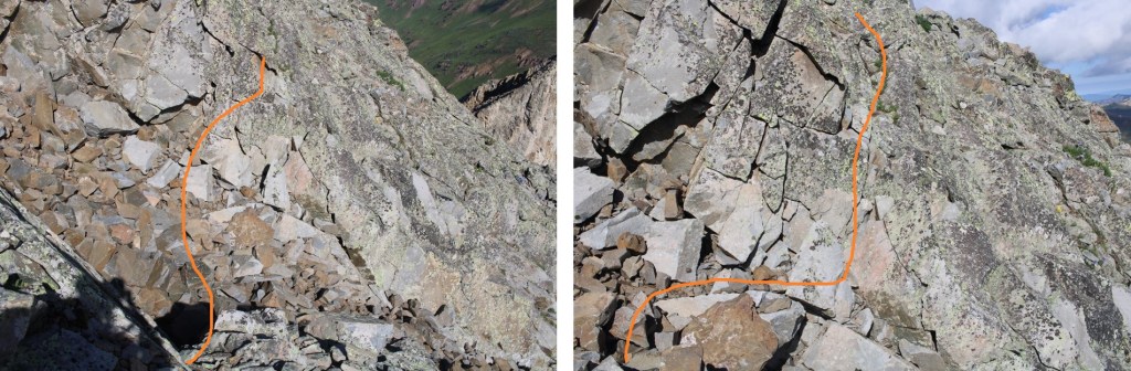
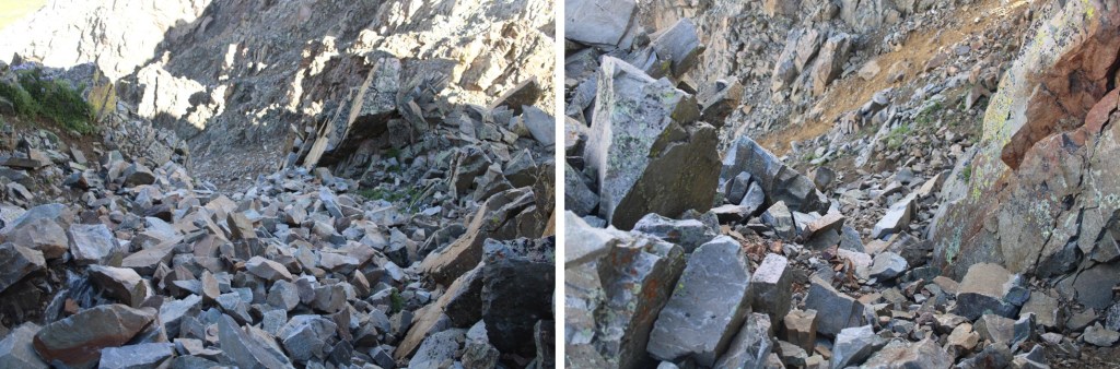
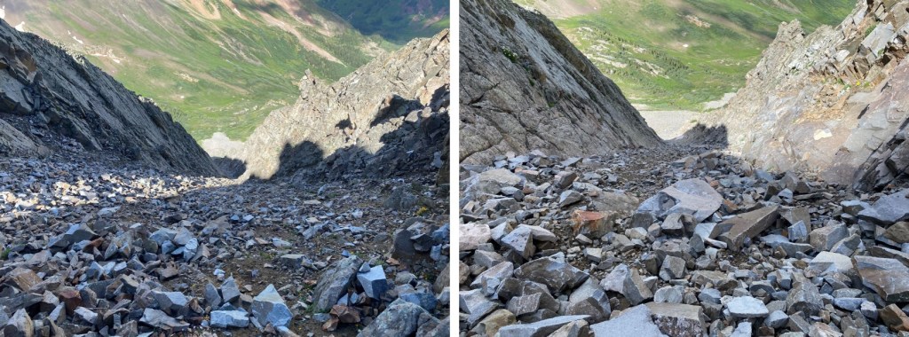
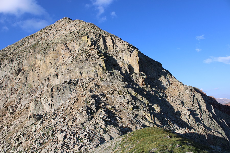
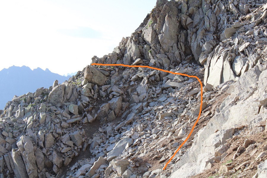
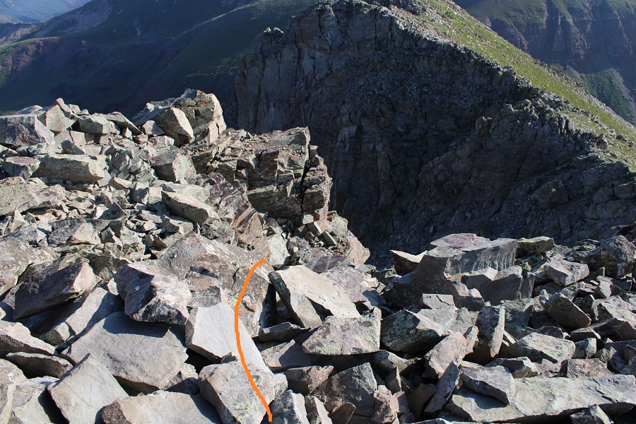
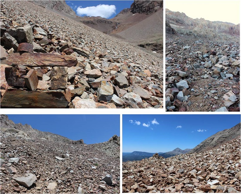
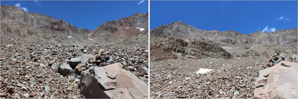
This is where it got interesting. I wanted to go straight up and over the face, but it seems as if there have been several slides in the area, and nothing went at class 2. This was supposed to be a class 2 hike, so I looked for a better way. My advice here is NOT to go directly up one of these gullies (you probably can, but they all looked sketchy/prone to slides).
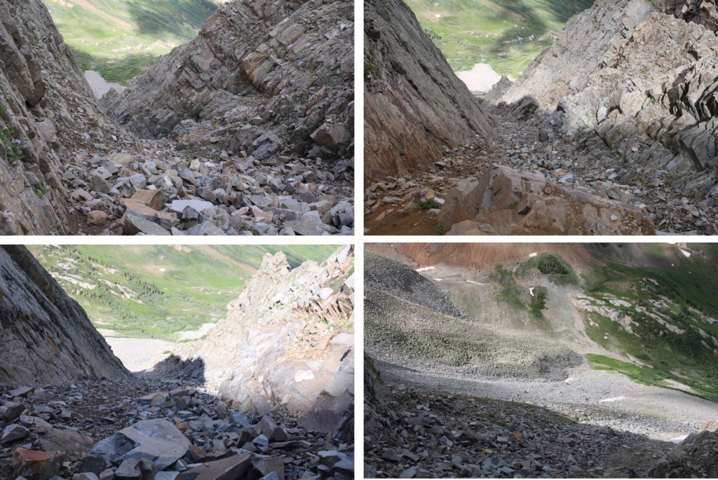
Instead, dip down to the left. This area stays class 2.
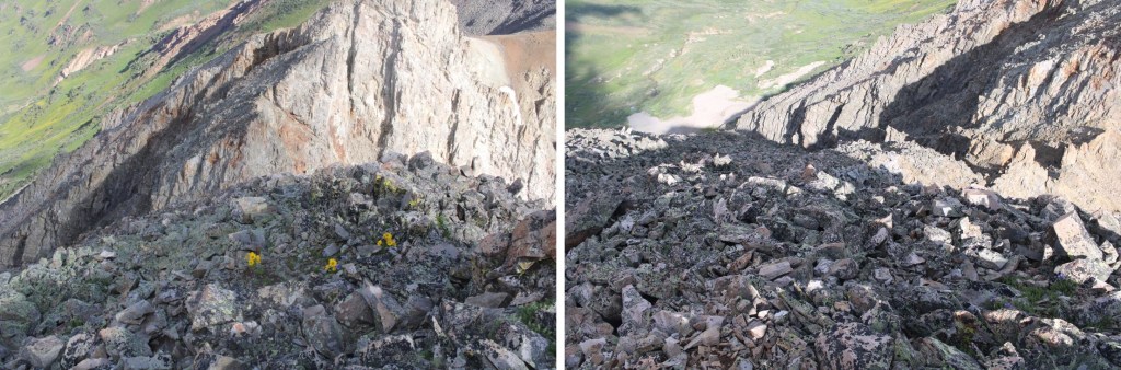
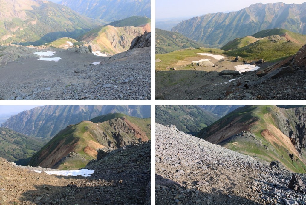
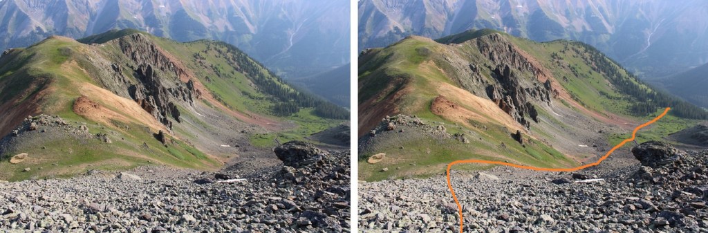
Here’s what my route looks like from below
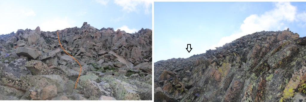
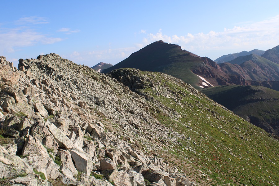
Once I was past this area, I turned right and headed southwest to the ridge (still class 2).
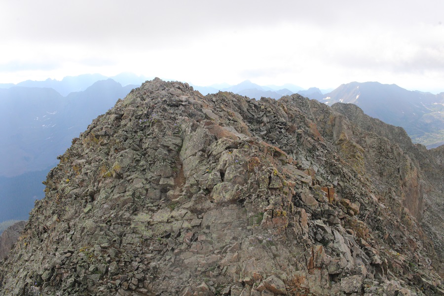
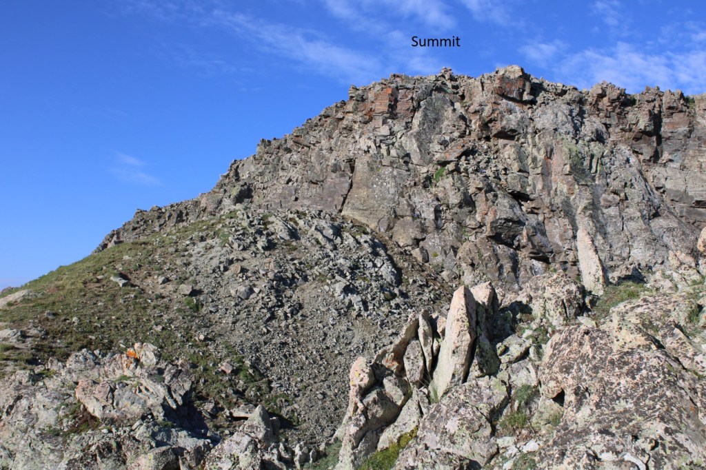
Then I followed the ridge south. I could clearly see the cairn indicating the top of 13039
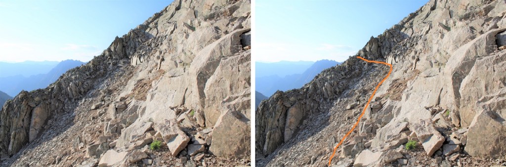
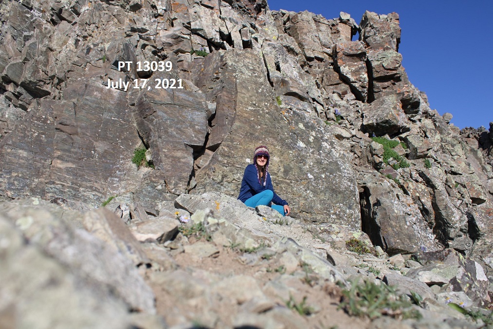
At the edge of the ridge is where it got spicy. It turned form a class 2 hike into a class 4 climb. I looked around for an alternate route, and realized the only way up to the summit was to climb the 30-40 feet or so up the chimney/gully to the summit block
I was a little disappointed because I’d left my helmet back in my tent. I debated if I should continue or not, and in the end I figured I did enough class 4 climbing yesterday without incident and was warmed up: I should be fine today. Also, I’d recommend wearing a helmet. I dropped my gear and headed up with just my camera. Here’s the route I took
I made it about halfway up the chimney, and once again had second thoughts. I continued on however, because I knew the worst was behind me and either way I’d have to downclimb that area again. Here’s another angle
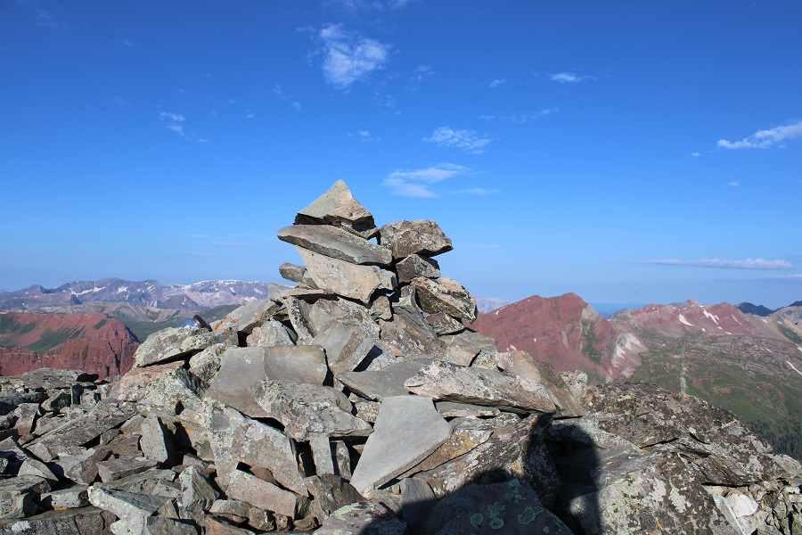
I summited PT 13039 at 7:45am
PT 13039:
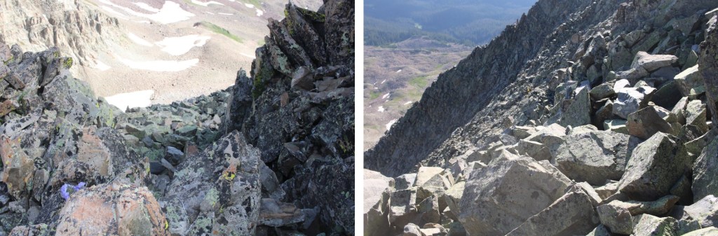
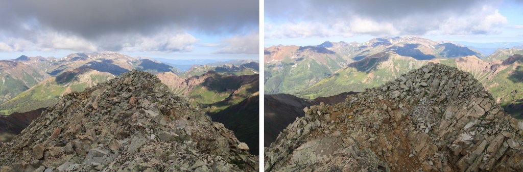
Here’s looking back at Buckskin Benchmark
From the summit you can see where I left my gear.
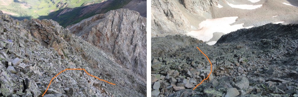
I turned and exited the way I came
The initial downclimb was steep and committing. I turned and faced the rock for this part.
I made it about halfway down and realized I hadn’t taken a picture of myself on the summit, but I wasn’t willing to re-summit again. I figured I’d just get a photo at the bottom.
I made my way back down the ridge
And back to Buckskin Pass
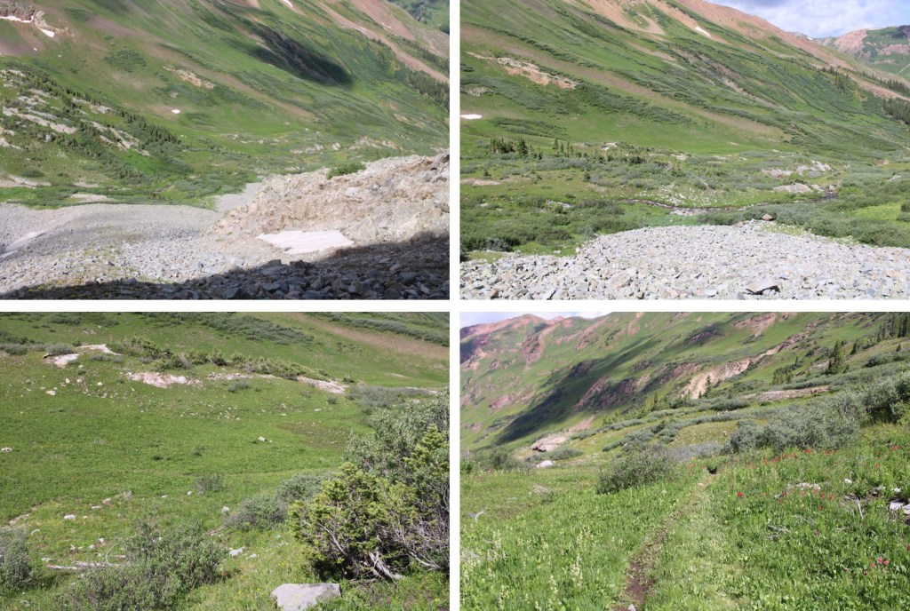
From the pass it was an easy, class 1 hike back to my campsite.
Side note: there are also good camping sites at 11,500’. Once at my campsite I was disappointed to find my water filter had leaked water all over the bottom of my tent. I dried it out the best I could, packed up my gear, and headed down.
Also, the wildflowers were on point today
Here are some pictures from the trek out
Once I made it back to the Crater Lake area I started seeing tons of people on the trail. They travelled in groups, and were spaced about 15 minutes apart (I’m guessing this is due to the bussing times). I met one lady who asked me how fat it was to Crater Lake, and when I told her it was another mile or so she looked like I’d just told her it was another 20 miles. She was exhausted, and I’m pretty sure she turned around (the round trip hike to Crater Lake is about 4 miles). There were several groups being led by guides, which leads me to believe guiding companies may be buying up the permits.
I made it back to the parking lot, cleaned up, and headed out.
I had another entire day of hiking yesterday, so my stats are estimates based on CalTopo math: Today’s hike was 18 miles with 5800’ of elevation gain.
Ophir Pass Road is a serious 4WD road, but the trailhead for this peak can be accessed from the Ophir city side with just a high clearance vehicle. There were a few small water crossings, but 4WD was never needed.
I parked in a parking area about 1.3 miles east of the town of Ophir, on Ophir Pass Road, in the Iron Spring area. All the parking spots were taken but 1, and every vehicle was parked there overnight. This is a popular spot to park to backpack/hike in the area.
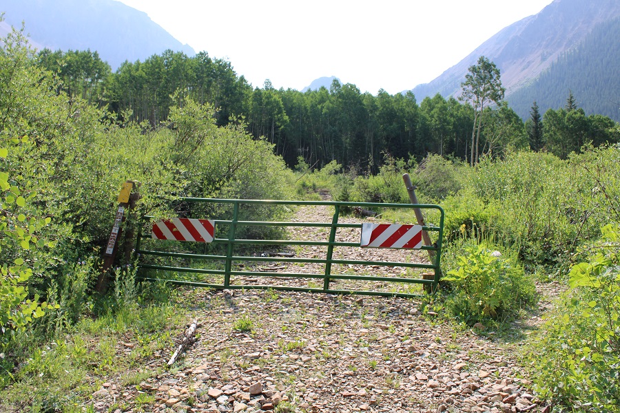
The mosquitoes were out here as well, so I made it an early night and got some sleep. I was up and on the trail by 3:45am. The trail starts on a blocked 4WD road to the south of the parking area.
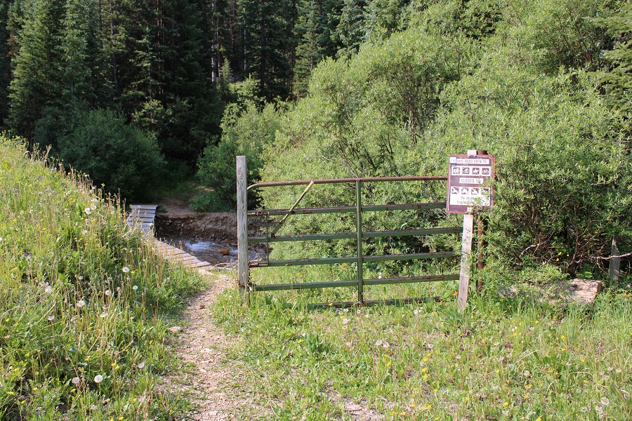
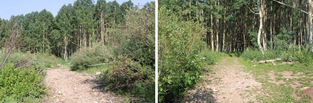
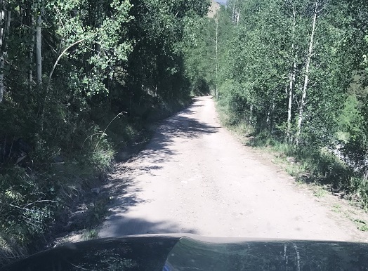
I followed this road southeast and then south, through gates, aspen trees and two stream crossings with easily crossable bridges
After the second stream crossing, I passed below some power lines, turned left to follow the trail, and started gaining elevation.
The hike below treeline was nice, and the trails were class 1, but there were no trail signs or numbers, and several trail crossings. I’ll do my best to describe the correct route.
I followed a well-defined path south.
At the first fork in the road, I turned right
At the second fork I turned right again, off the road and onto a trail (I’d hiked a total of 1.15 miles at this point)
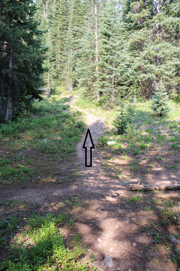
I hiked west for a few yards, and then came across a trail junction. I continued heading straight
I was now on the trail that heads south/southwest up the hillside. This is also where I ran into a porcupine. Porcupines don’t run, but we noticed each other while we were about 3 feet away from each other: He quickly turned and waddled away in the dark, showing me his full backside of quills as he did so.
I continued on this well defined trail
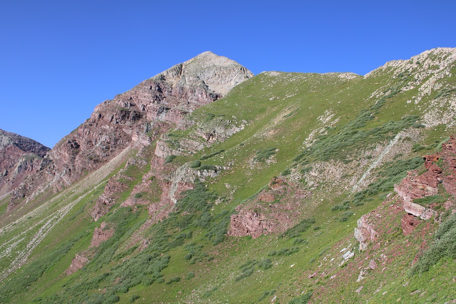
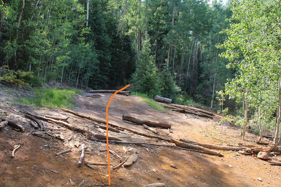
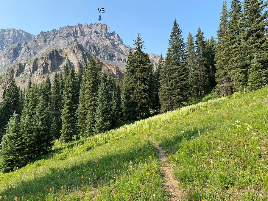
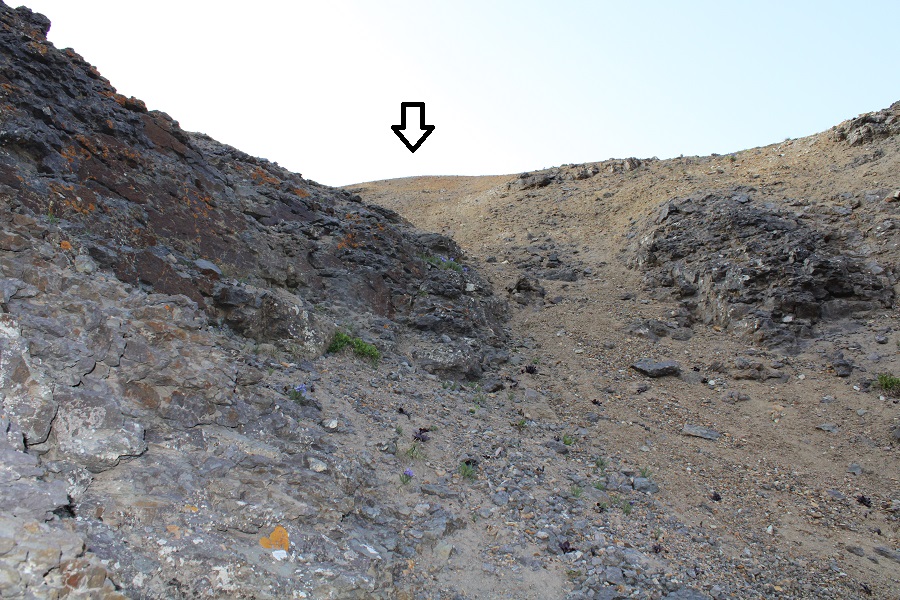
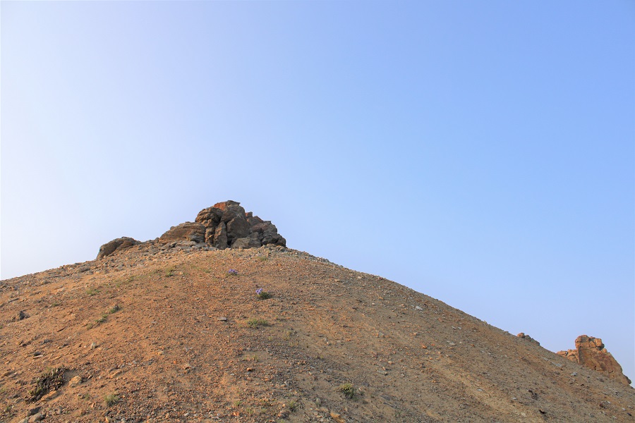
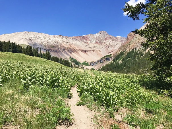
Here’s your first glimpse of V3. Look carefully, the arrow points to the exact summit, which you won’t see again until you’re there.
After hiking for a total of 2.25 miles and 11350’ I came to a small water crossing over the trail, and a meadow to my right. I left the trail and headed through the meadow. It was still dark, and there was a camper with a bright headlamp getting ready for the day. He was confused why I was ‘off trail’ and tried to direct me back to the proper trail. I assured him I was going in the right direction, apologized for walking so close to his campsite, and nicely told him I didn’t expect to find a trail to the summit.
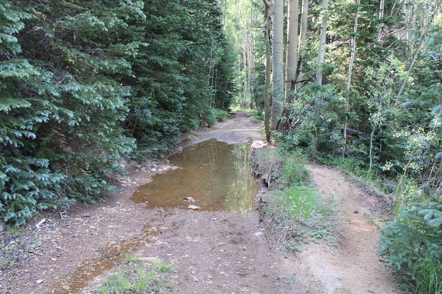
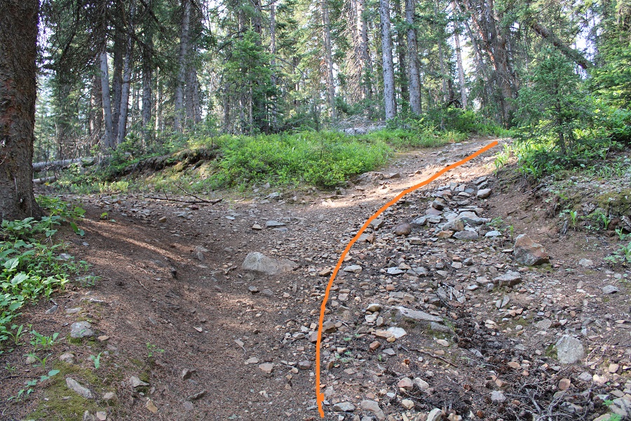
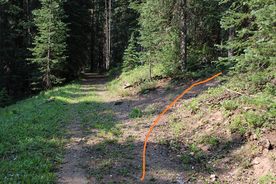
I was now in a meadow and basin. There were wildflowers I couldn’t yet see in the dark, and willows I kept encountering. I found out the hard way to stay right to avoid the willows. The path is obvious in the daylight. Here’s the route I took.
And some step-by-step pictures of my way to the saddle, first hopping across a small stream
Staying right to avoid the willows and ascending a small gully that still had snow. Microspikes were helpful here, both on the scree and snow.
At the top of the gully, I was now in a rocky upper basin. I crossed a boulderfield and headed towards the saddle.
Here’s a look at the last bit of hiking to the saddle
Once on the saddle I turned left and followed the ridge southeast, staying to the left of the snow.
At the top of this area you can see the crux of the route. Now is a good time to put on your microspikes and helmet, if you haven’t already. It’s much steeper than it looks, and the scree isn’t manageable without microspikes (trust me on this one).
Here’s your intended route:
You’re aiming for this gully. The scree here is steep; a 45 degree angle for an extended amount of time.
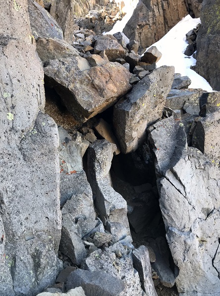
Once at the base of the gully the class 4 climbing begins. The route is obvious, curving around to the right. There is really only one way to go: follow the trail set out for you from the fallen scree. Also note: the scree and rocks here are loose. Very loose. I wouldn’t attempt to upclimb or downclimb this area with another person: take turns the entire way up and down. You will be causing screevalanches on climbers below you.
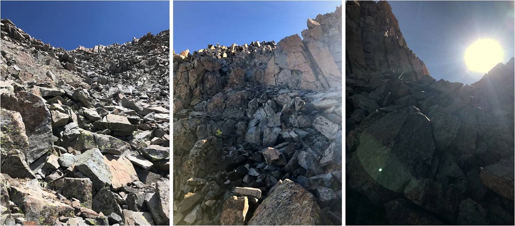
Here are some pictures from the inside of the gully. Pictures do not do the steepness justice (although the pictures down give you a better perspective). When heading up, continue climbing southeast.
Here’s a look at the exit of the gully
At this point it became even steeper. I did not have on my microspikes, lost grip, and slid on my stomach backwards for a full 12 feet. I seriously thought I was going to slide all the way back down that gully. I braced myself, and without taking off my pack located my microspikes in my backpack pocket and gingerly put them on while trying to balance without much traction. It was much easier to upclimb once I put on my spikes. Here is where I aimed
I then turned right, and hiked south towards the summit block.
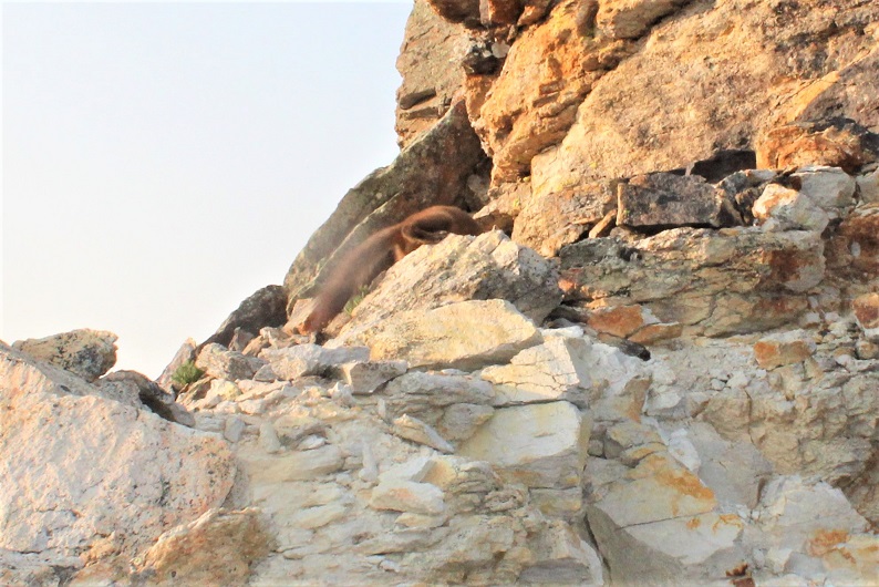
I made it to the base of the summit block and was surprised to see a pine marten. He sat there and looked at me. I tried to get a picture, but he quickly turned around and all I got was a picture of his tail and backside. Why are all of my wildlife pictures of animal butts?
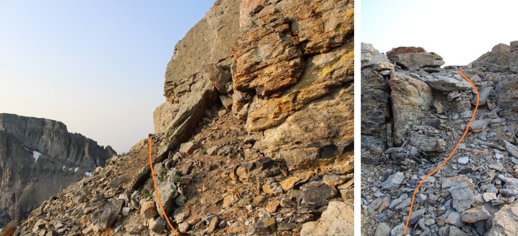
Ok, now, don’t let this summit block scare you: yes, you can upclimb it, but you can also skirt it to the left and follow it around and have a class 2 trek to the summit, which is what I did.
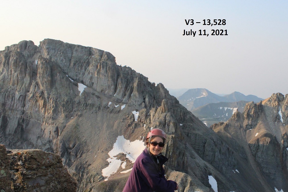
I summited V3 at 7:15am. There was a lot of smoke in the air from far away fires this morning.
V3:
I was surprised there wasn’t a summit register, so I left one. It was obvious this peak does not get a lot of visitors.
I kept my microspikes on for the trek back down, which seemed easier than the trek up. Here are some pictures of the way back down the gully. Once again, do this one person at a time, and when you’re done, head far away from the gully, as the rocks will slide and they will pick up speed as they do so.
Once out of the gully, the scree-surfing will begin. It’s always fun when you can ride the same pile of rocks all the way down the hillside.
Scree Surfing:
Here’s where you’re aiming. If you’re doing this with another person, you should be standing far away from the rockslide area while they’re ascending/descending. I’ve circled a good place to stand out of the way.
And now to hike down the ridge to the saddle, and exit the basin.
I made it back to the meadow, marveled again the wildflowers, and saw the group of campers were almost done taking down camp (I guess the man I talked to this morning was part of a larger group). I made it to the trail, turned left, and followed it back to the trailhead.
I made it back to my truck at 9:45am, making this an 8.29 mile hike with 3542’ of elevation gain in 6 hours.
It’s 7:30pm on Saturday night, and I go downstairs to find all 3 of my teenagers hanging out in my youngest daughter’s room. My son is sitting in a chair in the middle of the room serenading everyone, trying to figure out how to play a Bruno Mars song on his accordion. My oldest has her laptop in her lap, and my youngest has her headphones on (but takes them off when I enter the room).
The kids ask me why I’m not driving to the trailhead? Didn’t I have a long drive and hike ahead of me tomorrow?
Me: Well, you see yesterday I saw a really big bear when I was coming home from hiking. A really big bear. I didn’t realize we had bears that size in Colorado! I’m stalling because I don’t really want to hike solo in the dark for longer than I have to with bears on my mind.
My son: I thought you talked to us yesterday about not letting other people’s fears dictate your hikes?
Me: Yes, but currently, this is my fear.
My youngest: That’s fair.
My oldest: But you’re not hiking the same mountain, right?
Me: You’re right! Hey, I’m not even hiking in the same mountain range. Thanks! I’m out!
My oldest knows how I think, and knew just what to say to get me moving. I’ve hiked for miles and miles in the dark solo dozens of times, but for some reason seeing that really large black (cinnamon colored) bear yesterday kind of freaked me out. Sure, it was running away from me, but it wasn’t the smallish black bear I’m used to seeing. I encountered it during the day, but it’s not something I’d like to repeat at night. I know I’ll get over it after a time or two of hiking at night again; the experience was just still fresh in my memory and didn’t sit well.
So I drove the 6.5 hours to the Kilpacker trailhead. Quick note: the driving directions given on the dot com are correct, but I misinterpreted them. The instructions said to drive to Lizard Head pass and continue south. So when I got to Lizard Head Pass sign I turned south into the lot, thinking this was the pass, and looked for a route south. This wasn’t the pass, and I circled the parking lot twice looking for it. It was dark and the road was a half loop, leading to other trailheads and me to believe I was missing the turn off. I figured I must have missed something? Nope, there was no turn at Lizard Head Pass: just continue driving when you see it and don’t go into the parking lot (unless you need to use the restroom, because they have one there and not at the trailhead).
The 2WD dirt road in was a bit narrow in places, but easy to navigate. I put my truck in 4WD because I could, but it wasn’t necessary.
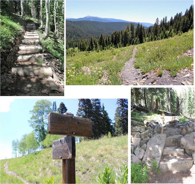
I signed the trail register at the well marked trailhead and started my hike a little before 4am. In the dark. Here’s proof:
The first 5 miles of this hike are really easy. Very little elevation gain (in fact, you lose more than you gain it seems, which stunk on the way out) and no real challenges. That is, if you put aside the fact when you hike in the dark your sense of hearing intensifies and every shadow becomes a mountain lion/bear/rabid squirrel coming at you at full speed. About 2 miles in I heard a large pine tree fall 20 feet in front of me on the trail, which was a first for me (but it’s gotta happen a lot, right?).
I came upon the stream crossing and it was more difficult than anticipated. You see, when I came upon it in the dark I saw a broken log in the water, with no way to cross. I walked up and down the banks a few times until I noticed an in-tact tree that was easy to cross. It’s one of the fun challenges of hiking at night! (I had a GPS but it wasn’t helpful in this situation, as it showed the crossing far from both logs, in a place where there were no logs).
So, how did I deal with my bear thoughts? I diverted my mind to a speech I’m writing for a presentation I’m giving next week at a conference on sensor technology, tapped each and every log and large rock I passed with my trekking pole to make noise, and said “Hey Bear!” more than I have in years. It worked, because I didn’t see any animals (which was also kind of a downer because I actually like seeing animals when I hike).
The route was very well maintained until I reached the basin.
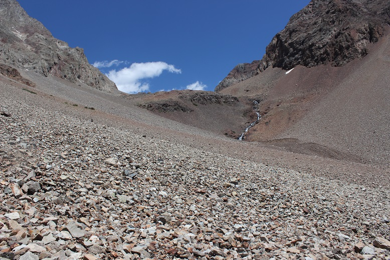
I reached the basin just as the sun was coming up. This was a very large basin filled with a lot of talus.
From here the route wasn’t difficult to follow, but everything looked the same, making cairn finding a fun game.
I never did see the cutoff for El Diente because I wasn’t looking for it. I was focused on route finding for Mt Wilson, but here it is (I found it on my way back down).
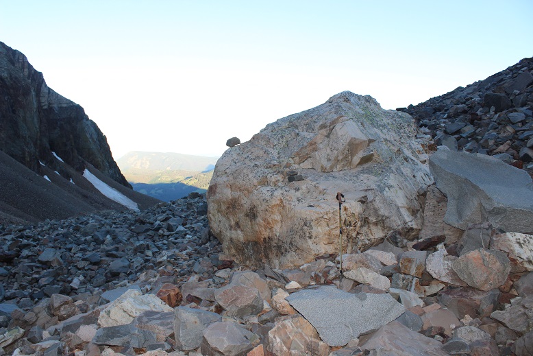
I left my trekking pole near a large rock, fully expecting a marmot or pika to destroy it (it’s time I got a new one anyway).
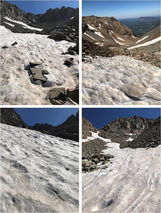
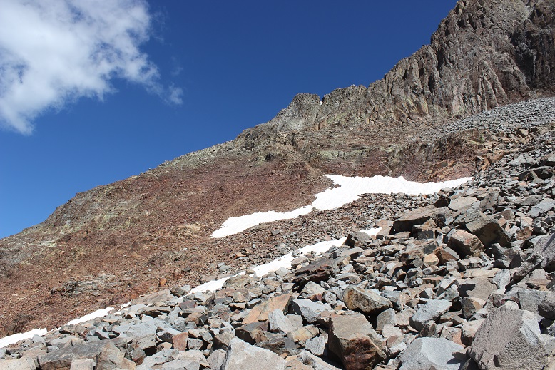
I chose to do Mt Wilson first because it’s further and there was a chance it would have snow. I wanted to get the snow part of the hike done in the morning before the snow softened. The jury was still out on the traverse. After hiking through miles of talus I came to a drainage area with larger rocks. I could see a snow free line to where I needed to go so I didn’t put on my crampons and spent the next hour and a half carefully hopping from rock to rock up the drainage.
Once I made it to just below the gullies below the summit it was much safer for me to put my crampons on, so I did, and left them on until I was about 150 feet away from the summit (when rock climbing became necessary).
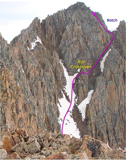
Here’s the route I took (I’m using the photo from 14ers.com because mine don’t have this great of a perspective).
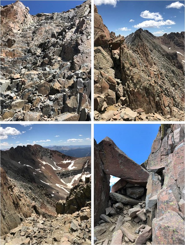
After making it to the notch rock climbing was necessary. Yes, it is important here to look back at the way you came. You’ll be surprised at how different it looks from this perspective!!!
There was one class 3 move
And the rest was a fun uphill scramble with the added bonus of the sun blinding me as it was just rising over the ridge
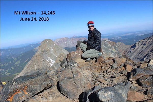
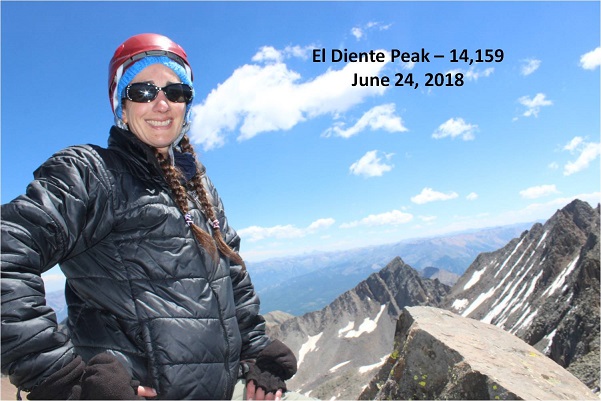
Wow! What a beautiful day for a summit!
I took a summit selfie, a summit video, and was back on my way.
This time I put on my crampons for the gully and kept them on as I was descending most of the basin, straight down the snow. Wow! What a difference from hoping rock to rock! This was so much easier! I wished I’d have done this on the way up: I’d have saved quite a bit of time.
Now it was time to head over to El Diente. I’d made the decision I wanted elevation gain today, and the best way to do that was to descend Mt Wilson and climb El Diente instead of doing the traverse. Also, I didn’t have a map or instructions for the traverse with me and this seemed like a safer option, even though the traverse was snow free.
The pink “v” is what you’re supposed to do if you hike each peak separately, but I found an established cairned route and took the blue line.
I still looked for and traversed the rib, but I took a route from the west instead of the east.
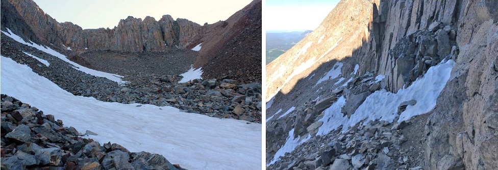
I climbed the gray gully and hiked just below the organ pipes
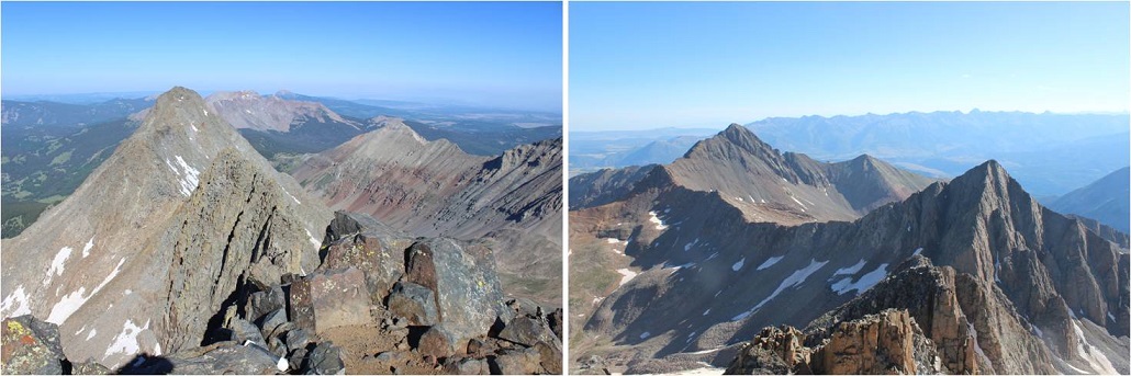
After gaining the ridge I actually moved from the south side and traversed the north side of El Diente. The north side had some snow directly on the route, but it was easily navigable. Here’s a picture looking back at the north side part of the trail and also of the traverse.
Here was the crux of the climb for me: I rounded the corner and since there was snow on the direct route from this point on I made a few class 4 moves to gain the summit. (It’s a steeper climb and those rocks are larger than this picture makes them look).
I couldn’t tell where the exact summit was. My GPS kept switching between points, and some were obviously not the summit (it was doing this for the north and south side of the mountain too, which was frustrating). There was no summit marker so I just stood on multiple high points on the ridge, just to be sure I hit the ‘actual’ summit. The high points were quite narrow so this picture is closer than I’d have liked.
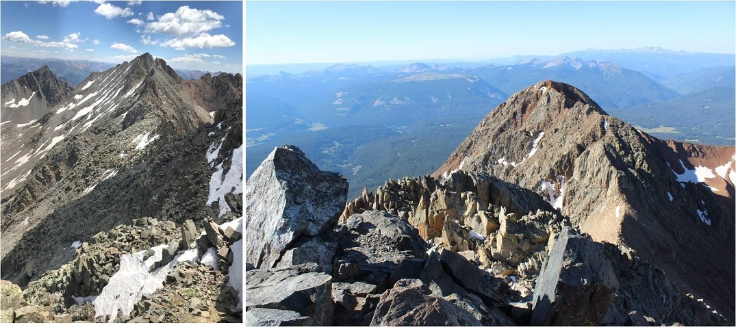
Take a look at that ridge heading back to Mt Wilson!
I was much more confident on the way back down El Diente. Both of the climbs I did today were completely within my abilities. They were fun, and while there was exposure I wasn’t scared at all (not even much of an adrenaline rush). These routes seemed very similar to the Mt Sneffles ridge route. The only downside? The talus! OMG, that stuff didn’t quit! Talus stinks to hike in because all of the rocks are of irregular size, none of them are stable or large enough to securely put your foot down, and they cause you to slide when hiking downhill. It’s hard on the knees and impossible to hike down fast without slipping.
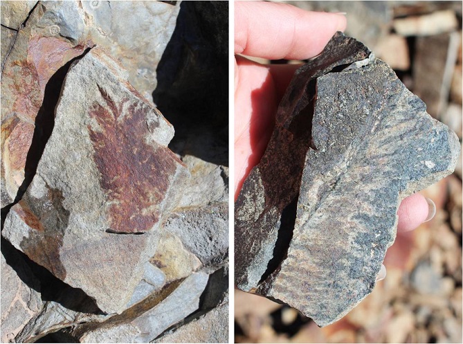
The only good thing about talus? It’s gorgeous to look at! I found several pieces that looked like they contained fossils of plant material. I left them there for the next hiker to find.
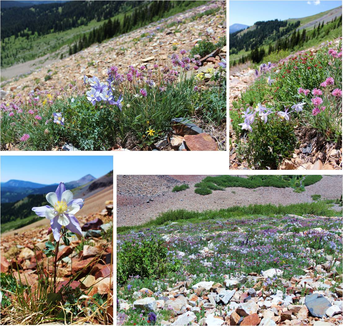
On the way back down I was able to see flowers that weren’t visible in the dark. Absolutely stunning! Pictures don’t do them justice!
I turned around before exiting the basin to get a good look at the waterfall
Here’s more of that talus route down…
I was able to retrieve my trekking pole with only minor bite marks. Due to the bite size I’m assuming a pika was involved, and was pleasantly surprised it wasn’t destroyed. I’ve heard stories of the rodents ruining gear, but they only seemed to have a nibble this time. Apparently they didn’t like the taste of the cork handle.
This hike made for a long and beautiful day, as I made it back to my truck at 4pm (and home at 10:30pm, so door to door it was a 27 hour day). I actually stopped at treeline to let some hikers pass (two young men trying to run down the talus to catch up with/pass me, and falling several times doing so… I figured I’d just let them pass since I wasn’t in a hurry today). To make sure they were well ahead of me so we wouldn’t play leap frog I waited for about half an hour in the meadow, enjoying the view. Talus might be tough to hike in, but it sure makes a beautiful mountain!
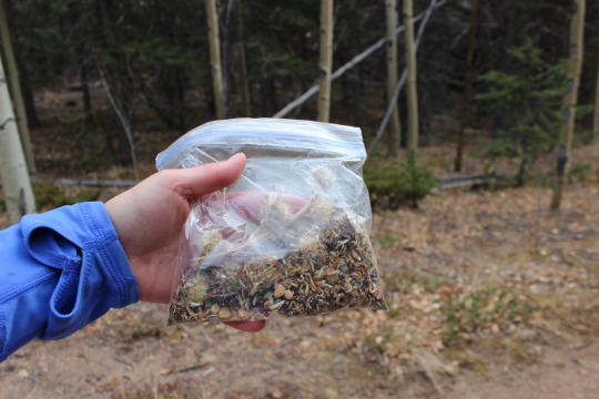
I had no intention of hiking Pikes Peak again this year. I’ve already hiked it 10 times, and my last hike was my best one (I hope your last one is your best one). But a couple of days ago my mom told me Granny loved wildflowers, and we should plant some in her honor. I just happened to have about ¼ a pound of Rocky Mountain Wildflower seeds sitting around at home. These were nowhere near enough to scatter and make a huge difference on a roadway, but they were perfect for lining a portion of the trail along Pikes Peak. The best time to disperse seeds is either October or April, and since there is no way I’m hiking Pikes Peak in April under several feet of snow I decided to go this week.
The weather Friday looked perfect! All forecasts indicated it would be in the 80s in Colorado Springs and 42 at the summit. That’s GREAT weather! Especially for the end of October. There was also a picture I’ve always wanted to take but for some reason spaced out on the past two times I’ve summited, so I planned a Friday hike.
Up at 2 am I started the coffee and got a spoonful of peanut butter as a snack. I ended up finishing the coffee on the way buy only had about half the spoonful of peanut butter. I just wasn’t hungry.
I made it in good time to the trailhead but there were 4 cop cars and a fire truck at the entrance to the parking lot. Nothing seemed to be going on (no accident/bystanders/victims) so I was a bit intrigued. One of the cops moved his cruiser and waived me on. There were 2 other cars in the parking lot. It was a nice 53 degrees. I saw a hatchback enter the parking lot as I began my hike at 2:58am.
Today I was in no hurry to summit. That doesn’t mean I hiked slow, but I wasn’t pushing myself as I was still sore from the hike earlier this week. I saw no one the entire hike up the mountain. I didn’t trip once (something that often happens in the dark because of all the loose rocks and roots). I didn’t see any animals except a rather large rabbit. I did hear what sounded like a large bird flapping in a tree but didn’t see anything when I shined my flashlight in its direction. When you hike at night eventually you get pretty good at identifying creatures in the dark by the sounds they make. I could tell it was a bird (not an owl because I wouldn’t have heard an owl) and its size by the sound it made. I can also tell if it’s a rabbit or a raccoon even before seeing the animal as different sized animals make different sounds.
There was no one visible at Barr Camp as I passed it in the dark. No tents set up on the outskirts of the camp either. The cars must have belonged to someone staying at the A-frame.
I made it to the A-frame at 6:19am. It was still dark. No one was about but the tarp was in place so I assumed someone was sleeping in the A-frame. I passed and walked about 100 yards before waking the kids up for school (I call them to make sure they’re awake. They usually are…).
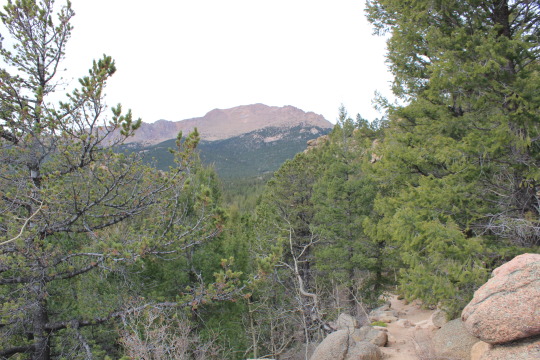
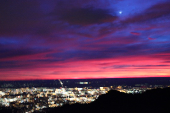
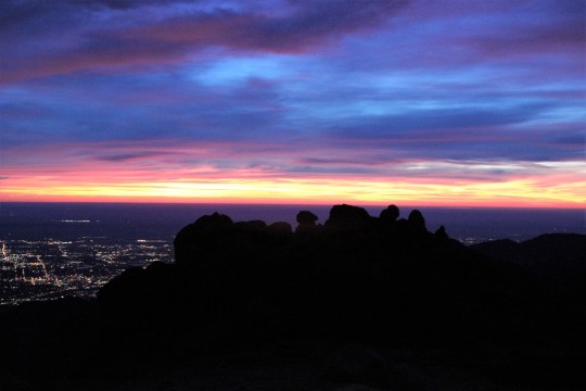
As I reached treeline I could immediately tell I wasn’t going to get the picture I’d wanted to get. It required a good sunrise and despite the fact it was supposed to be 80 degrees and clear there were lots and lots of clouds on the horizon. I wasn’t going to see a sun this sunrise. It was still beautiful:
I now had 3 miles to go to reach the summit and seriously considered turning back. I had no real reason to summit as this was a last minute trip and I wasn’t going to get what I wanted out of the rest of the uphill part of this hike (picture). I went back and forth for a few minutes in my mind and eventually decided to keep at it. Hey, maybe those clouds would miraculously go away in the next hour? While it was highly unlikely I kept hoping and watching east.
Here’s where my mood turned sour. I was sore and tired from the hike earlier this week, and while I’d made fantastic time this far it was obvious I was slowing down. I don’t know why that depressed me but it did. I could tell I was hiking “slow”. I was upset I wasn’t going to get that picture. That meant I’d need to at least TRY to hike again this year, and because of the type of picture it is I’m going to have to get up at 2am and hike for 10 miles in the dark to get it. Despite what I’m sure you’re all thinking, I don’t actually enjoy hiking in the dark alone. It’s quite scary. I’m not a fan of the dark. I don’t get the mail after dark or go on night walks by myself. I’ve been known to run from room to room when the lights are off. Hiking in the dark isn’t something in my comfort zone: I just do it despite being afraid because I like the end result.
I’d ben hiking with my good camera instead of my hand held. It was heavy, cumbersome, and now unnecessary. In addition, I hadn’t seen any wildlife on this hike. My 11th hike on Pikes Peak and I’ve yet to see a bear. That was upsetting in itself. The lack of the sunrise I’d anticipated meant I was going to have to hike in the dark again, risking the cold weather, shadows, and my fears.
This type of thinking on my part wasn’t typical and I became cognizant it must be due to low blood sugar. I hadn’t eaten anything yet and I’d hiked about 12 miles at this point. My stomach began to tighten. I told myself food was just going to have to wait until I reached the summit because I wasn’t making good time.
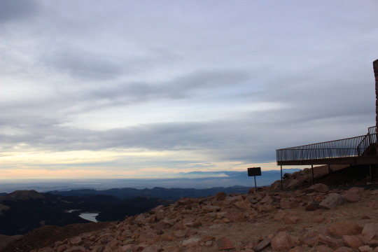
Check out the ice coming out of the mountain. Ah, geology at work, even without snow.
I summited at 7:54am. Not my best time, but not bad. I was hiking about 15 minutes behind my usual pace. Much to my surprise there was a man in a bright blue winter coat standing in front of the old summit house with his back to me. He was probably in his mid 20s, hunching out of the wind putting his pack together. I said hello and sat in the shelter of the window next to him to block the wind (as the summit house still wasn’t open).
I assumed he’d come up the back way from the Crags (a mere 6 miles and starting at about 10,000 feet, so it’s a much easier route to summit Pikes Peak). Eager to get started again he asked me if it’d been windy on my ascent. I told him no, it just started getting windy as I reached the summit. He told me to “enjoy my time” (mountaineering talk for the time spent on the summit before hiking back down), and was on his way, presumably the same way he came because he didn’t take the Barr Trail down. I
wished I’d engaged him in more information about his trip. He obviously knew what he was doing. I found myself wanting to know more details. Not for romantic reasons but personal: Which route was he hiking? What other hikes are available to me, how long do they take to hike, and are they worth it? He only had on a daypack, so he wasn’t backpacking… oh well.
I’d worn 2 pairs of gloves after reaching treeline, but took one pair off to eat. I had about 12 pieces of dried mango and my fingers were quickly turning numb. The wind was picking up and it was getting COLD quick. I put on my extra pair of gloves, took a picture facing southwest of the Junkins Fire, and started hiking down. I’d only spent 5 minutes at the summit.
This is where the wind became intense. Forecasts stated 20-25mph wind gusts, but these were sustained winds of at least 40mph. I was blown sideways several times. The wind made it miserably cold, and to top off my bad mood my right shoelace became untiled about 20 yards into my decent. Great. I had no use of my fingers at this point because they were frozen solid. I made a pathetic attempt that took way too long to tie the laces. I did a miserable job but it would be functional for a bit (hopefully I’d de-thaw soon and try again). About 100 yards later they became untied once more. I decided I wasn’t going to get far with this and just tucked the laces into my shoe so at least I wasn’t going to trip on them. This lack of support was going to slow me down.
My mind once again took a negative turn. I pulsed my fingers to keep them from getting frostbite (I have Raynauds) and thought about the hike this time. Why had it been so negative? I was upset about so many things I couldn’t control. I hadn’t seen any wildlife besides that rabbit. Not a bear, deer, marmot, pika, bird, or bighorn sheep. Nothing. What bad luck was this???
I knew my bad mood was self-caused but I couldn’t stop it. I’d thought it was due to low blood sugar levels, and indeed, eating did help quite a bit until the wind picked up, then the negativity returned. I’ve never regretted a hike up Pikes Peak. I may not have wanted to start out, but I’ve always been happy I went.
But this darn wind wasn’t letting up! Although my hair was in a bun it was hitting me in the face, as was the strap on my pack. The strap actually hurt. And I was cold.
The wind didn’t stop until I made it past the A-frame, where it abruptly ceased and warmed up at least 20 degrees. Wow. That mountain is brutal! I didn’t stop at the A-frame as I could see its inhabitants waking up and starting their day, preparing their hike to the summit.
As I dethawed I began seeing people. All asked me what it was like on the summit, to which I replied “very windy, and very cold”. They looked confused (forecasts predicted 42 degrees and light wind) but thanked me for the information. My mood brightened as I warmed up. I just needed to change my focus. No, I didn’t get the picture I’d wanted, but hadn’t I started this hike for Granny? Wasn’t scattering seeds for her the real reason I was taking this trip? Not to summit or see wild animals.
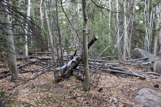
Ok. That was it. From here on out this hike was going to be about Granny and I was going to think positive. I took some “better” pictures of the downed trees along the trail. This is seriously insane and goes on for miles!
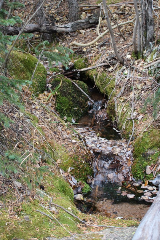
Just after MM6.5 I heard the sound of running water and my mind immediately cleared. I don’t know what it is about running water that has such a calming effect, but as I heard it I took a deep breath and smiled. This is why I hike.
Some of the trees were even happy to see me…
My mind cleared and I mentally planned where I’d scatter the seeds. I know enough about wildflowers to know they don’t grow just anywhere. Yes, I could have scattered seeds on the peak but it wouldn’t have done any good: they wouldn’t grow there because the growing season is too short. You can’t just plant seeds and expect them to grow. I needed seeds indigenous to the area not only so they would sprout, but also so they wouldn’t become an invasive species. The seeds I chose were specific to regions of the Rocky Mountains between 6000-9000 feet. In other words, they should grow here without harming the environment, and hopefully will contribute some happiness to hikers. Personally, I know I love seeing wildflowers while on a trail.
With that in mind I decided to spread some seeds near the aspen grove at Barr Camp where there was already a bench for weary hikers to sit and enjoy the view of the peak. These wildflowers will probably grow here. I hope they do, but because I wasn’t 100% certain they’d take I only planted a few tablespoons and saved the rest for another area. I also re-tied my shoe. While I was doing so I noticed someone sleeping in a sleeping bag about 40 feet from the trail. Stay warm my friend!
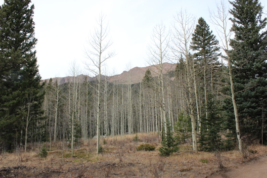
This is the area (below) I picked to scatter wildflower seeds in Granny’s name. I chose it for several reasons. Between MM3-3.5 is a well traveled area of the Barr Trail. I know wildflowers grow here because I’ve seen them in the past. There’s a lot more grass than flowers, but the potential for wildflowers is great. I’d like to see more grow here.
The hillside is facing the sun and has a great
view:
I plan on hiking back next year (probably in
July) to see if they take. I’ll know if they do because I only scattered
them on one side of the trail and I know what grew here before (mainly brown
eyed Susan’s, wild roses, vetch, and columbine).
The last 3 miles of the trail seemed really
slow. I was tired and sore but my mood was elevated, and while there were
a lot of unexpected clouds the weather was warm but not too hot. It
certainly didn’t feel like 80 degrees, but the clouds blocking the direct sun
probably contributed to the good weather. Did I mention it’s October in
Colorado? The mountain mahogany seeds were fun to watch!
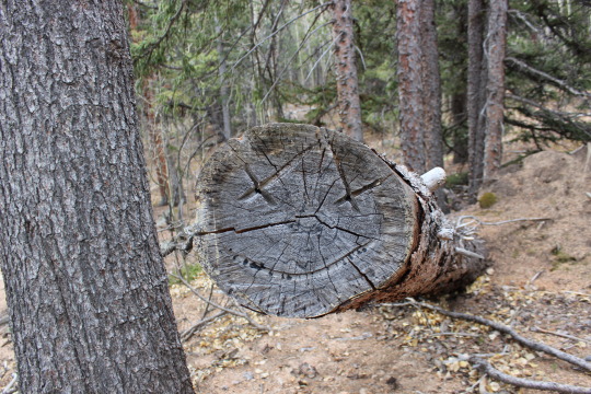
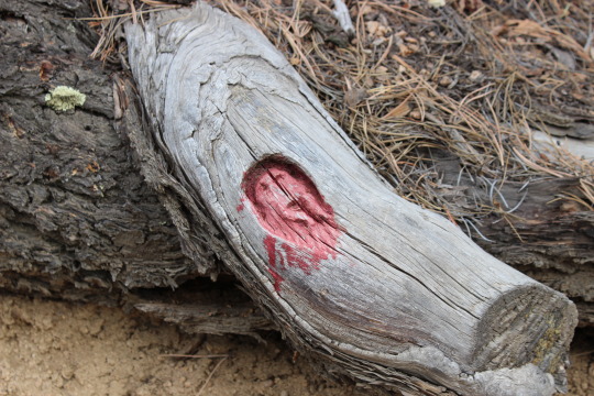
I saw this guy too. This interestingly
enough is apparently a popular landmark on the Barr Trail. I’ve never
seen it until today, but last week someone on the trail asked me how far they
were from him and I couldn’t answer because I knew nothing about it.
I made it back to my truck at 12:27pm. 9
hours 29 minutes. Not my best time, but honestly not bad!
When I got home Emily
and I planted more wildflower seeds in front of our house and on the side by
the maple tree. We hope to get a lot of flowers, and bring them inside to
enjoy them during the summer. We’ll be reminded of Granny every year! (Side
note, we still plan to scatter more seeds on a grander scale, but wanted to do
something immediately while we had the chance).