Mt San Gorgonio

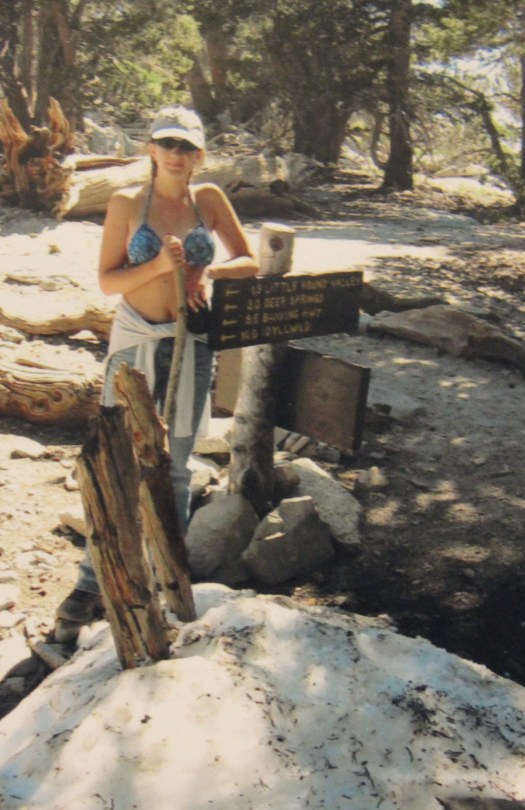
Mt San Gorgonio (11,501ft) via Fish Creek, elevation gain 3390ft

For those of you who
don’t often hike mountains, the hiking of 11,501.6 feet (and I say that so
precisely for a reason) may not know what an accomplishment the hiking of Mt.
San Gorgonio is for someone who lives at sea level.  Well, it’s a big deal, and I’m going to gloat
for a bit 🙂

OK, gloating done.  Here’s the story. 

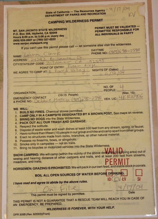
Because California backcountry
trails are so regulated I had to apply for a permit to take this hike months 3 ago.  If you’re caught on a trail without a permit
(or a shovel) you can face a hefty fine. 
I was so excited when it came in the mail!

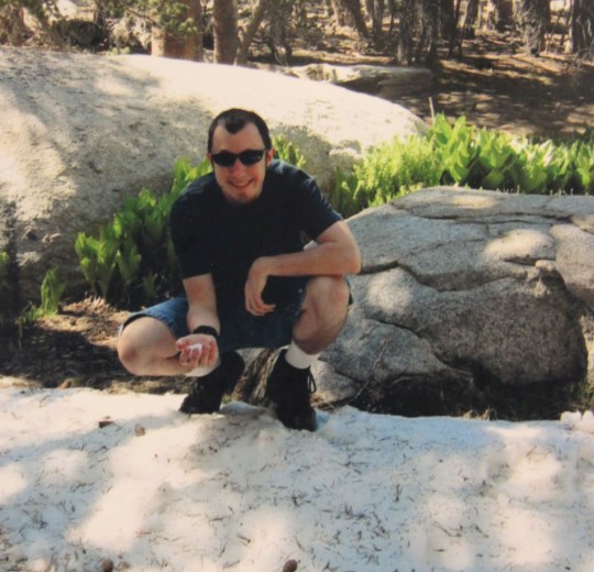
Friday night we left at
about 10:30pm and drove to the trailhead so we could get a fresh start on the
trail in the morning.  We made it there
at about 12:45am.  It was dark and cold,
and we were the only ones there.  This
tired mama didn’t much care, and fell asleep instantly. 

At about 7am I woke up
to noises outside the car.  Other hikers
had arrived and were ready to go. 
Literally.  They just parked their
cars, put on their hiking gear, and were gone. 
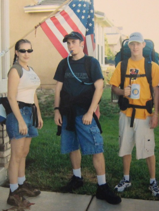
I should stop here to note they were all day hikers, hiking with just a
water bottle.  We had heavier backpacking
gear, intending to spend the night at the summit. 

Well, I woke up, brushed
my hair and teeth, made sure I had the map and keys, and we were on our way by
7:30am. 

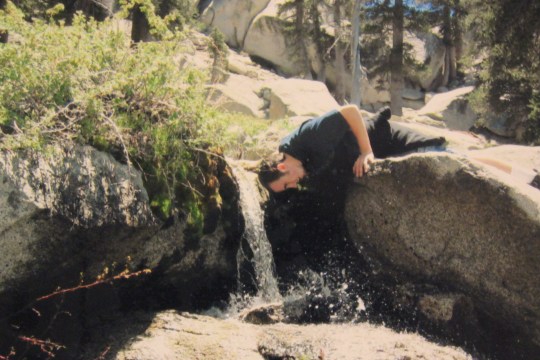
We immediately hiked
through a meadow, and came upon the namesake of this trailhead:  “Fish Creek”. 
When you look at the creek you wonder about the name… it doesn’t look
like any fish could live in that creek! 
It was really more like a trickle, and from the looks of it, even heavy
rains probably don’t make it much bigger. 
Maybe one time someone caught a minnow or something and thought to name
it Fish Creek.  Or the guy who named it
had the last name of Fish and thought it would be a fun joke. 

Well, Fish Creek was the
last place that had any water on the entire trail.  The trees were all dry, and the ground looked
like it hadn’t rained or snowed for years. 
Dry, dry, dry.

Here’s the first glimpse
of the peak.

It looked so far away,
and I knew it was even further than it looked. 
At the halfway point I noticed the trail was really poorly marked, so I
got out my orange marking tape and marked some of the trees.

Here I noticed someone
had left their water bottle (presumably to use on the way back down), which
seemed like a genius idea!  This is so
much smarter than carrying extra water all the way up.  That is, as long as you don’t run out with
what you have and someone else doesn’t take it first. 

We continued hiking, and
came upon a plane wreck from WWII.


It looked like a nasty
crash.  There were plane parts and debris
scattered all over the mountain.  When
the wind blew, the pieces of metal swaying in the wind made an eerie
sound.  We sat there for a few minutes
and wondered if it fell while trying to climb the mountain, or if it hit the
mountain straight on.

Now began the
switchbacks.  As far as I’m concerned,
switchback is a four letter word. As soon as I thought we were at the last one,
another one came into view.  There were
3.2 miles of switchbacks on this trail! 
UGH!  There has to be a better
way!!!


As you can see from the
topo map, once we were done with the switchbacks we had to circle the mountain
to summit.  That part really wasn’t too
bad, except we were at the end of the hike, and pretty tired by this
point.  Every time we made it around
another turn we just knew we had to be there, only to see more schist, slate,
and shale.


Finally I saw a sign
that said we were .4mi away.  I wanted to
start running, but couldn’t. It was all uphill and I was out of breath.  I took a bit of a break and noticed there was
a lot of Bighorn Sheep scat on the trail. 
I hoped we’d see some animals too.

This was where we were
passed by an INSANE person.  He was all
by himself, dressed in red, carrying nothing more than a water backpack and two
hiking poles.  He was RUNNING across the
trails.  He looked as if he were cross
country skiing sans snow!  This guy was a
maniac, and he was doing all 9 peaks in one day!  Later, when we talked to a ranger below, we
were told he does this weekly.  He parks
his car at the trailhead and leaves his bike at another.  He hikes, runs, and then bikes back to his
car.  Insane I tell you!  And it’s about 50+ miles to boot!

The view from the summit
was incredible! I could see a complete 360 degree view of all of Southern
California. 

I saw freeways, and knew
there must be cars on them, even if I couldn’t see the cars themselves. I found
the summit box with journals to write logs of our hike, and to sign the
register announcing I’d made it to the top. 
There was also a box with an American Flag inside.  I was a bit upset to find it all rolled
up.  I took a few pictures with it,
folded it up properly, and put it back into the box.

I met a lot of nice
people at the summit.  Some who hike all
the time and had tales of the Grand Canyon and the like.  I even talked to 3 older men (in their 60s)
who were currently on their way to Mount Whitney.  Can you believe that?  And we thought our hike was long!  More power to them!  There was a group of students there from Cal
State Fullerton who were there for a geology class, and a bunch of brothers who
were on a family hike with their father. 
Everyone was nice, and the conversations were great!  It was a really enjoyable time. 


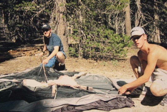
Being really tired, we
set up and slept in the tent for about half an hour. Then we went out on the
summit again to look for the elevation market (we hadn’t been able to find it
before).  A couple of guys had actually
found it, and clued us in.  It was pretty
hard to find, only about 2 inches in diameter.

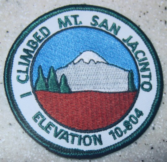
It did say the elevation
of Mt San Gorgonio (as of 1989) was 11501.6 feet.  This is a big deal because maps like to quote
it as being only 11499 feet, and so does the patch you can buy at the ranger
station.  When you hike mountains, and
want to brag, every inch counts. 
Seriously, this is a big deal!  I
talked with a ranger after the hike and he told me the mountain is actually
growing, so it’s probably taller now. (Edited in 2017 to add it’s now measured
at 11,503 ft).

The last hikers left at
about 4pm and from then on new had the whole mountaintop to ourselves!  We cooked dinner and ate on the peak and
walked around surveying the area.  Some
really smart people had set up walls of rocks, kind of like makeshift Indian
ruins, to block out the intense winds so you could set up your tent out of the
wind.  So we could hear, but not feel,
the wind all night.

After dinner we went to
bed early.  Mainly because we were
exhausted, and we could go to bed:  no
kids to take care of J  We had
mummy sleeping bags that kept us pretty warm, even in the 20 degree
temperatures.  There was no dew on the
inside of the tent thanks to our waterproofing it last week.  All in all, a pretty enjoyable night… much
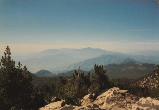
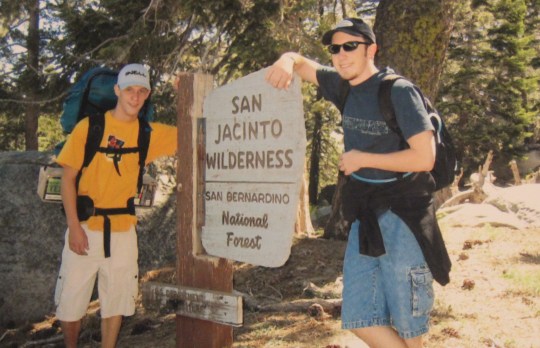
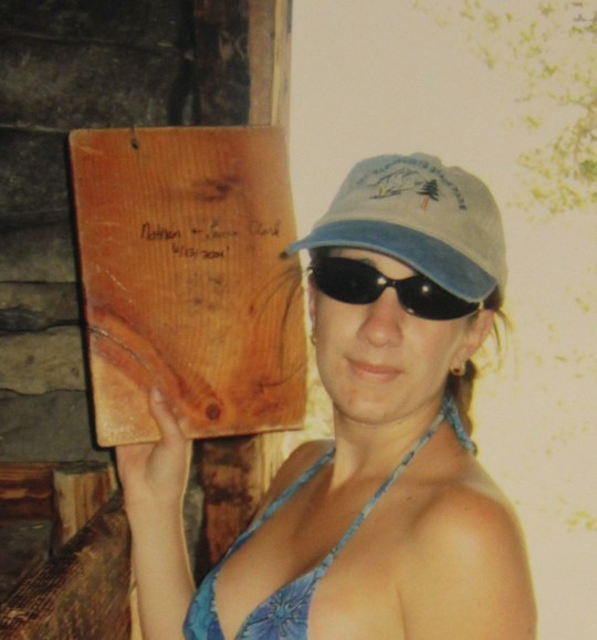
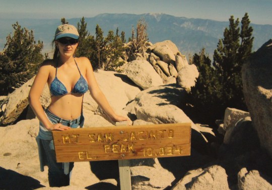
better than the one on Mt. San Jacinto.

I woke up at 8am to
bright sunlight and amazing views.  After
breaking down camp and eating breakfast I looked for some small rocks to bring
back for the kids.  I took in a last view
of all of Southern California, and started back down.  We breezed down the mountain.  It’s so much easier to hike down!  We made it back to the car by 1:30pm.  Amazing!

On the way down we saw a
bunch of day hikers.  Mostly people who
had slept at Dry Lake the night before and were hiking the rest of the way
today.  We talked to about 30 people who
had over-nighted it at Dry Lake, and concluded it must be a pretty full
campground. It was cool to know we were the only ones on the peak, with no one
there to bother us.  I don’t think I
would have wanted to camp with so many other people I didn’t know. Interesting
conversation, I’m sure, but not too peaceful.

We also met up with a
guy who was carrying 40lbs of water.  For
just a day hike.  Nuts!  He had two 20lb jugs of water on his back,
and was debating whether or not he could make the climb. He also said he was
sure he needed that much water.  I told
him to leave host of his water halfway up, and he could claim it if he needed
it on the way down. 

Next we came upon an ill
prepared scout troop.  By this time they
were only about 3 miles from the trailhead, and these boys already looked
exhausted!  They had just begun their
ascent, and it was already past noon. 
The boys were red in the face, lethargic, and more than a bit
grumpy.  It was really hot, and they were
thinking only about half of their troop would make it.  I doubt any of them did. They were only
carrying one water bottle each and they were already worn out.  I hope they made it, but seriously doubt they
did.  I told them maybe the guy with
40lbs of water could help them out?

After that it was an
easy hike to the bottom.  I spotted a doe
with two fawns, and some bear markings on trees (but no bears). We passed Fish
Creek again, and caught a frog.

That last mile was a bit
grueling, but only because we had hiked for so long already.  Estimates vary, but we hiked an entire 25
mile hike!  Woohoo!  We made it!

We hopped into the car,
threw on the air conditioning, and drove to the rangers’ station, where we
bought out traditional souvenir patches, and this time we bought pins to put
onto our backpacks (replicas of the marker on the summit).  I looked in the mirror and noticed I had
quite the sunburn.  I was red all over,
and there were blisters on my nose, despite my use of sunscreen.  Oh well! 
We ate at a really greasy spoon, and then headed home.  We were back home by 4pm, greeted by hugs and
kisses from the kids. 

So, compared to Mt. San
Jacinto, I would have to say this hike was a bit easier.  It was definitely longer, but less aggressive
elevation wise. Except of course for those switchbacks!  Mt. San Gorgonio is about 667 feet higher
than San Jacinto, and considered to be more difficult.  So I’m thinking maybe it was easier because
we knew what to expect?  Or maybe because
we were expecting it to be more difficult and thus planned accordingly. 

I found it was actually
easier to hike with a pack than with the water pack around my waist I carried
last time.  (Last time I was always off balance). 

Just remember:  It’s higher than it looks.  It’s longer than it looks. It’s harder than
it looks.  I had a great time, and
besides a few easy backpacking hikes though San Mateo Canyon, Mt Baldy is
next.  Anyone wanna join me?

Backpacking Mt. San Jacinto

image

We
made it!  Check it out… we hiked Mt San
Jacinto:  10,834 feet and back again in 2
days!  Read on for all the exciting
details…


image

It
all started Saturday morning when we left for the hike.  We stopped by the rangers’ station to use the
restroom one last time and to find out if there was anything else we needed to
know about the hike.   It was going to be
long, and when we asked the ranger how long it should take to climb to the top
he responded “If you ask me, 7 days”.  He
was being facetious, but towards the end of the hike I realized there was some
validity to his statement. 

To
hike in California you need a permit.  We
secured ours months ago…

image

I
bought a couple of patches that said “I climbed Mt San Jacinto” and we were
off.

image


We
parked one car at the Deer Springs trailhead and took the other to the Fuller
Ridge trailhead, which happened to be about 8 miles down a dirt road.  We parked the car, displayed our forest
adventure pass, and donned our hiking gear.


I
held the water, snacks, and first aid kits. 
Matt and Tim had packs too.  I had
the least to carry out of everyone, which is why I didn’t tire as fast as
everyone else.

image

Matt
and Tim did their exercises while I took some pictures.  I should have warmed up, but I foolishly didn’t
think it was necessary for a hike.  That
would come back to haunt me later.  We
began the hike at a pretty steady pace. 
The elevation began to climb continuously, and after an hour we realized
this was going to be harder than expected.


After
about 2 hours of steady climbing we reached Castle Rocks, which was an
elevation of 8600 feet, and had a great view of both sides of the
mountain.  At about this time I noticed a
sharp pain in my right thigh (by the Iliopaoas and Pectineus muscles… in other
words, right where your pelvic bone and thigh meet).  It hurt, but I figured if I just kept walking
it would smooth itself out and eventually go away.


image
image
image

We
continued hiking.  After about 2 more
hours we found a spring with running water! 
The guys rushed down to it and began soaking their head.  The water was ice cold but felt great!  It was a nice, refreshing interlude.  And, since our campsite was supposed to be
near a spring, we figured we must be getting close.  My thigh was really starting to hurt, and I
was beginning to think “walking it out” wasn’t going to work. 

image


We
finally hit the “5 mile mark”!  Oh boy,
were we excited!  This junction meant we
were more half way and we might even make it before dark!  Before we’d set out, our plans were to hike
to the campground, set up camp, and then hike to the peak.  Then in the morning we were going to hike
back down, make a side trip to Suicide Rock, and head back.  However, by this time we were revamping our
plans.

From
the 5 mile junction things got a little more difficult.  We began another ascent, this time to the top
of Newton Drury Peak, and every 5 minutes or so we kept thinking “We have got
to be almost there…”.  We passed a lot of
people who were hiking back down.  All of
them had smiles on their faces (while ours were set in determined lines) and
they promised us we were “almost there”. 
It was amazing how they all seemed to be enjoying ourselves, when we
were crawling along, taking breaks every 5 minutes to catch our breath. 

We
came to despise those overly optimistic people. 
Especially when we didn’t make it in the hour in a half they’d promised
us it’d take.  Why did they have to lie
to us?  Couldn’t they have told the truth
and said it would be another 3 hours of grueling, uphill switch backs that
never seemed to end?  Literally, these
switchbacks were killing us!  They were
probably only 10 feet long and seemed to climb forever!  They just kept going, and going, and going…


We
struggled up the last mile.  There were
times we seriously didn’t think we were going to make it.  I knew from the beginning this was going to
be a difficult hike, but this was getting ridiculous!  We could hardly breathe, let alone move our
feet.  By this time I was using my hands
to help lift my right leg over each and every uphill step, which was every step
I took.  I could only lift my right leg
about 2 inches off the ground if I didn’t use my hands to help.  It was awful. 
I hurt.  I hurt.  I hurt!!!


And
I wasn’t the only one!  I could only
imagine how much the guys were hurting, since they were the ones carrying the
packs!  I tried not to complain, but
complain I did.  Luckily for them I wasn’t
complaining as much as I’d wanted to.  I
was screaming and cursing inside but I felt like I had nothing to complain
about, considering I wasn’t wearing a pack. 


The
last mile was a killer, and once we finally found the campsite we crashed!


image

There
were patches of snow around where we were sleeping, so I figured it was going
to be a bit cold. 

image


We
hurriedly set up our tents, had a quick canned dinner, and fell asleep while it
was still light out.  It couldn’t have
been later than 5pm.  Gone were our plans
of setting up camp and hiking to the top. 
We just wanted to sleep.  I don’t
think any of us could have made it to the top, no matter how much we’d wanted
to.  I was sore from head to foot, and I
thought (hoped) sleeping would help my thigh 
After lying down in the tent I knew I wouldn’t be getting up for quite a
while.  It hurt just to roll over!


image
image

Sleep
proved difficult.  It was indeed cold,
and I was in pain.  The one thing I didn’t
pack was the painkillers.  I had
EVERYTHING else you could possibly need, but the painkillers I’d forgot.  However, I did get more sleep than I would
have at home with the kids… it was just more painful.  And cold. 
Water droplets formed inside the tent and seemed into the sleeping bags…


In
the morning (the sun wasn’t up yet) some adventurous Boy Scouts began hiking by
our campsite… multiple times.  These guys
had to be crazy, hiking (LOUDLY) before the sun came up.  I wanted to yell at them to go back to
bed.  However, I got another 1-2 hours of
sleep, only leaving the tent when I had to pee so bad I couldn’t wait any
longer.


Matt
and Tim had been up for a while already, so I got ready to hike the peak.  I didn’t actually think I was going to make
it due to my thigh.  It wasn’t any
better, and I knew it was only going to get worse.  But I’d bought those patches, and gosh darn
it, I was going to make it!  I wanted to
be able to wear the patch proudly, knowing I did indeed make it to the top. I
wasn’t going to get this close and not finish. 
Matt and Tim decided they weren’t going to hike to the peak (altitude
sickness) so I decided to hike it alone. Nathan didn’t want me doing that, so
he set out with me.

That
last 1.6 miles was the hardest of the entire hike.  It felt like 5 miles, and I wanted to cry in
pain with every step I took.  I’m sure I
uttered a few explicative’s along the way. 
I don’t know who came up with the idea of switchbacks, but they should
be shot! 


image

We
finally made it to a little cabin and looked inside.  It seemed to be a place to crash if you made
it to the top and got stuck in a storm, or if it was too late to hike back to
camp or something.  It was a little cabin
with two sets of bunk beds.  No lock on
the door, and a lot of names on the walls obviously written from others who’d
made it this far. 


There
was a log book to sign your name, and some Boy Scouts had left a piece of wood
to carve your name into.  I got out my
sharpie.


image

Now
for the ascent to the top.  There was no
trail to the peak but we could see it 20 yards away so we began climbing.  It was basically an all out, have fun finding
a steady rock to climb on scramble, but we made it!


I
spent about 15 minutes taking pictures and resting with a view from one of the
highest mountains in Southern California: 10,834 feet!  It was awesome!  Since it was a clear day I could see Big
Bear, my house, the desert, and all of Southern California!


image

I
sat down for a minute, and suddenly bees came almost out of nowhere.  There were dozens of them, and that was enough
of a reason to begin the descent. 
Immediately I noticed how much easier it was to hike down than up.  It took about half the time to hike back down
to camp, where we had breakfast and took down the tents.  We all wanted to get back down the mountain.  Soon.


Everyone
was tired and sore.  We unanimously
decided the Devils Slide trail would have to wait for another time. We realized
why everyone hiking down when we were hiking up had smiles on their faces:  hiking down was easy!  No problem! 
We were still tired, but hiking down was much preferable to hiking
up.  We exited through a different trail
than we’d entered.  The last 2 hours or
so were difficult (due to my thigh), and I just wanted it to be over with.  Everyone was hurting, I had 7 or 8 blisters
(tried not to complain too much).  I
noticed everyone else was having a much more difficult time than I was, so
while I wanted to yell and gripe and complain I tried to keep it low.  I’m sure I was annoying everyone anyway.  


Matt
had blisters.  Tim had blisters.  I had blisters.  When we spotted the car I wanted to cry.  I was aching all over.  I had a hard time just getting myself into
the car.  My left side was no problem,
but I could barely lift my right leg without screaming.  We drove back to the second car, raced out
the 8 mile dirt road, and went to a late lunch. 
We were filthy, but apparently they were used to hikers.  At least they let us eat inside…


After
lunch we drove home and the guys went in the spa.  I am really glad I went.  It was tough, but definitely a conversation
piece.  How many people can say they did
what we did?  It was a real learning
experience for me.  I tested my
endurance, and didn’t give up when I could have.  I made it, and I’m proud of myself.  I plan on taking my Girl Scouts when they get
older. 


Yes,
I would do it again, but at a slower pace. 
19 miles in 2 days on this trail was grueling.  “Strenuous” and “Aggressive” don’t begin to
describe the difficulty of this hike.  It
was wonderful!  I learned a lot about
myself and what I can do.  I can’t wait
to go backpacking again!  Next time I
want to carry a pack and distribute the trip over more days…