Sheep Mountain – 13,168, PT 13,100, PT 13681 & Silver Mountain – 13,714

RT Length: 25.26 miles

Elevation Gain: 6689’

Ah, the thrill of changing plans. I like to check off a bucket list item for my birthday, usually involving a lot of effort or planning and mileage.  I was supposed to do the Rim to Rim Grand Canyon hike for my birthday, and due to COVID and the shuttles not running so my boyfriend was going to be my shuttle driver (with the east gate closed it’s now a 5 hour drive from one rim to another).  However, last week I broke up with my boyfriend.  After the breakup I gave myself a day to wallow, and then came up with a plan B (Plan C was Rim to Rim to Rim).  In the end I wasn’t able to hike Rim to Rim on my birthday, but I was able to find someone to shuttle my truck a week earlier (in exchange for a photo shoot along the way at both Horseshoe Bend and Ouray Via Ferrata… to be featured in his next book).  So instead I hiked Rim to Rim on September 12, and decided for my birthday I’d try to get in a long hike somewhere in the San Juan’s.  

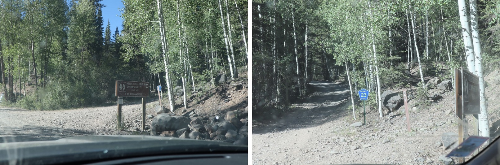
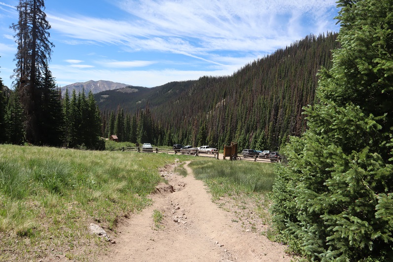
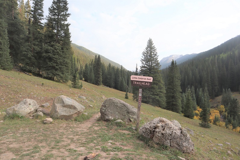
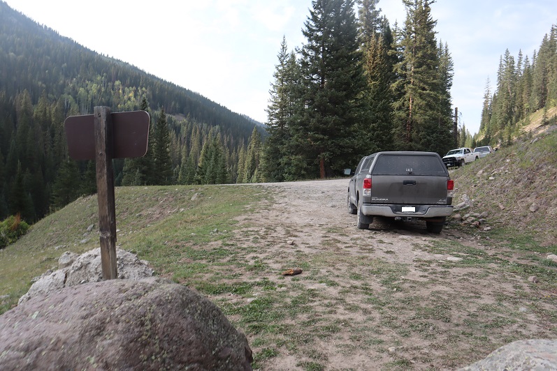
After birthday dinner with my daughters I drove to the Little Cimarron East trailhead and parked for a few hours sleep.  This is a 2WD drive on a dirt road.  There was space for 2 vehicles at the trailhead, but it looks like you can park along the road as well if needed.   Side note:  This trailhead is much preferred to the Nellie Creek Trailhead approach.  Hands down. 

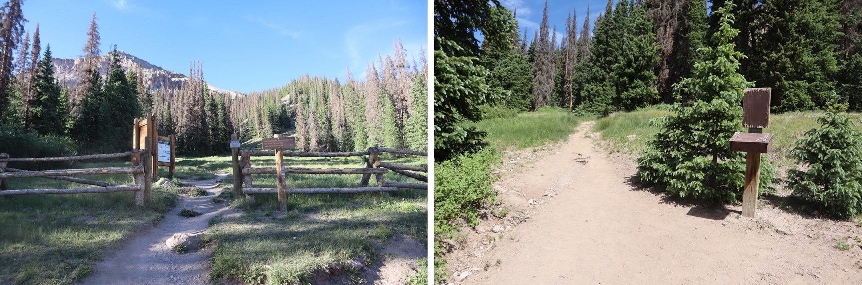
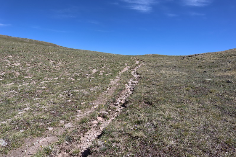
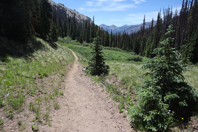
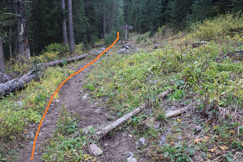
I got in a few hours sleep and was on the trail at 4:30am.  This is a class 1 trail (at least until the first stream crossing) that looks like it used to be a 4WD road. 

After the stream crossing there’s a junction.  Continue straight.

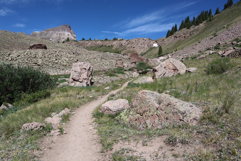
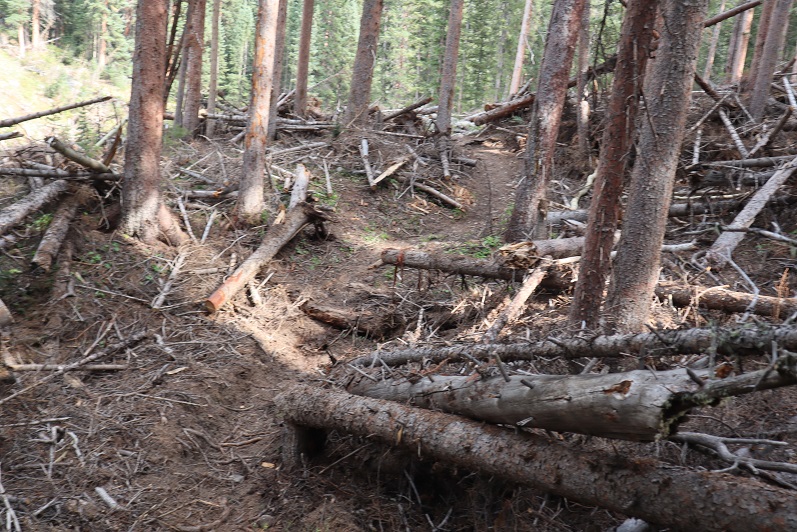
The trail goes through an avalanche area but a clear path has been established. 

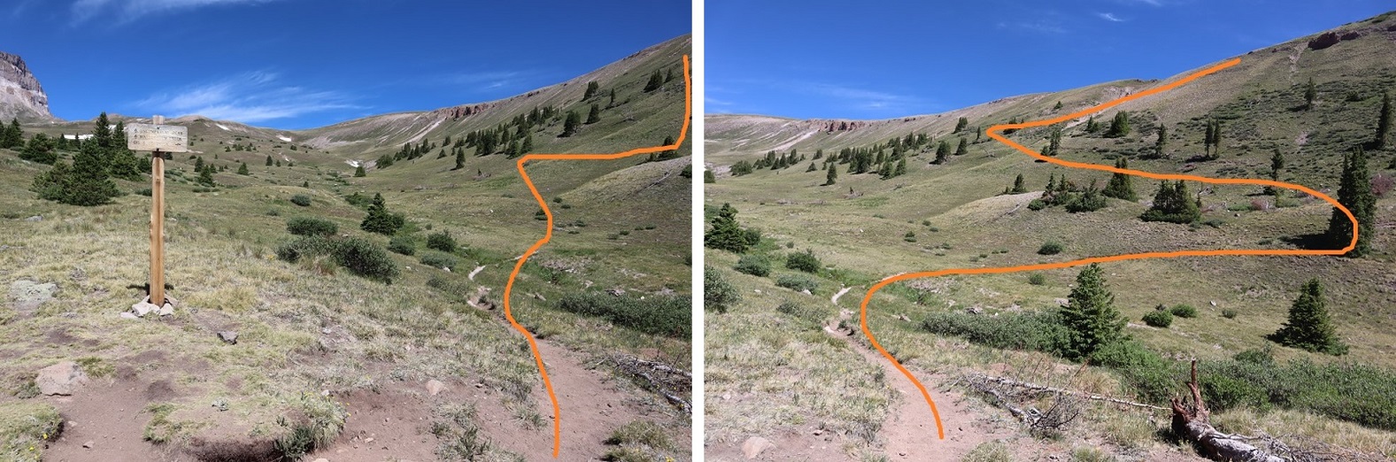
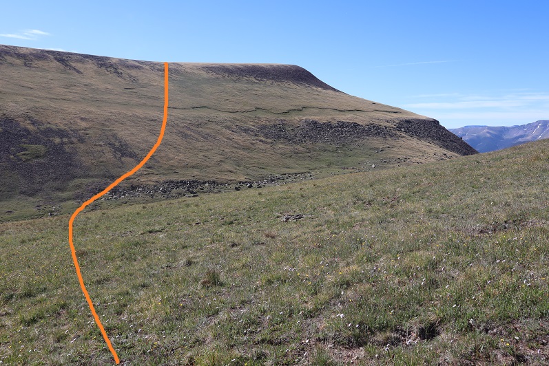
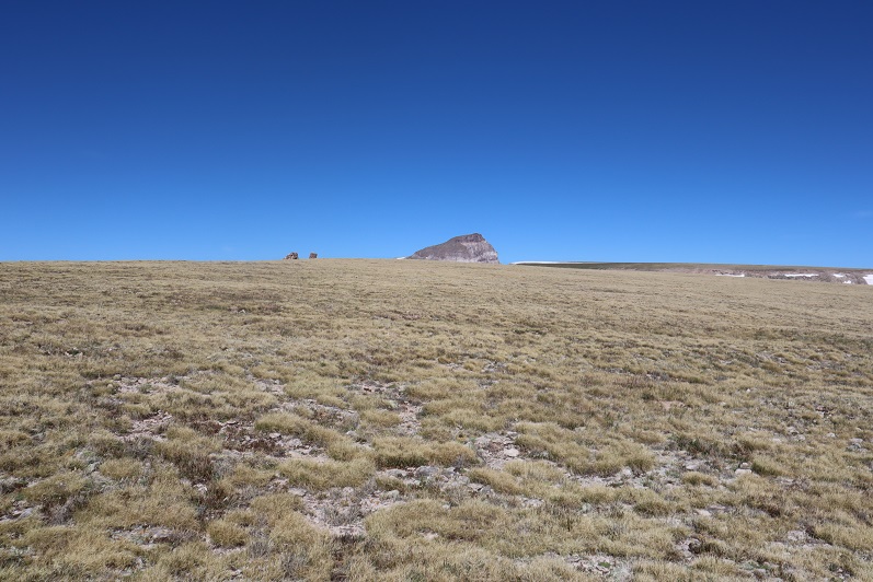
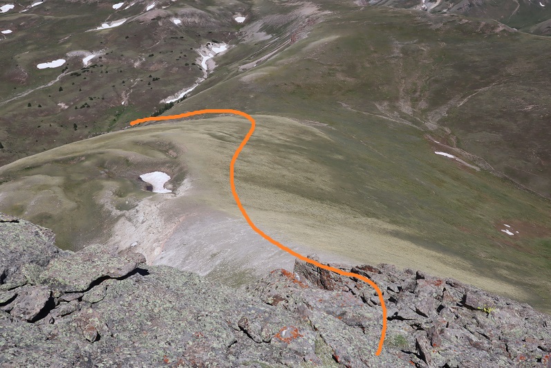
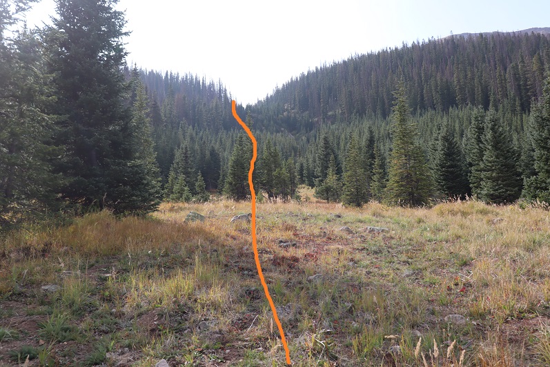
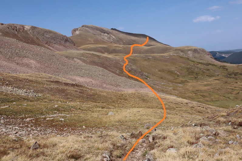
After hiking for 5 miles (exactly) I came to a small meadow.  Here I left the trail and headed west, staying to the left of the gully, but following it up.

I eventually picked up a faint trail.  There were a lot of game trails in the area, so I kept losing then re-finding the trail. 

When I hit treeline I crossed the gully and headed left and northwest up the side of the mountain

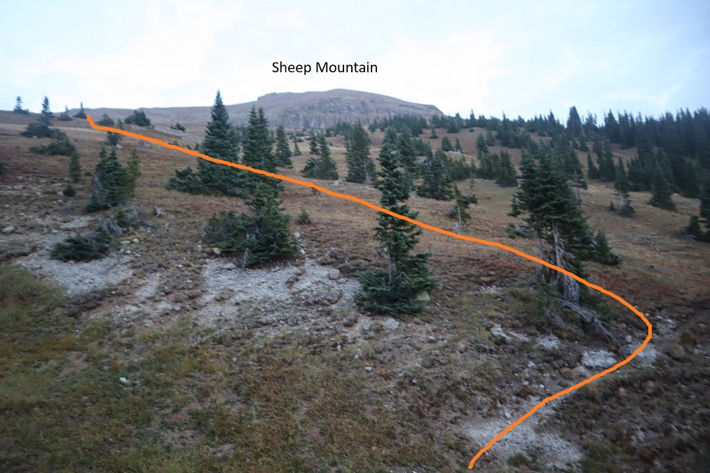
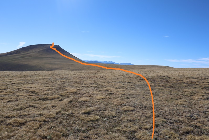
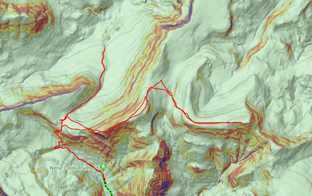
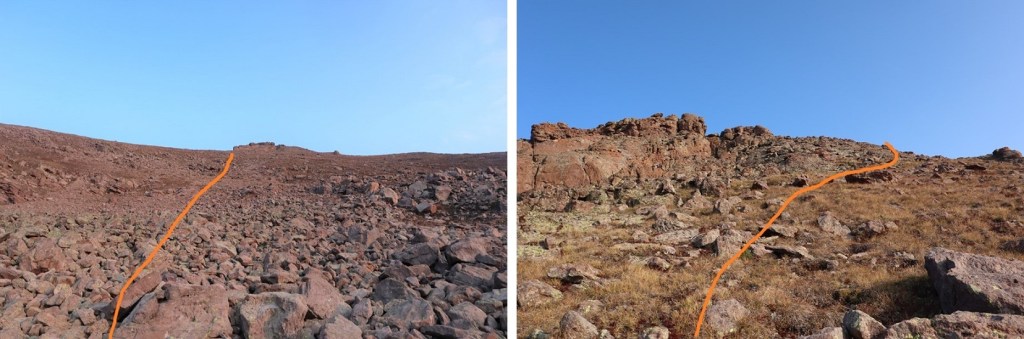
The rest of the hike to the summit of Sheep Mountain was fairly straightforward.   Here’s the route I took, staying to the left of the cliffs

Once on the ridge I skirted the rocks to the right to keep this class 2

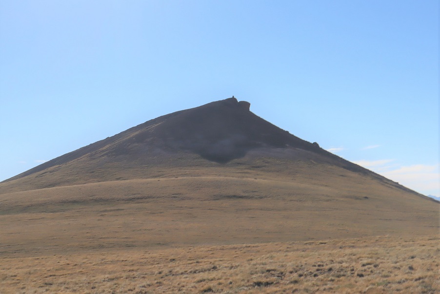
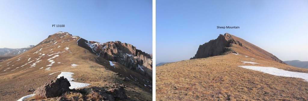
I summited Sheep Mountain at 7:55am.  The summit was wide and flat and it was my birthday, so I decided to jump for the photo.
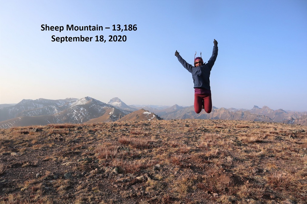
Sheep Mountain:

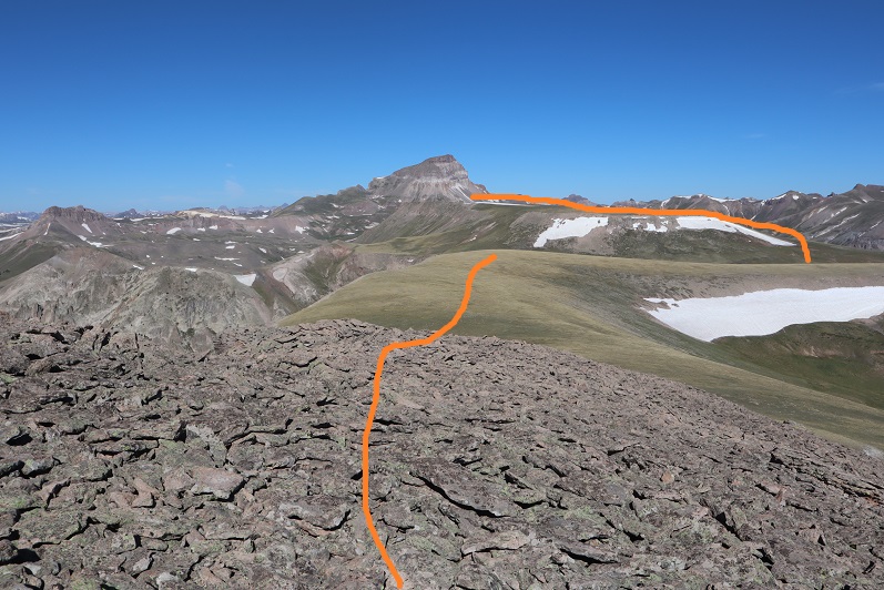
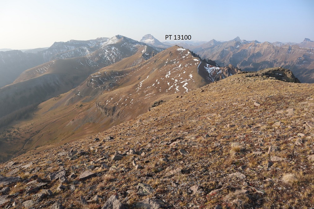
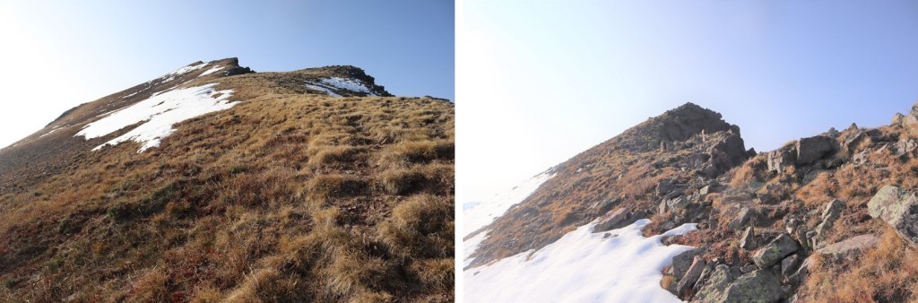
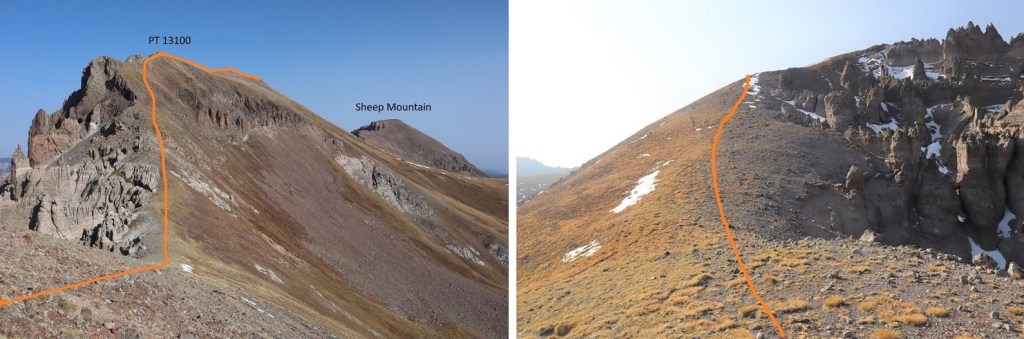
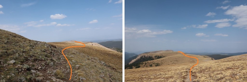
I was making this a ridge hike today.  Next on the agenda:  PT 13100.  I turned and followed the ridge south

This was an easy class 2 ridge to follow.  As times I stayed left to avoid rocks. 

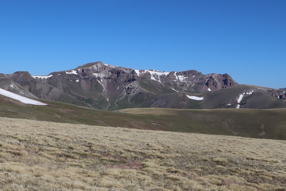
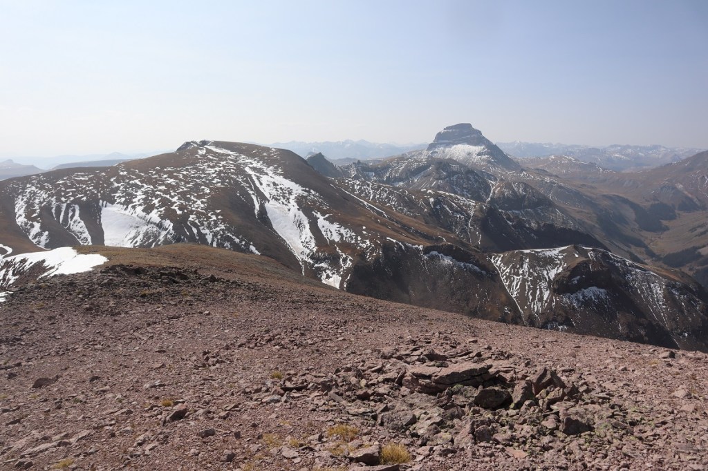
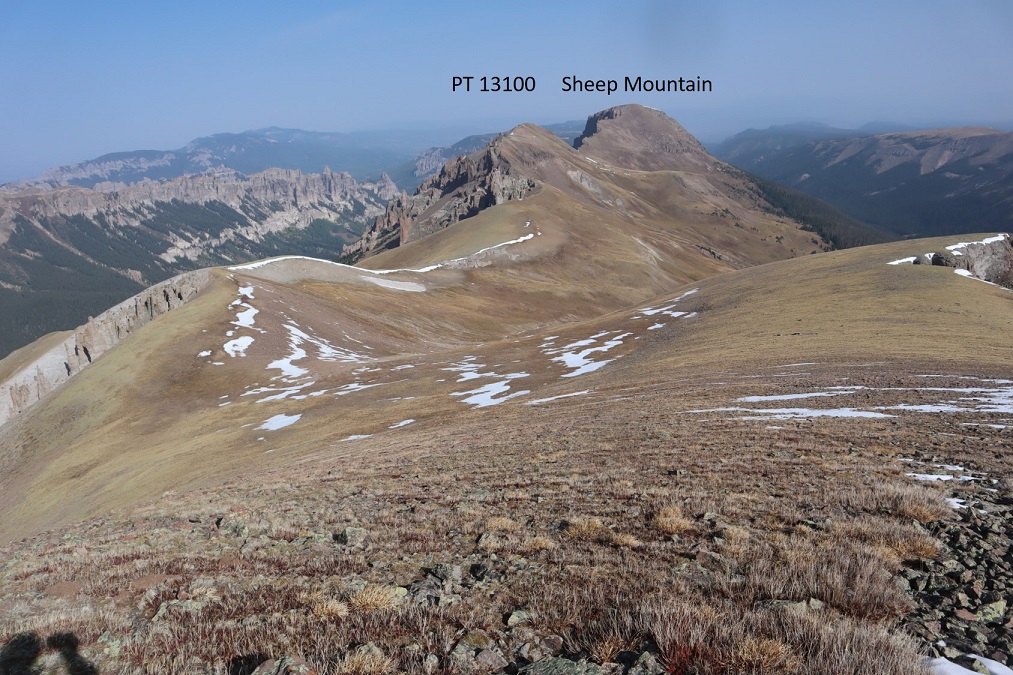
From the saddle, here’s looking up at PT 13100 and back at Sheep Mountain

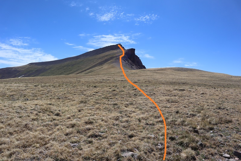
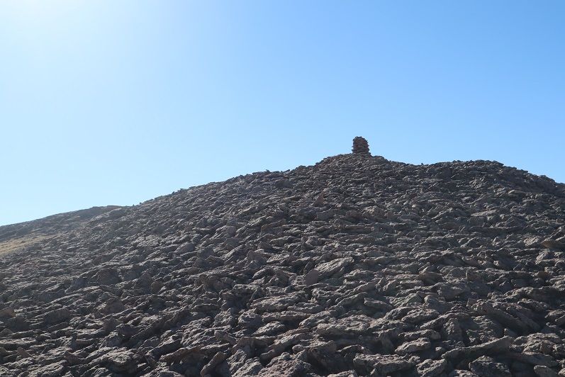
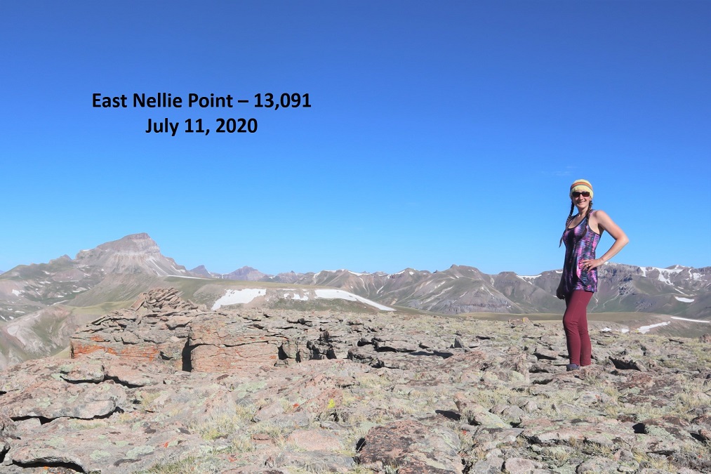
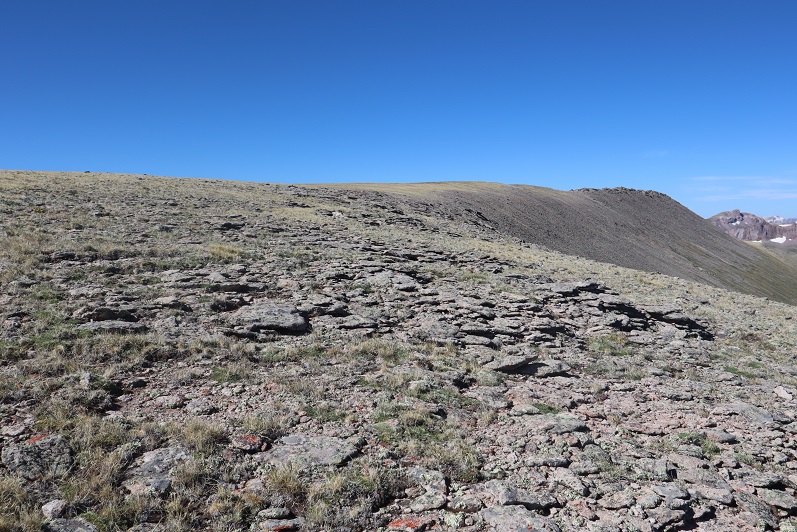
It was a simple ridge hike up tundra until the very end.  Then the terrain became rock and it was difficult to tell where the actual summit was, so I followed the entire ridge.  I spied a cairn and I considered the cairn the summit.

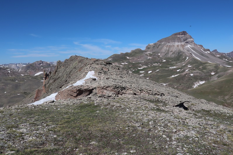
I’ve circled the summit cairn in red (although the rock outcropping certainly felt/looked the same height)

I summited PT 13100 at 8:50am
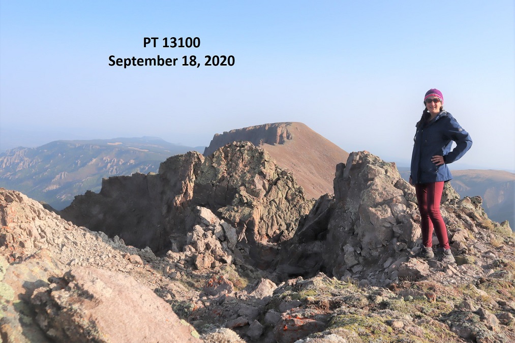
PT 13,100: 

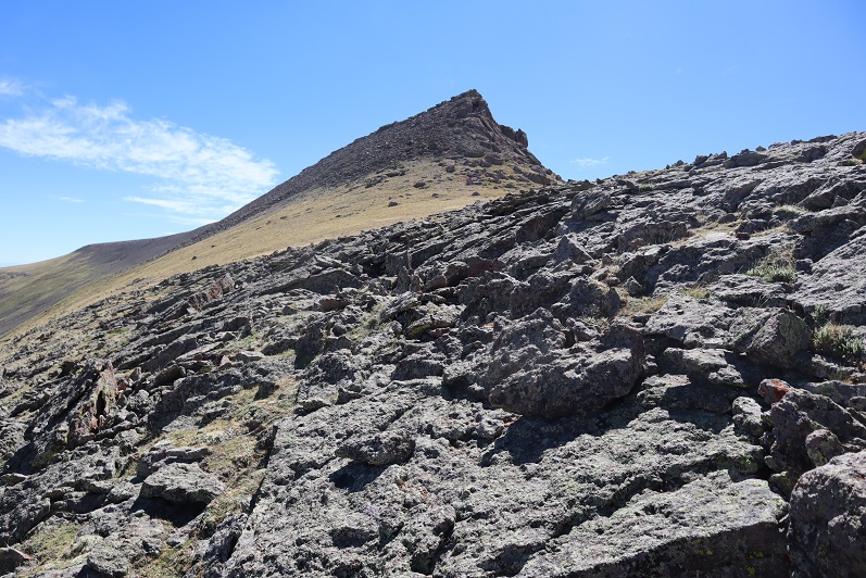
Next up was PT 13,681.  Once again, I followed the ridge south

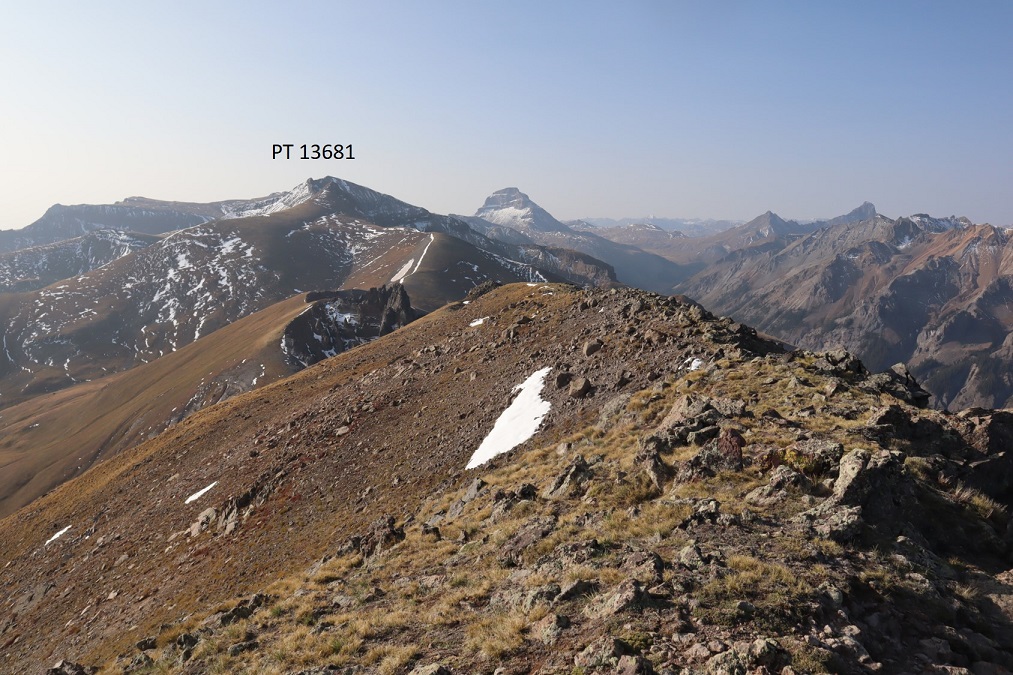
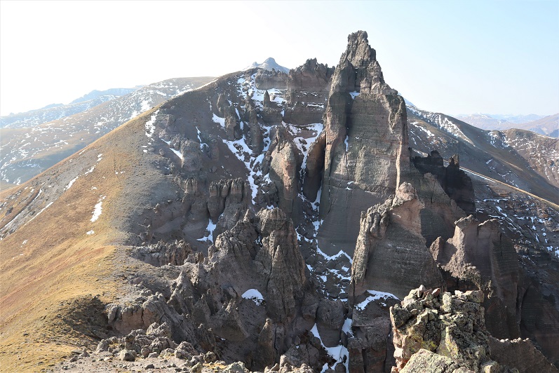
The volcanic ash towers at the saddle were pretty cool!

From the first saddle, here’s looking back at PT 13100 and Sheep Mountain, along with my route, and a look up the ridge

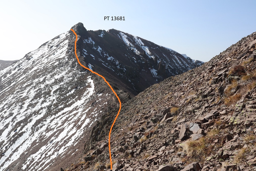
I followed the ridge to the false summit of PT 13681

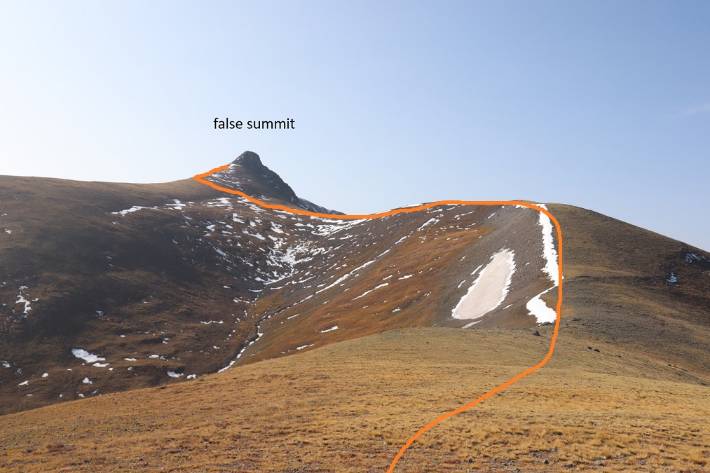
When I made it to the ridge, instead of climbing the false summit I stuck to the left, keeping this class 2

Here’s a look back from the ridge

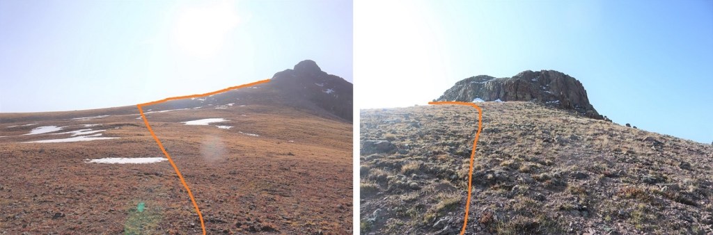
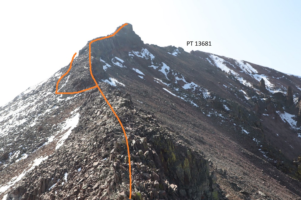
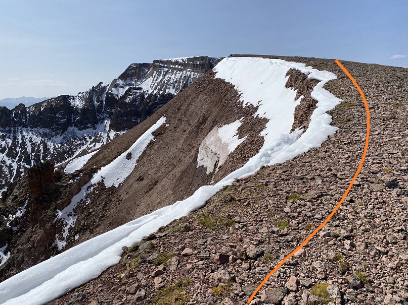
After skirting the false summit to the left I could see PT 13631.  I stayed low until I made it to the saddle, and then stuck to the ridge until I hit the second false summit

From the saddle, here’s looking back at how I skirted the bump

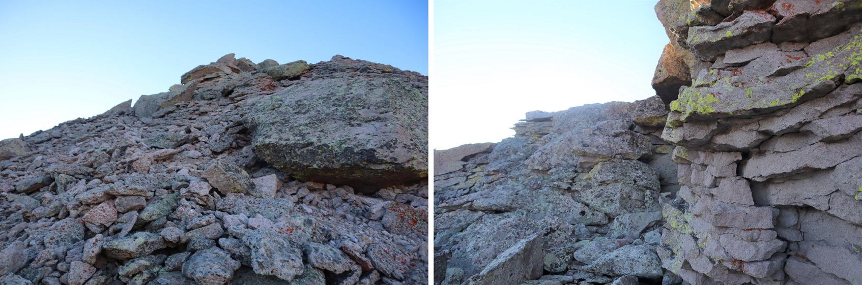
From here I took the ridge straight up and over, making this class 3.  You can keep it class 2 by going to the left and skirting the ridge.  They both end up in the same place.

A view from halfway up the ridge

If you go over the ridge, this is the downclimb (still class 3, not as bad as it looks)

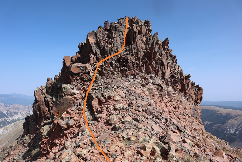
And here’s the rest of the class 2 route to PT 13681

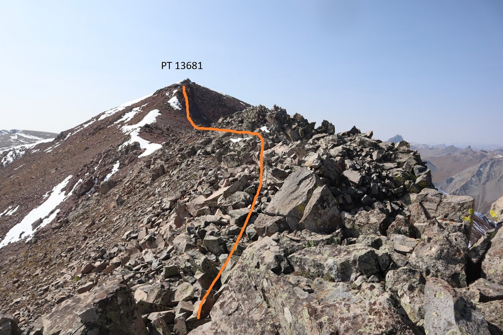
I summited PT 13681 at 10:45am

PT 13,681:

Here’s a look back on the route so far

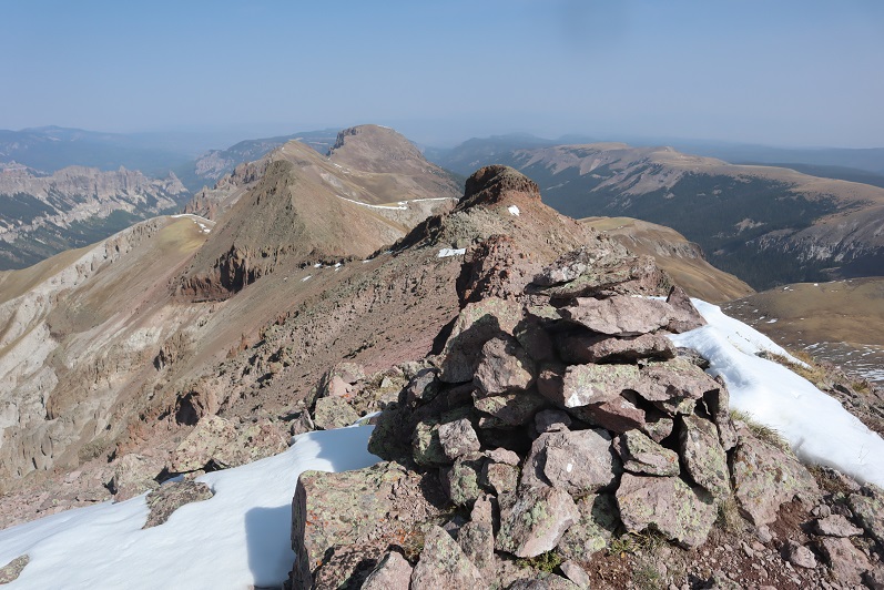
And a look at the route to Silver Mountain. The rest of the way was a simple tundra ridge walk

I summited Silver Mountain at 11:35am, and since it was my birthday (my 40th!) I kept my tradition of standing on my head because I still can.  Also, this is harder than it sounds, as I had to set up the automatic timer, get far enough away from the camera and then actually do the headstand before the camera took the picture. 
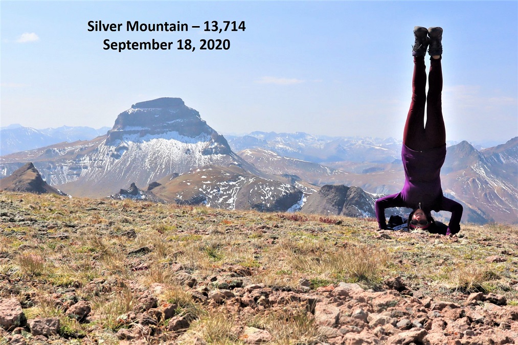
Silver Mountain:

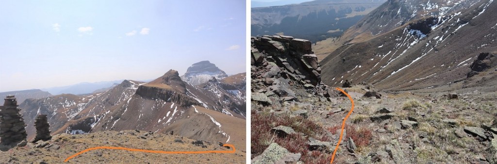
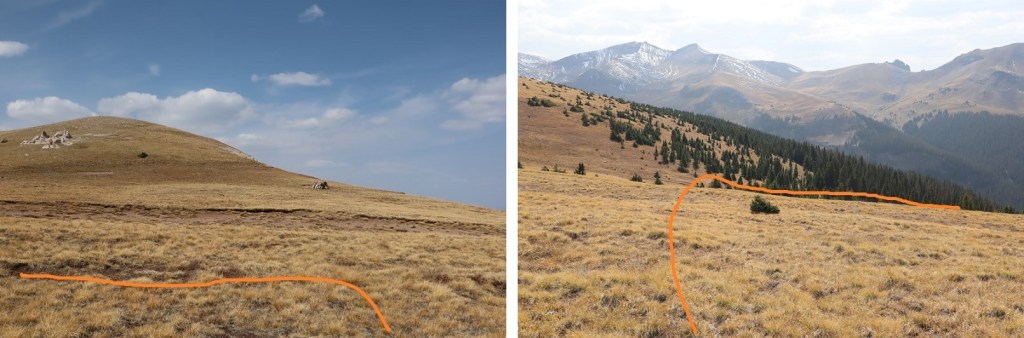
Now to head back down.  I had several options, but chose this one because it looked easier on a topo map (it most likely wasn’t).  I continued south along the ridge to the Silver Mountain/Big Blue Peak (unranked) saddle.

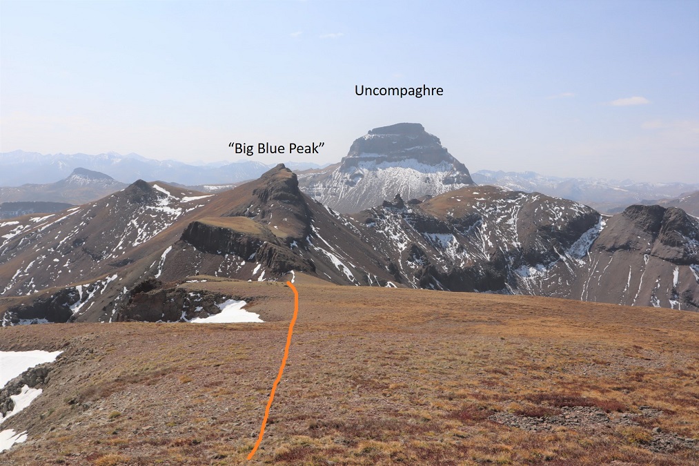
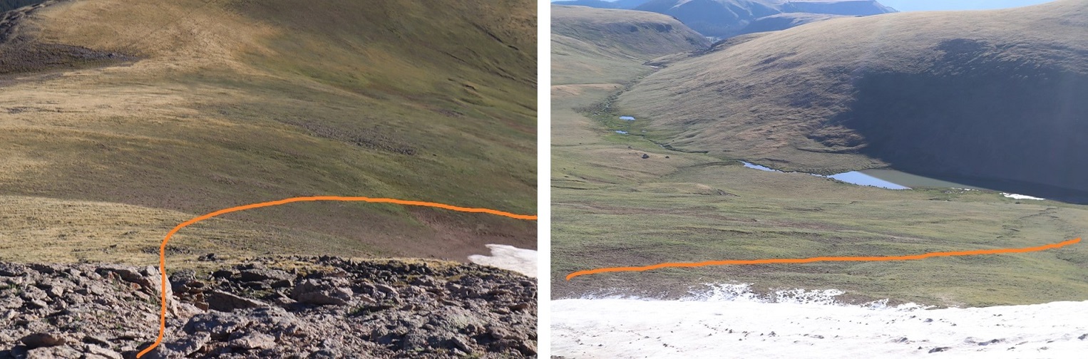
After passing the two large cairns, I continued a bit further down, turned left, and headed east down the gully

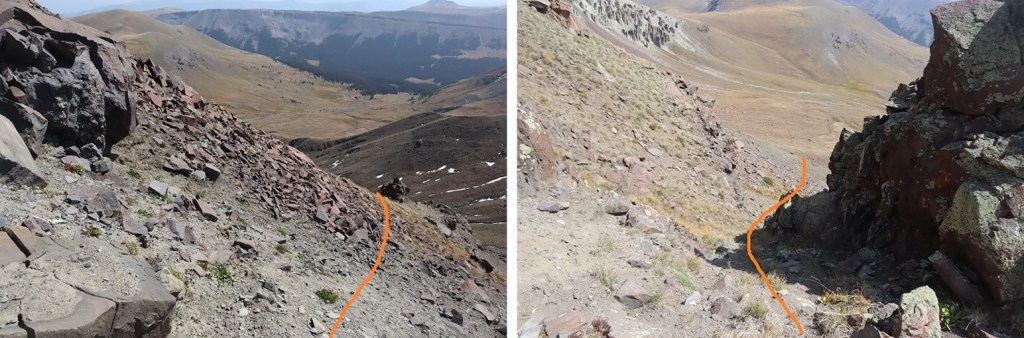
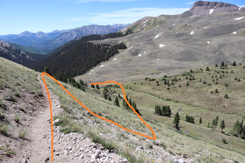
My goal was to link up with the Fall Creek Trail.  Here you can see it to the right.  However, I didn’t want to lose too much elevation, so I took a game trail up high to the left (they both link up on the other side of the hill).  I lost just over 1000’ of elevation here, and gained under 200’ by staying high to the left.

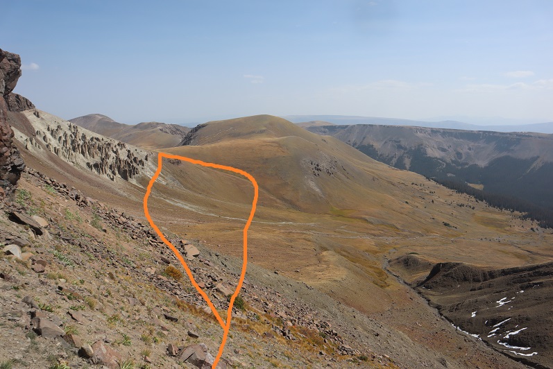
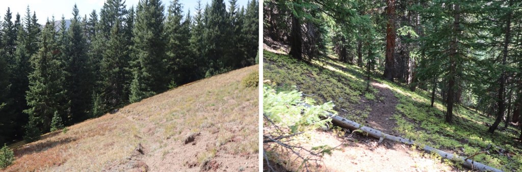
Once at the top of the hill I figured my elevation gain was over for the day.  Boy, was I wrong!  I dipped down once again, losing another 400’ of elevation, only to gain another 500’ of elevation to make it to the next ridge.  I was following the Fall Creek Trail, then switched as I stayed high on the Little Cimarron Trail, but this trail doesn’t look like it gets used much by people.  There are many game trails in the area that parallel this one, and they make route finding frustrating at times.  Here’s the overall route:

Once I’d regained the ridge it was a nice 2 mile tundra walk on a fairly visible trail.  Side note:  It’s hunting season, and the elk are bugling.  Advice to hunters:  Practice using your bugle call BEFORE trying it in the wild for the first time. I heard some pretty funny noises coming from what were obviously hunters and not elk. 

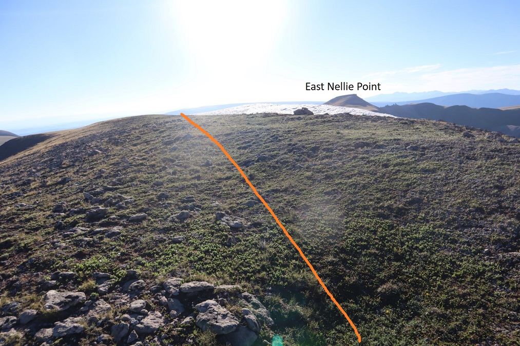
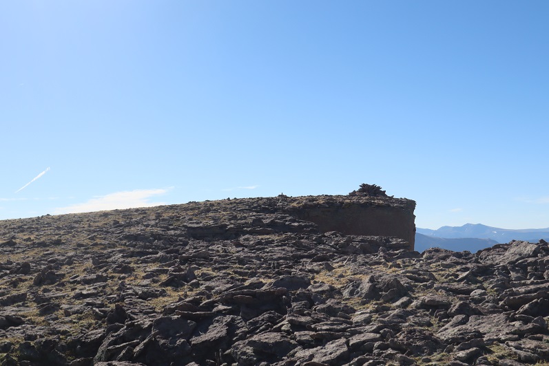
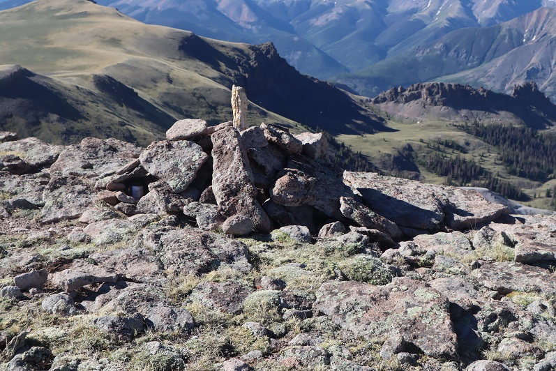
At exactly 2 miles of mesa walking, and just before reaching this old shack I turned left and headed west.  Here the trail pretty much ended.  There were 2 cairns in the area (which surprised me, the first I’d seen all day), so I just kept aiming for the valley below, where I knew I’d pick up with the trail I’d hiked in on. 

I had a good view of the path I’d taken up to Sheep Mountain that morning

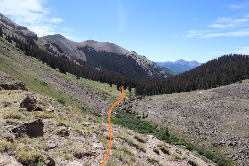
Gradually, the Little Cimarron Trail became more visible, as I followed it towards the creek below.

I crossed the Little Cimarron River (more of a creek now)

And headed north, easily picking back up the trail

I stayed right this time at the junction between the Little Cimarron Trail and Little Cimarron East Trail, crossed the stream again, and followed the trail back to my truck.  Along the way I saw a dad holding a rifle and two daughters, both under 10 years old, sporting camo and bright orange hunting hats.  They were the only other people I saw all day.  The girls had big smiles, and looked thrilled to be camping/hunting with their daddy. 

I made it back to my truck at 5pm.

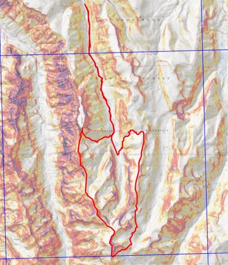
This was a 25.26 mile hike with 6689’ of elevation, completed in 12.5 hours.  Here’s a topo of my route. 

Not a bad way to celebrate my 40th birthday!  On to the next trailhead!

Nellie Peak – 13,106 and East Nellie Peak – 13,091

1

RT Length: 13.72 miles

Elevation Gain: 3833’


Wow, the 4WD road to Nellie Creek is much worse than I remember!   It’s absolutely 4WD from the turnoff, all 4 miles to the trailhead, with 2 creek crossings. Have I mentioned I love my truck?

2

3

I made it to the trailhead, which was empty. There were a few dispersed campers in the area however, taking shade beneath the trees.

4

The trailhead was also very much in the open, so I turned around and drove a short distance and parked my truck in a narrow parking spot under the trees, just off the road. There were mosquitoes all around, so I ate dinner in the back of my truck, jotted down notes and checked my topo map for tomorrow.   I decided to go to the trailhead to take a look around and get a visual for the start of tomorrow’s hike. There was a couple with a dog standing in front of the trail maps when I arrived. Their dog charged at me, barking loudly. The couple seemed surprised and apologized for their dogs behavior. That dog barked all night long.

I walked back to my truck, took care of a branch that had been scratching the roof of the truck like a critter trying to get in, and read for a bit before turning out the light.

If you couldn’t already tell by the tone of this post, from the time got to the trailhead I wasn’t ‘feeling it’. This rarely happens to me, and I was thinking maybe I need a short break from my goals? Or maybe expand them a bit? I love to hike, but today I couldn’t seem to get myself out of bed to start. I blame it on yesterday’s failed attempt on Coxcomb, which put my training into a different perspective.

Also, I was still worried about the injured horse. My mind had a lot to think about and I couldn’t turn it off. I finally started on the trail at 4:15am.

The trail starts at the north end of the parking area and follows a well defined, class 1 trail.

5

6

After hiking for 1 mile I turned right at this sign and switchbacked up the side of the mountain

7

After hiking for 2 miles I made it to the top of the pass

8

It was still dark at this time, and I knew I needed to descend a couple hundred feet. The trail seemingly ended and it took me a while to figure out which way to go, but there is an actual trail here that picks up again after about 50 feet of absence. In the daylight it wouldn’t have been an issue. I finally found it and descended in to the basin. And descended, and descended, and descended. I looked at my altimeter, concerned I’d lost too much elevation. At this point I’d lost 800’, and I could tell I’d need to lose several hundred more before starting to gain elevation again. The sun was starting to rise and I still didn’t have a good visual of the peak I’d intended to climb. I still wasn’t ‘feeling it’ and didn’t like the prospect of gaining 1000’+ at the end of today’s hike after climbing up gullies (I’m not a fan of gullies). I decided to call it and turn around. I headed back up towards the pass. I’d much rather get my elevation gain in the beginning of the hike, rather than at the end. However, I wasn’t done hiking for the day; just changing my plans. When I made it back to the pass I turned and headed east up the side of Unnamed PT 13106 (which I later found out is nicknamed Nellie Point, so that’s how I’ll refer to the peak. Names are better than numbers IMO).

9

This was mostly a tundra hike until the end, when the tundra turned into very large rocks.

10

These rocks were fun to navigate, kind of like a maze with large obstacles to go around. All class 2. My mood improved dramatically and I was excited to be out adventuring.

11

12

There were several large cairns on the long summit. I wasn’t sure which one was the actual summit until I found a summit register inside one of the cairns. It was kind of in the middle of the summit area (which was about a quarter mile long).

13

14

Nellie Peak:

From the summit of Nellie Peak I continued following the long summit northeast. There was still some leftover snow here from winter, which didn’t pose a problem at all.

15

While on the ridge I scared a Ptarmigan mother and her chicks (they scared me too, as I didn’t notice them until the mother squawked). Immediately the chicks dispersed and the mother pretended to be injured, leading me away from her babies. I kept telling the mother I didn’t want anything to do with her or her chicks, but unfortunately she was leading me exactly in the direction I needed to go. She did a wonderful, if unnecessary, job leading me away from her babies. When she felt I was far enough away she flew back in their direction, chirping to gather them all together again.

16

Ptarmigan:

From the summit ridge I could see East Nellie Point, but getting there isn’t as easy as it initially looked.

17

I followed the ridge almost to the saddle and then turned and headed east, losing 600’ of elevation. Luckily this part of the hike was mostly on rolling tundra and wasn’t too taxing.

18

Once at the bottom I was able to avoid the small pond/creek and ascend the hillside towards East Nellie PT.

19

This was still rolling tundra, and there were even game trails in the area (and tons of elk tracks). At the top of the tundra hill I had about a quarter mile of tundra to walk through to the final summit push (if you could call it that).

20

21

The final push to the summit was rocky and there was no trail, but it was straightforward

22

There was a large cairn just before the summit

23

The actual point of this summit was difficult to tell as well. Once again I knew I was at the summit when I found the summit register stashed inside a cairn

24

25

26

Summit Photo:

27

East Nellie Peak:

Here are some photos from the hike back down. I decided to make this an out and back hike, retracing the steps I took to get here from Nellie Pt.

28

The tundra can be vast. Luckily, I could keep Uncompaghre Peak in my view most of the time, and just kept heading towards that 14er.

29

I also had a good view of Silver Mountain (my original choice for a summit today). With this view I could see there was still snow at the top of the access gully, so it had been a good idea for me not to attempt that peak today because the snow was unavoidable and I’d left my ice axe in my truck (I had my crampons). I was feeling better about my choices.

30

I hiked down to the valley and then back up to the ridge

31

I followed the ridge back to Nellie Point

32

33

34

And back down to the pass

35

And the class 1 trail that leads you back to the trailhead

36

37

38

39

The trailhead now had several vehicles

40

Also, I came to the conclusion it’s impossible to get a bad photo of Uncompaghre

41

I made it back to my truck at 11:15am, making this a 13.72 mile hike with 3833’ of elevation gain in 7 hours. Obviously, I made this hike more difficult and added more elevation than needed, but in the end I was happy with today’s hiking change of plans. In fact, I wished I’d have made the choice to change routes earlier. Any day above treeline is a good day. The 4WD road was easier to navigate driving down than it was driving up.

Here’s a topo map of my route

42


Uncompahgre – 14,309

Notes:  

·The trailhead is 4WD

·The trail was pretty much free from snow, even after Monday’s storm.  Microspikes were not needed.

· This would be a great first class 2 hike:  it’s easy to follow, relatively short, and
not too taxing

· If you’re looking to spend the night on a 14er summit, this would be a good choice

Uncompaghre, or “Uncle Padre” as it’s affectionately referred to, wasn’t supposed to be my hike today.  We had a storm come in on Monday, blanketing
the entire state with snow.  So I’d gone on the Colorado Webcams page to see what the conditions looked like in different areas of the state.

I was specifically looking at peaks in the Crestone area, and the webcam made it look like there was surprisingly little snow.  I was thrilled!  That is, until night fell and I looked at the web cam again, and it still showed daylight.
It was then I went on the forum and someone said there was a lot of snow
on the Crestones, and I concluded the webcam must have been broken.  It was showing the correct time/date, but the image was obviously wrong.  UGH!  

No worries though, I had about 5 different 14ers I was interested in, so I just went down my list. I wasn’t 100% sure the conditions weren’t great at the Crestones (I asked for clarification from the poster and never got any), but the webcams for Lake City looked promising.  I gave it some thought and did a pro-con list.  The Crestones were closer, the hike was longer, and I’d get 2 14ers in tomorrow, but I didn’t know for certain the conditions. Uncompaghre was a lot further (6 hours), the hike was shorter, and I’d only get in one peak (I really wanted to hike it with Wetterhorn).  But my knees still weren’t 100% from my falls last week (I’d say 80% on one knee, 85% on the other) so a shorter hike was probably a good idea.  Also, Uncompaghre is affectionately referred to as “Uncle Padre”, and it’s my Uncle’s birthday today, who pretty much was like a father to me growing up, so I saw it a sign of good luck and just went for it.
Uncompaghre it was!

I woke up at midnight and made it to the trailhead at 6am (remember, I don’t sleep well at trailheads, so it’s just easier for me to drive and hike).  There’s an obvious sign telling you where the trailhead is.  If you don’t have 4WD, park here.

The drive up is definitely 4WD.  My directions indicated I’d cross 2 streams,
but I crossed 3, and was delighted to do so!
My whole face lit up when I saw the first one:  I love it when I get to drive my Tundra through streams!  

https://youtu.be/ztOCU_qzJK4 

The only downside to this road is it’s pretty narrow, and a bit bumpy in places. There were 3 turns that were tight for my Tundra, and I had to back up and reposition my truck to make the turns happen.

There was also a lot of ice on the trail (which I’m assuming is gone now).  In fact, there was a lot of snow on the entire drive up, starting at about 8000’.  This seriously worried me for the hike ahead!  I had microspikes and snowshoes,
but would rather not carry them if not needed.

The trailhead had parking for about 10 vehicles and was pretty open.

The weather forecast for the area today was a low of 22 and a high of 44, but as I drove I saw the temperature drop to 19 degrees, and stay there.  Lovely.  There was a half moon, and I could see there wasn’t enough snow on the mountains for snowshoes (woot!), but I brought along my microspikes anyway.  I bundled up and began my hike at 6:15am.  There were two Park Service trucks at the trailhead, but I never saw people on the trail. The trucks were still there when I left.

The beginning of the trail had a bit of ice in the creek areas

I hiked through a basin, and about a mile in there was a little bit of snow on the trail, but it was easily avoidable, and this was seriously the most snow I saw on the entire hike.

As I came to the trail junction for Matterhorn Creek and Uncompaghre Peak the sun and the temperature began to rise.  This is why I’d woken up at midnight!  The sunrise was amazing!

I turned around to take a look at Uncompaghre.  Wow.

The entire trail was well maintained and very easy to follow. It was almost too easy, it didn’t seem as if I were hiking a 14er.  

The Alpine glow this morning was fabulous against the blue sky!  I hiked up some switchbacks to Uncompaghre’s south ridge.  

This ridge gave me amazing views!  I had fun taking pictures

At the top of the ridge I turned left and went behind the mountain

I followed the trail and looked for this rock tower.  

You can either go to the left of it or the right of it.  I chose the right

The hike up until this point was very much a class 1 hike.  However, at this point there’s about 30 vertical feet of hand and feet climbing.  Woot! My favorite!  I took a picture and put away my camera.  Here’s why this is considered a class 2:  

This is what it looked like from the top

The rest of the hike was pretty straightforward.  I just followed a trail to the summit.  

The summit was a wide, flat, barren summit.  If you were looking for a 14er to camp out on for the night, this would be it (if you don’t mind wind). I summited at 8am.

I turned to look around, and all around me there was snow!  I’d picked the only peak in the area without snow!  Amazing!

I took a summit photo to prove I’d summited

And as I looked over the edge, I saw there was snow on the north face of the mountain.  What a drop!

I didn’t spend long on the summit, but turned around and started back down.  As I was descending the class 2 part of this hike I stopped to take in the view.  

I thought to myself how this was the perfect hike for today!  I didn’t get in Wetterhorn, but there are several 13ers in the area I can partner with Wetterhorn and take my time on instead of rushing to get them all in.
I was glad I’d chosen to hike Uncompaghre solo for today.

I didn’t see anyone else on the hike until I was just about to exit the basin.  It was a couple hiking together.  I didn’t see anyone else the entire day, and luckily didn’t pass anyone on the drive down.

I made it back to the trailhead at 9:55am, so I hiked 7.5 miles in less than 4 hours, with 3000’ feet of elevation gain.