Venable Peak – 13,334- Attempt

RT Length:  11.9 miles

Elevation Gain: 3921’

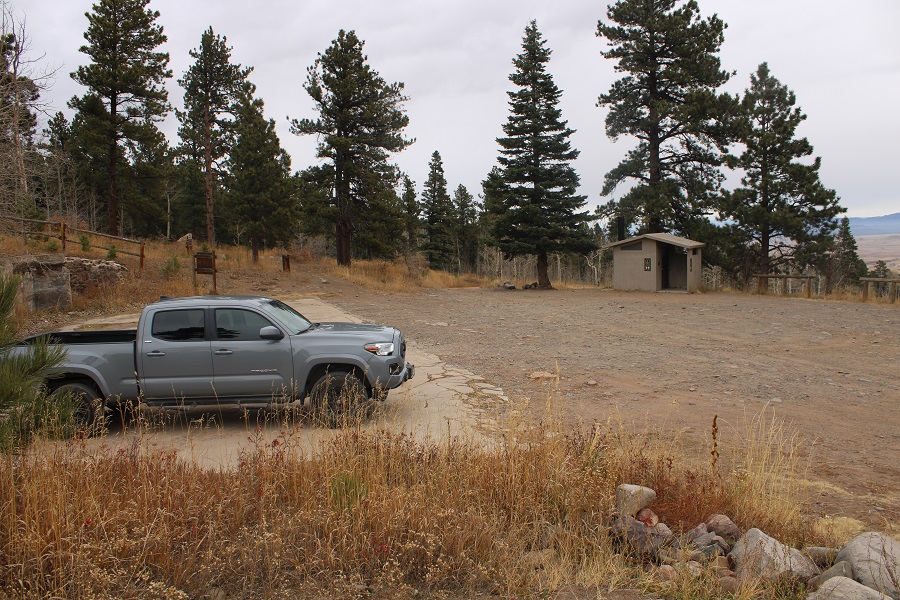
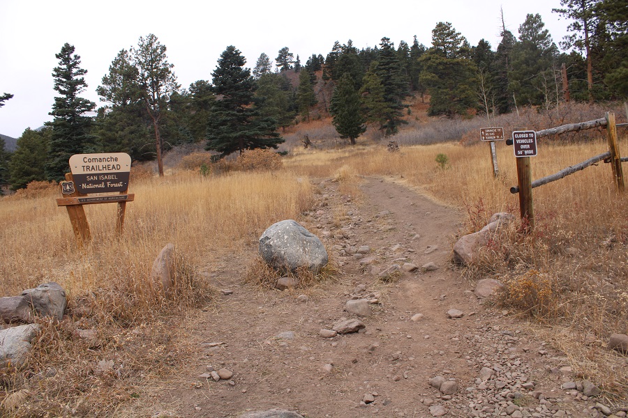
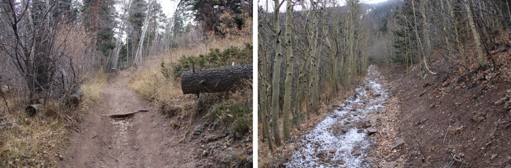
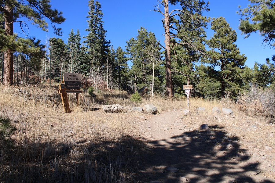
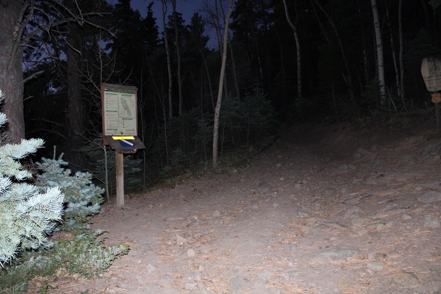
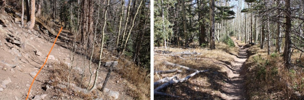
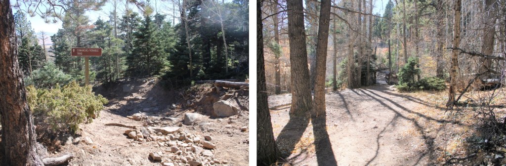
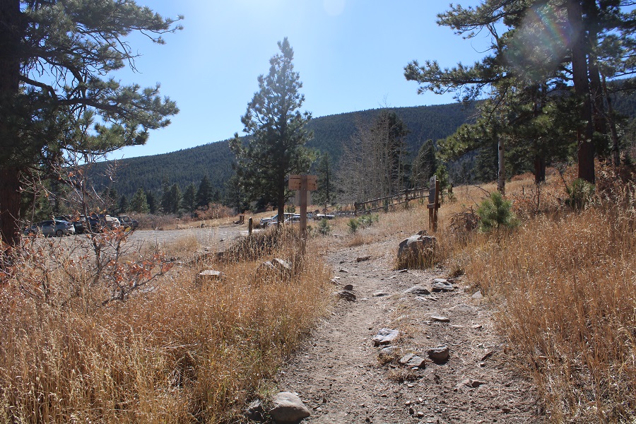
I made it to the trailhead late the night before, and slept in the cab of my truck.  Well, I tried to sleep. Unfortunately, there was internet access at this trailhead.  This meant I was scrolling through my phone until 1 in the morning.  I hit the snooze button three times before waking up to dawn approaching.  I threw on my gear, waved at the hunter who just pulled up in the parking area, and was on the trail at 7am.  This morning I was taking the Venable Trail, which is clearly marked from the parking area.

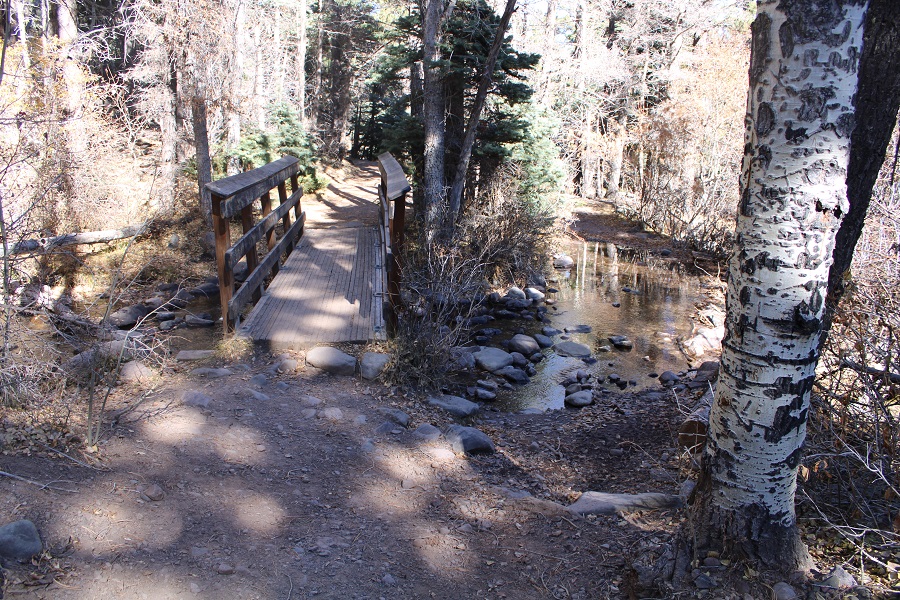
I followed the trail as it crossed over a bridge

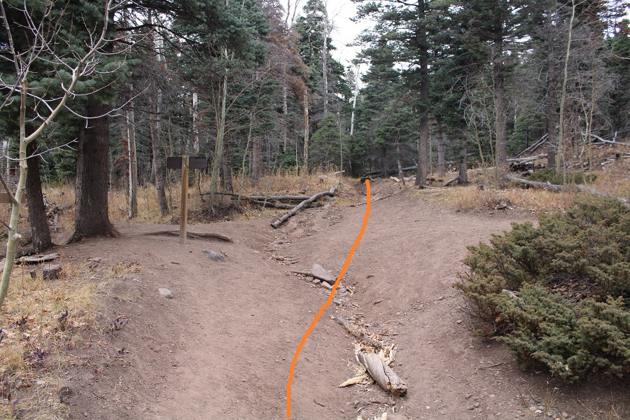
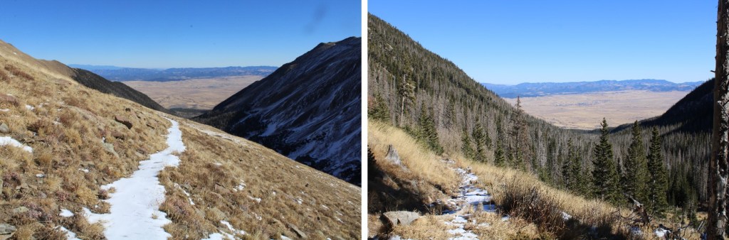
After hiking for half a mile, I came to a junction with the Rainbow Trail, and continued straight, following the Venable Trail (1347). 

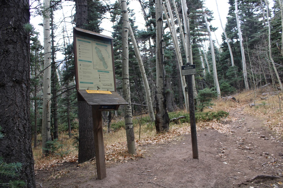
Just after this junction there was a trail register.  I signed it, and continued following the Venable Trail southwest

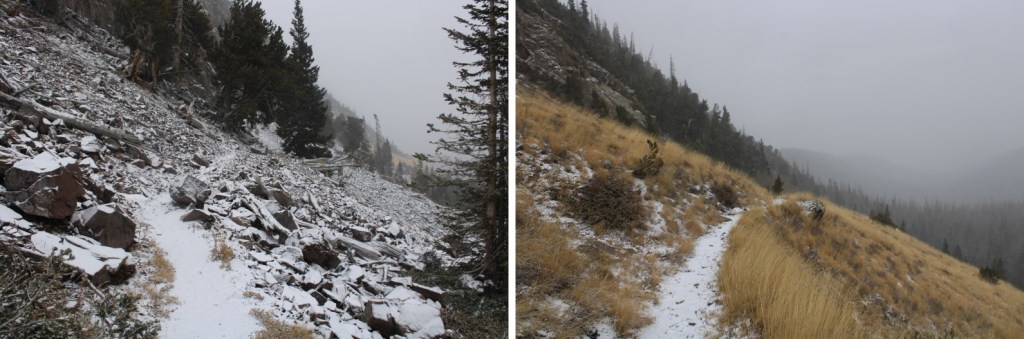
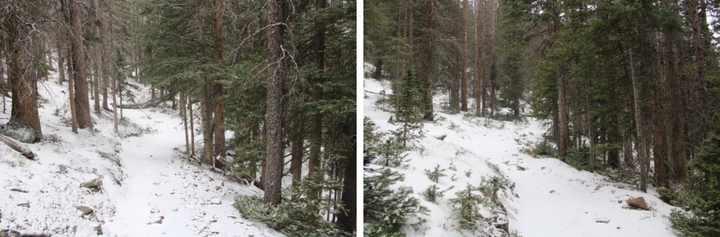
This is a class 1 trail.  Today’s conditions varied, from being covered with ice, to being bare dirt, to several inches of snow. 

After hiking for 2.5 miles, I came to the junction for Venable Falls.  Here I continued straight on the trail, towards Venable Lakes

The trail increasingly became more snow covered, but no traction was necessary.  Of course, most of the snow present was directly on the trail.  This is where I was headed

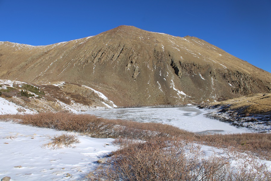
I rounded this hill (lower Venable Lake is to the right)

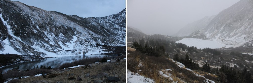
And after 5 miles of hiking, I made it to the lower Venable Lake

I kept following the trail

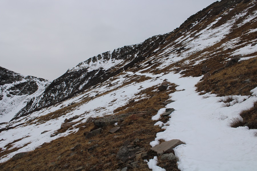
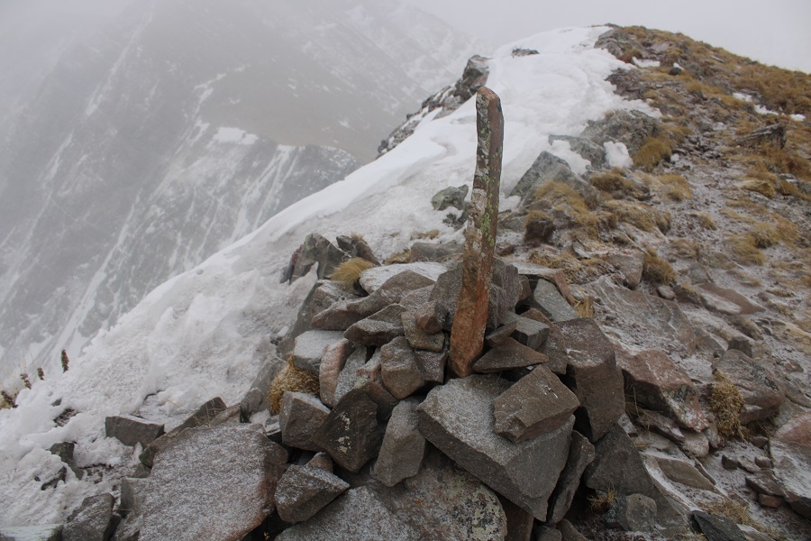
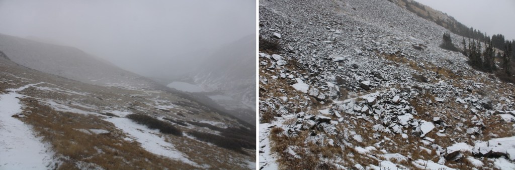
After hiking a total of 5.5 miles I came to what I assumed was a junction (it was covered in snow and the sign was missing:  only a post remained). I turned left and took Comanche Trail (1345) towards the pass.

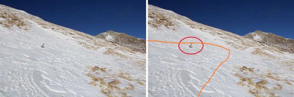
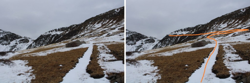
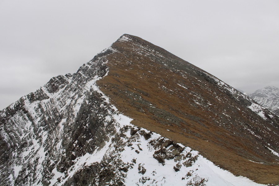
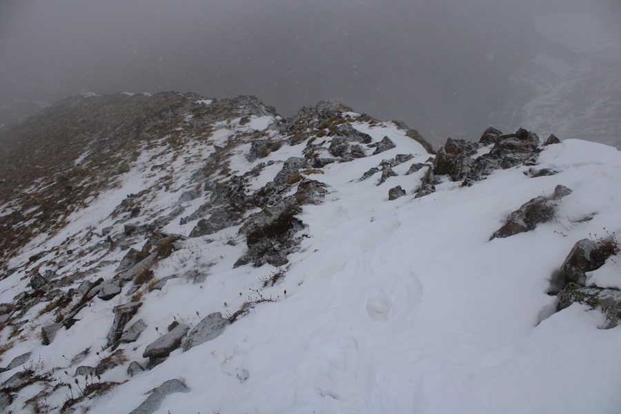
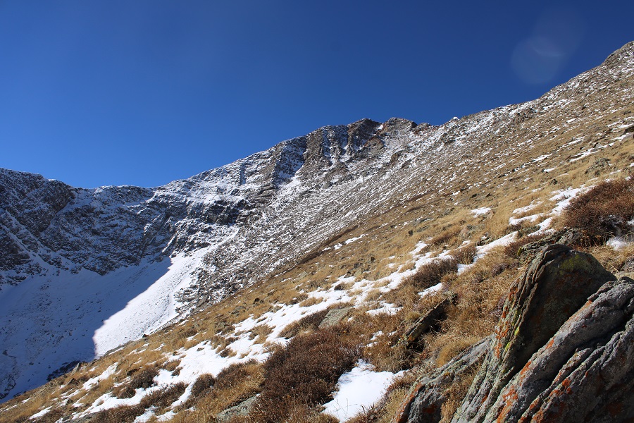
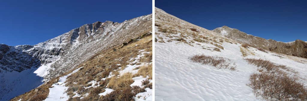
I now had a good view of the rest of my route to the pass

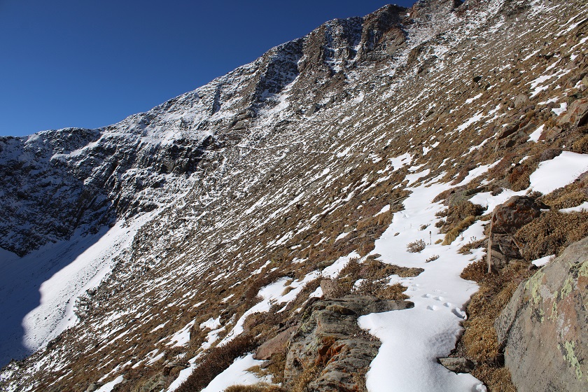
More and more snow started accumulating on the trail.  It was sugary, so I put on my microspikes.  I had snowshoes, but the snow was so sugary they wouldn’t have made much of a difference.

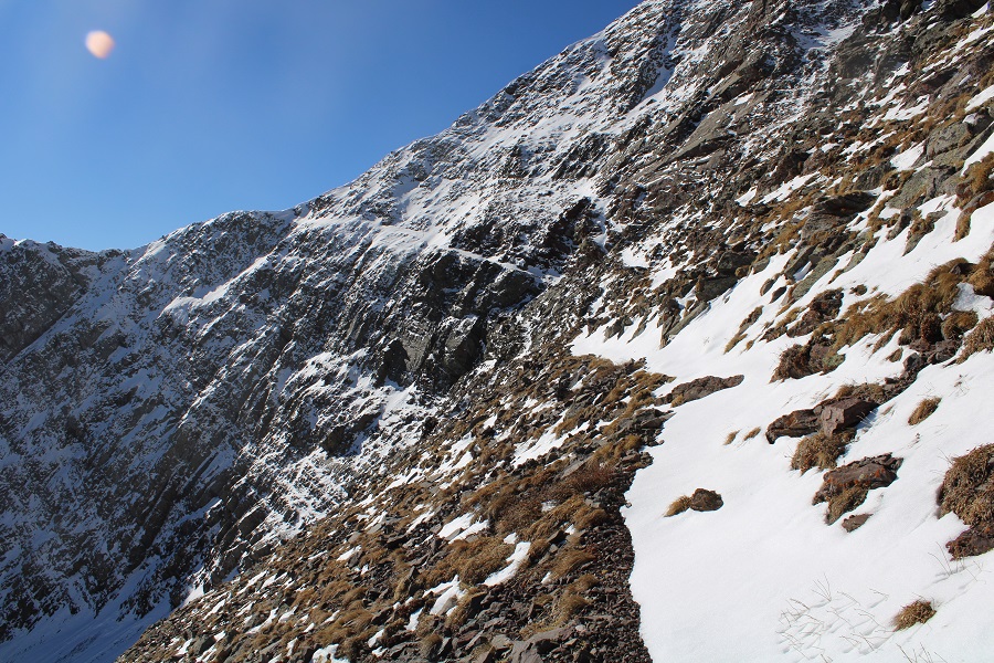
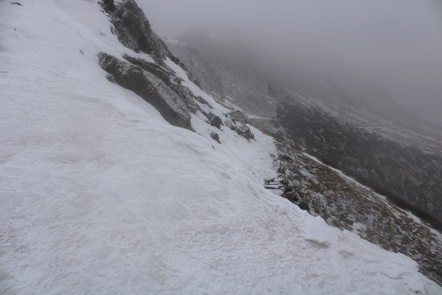
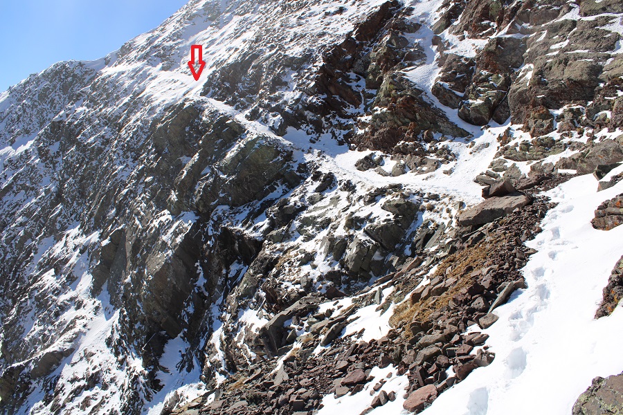
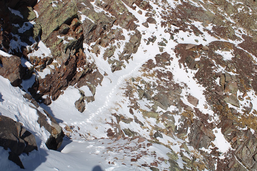
It was slow going, and I had to spend a lot of time making a solid path in some areas through the snow, doing my best to hug the cliff, not entirely sure how wide the trail was.  I was doing find until I got to this area:

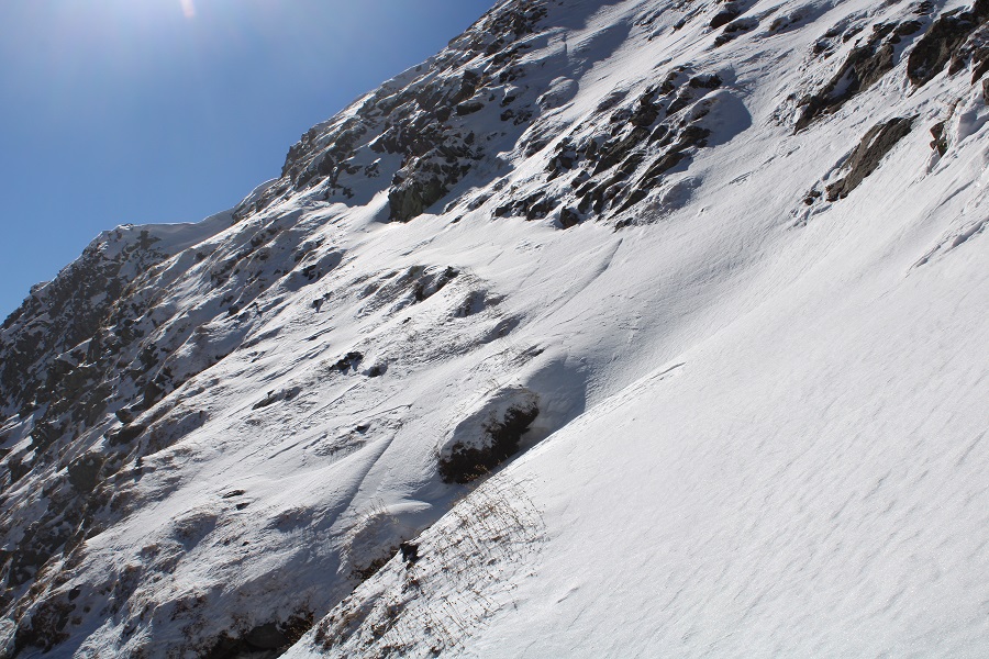
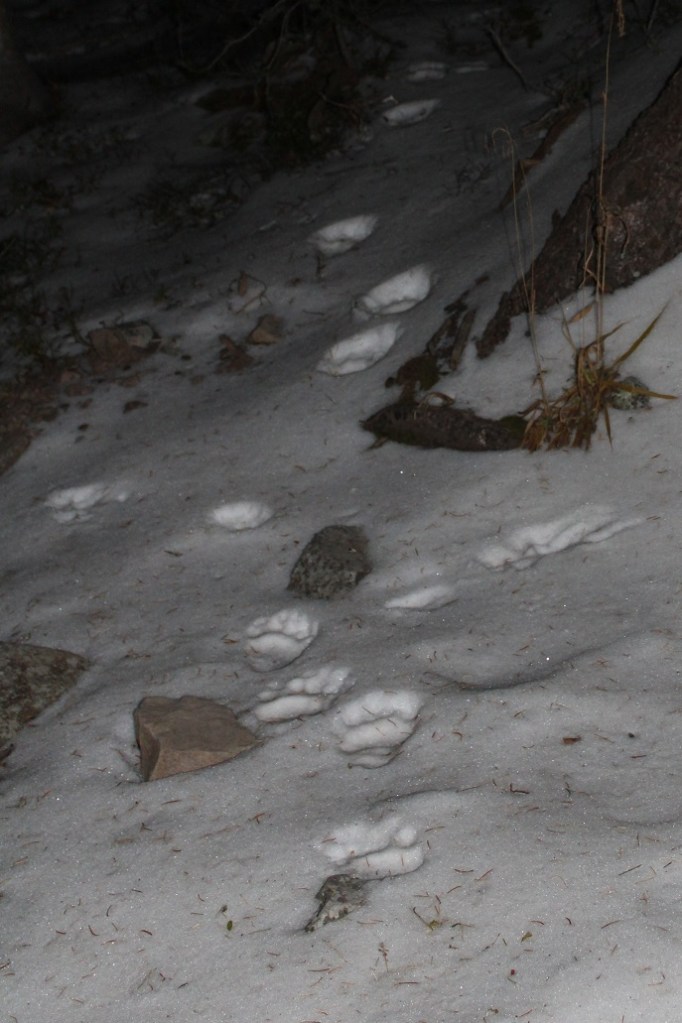
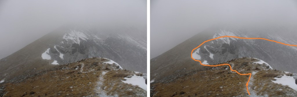
I was about 200 feet from the pass, and the snow drifts were now taller than I was.  I kept seeing snow slide down below my feet, over the cliffs, and made the decision to turn back. It hurt to turn back, but I knew it was for a good reason: I’m out here solo, and while I might have made it past the snow/cornice to the pass, I couldn’t have done so safely, and a fall would have been fatal.  The red arrow is where I turned around. You can see the tracks where I stopped

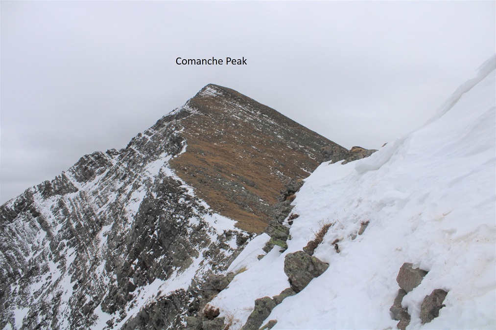
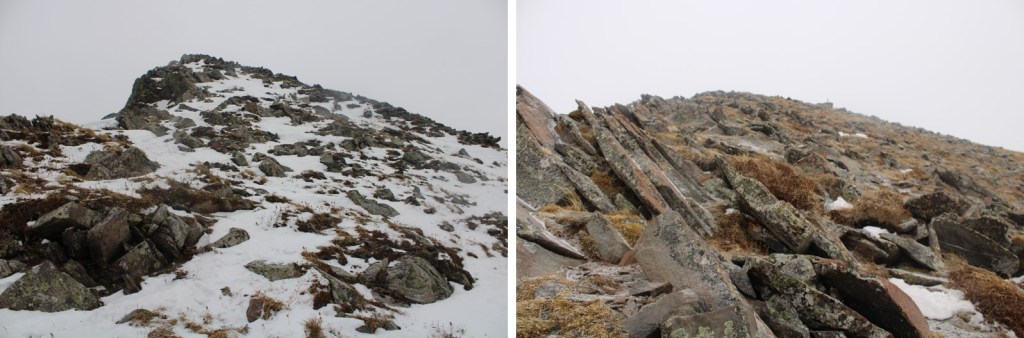
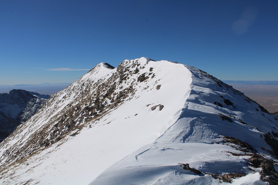
Just for reference, I was able to summit this peak via the Comanche trail the next day.  Here’s what the pass looked like from above

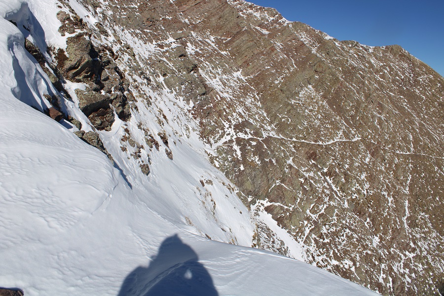
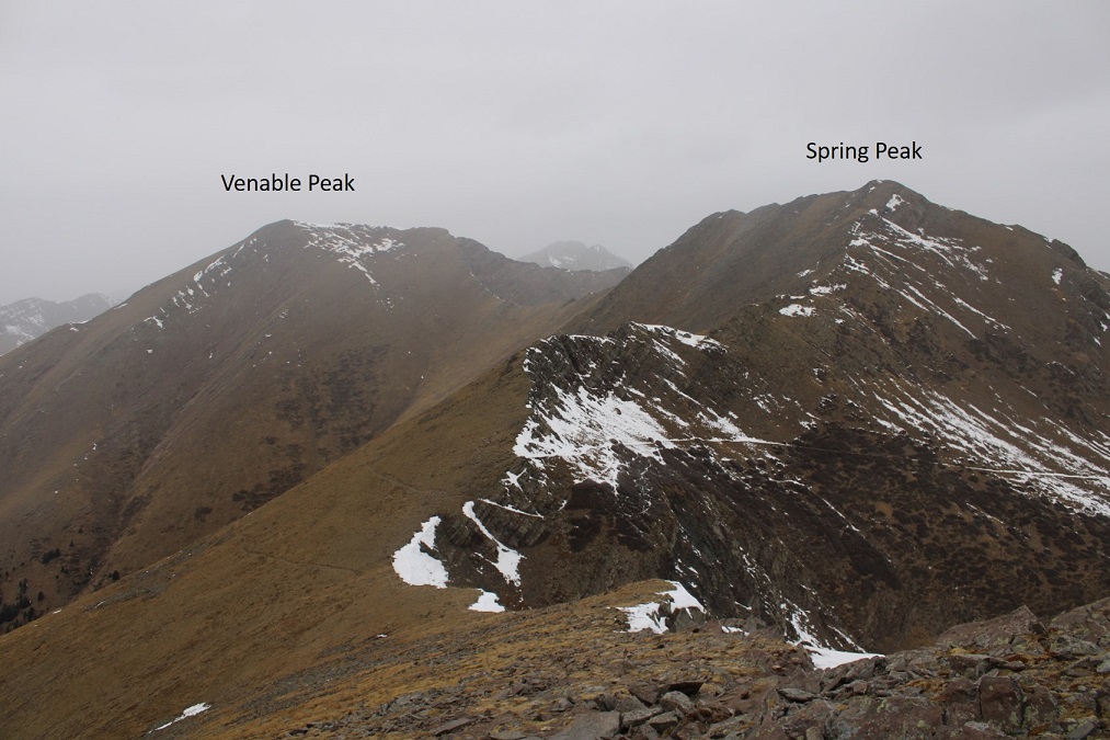
And look at how close I’d been to the summit of Venable! 

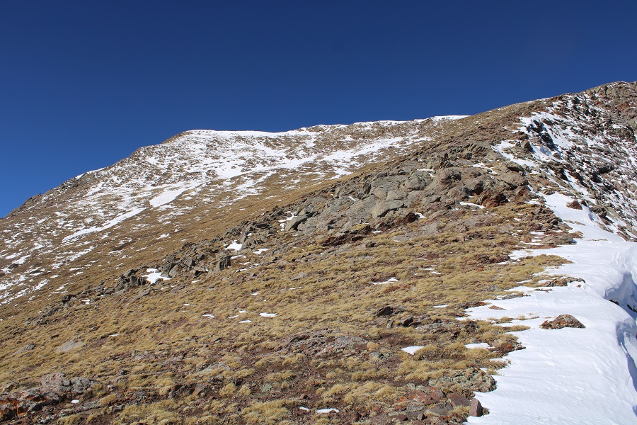
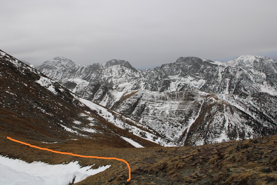
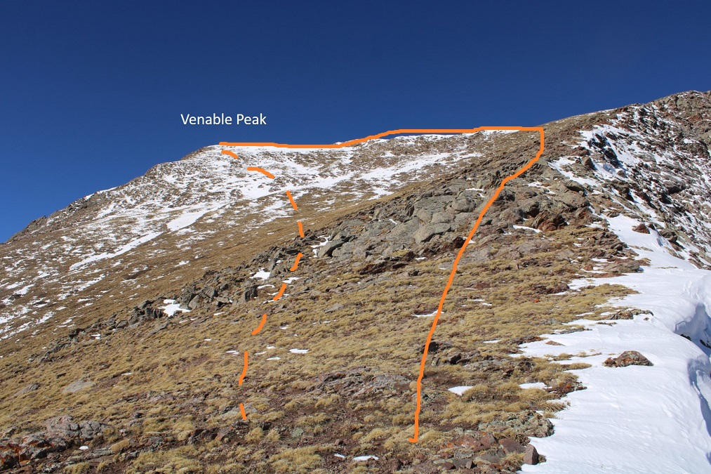
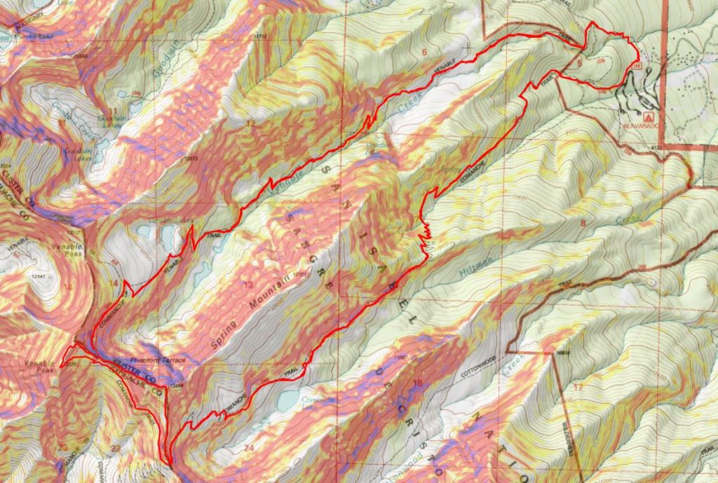
For those of you interested in taking this route, this is how I summited Venable the next day.  I took the solid line up, the dotted line down.  Both were class 2 (although the ridge had quite a bit of snow)

However, I wasn’t summiting today. Instead, I turned around and hiked the 6 miles back to the trailhead. 

On my way out I made plans to hike Venable and Spring from the Comanche Trail the next morning.  Added bonus: I didn’t have to drive to another trailhead, since the Venable and Comanche Trailheads share a parking lot.  I made it back to my truck at 12:30pm, which gave me plenty of time to read, drink whiskey, talk to hunters, and get some rest before tomorrow’s attempt.

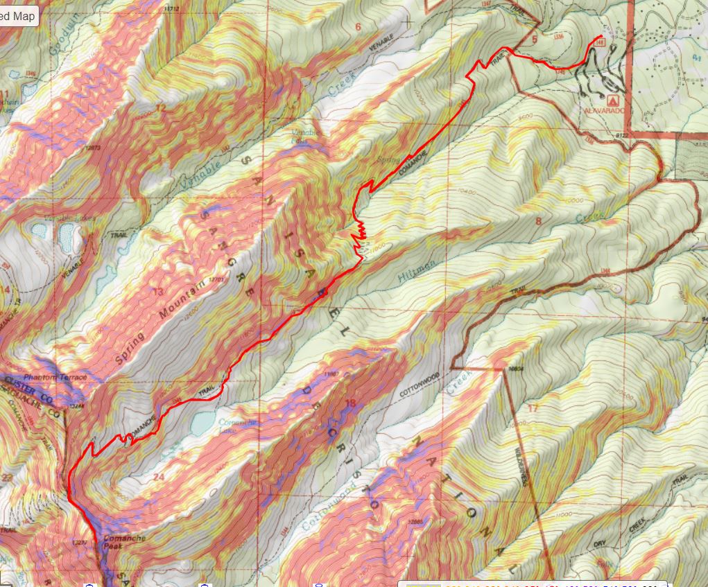
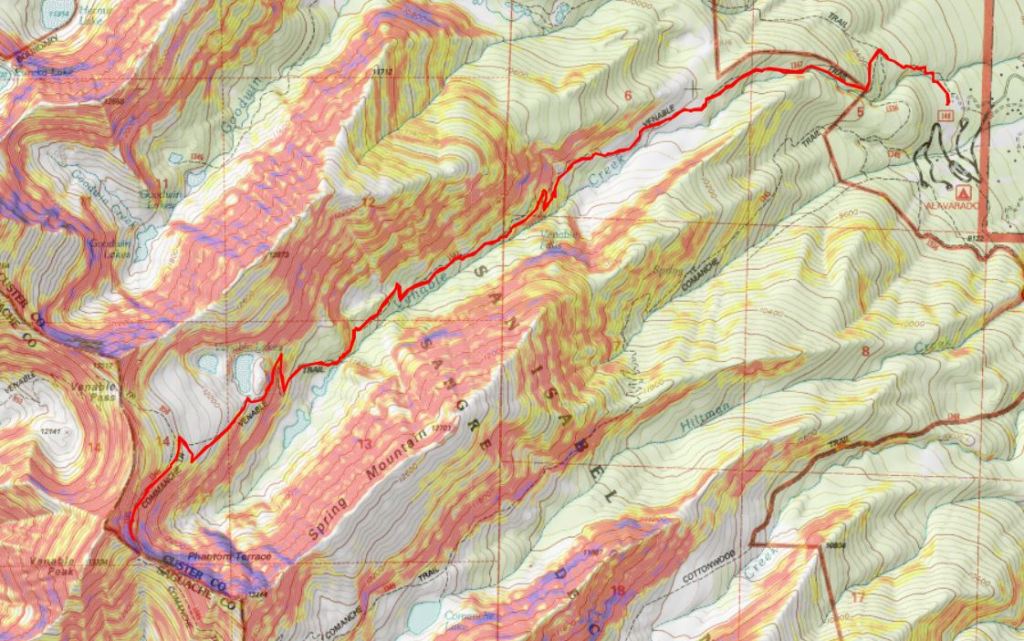
Here’s a topo map from today’s attempt, and another along with the route I took the next day

You can find my successful Venable trip report here.

Comanche Peak – 13,277

RT Length:  12 miles

Elevation Gain:  4837’

The weather forecast for today predicted a 40% chance of snow after noon, and the snow would be minimal, so I decided to head to the Sangres to do the Comanche/Venable loop.  Spoiler alert: I only got Comanche Peak.  My vehicle was the only one in the lot when I arrived.  I was on the trail at 5am.

I decided to do the loop clockwise, starting with Comanche Peak.  The Comanche Peak trail was clearly visible from the parking area.

I followed the Comanche Trail for about half a mile, and crossed the Rainbow Trail.  I stayed straight on the Comanche Trail.

There was a register and information area

This trail is well groomed and wide.  I followed the trail all the way to Comanche Lake, switchbacking up the mountainside.   

Also, the bears are still awake…

After hiking for 4.25 miles, just before making it to Comanche Lake, there’s a junction.  I continued straight, instead of heading down to the lake

I was headed to the Comanche/Spring saddle

The hike to the saddle continued to be class 1, but what little snow there was had accumulated directly on the trail. On the positive side, the trail was easy to locate!

Just before making it to the Comanche/Spring saddle there was a cornice to navigate.  I got out my microspikes and ice axe, and kicked in steps. 

As I was doing so, I looked to my left and could see Comanche Peak

I could also see weather coming in from the west.  It wasn’t supposed to snow until later in the day, but I could feel the wind picking up, and see the snow coming in.  I’d have to re-assess my hiking plans as I went. 

It was 5.8 miles from the trailhead to the saddle.

After putting away my microspikes and ice axe, I followed the saddle south

It was an easy, class 2 hike to the summit, mostly on tundra or stable rocks. In some areas there were bits of a game/social trail

As I was hiking up the ridge towards Comanche Peak the wind picked up, and it started snowing.  I figured I’d get a picture of Spring and Venable before the snow moved in.  In less than 10 minutes, I could no longer see these peaks.

Here’s a look at the last push to the summit of Comanche Peak

There was a cairn at the summit

I summited Comanche Peak at 8:50am. 

Comanche Peak:

I turned around to head back to the Spring/Comanche saddle, and noted the lack of visibility.

I descended to the saddle, and realized the snow wasn’t going to let up any time soon.  I could have made this a loop, but the pictures would have been useless in a trip report, and navigating a fresh layer of sugary snow on the rocks didn’t sound like a fun time, so I decided to just head back the way I came, making this an out and back hike.  I’d come back later for the other two peaks.

Here’s looking back at the trail from the saddle

And back over the cornice

It continued to snow the entire trek out, but the trail was easy to follow.  A nice layer of snow started to build up on my camera, gloves, eyelashes, backpack, etc. as I hiked out.

Check out the difference in Comanche Lake from earlier this morning

Here are some pictures from the hike out.  It was neat having more snow on the trail on the way out than I’d had on the way in.  The only downside: There had been ice on the trail this morning I could avoid because I could see it.  Now it was covered in a layer of snow and not quite as visible.  I did some slipping and sliding, but managed to remain upright.

It finally stopped snowing just as I made it back to the trailhead, but a look up at the peaks let me know it was definitely still snowing above treeline.

I made it back to my truck at 11:15am, making this a 12 mile hike with 4837’ of elevation gain in 6 hours, 15 minutes.