I was up late last night checking weather forecasts. I’d put together 6 different itineraries for
6 different hikes, and unfortunately all of them had crummy weather. I’m talking lots and lots of rain and
thunderstorms. Some even called for
snow. Hmph.
So I went to Plan B and looked at some of the other hikes I’d
planned on saving for later. I’d wanted
to hike Belford, Oxford, and Missouri in one day. It’s a long hike and 3 summits, but not
something I didn’t think I could do.
When I checked out the weather for these peaks I was completely
surprised: Just a 30% chance of rain
before noon, and then 70% chance thunderstorms.
That was by far the best forecast of any 14er I’d seen for that
day.
The only problem? I
was sore! I’ve done 15 different 14ers
in the past month and a half, and the Mt. Harvard/Mt Columbia route I took
yesterday did me in! I didn’t want to
attempt doing 3 more summits and stressing about time, etc. Oh, and the storms were supposed to start
around noon. I wasn’t confident I could
make all 3 summits before then starting at 5:30am.
But the weather was great!
I made the decision to just hike Missouri Mountain, and come back later
to hike the Belford/Oxford duo. It wasn’t something I really wanted to do (I
really wanted to do all 3 in one day), but at this point it was my best option
not to miss out on a hike.
When I woke up at 2am it was raining. I
checked the weather forecast for Missouri Mountain again, and again it showed
the same data. It was about 3 hours away
from my house, so I crossed my fingers the rain would stop.
It didn’t. Actually,
it got worse. As I hit Woodland Park it
started to lightning and thundering and pouring rain. I slowed my speed to avoid hitting a mama elk
and her calf, and continued on. I still
had a good 80 miles to go. It was more
storms in Florrisant and Hartsel and Buena Vista, but I kept driving. Anything could happen, right?
As luck would have it the rain let up about 10 minutes from
the turnoff to the trailhead. I could
now see stars in the night sky! Things
were looking better!
I drove down the very easy 2WD dirt road looking for the
trailhead. Long story short, it’s
actually 7.7 miles down the dirt road, and on the LEFT, not the right as stated
in my directions. Oh, and there isn’t a
sign (I was told to look for the sign on the right… there isn’t one and the entrance
is on the left). I made a note of this
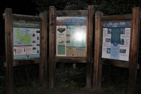
for when I came back to hike Belford & Oxford.
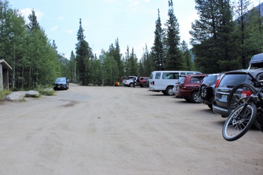
There were 3 cars in the parking lot and a vault toilet,
which wasn’t too bad as far as trailhead restrooms are concerned (but not great
either).
I tried to pull up the GPX file of the hike, but I didn’t
have service, so while I could see the route, I couldn’t see where I was on
it. Oh well, this didn’t look like a
hike that needed much route finding. (note, although I tried about every
quarter mile, I wasn’t able to load it until I made it to the summit, at which
point it wasn’t really necessary, but I thought it odd it followed me the
entire way down, even though I didn’t have service? Maybe I need to load it before leaving home
so it can follow me when I arrive?)
I gathered my gear and was off, super excited to see signs
that indicated I was at the right trailhead (but confused a bit as to why
Missouri Mountain was on the map but didn’t show a trail?)
In any event I was off to cross the river and begin the
switchbacks up the hill.
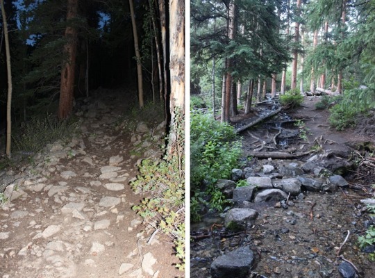
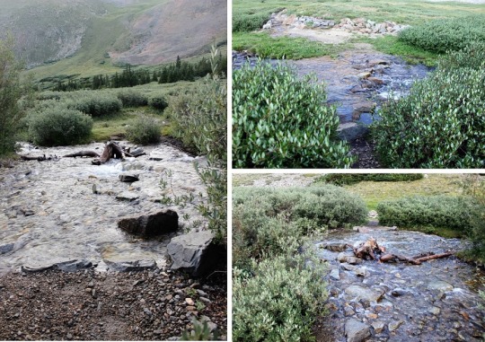
I crossed several streams in the early morning light
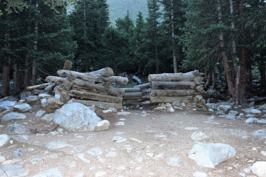
And came across an a old cabin (woohoo! This meant I was on the right trail).
Next I came up above treeline and crossed several more
streams along the gulch.
At about this point I had someone pass me. Well, we talked for a bit and parted ways (he
was taking the Belford Route). He
remembered me from last month hiking Mt Yale.
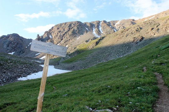
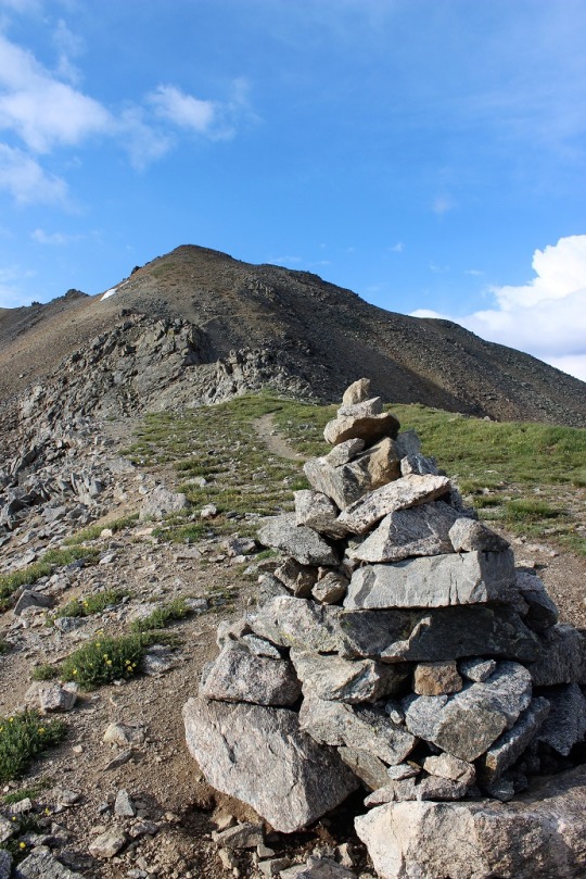
Want to know what I really loved about this route? The SIGNS at the junctions!

Here you can see Mt. Belford to the left, and Missouri
Mountain to the right
The trail was also pretty well maintained.
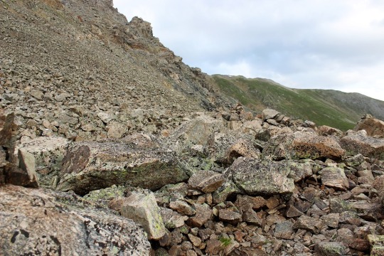
After the junction from Elkhead Pass/Missouri Mountain I
came to a boulder field. This was actually really easy to navigate as it had a
rock trail the entire way. Cairns weren’t
needed (although there were a few, I’m guessing for the snow route).
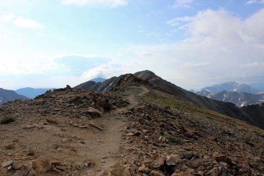
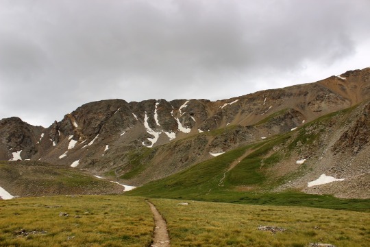
I made it to the saddle
And got to walk along the ridge to make it to the summit
(there were 2 false summits first). I
always love walking along ridges! This
one had a bit of exposure though…
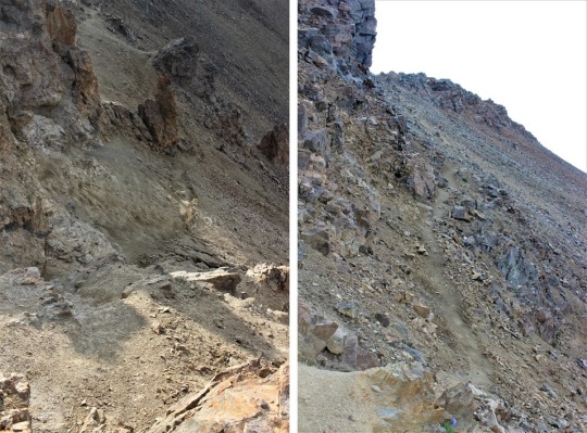
Just before the final push this hike became a (fun)
difficult class 2. Basically there was a
lot of scree and the trail wasn’t there anymore, but you needed to climb down
then back up and over the rocks. I loved this! If this is “difficult class 2” I’m
in!

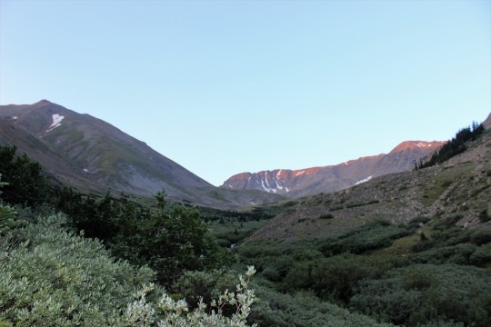
It was cold when I summited, and I could see clouds all
around. It was obvious it was snowing on
some of the peaks, but where I was standing?
Lots of SUN! I was surrounded by
sunlight! This was the PERFECT mountain
to climb today! I smiled at my good luck
and took a summit photo.
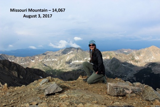
I found the summit marker (it was hard to miss)

And too some scenery shots.
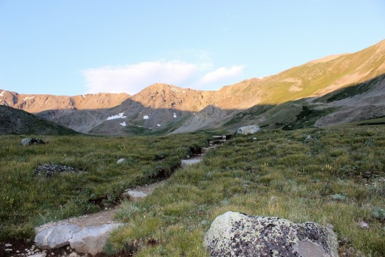
Here’s the way I approached along the ridge

And here’s a picture looking back at of most of the trail to
the summit

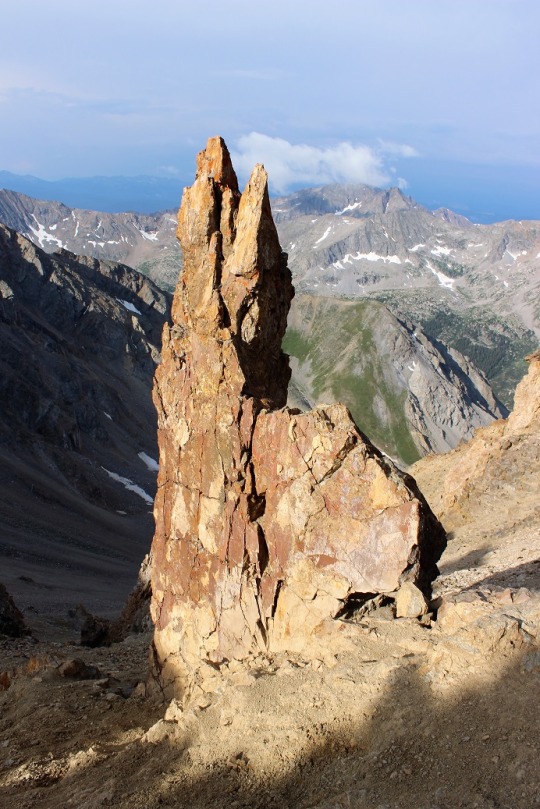
This rock formation is pretty cool, especially considering
it was right I the middle of the trail and I had to scuttle around it to
summit, and if I slipped I’d pretty much slide all the way down this hillside…
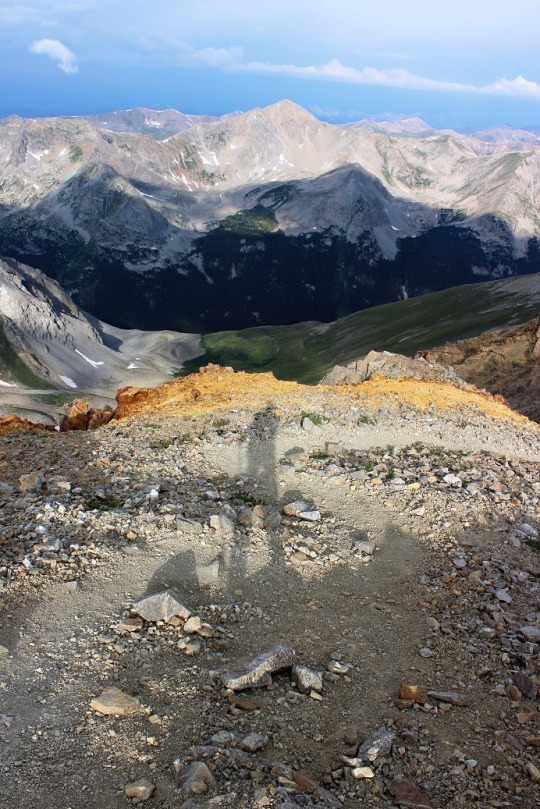
I took a shadow selfie of the amazing view and was on my way
back down the mountain.
As I walked along the ridge I saw three sets of hikers, the
first people I’d seen since leaving that guy at the junction.
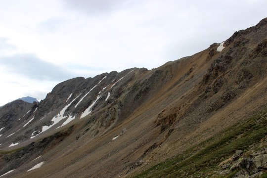
As I descended the trail I took a picture of Missouri
Mountain and all it’s scree (which I luckily avoided). The summit is in the middle of this picture.
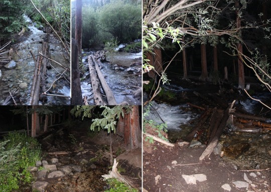
I took some pictures of the trail on the way back down
And some of the water.
There was a lot of water on this hike!

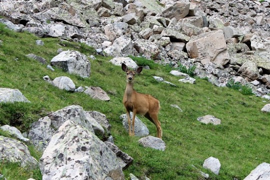
I saw a deer (the only wildlife besides marmots and pikas)
And lots of waterfalls!
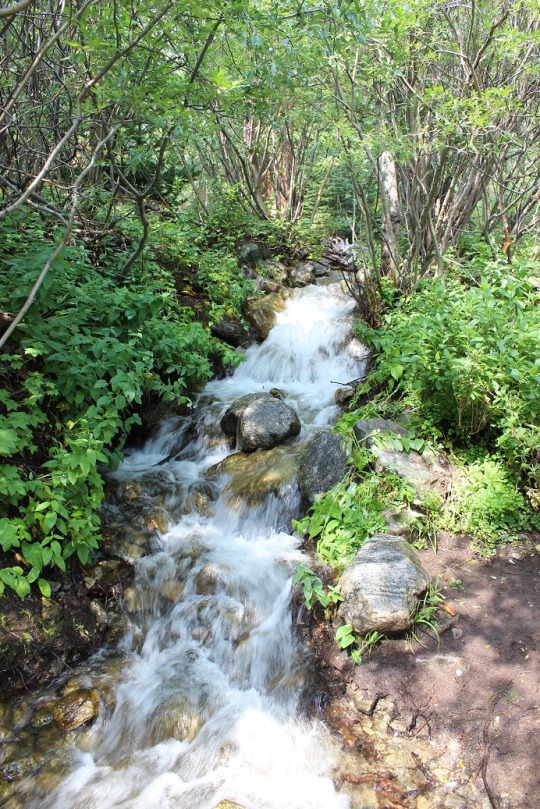
Here’s a daylight picture of the stream at the beginning of
the trail.

And the trailhead parking lot (easy 2WD lot)
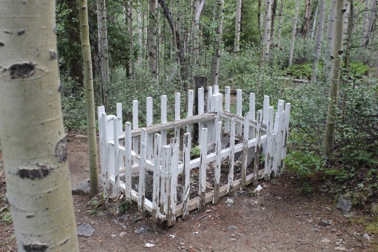
Something I hadn’t noticed on the way up (because it was
dark) there was a grave near the beginning of the trail. It was from the 1870s, and the headstone
indicated a 1 month old baby had died of pneumonia and been buried there. Side note:
the Vicksburg Cemetery is adjacent to this property. No, not the one in Mississippi, but there is
a museum and a cemetery to check out at a later date.
This hike was 10.5 miles, with 4500’ of elevation gain. I did it at a leisurely pace, finishing in
5.5 hours. This hike was easy to
navigate, fun, beautiful, and the perfect hike to take today! I’d do this one again.
View from the summit:
