This is the most fun I’ve ever had climbing a 14er! This hike is the hike I’ve been waiting for,
I just didn’t know it meant I’d need to hike a class 3 to get it.
I have a very Type A personality, so I do a lot of research
before going out on a hike. I usually
have no less than 3 maps (one on my phone and one in my backpack, another in my
pocket) a compass and altimeter on my phone and a manual one in my daypack, and
multiple versions of directions/checkpoints (including a GPS).
I’ve been trying to do this hike for a while now, as I
thought I was “ready” for a class 3, but the weather and my schedule wasn’t
cooperating, so it got pushed back. Last
night when I looked at the weather it said 30% chance of showers until 1pm and
winds at 9-13mph. That was by far the
best forecast I’d seen on a day I was able to hike, so I chose this one for
today (that and the forecast for Tour de Massive called for snow today, so that
was out).
My research told me the Longs Peak Trailhead fills up FAST
on weekends, and if I wasn’t there by 3am I might as well forget it. This is Labor Day weekend so I woke up after
a quick nap at midnight and drove to the trailhead. I’m not a fan of crowds, especially when I’m
hiking. It’s totally worth it to me to
wake up early to avoid seeing dozens of people on the trail. Not to mention I knew some parts of this
trail got bottlenecks when there were too many people hiking. I didn’t want to experience that.
When I got there at 2:45am there were about 10 cars in a 50
car lot. Did I mention it’s a Friday on
Labor Day weekend? This was not what I’d
expected, but I was pleasantly surprised.
The weather was warm (about 60 degrees) and it looked like I wouldn’t
run into too many people on this well trafficked route. This was turning out to be a wonderful hike,
and it hadn’t even started!
I got my gear out of my truck and was on the trail by
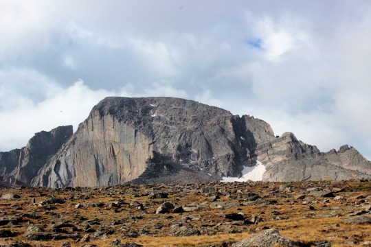
3am. I hiked all the way to the Keyhole
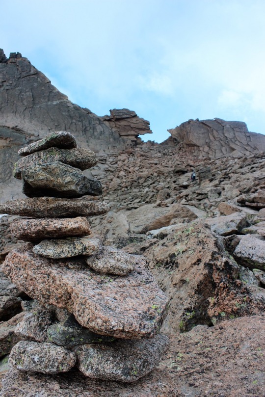
in the dark, so the only picture I have is this one from just above
treeline.

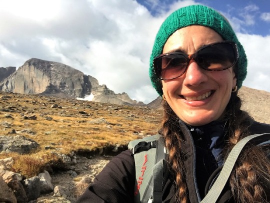
Much of this hike is above treeline. I have pictures to share but that will have
to come later in the post as I took them on the way back down in the
sunlight.
As soon as I hit treeline the wind picked up and the
temperature dropped. The wind was icy,
and not the 9-13mph winds as predicted, but 30mph+ gusts of cold air that took
forever to pass. I was miserable, and
put on my snow gloves and hat. Twice it
almost knocked me over and I had to brace myself on a rock.
All of my directions were great, but in the end not really
needed. The trail was heavily marked
with new signs all the way to the boulder field. I kept checking my GPS just in case, but I
was always right on route.
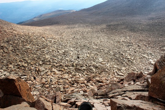
Until I hit the Boulder Field. This is where things got iffy. You see, I was hiking faster than I’d thought
I’d hike, and I’d made it there when it was still about an hour from
daylight. The trail kind of ended and I wasn’t
sure what to do. I knew I was supposed
to walk towards the Keyhole, but in the blackness I didn’t know where exactly
it was (or where I was in the boulder field for that matter). By this point I’d passed everyone else on the
trail (I knew this because I couldn’t see any more flashlights shining in front
of me) and those behind me chose to sit and wait for daylight. That was going to be over an hour away and I
didn’t want to wait that long.
I looked around for some cairns. It took a good 5 minutes, but I found one! Lucky me!
I hiked toward it, stopped, and looked for another one. I kept doing this and one by one they led me
to the campsites in the Boulder Field.
Everyone was still asleep. I
continued on, and soon I could see enough to tell I was at the base of the
Keyhole, so I just climbed up towards it and through to the other side. That was much easier than I’d
anticipated. And I’d done it in the
dark!
This is where the hike got REALLY FUN!!!
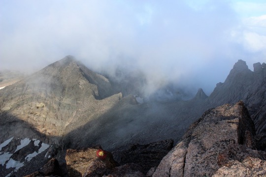
The wind died down a bit, but now I was surrounded in
clouds. This ended up being a good thing
because it minimized my perceived exposure.
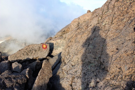
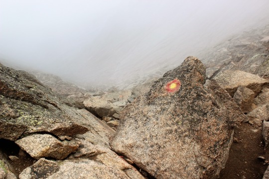
I put on my helmet, looked left, pointed my flashlight, and followed the
bullseyes. This was surprisingly
simple. I’m all about LNT, but I’m sure
these bullseyes have saved lives.
About 10 minutes after passing the Keyhole the sun had risen
enough for me to turn off my flashlight, which was a good thing because I
needed two hands to scramble on the rocks.
There were a few really tough places, but mainly because of my
height. I’m about 5’4” but I really
could have used 2-4 inches of height to climb in many areas, but I found if I
stopped and looked around, sometimes I could find footholds behind me to help
me out.
The part of the hike that was stated as the most difficult, “the
trough” was actually where I found the most satisfaction: I was so ready for this climb! My upper body strength was way better than I’d
anticipated, I didn’t need to stop to catch my breath/take breaks, and I was
being creative and learning with my climbing.
And I was doing it! Yes, there
were bullseyes to point the way, but I was doing this on my own, without
someone there to help me (and felt confident with my directions I could have
navigated through the trough). I was
climbing a class 3!
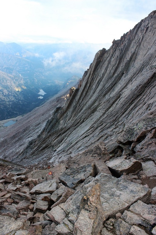
The narrows weren’t scary or difficult, but I also had cloud
cover blocking the drop, so I’m a bit biased.
The Homestretch loomed before me and I took a deep
breath. It looked just like the picture
I’d seen online, but being here in person I could visibly pick a line and just
go with it. So I did. I didn’t follow the bullseyes here, but the
route I felt most comfortable climbing. I
just have to say, I was so lucky I had decent weather today. In no way could I have done this if it had
been raining (look at pictures to come).
It would have been a waterslide the entire way down and I don’t mean
that in a good way! I have great hiking
shoes, but rock climbing shoes would really have been helpful here. When my shoes got wet they slipped on the
granite.
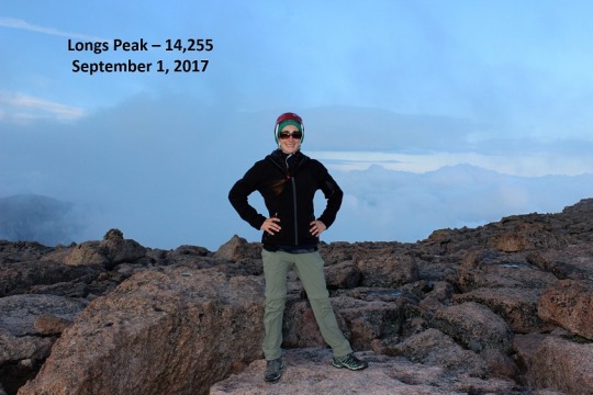
I kept putting one foot in front of the other, and before I
knew it, I was on the summit! I was
immediately overwhelmed. You know that
feeling you get when you’re so happy you want to cry and you start taking
really quick-deep breaths and your heartbeat races and your eyes start to tear
up? That’s what happened to me (all
except the eyes tearing up part). I was
overcome with emotion, and immediately on cloud 9! I’d done it!
I’d actually done it! For the
first time I’d climbed a class 3, and I’d done it all by myself, without
someone to follow or help me along. I was the first one to summit that day (it
was 7:05am) and had the summit all to myself!
This was fan-freaking-tastic!!!
The only downside were the clouds: they were moving in and out and obscuring the
view. They were really cool to watch
though.

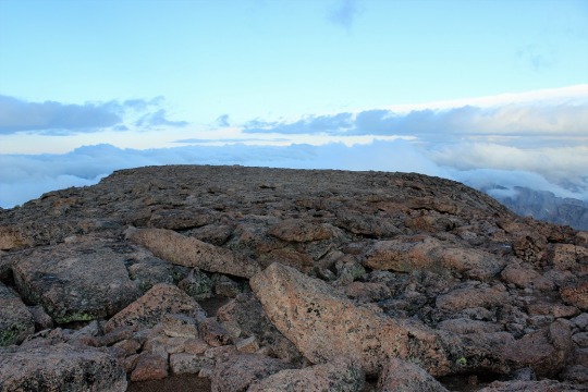
I was surprised at how flat the summit was.
I took some pictures and got to thinking: I’d really wanted to do 2 summits today: Long’s Peak, and an unranked peak referred to
as Southeast Longs that was really close to where I was now, but required a
different route. It was my intention to
make this a loop, hiking up the Keyhole route and down the Loft route. However, it’s not much fun to hike in the
dark. All you see are the shadows cast
from your flashlight, and those can be a bit scary. I wanted to see what I’d missed seeing on my
hike up. I’d seriously enjoyed this
hike, but I didn’t have any pictures to show for the places I’d been because I’d
hiked them in the dark. In my excitement
I decided I’d enjoyed this hike so much I’d come back and do Southeast Longs on
another trip, going up via the Loft route.
In other words, I was going back down the way I’d came.
I didn’t want to stay too long on the summit so I gathered
up my stuff and headed back down. I knew
I’d only completed half of the climb. I’d
need hike down what I’d climbed up. Here
are the pictures from the way down:
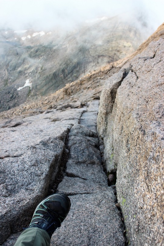
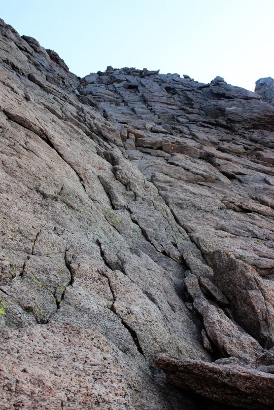
Here’s the homestretch
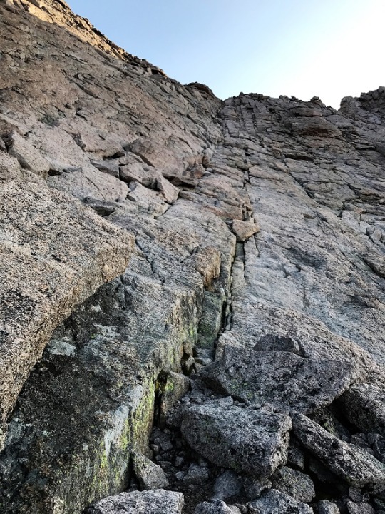
And the narrows

The exposure was blocked by clouds for parts of the route

Shadowselfie (because I do that kind of thing)
I didn’t see anyone until I was on my way down the narrows,
and no one I saw had a helmet. This
disappointed me. It was really easy to
accidentally kick loose rocks onto climbers below. It would suck to get hit in the head with one
of those rolling rocks!
The trough was really exciting!


When I hit the Keyhole the sun came out through the clouds
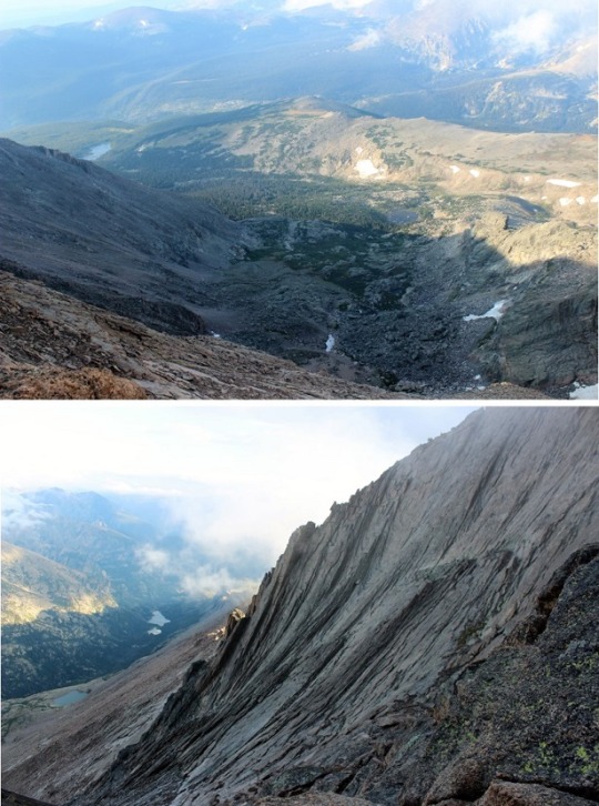
and I was able to see the Boulder Field. Holy Smokes!
I’d hiked through that in the dark?
How did I EVER find my way?
As I climbed down I realized something that made me
laugh: There were cairns EVERYWHERE with
no particular purpose. Throughout the
Boulder Field, dozens, if not hundreds of cairns had been placed in obscure
positions, as if someone just had a hobby of making cairns. This morning I’d followed one cairn to the
next and eventually they led me to the Keyhole, but in reality they shouldn’t
have! I must have been looking in the
direction I thought the Keyhole should be, and found cairns to validate my
theory.
I passed the tent sites in the Boulder Field, which are
really just large areas surrounded by rocks to break the wind. There’s a bivy here too.

The Boulder Field seemed to go on forever. I kept looking back to get a picture of Longs
Peak, but it was constantly surrounded with clouds.

That is, until I was just about to the place where I’d lose
site of the mountain. That’s when the
clouds lifted and Long’s Peak waved goodbye.
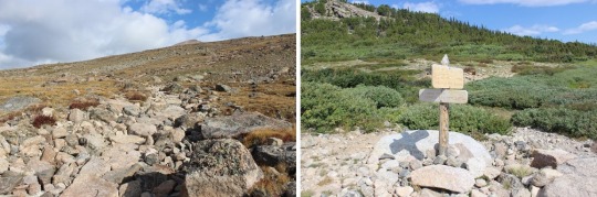
The trail from the Boulder Field back down was very well
maintained.
This is my absolute favorite 14er hike ever! I felt my abilities perfectly matched the
mountain. I was challenged just enough,
and in shape to handle the physical challenges.
If you’re reading this and wondering if you are personally
ready to hike this mountain, please don’t take my above narrative as making it
sound easy, because it wasn’t. I’ve been
training years to complete this type of a hike.
I’m not trying to brag here, or compare myself to the amazingness of
trail runners (who are pretty much trail gods BTW, move over for them because
they are awesome!!!), but I’ve been running 5-10 miles a day with a minimum of
4000’ of elevation gain every day for the past 8 years. Every day. No breaks (unless I’m hiking a
14er, and I’ve been known to hit the gym after one like Bierdstadt or Evans). I also do an hour of Yoga a day, and this is
my 21st 14er this summer (33rd overall). I did the 26 mile route on Pikes Peak 12
times last summer. I’ve been training
both mentally and physically for years, and this hike fits me perfectly. It may not be the best hike for you,
especially if you don’t have a lot of experience. However, at this point, I want to hike more
class 3’s!
Oh, and for those of you keeping tally, I started at 3am,
summited at 7:05am, and was back down at my truck by 11am. I asked the park rangers there how long they
thought the trail was (because I’ve seen it listed as anywhere from 14.5-16
miles) and they said 15 miles. So I did
15 miles, with 5100’ elevation gain, in 8 hours. This includes stopping to take lots and lots
of pictures and stopping to talk with everyone I passed on the way down to make
sure they were doing ok.
360 of the summit

There is a saying that says “Wherever you are; be all there.” Your writings and pictorials say just that .
LikeLike