RT Length: 12+ miles
Elevation Gain: 3400’
Notes: Bring your
sense of adventure and a helmet!
This hike was really pretty awesome! Each time I go out looking for a bit more of
a challenge, and today I found it!
Tuckaway Mountain is listed in the Pikes Peak Atlas, but there is no established
(or even mildly established) trail to the summit. The hike is long, the summit a class 3 scramble
(at least). It really is Tucked Away, and takes a long trail through North Cheyenne Canyon to reach.
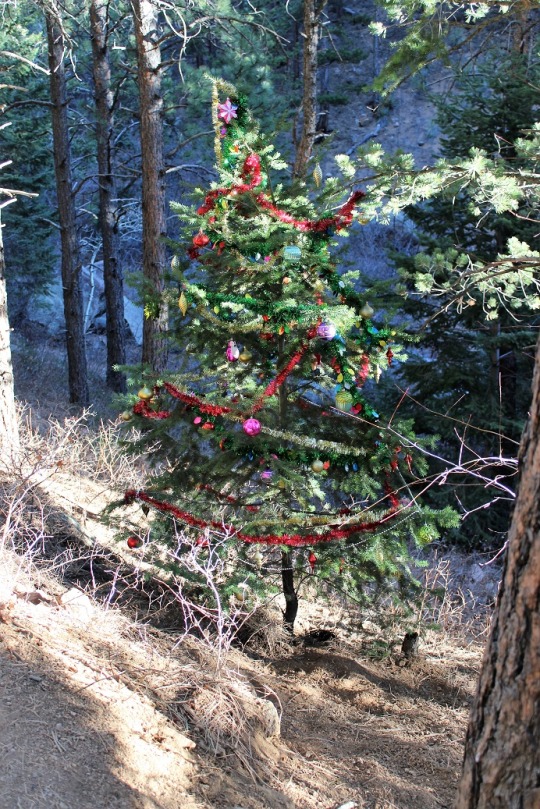
I started this hike at 7:45am at the 7 Bridges Trail parking
lot. Around the 2nd bridge I
saw a decorated Christmas Tree that wasn’t there two days ago when I hiked this
part of the trail to summit Mt Garfield and Mt Arthur. The tree immediately
brought a smile to my face, and then my next thought was “I hope whoever put
this here takes it down as well” LNT and
all.
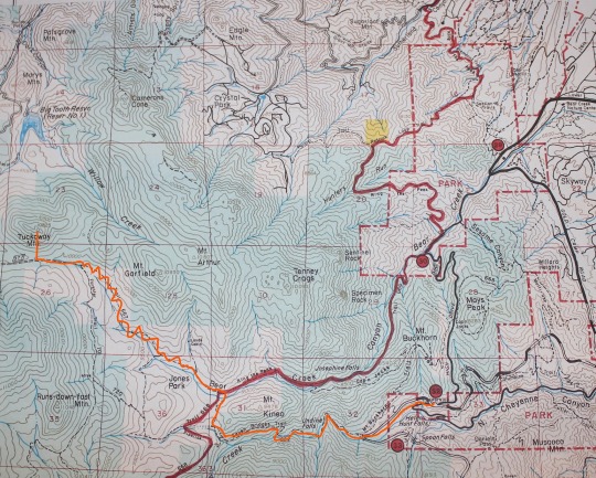
I followed the 7 Bridges Trail to the junction and turned left
onto 667. I stayed on this trail until
it ran into trail 377. This seemed to
take a really long time, probably because of all the switchbacks! My map didn’t mention those, so I put them in
where they’re missing. They go on
forever!
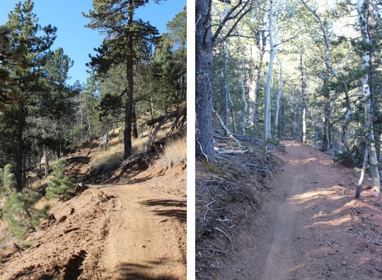
This trail is newly renovated, and seems to cater to
motorcyclists/mountain bikers. I didn’t
see one hiker on this trail all day, but saw 1 group of motorcyclists and 2
groups of bicyclists. They all seemed
surprised to see me.
The wind started picking up around 9500’ and I was glad I’d
chosen to stay below treeline today. Looking
at the topo map I thought once I was close to Tuckaway Mountain the hike would
be easy, but I was wrong. First off, the
mountain was extremely difficult to see, even though it’s late in the
fall. Secondly, it was covered in
rocks!
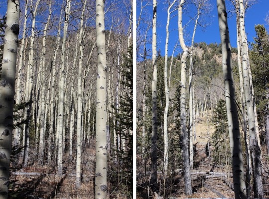
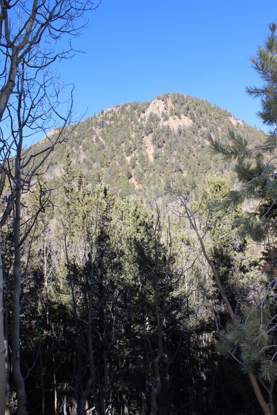
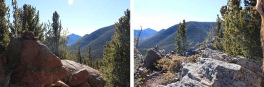
Once I made it to the area directly in front of the mountain
I turned right/north. This is what I
saw:
I decided my best course of action was to really study the mountain,
pick my route, and head up. The entire base
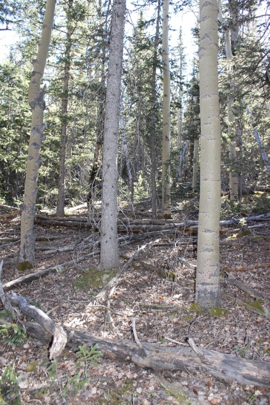
was covered in Aspens, making it difficult to tell where I was going. I didn’t
want to get stuck at a rock outcropping.

I chose to summit to the east to avoid the large
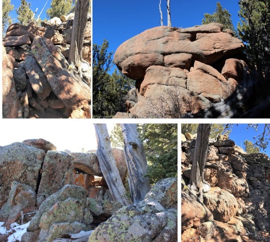
outcroppings, but in reality, you can’t avoid them all. There is no established trail to the top of
Tuckaway Mountain: no trail, no cairns,
nothing. I did some major scrambling,
involving all hands and feet at once, as well as some intuition and luck! The rocks weren’t stable, and even the big
ones rolled when I touched them. Where
there weren’t rocks there was scree, and very slippery terrain.

Since I was basically bushwhacking and I couldn’t see the summit
through the trees, I kept stopping every 20 feet or so to look back behind
me. I kept this sandy area in my sights
for my return trip back down.
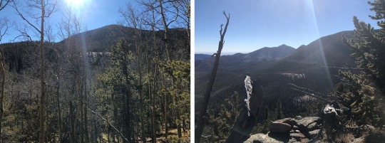
I summited at 10:45am, to a bunch of rocks! The summit was rather long and irregularly
shaped, full of trees, and lots of rocks to scramble on.
I took a bunch of photos from all around the mountain, just because
I could, and to show where it’s located in relation to the other peaks in the
area.

Next came the fun part:
heading back down. The trek up
was challenging, and so was the trek back down.
I had to be careful with my footing.
I spent a lot of time lowering my center of gravity and getting stuck
with needles and thorns. My gloves were ripped
in places and covered in yellow Aspen dust by the end. Just an FYI:
pine needles are slippery… avoid patches of pine needles. By the time I’d made it down I was COVERED in
dirt. I really looked like I’d worked
for that summit!
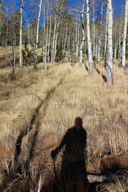
I made it back down to the Aspen grove and was able to find
trail 377 to lead me back. The trek back
seemed a lot longer than the trek in (which seemed long to begin with… I’m thinking
it may be more than 12 miles total now that all the switchbacks are there…). It was mostly downhill, but those switchbacks
went on forever! When I made it to the 7
falls area it was PACKED with people! I
was surprised to see so many families lining the trails. And I mean families! Most groups had over 10 people, over half of
them under 10 years old, most younger than that. It was great to see so many young families
out enjoying the trails, but it was frustrating trying to pass the large groups
who were (understandably) going slow. Gold
Camp Road was full of strollers. The
parking lot that had 6 cars in it when I arrived was overflowing with at least
100 cars: people were parking down at
Helen Hunt falls and walking up! I was
really glad I’d gotten an early start on such a popular hiking day.
I made it back down to the trailhead at 2pm, making this 12+mile hike with 2400′ elevation gain in 6 hours, 20 min (with a lot of summit time!)

FYI, the true summit of Tuckaway is a 5.3 boulder problem on the western edge of the contour. I had to go back up again after John Kirk hand leveled it to be higher.
LikeLike
This is great information! Back when I did this one the only info I had to go on was my Pikes Peak Atlas and altimeter. Did you need ropes for the 5.3 boulder, or was it manageable without?
LikeLike
Don’t think I remember this hike of Yours.I’m not a real fan of trying to hike past and around family hikers because they seem to amble when I have a set pace for my own personal goals.
LikeLike