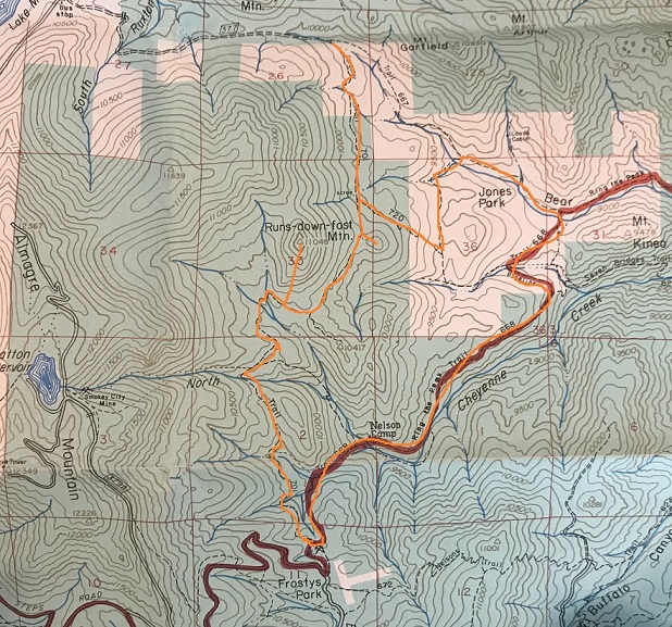
The last time I tried to summit this mountain I was unsuccessful (https://wildwandererlmc.wordpress.com/2017/12/09/north-cheyenne-canyon/ ) mainly because the trails had changed. The forest service had actually destroyed some trails, created new switchbacks and connections for others.
I met Tim at 7:30am and we drove the 13 miles of dirt that is Old Stage and Gold Camp Road. This time instead of hiking in through North Cheyenne Canyon and the 7 Falls trail we hiked in from Frosty’s Park.
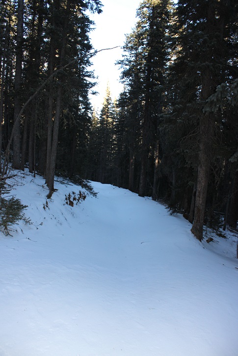
It had snowed 3 days ago, but it was obvious no one had been in the area since. We were making the first tracks. There were a couple of frozen river crossings, but the Tundra did just fine.
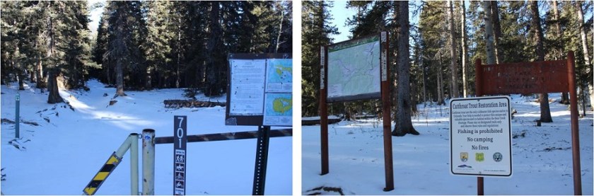
We started at the 701 Trailhead at 8:40am, intent on hiking to Runs-Down-Fast Mountain.
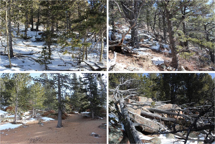
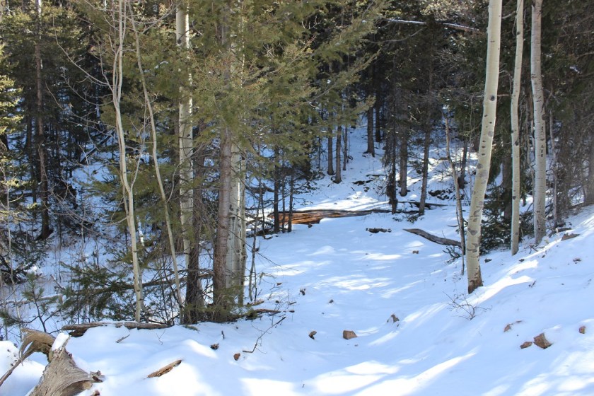
This trail too was undisturbed. It was really cool to be breaking trail in 2-4 inches of powdered snow!
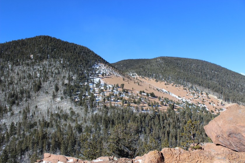
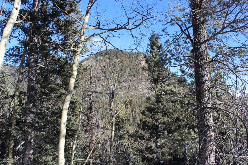
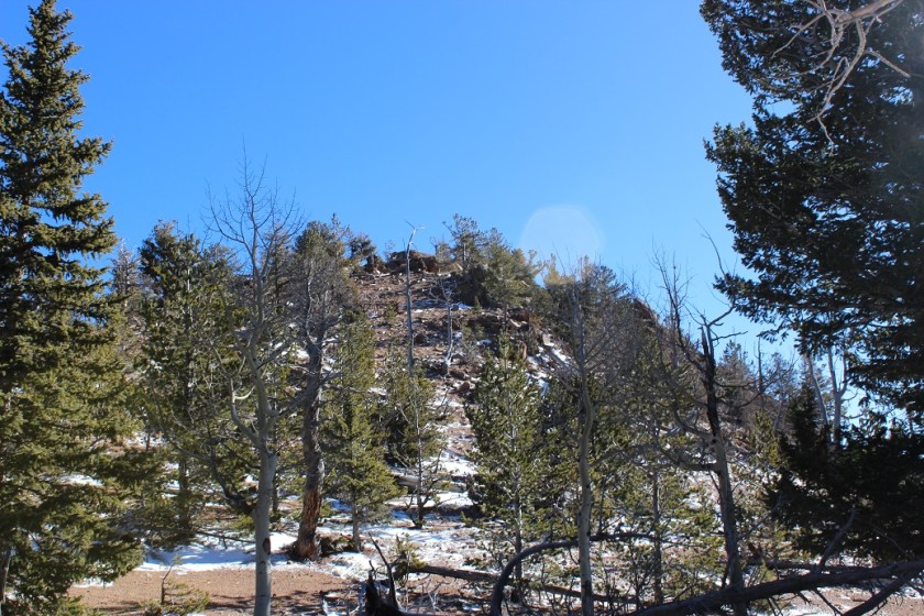
After hiking for about 2 miles we were able to see Runs-Down-Fast Mountain through the trees. Kind of. The area was densely treed and it was difficult to see any mountain, but we were pretty sure this was it.
There’s no trail to the summit, so we just headed north through 600 feet in elevation containing a lot of downed trees, boulders, brush, and snow. And the wind! It was insane! Gusts were supposed to be 55mph, with sustained 25-35mph winds. They weren’t kidding!
We reached a false summit and then continued on for about 20 more yards. The view from the top was lacking, as the summit was heavily treed at 11,048’
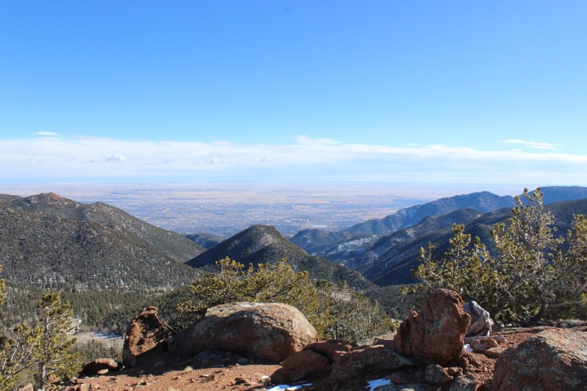
We walked around for a bit, and found an ok view from the north most part of the summit of Almagre. Pikes Peak was hidden in the clouds.

Since it was windy we didn’t stay long, but descended and once again found the 701 trail. I’d wanted to summit 2 or 3 more mountains, but with the recent snow the trails were hidden (or maybe they weren’t there at all?). We did see this plateau and decided it looked doable, so we headed up through the wind to its summit.
The slope up was all scree, but the good kind that is easy to find traction on. I tried to take a summit selfie but my camera kept getting knocked down by the wind!
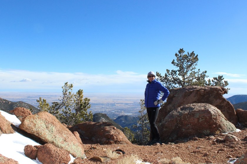
When Tim made it to the summit we tried again. The camera kept getting knocked around, but I think we got a pretty good shot!

The views were much better from this summit, even though it was about 600 feet lower than Runs Down Fast. This point has no name (or written elevation, but it’s 10,000+)
It was super windy here, so we headed back down to the trail again. I wanted to try and figure out where I’d gone wrong the last time I hiked this trail (I never did find Runs Down Fast last time) so we continued on the 701, looking for the 720. We hiked all the way to the 667 and never saw it, so we turned around and decided to look more carefully. Check it out! We found the destroyed trail! They’d ripped up perfectly healthy trees, roots and all, to try and hide the existing trail.
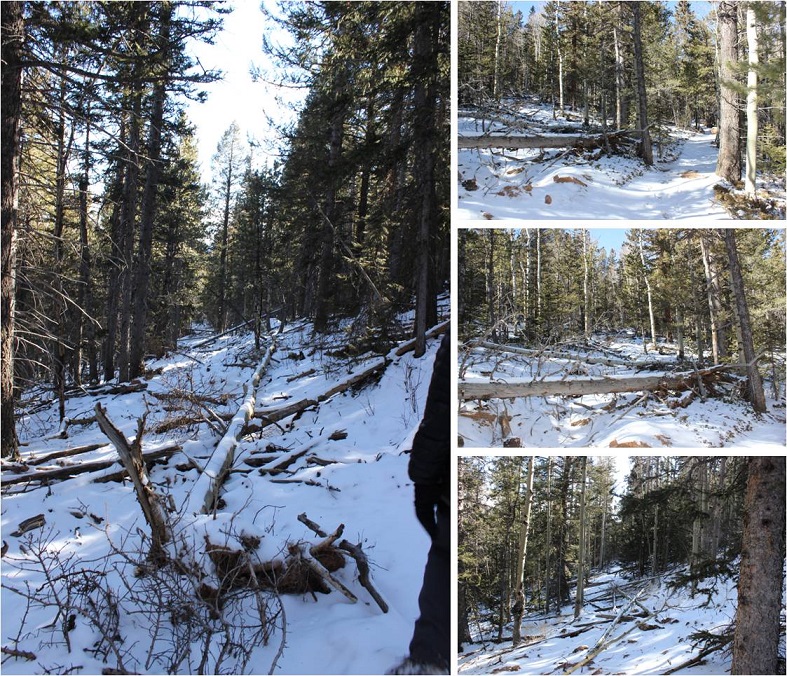
We followed the 720 for a while, but eventually hooked up with the 667 again, which brought us to the 668 and around. I was confused the entire time, mainly because we were below treeline and the route didn’t match my map. I was freezing by this point. It wasn’t lost on me we’d hiked in about 5 miles and would need to hike back 5 miles to get to the truck. My fingers were numb (but at least my feet were warm). The trail kept descending until it reached about 8500’ and followed the creek.
We hiked the 668 and Ring the Peak trail following the Cheyenne Creek. There was a lot of snow here too.

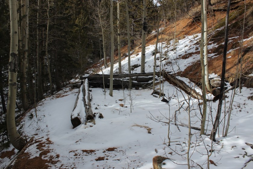
This is where the elevation started to climb rapidly. We’d descended about 2500’ and needed to make it up again to reach 10,500’ where the truck was parked. Most of that elevation gain was in about a mile and a half. We passed an old cabin
And for the last mile we followed Bobcat tracks! They were really neat to see, clearly marked in the snow, and proof of wildlife. Unfortunately they were headed in the direction opposite of where I was headed, but I was able to follow them almost the entire way back.

The elevation kept getting steeper, so Tim and I separated for the rest of the hike. He said he’d just follow my tracks in the snow. Right about now it started to snow again. Not a heavy snow, but more of a sprinkling of glitter in the air. The wind had died down. It was quiet, calm, and peaceful. I was no longer cold, as my body was producing heat from hiking harder up the hill.
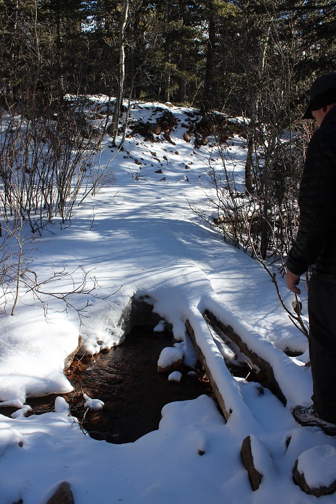
Take a look at this photo: It’s a stream crossing. Under that 2 inches of snow is another 2 inches of solid ice, spread out for about 20 feet. It was incredibly slippery, so I traversed around it and up the hillside. The one part of ice I couldn’t avoid sent me skidding for a bit, but I maintained my balance.

I made it back to the trailhead at 2:04pm. I’d say the hike was about 10 miles, with 3500’ of elevation gain total (up and down and up again).