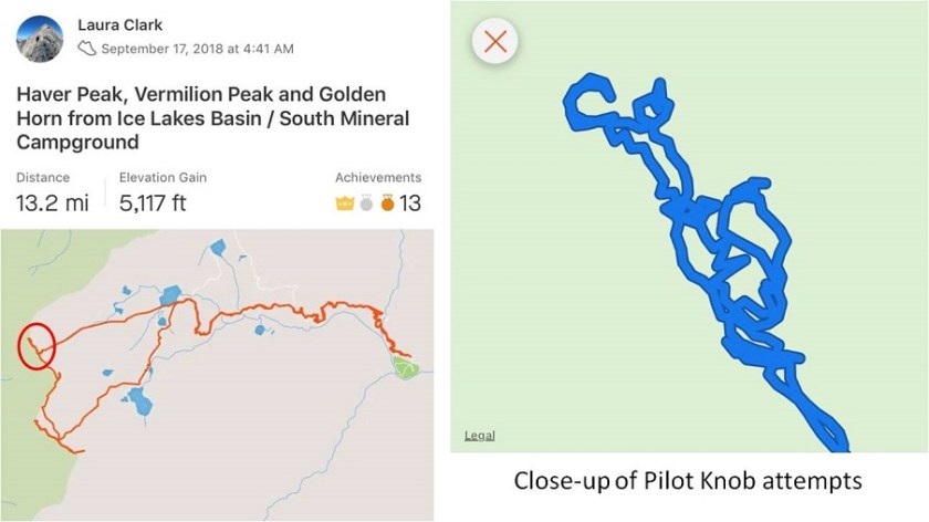
RT Length: 13.2 miles
Elevation Gain: 5117’
The weather all over Colorado has been fantastic all month (meaning sunshine like summertime). In fact, Colorado Springs has had more days over 90* this year than it has in over a century. This is pretty surprising for September, and I’ve been doing my best not to waste every opportunity to get outdoors and hike.
Many of Colorado’s 13ers are in the San Juans, which is a good 7 hour drive from my house. The distance makes it difficult for me to make it there on my Friday hiking days (because I usually need to be home by 3pm to pick up my daughter from school). So I promised myself whenever I had 2 days free in a row I’d head down to the San Juans for some hiking, and do my best to hit as many peaks as possible in those 2 days by camping at the trailheads. Earlier this month I hiked Pigeon and Turret in a day, and my plan had been to hike the a few more peaks the next day. That obviously didn’t happen, but I was going to try my plan again of jumping around and trailhead camping two days in a row when I could make it to the San Juans.
The opportunity came faster than I’d anticipated. I found out on a Thursday my entire office (it’s a small office) would be gone Monday and Tuesday the next week, so I’d be working from home. Oh, and Tuesday was my birthday! I looked at the weather forecast (sunny on Monday and 20% chance of rain after noon on Tuesday), and decided right then and there I was making a trip to the San Juans for my birthday. This didn’t give me long to plan my routes, etc. but I was determined to make it happen. Unfortunately there isn’t a lot of recent beta on this area, so I did as much research as I could and told myself I’d just have to wing it.
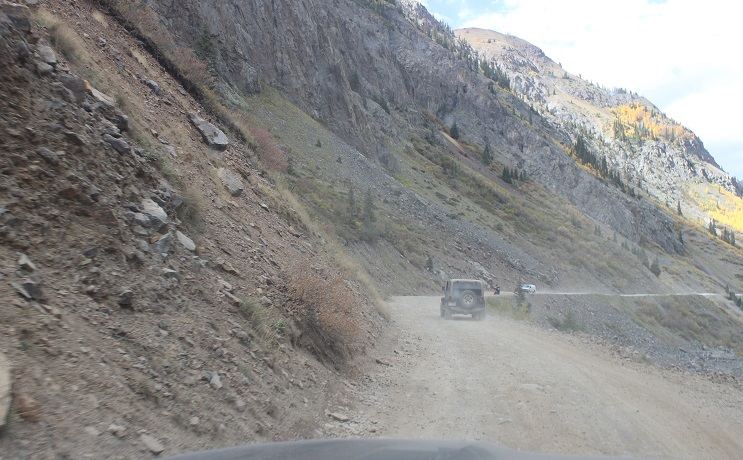
After tucking my kids in for bed I left my house on Sunday night around 8pm and made it to the trailhead earlier than anticipated (3:30am). The dirt road to South Mineral Campground is a 2WD dirt road, well maintained, and at the trailhead has room for about 20-30 vehicles.

Oh, and I’d seen no less than 7 porcupines waddling along the side of the 2WD dirt road in (not all in the same area). Drat: I’d forgotten my moth balls. Oh well, I’d have to cross my fingers this time. The moon was absent but the night sky was filled with millions of stars. I’d arrived early and because I wanted a good look at the basin in the daylight I decided to try and get in an hour nap before starting my hike. I was surprised at how well this worked. I closed my eyes and what seemed like a minute later my alarm rang, indicating it was time to get moving.
The trail starts on the west end of the parking lot. There’s a trail register to sign before heading out (one of the nicest and well kept registers I’ve ever seen at a trailhead). I started at 4:40am.
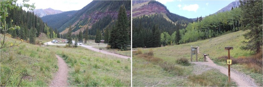
I took the Ice Lake Basin Approach, which is a very well maintained trail that crosses a small stream and switchbacks west. It looks like there’s been some recent trail overhaul and maintenance in the area, and even a shifting of much of the trail west, with lots of dead trees/branches covering the old trail. I was unable to find the 4WD parking area that’s been suggested as a possibility for shortening the hike in (I’ve also seen beta indicating this 4WD lot has been destroyed with “no parking” signs in the area now).

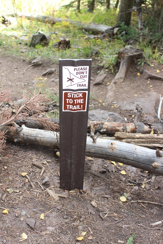
There were dozens of signs asking hikers not to cut trails.
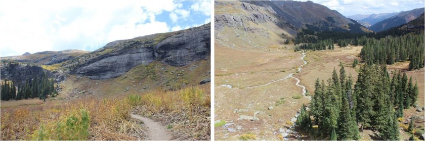
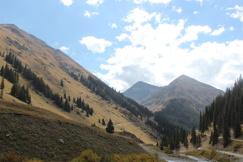
The trail was easy to follow all the way to the Ice Lakes Basin, gaining in elevation steadily.
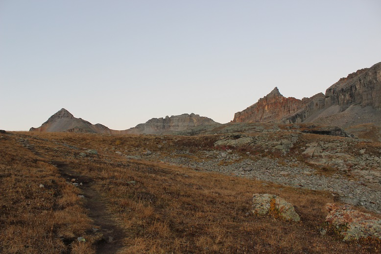
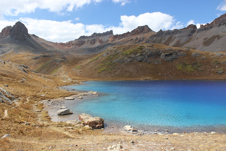
I made it to the Ice Lakes basin while the sun was beginning to rise.
Ice Lakes Basin:
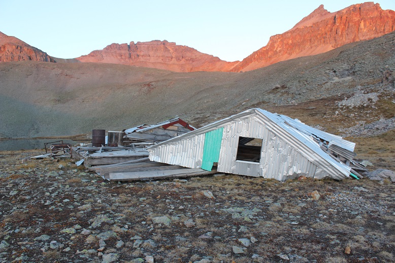
Instead of stopping at Ice Lake I took a quick picture from the trail and turned south and hiked to Fuller Lake. I wanted to see the lake and old cabin. Had I realized how blue those lakes were when I first passed them I’d have taken the time to explore more, but in the early morning light they weren’t yet impressive.

There was a trail the entire way to Fuller Lake.
What I wasn’t prepared for were the amazing reflections of the mountains on the water as the sun rose. Pictures do not do this area justice!


Unfortunately, the cabin has been destroyed, most likely by weather.
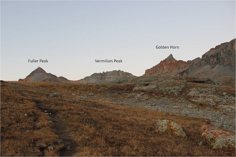
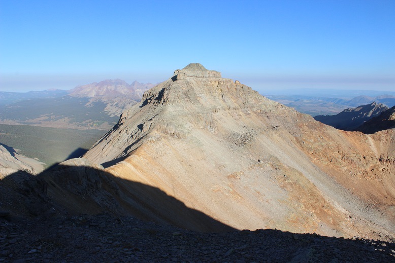
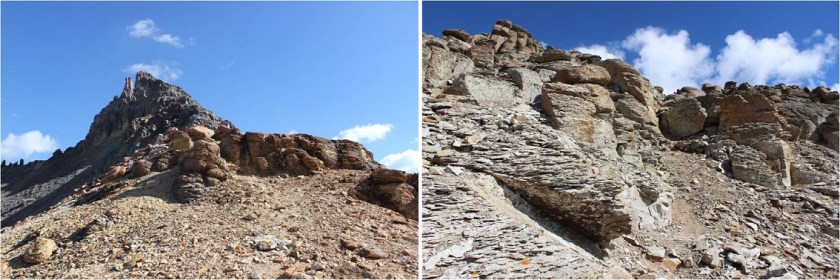
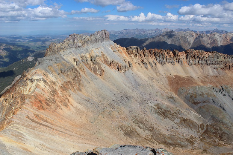
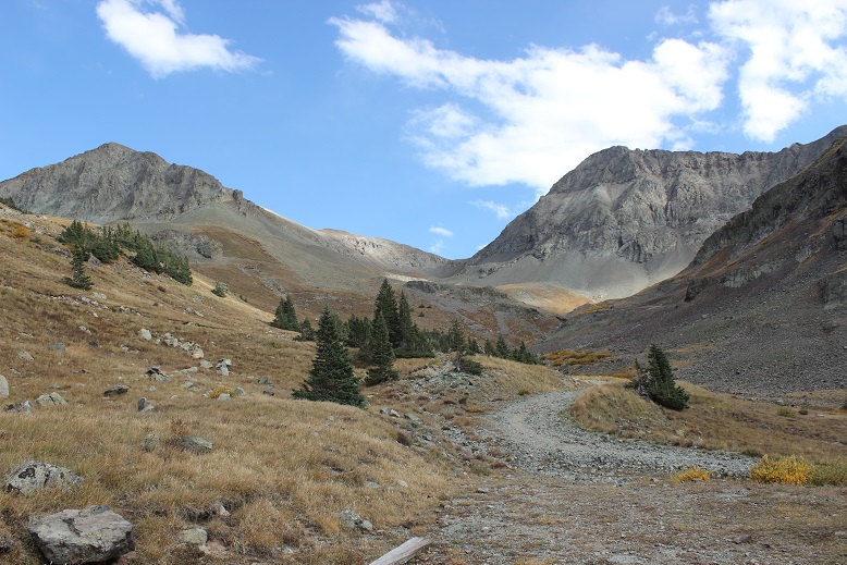
From here there was no trail for the rest of the hike. I could see Fuller Peak to the southeast, and hiked without a trail through the basin towards the saddle of Fuller and Vermilion.

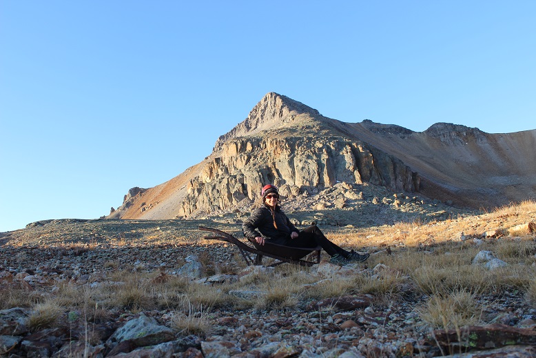
Along the way I saw an old wheelbarrow. Of course this meant a picture was necessary
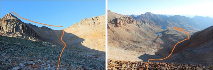
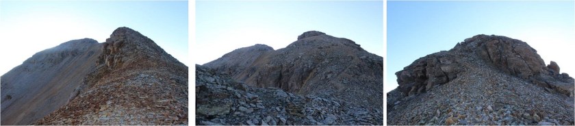
Here’s the route I took up to the saddle and over to Fuller Peak and a look back down the basin and the way I hiked in as seen from the saddle.
It’s steeper than it looks, and I was glad I was doing this part of the hike before the sun was too high in the sky. The rocks are semi loose talus. Annoying is what they are…
From the saddle turn left (southeast) and follow the ridge to the summit. It’s an easy class 2 hike with several small false summits.
The only downside was I was hiking directly towards the rising sun. It made seeing anything clearly impossible.
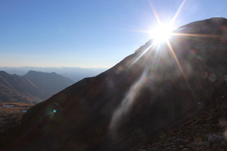
I made it to the summit of Fuller Peak at 8am
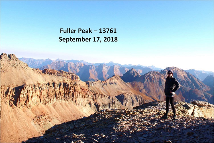
Fuller Peak:
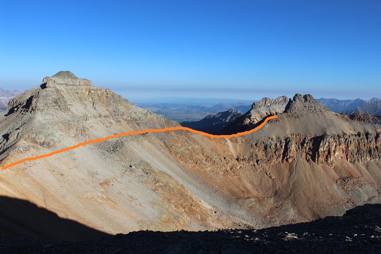
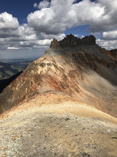
The views were amazing! I looked back at Vermilion and the route I needed to take to the summit. After returning to the Fuller/Vermilion saddle stick to the ridge
Here’s a view of the route from the saddle. Follow the ridge up and to the left
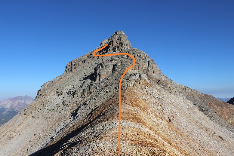
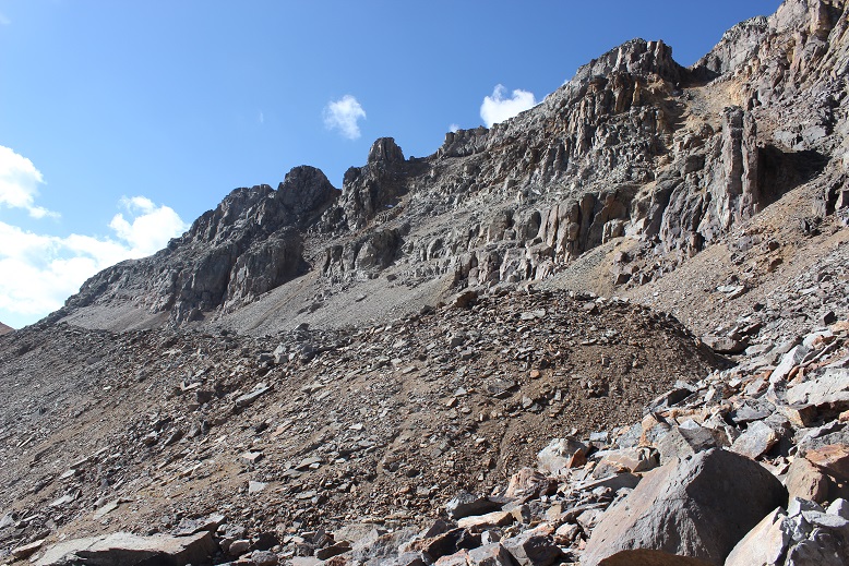
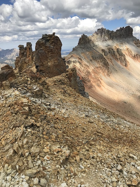
After you go left you’ll encounter a loose dirt gully. Climb the gully to the notch
At the top of the gully you’ll see two towers. Pass them to the left

And climb another gully

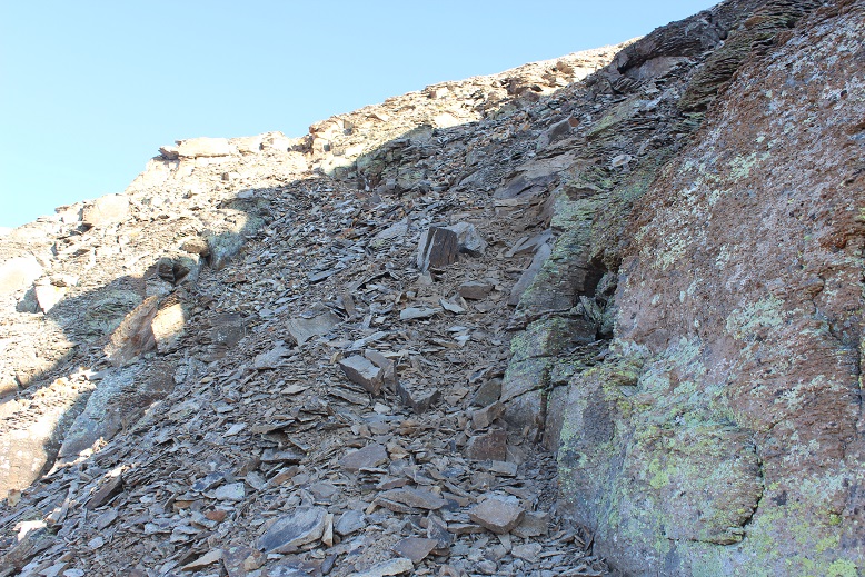
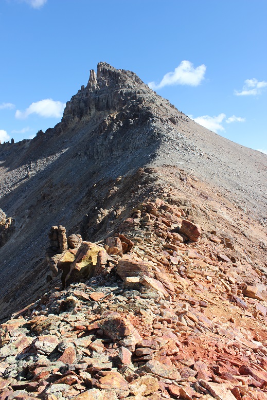
The gullies here seem to go down forever! (don’t worry, this isn’t the one I climbed, but one I wouldn’t want to fall down)
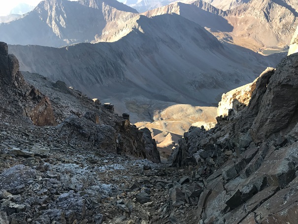
From here follow the rocks to the summit

I summited at 8:45am
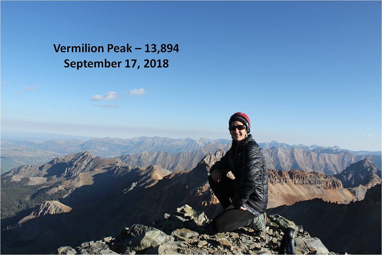
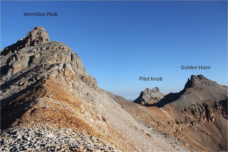
Vermilion:
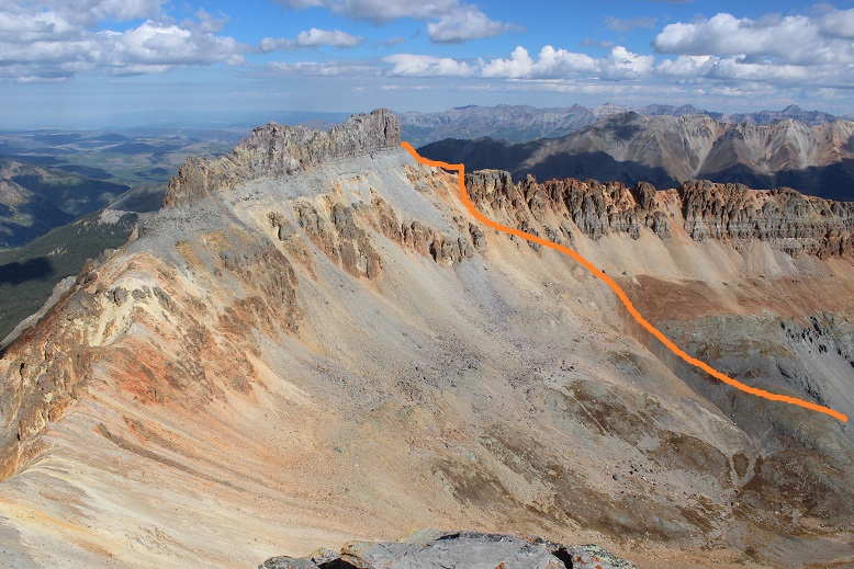
My next task was Golden Horn. I returned to the Fuller/Vermilion saddle and traversed the area on the northeast side of Vermilion between the cliffs and a scree ledge towards the Vermilion/Golden Horn Saddle. You’ll need to descend lower than you think you will. Follow this route (as seen from Fuller)
The scree & talus ledge is wider than it looks, with some large boulders thrown in. The rocks aren’t loose. Here’s a picture looking back from the Vermilion/Golden Horn Saddle
Here’s a look at the route from the saddle.
It’s a pretty straightforward climb, but about halfway up the ridge is when things get spicy. The scree intensifies and it can be difficult to find good footing. Luckily there’s not much exposure.
There aren’t any cairns but the route is obvious. There are two summits to Golden Horn. The summit register is on the summit to the west. Here’s a picture looking back at Vermilion
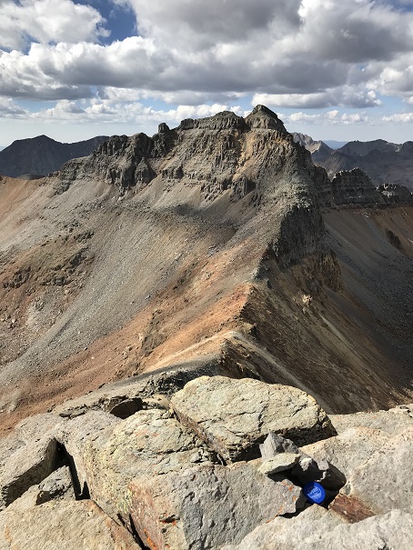
I summited at 10:15am
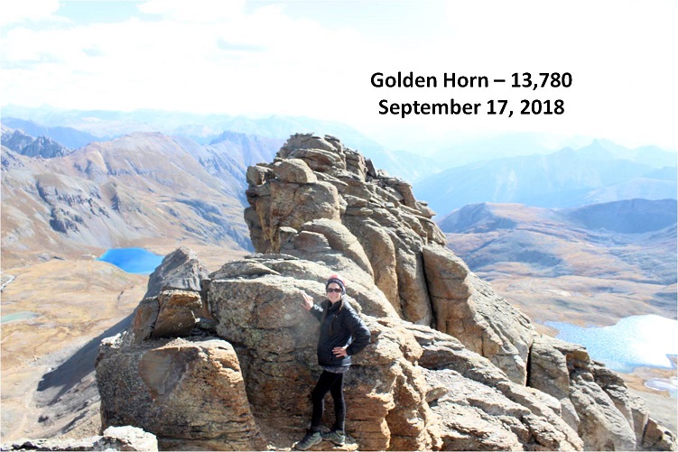
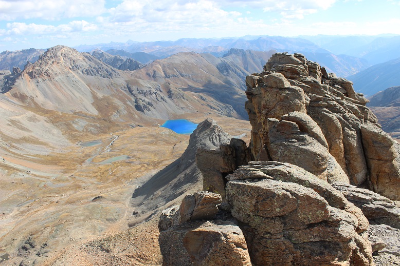
Golden Horn:
The views were amazing! I could see Ice Lake for the first time in the daylight and was immediately impressed: I had to make it down there!
My day had been going pretty good so far. It was still morning and I had the rest of the day ahead of me. The only thing that was troubling was the clouds creeping in. It was supposed to be sunny all day. There were way too many clouds for this forecast to be accurate. I had to keep an eye on the weather. I turned and looked northwest: Pilot Knob.
Hmmmm. It looked tempting. The only reservation I had (besides the weather) was beta. I had great information on Fuller, Vermilion, and Golden Horn, but there just wasn’t a lot of data out there on Pilot Knob. At least not much recent data. While planning this hike I’d been short on time and only planned on the three peaks I’d already summited. I mulled it over: I’d done some preliminary research on Pilot Knob (in fact, I’ve done enough on all the bicentennials to know which questions to ask, when I’d like to summit them, which routes I want to take, etc.). I knew I was supposed to summit Pilot Knob from the south and west face, looking for a chimney that would lead to a scramble to the ridge, and there was a crux I really wanted to get a first hand look at (a crack traverse/climb near the summit). Even though you summit from the south the approach is usually to the north (and I was south).
Trip reports last time I checked were few and far between, with the newest being 3 years old. The best beta was years before that. You were supposed to approach from the north and traverse southwest before summiting from the south/west, and I was on the south. I figured I could probably summit today, so I decided to descend Golden Horn the way I’d come by heading back to the Vermilion/Golden Horn saddle and look for a route over to Pilot Knob.
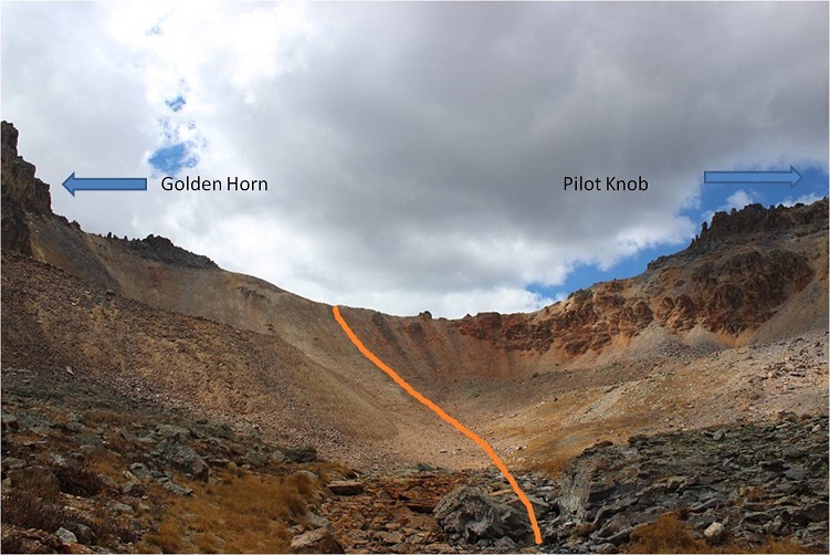
From the saddle I traversed west to the Golden Horn/Pilot Knob saddle.

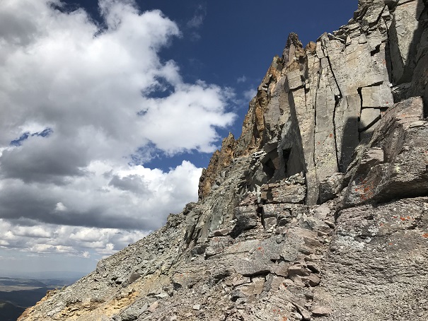
The first part (before getting to the saddle) was a fun, difficult class 2 scramble. It was the most intense scrambling of the day so far. If you stick to the ridge you’ll do fine.
Here’s a look from the Golden Horn/Pilot Knob saddle, looking up at Pilot Knob
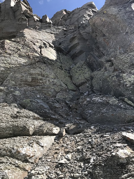
I kept watching those clouds. They were starting to bug me, blowing in and around with what looked like deep blue, rain filled centers. I made it up the ridge of Pilot Knob, and navigated to the southwest to look for a chimney that would lead me towards the summit. Instead I quickly encountered a very loose and scary talus filled gully.
It was obvious several large rock slides have occurred in the area since the last trip report. Many previous trip reports indicated a “well cairned route”. I didn’t see a single cairn, but there had been so many slides in the area they could have been destroyed by one. OK, back to the loose talus. This was unlike anything I’ve ever seen: I’d step on it and a 5 foot wide avalanche of rock would give way, tumbling down below me and gaining speed and larger boulders as it went. The first time it happened it startled me. Two steps later when it happened again I was seriously scared I was going to fall with it and braced myself: unfortunately there was nothing to grab onto.

I knew there was no way I could safely traverse any further west, but I needed to in order to find that rock wall. OK, so this wasn’t going to happen. Maybe I’d accidentally missed the rock wall I was supposed to climb? I’d just turn back and try again. It took me quite a while to backtrack to where I’d started on the south side of Pilot Knob: I was seriously scared I’d fall in an avalanche of talus with every step, but I made it back and decided to try again, thinking to myself traversing the area would be achievable and much safer in winter/spring with consolidated snow and crampons rather than all this talus/scree.
I just needed to gain the ridge. There had to be more than one way? I spent about an hour and a half trying to climb every area I could, but none of the routes I took went all the way to the top, and these were not class 3 moves as described in previous trip reports. They were class 4+ on loose and crumbling rock. Every time I found what looked like a solid route rocks would flake off both above and below me: Rocks the side of softballs and some the size of microwaves. I’d make it 20 feet up the side of a “wall” only to have to turn back and head back down. Rope wouldn’t have helped because none of the towers were stable enough to support a climber that way. I was glad I was the only one out there today.
I’m stubborn, so I did this fruitless climbing up and down walls for much longer than I should have and took more risks than I’m willing to admit to my mom. I even went over to the east side and tried that way. Nope, there wasn’t a way to gain the ridge from either side, and I couldn’t descend the slope and try to make my way to the north side to summit that way (it cliffed out). I was super frustrated. Hmph. I had to remind myself Pilot Knob wasn’t even on my list of climbs for today so I shouldn’t be too disappointed. But I was. I mean, I had hours left of daylight (it was only noon) and I really wanted this summit.
Wait! I know, I’ll just descend into the basin and re-gain the saddle from the north side, traverse southwest and try it that way! I was positive the right rock wall was on the other side of that talus/avalanche gully I couldn’t traverse. I made my way back to the saddle and looked at the route I wanted to take. Here’s a picture of that route from Golden Horn.
I looked up at the clouds, and it was obvious I was going to have to turn back. There wasn’t enough time to descend into the basin and re-ascend to try and summit. Oh well, I need US Grant too. I’d just combine the two the next time I was out here.
I made it back to the saddle and headed down into the basin. Here’s a look back at the route I took
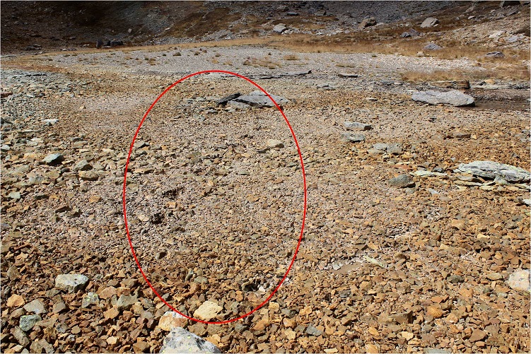
I felt I was getting pretty good at this descending down a scree slope into a basin thing. As I was hiking down I thought to myself how the area looked like it usually held water. It was made up of tiny flat rocks about the size of a silver dollar but an inch thick. The kind you’d usually see on the bottom of a lake or pond. Hmmm. I guess since it was such a dry year there wasn’t any water. I was walking on a lake/pond bed. And it was squishy. In fact, walking across it felt just like walking over a bog. No sooner had this thought entered my mind than realization hit and it happened: I heard a sucking sound as my left foot sunk into the muck up past my ankle (mind you, I was walking on rocks at the time) and was almost impossible to dislodge my foot.
No. No. No, no, no! I know how to get myself out of a bog/quicksand if I have to, but I really didn’t want to end up covered head to toe in mud (I was camping tonight after all and wouldn’t see a shower anytime soon). So I dislodged my left foot and ran as fast as I could, kicking up my heels as I went, trying to escape the mud that was trying to pull me under with each step. All in all it wasn’t that bad: with the running I only sunk up to my ankles, but I could tell if my foot had rested in any one place I’d have sunk much further as the mud had great suctioning abilities. Then I’d really be stuck. I made it to stable ground and let out a sigh. Crisis averted! My shoes and pants were caked in mud, but that was the worst of it. Here are my footprints looking back
I turned east and was greeted with a daytime view of Ice Lake. Wow! This was beautiful!
As I got closer I could see how truly clear the water was.
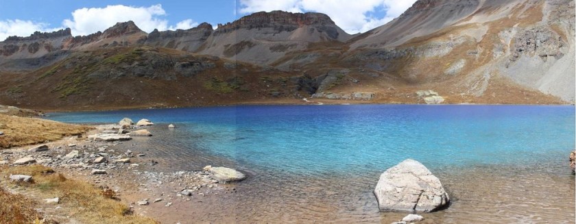
Ice Lakes:
This was amazing! I stopped for a while, took a bunch of pictures, and then headed on my way back down the basin where I was greeted with aspens changing color. I’d missed them on the way in when it was dark.

There were tons of people on this trail! I must have passed dozens (and it’s a Monday). It was a long 4 miles back down. I made it back to my truck at 2pm. And it never did rain. Oh well, this gave me time to find my next trailhead in the daylight. I took off my muddy pants, socks, and shoes and put on my sandals for the drive. Near the 550 on the road out I got cell service and stopped by the side of the road for a bit to do some work (emails, etc) and text my kids to let them know I was down the mountain and headed to the next.
Here’s my route with a close-up of my Pilot Knob attempts. Don’t worry, I’ll be back for this one!
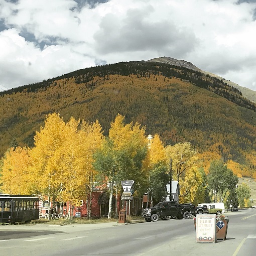
My drive took me through Silverton. I’d heard the fall colors weren’t supposed to peak here for another 2 weeks, but right now it looks beautiful.
I had conflicting directions on how to get to the Burns-Gulch trailhead, so I brought both with me. From Silverton I took County Road 2 past Eureka on a 2WD dirt road, and ate the dust from off road vehicles the entire way. For a Monday afternoon it sure was crowded! Leaf peeping season is definitely in full swing!
I made it to the base of the trailhead on the Animas River and my directions ended. So I pulled up a GPX file of the route to see where I needed to be: about 2 miles up a narrow shelf road.
The road was much narrower and steeper than it looks and filled with bowling ball sized rocks. I took it slow: this road was more difficult than I’d anticipated (but nothing my truck couldn’t handle). I just hoped no one would drive towards me from the top: There was no way I could turn this truck around on such a narrow road, and passing another vehicle wouldn’t be easy.
There was a campsite at the 4WD trailhead at 11,720’ and no other vehicle was in sight. Sweet! It looked like I was going to have the site all to myself for the night.
I got to work making dinner: Mountain House Beef Stroganoff. When it was ready I poured myself a glass of wine in the measuring cup I brought for making dinner, sat back, and enjoyed the view.
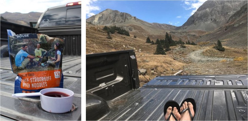
Life is good! Sitting in the bed of my truck looking at the mountains was so relaxing. As I was sitting there I heard a creek to my right and got up to investigate. This was wonderful! It was about 10 yards from where I’d parked my truck. I enthusiastically washed my hands in the running water. They were gross from today’s adventure and it felt good to have clean hands and fingernails again. I got up to turn around and head back when my left sandal broke. I mean really broke, like duct tape can’t fix it broke. Drat! I was going to have to tiptoe the 10 yards back to my truck without wearing shoes. The first step I took landed my left foot on a thistle. Wonderful. I made it back to my truck, poured myself another glass of wine and spent the next half hour picking splinters out of my foot (mostly on the heel and arch). I looked around at the mountains: Life was still good!
I got out my maps and route info for the next day and tried to identify the peaks around me and the best route to take (I had several options). I studied my chosen route until I felt it was time to get some sleep: it was starting to get cold.
I decided to sleep in the cab of my truck because I fit perfectly across the back seat and because I could. Two shots of whiskey later I was ready to go to sleep. I laid my head on my pillow and a fly landed on my arm. I thought about how much fun having a fly buzzing around me while I was trying to sleep would be and debated whether or not to open the door to let it out. In the end I decided I’d rather not let all the warm air out in doing so, so I made a deal with the fly: “Fred “(I named him Fred)”If you promise not to buzz around me all night I promise not to kill you right now”. Fred flew away to relax on my steering wheel and I fell asleep thinking this wasn’t a bad way to spend my last day of being 37.
To be continued…

With your love of hiking in the out-of-doors ,what a perfect birthday gift to give yourself. You mentioned the starlit skies where you were.I truly believe that Montana has a monopoly on the starlit skies. The photo of you sitting in the wheel borrow is impressive.I believe you mentioned in an earlier writing that you were a 104 lbs.That’s why it held you. The beauty of ice lake and the aspens that lined the trail. You’l have to forgive me for sometimes associating your hiking to what some may consider a comedy skit. Your tongs and the fly named (Fred) are definitely a classic in the comedy world.What a healthy attitude you have “Miss Laura” It thrills my heart to see you overcome so many obstacles and yet realize that there may be a better time to overcome the more difficult ways to the summit. I can see why your Mother worries about you.
LikeLike