
RT Length: 13 miles
Elevation Gain: 5100’
The roads on the drive in were insanely icy all the way from Colorado Springs to the trailhead. This was unexpected because it hadn’t snowed/rained lately: the ice was all due to a low lying and heavy fog. This was serious ice too! I didn’t even really notice the ice until I narrowly avoided sliding into a mama raccoon crossing the street with two of her babies. From then on I couldn’t drive faster than 35mph the entire way, which meant I didn’t make it to the trailhead until 5:30am (I should have been there around 4:30am). Luckily today was one of those rare days when I didn’t have a serious schedule or need to be home at a specific time, so I took it all in stride.
Besides being icy the road to the trailhead was a paved 2WD road. There was about 3 inches of snow in the parking lot and no other vehicles. The bathrooms are locked for the season.
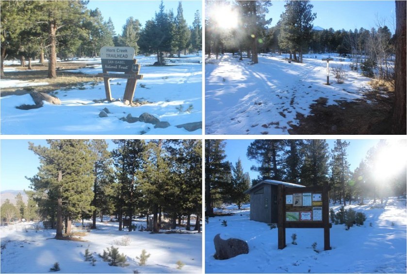
There was snow on the ground so I decided to just put on my snowshoes in the car so I wouldn’t need to later. I kept them on the entire hike. I started at 5:40am, following the mud, rocks, ice, and snow that today was the Rainbow Trail. Despite what you may think by the name of the trailhead, you actually turn left at this sign and take the Rainbow/Macey Trail #1336.

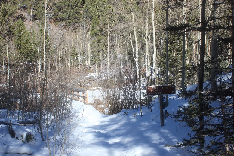
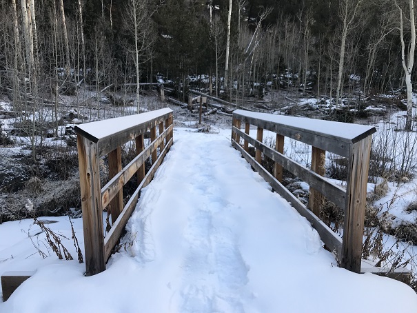
There are two creek crossings on this hike. The first is Horn Creek. Cross this bridge and take the trail to the left (Macey Lakes Trail)
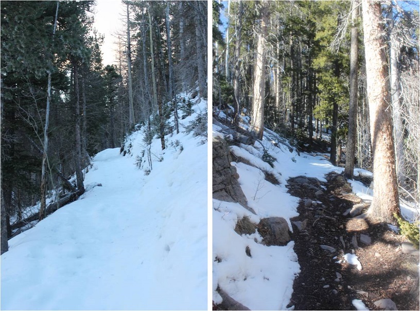
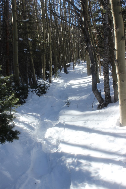
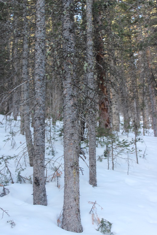
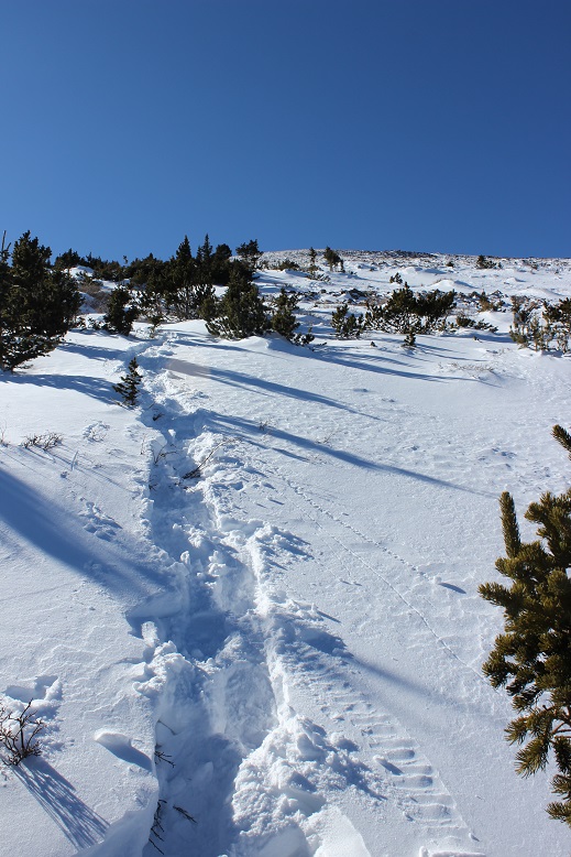
The trail weaves around the mountainside, so it varied from mud and rocks to 2+ feet of snow, depending on which side of the mountain I was on at that point. I decided it wasn’t worth taking off and putting my snowshoes on every ¼ mile or so, so they stayed on. I hiked in silence, all except for the sound of ice crunching underneath my snowshoes.
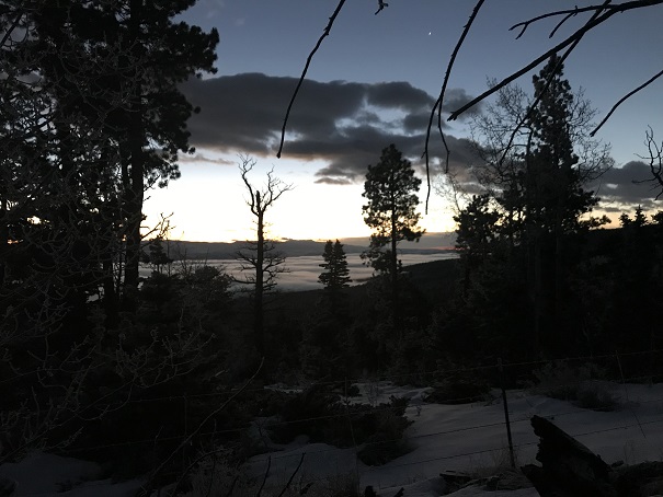
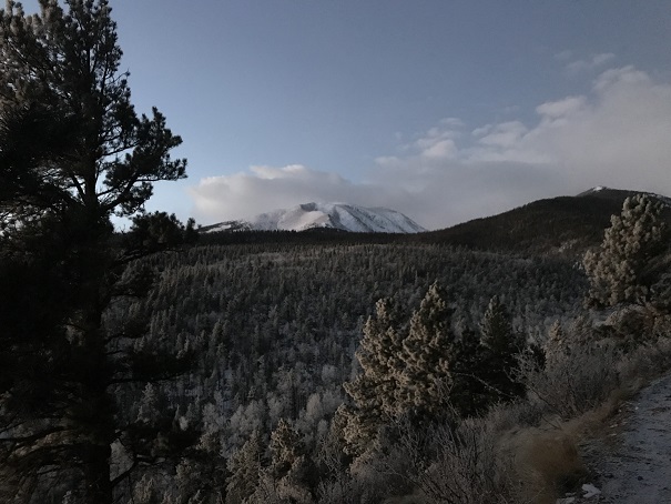
The sun was beginning to rise, and with it the low-lying fog.
The second bridge is over Macey Creek. It is very similar to the first bridge.

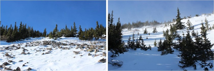
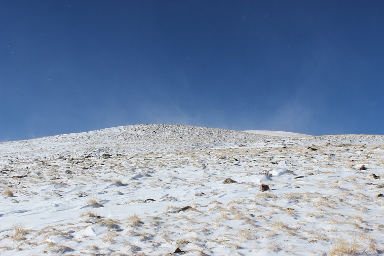
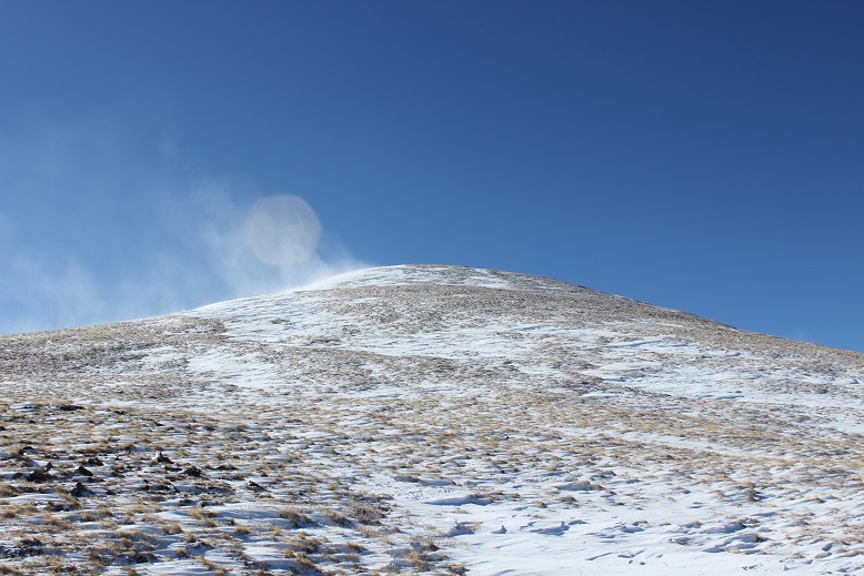
Here I got my first view of Colony Baldy
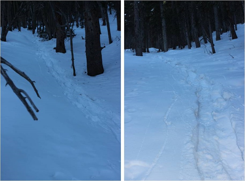
At the Macey Creek bridge the snow was deep and from here to the summit I broke trail. Once you cross Macey Creek you’ll follow the trail down to the bottom of a long hill, losing about 200-300’ in elevation (thinking WHY?!?!? the entire time). Just before you get to the bottom of this hill there’s a path to the right. I was unable to see it as the path was covered in snow and I had to backtrack and look for it, knowing from my topo map it was there. If you see the drainage you’ve gone too far.

On my way out I noticed the path is directly opposite of this sign, and I took a picture of my GPS coordinates
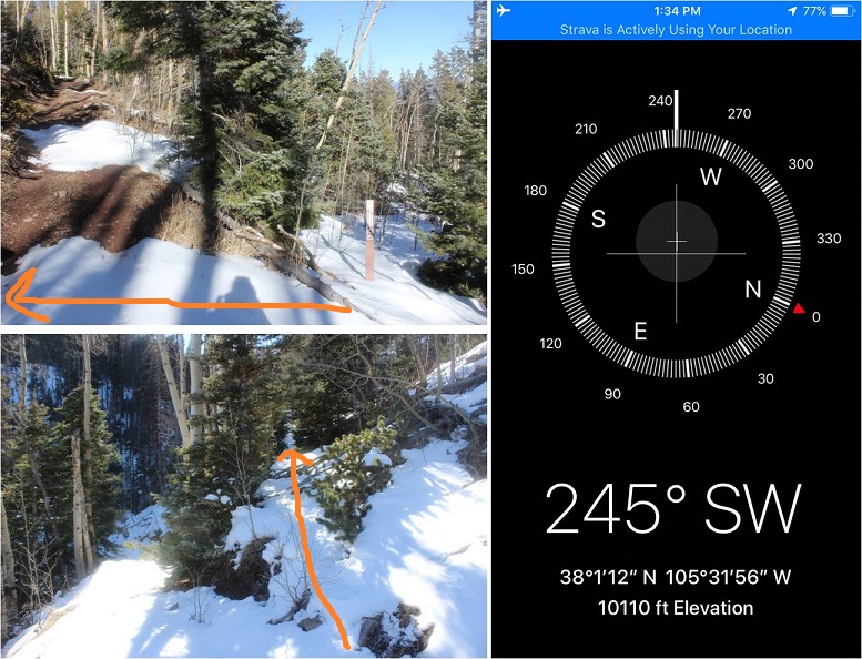
This is where the trail ends. I followed the drainage west through a heavily forested area until I came to a small clearing.
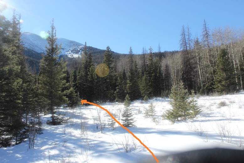
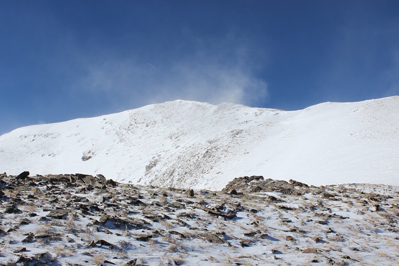
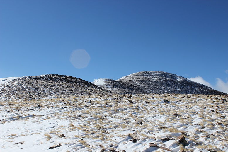
From here I could see Colony Baldy, and turned south (left).
I was supposed to follow the ridge to treeline, but the trees were so dense it was difficult to see anything, let alone a ridge
Instead of following the ridge I followed the drainage, which was a great idea since I couldn’t see the ridge: all I could see were hills and trees. The drainage didn’t have water, and didn’t look like it ever held water, but it gave me a nice, stable ‘V’ to follow up the hillside.
From the small clearing to treeline was the most difficult part of this hike. The snow was about 3 feet deep and like cotton candy: I’d take a step and sink to my knees, sliding backwards. Every step was like this, and as I made it higher up the mountain my steps became deeper and the snow became softer. The snow also made the angle I was climbing much steeper.
It seemed to take forever to make it to treeline! Each step was exhausting. The angle of the slope is much steeper than these pictures suggest. Many times my snowshoes would slide backwards as I tried to take a step forwards. It was like climbing on a treadmill at elevation that isn’t turned on.
I made it to the bristlecone pine trees and was only halfway done with the hardest part of this hike. That bristlecone pine area is a good half mile of very steep elevation gain.
This was the largest dispersion of bristlecone pines at treeline I’ve ever encountered, and it all goes straight up. Just when you think you’ve made it to the top of the bristlecone pine area you encounter more. Once again, the steepness of the slope cannot be stressed enough, especially with the added snow. I was using tree branches as handholds to keep myself from sliding backwards.
This is also where the wind picked up and didn’t stop. It was only about 20mph, but it was a steady 20mph with no breaks between gusts. On the plus side it was beautiful to watch the snow get thrown into the air and fall back down.
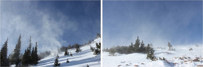
I put on my goggles and pulled my balaclava up over my nose and kept climbing until I was finally out of the bristlecone pine area and just needed to finish gaining the ridge. I kept looking back at the route I’d taken thinking to myself how it all looked the same: There were so many tree covered hills at seemingly equal elevation below treeline. I seriously hoped the wind didn’t cover my tracks with snow or I’d be using my map and compass to find my way back as well.
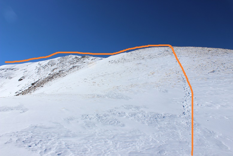
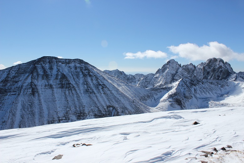
Once I gained the ridge I had a great view of Colony Baldy
And the route before me
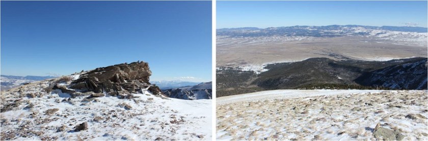
From here to the summit it was an easy hike over rocky tundra. Easy, yes, but it took me forever to complete. The hike thus far had completely worn me out. I haven’t been this tired/slow going on an alpine hike in a very, very long time. I’d take 50 steps (yes, I’d count them) and then reward myself with a rest to breathe for 10 seconds. And all the false summits! Here’s the first one
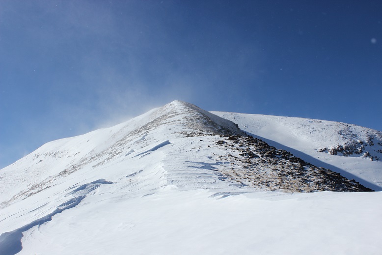
And the second one
I gained the second false summit after a battle of wills with myself. I was exhausted. The wind coming straight at me and the intense elevation gain up the ridge and through the bristlecone pines had seriously worn me out. I kept telling myself it was almost over and I just needed to gain this one last hill and I’d be done. I promised myself I’d take a break once I’d summited and rest a bit. Imagine the words that went through my head when I gained the ‘summit’ and was met with this
Argh!!! Nope, I didn’t stop, even though my legs were screaming and I was having a difficult time catching my breath (something else that hasn’t happened on an alpine hike for me in quite a while). I kept going: 50 steps, 10 seconds to breathe. 50 steps, another 10 seconds to breathe. And you know what? When I finally gained that last hill to the true summit it was all worth it: I was met with the most fantastic view of the Crestones I’ve ever seen!
The downside? It was freezing cold! And windy. I took a summit picture

And a quick video before my cell phone went from 49% battery down to 7%
VIDEO:
I plugged in my cell phone to the charger and it immediately went back up to 15% and just stayed there, so I put my cell phone back in my pack and headed down, as my hands were starting to burn inside my mittens.
Here’s a look at that long, wonderfully ‘easy’ ridge. While it looks flat, it’s really just an easy slope.


The best part about hiking down? I was using different leg muscles and now I wasn’t tired at all. Each step downhill it became easier to breathe and I started picking up the pace (being careful not to trip on the rocks poking out from between the snow with my snowshoes). At the end of the slope I turned right (northeast) and followed the slope back past a small outcropping and to the bristlecone pine area. My tracks were all still (mostly) visible. Woot!

This is where I decided to have a little fun. The trench I’d made on my way up was steep and I kept slipping and sliding forward on my way back down because the snow was really, really soft. So I decided to just glissade on purpose because I was doing it by accident anyway.
I ended up doing this almost the entire way back down to the meadow. The path I’d taken was steep enough for me to slide down the entire way, but the snow was deep enough not to let me go too fast (an ice axe wouldn’t have been much help in this snow).
I made it back to the meadow and turned right and headed back to the Rainbow Trail. The 3.5 miles back to the trailhead seemed to last forever. It still wasn’t worth it to take off my snowshoes for the help they gave me in the shaded/snowy areas, so I kept them on. Wearing them included the added bonus of not needing to carry them. I didn’t see anyone else all day, and my tracks in were still the only tracks I saw on my way out, so I’d been alone all day today on the mountain.
I made it back to my truck at 3pm, making this a 13 mile hike with 5100’ of elevation gain in approximately 9.5 hours.

Here’s the relive video of the trek : https://www.relive.cc/view/1972846660
I made it back home at about 6pm and when I went to jump out of my truck my entire body groaned as I touched the ground. That soreness is something else I haven’t experienced for a long time, and an indication of a fabulous hike and a day well spent!

What can a person say after reading this article from the very person who experienced every demanding step to touch upon the summit ? Even though your climb is completed and penned for others to see;I have a sense of guilt just reading about your physical sacrifices for others to read in the warmth of their homes. I know what it’s like to push your physical body to a certain limits,but You go beyond that Laura.No one demonstrates courage and the fortitude to overcome such adversities as You.I’m always impressed with your activity chart as I am Your writings and pictorials.Please stay safe on your next mountain adventure. “Don’t tell me what to do” by Pam Tillis on utube. It represents Your freedoms in summiting.
LikeLike