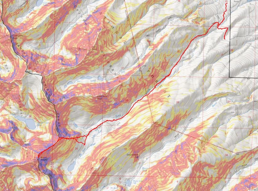
RT Length: 13.5 miles
Elevation Gain: 5292’
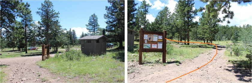
My decision to attempt Mt Adams from Horn Creek was based on distance to the trailhead: The Willows Creek trailhead was an extra 1.5 hours in driving time from my house than the Horn Creek Trailhead, so that’s the route I chose. There were several cars in the parking lot when I arrived, and at least two parties camping in tents. The bathrooms were open and clean. It had rained the night before. I was on the trail at 2:30am.
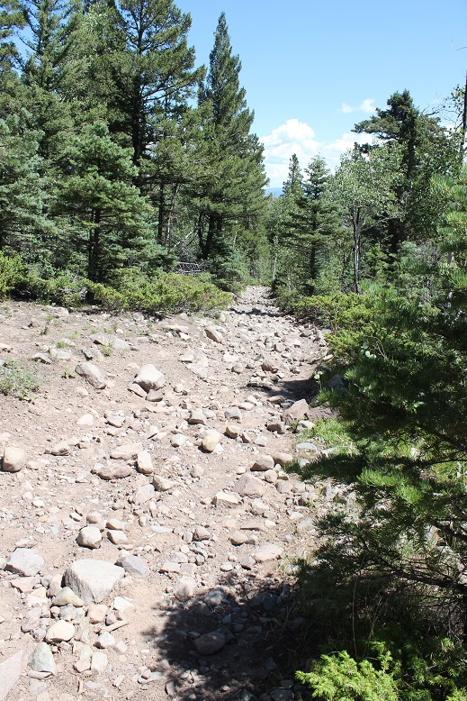
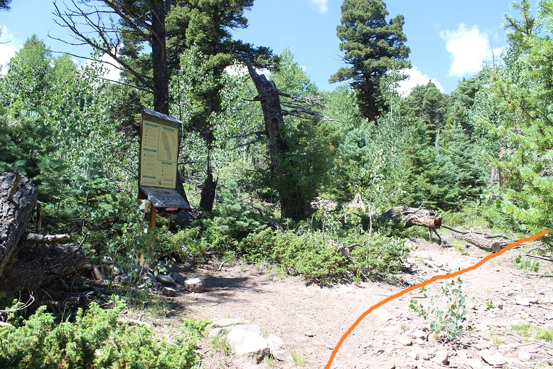
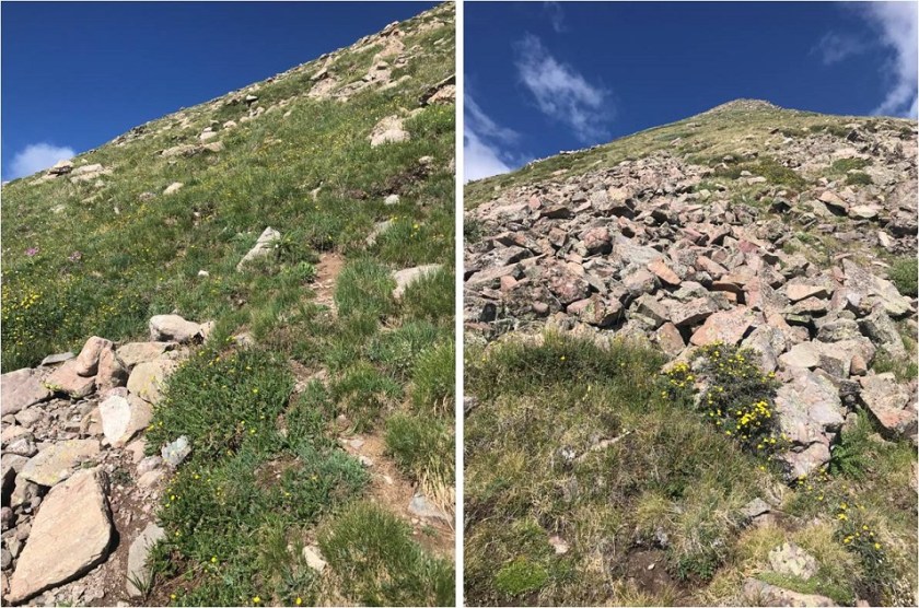
I followed the well defined trail to the left. While the path was easy to follow, I could tell the rocks on the trail in this section were going to be hard on my feet on the way out.
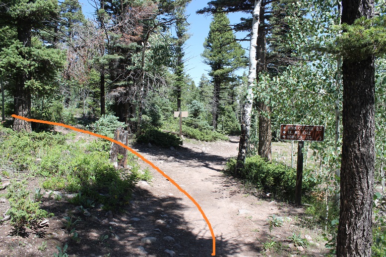
After about .3 of a mile I came to a junction in the dark. My instructions said to go southwest here, so despite doing the obvious thing and following the sign that pointed right to Horn Creek I got out my compass and saw southwest was left. I turned left and walked for about a quarter mile before realizing (remembering) I was on the trail for Colony Baldy, and there was no way it was taking me to Horn Creek. I turned around and retraced my steps and corrected where I’d gone wrong… (turn right at this sign, do not go southwest)

Continue on this trail for about one tenth of a mile and you’ll come to another junction where you then turn southwest (left) and follow a well defined trail for about 5 miles to Horn Lakes.
There’s a trail register shortly after the second junction. I signed my name and for some reason wrote “Horn Peak” as my destination even though it was actually Mt Adams, but didn’t realize this until I’d hiked a few miles past the register. Whoops!
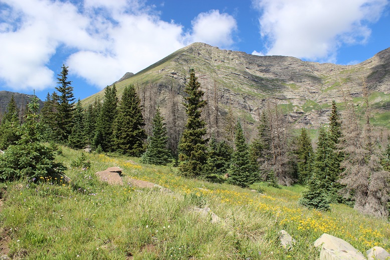
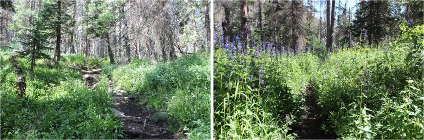
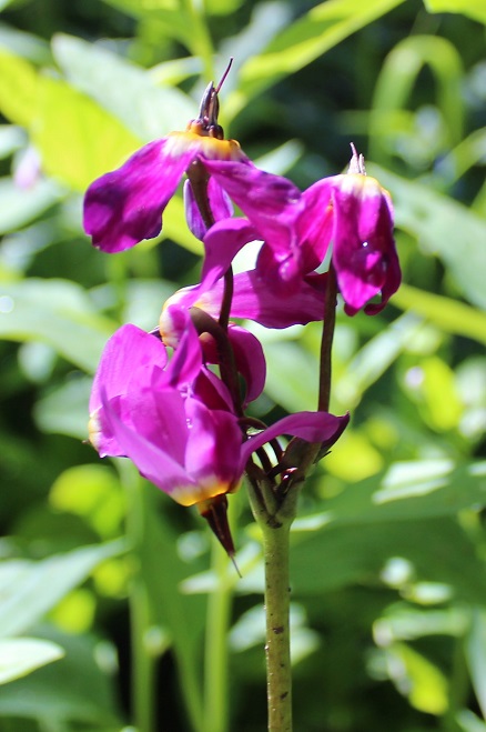
From here the trail became less rocky and followed Horn Creek. I could tell even in the dark the flowers were amazing right now!

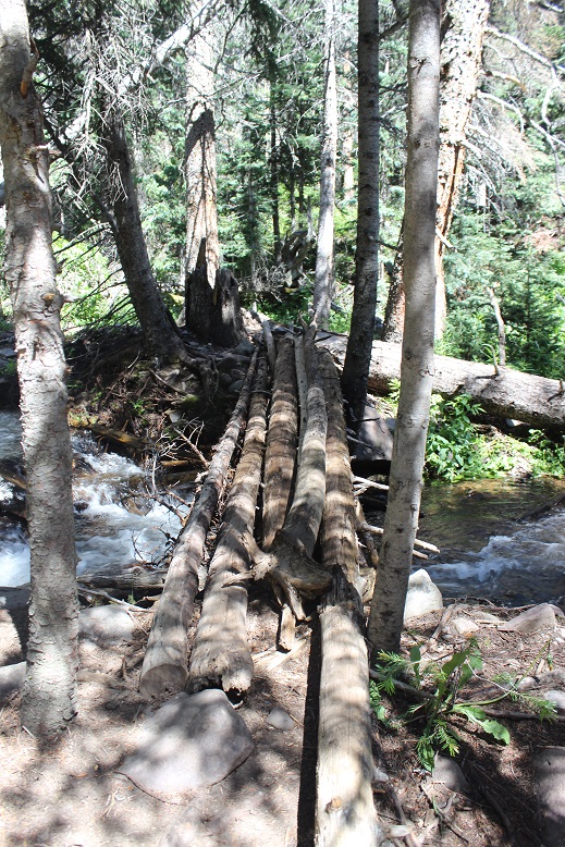
At about 2.5 miles I crossed Horn Creek on what I’d describe as ‘bouncy’ logs: They bounced up and down as I walked across them.
The trail became quite overgrown at this point, and my legs were getting a little damp from the plants still wet from last night’s rain. I looked for animal/human tracks and didn’t see any on the trail. It was a nice and gentle hike in without a moon. Oh, and there were moths I honestly thought were bats at first they were so big. They were white, loud as they flapped their wings, and quite attracted to my flashlight. The first few gave me quite a start, but I quickly got used to them.

There was water in the middle of the trail around mile 3
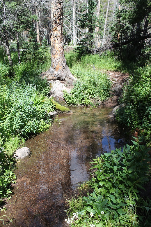
And another stream crossing at mile 4. I crossed the creek and headed up into the basin

I was a little worried I wasn’t following the correct trail here because there was also a trail that didn’t cross the creek the second time and in the dark looked like it paralleled this trail, entering the basin as well. The trails never converged, but it looked like the other trail made it to Horn Lakes too
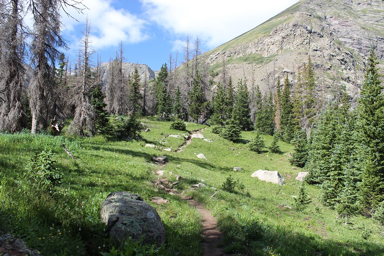
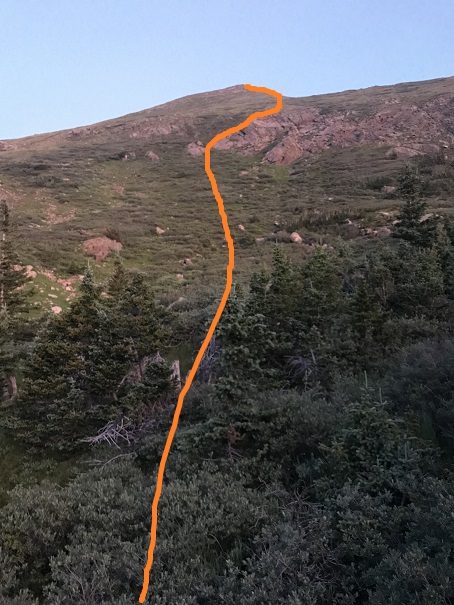
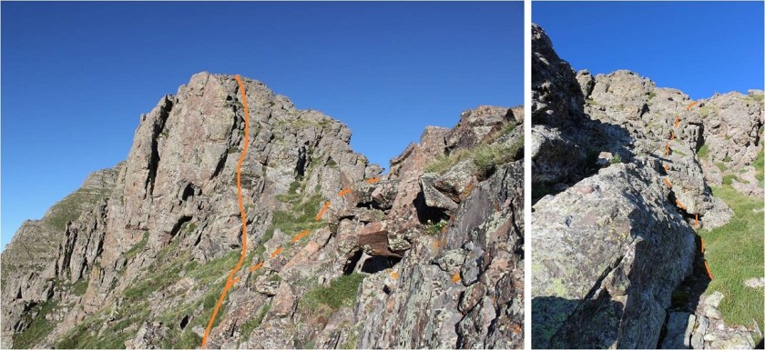
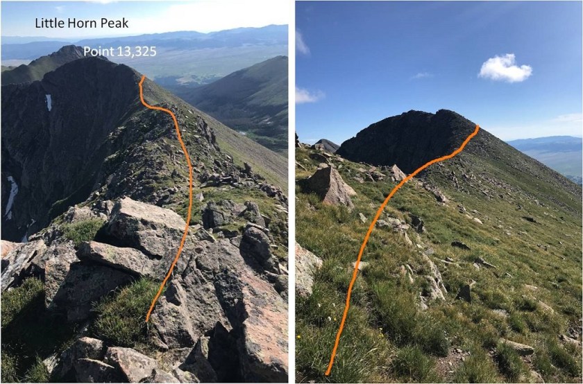
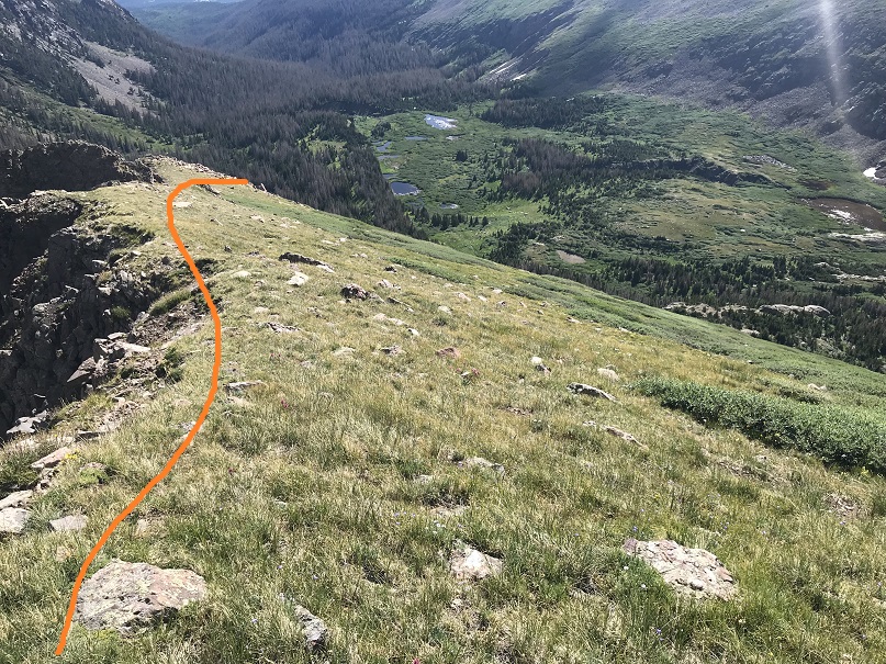
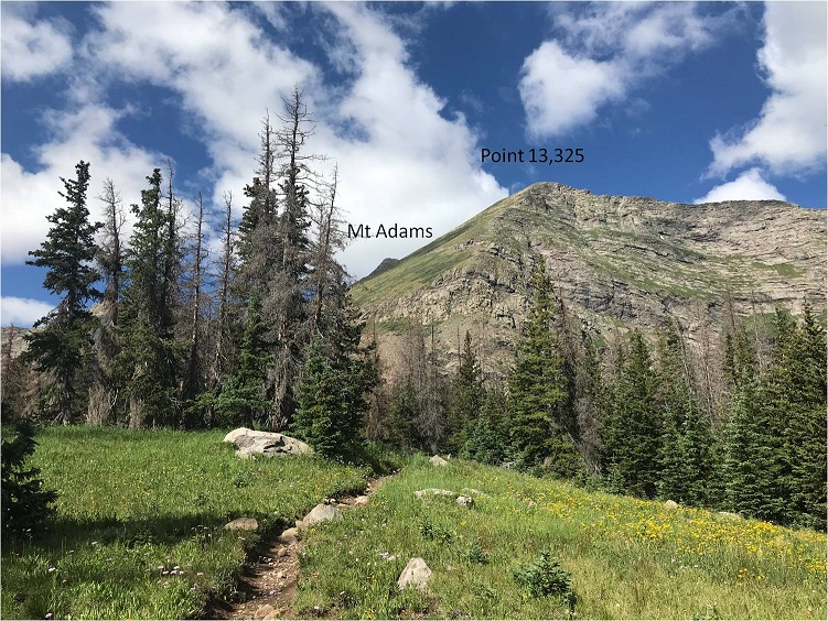
The trail goes all the way to the end of the basin, but at some point you need to turn right (west) and head up a steep grassy slope to gain Point 13,325 and the ridge to Mt Adams. I did this at about 11,780’ while I was still under treeline, and as I turned west this is what I saw

There was a lot of bushwhacking involved for about 20 yards or so, and then the brush and trees cleared and I could see where I was headed.
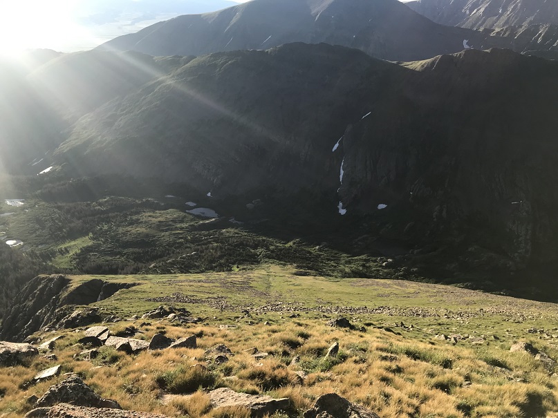
As I ascended the northeast ridge the sun began to rise and as I looked back I could see some of the lakes I’d passed and not noticed in the dark

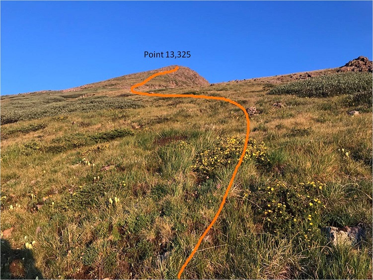
This slope is very steep and longer than it looks. There are willows here, but luckily they’re only about a foot or so off the ground so they’re easy to navigate. There are a lot of different ways to gain the ridge. This seemed like the easiest route to me

I did my best to avoid the willows when possible
Here’s looking back down on the basin from about halfway up the slope
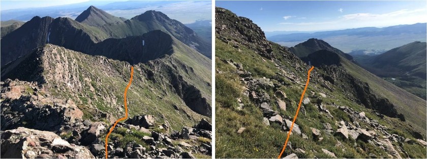
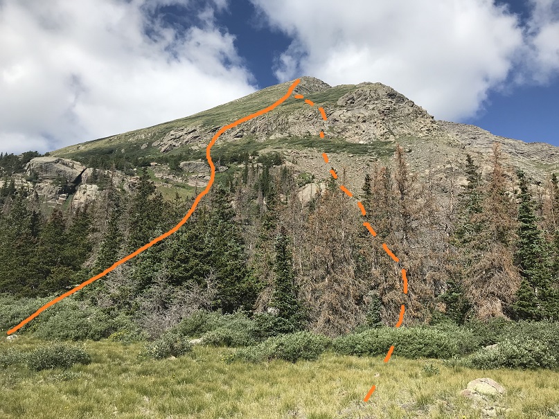
Once I made it up the top of the slope (Point 13,325) I turned left (southwest) and could see the rest of the route before me. The ridge looked like fun!!!

This ridge can be kept at a class 2 if you know where to go, but class 3-4 if you just stick to the ridge. I like scrambling so I took the solid route up and the dotted line down.
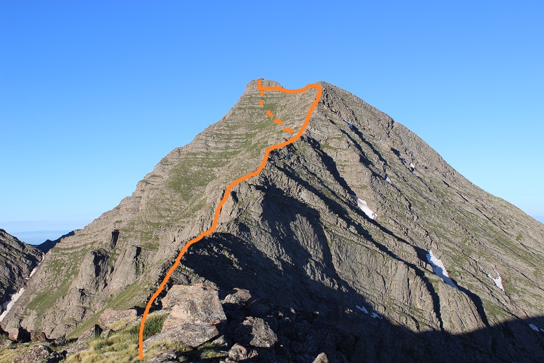
The first obstacle was this bump in the ridge. I went straight over the top but you can keep this class 2 by going to the right and skirting the bump
Here’s the next obstacle. Once again you can go straight over the top or keep it class 2 by going to the right
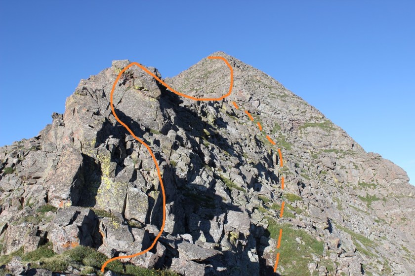
Finally I had to decide which way I wanted to summit. I like sticking to ridges when I can, so I decided to continue my climb along the ridge. I took the solid line up, and dotted line down

I kind of skirted the point next to Mt Adams and aimed for the ‘saddle’ between the point and summit block
Once at the base of the summit block there were several options to summit, all easily kept at a difficult class 2. The ground here was surprisingly stable and covered in vegetation.
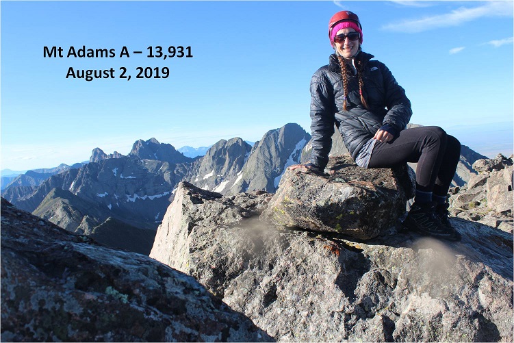
I summited at 8am
Summit Video:
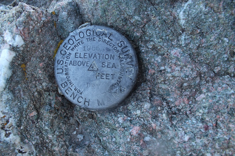
The summit marker was missing a few things…
But the views of the surrounding peaks were amazing!

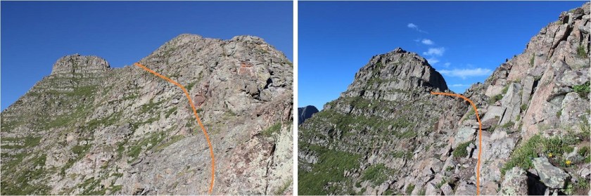
I decided to descend a different way than I’d taken up. Here’s a look at the route I took back to the ridge
I skirted Point 13,325 to the right on my way back
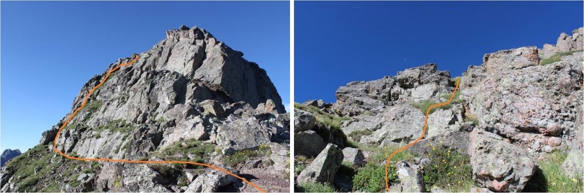
Here’s another look at the steep slope
And the path I took down
Here’s where my route diverged a bit from the way up: I continued to follow the ridge, staying just a little to the right as I did, and ended up in a navigable scree-filled gully. I descended the gully and aimed for the trail I could see in the distance that would lead me back down the basin.

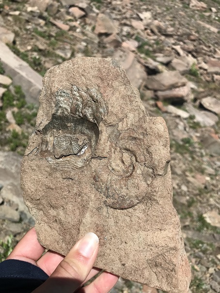
At about 12,000’ I found what I’m pretty sure are oceanic fossils in the talus.
I exited at 11,690’. Here’s looking back at the route. The solid line is the way I took up, dotted is back down. Neither was better than the other, and there seemed to be many ways to ascend the slope and gain the ridge.
As soon as I found the trail that would lead me back to the trailhead the mosquitoes started swarming. This is the type of area they liked best. Luckily it only lasted for 3 miles or so…
There were tons of mosquitoes. I could swipe my hand through the air and dozens would be on my arm. I couldn’t stop to take pictures of flowers (etc) without mosquitoes taking it as an opportunity to land and feast.
They were biting me through my clothes. Even though it was around 80 degrees I put on my puffy jacket and a hat and stopped stopping. Back at the trail register I corrected my hike to Mt Adams (not that it mattered anymore) and luckily by then the mosquitoes had died down a bit. The rocks on the trail were indeed bothersome on the way out. I made it back to the trailhead a little before 12pm, making this a 13.5 mile hike with 5292’ in elevation gain in 9.5 hours.


What a pretty sun-up that You always pass on to Your followers.I believe that Your shadow was slightly seen as You journeyed to the summit. Your self photos are well taken.I am truly fascinated by the length of Your braided hair and long finger nail that I’m sure matches the other nine.You wouldn’t think that a woman who does what You do could still maintain her femininity.You climb some of the most rugged terrains and when You have accomplished doing that ,(You smile in victory). I look at the distance,time and elevation and compare it to the highlighted areas of your mountaineering. And do You know what crosses my mind the most is,How do You do it ? My heart goes out to You everytime You freeze Your hands,feet ,sink into the snows to Your waste at times,get caught in hail storms,forge streams bare foot and often shod with lasting foot pains that last for hours or even days. Your a remarkable Lady that captures the thought process in all that You do . I thank You Miss Laura for sharing the many facets of mountaineering by way of photos and written words. I look forward to Your next posting and hope others feel the same. Thank You.
LikeLike
I feel privileged to follow You and You allowing me to do so.I am never oblivious to the many trials You face on each and every summit You strive to reach.The loss of sleep and the early morning hours You plant Your feet at the base of Your ascension to the summit with sometimes little to no light to show the way other than Your wisdom and knowledge which You have studied before hand.I could sit here and type for hours about Your knowledge and wisdom beyond Your years. Stay as safe as Your presentation on “Staying Safe.”
LikeLike