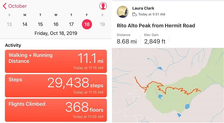
RT Length: 9 miles
Elevation Gain: 2849’
This was my second attempt of Rito Alto Peak, as the last time I was here I had to turn around due to downed trees and too much ice on the 4WD road in. The weather forecast for today showed heavy winds (70-80mph) overnight that would calm down to 30mph around 8am, and a 20% chance of snow between 1-3pm. I wanted to summit 3 peaks today: Rito Alto Peak, Hermit Peak, and Eureka Mountain, and I figured if I started around 6am I should be able to summit them all and avoid the weather in the morning and the afternoon. Note: most of these pictures have been lightened because it was darker than anticipated and the pictures didn’t turn out well.
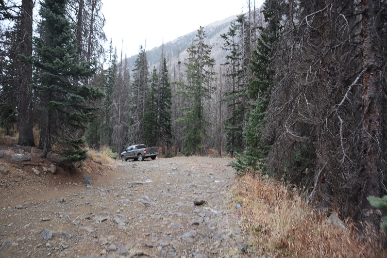
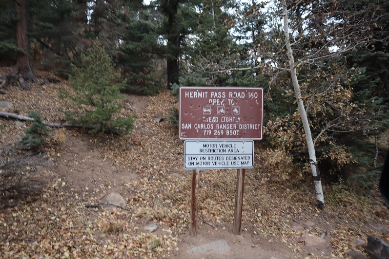
Let’s talk about Hermit Pass Road: It’s definitely a high-clearance 4WD road I wanted to drive when I wouldn’t need to pass another vehicle. October after the leaves had fallen off the trees seemed like a good time. It took me about 45 minutes to go the final 3 miles to where I parked around 11,300’. My Tundra handled it just fine, but it’s not something I want to drive again.

The wind was howling and I was seriously worried a tree would fall in the road while I was hiking and block my drive out. Note to self: time to put the axe and shovel in the back of the truck again. At one point I saw a two person backpacking tent (set up) on the side of the road. I thought to myself “Wow, they’re camping seriously close to the road. Who would do that?” (I’ve done this before near a trail, but never on a road). Then another gust of wind blew and the tent flew about 30 feet into the air and over my truck. Hmmm… seems like someone lost a tent.
I parked around 11,300’ but my truck could have made it all the way to the top of the pass. There were a lot of camping areas along the road, but not many areas to pass another vehicle.
I parked my truck and got out my gear, glad to notice it seemed the wind had stopped. My GPS stated it was 3.6 miles further on this road to the pass. I started hiking along Hermit Pass road at 6am. The stars were out in full force and there was only one small cloud in the sky, illuminated by the moon. The road was no more fun to hike than it was to drive. There are so many bowling ball sized rocks that you have to be careful where you step. At least there wasn’t any route finding involved.

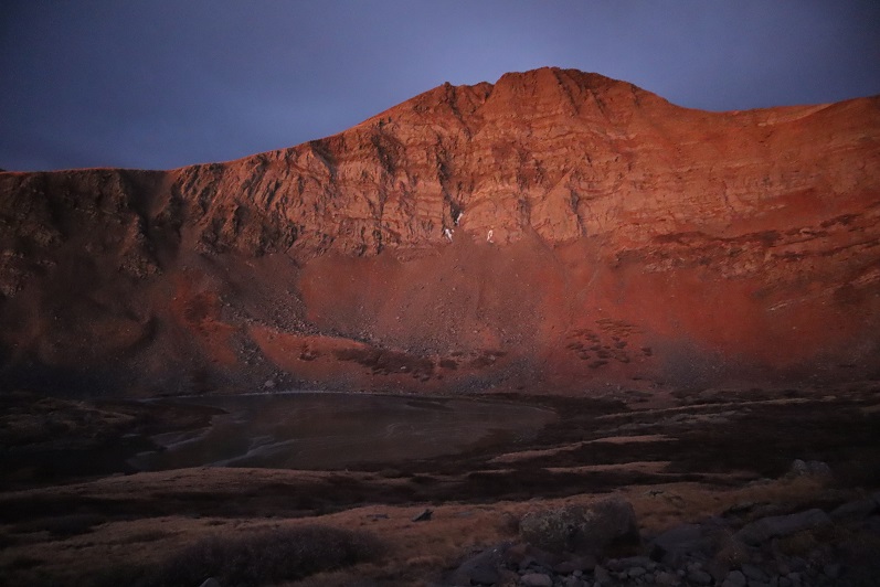
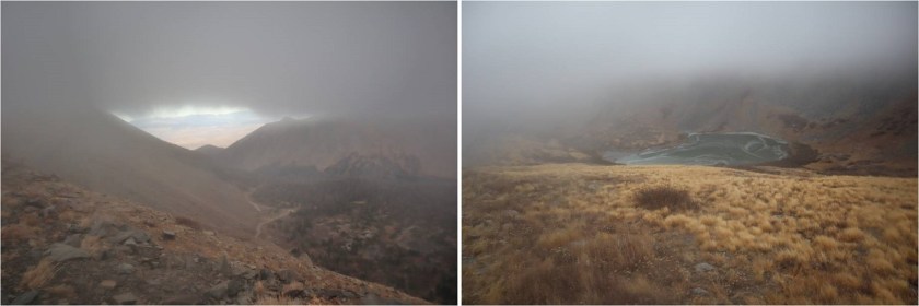
I made it to Horseshoe Lake just as the sun was beginning to rise. I could see a thin layer of ice on the lake.
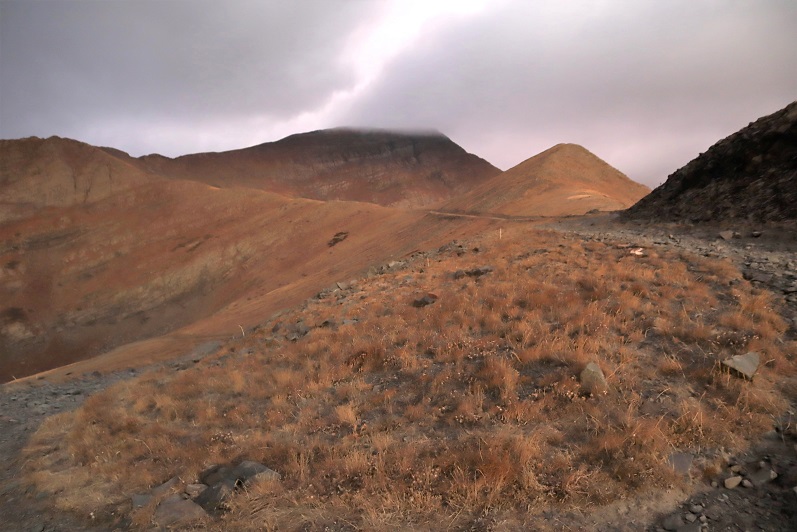
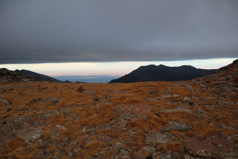
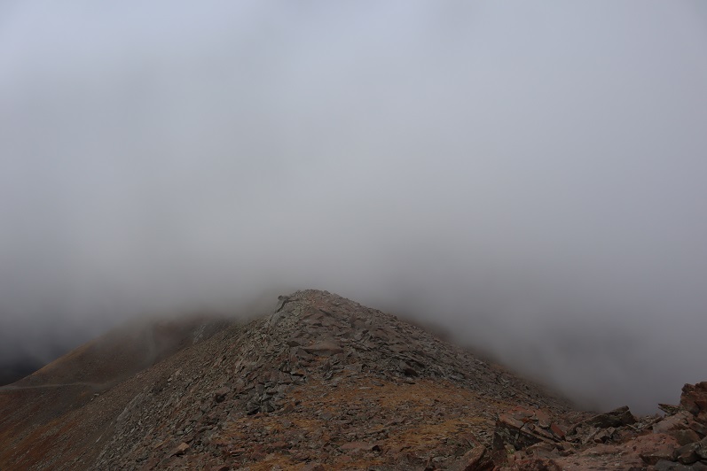
As I followed the road it curved around the hillside and up towards Hermit Pass. Here I got my first (and best) view of Rito Alto Peak. The summit was in the clouds, but I figured by the time I made it there the fog would have lifted.

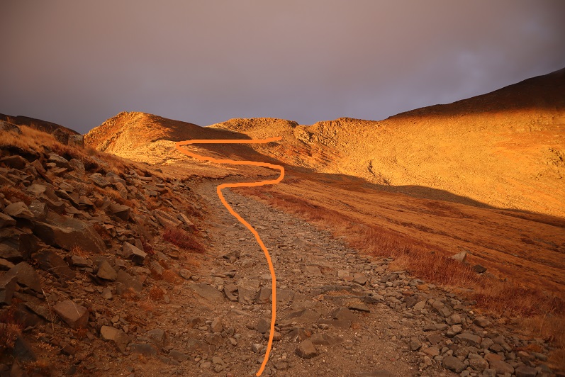
Once again, well defined road to the pass
Here’s looking back on the road from the top of the pass

Just before reaching the pass I left the road and climbed a rocky gully to reach the ridge.

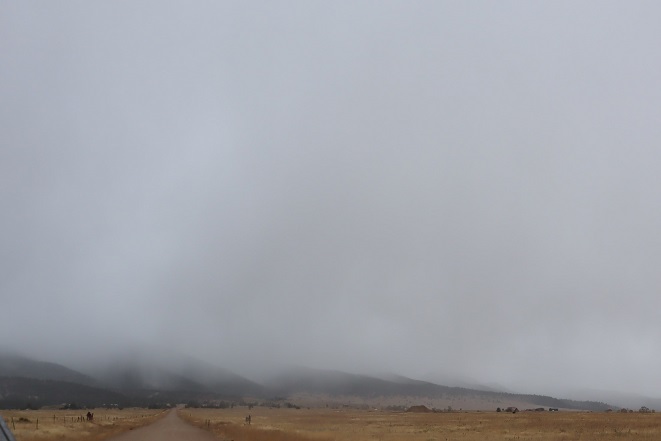
Once on the ridge I looked to the west and assessed the weather situation. The wind picked up and it was pushing the fog towards me at an accelerated pace. “Good” I thought. “The wind should push the fog past me around the time I make it to the summit.” Unfortunately, mountains make their own weather.
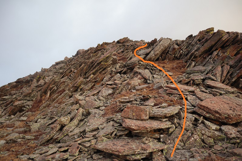
I turned northwest and headed up this rocky section
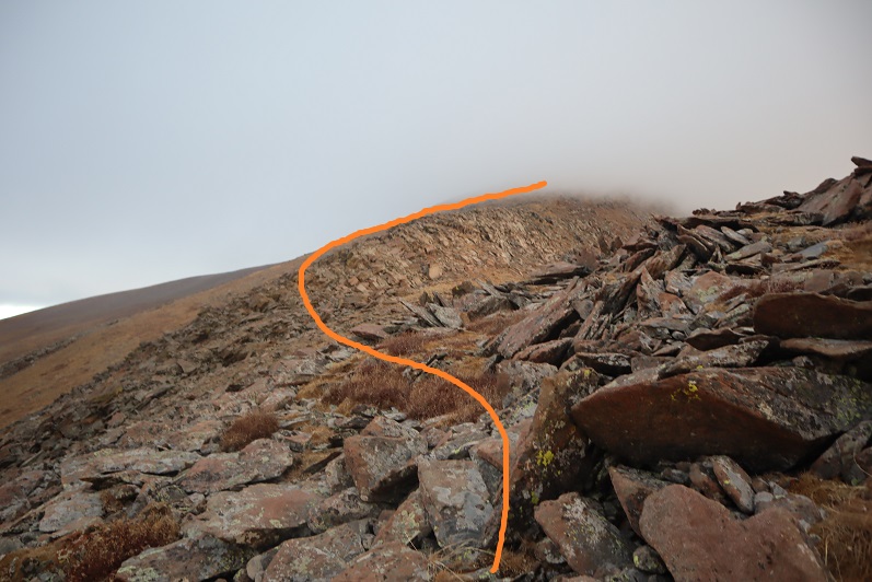
And onto the ridge
From here it was a simple class 2 ridge hike to the summit

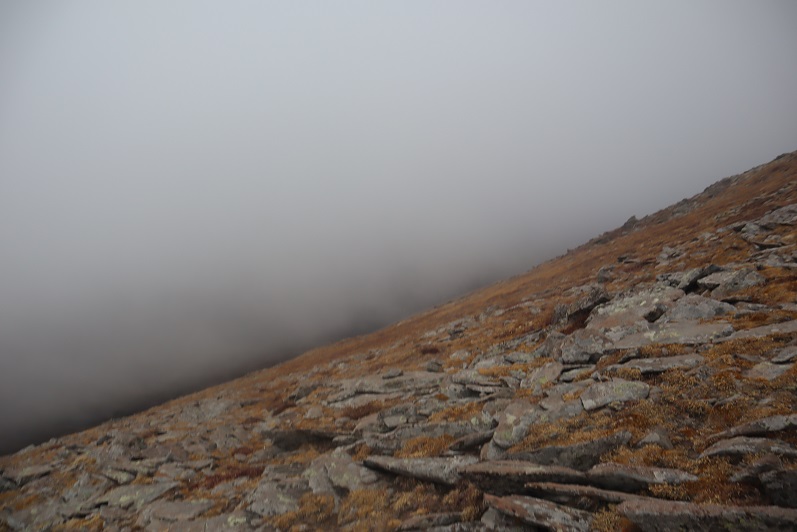
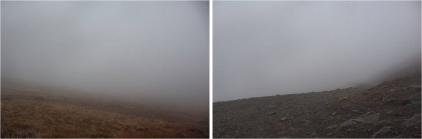
Here is where the wind seriously started picking up, bringing the fog with it at an alarming pace. I could see it rushing up the mountainside towards me
I continued following the ridgeline as the fog turned into clouds


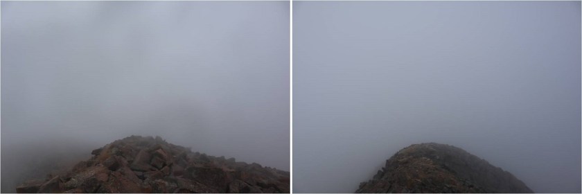
Now I could only see a few feet in front of me, and wondered how I’d know I’d made it to the summit?
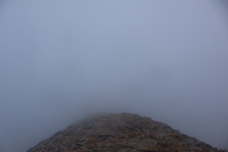
That’s when I saw it: A flag and cairn in the distance!

I headed towards that flag and when I got there I dropped all my gear and took a photo
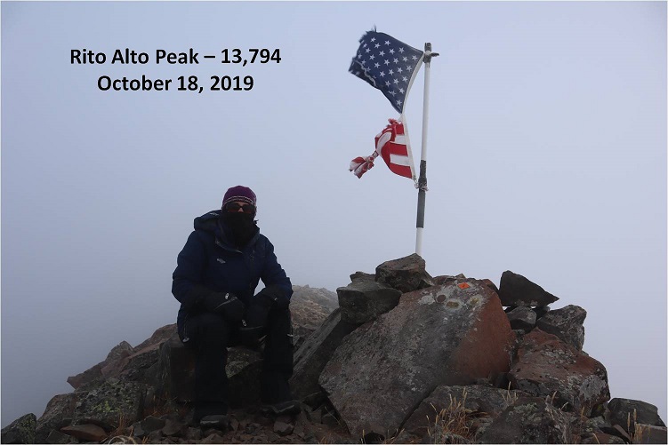
It was cold and that wind was brutal. I took some pictures of the memorial
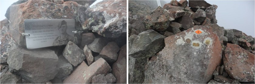
And was taking a picture of the flag again when I noticed it:

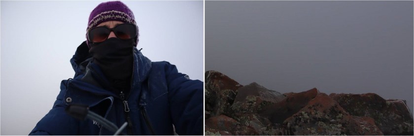
I wasn’t at the highpoint of Rito Alto Peak. The wind slowed down for a bit and I could see the terrain angled up ahead of me. Frustrated (why would the memorial be below the summit?) I gathered my gear and continued north for a couple dozen yards in almost no visibility. The rocks got larger and then I felt they were heading down. I had no idea if I’d reached the summit because I couldn’t see anything. I took a selfie (lightened for clarity) and a picture of the rocks (not lightened) and decided to head back down, hoping the clouds at this point would have cleared enough below for me to see my way to Hermit Peak.
The clouds I expected to dissipate as I hiked down instead grew thicker and I had a hard time orienting myself because I couldn’t see any landmarks. I just kept aiming southeast, hoping I was following the ridge. Every once in a while the wind would slow down and I could see a few yards ahead of me.
I was thrilled when I made it to a point where I could see the road again! It looked like this was where the clouds were at their lowest.
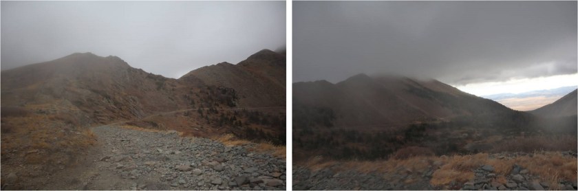
Foolishly I entertained the idea of waiting them out. I honestly expected the clouds to lift at any moment because weather wasn’t predicted until 1pm today (and then only a 20% chance). Instead of hiking down to the road I hiked straight to the pass, hoping to see Hermit Peak. When I got to the pass I couldn’t see Hermit Peak, or much of anything really

I did see this…

Undeterred, I decided to hike to the road slowly. Maybe the clouds would lift in the next few minutes?
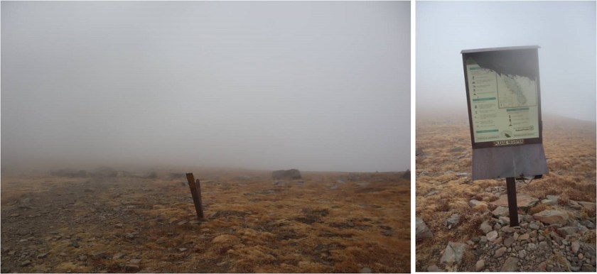
I found a sign saying “road closed” and a trail register
The clouds grew thicker. Argh! I had all day to hike and I wasn’t even tired at this point. I really wanted to summit Hermit Peak and Eureka Mountain today as well, but without visuals I didn’t want to continue on. I also really didn’t want to come back for these peaks: that 4WD road in had not been pleasant and I didn’t want to drive it again. The weather was rapidly deteriorating. I wasn’t worried about summiting the 2 other peaks, I was worried about the descent from Eureka back to the lake. I’d had a good look at the route on the way in and in case the clouds didn’t lift (I still thought they would) it wasn’t a route I wanted to attempt with low visibility.
I wrestled with my decision for longer than I’d like to admit, and in the end chose to head back. This ended up being the correct choice: The clouds continued to form and followed me down the road.
The clouds played tricks with my eyes: it was if I could see each tiny particle swirling around in the mist. It was beautiful to watch but caused me to blink my eyes every so often to refocus. Visibility got a little better as I made my way back to Horseshoe Lake.
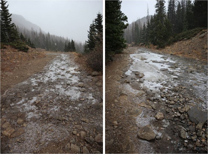
Here’s a look at the road back out
It kept getting colder and colder and then it started to snow. The snow was peaceful and nice to hike out with.
Yes, turning back had been the correct decision, but I felt a bit deflated because I didn’t get in as much elevation gain/mileage today as I’d hoped. Those clouds never lifted, they just got worse, and the snow had been quite unexpected this early in the day. I made it back to my truck at 11am, well before the possible snow time of 1pm. This was a 9 mile hike with 2849’ of elevation gain hiked in 5 hours.
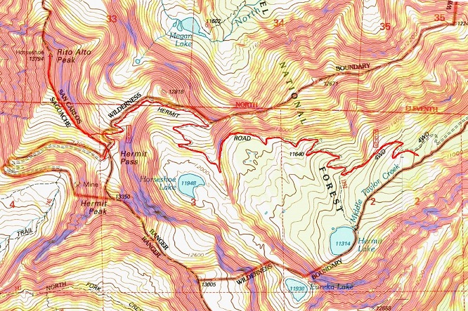
I kept apologizing to my truck on the drive down: I love my truck, and this road isn’t something you do to something you love. At this sign it’s 6.7 miles up to Hermit Pass. I know I’ll be coming back to hike Hermit/Eureka, and I want to summit Rito Alto again at the same time so I can get better summit shots. Physically the hike really wasn’t very difficult from the pass. Next time I think I’ll just park here and make it a long day (or possibly come in another way?).
Here’s a look back at the weather on my way out. The snow didn’t stop for as long as I had the mountains in view.
For some reason I was under the impression the name of this peak was “Rio Alto Peak”. Maybe I just spelled it wrong in my notes the first time and never caught the error? It wasn’t until I came home and looked at my log on a topo map that I realized my mistake. Whoops!

You and that tundra truck of Yours have been just about at every mountain You have set Your mind to summit and many roads beyond and other states to conquer. You pointed out persons tent camping so close to the road.I was an overbthe road driver and was driving through Cloudcroft,New Mexico and noticed a spanish family with 3 small children having a picnic in a run a way truck ramp.Just seeing that cared me to death.I couldn’t stop because of my down hill grade and the road being so narrow. All I could do was notify other truck drivers over the CB of the situation at that mm. That is really quite the photo of the flag and that of Yourself being the photographer You are. You make such wise decisions that I find remarkable as to wether to continue on or wait for the appropriate time.to summit. I still don’t understand how You are able to climb all those rocks,boulders shale and many other names given to those things that try to hinder You. Every tim e I look at Your highlighted trail You have decided on to take ; I/m totally awed. I can’t help but repeat mysel so often on Your postings because I look at Your chart and don’t know how You are able to accomplish these feats in such a short time. Thzank You Lady Laura.
LikeLike