
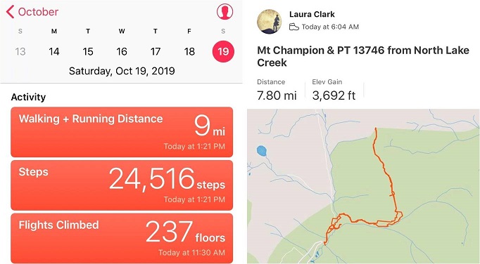
RT Length: 8 miles
Elevation Gain: 3692’
I really wanted to get in this hike before they close Colorado 82 for the winter, and this weekend seemed like a great opportunity: The weather had a nice forecast so I decided to go for it. I made it to the trailhead and was on the trail by 6am. My truck was the only vehicle in the lot, and there was frost on the ground and glittering in the moonlight on the willows. It had snowed 3-5 inches the night before and right now it was cold, cold, cold!

I’d just started out when I heard the loudest sound of tires screeching I’ve ever heard. I turned around and saw a truck’s headlights stopped in the distance. In the dark the driver had missed the last turn before ascending up to Independence Pass and had driven about 40 feet off the road. They were very lucky this part of the road was relatively flat! I watched the truck as it backed up, stopped, backed up again, stopped, and backed up a third time to make it back to the road. Once they were successfully on their way so was I.
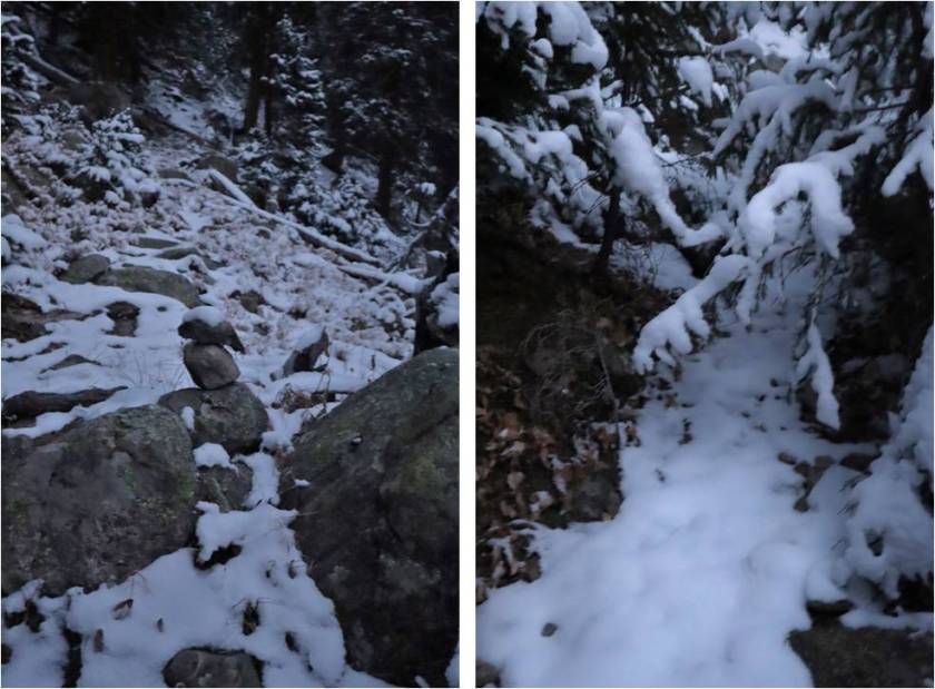
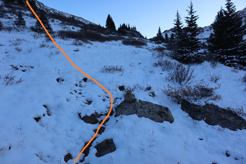
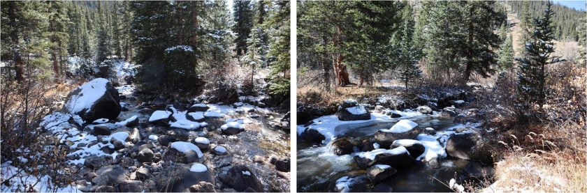
I’ve been in this area before and the instructions I’d put together said to follow Lackawanna Gulch. So I did, but I had difficulty with the frozen stream crossings. The usual areas had more water than I’d expected so I had to walk up and down the banks of the creek to find a place to cross. I didn’t feel comfortable taking off my boots and fording the stream with all that ice. I ended up turning back and starting over again when I came to an area I didn’t recognize. Yes, I’d been here before and I knew the way I was going would get me to the gulch, but I wasn’t headed the way I’d left instructions I said I was going, so I backtracked and crossed the creek again and headed northeast until I came across a cairn, which led me to another cairn and another and I knew I was on the correct trail.

The snow was fresh and I used my trekking pole to knock it off the trees when they were covering the path.
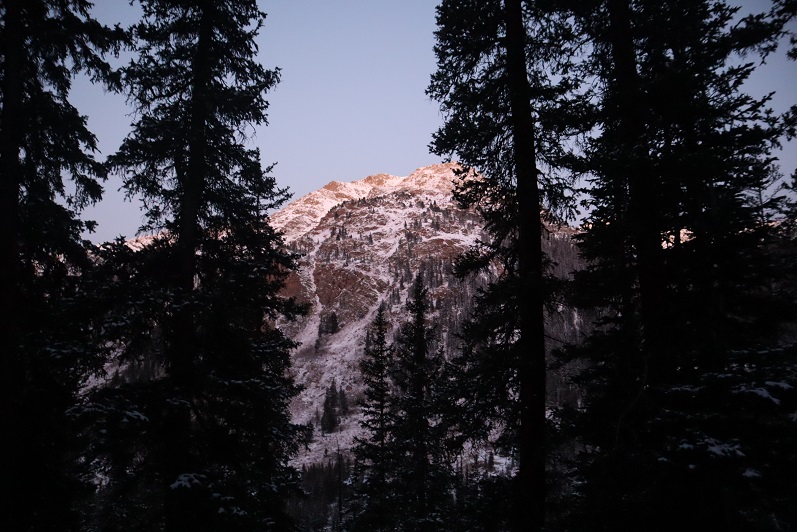
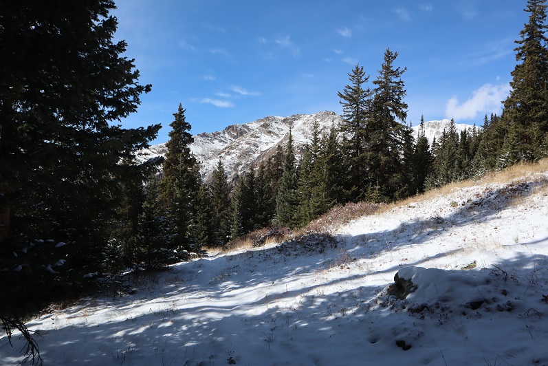
The sun started to rise and through the trees I could tell the views today were not going to disappoint.
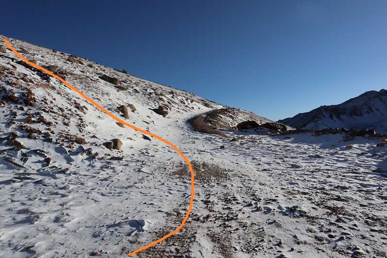
The trail was faint but easy to follow, even in the snow, until I made it to the avalanche area.

Here the trail ended so I followed some fresh deer tracks through the debris and into the trees. Keeping the creek to my right I made my way west.

There are a bunch of game trails here, and they all lead in the correct direction. Just before making it to the creek again I found a cairn and turned left (north) and headed up Champion’s east ridge.
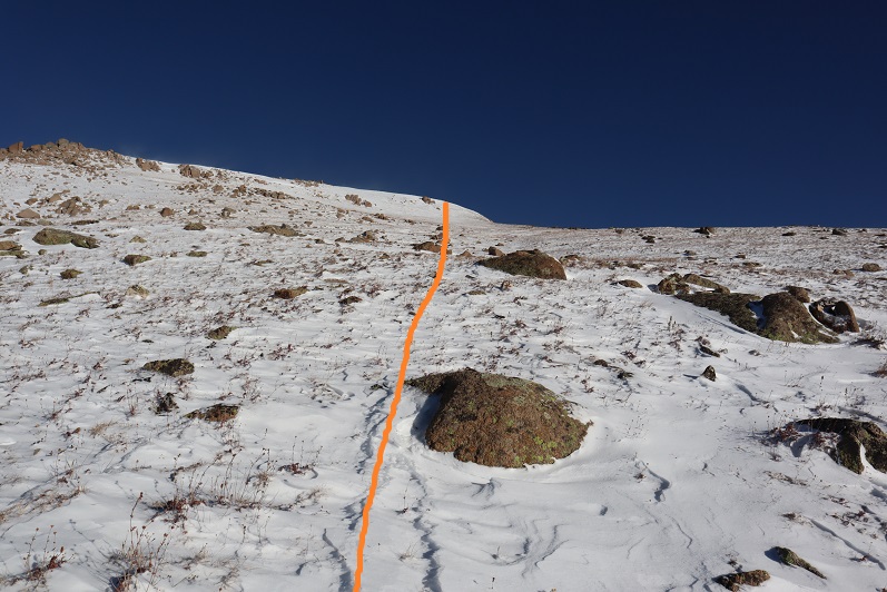
There was no trail here, or if there was it was covered in snow. I followed a steep rocky drainage up the slope and towards a mine.
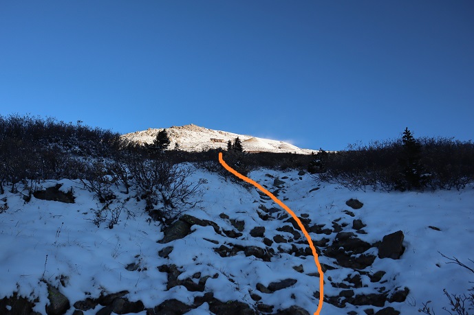
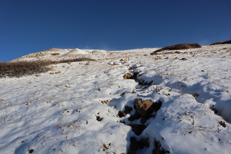
Once at treeline the wind picked up a bit, but stayed at the forecasted 20-30mph. I made it to a 4WD road and decided to do some exploring of the Champion Mine as an excuse to get out of the wind for a bit.
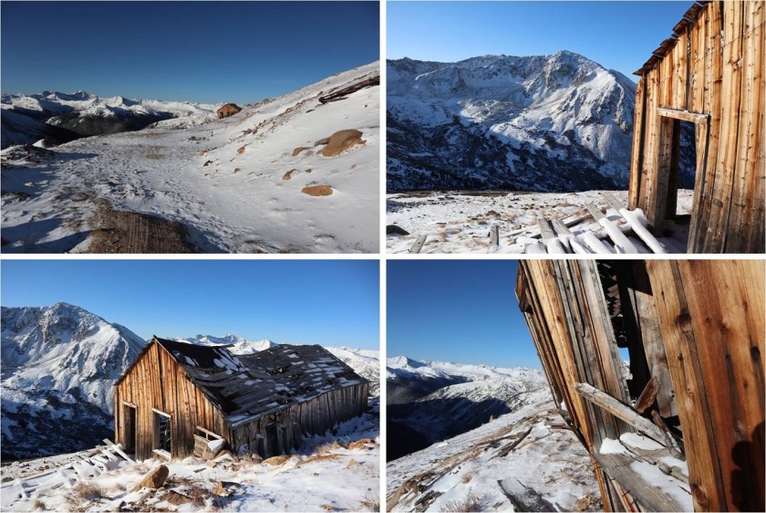
There was old equipment littered about the area

I stayed here for about half an hour taking pictures. I didn’t spend too much time inside because in the wind it didn’t feel too stable. There was a lot of creaking going on. I headed back to the road and continued heading northeast up the side of Mt Champion.
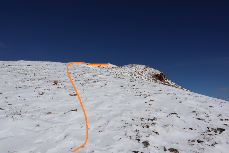
This was by far the most difficult part of the hike for me. It wasn’t technical at all, but I haven’t hiked in snow for many months and I was using muscles in my calves and quads I haven’t used for a while. I’d brought snowshoes and seriously considered putting them on, but in the end didn’t because I felt they would be overkill in such little snow and this was actually good conditioning for the months to come. The snow was about 6-8 inches deep in its deepest spots, and at times there was bare dirt. I aimed for the ridge and followed it up. Note: this is not the summit

But it’s close. This is the true summit
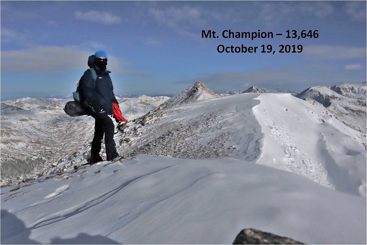
The summit was marked with a cairn and summit register (which I didn’t touch).
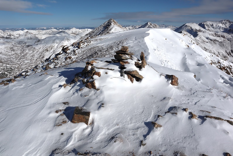
I was surprised to find a cornice already beginning to form on the summit. Surprised because this was the first snowfall here of the season.
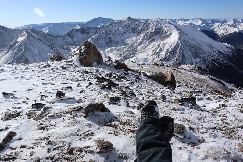
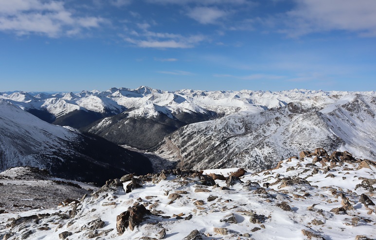
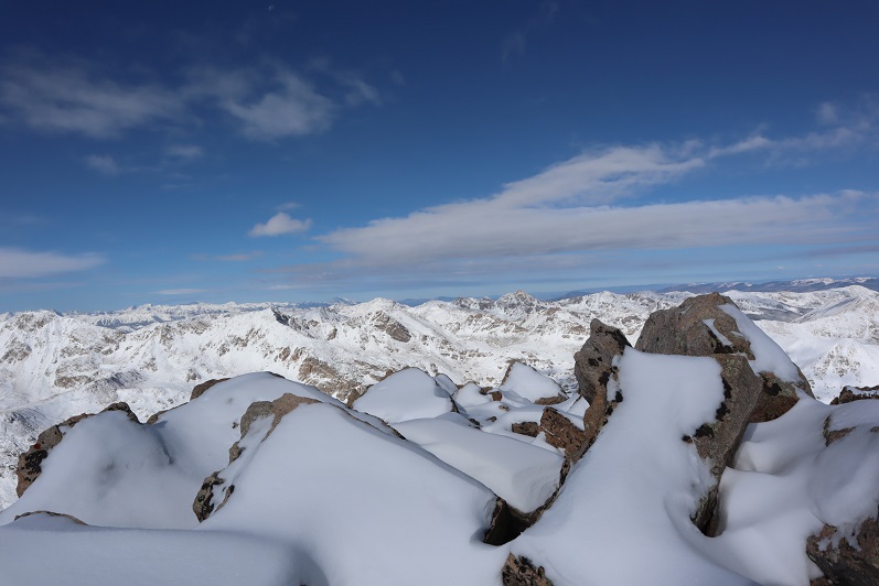
I was quite cold and debated heading over to PT 13,736: that last bit of elevation gain after the mine had worn me out! Did I mention the views? Absolutely amazing!!!

Of course I decided to continue on (I wasn’t that tired, just a bit out of hiking-in-snow shape). The trek over to PT 13,736 is a straightforward scramble along the ridge

I had to be careful because some of the rocks were large and the spaces in-between them was often covered in snow and my feet could fall between the cracks if I wasn’t paying attention. I probably took more time on this ridge than it required, but I didn’t slip, fall, or twist an ankle. Microspikes didn’t seem necessary, my boots provided enough traction here.

Once again, windy, but with the balaclava and hat it was tolerable
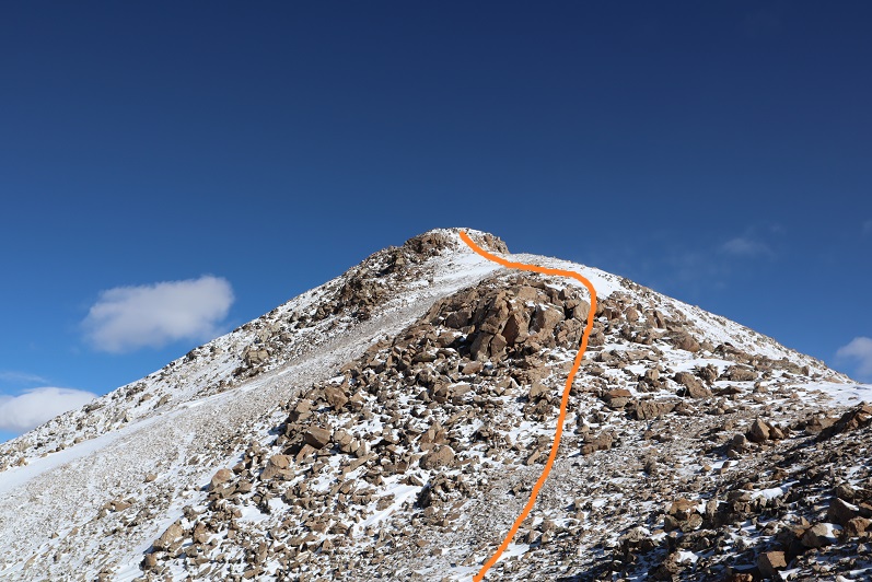
Here’s the last push to the summit

The summit was small and full of large, snow covered rocks.
I set up my camera, sat on a snow covered rock and took 1 picture of myself. I was super glad when I got home and saw the picture turned out ok because it was the only one I took (logistics made it difficult to take a picture of myself on this summit). I didn’t see a summit register, but it was probably buried under the rocks and snow.

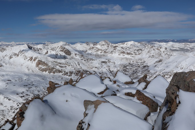
The views from here were as equally amazing as from Mt Champion
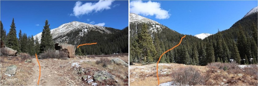
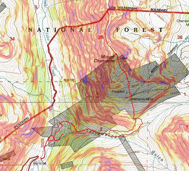
Here’s the route back to Mt Champion, and the North Lake Creek trailhead is circled in red.

A short way down from the summit I met another hiker! I was very surprised to see anyone else out here today. We talked for a short while, but I don’t do well standing still in the cold so I was probably a little quick to end the conversation. He said he might be headed over to French Mountain after this, and had taken the road in. I wished him luck and was on my way

Re-summiting Mt Champion was easier than I’d thought it would be: I wasn’t nearly so tired after taking the ridge. Heading back was a breeze as all I had to do was follow in my previous footsteps.


Here’s the route down from the summit of Mt Champion

By now the sun was warming up the snow and it was getting slippery, but I still didn’t feel I needed traction


I found the rock drainage again and followed it back down the mountain

I slipped here. Twice. Turns out snow covering moss that’s still green is slippery when the sun warms it up.
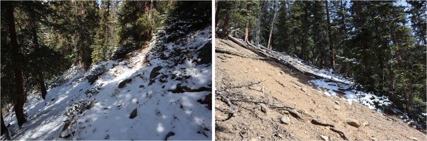
On my way out of the gulch I stayed higher in the trees than on my way in because I found a cairned trail. I followed it until it disappeared and then followed game trails to the avalanche area.
Where I linked up with the trail I’d followed in and followed it back out. The sun had already melted out a lot of the snow from this morning.
The creek crossing was much easier to navigate in the daylight and I found an easy place to cross
From here I could see the dirt road, so I aimed for it and followed it back to the trailhead.

I made it back to my truck at 1pm, making this an 8 mile hike with 3692’ in elevation gain in 7 hours. I was surprisingly but pleasantly sore from such little mileage/elevation gain.

Laura,You have some really nice framing photos.Especially the photo of yourself at the summitT.That photo should be surely framed.As a photographer Yoy can surly see thst.You have so many great photos thatI would like to copy for myself ,espically Your sun rises and self photos.I am still drawn to the sun coming up between Your index finger and thumb.That’s just the beginning to the many photos You have taken while having frozen hands and feet.That doesn’t include the super high winds that topple Your petite frame of a body and at times brings injury.Even in bruises and cuts and sprains You always manage to stand strong.
Thank You Laura for showing me places that I’m sure I wouldn’t see without Your camera and the writtings. I have come to love and cherish as a part of my daily readings and thoughts.I realize You present Your articles at and average of once a week,but I return to see if I may have omitted any important item that would make my day more proffitable.
I truly thank for allowin me to follow You and Your family as as Your lives change for the better.God Love You collectively and individually.You are absolutely amazing Lady Laura.
LikeLike