RT Length: 15.92 miles
Elevation Gain: 5039’
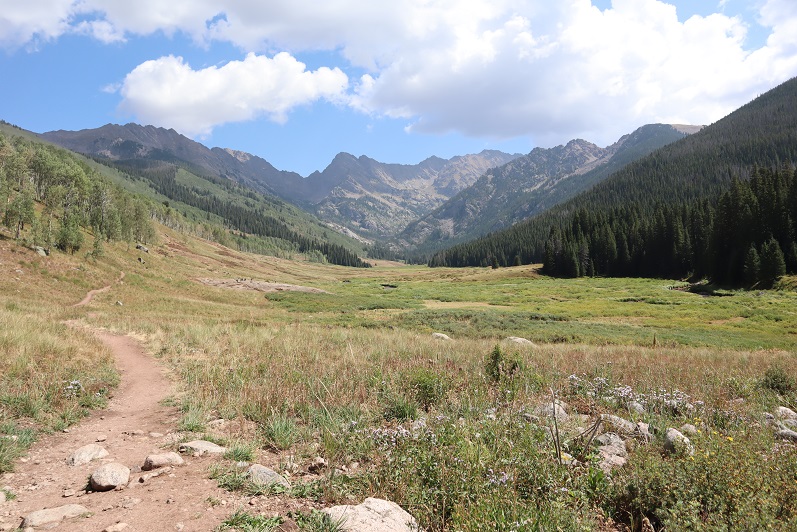
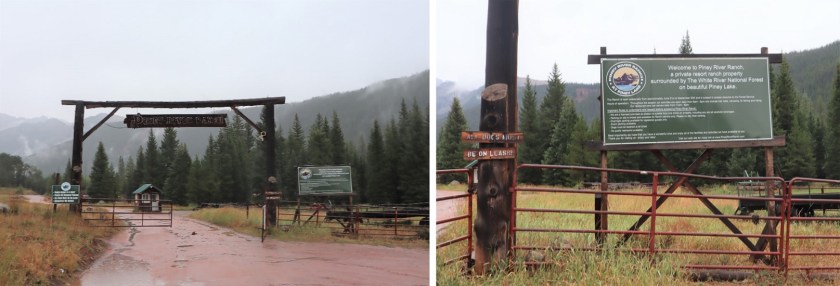
I drove to Piney Ranch in the rain. The dirt 2WD road to get there is more like easy 4WD: tons of potholes make this slow going for 2WD vehicles and 4WD vehicles alike. Given that it was raining as well it was a slow drive in (the Escalade in front of me was extra cautious, and didn’t seem to mind I was behind them: gotta love California drivers. I say this being from California myself, and understanding their driving mentality). I parked near the gate and ate dinner as I waited for the rain to stop. It finally did and the sun came out. Woot! The sun dried up all the rain and I wasn’t going to need to worry about my legs getting wet from water droplets brushing against my pants from the plants on my way in. This picture is from one of the good parts of the road, just before the ranch.
I hadn’t planned on hiking this peak today. In fact, it wasn’t on my list for the net few weeks, but weather earlier today had caused me to alter my plans. This meant I hadn’t done as much research on this peak as I should have, so I asked everyone arriving back at the trailhead where they’d been to see if I could get more beta. No one had been hiking Mt Powell. I did talk to one guy who hadn’t hiked it, but said “That’s one heck of an approach!” This scared me a bit. I asked him to be more specific? I told him I’d hiked all the 14ers, could he compare the approach to any of those? His reply was “I’ve done the 14ers as well. Nothing compares”. It wasn’t lost on me he didn’t say ALL the 14ers, but I figured it couldn’t be that bad or I’d have heard about it by now, even with just some cursory research.
I sat in the back of my truck with a glass of whiskey and finished reading “Death in Yosemite” (the last chapter is ‘Homicides’, and I’d advise against reading that chapter, especially if you’re hiking alone in the dark the next morning: also, avoid hitchhiking).
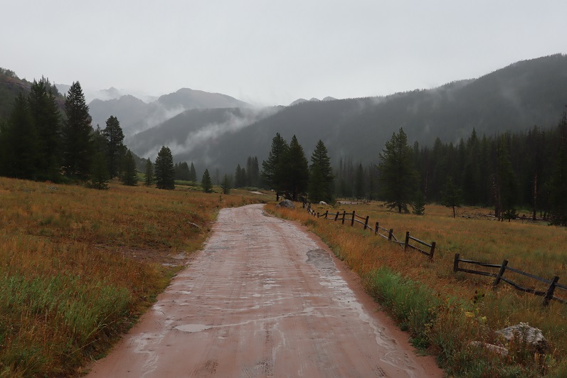
I went to bed early, and was woken up around midnight to the sound of rain. Wonderful. Oh well, nothing I could do about it now. I fell back asleep for a few hours, woke up and was on the trail by 3am. The trail starts just to the north of the gate, and heads east.
It passes Piney Lake and continues along the basin. In the morning moonlight I could see the basin was covered in fog. Such a cool experience!

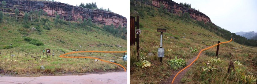
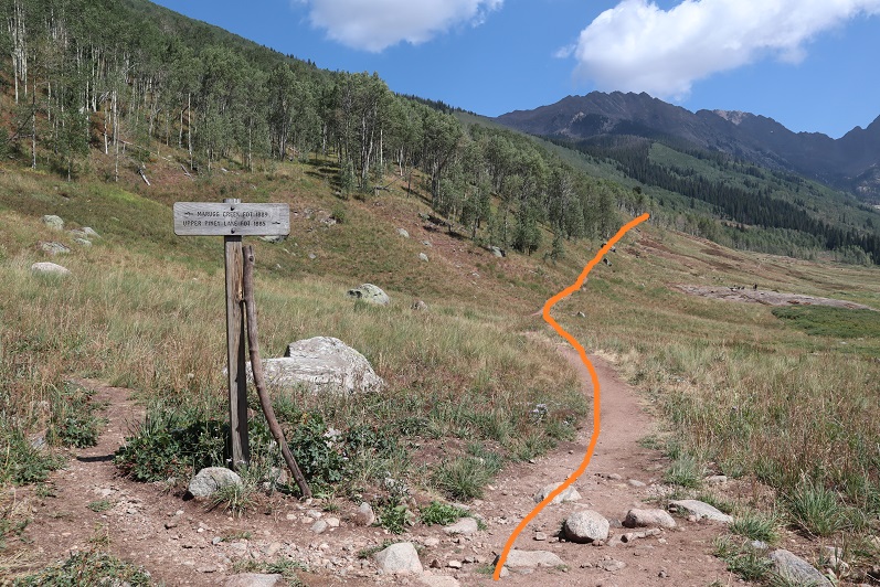
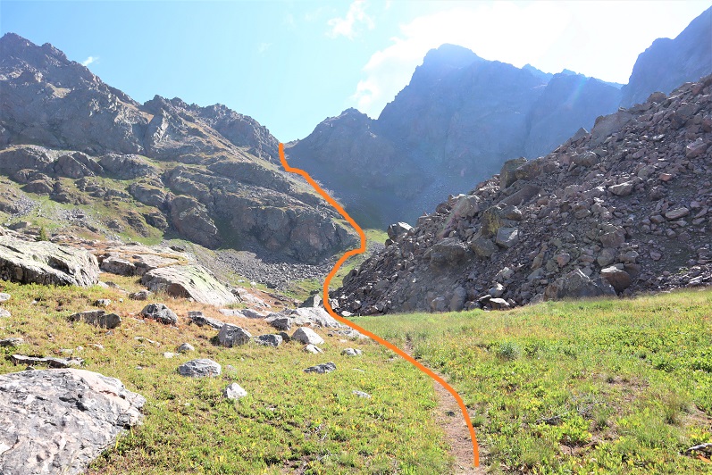
I continued heading east at this sign (after about half a mile). It’s the only junction you’ll come to.
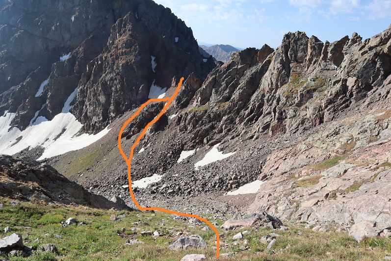
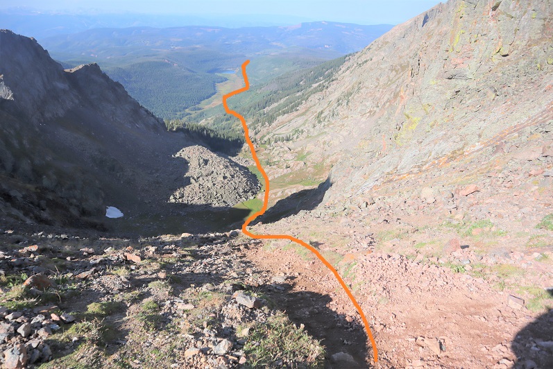
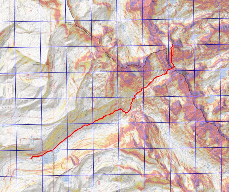
Other than that, this is pretty much a class 1 hike all the way to the pass. There’s a trail that passes rocks/goes up drainages/waterfalls in areas, but it’s difficult to get lost on this trail, especially in daylight. Here’s the overall route to the pass, with the more difficult parts highlighted
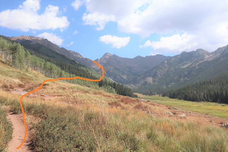
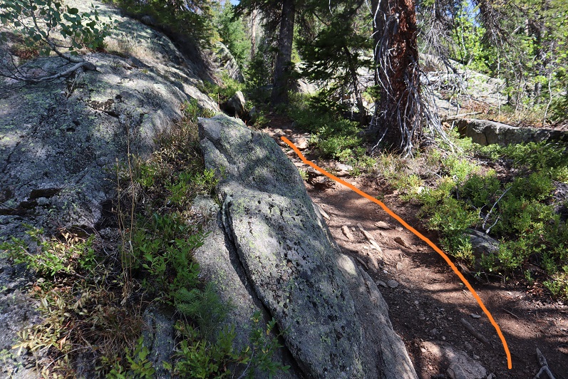
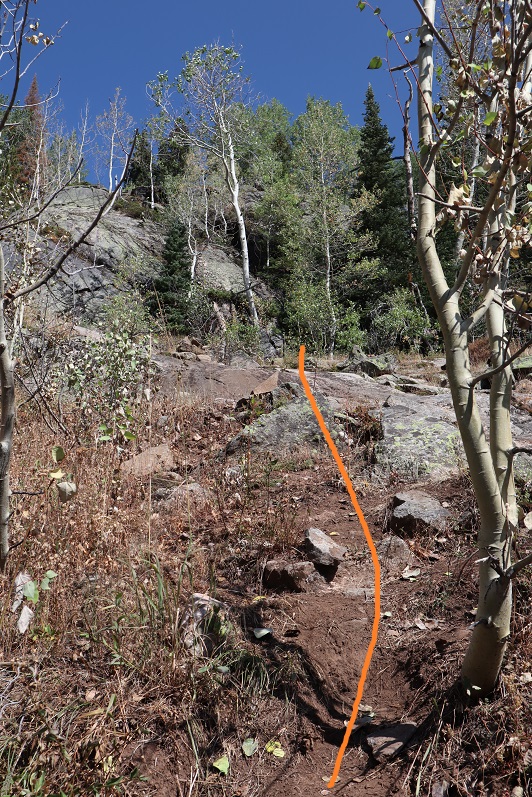
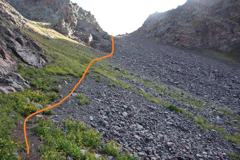
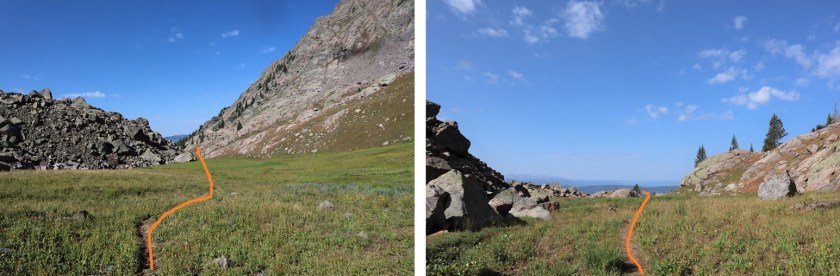
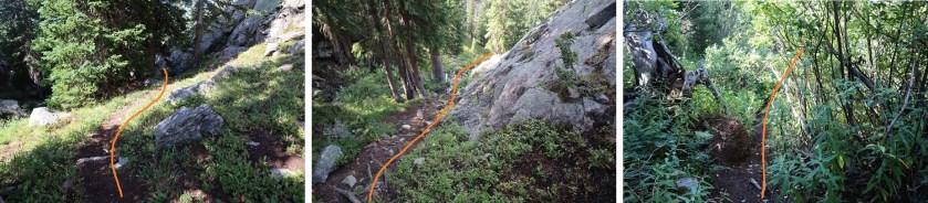
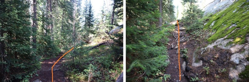
and some photos of the trail
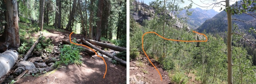
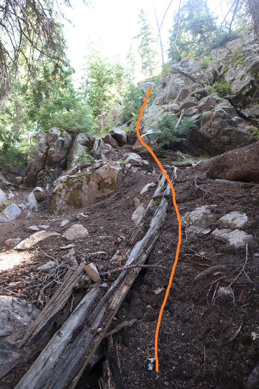
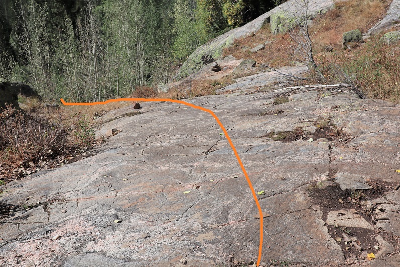
This area was a bit tricky for me in the dark, but when the trail ended I really just needed to follow the granite slab up. There was a cairn at the top, but I couldn’t see it from below in the dark
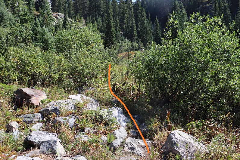
I went through an area with willows
And then some dry waterfall areas (the waterfall stays to your right, and you don’t ever cross it). If you come to large boulders, they’re ALL passed to the right on the way up. If I ever lost the trail, it was because I was supposed to climb up the rocks (nothing other than class 2).

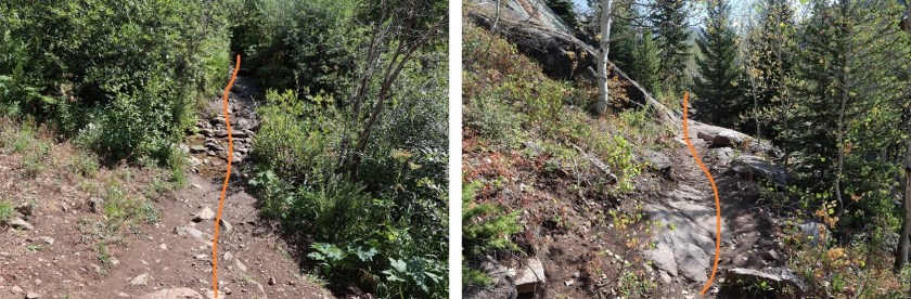
I passed a camping area. (There are 3 in total, this was the first). From far off I could see a green tent lit from inside with a flashlight, and someone standing with a headlamp. It was now about 4:30am. I was sure this person could see me too, because I was right in front of them and I had a flashlight as well. Apparently, he was groggy, because as I got closer I realized he was peeing. He didn’t notice me until it was too late. He also didn’t bother to recognize I was there (I’d have been embarrassed too). He turned away and went back to his tent. I’m only saying this to reiterate to everyone out there: don’t pee by your tent, instead head for the trees, and turn your flashlight off while you do so! Just assume someone can ALWAYS see you (I had a pair of hunters follow me with binoculars once in the middle of nowhere. They watched me for over a mile just to talk with me when we met up. Good thing I hadn’t stopped out in the open to pee….). Just before entering the upper basin there’s a large boulder. This gave me some pause in the dark. Yes, you do traverse a few feet above the ground here, and then the trail picks back up

It’s now back to class 1. There’s also a camping area here. If I were backpacking, this is where I’d camp (at 11200’ after 5.25 miles of hiking).

Imagine my surprise when, upon entering the upper basin, there was still a trail! In fact, there was a trail up the gully as well. I thought back to what that man had told me last night about this being a difficult approach and laughed. The only thing ‘difficult’ was it seemed to take forever to get to treeline (over 5 miles, it seemed like I would never get there, and it was all up). Other than that, I’d been following a trail the entire way. I smiled and continued on. Here’s the trail to the top of the gully
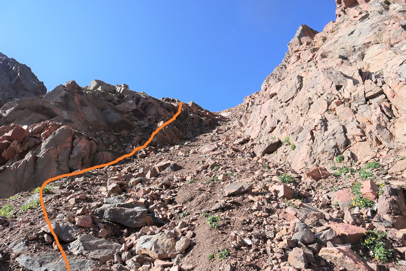
The scree here wasn’t even that bad. You could just go up the middle directly, but the scree there looks loose. I kept to the left. If there were snow I’d most likely have gone directly up the center.
At the top of the gully I was thrilled to discover the snow was avoidable. I’d seen several trip reports where there was unavoidable snow until September, but luckily the snow today was avoidable. I decided to descend 150’ and keep this class 2 instead of traversing the ledges. I went down to the right, and came back up to the left. Since it had rained last night the scree was easily navigable, but is most likely a nightmare when dry: bring microspikes for the dry scree.

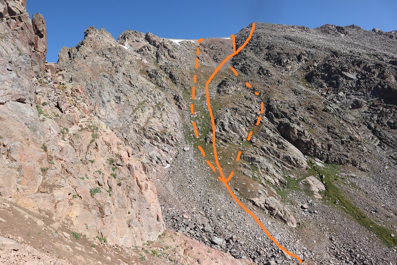
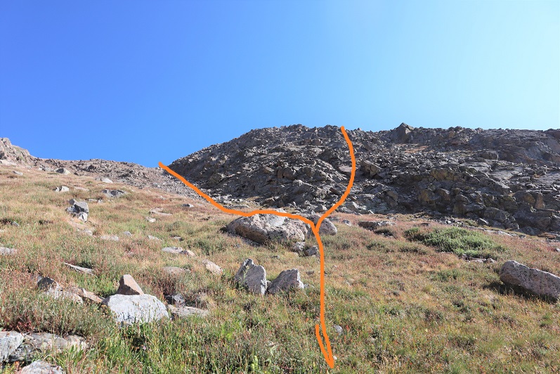
Then I dipped down a bit, crossed the ravine, and headed back up. All of these gullies go to the top, and the short saddle is relatively flat. However, I found when I’d summited there was still about 200 feet of snow/ice at the top. To avoid this, take the gully as far right as possible. By this time it was getting windy: the cold, early morning wind was coming straight down the gully and that spells disaster for my Raynaud’s. Also, I was done with gullies (I’d done 13631 the day before with, like, 10,000 gullies) and decided to rock-hop the last bit of the way to the summit. This was all class 2 and went easily to the summit (and I was now working different muscles so my legs thanked me). I went right on the way up, left on the way down. Dotted lines are alternate routes. They all go, and there are most likely many more lines that go as well.
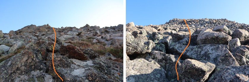
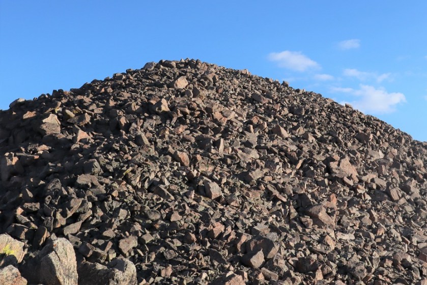
Here’s what the rock-hopping looked like. Most of the rocks, especially the larger ones, were stable. Once again, all class 2.
The last bit up to the summit was especially easy, and needs to be climbed if you take the gully or ridge
I summited at 8am
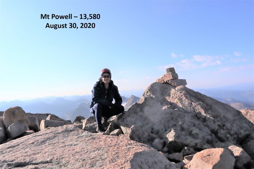
Mt Powell:
It was windy and cold so I didn’t spend a lot of time on the summit: I couldn’t feel my fingers and wanted to get down as soon as possible. I chose to take the gully down. There was still snow at the top, but it was avoidable.
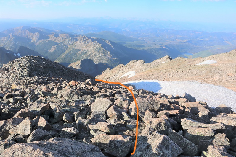

Here’s looking back up the gully. I took the route to the right up, left down
Here’s a look back up to the pass. I went left on the way down (less steep but I lost elevation) and right back up (steeper, just a tad bit of ice left at the top but will be gone in a day or two). All snow was avoidable
Here’s a look at the gully I went up on my way back. It’s more solid to the left
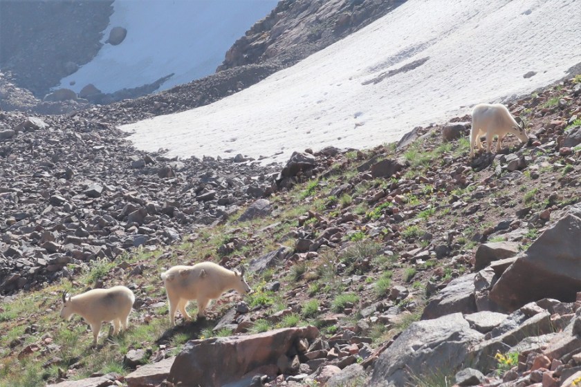
Also, there were mountain goats here
I made my way back up to the pass on muddy scree (thanks to the rain)
And back down into the upper basin

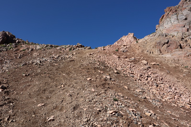
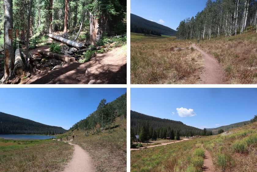
Here are some pictures from the class 1 trail back down to the trailhead
Here’s looking down that rock slab that had given me trouble earlier in the dark…
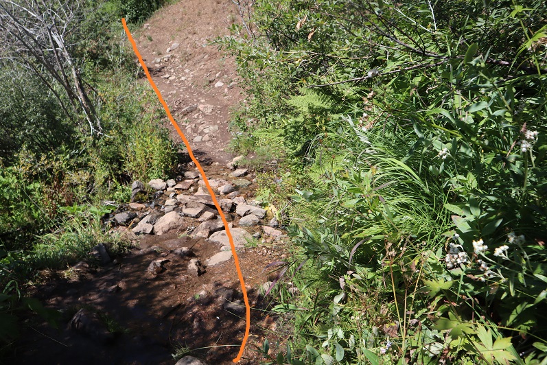
Back around the rocks and across the stream
And back to the ranch

I made it back to my truck at 12pm, making this a 15.92 mile hike with 5039’ of elevation gain in 9 hours.
So, in the end I got 2 peaks this weekend, and only 1 of the 5 I’d planned for, but I consider it a success just the same. Also, any day above treeline is a great day!
