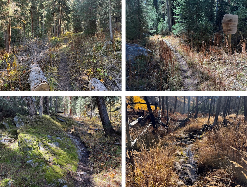
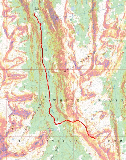
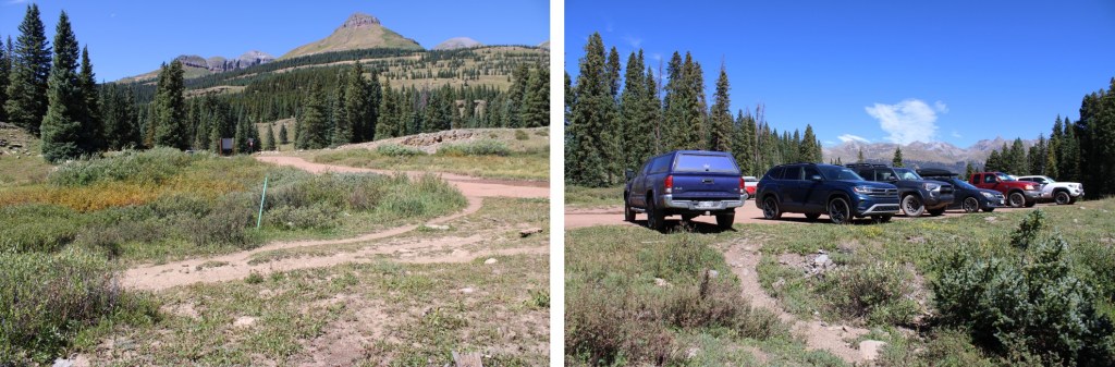
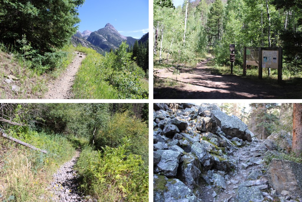
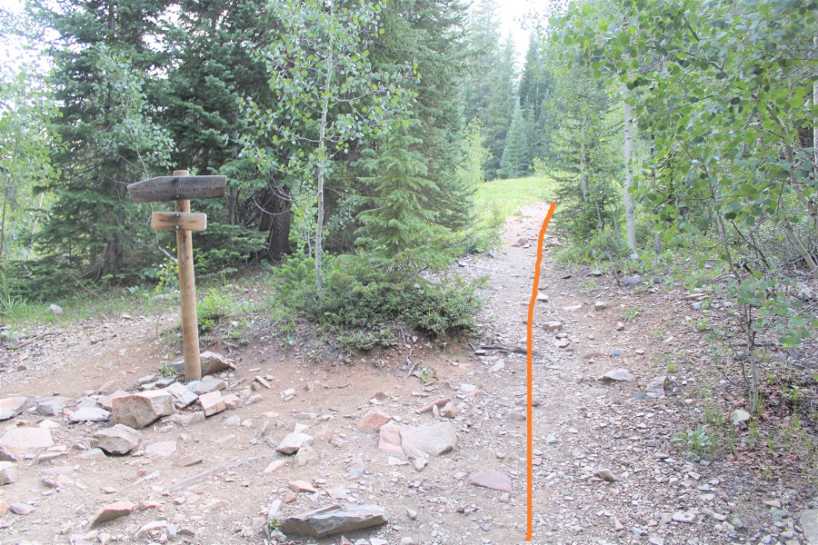
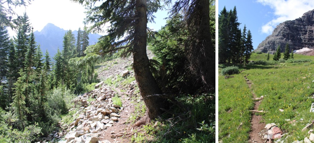
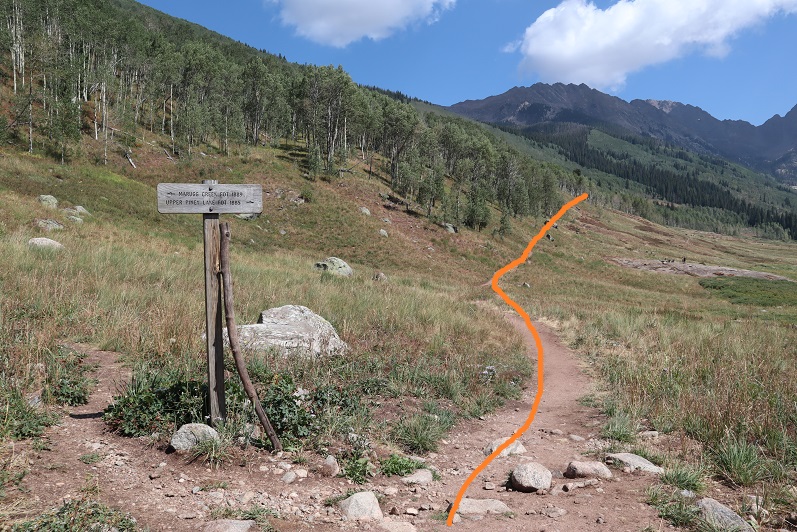
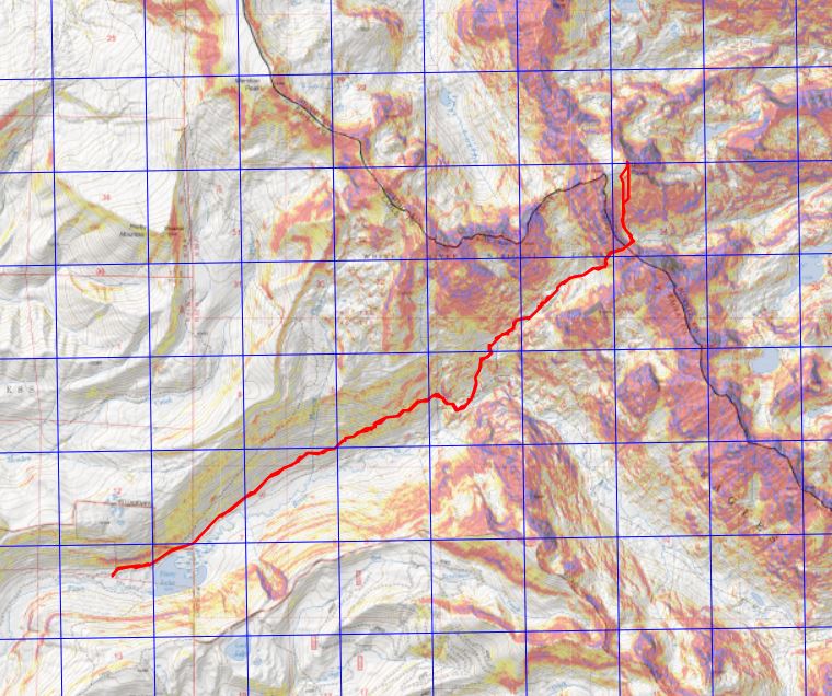
Maps call this trail 1940, but the sign at the trailhead said Fork Fryingpan Trail 1924. From Norrie Colony I took 2WD dirt road 504 for 10 miles until it ended. There is one place to turn left about halfway through the drive to stay on 504 but that was the only turn I took. The left turn is where there’s a sign saying “Hunters Beware: Moose in area, be sure of your shot”. At the trailhead there were several dispersed campsites and lots of places to park. This is a lightly trafficked and remote but easy to drive to trailhead. I didn’t see any other vehicles there. I did see several very large marmots I mistook initially for bear cubs. Be sure to marmot-proof your vehicle.
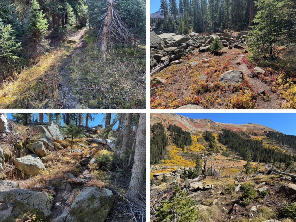
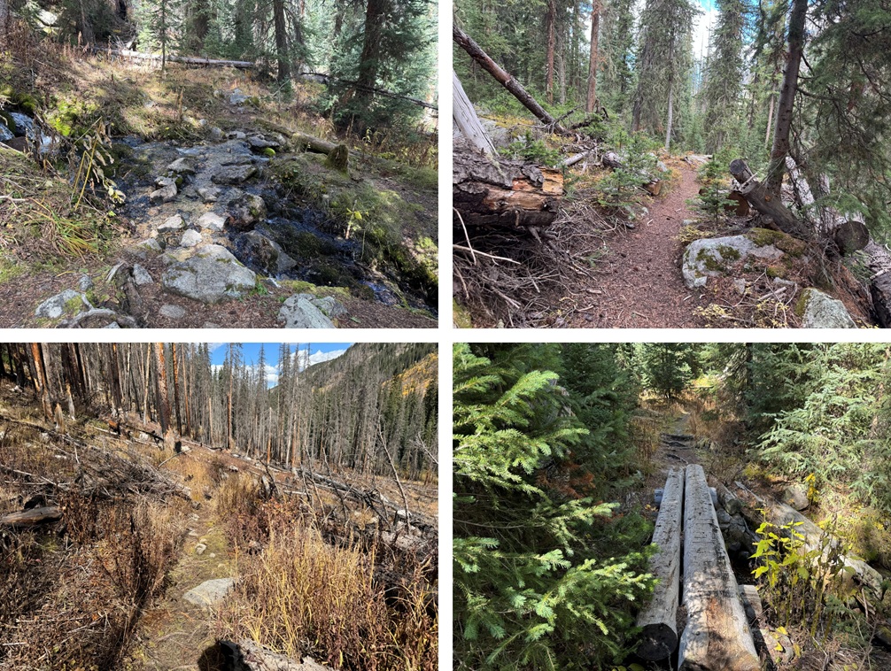
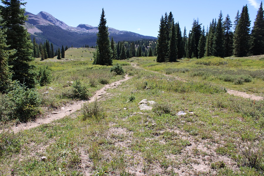
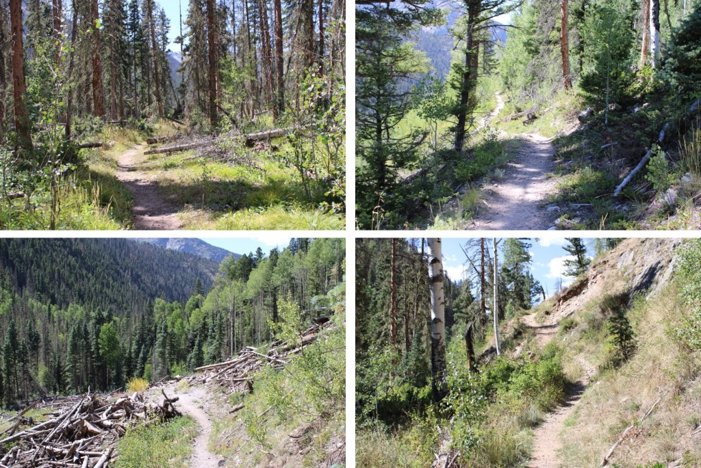
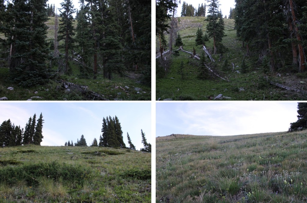
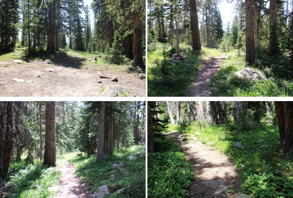
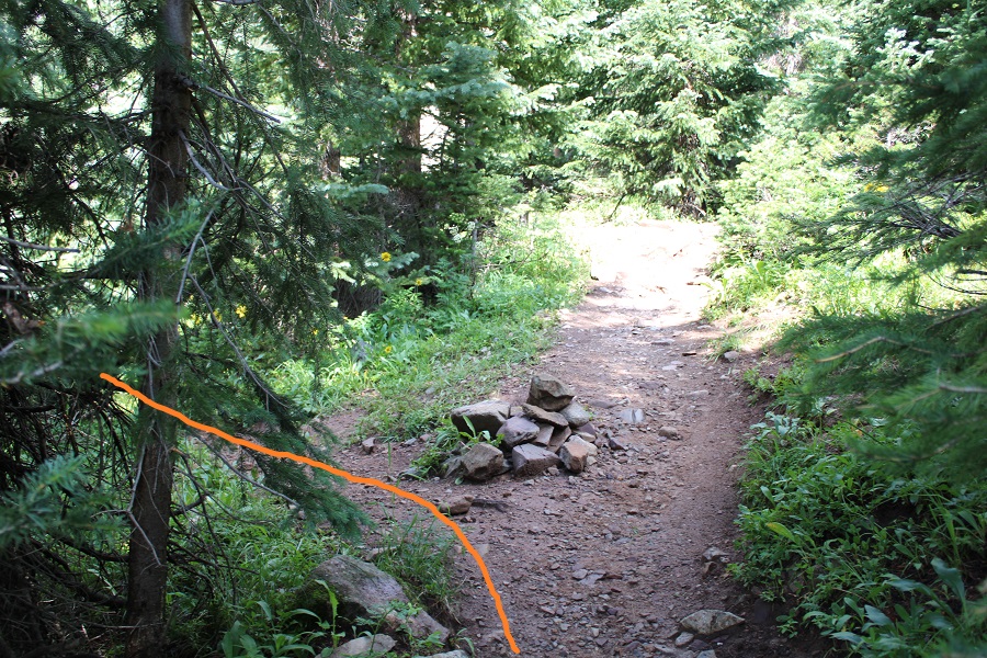
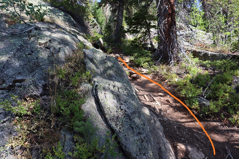
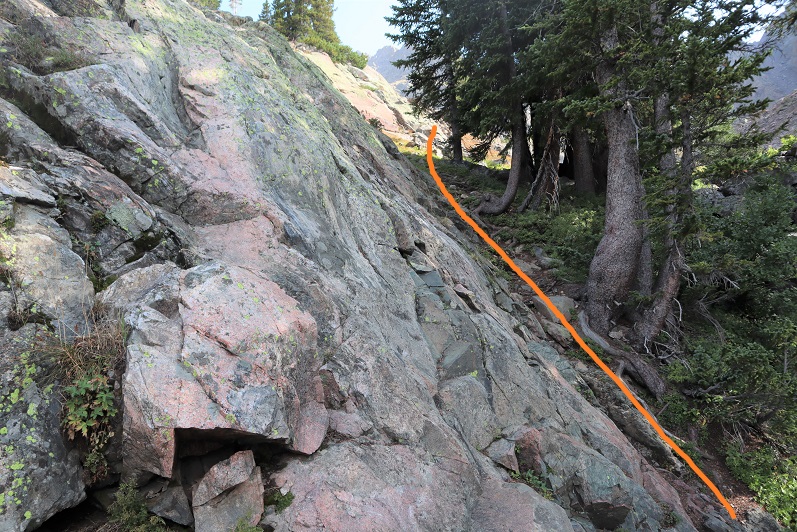
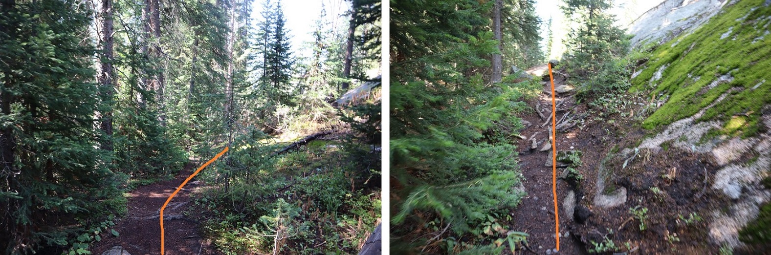
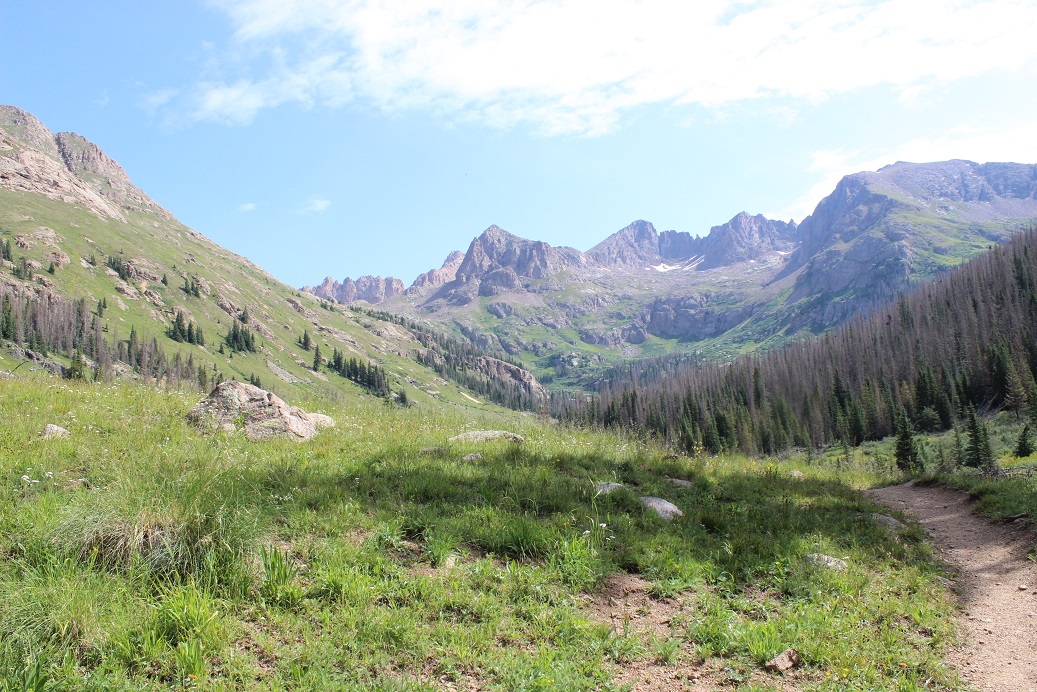
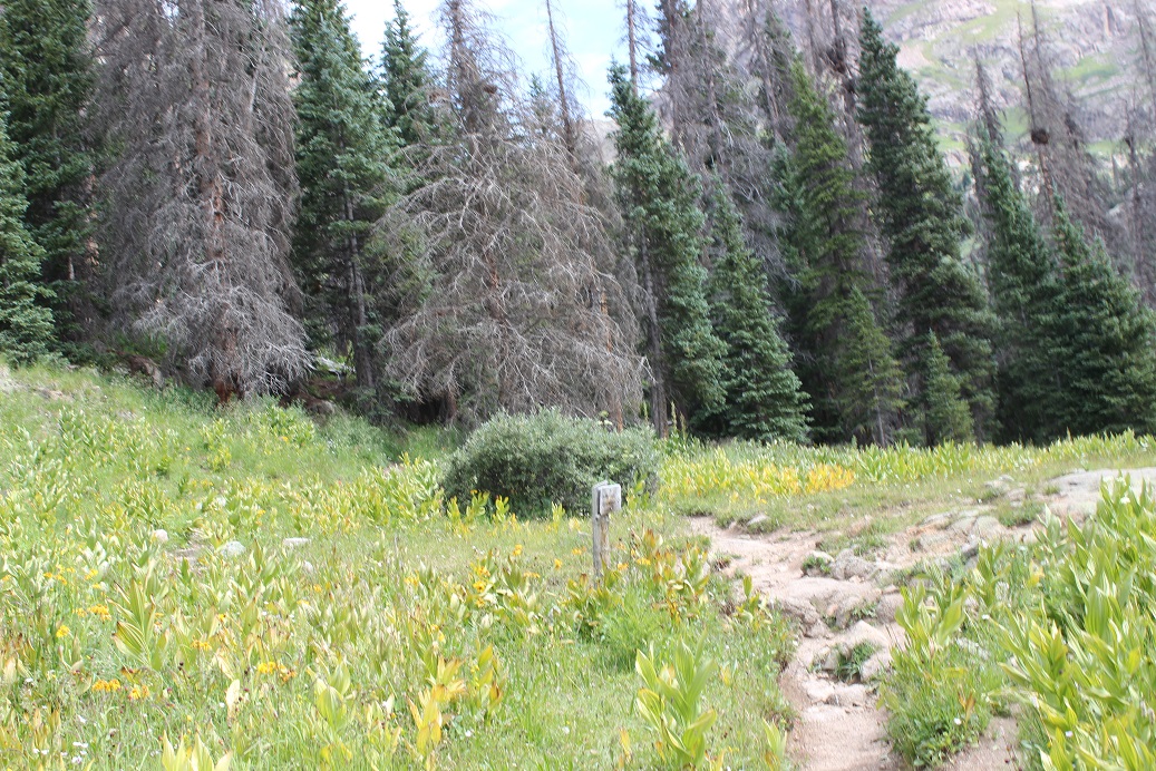
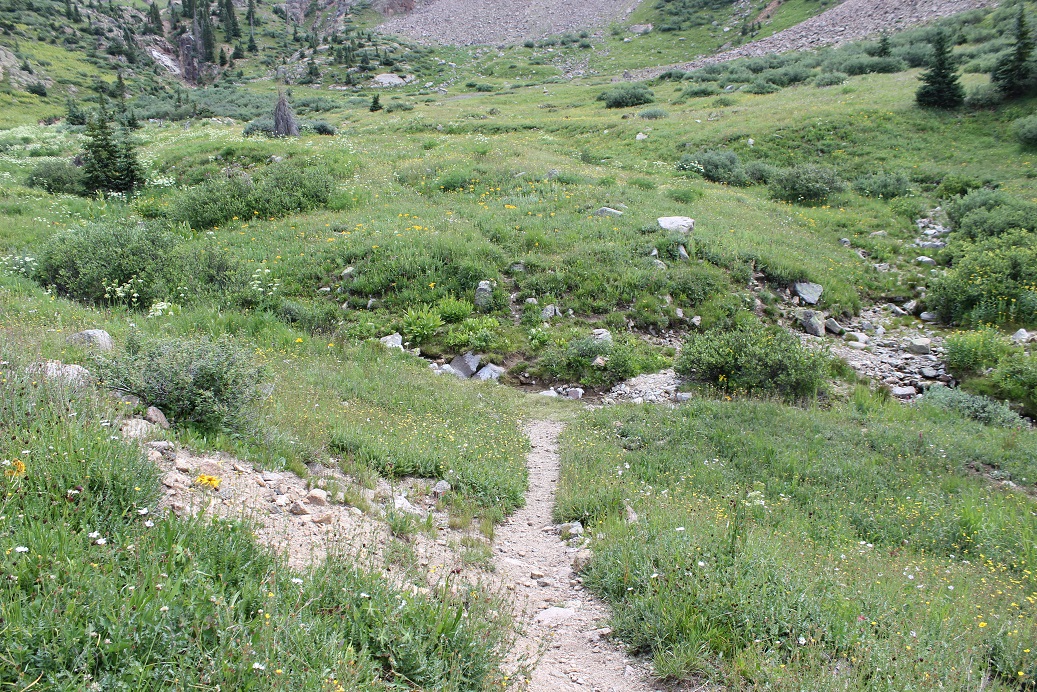
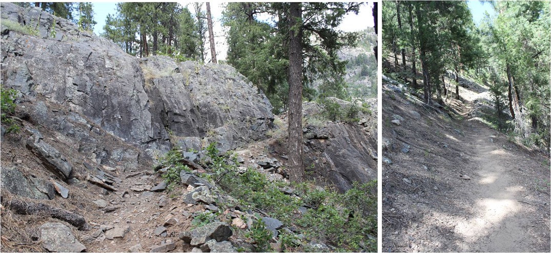
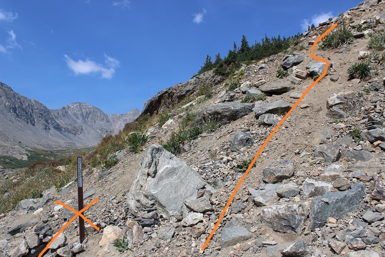
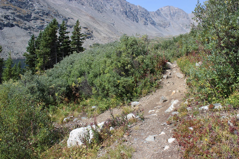
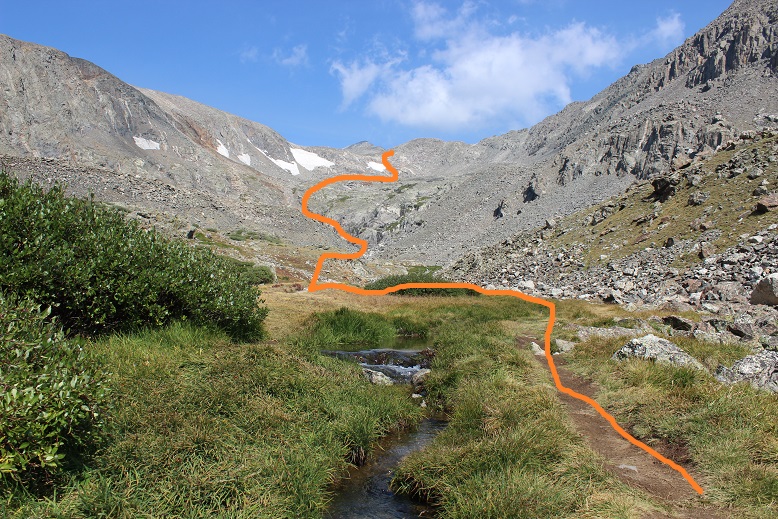
The trail starts at the south end of the parking area. This is a class 1 trail I followed for 4 miles. It parallels the South Fork Fryingpan River. If you get to Deadman Lake you’ve gone too far. There were several small stream crossings and lots of evidence of moose (but I didn’t see a moose). This area has also seen avalanches and a fire in recent years, but the trail is well maintained and easy to follow with no junctions. Oh, and SO MANY SPIDERWEBS! It was obvious no one had hiked this trail in a while. My tracks were the only ones (besides moose) going in and coming out.
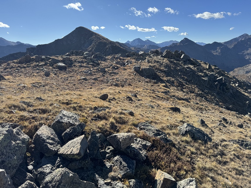
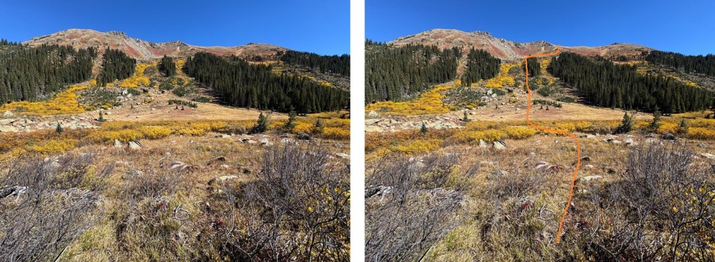
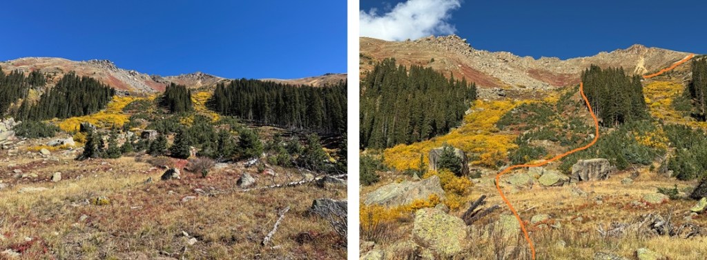
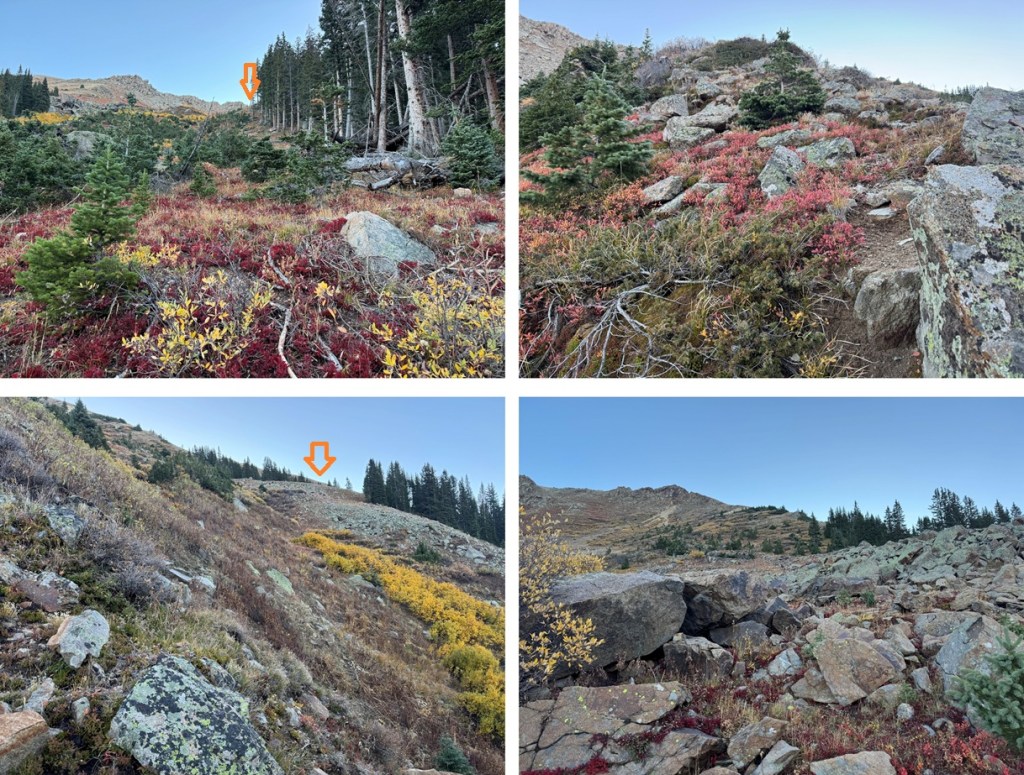
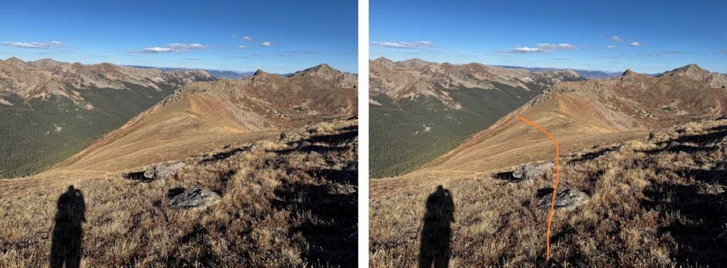
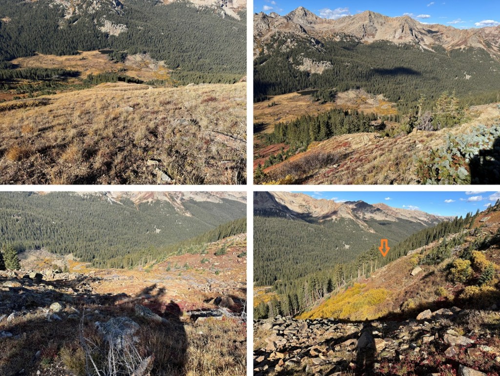
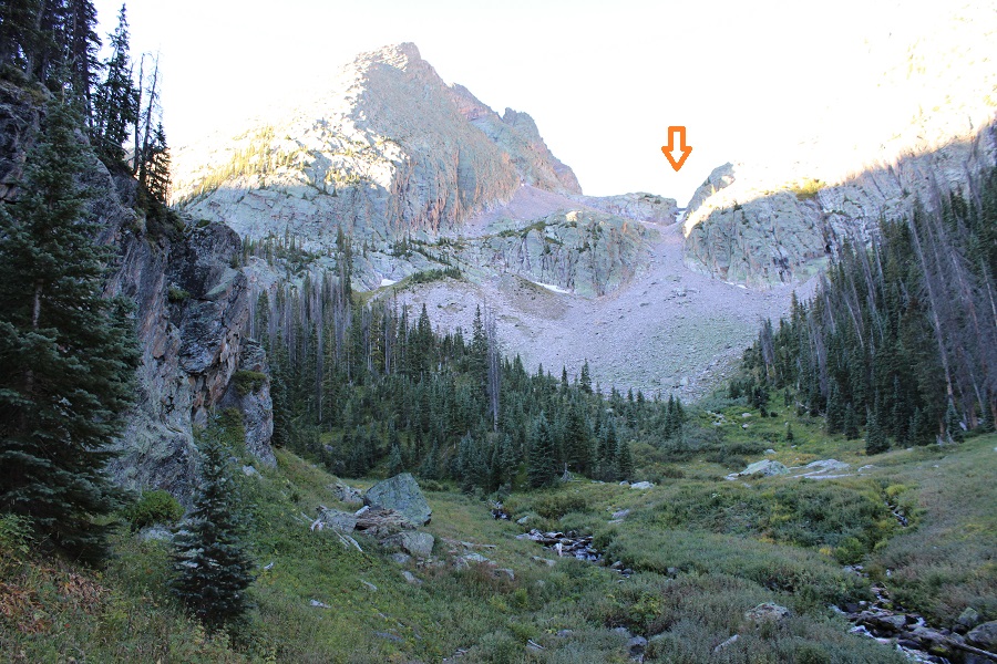
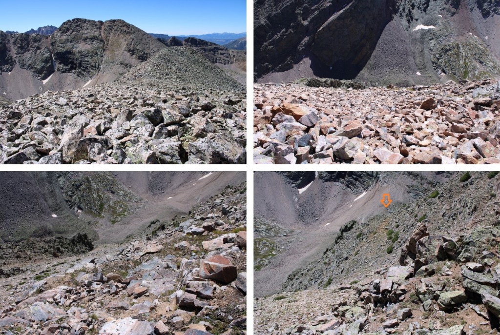
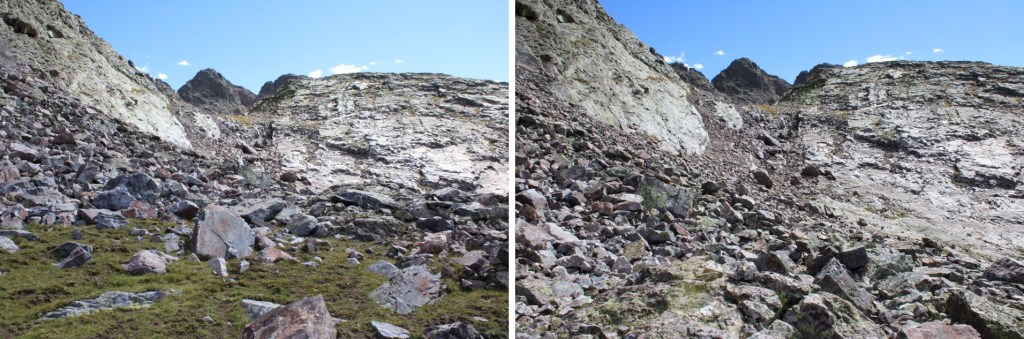
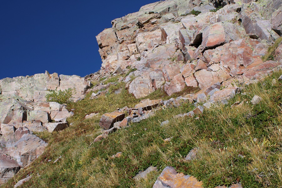
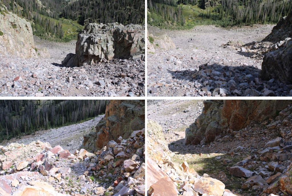
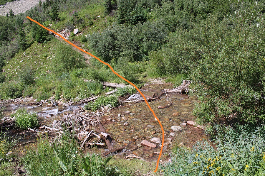
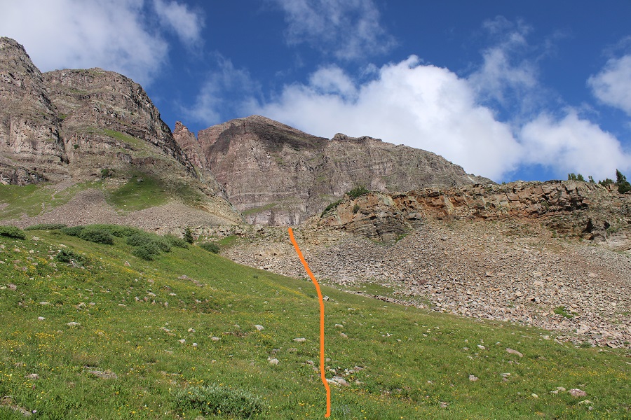
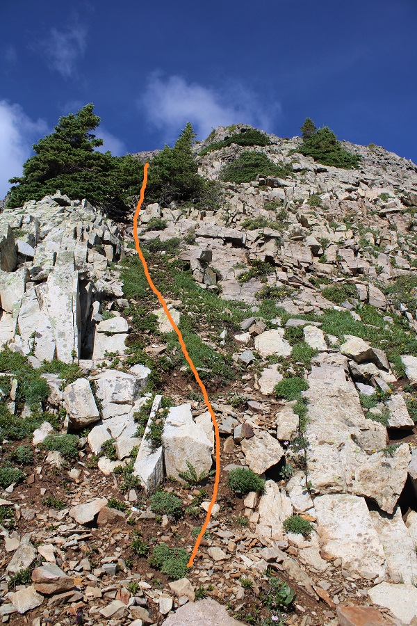
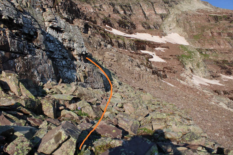
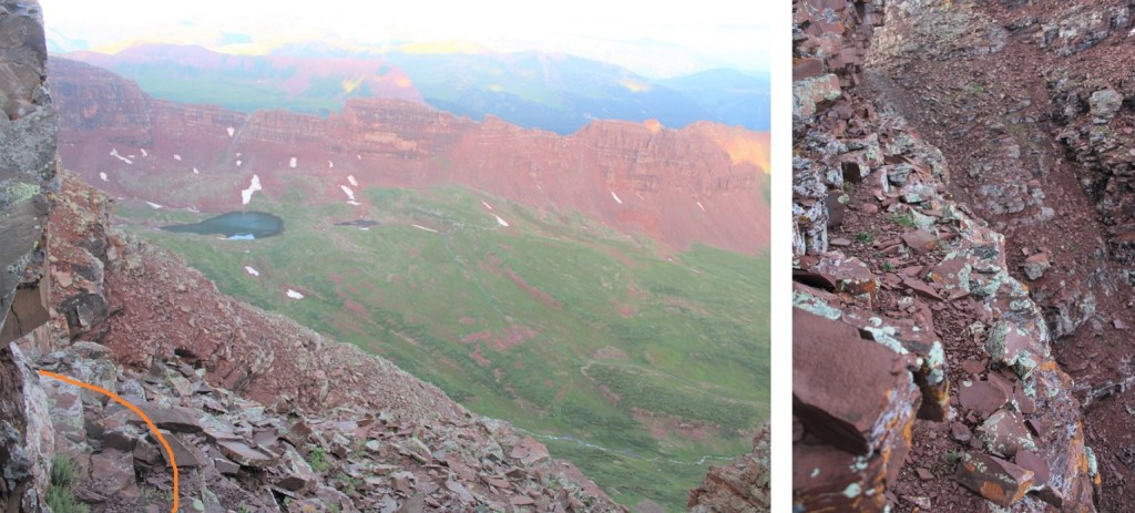
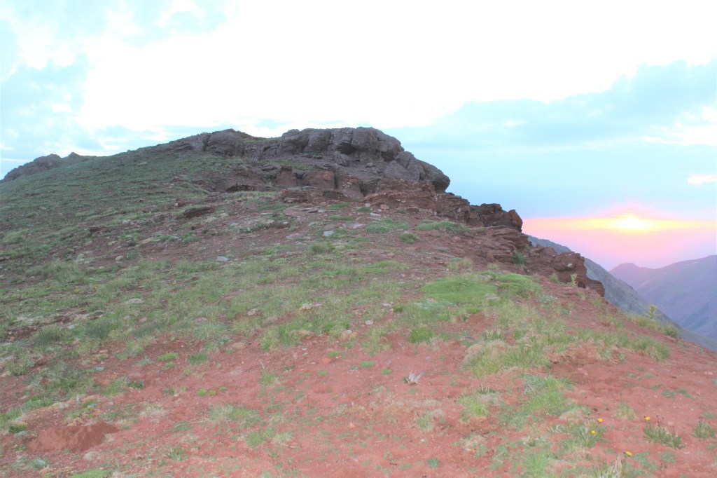
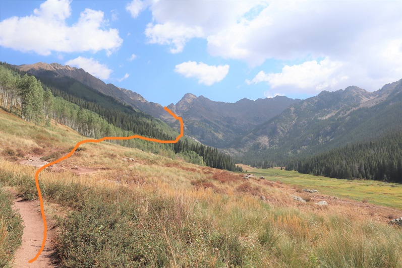
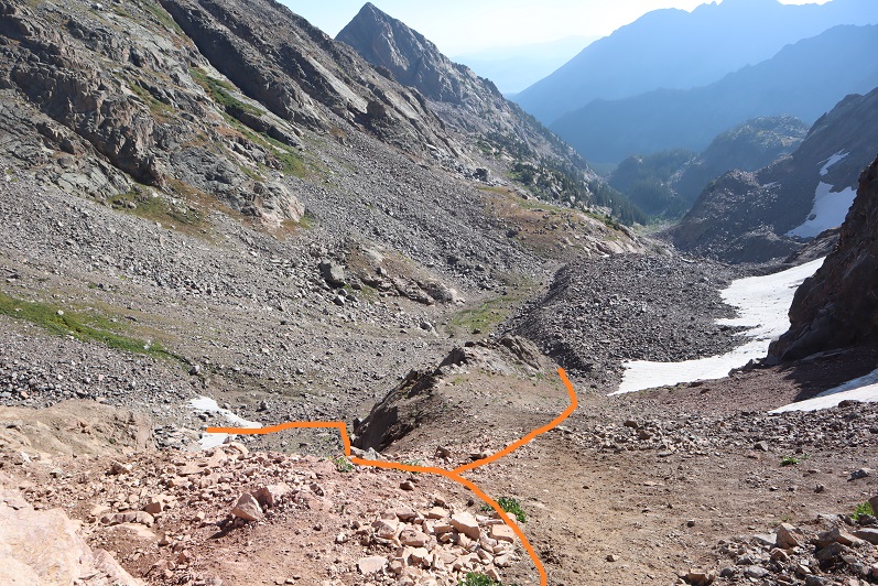
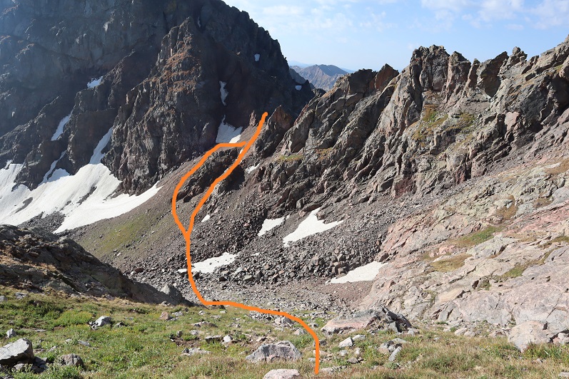
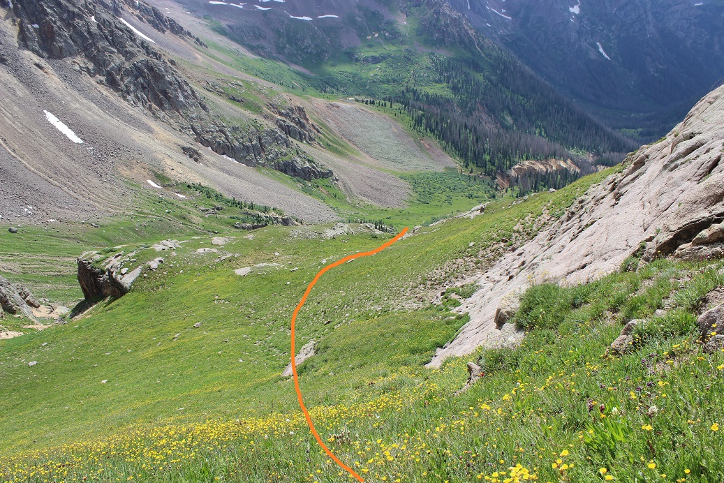
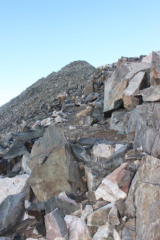
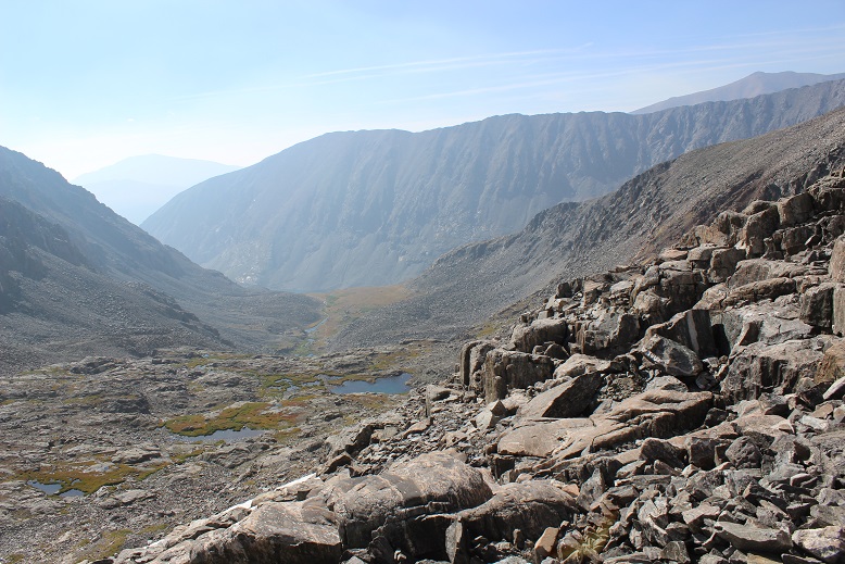
After hiking for 4 miles and at 10930’ of elevation I left the trail and headed east towards an obvious avalanche slide. There are a lot of slides in the area, so look for the one around 4 miles. I was making this an overnight to just enjoy the trek, so I planned to set up my tent at the base of this slide, but if you’re making this a day hike here’s the route I took up to the ridge
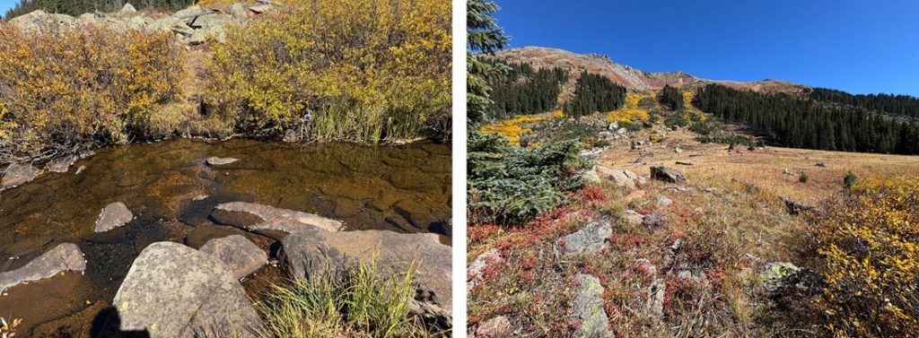
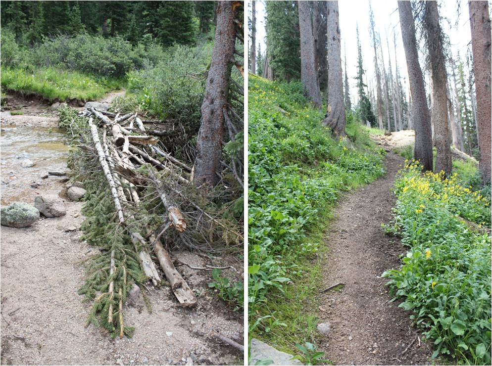
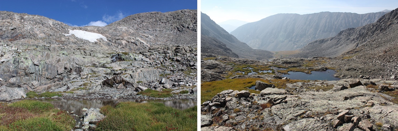
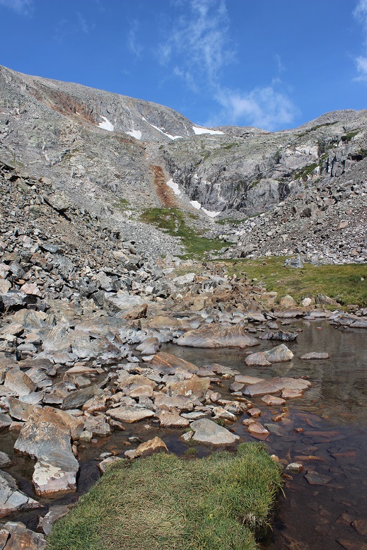
To get to my campsite (and to make it to the ridge) I had to cross the river. Luckily, I was able to rock hop across it, but earlier in the year it was several feet deep and I decided to turn back and wait for the water levels to lower because I didn’t have the correct gear to cross the river at that time. There’s a game trail that goes through the willows that will lead you to the river crossing area. I easily crossed the river and set up camp in the grassy area below the slide.
It took me 2 hours of hiking to get to this spot. I set up camp and enjoyed the rest of my afternoon. Surprisingly, the only wildlife I saw were camp robbers and raptors. While there was evidence of elk, deer, moose, etc. I didn’t see any. There were fish in the river however, and I spent some time watching them swim with the stream. I also enjoyed my views of the Williams group I’d summited earlier this summer. It’s cool seeing mountains from different angles. I went to bed early expecting a cold night. Pro tip: when the temperature is expected to be below 30 degrees I usually double up my sleeping gear. I set up my bivy inside of my tent to stay extra warm. My bivy is very light and small so it doesn’t take up too much space in my pack. It’s worth it for the extra warmth.
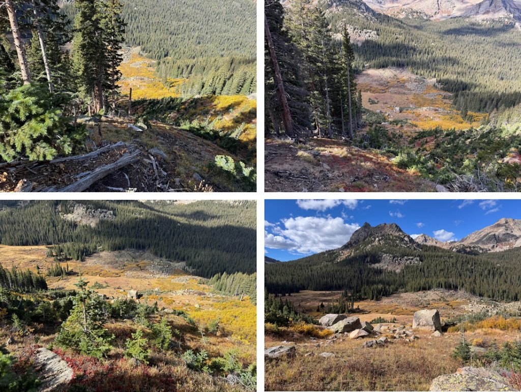
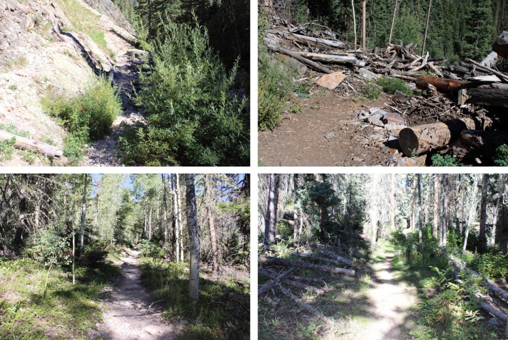
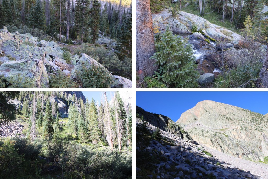
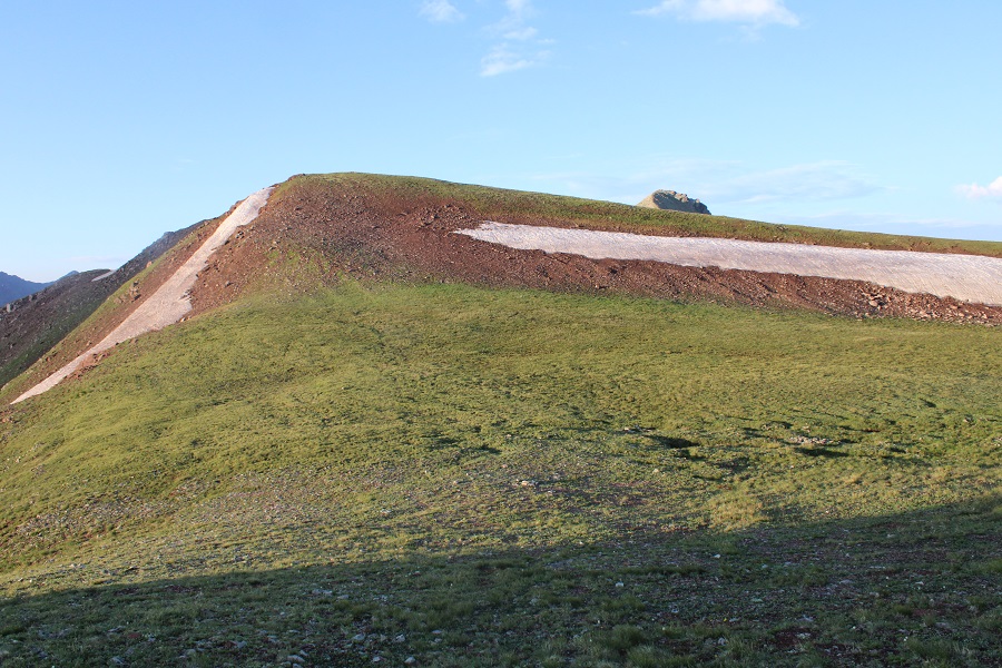
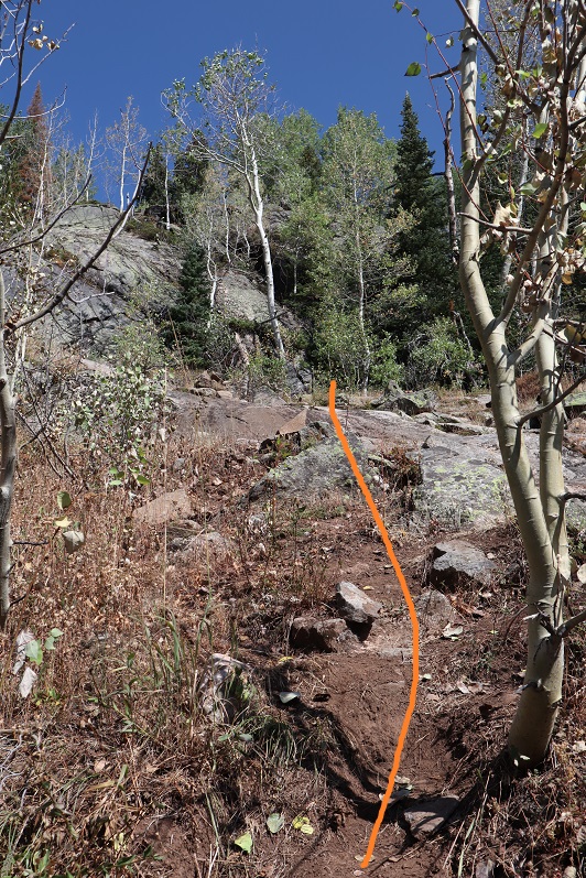
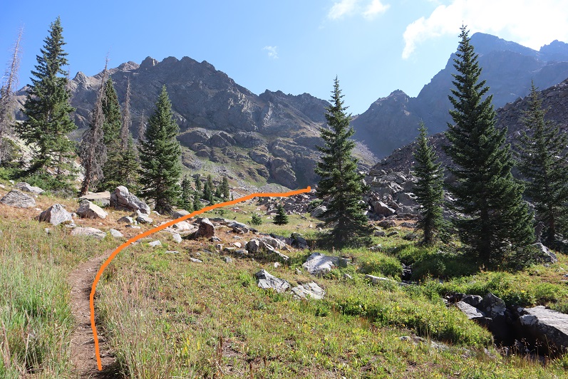
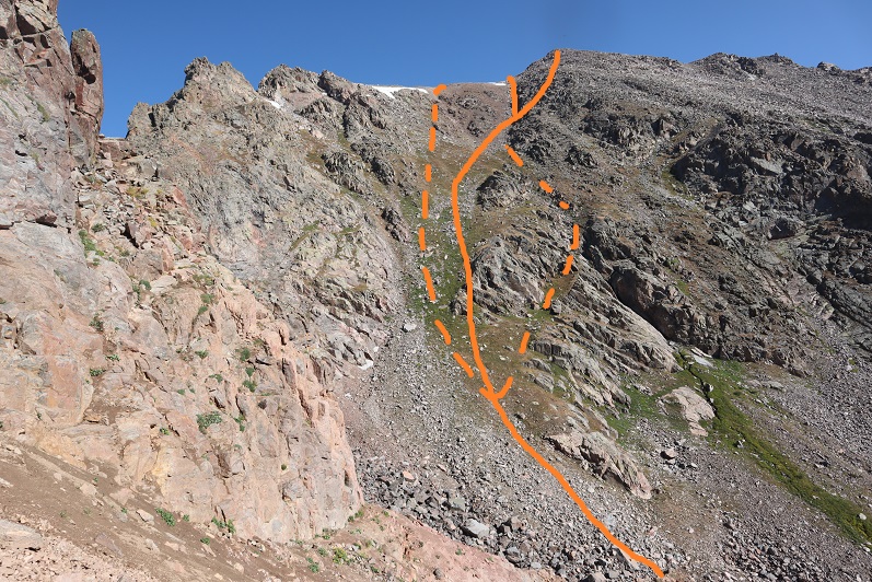
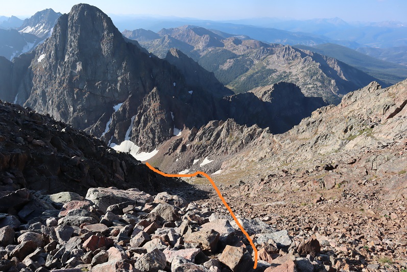
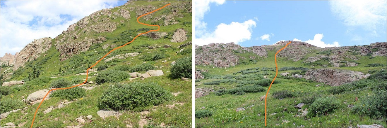
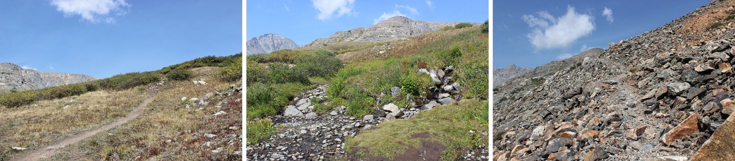
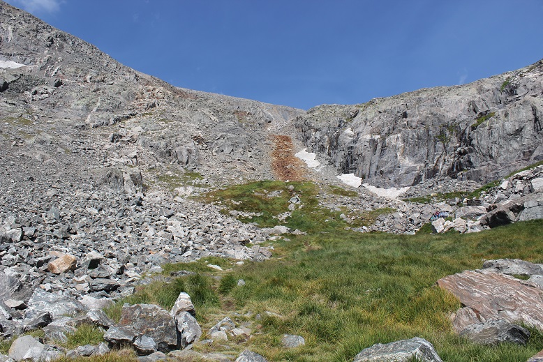
The next morning I was up and on the trail at 7:15am. I found the best way to avoid the willows in the slide area was to stick close to the trees. At the top of the trees I veered right on a game trail and took a tundra grassy hike to the ridge.
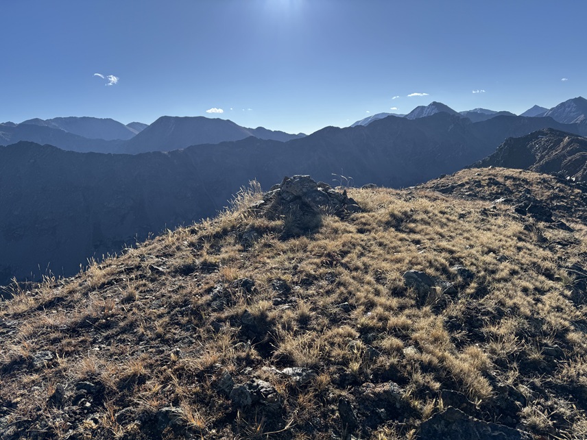
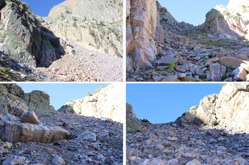
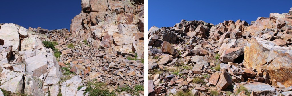
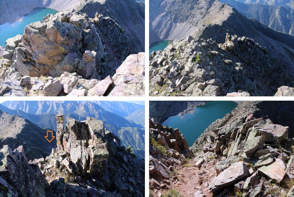
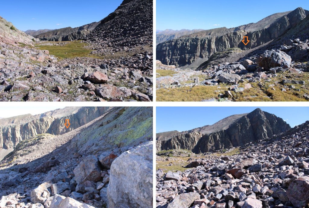
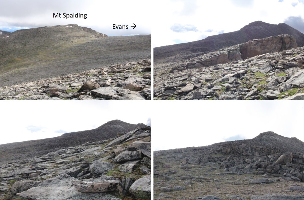
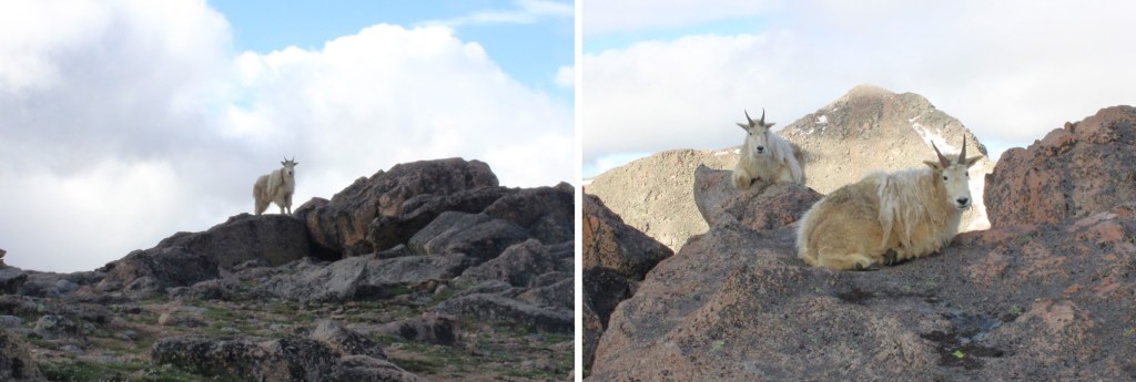
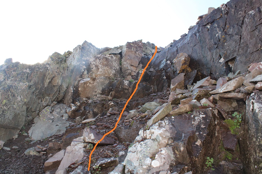
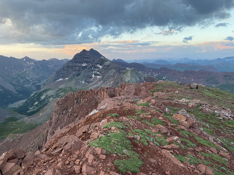
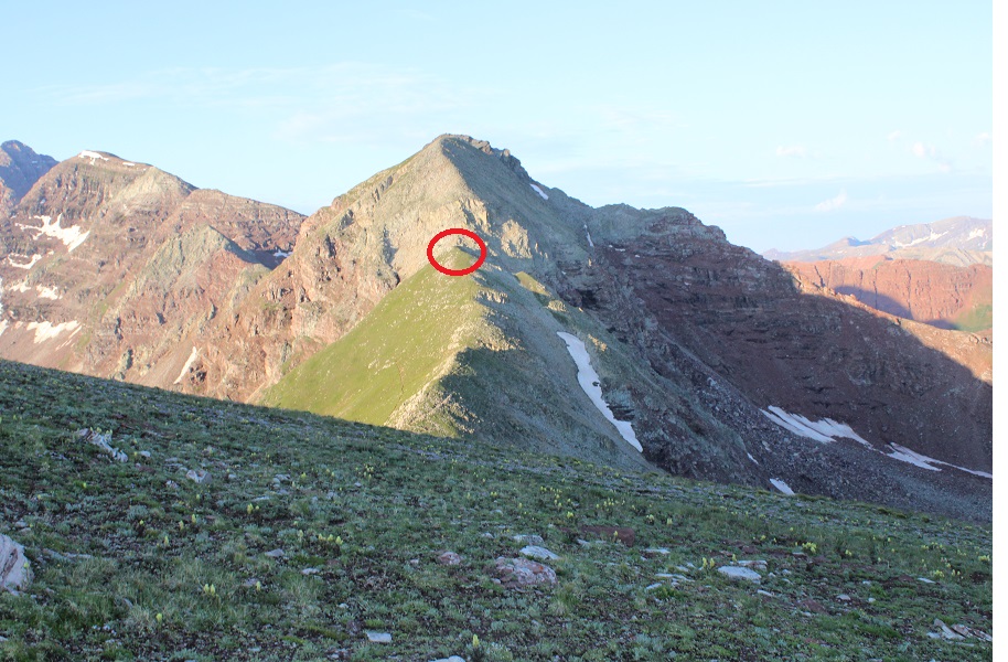
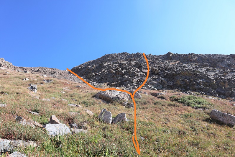
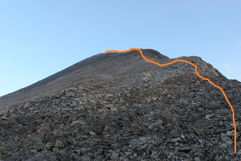
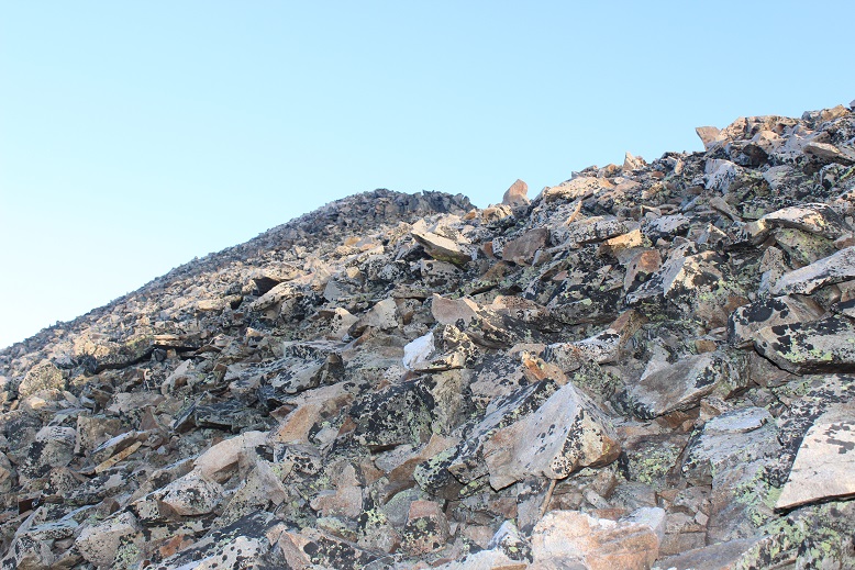
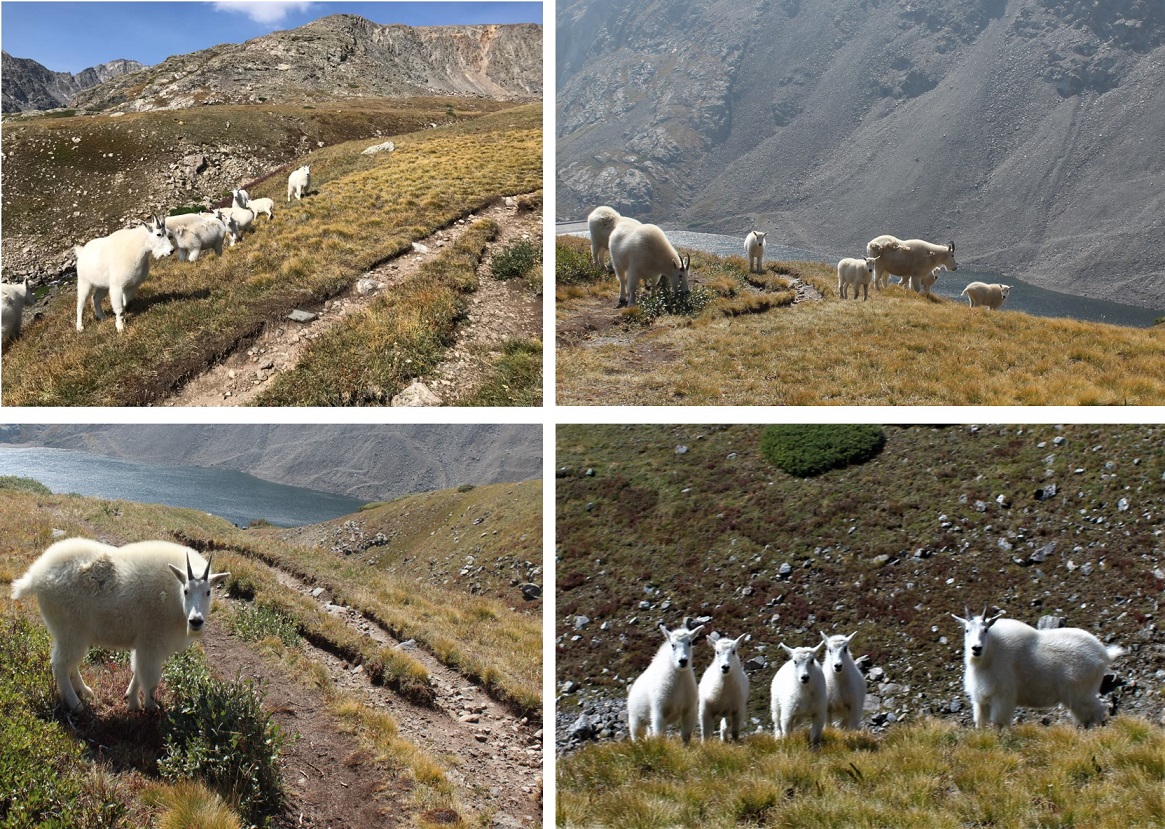
At the top of the ridge I turned right and started following the ridge southeast, still on tundra. This can all be kept class 2, but there is a false summit. I followed the ridge to the false summit and saw a pair of mountain goats.
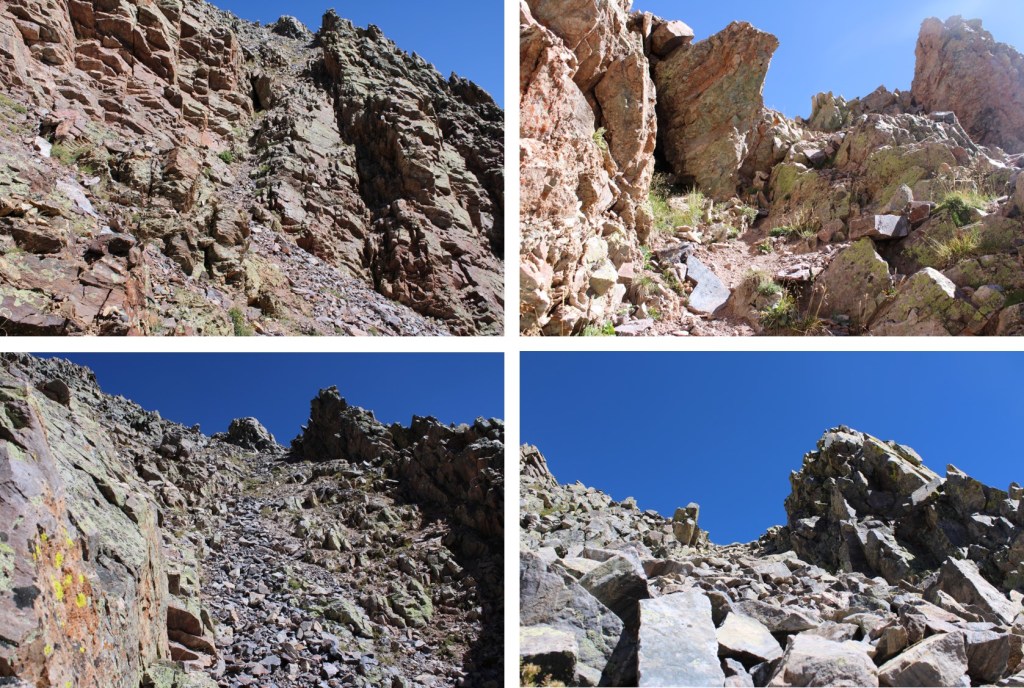
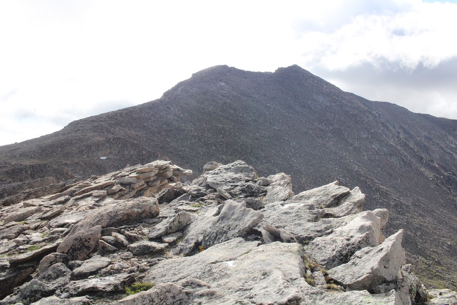
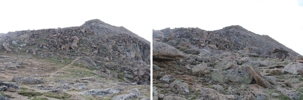
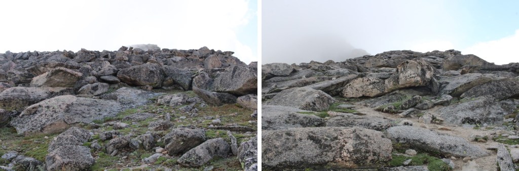
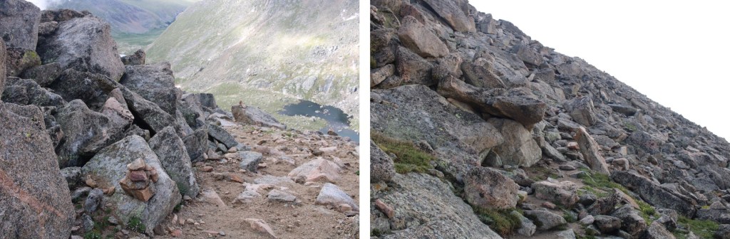
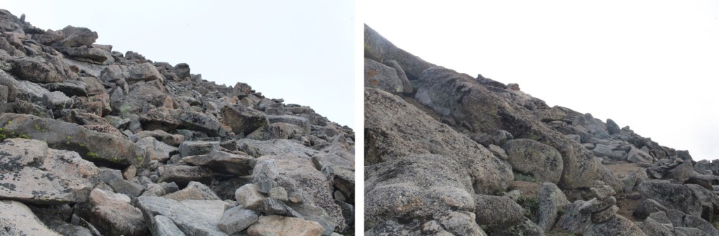
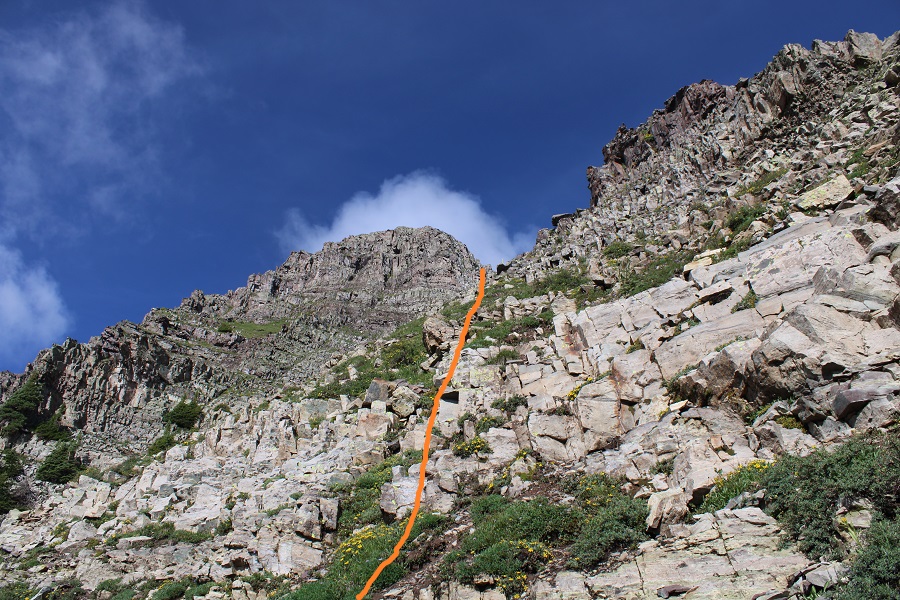
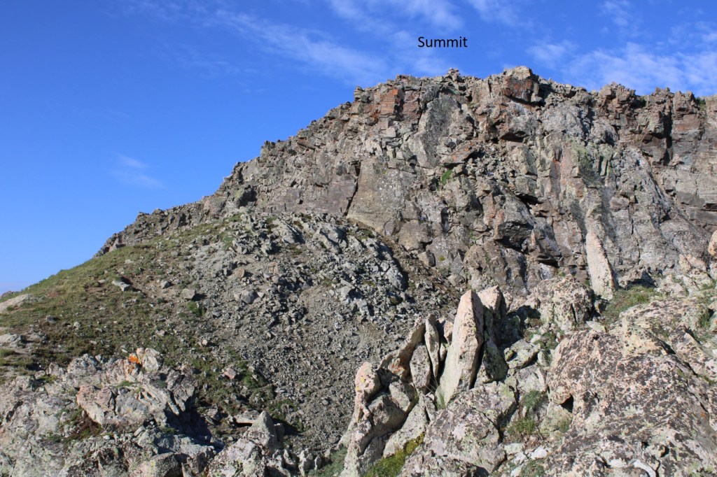
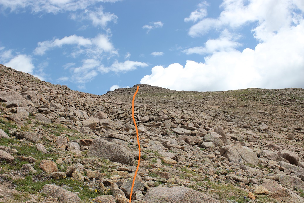
From the false summit I could see the true summit of 13033. The terrain becomes a little rockier, but it can still be kept class 2 by sticking to the ridge or dipping down a couple of feet to the right to stay on the tundra. The route is obvious. Even rock-hopping along the ridge this can be kept class 2.
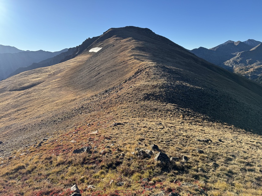
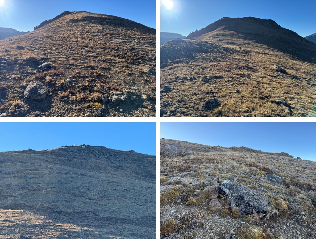
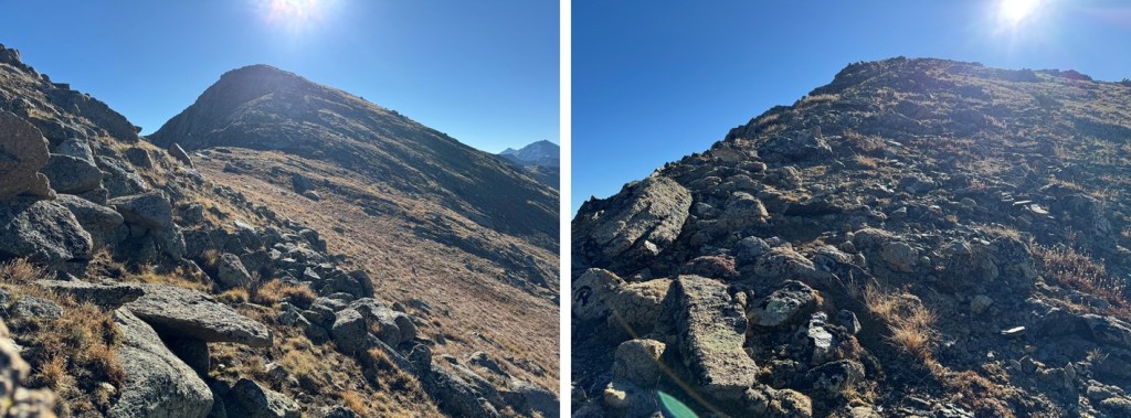
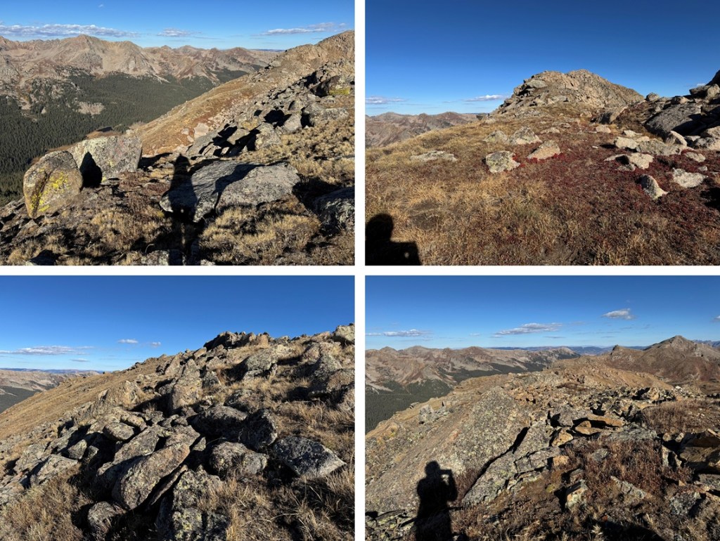
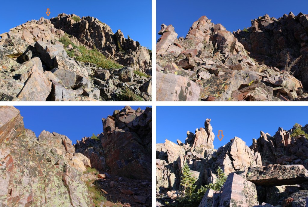
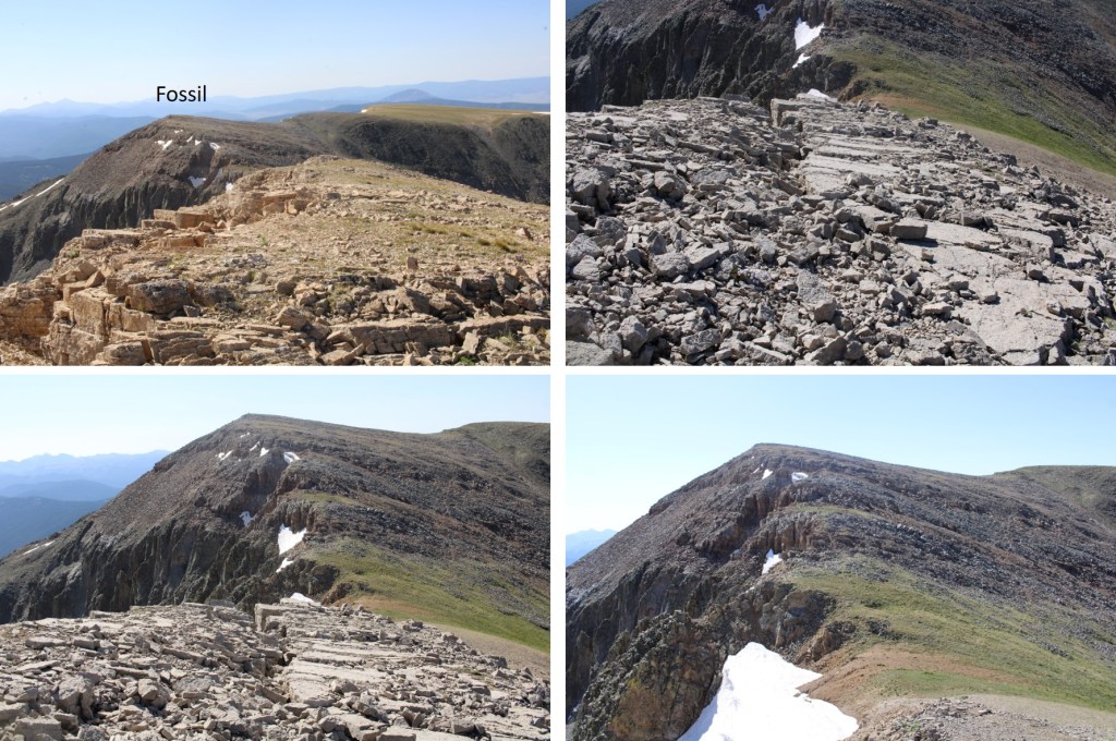
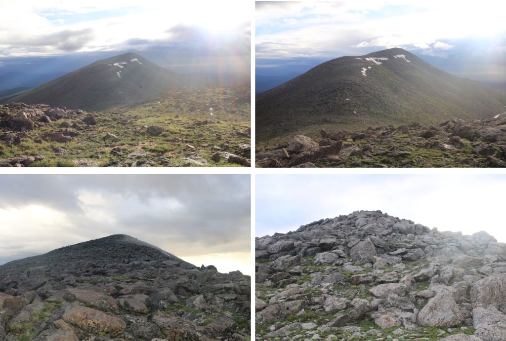
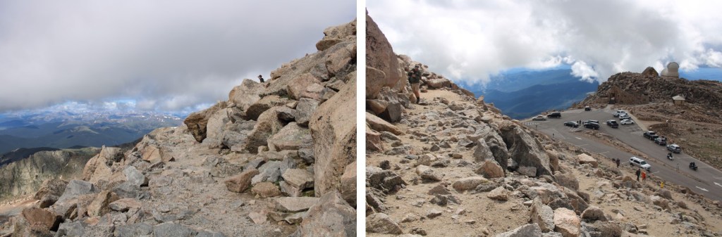
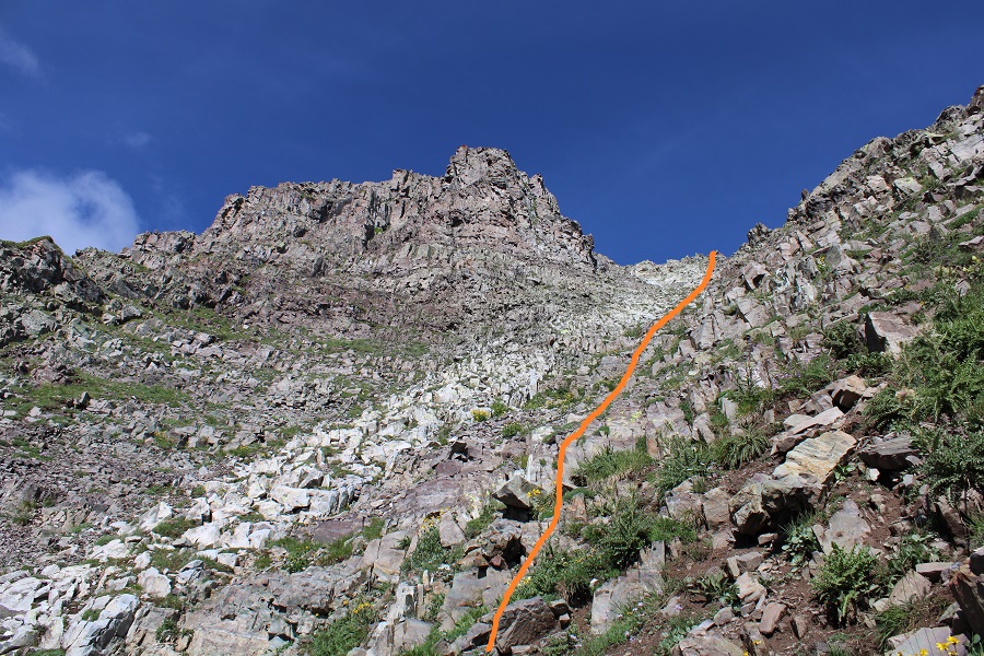
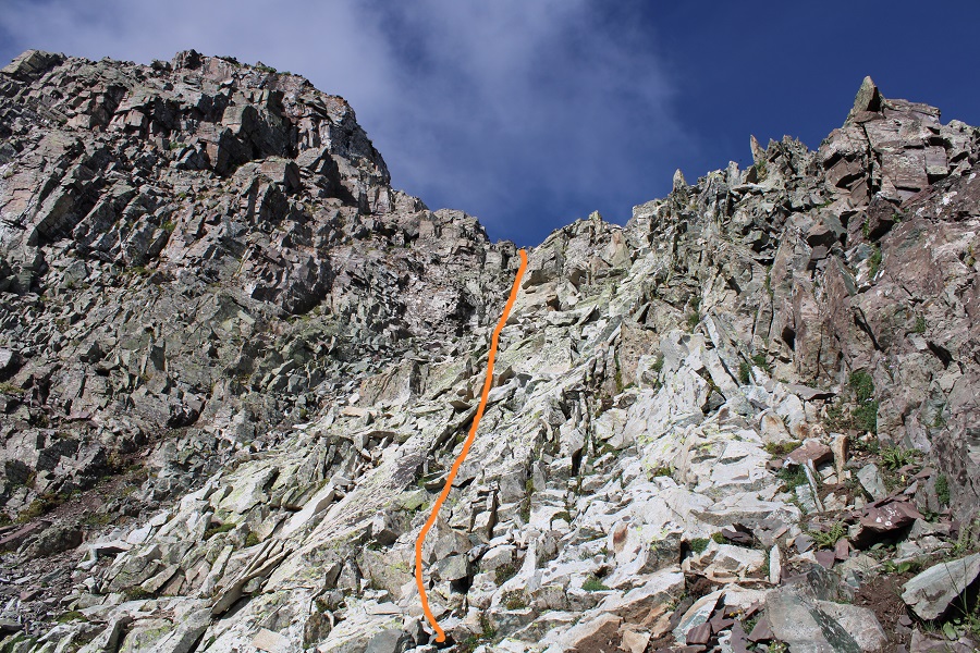
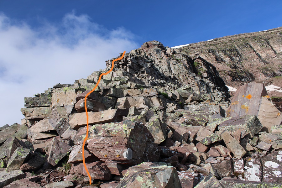
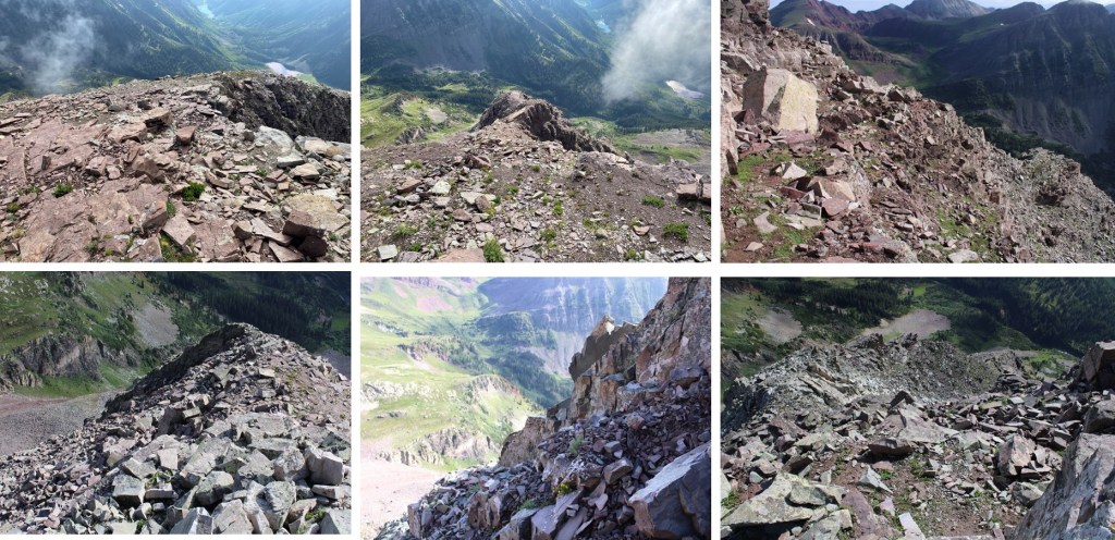
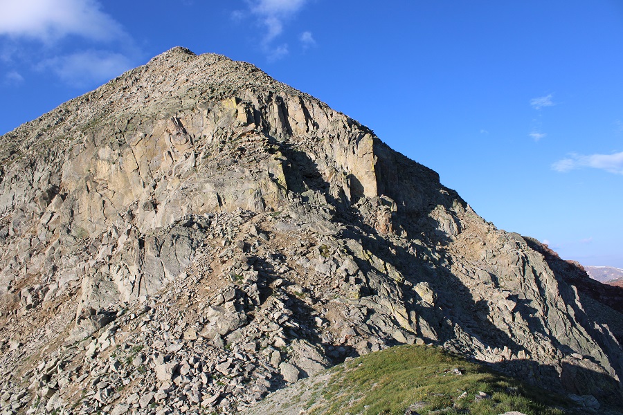
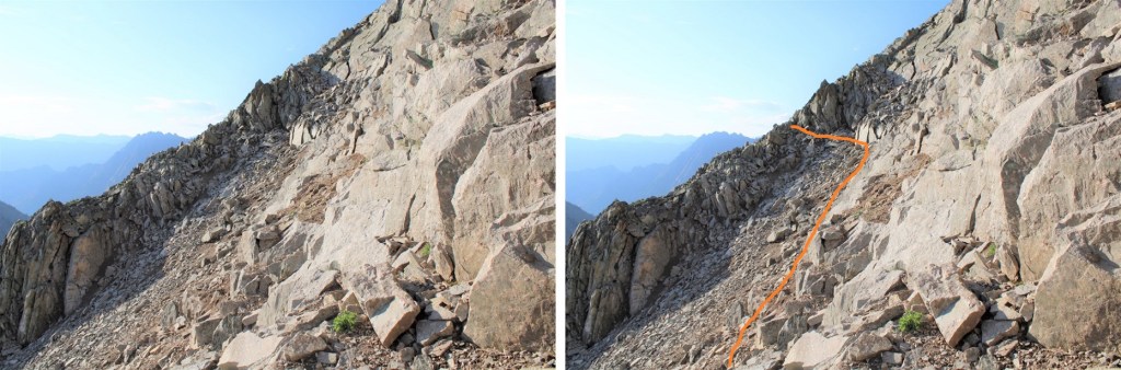
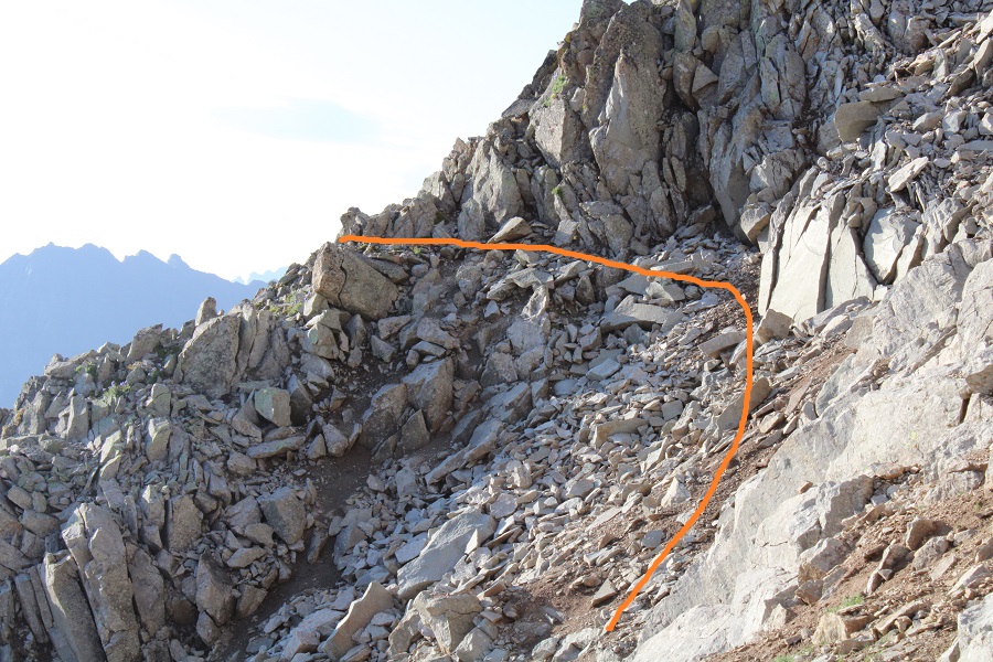
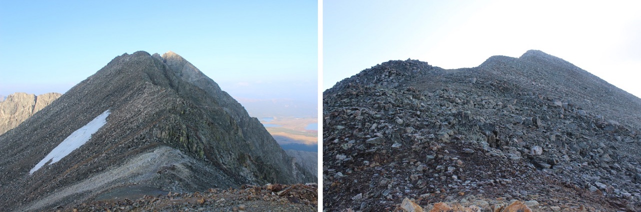
Here are some pictures of the ridge to the summit:
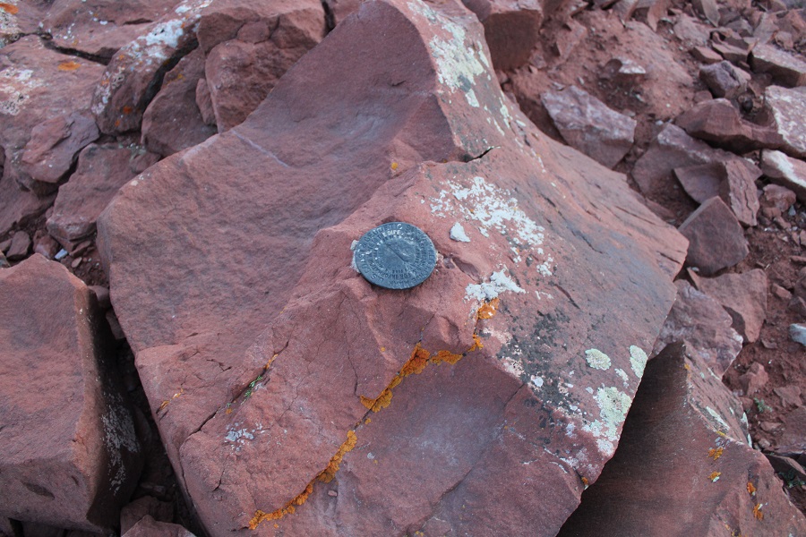
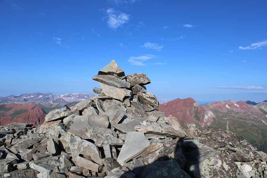
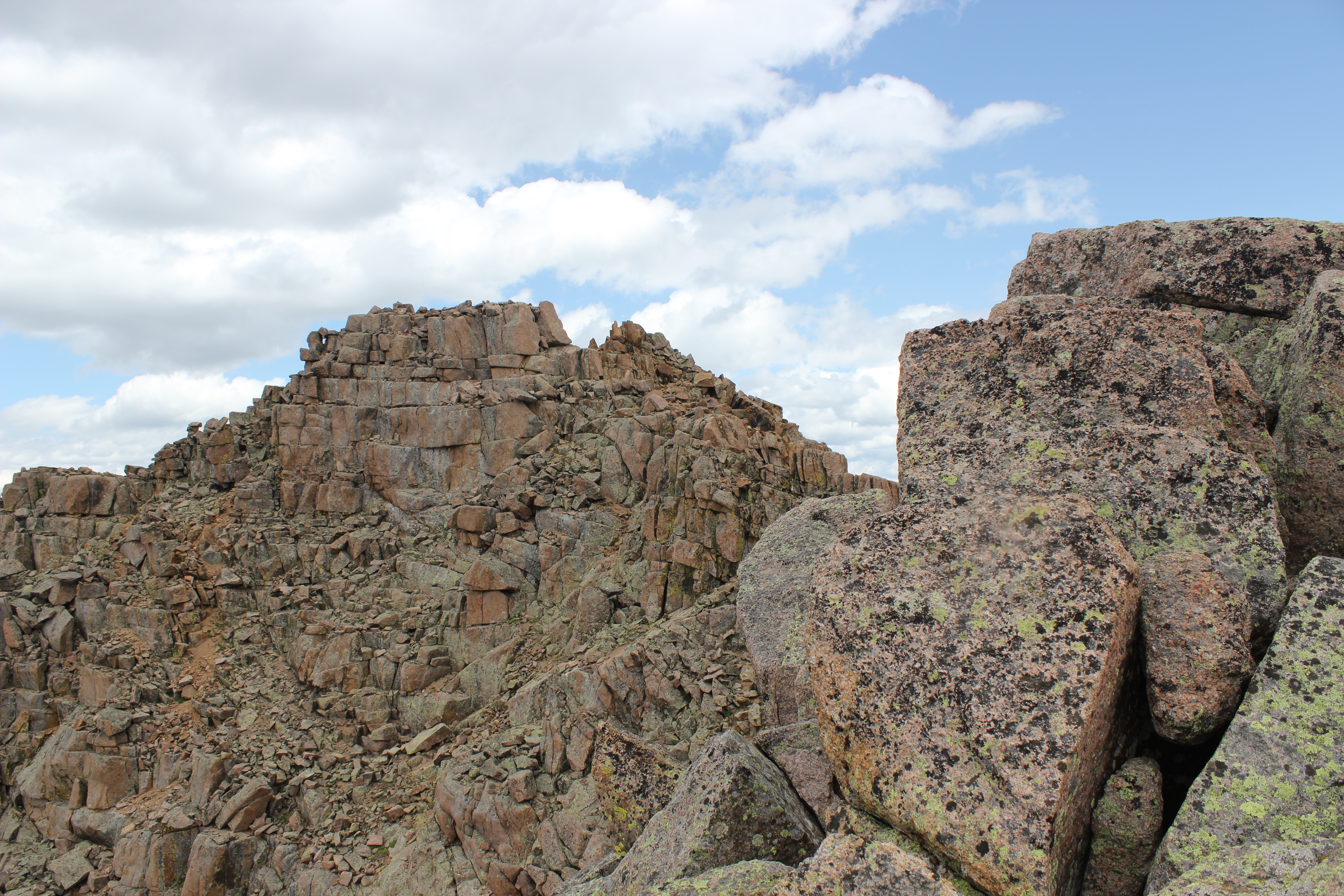
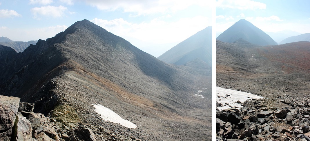
I summited PT 13033 at 9am
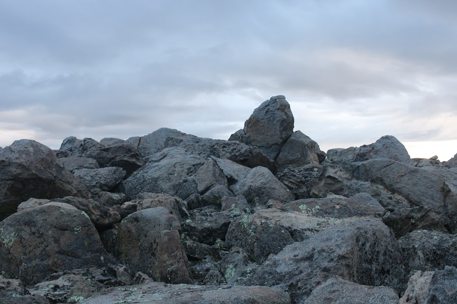
PT 13033:
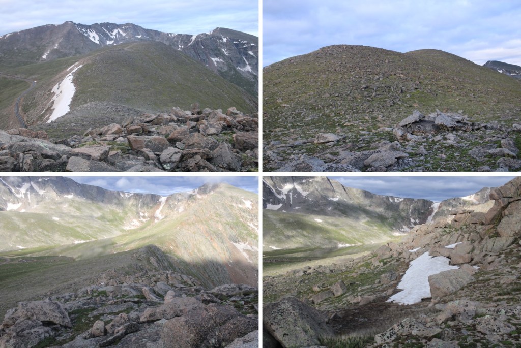
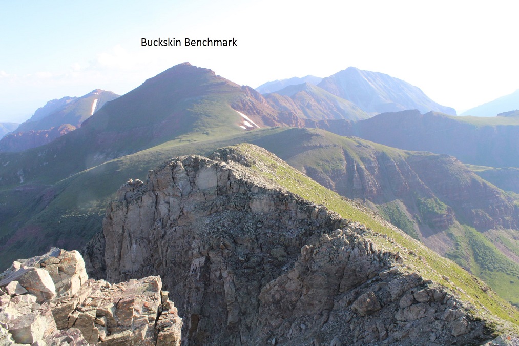
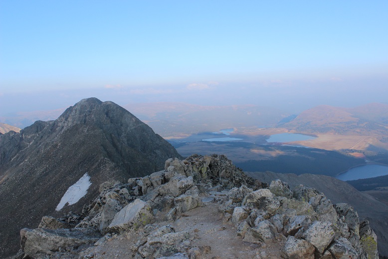
From the summit looking north I could see PT 13014.
It was my intention to summit 13014 today as well by following the ridge. However, I took my phone off of airplane mode and my cousin chat group immediately started blowing up with messages I had missed from the past 2 days. I must have had 200 messages (I have a lot of cousins) and apparently my Grandpa (who’s 97) was in the hospital. I tried to make phone calls and message back but didn’t have enough cell service to do so. I made the decision to cut this hike short so I could make sure my Grandpa (and my mom, who isn’t quite ready to lose her father) were ok. I’ll come back and summit 13014 another way (I already have ideas…). I turned back and followed the ridge northwest towards the saddle.
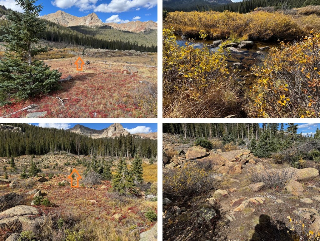
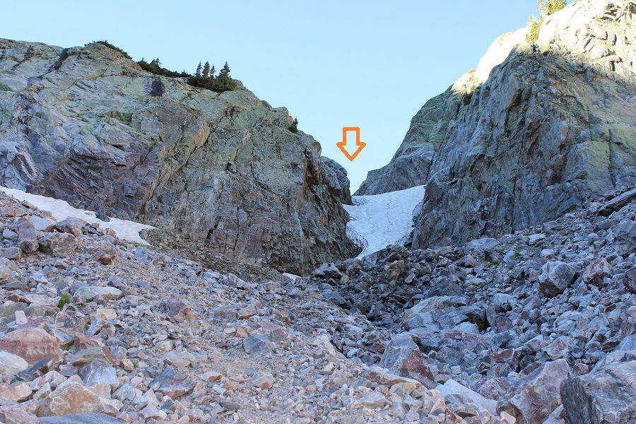
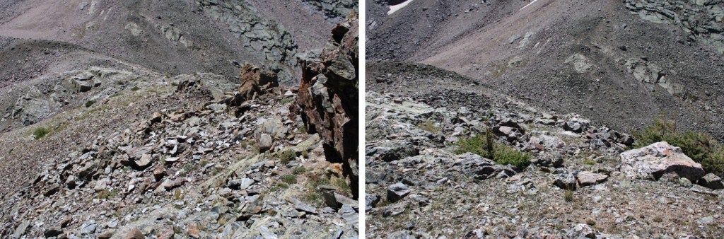
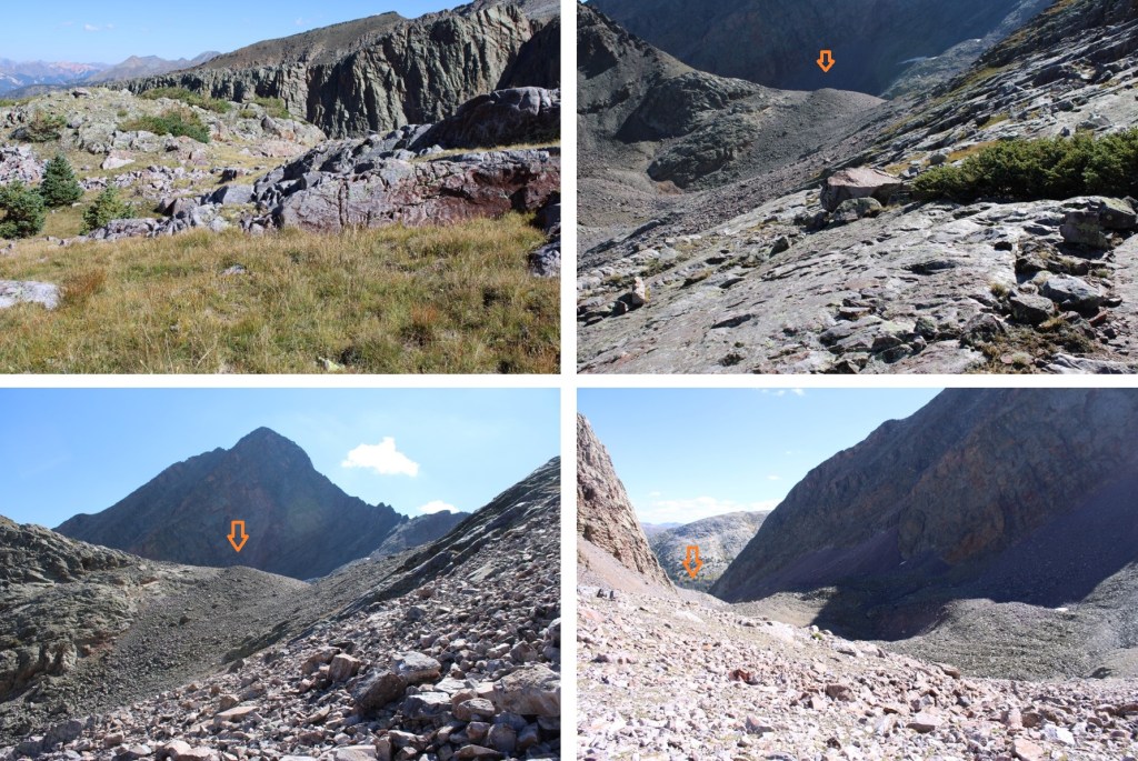
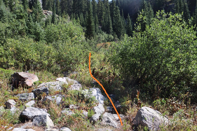
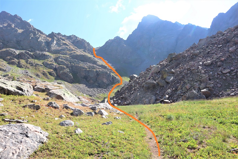
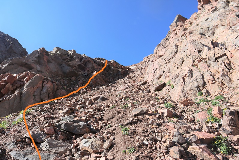
Back on the saddle I’d placed a small cairn where I wanted to descend. There’s also a robust game trail here that’s a good indication of when to descend, just don’t follow it, as it goes in the opposite direction.
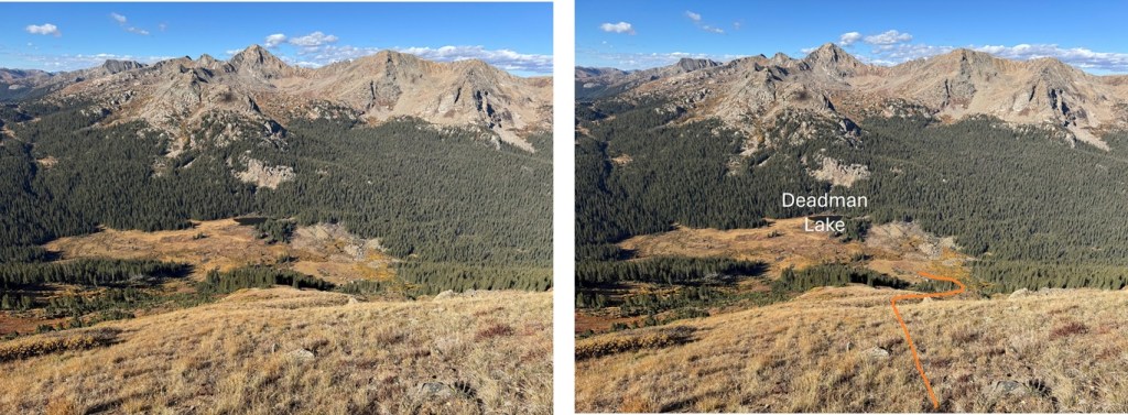
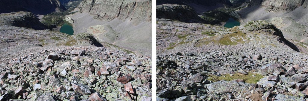
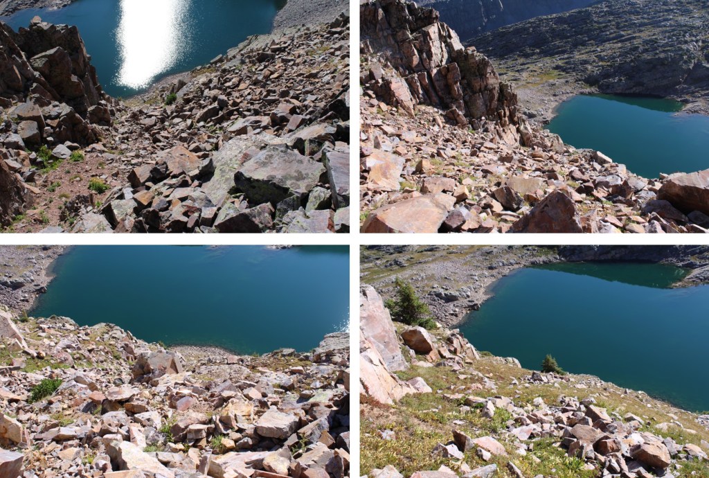
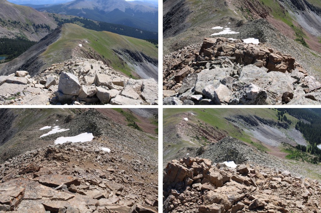
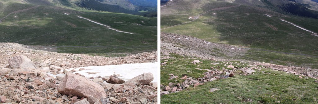
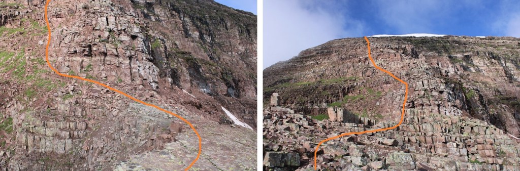
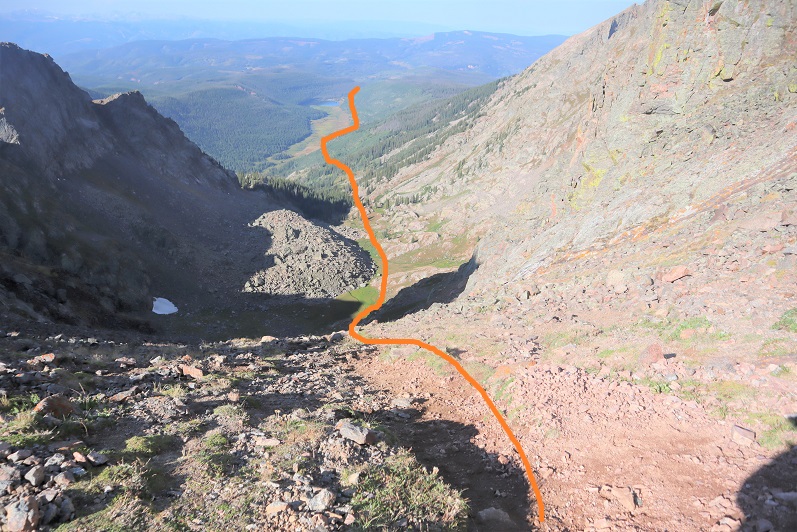
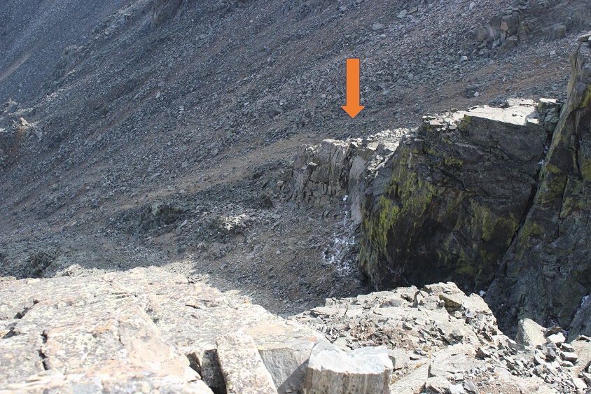
Here’s a view of my route back down the avalanche chute. Notice Deadman Lake in the distance. It’s a good visual for the decent.
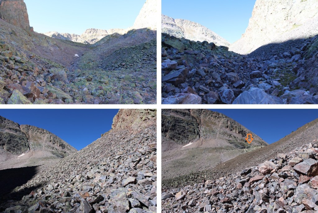
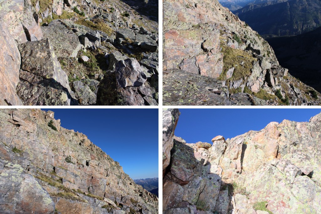
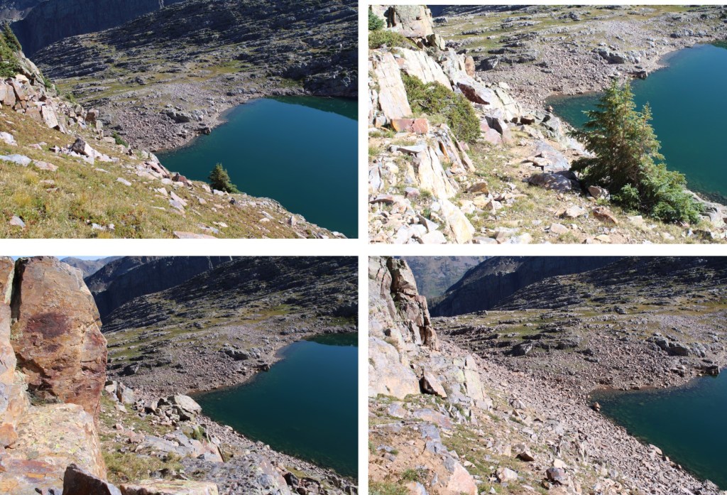
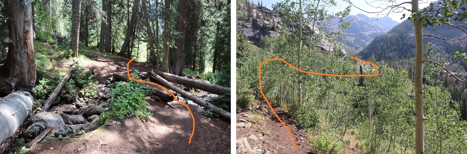
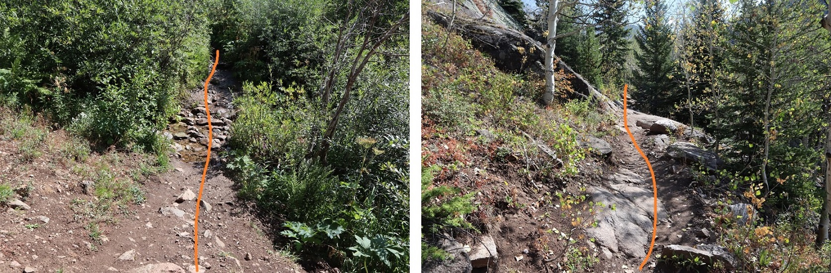
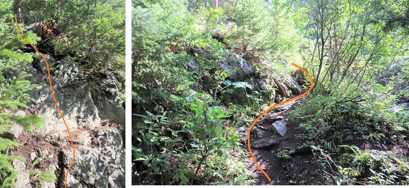
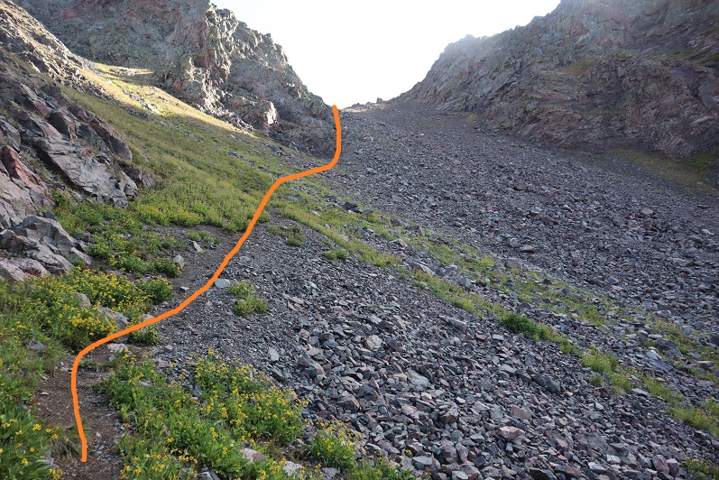
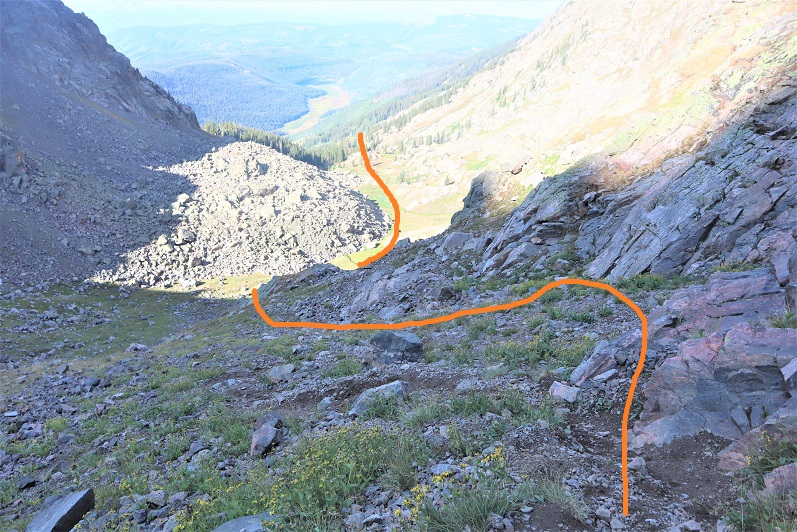
And some pictures of the route back to my campsite
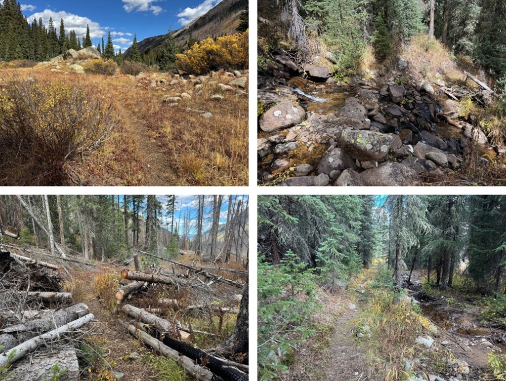
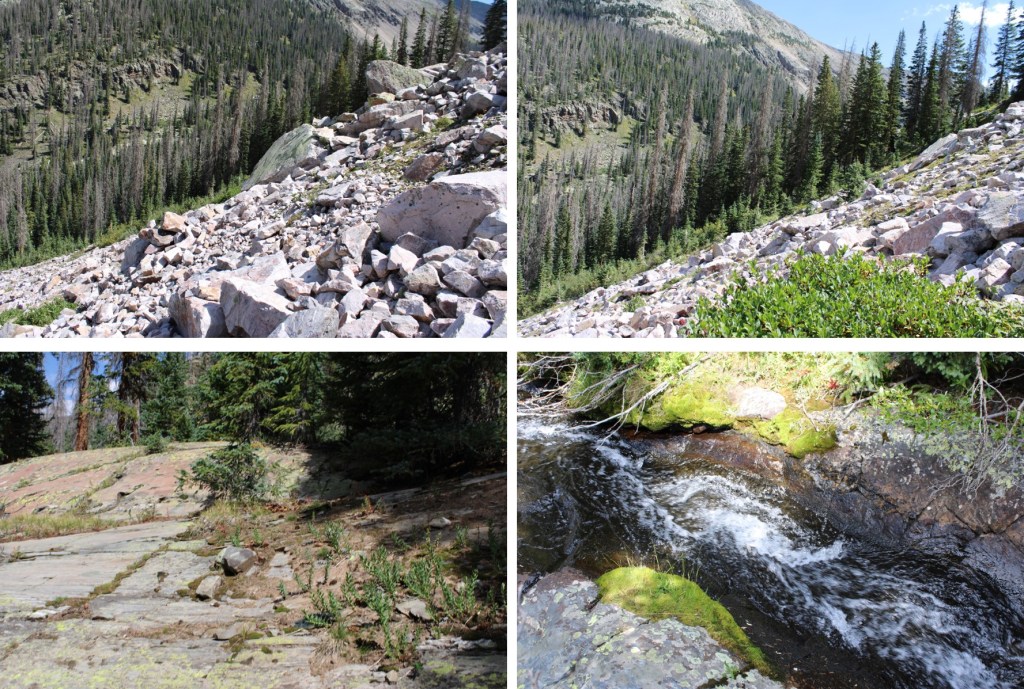
Back at my campsite I quickly packed up my gear and was on my way. First, I crossed the stream/river and found the trail again.
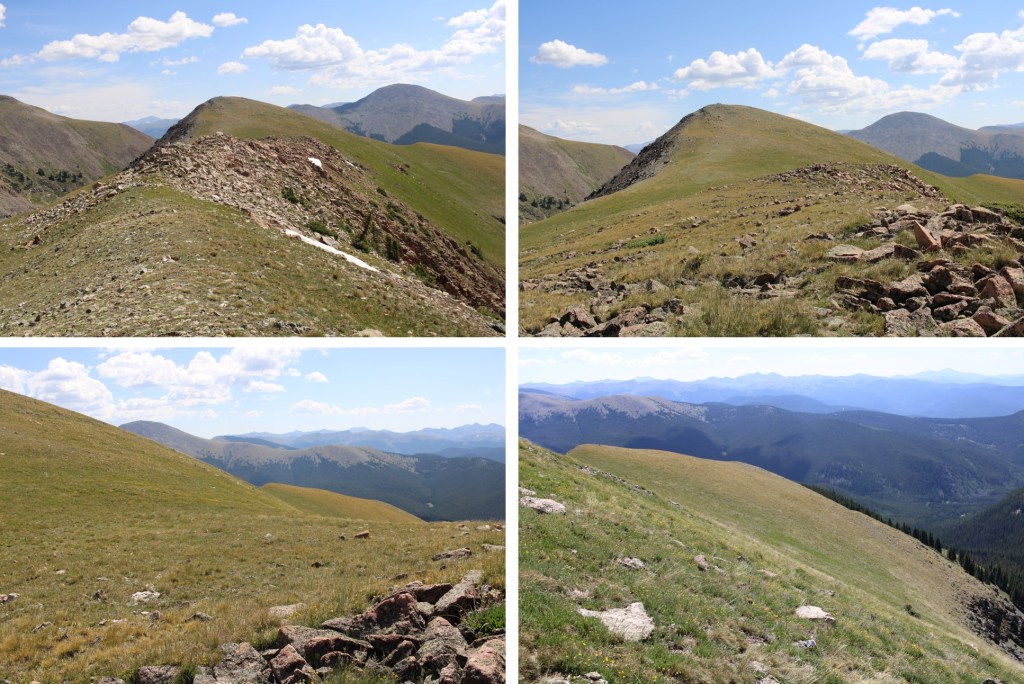
I then followed the trail 4 miles north back to the trailhead.
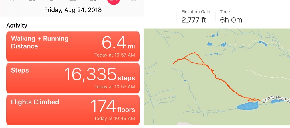
I made it back to the trailhead at 12:30pm. This was a 12.14 mile hike with 3207’ of elevation gain.
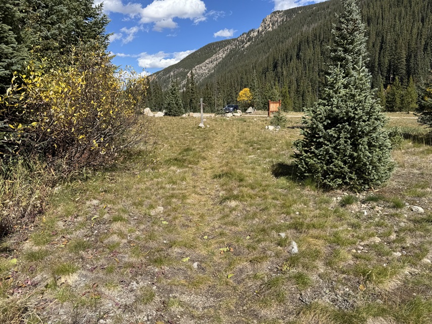
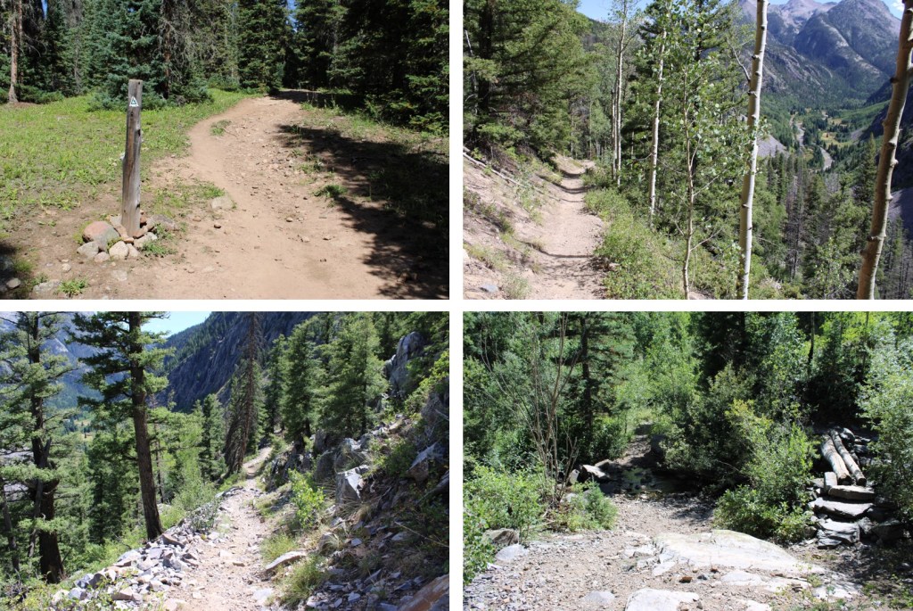
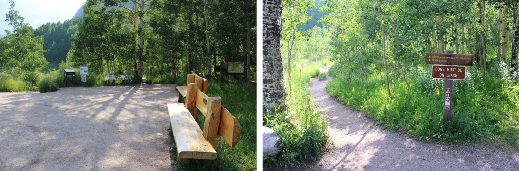
I started from the Molas Trailhead parking area. This trailhead has plenty of parking, and is a popular spot among CT hikers.
The trail starts at the south end of the parking area.
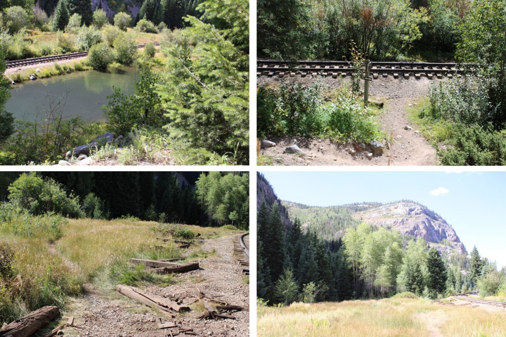
Much of the approach route follows the Colorado Trail, so it’s well maintained and easy to navigate. I followed the trail as I descended 1700’ to the Animas River.
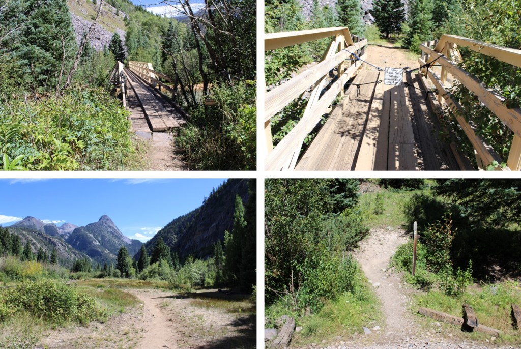
I crossed the river on a well-maintained bridge, and then followed the trail as it crossed the railroad tracks
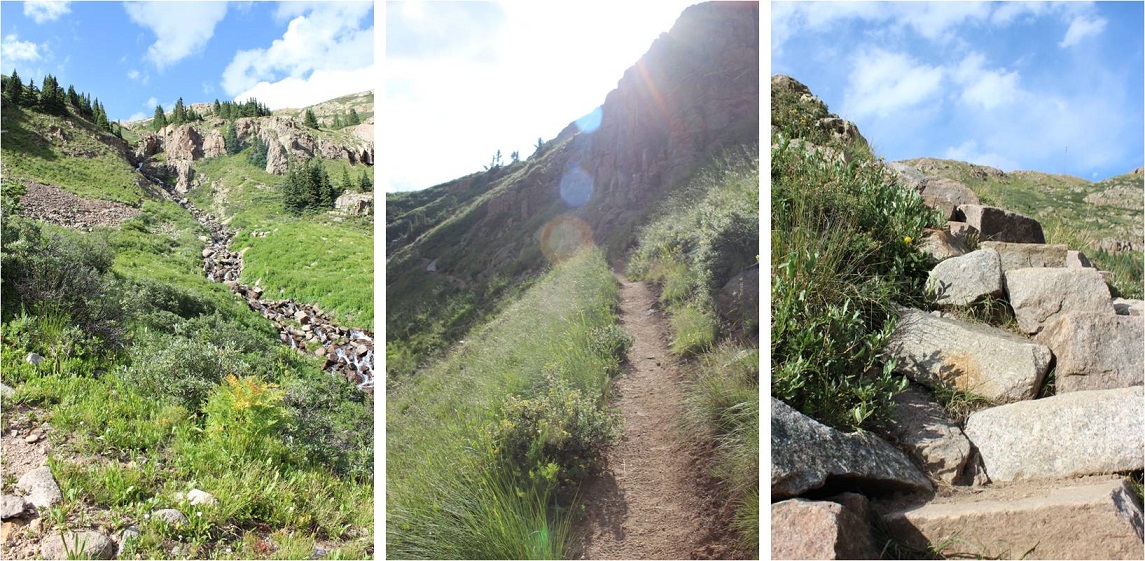
Here is where the elevation gain begins. I hiked along the Colorado Trail east to the Beaver Ponds, following Elk Creek and passing through a couple of cleared avalanche areas. This trail is easy to follow, with no trail junctions.
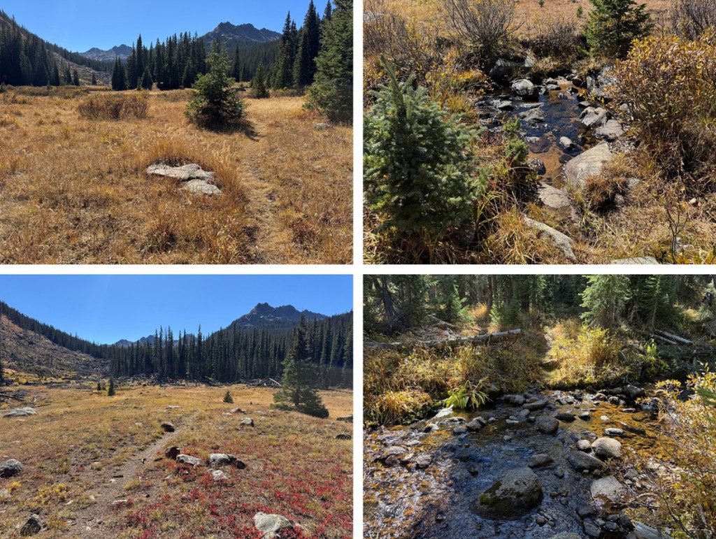
This part trips people up all the time when headed towards Vestal Basin: Once at the beaver ponds, I turned right off the trail and traversed behind this large boulder. There’s a faint trail here that picks up again once you’re past the ponds.
The trail picks up again after the beaver ponds, but it’s no longer as well maintained as the Colorado Trail. There are fallen trees to navigate, but the trail is easy to see. I followed the trail as it crossed a beautiful creek and headed south.
At 11260’ of elevation I left the trail. There are several options to do this, but here’s a visual of where I was headed.
This is the route I took:
I headed a little further up the trail, crossed the creek at an easily accessible spot, and headed southwest up the slope. However, this is choose your own adventure, and you can climb straight up the talus/scree if that’s your choice. I decided to skirt around it.
This gully wasn’t too bad as far as gullies go, but I put on my microspikes anyway.
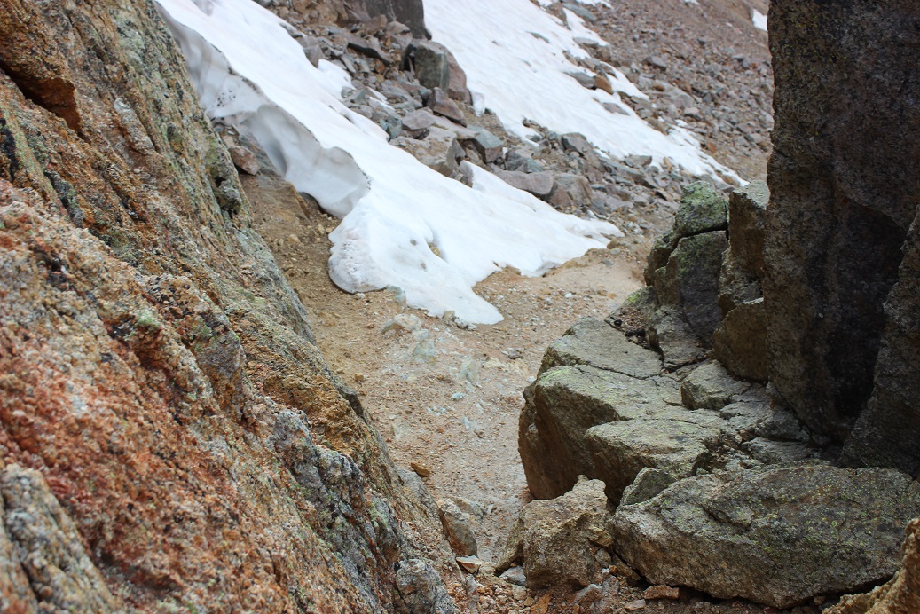
Towards the top I could see quite a bit of snow still left in the gully.
I traversed the gully to the right, finding there was about 2 feet of space where the snow had melted away from the rock. The snow was avoidable until the last 30 feet or so, when I climbed on top of the snow and walked to the top of the gully on several feet of rock-solid snow.
However, if this is outside of your comfort zone, you can also traverse to the left and make it to the top of the gully on more scree. Both routes lead to the same place (I took this route on my way down).
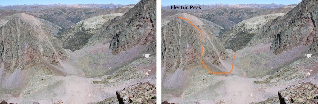
I was now in an upper basin, full of all different sizes of loose rocks. This wasn’t difficult to navigate, but it was extremely time consuming. I was headed southwest, staying to the right.
At 12500’ of elevation I turned right to start my climb up Electric Peak’s south side. If you don’t already have your helmet on (I usually put them on for scree-filled gullies) now is the time to do it.
Much of the route to the summit is hidden at this time. I started by climbing up a class 3 gully to the right
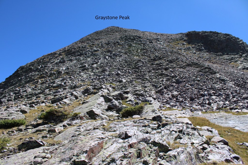
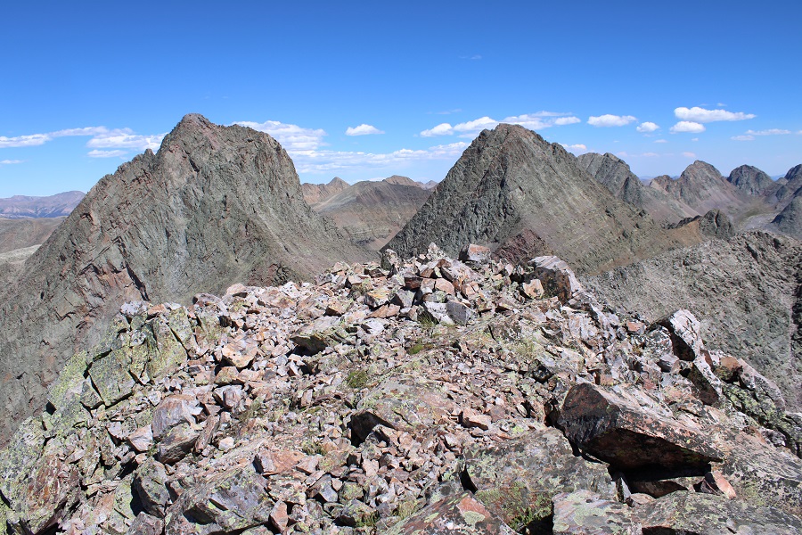
From Graystone Peak, I had a good visual of the route I took, keeping it mostly class 2 after the initial class 3 gully
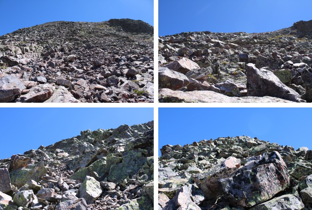
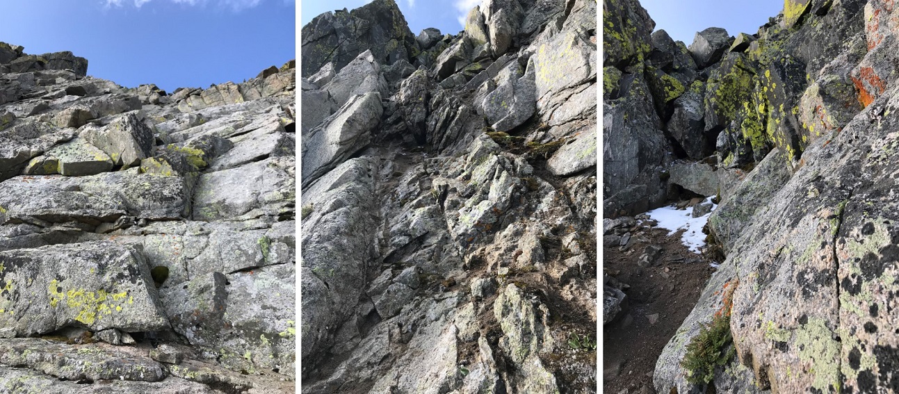
Once on top of this gully, there are several options to make it to the summit. Here are some on the ground pictures. The terrain was rocky most of the way to the summit.
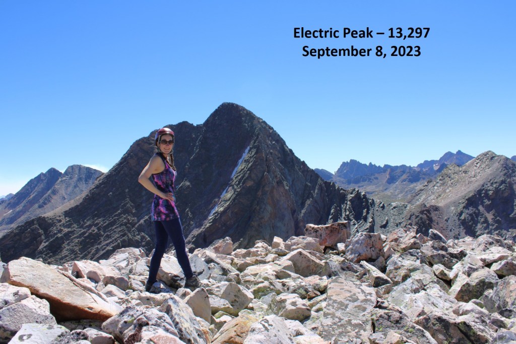
The summit was fairly flat and rocky.
Electric Peak:
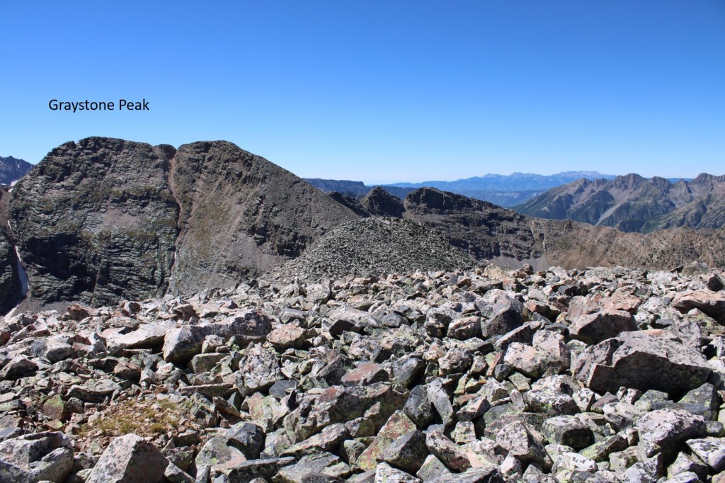
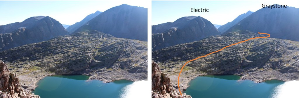
From the summit of Electric Peak, I could see my next objective, Graystone Peak, to the south.
I re-traced my steps back to the saddle
Now to head over towards Graystone Peak. I looked east, and saw these wonderful rock slabs.
Traversing up and down large rock slabs is mostly a mental exercise in not freaking out. I kept telling myself “My shoes have got this, trust your shoes. Also, don’t look down”. This is the route I took. There’s no avoiding the slabs.
Another view of the rock slabs, with a little bit of climbing towards the end (which was favorable to the smooth slabs)
After making it up the rock slabs, I turned left, now ready to scale Graystone Peak
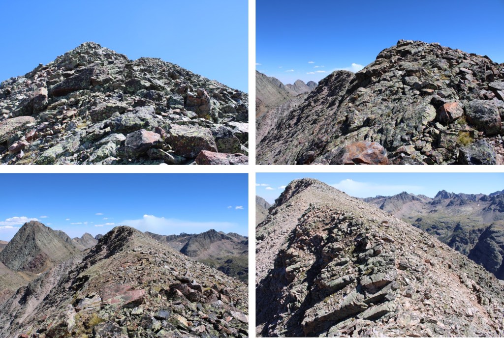
Scaling this peak is exactly what it looks like: straight up the side with a lot of various sized rocks to traverse that are loose. I headed southeast up the mountainside.
Once making it to the ridge, I stayed on the ridge proper to the summit, with some easy class 3 ups and downs along the way.
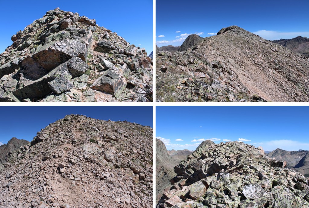
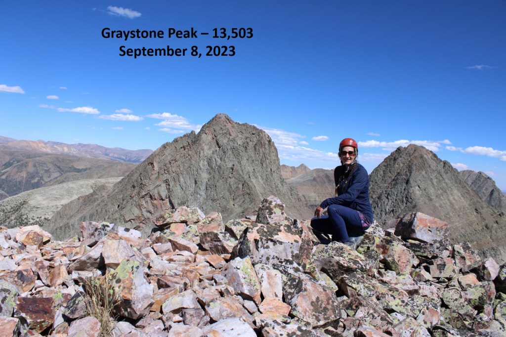
There was a large cairn at the summit
Graystone Peak
I turned around and headed back down the peak the way I’d ascended, doing my best to keep my balance and navigate the loose rocks.
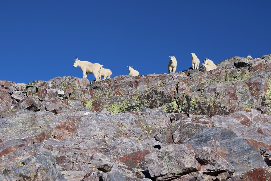
It had been a long day, so once I made it back down to the little patch of grass at the base of Graystone Peak I decided to call it a night and set up my bivy. I dried out my clothes, ate some dinner, and wrote notes down in my journal. Just before settling down for the night, I heard rocks tumbling and then skidding to a halt behind me. I turned around, and about 30 mountain goats were standing on the ledge, about 20 feet away. Most of them dashed away before I got a picture, but they seemed just as surprised to see me as I did them. They were probably headed towards the patch of grass I was using as a bivy site, and seemed a little disappointed to find me already occupying the space. I wish I could have told them I wouldn’t bother them and they were free to stay, as there wasn’t any other grazing areas around, but they all bounded away to find another site.
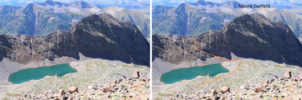
I was up early the next morning and on route to Mount Garfield. Even though this was the shortest of the peaks I was doing this weekend, it was by far the most challenging. Once on the ridge it was consistent class 3 the entire way. I started out by heading southeast around the base of Graystone Peak. I was headed here:
This was a quick and easy gully to climb. Once out of the gully, I passed through an open grassy area and then descended over 300 feet down grassy slopes to the right, towards Garfield Lake.
Once at Garfield Lake, I needed to gain the ridge. This can be done in several ways, but this is the overall route I took. There were a couple of nicely placed trees I used as a guide on the ledges. I just aimed for one tree, and then the next. Here’s an overview of the route to the ridge as seen from Graystone Peak
From Garfield Lake, I aimed for the rock ledge with two trees on it, spaced about 300 feet apart. It was class 2 to the ridge.
When I’d passed the two trees, I looked up and saw this gully.
I made my way straight up the gully to the ridge.
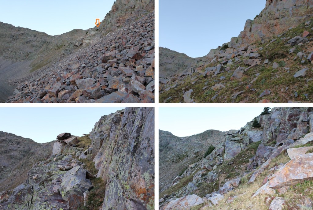
Once on the ridge I turned right, and this became a class 3 ridge hike all the way to the summit. I was able to mostly stay on the ridge, dipping to the right one time. If you encounter a class 4 move, you’re off route. Here are some pictures of the ridge.
I stayed to the left of this gully, climbing up the rocks instead of on the scree.
At the top of the gully I turned right, and continued following the ridge.
The only time I dropped off the ridge was when I came to this large rock. At this point I dropped to the right and descended about 30 feet before re-gaining the ridge.
Back on the ridge, I followed it to the summit, class 3 the whole way
Mount Garfield
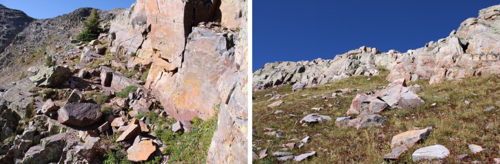
Here are some pictures of the route back down the ridge
Then back down the gully to Garfield Lake
Back at Garfield Lake, I took the same route back to the base of Graystone Peak, this time going up the grassy ledges
This was an out and back hike, so I re-traced my steps down the rock slabs, across the rock field, and back down the gully to the trail.
This time, instead of going down the snow-filled gully I went to the right, and descended on scree
Back on the trail, I followed it back to the Beaver Ponds
Then I followed the Colorado Trail back to the Animas River
I crossed the train tracks, and trudged back up to Molas Pass, something I timed just right so I’d be doing later, during the cool part of the day.
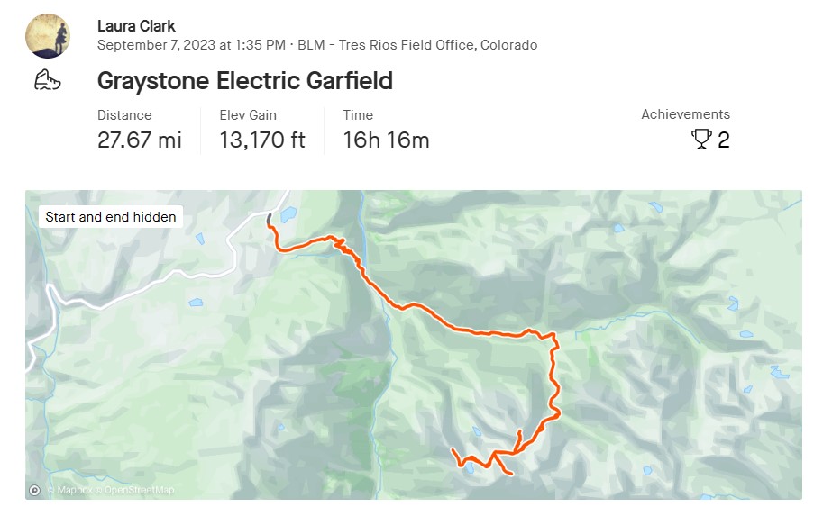
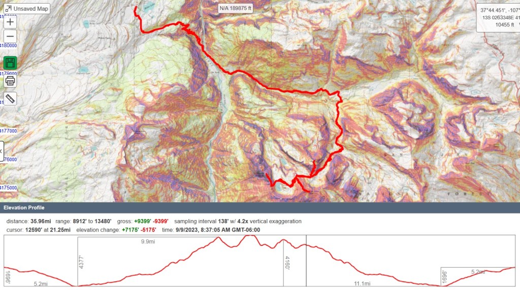
I usually go by CalTopo stats to keep things consistent. CalTopo gave me 35.96 miles with 9399’ of elevation gain, but Strava gave me 27.67 miles with 13,170’ of elevation gain. Take your pick!
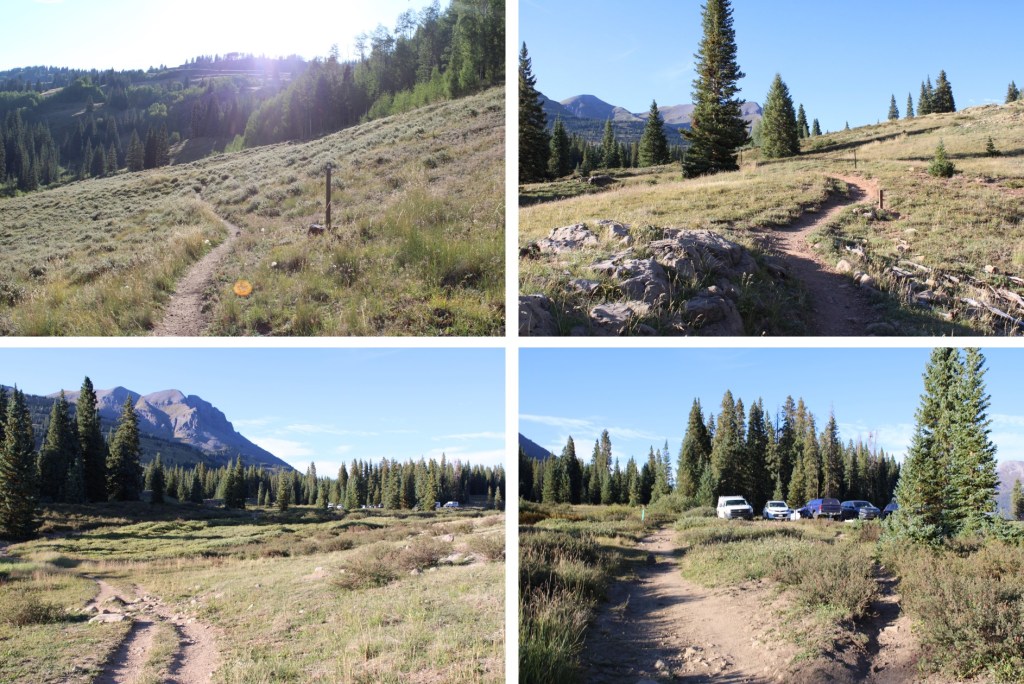
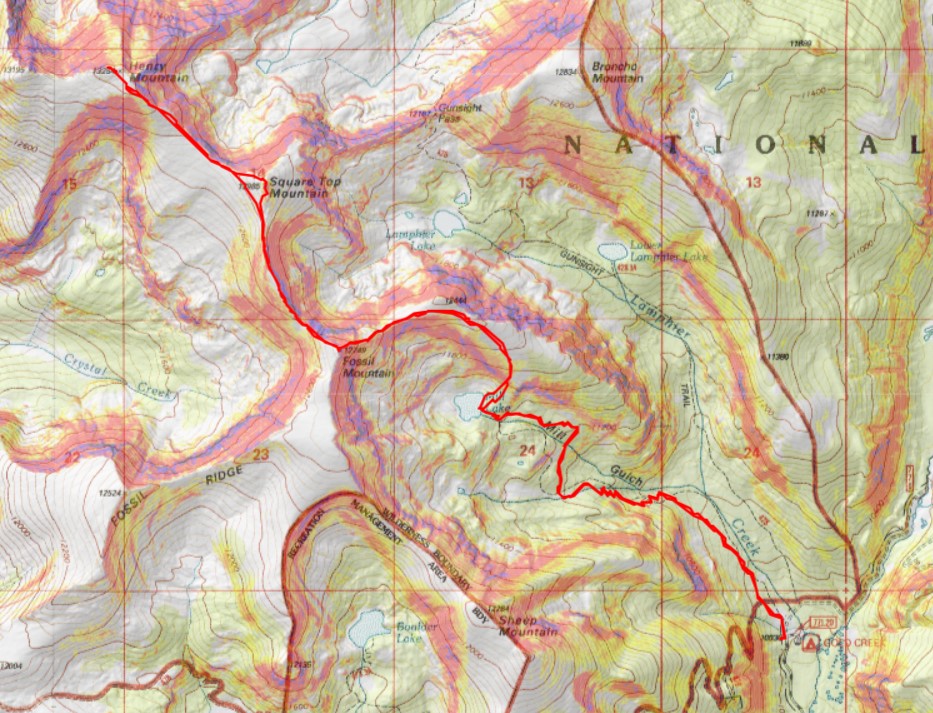
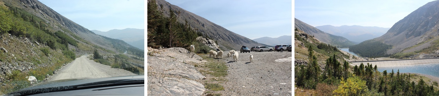
I started from Gold Creek Campground outside of Ohio City. The road in was an easy 2WD dirt road, that led me to a dispersed campground maintained by volunteers. There are about 5 sites, with vaulted toilets. I didn’t feel right using the empty campsites, as I wasn’t really camping, but sleeping in the back of my truck, so I parked at a dispersed site directly across the road, near the trailhead, at about 10,050’. Also, it was quieter, as a family with two small children and rather loud dog were staying in the campground. There was a makeshift corral for horses there as well.
I was on the trail at 5am the next morning. The trail starts at the north end of the camping area.
I followed Trail 532 northwest for 2.5 miles to Mill Lake. This is an easy to follow, class 1 trail the entire way to the lake.
There is one junction early on that isn’t on a topo map, but it’s well marked. Just keep going towards Mill Lake.
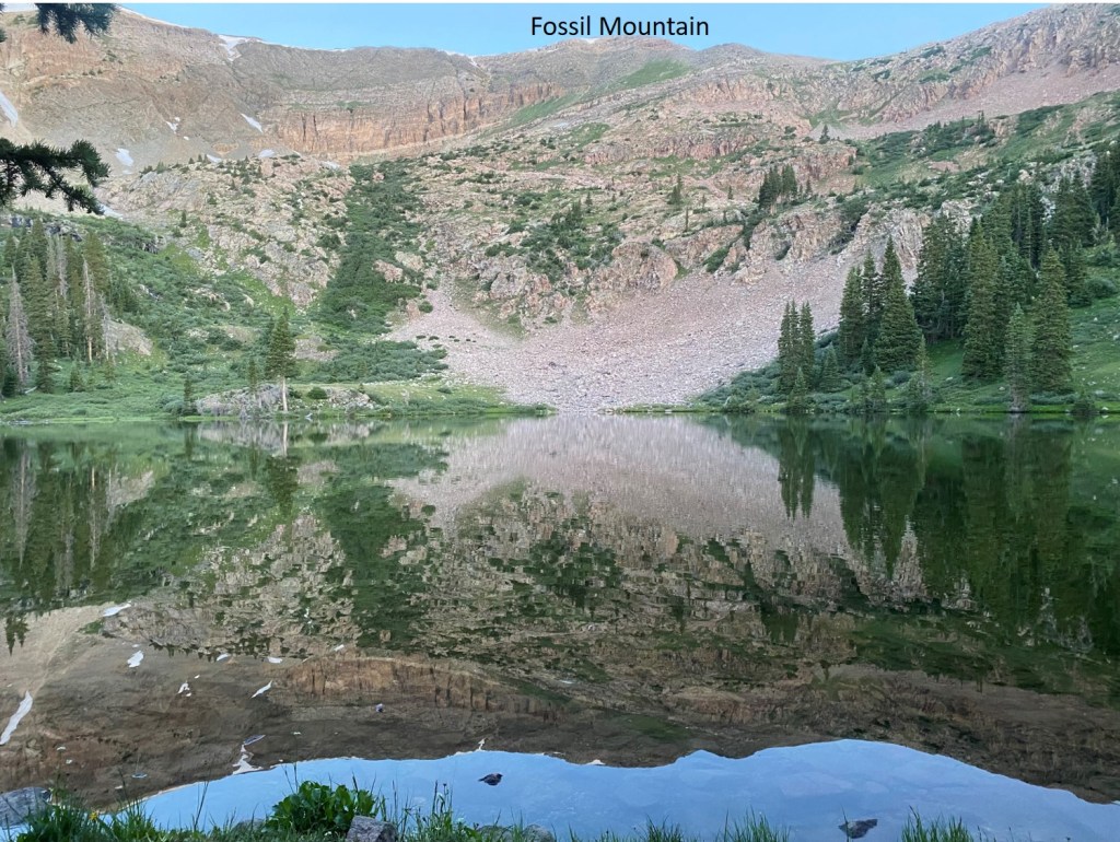
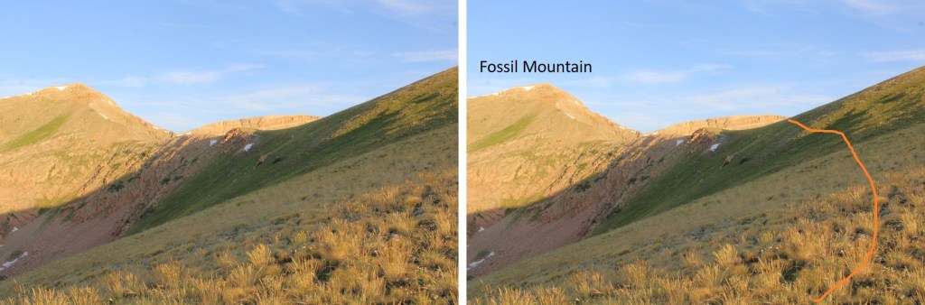
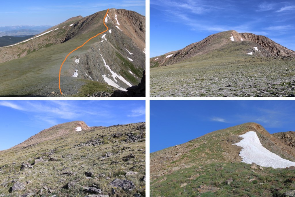
At Mill Lake you can clearly see Fossil Mountain. The easiest way to get there is to turn right, and head northeast through the trees until you see the ridge. It’s a short (100 yards at most) hike to get there, and the bushwhacking is easy.
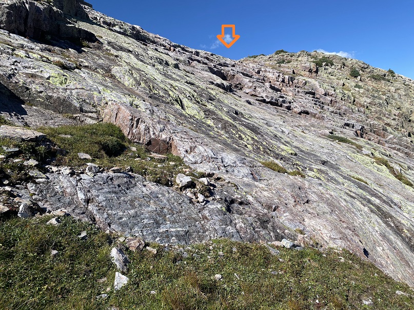
The route will be easily visible. There are rock ledges if you go to far left or right. You want to take the tundra northeast until you make it to the ridge, and then turn left and follow the ridge west. Here I gained 850’ of elevation in .75 miles
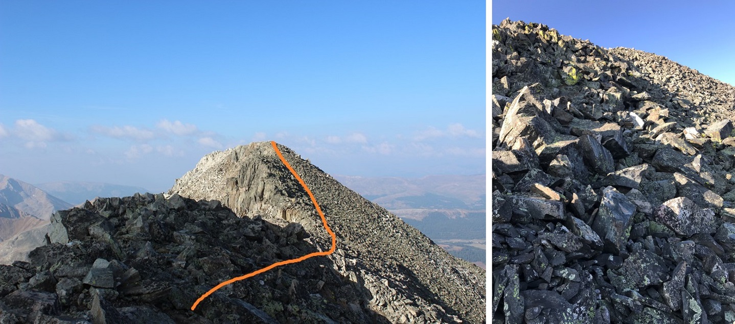
Here’s looking at the last bit of the route to the ridge. There’s no need to hike all the way to the top of this little bump in the ridge, as it isn’t ranked. I skirted it and headed towards Fossil Mountain.
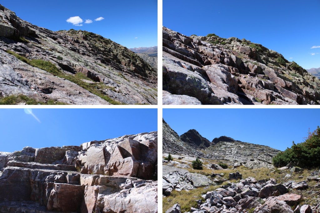
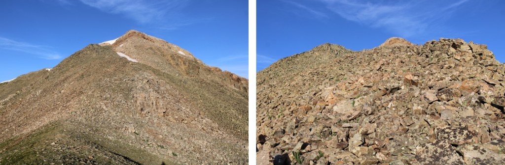
Now the hike became fun. The ridge goes at a class 2 scramble until the base of Fossil Mountain, then becomes an easy class 3 scramble to the summit.
Here’s the overall route I took
And some step-by-step pictures
I went straight up and over this large rock formation. It was easy class 3. You can go to the right to get around it, but you’ll be met with loose talus and a gully.
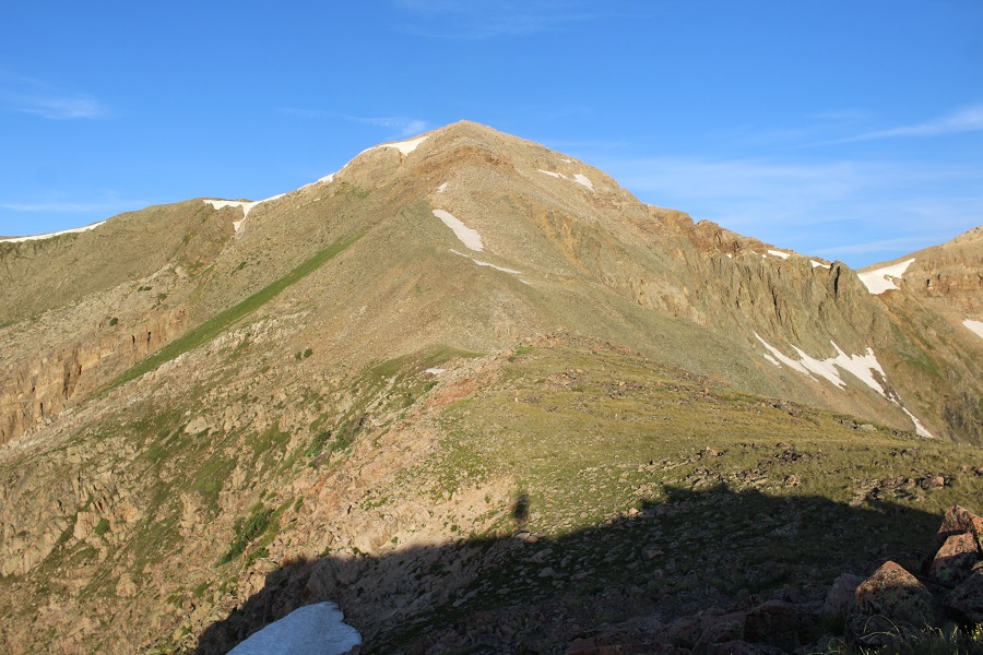
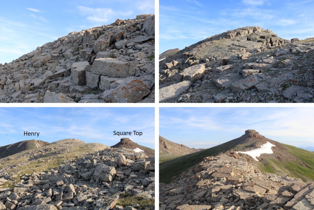
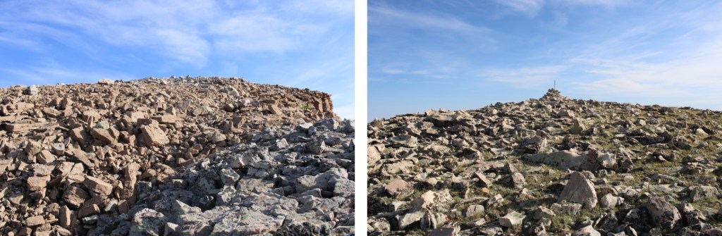
I summited unranked Fossil Mountain at 7am
Fossil Mountain:
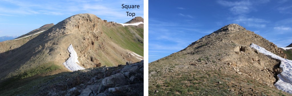
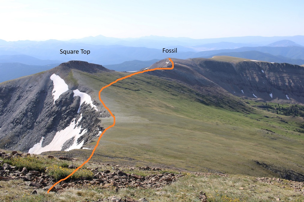
From the summit of Fossil Mountain, looking to the northeast you can see the other two peaks I was headed for today, Square Top Mountain (unranked), and Henry Mountain
It was a straightforward ridge hike to get to Square Top Mountain, where I pretty much stayed on the ridge. There were some easy class 3 moves, and at times I needed to dip to the left or right. The rock is very loose in areas, and very stable in others, so basically it keeps you on your toes. I lost about 180’ of elevation going to the Fossil/Square Top saddle. Here are some pictures of the ridge to Square Top Mountain.
From the saddle, here’s looking up at the path towards Square Top. The first half was on tundra, and then the rocks began
It was here I noticed a small herd of elk. I stayed where I was until they noticed me, then watched them watch me as they ran away.
Check out the herd of elk:
Ok, continuing with the ridge. This part looked difficult, but I found it was easy class 3 if I just kept to the ridge.
Now to summit Square Top Mountain. This was relatively simple, as there were several options. I went up the gully nearest me (and down the one on the other side). The rocks here were loose, but the angle was light.
After ascending the gully, I turned left and easily walked to the summit
I summited Square Top Mountain at 8am
Square Top Mountain:
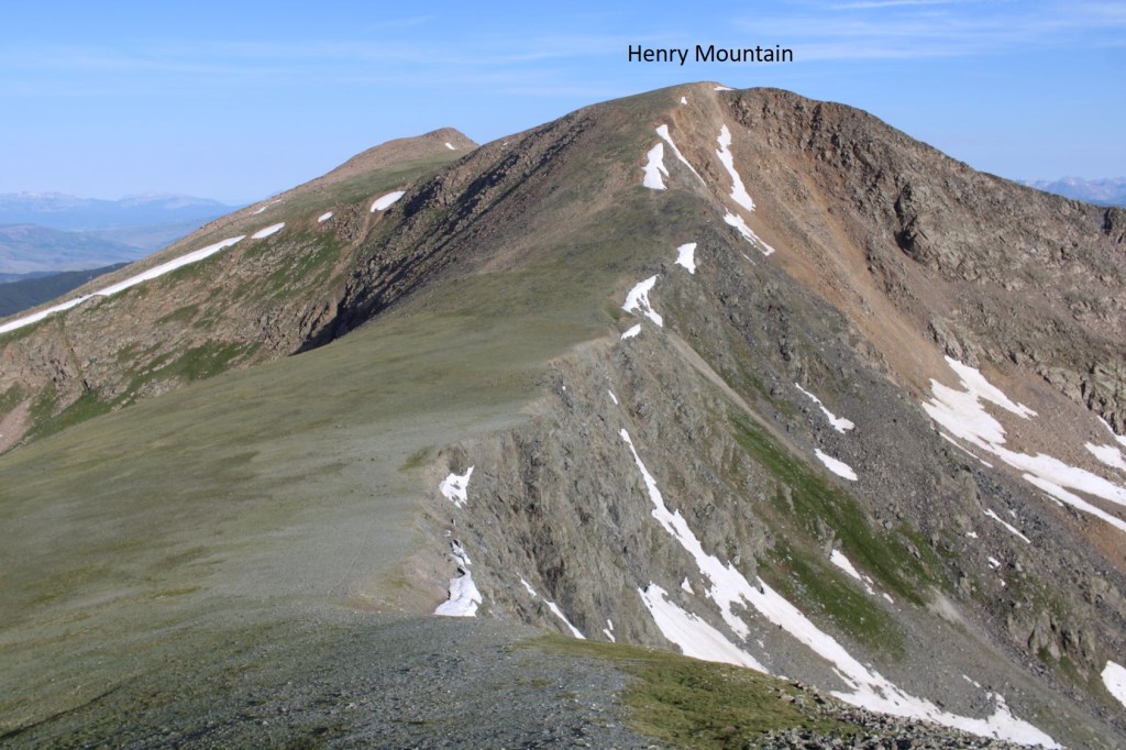
Looking to the northwest I could see Henry Mountain
I descended Square Top Mountain to the northwest, and hiked on tundra to the summit of Henry. There were some very faint fame trails here I utilized.
As I came to the top of the ridge, I was greeted by 4 mountain moats. Usually, mountain goats are pretty tame and just watch me. These ones did for a while, but as soon as I got out my camera and they could hear the shutter snap, they took off. Well, three of them did, the other one stood and looked like he was ready to fight, but then turned and followed the others
The summit of Henry Mountain is to the northwest, so I headed northwest towards the obvious highpoint on more tundra
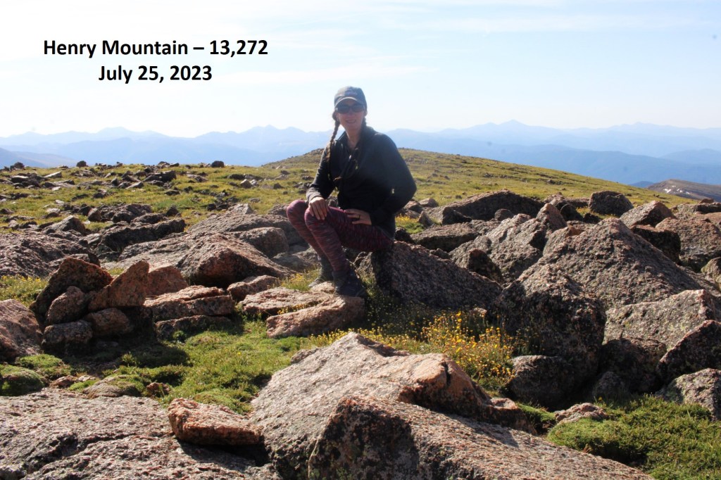
I summited Henry Mountain at 8:40am
Henry Mountain:
This was an out and back hike for me, so I turned around and retraced my steps back to Fossil Mountain
Here’s the overall route I took, skirting Square Top this time
And some pictures of that rocky ridge between Square Top and Fossil
Then down to the Fossil/Square Top saddle
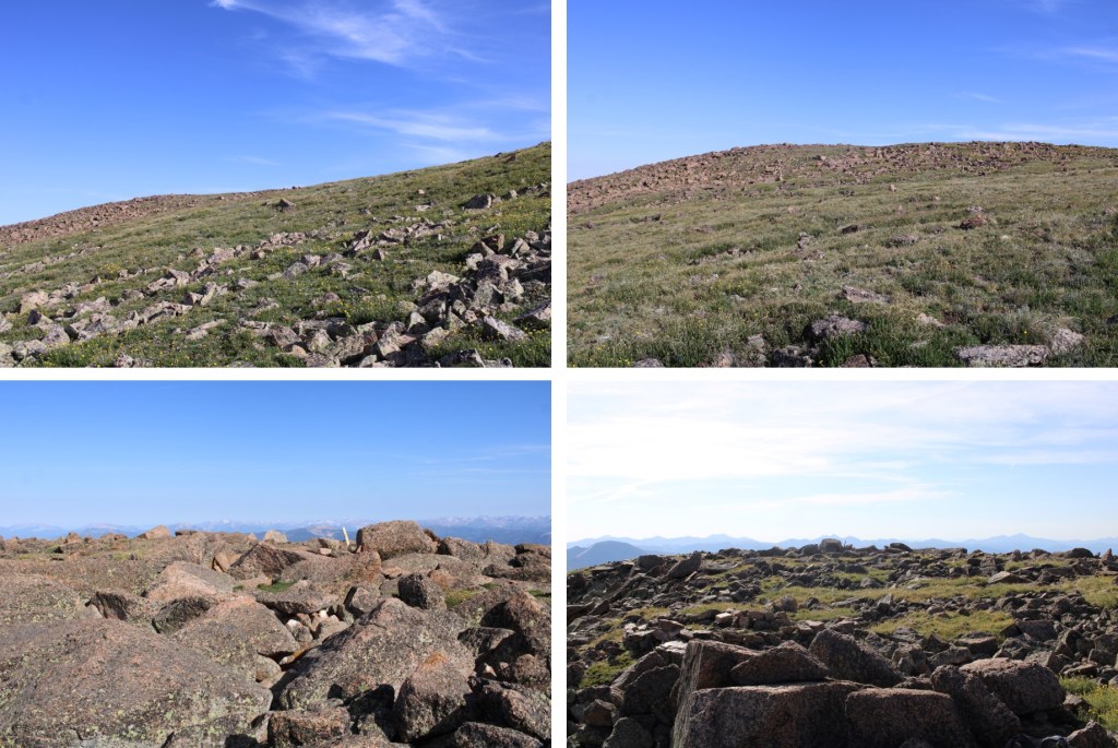
And up the ridge, back to the summit of Fossil. This part was class 2
At the summit of Fossil Mountain I was greeted to 4 ptarmigans on the summit cairn. They actually led me for a bit down the trail.
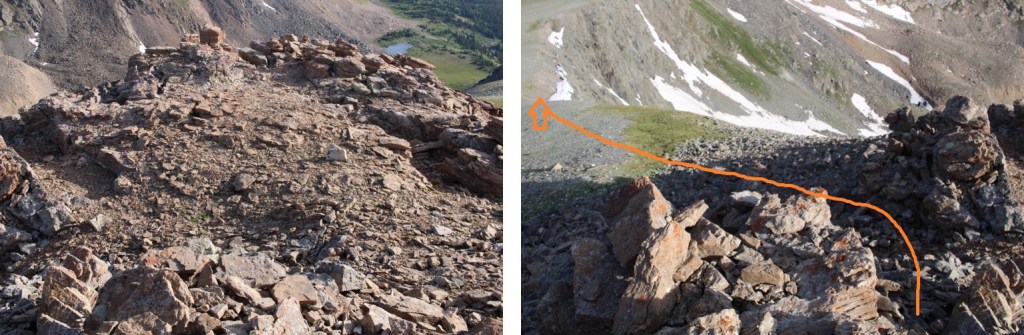
I descended Fossil Mountain to the northeast, staying directly on the ridge. Here’s the overall route. Note where I entered/exited the trees, as it kept me on tundra and avoided the rocky sections and brought me back to Mill Lake.
Here’s looking at that easy class 3 section down the ridge. Once again, I stayed directly on the ridge and kept it easy class 3
Then back towards the tundra
As soon as I came to the first group of trees on the tundra I turned right, and headed down towards the lake
After a quick bushwhack in the trees, I could see the lake and a trail below
I followed the trail around the east side of the lake, back to Trail 532, and then followed that trail back to the trailhead
I made it back to my truck at noon, making this a 10.96 mile hike with 3927’ of elevation gain in 5 hours. Please, note, I spent a lot of time admiring the wildlife and looking for cool rocks.
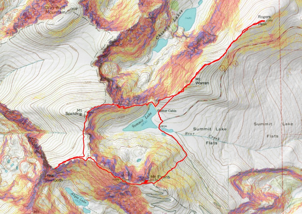
The permit system was simple, especially for Summit Lake. I bought it the day before, and there were 23 spots left for entry between 8-10am, the time I picked since it was the earliest. There were two other vehicles in the parking lot when I was on the trail at 4:45am.
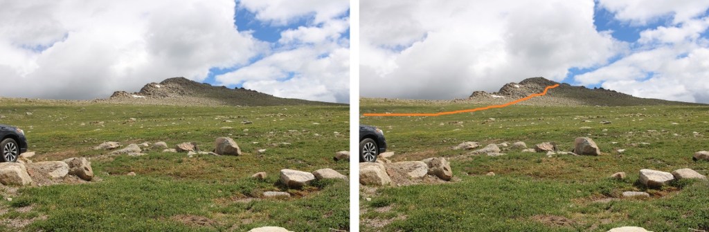
I was headed northeast, to the summit of Mt Warren. This was simple, class 2, and straightforward. Except it was dark and the rocks were slippery because of the rain. Here’s the route I took.
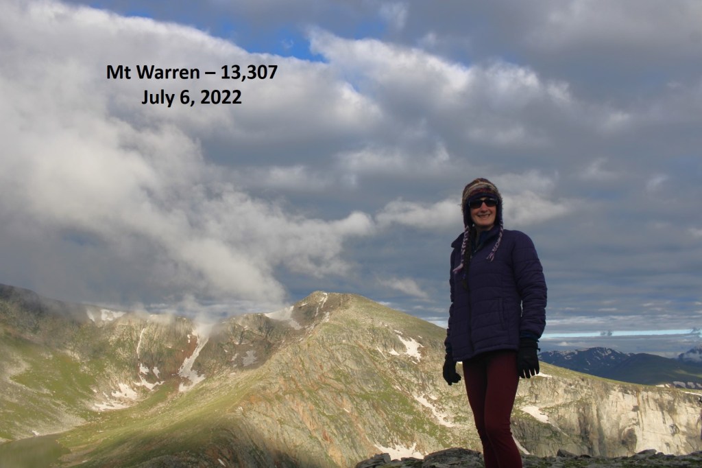
After hiking northwest for .75 miles, I summited Mt Warren at 5:10am
Mt Warren:
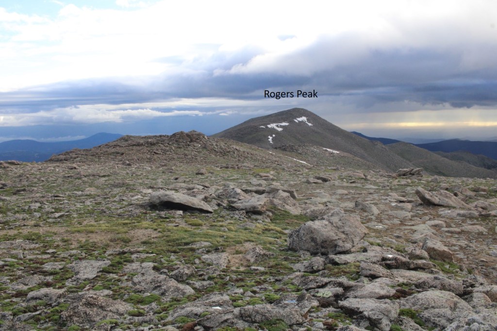
I continued following the ridge northwest, to the summit of Rogers Peak. This was also class 2
The summit of Rogers Peak is the top of this rock.
I climbed up it (not difficult) but took the video from below.
I summited Rogers Peak at 6am
Rogers Peak:
Now to re-trace my steps back to Summit Lake.
I re-summited Mt Warren, and continued southwest towards Summit Lake
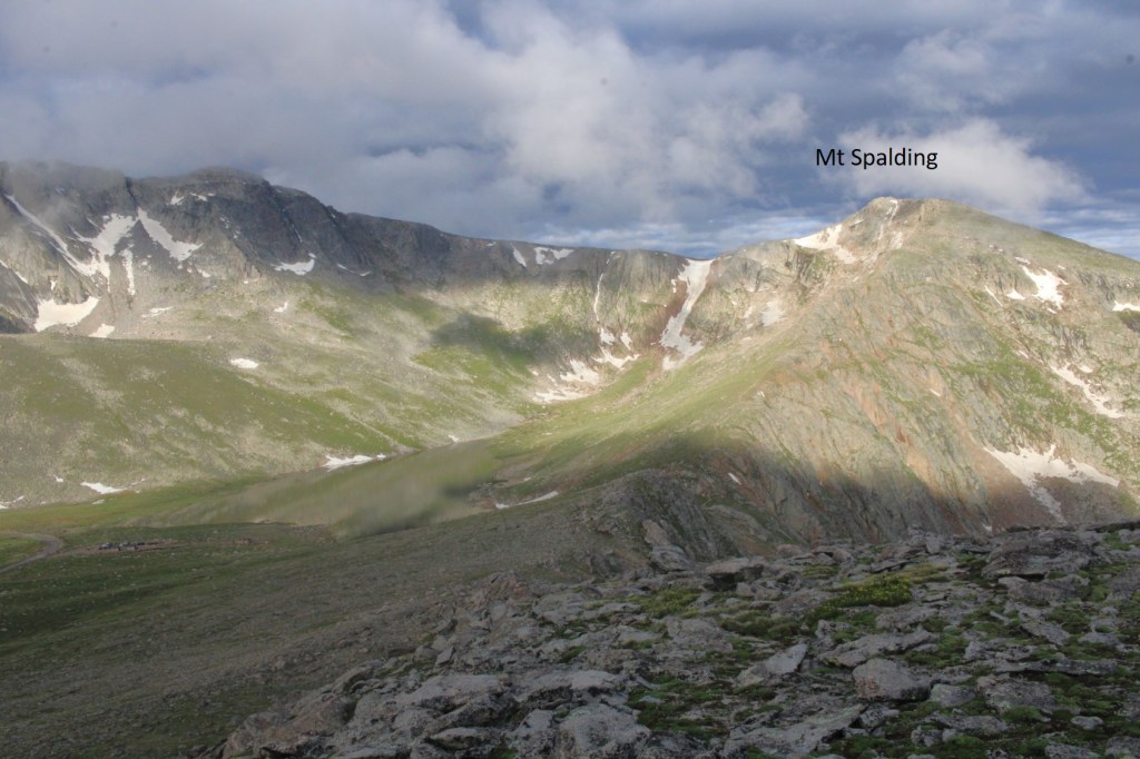
Once at Summit Lake, there was a class 1 trail that let me up to the summit of Mt Spalding
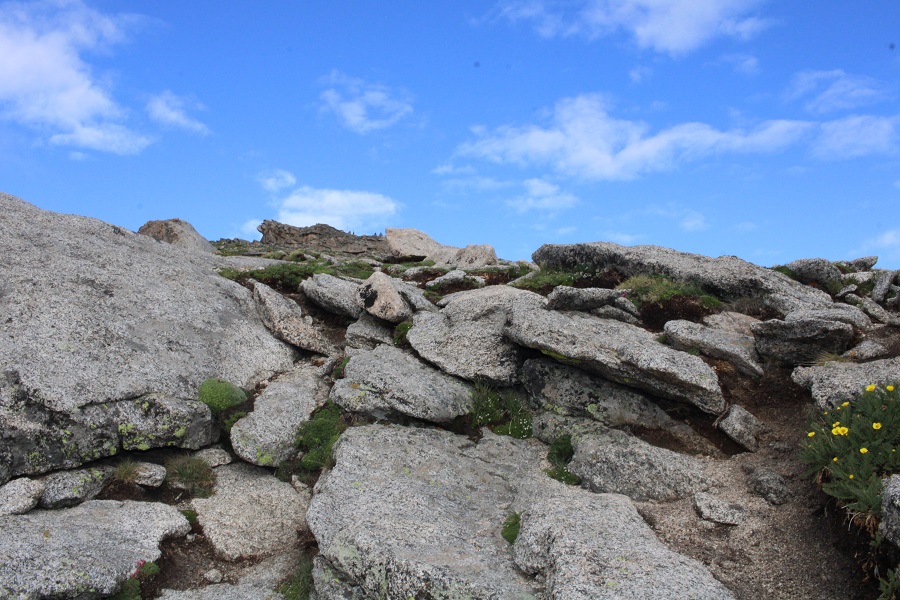
While this was class 1, there were a couple of quick class 3 scrambling moves. Large cairns made the route obvious
I continued following the ridge west towards the summit, on the class 1 trail
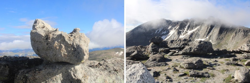
This rock is the summit block. I climbed it. The summit area (besides the block) is flat
I summited Mt Spalding at 8am
Mt Spalding:
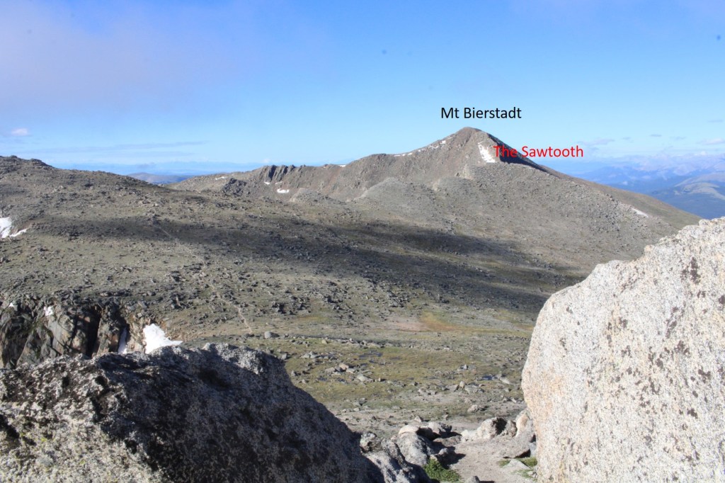
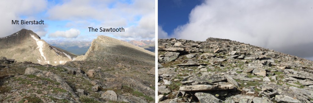
From Mt Spalding I could see my next objective to the southwest: The Sawtooth
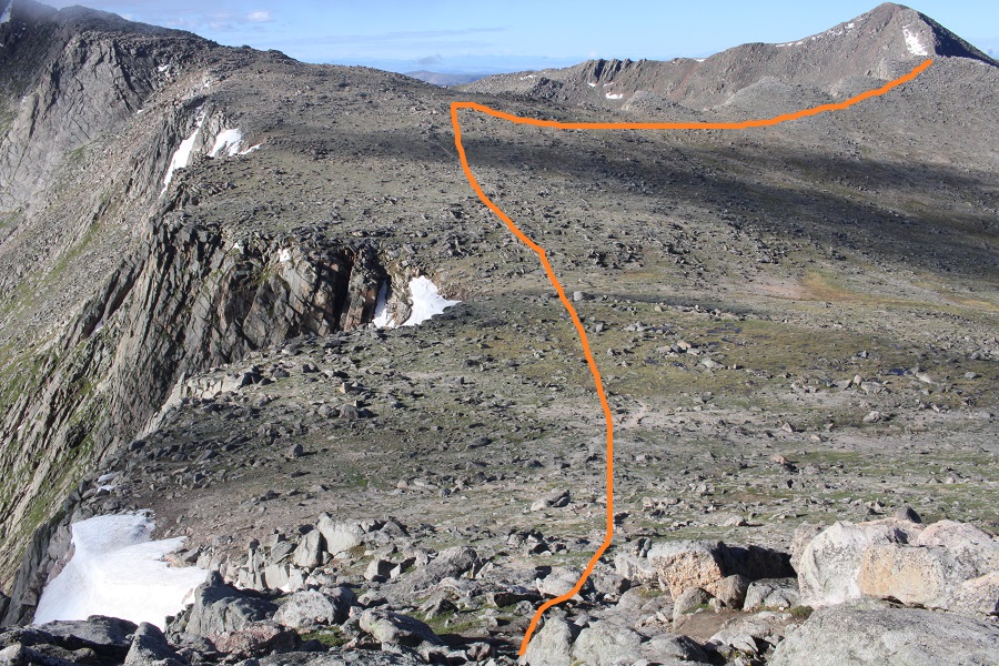
I continued following the class 1 trail south towards Mt Evans, but once I hit the ridge to The Sawtooth I left the trail and headed west. Here’s my overall route
And some step-by-step pictures
I summited The Sawtooth at 8:35am
The Sawtooth:
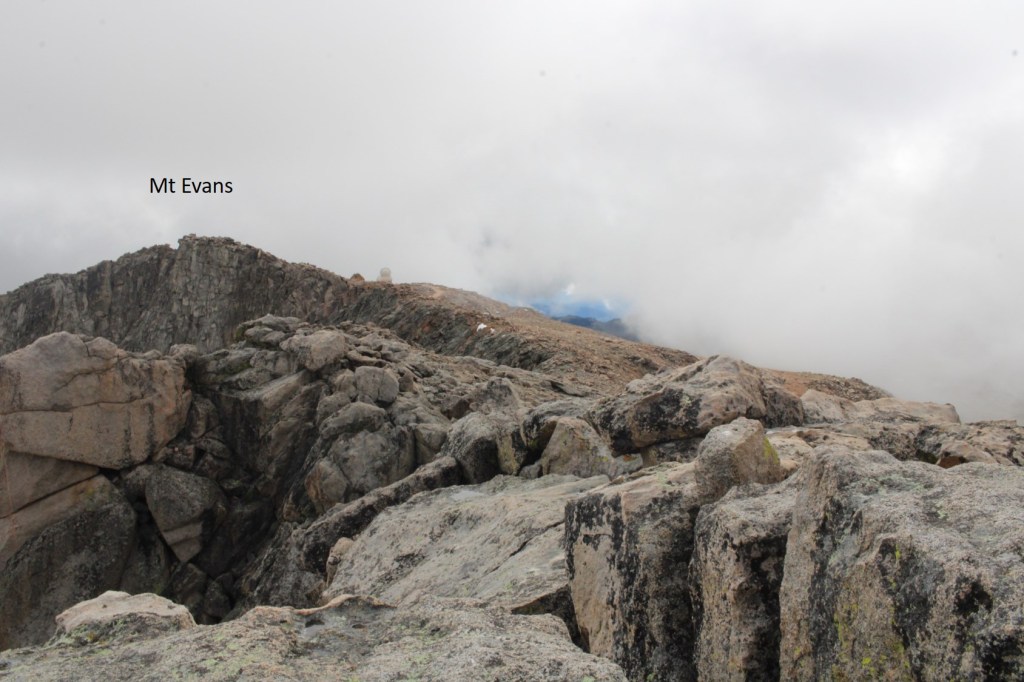
From The Sawtooth I could see Mt Evans to the east (actual summit hidden)
I made my way back to the Class 1 trail
I was still off trail, but just before linking back up with the actual trail I came upon a couple of mountain goats. They didn’t seem to mind my taking their picture. I never would have seen them if I’d been 50 feet away, on the actual trail.
Now back on the trail, I followed it southeast
I came to a small saddle, and while there are cairns on the other side, the true trail descends the gully a few feet, and picks up below. There are cairns to indicate this way as well
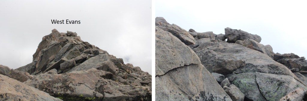
I followed the cairns southwest, until I made it to 14175’. I then left the trail, put on my helmet, and aimed for the ridge, and West Evans above. This was all easy class 3
I summited West Evans at 9:25am
West Evans:
From West Evans I could see the summit of Mt Evans to the east.
I descended back to the class 1 trail, and followed it east to the summit of Mt Evans
Just before the summit I followed the large switchbacks to the summit
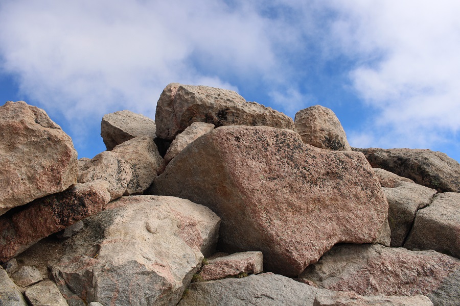
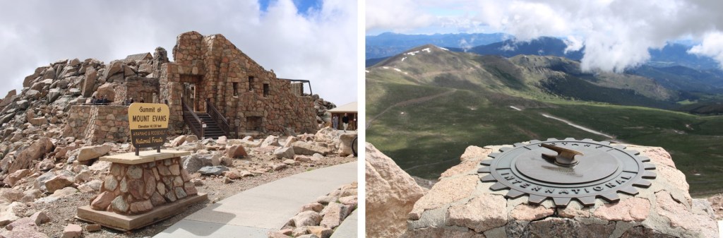
This is the actual summit of Mt Evans. I still had on my helmet, so I scrambled up.
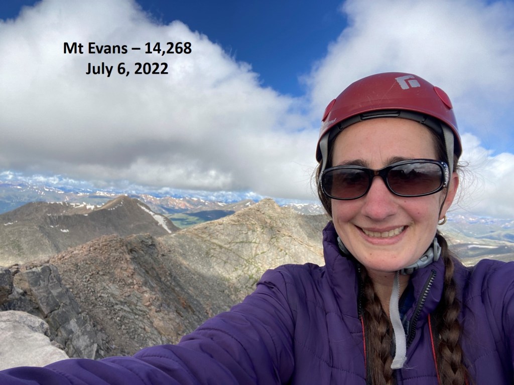
I summited Mt Evans at 9:40am
Mt Evans:
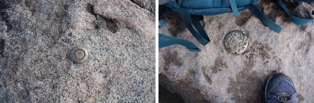
There were summit markers… not on the summit
And tons of tourists. Time to head down. I made my way back down the switchbacks, and headed east to the summit house
Once at the summit house I continued northeast, back down to the road below. At times there was a well-defined trail here
Back on the road, I followed it north to Summit Lake, and my truck
I made it back to my truck at 10:30am, making this a 10.28 mile hike with 3263’ of elevation gain I 5 hours, 45 minutes.
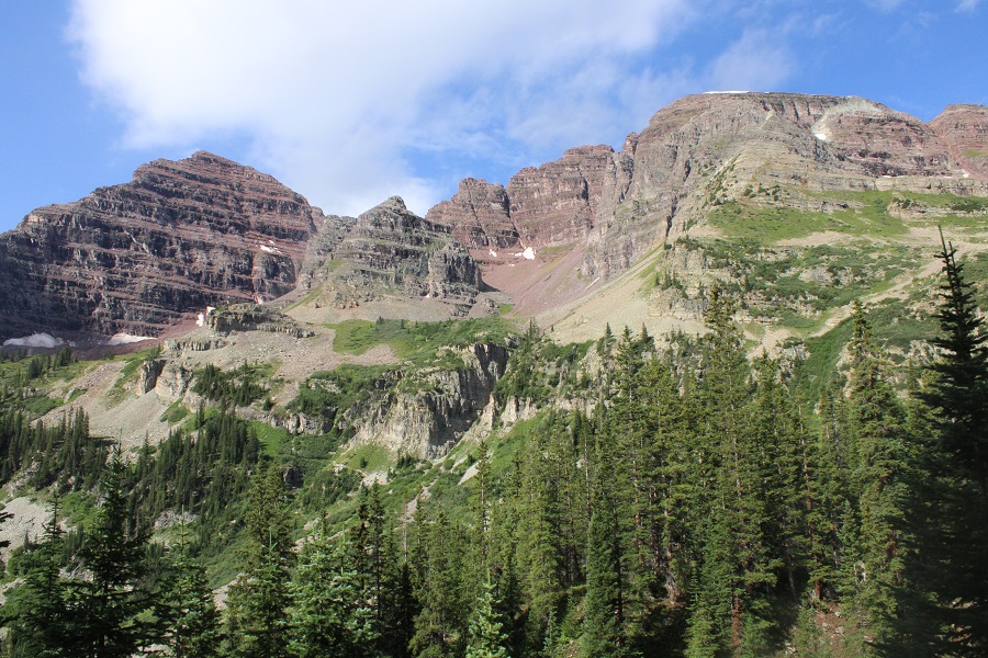
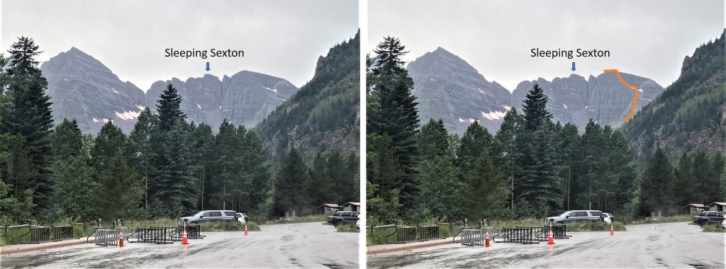
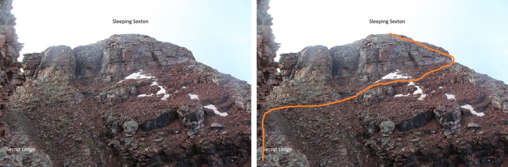
This was actually my second attempt on Sleeping Sexton: I was here last week but got turned around at the false summit due to getting ‘buzzed’. I figured it was for the best however, because I had done some serious route finding that morning and now I could provide a clear and useful GPX file for the route, instead of one with a lot of attempts that didn’t lead anywhere.
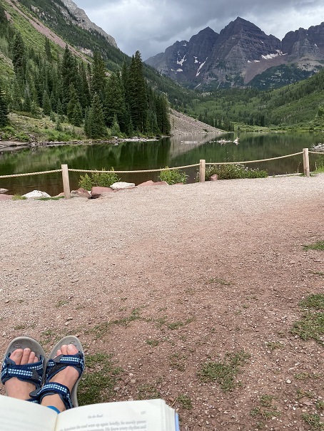
I made it to the Maroon Bells welcome station, and this time the attendant recognized me. We chatted for a bit, as he was interested in some of the summits I was doing. Then he referred me to talk with someone at their offices in town, and we’re basically best friends now.
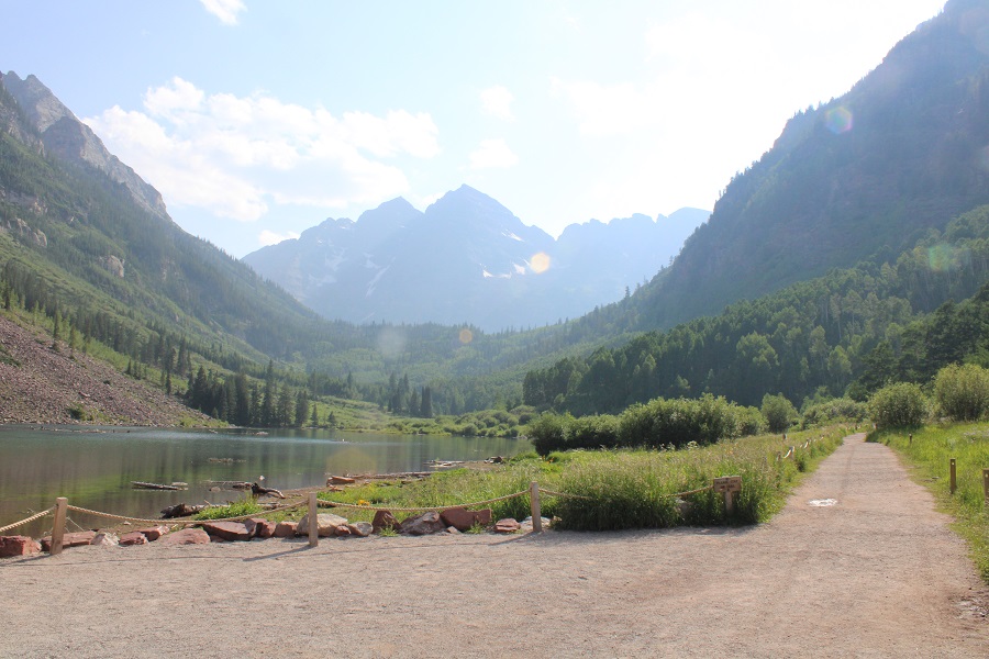
It was raining when I arrived, but people were walking around Maroon Lake anyway.
I was on the trail at 2:15am.
From the parking area, here’s an overview of the route above treeline to the false summit
The trail starts by skirting Maroon Lake, then taking the Crater Lake trail southwest.
There was a full moon out, so I didn’t need my flashlight.
At the junction for Crater Lake I continued following trail 1975 northwest. This is the trail you take if you’re doing the Northeast route for North Maroon Peak. There are camping spots just before the next junction.
The trail continues to be a well defined, class 1 trail. At about 10775’ there’s another junction. If you’ve hiked North Maroon Peak before, you’ll recognize this trail. I turned left here and crossed the creek, following the North Maroon Peak Trail (still class 1)
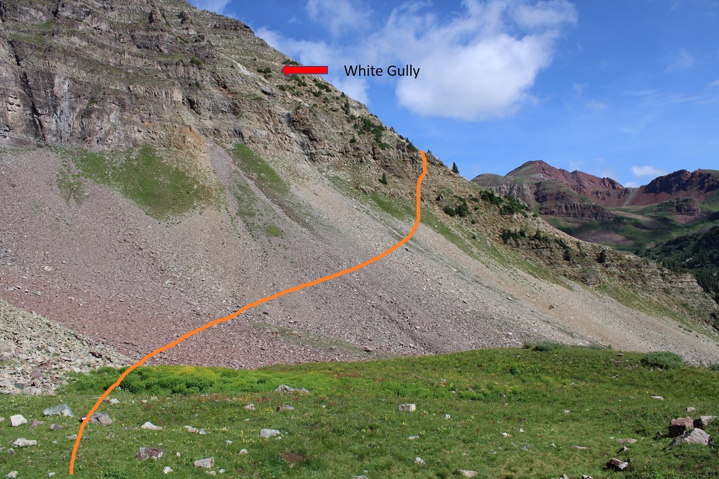
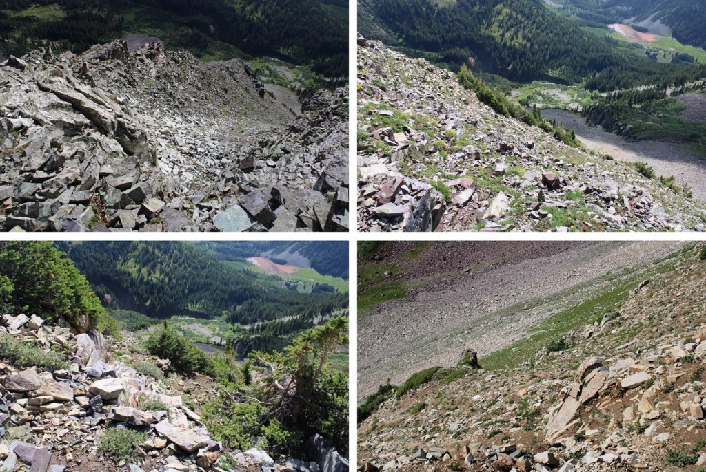
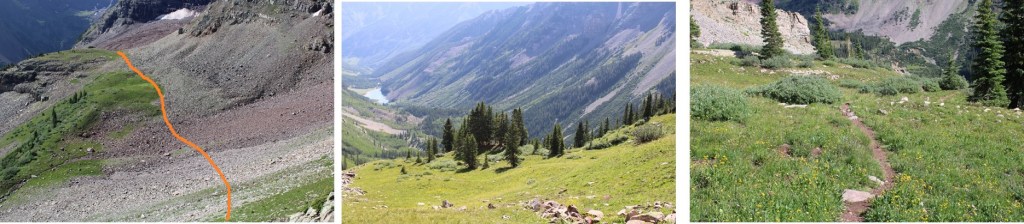
Here’s an overview of the trek to the false summit (or ‘the crown’) from the creek crossing. I followed the North Maroon Peak’s Northeast Ridge Route until I made it to tundra, at about 11,600’. I then left the trail and headed northwest, behind this outcropping, to the base of the white gully. I then trekked up the ridge and followed the white gully until it ended. Here’s a basic overview.
Here are some step by step photos of the way I accessed the white gully: I followed the North Maroon Trail to treeline
At 11,600’ I left the North Maroon Trail and headed northwest
Here you can see the base of the white gully. I didn’t want to climb straight up the gully, as it was very steep. Instead, I accessed the ridge, and followed the ridge to the white gully. (I did this after spending a lot of time last week trying to see if the smaller gullies ‘went’ to access the white gully, and turned back every time because I didn’t have rope. I believe it’s much easier to access the ridge first and then head up).
Here’s exactly where I entered and exited the ridge. I found this to be class 2 and direct access. Now’s a great time to put on your helmet if you haven’t already done so.
Once on the ridge I followed it west, staying in-between the ridge and the white gully (to the right of the gully, but left of the ridge). If you look for them, you’ll find game trails here (you may have to duck under some branches to use them though).
Once near the white gully, I found the terrain to the right to be more stable than the white gully itself, especially on my way down.
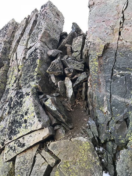
Topping out of the white gully felt class 3
From here it became ‘choose your own adventure’ as I followed the ridge southwest. I started out rounding the ridge’s north side, and then went back and forth between north and south sides of the ridge a few times. There are cairns here, and nothing is more difficult than class 4. In fact, if you’re extra careful/spend a lot of time route finding, you can probably keep this at mostly class 3. Here’s the route I took:
From the top of the white gully I rounded the corner and made my way back to the ridge. It had rained the night before, so I had to be extra careful with every foot placement (wet = slippery)
Once back on the ridge I followed it for a ways
Before hitting a bit of a shelf and crossing over to the south side of the ridge
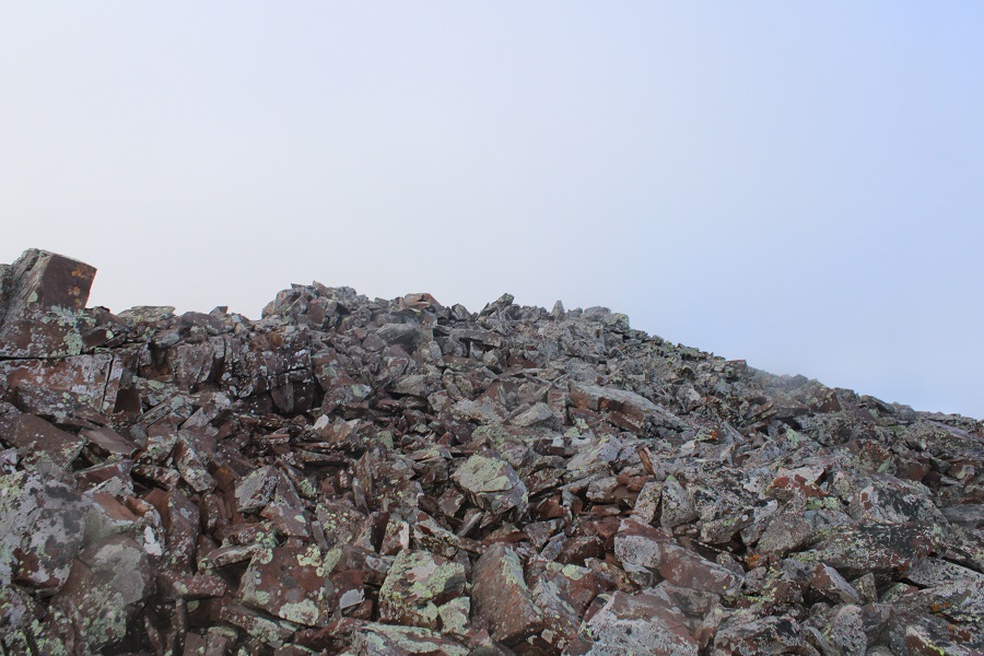
I followed the ridge to the false summit / ‘the crown’
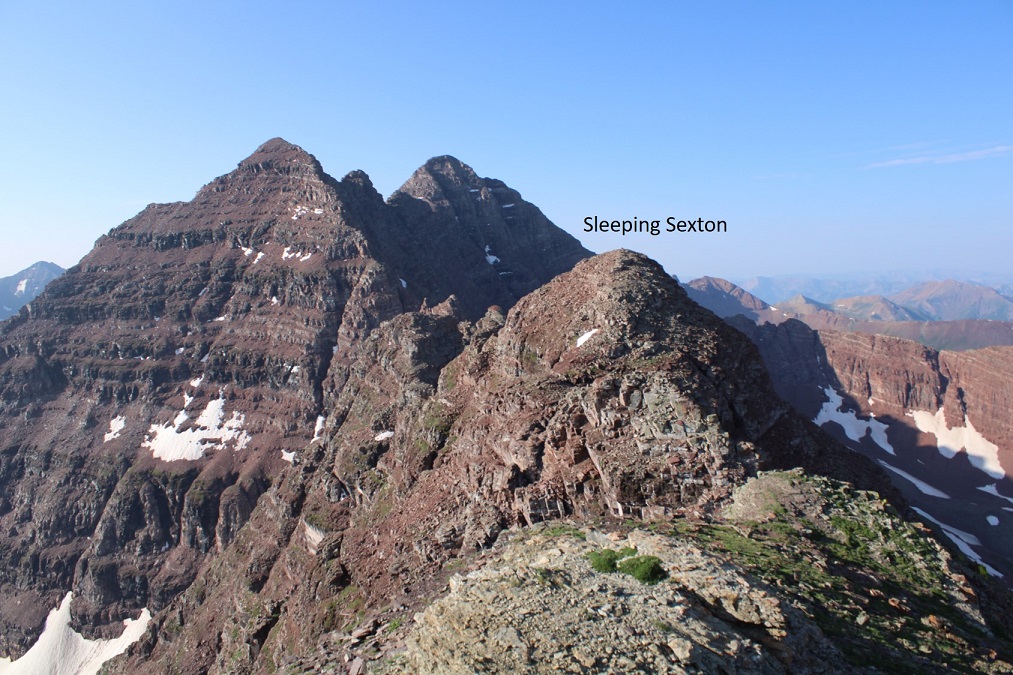
From the false summit you can see the true summit of Sleeping Sexton
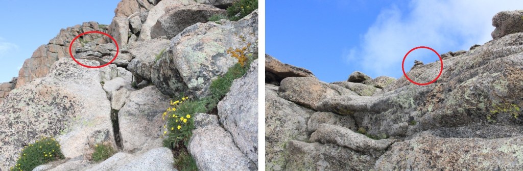
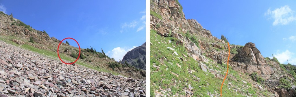
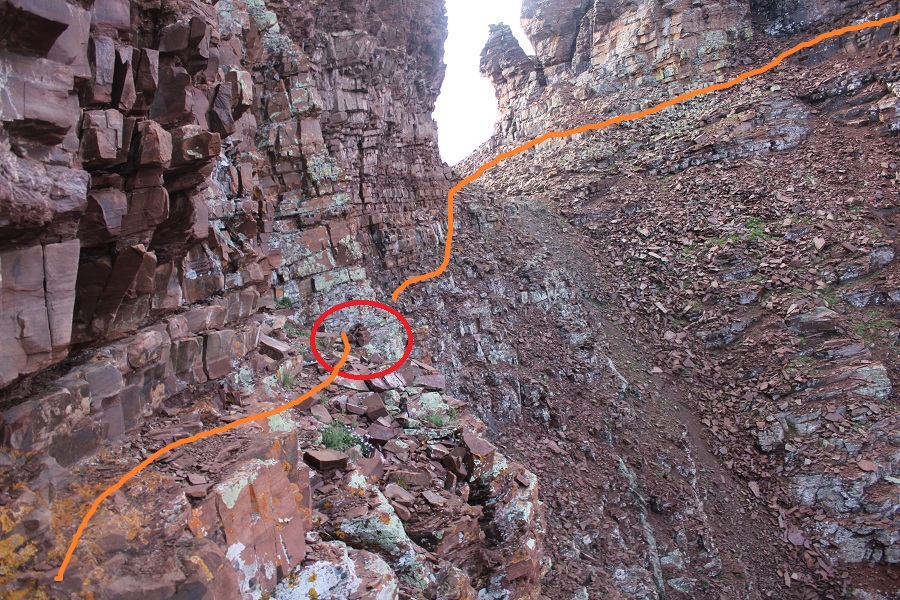
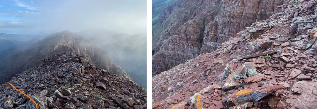
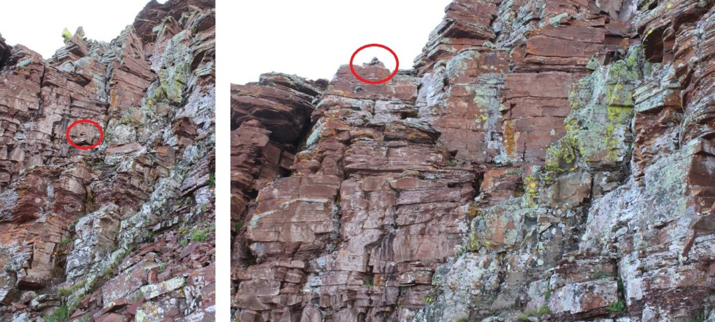
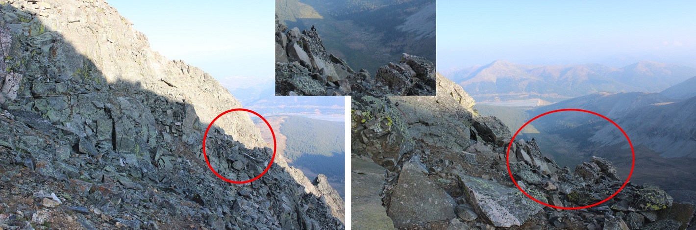
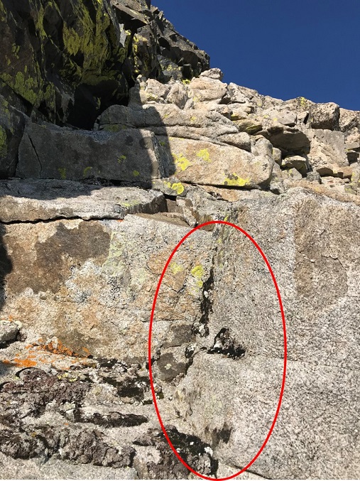
And now, the fun route finding begins! I descended the false summit 125’ and crossed a gully. There were cairns here to help in the crossing (circled in red). These are steep and go at class 3/4
After crossing the first gully I descended once again, another 160’
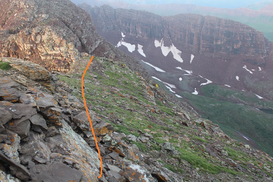
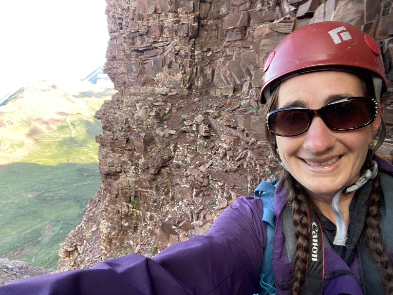
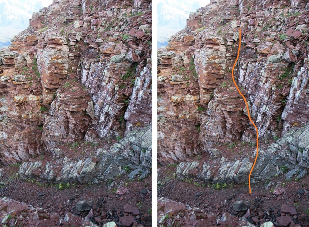
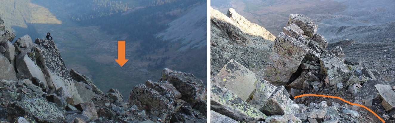
I was now at 13,130’, and parallel with the saddle between Sleeping Sexton and the false summit. I followed the contour of the mountain to the ‘secret ledge’. Here’s what that looks like heading in
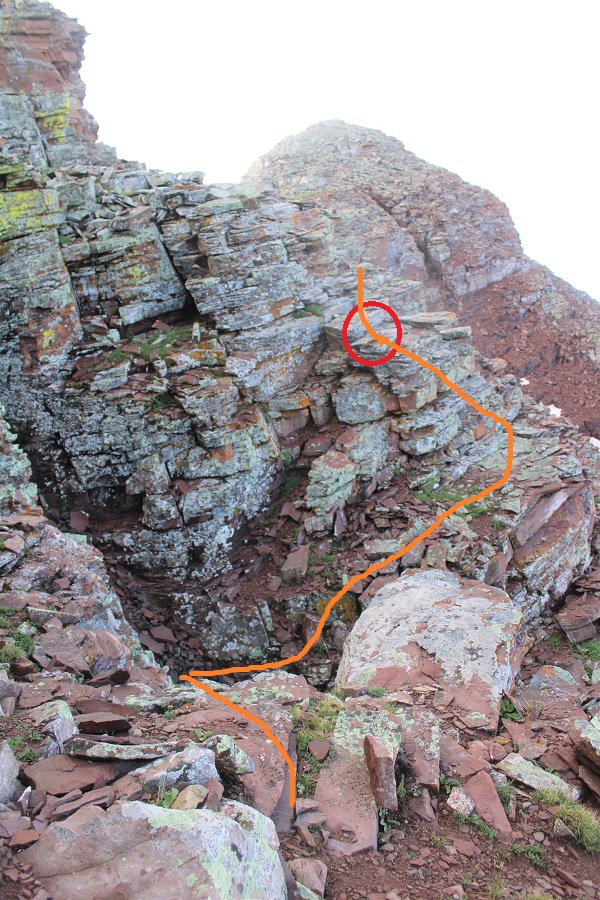
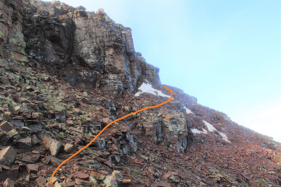
I crossed the ledge to the ‘saddle’, then skirted the side of the mountain and headed up to the summit
The ledge is not as bad as it looks. There’s a cairn here (circled in red) DO NOT DESCEND HERE. Instead, use it as a reference point and stay level with it (especially on your way back) and continue following the ledge. If you do this, it stays class 2 to the saddle.
From there it was an easy trek to the summit, first skirting the mountainside
And then ascending the ridge
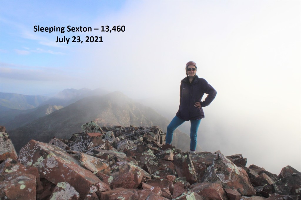
I summited Sleeping Sexton at 6:45am, just as the weather started rolling in
Sleeping Sexton:
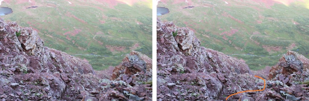
Since the weather wasn’t cooperating I didn’t stay long. I turned and headed back the way I’d hiked in. Here’s looking back at the false summit / ‘the crown’
And a view making it back to the ledge
Here are some more images of that ledge, looking back. Remember to look for the cairn, and stay level with it.
For reference, here’s the size of the route. The route can clearly be seen over my shoulder (to the left)
I rounded the corner, and ascended the gully, aiming for the cairns
Crossed the next gully
And gained the ridge to the false summit / ‘the crown’
I actually stayed here for a bit because I had cell service. I let my family know I was ok, and downloaded the weather forecast for the next day. However, eventually the clouds told me to get going.
Clouds rolling in:
Here are some pictures of my way back to the white gully
Back down the white gully to the ridge
And from the ridge back to the trail
Once back on the trail it was an easy, class 1 hike back to the parking area.
I made it back to my truck at 11:30am, making this a 12.7 mile hike with 5156’ of elevation gain in 9 hours, 15 minutes.
It was still early in the day, so I ate lunch by Maroon Lake, read for a bit, looked at topo maps for tomorrow, and jotted down notes in my journal before making it an early night. Oh, I forgot to mention the goats: They were the same two goats I saw last week, and if for no other reason than them, wear your helmet until you make it back onto the class 1 trail: They were kicking rocks down the gullies the entire time I was there.
I’ve said it before, and I’ll say it again: I’m NOT a fan of the permit system. Even though I was on their website exactly when permits were released, I wasn’t able to get an overnight permit for Maroon Bells on a date I could go, so I had to get three back-to-back permits instead. When I pulled up at the gate my paperwork confused the attendant. He didn’t know what type of a parking pass to give me, but settled on an overnight pass that expired in two days time. He then asked me to park in the further lot, as the closer lot was intended for day use.
I balked at this: I’d wanted a 2 night pass, but because of the reservation system I couldn’t get one. Instead, I paid 3 times what those who were able to score a longer permit were paying for the same amount of time in the park. I felt if I was paying that much more, the least they could do was give me a better parking spot. Also, while annoying, the main reason I don’t like the permit system isn’t because of stuff like this: it’s because it encourages bad decision making among people who feel they need to hike/continue when dangerous because it’s difficult to get a permit, etc. One of the reasons I left California in 2006 was because of the permit system, and all the fees associated with said system. I hate seeing it brought to Colorado.
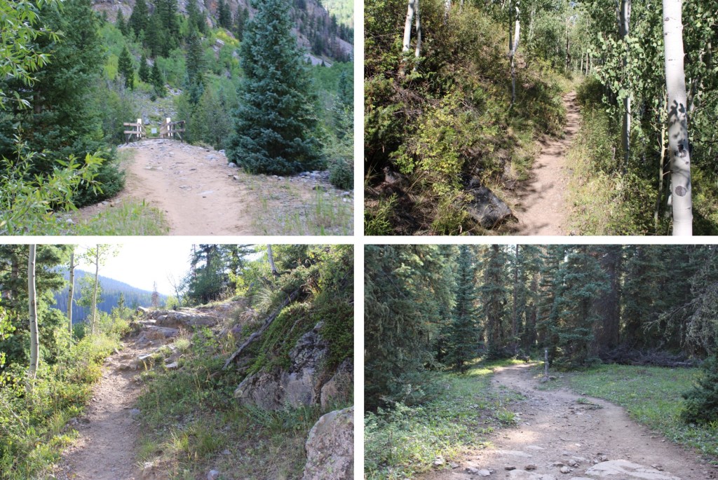
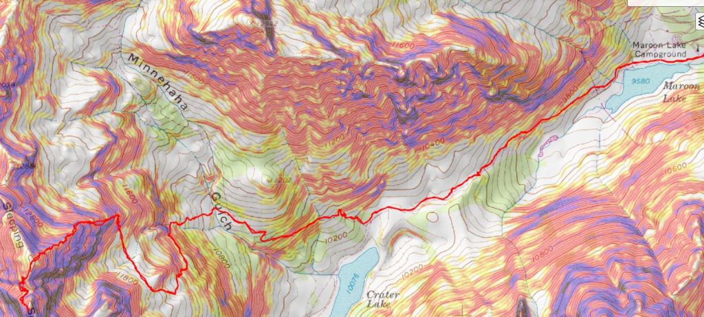
Ok, rant over. I was on the trail around 5:30pm. It was my intention to camp around 11,000’ and start early the next morning. For those of you who haven’t hiked the Maroon Bells area before, the trail is obvious:
I followed the trail west, staying right at the junction for Crater Lake
And continued up the hillside to my camping spot at 11,100’. I was surprised no one else was camping here, as it’s the perfect spot.
I’ll spare you the details of the next day’s hike, as I came back to this spot, spent the night, and started from here the next morning. I’d gotten to bed early after a long day of hiking, and woke up to sunlight. I looked at my phone and it showed 5:30! Ack! I initially thought I’d slept through my alarm, and started rolling up my sleeping bag. About 30 seconds later I realized I’d only been sleeping about an hour, so I happily went back to bed and slept soundly until 3:30am the next morning. I left my new water filter bag inside my tent and was on my way.
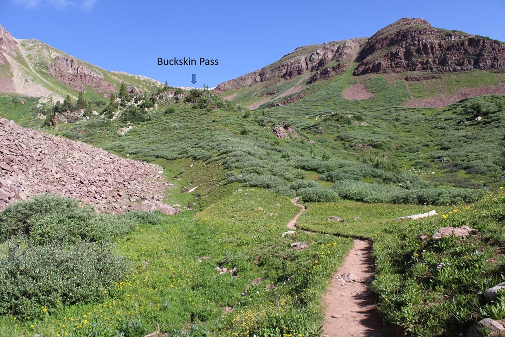
I was on the trail by 3:45am, heading northeast along the well-defined trail through Minnehaha Gulch. I crossed a stream and continued along the trail, not really ‘feeling it’ today. I was more tired than I should have been, and wasn’t feeling very motivated.
I followed the trail all the way to Buckskin Pass
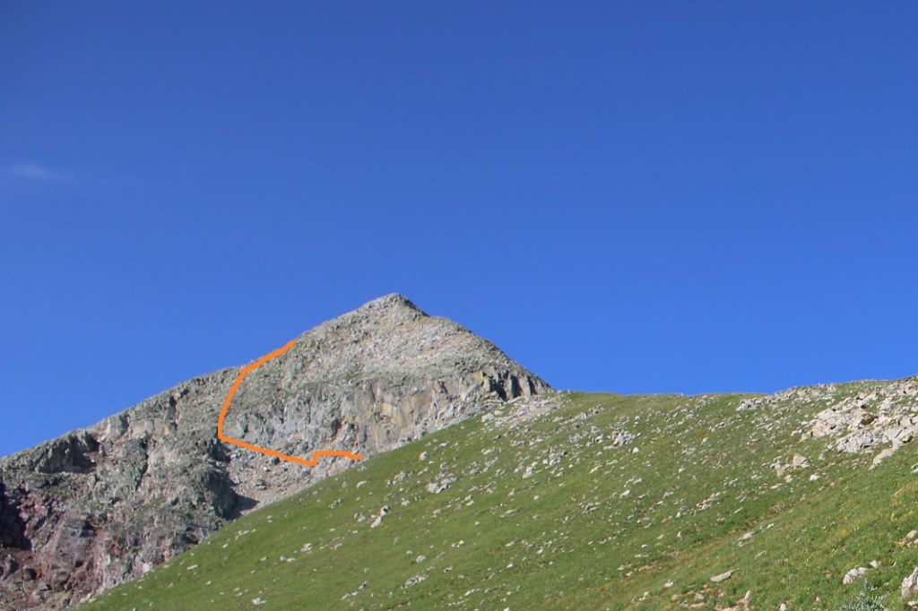
Once at Buckskin Pass, I turned right and headed north towards Buckskin Benchmark
This was an easy, class 2 hike, mostly on tundra
Towards the top it got a little rocky, but stayed class 2. I saw several ptarmigans here, and a few crows
Right about now the sun was starting to rise, along with my motivation.
Here’s the last bit to the summit. It stays class 2 if you keep left
I summited Buckskin Benchmark at 6am
Buckskin Benchmark:
The benchmark
The views from up here were amazing! My spirits lifted, I actually ate a snack, and headed back down to Buckskin Pass.
On my way down I made some mountain goat friends (those are Snowmass and Capitol peaks in the background)
My next peak was PT 13039
It was a tundra walk back to Buckskin Pass
And a trail hike up to the point circled in red
This is where it got interesting. I wanted to go straight up and over the face, but it seems as if there have been several slides in the area, and nothing went at class 2. This was supposed to be a class 2 hike, so I looked for a better way. My advice here is NOT to go directly up one of these gullies (you probably can, but they all looked sketchy/prone to slides).
Instead, dip down to the left. This area stays class 2.
Here’s what my route looks like from below
Once I was past this area, I turned right and headed southwest to the ridge (still class 2).
Then I followed the ridge south. I could clearly see the cairn indicating the top of 13039
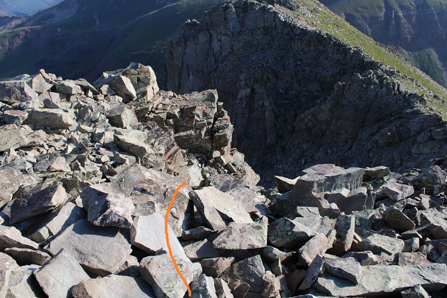
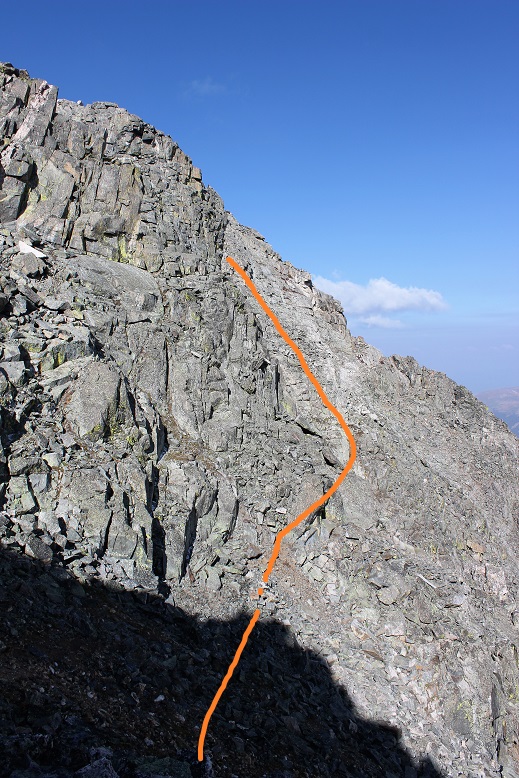
At the edge of the ridge is where it got spicy. It turned form a class 2 hike into a class 4 climb. I looked around for an alternate route, and realized the only way up to the summit was to climb the 30-40 feet or so up the chimney/gully to the summit block
I was a little disappointed because I’d left my helmet back in my tent. I debated if I should continue or not, and in the end I figured I did enough class 4 climbing yesterday without incident and was warmed up: I should be fine today. Also, I’d recommend wearing a helmet. I dropped my gear and headed up with just my camera. Here’s the route I took
I made it about halfway up the chimney, and once again had second thoughts. I continued on however, because I knew the worst was behind me and either way I’d have to downclimb that area again. Here’s another angle
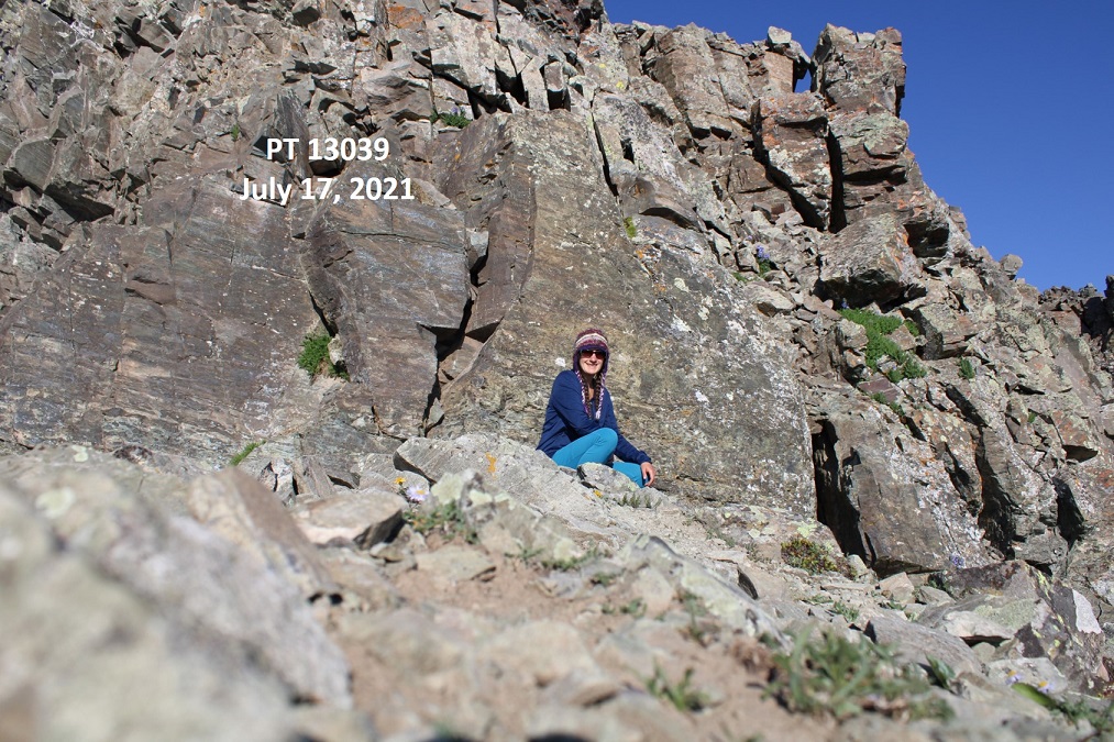
I summited PT 13039 at 7:45am
PT 13039:
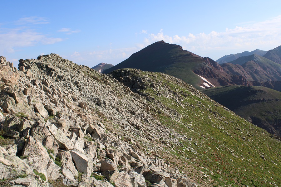
Here’s looking back at Buckskin Benchmark
From the summit you can see where I left my gear.
I turned and exited the way I came
The initial downclimb was steep and committing. I turned and faced the rock for this part.
I made it about halfway down and realized I hadn’t taken a picture of myself on the summit, but I wasn’t willing to re-summit again. I figured I’d just get a photo at the bottom.
I made my way back down the ridge
And back to Buckskin Pass
From the pass it was an easy, class 1 hike back to my campsite.
Side note: there are also good camping sites at 11,500’. Once at my campsite I was disappointed to find my water filter had leaked water all over the bottom of my tent. I dried it out the best I could, packed up my gear, and headed down.
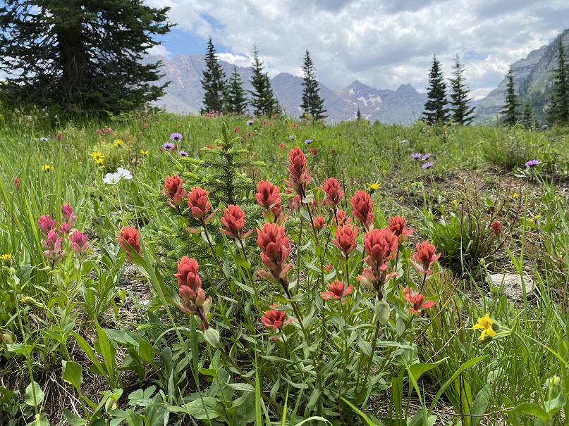
Also, the wildflowers were on point today
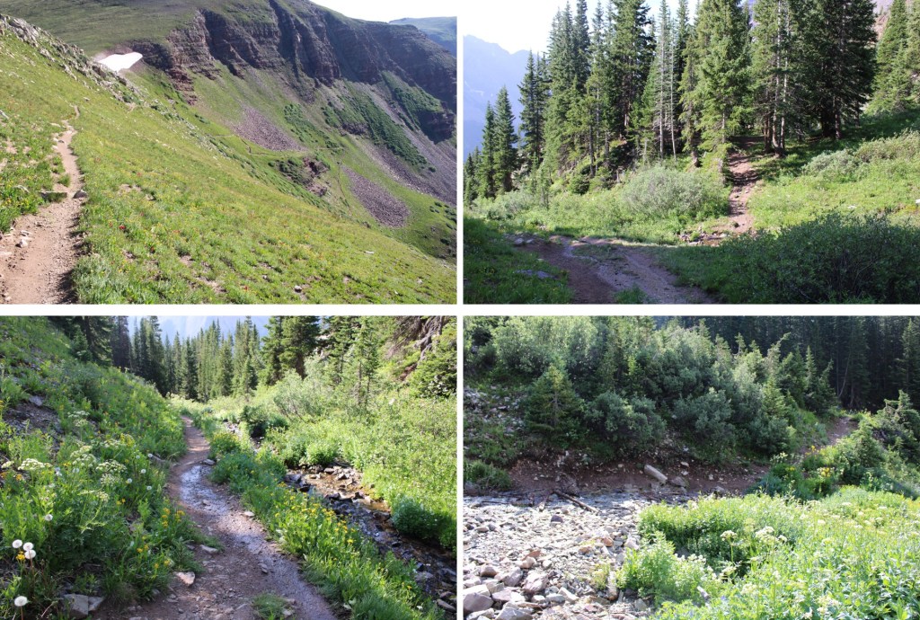
Here are some pictures from the trek out
Once I made it back to the Crater Lake area I started seeing tons of people on the trail. They travelled in groups, and were spaced about 15 minutes apart (I’m guessing this is due to the bussing times). I met one lady who asked me how fat it was to Crater Lake, and when I told her it was another mile or so she looked like I’d just told her it was another 20 miles. She was exhausted, and I’m pretty sure she turned around (the round trip hike to Crater Lake is about 4 miles). There were several groups being led by guides, which leads me to believe guiding companies may be buying up the permits.
I made it back to the parking lot, cleaned up, and headed out.
I had another entire day of hiking yesterday, so my stats are estimates based on CalTopo math: Today’s hike was 18 miles with 5800’ of elevation gain.
Hike/walk/run/treadmill elevation gain of 1 million feet
Summit a combined total of 10 winter 13/14ers
Finish the Bicentennials
Summit 3 new state highpoints outside of Colorado
Summit 3 new El Paso County Highpoints
Hike another section of the Colorado Trail
Keep my average above 10+ miles and 4000’+ of elevation gain per hike
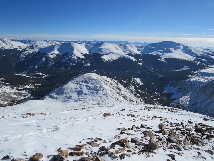
Quandary Peak – 14,265
RT Length: 7.22 miles
Elevation Gain: 3444’
Just to get 2021 off to a good start, I set my alarm for early and made a reservation to hike the Manitou Springs Incline on New Years Day. Unfortunately, my alarm didn’t go off and I ended up missing my start time. I was super bummed, but I didn’t let it get me down: I still had enough time to get a hike in. I figured I’d just do Quandary Peak instead. This is the 4th time I’ve hiked Quandary, and I’ve written several trip reports on the peak, so I’ll just post some pictures with highlights:
The road and trail was well packed down
This time I decided not to stop at all, and guess what? I had my fastest summit of Quandary Peak! There were tons of dogs on the trail today, and I even saw a group of skiers with guides. Here’s the summit
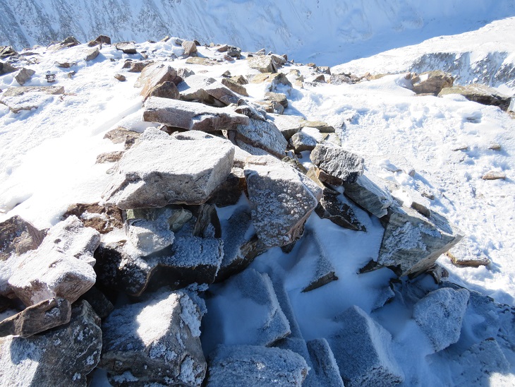
It was very, very cold today. It didn’t get above 18 degrees (that’s what the temperature was when I got back to my truck). There was a slight layer of frost on everything
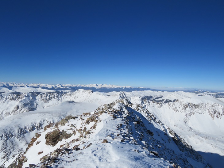
Looking west
Heading back down I came across some BASE jumpers who were intending to jump from the summit. I didn’t think it was windy enough today. In fact, it was a perfect, bluebird day to go hiking!
I saw Mountain Goats on the way down, but they were kind of far away
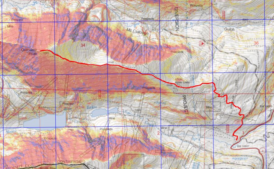
Here’s a topo map of the route. I made it back to my truck at 11:45am, making this a 4 hour hike: 7.22 miles with 3444’ of elevation gain
The Quandary Peak Summit Sticker can be found here
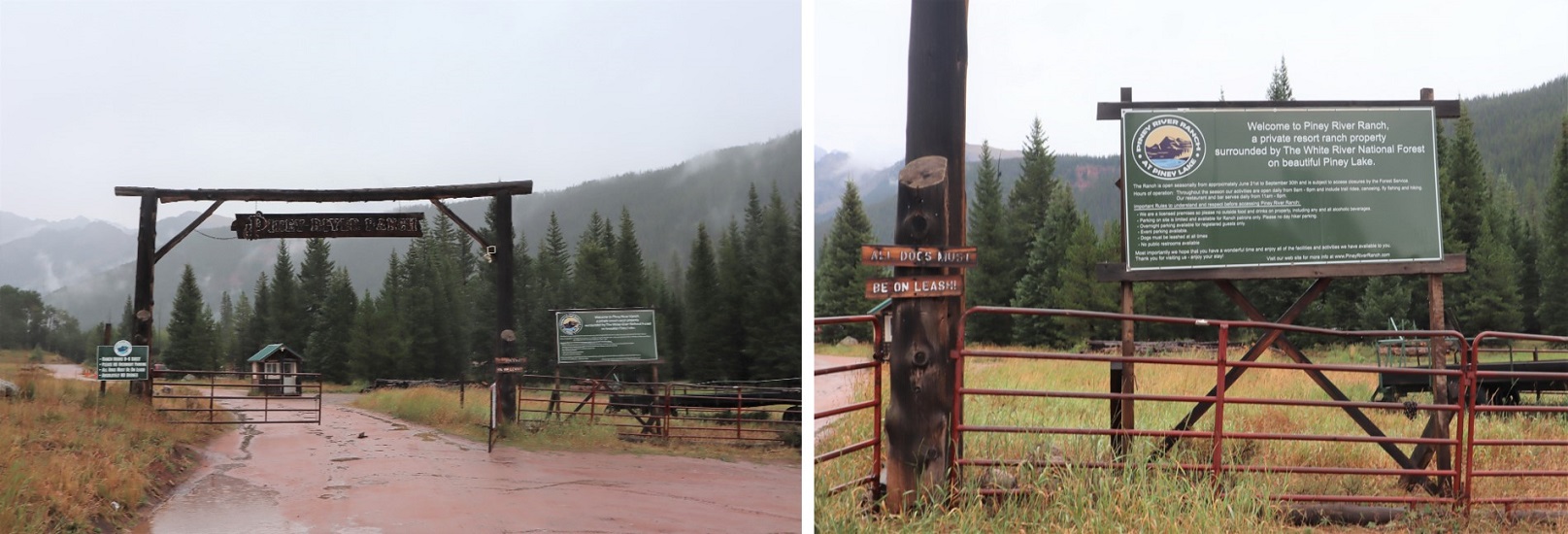
I drove to Piney Ranch in the rain. The dirt 2WD road to get there is more like easy 4WD: tons of potholes make this slow going for 2WD vehicles and 4WD vehicles alike. Given that it was raining as well it was a slow drive in (the Escalade in front of me was extra cautious, and didn’t seem to mind I was behind them: gotta love California drivers. I say this being from California myself, and understanding their driving mentality). I parked near the gate and ate dinner as I waited for the rain to stop. It finally did and the sun came out. Woot! The sun dried up all the rain and I wasn’t going to need to worry about my legs getting wet from water droplets brushing against my pants from the plants on my way in. This picture is from one of the good parts of the road, just before the ranch.
I hadn’t planned on hiking this peak today. In fact, it wasn’t on my list for the net few weeks, but weather earlier today had caused me to alter my plans. This meant I hadn’t done as much research on this peak as I should have, so I asked everyone arriving back at the trailhead where they’d been to see if I could get more beta. No one had been hiking Mt Powell. I did talk to one guy who hadn’t hiked it, but said “That’s one heck of an approach!” This scared me a bit. I asked him to be more specific? I told him I’d hiked all the 14ers, could he compare the approach to any of those? His reply was “I’ve done the 14ers as well. Nothing compares”. It wasn’t lost on me he didn’t say ALL the 14ers, but I figured it couldn’t be that bad or I’d have heard about it by now, even with just some cursory research.
I sat in the back of my truck with a glass of whiskey and finished reading “Death in Yosemite” (the last chapter is ‘Homicides’, and I’d advise against reading that chapter, especially if you’re hiking alone in the dark the next morning: also, avoid hitchhiking).
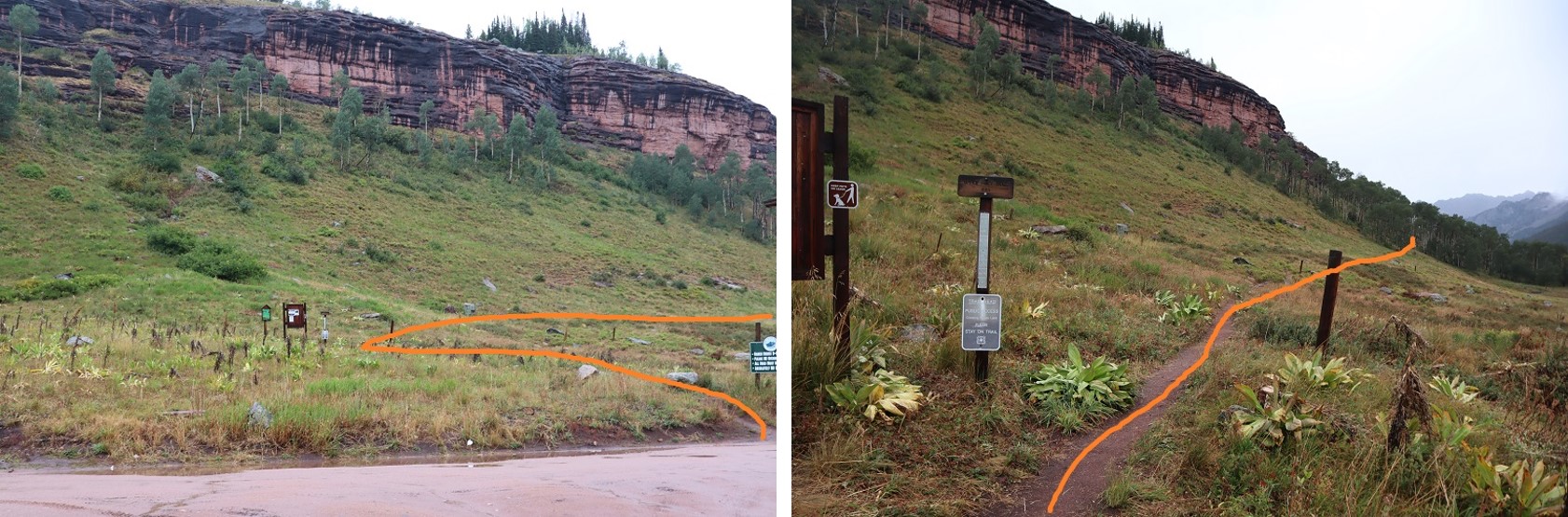
I went to bed early, and was woken up around midnight to the sound of rain. Wonderful. Oh well, nothing I could do about it now. I fell back asleep for a few hours, woke up and was on the trail by 3am. The trail starts just to the north of the gate, and heads east.
It passes Piney Lake and continues along the basin. In the morning moonlight I could see the basin was covered in fog. Such a cool experience!
I continued heading east at this sign (after about half a mile). It’s the only junction you’ll come to.
Other than that, this is pretty much a class 1 hike all the way to the pass. There’s a trail that passes rocks/goes up drainages/waterfalls in areas, but it’s difficult to get lost on this trail, especially in daylight. Here’s the overall route to the pass, with the more difficult parts highlighted
and some photos of the trail
This area was a bit tricky for me in the dark, but when the trail ended I really just needed to follow the granite slab up. There was a cairn at the top, but I couldn’t see it from below in the dark
I went through an area with willows
And then some dry waterfall areas (the waterfall stays to your right, and you don’t ever cross it). If you come to large boulders, they’re ALL passed to the right on the way up. If I ever lost the trail, it was because I was supposed to climb up the rocks (nothing other than class 2).
I passed a camping area. (There are 3 in total, this was the first). From far off I could see a green tent lit from inside with a flashlight, and someone standing with a headlamp. It was now about 4:30am. I was sure this person could see me too, because I was right in front of them and I had a flashlight as well. Apparently, he was groggy, because as I got closer I realized he was peeing. He didn’t notice me until it was too late. He also didn’t bother to recognize I was there (I’d have been embarrassed too). He turned away and went back to his tent. I’m only saying this to reiterate to everyone out there: don’t pee by your tent, instead head for the trees, and turn your flashlight off while you do so! Just assume someone can ALWAYS see you (I had a pair of hunters follow me with binoculars once in the middle of nowhere. They watched me for over a mile just to talk with me when we met up. Good thing I hadn’t stopped out in the open to pee….). Just before entering the upper basin there’s a large boulder. This gave me some pause in the dark. Yes, you do traverse a few feet above the ground here, and then the trail picks back up
It’s now back to class 1. There’s also a camping area here. If I were backpacking, this is where I’d camp (at 11200’ after 5.25 miles of hiking).
Imagine my surprise when, upon entering the upper basin, there was still a trail! In fact, there was a trail up the gully as well. I thought back to what that man had told me last night about this being a difficult approach and laughed. The only thing ‘difficult’ was it seemed to take forever to get to treeline (over 5 miles, it seemed like I would never get there, and it was all up). Other than that, I’d been following a trail the entire way. I smiled and continued on. Here’s the trail to the top of the gully
The scree here wasn’t even that bad. You could just go up the middle directly, but the scree there looks loose. I kept to the left. If there were snow I’d most likely have gone directly up the center.
At the top of the gully I was thrilled to discover the snow was avoidable. I’d seen several trip reports where there was unavoidable snow until September, but luckily the snow today was avoidable. I decided to descend 150’ and keep this class 2 instead of traversing the ledges. I went down to the right, and came back up to the left. Since it had rained last night the scree was easily navigable, but is most likely a nightmare when dry: bring microspikes for the dry scree.
Then I dipped down a bit, crossed the ravine, and headed back up. All of these gullies go to the top, and the short saddle is relatively flat. However, I found when I’d summited there was still about 200 feet of snow/ice at the top. To avoid this, take the gully as far right as possible. By this time it was getting windy: the cold, early morning wind was coming straight down the gully and that spells disaster for my Raynaud’s. Also, I was done with gullies (I’d done 13631 the day before with, like, 10,000 gullies) and decided to rock-hop the last bit of the way to the summit. This was all class 2 and went easily to the summit (and I was now working different muscles so my legs thanked me). I went right on the way up, left on the way down. Dotted lines are alternate routes. They all go, and there are most likely many more lines that go as well.
Here’s what the rock-hopping looked like. Most of the rocks, especially the larger ones, were stable. Once again, all class 2.
The last bit up to the summit was especially easy, and needs to be climbed if you take the gully or ridge
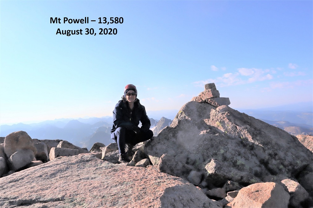
I summited at 8am
Mt Powell:
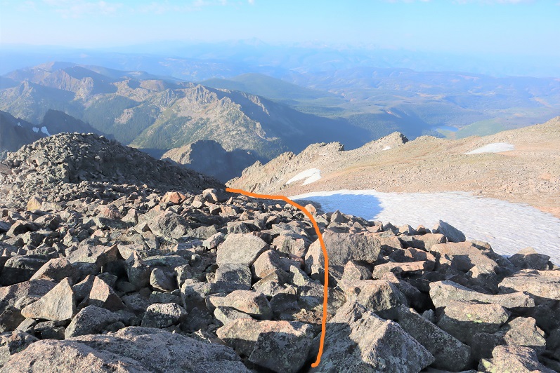
It was windy and cold so I didn’t spend a lot of time on the summit: I couldn’t feel my fingers and wanted to get down as soon as possible. I chose to take the gully down. There was still snow at the top, but it was avoidable.
Here’s looking back up the gully. I took the route to the right up, left down
Here’s a look back up to the pass. I went left on the way down (less steep but I lost elevation) and right back up (steeper, just a tad bit of ice left at the top but will be gone in a day or two). All snow was avoidable
Here’s a look at the gully I went up on my way back. It’s more solid to the left
Also, there were mountain goats here
I made my way back up to the pass on muddy scree (thanks to the rain)
And back down into the upper basin
Here are some pictures from the class 1 trail back down to the trailhead
Here’s looking down that rock slab that had given me trouble earlier in the dark…
Back around the rocks and across the stream
And back to the ranch
I made it back to my truck at 12pm, making this a 15.92 mile hike with 5039’ of elevation gain in 9 hours.
So, in the end I got 2 peaks this weekend, and only 1 of the 5 I’d planned for, but I consider it a success just the same. Also, any day above treeline is a great day!
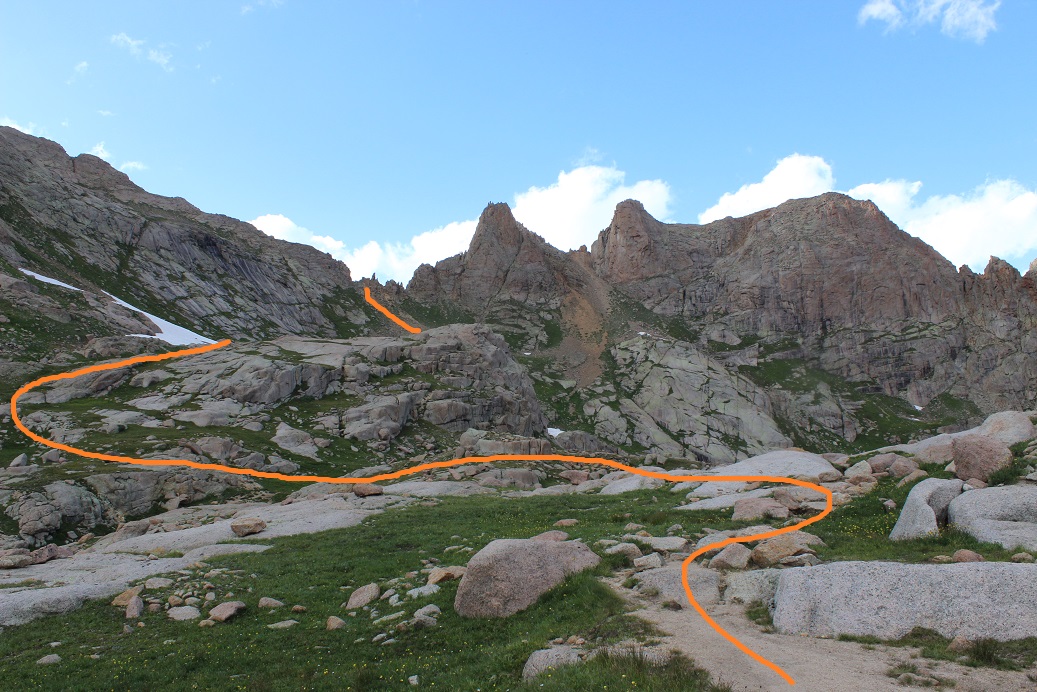
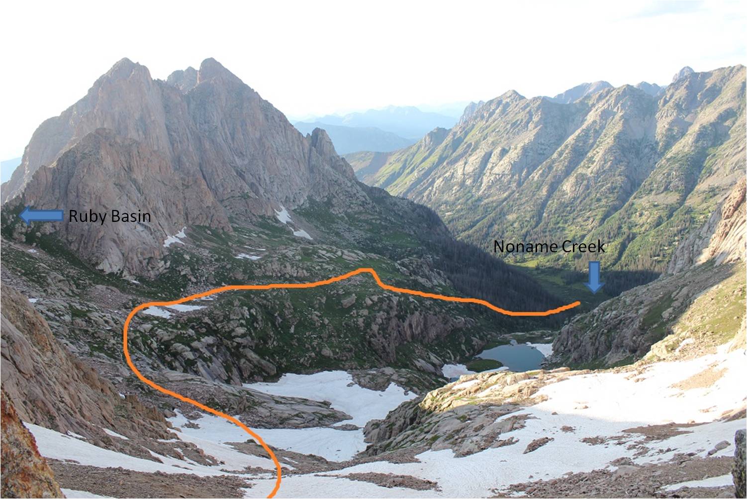
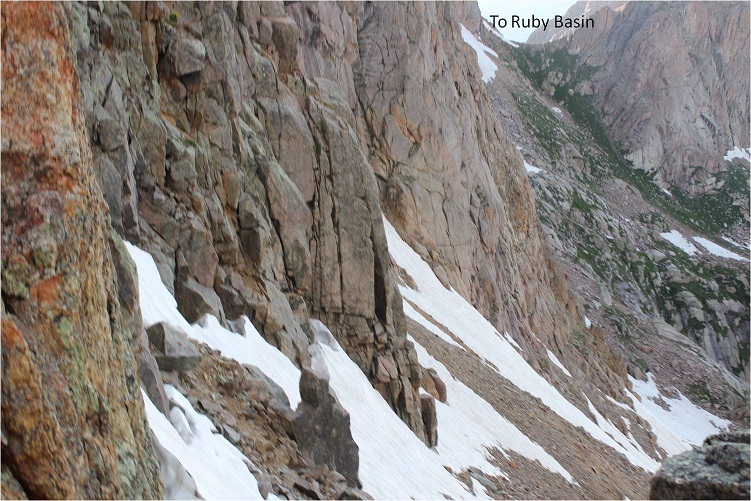
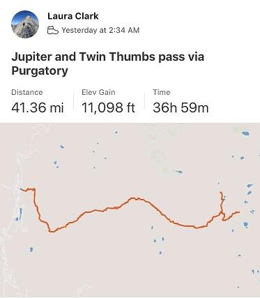
I did a ton of research before setting out for this hike. It was my goal to link up the Chicago Basin with the Noname Creek Approach via Twin Thumbs Pass. All of my research said it was “doable”, but I hadn’t found a trip report indicating it had ever been done, so I went in kind of expecting to fail. I was trying to eliminate hiking into the Chicago Basin to summit Jupiter and then hiking back out and attempting Jagged Mountain via the Noname Creek Approach. If I could link up the hike via Twin Thumbs Pass I’d be saving about 20 miles and several thousand feet of elevation gain. And it almost worked…
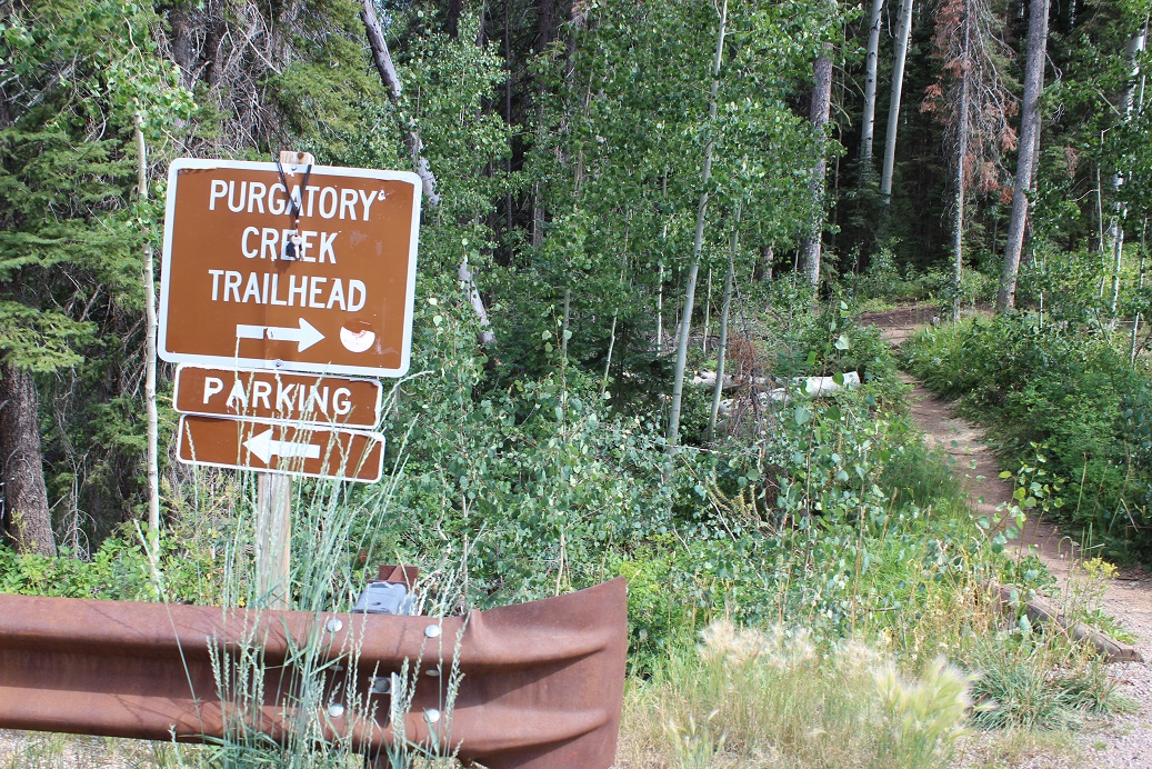
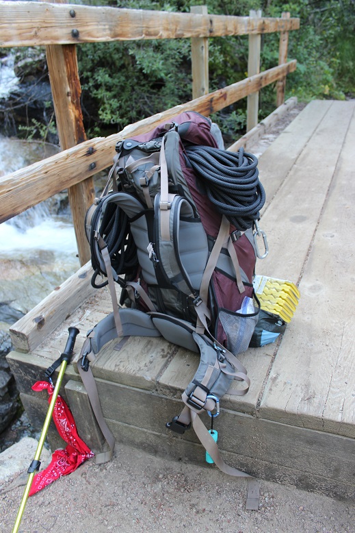
Sleep is for armatures, so I left my house at 8pm after hosting a Girl Scout awards ceremony, arriving at the Purgatory Trailhead at 2:15am. I was on the trail by 2:30am. The first 10 steps hurt. A lot. My pack was wayyyyy too heavy. I’d gone through it multiple times eliminating what wasn’t absolutely necessary and it was still painfully heavy. I’m not sure how much it actually weighed (I was too scared to weigh it) but I’m guessing it was around 45-50lbs. That’s excessive, especially for someone who only weighs 105lbs. But I just couldn’t lose any more weight: I’d already thrown out unnecessary items like a camp stove (it was all peanut butter and beef jerky for me this weekend) a pillow (not needed), a change of clothes, bug repellant, etc. and had switched my “good” backpacking sleeping bag for a lighter weight one. What was weighing me down was all the gear: rope, harness, carabiners, webbing, etc. All that stuff was necessary if I wanted to attempt Jagged this weekend, which I did.
So those first 10 steps hurt and I should have known then to stop and reassess this adventure, but I told myself it would eventually get easier if I just kept moving so I just kept moving. Yep, I kept moving but it didn’t get easier. I gingerly hiked my way down the Purgatory trail towards Cascade Creek, losing elevation the entire way and thinking to myself “hiking down shouldn’t be this difficult”.
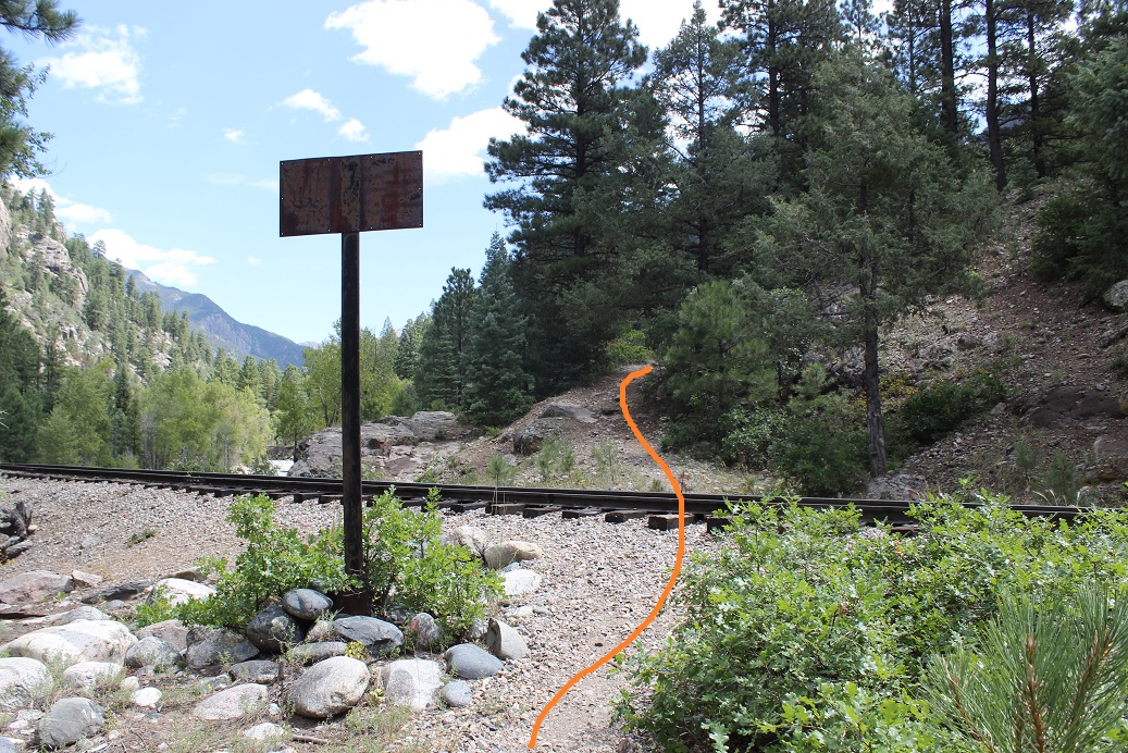
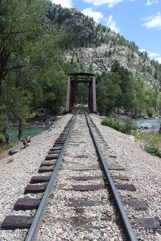
The trail follows Cascade Creek southeast towards the Animas River. There’s a bridge here to cross
and a good trail to follow to the Railroad tracks. I crossed the tracks and continued on the Animas River Trail.
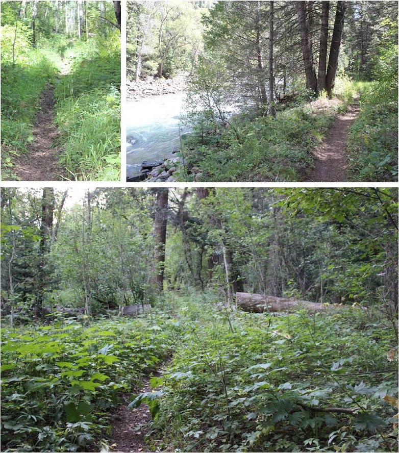
The trail is easy to follow, but was overgrown in areas. It follows the Animas River, which I could hear but not see in the dark.
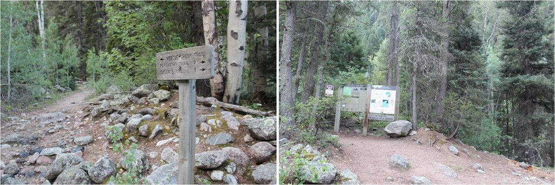
While the trail follows the river it still has numerous small ups and downs in elevation, which I thought were completely unnecessary: I’d rather stay at a steady elevation. The sun started to rise and I made it to the Needleton/Purgatory/Cascade Junction and followed the Needleton Creek Trail to Chicago Basin. Side note: It is not 7 miles to the Purgatory Trailhead. From this point my tracker says it’s 10 miles. A little ways up there’s a trail register and information area. I didn’t sign the trail register because I hadn’t intended on exiting this way.
From this area it’s another 6 miles to the Chicago Basin. This part of the trail follows Needle Creek as it climbs towards the basin. I loved hearing the water rushing past and seeing the waterfalls along the way.
It seemed like it took forever to make it to the basin. I realized I was almost there when I saw the avalanche debris. There really wasn’t very much damage, and luckily there were already clearly established trails as a workaround.
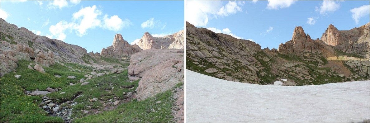
The hike into Chicago Basin is indeed beautiful!
I didn’t see much evidence of mountain goats. I was here last year and they were everywhere. This year I saw a couple, but nowhere near as many as before.
Normally I like to do the hardest peak first, but today the easier peak was my first goal for several reasons: I wanted to get a look at the backside of Jagged to see how much snow there was on route and I wanted to see if there was still snow on Twin Thumbs Pass. I knew I didn’t need all my gear to summit Jupiter so I stashed my pack and just brought the essentials: water, my camera, and some snacks. Oh yeah, snacks. I should probably eat something? I had about 12 almonds and kept them down so I considered it a win.
If you go left at this junction it takes you up to Twin Lakes. If you continue straight it will take you on a well established path towards Jupiter.
The trail crosses Needle Creek and heads west up the hillside
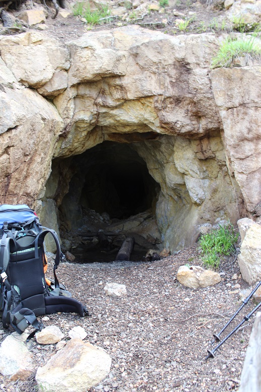
About halfway up the hillside there’s an old mine. I’d already explored this mine the last time I was here so I didn’t feel the need to go inside, but I did see a pack outside, and called in to say hello to whoever was exploring.
I met a man who was really excited about the mine. His hands were white from the walls, and it looked like he’d been having a time. We chatted for a bit: He’s already hiked the Colorado Trail and was now looking for a way back to Durango. He asked me if I knew if the trail “went” and since I’d already done a lot of research on the Johnson Creek/Vallecito trails when planning this trip I knew if he made it to the saddle he could take Columbine pass over. I envied this man his freedom to just explore and not worry about time and wished him luck. I wish I had more time to adventure!
I continued on the trail to treeline, crossed a creek, and here the trail (mostly) stopped. I felt so much better hiking with just the essentials: I felt like I could skip up this mountain!
There were a few cairns and what looked like overgrown social trails but no established trail after the small creek crossing. Here’s the route I took up the side of Jupiter.
It’s much steeper than it looks, but the wildflowers made up for the difficulty.
About halfway up the hillside I started getting worried about the weather. There was a 30% chance of rain today between 2-4pm, and the clouds forming didn’t look good. Luckily the wind was blowing them away from me, but I kept an eye on them just in case. I really, really didn’t want to turn back at this point (but I would have if necessary). I kept looking for the man I’d met, watching for his ascent of Columbine pass, but I never saw him again (even from a distance).
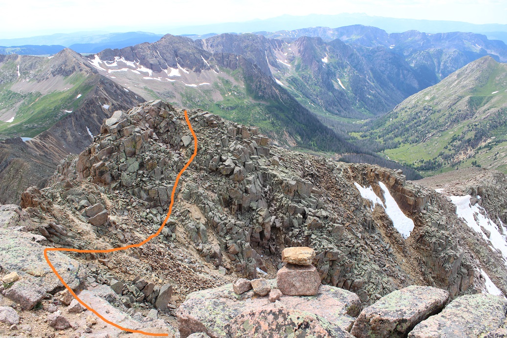
I continued on and came across cairns. There seemed to be several ways around this part. I took the solid line up, the dotted line back down.
I continued up the side of the mountain, aiming for the cairn I could see at the top of that pile of rocks, sure that was the summit (spoiler alert: it wasn’t)
Imagine my surprise when I made it to the top of that pile of rocks, only to see… this
Wait? I thought this was a class 2 hike? That looked like class 3 scrambling to me. I was a little put off I’d left my helmet back with my gear in the basin and a little upset with discovering this had been a false summit, but decided to just go ahead and finish. I took the solid route up, the dotted line down. I felt the dotted line route was indeed class 2+, but the solid route was class 3. There were several ways to summit here, and so many cairns they lost their intended purpose.
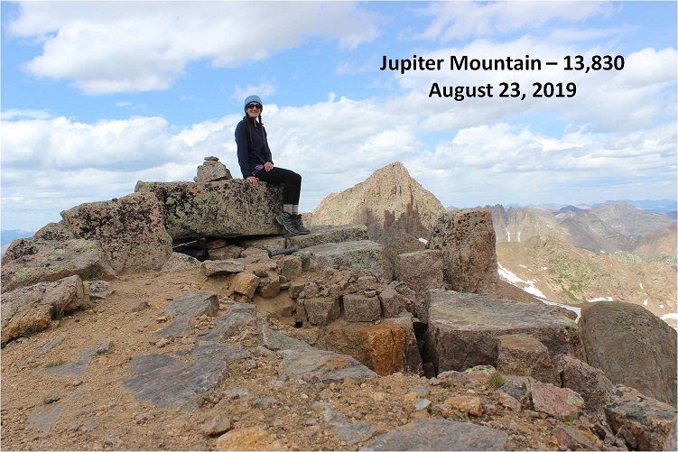
I summited Jupiter Mountain at 2pm.
Summit Video:
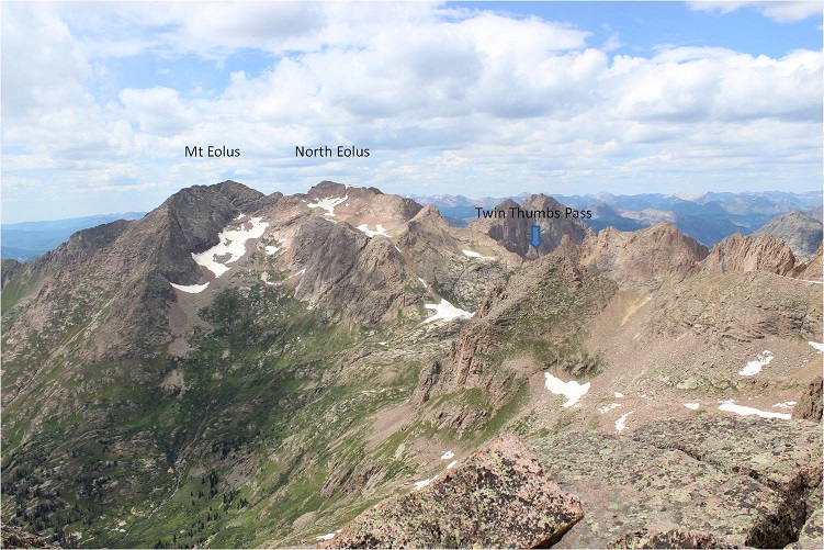
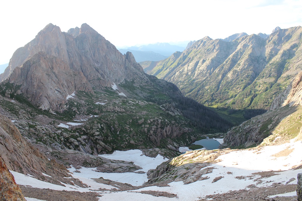
I’d been hiking for almost 12 hours at this point, but without my full gear for the past 2 hours I was feeling pretty good. I decided to take a look around. Jagged from this side was mostly snow free!
Twin Thumbs pass was obscured by Point 13,472, but it looked mostly clear of snow as well. This was all good news. Now I only had to worry about the north facing sides of the mountains (which hold snow longer).
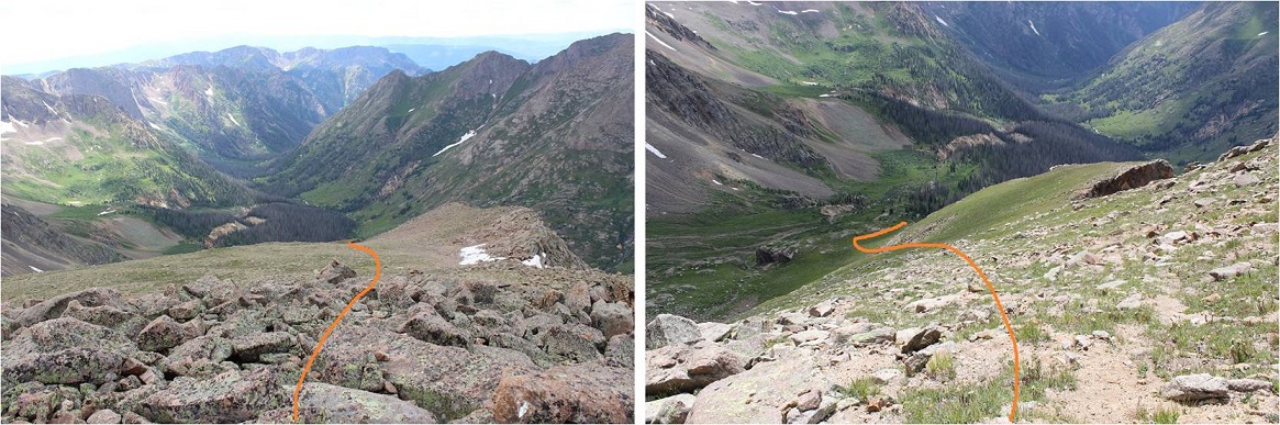
Time to head back. Here’s the route I took off Jupiter (this also shows Columbine pass in the background)
And back down to treeline
Back at treeline I had a better view of Twin Thumbs pass. It appeared clear. Now it was time to retrieve my gear and head up to Twin Lakes.
I saw my first mountain goat of the day here
I re-crossed Needle Creek and stopped to filter some water. It was a warm day and I was forcing myself to drink. It was making me nauseous, but at least I wasn’t light headed. The cool water felt really good, and I started just drinking it from the filter to save time. After my water bladder was full I went to find my pack. Argh! I wasn’t able to find it! This was not good. I was sure I’d left it by the sign? After about 5 minutes of searching I realized there were two similar signs and I was at the wrong one. I made my way about 10 yards further and was relieved to find my pack where I’d left it, and as an added bonus, no goat/marmot damage to be seen. The downside? There were so many mosquitoes here! I’d wanted to rest for a bit, but the mosquitoes wouldn’t quit, so I decided to just get going.
My pack was on the ground so I sat down to put it on and groaned as I leaned to the side to stand up. That pack was heavy!!! Time to trudge up to Twin Lakes. Luckily this is a very well marked trail.
About halfway up I saw my second set of goats for the day. They were directly on the trail and looked me straight in the eye as I got close. I was wondering how we would pass each other politely when one of them just veered off the path a little to the left, went around me, and then hooked back up with the trail. They must be used to this…
From this angle Jupiter looks imposing
As I continued on I saw a sign that said “No camping beyond this point: Including Twin Lakes Basin”. Well shoot. There went my “Plan B” of sleeping at Twin Lakes if I couldn’t make it over the pass. Oh well, it looked like the path was clear, so it shouldn’t matter anyway.
I made it to the Twin Lakes area and had a great view of my intended route. There looked to be a little snow, but nothing I couldn’t handle
Also, there’s hidden snow here, more than anticipated
No worries though: I just put on my crampons, tested the snow for stability, and easily traversed over to the final gully before Twin Thumbs pass. I took the solid route up, and the dotted route down (the dotted route is the better route).
There were no cairns or paths or footprints here, or anything indicating anyone had used this route in the past. I was huffing and puffing by this point but really wanted to just get over the pass. When I made it to the top this is what I saw
Ok, this looks good! I could see where I wanted to be and the path I wanted to take to get there.
Right now I was pumped! I probably had 2 hours left of daylight and a clear visual of where I wanted to be. And it was all downhill. I began my descent through a class 4 chimney (not as easy as it sounds with a full pack on my back. Also, this move wouldn’t have been necessary had I taken the dotted line route.) I was immediately taken aback by how steep the scree here was.
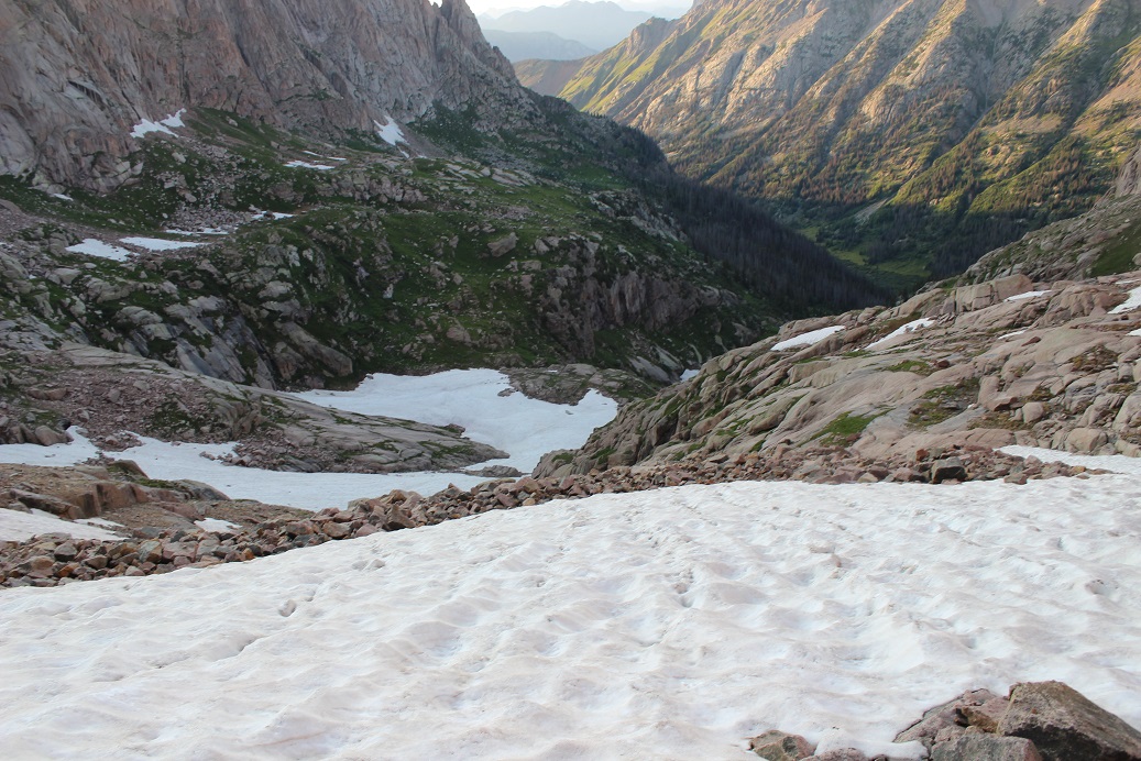
It quickly became apparent the route up to Ruby Basin (should I need to use it) was much steeper than it looked on a topo map.
This is where my trouble began. I made it to the first patch of snow and thought it would be similar to the snow I’d encountered in the Twin Lakes area. I stepped on it and promptly sank up to my waist. My feet however were still dangling in the air beneath the snow. This was not good. It wasn’t lost on me I’d narrowly avoided breaking a leg. My large pack is what had caught me and kept me from sinking further. It took some time but I was able to get myself out of the hole I’d fallen into.
A bit shaky now I stood where I was and considered my options. I probed the snow a bit with my trekking pole and realized there was a layer of snow a couple of inches thick over the rocky ground. This layer broke easily (obviously) and I did not feel comfortable traversing on it, even with crampons. I looked for a clear line of scree/rocks to traverse to get me where I wanted to go and just couldn’t make out a snow free path.
I could continue to descend and look for a snow free path, but I gave finding one a low probability since the areas I couldn’t see were the steeper parts of the route. It looked like no matter what I was going to have to cross snow. The sun had already gone down behind the mountains and I figured I had about an hour of daylight left. There was nowhere to camp on this side of the mountain.
I had two options: either continue on and hope to find an area without snow I could cross or to turn around and head back. The choice was obvious. I wept a few silent tears, turned around, and started my ascent back up and over Twin Thumbs Pass: making it to Noname creek was optional, making it back to my truck was mandatory. Here’s the path I took back up to the pass. The dotted line is the path I took down. I’d recommend the solid line.
Ok, so I turned to head back to the pass but my shoes immediately slipped as if I were wearing ice skates. This wasn’t good. The scree here was terrible for an ascent. I hadn’t brought along my microspikes (to save weight) but I did have my crampons, so I took those out, strapped them on, and wouldn’t you know it? Better than microspikes! Sure, I was ruining the crampons, but at this point the benefits outweighed the risks.
I knew I was racing against the clock: the sun was rapidly setting and I needed all the daylight I could get. I found an unexpected boost of adrenaline and booked it up to the pass. I was shocked at how quickly I moved, and actually entertained the idea of hiking all the way back to Needleton tonight and attempting Jagged in the morning.
I made it up and over the pass and kept my crampons on until I made it past the snow near Twin Lakes. Here I stopped to take off my crampons and at this point the adrenaline stopped and exhaustion took over. I took off my crampons but was too tired to take off my pack and put them away so I carried them in my left hand. This worked well until it got too dark to see and I needed to carry a flashlight (I’m not a fan of headlamps).
I was stumbling in the dark. Stumbling because at this point I was exhausted and also because I’d completely ruined my hiking boots: they had holes in them the size of quarters and the tread was completely gone. That pass had been more brutal than I’d anticipated. Every few steps I’d slide due to lack of traction and catch myself. One time I didn’t catch myself quick enough and I landed on my shoulder in a bunch of willows. Ouch. That was it; I needed to stop and set up camp. Now. Gone were my fantasies of setting up camp at Needleton, or even in Chicago Basin for that matter.
But I’m a rule follower and I’d seen the sign. I wasn’t allowed to camp here, and I knew it. So I kept on. It seemed like I’d hiked for miles before I finally made it to the “no camping past here” sign, and when I did I dropped all my gear and haphazardly set up my tent directly in front of it. I did a terrible job: I couldn’t see in the dark and honestly I was too tired to care what I was doing. It took me twice as long as it should have to set up and I did so directly beside the trail. Dumb move, and I knew it, but I didn’t care. I needed to rest. Oh, and eat. So far all I’d had were a few almonds and I knew I needed more calories. I opened my bear sack and had tons of options: beef jerky, tuna, almonds, peanut butter. I chose dried mangoes. Not the most caloric but it was what my body was craving. I only wished I’d brought more.
I fell asleep around 10:30pm and woke up every half hour after midnight. You see, I was camped directly next to the trail, so every set of early morning hikers intent on Eolus, Windom, and Sunlight passed right by me. As they did so they all directed their flashlights at my tent. What they most likely didn’t realize is that when you shine a light on a tent it doesn’t allow you to see inside of it, but it does brightly illuminate the inside of the tent. So every 30 minutes or so it was like someone turned on a light inside my tent. My fault for so many reasons I know, but I was too tired to care. And cold. It had been a bad idea to swap my good sleeping bag for a lighter weight one.
In the middle of the night I could hear a goat beside my tent. It was occupying itself with the bandana I’d left outside. I could actually hear him a foot or so from my head, and mentally visualized him picking up the bandana with his teeth and swishing it from side to side.
I left my tent at daylight. My bandana was now separated from my trekking pole but lying inches from where I’d been in my tent. Apparently the goat didn’t want the souvenir. I wasn’t hungry but forced myself to eat a packet of tuna and quickly packed up my gear. Taking down the tent was the worst: my fingers were frozen stiff, despite it being about 40* the night before. My whole body ached from yesterday. I wasn’t sure I was going to be very efficient today, and laughed at myself for thinking last night I could even attempt Jagged today. I was honestly considering camping at Needleton and making the rest of the journey tomorrow.
It was Saturday morning but I didn’t pass many people as I exited the basin. I hurt all over, but especially my shoulders, and specifically my right shoulder. I was worried I’d broken my clavicle when I’d fallen into the willows yesterday. Every hundred feet or so I had to stop and lean over to take the weight off my shoulders for a bit. I tried re-adjusting my straps to distribute the weight more evenly but that wasn’t helping. When I made it to the bridge 2 miles from the Needleton junction I stopped and took off my pack. I realized one of the upper straps had come unbuttoned and fixed it. This seemed to help a bit, but I was still worried about my shoulder. It was red and sore and there was an unfortunate bump right on the collarbone. It wasn’t lost on me I’d carried most of this gear for nothing…
I’d rested for a bit and decided that was enough for today and was on my way. I met a trail runner who stopped to talk for a bit. “Isn’t Chicago Basin as close to heaven on Earth as you can get?” she asked. I agreed, but mentally thought Purgatory was a more apt name, and most likely why Chicago Basin felt like heaven. I really thought she was running to the junction and back but I never saw her again (and she should have caught back up with me if she were doing so).
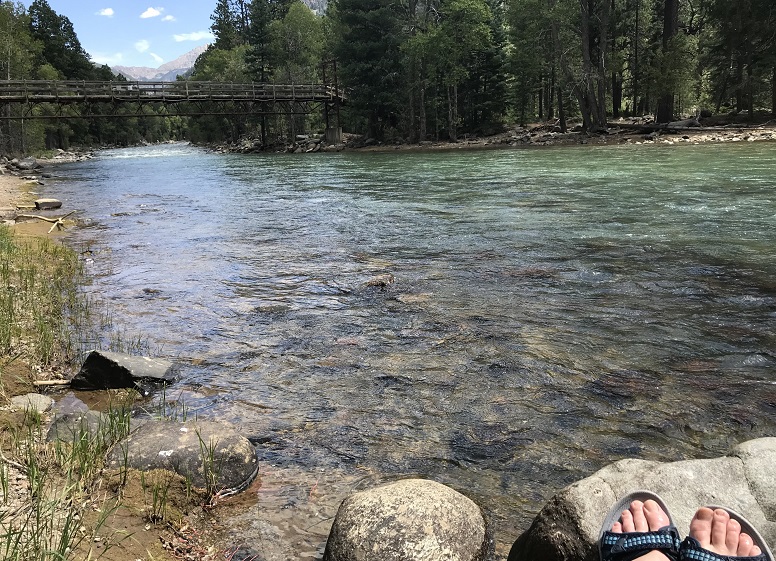
I was bummed. The weather was perfect, which meant I was wasting a perfect day not summiting something. And I hurt. I was sore and each step hurt more than the last. My shoes were trashed and I’d carried 30 extra pounds of unnecessary gear for dozens of miles and elevation gain for naught except conditioning. Suddenly Sherpas made sense. By the time I made it to the Animas River I was done feeling sorry for myself and instead decided to focus on the positive: I’d been here three times but never hiked the trial in the daylight. I was going to enjoy the view of the river and the shade and the occasional view of the train passing by
I was actually making good time and made it to the railroad crossing around lunchtime.
I’d made a deal with myself here I’d take off my pack for a long time (at least 15 minutes) and have lunch and soak my feet in the river. The mosquitoes had other plans however. Eventually I figured out they came in small swarms and if I killed all 12-15 of them I’d have a solid 2-3 minutes before the next swarm arrived. On the positive side the water was cool and it felt good to sit for a bit.
Animas River:
Lunch was a couple spoonfuls of peanut butter. I strapped on my gear and got ready for the hardest part of the hike: the last 4 miles and several thousand feet of elevation gain. I headed northwest and hugged the side of the mountain
I was pleasantly surprised to realize this trail is mostly in the shade. I was also surprised to realize just how closely this trail comes to Cascade Creek. Hiking this at night I’d always assumed the creek was down much further from the trail than it actually is.
So the shade was nice but the elevation gain was exhausting! I kept gaining and then losing elevation for what seemed like no purpose whatsoever. Why couldn’t the trail just gain steadily in elevation? It was disheartening to gain a couple hundred feet just to lose it again.
There were raspberries on this trail, and while I’m not fond of raspberries these were by far the best I’ve ever had. I couldn’t collect them fast enough (sorry woodland creatures that would have benefited from them, but they were delicious).
This meadow looks totally different in the daylight
The last quarter mile was the worst of the entire hike for several reasons: This part was a steep uphill climb, the sun came out again from behind the clouds, I was tired, my pack was heavy, and I ran out of water just as it began. This last quarter mile took me half an hour to complete (which is very, very slow for me).
Last time I was here I’d hiked Pigeon and Turret’s 39 miles in a day and I’d had hallucinations. This time I realized I’d gladly hallucinate again if it meant not being in this much physical pain from carrying such a heavy load. The only redeeming factor to the weight was I’d used every piece of equipment I’d brought (except the climbing gear, but that was necessary if I’d intended to climb). The physical pain was terrible, and I wondered to myself how long it would take me to forget the torture I’d put myself through over the past two days. Hopefully less than two weeks because I totally plan on doing this again. Soon.
I made it back to my truck at 2:30pm, making this a 41.5 mile hike with 11,098’ in elevation gain in 37 hours.
But my adventure wasn’t over yet. I limped back to my truck and set my pack on my tailgate. I unlocked my truck and downed an entire 2 quart bottle of cranberry juice in-between huge gulps of air. It was still early enough to make today productive, so I decided to drive to a Subway, get dinner, and then sit in my truck and figure out what to do next. A nap was definitely in the plan.
Did you know it’s difficult to find a place to sleep in your car in Durango? Seriously. Every parking lot I entered had “no camping” signs, and many even had “no sleeping in your car” signs. So I drove to a park on the edge of town, thinking this would be a good place to rest for a while. I got out my list of peaks I want to attempt in the next few months and did some calculations. None of them were close enough to drive to tonight to make them worth summiting tomorrow. Drat. It looked like tomorrow was shot as well. Which was probably for the best seeing as how I couldn’t move at the moment, but I was still disappointed.
It was too hot to sleep in my truck without the windows open and there were a surprising number of children screaming at the park as if being there itself were pure torture. I gave up on the nap and drove for a few hours until I found a National Forest Trailhead I could park at for the night, avoiding suicidal deer running across the road. This was a fabulous idea and I was able to sleep under the stars.
I woke up as the sun began to rise and drove the rest of the way home. I was itching all over, and when I looked in the mirror I noticed I had so many mosquito bites it looked like I had the chicken pox. Lovely. I randomly picked a CD out of the glove compartment and began singing 9-5 at the top of my lungs along with Dolly, my mood instantly improved. Until I stopped for gas. I slid out of the truck and my legs buckled underneath me. I quickly looked around to make sure no one had noticed me, and then pulled myself back up into my truck, laughing at myself for even thinking I could’ve hiked another peak today. My body needed a few days to rest, and I need to figure out a way to lighten my pack…
I was a bit worried about today’s hike. After hiking Stewart Peak with frozen feet last Tuesday I found this rock in my right hiking boot.
I’m not sure how long during the hike it had been there, but it had apparently rested under the ball of my right toe for quite some time. I know this because for the past 2-3 days I’ve had a hard time walking without pain. My foot wasn’t red or swollen, but I couldn’t walk on it normally, and it hurt to massage it. I researched my symptoms, and Google told me I did something to the joint. Ironically the way to treat it was to either exercise it, rest it, or take Ibuprofen. I don’t rest and I don’t take medication if I can avoid it, so I decided to get some exercise (but not too much).
So for today I picked a moderate class 3 hike that was supposed to be about 6 miles in length with around 3000’ of elevation gain in a heavily trafficked area so if something went wrong I’d have a better chance of finding help.
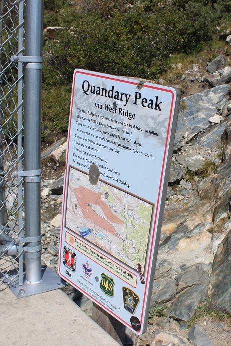
I woke up at 2am (woohoo! It’s like I slept in!) and made it to the trailhead at 5am. There was one other car in the parking lot but as I was getting ready someone pulled up and asked me if we were at the Quandary Trailhead. Technically we were, but it’s the trailhead for the more dangerous West Ridge route, and I figured by looking at them they were looking for the East Ridge Route, so I gave them directions back to the lower trailhead. For so many reasons sorry not sorry if I’d been wrong.
Here’s a view of the 2WD dirt road in and the parking area
It was dark when I started out. I crossed my fingers and started my new tracker, walked to the right to the hill where the gate and dam meet and noticed this sign:
There’s a trail here that follows the lake. I took it for longer than I should’ve and quickly noticed my mistake: I was too far south. In the dark where I was supposed to turn didn’t look safe so I’d continued along the lake looking for another trail that headed up. Luckily there were several social trails that headed north towards the correct trail. I found one that was most likely more difficult than the first and was soon back on route. Here’s where you’re supposed to turn right and climb the hill.
Here’s where I joined the trail
The trail up through the basin is easy to follow (even in the dark). The trail gained elevation very gradually and my right foot throbbed with every step.
Here’s the route I took through the basin and up over to 12,500’
Once the trail ends it’s heavily cairned and easy to follow, even in the dark. I wasn’t able to see the red gully, but it was still the obvious trail to follow. As I gained in elevation and the route became steeper my foot curiously stopped hurting.
After the red gully there were large boulders and rocks to hike around, with lots of carins to help out with route finding.
When I reached the top of the basin I turned around. Quandary’s west ridge looked amazing in the morning light!
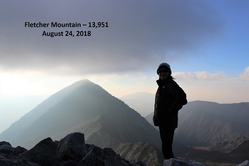
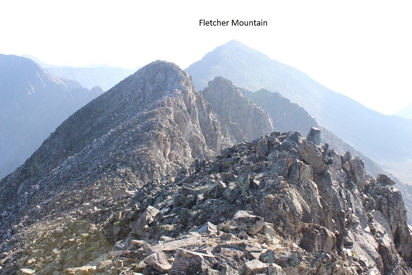
Ahead of me I could see Fletcher Mountain
There was no trail, but the route to the summit was obvious. Here’s the route I took
You want to stick to the left of the ridge because there are steep drop offs to the right. The rocks aren’t stable but they won’t fall on you either, they’ll just roll. About half way up it started getting tricky: I was curiously slipping with every step! That wasn’t right? I have great shoes that usually grip everything. It seemed there was a thin layer of ice on the rocks I couldn’t see but which made hiking without slipping nearly impossible. Yes, I resorted to a kind of forward crawl where I had at least 3 points of contact the entire time. I probably looked silly with my butt in the air but I wasn’t slipping and falling. And there wasn’t anyone around to see…
I made it to the summit at 7am and had a great view of Quandary (it looked cold up there!). The wind was intense and made it much colder than it should have been. Here’s my summit photo
And video:
The cloud above Quandary worried me, but the wind was blowing east and I was headed west so I decided to just keep an eye on the weather. Otherwise it was a perfect morning!
I looked to the southeast at my next goal
The hike down Fletcher towards the saddle was just as awkward as the hike up (I kind of spider crawled due to the ice) but by the time I’d made it to the saddle the ice was pretty much gone. Here’s the view of Drift (left) and Fletcher (right) from the saddle
This is a great place to put your helmet on (and keep it on until you make it back here). The beginning part of the ridge for Drift wasn’t too difficult. I just gained the ridge and followed it
From the picture below you want to stop following the ridge and turn right (north) to bypass the crux of the route (if you continue on the ridge you’ll encounter steep drop-offs and need to turn around)
You’re looking for and aiming towards a large round bolt in the route. It’s about 5 inches in diameter, and visible from a good ways away if you know where to look. I’ve circled the bolt in the pictures below
When you make your way to the bolt you’ll see by facing north how to drop into the gully.
This is kind of a chimney, and gets you ready for the more serious climbing ahead
Oh, did I mention the rocks were now icy again? Here’s a better view of the ice
From here I had to re-gain the ridge. I crossed the gully, located the lighter gray colored rocks, and headed up.
There are several routes to regain the ridge but if you stay on the lighter gray rock you should be fine. Did I mention this was steep? Seriously steep and slippery (due to the ice) and definitely Class 3+. Several times I thought how helpful a rope wouldn’t been…
But once I gained the ridge all I had to worry about was ice and wind as I crossed the easy path to the summit. The rocks weren’t stable but they weren’t a problem to navigate. Just be careful for rolled ankles.
Well, easy if the wind wasn’t blustering at 40mph and there wasn’t a thin layer of ice on the rocks. I was very cold and honestly crab-walked over the slippery rocks to the summit, afraid with the wind and ice I’d slip and fall. But I made it! I summited at 8:15am. I couldn’t smile because my lips were frozen… I tried though.
Video:
Here’s a look back at the ridge
I was cold and my fingers were starting to freeze so I didn’t stay on the summit long. I knew I’d need some dexterity in my fingers to make it back down the light gray rocks. I followed the easy ridge back and braced myself to downclimb back into the gully. The first few sections were fun and I was easily able to navigate the large boulders. Until I reached this point
This is where I fell. Well, I didn’t actually fall, more like slid for about 4 feet (scarier when it’s actually happening than it sounds reading about it). You see, everything was once again covered in a thin layer of ice, and there were no foot/hand holds available. None. I know, I was looking. I was in a spot that (due to the ice) offered very little in the way of help for the situation I was in. There were a few patches of moss that I tried to use, but naturally they weren’t stable and quickly crumbled out from under my shoes. And that ice didn’t help at all! I knew I was going to slip and slide eventually, so I tried to minimize the acceleration as much as possible before and as it happened by hugging the rocks and leaning forward. When I slid I was able to stop myself on a ledge about 3 inches wide and 6 inches long, stabilize myself, take a deep breath, and continue downclimbing. I’d bruised my right shin (just a little scrape with minor bleeding) and I had a hole in my pants at my shin, but I was proud of myself for not turning this into a worse situation. Here’s the section where I slid. From top of the circle to the bottom is about 10 feet.
I couldn’t go to the left or right because it was actually steeper in those sections and led to larger drop-offs. This looked less steep when I was first climbing down, and the moss and lichen looked to be on larger/actual holds, or I wouldn’t have attempted it. In hindsight, before I was downclimbing this area I should have retraced my steps to where I climbed up (as I knew there were adequate hand and footholds in that area).
Once I was on more stable ground I took a look around: I needed to find that chimney to head back. Here you can see it from across the gully
I headed towards the chimney, climbed it, turned right and headed back to the ridge, knowing the worst was behind me. I made it back to the saddle and saw no reason to re-summit Fletcher, so I turned right and headed down the middle of the basin towards Quandary.
Once again, no trail, just rocks. Luckily, while the rocks weren’t stable they also weren’t icy. I felt humbled by the enormity of the rock field and my small place in it.
VIDEO:
As I descended into the basin the beauty caused me to pause. This is truly a gorgeous area! I’ll be coming back to attempt Quandary’s West Route someday.
I followed the cairns down and around the several small ponds I’d missed in the dark.
I stayed here much longer than I should have, but it was worth it for the views! The red gully was clearly visible in the daylight
And those ponds and streams are much deeper than they look. For such narrow streams at a high elevation I was surprised they were 4-5 feet deep.
Exiting the basin was an easy walk. At this point I noticed my foot didn’t hurt anymore. I guess exercise was the answer! I passed an old mine
Turned the corner to take one last picture of the basin (I may frame this)
and: Goats! I love running into goats on the trail! This herd had several kids. All adorable
Video:
I made it back to my truck at 11am, making this a 6.4 mile hike/climb in 6 hours. Oh, and my tracker had worked! It said I’d climbed 2777’ in elevation, which I thought was pretty close to the 2800’ I’d been expecting. Now I just need to figure out how to save and transfer the GPX file to my computer. I was not happy with my time, but considering I’d crawled for a good portion of it due to ice I wasn’t too upset either. And I’d stayed safe. And I’d seen goats!