My girls call me Leader Laura. I have been privileged to be the Leader of Girl Scout Troop 931 in Colorado Springs since 2007, where I have seen these girls learn, grow, and mature into self confident young adults. These girls take cookie sales very seriously: They set high goals, achieve them, and enjoy their success by planning activities and adventures paid for from the profits of the sale.
Troop 931 has sold tens of thousands of boxes of Girl Scout Cookies, and used the proceeds to perform community service and go on some amazing trips. This year a few of the girls in the troop were interested in backpacking to the top of Pikes Peak. This 14,115 ft. mountain towers over Colorado Springs, and is a constant source of pride for our community.

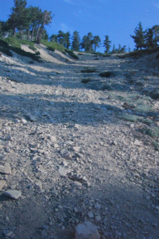
The hike to the top isn’t for the faint of heart. The Barr Trail to Pikes Peak is the most difficult hike in the area. It is an advanced trail that gains 7,800 feet in altitude in 12.5 miles, not to mention the 12.5 miles back down to your vehicle.
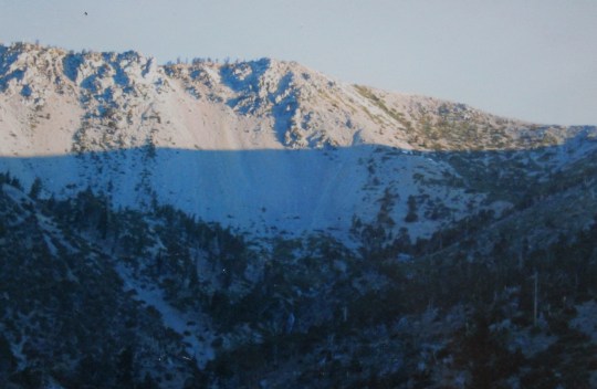
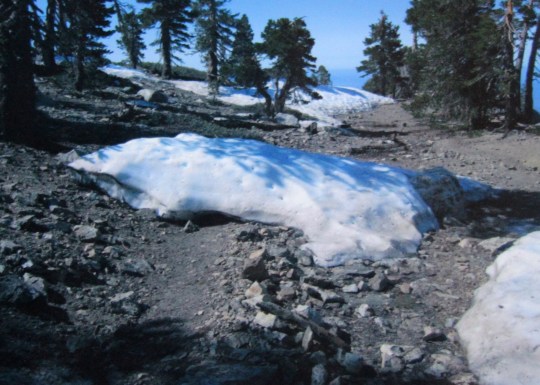
Colorado weather is dangerously unpredictable. It can be extremely hot hiking the beginning of the trail, and the average temperature at the summit in the summer is forty degrees below the temperature at the base of the trail. Electrical storms and rain are daily events, and it is possible to encounter snow and ice even in the summer months.
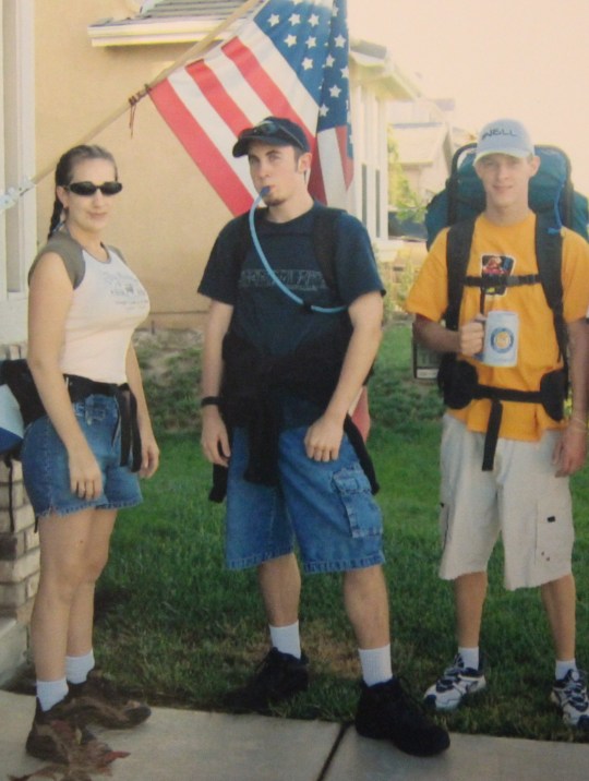
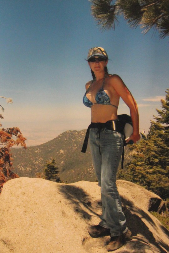
Three girls in the troop were interested and able to go on the hike: Jordan, Rebecca, and Tristina, all who have been Girl Scouts since elementary school. All of these girls take honors classes, Jordan is active in Ice Hockey, Rebecca is captain of her High School Color Guard, and Tristina is in cross country and cheer.
In addition to being physically fit and enthusiastic about the hike, the girls train for the Girl Scout “Reach for the Peak” outdoor skills competition every year, where they compete in events such as emergency first aid, campsite set up, emergency survival, knots, lashing, outdoor cooking, etc., so they had the skills and training necessary to take such an adventurous trip.
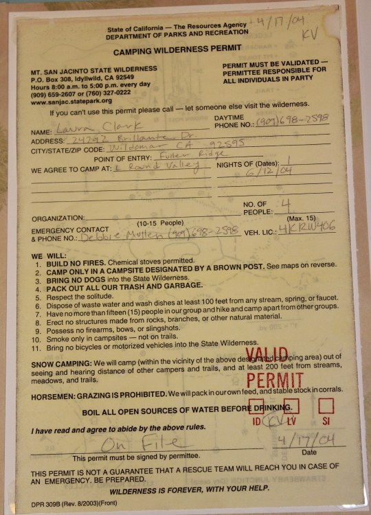
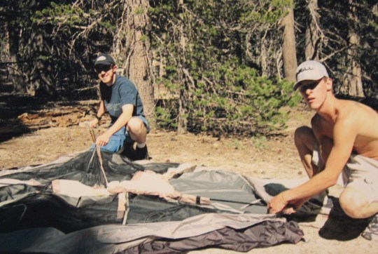
We all met at my house Friday night. The theory being they would be able to go to bed as soon as possible Friday night and get up early for the hike the next morning. We put together our food for the trip (lots of nuts, dried fruit, cereal, breakfast bars, Ramen, freeze dried meals and water), and distributed necessary gear amongst the girls (tents, camp stove, water filter, emergency first aid and fire starting supplies). Then the girls used the computer to check the most recent weather forecast and trail conditions (50% chance of storms after 11am), printed a detailed description of the hike with landmarks and places to filter water along the way, and planned to get up at 3am to leave by 3:30am to get an early start on the trail.
Saturday morning we had a quick breakfast of coffee, cinnamon rolls, and sausage. The girls were excited and awake at 3am, even though they did not go to bed early as planned (they are all good friends, so I figured they’d be up talking most of the night, and they were). All 6 of us piled into my truck (the three scouts Jordan, Rebecca, and Tristina, Thomas (a brother and a Boy Scout who wanted to hike too), Liane the Troop co-leader, and I) and headed to the trailhead.

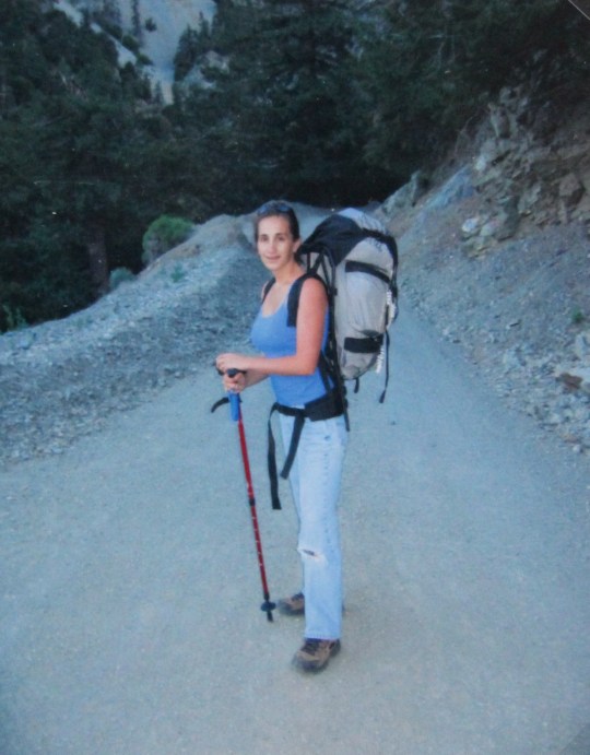
Barr Trail is located in Manitou Springs, close to the Cog Railway that travels up Pikes Peak. It was still dark as we parked at the base of the trail, along with many other hikers looking to get a head start on the trek. At 4:30am we donned our backpacks, head lamps and good attitudes, took a picture for posterity, and began hiking.
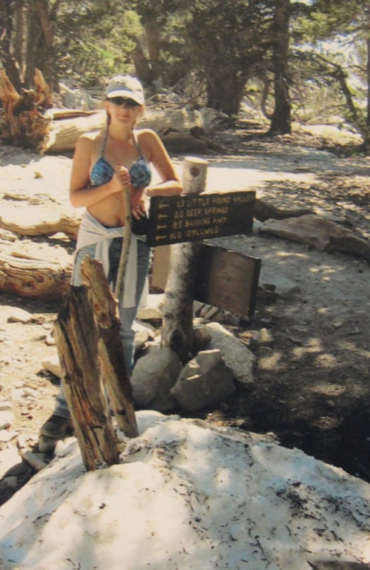
The girls had researched the trail, so we knew the first few miles would be a difficult uphill climb, but after about the third mile it would even out for a bit. At around 6.5 miles we would come upon Barr Camp, where many hikers choose to spend the night either before or after hiking the peak. There would be water to filter at Barr Camp, and emergency supplies to purchase if needed. Our research told us there would be a cabin about a mile past Barr Camp that sleeps 6, available on a first come basis, and a popular spot to stay in the summer months. After reaching the cabin the hike would get more difficult, especially once we made it past the timberline. The last 3 miles was supposed to be the most complicated, due to lack of oxygen and stress from the hike. It was recommended to summit and be back below the tree line before 1pm to avoid summer thunderstorms. It normally takes about 8 hours to summit (without backpacking gear).
It became obvious about half a mile into the trail the group wanted to hike much faster than Liane. We were worried we wouldn’t make it to the summit before the required time unless we hiked at a faster pace, but we wanted to stay together. Liane had quite a heavy pack, and after some discussion we decided to separate and meet at the cabin a mile past Barr Camp: She never planned on summiting, the trail was heavy with hikers, and we all felt confident she would be safe hiking “by herself”. So it was decided Thomas and I would continue the hike with the girls, Liane would hike on her own, and we would communicate every so often through texting.

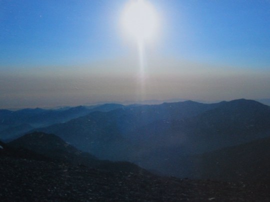
The first three miles were indeed aggressive, but we pressed on knowing the trail would eventually get easier. It was dark when we started out, and along the way we had views of the night lights of Colorado Springs, hundreds of twinkling stars, and the bright lights that were Venus and Jupiter shining just to the left of the crescent moon. I took pictures with my camera, knowing they would never represent the true beauty of the night.
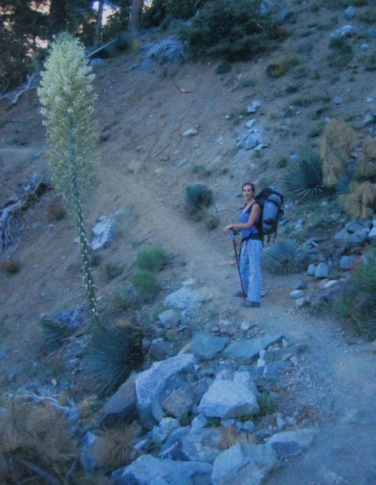
We stopped many times for a few seconds here and there to admire the view. At about the 3-4 mile mark the sun came up and we started seeing really cool red and white mushrooms. The girls identified them as Amanita muscaria, more commonly known as fly agaric. These mushrooms are poisonous to the touch, so we became concerned when we found some had been uprooted. We followed a stream for a while, and the girls took turns identifying several trees, mushrooms, and flowers (to get ready for the plant identification part of the Reach for the Peak competition in 2 weeks).
Around the 4 mile mark the trail indeed became a bit easier to hike, but only for about a mile. Then the incline picked up once again, and the five of us started stopping more frequently to rest. We were all hungry despite breakfast, and broke into our snacks earlier than anticipated. We were glad we packed plenty of food: it began to look like we were going to need all the calories we could get!

Tired but feeling accomplished with the hike so far, we arrived at Barr Camp at about 8am. Barr Camp has a nice stream running through the area, and we noted several places we could camp if the cabin a mile up was occupied when we arrived. It was at the cabin we planned to take a longer rest before tackling the second half of the hike. We knew the hike would get a bit easier from there, so we didn’t rest, but continued on up the trail.
We expected a gradual climb to the cabin. After about a mile we were discouraged by how steep the climb was becoming, and in our lack of locating our designated spot to rest. We went back to our notes, verifying the cabin’s location. We started wondering: Had we missed it? Was it hidden? We were getting pretty tired by this point, so we stopped to take a rest and have a snack (peaches!).
A hiker passed us, and we asked her if we were close to the cabin. “You mean the A-frame? That’s at least another mile” she answered. We were taken aback. She had to be mistaken. She indicated she had hiked most of the way to the summit on another occasion, but had to turn back because of a storm. However she did remember seeing the A-frame at Timberline, and obviously we were a ways away from that yet. We looked around, and indeed we were still in a heavily wooded area, nowhere near the timberline.
This changed things a bit. By this time we were at least 2 miles past Barr Camp (with our gear), and about a mile from where we had planned to meet Liane (the cabin I will now refer to as “A-frame”). We were pretty tired at this point. The group discussed the options we now faced: We could go back and meet Liane at Barr Camp, or continue with our hike and plan to sleep at the A-frame no matter what, knowing Liane wouldn’t go that far. We knew if we hiked back to Barr Camp we would not be summiting, and that once Liane found out how far away the A-frame was from Barr Camp she would stay at Barr Camp. Jordan indicated Liane had her own tent, sleeping bag, food, and stove in her pack, so we all decided to continue with our hike and text Liane to let her know our decision.
On we hiked. The mile more we had to hike to get to the A-frame took us quite a while. We were tired and sore, but with the knowledge the A-frame was located at the Timberline felt like we were on a mission.
Finally, after what seemed like forever, we saw about 15 people scattered on rocks, looking down at the A-frame below. It was beautiful. A small wooden platform covered on three sides with an open view of Colorado Springs below. It was situated in a small valley, with a stream running through the area and 3 or 4 obvious campsites directly nearby. This meant we would have a place to camp, even if the A-frame was occupied. The girls took off their packs, and despite their fatigue immediately began to inspect the site.

There were belongings already in the A-frame, but no one seemed to be around. It looked like the sleeping bags inside had been left by previous backpackers (they were old and worn), and the shelter was littered with trash. There was a fire pit directly in front of the cabin, so we would be able to have a campfire at night if it wasn’t too windy. A quick inspection of the area indicated there was no firewood so I made a mental note to try and collect some on our way back down.

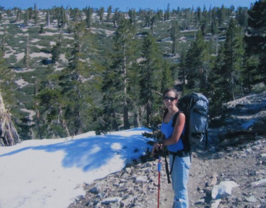
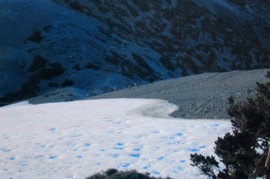
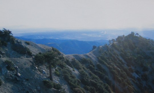
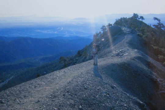
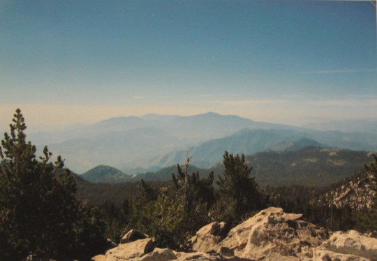
The girls seemed to have a new sense of energy. At 9:30am we left our sleeping bags and tents in the A-frame (we would be ok without these supplies if they were stolen, but we figured they wouldn’t be), put on our packs with the rest of our supplies, and headed up the trail to finish our journey. We were at 11,500 ft in elevation at the A-frame, and needed to get to 14,115 ft. It was 3 miles to the summit, and more difficult than we could have imagined. The hike just kept getting harder and harder, the air thinner and thinner, and just when we thought we were at the summit, we would round a corner and see what looked like miles and miles of trail still ahead. The air was much colder here, and without the trees the wind was brutal. We could see storm clouds quickly curling over the mountain above us and forming into thunderheads. We put on our hats, jackets, and gloves, and trudged on.
Every hiker we passed on their way down would congratulate us, smile and say we had about half an hour to go. Every. Single. One. Despite the fact we kept advancing on the trail, for about 2 hours every hiker would tell us we had half an hour to go. It was maddening, but we made a joke out of it to help pass the time. At this point we could hear the horn of the Cog Railway, indicating passengers should board the train to head back down. To us it was a sign we were getting close. We saw several mountain bikers riding down the mountain, and commented on their bravery/foolishness.

When we had about a mile left on the trail, the hike was no longer “fun”. It was here we would hike 5 or 6 yards and need to stop and rest for a minute (or five) to catch our breath. I felt like I was a coach pushing the girls to “keep going” because we were “almost there!” They became each others’ cheerleaders, taking turns saying “We got this!” and “We can do it!” We reminded each other if this was an easy hike, everyone would do it, and that its difficulty built character. And awesomeness. On we trudged.
It was brutal. No one wanted to give up, but neither did we want to keep going (resting felt wonderful, and it was so hard to start hiking again). At long last we saw a sign indicating the “16 Golden Stairs”. We had no idea what those were, but they didn’t sound good. They ended up being switchbacks that were more like rock climbing than actual stairs, and vicious on our already aching legs. Rebecca announced this hike brought new meaning to the term “thunder thighs”. We all laughed, and kept climbing.
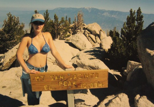
After the last “stair” we stopped to catch our breath (again), and saw we were about 200 yards from the summit. Although we would have loved to have run, skipped, or jogged those last yards, it just wasn’t possible. We lumbered the last few feet, and almost cried tears of joy as we crossed the cog train tracks and stepped onto the deck.
I asked the girls “Do you want to take pictures now or after we rest?” “Now!” was their answer because once they sat down, they didn’t think they would get up again. We took some pictures at the summit sign, walked in the door of the gift shop, and almost fell upon the nearest empty booth to the triumphant arm pumping cries of “We made it!” and “We did it!”. The girls were elated. We all were! It was 12:30pm, and it was snowing. We made it from Barr Trail up Pikes Peak in 8 hours, with full gear.

During our 45 minute reprieve at the summit we spent most of our time resting and commenting on how difficult the hike was and how awesome we were. The Summit House consists of a restaurant, gift shop, and deck area. It was extremely crowded with tourists milling about, waiting in lines to buy souvenirs indicating they had “made it to the top”. There were two guys in the booth next to us who had just hiked up as well, but were waiting to take the train down the mountain. The girls told them about some of our other Girl Scout adventures (our trip to Alaska, learning how to surf in Texas, heading to Wyoming for Frontier days, rafting, spelunking, rock climbing, etc.). They were impressed we were Girl Scouts, and one even indicated his 11 year old niece was “getting bored with dance”, and would love to do some of the adventurous things we did. He didn’t know “older girls” could be Girl Scouts too. I gave him information on joining a troop.
I text Liane, and she had just reached Barr Camp. She indeed decided upon hearing it was 3.5 miles past Barr Camp to the A-frame to stay at Barr Camp for the night. She already had an adventurous 6.5 mile hike up to Barr Camp and was equipped with plenty of food, water, and supplies. We would meet her in the morning at the campground.
We ate lunch (Ramen!), used the restroom, filled all of our empty water bottles, enjoyed a cappuccino, and bought some fudge to celebrate for dessert later that night. Then it was time to head back down to our campsite (hopefully before a storm hit).
Now that we were rested we took a few more pictures as we made our way back to the trail. I don’t know if it was our rest or the fact that the storm seemed to be coming over the mountain so quickly, but the hike down was much faster than the hike up. We could practically run down the trail without needing to rest (we walked). We heard a chirp-like barking sound, and were delighted to discover it was a Marmot perched on a nearby rock. The girls posed for pictures (it’s an inside joke for the troop: We love Marmots because the Troop won the “Marmot Award” five years in a row in the Reach for the Peak outdoor skills competition).


The hike from the A-frame to the summit took us 3 hours. We made it back down in about 45 minutes, stopping along the way to gather some precious firewood. There wasn’t much, but we collected what we could, knowing the night would be cold. We correctly informed hikers still ascending of the actual time to the top, and as we got closer and closer to Timberline became fearful for hikers beginning the hardest part of their trek with night coming.
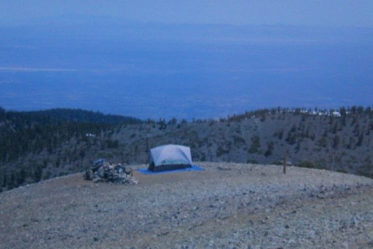
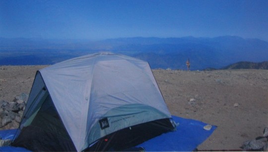
As we descended I kept hoping no one would be there to greet us at the A-frame. It is a first come camping situation, and barely big enough for the six of us to set up our sleeping bags. I hoped our leaving sleeping bags inside the shelter would “claim” it for us, but was unsure as to the protocol for such a situation.
Then I heard voices. It seemed there were people at the site already, so I braced myself for the best way to handle the situation. I mentally told myself confident and positive was best.
As we rounded the corner and crossed the stream I saw what appeared to be a man wearing cotton sweats and a t-shirt crouched down beside the fire pit. Inside the pit were 2 branches that had obviously just taken off a nearby pine tree, complete with short green needles and sap oozing from the branches. He was holding a match under one of the green pine needles, trying to get it to catch.
I smiled warmly and shouted “Hello! We’re the ones sharing the site with you tonight. It looks like you could use some help. Do you mind if we help you start the fire?”
“Y-y-y-es, if you think you c-c-c-an do it” he stammered. “I’m f-f-f-reezing over here, and c-c-c-an’t get it lit.”
“Ok, give us 10 minutes. Ladies, start the fire.”
The girls dropped their gear near the A-frame and separated into two groups: One to start on the fire, the other to look for more of the scarce firewood (we hadn’t found very much, and would obviously need more). Thomas helped the girls gather wood, and found some tinder and kindling under a nearby tree.

I wanted to get to know our fellow campers better, so I began asking questions. Right away it was obvious something was wrong. He started babbling. It seem he had a gallon of water open and spill inside his pack 2 miles down the trail, but he kept hiking until he reached the A-frame. His clothes were soaked, and due to the cold water, powerful wind and dropping temperatures, he was having a bad reaction. In addition he had a terrible headache. His friend had one too, and was throwing up near the shelter.
I saw this as a dreadful situation but a wonderful teaching opportunity. “Girls” I said, “what do you think is going on here?”
They quickly assessed the situation. The young man was obviously suffering from hypothermia: His clothes were soaked, he had goose bumps all over his skin, he could barely walk, and he was chattering and stammering. He also had a mild case of altitude sickness, and his friend more severe.
The girls knew what to do: get the young man out of his wet clothes and into a dry sleeping bag. Did anyone have spare clothes he could wear? The wet injured party did. Apparently he was in shock as well, as he had been wearing his wet clothes even though he had dry ones in his pack. The girls got the fire started, and treated one boy for altitude sickness, while I continued to ask the young man questions to keep him awake as he was warming himself up in his sleeping bag near the fire.
They were in more trouble than I had thought. It seems they drove 8 hours from eastern Kansas (where they lived at 1000 ft elevation) the night before and arrived early that morning to hike the peak. Neither he nor his friend (the one throwing up) had made it to the peak. They were in High School, and had three other friends hiking with them, but got separated along the way. At one point between Barr Camp and the A-frame they were so exhausted they slept beside the trail for a few hours (another sign of altitude sickness).
These two young men took a wrong turn but ended up finally finding the A-frame, so they figured they were ok because they made it where they were supposed to end up. They had left their dinner (hamburgers) in the car, but at least they had water to drink (from the creek!). At this point I was seriously wondering who had authorized this trip for these boys when one of the missing three showed up. He had indeed also gotten lost, and was suffering from a pretty bad headache. The girls treated him as well, and then began bandaging their own blisters.
It was now starting to get dark. These boys had no food and no tents, but they were getting along pretty well with the girls. Well, the two who were awake with headaches and hypothermia were talking with the girls; the other boy had passed out inside a sleeping bag, and we all figured that was the best thing for him at the moment. The girls set up a bag near him in case he needed to vomit again anytime soon.
Troop 931 made the decision to share the A-frame and what food and filtered water we had with the boys. Our new friends had been hiking all day with no food, and would need to eat something if they planned to hike down the mountain the next day. The girls talked them out of hiking to the summit and taking the train down in the morning. We got our freeze dried food, and brought out the backpacking stove to heat some water. Just as we were finishing dinner their other two friends showed up.
These “friends” were actually an adult male and female who were “supervising” the boys on the trip, but none of the party of 5 were related. They had 5 apples and 5 brats in their bag, which was better than nothing but nowhere near enough in our opinion. They also had a 2 man tent, which the two went to set up at a site nearby. They seemed amused when the boys told them they left their food and gear in the car, and thanked the girls for treating the boys.
About half an hour later the woman cheerfully came back to the A-frame. She had heard the girls were Girl Scouts, and wondered if they could help them start their fire. They had a lighter and had been trying for half an hour, but couldn’t get it going. At this point I need to mention the girls didn’t really pack much in the way of fire building materials. We hadn’t expected a fire ring, and only brought a few supplies in case of an emergency. The man was eager to help the Girl Scouts with the fire: “Just tell me what I can do to help and I’ll do it!” he said, then asked them how to keep it going.
The girls quickly got the couple’s fire started as well. As we were sitting there, I heard the woman say she didn’t know Girl Scouts did outdoor stuff, or that you could even be a Girl Scout in High School. She thought Girl Scouts was just about selling cookies. She also said she was “definitely buying lots of Girl Scout cookies” the next time she saw girls selling, and sincerely thanked the girls over and over again for their help.
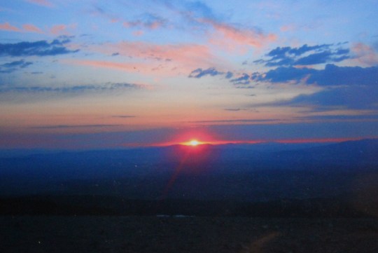
Back we went to the A-frame. The girls re-assed the boys conditions, and noticed the ones who were awake were improving. The other boy was still sleeping, but didn’t have a fever. The girls decided to practice some Yoga to stretch their sore muscles from the climb and to prepare for the descent tomorrow. We shared the fudge and celebrated our success as we watched the sun set and stars come out. Together we pointed out landmarks and reflected on how awesome the whole experience had been. We had to be the luckiest people alive to have this view at night.

Just after the sun went down, two soldiers from a nearby Army base came up to the A-frame. The two had decided over breakfast to hike the peak, and headed out that afternoon. They wanted to know how far it was to the summit. We strongly encouraged them to hike in the morning. It was snowing on the peak, not to mention at least a 3 hour climb through difficult trail to get there. “Well, we aren’t really convinced we can’t make it tonight” one of them said. They didn’t seem to believe us, and kind of smirked when we told them of the difficulty. We wished them luck and warmly let them know they were welcome to set up a tent anywhere nearby if they’d like.
One hour later they were back from their attempt and setting up their tent (they had gone a little ways, began to believe us, and decided to turn back). However, they couldn’t start their fire. The girls were happy to help yet again!
Back in the A-frame things were starting to get fun. The new friends were discussing books, High School classes and sports, and college prospects. It was now about 10pm, and starting to get windy. We put our fire out, and with one side completely open to the elements it immediately got very cold inside the A-frame. This was not good for the boy still chilly but recovering in the sleeping bag, or anyone else for that matter: It was supposed to be in the 20s on the peak that night. The girls used their knot tying skills to attach a tarp over the opening, which kept out most of the wind, but unfortunately took away the view of the city below, and also the light. The girls took the notorious water jug and attached a flashlight to the top, making the small light into a wonderful lantern, and brought out a deck of cards.

The group of teenage girls and boys were getting along pretty well. At this point, I thought they were getting along a little too well. Realizing I was the only real adult in this whole situation, and that most of their parents would be upset with the kids “sleeping together” no matter the extenuating circumstances, I decided to put my foot down with sleeping arrangements. The girls had their sleeping bags set up where their heads were facing one wall of the cabin, the boys on the other. I was in the middle. While I was really tired, I knew I should stay awake while the teenagers were awake, so I listened to them talk and have a really fun time comparing Kansas to Colorado until 2am, when they finally got to sleep. By this time I was freezing, and unable to sleep myself, so I listened to the wind howling outside the shelter. 4am came, and along with it, some pretty powerful wind gusts. One gust tore the rivet off the tarp, and with a loud and obnoxious crumpling and flapping sound started flailing noisily in the wind. I am proud to say the knots the girls tied remained in place, even though the tarp had torn. The tarp was replaced, and luckily that seemed to be the worst of the wind for the night.

The girls set the alarm for 6am so we could watch the sunrise, eat breakfast, pack up and go. The two boys with headaches were doing much better, and wanted to pose for pictures with the girls. The boy who had pretty severe altitude sickness was better but still miserable (he would be until he descended the mountain), and planned to sleep for a few more hours. We briefed the adults on what to do for altitude sickness, gave them some supplies, and told them if the boys ended up getting sick in the near future to research Giardia. They were very appreciative, thanked the girls over and over again, and let them know if it hadn’t been for them, they “probably wouldn’t have made it through the night.”
The A-frame had been filthy when we arrived, so being Girl Scouts we decided to clean it up before we left. Since it is quite a hike to reach the shelter from both the top and bottom of the trail, it is unlikely others would come to clean up the mess. Luckily we had brought some trash bags along in our packs (in case of intense rain they work well as ponchos). We filled the bags with empty water bottles, dirty plates and utensils, empty fuel canisters, socks, and other “trash” and decided to carry the bags from the shelter 9.5 miles down the mountain.
It took us about an hour to hike down to Barr Camp, where Liane was waiting for us, ready to go. She had a fabulous time talking with dozens of hikers she met along the trail, and a peaceful night sleeping in a tent by the stream, watching a campfire of her own. We had quite a few stories to share with her on the way down. We couldn’t believe how many unprepared hikers we encountered. They all agreed “someone should write a book about this trip, or make it into a movie!”
We had 2 more miles to hike when Thomas yelled back to us “Come quick! Ms Liane fell down!” We rushed back up the trail to see that she had indeed taken a pretty hard fall, and was lying face down in the dirt. She had lost her footing and was off balance due to the pack she was carrying (which gave momentum to her fall) and fell face forward down the trail. We were all afraid she had broken something, but she assured us she had just fallen quite hard, landed on her nose (ouch!), hand, and knee, and while she was shaken up, nothing seemed to be broken. Bruised pretty badly, but not broken. Liane was a brave and excellent role model through the whole experience. She handled the fall like a champ, didn’t complain, kept positive, and after cleaning her cuts we were on our way back down the trail, a little more cautious this time.

We made it to the parking lot at 11:30am, took a celebratory picture by the Barr Trail Sign, and headed home. We were all exhausted, dirty, and smelly, but so proud of our accomplishments!
The whole way home we would look at Pikes Peak and say ‘We were just there!” and “We climbed that!” Every time we look at Pikes Peak we will think of the adventures we had this weekend, and how we conquered the mountain.
Pikes Peak Summit Sticker can be bought here