Hope Mountain A – 13,939 & Quail Mountain 13,465

1

RT Length:  10.6 miles

Elevation Gain: 5200’

Hiking/climbing over the next few weeks are going to be tricky since I’m taking my survival troop camping on the weekends (which is always a blast!!!).  Today I needed to be back home by noon so I got out my spreadsheet to look for a hike that was: 3 hours or less driving distance, around 10 miles of hiking, and didn’t require much route finding (because I didn’t have time for that today).

I love spreadsheets!  They take some initial time to set up but make narrowing down this kind of information so much easier.  After finding 4 different Centennials that met my criteria (it’s great having so many options open!)  the one with the ‘best’ weather was Hope Mountain A:  50% chance of rain from 3am-9am with 40% chance of thunderstorms after 9am. I liked those numbers, I’d just need to pack extra rain gear.

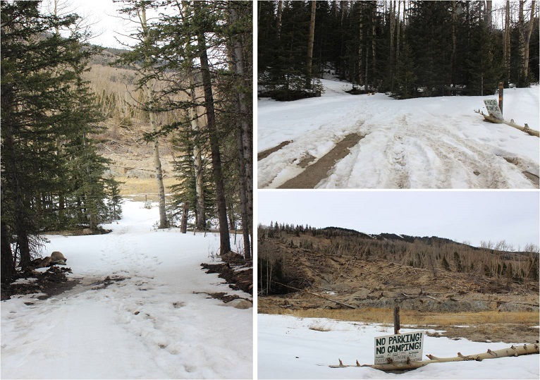
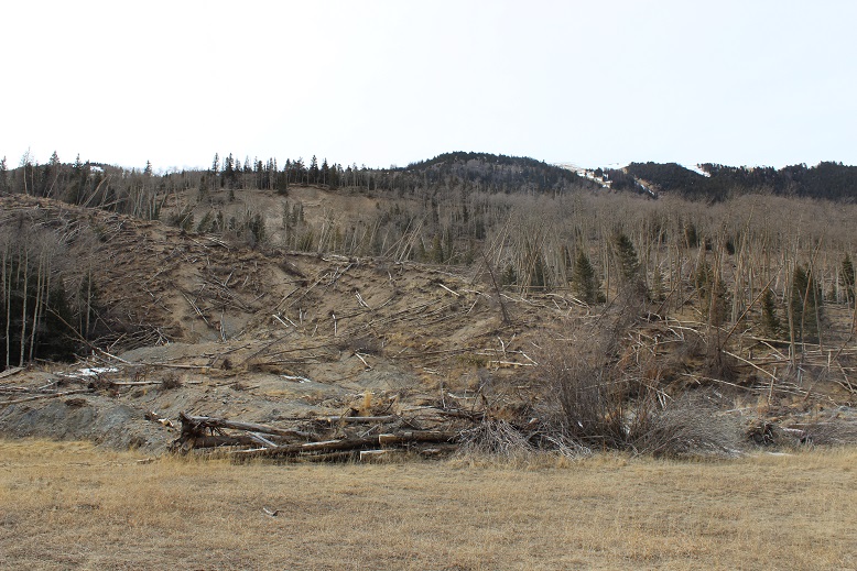
I made it to the 2WD trailhead at 3:15am.  The road is in excellent condition with great signs.  There was only one other vehicle in the parking lot when I arrived (and it was still there when I left).  The parking area could comfortably hold about 10 vehicles.

2

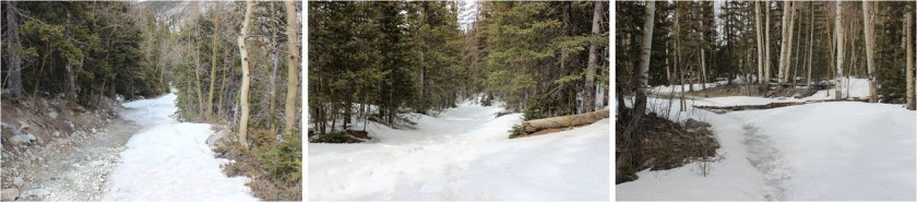
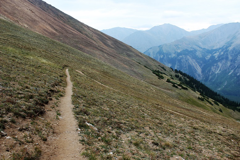
The trail was indeed excellent:  no route finding necessary until I made it to the Hope Saddle.  There weren’t many signs, but they weren’t really needed either.

3

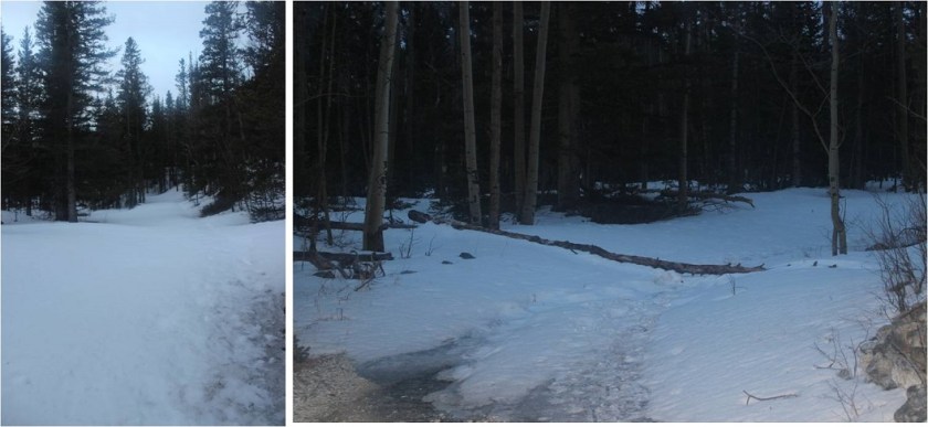
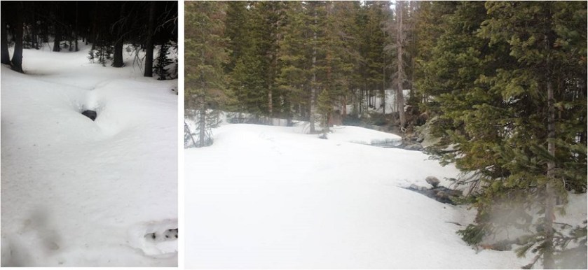
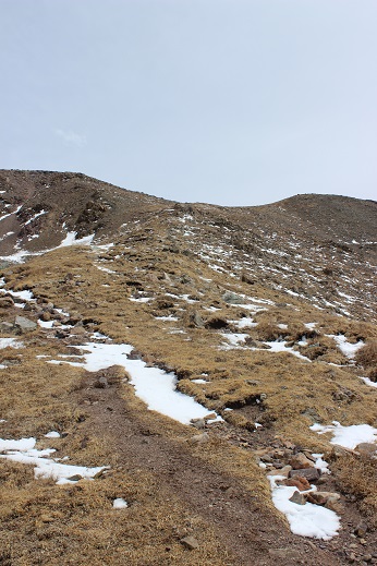
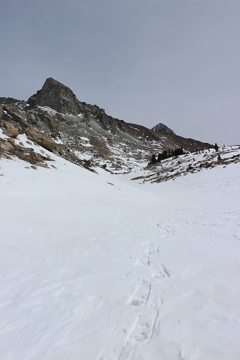
The beginning of the trail began with solid elevation gain that never quit.  It was a nice steady climb through heavily wooded areas of aspens, and after Sheep Gulch switching to small pines and then quickly to alpine tundra.  It was a perfect night to see wildlife, yet I didn’t see any tracks so I didn’t expect to see any animals (I didn’t).

4

As soon as I hit an elevation of 12000’ the switchbacks began.  These weren’t the kind of switchbacks that wear you out, but instead the kind that make the hike more enjoyable as they weave up the mountainside.

5

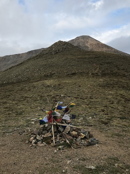
The hike this far had a lot of elevation gain, but the gain had been steady and hadn’t tired me out.  I made it to Hope Pass and thought to myself it was still way too dark.  I must have been hiking faster than I’d anticipated.  I looked at my watch:  Yep, it was only 4:30am.  I’d hiked 3 miles with 2700’ of elevation gain in an hour.  I was going to need to slow down if I wanted to get pictures from the summit.  At the Hope Pass saddle between Hope Mountain A and Quail Mountain there was a cairn with prayer flags.

6

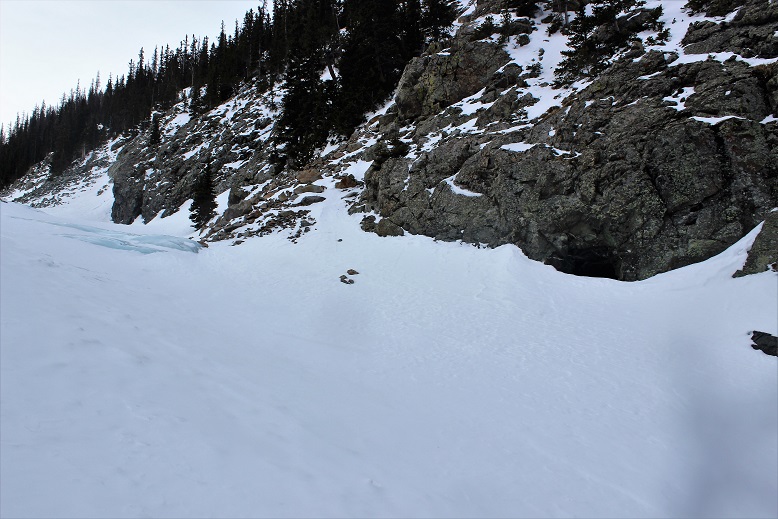
I couldn’t see Hope Mountain because it was still dark out, but I knew once I made it to the pass to turn left and head up the first ridge.  The route was supposed to be easy to figure out and visible from the top of this first ridge, but since it was still too dark to see I couldn’t tell.  There was no route from the pass to the summit:  no dirt path and certainly no cairns.   My flashlight kept going in and out (I need a new one) which was a little frustrating but I’d needed to slow down anyway, so spending time hitting it against a rock to re-light it every time it went out seemed like time well spent.

Here’s the route I took:

7 Hope Ridge

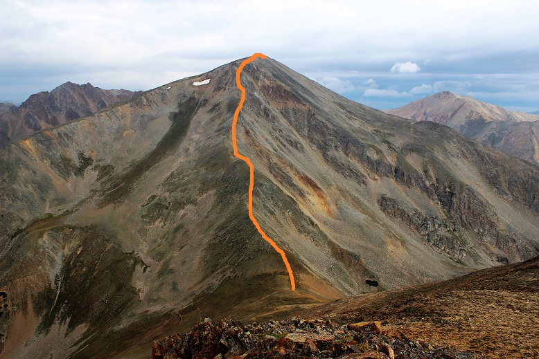
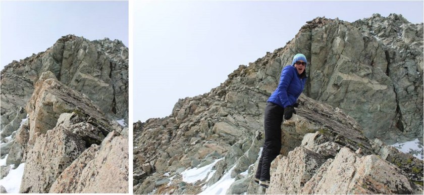
That ridge was FUN!!!  This is rated as a 2D hike, and I hadn’t brought a helmet, but it would have been nice, especially if others had been on the mountain as well.  The ridge had some exposure and would be a great training hike for someone to take before tackling some of those class 3 14ers.  I hiked the entire ridge in the dark, so my advice to someone doing the same is to stick to the ridge, and if you must leave the ridge go to the left.

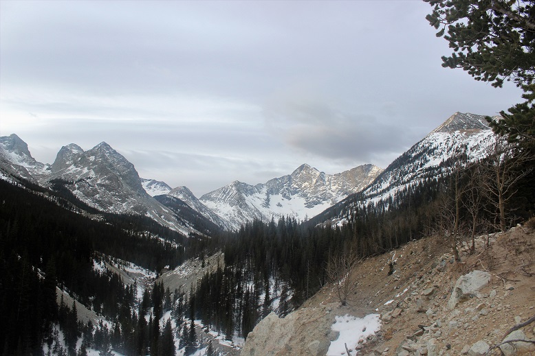
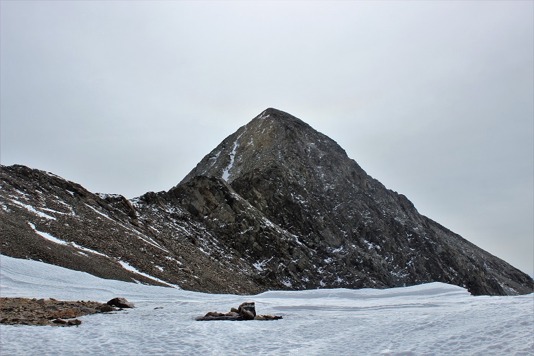
The ridge took me about an hour to climb, which gave me lots of time to think.  My mind drifted to 14er firsts.  I know some people don’t appreciate the idea of any more “firsts”, but I think they’re fun and encourage people to get outside, and while I don’t plan on attempting any, there are a few I’d like to see:  The first person to summit them all in the dark, the first person to spend the night on every summit (has this been attempted/done?) and my favorite, the first to stand on every summit without actually hiking (I’m thinking this one would involve a helicopter, rope, and tons of money).  In any event, the topic took up my mind as I climbed the ridge.  Here’s a look up and back from halfway up the ridge.  To the left is Hope Mountain A, and the right is Quail Mountain.

8

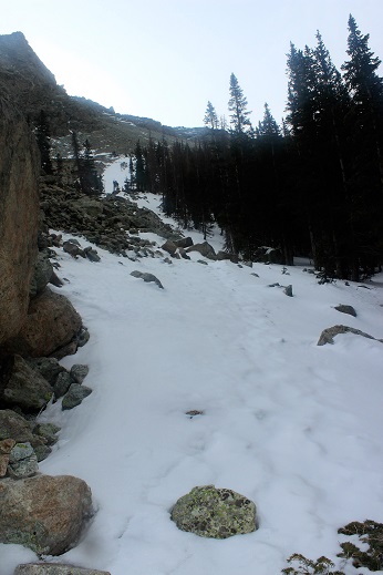
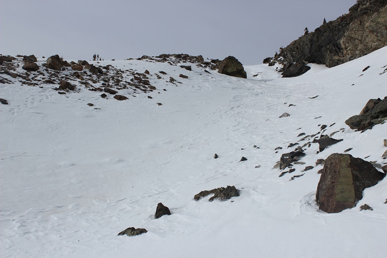
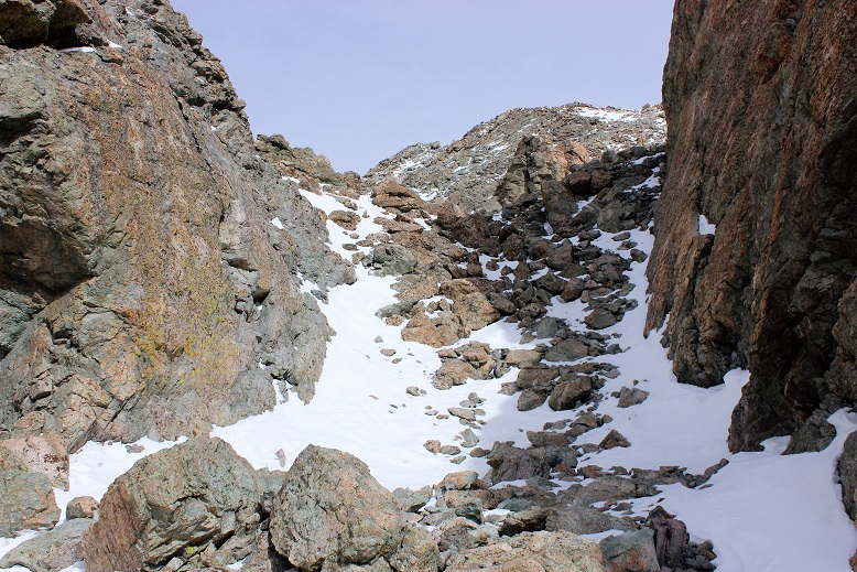
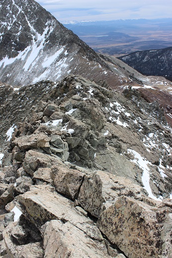
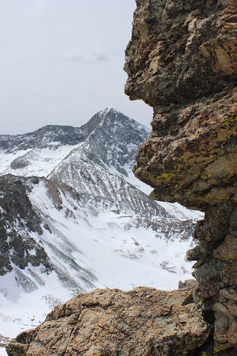
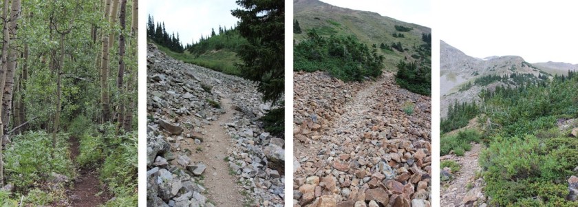
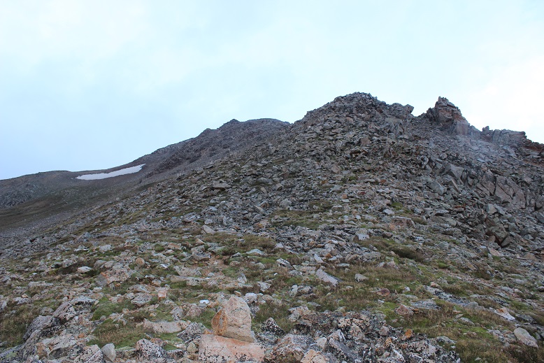
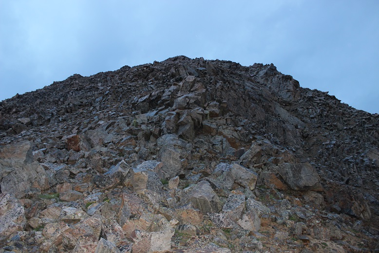
At about 13000’ the loose rock began.  In this picture you can see there’s a false summit

9

10

This is where it got a bit sketchy in the dark:  those gullies were loose!  All rocks the size of microwaves or smaller were very unstable and just waiting to find their way lower down the mountain.  I tried not to touch the larger ones.

11

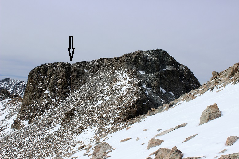
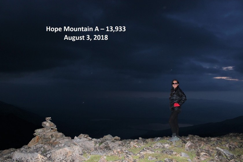
The trick here is also to stay to the left (the right drops off into a couloir).  But as soon as you get up those loose rock gullies you’re met with a nice gentle but rocky slope past a false summit to the true summit.  I summited at 5:45am.   Here the sun was just beginning to rise and I got a summit photo

12 Hope Mountain A 13933

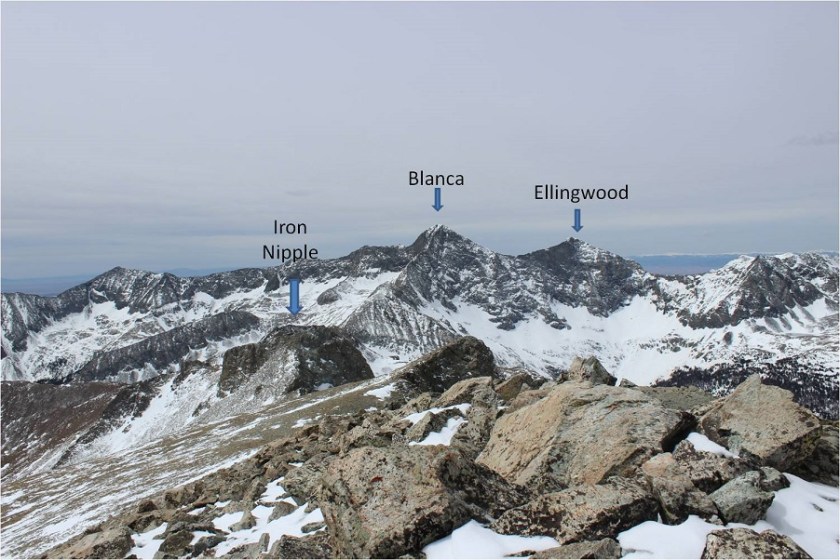
I also took a good look around.  Yep, it was going to rain.  Hmmm… I was still debating hiking Quail Mountain today, but those clouds didn’t look friendly.  I guess I was just going to have to skip it and hike it another day.

13

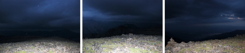
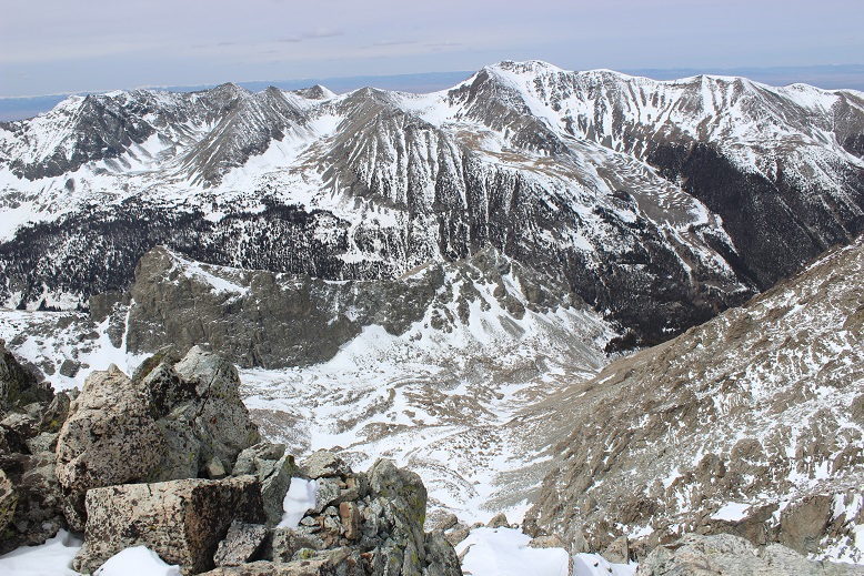
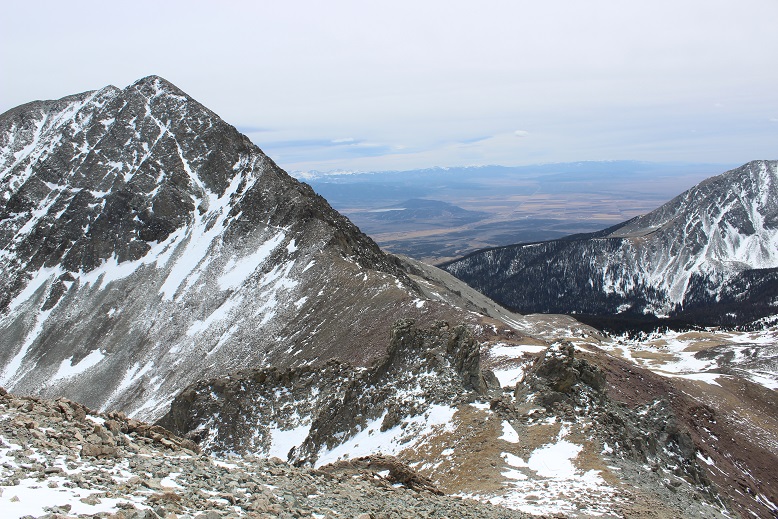
As I started descending Hope Mountain A it started spitting rain.  Nothing much, not enough to put on rain gear or anything, but then the graupel began and I decided to hike a little faster.  The graupel only lasted about 2 minutes however, and then was gone.  I took another look around me

14

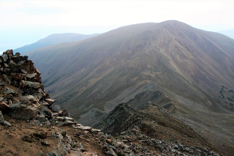
The sun was rising and Quail Mountain was looking really inviting.  Since the rain was behind me I decided to keep looking ahead and not make a decision about hiking Quail until I made it to the pass.  In the daylight the ridge was much easier to navigate.  This time if necessary I just stayed to the right, but I mainly took the ridge.

15

I made it back to the prayer flags at 7am and took a look around.  All signs of rain in the next two hours were gone, so I decided to attempt Quail Mountain.  This 13er didn’t have a trail either.  Here’s the route I took

16 Quail Route

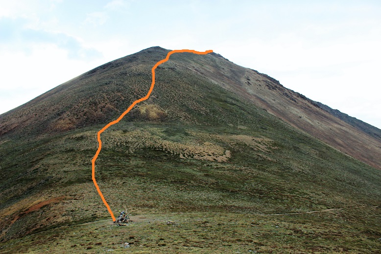
The beginning started with scree, and due to the elevation gain you couldn’t see the summit for most of the hike, so I just aimed for the first bump and began hiking.

17

There were multiple ‘social trails’ towards the middle of the mountain.  The ones to the lower right (where the mountain has red dirt) were on loose scree so I stayed to the upper right on a light but sturdy semi trail through the tundra (stick to where it’s green and you’ll be fine).  It became more and more stable as I ascended and then abruptly ended at the first bump

18

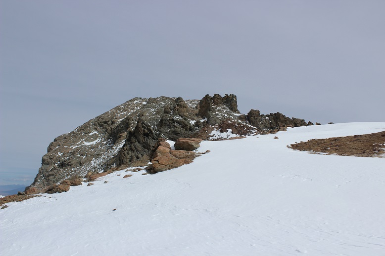
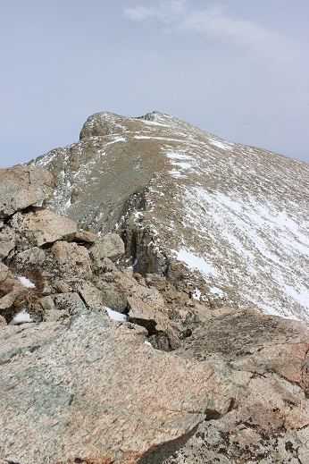
From here I followed the slight ridge up and over the false summit to a small saddle

19

And just like that, I summited at 7:30am.

20 Quail Mountain 13461 August 3 218

From the summit of Quail Mountain I could smell smoke from the nearby fires.  It wasn’t overpowering, and reminded me of campfire off in the distance.  It also didn’t last very long, and I could only smell smoke when the wind blew strong.

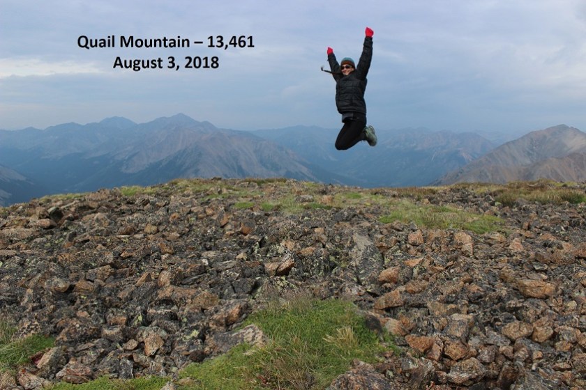
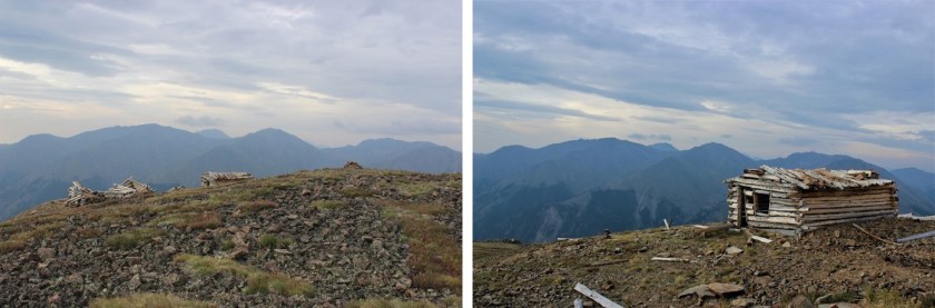
If you’re thinking about hiking Quail Mountain after Hope and the weather’s nice my advice is to just go for it!  It only took me half an hour to climb the 950 feet in elevation gain, and the views were incredible!  There were a few small and abandoned cabins (mines?) at the summit.

21

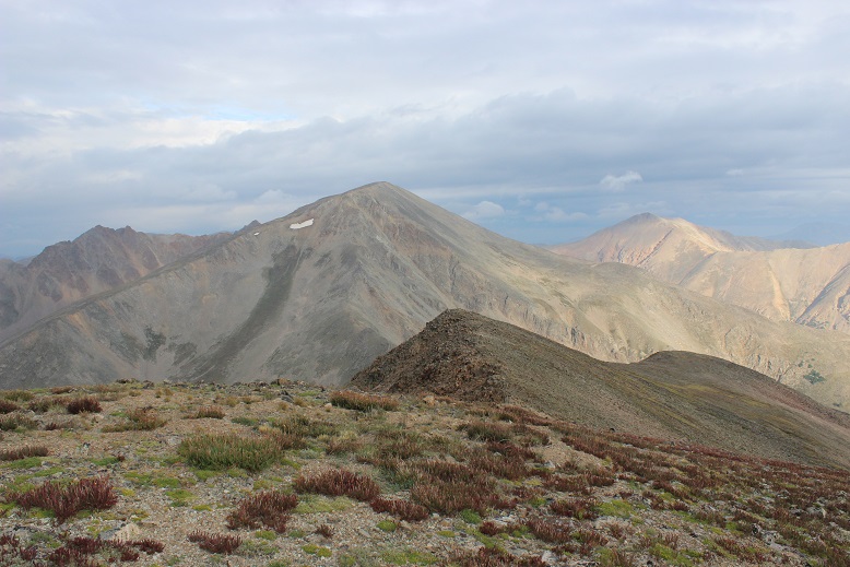
I turned to head back and got a great view of Hope Mountain A and the small ridge I’d followed to the summit of Quail.  Going back I followed the mountain to the right

22

This is another one of those mountains where microspikes are useful on the way down to navigate through the scree.  I made it back to Hope Pass at 8:10am and started my way back down the switchbacks.  Here I saw the only 3 other people I’d see today: a group of men who looked like they were thru hiking.

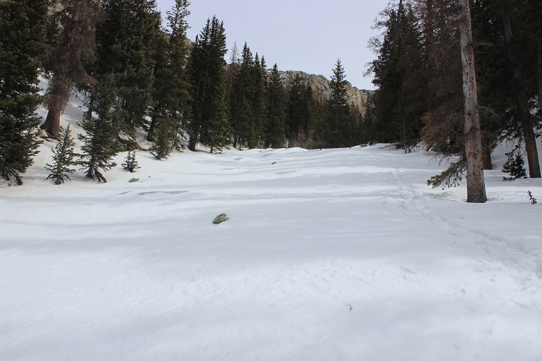
The hike through the aspens reminded me once again of why I hike:  solitude, beauty, nature, and time to think.  I saw a couple of ptarmigans on the trail, but otherwise no wildlife.  I made it back to the trailhead at 9am, just as it started to rain, making this 10.6 mile hike with 5200’ in elevation gain in 5.5 hours.  Perfect timing to make it back by noon!

23

On the way out I noticed there was still only one other car in the parking lot at the Sheep Gulch Trailhead I was at, but as I passed the Missouri Gulch trailhead on my way out it was overflowing with cars and there were several passenger vans there guiding groups.  I know the trail there goes to 3 different 14ers and several other hikes, but I think it’s safe to say I’m going to have no problem getting used to this less crowded 13er thing!

Huerfano Peak – 13,828 & Iron Nipple – 13,500

1-15

RT Length: 13 miles (from lower trailhead)

Elevation Gain: 4400’

Today’s Easter, and when I asked my 3 (older) teenagers what they wanted to do they said “Sleep in until 3pm and stay in our pajamas all day”. This is something completely doable for them, so I decided to let them do this and go hiking in the morning by myself.  I figured I’d be back by 3pm no problem.

After Friday’s hike (trudge) through lots of snow I was looking for something a little warmer. The Sangre de Cristo range looked relatively warm, so I focused on Huerfano Peak and the Iron Nipple.  I figured this was a safe route to take since I’ve already done Lindsey and am familiar with the area.  Also, it was supposed to be 41 degrees with 25mph winds above treeline.  That was the best forecast for the state!

I made it to the trailhead at 6am. I parked in the lower trailhead/avalanche area.  The 4WD road was open but there weren’t any tire tracks heading up the trail, just footprints.  I debated trying it out in my truck (I’d just had quite a bit of fun racing through some mud puddles on the say in) but figured there weren’t tracks in for a reason.  This ended up being a good choice.  I could have driven maybe another half mile up the trail, but after that it was covered in lots of ice and snow. And a few downed trees.

2 Lower trailhead

3 4WD road in morning

Parking at the lower trailhead added 4 miles to my round trip, which wasn’t too bad because those 4 miles don’t have any intense elevation gain.

And the view was totally worth it! Check out Blanca and Ellingwood!

4

I stalled as long as I could with putting on snowshoes. I don’t know why I do this:  If I need them early I usually need them for a while.  I guess I just don’t want to stop and put them on.  It was well worth the effort though:  I needed them for most of the hike.  (Side note:  I postholed at minimum up to my ankles, and up to my elbows the entire time I was wearing snowshoes, both on the way in and out.  Postholing averaged at about my knees).

The Upper Huerfano / Lily Lake trailhead actually looked pretty clear (it was just the trail getting in that was difficult to drive). I signed the trail register, noticed no one had signed it in quite some time (10 or more days) and headed out.

5 Upper trailhead and register

The meadow was pretty clear of snow, but it was here I saw my first mosquitoes of the day. They were everywhere below treeline, and didn’t let up!

6

The Lily Lake turnoff was covered in snow.

7

At this point I saw the stream for the first time. It was beautiful, covered in snow, with holes where the water flowed.  It was not completely covered in ice (as I’d read in previous conditions reports).

8

This is where the hike got a little sketchy. I was following a poorly defined trench, and at one point it split:  one patch going towards a river, the other up this gully.

9

Neither paths were correct on either my map or GPS. Since I’d seen the river wasn’t completely solid less than ¼ of a mile ago I decided to take the gully, but when I got halfway I realized what a mistake that was.  I was way off route, and not sure the way I was headed up would connect with where I needed to be.  So I backtracked and tried to follow my GPS through the trees.

This was as really, really bad idea. I was on course, but the snow was soft and powdery and up to my elbows (yes, I still had those snowshoes on).  And it was slippery.  I kept sliding, and I was on a steep hillside.  Added to that I was making a trench others may think was safe in what was actually a dangerous place.  This was not good.  I chose the safest path I could, exited the trees, and came to the river.

At this point the river was completely frozen, and I could see faint tracks where others had walked up the river in days prior. I walked up to the edge, used my ice ax to pound on the ice a bit and estimate the thickness of the ice, and determined it was much thicker here than the 3 inches necessary needed to hold my weight.

This was something new! I was hiking over a solid river (hey, walking on (frozen) water on Easter…) covered by about 2 inches of powdered snow.  It was a bit slippery in places, but manageable. Crampons would have made this easier, but my snowshoes worked just fine.  At places I could hear the water running under me, and the ice was so blue/teal/clear!

10 River morning

I kept following the river, and quickly came to the mine. I’d wanted to explore the mine a bit today, but obviously that wasn’t going to be possible since it was almost completely covered in snow.  Yes, the whole Easter/tomb thing came to mind here as well…

11 Mine

12

The trail continued up, up, and up, over what felt like a waterfall and eventually came to a gully. All the visible tracks (they’d been gone for a while) showed footprints going to the right, up the gully.  Even though I knew I was supposed to go left eventually, I followed the tracks.

13

That was a long trek up a steep slope!

14

It was a long uphill battle that put me on the far west upper end of the basin when I was done.

4

I side tracked and snow-shoed my way east towards where I knew the trail picked up on the other side of the basin (there weren’t any trails visible due to the snow). I needed to use my GPS to find the exact location of the point where the trail climbed the mountain, but once I did the route wasn’t difficult to follow.

16

I took off my snowshoes at this point and headed up the mountainside. Now I was starting to get a bit tired.  All those gullies and postholing in snowshoes was starting to take its toll!

When I made it to just below the saddle I had a good view of Mt Lindsey

17

At the saddle at 13,100’ I turned north away from Lindsey and headed towards the Iron Nipple. The trick is to aim for the U-shaped notch in the center.

18

Here’s what that looked like up close

19

This is where the wind really started to pick up. It was way more intense than the 25mph predicted, and turned the snowshoes I was carrying into a kite.  I stashed my snowshoes and trekking pole, got out my ice ax, and started towards the Iron Nipple.  I’m not a big fan of the name (it gets its name because from far away it looks like a big nipple (just the nipple) and it’s a mountain made of iron.  I know, who’d have thought?).  From here I think it kind of looks like a Jaguar taking a rest.

20

Anyway, I didn’t want to climb this peak first because they I’d have to refer to it first in all of my postings, and I mentor Junior and High School aged adventurists and I really didn’t want to keep bringing this up when talking about summit Huerfano, so I descended some class 3 boulders down the side of the cliff and followed the ridge towards Huerfano Peak.

21

22

There wasn’t a lot of snow here, but just enough to make me need to watch every foot placing. I stayed towards the top of the ridge, ice ax in hand (and used several times).  When I got to the saddle I took a look back… it kind of looks more like a nipple from here.  The black arrow points the route I took to descend.

23

The rest of the route was pretty straightforward: I just aimed towards Huerfano and walked towards the peak for about half a mile.  Here’s a summit photo to prove I summited

24

And some views of the surrounding mountains

25

Check out Lindsey! Almost no snow!

26

Here’s a bird’s eye view of the basin I’d entered through

27

And now I was on my way back towards the Iron Nipple. Did I mention it was windy?  I’m guessing winds were at 50-55mph, and they didn’t let up.  This wasn’t a big problem while I was hiking the saddle or talus below the ridge, but once I reached the ridge I had to keep my profile low.

I know this is going to sound like a bad joke, but the nipple actually had a lot of exposure.  I wasn’t prepared for this, and it was quite exciting!  I tried to get a picture to prove I was there and experiencing this exposure, but the wind kept knocking over my gorillapod with my DSLR camera.  The third time it happened I almost lost my camera down the side of the cliff (ice ax to the rescue!) and I gave up getting the photo (I probably should have quit a bit earlier).  There was a very substantial drop on either side, but especially the northeast side of this part of the route.

28

29

I summited and took a picture back at the ridge and Huerfano

30

I turned around and started heading back towards the notch. Mt Lindsey looks beautiful!

31

And Blanca as well

32

I hiked past the saddle and down the hillside towards the basin. The end provided some fun glissading!

33

From here I didn’t want to hike back down that gully I’d hiked up, mainly because it meant hiking up out of the basin just to hike back down the gully.   So I took a look at my topo map.  It looked like the gully in front of me was less steep and connected with where I needed to be, so I took that route instead, and indeed ended up where I needed to be:  right back on that frozen river.  It was beautiful!  I couldn’t help but take more photos

34 Up and down river

And a video

https://youtu.be/YDJ8fHkVQqk

I decided the smart thing to do would be to follow the river down past where I’d entered and look for a logical exit point. I followed it for much longer than I felt comfortable, but a look at my topo map kept telling me I was on course with picking up the actual trail.  The river did begin to open up due to weakness in the ice and I needed to exit to stay safe, but where  exited was very close to the actual trail.

35

This was close to the Lily Lake trailhead, but 3 miles from where I’d parked my truck. Those last 3 miles took FOREVER!  I don’t know if it’s because my 9 mile hike turned into a 13 mile hike, because I’m out of shape (I’m most definitely not) or because I was postholing in heavy winter boots and snowshoes up to my knees for most of this hike (that’s my story) but I was physically exhausted.  My back and shoulders hurt, not to mention my quads.  This isn’t normal for me while hiking:  I loved every minute of it!  What I didn’t love however, were those mosquitoes!  It was actually quite pleasant outside, but I refused to take off layers because they were keeping me from getting bitten.  I kept swatting the little buggers out of my face.  I could see them everywhere (there were birds feasting everywhere as well).

I made it back to the trailhead and signed out of the register.

36

The ice on the road had melted a bit on the way out

37 Uper 4WD trail out

Here’s a daylight view of the avalanche area at the lower trailhead.

38

There was a lot of mud on the trail on the way out. I had fun driving through several very large mud puddles in my truck, making a mess of things.  I absolutely LOVE my truck, and this was fun! Side note:  everyone should own a truck for times like this.

39

I didn’t get any great photos of the big puddles or videos while mudding (because that required two hands on the wheel) but I did get a short video just driving out. The deer weren’t planned

https://youtu.be/vjg2uA114Cs

I made it back down to my truck at 4:15pm, but didn’t get cell reception until about 5pm (that dirt road and drive in takes forever!). When I finally was able to call the kids and tell them I’d be home around 7pm I found out they’d just woken up, so no worries.  Oh, to be a teenager again!  It seems we all enjoyed our holiday!