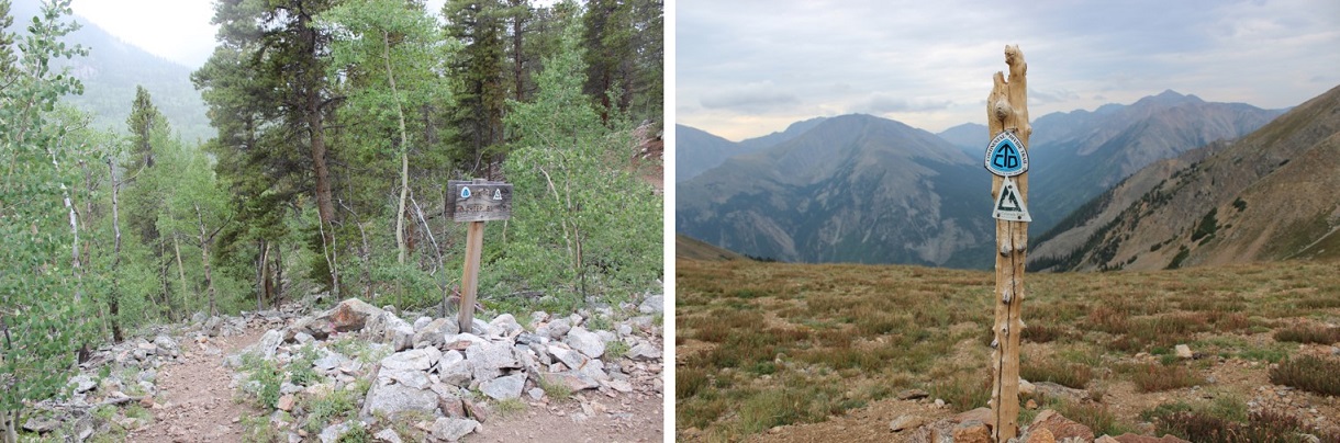
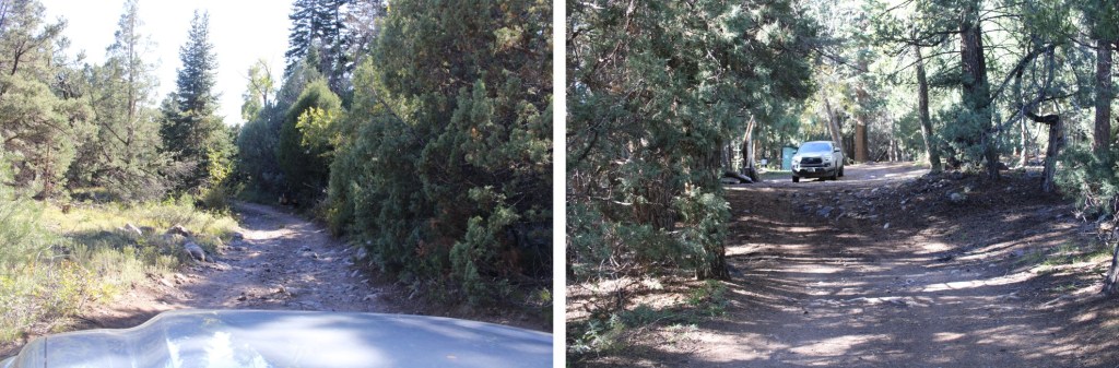
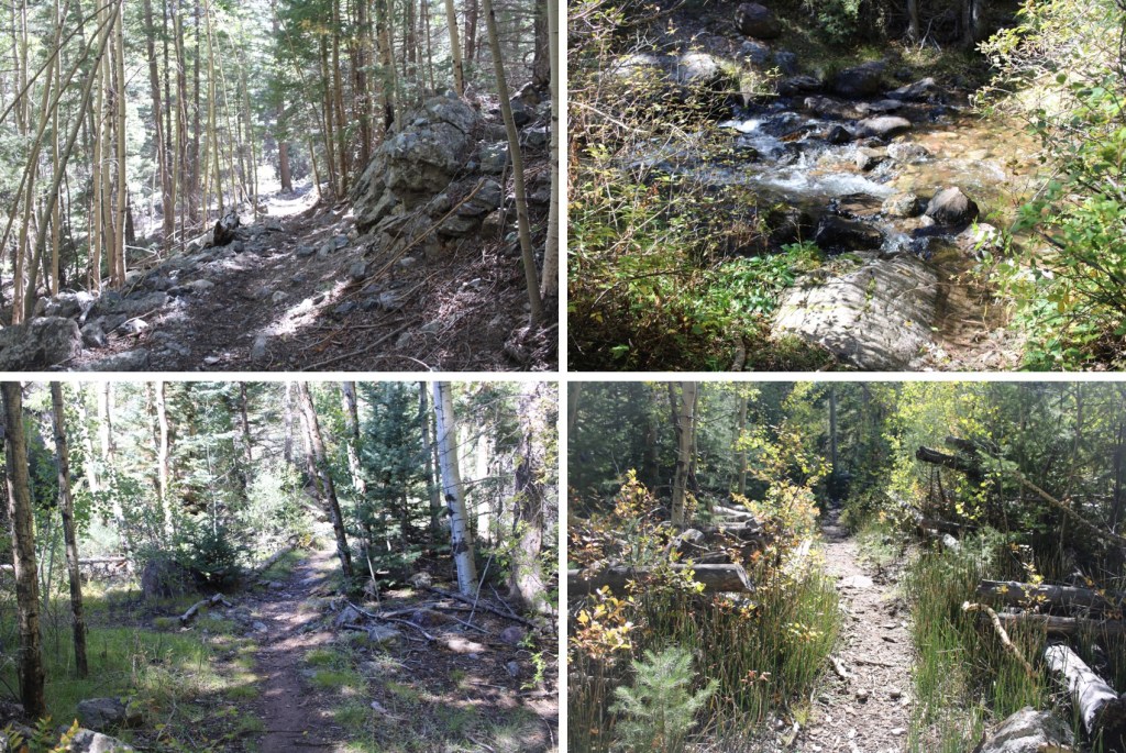
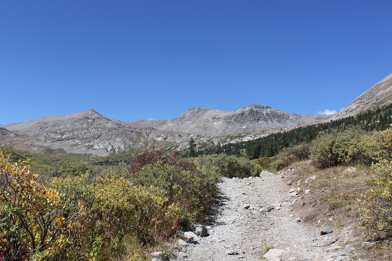
The last mile to the San Isabel Creek Trailhead was 4WD, but there were tons of campsites along the way. Since it’s hunting season, a few of them were taken and I parked at the end of the road.
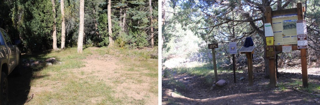
There was a faint trail at the end of the campsite that led me to the trailhead
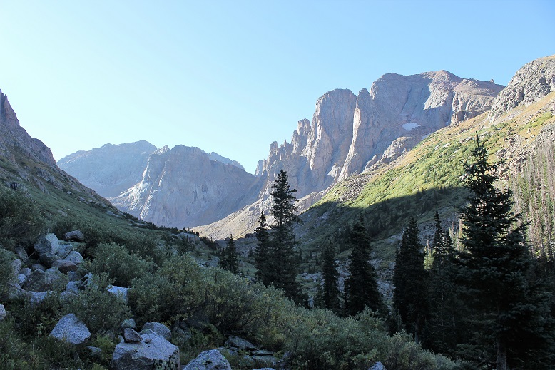
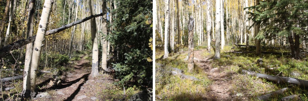
I followed the San Isabel Trail No. 858 East, on a well-defined, class 1 trail.
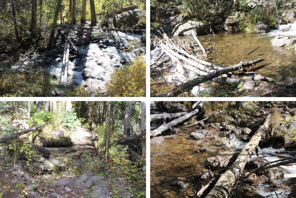
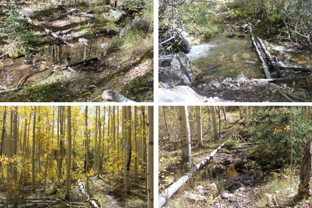
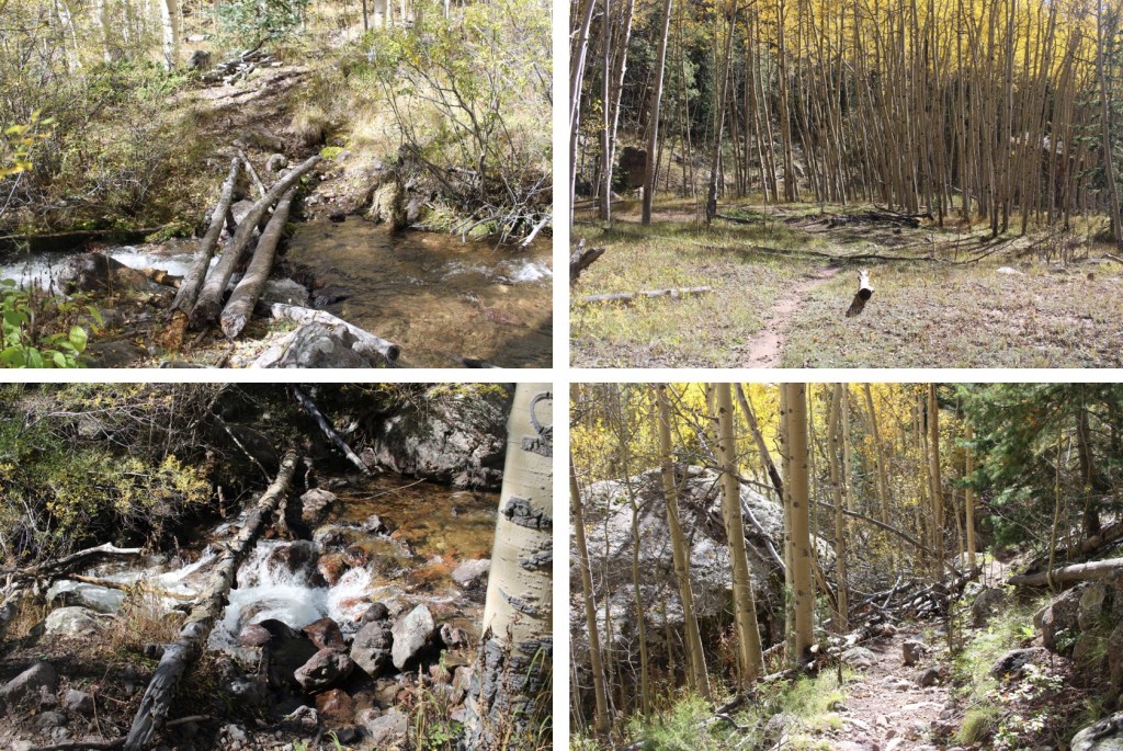
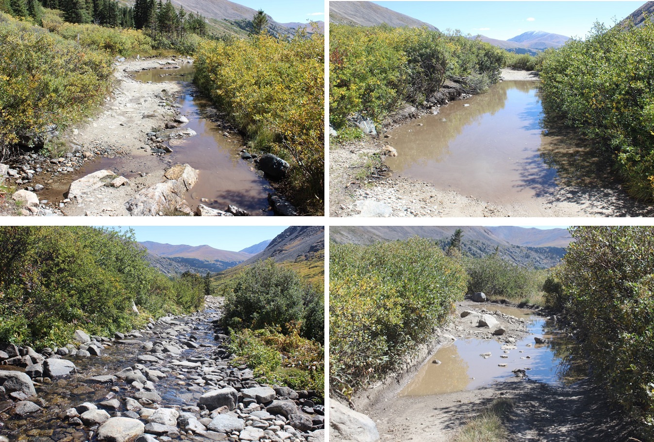
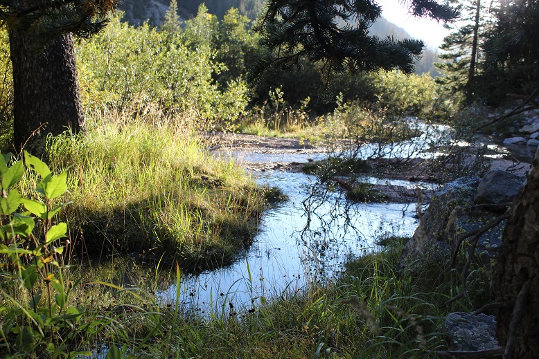
There were several creek crossings. Since it was late September, they were all easily manageable, without creek crossing shoes. The last time I was in the area I think I counted a minimum of 9 crossings.
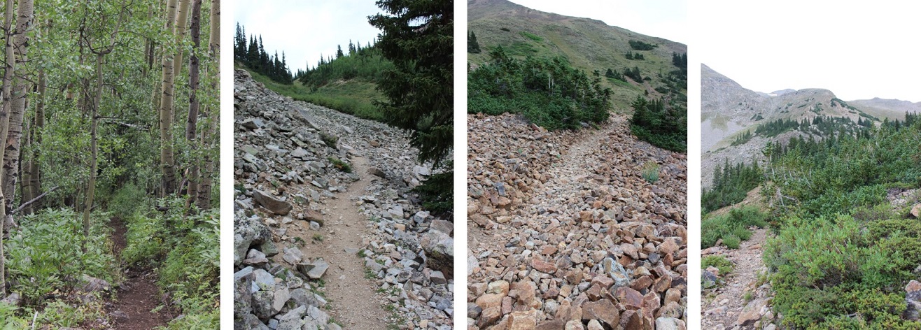
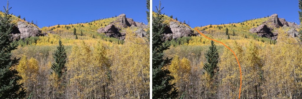
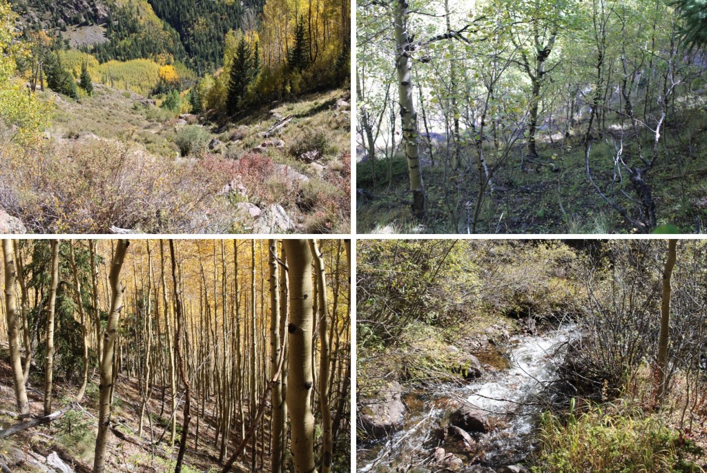
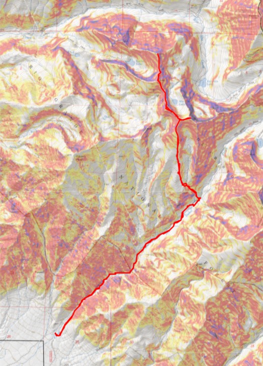
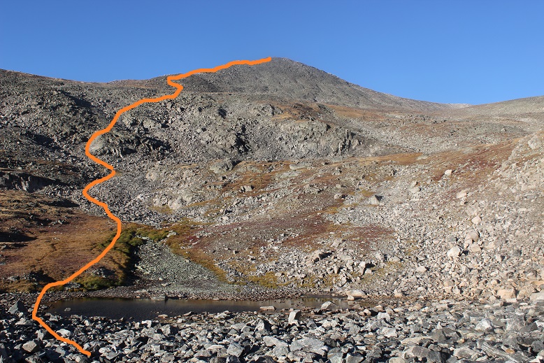
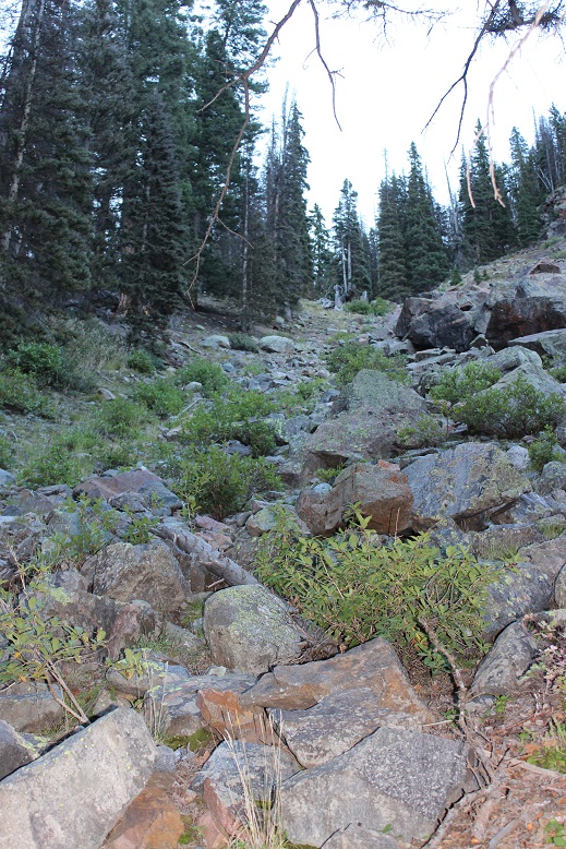
After hiking for about 4.4 miles, and at 10450’ of elevation, I left the trail and headed northwest up this drainage. There was some bushwhacking, as the trees in the slide area seem to be growing back
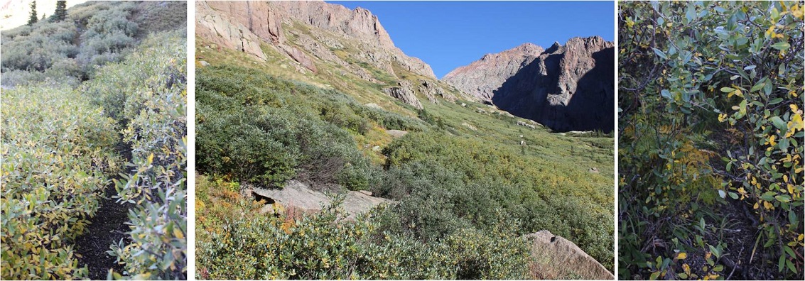
I crossed San Isabel Creek, and made my way up the drainage
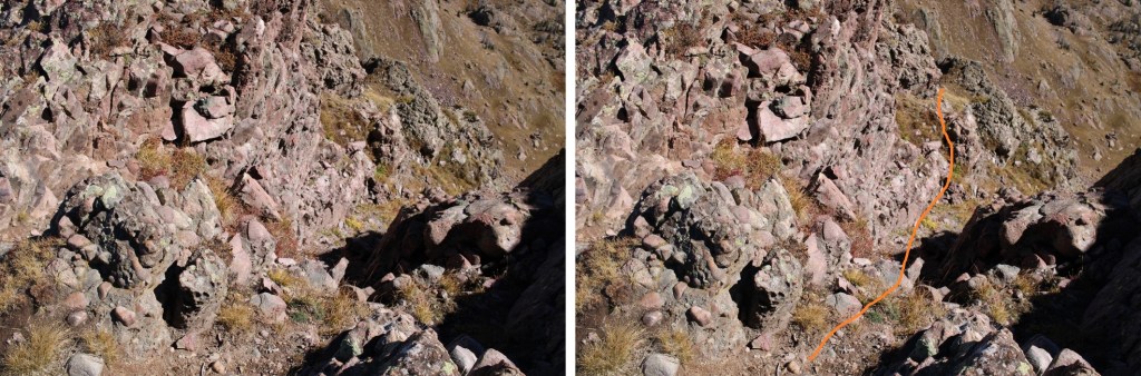
I ended up going back and forth on either side of the drainage, looking for the best route. There are some minor game trails in the area, but once you make it to the clearing you want to ascend the ridge to your left.
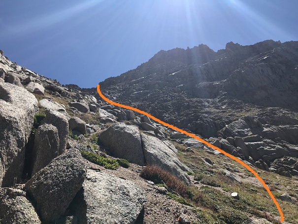
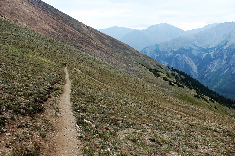
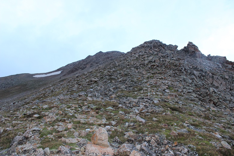
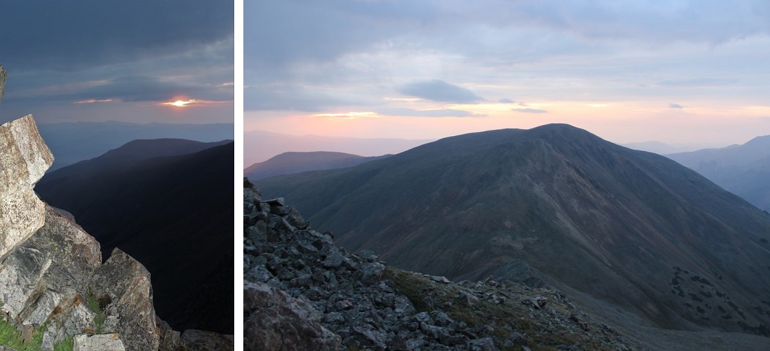
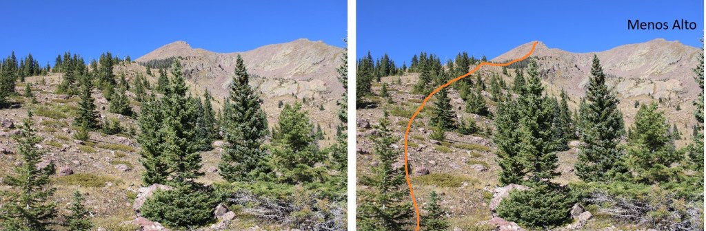
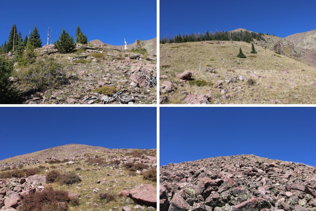
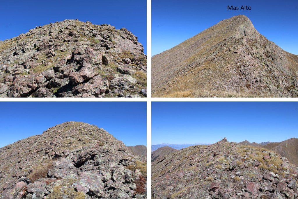
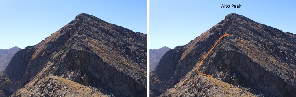
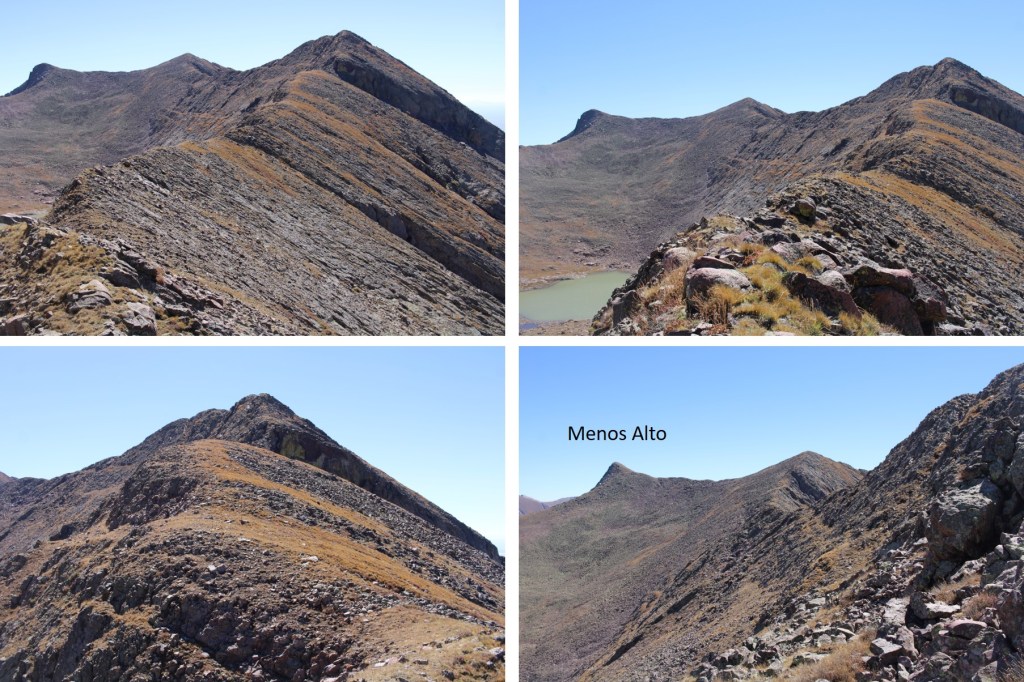
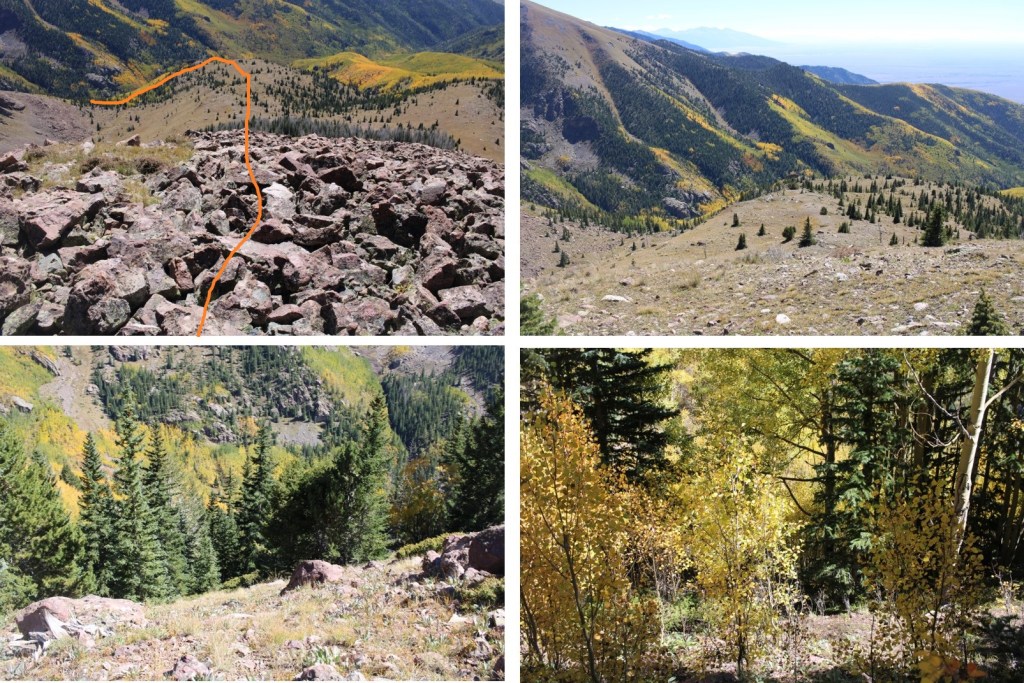
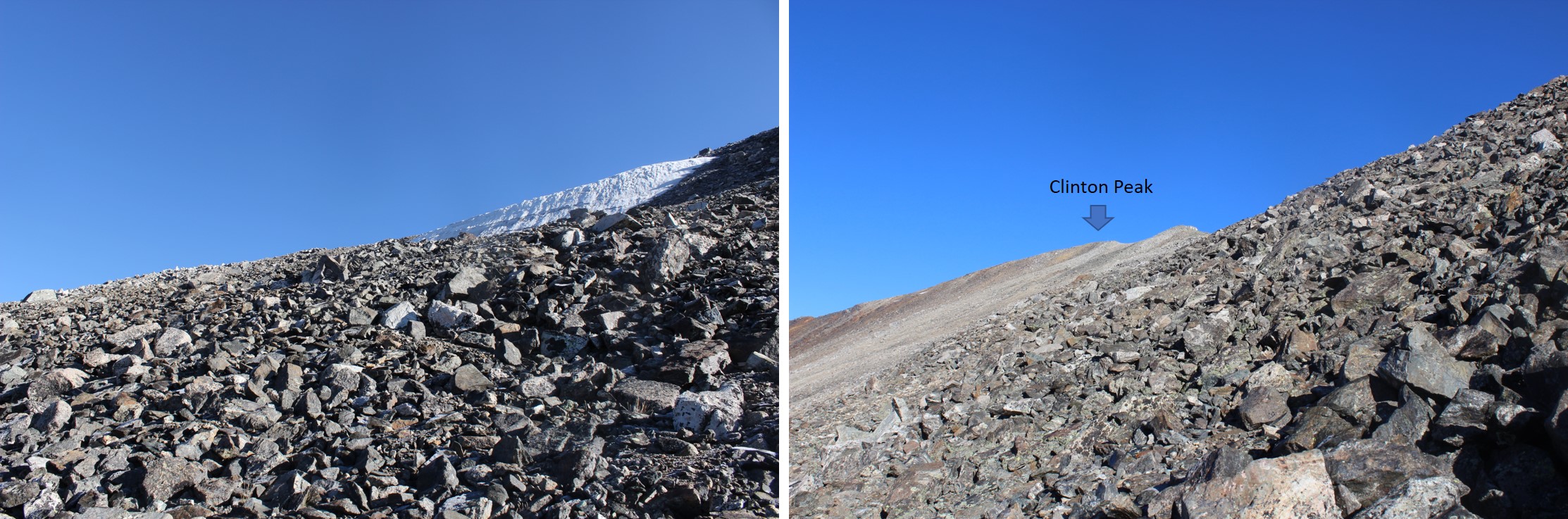
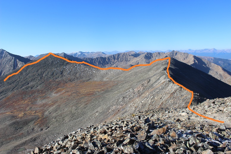
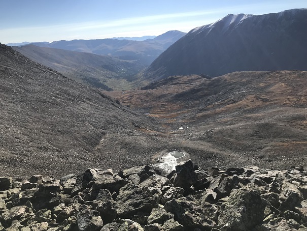
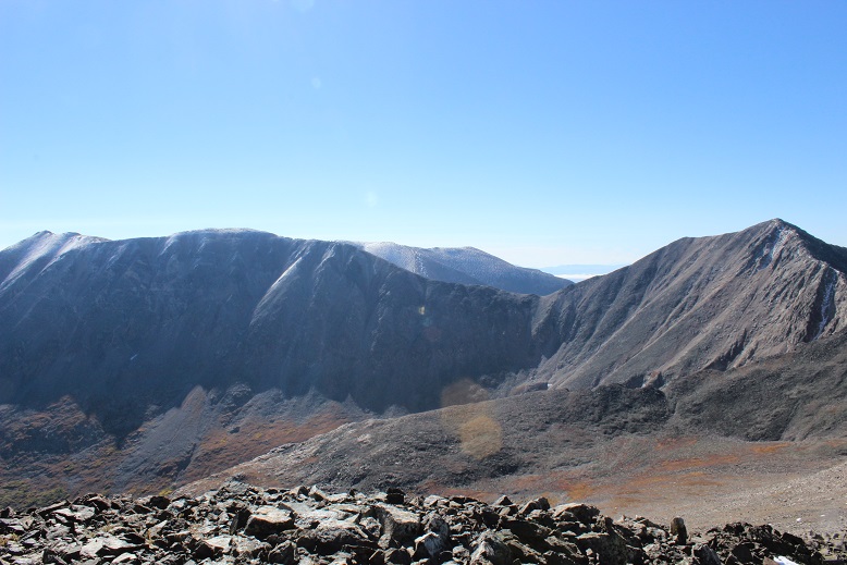
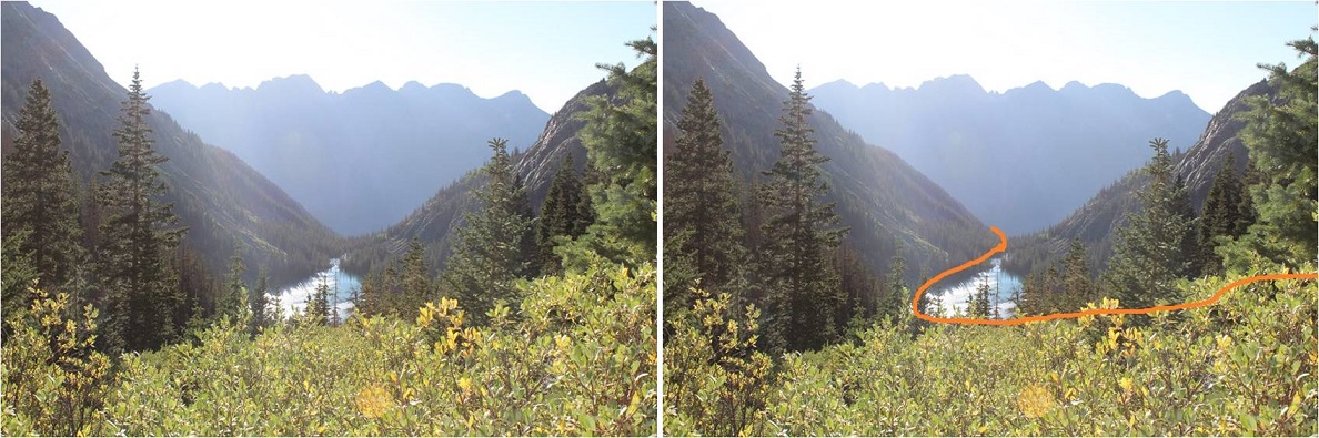
Once on the ridge, I followed it north. As you can see, Menos Alto is to the right. However, I’d already summited that peek, so I left it today for last.
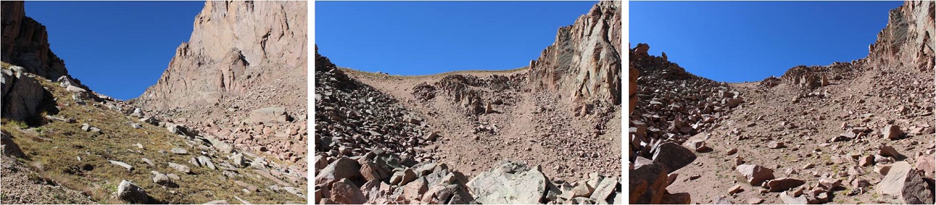
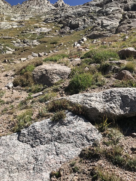
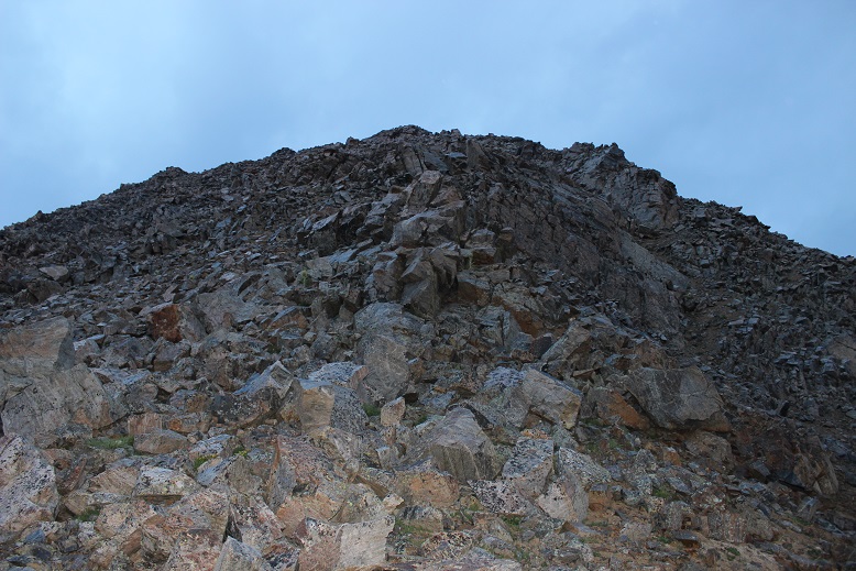
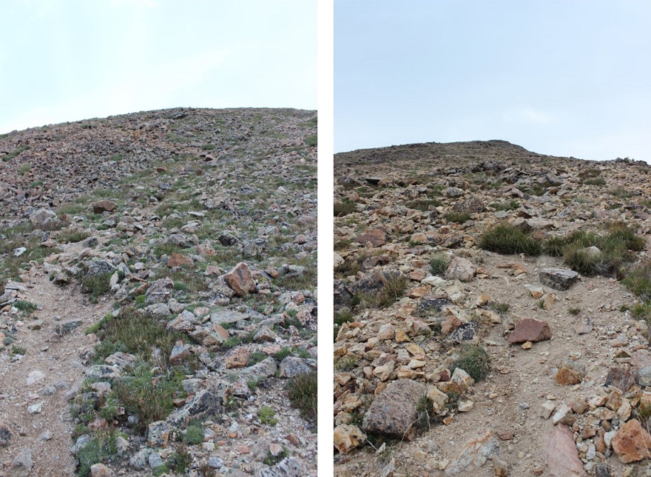
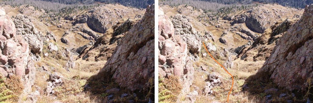
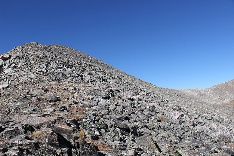
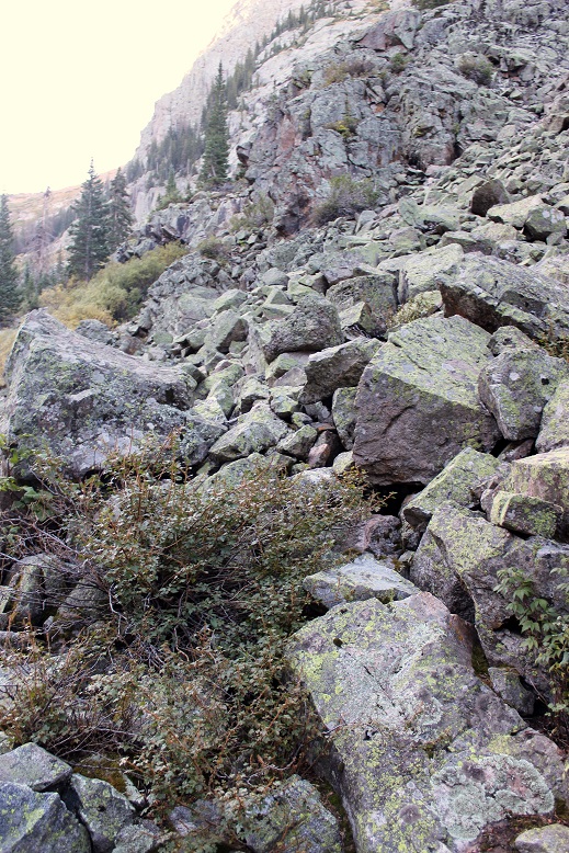
Here are some pictures of the route up the ridge. It started out as tundra, then I entered the trees for a short bit, and exited to class 2 rock hopping.
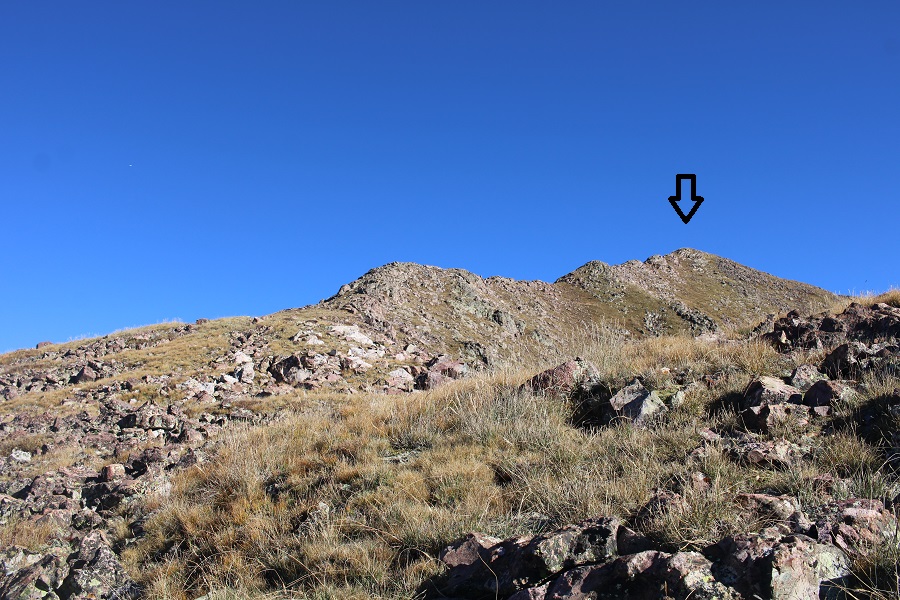
I continued following the rocky ridge (class 2) northeast to this point, which is not a summit.
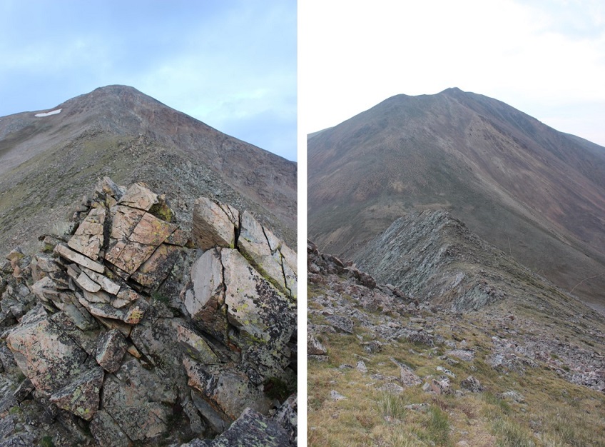
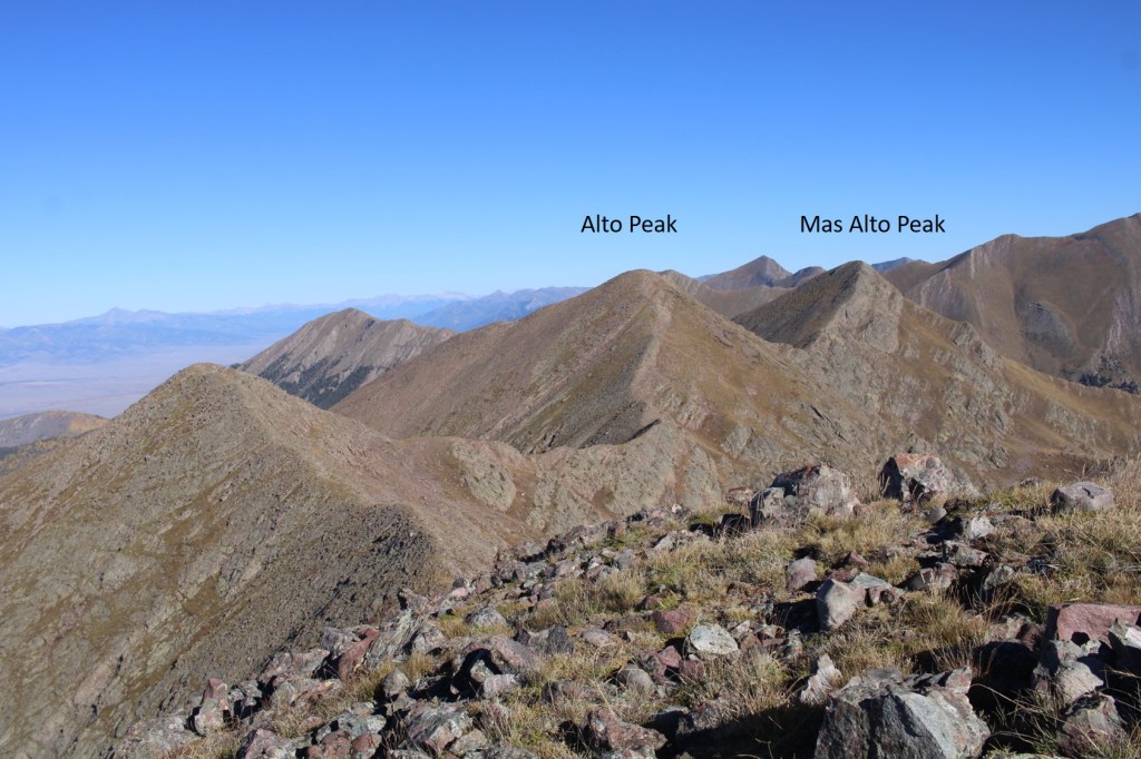
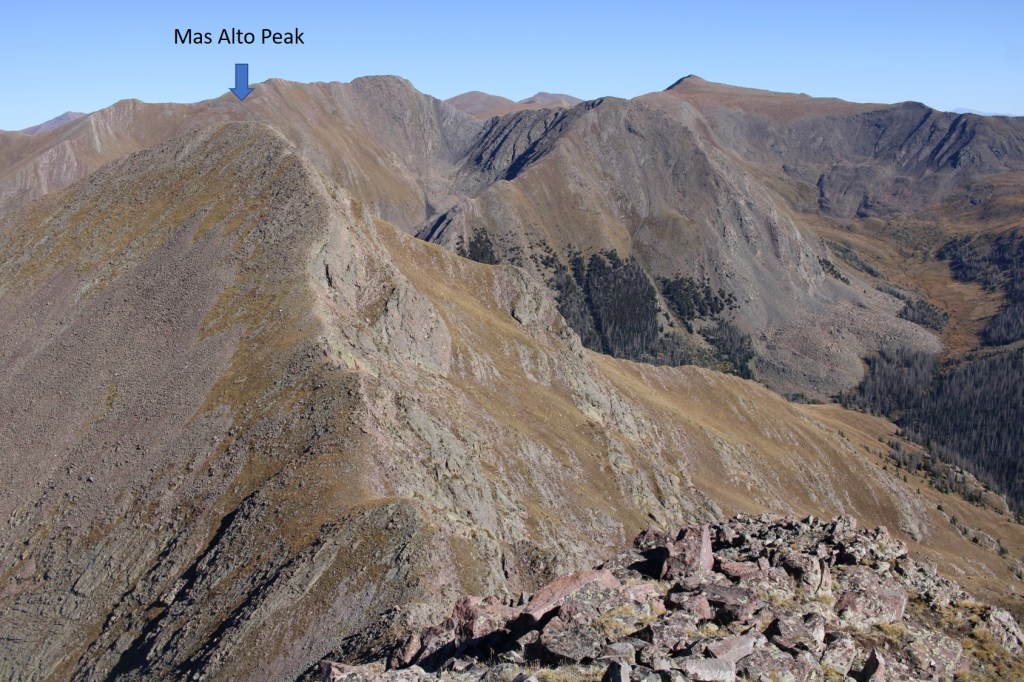
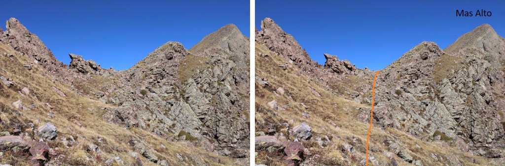
From there, I could see my next two objectives to the northwest, Alto Peak and Mas Alto Peak
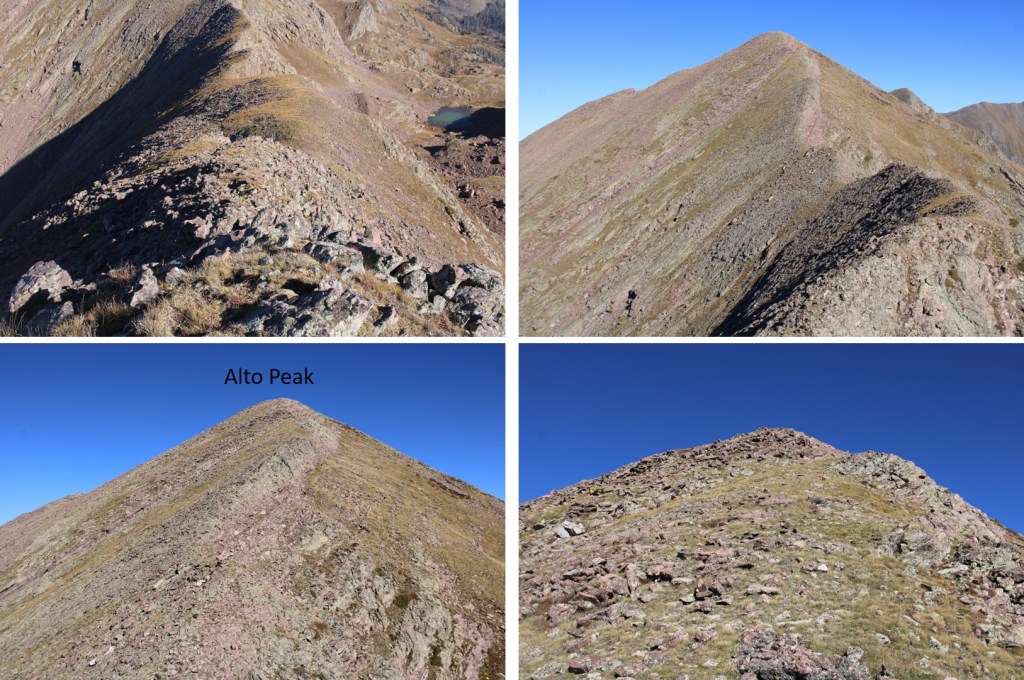
I followed the class 2 ridge northwest to the first point, which was unranked
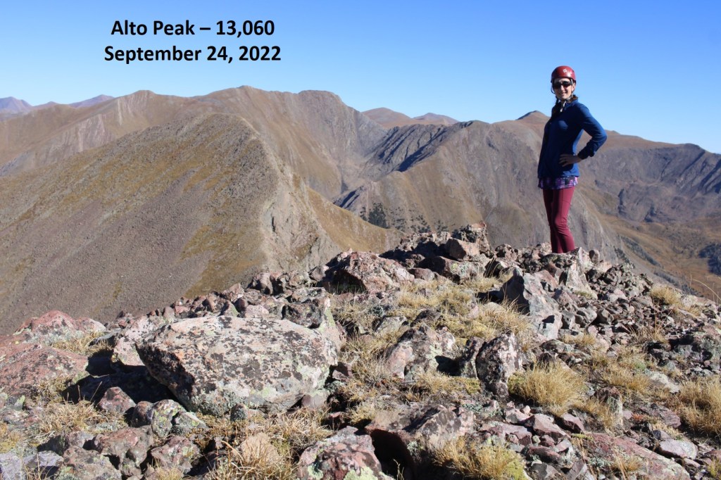
It was then a class 2 hike to the summit of Alto Peak
Alto Peak – PT 13060:
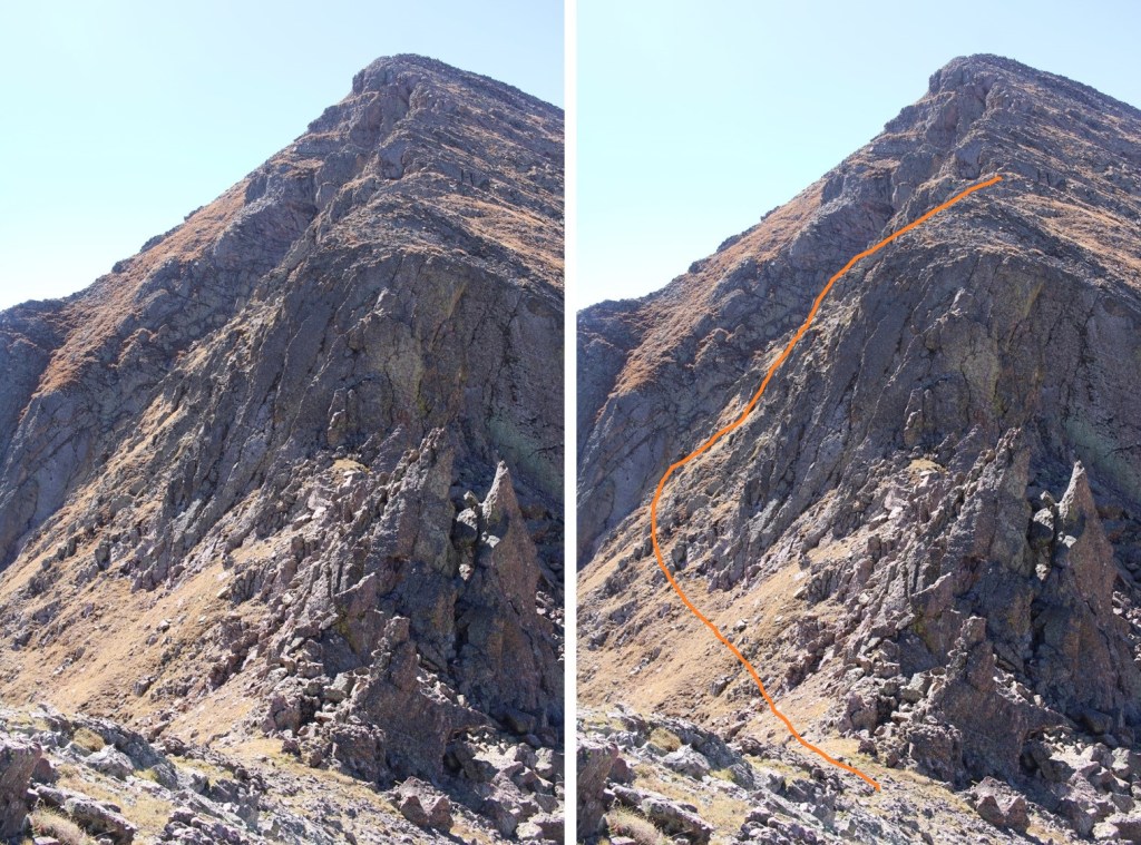
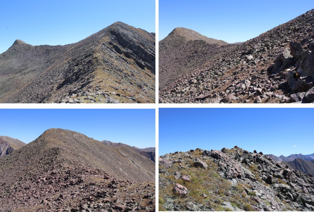
From Alto Peak I was headed north, towards Mas Alto Peak. The route looked straightforward, but I soon found the ridge cliffed out.
The ridge started out as class 2
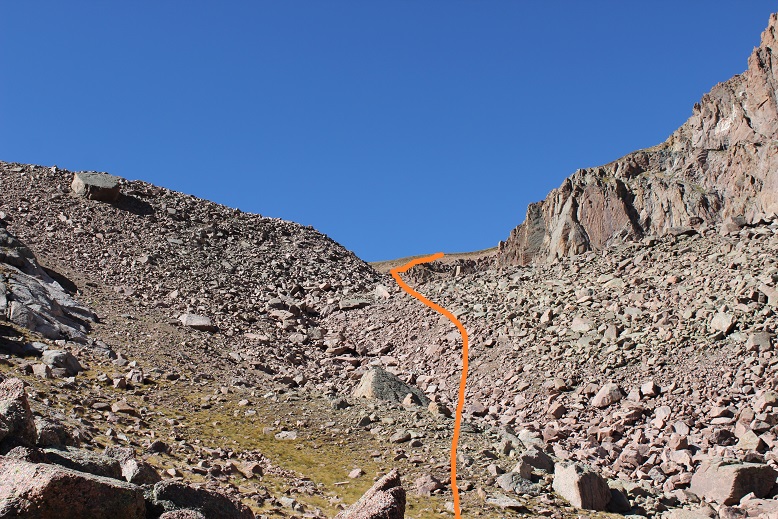
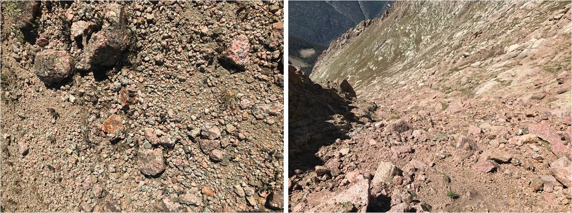
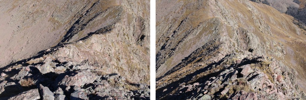
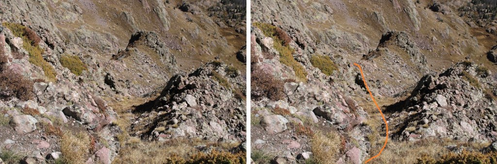
But when I got to around 12830’ I had to get creative, as the ridge ran out. I found a gully that looked like it ‘went’, which it did. I descended northeast down the gully, and set up about several cairns indicating my route. I was able to keep it all class 2+
Here are some pictures
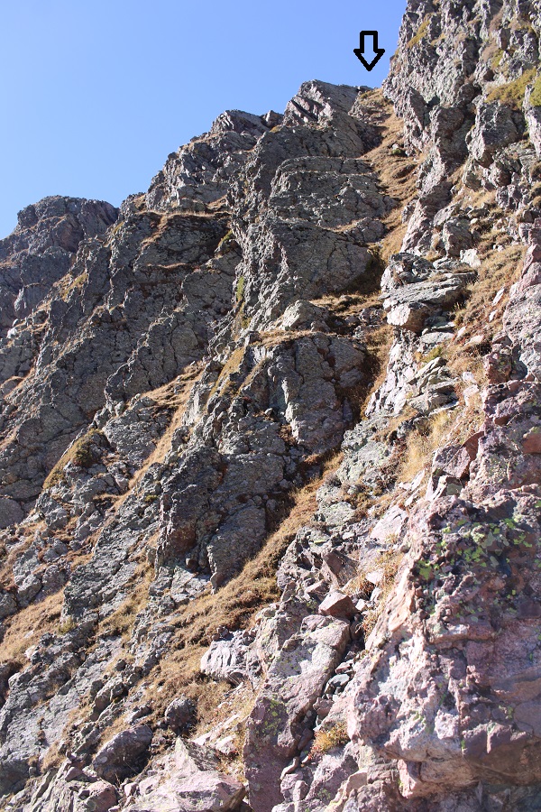
I descended to 12700’, and then followed the contour of the mountain back up to the ridge
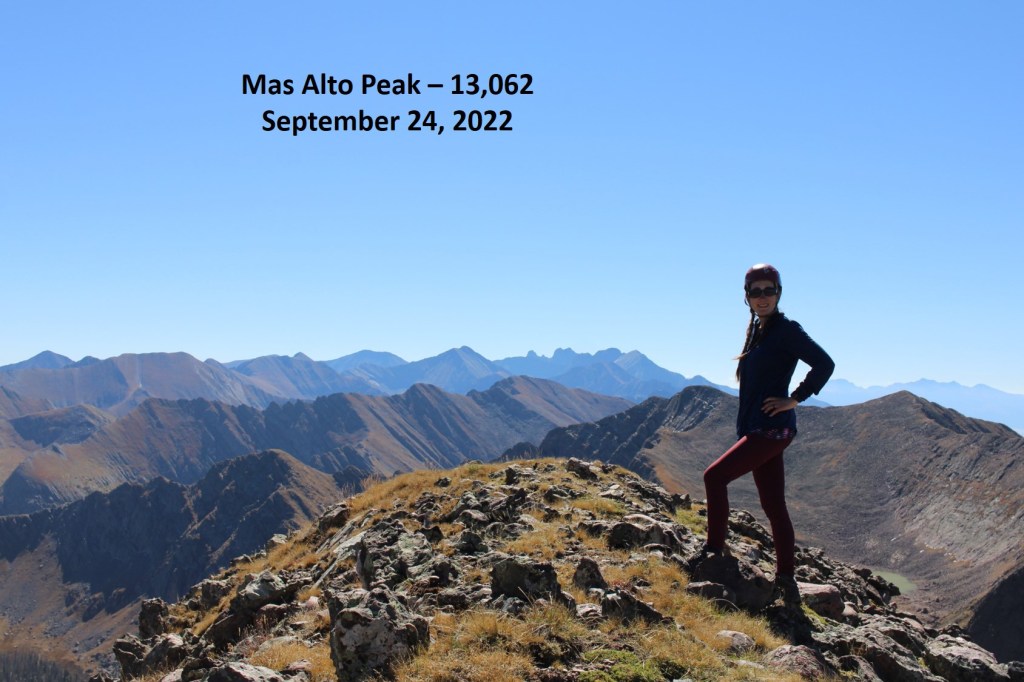
Now back on the ridge, I followed the class 2 terrain north to the summit of Mas Alto
Mas Alto Peak
PT 13062:
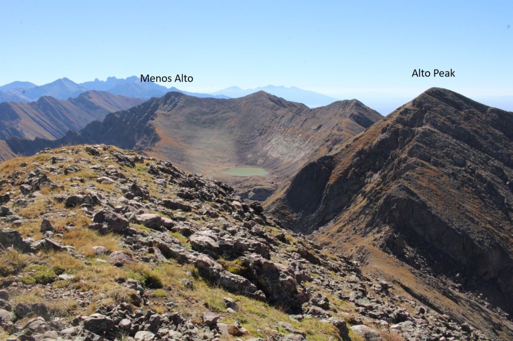
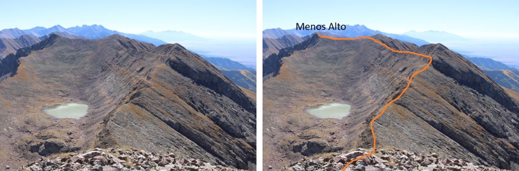
Now to retrace my steps back towards Alto Peak, and eventually Menos Alto Peak, by following the ridge south.
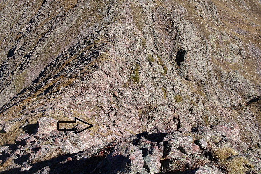
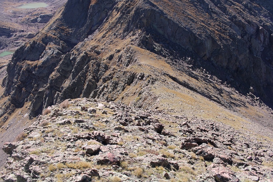
Here’s that section I avoided by going down the grassy gully, and the route I took to reascend.
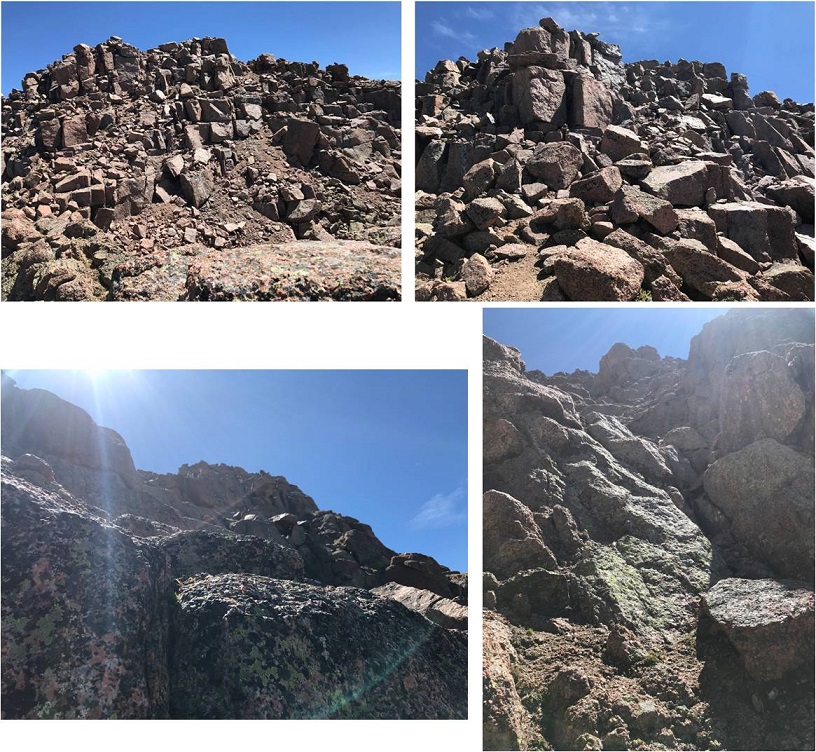
Here are some step-by-step pictures of the route, now well cairned
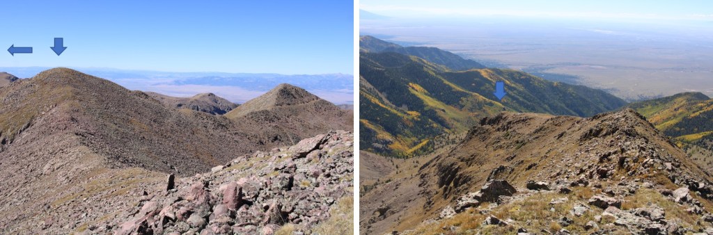
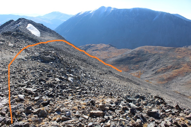
I re-summited Alto Peak, and then this is the route I took over to Menos Alto… choosing not to re-summit the unranked points and instead taking grassy ledges.
The entire route was class 2. Here are some closer pictures
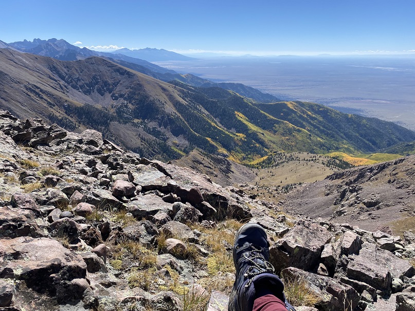
The view from the summit wasn’t all that bad
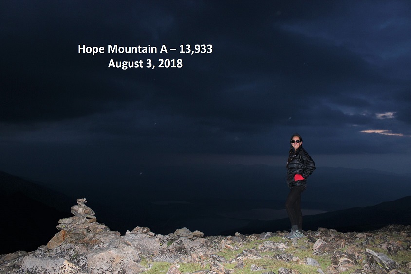
Menos Alto – PT 13031:
And now to make my way back down the ridge
Then back down the ridge to the gully
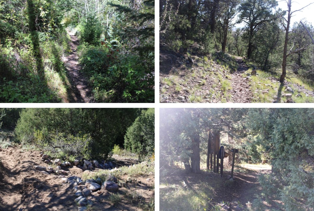
And bushwhacking back to the trail
Once I made it to the trail, I turned right, and followed it back to the trailhead, still loving those stream crossings
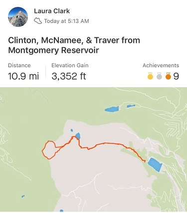
I made it back to my truck at 4pm, making this a 15.63 mile hike with 6250’ of elevation gain in 11 hours.
I didn’t want to get up when my alarm went off at 2am. I really didn’t. I rarely ever want to get up when my alarm rings, but today I was extra tired. I really wanted that extra sleep. I reminded myself while it’s typically difficult waking up early for a hike, I always thank myself for it later. So I dawdled and took extra time getting ready, trying to wake myself up. It was supposed to snow last night and there was as 40% chance of snow today, so I dressed in triple layers of pants and double jackets (necessary for me, not for most people). I also had 3 different pairs of gloves.
I drove to the trailhead and actually stopped at a gas station for 20 minutes to sleep for a bit before continuing on: I was more tired than I thought! I felt great after that quick cat nap though.
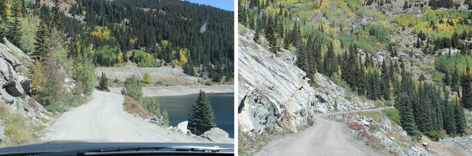
I finally made it to the trailhead at 5am and was ready to go by 5:15am. Already I could tell this was going to be a much different adventure than when I was here last March and the area was covered in feet of snow (https://wildwandererlmc.wordpress.com/2018/03/31/wheeler-lake-12168/). I’d had to turn back at the lake on that trip, but I’d learned a lot! Today the gate was open all the way to the mill, and there wasn’t any snow to be seen anywhere (in the dark that is). The road in is a 2WD dirt road all the way to the mill
There’s plenty of parking all along the way. I chose to park by the mill (the ‘lot’ there holds about 7 vehicles).
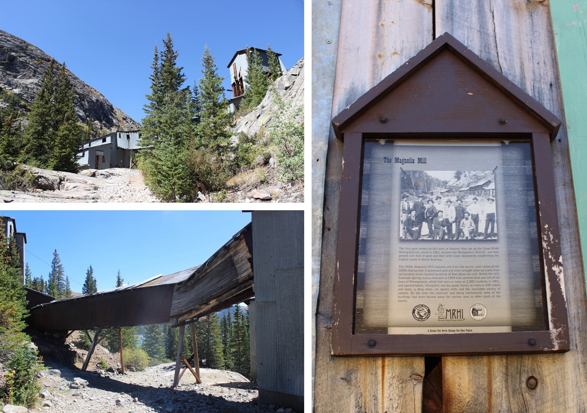
Here are some pictures of the Magnolia Mill, which I swear is going to collapse any minute…
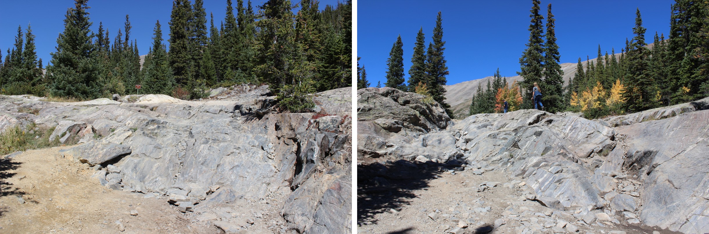
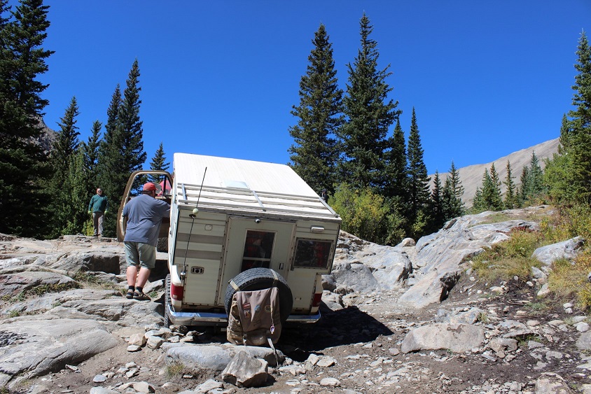
Don’t go past the mill unless you have a heavily modified 4×4 vehicle. You will get stuck. Here are some pictures of the 4×4 road in
And one of a truck getting stuck on my way out
You can follow the 4×4 road all the way to Wheeler Lake: it’s about 3 miles. Wow! Was this a different experience than the snow-covered road I’d encountered back in March! Back then I wasn’t even aware there was a road… I kept looking for trails. It was obvious from my hike today I’d been way off route earlier this year. Way off. And the road had to be under a good 5 feet of snow at the time because these willows which were taller than me now were only about 6 inches high last time I was here. I’d gone in circles in the blowing snow trying to route find my way to the lake (and back). Today was a breeze!
I kept thinking to myself: those rocks are going to be a bugger to hike over on the way back down (they were).
What a difference the season makes! One bad part about no snow? The road was pretty much a river most of the way. Most of the areas of road covered in water had side trails going through the willows so you didn’t need to walk directly through the mud puddles, which I’m sure added to my route confusion in the snow as well.
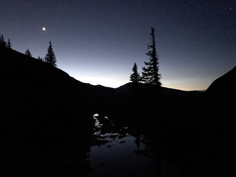
Oh, but it was still early morning and I was hiking through all of this at night…
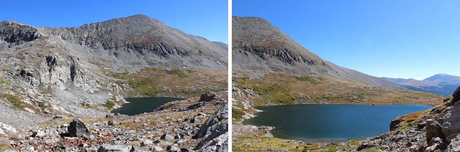
It’s about a 3 mile hike from the Mill to Wheeler Lake. I made it to the lake just as the sun began to rise (and thought back on how difficult this trudge had been in snowshoes: there were actual spots that had had exposure with all the snow and I’d been fearful I’d slip and slide down the mountain. Not so today.)
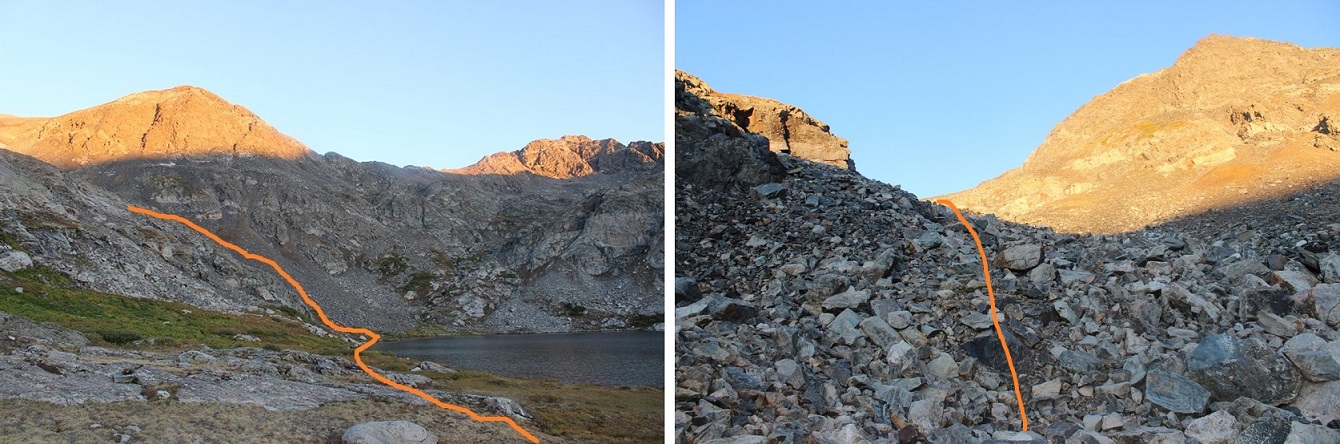
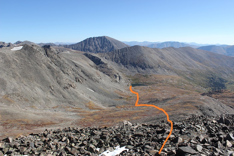
This is where the route ends and the creativity begins. Hike around the lake to the left about ¾ of the way around. You’ll notice an unmarked path left and up a drainage. (There’s no trail, make your own)
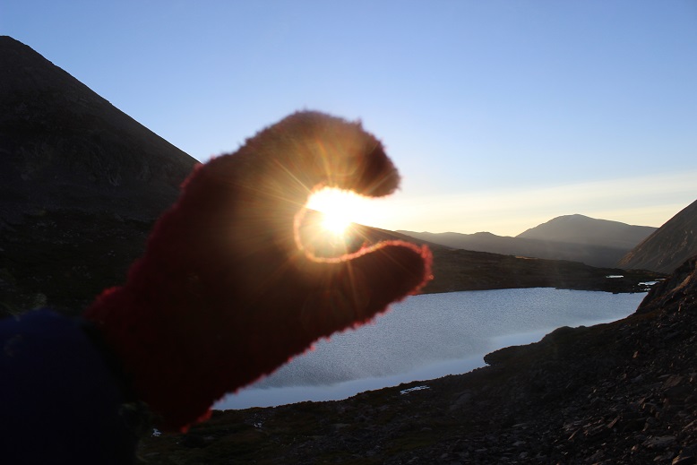
I turned back to watch the sunrise and take a Colorado Flag picture of the lake…
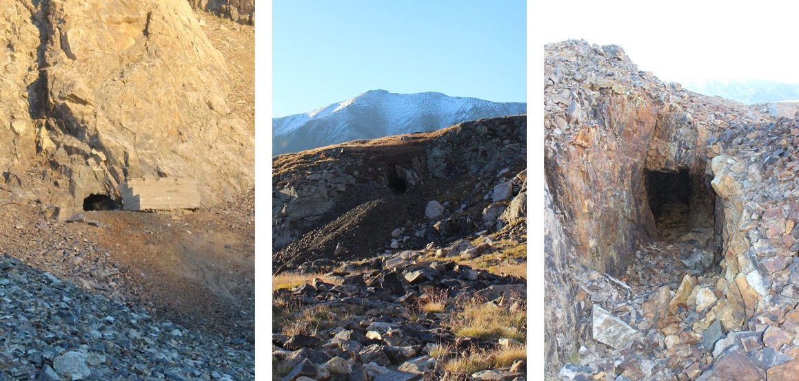
There are a lot of mines in the area. I counted at least 6
When you get to the top of the drainage you’ll find yourself in a small basin.
I tried to stay higher up to the right, and this ended up being a mistake: Stick to the middle, go up the area with small ponds and waterfalls, and head west.
I was trying not to lose my elevation gain, but all I ended up doing was complicating things with lots of rocks, slowing me down.
So my route had steeper elevation, lots of loose rocks and scree, and was thus very slow going. I rounded the corner and kept heading northwest. Finally I was able to see the summit! If you’re hiking this too you can breathe a sigh of relief now: the worst of the hike is over (yes, even if you’re doing all 3 summits)
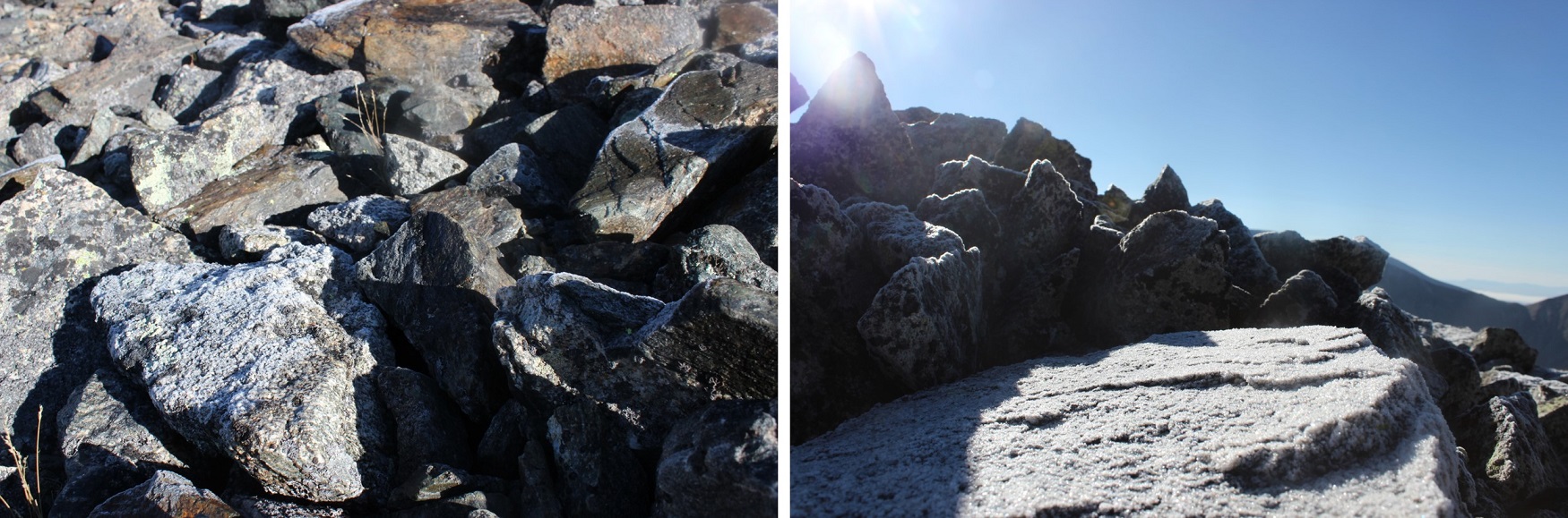
As I rounded the slope the rocks became slippery: everything in the shadows (west) had a thin layer of frost covering it (slippery!)
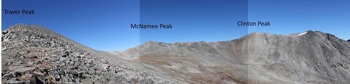
I gained the ridge and followed it to the summit of Clinton Peak.
I turned back and looked at the way I’d come: that had been a steep climb!
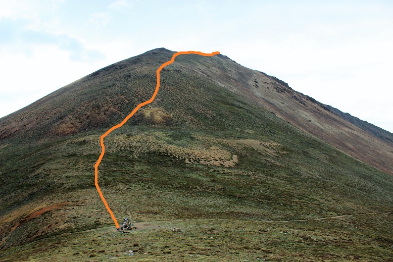
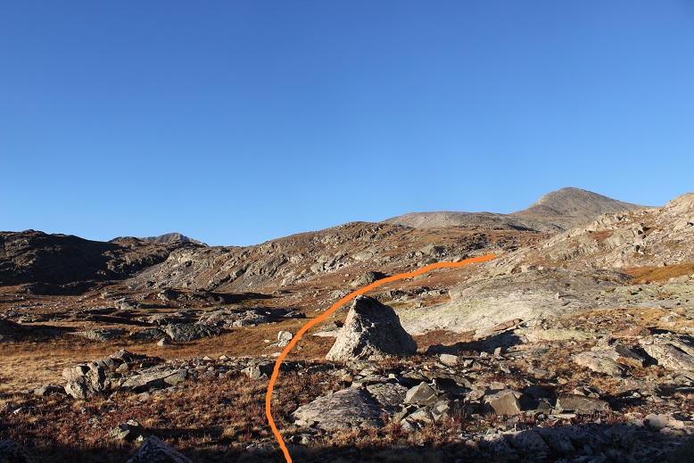
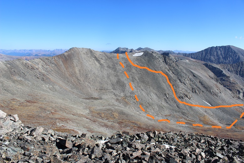
From Traver Peak, here’s a view of the route I took (solid line) versus the one I should have taken (dotted line)
I summited at 8:30am. Here’s proof I summited
VIDEO:
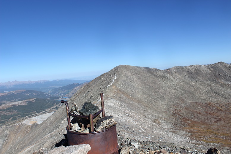
There were a lot of active mines in the area west of the peak and below as well
The rest of the route before me was very straightforward. It was class 2 ‘climbing’, following the ridge.
There were a few large rocks to contend with, but nothing class 3, and all avoidable if you went down the ridge a bit (go left (east) to avoid frost).
There were also small bits of snow, but nothing that got in the way or wasn’t easily avoidable
I couldn’t help but think as I reached the saddle of Clinton/McNamee how much easier this hike would have been to just continue straight all the way through the basin up to this saddle. It would have added maybe a mile to the hike (maybe) but also made the elevation gain so much simpler to deal with! I’m sure it would have cut my time down at least an hour.
The path to McNamee was about half a mile and easy to follow. I summited at 9am
VIDEO
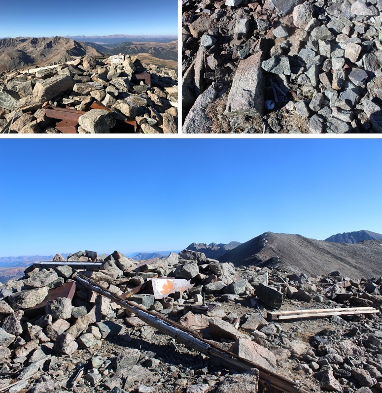
There was a lot of mining trash on this summit!
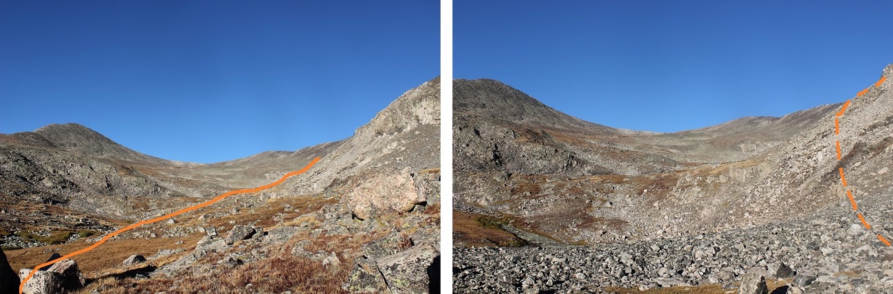
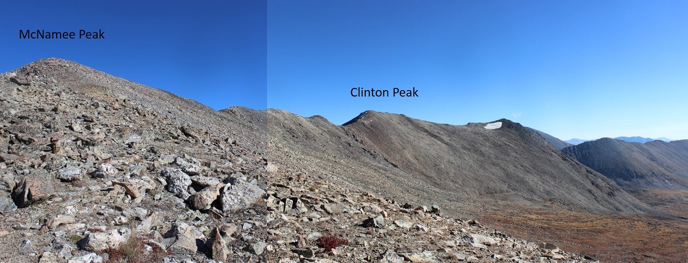
Here’s the rest of the route to Traver Peak
Here’s a picture from the McNamee/Traver saddle looking back on the route so far
Summiting Traver was just a little more difficult than McNamee, but as long as I stuck to the ridge I was just fine (class 2). There were a couple of places I intentionally made it a class 3 climb, but they were completely unnecessary.
There was also a metal trash can full of rocks on the ridge?
I summited at 9:30am
VIDEO
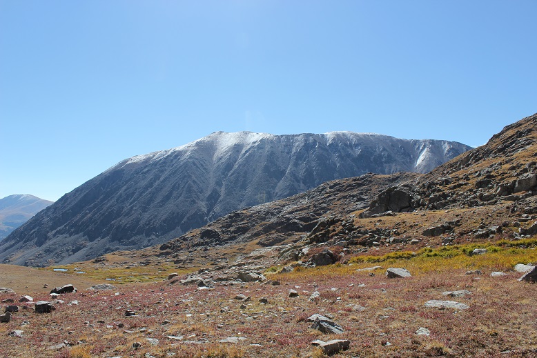
There had been a light dusting on DeCaLiBron the night before
Ok, now it was time to head down. I turned east and looked at my route before me. All I had to do was follow the ridge down and head for Wheeler Lake. It was quite simple really
About ¼ of the way down the ridge I found this survey marker
And halfway down the ridge I saw a large cairn. Or at least that’s what I thought it was until I saw the stone with writing and a date. I couldn’t make out the writing, but the year is clearly 1881. When I got home I looked it up online, and couldn’t find any information about a possible grave/death/etc. It looks like a cairn grave to me (think Oatman family?). Thoughts?
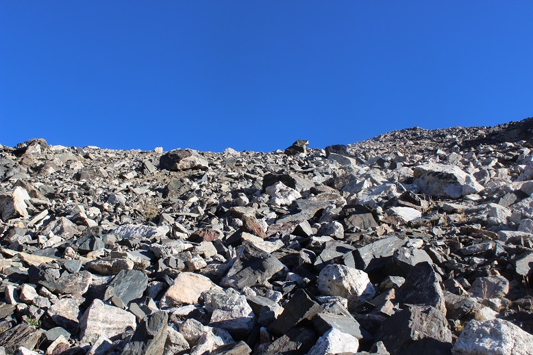
The ridge was easy to follow with medium sized, mostly stable rocks. I couldn’t help but think how much easier it would have been to have done this hike in reverse, instead coming up the east ridge of Traver and down Clinton. My advice to anyone doing this hike: HIKE IT IN REVERSE. Or go up the McNamee/Clinton saddle, over to Clinton, and then back to McNamee and Traver. That trek up Clinton’s south slope is a bugger! And from what I experienced on the easy way down Traver, totally avoidable and unnecessary.
In any event, the cairn is clearly visible from a ways away. It’s a good marker to look for (especially if you’re hiking this in reverse). When I made it to the cairn I headed down the basin, over large rocks and some grassy areas. Before the bottom of the basin I was greeted with some large boulders. I didn’t have to climb down them… but I did.
Here’s the route I took. I obviously could have avoided the boulders by sticking to the north. (Note, this is NOT Wheeler Lake, but a small pond in the middle basin).
All morning and afternoon the weather had been perfect! The skies were clear and I’d way overdressed (no worries, this is better than the alternative). The basin was beautiful, and I got to thinking: Life for me has been extremely difficult in the past and I’ve been through some dreadful things no one should ever have to go through, but today, life is good. I mean really, really good! I’m the happiest I’ve been in years, my kids are all amazing and doing amazing things with their lives, I get to hike every Friday, I paid off my truck this month (woohoo! This means I’m debt free!), and I’ve now completed 28 13ers (think I can hit 30 by my birthday on the 18th?). I was in a great mood, and so glad I decided to go hiking today! (See? I told myself so!)
Here’s where the hike became beautiful. As I was exiting the basin and aiming towards Wheeler Lake I was able to notice all the fall colors. Here’s a look at the North side of Lincoln (14er)
And a look back down on Wheeler Lake
I passed by the waterfall and skirted the lake
Here is where I met back up with the road again. The 3 miles out would have been easier and much faster without all those rocks in the road, but at least route finding was easy!
I made it back to my truck around 12:15pm, making this a 10.9 mile hike with 3300’ in elevation gain in 7 hours with lots of summit time.
The fall colors are starting to change early this year. The drive through Alma was unexpectedly beautiful!
I’ve been feeling guilty lately. I was one of the 5 people who actually got to ride the train to Needleton this summer. No one else I know caught a ride, yet many of my friends made the trek into the basin anyway, intent on crushing their adventuring goals. They have stories to tell of adding double digit mileage to an already intense adventure, hiking in from Vallecito, Purgatory, Beartown, and Elk Park.
I didn’t feel like I’d earned my hike in this summer; cheating it by taking the train in a year no one else was able. I felt like this made my 2018 summer of hikes/climbs too easy; like I didn’t get the full Chicago Basin summer of2018without the train experience. So I promised myself as soon as there was a nice day in the San Juan’s with no chance of rain I was rearranging my schedule and hiking Pigeon and Turret from the Purgatory Trailhead.
My plan was to drive to the trailhead, sleep for a bit and begin hiking at 1am. I was going to take the Purgatory Trail (etc.) to the Ruby Creek Trail, hike/climb Pigeon and Turret, and then hike back to my truck. Next (because I didn’t want to waste the mileage) I planned to drive an hour to another trailhead in the San Juan’s, sleep until 5am and hike 3 more low mileage13ers the next day. I know Pigeon & Turret via Purgatory is a challenging hike, but reports I’ve read placed it at about a 32 mile 10000’ hike (ha! More on this later). I’ve done Pikes Beak via Barr Trail (26+ miles, 7500’ in elevation gain) two days in a row before, and I’ve always been able to do that one in around 7 hours (even both days two days in a row), so I totally thought my Purgatory plan was doable in a day. Insert God laughing here.
The great weather chance came very last minute. I left work, drove home to pick up my daughter from band practice, made dinner, and drove 6.5 hours to the Purgatory Trailhead, arriving at 12:30am August 28th. I’d originally planned on sleeping for a couple of hours in my truck before starting out, but my target start time had been 1am, so I figured I’d forego the sleep and just hit the trail. I started at 12:30am
It’s a 2WD paved road all the way to the trailhead, with a parking lot that holds about 10 cars comfortably (and several more on the side of the road). There’s a lake and a nice trail that begins to the south and continues east.
The hike down to the Animas River was pleasant, but I couldn’t help but think of how I’d have to hike back up this trail on my way out. It switchbacked down for 4 miles and lost 1000’ in elevation as it wound its way to the Animas River, passing through meadows and hugging the mountainside, even following the Cascade Creek for a bit.
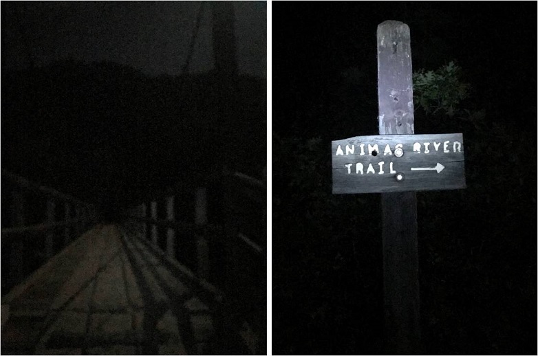
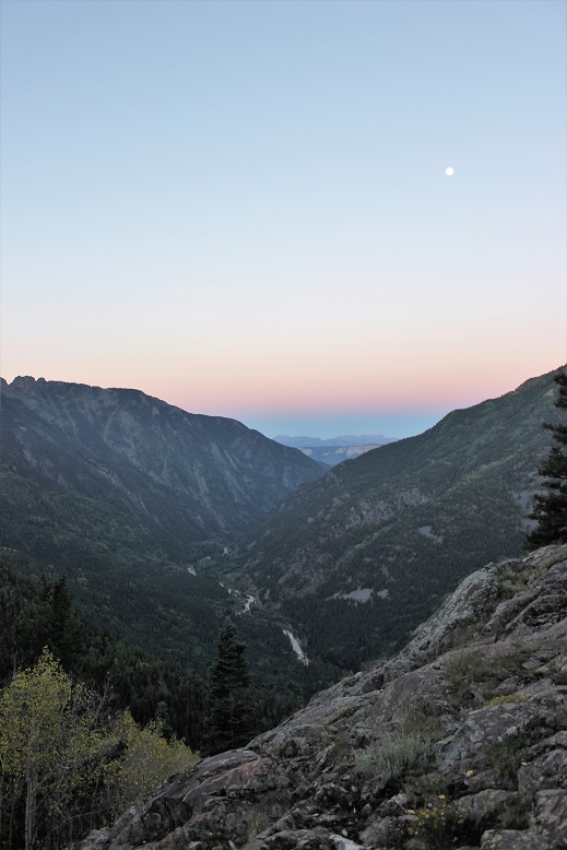
I wish I had pictures of this part of the trail, but I did all this hiking in the dark and figured I’d just take pictures on my way out in the sunlight. I had a flashlight but didn’t need it, as the full moon was lighting my way. I made it to the Animas River, crossed the bridge and the railroad tracks, and started my trek along the Animas River Trail.
This part of the trail hugs the Animas River. Its ups and downs are barely noticeable, unless you’re paying attention to that sort of thing (which I was). I couldn’t help but think how much those elevation losses now were going to hurt on my hike back out. I could hear the rushing of the river, and looked forward to actually seeing it while hiking back out later today.
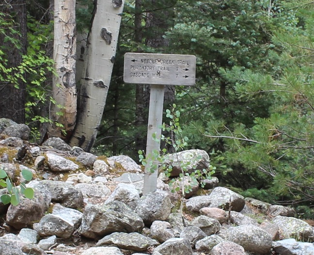
There are signs at the junction of the Animas River Trail and the Needle Creek approach to the Chicago Basin that state it’s 7 miles from there to the Purgatory Trail. I was skeptical it was only 7 miles.
After some consideration, talking to others who’ve hiked in from Purgatory as well, and consulting the tracker I was using, I’ve come to the conclusion it’s about 7 miles along the Animas River Trail to the base of the Purgatory Trail from this point, plus another 3- 4 miles to the top of the Purgatory trail. Here’s proof from my tracker, stating it’s 9.7 miles from the Purgatory Trailhead to the Needle Creek Approach:
I’ll admit this tracker isn’t always 100% accurate, and tends to overestimate things (but only by a little). However in my estimation 9+ miles is much closer to the actual mileage than 7.
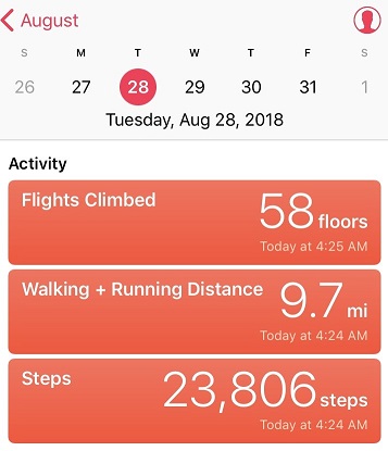
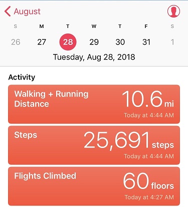
On to the Needleton train stop. I made it to the Needleton stop at 4:45am. This time my tracker said I’d gone 10.6 miles in just over 3 hours.
Not bad. And my tracker was accurate stating it was .9 miles from the Needleton Creek Approach to the Needleton Train Stop, so I think it’s accurate to state it’s 10.6 miles from the Needleton stop to the Purgatory Trailhead. This means if you take the train you’re saving 21.2 RT miles of hiking (or in my case, if you’re not taking the train you’re adding 21.2 miles to your hike).
The next part of the trail is where it gets tricky. There isn’t an established trail or any signs indicating the path you’re to take. I chose to take the Ruby Creek ‘Trail’ as opposed to the Pigeon Creek ‘Trail’ because I’d read the Ruby Creek Trail had some cairns and at times a trail to follow, whereas the (shorter) Pigeon Creek Trail did not. Since I was doing my route finding in the dark I opted for the trail with more indications I was headed in the correct direction.
There’s an area to camp here, where I saw a white horse tied up to a tree. At first I was thinking to myself “Harry Potter and a Unicorn” but after the horse whinnied hi to me I noticed a tent nearby.
I continued along the Animas River Trail for about a mile and turned right, heading up the North Pigeon Creek Trail to the Ruby Creek Trail (neither of which were actual trails). It was dark and I was upset I never saw the Columbine Tree, but figured I’d see it on my hike back out. I hugged the mountains and followed a steep and undefined trail northeast to Ruby Lake. Steep. And undefined. In the dark. Yes, route finding was a challenge, but there were just enough cairns in the right spots to assure me I was on the correct path. As the sun started to rise I got a good look at the path I’d taken thus far
And a good look at the trail ahead of me. Much of the Ruby Creek Trail looked like this. I was glad it was getting light out!
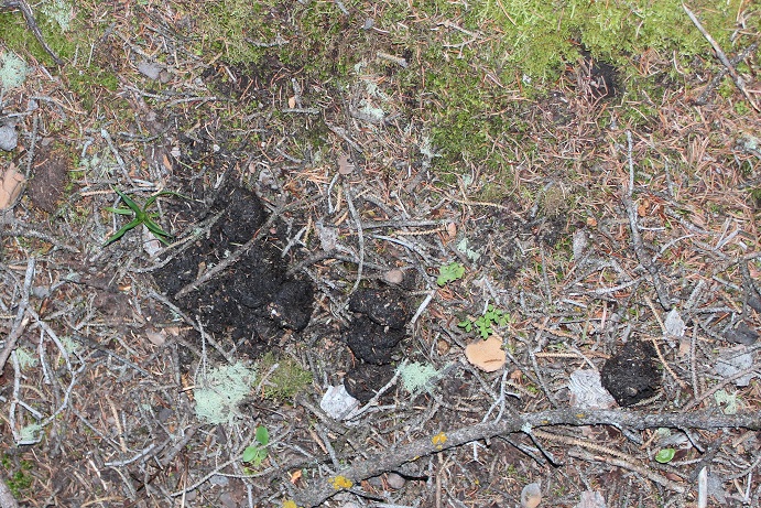
Just before making it to Ruby Lake I saw some bear scat directly on the trail (I was on a trail at this point)
Now I was on bear patrol. The scat didn’t look fresh, but it did indicate a bear had been in the area semi recently. Next I crossed a very thorny raspberry patch (probably why the bear was in the area) and came upon some boulders that led me to Ruby Lake.
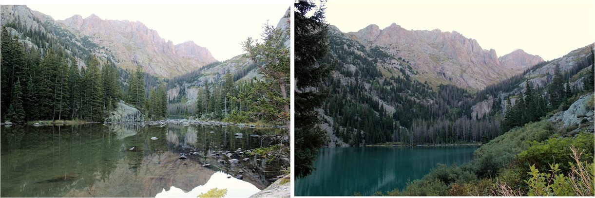
The lake was beautiful in the morning light, but there was no good way to get a picture of it because of all the trees. It’s one big lake separated into two in the middle by a log jam.
It doesn’t matter which way you cross the lake, as both sides end up connecting on the upper northeast side of the lake. I chose to take the south route, full of boulders. It’s best to stay low and close to the lake.
If you take the south route you’ll need to cross a small stream after the lake to re-connect with the trail.
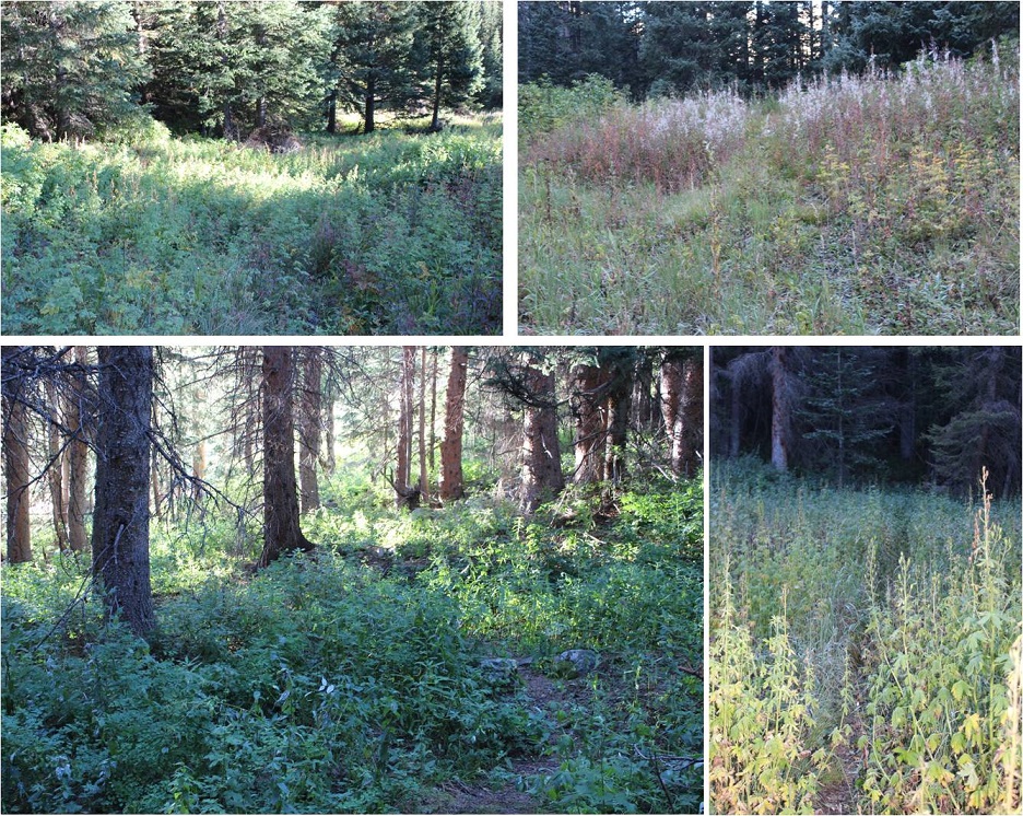
I use the term ‘trail’ loosely. I’m not sure if it’s because of underuse this year with the train being closed or if it’s just a poorly defined trail, but this is what it looks like after the lake.
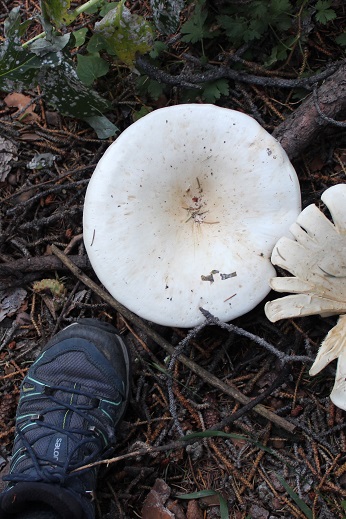
There were some pretty big mushrooms in this area
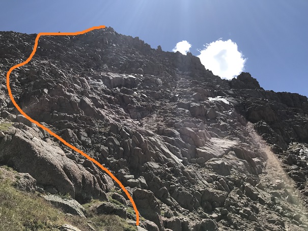
Stay to the left (northeast) of the creek/waterfall as you climb into the basin. Here’s looking back at the trail from the waterfall area (and the route I took)
Above Ruby Lake:
From the waterfall area here’s the path in front of you
This path includes quite a bit of bushwhacking through high brush, willows, tall grass and flowers. I’m sure there are ticks involved. Once again, the trail isn’t clearly defined but you’ll see cairns every so often indicating you’re on the correct path. The path through the willows looks appropriate for anything about the size of a mountain goat (meaning you’ll get hit in the face with branches but your knees won’t) and in areas without willows the grass/flowers cover the trail. Stay high and to the left. I promise you there is a path the entire way. Also, wear pants (please wear pants hiking people!!!).
Ruby Basin Trail:
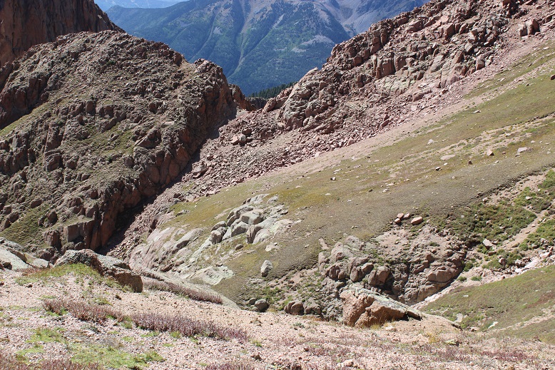
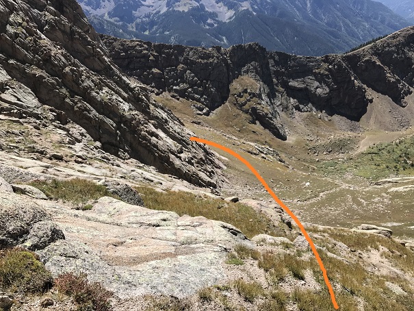
Continue on this path until you’re in the center of the basin. Stop here to get a good look and plan the route you want to take (there’s no trail from this point on). Turn to the south, look across the basin and you’ll see the route before you. Head south, cross the creek, and head up the drainage.
This is the path you want to take: aim for the large boulder (it’s freestanding and you can walk around it from either side).
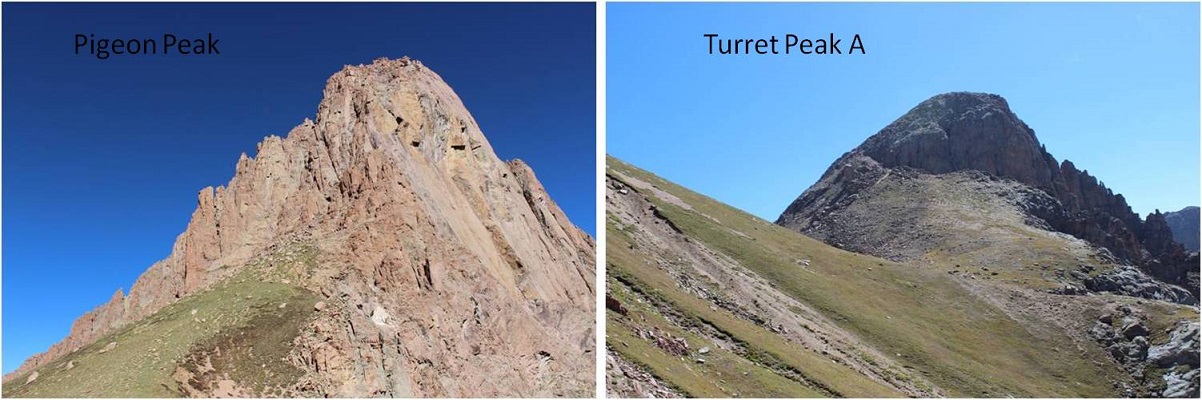
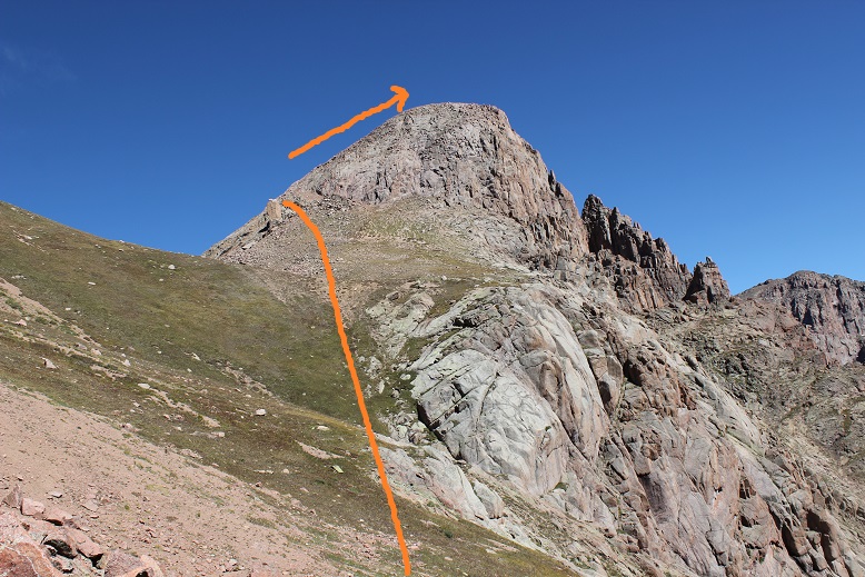
If your goal is just to hike Turret Peak A today head to the left. If Pigeon is your goal go to the right and enter a boulder. This is where your troubles begin. This section is much steeper than it looks, and filled with large boulders and loose scree.
Aim for the saddle you can see behind the boulder field.
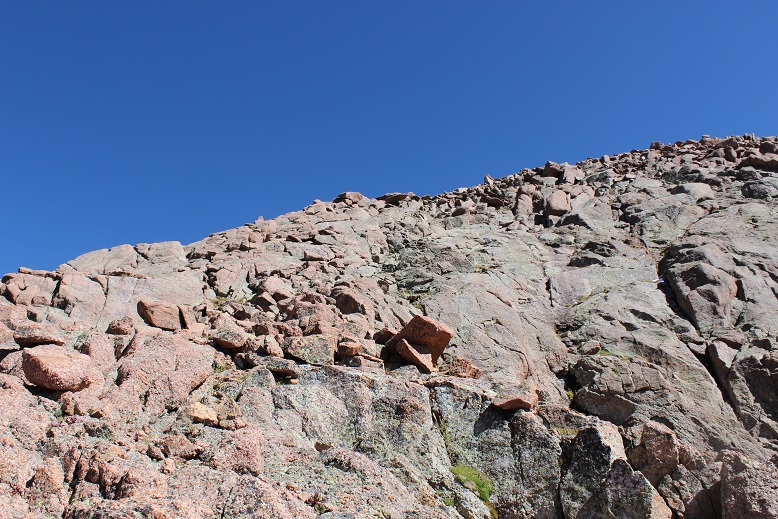
Along the way stop and look at the rocks. They’re pretty amazing, many made up of crystals. Scores of them look like the inside of geodes. They kept me busy for quite some time, until I realized I should just take pictures and keep going.
Woohoo! I made it to the 13,100’ Pigeon/Turrret Saddle. I turned around to look at the two summits.
I chose to climb Pigeon first since it was supposed to be the more difficult of the two (it was). I looked southwest and shook my head from side to side: No. That’s not what I’m supposed to do. No way.
But it was. You see, you don’t climb Pigeon from the saddle, you need to be on the other side of the mountain to summit (the west side), but it’s not a direct shot. To summit from this point you have to lose elevation and re-gain it by circumnavigating the south side of Pigeon. I knew this going in, but I’d drastically underestimated the affect it would have on me when I was there. I did not want to lose all that elevation! I also didn’t want to regain it to summit Pigeon only to lose it and regain it again to summit Turret. It was now 11am and I’d been hiking since 12:30am. I was exhausted and honestly I’d expected to already have summited both peaks by this point and be headed back down. I had a serious decision to make: This was going to take a lot longer than I’d anticipated. Did I just want to turn back now?
No. No I did not. I’d come this far, it was a perfect day (not a cloud in the sky) and I was pretty sure I’d regret it if I didn’t keep going, and possibly never come back (the hike in was brutal!). I mentally calculated distance and time and knew my chances of getting back to my truck before dark were pretty much nonexistent now. I took a deep breath and began losing elevation. Several times.
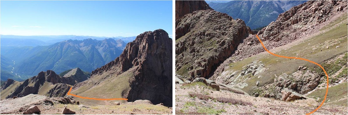
From the saddle look west-southwest and aim for a small notch/gully. You’ll be tempted to stay high, not wanting to lose elevation but trust me, you need to aim for this lower spot. The left picture shows the route looking from above
Once there you’ll continue west/southwest and drop in elevation again. Yep, all the way down to this point (12,400’). The terrain here is perilously loose, and one slip can take you sliding dangerously for a long time. Stay high, aim for the rock wall, and follow it down and around. The higher you stay early on the larger and more stable the rocks are.
Once you round the mountain you’re greeted with 1500’ of elevation to regain. It’s actually harder than it sounds/looks.
Continue west until you’re halfway across the slope. Head right (northeast) to the base of the summit pyramid. Pick your route and stay on the grassy areas as much as possible to avoid the scree. This is a very steep area.
The grass changes to the worst rubble gullies I’ve ever encountered. Scree, sand, rocks, and steep elevation don’t mix. It’s steeper than it looks. I don’t usually sweat while hiking, but today I was. I could feel drops forming and rolling down my sternum. This was a workout!
Just keep aiming here
The terrain eventually changes to large boulders. If your helmet isn’t already on now’s the time to put it on. This rock itself is stable, but it crumbles when you touch it (hence the rubble gullies). It’s very slow going.
I’ve been told this is a class 4 climb, but by aiming for the base of the ramp and following it to the summit I was able to keep it at a class 3. There was still some intense scrambling going on, but nothing class 4.
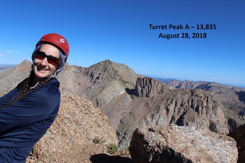
I (finally) summited at 1:15pm. I’m not standing on the photogenic rock in the middle of the picture because the longest my camera will go on automatic is 10 seconds, and it wasn’t safe for me to make it there in that amount of time. #solohikingproblems
VIDEO:
Wow. That had been intense! I’d seriously misjudged today’s hike. I’m pretty sure it took me longer to summit Pigeon Peak than any other peak I’ve attempted. (12 hours, 45 minutes). It wasn’t lost on me I wasn’t even halfway through my day yet. I still needed to descend back into that basin, regain the saddle, and summit Turret Peak A. Did I still want to summit Turret? Honestly I was seriously debating this the entire time I was descending Pigeon, and told myself I’d decide when I reached the saddle. It had already been a very long day and I was very, very tired. Pigeon had kicked my butt!
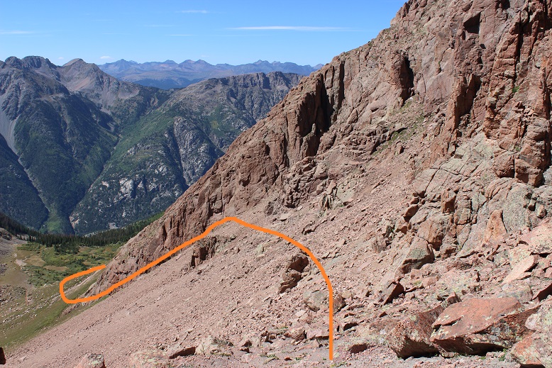
Here’s the descent route from Pigeon: First do your best to stay on the grassy areas to avoid slipping, and aim here
Locate a “thumb” in the side of the mountain. From here aim for the first gully/saddle to your left, being careful to stay as high as possible to avoid dangerous scree
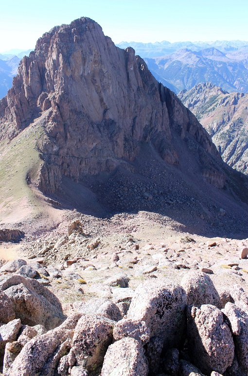
From the gully/saddle you can see most of the route left. I decided to attempt Turret (not really a surprise). At this point I knew I wasn’t getting back to my truck before midnight and I wasn’t going to get to see the Animas River in the daylight. I wasn’t going to get to see the Columbine tree and I wasn’t going to get any pictures of the Aspens I knew were changing colors. (All reasons to come back I guess?)
I didn’t want to route find at night. I really didn’t, but I’d made the decision to come this far and even though I was exhausted I knew I could do this. I’d made it here route finding at night, hadn’t I? I could do the same route finding back to my truck in the dark.
Instead of re-gaining the Pigeon-Turret saddle I crossed lower, aiming for this large rock.
Once I passed the rock I turned right and followed the scree filled slope to the summit. This scree was just as bad, if not worse than the scree on Pigeon. There were also some large boulders to contend with (but it stayed at a 2+)
I summited at 4pm. Exhausted. I set up my camera but noticed too late I was out of the picture… that’s ok, people would rather see the views anyway. I was too tired to try a second time.
VIDEO:
The views were incredible! I turned around and looked back on the route I’d taken along the Animas River
And some other peaks in the area…
Wow. A 4pm summit. It was late, and I was now halfway through with my trip. I needed to book it down this mountain and back to my truck. But first I had to wish my friend a happy birthday. I turned on my phone, noticed I had reception, sent her a quick note and one to my kids letting them know I’d summited and turned my phone back off. I thought to myself how it would probably be faster to drive from my house to Purgatory (6.5 hours) than it would be for me to hike there from my current position.
I turned back towards Pigeon Peak and headed down.
The boulders at the beginning of that large rock gully were bigger than I’d remembered. And check out that boulder! It was about 30 feet across. With how loose the rock was here I didn’t feel safe anywhere near it.
I headed back down into the Ruby Basin and had to stop for a second to enjoy the enormity of it all. I hadn’t seen one person all day. I want to come back and camp here
VIDEO:
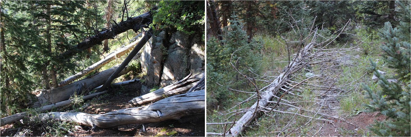
I crossed the creek and located the “trail” that would take me back to the lake. I was surprised at just how fast the sun was setting. I mean, it just kept getting darker and darker by the minute! It became my goal to make it past the bear scat before I needed to get out my flashlight. I made it (barely), got out my flashlight, and steeled myself for some serious in the dark route-finding. It’s different route finding at night in the dark instead of early morning in the dark because you don’t have the sun coming up to look forward to (or wait something out). For reference, imagine navigating the following terrain, but at night. It really gets tricky when a 150 foot tree falls directly on the trail and you have to navigate around it without one of your senses to help
At least the route in the picture above is an actual route. Most of the trail down lacked a defined trail. It was steep and route finding wasn’t easy. But I reminded myself I’d done this once already today, I could do it again. I just kept hugging the mountainside to the left and kept listening to make sure the Animas River was to my west.
Route finding at night:
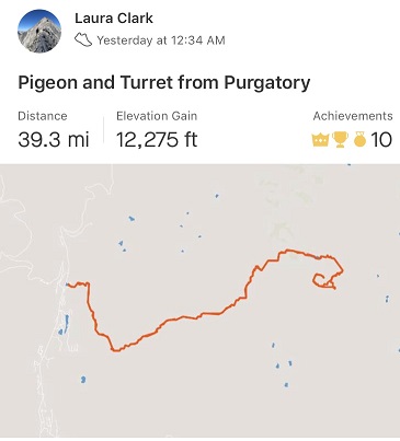
I made it back to my truck at 2am. My tracker told me this was as 39.3 mile hike with 12,275’ in elevation gain. I believe it (this is my more accurate one than the one I’d used earlier). It took me 25.5 hours to complete
This was by far the most challenging hike I’ve ever attempted endurance wise. For those of you just wanting a trip report, it stops here. For those of you interested in what happened in those 6 hours it took me to hike from Ruby Lake back to my truck, read on.
I’m not sure when the hallucinations started, but I fully noticed them around 10:30pm and tried to trace them back in time. It must have been around 9pm. I was in the middle of the Ruby Creek trail when I noticed I was running a fever.
Have you ever had a hallucination before? Well, I haven’t (besides those auditory ones near the river on Snowmass, which I experienced again on this trip btw.). Well, I noticed the river singing this time for what it was and wasn’t put off by it, but now I was hearing voices in my head and having visual hallucinations as well. I was about halfway down the Ruby Creek Approach, desperately determined to correctly route find in the dark, when I became more than flushed. I could tell I was running a fever.
I began talking to myself about myself, as if I were someone else (like a doctor talking with a nurse about a patient). What’s weird is I was having a conversation in my head with another person who wasn’t there. Interestingly enough, I was the male in the conversation, talking to a female about the patient (me).
“She’s running a fever. Anything over 102.7 and she needs to evacuate”
“Make sure she keeps drinking and gets plenty of water, but ration it so she doesn’t run out”
“Now is a good time to start trying to talk her out of those other 13ers in the morning”
“You know she’s stubborn and it won’t be easy, start reasoning with her now”
I’d hiked for two more hours before I recognized I’d had this dialogue in my head, or that it was out of the ordinary. What made me think back to this conversation I’d had in my head? It was the third time I said “Hey Bear!” and it ended up not being a bear but a shadow. I paused and took time to look at what I’d thought was a smallish bear rolling on its back and happily sucking its toes. Unlike a real animal it kept doing what it was doing and didn’t run away. I walked closer and it turned into the shadow of a rock. I’d also been seeing red eyes glowing in the dark since it became dark.
I knew the hallucinations were due to low blood sugar and lack of sleep, but I have Raynaud’s and didn’t have a sleeping bag/blanket with me, so stopping to sleep or rest was out of the question. I had food and water but food didn’t sound appetizing. I felt like I’d throw up if I ate anything, but lack of food meant low blood sugar and that combined with strenuous exercise and lack of sleep meant hallucinations (I’d been up since 4am the day before so I was going on 45 hours with no sleep and all I’d had for dinner before hiking was string cheese and two slices of roast beef).
I was saying things to placate myself like:
“Tell her we’ll get the rocks out of her shoe at the next stop. She just needs to focus and keep going to the bridge.”
“When we get to the base of the Purgatory trail she can have another piece of candy”
I made it to the Needleton stop and thought to myself I still had 10 miles to go. OMG, 10 miles! This was insane! It had been dark for hours (I’m guessing it was about 10pm at this point) and I was physically ready to drop. But I kept going. Stopping just wasn’t an option.
I felt like a machine, thinking outside of my body, running on autopilot. I was referring to myself in the third person. Ever the scientist I recognized what was going on and decided to document it in my mind to remember later. I was having both auditory and visual hallucinations (and apparently talking to myself). Not only as I talking to myself, I was talking to myself in third person, treating myself like I said before as a patient instead of as me. It was more than just a “pep talk” to keep going (but it was a pep talk, just from someone else… who was me).
Why was I seeing so many shadows tonight? I hadn’t seen any last night? Why was hiking tonight so different from last night? Then it occurred to me: the full moon wasn’t out yet. Yesterday the full moon had eliminated a lot of the shadows I was seeing tonight in the rays of my flashlight.
The visual ones were the most interesting. Once I realized the bear(s) weren’t real I decided to pay attention to what was going on. I couldn’t make the hallucinations stop, but I could accept them for what they were. They came in many forms, there was only one image at a time, I never knew what they were going to do, and they were all trying to get my attention for one reason or another.
I started using the experience as entertainment, like a tv show to keep me occupied and my mind off the fact I was physically exhausted and it hurt to continue hiking. Here are some of the hallucinations I had:
A woman in a t-shirt trying to get me to notice her t-shirt (dancing around holding up the fabric on her shoulders with her fingers while moving side to side)
A life size version of Yoda climbing a tree
Horses shaking their heads and pawing at the ground
Apes / Sasquatch walking past me (I’m guessing this was because I was seeing my shadow a lot)
Witches with cauldrons
Frogs, snakes, and bugs skittering across the path (they’d been the leaves and sticks on the ground)
Flashing black and yellow freeway signs (I didn’t read them because I was scared to see what they’d say)
Street vendors trying to get me to visit their stores
Every type of animal you can imagine pretending to be a human (a giraffe trying to use an umbrella, a zebra on two legs trying to mow a lawn)
Eventually the visions would all become a shadow/rock/tree/etc. as I passed by. As the night wore on the hallucinations started getting bolder and coming towards me. Knowing they weren’t real but still fearful, I decided to keep my head down and focus on the trail directly below my feet. From the time I crossed the Animas River until I made it back to my truck I refused to lift my head to look at anything ahead because something would lunge at me from out of the dark (not really, but it felt real at the time). The good news was I’d stopped talking to myself in the third person.
The trail up from Purgatory was terrible. It was much longer than I’d remembered, the leaves and small rocks under my feet became large bugs and frogs I tried in vain not to step on, and none of the terrain looked familiar or as I’d remembered it from yesterday. I had to keep checking my map and compass to make sure I was headed in the correct direction (I was).
I needed rest. I needed to eat. I needed to make it back to my truck so I could do both. At this point there was no way I was going to drive to another trailhead and attempt any more 13ers tomorrow (today!).
I made it back to my truck at 2am. All of the vehicles in the parking lot were the same ones that were there when I’d left. I needed to eat. I wasn’t hungry but I told myself I had to eat to replace all the calories I’d burned, so I got out a Mountain House meal and the Jetboil and got to work.
I found a ‘safe’ place to light the Jetboil, which ended up being in the middle of the parking area (small rocks and pebbles were the ground cover). I’m so glad I decided to light the stove in a fire safe area because as soon as the water started boiling and I tried to turn the stove off it wouldn’t turn off: the flame just kept intensifying. Yes, I was operating it correctly and I knew what I was doing. I decided to pour the water into the bag so I wouldn’t pour scalding water on myself as I was trying to put out the flame. You can probably guess what happened next. There’s a reason you’re not supposed to turn a Jetboil sideways/upside down. The flame quickly became 5 times its original size, dancing wildly. I momentarily panicked, blew on it, and the flame went out. Whew! That was a disaster narrowly averted. Advice: Don’t try to operate a camp stove when you’ve been hallucinating.
I put the stove away, ate my dinner, set my alarm for 9:30am and quickly fell asleep in the back of my truck. Two seconds later my alarm went off. It was already bright and quite warm outside. I did a quick head to toe physical assessment of myself: My hair was a mess, my head didn’t hurt, my feet were dry, warm, and operational. I was thinking clearly, and I wasn’t sore (at all, which was weird considering all the activity I’d done). I felt fine to drive, so I jumped into the front seat and was on my way, glad I’d had the sense to fill up the truck with gas the night before.
Normally I get on the treadmill everyday and do 5 miles with 4000’ of elevation gain, unless I’ve hiked more than that. I do this 7 days a week, and have done so for the past 8 years. I’ve been known to hop on the treadmill after easier 14ers like Bierstadt or Evans because I didn’t get enough of a workout in. Today I’ve only hiked 1000’ of elevation gain, but I’ve done 7 miles since midnight, so I’m calling it a draw and not getting on the treadmill today… I don’t even feel guilty!
Hiking/climbing over the next few weeks are going to be tricky since I’m taking my survival troop camping on the weekends (which is always a blast!!!). Today I needed to be back home by noon so I got out my spreadsheet to look for a hike that was: 3 hours or less driving distance, around 10 miles of hiking, and didn’t require much route finding (because I didn’t have time for that today).
I love spreadsheets! They take some initial time to set up but make narrowing down this kind of information so much easier. After finding 4 different Centennials that met my criteria (it’s great having so many options open!) the one with the ‘best’ weather was Hope Mountain A: 50% chance of rain from 3am-9am with 40% chance of thunderstorms after 9am. I liked those numbers, I’d just need to pack extra rain gear.
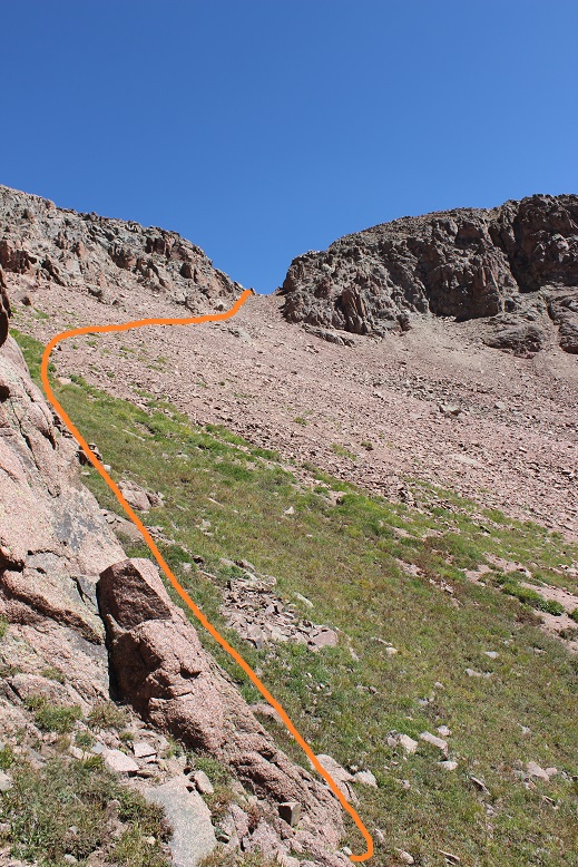
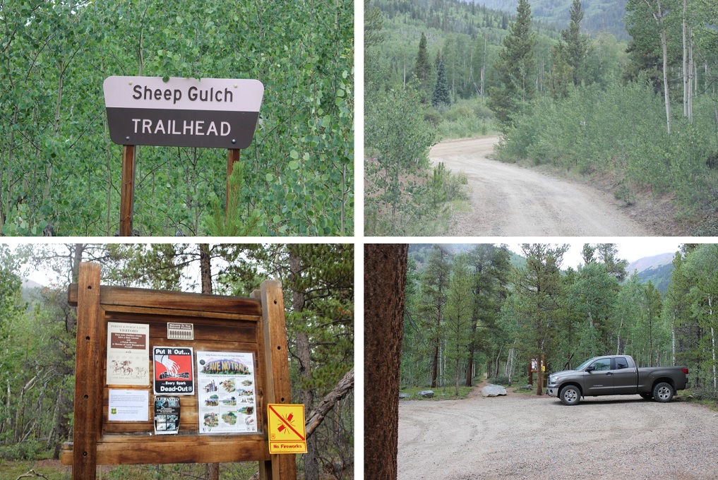
I made it to the 2WD trailhead at 3:15am. The road is in excellent condition with great signs. There was only one other vehicle in the parking lot when I arrived (and it was still there when I left). The parking area could comfortably hold about 10 vehicles.
The trail was indeed excellent: no route finding necessary until I made it to the Hope Saddle. There weren’t many signs, but they weren’t really needed either.
The beginning of the trail began with solid elevation gain that never quit. It was a nice steady climb through heavily wooded areas of aspens, and after Sheep Gulch switching to small pines and then quickly to alpine tundra. It was a perfect night to see wildlife, yet I didn’t see any tracks so I didn’t expect to see any animals (I didn’t).
As soon as I hit an elevation of 12000’ the switchbacks began. These weren’t the kind of switchbacks that wear you out, but instead the kind that make the hike more enjoyable as they weave up the mountainside.
The hike this far had a lot of elevation gain, but the gain had been steady and hadn’t tired me out. I made it to Hope Pass and thought to myself it was still way too dark. I must have been hiking faster than I’d anticipated. I looked at my watch: Yep, it was only 4:30am. I’d hiked 3 miles with 2700’ of elevation gain in an hour. I was going to need to slow down if I wanted to get pictures from the summit. At the Hope Pass saddle between Hope Mountain A and Quail Mountain there was a cairn with prayer flags.
I couldn’t see Hope Mountain because it was still dark out, but I knew once I made it to the pass to turn left and head up the first ridge. The route was supposed to be easy to figure out and visible from the top of this first ridge, but since it was still too dark to see I couldn’t tell. There was no route from the pass to the summit: no dirt path and certainly no cairns. My flashlight kept going in and out (I need a new one) which was a little frustrating but I’d needed to slow down anyway, so spending time hitting it against a rock to re-light it every time it went out seemed like time well spent.
Here’s the route I took:
That ridge was FUN!!! This is rated as a 2D hike, and I hadn’t brought a helmet, but it would have been nice, especially if others had been on the mountain as well. The ridge had some exposure and would be a great training hike for someone to take before tackling some of those class 3 14ers. I hiked the entire ridge in the dark, so my advice to someone doing the same is to stick to the ridge, and if you must leave the ridge go to the left.
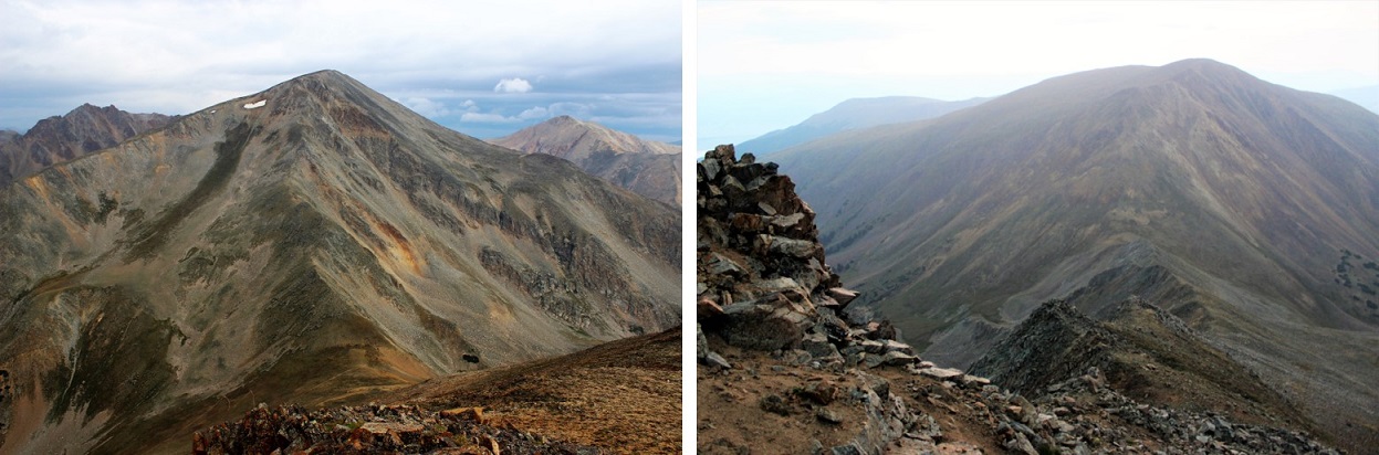
The ridge took me about an hour to climb, which gave me lots of time to think. My mind drifted to 14er firsts. I know some people don’t appreciate the idea of any more “firsts”, but I think they’re fun and encourage people to get outside, and while I don’t plan on attempting any, there are a few I’d like to see: The first person to summit them all in the dark, the first person to spend the night on every summit (has this been attempted/done?) and my favorite, the first to stand on every summit without actually hiking (I’m thinking this one would involve a helicopter, rope, and tons of money). In any event, the topic took up my mind as I climbed the ridge. Here’s a look up and back from halfway up the ridge. To the left is Hope Mountain A, and the right is Quail Mountain.
At about 13000’ the loose rock began. In this picture you can see there’s a false summit
This is where it got a bit sketchy in the dark: those gullies were loose! All rocks the size of microwaves or smaller were very unstable and just waiting to find their way lower down the mountain. I tried not to touch the larger ones.
The trick here is also to stay to the left (the right drops off into a couloir). But as soon as you get up those loose rock gullies you’re met with a nice gentle but rocky slope past a false summit to the true summit. I summited at 5:45am. Here the sun was just beginning to rise and I got a summit photo
I also took a good look around. Yep, it was going to rain. Hmmm… I was still debating hiking Quail Mountain today, but those clouds didn’t look friendly. I guess I was just going to have to skip it and hike it another day.
As I started descending Hope Mountain A it started spitting rain. Nothing much, not enough to put on rain gear or anything, but then the graupel began and I decided to hike a little faster. The graupel only lasted about 2 minutes however, and then was gone. I took another look around me
The sun was rising and Quail Mountain was looking really inviting. Since the rain was behind me I decided to keep looking ahead and not make a decision about hiking Quail until I made it to the pass. In the daylight the ridge was much easier to navigate. This time if necessary I just stayed to the right, but I mainly took the ridge.
I made it back to the prayer flags at 7am and took a look around. All signs of rain in the next two hours were gone, so I decided to attempt Quail Mountain. This 13er didn’t have a trail either. Here’s the route I took
The beginning started with scree, and due to the elevation gain you couldn’t see the summit for most of the hike, so I just aimed for the first bump and began hiking.
There were multiple ‘social trails’ towards the middle of the mountain. The ones to the lower right (where the mountain has red dirt) were on loose scree so I stayed to the upper right on a light but sturdy semi trail through the tundra (stick to where it’s green and you’ll be fine). It became more and more stable as I ascended and then abruptly ended at the first bump
From here I followed the slight ridge up and over the false summit to a small saddle
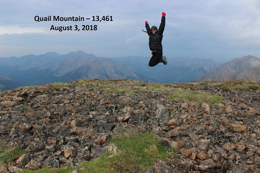
And just like that, I summited at 7:30am.
From the summit of Quail Mountain I could smell smoke from the nearby fires. It wasn’t overpowering, and reminded me of campfire off in the distance. It also didn’t last very long, and I could only smell smoke when the wind blew strong.
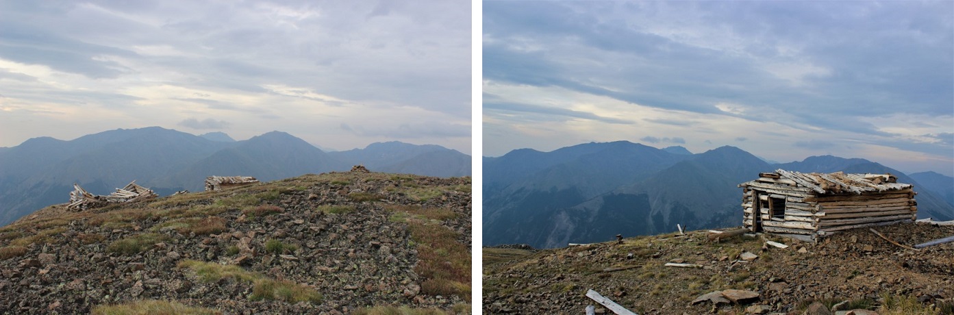
If you’re thinking about hiking Quail Mountain after Hope and the weather’s nice my advice is to just go for it! It only took me half an hour to climb the 950 feet in elevation gain, and the views were incredible! There were a few small and abandoned cabins (mines?) at the summit.
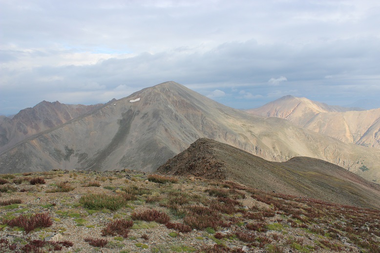
I turned to head back and got a great view of Hope Mountain A and the small ridge I’d followed to the summit of Quail. Going back I followed the mountain to the right
This is another one of those mountains where microspikes are useful on the way down to navigate through the scree. I made it back to Hope Pass at 8:10am and started my way back down the switchbacks. Here I saw the only 3 other people I’d see today: a group of men who looked like they were thru hiking.
The hike through the aspens reminded me once again of why I hike: solitude, beauty, nature, and time to think. I saw a couple of ptarmigans on the trail, but otherwise no wildlife. I made it back to the trailhead at 9am, just as it started to rain, making this 10.6 mile hike with 5200’ in elevation gain in 5.5 hours. Perfect timing to make it back by noon!
On the way out I noticed there was still only one other car in the parking lot at the Sheep Gulch Trailhead I was at, but as I passed the Missouri Gulch trailhead on my way out it was overflowing with cars and there were several passenger vans there guiding groups. I know the trail there goes to 3 different 14ers and several other hikes, but I think it’s safe to say I’m going to have no problem getting used to this less crowded 13er thing!


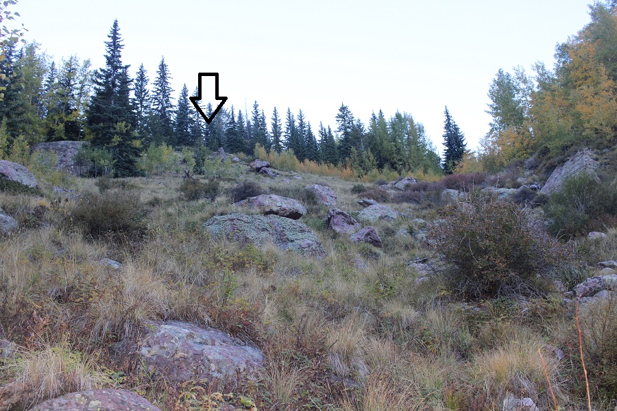


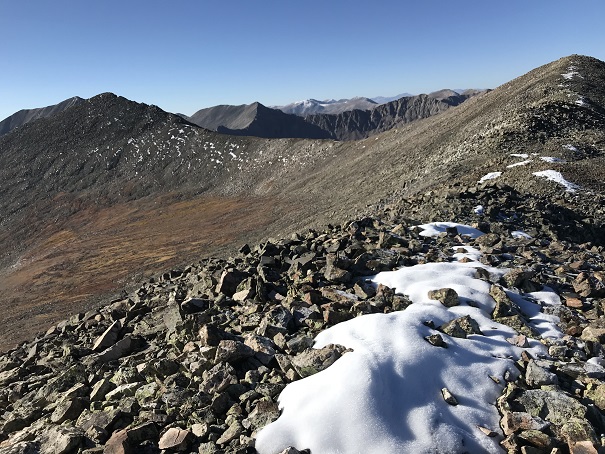


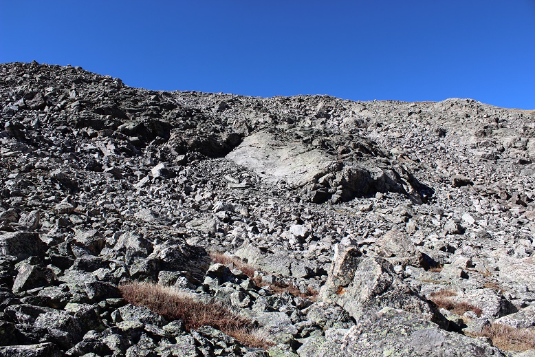
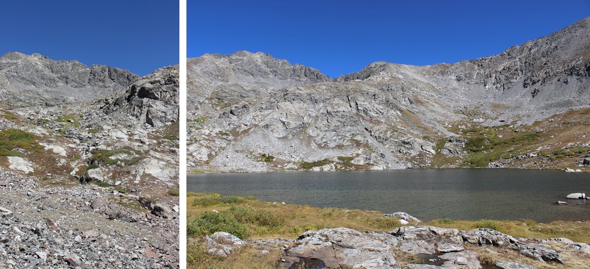


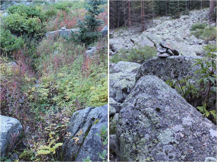
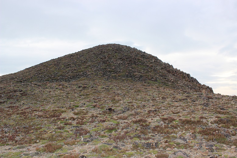
 Above Ruby Lake: